
 California Highways:
Click here for a key to the symbols used. An explanation of acronyms may be found at the bottom of the page.
 Routing
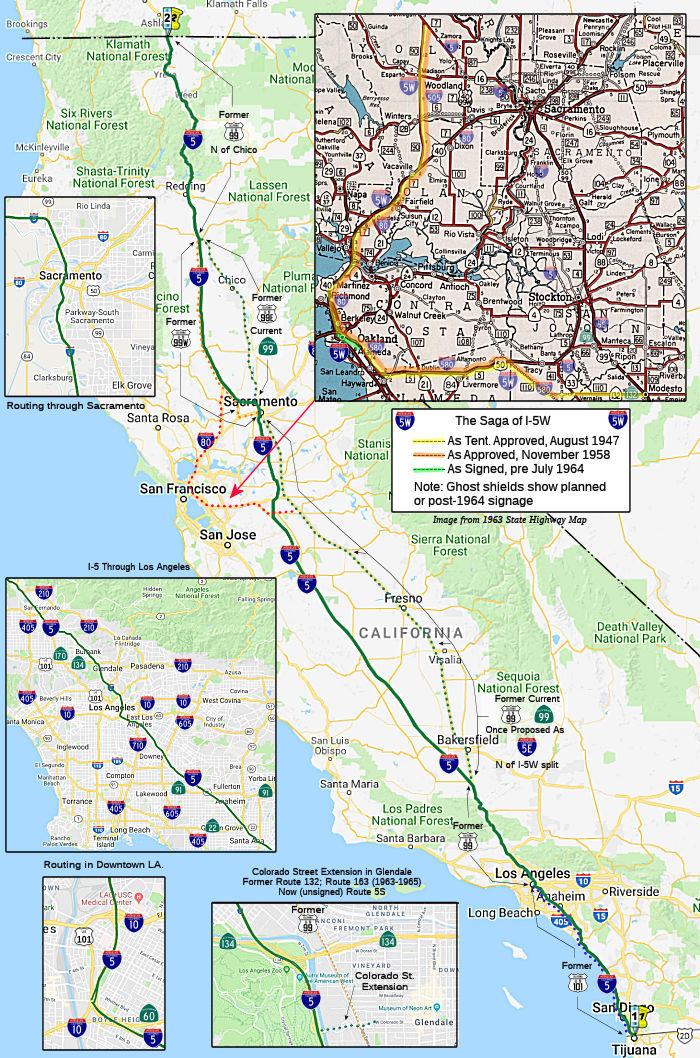 From the international boundary near Tijuana to the Oregon
state line via National City, San Diego, Los Angeles, the westerly side of
the San Joaquin Valley, Sacramento, and Yreka; also passing near Santa
Ana, Glendale, Woodland, and Red Bluff.
From the international boundary near Tijuana to the Oregon
state line via National City, San Diego, Los Angeles, the westerly side of
the San Joaquin Valley, Sacramento, and Yreka; also passing near Santa
Ana, Glendale, Woodland, and Red Bluff.
 Suffixed Routings
Originally, there was also an I-5W. This routing dates back to the original definition of I-5 in 1947. At that time, I-5 was defined to run along the present-day Route 99 routing from N of Los Angeles to Sacramento. I-5W was proposed to run along a routing that corresponds to present-day Route 132, I-580, I-80, and I-505 (although it was only signed E of I-80 to near Piedmont). US 50 was multiplexed on the I-580 section. The route was resigned to the present-day route numbers in 1964 as part of the regularization of state and legislative route numbers. Note that the CalTrans history shows that I-505 and I-580 were approved as interstate in 1947 but proposed as I-5W (as well as some other numbers), and renumbered in 1964. One issue of California Highways and Public Works has a picture showing an I-5W shield on a segment of present-day I-580.
Note that it appears the original 1947 Interstate route submission had I-5W running to Modesto along LRN 110, now the portion of I-580 from the I-580/I-205 split to near Vernalis, and then along Route 132 to Modesto. By the 1958 submission and approval, this routing has been truncated to "Near Tracy". This appears still to be the portion of I-580 near Vernalis, although some maps appear to show it going straight to Tracy (potentially I-205's routing). But as I-205 was submitted separately at that time, and nothing was constructed, it appears the desire was the I-580 routing.
A proposal unearthed by Richard Moeur from the AASHTO files indicates that, at least in 1957 and 1958, there was at least a proposal for an I-5E. These proposal had I-5 running along the traditional alignment (Route 99 in 1957; "Westerly Alignment" in 1958) until either Modesto (1957) or Tracy (1958). The route then split, with I-5W going off as described above, and I-5E continuing along present Route 99 (1957)/I-5 (1958) into Sacramento. Evidently, AASHTO liked the routings, but didn't like I-5E, because that was never signed.
Over on AAroads, Scott Parker provided significant history of the
suffixed routing in a number of posts (combined below):
(Scott Parker (Sparker) at AAroads, 7/12/2016, 8/9/2016, 8/10/2016, 8/24/2016; Joe Rouse at AAroads, 8/12/2016)
The original I-5E/I-5W split was, designation-wise, more of a political decision than one made at the planning level. The 48,300 mile Interstate plan was one of the earlier more extensive plans to be proffered; the immediate postwar years under the Truman administration saw the Interstate concept opened up for input and comment from various states; the composite of what was proposed by 1952 was similar in scope to that "48.3" plan, but with about 900 less total miles; but one consistent similarity was two routes planned between L.A. and Northern California, one along US 101 and the other following US 99. When the plans were retrenched to (more or less) the original MacDonald plan of '44, featuring a little under 40K miles, by the incoming Eisenhower administration in 1953, the US 101-based route was again eliminated from consideration. Prior to 1958 there was a connector from US 99 in Modesto to Oakland via Route 132, a new-terrain route extending Route 132 northwest from its terminus at Route 33 to Altamont Pass, and thence west along US 50 to the east end of the Bay Bridge. The original number proposed for that route was I–72, but complaints began rolling in from Bay Area political figures that such a designation didn't place the region on the Interstate north-south grid. Thus, when the first "final" sets of numbers were established in 1958, the I-5E/I-5W concept was put into place—which would, of course, require a substantial multiplex from Emeryville to Vacaville (about 48 miles) with I-80.
In 1963 the Division of Highways issued the "one road/one number" credo that instigated the vast 1964 renumbering effort, and the shift away from I-5E/I-5W began. The multiplex with I-80 would have stretched approximately 48 miles, from the present I-80/I-580/I-880 interchange in Emeryville north and northeast across the Carquinez Bridges to Vacaville, where I-5W would have turned north along LRN 90, which, despite its longstanding use as a connector to north US 99W, had never received signage; the basic alignment is today's I-505. Not wanting to cosign I-5W and I-80 for that distance, the Division, after exploring several numbering permutations, settled on I-580 for the Oakland-Tracy segment and I-505 for Vacaville-Dunnigan. Except for short sections of freeway at the junctions of Route 128 and Route 16, I-505 remained largely a 2-lane road for several years after its designation. Expansion to a full freeway began in the mid-70's; it was completed circa 1980. Prior to completion the road was signed as "Temporary I-505"; this signage extended to BGS's on I-80 and I-5.
Along today's I-580, I-5W shields were indeed deployed from the Emeryville interchange east along the MacArthur Freeway, at the time co-signed with US 50. That initial section of I-5W only extended for a few miles east to Grand Ave. in eastern Oakland; it was the only stretch to receive signage as 5W. I-580 signage was applied to that segment in early 1964 and further east as the freeway was completed. Aside from that original stretch of the MacArthur Freeway between the first "Distribution Structure" and Grand Ave., there were no other I-5W shields posted in the field. Despite being technically multiplexed along I-80 for 48 miles north from Oakland, no I-5W reassurance shields were ever posted along that route; the only mention of 5W was on the approach BGS's from I-80—and those lasted about as long as the shield shown in the pictures. There is one legacy, however, from the I-5W signage: if you have ever looked at the post miles on I-580, you might notice that they actually decrease as you head eastbound, rather than increase (the exit numbers increase, as expected). The I-80 interchange with the northern independent section of I-5W wasn't constructed until 1965, a year after the number change to I-505 occurred.
At that point (1960) the routing of (then) I-5E was still TBD; the Division of Highways was trying to juggle the desire of Sacramento interests who didn't want the freeway coming through the downtown district (which was then planned for renovation [read gentrification!]), so I-5E was tentatively routed through West Sacramento, which had little political clout to oppose the routing. But because of the location of the Yolo Bypass flood-control facility to the west, which north of Broderick was separated from the Sacramento River itself only by the levee on which Route 16 and the Sacramento Northern railroad tracks were located, a West Sacramento routing would have meant three separate high-level crossings of the navigable Sacramento River—a very expensive proposition. In addition, the Division was trying to find a route between Sacramento and Stockton that was feasible to construct — a problem because that area was mostly marshland immediately east of the Sacramento Delta. The route preliminarily adjudged the most feasible followed the Western Pacific RR tracks, which were in turn closely followed by Franklin Blvd. (County Sign Route J8). That is the road that Rand McNally utilized as the place to plop down the I-5E shield west of Lodi. Eventually the constructed I-5 alignment did closely follow County Sign Route J8 north of Stockton, but veered slightly west north of Route 12 before turning north again; this was to avoid the taking of valuable grape-growing tracts in the area (mostly table grapes then; now Lodi has evolved into a recognized wine-grape growing district), a politically charged phenomenon then as it would be today.
By 1964, I-5E (none of which had been constructed at the time) gave way to mainline I-5 via Sacramento. Additionally, by this time anti-freeway grumblings were beginning to be heard from San Francisco and other Bay locations; the concept of the Bay Area being located on a major north-south Interstate axis was no longer of any importance.
The first section of I-5 to be completed in the Sacramento area was the E-W segment west of El Centro Ave. (Route 99); 2 lanes of the eventual 4 (2 + 2) were constructed between El Centro and Garden Highway (at the Sacramento River) and opened to traffic in early 1967. These became the eventual I-5 northbound lanes; the southbound side was grubbed by that time; grading & paving came later. The initial berms for the Sacramento River bridge were under construction at that time as well. As the Sacramento airport was also under construction immediately to the north, this initial 2-lane segment served as a construction access road to the airport site. It saw little traffic until I-5 was completed both north and south of the segment.
Temporary I-5 signage existed, at one point, along Route 99. This signage
is discussed on the Route 99 page. Over on AAroads, Scott Parker (Sparker)
provided the following summary of Temporary I-5 signage:
(Ref: Scott Parker (Sparker) on AAroads, 10/16/2016)
Temporary I-5 was signed, from 1972 to about 1976, from the present Charter Way (Route 4 WB) interchange in Stockton, east along Route 4 to Route 26 (old US 50), on Route 26 east to Route 99, then north on Route 99 north to I-80 (now Business Route 80/US 50) at the Oak Park interchange in Sacramento. From there it was signed west on I-80 to Route 113, then north on Route 113 to Route 16, which at that time remained on its original E-W route through downtown Woodland. It turned west on Route 16 to the old US 99W alignment northward to the present I-5 alignment (this currently is the eastern end of the western segment of Route 16), where it veered northwest along old US 99W, which was gradually being supplanted by I-5. The reason why Temporary I-5 was not routed from Sacramento to Woodland along Route 16, the most direct route and the one closest to the nascent I-5 alignment was the same as that of the original US 99W: Route 16 traversed the Yolo Bypass flood-control facility at ground level and was inundated during heavy rains, when the weirs along the Sacramento River were opened to avoid overflow in Sacramento. I-80, and US 40/US 99W before it, crossed the Bypass on a bridge structure, so it remained open even when the bypass was flooded. After 1976, when the I-5 bridge over the Bypass opened, completing that route north of Sacramento, the temporary section was truncated back to the (then) I-5/I-80 interchange in Sacramento, using Route 99 via Lodi until I-5 was opened between Stockton and Sacramento in 1981.
 Post 1964 Signage History
In 1963, the routing was defined by Chapter 385 as "Route 5 is from the international boundary near Tijuana to the Oregon state line via National City, San Diego, Los Angeles, a point on Route 99 south of Bakersfield, the westerly side of the San Joaquín Valley, and via Yreka; also passing near Santa Ana, Norwalk, Elysian Park in Los Angeles, Glendale, Woodland, and Red Bluff. That portion between Route 99 south of Bakersfield and Route 113 near Woodland may include all or portions of any existing state highway route or routes." The routing was simplified in 1984 (Chapter 409) to the present "Route 5 is from the international boundary near Tijuana to the Oregon state line via National City, San Diego, Los Angeles, the westerly side of the San Joaquín Valley, Sacramento, and Yreka; also passing near Santa Ana, Glendale, Woodland, and Red Bluff."
The final gap in I-5 was closed in October 1979, with the completion of the segment from S of Route 12 (Hammer Lane) to Lambert Road near Stockton.
In San Diego, the "Montgomery" Freeway portion of I-5 was built for US 101 and existed before I-5, as part of US 101. When the San Clemente section of I-5 was finished, it was connected to the rest of the "San Diego" Freeway, which was connected to the "Montgomery". The Montgomery was then updated to be to Interstate standard. When the San Clemente section was finished, US 101 was multiplexed to San Diego. At the time, the section of I-5 from I-8 to Mission Bay Dr. was not finished, so the rest of US 101 from the northern end of the Montgomery to Mission Bay was part of US 101. When I-5 was finished there, US 101 was decommissioned south of the East Los Angeles Split (the present-day US 101/I-5 junction).
In Oceanside, US 101 (I-5) previously ran along Hill Street.
In San Clemente, there are records of battles when the route was built
through the town. With apparently little local protest, the freeway was
cut through the heart of San Clemente. The route resulted in deep cuts
through local hills and the destruction of a large reservoir. The huge
demand for a better road between Santa Ana and San Diego outweighed
concerns expressed by local environmentalists, and even the brass at Camp
Pendleton agreed. Between 1958 and 1960, bulldozers scraped the pathway.
As they were about to rip out several stately palm trees, local nursery
owner Bob Carrick, Sr. convinced the crew to allow him to dig up the trees
for transplanting in town. Those trees are still there to see in the
median strip of Esplanade. Today the I-5 corridor basically cuts San
Clemente in two. Most local leaders agree the road should have been
located east of town.
(Source: San Clemente Journal, 11/15/2019)
According to a book on the history of Buena Park, there was a debate regarding the routing of Route 5 through Buena Park. Apparently there were
three proposed routes each of which were established as temporary highways
while the freeway was being planned, and there was even a AAA map
published that showed all three routes. Apparently one route was the site
of the original El Camino Real Highway, which thru Orange County went up
roughly what is now Route 57, and then went west on La Habra Blvd. Knotts
Berry Farm, which was then the Amusement Park as this was pre-Disneyland,
wanted the route that went up Beach Blvd, Route 39. Buena Park, itself,
did not want to be divided by a freeway and was opting for the Manchester
route which is the current route.
[Thanks to David Whiteman for this information.]
One map shows that, by 1953, the freeway portion of US 101 (now I-5) south of 1965 Route 245 had been constructed.
The history of the East LA Interchange, where US 101, I-10, I-5, and Route 60 come together, is discussed with US 101.
In the historic downtown Los Angeles community of Boyle Heights, full of
Craftsman bungalows and Victorian homes, city planners saw fit to run a
stretch of I-5 right through Hollenbeck Park in 1960 (despite a petition
against it bearing an estimated 15,000 signatures and the dissent of then
Councilman Edward Roybal). Hollenbeck originally includes a lovely lagoon
ringed by trees. That lagoon now has a freeway running through it.
(Source: LA Times, 8/10/2015)
Scott Parker (Sparker) provided more history of the construction of the
Golden State Freeway (the portion of I-5 N of the East LA interchange):
(Source: Scott Parker (Sparker) at AAroads, 8/23/2016; Image source: September 6: This Date in Los Angeles Transportation History)
The first section of the Golden State Freeway (eventual I-5) to be constructed and opened was between Riverside Drive near the L.A. Zoo in Griffith Park and Alameda Ave. in Burbank; that was opened on September 6, 1957. By the end of that year it had been extended south to between Glendale Blvd. and Los Feliz Blvd, using temporary ramps to empty out onto Riverside Drive. Included in that segment was the Colorado Blvd. extension (part of LRN 161/Route 134). By mid-1958 US 99/US 6 had been rerouted onto the freeway using the Colorado extension (an arrangement that lasted for about 3 years). Northbound, US 99/US 6 remained on San Fernando Road (the original alignment) to the Colorado extension, then used that extension to the freeway mainline. It went north on the freeway to Alameda, where it turned west with Route 134 to Victory Blvd. At Victory Blvd. the temporary routing turned north, using that street to the "Five Point" intersection of Victory Blvd., Burbank Blvd., and Victory Place. While Victory Blvd. turned due west at that intersection, the US 99/US 6 temporary routing continued north on Victory Place, which merged with the original San Fernando Road alignment east of Lockheed (now Hollywood/Burbank) airport. This rerouting was necessary because northward construction on the Golden State Freeway used the alignment of Front Street, the former route, in central Burbank; the street was demolished in late 1957 to make room for the freeway, which was opened to traffic as far north as Burbank Blvd. in the spring of 1959.
The segment along Riverside Drive, which included the Route 2/Glendale Freeway interchange, was opened to traffic in the spring of 1961; southbound, it emptied all US 99/US 6 traffic onto the southbound Pasadena Freeway over the present ramp system bordering Elysian Park. The first Golden State Freeway section to actually receive I-5 signage, between Broadway on the north and Boyle St. on the south (near Hollenbeck Lake, just north of Wilshire Blvd., and including the San Bernardino Freeway interchange), had opened in early 1960, with the I-5 ramps to the southbound Santa Ana Freeway (US 101) opening a year later. The final section, between Broadway and just north of the Pasadena Freeway (including the interchange with that freeway, then US 66, and the L.A. river bridge) opened in late 1962.
North of Burbank, the segment between Burbank Blvd. and Lankershim Blvd. in Sun Valley opened in the spring of 1961, extending north to Van Nuys Blvd. in early 1963 (this section included the inital ramps to the planned Hollywood Freeway—originally intended to be part of US 6, but, after the '64 renumbering, becoming Route 170). The final I-5 segment between Van Nuys Blvd. and the existing Golden State Freeway alignment north of Sylmar was opened to traffic in the fall of 1963, essentially finishing the freeway from its inception at the E.L.A. interchange to the point where it departed the San Fernando Valley.
Colorado Street Extension (Route 5S)
The Colorado Street Freeway Extension (Route 5S) opened
in 1958 as the Golden State Freeway (then US 99, US 6 and I-5) was being
constructed. The Colorado Freeway Extension would serve as a temporary
realignment of US 99/US 6 off of San Fernando Road and new alignment of
Sign Route 134. US 99 and US 6 followed the Colorado Street Freeway
Extension to San Fernando Road until the Golden State Freeway was
completed to the San Bernardino Freeway in 1962. The Colorado Street
Freeway Extension would be assigned as part of the original 1964
incarnation of Route 163, but was quickly folded into a Route 134 Spur by
1965. The corridor would be assigned as part of Route 5S when the Ventura
Freeway extension reached Route 2 (then at Verdugo Road) in 1969. Note:
The Colorado Street Extension is a formally suffixed route in the
Postmile System (Route 5S), as opposed to having "S" postmiles (i.e.,
07-LA-005 S0.0).
(Source: Gribblenation Blog (Tom Fearer), "The Colorado Street Freeway Extension (Interstate 5 Spur in Glendale and Los Angeles)", 2/2024)
As originally defined, Colorado Street ended at San
Fernando Road (US 99 / LRN 4) in the city Glendale. Colorado Street became
a component of LRN 161 in 1933 after the state began to allow the Division
of Highways to maintain State Highways in incorporated cities. When sign
routes were announced in 1934, Sign Route 134 westbound followed a
multiplex of US 99/LRN 4 on San Fernando Road from the end of Colorado
Street in Glendale to Alameda Avenue in Burbank. US 99 along San Fernando
Road would be joined by an extended US 6 beginning in 1937. In 1955,
construction began on the Golden State Freeway corridor between the Santa
Ana Freeway and Hollywood Freeway; this would be an eventual rerouting of
US 99/US 6/LRN 4, and the route would take it through the cities of
Glendale and Burbank. By 1958, the Colorado Boulevard Interchange was
under construction to connect Sign Route 134 via LRN 4 to US 99/US 6 on
the Golden State Freeway over the Los Angeles River extending it from San
Fernando Road in Glendale. By 1959, the Golden State Freeway was completed
between Alameda Avenue in Burbank south to Glendale Boulevard in Los
Angeles. US 99/US 6 followed an interim alignment on LRN 4 originating at
San Fernando Road in Burbank, west on Alameda Avenue, south on the Golden
State Freeway and east on the Colorado Street Freeway Extension to San
Fernando Road in Glendale. Route 134 followed an interim multiplex of US 99/US 6/LRN 4 on the Golden State Freeway between Colorado Street north to
Alameda Avenue. South of Colorado Boulevard to Glendale Street, the Golden
State Freeway was part of LRN 161. The completion of the Golden State
Freeway from Lankershim Boulevard to the Santa Ana Freeway in 1962
resulted in the realignment of US 99 to follow I-5/LRN 4 on the Golden
State Freeway directly to the San Bernardino Freeway, bypassing the
Pasadena Freeway and Santa Ana Freeway through downtown Los Angeles. At
this time, the Colorado Street Freeway Extension was a spur of LRN 4 and
solely signed as Route 134. This segment became part of Route 163, only to
go away in 1965 when it became a spur of Route 134. With the completion of
the Ventura Freeway Extension from I-5 east to Route 2 at Verdugo Road in
1969, Route 134 was rerouted off of Colorado Street in downtown Glendale
north on Route 2/Verdugo Road to the new segment of the Ventura Freeway.
The Colorado Street Freeway Extension was renumbered as Route 5S (note: it
is not I-5S, as it was never a formal part of the Interstate system)
(Source: Gribblenation Blog (Tom Fearer), "The Colorado Street Freeway Extension (Interstate 5 Spur in Glendale and Los Angeles)", 2/2024)
On I-5 south at Route 118 there's a section of a bridge just before Paxton where it looks like the exit for Paxton originally went before Route 118 was built. It's an extra lane on the right with the original round rails but a little bump of concrete has been put down to kind of block off that lane.
Newhall Pass and the Grapevine
 The truck route for the current I-5 near Newhall Pass is from 1954
(when the route was still US 99). At the point where the truck routes
cross Sierra Highway, there is an old tunnel similar to the one on the
truck routes today. Its about half-filled with dirt and is open on one
side. You can even see where the lights used to be. It was an
undercrossing for an onramp that no longer exists connecting southbound
Sierra Highway with southbound I-5 or US 99.
The truck route for the current I-5 near Newhall Pass is from 1954
(when the route was still US 99). At the point where the truck routes
cross Sierra Highway, there is an old tunnel similar to the one on the
truck routes today. Its about half-filled with dirt and is open on one
side. You can even see where the lights used to be. It was an
undercrossing for an onramp that no longer exists connecting southbound
Sierra Highway with southbound I-5 or US 99.
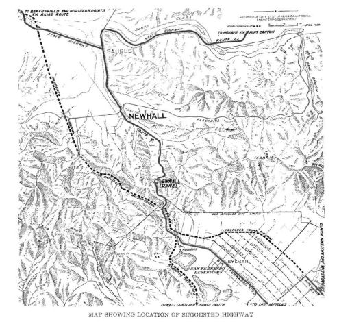 More specifically, the history of the "truck route" in
this area is as follows: The original "road" was the railroad, which still
goes through the tunnel built in 1875. The surface roads were pretty
primitive in those days, with a mere dirt path going through Beale's Cut
less than a mile north. That road was improved in stages, and became San
Fernando Road, running continuously from LA all the way up into Newhall.
The road NW to Castaic Junction was extended in 1915 along the Ridge
Route, connecting LA to the Central Valley. When the roads got numbered in
the 1930s, the road NW became US 99 (and the Ridge Route was bypassed by a
new divided highway), and the road NE got the US 6 designation, but was
renamed the Sierra Highway, which is why there is now a disjoint section
of San Fernando Road up in Newhall. This was also Route 7. At this time,
all the traffic was going through the old Newhall Tunnel. This tunnel was
constructed in 1910, and was only 17' 5" wide, and accommodated two lanes
of traffic. In 1928-1929, to alleviate traffic in this tunnel, the state
constructed a bypass route along Weldon Canyon. This diverted the traffic
going N to Sacramento and the San Joaquin Valley. However, the tunnel
remained a bottleneck. On May 5, 1938, the State of California awarded a
contract for the reconstruction of the Newhall Pass highway alignment
between the San Fernando Valley and the Mojave Desert. This project,
called the Mint Canyon Short Cut, involved creating a divided road, and
completely eliminating the tunnel by excavating and opening the top. The
purpose of the Mint Canyon Short Cut was to carry the US 6/Route 7
traffic. This project also involved some rerouting of the end of Foothill
Blvd. At some point, US 99 in the Sylmar area was rebuilt again as a
divided highway next to "The Old Road", and its interchange with Sierra
Highway was rebuilt as a three-level structure, with a short tunnel to
carry southbound US 6. You can still find a bit of that tunnel on the
ground, but it is mostly filled in with dirt. US 99 became I-5 officially
in 1964, and US 6 became Route 14. Through the 60s, the Sierra Highway was
gradually replaced by a freeway following a different alignment; the
freeway construction started in the Antelope Valley and worked its way
south. This project was finally completed in 1971 when the old I-5 (US 99)
was redefined as truck lanes, the side of the hill was carved away, and
new auto lanes were built, including the connection to the new Route 14
freeway. This involved eliminating most of the connectivity to Sierra
Highway. This interchange still shows signs of the plans to continue Route 14 S. Half way through this construction, the Sylmar earthquake hit, and
knocked a lot of the flyover ramps down, delaying the completion of the
project. Similar damage happened in 1994.
More specifically, the history of the "truck route" in
this area is as follows: The original "road" was the railroad, which still
goes through the tunnel built in 1875. The surface roads were pretty
primitive in those days, with a mere dirt path going through Beale's Cut
less than a mile north. That road was improved in stages, and became San
Fernando Road, running continuously from LA all the way up into Newhall.
The road NW to Castaic Junction was extended in 1915 along the Ridge
Route, connecting LA to the Central Valley. When the roads got numbered in
the 1930s, the road NW became US 99 (and the Ridge Route was bypassed by a
new divided highway), and the road NE got the US 6 designation, but was
renamed the Sierra Highway, which is why there is now a disjoint section
of San Fernando Road up in Newhall. This was also Route 7. At this time,
all the traffic was going through the old Newhall Tunnel. This tunnel was
constructed in 1910, and was only 17' 5" wide, and accommodated two lanes
of traffic. In 1928-1929, to alleviate traffic in this tunnel, the state
constructed a bypass route along Weldon Canyon. This diverted the traffic
going N to Sacramento and the San Joaquin Valley. However, the tunnel
remained a bottleneck. On May 5, 1938, the State of California awarded a
contract for the reconstruction of the Newhall Pass highway alignment
between the San Fernando Valley and the Mojave Desert. This project,
called the Mint Canyon Short Cut, involved creating a divided road, and
completely eliminating the tunnel by excavating and opening the top. The
purpose of the Mint Canyon Short Cut was to carry the US 6/Route 7
traffic. This project also involved some rerouting of the end of Foothill
Blvd. At some point, US 99 in the Sylmar area was rebuilt again as a
divided highway next to "The Old Road", and its interchange with Sierra
Highway was rebuilt as a three-level structure, with a short tunnel to
carry southbound US 6. You can still find a bit of that tunnel on the
ground, but it is mostly filled in with dirt. US 99 became I-5 officially
in 1964, and US 6 became Route 14. Through the 60s, the Sierra Highway was
gradually replaced by a freeway following a different alignment; the
freeway construction started in the Antelope Valley and worked its way
south. This project was finally completed in 1971 when the old I-5 (US 99)
was redefined as truck lanes, the side of the hill was carved away, and
new auto lanes were built, including the connection to the new Route 14
freeway. This involved eliminating most of the connectivity to Sierra
Highway. This interchange still shows signs of the plans to continue Route 14 S. Half way through this construction, the Sylmar earthquake hit, and
knocked a lot of the flyover ramps down, delaying the completion of the
project. Similar damage happened in 1994.
Note: Tom Fearer has done detailed research into all the variants of the Ridge Route / Grapevine routings, and has extensive maps and such on his blog: Legend of the Ridge Route; a history of crossing the mountains between the Los Angeles Basin and San Joaquin Valley from wagon trails to Interstates.
In the Santa Clarita area, I-5 was built in segments: Castaic to Castaic
Junction - 1967. Castaic Junction to Saugus Junction - 1964, Saugus
Junction to Calgrove Blvd - 1968. Calgrove Blvd to the top of Weldon
Summit - 1967.
(Ref: Michael Ballard on AARoads, 9/18/2016)
 Much more detail on the construction from Santa Clarita to Grapevine was
provided in the Sep/Oct 1965 issue of CHPW. It broke the construction down into the following segments:
Much more detail on the construction from Santa Clarita to Grapevine was
provided in the Sep/Oct 1965 issue of CHPW. It broke the construction down into the following segments:
The freeway construction utilizes various sections of the old four-lane
expressway in several ways:
(Source: Sep/Oct 1965 issue of CHPW)
Often, folks ask about the famous "French Switch", where the two sides of I-5 swap which side of the road they are on. This occurs to give southbound - downhill - traffic a gentler descent so as to reduce the incidence of trucks losing their brakes. The uphill lanes are curvier and much steeper, as they follow the previous route of US 99/Golden State Highway. Uphill traffic stays on the valley floor until it reaches the base of the mountains, then takes a path through the canyons as it travels to the top of the first major set of hills. Downhill traffic takes a nearly straight constant-grade path that doesn't come down to the valley floor until nearly a mile south of the point where northbound leaves the valley floor.
Some pictures of the former bridges in Piru Gorge can be seen here. A nice article on the history of the Ridge Route may be found on the KCET Website. There's also a Ridge Route Preservation Organization website.
In 2013, it was reported that volunteers had
been attempting to maintain the original Ridge Route roadway, and were
running into resistance from the US Forest Service, which technically owns
the two-lane road that was created by horse-drawn scrapers in 1914 across
ridge tops dotting the Sierra Pelona mountain range north of Castaic. The
Forest Service closed the 20-foot-wide road to the public in 2005 after
heavy rains washed out parts of it. Federal officials later spent millions
of dollars to repair the damage and repave 1½ miles of the road. It
is now passable, although some areas remain unpaved because of pipeline
relocation projects conducted by petroleum and gas companies whose lines
run parallel to the road. The Forest Service also will not allow members
of the nonprofit Ridge Route Preservation Organization to use mechanized
equipment to clean out culverts and remove rocks that occasionally tumble
onto the roadway, and have balked at designating the road a National
Forest Scenic Byway. The organization, as of 2013, was sitll using shovels
and wheelbarrows to clean out drains. The volunteers also use
sledgehammers to break up steamer-trunk-sized boulders that sometimes fall
onto the road where it slices through a steep ridge at a place called
Swede's Cut. The Forest Service has indicated the roadway might reopen to
the public later in 2013 after the utility companies undertake a
$10-million slope-shoring project that will protect both their pipelines
and the pavement at Osito Canyon, near the road's halfway point.
(Source: Los Angeles Times, 1/13/2013)
In 2016, there was another update on the
volunteers maintaining the original Ridge Route, and why it may never be
reopened again. Opened in 1915, and credited by historians with uniting
the economies of Northern and Southern California, the notoriously slow
and dangerous roadway had been superseded in 1933 by Route 99, itself to
be replaced in 1970 by I-5. Harrison Scott first met the roadway in 1955,
but did not return to the route until exploring it again in 1991, this
time on a road trip with his son. After Route 99 bypassed it, the Ridge
Route began losing its businesses. The cafes and gas stations were
gradually shuttered, many of them in the 1940s and '50s. Sandberg's was
destroyed in a 1961 fire. The once-grand but fading Hotel Lebec was torn
down three years later. The Gorman Hotel was demolished in 1972. Working
with government officials, Scott succeeded in 1997 in getting the highway
listed on the National Register of Historic Places. He wrote a book about
the road, formed the nonprofit Ridge Route Preservation Organization to
raise funds to maintain it, and organized volunteer work crews to ensure
it was safe for driving, biking and hiking. He hoped to have the route
named a National Scenic Byway, like the Blue Ridge Parkway in the
Appalachians, or the Natchez Trace Parkway, which runs through
Mississippi, Alabama and Tennessee. That would have qualified the Ridge
Route for federal money, Scott said, for signage, guardrails, vista
pullouts and other improvements. But Scott gradually found his proposal
snarled in red tape. In 2005, the Los Angeles County Board of Supervisors
elected to vacate the Ridge Route, giving up their control of the mountain
motorway and ceding stewardship to the U.S. Forest Service, over whose
land the road had always traveled. Massive rainstorms in 2005 forced the
Ridge Route's closure. The Forest Service, without sufficient funds to
repair storm damage to the road, erected huge metal gateways, and shut off
access to all but the utilities and energy companies whose gas pipes or
power lines still follow the Ridge Route. Worse, the transfer of control
of the roadway also relinquished easements onto it. Suddenly, access to
the northern and southern ends of the Ridge Route, already gated, was in
the hands of homeowners. Today, the stalemate continues. The Forest
Service confirmed that it had given up the easements in question, and that
the public Ridge Route is now landlocked by private citizens. The southern
gate to the roadway is a 12.5-acre parcel owned by retired graphic artist
Greg Olson, who said he has lived on the property for 26 years. Olson said
he had several conversations with Forest Service officials and Scott's
Ridge Route Preservation Organization about granting right of passage, and
was prepared to give it to them free of charge. But those conversations
ended in 2008 and never resumed. Olson, who has plans to develop the
property, is no longer willing to reopen the road to full-time traffic.
Today, Scott, as founder of the Ridge Route nonprofit, is one of only a
few private citizens with keys to the gates that block the historic
roadway.
(Source: LA Times, 5/2/2016)
Kern County and the Westerly Routing
Scott Parker on AARoads explained by I-5 uses a right exit at the
southern junction with Route 99:
(Source: Sparker on AARoads, "Re: Interstate 5", 6/22/2019)
That was one of the earlier 6+ lane sections of US 99, dating from about 1962; as the I-5/Westside alignment had been adopted several years earlier and the interchange location had been finalized, it was decided that it was not worth the effort to tear up the existing alignment just to place the I-5 divergence on the left side of the NB carriageway. In addition, it was calculated that it would be safer to diverge I-5's truck traffic from the right side rather than require them to merge to the left—particularly as they were (and are) on a relatively steep downgrade at the interchange's location. So along with the 6-lane upgrading of former US 99, the initial berm to carry the I-5 diverging ramp was simultaneously constructed. Southbound, that steep gradient eventually caused problems with slow trucks SB from Route 99 interfering with a "clean" merge from I-5; the present separation of truck lanes from auto lanes was subsequently implemented (this also helped with Route 99 trucks accessing the Grapevine scales).
 In 1958, meetings were held to discuss the proposed routings for the Westerly
Routing. There were five initial proposed routes in the first round.
In 1958, meetings were held to discuss the proposed routings for the Westerly
Routing. There were five initial proposed routes in the first round.
(Source: Stockton Record, 1/2/1958 via Joel Windmiller, 2/6/2023)
Many ask why the Westerly routing in the San Joaquin Valley was constructed. One poster on MTR noted that in 1965 or thereabouts, in response to a legislative request, the then California Division of Highways prepared a report on the effect of the Interstate system on California highway development. One important point noted in this report was that although both I-5 and Route 99 were planned for eventual development as freeways, I-5 had received artificially higher priority over Route 99 because it was funded as an Interstate and so attracted federal completion deadlines. This in turn meant that more resources were being devoted to I-5 even though it was projected to be far less busy than Route 99. This might imply that the Division had had the decision to build I-5 on an independent alignment wished on it—possibly by the Legislature, the Highway Commission, or even the B.P.R.—and would rather have chased the traffic on Route 99, possibly by building it as an Interstate, while leaving the facility now known as I-5 to be developed as a western relief route at some point in the relatively distant future.
 In July 1958, the CHC chose a freeway routing for the northerly portion of the West Side
Freeway (future I-5, US 50), extending from the vicinity of Patterson to
junctions with US 50 east and west of Tracy. The routing would extend from
a connection with the previously adopted portion of the West Side Freeway
at Del Puerco Canyon Road W of Patterson to just N of the San Joaquin
County line diverging at that point with one leg leading toward Oakland
and the other leading toward Stockton. Beginning at Del Puerco Canyon
Road, which is the northern end of a 48 mile section for which a routing
was adopted in June 1958, the Stanislaus County portion of the recommended
route is located slightly west of the Delta-Mendota Canal, on a line
generally parallel to Sign Route 33. This portion of the route is 12.3 mi
in length. From just N of the Stanislaus/San Joaquin County line, the
westerly leg (future I-580) continues NW for 15.7 mi to connect with US 50
(future I-580/I-205 junction) in Alameda County. The easterly leg runs N
from the vicinity of the Stanislaus/San Joaquin County line for 11 mi to
connect with US 50 (future I-205) in the vicinity of Grant Line Road. It
crosses Sign Route 33 diagonally about 3 mi N of Vernalis.
In July 1958, the CHC chose a freeway routing for the northerly portion of the West Side
Freeway (future I-5, US 50), extending from the vicinity of Patterson to
junctions with US 50 east and west of Tracy. The routing would extend from
a connection with the previously adopted portion of the West Side Freeway
at Del Puerco Canyon Road W of Patterson to just N of the San Joaquin
County line diverging at that point with one leg leading toward Oakland
and the other leading toward Stockton. Beginning at Del Puerco Canyon
Road, which is the northern end of a 48 mile section for which a routing
was adopted in June 1958, the Stanislaus County portion of the recommended
route is located slightly west of the Delta-Mendota Canal, on a line
generally parallel to Sign Route 33. This portion of the route is 12.3 mi
in length. From just N of the Stanislaus/San Joaquin County line, the
westerly leg (future I-580) continues NW for 15.7 mi to connect with US 50
(future I-580/I-205 junction) in Alameda County. The easterly leg runs N
from the vicinity of the Stanislaus/San Joaquin County line for 11 mi to
connect with US 50 (future I-205) in the vicinity of Grant Line Road. It
crosses Sign Route 33 diagonally about 3 mi N of Vernalis.
(Source: Unspecified newspaper, 7/1958, via Joel Windmiller,
2/16/2023)
Scott Parker (Sparker) at AARoads provided a nice explanation for the delay in completion of I-5 between Stockton and Sacramento on 7/17/2016:
The reason for the delay in the completion of [this segment] was largely due to the fact that the ground along the alignment was highly unstable, the routing essentially lying along the eastern fringe of the Sacramento River delta. Grading that sunk hours after being completed was more common than not along this section; there was a lot of fill involved, often with rocks and rip-rap trucked in from other projects. One section, between Route 12 and San Joaquin County Sign Route E13 (the western non-state extension of Route 104 west from the Galt area) was particularly problematic; they built twin bridges over the Mokelumne River (at that point practically a bayou rather than a river) — but every time they tried to build the embankment approaches (there were levees on both sides of the river), it would sag almost immediately because the water-saturated ground upon which they were building wouldn't support the additional weight. Eventually, they had to resort to pumping as much water out as they could, replacing it with a fill composition more resistant to saturation. Pretty much every technique used along that route was trial-and-error; neither Caltrans nor their various contractors had encountered anything like it previously. The preliminary grubbing for that route segment had started about 1967; it was 14 more years until it finally opened.
Scott Parker (Sparker) later noted:
(Source: Scott Parker (Sparker) on AAroads, 4/15/2018)
The terrain of the Delta region through which I-5 travels has the consistency of a sponge—one of the things that delayed the completion of this segment for nearly 10 years. Lane additions—especially from Route 12 to the Consumnes River floodplain at the south end of Elk Grove —require dry earth and other underpinning material be brought in to handle the combined weight of pavement + traffic. Caltrans uses that segment of I-5 as a training ground for their fledgling bridge engineers as a "worst case scenario", since the Mokelumne River section of the Delta tended to swallow up berm materials in the late '70's when construction was under way; they just had to bring in more and more riprap, coarse gravel, and other materials to occupy space but, at the same time, not sink under its own weight. Finally a combination of a brute-force approach and partial relocation of some of the bayous that accommodated the river's flow made it possible to drop a series of short bridges in place connected by berms as short as possible, leading to the final 1981 bridging of the I-5 gap.
 In 1961, the San Joaquin Board of Supervisors was
determining which of the proposed routes they wanted to recommend. There
were two routes. The westerly one cut through a number of cattle ranches,
one to two miles W of Thornton Rd., which it generally parallels. The
easterly route, favored by cattlemen, would be immediately adjacent to
Thornton Road for most of the 9 mi stretch from Route 12 and the Mokelumne
River. The state considers the westerly route the most feasible from an
engineering and economic standpoint, and would use it unless the
supervisors recommend otherwise. The westerly route was already adopted
between Stockton and Route 12. In the end, it looks like they adopted the
easterly routing.
In 1961, the San Joaquin Board of Supervisors was
determining which of the proposed routes they wanted to recommend. There
were two routes. The westerly one cut through a number of cattle ranches,
one to two miles W of Thornton Rd., which it generally parallels. The
easterly route, favored by cattlemen, would be immediately adjacent to
Thornton Road for most of the 9 mi stretch from Route 12 and the Mokelumne
River. The state considers the westerly route the most feasible from an
engineering and economic standpoint, and would use it unless the
supervisors recommend otherwise. The westerly route was already adopted
between Stockton and Route 12. In the end, it looks like they adopted the
easterly routing.
(Source: Stockton Evening and Sunday Record, 2/18/1961, via Joel
Windmiller, 2/26/2023)
In Sacramento, before the route was completed in the late 1960s, it appears that I-5 split off of Route 99, and ran W along Broadway, and then continued W co-signed with the West Sacramento Freeway, then signed as I-80/I-5 (now Business Route 80, unsigned Route 50). Given that, it was likely then route N temporarily along Route 113 back to the present route of I-5. Additionally, while the West Side Freeway portion was being completed around 1975, I-5 had a temporary routing that entered the Sacramento area via Route 99 (South Sacramento Freeway), then followed Route 99 westbound on the WX Freeway past the Oak Park Interchange (co-signed with I-80), before merging with the constructed portion of the West Side (but still co-routed with Route 99).
 In 1961, a freeway alignment of US 99W/US 40/LRN 6/I-80 through Sacramento was adopted. This
adoption included the new alignment for I-5 on the W side of Sacramento.
In 1962, the last segment of the Westside Freeway and Interstate 5 East
was being adopted between Freeport and Sacramento.
In 1961, a freeway alignment of US 99W/US 40/LRN 6/I-80 through Sacramento was adopted. This
adoption included the new alignment for I-5 on the W side of Sacramento.
In 1962, the last segment of the Westside Freeway and Interstate 5 East
was being adopted between Freeport and Sacramento.
(Source: Gribblenation Blog (Tom Fearer), "Former US Route 99 West from West Sacramento to Red Bluff", August 2021)
In January 2005, the CTC considered a resolution to vacate the public’s right to use roadway connectors in the City of Sacramento, along Interstate 5 (I-5) between N Street and Capitol Mall and between Capitol Mall and L Street. The connectors were constructed around 1964 as part of the I-5 freeway project. At the time, Capitol Mall (formerly LRN 6, which was signposted as US 40) was the principal route for traffic traveling between Sacramento and San Francisco resulting in high volumes of inter-regional and local traffic using the same corridor. Upon completion of the freeway system in Sacramento, inter-regional traffic on Capitol Mall was almost completely eliminated. Traffic operation studies have concluded that these connectors are no longer necessary. The connectors are currently maintained by the City of Sacramento and reimbursed by Caltrans. Terminating the public’s right to use the connectors creates excess land that can be combined with other excess parcels and sold.
The exit for Route 99 North is also labeled "To CA 70". This was placed after the original Route 70/Route 99 co-designation was removed between here and the current junction. The overhead sign at the exit had a Route 70 shield on it until around the year 2000. The Route 99/Route 70 co-designation signage that remained as of 2003 were (1) on eastbound Elkhorn Blvd at the onramp to NB Route 99; (2) on Capitol Avenue at 5th Street; and (3) on I Street and 4th Street at the Amtrak station.
Prior to the construction of I-5, the routing between Woodland and Red Bluff was along US 99 (later US 99W).
In 1935, US 99W/LRN 7 north of Woodland followed current Route 16/County
Road 98 to County Road 99W at Yolo. From Yolo, US 99W/LRN 7 northbound
followed County Road 99W through Zamora and Dunnigan to the Colusa County
Line. US 99W/LRN 7 used current County Road 99W through Hersey and
Harrington. Upon entering Arbuckle, US 99W/LRN 7 used 5th
Street. US 99W/LRN 7 then followed Frontage Road north from Arbuckle
through Genevra and Macy, and passed through Williams via 7th
Street. North of Williams, US 99W/LRN 7 followed Old Highway 99W through
Cortena and Maxwell. From Maxwell, US 99W/LRN 7 continued along Old
Highway 99W north through Delavan to the Glenn County Line. The route
continued along Highway 99W through Norman and Logandale onward toward
Willows. US 99W/LRN 7 traversed Willows via Tehama Street northbound.
(Source: Gribblenation Blog (Tom Fearer), "Former US Route 99 West from West Sacramento to Red Bluff", August 2021)
In 1925, the LRN 7/Pacific Highway bridge approaching Willows and the
Willows Arch was completed.
(Source: Gribblenation Blog (Tom Fearer), "Former US Route 99 West from West Sacramento to Red Bluff", August 2021)
In 1935, US 99W/LRN 7 continued along Highway 99W northbound through
Lyman, Artois and Greenwood towards Orland. US 99W/LRN 7 used 6th
Street through Orland and Highway 99W to the Tehama County Line and into
Corning. US 99W/LRN 7 went through downtown Corning on Solano Street and 3rd
Street. North from Corning, US 99W/LRN 7 followed Highway 99W through
Richfield, Proberta and Rawson to Main Street in Red Bluff. US 99W/LRN 7
followed Main Street through north Red Bluff to US 99E/LRN 3 at Antelope
Boulevard.
(Source: Gribblenation Blog (Tom Fearer), "Former US Route 99 West from West Sacramento to Red Bluff", August 2021)
Freeway conversion started in 1957 in Arbuckle. In 1963, 39.7 miles of US 99W/LRN 7 had a freeway route adopted in Yolo, Colusa and Glenn Counties,
including an alignment in Willows. Orland was bypassed in 1964-1965. Also
in 1965, US 99E/LRN 3 south of Red Bluff was selected as the future
mainline corridor of US 99 (I-5). US 99W/I-5/LRN 7 south of Red Bluff
bypassing Corning was budgeted for freeway conversion during the 1965-66
Fiscal Year. A new segment of I-5 from Willows north to Red Bluff opened
in Fall 1966, connecting to the segment constructed north of Red Bluff. In
FY66-67, I-5 in Arbuckle was budgeted to be extended 5.5 miles south and 8
miles north. The freeway expansion of I-5 on former US 99W south from
Arbuckle to I-505 was budgeted for the FY68-69. By 1970, I-5 was completed
north from Sacramento to the outskirts of Woodland and south from I-505
towards Zamora.
(Source: Gribblenation Blog (Tom Fearer), "Former US Route 99 West from West Sacramento to Red Bluff", August 2021)
 In November 1959, California Division of Highways published route adoptions
for the Westside Freeway (I-5). This also included adopted routes for
California 16 & Alt US 40 Alt & US 99W (post-1964 Route 113 and
Route 16) in Woodland, Yolo County.
In November 1959, California Division of Highways published route adoptions
for the Westside Freeway (I-5). This also included adopted routes for
California 16 & Alt US 40 Alt & US 99W (post-1964 Route 113 and
Route 16) in Woodland, Yolo County.
(Source: Joel Windmiller, California's Historic Highways on FB, 5/31/2020; Image source: Sacramento Bee, 11/19/1959)
Shasta Environs / Far Northern California
Note that many of the details of the history of this area are on the Route 99 page, in the section covering the former segment of US 99 N of Red Bluff
 In 1957, it was reported that the state had selected a tentative freeway routing for US 99 (future
I-5) between Corning and Red Bluff. The route begins at the Glenn County
line approximately 750' W of US 99W. It runs parallel to US 99W to a point
approximately 3 mi N of Corning, where it veers slightly to the W and
continues straight until it crosses US 99W and the railroad tracks about a
mile S of Red Bluff. It then passes over the Sacramento River and crosses
US 99E between the E and W Sand Sloughs. It rejoins US 99 about 2 mi N of
Red Bluff beyond Dibble Creek.
In 1957, it was reported that the state had selected a tentative freeway routing for US 99 (future
I-5) between Corning and Red Bluff. The route begins at the Glenn County
line approximately 750' W of US 99W. It runs parallel to US 99W to a point
approximately 3 mi N of Corning, where it veers slightly to the W and
continues straight until it crosses US 99W and the railroad tracks about a
mile S of Red Bluff. It then passes over the Sacramento River and crosses
US 99E between the E and W Sand Sloughs. It rejoins US 99 about 2 mi N of
Red Bluff beyond Dibble Creek.
(Source: Redding Record-Searchlight, 2/12/1957 via Joel Windmiller,
2/10/2023)
 Route Adoptions near Red Bluff") In April 1960, the Sacramento Bee published information on route adoptions in
the Red Bluff area. Note that on this map, North is to the LEFT. The
Sacramento Bee wrote regarding this:
In April 1960, the Sacramento Bee published information on route adoptions in
the Red Bluff area. Note that on this map, North is to the LEFT. The
Sacramento Bee wrote regarding this:
(Source: Joel Windmiller, California's Historic Highways on FB, 5/31/2020)
Aide Outlines US99E Freeway Tehama Routing. The state highway commission is considering adoption of a route for construction of 30 miles of freeway at an estimated cost of $12,765,000 on US 99E [future I-5] in Tehama County. State Highway Engineer'J C Womack yesterday recommended a route for the freeway from the Butte County line to 32 miles south of Red Bluff .
Taken Under Study. His recommendation was taken under advisement by the commission that opened a two day meeting in the Public Works Building. Womack said that of alternates studied his recommended route would save the state $1,228,000. He said it also would cause a minimum of interference with existing development and would involve the least acreage of cultivated land. His route would follow the existing highway to south of Deer Creek run, roughly parallel with and half mile east of the present highway to just north of Los Molinos, then turn northwesterly across the Sacramento River. It would cross the Southern Pacific Company tracks north of Proberta and join the adopted route of the US 99W Freeway (Route 99) south of Red Bluff The existing highway runs east of the Sacramento River to Red Bluff. The commission asked Womack to ascertain whether Tehama County Board of Supervisors wishes the commission to hold a public hearing on the routing before further action is taken.
 In May and June 1957, the State Highway Commission
adopted a freeway routing for US 99 for the section from 1.5 mi N of Red
Bluff to 1 mi S of Anderson, a distance of 15.3 miles. This section
follows the existing US 99 except for a 2.5 mi section that would run just
to the W of Cottonwood, bypassing the community. In April, the SHC adopted
a freeway routing for 28.6 mi of US 99W (I-5) and US 99 (I-5) from the
Glenn County line to 1.5mi N of Red Bluff.
In May and June 1957, the State Highway Commission
adopted a freeway routing for US 99 for the section from 1.5 mi N of Red
Bluff to 1 mi S of Anderson, a distance of 15.3 miles. This section
follows the existing US 99 except for a 2.5 mi section that would run just
to the W of Cottonwood, bypassing the community. In April, the SHC adopted
a freeway routing for 28.6 mi of US 99W (I-5) and US 99 (I-5) from the
Glenn County line to 1.5mi N of Red Bluff.
(Source: Unspecified Newspaper, 1957 via Joel
Windmiller, 1/27/2023)
Former US Route 99 in Cottonwood of southern Shasta County, California
was located on Main Street in the community. The Main Street routing
started as early as 1917. In 1927, a new bridge over Cottonwood Creek was
financed; it was completed by 1930. In 1949, a reconstructed segment of US 99/LRN 3 from Cottonwood north to Anderson was completed. This resulted in
a bypass of much of an older 15 foot wide concrete segment (now Rhonda
Road) of US 99/LRN 3 between Cottonwood and Anderson. By 1961,
construction of a freeway realignment of US 99/LRN 3/I-5 onto a bypass of
Cottonwood was underway.
(Source: Gribblenation Blog (Tom Fearer), "Former US Route 99 in Cottonwood", September 2021)
 In 1956, the CHC received the proposed freeway routing for US 99 between
Anderson and Redding. This routing included some rerouting of Route 44
through Redding. In May and June 1957, the State Highway Commission
adopted the freeway routing for US 99 (future I-5) between 1 mi S of
Anderson to 2 mi N of Redding. The northerly section diverged easterly
from the previous highway S of Anderson, following a northerly course E of
the Sacramento River to Redding, where it runs mostly E of Redding to a
junction with the previous highway N of the city.
In 1956, the CHC received the proposed freeway routing for US 99 between
Anderson and Redding. This routing included some rerouting of Route 44
through Redding. In May and June 1957, the State Highway Commission
adopted the freeway routing for US 99 (future I-5) between 1 mi S of
Anderson to 2 mi N of Redding. The northerly section diverged easterly
from the previous highway S of Anderson, following a northerly course E of
the Sacramento River to Redding, where it runs mostly E of Redding to a
junction with the previous highway N of the city.
(Source: Unspecified Newspaper, 1957 via Joel
Windmiller, 1/27/2023 and 2/10/2023)
I-5 almost bypassed Redding entirely. Early plans would have had the freeway skirt the town near what is now Redding Municipal Airport. News reports from 1962 say that as many as four routes originally were considered, but residents, city leaders and business owners chose the one nearest to Redding. Cypress Avenue and Hilltop Drive soon became the main pit stops for travelers, leaving many businesses on former Route 99 in south Redding, downtown and the Miracle Mile to wither away.
In the Lake Shasta area, I-5 replaced the former Route 99 routing, which was submerged when the lake was filled. Relics of this routing reappears when the lake water level drops, as noted in this story: "A bridge from Highway 99, the precursor to Interstate 5, was being used last week as a makeshift low-water boat ramp at Antlers Resort & Marina near Lakeshore Drive in Lakehead."
The Gribblenation Blog "Interstate 5 in the Sacramento River Canyon" provides extensive details of the routing of US 99 in the Shasta Dam area, as well as the eventual
construction of the freeway routing. The following are some excerpts from
that blog:
(Source: Gribblenation Blog "Interstate 5 in the Sacramento River Canyon")
In 1931, State Engineer Edward Hyatt drafted the State Water Plan. The State Water Plan was essentially the genesis of the Central Valley Project ("CVP") and California State Water Project ("CSWP"). The State of California intended to finance the CVP and CSWP sale of revenue bonds. The State authorized bonds for the CVP (which included Shasta Dam as a key piece) in 1933 but fell short of the funding required due to the Great Depression. The CVP was subsequently authorized in 1935 as one of the many New Deal public works projects. This included plans for Kennett Dam and Reservoir, later renamed Shasta Dam. By 1935, the Division of Highways was planning for relocation of LRN 3/US 99 and the Southern Pacific Railroad around Kennett (Shasta) Lake. A ground breaking ceremony for Shasta Dam took place in the town of Kennett on September 12th, 1937. Shasta Dam was intended to be 800 feet high and would be constructed by Pacific Constructors Incorporated. Pacific Constructors Incorporated set up several company camps that would house workers at the site of Shasta Dam. These company towns were known as: Central Valley, Toyon, Project City, Pine Grove, and Summit City. Project City was located at what was LRN 3/US 99 on Cascade Boulevard and Shasta Lake Boulevard (future Route 151). In November 1938, construction of a diversion tunnel at Shasta Dam began so that the foundations could be built. This included realignment of US 99/LRN 3 and the design of the new Pit River Bridge. By 1943, the new Pit River Bridge was completed, and the new alignment of US 99/LRN 3 around Shasta Dam (including the then new Antlers Bridge) was opened to traffic.
The Federal Aid Highway Act was enacted on June 29th, 1956 which put US 99/LRN between Weed-Shasta Lake City on the planned route of I-5. The first contract to rebuild US 99/LRN 3 in the Shasta River Canyon came in 1952, with a contract for 4 miles of divided highway north of Dunsmuir. This was followed by a new contract in 1953 to construct a new bridge over the Sacramento River in Dunsmuir. 12 miles of US 99/LRN 3 north from Redding to Shasta Lake City were cited to have been completed in 1955. Additional contracted projects in the Sacramento River Canyon at the time included a new bridge over Dog Creek and 6.5 miles of additional highway. The new Dog Creek Bridge along with 6 miles of divided highway is stated to have opened as a realignment of US 99/LRN 3 in December 1956. Freeway construction started in 1958, with a segment near Dunsmuir. A segment of I-5 between Delta and O'Brien appears upgraded to freeway standards on the 1969 Division of Highways State Map. I-5 is shown as a freeway from Weed south to Mount Shasta on the 1975 Caltrans State Map. Despite I-5 being functionally four lane fully in the Sacramento River Canyon segments remained expressway grade into the 1980s and 1990s. According to Scott Parker ("Sparker") of AAroads a segment of I-5 was upgraded to full freeway standards north the oxbow north of Vollmers in late 1987. The final section of I-5 to be built to Interstate standards in the Sacramento River Canyon was the Vollmers-Castella segment in early 1992.
 In the early 1960s, the CHC considered a freeway routing for 16 mi of US 99 between the
Shasta River and Grenada. The recommended route follows a more direct
northerly course than the present highway, which takes a wide westerly
swing. The recommended route was the easterly alternative discussed during
public hearings in 1962.
In the early 1960s, the CHC considered a freeway routing for 16 mi of US 99 between the
Shasta River and Grenada. The recommended route follows a more direct
northerly course than the present highway, which takes a wide westerly
swing. The recommended route was the easterly alternative discussed during
public hearings in 1962.
(Source: via Joel Windmiller, 2/10/2023)
In 1953, it was proposed that I-5 bypass Yreka. However, California
Senator Randall Collier made the route go through Yrkea. The original plan
was to have I-5 run on the east side of those hills near Shasta Lake,
straight across that gently rolling plain instead of taking a big bend to
the west. However, although the interstate was a federal project, the
California Highway Commission had the final say in where the freeway would
go, and in the early 1960s, State Sen. Randolph Collier was chair of the
CHC. In 1947, Collier wrote the Collier-Burns Act, which created the
funding for the California highway network. Collier grew up in Yreka, and
began his political career as Yreka's police judge, a position he held for
13 years until 1938, when he was elected California senator. For 37 years
he was the representative for six Northern California counties. In 1953,
when the government proposed to bypass Yreka by routing I-5 directly from
Grenada to Hornbrook, Collier went to work. By the end of the year, the
planned length of the freeway had increased nearly two miles, with the
route swerving to the west and passing through Collier's hometown of Yreka
before turning back east, adding an additional $7 million to the $28
million project. Until his death in 1983, Collier's opponents whispered
under their breath, calling his freeway diversion "Collier Curve,"
"Politician Hill" and the "Randolph Collier Monument."
(Source: Mail Tribune, July 2009)
Research by J. Ledbetter noted that I-5 was completed from the Oregon state line to the Hilt interchange sometime in 1966. This coincides with the opening of I-5 in Oregon, from the S. Ashland Interchange (Exit 11) to the California state line, as a full freeway on June 21, 1966. (The northbound lanes were opened to two-way traffic six months earlier, on December 21, 1965, while the southbound lanes were still under construction) In particular, the November-December 1965 of CHPW notes "In Siskiyou County, conversions of a short section of I-5 in and north of Dunsmuir and a 1.5-mile section south of the Oregon line to full freeway standards are nearing completion, and the budget will finance the construction of 3.3 freeway miles on this route, approximately 11 miles north of Yreka."
The following freeway-to-freeway connections were never constructed:
 Pre 1964 Signage History
 In 1934, Route 5 was signed along the route from Jct. Route 13
(now Route 17) near Glenwood to Jct. Route 1 at San Francisco (along
Skyline Blvd) . This route was LRN 55. This was renumbered on July 1, 1964
as Route 35, although parts of the original Route 5 alignment follow the
current alignment of Route 280. Before Route 280 was constructed, Route 5
began at the intersection of Route 9 (LRN 42) and Skyline, proceeded up to
the junction of Route 92 (LRN 105), and then went over Crystal Springs
Reservoir, and then turned north following the existing portion of Route 280 from the Route 92/I-280 interchange north to until where Skyline Blvd
exits to the left.
In 1934, Route 5 was signed along the route from Jct. Route 13
(now Route 17) near Glenwood to Jct. Route 1 at San Francisco (along
Skyline Blvd) . This route was LRN 55. This was renumbered on July 1, 1964
as Route 35, although parts of the original Route 5 alignment follow the
current alignment of Route 280. Before Route 280 was constructed, Route 5
began at the intersection of Route 9 (LRN 42) and Skyline, proceeded up to
the junction of Route 92 (LRN 105), and then went over Crystal Springs
Reservoir, and then turned north following the existing portion of Route 280 from the Route 92/I-280 interchange north to until where Skyline Blvd
exits to the left.
Interstate 5 Routing Before 1964
Prior to 1964, the present day I-5 previously was numbered as US 99
and US 99W, and US 101.For most of the details of the pre-1964, see the
pages on US 99 and US 101.
The segment of I-5 (that is, former US 101) between the Mexican Border and Santa Ana (Route 72) was defined as part of the state highway system as LRN 2. It was originally signed as US 101. The segment between San Diego and Santa Ana was added in the first bond issue in 1909/1910.
LRN 2 (US 101) was extended to the Mexico border in 1931. Prior to 1931, the existing state highway only went as far S as National City; the remaining 10 miles to the border was traversed by county highways. The extension used portions of the county roads with an ultimate connection to the Mexican line that depended on the selected site for the US Customs House. It was anticipated that the extension would carry a large volume of local traffic but when the proportion of such traffic that can be analyzed (as of is of a transient nature) is added to the traffic originating at distant points, it was determined that the routing served principally a class of traffic that was of State rather than local nature.
 The freeway routing in San Diego was under discussion in 1955. The recommended route
extended from 18th St in National City through the downtown
area of San Diego to Washington Street. The route would run to the E of
the original US 101 routing. It was felt, at the time, that running the
route through the central business district to have the best chance of
relieving the overloaded city streets. The route connected with existing
US 395 and Route 94.
The freeway routing in San Diego was under discussion in 1955. The recommended route
extended from 18th St in National City through the downtown
area of San Diego to Washington Street. The route would run to the E of
the original US 101 routing. It was felt, at the time, that running the
route through the central business district to have the best chance of
relieving the overloaded city streets. The route connected with existing
US 395 and Route 94.
(Source: National City Star News, 1/27/1955)
The LRN 2 / original US 101 routing between Santa Ana and Los Angeles is present-day Route 72, which was part of the 1909 LRN 2. From San Juan Capestrano, the LRN 2 routing of US 101 ran N through El Toro and Irvine to Santa Ana. It ran along 1st Street, Main Street (Santa Ana), Santa Ana Blvd, Los Angeles Blvd (renamed after 1970 to Anaheim Blvd), and Spadra (renamed in 1967 to Harbor Blvd). It ran N on Spadra/Harbor to Whittier Blvd, and W along Whittier Blvd into Los Angeles County to Mission Road. It ran N along Mission Road to Sunset Blvd. This portion of the routing has been bypassed by I-5.
LRN 161 and LRN 174 were planned limited-access reroutings. The current segment between Main Street in Santa Ana to Firestone Boulevard (former Route 42) near Norwalk was defined as part of the state highway system in 1933 was LRN 174, and was signed as US 101.
The segment from LRN 172 (3rd Street, eventual Route 60) at the intersection of Downey Road to Firestone Blvd near Norwalk (LRN 174; former Route 42) was LRN 166, defined in 1933. The routing was moved in 1941 from Telegraph Road between Los Nietos Road and I-5. LRN 166 also included the segment of 1964-1965 Route 245 along Downey Road between Route 60 (LRN 172). This was also part of US 101.
The segment between Downey Road (eventual Route 60, LRN 172) and downtown Los Angeles was the remainder of the original 1909/1910 LRN 2. The segment between downtown Los Angeles (the current start of US 101) and Route 14/Tunnel Station was defined in 1909 as part of LRN 4. It was signed as US 99. Portions of this were later bypassed by LRN 161, leaving the only the portion between downtown and Route 110, and the portion N of Colorado Street in Glendale, as what was LRN 4. LRN 161 (between Route 110 and Colorado Street (originally Route 134)) was defined in 1947. The Burbank section was completed in 1959; the San Bernardino Split in 1947, and the San Fernando section in 1963. This segment was signed as US 99 until 1961.
An August 1941 report issued by the Regional Planning Commission of Los
Angeles County entitled "A Report on the Feasibility of a Freeway Along
the Channel of the Los Angeles River" proposed a four-lane roadway
on each levee from Anaheim Street in Long Beach north to Sepulveda
Boulevard in the San Fernando Valley; excepting between Soto Street and
Dayton Street in downtown Los Angeles, where, due to a lack of
right-of-way along the river, the alignment matches the future alignment
of the US 101 portion of the Santa Ana Freeway. There is no mention in the
report of a master plan of freeways like that issued in 1947, although the
maps showed connections to the already-completed Arroyo Seco Parkway and
the proposed Ramona and Rio Hondo Parkways.
(Thanks to Daniel Thomas for hunting down this
information)
The segment between Route 14 (pre-1964 Route 7, US 6) and Route 126 was added to LRN 4 in 1935 (Chapter 274).
The segment between Wheeler Ridge and Woodland (the "westerly realignment") was defined in 1957 (Chapter 26), and was LRN 238. Before the westerly realignment, the route (as US 99) continued along US 99 (LRN 4) through Bakersfield to Sacramento. It then ran, as US 99W (cosigned with US 40), from Sacramento along LRN 6 (the present day routing approximates I-80) to just W of Davis, where it turned N, running cosigned as Alt US 40/US 99W (LRN 7; present-day Route 113) to Woodland. Currently, portions of this routing include LRN 138 (defined in 1955, Chapter 1912) from Route 33 near Oilfields to Route 33 and LRN 5 from I-205 east of Tracy to Route 4 in Stockton (defined in 1909/1910).
The segment from Woodland to Red Bluff was defined in 1909 was part of LRN 7. It was signed as US 99W to the junction with US 99E (now Route 99).
The segment from Red Bluff to the Oregon State Line was defined in 1909 as part of LRN 3. It was signed as US 99. See NAMING for more details on this history of this segment (see Stone Turnpike Memorial Freeway). Portions of this LRN have since been renumbered (as bypasses have been constructed) as Route 263, Route 265, and Route 273. See the Route 99 page for more information on US 99, as well as the pages on Route 263, Route 265, and Route 273.
 Freeway
[SHC 253.1] Entire route. Added to the Freeway and Expressway system in 1959 by Chapter 1062.
 Marine Highway
 Route Description: The M-5 Route includes the
Pacific Ocean coastal waters, connecting commercial navigation channels,
ports, and harbors from San Diego, CA, to the US-Canada border north of
Seattle, WA. It spans Washington, Oregon, and California along the West
Coast. It connects to the M-84 Route at Astoria, OR, and the M-580 Route at Oakland, CA.
Route Description: The M-5 Route includes the
Pacific Ocean coastal waters, connecting commercial navigation channels,
ports, and harbors from San Diego, CA, to the US-Canada border north of
Seattle, WA. It spans Washington, Oregon, and California along the West
Coast. It connects to the M-84 Route at Astoria, OR, and the M-580 Route at Oakland, CA.
(Source: National Maritime Route System, May 2021)
Sponsors: California Department of Transportation (Caltrans) and Oregon Department of Transportation (ODOT), Oregon Business Development Department (OBDD)
Supporters: Pacific Northwest Waterways Association, California Marine Affairs and Navigation Conference, Humboldt Bay Harbor, Recreation, and Conservation District/Port of Humboldt Bay, Port of Skagit County, WA, Skagit County Board of Commissioners, Town of La Conner, WA, and Swinomish Tribal Community.
Landside Route Served: I-5
Attributes: This Route contains several areas identified by the U.S. Department of Transportation (U.S. DOT) as having considerable annual truck hours of delay, most notably in the urban areas of California, Portland, Oregon, and Seattle, WA. U.S. DOT reports that Southern California and the Pacific Northwest are also plagued with freight rail congestion. Total domestic trade movements between the three States along the I-5 Route are expected to grow from 145 million tons per year to 366 million tons by 2030, exacerbating existing challenges.
Navigable coastal waters that parallel the entire I-5 Route, combined with numerous deep and safe rivers, bays, and ports, can help to accommodate some of this expected increase in traffic, reducing landside travel delays and greenhouse gas emissions along this essential freight route.
For More Information: National Maritime Highway System
 Status
San Yisidro Port of Entry
In November, 2014, the first phase of the modernization of the San Ysidro POE was inaugurated, consisting of expanding to 25 northbound lanes with 46 tandem booths – and the construction of a new Customs and Border Protection (CBP) administrative building – in order to reduce border wait times to 15-40 minutes. This goal was achieved during the first three months of operation after the expansion, however, wait times are once again on the rise. The remaining phases are expected to be concluded by 2018. The overall modernization project consists of three phases: phase one was the primary and secondary inspection facilities, the administration building, and the San Ysidro bridge; phase two will be the construction of a new northbound pedestrian crossing; and phase 3 will connect I-5 directly to the El Chaparral southbound facilities, as well as invert the old southbound lanes and add them to the 25 existing northbound lanes to reach a total of 33 lanes.
According to a General Services Administration (GSA) study, more than 50,000 vehicles cross through San Ysidro each day, and that number is expected to grow by up to 87% by 2030. Because more than 18 million vehicles and 8 million pedestrians cross through this POE each year, reducing border wait times has become a priority for both Californias. The San Ysidro Chamber of Commerce has stated that these border wait times cost San Diego County $7 million a year in losses.
San Ysidro will also receive a Pedestrian West Facility and a Virginia Avenue Transit Center in Summer 2016. Located adjacent to the Las Americas Outlet Mall, the GSA already unveiled designs for the Pedestrian West Facility back in May 2014. At the time, community members said it looked like a “road stop bathroom.” The GSA presented the same design at The Front, this time without public comment. The Pedestrian West facility will have ten northbound and two reversible pedestrian inspection booths.
The status of the project as of January 2016 was (more
information at the project webpage):
(Source: Andy3175 @AAroads, 1/30/2016)
In July 2017, it was reported that the border crossing
was going to have its own equivalent of Carmaggedon: For 57 hours in
September 2017, all cars will be barred from entering Tijuana through San
Ysidro. Lasting from Sept. 23 at 3 a.m. until noon on Sept. 25, the
closure is part of a plan by the U.S. General Services Administration to
realign a portion of I-5. The operation launches the third and final phase
of the $741 million expansion of the San Ysidro Port of Entry. The partial
closure of I-5 at San Ysidro will cause all vehicle traffic crossing into
Mexico during that period to be rerouted to Otay Mesa, where Mexico has
only five inspection lanes. the partial closure of I-5 at San Ysidro will
cause all vehicle traffic crossing into Mexico during that period to be
rerouted to Otay Mesa, where Mexico has only five inspection lanes. The
massive project, which entails re-building the southernmost stretch of I-5
as it leads into Tijuana’s El Chaparral Port of Entry, is scheduled
for completion in June 2019. The aim is to double the number of southbound
lanes that feed into El Chaparral from five to ten. It will also involve
adding eight more northbound inspection lanes at the San Ysidro Port of
Entry, bringing the total to 33. In addition, plans call for southbound
vehicle inspection booths to be operated by U.S. Customs and Border
Protection inspectors, and a secondary inspection area. The 57-hour
closure of the southbound vehicle lanes is necessary for the safe removal
of a large steel and canvas canopy that currently covers a portion of the
southbound car lanes, according to GSA. During that time, workers will
also remove concrete crash barriers, and install infrastructure and
temporary paving and striping. Following the closure, southbound lanes
will be reduced from five to three for a two-month period. After that the
plan calls for adding a fourth lane before Thanksgiving, and softening the
current sharp 110° turn toward El Chaparral to 90°. GSA expects
that as a result of the gentler curve, the flow of traffic will not change
significantly from what it is today, despite the reduction in lanes.
(Source: San Diego U-T, 7/17/2017)
In May 2019, it was reported that the U.S. General
Services Administration (GSA) will realign southbound I-5 to a newly
constructed roadway on May 14, 2019 as part of Phase 3 of the San Ysidro
Land Port of Entry (LPOE) Modernization and Expansion project. This stage
of the project opens the four westernmost lanes of the newly constructed
I-5 southbound freeway just south of the Camino De La Plaza Bridge. Four
additional southbound lanes opened in June 2019.
(Source: GSA Press Release, 4/30/2019; GSAPress
Release 5/29/2019)
Immigration Warning Sign (~ SD R0.305, ~ SD R67.368)
![[I-5 Sign]](images/i5crossing.gif) Near San Clemente (≊ 005 SD R67.368), there was once a freeway crossing sign
(5-feet × 7-feet) warning of people attempting to run across this
freeway. This is because there is a border crossing checkpoint on NB I-5
in this area, and people wishing to avoid the INS often attempt (stupidly)
to run across the freeway. There were similar signs on I-5 near the San
Yisdro Border Crossing (~ 005 SD R0.305), as well as on I-805 at the I-5/I-805 split. The unusual signs were deployed during an era when San Diego County had by far the most freeway pedestrian deaths in
the nation. In the 1980s, dozens of illegal aliens were killed or injured
each year as they tried to cross the treacherous freeways near the
U.S.-Mexico border. Recent efforts have reduced the death rate. There are
a variety of factors: beefed-up law enforcement, a doubling of patrols at
the border and increased public awareness. The problem reached its height
in 1989, when 24 illegal aliens were killed on the freeways near the
border. From 1985 to 1987, 128 died and 105 were injured. In 1992,
Caltrans erected a special warning sign, and built 10- to 12-foot high
median fences in the area. Since that time, the number of injuries and
deaths has dropped. Part of this is due to Operation Gatekeeper, a joint
operation that fortified walls between San Diego and Tijuana that moved
the cross-border traffic to the east. There were none in 1997, the year
the California Highway Patrol stopped keeping track. There were no
pedestrian fatalities between 1998 and 2002, and there is currently talk
that the sign has outlived its usefulness and should be taken down. The
sign itself was designed by John Hood, a longtime CalTrans graphic artist
in 1990. There were several versions of the sign, some stuffed in the
envelopes of residential electric bills, other posted at rest stops. In
some, the characters had eyes and other features; officials felt those
would be too detailed for motorists to discern at high speed. In another,
the mother juggled a baby and a sweater, but that too was deemed overly
complicated for the freeway. The artist is quoted in an article on the
sign in the Los Angeles Times (4/4/2008) as saying, "People are going fast. It had to be simple." In the end, the artist thought about family, noting "When you
think about a little girl, you are more sensitive to something horrific.".
Additionally, the choice of a family permitted the artist to give the girl
pigtails—a visual tool that made it easy to demonstrate the idea of
motion, of running. A photograph of the sign is hanging at the National
Museum of American History, part of the Smithsonian Institution in
Washington.
Near San Clemente (≊ 005 SD R67.368), there was once a freeway crossing sign
(5-feet × 7-feet) warning of people attempting to run across this
freeway. This is because there is a border crossing checkpoint on NB I-5
in this area, and people wishing to avoid the INS often attempt (stupidly)
to run across the freeway. There were similar signs on I-5 near the San
Yisdro Border Crossing (~ 005 SD R0.305), as well as on I-805 at the I-5/I-805 split. The unusual signs were deployed during an era when San Diego County had by far the most freeway pedestrian deaths in
the nation. In the 1980s, dozens of illegal aliens were killed or injured
each year as they tried to cross the treacherous freeways near the
U.S.-Mexico border. Recent efforts have reduced the death rate. There are
a variety of factors: beefed-up law enforcement, a doubling of patrols at
the border and increased public awareness. The problem reached its height
in 1989, when 24 illegal aliens were killed on the freeways near the
border. From 1985 to 1987, 128 died and 105 were injured. In 1992,
Caltrans erected a special warning sign, and built 10- to 12-foot high
median fences in the area. Since that time, the number of injuries and
deaths has dropped. Part of this is due to Operation Gatekeeper, a joint
operation that fortified walls between San Diego and Tijuana that moved
the cross-border traffic to the east. There were none in 1997, the year
the California Highway Patrol stopped keeping track. There were no
pedestrian fatalities between 1998 and 2002, and there is currently talk
that the sign has outlived its usefulness and should be taken down. The
sign itself was designed by John Hood, a longtime CalTrans graphic artist
in 1990. There were several versions of the sign, some stuffed in the
envelopes of residential electric bills, other posted at rest stops. In
some, the characters had eyes and other features; officials felt those
would be too detailed for motorists to discern at high speed. In another,
the mother juggled a baby and a sweater, but that too was deemed overly
complicated for the freeway. The artist is quoted in an article on the
sign in the Los Angeles Times (4/4/2008) as saying, "People are going fast. It had to be simple." In the end, the artist thought about family, noting "When you
think about a little girl, you are more sensitive to something horrific.".
Additionally, the choice of a family permitted the artist to give the girl
pigtails—a visual tool that made it easy to demonstrate the idea of
motion, of running. A photograph of the sign is hanging at the National
Museum of American History, part of the Smithsonian Institution in
Washington.
In July 2017, it was reported that originally there
were ten signs warning of immigrants running across the freeway once
dotted the shoulders of I-5 Freeway, just north of the Mexican border.
They became iconic markers of the perils of the immigrant journey north.
But they began to disappear — victims of crashes, storms, vandalism
and the fame conferred on them by popular culture. Today, one sign
remains. And when it’s gone, it won’t be replaced — the
result of California’s diminished role as a crossing point for
immigrants striving to make it to America. In 1986, the San Diego sector
recorded its highest number of border crossing apprehensions in a year:
628,000, according to Department of Homeland Security statistics. The area
— geographically the smallest for Border Patrol — was once the
busiest sector for illegal immigration in the U.S., accounting for more
than 40% of nationwide apprehensions in the early ’90s. In fiscal
year 2016, Border Patrol agents apprehended 31,891 people in the San Diego
sector suspected of crossing the U.S.-Mexico border illegally. And so the
famous border crossing sign, Caltrans officials say, has become largely
obsolete. Currently, the last of the “running immigrants”
signs stands on two wooden posts in a concrete median of northbound I-5,
just before a “Welcome to California” sign.
(Source: LA Times, 7/7/2017)
In February 2018, it was reported that the last iconic
road sign cautioning drivers near the San Diego border to watch for
migrants running across the freeway has quietly disappeared. The
transportation department stopped replacing the signs years ago because it
constructed fences along medians to deter people from running across
highways. The last sign, which stood on the side of I-5 near the San
Ysidro border crossing (~ 005 SD R0.305), vanished in September.
(Source: LA Times, 2/10/2018)
 InJune
2018, it became clear that the immigration sign had entered popular
culture, when Trump's policy of Family Separation hit the news. You can
see Rogers, 2018; or Sherffius; or Ebert. There are more older examples: Danzinger, 2014; Bennett, 2013; Luckovich, 2010.
InJune
2018, it became clear that the immigration sign had entered popular
culture, when Trump's policy of Family Separation hit the news. You can
see Rogers, 2018; or Sherffius; or Ebert. There are more older examples: Danzinger, 2014; Bennett, 2013; Luckovich, 2010.
In San Diego County, HOV lanes exist between the Mexico and US ports of entry (just a bit S of 005 SD R0.305). These require four or more passengers, and operate 24 hours a day on weekdays. Note that, at least in terms of postmiles. 005 SD 0.0 does not exist, the statewide odometer starts at 0.0 at R0.305.
In San Diego, there are plans to realign the freeway at Virginia Avenue (≊ 005 SD R0.644) approaching the San Ysidro Port of Entry [CTC April 2002 Agenda Item 2.1c.(1) TCRP Project #88]. According to Don Hagstrom in October 2002, plans to re-align the southbound I-5 lanes towards the old Virginia Avenue crossing, allowing a conversion of the current southbound lanes into northbound lanes, to alleviate some of the waits and congestion there. This would mean that I-5 southbound into Mexico would veer sharply to the right to meet the new crossing. It is likely that a suitable connection to the Calle Internacional (a 4-lane divided highway in Tijuana that parallels the border fence) will be constructed, since this important highway is the main gateway to the MEX-1D toll freeway to Rosarito and Ensenada.
The SAFETEA-LU act, enacted in August 2005 as the reauthorization of TEA-21, provided the following expenditures for or near this route:
Harbor Drive 2.0 Project (11-SD-05 R9.840/R14.700)
In October 2022, the CTC received notice that Caltrans
will request that the CTC approve a program amendment at the next
scheduled Commission meeting. The Department proposes to program
$5,000,000 of "The Infrastructure Investment and Jobs Act (IIJA)" Surface
Transportation Block Grant Program (STBGP) – Coordinated Border
Infrastructure Program (CBI) funds to the new I-5/Route 15/Harbor Drive
2.0 project (PPNO 11-1447; EA 43131), in San Diego County.This Project is
located on Harbor Drive from Imperial Avenue in the City of San Diego to
Mile of Cars Way in the City of National City with connecting arterials to
the Department’s right-of-way with the I-5 and Route 15. This
interjurisdictional project encompasses San Diego's Working Waterfront
extending from the Unified Port of San Diego's (Port) Tenth Avenue Marine
Terminal to the National City Marine Terminals. This includes the Naval
Base of San Diego, private shipyards (Shipyards), industry and hospitality
services, and Assembly Bill 617 identified Portside Environmental Justice
(EJ) neighborhoods of Barrio Logan and National City. Harbor Drive is a
4-lane major arterial roadway adjoining the San Diego Bay from Point Loma
to National City. Harbor Drive currently experiences high levels of
congestion that slow down Port and naval operations and produce downstream
impacts on Portside EJ Neighborhoods. Currently, neither Harbor Drive nor
it’s connecting arterials have intelligent transportation
technologies and signal prioritization equipment installed. This has
resulted in most intersections failing to clear vehicles during peak hour
traffic. In addition, significant queuing occurs at the Naval Base of San
Diego security gates extending into general-purpose travel lanes thus
constraining movement between the Marine terminals, I-5, and Route 15. The
purpose of the project is to develop a connected, sustainable freight
corridor to enable efficient movement of goods and people between the
Working Waterfront, I-5 and Route 15 and install Intelligent
Transportation Systems technologies to improve access and circulation to
I-5 and Route 15, Port marine terminals, Shipyards, and Naval Base San
Diego gates; which will manage truck travel on designated routes and to
expand transportation mobility options for the Working Waterfront.
(Source: October 2022 CTC Agenda, Agenda Item
2.1b.(1))
In December 2022, the CTC approved the following STIP
amendment that was noticed at the October 2022 CTC meeting: 11-SD-5
R9.840/R14.700. PPNO 11-1447; EA 43131. I-5/SR-15/Harbor Drive 2.0.
I-5 In San Diego County on Harbor Drive from Imperial Avenue in the City
of San Diego to Mile of Cars Way in the City of National City with
connecting arterials to Caltrans right-of-way with the I-5 and Route 15.
This project proposes to introduce connected all-day and off-peak
dedicated truck lanes and Intelligent Transportation Systems technologies
along Harbor Drive and connecting arterials to I-5 and Route 15 in San
Diego and National City. Additional improvements include upgraded and new
traffic signals, freight signal priority and truck queue jumps, wayfinding
gantries, pedestrian and bicycle infrastructure upgrades, and supportive
infrastructure for the deployment of alternative fuel and zero-emission
vehicle charging and pilot innovations. The CTC action programmed
$5,000,000 of Surface Transportation Block Grant Program (STBGP) –
Coordinated Border Infrastructure Program (CBI) funds.
(Source: December 2022 CTC Agenda, Agenda Item
2.1a.(2))
In June 2023, the adoption of the 2022 Trade Corridor
Enhancement Program included the following description of a program: The
I-5, Route 15, and Harbor Drive 2.0 Project improves freight throughput of
about 1,600 more trucks per year in a key freight location by constructing
all-day connected truck-only lanes and off-peak dedicated flex lanes,
queue jumps, freight signal priority, and other Intelligent Transportation
System technologies to separate trucks from passenger traffic. It includes
zero-emission commercial vehicle charging stations for freight trucks. The
project also includes sidewalks and bike lanes addressing community
concerns by separating freight traffic from passenger traffic. The Vesta
Street Bridge component allows freight trucks to cross the Naval Base San
Diego without going on the local roads. The recommended Trade Corridor
Enhancement Program funds are for the Right-of-Way and Plans,
Specifications, and Estimate phases of this project.
(Source: June 2023 CTC Agenda, Agenda Item 4.5)
In July 2023, it was reported that the CTC allocated
$18.5 million to fund the I-5, Route 15 and Harbor Drive 2.0 Project in
the city of San Diego, which will improve freight throughput of about
1,600 more trucks per year by constructing all-day connected truck-only
lanes and off-peak dedicated flex lanes, and other improvements to
separate trucks from passenger traffic.
(Source: Construction Equipment Guide, 7/24/2023)
The SAFETEA-LU act, enacted in August 2005 as the reauthorization of TEA-21, provided the following expenditures for or near this route:
In March 2012, the CTC approved funding for: (2) In San Diego at Bay Marina Drive and I-5 (≊ 005 SD R10.054). $910,000 to widen Bay Marina Drive and add right turn lane onto Southbound I-5. (TCIF Project 69). [Note: Bay Marina Drive = Miles of Cars Drive = 24th St, National City]
In National City, there are plans to construct an auxiliary lane from 24th St. (≊ 005 SD R10.058) to Harbor Drive (≊ 005 SD R10.692).
In March 2012, the CTC approved funding for: (1) In San Diego at Civic Center Drive (≊ 005 SD R10.772) and the Wilson Avenue/I-5 northbound onramp (≊ 005 SD R10.465): $1,150,000 to add signalization; add northbound lane on Wilson Avenue; widen northbound I-5 onramp; lengthen left-turn pocket from westbound Civic Center to Southbound I-5; add left-turn pockets for eastbound/westbound Civic Center. (TCIF Project 72).
In October 2021, the CTC authorized relinquishment of right-of-way,
consisting of collateral facilities, in the city of San Diego along Route 5 on Russ Boulevard (11-SD-5-PM 15.4). The City, by letter dated June 29,
2021, agreed to waive the 90-day notice requirement and accept title upon
relinquishment by the State.
(Source: October 2021 CTC Agenda, Agenda Item 2.3c)
Sherman Heights (~SD R14.885) and Balboa Park (~ SD R16.097) Freeway Lids/Freeway Caps
 In June 2021, in response to an increasing movement to reunite communities
divided by freeways, San Diego Commons, a nonprofit group led by architects and urban planners, proposed that the city build bridge decks, often called freeway lids,
above I-5 to reconnect several central San Diego neighborhoods that years
ago were sheared apart when the interstates were built. Specifically, the
nonprofit proposed building two freeway lids over I-5 in the neighborhoods
of Sherman Heights, East Village, Balboa Park, Bankers Hill and Cortez
Hill. The concrete bridge decks could contain such features as parks,
playgrounds, housing or parking — depending on what the community
wants. Representatives from Caltrans and the SANDAG were given a
presentation on the freeway lids by San Diego Commons in May. Officials
said the ideas are in their early stages. This is not the first time a San
Diego group has explored freeway lids. Less than 10 years ago, Center City
Development Corp. called for lids on I-5, and 20 years earlier, community
members in Sherman Heights advocated a similar proposal. But lack of
funding halted the efforts. Proponents believe now is an ideal time to
resuscitate the proposals, given the nationwide focus on racial justice
and climate change and President Biden’s proposed $20 billion in
road safety spending as part of his infrastructure plan, which has been
touted as a vehicle to bring opportunity and equity to disadvantaged
communities. San Diego Commons’ proposal includes a 4.5-acre freeway
lid with public pedestrian space above I-5, from Market Street to J
Street, between Sherman Heights and East Village. The other proposed
freeway lid would be about 14 acres, past 2nd and before 9th
Avenue, in Bankers Hill, Cortez Hill and Balboa Park. The estimated cost
of the projects is not available without a feasibility study. The freeway
lid proposed by Center City Development Corp. in 2012, which would have
capped I-5 between 3rd and 8th avenues, was
estimated to cost about $300 million at the time.
In June 2021, in response to an increasing movement to reunite communities
divided by freeways, San Diego Commons, a nonprofit group led by architects and urban planners, proposed that the city build bridge decks, often called freeway lids,
above I-5 to reconnect several central San Diego neighborhoods that years
ago were sheared apart when the interstates were built. Specifically, the
nonprofit proposed building two freeway lids over I-5 in the neighborhoods
of Sherman Heights, East Village, Balboa Park, Bankers Hill and Cortez
Hill. The concrete bridge decks could contain such features as parks,
playgrounds, housing or parking — depending on what the community
wants. Representatives from Caltrans and the SANDAG were given a
presentation on the freeway lids by San Diego Commons in May. Officials
said the ideas are in their early stages. This is not the first time a San
Diego group has explored freeway lids. Less than 10 years ago, Center City
Development Corp. called for lids on I-5, and 20 years earlier, community
members in Sherman Heights advocated a similar proposal. But lack of
funding halted the efforts. Proponents believe now is an ideal time to
resuscitate the proposals, given the nationwide focus on racial justice
and climate change and President Biden’s proposed $20 billion in
road safety spending as part of his infrastructure plan, which has been
touted as a vehicle to bring opportunity and equity to disadvantaged
communities. San Diego Commons’ proposal includes a 4.5-acre freeway
lid with public pedestrian space above I-5, from Market Street to J
Street, between Sherman Heights and East Village. The other proposed
freeway lid would be about 14 acres, past 2nd and before 9th
Avenue, in Bankers Hill, Cortez Hill and Balboa Park. The estimated cost
of the projects is not available without a feasibility study. The freeway
lid proposed by Center City Development Corp. in 2012, which would have
capped I-5 between 3rd and 8th avenues, was
estimated to cost about $300 million at the time.
(Story and Image Source: Los Angeles Times, 6/27/2021)
In June 2021, the CTC authorized relinquishment of right-of-way,
consisting of collateral facilities in the city of San Diego along Route 5
at Pershing Drive (11-SD-5-PM 15.4). The City, by letter dated February
24, 2021, agreed to waive the 90-day notice requirement and accept title
upon relinquishment by the State.
(Source: June 2021 CTC Agenda, Agenda Item 2.3c)
In January 2021, the CTC vacated right of way in the city of San Diego
along I-5 on Russ Boulevard, consisting of highway right of way no longer
needed for State highway purposes. According to the vacation map, this is
the northwest point where Russ Blvd turns to 17th Street near
I-5 (~ SD R15.45), between the San Diego High School parking lot and the
I-5 SB offramp, near Pershing Drive and Route 94. Upon the recording of
the approved vacation resolution in the county where the facilities are
located, the public’s right to use the facilities will be abandoned.
(Source: January 2021 CTC Agenda, Agenda Item 2.3d)
In June 2013, the CTC authorized $5,052,000 on I-5 in the city of San Diego, from 0.1 miles south of Route 8 (≊ 005 SD R19.944) to 0.3 miles north of Tacolote Creek Bridge (≊ 005 SD R020.88); also on Route 8 from Route 5 (≊ 008 SD R0.099; note that mileage W of I-5 is L mileage) to 0.3 mile east of Morena Boulevard (SD ≊ 008 SD R0.38). Outcome/Output: Construct auxiliary lanes and widen connector to improve traffic operations.
The SAFETEA-LU act, enacted in August 2005 as the reauthorization of TEA-21, provided the following expenditures for or near this route:
 In December 2014, Steve O, the star of the television
series Jackass was cited for illegally modifying a sign near Sea World
(near Baker St, ≊ 005 SD R22.975). The Los Angeles-based
entertainer, whose full name is Stephen Gilchrist Glover, posted a YouTube
video in August showing him climbing up the freeway sign to attach the
word "sucks'' after the words "Sea World." The stunt was meant as a show
of support for critics of SeaWorld who assert that the park mistreats its
orcas. People for the Ethical Treatment of Animals—which has long
been critical of SeaWorld—has agreed to pay any fine assessed
against the entertainer. The citation can be settled by paying a $239 fine
before Dec. 22. Steve-O also has the option of a trial before a traffic
court commission. The stunt damaged the sign and posed a distraction for
drivers that could have caused an accident, the city attorney's office
said.
In December 2014, Steve O, the star of the television
series Jackass was cited for illegally modifying a sign near Sea World
(near Baker St, ≊ 005 SD R22.975). The Los Angeles-based
entertainer, whose full name is Stephen Gilchrist Glover, posted a YouTube
video in August showing him climbing up the freeway sign to attach the
word "sucks'' after the words "Sea World." The stunt was meant as a show
of support for critics of SeaWorld who assert that the park mistreats its
orcas. People for the Ethical Treatment of Animals—which has long
been critical of SeaWorld—has agreed to pay any fine assessed
against the entertainer. The citation can be settled by paying a $239 fine
before Dec. 22. Steve-O also has the option of a trial before a traffic
court commission. The stunt damaged the sign and posed a distraction for
drivers that could have caused an accident, the city attorney's office
said.
(Source: LA Times, 12/2/2014)
In San Diego, there are plans to add an auxiliary lane at the Mission Bay Overcrossing to Route 52 (PM R24.1/R25.8). [CTC February 2002 Agenda Item 5.2b(1) Project 4].
Gillman Drive Traffic Improvements (11-SD-005 R25.9/R26.8)
In December 2018, it was reported that the CTC
allocated $7.3 million allocation for a project to improve traffic flow on
I-5 at the Route 52 northbound connector by decreasing delay. The project
will add an auxillary lane from Route 52 to Gillman Drive (~ SD R26.028 to
SD R26.837).
(Source: Times of San Diego, 12/7/2018)
In December 2018, the CTC approved the following
allocation (see above): $7,324,000. San Diego 11-SD-5 R25.9/R26.8. Route 5
In the city of San Diego, from Route 52 to Gilman Drive. Outcome/Output:
Construct auxiliary lane. This project will improve operational
functionality of Route 5 at the Route 52 northbound connector by
decreasing delay. (Time Extension FY 17-18 CONST and CON ENG expires on
January 31, 2019.) PPNO 11-1137.
(Source: December 2018 CTC Minutes, Item 2.5b(1) Item 9)
Gillman Drive Bridge (SD R26.81)
SANDAG, in partnership with UC San Diego and the California Department of Transportation (Caltrans) are constructing a new overcrossing over I-5 at Gilman Drive, just north of the La Jolla Village Drive Interchange. The overcrossing and related roadway improvements will connect Gilman Drive to the west and Medical Center Drive to the east. The project will provide a vital link between the west and east campuses of UCSD and add a second on-campus crossing over I-5. The overcrossing will be a three-span, pre-stressed concrete arch structure.
Construction started in November 2016, and is anticipated to complete in Spring 2019. The approximate total cost of construction is $20.6 million. The Gilman Drive Bridge project is being funded through a combination of local and private funding sources, including approximately $15.3 million from TransNet, the regional half-cent sales tax for transportation administered by SANDAG.
In November 2018, there were a series of full overnight closures of northbound lanes of I-5 for the removal of the Gilman Drive falsework, the temporary structures used to support the Gilman Drive Bridge until final construction is completed.
In November 2018, it was reported that the Gilman Drive
Bridge was unveiled as crews continue to put finishing touches on the
route across the busy I-5 corridor. The bridge provides a new connection
between La Jolla and UC San Diego west of I-5 and Medical Center Drive on
the east side of the highway. The bridge was built through a partnership
between the San Diego Association of Governments, Caltrans, and the
University of California, San Diego. “It’s a very unique arch
bridge,” John Haggerty, Director of Rail at SANDAG said. “The
university wanted a signature bridge for their campus connection.”
Haggerty said the graceful bridge is an enhancement to the area and will
serve as the second on-campus crossing over I-5. It will open to
pedestrian and vehicle traffic in January. Construction on the bridge
began two years ago and has required the closure of I-5 in recent weeks.
Next steps in the Mid-Coast Trolley Expansion will be two other bridges to
serve the trolley over I-5. Those will soon begin construction at Voigt
and Nobel drives. When construction began, the approximate cost was
estimated at $20.6 million. An estimated $15.3 million was expected to
come from TransNet, the regional half-cent sales tax for transportation
administered by SANDAG.
(Source: 7 San Diego, 11/7/2018)
North Coast Corridor Widening - North San Diego to Camp Pendleton (SD R28.444 to SD R54.398)
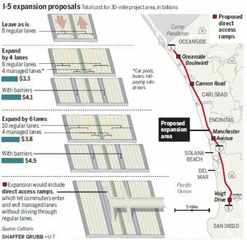 In November 2010, there was additional information on the project that would
widen I-5 between the I-5/I-805 interchange and the Camp Pendleton
boundary. There are a number of different options for expansion (shown in
the figure to the right, from the S-D Union Tribune). There is lots of opposition. At least four cities along the corridor have paid for their own impact studies and will be conveying
their conclusions to Caltrans. Del Mar’s City Council urged Caltrans
to look at alternatives to move people and goods, rather than just cars
and trucks. SANDAG sought to contain any construction to the existing
right of way and to protect the six lagoons and ocean views traversed by
the highway. Community groups have hired attorneys to fight the plan every
step of the way. Groups like the Audubon Society and Sierra Club have
weighed in against the expansion. Allan Kosup, Caltrans director for the
I-5 corridor, says it will take until the middle of 2011 to sort through
and address all the comments and then pick a preferred option.
Construction could begin in 2013.
In November 2010, there was additional information on the project that would
widen I-5 between the I-5/I-805 interchange and the Camp Pendleton
boundary. There are a number of different options for expansion (shown in
the figure to the right, from the S-D Union Tribune). There is lots of opposition. At least four cities along the corridor have paid for their own impact studies and will be conveying
their conclusions to Caltrans. Del Mar’s City Council urged Caltrans
to look at alternatives to move people and goods, rather than just cars
and trucks. SANDAG sought to contain any construction to the existing
right of way and to protect the six lagoons and ocean views traversed by
the highway. Community groups have hired attorneys to fight the plan every
step of the way. Groups like the Audubon Society and Sierra Club have
weighed in against the expansion. Allan Kosup, Caltrans director for the
I-5 corridor, says it will take until the middle of 2011 to sort through
and address all the comments and then pick a preferred option.
Construction could begin in 2013.
SANDAG later indicated that their preferred approach is a phased-in development of the 12-lane highway that retains the inner-freeway but would require far less taking of private land and homes along the corridor. Their letter to the CTC stated that the board of directors supported the 8+4 option for the highway and encouraged Caltrans to minimize right-of-way impacts to adjacent properties to the corridor. It backed a gradual introduction of the HOV/HOT lanes, starting with two in the center (one in each direction) and expanding only if necessary. They also suggested that the design minimize and mitigate visual, noise and air quality impacts as well as effects on the corridor’s coastal lagoons.
In July 2011, it was reported that had decided to go with the 4-lane widening option. The decision to build only four express lanes (open to buses, carpools and drivers willing to pay a fee) reduces the project cost to $3.5 billion. It also cuts in half the number of homes and businesses slated for seizure and removal to make way for the project. Caltrans must still obtain a development permit from the California Coastal Commission before the agency can widen the freeway. Caltrans estimates the first phase of construction—a northbound and southbound express lane from Encinitas to Oceanside—could start as early as 2013.
In September 2012 additional details were provided. The new information about the project is contained in a draft supplemental Environmental Impact Report, which was
officially released for public comment on Aug. 31, 2012. The public has
until Oct. 15 to review and comment on the document. Additional documents
to be released in the coming months include a final EIR and a
“public works plan.” The project involves the addition of four
carpool lanes — for a total of 12 lanes — between La Jolla and
Oceanside, as well as rail improvements such as double-tracking,
enhancements to North County lagoons, bicycle paths along the entire 27
miles of the project, and pedestrian walkways. In preparing the
supplemental EIR, Caltrans commissioned hydraulic and other studies to
determine how best to protect and enhance the health of the lagoons. The
study found that longer bridges over three lagoons — San Elijo,
Batiquitos and Buena Vista — are needed to provide better water flow
in and out of the lagoons. Bridges across Penasquitos, San Dieguito and
Agua Hedionda were found to be adequate. Caltrans has also acquired 100
acres of land along the lagoons, which will be preserved as open space to
compensate for environmental impacts of the I-5 project. Planners have
also added bicycle lanes along the entire project corridor; some will be
within the freeway right-of-way, while others will be on local streets.
Construction on the road improvements and environmental mitigation could
begin in 2014, pending approval by the California Coastal Commission and
other agencies. The road portion of the project will cost $3.5 billion,
while the total project, including rail improvements, is pegged at $6.5
billion. The estimated completion date for the entire project is 2035.
(Source: Rancho Santa Fe Review, 9/26/2012)
In October 2012, more information on the EIR was obtained. There are five alternatives being considered:
In March 2014, the CTC approved for future consideration of funding a project in San Diego County that will construct roadway improvements on I-5 for 27 miles from Oceanside to San Diego. Phase 1 (PPNOs 0615A, 0615B, and 0615C) will extend the existing High Occupancy Vehicle lanes from Manchester Avenue to Route 78, replace the San Elijo and Batiquitos Lagoon bridges, and build soundwalls. Phase 1 is programmed in the State Transportation Improvement Program and is fully funded. The total estimated cost of this phase is $481,820,000 for capital and support. Construction is estimated to begin in Fiscal Year 2015-16. The remaining phases are not yet funded. The locally preferred alternative was Alternative 4: 8 + 4 buffer.
In August 2014, it was reported that the North Coast
Corridor program, a $6.5 billion package that would add freeway, rail,
bicycle, pedestrian and environmental improvements along a 27-mile stretch
from La Jolla to Oceanside, won unanimous approval from the California
Coastal Commission. The new freeway lanes, called express lanes, would be
added to the middle of I-5, eventually stretching the entire 27 miles and
costing an estimated $3.5 billion. Like the I-15 express lanes, they would
be open to carpools, buses, motorcycles, select clean air vehicles and
toll-paying solo drivers.
(Source: UT San Diego, 8/13/14)
In May 2016, it was reported that work will begin in late Summer 2016 on part of the $6.5 billion North Coast Corridor Program — led by the California Department of Transportation and the San Diego Association of Governments — that will ultimately stretch 27 miles from La Jolla to Oceanside. The plan includes an ambitious collection of transportation, environmental, and coastal access projects that will take shape over the next 30 years. Key among them is adding four express lanes to I-5. The $700 million first phase of the corridor project will begin in the next several months with freeway work in Encinitas, where an eight-lane bridge that crosses the San Elijo Lagoon will slowly be replaced with a larger, wider structure. Work will also begin on another freeway bridge that crosses the Batiquitos Lagoon in Carlsbad. The $700 million Phase 1 work will include:
All of the Phase 1 construction is scheduled to be
completed by the end of 2020. The price tag includes $480 million for the
highway improvements, $140 million for railway improvements and $80
million for environmental work. The freeway between La Jolla and Oceanside
carries an average of more than 700,000 vehicle trips a day, according to
SANDAG. Growth forecasts vary, but the county’s population has more
than doubled since the freeway was built, and traffic is certain to
increase in the decades ahead.
(Source: San Diego Union Tribune, 5/8/2016)
In September 2015, it was reported that property
acquisition was underway for a future park and ride and direct access ramp
at Manchester Avenue (≊ 005 SD R38.539) in Encinitas along I-5 north
county corridor. Plans call for a 5-acre Park and Ride, with five acres to
be set aside for agriculture and 10 acres for open space. The projects are
part of Caltrans’ $6.5 billion package of rail, freeway and lagoon
improvements for the I-5 corridor. They’re scheduled to be completed
during phase one of plans, 2016 to 2020. It was also reported that, in
August 2015, the California Coastal Commission unanimously signed off on
the widening plan, which would widen I-5 to include four new express lanes
and provide a series of rail, public transit, bicyclist and pedestrian
improvements between La Jolla and Oceanside. Four lanes designed for car
pools, buses and toll-paying solo drivers would be built along the middle
of the freeway. Two conventional lanes would also be added. The project
was estimated to cost $6.5 billion to be funded through a combination of
federal, state, and local funds. Environmental groups had expressed
concerns about the impact on wildlife living in six coastal lagoons, 32
acres of wetlands and 74 acres of coastal sage. Developers have since said
they’ve addressed these concerns. Now that planners have received
approval from the CCC, a carpool lane from Manchester to Birmingham will
begin construction next year. That will be the first phase of an 11-mile
HOV extension from Manchester to Route 78.
(Source: AAroads Pacific Southwest Forum, 9/30/2015)
In 2017, the following was noted: The I-5 Express Lanes Project will be constructed in three phases from 2013 – 2040. Once completed, the project will result in four Express Lanes, two in each direction, along I-5 from La Jolla Village Drive in San Diego to Harbor Drive in Oceanside. The three phases include:
Phase 1 (2013-2020)
Phase 2 (2021-2030)
Phase 3 (2031-2040)
(Source: SANDAG, I-5 Improvements FAQ)
The 2018 STIP, approved at the CTC March 2018 meeting, appears to include a number of items related to this:
In the SB1 Project List, as of June 2018, under the Solutions for Congested Corridors Program program, the following appears: I-5 North Coast Corridor HOV Extension: In the Cities of Encinitas and Carlsbad from Manchester Avene to Paolmar Airport Road. Construct one High Occupancy Vehicle (HOV) lane in each direction; construct multi-use facility at Manchester; Construct bike paths and construct soundwalls. $195,000,000.
In August 2018, it was reported that the CTC approved
$195 million in SB 1 funding for the I-5 North Coast Corridor HOV
Extension, which includes 18 miles of high occupancy vehicle lanes in both
directions from Encinitas to Carlsbad, software and infrastructure to help
traffic flow, a Park and Ride facility and bicycle and pedestrian paths.
The budget for the overall project is $266 million. Specifically, the CTC
approved that $227,078,000 be allocated from the Budget Act of 2017,
Budget Act Items 2660-301-0890 and 2660-309-0042 for construction and
$39,000,000 for construction engineering for the State-administered
multi-funded SB 1 SCCP/STIP project.
(Source: Times of San Diego, 8/21/2018; August 2018 CTC Agenda Item 2.5s.(7))
In November 2018, it was reported that local, state and
federal transportation officials held a press event marking the start of
construction on eight miles of new carpool lanes on I-5 in Carlsbad and
Encinitas. The project, which officially starts construction in
mid-November, is part of the larger North Coast Corridor program to add 13
miles of carpool lanes, seven miles of bike and pedestrian paths and 1.5
miles of rail corridor double tracking in North County. The first work on
the program began in 2016. The I-5 expansion in North County faced intense
opposition from environmentalists several years ago as it was being
debated at SANDAG. Opponents argued that past expansions of freeways have
failed to reduce traffic congestion, instead only encouraging more people
to drive on them. Researchers refer to this phenomenon as "induced
demand." In 2015 Caltrans itself put on its website a policy paper from UC
Davis' National Center for Sustainable Transportation detailing the
evidence behind induced demand. The paper says the data show projects to
add capacity to freeways result in more vehicle trips and more greenhouse
gas emissions.
(Source: KPBS San Diego, 11/2/2018)
In December 2019, it was reported that local
transportation planners received a milestone approval when the California
Coastal Commission issued a permit for express lanes on I-5 from Carlsbad
to Oceanside. The new lanes will be built from Palomar Airport Road to
Route 78, with construction beginning in the fall of 2020 and completion
scheduled in 2022. When this segment is finished, there will be express
lanes for 20 miles, from the I-805 merge to Route 78.
(Source: Times of San Diego, 12/17/2019)
In January 2020, it was reported that the Build NCC
program has officially reached the halfway point. Coinciding with the
halfway point, the Caltrans and the SANDAG Build NCC highway construction
crews will begin work to rebuild the inside of the highway bridge over the
San Elijo Lagoon. As part of this work, construction crews will shift
northbound and southbound I-5 traffic to the new outside highway bridges.
The same number of lanes will remain in each direction; however, motorists
will experience a curve in both directions over the San Elijo Lagoon
highway bridge. The traffic shifts are anticipated to take place in early
February and will be completed at night over the course of two weeks. The
traffic shift marks a significant milestone in the construction of the San
Elijo Lagoon Bridge. Following the traffic shift, construction crews will
move forward with demolishing the old bridge and complete the project with
the construction of the new inside bridge. Once complete in 2022, the
Build NCC program will accommodate the addition of one new High Occupancy
Vehicles (HOV) lane (or carpool lane) in each direction, between Lomas
Santa Fe Drive in the City of Solana Beach and Route 78 in the City of
Oceanside.
(Source: The Coast News, 1/30/2020)
The 2020 STIP, approved at the March 2020 CTC meeting,
had a number of allocations and programming continuations related to this:
(Source: March 2020 CTC Agenda, Item 4.7, 2020 STIP
Adopted 3/25/2020)
| PPNO | Project | Prior | 20-21 | 21-22 | 22-23 | 23-24 | 24-25 |
| 0615F | HOV extension, Phase 1, Encinitas Seg (CMGC)(SCCP) | 71,078K | 0 | 0 | 0 | 0 | 0 |
| 0615G | HOV extension, Phase 1, Carlsbad Seg (CMGC) | 0 | 0 | 0 | 89,063K | 0 | 0 |
| 0615G | HOV extension, Phase 1, Carlsbad Seg (CMGC) | 0 | 0 | 0 | -89,063K | 0 | 0 |
| 0615G | HOV extension, Phase 1, Carlsbad Seg, Pckg 1 (CMGC) | 0 | 0 | 0 | 10,000K | 0 | 0 |
| 0615H | HOV extension, Phase 1, Carlsbad Seg, Pckg 2 (CMGC) | 0 | 0 | 0 | 40,000K | 0 | 0 |
| 0615I | HOV extension, Phase 1, Carlsbad Seg, Pckg 3 (CMGC) | 0 | 0 | 0 | 39,063K | 0 | 0 |
| 0615 | Del Mar-Camp Pendleton, widen, env | 9,730 K | 0 | 0 | 0 | 0 | 0 |
| 1410 | Rt 78-Rt 5/Rt 805-Rt 52, HOV to Express Lns Conversion | 0 | 0 | 0 | 0 | 18,000K | 0 |
In May 2020, it was reported that Build North Coast
Corridor (NCC) crews have entered the next stage of construction.
Specifically, crews began shifting construction operations from the I-5
median to the outside shoulders in both north and southbound directions
between Birmingham Drive in the City of Encinitas and Palomar Airport Road
in the City of Carlsbad. This transition was performed in two phases: (1)
Birmingham Drive to Batiquitos Lagoon, and (2) Batiquitos Lagoon to
Palomar Airport Road. Together, both phases of the transition are
anticipated to take a total of eight to 10 weeks to complete (excluding
Saturday and Sunday nights, and holidays). The transition will occur
during overnight shifts, between 7:30 p.m. and 5 a.m., and begins with the
relocation of concrete barriers (k-rail) from the I-5 median to the
outside shoulders followed by restriping of the I-5 travel lanes to shift
traffic toward the median. Crews have worked over the past 18 months to
complete inside freeway widening and new median barrier construction. By
shifting work to the outside, crews will be able to complete the I-5
widening work to accommodate one new Carpool/High Occupancy Vehicle (HOV)
Lane in each direction on I-5. Once complete, I-5 will be widened an
average of eight to 10 feet and all existing I-5 on and off ramps within
the Build NCC project limits will be realigned to tie into the future
widened freeway.
(Source: Coast News Group, 5/11/2020)
In December 2020, it was reported that Caltrans and
SANDAG Build NCC crews performed the final concrete pour to complete the
underground foundation for the new I-5 bridge at the San Elijo Lagoon in
the City of Encinitas. The bridge reconstruction will help relieve traffic
congestion, improve lagoon tidal flows, and create new bike and pedestrian
paths when complete in late 2021. Construction first broke ground in early
2017 to replace the original, 57-year-old San Elijo Lagoon I-5 highway
bridge located above Manchester Avenue. The project is part of the first
phase of construction of the NCC program, a 40-year, $6 billion balanced
set of highway, rail, environmental, bike and pedestrian mobility, and
coastal access projects along a 27-mile corridor stretching from La Jolla
to Oceanside. After successfully opening new exterior I-5 bridges to
motorists in February, crews demolished the original bridge and worked
continuously through the pandemic to form new bridge foundation columns
that will support the interior of the reconstructed San Elijo Lagoon
highway bridge. The new bridge has 22 support columns running 145 feet
deep and eight support columns running 255 feet deep below ground level,
which will allow the bridge to support current and future travel demands
and to withstand seismic events. Sediment unearthed from the ongoing
foundation column work was transported from the bridge construction site
and used to support ongoing San Elijo Lagoon restoration and plant
establishment efforts. Once the bridge is complete in late 2021, it will
accommodate one new Carpool/High Occupancy Vehicle (HOV) Lane in each
direction on I-5 and a new north-south suspended bike and pedestrian
bridge below the highway and above the San Elijo Lagoon to connect
Manchester Avenue with the lagoon’s robust trail network. In future
construction phases of the NCC program, the bridge will accommodate a
second Carpool/HOV Lane in each direction on I-5 and a future Direct
Access Ramp from Manchester Avenue.
(Source: Caltrans Press Release, 12/10/2020)
In January 2021, the CTC approved the following STIP
allocation: $10,000,000 ($9,000,000 be allocated from the Budget Act of
2020, Budget Act Items 2660-301-0042 and 2660-301-0890 for construction
and $1,000,000 for construction engineering) for 11-SD-5 37.4/R52.6. PPNO
11-0615G; ProjID 1120000149; EA 2T357. I-5 North Coast Corridor
HOV Extension - Phase 1 - Carlsbad HOV Package 1. I-5 In the
city of Carlsbad from Palomar Airport Road to Route 78. Package 1-
Construct one High Occupancy Vehicle (HOV) lane in each direction (CMGC).
(Right of Way Certification: 12/02/2020) (Future consideration of funding
approved under Resolution E-14-11; March 2014.) (This project is being
delivered using Construction Manager/General Contractor [CMGC] method of
delivery.) (Using the CMGC method of delivery, this project is being
delivered in three contracts: 1) PPNO 0615G, 2) PPNO 0615H, 3) PPNO
0615I.This is first of the three contracts.The overall project outcomes
(8.1 HOV/HOT lane-miles, 1.0 Auxiliary lane-miles, 7 operational
improvements, and 1.3 Pedestrian/Bike facilities miles) have been
arbitrarily distributed among three contacts.) (Contribution from other
sources: $14,569,000.) Allocation time extensions for other projects
programmed within the current Fiscal Year have allowed for sufficient
capacity to become available to fund this advanced project allocation.
(Source: January 2021 CTC Agenda, Agenda Item
2.5c.(4))
In June 2021, the CTC approved an allocation of
$40,000,000 for the State-Administered State Transportation Improvement
Program (STIP) I-5 North Coast Corridor HOV Extension –
Phase 1 – Carlsbad HOV Package 2 project (PPNO 11-0615H;
ProjID 1120000150; EA 2T358; 11-SD-5 37.4/R52.6), on the State Highway
System, in San Diego County, programmed in 2022-23. Allocation time
extensions for other projects programmed within the current Fiscal Year
have allowed for sufficient capacity to become available to fund this
advanced project allocation. The project is on I-5 In the city of Carlsbad
from Palomar Airport Road to Route 78. Package 2- Construct one High
Occupancy Vehicle (HOV) lane in each direction; soundwalls (CMGC). (Future
consideration of funding approved under Resolution E-14-11; March 2014.)
(This project is being delivered using Construction Manager/General
Contractor [CMGC] method of delivery.) (For CMGC construction purpose,
this contract will be combined with a previously allocated STIP project EA
2T357/PPNO 0615G and a SHOPP project EA 43017/PPNO 1279 under EA
2T35U/EFISID 1121000195) (Concurrent SHOPP allocation for EA 43017/PPNO
1279 under Resolution FP-20-87; June 2021.) (RIP CON ENG savings of
$2,870,000 to be moved to RIP CONST.) (Contribution from other sources:
$6,744,000.) The STIP allocation is $40,000,000: $27,163,000 in STIP
funding and $12,837,000 in STIP COVID funding. ($12,837,000 of RIP CON
supplanted by COVID shares to be returned to San Diego county shares)
Allocation: RIP/22-23: CON ENG $7,171,000 $4,301,000
CONST $32,829,000 $22,862,000. COVID RIP/21-22:
CONST $12,837,000.
(Source: June 2021 CTC Agenda, Agenda Items
2.5c.(5), 2.5v.(1))
In October 2021, Caltrans and SANDAG broke ground on
four miles of new carpool lanes connecting Carlsbad and Oceanside,
stretching N to Route 78.. The lanes are part of the $887 million Build
North Coast Corridor (NCC) project that includes $195 million in funding
from Senate Bill (SB) 1, the Road Repair and Accountability Act of 2017.
The groundbreaking event follows more than four years of construction
along I-5 in San Diego County. The $110 million project that kicked off
with the groundbreaking will build four miles of new carpool lanes, one in
each direction of I-5 from Palomar Airport Road in Carlsbad to Route 78 in
Oceanside. When complete, this project will conclude the first phase of
the larger NCC vision. Construction on the carpool lanes between
Manchester and Palomar Airport should be completed by the end of 2021. One
of the most noticeable changes will be the addition of orange lines to
better warn people when lanes shift along I-5. The carpool lane extensions
should be completed by the end of 2023.
(Source: Caltrans District 11 on FB, 10/12/2021; NBC 7 San Diego, 10/12/2021)
In February 2022, it was reported that nine miles of
new HOV lanes opened on northbound I-5 between Lomas Santa Fe Drive in
Solana Beach and Palomar Airport Road in Carlsbad. These lanes are part of
an ongoing $875 million effort that includes widening the freeway for
additional HOV lanes, but also includes double tracking bike paths,
walking trails, and lagoon restorations. The projects include rail
double-tracking, extended Carpool/HOV Lanes, new bike and pedestrian
trails, and the restoration of the San Elijo Lagoon.
(Source: CBS 8, 2/15/2022)
In June 2023, it was reported that HOV lanes have been
completed from Palomar Airport Road in Carlsbad to Route 78 in Oceanside,
with southbound lanes opening June 14 2023 and the northbound section
opening two weeks later. These lane openings include four additional miles
that connect to Route 78. The additional lanes mean that there are now 13
miles of additional HOV lanes that have recently been completed in this
region. The highway portion of the project, which included a new bridge
over San Elijo Lagoon, was the most expensive at a cost of $646 million.
This was a joint project between SANDAG and Caltrans. SANDAG also
announced an additional $260 million from the state which will be used to
fund future projects. That funding is coming through a Senate bill that is
being considered by the California Transportation Commission (CTC) on June
29. The CTC said that it recommended $103 million for SANDAG and North
County Transit District to build rail infrastructure. This funding would
be used to replace an 80-year-old wood bridge with a concrete rail bridge
and add about half a mile of double tracks across the Batiquitos Lagoon.
Once finished, this new bridge would connect Carlsbad with Encinitas.
(Source: CBS 8 San Diego, 6/13/2023; Times of San Diego, 6/13/2023)
La Jolla Village Drive to Genesee Ave Auxilary Lane (SD R28.6/R29.3)
The following project was included in the final adopted 2018 SHOPP in March 2018: PPNO 1136. 11-San Diego-5 R28.6/R29.3. I-5 In the city of San Diego, from north of La Jolla Village Drive to south of Genesee Avenue, on southbound. Construct a 0.5 mile auxiliary lane. Begin Con: 1/31/2019. Total Project Cost: $6,750K.
In December 2018, it was reported that the CTC
allocated $5.9 million allocated to a project that will construct a
half-mile auxiliary lane on southbound I-5 from north of La Jolla Village
Drive to south of Genesee Avenue to improve traffic flow and decrease
delay.
(Source: Times of San Diego, 12/7/2018)
In December 2018, the CTC approved the following
allocation: $5,950,000. San Diego 11-SD-5 R28.6/R29.3. Route 5 In the city
of San Diego, from 0.2 mile north of La Jolla Village Drive to 0.1 mile
south of Genesee Avenue. Outcome/Output: Construct a 0.5 mile
auxiliary lane in the southbound direction. This project will improve
operational functionality by reducing delay. (Future consideration of
funding approved under Resolution E-14-11; March 2014.) (Time Extension FY
17-18 CONST and CON ENG expires on December 31, 2018.) (This is a
Financial Contribution Only (FCO) to San Diego Association of Governments
(SANDAG).) PPNO 11-1136.
(Source: December 2018 CTC Minutes, Item 2.5b(1) Item 10)
In October 2020, it was reported that SANDAG and
Caltrans have opened a southbound I-5 auxiliary lane in the University
area. The new exit-only lane allows motorists to enter the freeway from
Genesee Avenue and continue directly to the La Jolla Village Drive
off-ramp without having to merge with freeway traffic. The approximately
half-mile auxiliary lane is intended to improve traffic flow, reduce
travel delays and increase overall safety in the area. Prior to its
completion, the heavily trafficked southbound I-5 off-ramp to La Jolla
Village Drive often caused congestion on the freeway, posing a safety risk
to motorists. Construction for the I-5/Genesee Avenue Auxiliary Lane
project began in July 2019 and required careful work alongside freeway
traffic. The $7 million project was made possible by the Road Repair and
Accountability Act of 2017, which increased the state gas tax to fund
state transportation projects. The auxiliary lane was constructed
concurrently with the Mid-Coast Trolley project, which will extend Blue
Line Trolley service from Downtown San Diego north to the University
community when it opens for service in late 2021. The auxiliary lane runs
beneath the Voigt Drive Trolley bridge, one of two locations where the
future trolley will travel over I-5.
(Source: Times of San Diego, 10/28/2020)
Genesee Avenue Interchange (≊ 005 SD R29.466)
The SAFETEA-LU act, enacted in August 2005 as the reauthorization of TEA-21, provided the following expenditures for or near this route:
In September 2011, the CTC approved for future consideration of funding a project to reconstruct the I-5/Genessee Avenue Interchange in the city of San Diego (≊ 005 SD R29.466). The scope of work includes replacing existing overcrossings at Genesee Avenue and Voigt Drive, ramp widening at Genesee and at Sorrento Valley Road interchanges, construction of I-5 auxiliary lanes, realignment of Gilman Drive and various measures to improve pedestrian and bicycle access. The entire I-5/Genesee Interchange Reconstruction project will be constructed and designed in phases. Phase 1 includes the reconstruction of the I-5/Genesee Interchange, the addition of auxiliary lanes north of Genesee Avenue, and improvements to the Sorrento Valley Road on-and off-ramps. Phase 2 includes the addition of auxiliary lanes south of Genesee Avenue, replacement of the Voigt Drive Overcrossing and realignment of Gilman Drive. Phase 1 is fully funded with local and federal dollars and is estimated to begin construction in 2014. Phase 2 is fully funded through Plans, Specifications, and Estimates only. Depending on the availability of funding, construction of this phase is estimated to begin between 2015 and 2020. The realignment and widening of the Genesee southbound off-ramp (PPNO 0129P) is programmed in the 2010 State Highway Operation and Protection Program (SHOPP). Total cost of this portion of the project is $12,987,000 for capital and support. Construction is estimated to begin in Fiscal Year 2012-13. The approximate estimated cost of the entire Interstate 5/Genesee Interchange Reconstruction Project, including the SHOPP funding, is $145,000,000. The SHOPP scope of work as described scope programmed by the Commission in the 2010 SHOPP. A copy of the MND has been provided to Commission staff. The project will mitigate potential impacts to traffic, biological resources, aesthetics, noise, and paleontology to a less than significant level by incorporating measures to minimize, avoid, restore, and replace impacted resources. As a result, an MND was completed for this project.
In May 2013, the CTC authorized $8,423,000 to realign and widen the Genesee southbound off-ramp. The CTC also authorized $8,000,000 of Prop 1B funds to reconstruct I-5 Genesee Bridge and interchange including ramps and retaining walls; add Type 1 bicycle facility between Voigt and Sorrento Valley Road.
In January 2007, the CTC considered relinquishment of right of way in the city of San Diego on Vista Sorrento Parkway (≊ 005 SD 28.332), north of Sorrento Valley Boulevard, consisting of frontage road.
In January 2010, the CTC authorized use of ARRA funds for a project that consists of extending the high occupancy vehicle lanes from the Route 5/Route 805 merge (≊005 SD R30.584R) to Carroll Canyon, constructing a north facing Direct Access Ramp with Carroll Canyon and extending Carroll Canyon to Sorrento Valley road. This project is an excellent candidate for Recovery Act funds as the project will likely create approximately 660 jobs in San Diego County. In accordance with AB 3X-20, which authorizes the Commission to allocate bond funds displaced by Recovery Act funds, SANDAG plans to request that the $57,500,000 in CMIA funds be reprogrammed to other eligible projects in the region at a future Commission meeting.
In October 2013, the CTC relinquished right of way in the city of San Diego along Route 5 on Roselle Street (11-SD-5-PM R30.4), consisting of roadway and sidewalks.
2007 CMIA. A number of projects on I-5 in San Diego County were submitted to the Corridor Mobility Improvement Account for funding. These projects included the North Coast Corridor, Stage 1A, Unit 1 ($64 million requested); the N Coast Corridor, Stage 1B, Encinitas HOV ($327 million); the N Coast Corridor, Stage 1C, Carlsbad HOV ($92 milllion); the N Coast Corridor, Stage 1F, Voigt Dr-I-805 HOV ($158 million); and the N Coast Corridor, Stage 1E, Genesee Av interchange ($78 million). None were recommended for funding.
In August 2015, the CTC vacated right of way in the city of San Diego along Route 5 at 0.2 mile north of Carmel Mountain Road (11-SD-5-PM R32.0), consisting of a drainage easement no longer needed for State highway purposes.
I-5/Route 56 Interchange (≊ 005 SD R32.932)
The SAFETEA-LU act, enacted in August 2005 as the reauthorization of TEA-21, provided the following expenditures for or near this route:
In San Diego: In July 2005, the CTC received a notice of EIR preparation for Route 5 and Route 56 in San Diego County (≊ 005 SD R32.932) that would provide a connector between Route 5 and Route 56 near Del Mar Heights (NOP). This is funded in the 2005 Transportation Bill. The alternatives being considered are:
In San Diego, TCRP Project #82 reconstructed the I-5/I-805 interchange, from Genesee Avenue to Del Mar Heights Road. The basic plan was to extend C/D (Collector/Distributor) roadways along I-5 from Route 56 to I-805. Trucks would also be directed onto the C/D roads, so they would also serve as truck bypass lanes, separated from the main lanes by concrete barriers. The "C/D lanes" (4 in each direction) are labelled as the "LOCAL BYPASS" (not truck lanes). Northbound the signage (from both I-5 and I-805) is "LOCAL BYPASS/Junction 56 EAST", reflecting that one must use the bypass to access Route 56); southbound it is "LOCAL BYPASS/Carmel Mountain Rd". The bypass includes a new Carmel Mountain Rd exit in both directions. Route 56 traffic going south merges into the bypass (≊ 005 SD R31.795).
In April 2007, the CTC considered an amendment to TCRP Project #82.2 that changed the project from constructing of northbound and southbound auxiliary lanes from Via De La Valle (≊ 005 SD R36.288) to Lomas Santa Fe Drive (≊ 005 SD R37.398) (including soundwalls and bridges) to extending the existing HOV lane from just south of Via de la Valle to just south of Manchester Avenue, and realigning ramps at the Lomas Santa Fe Drive Interchange. The original proposal was part of a larger project to revise the interchange at Lomas Santa Fe Drive. However, the estimated cost of the interchange work increased beyond the region’s funding capability. The auxiliary lane work was then removed from the larger project and is now being constructed as part of another project. A Value Analysis Study suggested that the region would likely be able to fund the interchange work if the construction was combined with a planned extension of a High Occupancy Vehicle (HOV) lane in each direction from just south of Via de la Valle to just south of Manchester Avenue. The HOV work would provide significant congestion relief by allowing HOV users to continue through an area of daily recurring congestion. By removing the scope of the auxiliary lanes and combining the interchange work and the HOV extension project, the region expected to be able to fully fund the project. The project is scheduled for completion in FY 2009/2010.
In October 2017, the CTC approved for future consideration of funding the following project for which a Final Environmental Impact Report (FEIR) has been completed: I-5 and Route 56 in San Diego County. Construct roadway and interchange improvements on I-5 and Route 56 in and near the city of San Diego. (11-SD-5, PM R32.7/R34.8, 11-SD-56, PM 0.0/2.5) (EA 17790). This project proposes to provide direct connections between I-5 and Route 56 in San Diego County. This project is not fully funded and is included the San Diego Association of Governments 2016 Regional Transportation Improvement Program for $16.9 million, which includes local funding for preliminary engineering. The project will be constructed in multiple stages upon further programming. Construction is estimated to begin in 2020.
In August 2015, the CTC authorized relinquishment of right of way in the city of Solano Beach on Marine View Avenue (11-SD-5-PM R37.1), consisting of a reconstructed city street.
In April 2021, it was noted that, as part of the NCC project, the scenic
I-5 Vista Point overlook in Encinitas (~ SD R39.15) will be redesigned in
the shape of a squid, a direct nod to the project’s proximity to the
Pacific Ocean. By using earth tones and varying surface textures, the
design features allow project components to blend into the environment,
illustrating the comprehensive design thought and approach throughout the
North Coast Corridor. The San Elijo Lagoon highway bridge is another
example of how function and structural design can co-exist. The retaining
walls on the future San Elijo Lagoon highway bridge (~ SD R38.385) have
textured sandstone and contoured retaining walls that are designed to look
like the scenic coastal bluffs that are quintessentially north coastal San
Diego County.
(Source: Coast News Group, 4/22/2021)
In October 2013, the CTC relinquished right of way in the city of Encinitas adjacent to Route 5 along Regal Road (11-SD-5-PM R40.69), consisting of non-motorized transportation facilities.
Leucadia Blvd to Palomar Airport Road Auxiliary Lane (11-San Diego-5 PM R42.2/R47.1)
The 2020 SHOPP, approved in May 2020, included the
following NEW Mobility item of interest: 11-San Diego-5 PM R42.2/R47.1
PPNO 1320 Proj ID 1118000134 EA 43041. I-5 in Encinitas and Carlsbad, from
south of Leucadia Boulevard to north of Palomar Airport Road. Construct
auxiliary lanes to facilitate merging movements and upgrade facilities to
Americans with Disabilities Act (ADA) standards. Programmed in FY22-23,
with construction scheduled to start in January 2023. Total project cost
is $23,258K, with $21,577K being capital (const and right of way) and
$1,681K being support (engineering, environmental, etc.).
(Source: 2020 Approved SHOPP a/o May 2020)
In August 2023, the CTC approved an allocation request
for $44,482,000 for the SHOPP Operational Improvements project on I-5, in
San Diego County, to advertise the project. This project (11-SD-5
R42.2/R47.1, PPNO 11-1320, ProjID 1118000134, EA 43041) is located on I-5
in the Cities of Encinitas and Carlsbad, from south of Leucadia Boulevard
to north of Palomar Airport Road, in San Diego County. The project will
construct an auxiliary lane in the southbound direction, upgrade existing
pedestrian curb ramps, and repair the Agua Hedionda slope. In May 2020,
this project was programmed in the SHOPP for $21,508,000 in Construction
Capital and $1,231,000 in Construction Support for allocation in Fiscal
Year 2022-23. In June 2023, the project received a 4-month allocation time
extension for the Construction phase. This project is the 7th
project delivered under the North Coast Corridor (NCC) program, known as
Build NCC. In December 2014, the Department determined that the NCC
program would benefit significantly using the Construction
Management/General Contractor (CMGC) delivery method instead of the
standard Design-Bid-Build delivery method. In July 2023, the Department
reached an Agree to Price (ATP) with the CMGC contractor of $42,251,000 in
Construction Capital (96.4 percent over the programmed amount) and
$2,231,000 in Construction Support (81.2 percent over the programmed
amount). The Department plans to award the project in September 2023 and
begin construction in October 2023. Construction is planned for two
construction seasons with a duration of 370 working days. The Construction
Capital estimate is greater than the programmed amount due to the addition
of the Agua Hedionda Slope Restoration effort, which was possible through
Infrastructure Investment and Jobs Act (IIJA) funding for climate
resiliency. The remainder of the requested increase falls into three
categories: market escalation, Disadvantaged Business Enterprise (DBE)
utilization increase, and recommended scope additions due to recent
weather events. Preliminary Engineering (Budget / Expended):
PA&ED $0 / $0; PS&E $400,000 / $360,525;
R/W Sup $50,000 / $872. Allocation (Programmed / Allocated):
CON ENG $1,231,000 / $2,231,000; CONST $21,508,000 / $42,251,000.
(Source: August 2023 CTC Agenda, Agenda Item 2.5d.(14))
Palomar Airport Road to Cannon Road Auxillary Lane (11-SD-5 R47.0/R48.0)
The following project was included in the final adopted 2018 SHOPP in March 2018: PPNO 1279. 11-San Diego-5 R47.0/R48.0. I-5 In Carlsbad, from Palomar Airport Road to Cannon Road. Construct auxiliary lane in southbound direction for operational efficiency. Begin Con: 2/18/2022. Total Project Cost: $8,026K.
In March 2019, the CTC provided the following support
allocation: 11-SD-5 R47.0/R48.0 PPNO 1279 Proj ID 1117000206. I-5 In
Carlsbad, from Palomar Airport Road to Cannon Road. Construct auxiliary
lane in southbound direction for operational efficiency. PA&ED
$207,000.
(Source: March 2019 CTC Minutes, Agenda Item
2.5b.(2a) Item 29)
In June 2019, the CTC approved the following SHOPP
support allocation: $1,209,000 11-SD-5 R47.0/R48.0 PPNO 1279 ProjID
1117000206. I-5 In Carlsbad, from Palomar Airport Road to Cannon Road.
Construct auxiliary lane in southbound direction for operational
efficiency. PS&E $1,209,000. (Future consideration of funding approved
under Resolution E-14-11; March 2014.)
(Source June 2019 CTC Minutes, Agenda Item
2.5b.(2a) Item 37)
The 2020 SHOPP, approved in May 2020, included the
following Mobility item of interest (carried over from the 2018 SHOPP):
11-San Diego-5 PM R47.0/R48.0 PPNO 1279 Proj ID 1117000206 EA 43017. I-5
in Carlsbad, from Palomar Airport Road to Cannon Road. Construct auxiliary
lane in southbound direction for operational efficiency. Programmed in
FY21-22, with construction scheduled to start in November 2021. Total
project cost is $8,026K, with $5,524K being capital (const and right of
way) and $2,502K being support (engineering, environmental, etc.).
(Source: 2020 Approved SHOPP a/o May 2020)
In June 2021, the CTC approved the following advance
construction phase allocation: $6,744,000. 11-SD-5 R47.0/R48.0. PPNO
11-1279; ProjID 1117000206; EA 43017. I-5 In Carlsbad, from Palomar
Airport Road to Cannon Road. Outcome/Output: Construct auxiliary lane in
southbound direction for operational efficiency. This is a Construction
Manager/General Contractor (CMGC) project. Allocation: CON ENG $1,243,000
CONST $5,501,000 . (Future consideration of funding approved under
Resolution E-14-11; March 2014.) (EA 43017/PPNO 11-1279 combined with STIP
EA 2T357/PPNO 11-0615G and STIP EA 2T358/PPNO 11-0615H for construction
under EA 2T35U/Project ID 1121000195.) (Related STIP allocation for EA
2T357/PPNO 11-0615G approved under Resolution FP-20-47; January 2021.)
(Related STIP allocation for EA 2T358/PPNO 11-0615H under Resolution
E-20-93.)
(Source: June 2021 CTC Agenda, Agenda Item 2.5b.(3)
#6)
In the City of Carlsbad, the small segment at KP 78.0 (≊ 005 SD R48.46) was up for relinquishement in September 2002.
I-5/Route 78 Interchange (≊ 005 SD R51.183)
 The SAFETEA-LU act, enacted in August 2005 as the reauthorization of TEA-21, provided the
following expenditures for or near this route:
The SAFETEA-LU act, enacted in August 2005 as the reauthorization of TEA-21, provided the
following expenditures for or near this route:
In June 2015, it was reported that Caltrans is in the
process of rebuilding the I-5/Route 78 interchange that spills traffic
into a residential neighborhood. Caltrans first shared information on
proposed interchange improvements in January 2015, and followed up with
additional community briefings since then. This was reolated to a number
of planned I-5 corridor improvements, and the necessity to upgrade both
ends of Route 78 before future work on I-5 begins. The roadway
improvements would be designed to ease expected traffic flow for 30 years
out. There was a specific community concern about flyovers; the community
wanted flyovers to be eliminated as an idea. Caltrans indicated that a
flyover would be studied for traffic, cost and impact on neighborhoods,
along with other alternatives. However, they appreciated community
feedback, and it provided Caltrans great ideas, including consideration of
a roundabout and bike lane. In addition to objections to noise and
pollution, residents expressed concern over the lack of progress in Buena
Vista Lagoon restoration, which the interchange will cross. Another big
concern of residents and city council members was the speed of traffic
that exits the interchange and barrels through a South Oceanside
neighborhood.
(Source: The Coast News, 6/10/2015)
In January 2022, it was reported that the congested
interchange between state Route 78 and I-5 in North County could be
upgraded with federal infrastructure money. The junction connects two
heavily traveled freeways, but instead of an uninterrupted transition,
vehicles in the westbound lanes of state Route 78 must wait at a stoplight
to turn south to get onto I-5. This leads to back-ups in the westbound
lanes causing delays as long as 15 minutes during rush hour and increasing
the risk of accidents. To modernize the interchange, officials plan to
build a flyover overpass that would route cars over existing lanes,
according to the San Diego Association of Governments. It would replace
the traffic light and allow vehicles on Route 78 to merge seamlessly onto
I-5 without slowing or stopping. The $1.2 trillion federal Infrastructure
Investment and Jobs Act, passed in November 2021, authorizes funding to
modernize roads, bridges, rail, ports, water systems and broadband lines.
California’s share includes $29.5 billion for roads and bridges,
which officials hope to tap for the interchange. The federal Department of
Transportation will provide $4.8 billion to California immediately and
CalTrans will administer the money within the state. The North County
interchange project requires two or more years for environmental review
and engineering plans. After that construction of the new interchange
could be completed within about 18 months.
(Source: San Diego Union Tribune, 1/24/2022)
Orange County Line to Route 22
HOV Lane - San Diego County Line to Avenida Pico (ORA 0.000 to ORA 3.391)
 In March 2020, it was reported that, as part of the
agreement not to extend the Route 241 toll road, the TCA will collaborate
with Caltrans and OCTA to advance plans of having the high occupancy
vehicle (HOV) lane on the I-5 extend from Avenida Pico to the San Diego
County line, as well as complete the project to widen Ortega Highway in
San Juan Capistrano. The collaboration will entail the agencies executing
the Alternative 22 proposal (Los Patrones Parkway) and “conclude the
Agency’s efforts to identify solutions for a southerly extension of
the 241 Toll Road,” the agenda report on the subject states.
In March 2020, it was reported that, as part of the
agreement not to extend the Route 241 toll road, the TCA will collaborate
with Caltrans and OCTA to advance plans of having the high occupancy
vehicle (HOV) lane on the I-5 extend from Avenida Pico to the San Diego
County line, as well as complete the project to widen Ortega Highway in
San Juan Capistrano. The collaboration will entail the agencies executing
the Alternative 22 proposal (Los Patrones Parkway) and “conclude the
Agency’s efforts to identify solutions for a southerly extension of
the 241 Toll Road,” the agenda report on the subject states.
(Source: San Clemente Times, 3/12/2020)
In March 2020, the CTC approved the 2020 STIP, which
included programming of $5,500K for engineering for PPNO 2863J "Managed
lanes, San Clemente, Av Pico-SD Co Line"
(Source: March 2020 CTC Agenda, Item 4.7, 2020 STIP
Adopted 3/25/2020)
In May 2021, it was reported that OCTA had awarded a
contract to prepare environmental documents for extending the carpool
lanes in each direction between Avenida Pico and the border with San Diego
County. This improvement would build on the six miles of carpool lane
opened in 2018 in each direction of I-5 through the cities of San Juan
Capistrano, Dana Point and San Clemente. The environmental phase is
expected to be completed by early 2024. OCTA is planning extensive public
outreach with residents of San Clemente and other stakeholders.
(Source: OCTA Blog, 5/20/2021)
In December 2011, the city of San Clemente has asked Caltrans to remove a 16-foot sound wall that was constructed along the I-5 Freeway near South El Camino Real. San Clemente's city attorney thinks Caltrans might have violated the California Environmental Quality Act by not notifying residents east of the freeway that the wall was planned. They have also asked Caltrans to reopen the environmental-review process for the $5.3 million project, which also calls for a see-through wall on the west side of the freeway atop the El Camino Real overcrossing (≊ 005 ORA 1.651). In February 2012, Caltrans offered to consider changes to the design. Changes could include extending and lowering the existing wall, though Caltrans told the city in October that the wall is the height required to meet a mandatory level of sound reduction for residents west of I-5.
Avenida Pico / San Juan Creek Widening (≊ 005 ORA 3.391/OR 8.808)
In March 2012, it was reported that a new $275 million project will add a carpool lane in each direction and rebuild the Avenida Pico interchange, including widening the northbound Avenida Pico on-ramp to three lanes. Construction is expected to start in late 2013. In early March 2012, the OCTA board authorized the acquisition of ten properties, most commercial and one residential building, to make way for construction. Some of the properties include: Saint Andrew's by the Sea Methodist Church, Victoria Land Partners, and Faith Lutheran Church of Capistrano Beach.
The CTC minutes from February 2012 clarified the March 2012 report above. In late February 2012, the CTC approved for future consideration of funding a project that widen I-5; adding one HOV lane in each direction and re-establishing and constructing auxiliary lanes between Avenida Pico (≊ 005 ORA 3.391) and San Juan Creek Road (≊ 005 ORA 8.808); in the cities of San Clemente, Dana Point, and San Juan Capistrano. The project is not fully funded, however, the project is entirely funded through the environmental, planning, design, and right of way phases with federal and local dollars. The total estimated project cost is $275,000,000 for capital and support. Construction is estimated to begin in Fiscal Year 2012-13. The project will mitigate potential impacts to biological resources, aesthetics, noise, and water quality to a less than significant level. Proposed mitigation measures include pre-construction surveys for rare and endangered species, establishment of fenced Environmentally Sensitive Areas (ESA), incorporation of sound control features in final project design, landscaping, and adherence to Best Management Practices (BMP) for erosion and water quality.
In November 2012, it was reported that the OCTA has
approved projects on I-5 in S Orange County. In 2013, construction will
begin to add lanes, improve interchanges and ease congestion at Avenido
Pico to San Juan Creek Road. Approximately 241,000 vehicles currently
travel through the area daily, leading to traffic and congestion during
peak hours. By 2040, the number of vehicle trips is expected to rise by 24
percent, or 300,000 vehicles traveling across the freeway. Construction
will come in three phases, with the final segment of Avenida Pico to Vista
Hermosa expected to be completed in 2016. Upon completion of that project,
work will begin in 2018 to widen the stretch from the Route 73 toll road
to El Toro Road.
(Source: OC Register, 11/12/2012)
In January 2013, it was reported that the first work
being done on “Segment 2” of the larger Orange County
Transportation Authority project, the widening of I-5 between the San
Clemente city line (≊ 005 ORA 0.0) to just south of Avenida Vista
Hermosa (≊ 005 ORA 4.072), has begun. The project will widen I-5 to
accommodate a high occupancy vehicle lane through the length of the
project and is slated to last until 2014. The third segment of the total
project, which includes the widening of the Avenida Pico exchange, is
scheduled to begin construction in 2014 and last until 2017.
(Source: San Juan Capistrano Patch, 1/11/2013)
In May 2013, the CTC received notice that the OCTA was going to propose amending the 2012 STIP for the I-5 High Occupancy Vehicle (HOV) Lane – South of Avenida Vista Hermosa to South of Pacific Coast Highway project (PPNO 2531E) to reduce Regional Improvement Program (RIP) construction by $10,000,000, from $47,381,000 to $37,381,000 and backfill with Congestion Mitigation and Air Quality (CMAQ) Program funding. It is also proposed to reprogram the $10,000,000 in RIP funds to the design phase of a new STIP project, I-5 widening – El Toro Road to Route 73 (PPNO 2604B) in Orange County.
In January 2014, freeway construction started on the project that will add carpool lanes between San Juan Creek Road and Avenida Pico.
In January 2014, it was reported that the $275 million
I-5 widening that will add carpool lanes between San Juan Creek Road in
San Juan Capistrano and just past Avenida Pico in San Clemente could lead
to a second widening in San Clemente. Specifically, a new OCTA long-term
transportation plan will propose I-5 carpool lanes between Pico and the
San Diego County line. However, there is no timetable for the second
project, and the OCTA has yet to determine the project’s scope and a
source of funding for it. Work could begin on the current I-5 widening
project late this month, with completion by the end of 2016. The second
widening project (widening I-5 in downtown San Clemente) figures to be
costly and could be tricky, with tight tolerances, impacting homes and
businesses. A wider freeway would not only need a broader roadbed but
longer bridges, new sound walls and re-engineered on- and off-ramps. The
San Diego Association and Caltrans are proposing widening I-5 by 2035 to
12 lanes from La Jolla to the north end of Oceanside, 27 miles north.
Beyond that, a long-term plan from the San Diego Association shows four
toll express lanes from Oceanside north to the county line. The San Diego
County group is figuring four toll express lanes will be needed based on
population and traffic projections, but it's too far out to be certain.
Additionally, some San Clemente residents have voiced fears that ending
the southbound carpool lane at Pico will create a bottleneck right away,
narrowing I-5 there from five to four lanes on an uphill.
(Source: OCTA Blog)
In September 2015, it was reported that pile driving
was scheduled to begin in late October 2015 for the new portion of the
Avenida Pico bridge on the southbound side of I-5 in San Clemente.
Reconstruction of the Avenida Pico interchange is part of the $230 million
I-5 South County Improvement Project, which also extends the carpool lane
from San Juan Creek Road in San Juan Capistrano to Avenida Pico in San
Clemente. Before pile driving can begin, crews have to excavate the
massive piles of dirt where the new portion of the bridge is being built.
The dirt, known as surcharge, ensures the ground beneath it is completely
compacted and will fully support the new bridge. Crews also will install
temporary shoring adjacent to southbound lanes to support the existing
freeway while the bridge is being built. In parallel, crews will be
reconstructing the sound walls along the southbound I-5 freeway, between
Camino de Estrella and the bridge over Avenida Vaquero. Further north,
near the PCH connector to I-5, efforts continue to widen three bridges and
finish several retaining walls.
(Source: OCTA Blog, 9/23/2015)
In December 2015, it was reported that crews have
finished driving about one hundred steel piles for the new I-5 bridge over
Avenida Pico in San Clemente, part of the $230 million I-5 South County
Improvements Project. Pile driving is set to resume in January 2016 for
another part of the Pico bridge, which must be widened to accommodate the
new carpool lanes. The steel piles will support the footings of the new
bridge.
(Source: OCTA Blog, 12/23/2015)
In February 2016, it was reported that crews recently
completed driving steel piles for the foundation of the new bridge being
constructed adjacent to the southbound side of the freeway. Now they are
focused on building the bridge abutments, which will support the bridge
deck. At the same time, construction has begun on the new retaining wall
along westbound Avenida Pico, just before the on-ramp to northbound I-5.
Crews are excavating dirt and constructing the wall from the top down. The
new wall will allow Avenido Pico to be widened to accommodate dedicated
turn lanes onto the freeway on-ramps in both directions.
(Source: OCTA Blog, 2/18/2016)
In April 2016, it was reported that pile driving for
the Avenida Pico bridge foundation on the west side of the interchange is
done, and crews are building the bridge abutments and pilasters, which
will support the bridge deck. Work also is beginning on large retaining
walls adjacent to the southbound Pico off-ramp and on-ramp. Crews have
already begun installing steel beams for the bridge falsework, the
temporary structure used during construction of the bridge and bridge
deck. The beams will extend across Pico, requiring several full nighttime
road closures, currently scheduled for early to mid-April. Once this new
portion of bridge is completed, freeway traffic will be shifted onto it
and the remainder of the old bridge will be demolished and rebuilt. The
traffic shift is expected to take place toward the end of the year.
(Source: OCTA Blog, 4/6/2016)
In July 2016, it was reported that crews have hit some
significant milestones on the I-5 South County Improvements Project, a
$230 million effort that extends the carpool lane from San Juan Capistrano
to San Clemente and reconstructs the Avenida Pico interchange. The new
deck on the recently constructed bridge over Avenida Pico has been poured,
and crews have lowered the temporary structure supporting the concrete
bridge as the concrete cured. The temporary structure, known as falsework,
will be moved to the east side of the interchange once work starts there.
The deck required 603 cubic yards of concrete, enough to completely cover
a football field with about four inches of concrete. The nine-hour pour
took 61 trucks that delivered 1,182 tons of concrete. Traffic lanes are
tentatively scheduled to be switched over to the new bridge in September,
after which crews will demolish the remainder of the old bridge. Then work
will begin on the second half of the Pico bridge, starting with pile
driving for the foundation. Sound walls have gone up on the southbound
side of I-5 between Avenida Vista Hermosa and Camino de Estrella. Drivers
exiting at Avenida Vista Hermosa encounter new configurations on some
ramps as crews shift traffic to move forward with the next stage of
construction. That stage includes a series of long-term ramp closures
coming in Summer 2016 at Avenida Vista Hermosa and Camino de Estrella. The
full closures – ranging from 55 hours to nine days – will
allow crews to work more efficiently to realign the ramps. A little
further north, crews are pouring the face of the retaining wall along
southbound I-5, just past the PCH/Beach Cities exit. The wall face is
constructed using specially crafted form liners that, once removed, will
reveal an architectural treatment displaying pelicans and waves. In all,
it’s about 21 weeks of work.
(Source: OCTA Blog, 7/6/2016)
In January 2017, it was reported that construction
crews would be closing the loop on-ramp from westbound Camino Las Ramblas
to southbound I-5 for an extended period, beginning Friday, February 3.
The ramp closure is part of the $230 million I-5 South County Improvements
Project, which extends the carpool lanes from San Juan Capistrano to San
Clemente. During the closure, which will be in effect from 10 p.m. Friday,
February 3, to 5 a.m. Monday, February 13, crews will realign the ramp to
accommodate the widened freeway. Motorists will be detoured to Doheny Park
Road and southbound Pacific Coast Highway to access southbound I-5. On the
other side of I-5, as part of a separate Caltrans project, repair work has
begun on the loop on-ramp from eastbound Camino Las Ramblas to northbound
I-5. Crews will be demolishing and replacing the bridge deck and the
bridge barrier rails of the on-ramp. The project requires closing the loop
on-ramp for four months, through May 31.
(Source: OCTA Blog, 1/31/2017)
In July 2017, it was reported that construction crews
have completed the overhead carpool sign installation on southbound and
northbound I-5. The lane and full freeway closures for this work on I-5
are now complete. The construction on the I-5 South County Improvements
Project began in 2014. The project will add nearly six miles of carpool
lanes in each direction from Avenida Pico in San Clemente to San Juan
Creek Road in San Juan Capistrano. The overhead sign work is part of the
project’s San Juan Creek Road to PCH Segment. The remaining work on
this portion of the project includes realignment of the median barrier,
landscaping installation and final striping.
(Source: OCTA Blog, 7/31/2017)
In February 2018, it was reported that this project was nearing completion. In the segment from San Juan Creek Road to PCH/Camino Las Ramblas, crews have finished placing the final cap of asphalt and are striping lanes into their final configuration on this section of the project. In the PCH/Camino Las Ramblas to Avenida Vista Hermosa segment, crews were removing debris along the median in the coming weeks to prepare this segment for final striping. In the Avenida Vista Hermosa to Avenida Pico segment, final paving and striping was completed on Avenida Pico, and the roadway is now in its final configuration. During the end of February, crews were finalizing signal timing and completing landscaping. On the freeway, crews still need to place final paving and striping, which requires nighttime temperatures of 50 degrees or higher. All of this working, including the opening of the carpool lines, should be completed in March 2018.
In August 2011, the CTC approved $5,978,000 in SHOPP funding for repairs near Dana Point and San Clemente from south of Camino De Estrella Road (≊ 005 ORA 5.785) to south of Via California Road (≊ 005 ORA 6.611) that will construct an auxiliary lane between two interchanges and widen overcrossing structure to alleviate traffic delay.
Camino Capistrano (≊ 005 ORA 8.686)
In January 2010, the CTC approved for future consideration of funding a project in Orange County that will widen southbound on and off ramps at Camino Capistrano (≊ 005 ORA 8.686), reconfigure the hook-ramp interchange and construct roadway improvements on I-5 in the city of San Juan Capistrano. The project is fully funded in the 2008 State Transportation Improvement Program. The total estimated project cost is $19,015,000, capital and support. Construction is estimated to begin in Fiscal Year 2009-10.
In May 2016, it was reported that developers of the
416-home Pacifica San Juan development are looking to make life easier for
I-5 drivers who use the often-backed-up northbound Camino Capistrano exit.
Work will begin in late May 2016 to convert the disjointed intersection at
the top of the off-ramp into a roundabout, aiming to smooth the flow of
traffic. The roundabout is part of an agreement between the developers and
the city to complete a 257-acre residential project originally approved in
1992. The project has had stops and starts, from a landslide to the
recession to bankruptcy of the financial backer, officials said. The City
Council, on May 17, approved a five-year extension of the agreement, which
was to expire this year, so a new builder, Taylor Morrison Homes, can see
it through. The development is between the intersection of Camino las
Ramblas at Avenida California and Vista Marina at Valle Road, east of I-5,
south and east of McCracken Hill, south of San Juan Meadows and west of
Lomas San Juan.
(Source: OC Register, 5/24/2016)
In December 2016, the CTC authorized relinquishment of right of way in the city of San Juan Capistrano along Route 5 on Camino Capistrano, consisting of collateral facilities (12-Ora-5-PM 8.3/8.6). The City, by freeway agreement dated April 17, 2012, agreed to accept title, and by Resolution dated August 2, 2016, agreed to waive the 90- day notice requirement and accept title upon relinquishment by the State.
San Juan Creek Road Roundabout (ORA 8.8)
In July 2019, the Summer 2019 Mile Marker was published, which reported on the new connection at San Juan Creek Road. Prior to 2017, drivers entering or getting off the
freeway at Exit 82 for San Juan Creek Road had to contend with an
intersection at Valle Road and La Novia Avenue where five road segments
came together. The five-leg intersection featured a challenging geometry
with poor sight lines and awkward turning movements for drivers. In
addition, the lack of traffic signals contributed to both congestion and
directional confusion. Following eight months of intersection control
analysis, a roundabout intersection was selected as the preferred
alternative. Compared with other options, the roundabout required the
least right-of-way acquisition and had the highest benefit-tocost ratio.
It also cost the least to construct and maintain, and brought safety
advantages over signalized intersections. Construction began in June 2016.
The design consists of a landscaped center median, a circulating roadway
with a width of 20 feet, and single lane approaches on Valle Road, La
Novia Avenue and the I-5 entrance and exit ramps. The steep grade on La
Novia, hillside conditions in the area, and proximity of the intersection
to the freeway increased the difficulty level of the work. They also had
to keep the interchange open during the rework. Ten months after
construction began, the $1.6 million roundabout opened to traffic in April
2017. San Juan Capistrano arranged for funding from the developer. The
American Public Works Association, Southern California Chapter, recognized
the project in 2017 as its Traffic, Mobility and Beautification Project of
the Year. The Los Angeles chapter of the American Society of Civil
Engineers honored the I-5/La Novia Roundabout as its Roadway and Highway
Project of the Year in 2018.
(Source: Summer 2019 Mile Marker: Answer to Traffic Woes Comes Full Circle)
Ortega Highways Interchange (≊ 005 ORA 9.603)
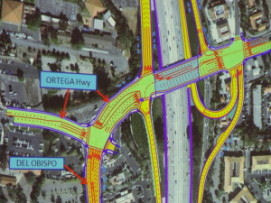 In December 2005, the OCTA approved use of Measure M money to widen the I-5
interchange with Ortega Highway (Route 74). In April 2012, it was reported
that groundbreaking on the project will occur in early 2013. The first
phase of construction entails rebuilding the Ortega Highway overpass,
first demolishing the south side of the bridge and diverting traffic to
two lanes on the north side. It also includes widening the overpass and
diverting traffic to southbound lanes and building the first portions of
the realigned Del Obispo and a new loop-shaped northbound on-ramp. During
this first phase, the southbound on-ramp will be closed temporarily so it
can be raised 4 feet; the existing northbound on-ramp will be closed to
allow for construction of the new one; and Ortega Highway will be closed
to traffic to complete the reconstruction of the overpass. In the second
phase, travelers will be able to drive on the new Del Obispo
alignment—which will eliminate the left-hand turn off Ortega
Highway—while work continues on the northbound on-ramp. CalTrans has
set aside $28 million to buy the land it needs to complete the interchange
project. Businesses that will be demolished include the Chevron gas
stations on the east and west sides of Ortega, Arby's and Jack in the Box.
In December 2005, the OCTA approved use of Measure M money to widen the I-5
interchange with Ortega Highway (Route 74). In April 2012, it was reported
that groundbreaking on the project will occur in early 2013. The first
phase of construction entails rebuilding the Ortega Highway overpass,
first demolishing the south side of the bridge and diverting traffic to
two lanes on the north side. It also includes widening the overpass and
diverting traffic to southbound lanes and building the first portions of
the realigned Del Obispo and a new loop-shaped northbound on-ramp. During
this first phase, the southbound on-ramp will be closed temporarily so it
can be raised 4 feet; the existing northbound on-ramp will be closed to
allow for construction of the new one; and Ortega Highway will be closed
to traffic to complete the reconstruction of the overpass. In the second
phase, travelers will be able to drive on the new Del Obispo
alignment—which will eliminate the left-hand turn off Ortega
Highway—while work continues on the northbound on-ramp. CalTrans has
set aside $28 million to buy the land it needs to complete the interchange
project. Businesses that will be demolished include the Chevron gas
stations on the east and west sides of Ortega, Arby's and Jack in the Box.
(Source: San Juan Capistrano Patch, April 2, 2012)
In January 2013, it was reported that work on the
Ortega interchange would begin in mid-February 2013. The $86.2 million
project will completely rebuild the Ortega Highway bridge over I-5,
construct a new northbound loop on-ramp, reconfigure the northern portion
of Del Obispo Street leading to the bridge and apply several changes to
existing on- and off-ramps. Estimated completion is Spring 2015.
Additional information on this project can be found here.
(Source: San Juan Capistrano Patch, 1/11/2013)
In June 2015, it was reported that work on the
Interstate 5 (I-5)/Ortega Highway Interchange Improvement Project is 80%
complete, and the project is expected to wrap up sometime in late 2015.
The $86 million project, which began construction in February 2013, widens
the Ortega Highway bridge as well as the existing ramps and adds a loop
on-ramp to northbound I-5. The project also realigns Ortega Highway to
curve into Del Obispo Street. This will improve traffic flow on Ortega
Highway as well as ease regional commutes. The deck for the second half of
the new bridge was poured at the end of May 2015. The wood forms
supporting the structure are set to be removed by late June or early July.
Concrete pours to fill the small gap between the north and south sides of
the bridge are scheduled for mid- to late July 2015. In late June,
motorists will see crews placing white foam blocks at the southbound I-5
off-ramp to Ortega. These strong, lightweight blocks, known as geofoam,
are used as fill for the ramp, taking the place of dirt, which requires
time to compact. The northbound on-ramp and the remaining portion of the
southbound off-ramp are scheduled to be paved by the end of July, but they
won’t open until the bridge opens in late August or early September
2015.
(Source: OCTA, 6/16/2015)
In September 2015, it was reported that construction
was completed on the Ortega Highway interchange with I-5. The California
Department of Transportation and the Orange County Transportation
Authority began improvements on the intersection of Ortega Highway and I-5
in February 2013 to relieve traffic congestion around San Juan
Capistrano’s primary connection to the freeway. The $81 million
project was finished the first week of September 2015 with improved
traffic flow and freeway access. Construction included remodeling the
bridge over the freeway, widening on- and off-ramps and a new northbound
on-ramp loop. The new plans also smoothed out the traffic flow west of the
freeway by making Ortega Highway lead into Del Obisbo street and
diminishing two intersections to one. The project was officially opened on
October 1, 2015. The 2.5-year project includes a reconstructed Ortega
Highway bridge over the I-5 freeway, increasing the number of lanes on the
bridge from four to eight, including turn lanes and through lanes,
realignment of Ortega Highway west of the I-5 into the downtown area of
San Juan Capistrano, and a new northbound loop on-ramp; and widened north
and south I-5 on- and off-ramps to improve traffic flow. The project
highlights a “bridging of history,” as San Juan
Capistrano’s Spanish architectural style is reflected in colored
concrete on the new bridge and textured retaining walls that were painted
by hand. All lanes on the bridge and on- and off-ramps are open as of
10/1/2015, and only minor work remains before Caltrans, the lead agency on
the project, gives it final approval.
(Source: OC Register, 9/9/2015, 10/6/2015)
In August 2019, the CTC approved relinquishment of
right of way in the city of San Juan Capistrano (City) along Route 5 at
Ortega Highway and Del Obispo Street (12-Ora-5-PM 9.5), consisting of a
reconstructed city street. The City by freeway agreement dated April 17,
2012, agreed to accept the relinquishment and by resolution dated April 2,
2019, agreed to waive the 90-day notice requirement and accept title upon
relinquishment by the State.
(Source: August 2019 CTC Agenda, Item 2.3c)
Ortega Hwy to Junipero Serra Road Aux Lane (12-Ora-5 9.6/10.4)
In October 2021, the CTC approved the following Major
Collision SHOPP amendment: 12-Ora-5 9.6/10.4. PPNO 12-2627; ProjID
1220000014; EA 0S280. I-5 In San Juan Capistrano, from Route 74 to south
of Junipero Serra Road. Add a second auxiliary lane, Changeable Message
Sign (CMS), and overhead sign structures. Allocation ($1000s): PA&ED
$1,022; PS&E $1,097; R/W Sup $0; Con Sup $1,023; R/W Cap $0; Const Cap
$5,000; Total $8,142. BC: 8/13/2024. (Concurrent COS allocation under
Resolution FP-21-26; October 2021.)
(Source: CTC October 2021 Agenda, Agenda Item
2.1a.(1a) #13)
In October 2021, the CTC approved the following
allocation for preconstruction project phases: $1,022,000. 12-Ora-5
9.6/10.4. PPNO 12-2627; ProjID 1220000014; EA 0S280. I-5 In San Juan
Capistrano, from Route 74 to south of Junipero Serra Road. Add a second
auxiliary lane, Changeable Message Sign (CMS), and overhead sign
structures. (Concurrent Amendment under SHOPP Amendment 20H-011; October
2021.) Allocation: PA&ED $1,022,000.
(Source: October 2021 CTC Agenda, Agenda Item
2.5b.(2a) #26)
In October 2022, the CTC approved the following
pre-construction phase allocation: $1,097,000. 12-Ora-5 9.6/10.4. PPNO
12-2627; ProjID 1220000014; EA 0S280. I-5 In San Juan Capistrano, from
Route 74 to south of Junipero Serra Road. Add a second auxiliary lane,
Changeable Message Sign (CMS), and overhead sign structures. Allocation:
FY23-24 PS&E $1,097,000.
(Source: October 2022 CTC Agenda, Agenda Item 2.5b.(2a) #17)
In January 2023, the CTC amended the following project
in the 2022 SHOPP: 12-Ora-5 9.6/10.4. PPNO 12-2627; ProjID 1220000014; EA
0S280. I-5 In San Juan Capistrano, from Route 74 to south of Junipero
Serra Road. Add a second auxiliary lane, Changeable Message Sign (CMS),
and overhead sign structures. Increase construction capital because of
additional work needed for drainage channel enclosure work and median
lighting, along with various item cost increases. Increase construction
support because additional support is needed for added channel and
lighting work. Allocation ($ × 1,000): PA&ED $1,022; PS&E
$1,097; R/W Sup $0; Con Sup $1,023 ⇨ $1,641; R/W Cap $0; Const Cap
$5,000 ⇨ $7,388; TOTAL $8,142 ⇨ $11,148.
(Source: January 2023 CTC Agenda, Agenda Item 2.1a.(1d) #9)
I-5 Widening Project From State Route 73 to El Toro Road (12-Ora-5, PM 12.4/18)
 In August 2014, the CTC approved for future consideration
of funding a project that will widen I-5 from Route 73 (≊ 005 ORA
12.65) to El Toro Road (≊ 005 ORA 18.692). The total estimated cost
is $418,474,000 for capital and support, and construction was expected to
commence in FY18-19.
In August 2014, the CTC approved for future consideration
of funding a project that will widen I-5 from Route 73 (≊ 005 ORA
12.65) to El Toro Road (≊ 005 ORA 18.692). The total estimated cost
is $418,474,000 for capital and support, and construction was expected to
commence in FY18-19.
The 2018 STIP, approved at the CTC March 2018 meeting, appears to adjust the funding down from $78.03K to $73.735K, and move the construction into FY18-19 from FY19-20 (PPNO 2655). In Laguna Niguel, Mission Viejo and Laguna Hills from Route 73 to Oso Parkway. Add general purpose lane in each direction and reconstruct interchanges at Avery Parkway.
It also adds two projects, PPNO 2655D, Widening, Rt 73-Oso Parkway, Seg1 landscaping, $6M, and PPNO 2655B, Widening, Alicia Pkwy-El Toro Rd, Segment 3 (~ ORA 17.489 to ORA 18.698), $69.911M. This implies there is a Phase 2 somewhere in the pipeline from Oso to Alica (~ORA 14.5 to ORA 17.489)
At the end of December 2018, it was reported that one
of the projects planned for Orange County was along I-5 from Route 73 to
El Toro Road, where a regular traffic lane in each direction will be added
between Avery Parkway and Alicia Parkway. A carpool lane in each direction
will be extended from El Toro Road to Alicia Parkway. Avery Parkway and La
Paz Road interchanges will also be reconstructed. Period: Mid-2019 to late
2024. Oso Parkway to Alicia Parkway segment will be the section under most
construction in 2019. Cost: $548 million.
(Source: OC Register, 12/31/2018)
In December 2018, the CTC approved adding the following
project to the Trade Corridors Improvement Fund (TCIF) list of projects:
Project 131 – I-5 Improvement Project (Segment 1) from Route 73 to Oso Parkway (Segment 1) in Orange County . With the support
of the Southern California Trade Corridors Coalition, the Orange County
Transportation Authority proposes to amend the Trade Corridors Improvement
Fund Program by including the I-5 Improvement Project (Segment 1) as
Project 131. The proposed project will add general-purpose lanes on I-5,
reconstruct the Avery Parkway Interchange (~ ORA 12.958), reconstruct
various ramps, and construct auxiliary lane improvements. These
improvements will increase the efficiency and productivity of the facility
by minimizing delays in the supply chain and helps to reduce the
environmental and local community impacts of freight. The I-5 Improvement
Project-Segment 1 is estimated to cost $179.7 million and construction is
expected to begin in October 2019. Additionally, the CTC approved the
Trade Corridors Improvement Fund Project Baseline Agreement and establish
this agreement as the basis for project delivery and monitoring for Trade
Corridors Improvement Fund Project 131, the I-5 Improvement Project
(Segment 1).
(Source: December 2018 CTC Minutes, Agenda Item
4.22; Agenda Item 4.23)
In May 2019, the CTC approved programming an additional
$2,841,000 in TCIF funds to Construction on TCIF Project 131, I-5
Improvement Project – Segment 1 (PPNO 2655) in Orange County, for a
total TCIF programmed amount of $29,832,000. The I-5 Improvement Project
– Segment 1 will add one general-purpose lane in each direction on
I-5 between Route 73 and Oso Parkway (approximately 2.2 miles),
reconstruct the Avery Parkway Interchange, reconstruct ramps at Avery
Parkway, Crown Valley Parkway, and Oso Parkway, and construct auxiliary
lane improvements. Segment 1 is part of a larger project to improve the
I-5 between Route 73 and El Toro Road. The I-5 Improvement project –
Segment 1 received approval for $26,991,000 in TCIF funding at the
December 2018 Commission meeting. Since then, a cost increase of
$9,274,000 was identified as part of the final project cost estimating
project as well as an analysis of the January 2019 construction bids for
the adjacent Segment 2 project. The construction bids indicated higher per
unit costs for concrete and Time Related Overhead items. To cover the cost
increase, it is proposed to program an additional $2,841,000 in TCIF
funding and add $6,433,000 in Highway Infrastructure Program funding. The
additional $2,841,000 in TCIF funding will be made available from project
close-out savings. The project is on schedule to receive a construction
allocation at the June 2019 Commission meeting pending concurrent approval
of two Resolutions of Necessity on the May 2019 Agenda.
(Source: May 2019 CTC Minutes, Agenda Item
2.1c.(5); Agenda Item 4.27)
In June 2019, it was reported that Orange County
transportation officials broke ground on a $581 million I-5 improvement
project in south Orange County between Route 73 and El Toro Road. The
project is largely funded by OC Go, the county’s half-cent sales tax
for transportation. The project that will add a regular lane in each
direction, extend a second carpool lane between Alicia Parkway and El Toro
Road, and improve interchanges and streets. The project is scheduled to be
completed in 2025 and will be built in three segments. Several streets
that intersect the freeway also will be improved and widened, as well as
ramps that enter and exit the freeway. Those major intersection
improvements include La Paz Road in Mission Viejo and Laguna Hills, and
Avery Parkway in Mission Viejo and Laguna Niguel. The overpass at Los
Alisos Boulevard in Lake Forest and Laguna Hills also will be widened.
Newly constructed retaining walls will include designs reflecting the
ranching heritage of the local communities.
(Source: PR Newswire, 6/6/2019; OCTABlog,
6/20/2019)
In June 2019, the CTC approved an allocation of
$121,809,000 for the State-Administered Multi-Funded Local Partnership
Program (LPP) (Formulaic)/State Transportation Improvement Program
(STIP)/Proposition 1B Trade Corridor Improvement Fund (TCIF) I-5 Widening,
Segment 1 (Route 73 to Oso Parkway) (PPNO 2655; ProjID 1214000096) project
(12-ORA-5 12.4/14.5). I-5 in Laguna Niguel, Mission Viejo and Laguna Hills
from Route 73 to Oso Parkway. Add general purpose lane in each direction
and reconstruct interchanges at Avery Parkway. Resolution E-14-37; August
2014.) (Right of Way Certification: 05/21/2019) (RIP CONST savings of
$84,000 to be moved to RIP CON ENG.) (Contribution from other sources:
$20,754,000.) ALLOCATION IS CONTINGENT UPON APPROVAL OF A BUDGET REVISION
BY THE DEPARTMENT OF FINANCE.
(Source: June 2019 CTC Minutes, Agenda Item
2.5s.(7))
In February 2020, OCTA provided updates on this
project, noting that construction will be done in three segments. Crews
began work on the first segment from Oso Parkway to Alicia Parkway in
2019. In March 2020, construction was scheduled to begin on the second
segment, a 2.1-mile stretch between Route 73 and Oso Parkway that borders
Mission Viejo, Laguna Hills, Aliso Viejo, and Laguna Niguel. Improvements
include adding one general purpose lane to increase capacity and
reconstructing Avery Parkway to expand it from four to six lanes, increase
bike lane width, install sidewalks on both sides of the street, and
construct monument walls under the bridge featuring a pastoral ranch
theme. Other project improvements include new and improved merging lanes
and the conversion of carpool lanes to continuous access to make it easier
to enter and exit.
(Source: OCTA Blog, 2/4/2020)
In March 2020, the CTC approved the 2020 STIP, which
deleted the programmed PPNO 2655B "Widening, Alicia Pkwy-El Toro Rd,
Segment 3", and delayed the programmed funding for PPNO 2655D "Widening,
Rt 73-Oso Parkway, Seg1 landscaping" from FY22-23 to FY 24-25. It appeared
to leave unchanged the programmed funding for PPNO 2655 "Widening, Rt
73-Oso Parkway, Segment 1".
(Source: March 2020 CTC Agenda, Item 4.7, 2020 STIP
Adopted 3/25/2020)
In May 2020, the CTC approved the following allocation:
$9,388,000. 12-Ora-5 17.1/18.9. PPNO 12-2655B. ProjID 1214000100 EA 0K023.
I-5 Improvement from Alicia Parkway to El Toro Road - Segment 3. In Laguna
Hills, Mission Viejo and Lake Forest from Alicia Parkway to El Toro Road.
Extend general purpose lane (southbound) from 1.1 mile south of Alicia
Parkway to north of Los Alisos; extend 2nd HOV lane
(southbound) between north of Alicia Parkway and south of El Toro Road;
extend 2nd HOV lane (northbound) 1.8 miles; replace auxiliary
lanes. Allocation: CON ENG $1,261,000; CONST $8,127,000. (As part of this
allocation request, the Department is requesting to extend the period of
project completion an additional 9 months beyond the 36 month deadline.)
(Contribution from other sources: $127,227,000.) (The Department is
requesting to add CON ENG to ensure that Caltrans has sufficient state
funding to directly draw down for construction support which was omitted
when programmed originally.)
(Source: May 2020 CTC Agenda, Agenda Item 2.5s.(1))
In March 2021, it was reported that the I-5 South
County Improvements Project continues to move forward as it widens 6.5
miles of the freeway between Route 73 and El Toro Road. All three segments
of the project are under construction and are expected to be completed in
2025. Planned improvements include:
(Source: OCTA "On The Move" Blog, 3/19/2021)
In July 2022, it was reported that continuing closures
were coming to I-5 as part of this project: an extended I-5 closure will
begin in the Lake Forest area in August 2022. The extended closures of
southbound I-5 between Alicia Parkway and El Toro Road will take place
from Aug. 2 through Aug. 3 overnight, from 11 p.m. to 5 a.m. The Orange
County Transit Authority, in cooperation with Caltrans, is widening the
I-5 between Route 73 and El Toro Road in Lake Forest. The project will
improve 6.5 miles of freeway for drivers through Mission Viejo, Laguna
Niguel, Laguna Hills and Lake Forest. The $580 million project adds a
regular lane of traffic to each direction and improves several ramps. The
roadwork which has been underway since 2019 will be complete in early
2025. Segment 1, from State Route 73 to Oso Parkway, is scheduled for
completion in late 2024.
(Source: Lake Forest Patch, 7/28/2022)
In March 2023, the CTC approved for future
consideration of funding the following project for which a MND and an
Addendum have been completed: I-5 in Orange County (12-Ora-5, PM
12.4/18.9). Add general purpose lanes in each direction on I-5 between
Avery Parkway and Alicia Parkway, extend the second High Occupancy Vehicle
(HOV) lane from Alicia Parkway to El Toro Road, reestablish existing
auxiliary lanes and construct new auxiliary lanes, and improve several
existing on- and off-ramps. In addition, the project proposes no HOV
buffer and will accommodate continuous access throughout the project
limits, in Orange County. (PPNO 2655) The project is located on I-5 from
postmile 12.4 to 18.9, in Orange County. The Department proposes to add
general purpose lanes in each direction on I-5 between Avery Parkway and
Alicia Parkway, extend the second HOV lane from Alicia Parkway to El Toro
Road, reestablish existing auxiliary lanes and construct new auxiliary
lanes, and improve several existing on- and off-ramps. In addition, the
project proposes no HOV buffer and will accommodate continuous access
throughout the project limits. The project is currently programmed in the
2022 SHOPP for a total of 189,042,000 which includes Surface
Transportation Program funds, Senate Bill 1 Local Partnership Program
funds, and Trade Corridors Improvement Program funds for Construction
(support and capital). Construction is estimated to begin 2024-25. The
scope, as described for the preferred alternative, is consistent with the
project scope as programmed by the Commission in the 2022 STIP.
(Source: March 2023 CTC Agenda, Agenda Item 2.2c.(13))
In March 2023, the CTC approved the following
Multi-Funded Local Partnership Program (LPP) (Formulaic)/STIP/Proposition
1B Trade Corridors Improvement Fund (TCIF) Allocation Amendment:
$121,809,00. 12-Ora-5 12.4/14.5. PPNO 12-2655; ProjID 1214000096; EA
0K021. I-5 Widening, Segment 1 (Route 73 to Oso Parkway). In
Laguna Niguel, Mission Viejo and Laguna Hills from Route 73 to Oso
Parkway. Add general purpose lane in each direction and reconstruct
interchanges at Avery Parkway. CEQA - MND, 04/23/2019. NEPA - FONSI,
04/23/2019. (Future consideration of funding approved under Resolution
E-14-37; August 2014.) (Right of Way Certification: 05/21/2019) RIP CONST
savings of $84,000 to be moved to RIP CON ENG. Contribution from other
sources: $20,754,000. The CTC approved an addendum for the previously
approved Future Consideration of Funding under Resolution E-23-45; March
2023. As part of this allocation amendment request, the Department is
requesting to extend the completion of construction an additional 15
months beyond the 36 month deadline. Amending Resolution TCIF-A-1819-03,
LPP-A-1819-30 and FP-18-84 to include the request to extend the period of
project completion which was inadvertently omitted at the time of
construction allocation. There is no change to the original allocation.
ALLOCATION IS CONTINGENT UPON APPROVAL OF A BUDGET REVISION BY THE
DEPARTMENT OF FINANCE. Allocation: RIP/18-19 ⇒ CON ENG $8,564,000,
CONST $65,171,000; TCIF/18-19 ⇒ CONST $29,832,000; LPP-F/18-19
⇒ CON ENG $2,902,000;
CONST $15,340,000.
(Source: March 2023 CTC Agenda, Agenda Item 2.5s.(7))
In October 2023, the CTC approved for consideration of
funding the following project for which a MND and an Addendum have been
completed: I-5 in Orange County. Add general purpose lanes in each
direction on I-5 between Avery Parkway and Alicia Parkway, extend the
second High Occupancy Vehicle (HOV) lane from Alicia Parkway to El Toro
Road, re-establish existing auxiliary lanes and construct new auxiliary
lanes, and improve several existing on and off-ramps, in Orange County.
(12-Ora-5, PM 12.4/18.9; PPNO 2655B). The project is currently programmed
in the 2020 STIP for a total of $174,160,000, which includes Right of Way
(Capital) and Construction (Capital). Construction began in 2019-20. The
scope, as described for the preferred alternative, is consistent with the
project scope as programmed by the Commission in the 2020 STIP. A copy of
the MND has been provided to Commission staff. The Commission approved the
project for future consideration of funding on August 20, 2014, under
Resolution E-14-37 and March 22, 2023, under Resolution E-23-45. Since the
approval of the MND, there have been changes to the project and an
Addendum was prepared pursuant to CEQA. These changes include widening the
roadway on the southern portion of southbound I-5 rather than at the
centerline, which would impact the alignment of the Aliso Creek Bikeway
and Aliso Creek itself; and would also require replacing retaining walls
adjacent to the edge of the southbound shoulder. Changes in potential
impacts to environmental resources such as land use, traffic,
visual/aesthetics, cultural resources, water quality, paleontology,
hazardous waste, and biological resources (including natural communities
and habitats, wetlands, jurisdictional waters, plant species, animal
species, and invasive species) are described in the Addendum. These
changes, however, do not result in new significant environmental effects
or a substantial increase in the severity of effects reported in the
environmental document. The project changes do not meet the criteria
outlined in CEQA Guidelines Section 15162 to prepare a Subsequent MND. The
Department subsequently completed an Addendum to the MND pursuant to CEQA.
The Department has approved this project for construction. This approval
and the Addendum will satisfy the environmental requirements for this
stage of the planning process.
(Source: October 2023 CTC Agenda, Agenda Item 2.2c.(4))
In October 2023, the CTC approved the following
supplemental LPP allocation: $7,527,000. 12-Ora-5 17.1/18.9. PPNO
12-2655B; ProjID 1214000100; EA 0K023. Interstate 5 Improvement from
Alicia Parkway to El Toro Road - Segment 3. In Laguna Hills,
Mission Viejo and Lake Forest from Alicia Parkway to El Toro Road. Extend
general purpose lane (southbound) from 1.1 mile south of Alicia Parkway to
north of Los Alisos; extend 2nd HOV lane (southbound) between
north of Alicia Parkway and south of El Toro Road; extend 2nd
HOV lane (northbound) 1.8 miles; replace auxiliary lanes. Supplemental
funds are needed to Complete Construction. CEQA - MND, 05/06/2014;
Re-validation 03/24/2020 NEPA - FONSI, 05/06/2014; Re-validation
03/24/2020. Future consideration of funding approved under Resolution
E-14-37; August 2014. Total revised amount $16,915,000 Concurrent LPP
(Formulaic) Programming Amendment under Resolution LPP-P-2324-03; October
2023. Concurrent addendum for the previously approved Future Consideration
of Funding under Resolution E-23-137A; October 2023. Contribution from
other sources: $18,254,000. The allocation represents a $7,067,000 (86.9%)
in Construction Capital and $460,000 in Construction support (36.5%).
(Source: October 2023 CTC Agenda, Agenda Item 2.5s.(5))
Capital Cost Increase: The presence of bats at Aliso Creek delayed the contractor’s pile driving at this location, resulting in a 92-day delay. As the result of the late start, the contractor had to work extended shifts and weekends to complete the work within Aliso Creek prior to start of the Winter season. This added additional costs that were not part of the original construction contract. The contractor submitted a claim and was granted an additional 92 working days. The cost impact from the delay and the additional work required to be performed by the contractor is approximately $1,500,000. There were three Southern California Edison (SCE) major utility relocations that were required in order to construct the freeway widening, however, mobilization of SCE forces delayed the State’s contractor’s controlling operation and delayed the construction completion date by 99 working days. The contractor submitted an additional claim and was granted an additional 99 working days. The cost impact from the delay is approximately $1,750,000. The contractor encountered buried asbestos conduits, within the excavation limits along the I-5, that had to be removed and disposed of by a certified hazardous waste subcontractor. The removal and disposal resulted in additional work and added cost. The cost of the additional work is approximately $1,400,000. When the I-5 freeway was originally constructed, many of the existing freeway on and off-ramps were built over local streets. During reconstruction of these ramps, the contractor encountered buried manmade objects not shown on the plans that had to be removed and disposed of. The cost of this additional work is approximately $3,480,000. Four SCE transmission power poles required protection in place while excavating for one of the proposed retaining walls along the southbound direction of I-5. To protect these poles, the contractor had to install significant shoring protection. The cost of shoring installation and removal was not included in the project bid items. The cost of the additional work is approximately $1,600,000. The contract bid item list includes 21 items such as traffic control items, storm water measures, electrical system, and job site management, that requires the contractor to continue the required work during the 191-day delay. The cost of the additional work for these items is approximately $2,400,000. The project included supplemental work during the original contract duration of 750 working days. The addition of these working days will increase the cost of the additional work by approximately $2,500,000.
Support Cost Increase: The increased construction capital costs have also led to increased construction support costs. The increased work associated with delays due to third-party relocation of utilities and protection of third-party utilities have increased construction support costs and extended the duration of the construction contract by 99 working days. Another 92 working days were granted to the contractor due to incorrect as-built drawings showing existing foundations and retaining walls in the vicinity of the Los Alisos Overcrossing. The total time delay to date is 191 working days. Although the project will be open to traffic per schedule, there will be some remaining work to complete the project. As a result, the Department anticipates requesting a construction completion extension at the January 2024 Commission meeting. In addition, traffic maintenance, electrical facility maintenance and lane closure coordination with neighboring Segments 1 and 2 has also increased support costs. At this time, Segment 3 construction is scheduled to be completed in late 2024. Additional construction scope of work also requires additional collecting, processing, and maintaining of project communications and records, managing of contractor progress payments, and processing of change orders and claims. The most recent analysis of staffing required for construction support services has resulted in an increase in the construction support costs by $4,940,000. The increased work associated with delays due to protection and relocation of third-party utilities increased construction support costs and extended the duration of the construction contract by at least 191 working days. The major cause of the construction support increases is attributed to the delays from the presence of bats and SCE utility relocations as described in the prior Construction Capital increase section.
In October 2023, the CTC approved the following
amendment request for the Local Partnership Program: The Orange County
Transportation Authority requests to add supplemental funding to the I-5
Improvement from Alicia Parkway to El Toro Road (Segment 3) Project in
Orange County and program $7,527,000 of its available 2022 Formulaic
Program funding to the Construction phase in fiscal year 2023-24. This
project was programmed with 2019 Formulaic Program funds at the October
2018 Commission meeting. This project requires additional funding for
construction due to several issues including different site conditions
than anticipated, delays caused by third party utility relocations, and
encountering buried manmade objects such as asbestos conduits. Despite
these cost increasing difficulties, the scope of the awarded contract and
the project schedule have not changed, and the project schedule remains on
track, with construction expected to be completed in the latter part of
2024.
(Source: October 2023 CTC Agenda, Agenda Item 4.26)
El Toro Interchange Project (~ ORA 18.706)
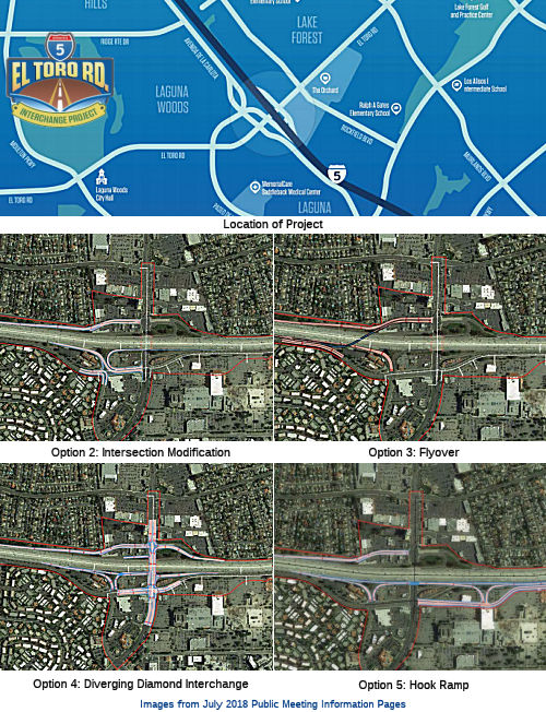 In July 2018, a public information meeting was held on a proposed modification of the I-5 / El Toro Road Interchange to
improve traffic flow, optimize traffic signalization, reduce queuing at
freeway on- and off-ramps, and reduce congestion at and through local
street intersections adjacent to the I-5 / El Toro Road Interchange within
the cities of Lake Forest, Laguna Hills and Laguna Woods. As of July 2018,
the project is in the environmental review and preliminary engineering
process. An Initial Study (IS) and Environmental Assessment (EA), with
proposed Mitigated Negative Declaration (MND) will be prepared to evaluate
potential effects that could result from the proposed project. The
environmental phase started in May 2017 and is anticipated to be completed
by late 2019. The draft IS/EA is anticipated to be released for public
review and comment in mid-2019. The information meeting presented the
following options in addition to the default "no build": (•)
Intersection modifications; (•) Flyover interchange; (•)
Diverging Diamond; (•) Hook Ramp
In July 2018, a public information meeting was held on a proposed modification of the I-5 / El Toro Road Interchange to
improve traffic flow, optimize traffic signalization, reduce queuing at
freeway on- and off-ramps, and reduce congestion at and through local
street intersections adjacent to the I-5 / El Toro Road Interchange within
the cities of Lake Forest, Laguna Hills and Laguna Woods. As of July 2018,
the project is in the environmental review and preliminary engineering
process. An Initial Study (IS) and Environmental Assessment (EA), with
proposed Mitigated Negative Declaration (MND) will be prepared to evaluate
potential effects that could result from the proposed project. The
environmental phase started in May 2017 and is anticipated to be completed
by late 2019. The draft IS/EA is anticipated to be released for public
review and comment in mid-2019. The information meeting presented the
following options in addition to the default "no build": (•)
Intersection modifications; (•) Flyover interchange; (•)
Diverging Diamond; (•) Hook Ramp
(Sources: On the Move Blog, 7/18/2018; ElToro
Road Interchange Project Page, July 2018)
In April 2019, it was reported that Caltrans
was again conducting public information sessions on the El-Toro
Interchange. The project goal is to reduce traffic congestion on the
freeway and surrounding streets by improving on-ramps and off-ramps and
optimizing traffic signal operations to keep traffic moving. Currently in
the environmental review and preliminary engineering phase, the I-5 El
Toro interchange project is part of OC Go (also known as Measure M),
Orange County’s half-cent sales tax for transportation improvements.
The meetings announced the availability of the Draft EIR, inviting public
comments. At the time of the meeting, there were two build alternatives:
Build Alternative #2: Flyover and Build Alternative #4: Collector
Distributor and Hook Ramps (includes Design Option B).
(Source: OCTA On The Move Blog, 4/18/2019)
Interstate 5 Improvement Project from Interstate 405 to Yale Avenue, Segment 1 (12-Ora-5, PM 21.3/30.3)
The 2018 STIP, approved at the CTC March 2018 meeting, appears to allocate $12,686 of Advance Project Development Element (APDE) funding for PS&E in FY22-23 for PPNO 2473, Widening, Rt 405-Rt 55
In March 2020, the CTC approved the 2020 STIP, which
changed the agency for PPNO 2743 from OCTA to Caltrans, changed the title
to "Widening, Rt 405-Yale Ave, Segment 1 (LPP)" (previously it was to
Route 55). It also changed the programmed funding from $12,628K to
$95.338, and pushed the work back to FY24-25. Yale Ave is ORA R25.831.
(Source: March 2020 CTC Agenda, Item 4.7, 2020 STIP
Adopted 3/25/2020)
In May 2020, the CTC approved for future consideration
of funding the Interstate 5 (I-5) Improvement Project from Interstate 405 (I-405) to State Route 55 (SR 55) (12-Ora-5, PM 21.3/30.3),
which will widen I-5 between I-405 and Route 55
in Orange County. (PPNO 2743). This project is located on I-5 between
I-405 and Route 55 through the cities of Irvine and Tustin in Orange
County. In cooperation with the Orange County Transportation Authority the
project proposes to widen I-5 between I-405 and Route 55. The proposed
project would reduce congestion and improve operation efficiency. This
project is divided into two segments. Segment 1 is from I-405 to Yale
Avenue and Segment 2 is from Yale Avenue to Route 55. Segment 1 is
currently programmed in the 2020 State Transportation Improvement Program
(STIP) for $95,338,000 in Regional Shares for Construction Capital and
Construction Support. The project in its entirety is not fully funded. The
estimated total project cost is $417,000,000, which includes funding from
Surface Transportation Block Grant, Local funds, STIP and LLP.
Construction is estimated to begin fiscal year 2024-2025. The scope, as
described for the preferred alternative, is consistent with the project
scope programmed by the Commission in the 2020 STIP.
(Source: May 2020 CTC Agenda, Agenda Item 2.2c.(1))
In August 2021, the CTC approved the following
LPP-F/21-22 allocation: $7,395,000. 12-Ora-5 21.3/R25.8. PPNO 12-2743;
ProjID 1200020052 1220000034; EA 0K670
0K671. Interstate 5 Improvement from Interstate 405 to
Yale Avenue, Segment 1. In the city of Irvine, from I-405 to Yale
Avenue. Add one mixed flow lane northbound from truck bypass on- ramp to
Yale; add one mixed flow lane southbound from Yale to to truck bypass.
(Future consideration of funding approved under Resolution E-20-31; May
2020.) (Contribution from other sources: $7,396,000.) Allocation: PS&E
$7,395,000.
(Source: August 2021 CTC Agenda, Agenda Item
2.5s.(2); ProjID and EA corrected by March 2022 CTC Agenda Item
2.5s.(9))
In March 2023, the CTC approved the following for
locally-administered LPP (Formulaic) allocation: $3,979,000. 12-Ora-5
21.3/R25.8. PPNO 12-2743; ProjID 1220000034; EA 0K671. I-5
Improvement Project from I-405 to Yale Avenue, Segment 1. In the
city of Irvine, from I-405 to Yale Avenue. This project will add one
general-purpose lane in both directions of the Santa Ana Freeway (I-5)
from I-405 to Yale in the City of Irvine, implement a continuous access
HOV ingress/egress configuration,provide standard traffic lanes and
shoulder widths where possible. Additional features of the project include
improvements to three interchanges, add new auxiliary lanes and
re-establish new ones within the project limits. CEQA - ND, 05/13/2020
NEPA - FONSI, 01/07/2020. Future consideration of funding approved under
Resolution E-20-31; May 2020. Contribution from other sources: $5,521,000.
Concurrent LPP (Formulaic) Programming Amendment under Resolution
LPP-P-2223-07; March 2023.This amendment updates the project LPP-F R/W
programmed costs from $10,779,000 to $3,979,000. R/W $10,779,000
$3,979,000.
(Source: March 2023 CTC Agenda, Agenda Item 2.5s.(4))
In October 2006, the CTC considered a resolution to relinquish right of way in the city of Tustin, between Browning Avenue (≊ 005 ORA R28.59) and Pasadena Road (≊ 005 ORA 30.154), consisting of frontage roads.
HOV Degredation / I-5 Managed Langes and Improvements (12-ORA-005 29.1/44.4)
In March 2021 the CTC received notice of, and in May
2021 the CTC considered, a proposal to amend the STIP to
program $2,200,000 in Interregional Improvement Program (IIP) shares to a
new project – I-5 Managed Lanes project (PPNO 2833C) in Orange
County, for the Project Approval and Environmental Document (PA&ED)
phase in Fiscal Year 2021-22. This project is in Orange County on I-5 from
Red Hill Avenue to 0.5 mile north of Los Angeles (LA) County Line within
the Cities of Tustin, Santa Ana, Orange, Anaheim, Fullerton, and Buena
Park. The project proposes to address operational deficiencies related to
High Occupancy Vehicles (HOV) degradation (i.e., the fact that the HOV
lanes are increasingly congested above Federal guidelines) through studies
of alternatives that include Priced Managed Lanes (PML) strategies. The
purpose of this project is to implement operational improvements that will
address HOV degradation, increase operational efficiency, improve movement
of people and goods, incentivize ride sharing, facilitate transit, strive
to reduce vehicle miles traveled and increase average vehicle occupancy
and improve freight travel while minimizing impacts to the surrounding
communities and the environment. The project goals and benefits include
the following:
(Source: March 2020 CTC Agenda, Agenda Item
2.1b.(4); May 2021 CTC Agenda, Agenda Item 2.1a.(5))
This project is proposed to be funded with both State
Highway Operation and Protection Program (SHOPP) and Interregional
Transportation Improvement Program (ITIP) to address improvements to
existing infrastructure. This project will evaluate four alternatives:
(Source: May 2021 CTC Agenda, Agenda Item 2.1a.(5))
Also in May 2021, the following project was considered
for amendment into the SHOPP: (1c) #1. 12-Ora-5
R29.1/44.382 PPNO 2833C ProjID 1218000006 EA 0Q950. I-5 In and near the
cities of Tustin, Orange, Santa Ana, Anaheim, Fullerton, and Buena Park,
from Red Hill Avenue to the Los Angeles County line. Address High
Occupancy Vehicle (HOV) lane degradation. (Additional $2,200,000 from
Interregional Improvement Program (IIP) contribution.) (Long Lead
Project). PA&ED $12,800K only. Begin const: 2/16/2028. While this
SHOPP funding would to be used to evaluate Alternatives 1, 2, and 3, ITIP
funding is proposed to study Alternative 4. The total anticipated cost for
the project ranges between $0 and $1,430,000,000 for these four
alternatives, depending on the selected alternative, at the completion of
PA&ED phase.
(Source: May 2021 CTC Agenda, Agenda Item 2.1a.(1c)
#1, 2.1a.(5))
Lastly, in May 2021, the CTC approved the following
pre-construction support phase allocation(s): (2a) #13. $12,800,000
(PA&ED). 12-Ora-5 R29.1/44.382. PPNO 12-2833C; ProjID 1218000006; EA
0Q950 . I-5 In and near the cities of Tustin, Orange, Santa Ana, Anaheim,
Fullerton, and Buena Park, from Red Hill Avenue to the Los Angeles County
line. Address High Occupancy Vehicle (HOV) lane degradation. (Additional
$2,200,000 from Interregional Improvement Program (IIP) contribution).
(Long Lead Project) (Concurrent Amendment under SHOPP Amendment 20H-007;
May 2021.) Prog year 27-28.
(Source: May 2021 CTC Agenda, Agenda Item 2.5b.(2a)
#13)
State Route 55 Corridor Improvements from I-405 to I-5 (12-Ora-5 29.6)The 2018 STIP, approved at the CTC March 2018 meeting, appears to allocate $80M in Construction funding in FY21-22 for PPNO 3470, Central Corridor Improvements, Rt 405-Rt 5 (SHOPP)
In March 2020, the CTC approved the 2020 STIP, which
shifts the programmed funding of $80M for PPNO 3470 "Corridor Imprvmnts,
Rt 405-Rt 5 (SHOPP)(SB1)" from FY21-22 to FY20-21.
(Source: March 2020 CTC Agenda, Item 4.7, 2020 STIP
Adopted 3/25/2020)
In December 2020, it was reported that OCTA has been
awarded $140 million in competitive state transportation funding to
support the Route 55 Improvement Project between I-5 and I-405 in central
Orange County. The funding comes from the California Transportation
Commission (CTC), which awarded $115 million from the SB1 Trade Corridor
Enhancement Program and $25 million from the SB1 Local Partnership
Competitive Program. The Route 55 project will add a regular lane and a
carpool lane in each direction between I-5 near Santa Ana and Tustin and
I-405 near Irvine and Costa Mesa. It will also add auxiliary lanes to help
traffic smoothly enter and exit the freeway. The improvements will
increase access to job centers, healthcare and educational facilities,
South Coast Plaza and John Wayne Airport, among other important
destinations for the region. The project is estimated to cost $474 million
with additional funds coming from OC Go, and other state and federal
funding. It has completed the design phase and construction is expected to
begin in 2022. Improvements are expected to be finished in 2026.
(Source: OCTA Blog, 12/10/2020)
In October 2021, the CTC approved the following
State-Administered multi-funded STIP/SB 1 TCEP/LPP (Competitive)
Amendment/Allocation, which added in a component on I-5: $220,000,000. 12-Ora-5
29.6 and 12-Ora-55 6.4/10.3. PPNO 12-3470; ProjID 1200020328; EA
0J340. State Route 55 Corridor Improvements from I-405 to I-5.
In Orange County in cities of Irvine, Santa Ana, and Tustin on Route 55
from 0.4 mile north of Route 55/I-405. Separation to 0.1 mile south of
Route 5/Route 55 Separation and on Route 5 at Newport Avenue
Undercrossing (PM 29.6). Widen Route 55 for an additional high
occupancy vehicle (HOV) lane and a general-purpose lane in each direction
within the project limits, re-establish existing auxiliary lanes, and
proposes new auxiliary lanes. Also widen the MacArthur Boulevard, Dyer
Road, Edinger Avenue, and South Tustin Overhead structures. All ramps will
be reconstructed due to the widening. Traffic Signal Improvement at
I-5/Newport Ave onramp (for mitigation only). Funding Allocation:
RIP/20-21 ⇛ CON ENG $16,242,000 $7,004,000
CONST $63,758,000 $72,996,000. TCEP-R/21-22
⇛ CON ENG $9,490,000; CONST $105,510,000. LPP-C/21-22 ⇛ CON
ENG $1,846,000; CONST $23,154,000. (Future consideration of funding
approved under Resolution E-17-67; October 2017.) (Time extension for FY
20-21 RIP CON expires June 30, 2022) (Contribution from other sources:
$37,713,000) (As part of this allocation request,the Department is
requesting to extend the period of project completion an additional 16
months beyond the 36 month deadline.) For construction purpose, this
contract will be combined with a SHOPP project EA 0G950/PPNO 3483 under EA
0J34U, Project ID 1218000034. (Concurrent SHOPP allocation request of
$15,900,000 under Resolution FP-21-25 (PPNO 3483/EA0G950); October 2021.)
(Right of Way Certification: 09/02/2021)
(Source: CTC October 2021 Agenda Item 2.2c.(1))
HOV Lane Project Rte 55 to Rte 57 PPNO 2883A - Tustin (≊ 005 ORA 31.072) to Orange (≊ 005 ORA 33.983)
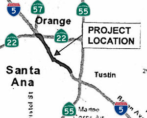 In June 2015, the CTC approved for future consideration of funding a project in Orange County
that will add one HOV Lane in each direction on a 2.9-mile portion of I-5
within the city of Santa Ana. The project is programmed in the 2014 State
Transportation Improvement Program. The estimated cost is $42,471,000 for
capital and support. Construction is estimated to begin in Fiscal Year
2016-17. The scope, as described for the preferred alternative, is
consistent with the project scope programmed by the Commission in the 2014
State Transportation Improvement Program.
In June 2015, the CTC approved for future consideration of funding a project in Orange County
that will add one HOV Lane in each direction on a 2.9-mile portion of I-5
within the city of Santa Ana. The project is programmed in the 2014 State
Transportation Improvement Program. The estimated cost is $42,471,000 for
capital and support. Construction is estimated to begin in Fiscal Year
2016-17. The scope, as described for the preferred alternative, is
consistent with the project scope programmed by the Commission in the 2014
State Transportation Improvement Program.
In May 2016, the OCTA reported that the roject to
improve traffic congestion on I-5 between Route 55 and Route 57 is moving
forward. The section of I-5, used by more than 390,000 motorists each day,
is currently subject to delays that are expected to increase over time. By
2030, the number of daily travelers is expected to rise to 464,000 –
an increase of 19 percent. OCTA, in partnership with Caltrans, is adding a
second carpool lane in each direction to relieve traffic congestion,
alleviate bottlenecks and improve traffic operations on this corridor
within the cities of Santa Ana, Orange and Tustin. The project also
includes removing the I-5/Main Street carpool on- and off-ramps. The
project is in the final design stage. In this stage, project information
is reviewed and updated, the scope of the project is refined, and data is
collected on a number of factors such as the latest traffic operations,
utility locations, existing road and bridge conditions, terrain and soil
properties and drainage. Experts including transportation planners,
engineers, environmentalists, landscape architects, geologists and others
use the data to develop a complete set of project plans that include a
refined estimate of the construction costs and best practices for the
construction phase. The plans are about two-thirds complete. Construction
is expected to begin in early 2018 and continue through 2020.
(Source: OCTA Blog, 5/17/2016)
The 2018 STIP, approved at the CTC March 2018 meeting, appears to delete this project, as the funds have been allocated for FY18-19.
At the end of December 2018, the OCTA seemed to
contradict the 2018 STIP. It was reported that along I-5 between Route 55
and Route 57 a second carpool lane in each direction will be added. The
concrete barrier adjacent to the existing lanes will be demolished. The
demolition will require overnight closures on northbound I-5. Construction
Period: Mid-2019 to Mid-2021. Cost: $41.6 million.
(Source: OC Register, 12/31/2018)
In February 2019, it was reported that OCTA and
Caltrans were kicking off construction of the I-5 Central County
Improvement Project, which will add a second carpool lane in
each direction on I-5 between Route 55 and Route 57. Traffic on that
stretch of I-5 is expected to climb to more than 400,000 vehicles a day by
2035, a seven percent increase from today’s traffic volume. This
two-year project will reduce existing and future traffic congestion and
travel time, as well as improve overall traffic operations. The new
carpool lanes will be striped for continuous access allowing drivers to
move freely between lanes. The project will require removal of the
concrete barrier between the carpool and regular lanes and demolition of
the I-5/Main Street HOV ramp to make room for the additional carpool
lanes. The $41.6 million project is funded with federal dollars and by OC
Go (also known as Measure M), Orange County’s half-cent sales tax
for transportation improvements.
(Source: OCTA Blog, 2/7/2019; Project Page)
In April 2019, it was reported that work has begun on
the I-5 Central Project between Route 55 and Route 57. The I-5/Main Street
carpool on- and off-ramps have been permanently closed to allow crews to
perform preliminary work leading up to the bridge demolition in early
summer 2019. Other activities include removing overhead signs, adjusting
traffic signal adjustments, re-striping lanes and installing concrete
barriers on southbound Main Street, reducing it to two lanes near the
Discovery Cube. Motorists who normally use the Main Street carpool ramp
can exit Broadway to get to Main Street. In addition, the existing
auxiliary lane on northbound I-5 between Grand Avenue and 17th
Street has been closed to create room for a work area to construct new
retaining walls and to install new concrete pavement. The Grand Avenue
on-ramp and the 17th Street off-ramp remain open.
(Source: OCTA Blog, 4/18/2019)
In September 2020, it was reported that two northbound
HOV lanes opened to traffic in late August as part of the I-5 Central
County Improvements Project. A partnership between OCTA and Caltrans, the
project added a second carpool lane in each direction of the busy stretch
of I-5 between Route 55 and Route 57 to help speed up commutes and
alleviate bottlenecks through Santa Ana, Orange and Tustin. The southbound
lanes opened to traffic in July. Overall, the carpool lanes opened to
traffic at least four months early. In addition to adding carpool lanes,
the project removed the concrete barriers between the carpool and regular
lanes in several locations, and restriped the carpool lanes for continuous
access, allowing drivers to move freely between all lanes.
(Source: OCTA Blog, 9/2/2020)
HOT/Express Lane Project Rte 55 to LA County Line (≊ 005 ORA 31.072) to Orange (≊ 005 ORA 33.983 to ≊ 005 ORA 42.36L)
In December 2019, it was reported that Caltrans was
actively studying creating toll lanes on I-5 from south of Route 55 to the
Los Angeles County line as soon as 2028. Orange County Transportation
Authority board members were briefed Monday, Dec. 9, on plans for further
exploring an expansion of the county’s network of tolled lanes
– it’s unclear now if that would mean a conversion of all or
just some carpool lanes. OCTA staff has started meeting with local
officials to hear their thoughts, and the board in April will discuss
which freeways the agency could prioritize. It’s not about the
revenue, they said, but about finding help for the county’s
congested freeways, especially the carpool lanes. In late November,
Caltrans finalized a study that says tolling carpool lanes on I-5 from Red
Hill Avenue in Tustin to the Los Angeles County line could reduce
congestion by up to 42%. By 2035, drivers could be saving up to 11 minutes
on general-purpose lanes and up to 43 minutes on tolled lanes, the study
said. Such a project could cost from $329 million to $1 billion.
(Source: OC Register, 12/10/2019)
In January 2010, the CTC approved relinqishment of right of way in the city of Santa Ana along Route 5 between Santa Ana Boulevard (≊ 005 ORA 31.78) and Seventeenth Street (≊ 005 ORA 32.507), consisting of relocated and reconstructed city streets and frontage roads
In July 2010, the CTC approved relinquishment of right of way in the city of Santa Ana along Route 5 between Santa Ana Boulevard and Seventeenth Street (12-Ora-5-PM 31.8), consisting of a collateral facility that is appurtenant to a previously relinquished collateral facility and was inadvertently omitted from said relinquishment.
In January 2018, the CTC authorized relinquishment of right of way in the
city of Santa Ana along Route 5 between Seventeenth Street and Main Street
(12-Ora-5-PM 32.5/33.3), consisting of collateral facilities. The City, by
freeway agreement dated February 21 1989, agreed to accept title upon
relinquishment by the State, and by resolution, dated November 21, 2017,
waived the 90-day notice requirement.
(Source: CTC Agenda, January 2018, Agenda Item
2.3c)
Artistic Panels
Newspaper reports in February 2009 have indicated that art projects installed along I-5 S of Route 22 (≊ 005 ORA 33.983) are melting and shredding. These panels were part of a $956,000 project by the California Department of Transportation "to provide aesthetic enhancements on existing sound walls and to deter graffiti where sound wall vine coverings are not feasible." Caltrans put about 2,400 of these panels on freeways throughout Orange County. The project was funded by specifically designated funds for transportation-related beautification projects from the Transportation Enhancement Activities (TEA) program within the federal Intermodal Surface Transportation Enhancement Act. Each panel cost approximately $250, and were created by Orange County artist Janet Inez Adams. There are four images: one abstract flower, and three wildflowers native to Orange County. Caltrans believes the damage to the panels are from vehicular accidents, not vandalism.
In May 2019, the CTC added the following into the
SHOPP: 12-Ora-5 30.8, On I-5 In Santa Ana, at Main Street. Repair precast
wall panels. PPNO 2839, Proj ID 1219000043. Total Cost: $542,000.
(Source: CTC Agenda, March 2019 Agenda Item
2.1a.(1) Item 24)
Orange County — Route 22 (≊ 005 ORA 33.983) to LA County Line
I-5 has been beautifully reconstructed between Route 91 (≊ 005 ORA 42.072L) and Route 22 (≊ 005 ORA 34.084). North of Route 91, the freeway narrows to three lanes and the pavement gets horrid. However, it appears that construction to fix this section of I-5 (specifically, from Route 91 to the Los Angeles County border) together with a companion project up to I-605, should begin in 2006, depending on land acquisition and bond sales. Caltrans needs to acquire 68 parcels for the freeway, including full and partial properties. The state's goal is to purchase all land by next June. This has started showing up on the CTC RADAR. The August meeting agenda shows an amendment to designate $21M in funding for the Los Angeles County segment widening, and there is also discussion on the Orange County portion of the widening.
In August 2016, the CTC authorized relinquishment of two segments of right of way in the city of Anaheim (City) along Route 5 on Disney Way (12-Ora-5-PM 34.0/36.9), consisting of collateral facilities. The City, by freeway agreement dated November 9, 1992 and by amendment to freeway agreement dated July 9, 1996, agreed to accept title upon relinquishment by the State. The City, by letter dated May 20, 2016, waived the 90-day notice requirement and agreed to accept the relinquishment.
In December 2006, the CTC considered a resolution to relinquish right of way in the city of Orange, at Chapman Avenue (≊ 005 ORA 35.012), consisting of reconstructed and relocated city streets and frontage road.
In August 2010, they authorized relinquishment of right of way in the city of Anaheim along Route 5 between the southerly city limits and South Harbor Boulevard (12-Ora-5-PM 35.2/37.0), consisting of collateral facilities.
In August 2012, the CTC approved relinquishment of right of way in the city of Anaheim along Route 5 on Santa Cruz Boulevard (12-Ora-5-PM 35.6), consisting of collateral facilities; it also relinquished right of way in the city of Anaheim along Route 5 on Anaheim Way (12-Ora-5-PM 35.6/35.9), consisting of collateral facilities.
In January 2011, the CTC relinquished right of way in the city of Anaheim along Route 5 on South Anaheim Boulevard (≊ 005 ORA 36.635), consisting of collateral facilities; right of way in the city of Anaheim along Route 5 on Gene Autry Way (≊ 005 ORA 35.978), Santa Cruz Street (≊ 005 ORA 35.746), and Stanford Court (≊ 005 ORA 35.775), consisting of collateral facilities, and right of way in the city of Anaheim along Route 5 at Katella Avenue (≊ 005 ORA 36.257), consisting of collateral facilities.
2007 CMIA. Two projects on I-5 in Orange County were submitted to the Corridor Mobility Improvement Account for funding. These projects were a transitway interchange at Gene Autry Way ($17.5 million) (≊ 005 ORA 35.978) and the I-5/Route 74 interchange ($38 million). Neither was recommended for funding.
In January 2011, the CTC reqlinquished right of way in the city of Anaheim along Route 5 at Katella Avenue (≊ 005 ORA 36.257), consisting of collateral facilities.
In July 2005, the CTC considered relinquishment of right of way in the City of Anaheim, between Cherry Street (≊ 005 ORA 37.048) and Euclid Way (≊ 005 ORA 39.486), consisting of reconstructed and relocated city streets, frontage roads and cul-de-sacs.
In July 2010, the CTC approved relinquishment of right of way in the city of Anaheim along Route 5 on Palm Street (12-Ora-5-PM 37.1/37.3), consisting of relocated or reconstructed city streets and frontage roads.
In August 2009, the CTC approved relinquishment of right of way in the city of Anaheim along Route 5 between Ball Road (≊ 005 ORA 37.622) and Santa Ana Street (≊ 005 ORA 38.528), consisting of reconstructed city streets.
In July 2006, the CTC considered Resolution No. R-3638, relinquishment of right of way between PM 37.7 and 37.9 in the City of Anaheim, on Disneyland Drive between Ball Road and 0.2 mile northerly of Ball Road, consisting of reconstructed and relocated city street and frontage road.
In August 2012, the CTC approved relinquishment of right of way in the city of Anaheim along Route 5 on Illinois Street (12-Ora-5-PM 38.1), consisting of collateral facilities; and right of way in the city of Anaheim along Route 5 on Westmont Drive, consisting of collateral facilities.
In January 2011, the CTC relinquished right of way in the city of Anaheim along Route 5 at the intersection of South Walnut Street (≊ 005 ORA 38.544) and West Broadway Street (≊ 005 ORA 38.67), consisting of collateral facilities.
In August 2011, the CTC approved relinquishment of right of way in the city of Anaheim along Route 5 on W. Lincoln Avenue (≊ 005 ORA 38.93) and N. Manchester Avenue (≊ 005 ORA 39.192), consisting of collateral facilities.
In June 2014, the CTC authorized relinquishment of right of way in the city of Anaheim along Route 5 on Euclid Street, Loara Street, and Wilshire Avenue (12-Ora-5-PM 39.1/39.6), consisting of reconstructed city streets. The City, by freeway agreement dated November 9, 1992, and by amendment to freeway agreement dated July 9, 1996, agreed to accept title upon relinquishment by the State. The 90-day notice period expires June 8, 2014.
In December 2004, the CTC considered a resolution to relinquish right of way in the City of Anaheim, at Mariposa Place (≊ 005 ORA 39.568), consisting of a cul-de-sac. The City, by freeway agreement dated November 9, 1992 and by amendment to freeway agreement dated July 9, 1996, agreed to accept title upon relinquishment by the State. The 90-day notice period expired November 10, 2004.
In August 2012, the CTC approved relinquishment of right of way in the city of Anaheim along Route 5 on Fir Avenue, Ivy Lane, Maple Street, Holly Street, and Catalpa Avenue (12-Ora-5-PM 40.4/40.6), consisting of collateral facilities.
In June 2018, the CTC authorized relinquishment of right of way in the
city of Anaheim (City) along Route 5, on Ventura Street, consisting of
collateral facilities (12-Ora-5-PM 41.1). The City, by freeway agreement
dated November 9, 1992 and by amendment to freeway agreement dated July 9,
1996, agreed to accept title upon relinquishment by the State. The 90-day
notice period expired May 3, 2018.
(Source: CTC Agenda, June 2018 Agenda Item 2.3c)
In March 2016, the CTC authorized relinquishment of right of way in the city of Buena Park along Route 5 from Western Avenue to Stanton Avenue (12-Ora-5-PM 43.1/43.7), consisting of relocated or reconstructed city streets. The City, by freeway agreement dated June 28, 2005, agreed to accept title upon relinquishment by the State. The 90-day notice period expired January 18, 2016.
In November 2006, the Control City for Orange County was changed to Santa Ana. However, it isn't signed consistently.
In October 2010, the widening of I-5 between Route 91 and the northern Orange County line was completed.
Los Angeles County — General General
In June 2015, it was reported that, in its latest analysis of California
Highway Patrol data from 2012, the Southern California Associations of
Governments (SCAG) included sections of this route in its list of freeway
sections in L.A. County and the Inland Empire with the highest
concentrations of truck crashes per mile annually. These sections were
I-710 at Route 60 in the East L.A. Interchange, with 7.2 accidents; I-710
between I-105 and the Route 91, with 5.8 accidents; the convergence of
Route 60 and Route 57, with six crashes; and I-5 between I-710 and I-10,
also in the East L.A. Interchange, with 6.6 crashes. The analysis also
identified that the second-highest number of truck crashes can be found on
three parts of Route 60 between I-605 and I-710, between the I-15 and
Route 71 — the Chino Valley Highway, formerly known as the Corona
Expressway — and immediately east of I-215. That category also
includes I-10 between Route 71 and I-215, I-605 between Route 60 and I-10,
and Route 710 between Route 91 and the Port of Long Beach as well as
between I-5 and I-105. With the nation's largest combined harbor, the Los
Angeles area also is one of the busiest in the country, if not the world,
for trucking. I-710 often handles more than 43,000 daily truck trips,
Route 60 up to 27,000 and I-5 about 21,500, according to Caltrans.
(Source: LA Times, 6/2/2015)
Los Angeles County - Orange County Line to Route 710
The SAFETEA-LU act, enacted in August 2005 as the reauthorization of TEA-21, provided the following expenditures for or near this route:
Interstate 5 Major Improvement Project — General
Detailed information on the I-5 Improvement project may be found at http://www.dot.ca.gov/dist07/travel/projects/I-5/. The project is divided into the following segments, with the indicated schedule as of 2011:
| Segment Name | Location on I-5 | Project Approval Anticipated | Initiate Right of Way Process | Begin Construction |
| Carmenita Interchange | Carmenita Road | Approved 6/20/01 | Summer 2008 | Winter 2011 |
| A | Route 91 to I-605 | Approved 12/31/07 | Summer 2009 | Winter 2011 |
| B | I-605 to I-710 | February 2015 | February 2017 | Winter 2019 |
| C | I-710 Interchange | February 2015 | February 2017 | Winter 2019 |
Interstate 5 Major Improvement Project — Route 91 (≊ 005 ORA 42.36L) to I-605 (≊ 005 LA 6.811)
Overall Project
![[TCRP 42.1]](maps/005-tcrp-42.1.jpg) According to plans, commuters will have to wait until 2016 to see what is predicted to
be a $1.4-billion expansion from the Orange County line through the L.A.
County cities of La Mirada, Norwalk, Santa Fe Springs and part of Downey
to the junction with I-605 Freeway. This is TCRP Project #42.1 ’150;
Route 5; widen Santa Ana Freeway to 10 lanes (two HOV & eight mixed
flow), Orange County line to Route 605, with related major arterial
improvements, in Los Angeles County ’150; Orange County line to
Route 605. This project is to widen Route 5 from six lanes to ten lanes
(two HOV and eight mixed flow) from the Orange County line to Route 605
and will also improve related major arterials. This project will improve
the level of service during peak hours and improve access to regional
transit. The project is now projected to be completed in FY 2015/2016. The
funding for this project includes $387 million in funds from the Corridor
Mobility Improvement Account and SAFETEA-LU monies.
According to plans, commuters will have to wait until 2016 to see what is predicted to
be a $1.4-billion expansion from the Orange County line through the L.A.
County cities of La Mirada, Norwalk, Santa Fe Springs and part of Downey
to the junction with I-605 Freeway. This is TCRP Project #42.1 ’150;
Route 5; widen Santa Ana Freeway to 10 lanes (two HOV & eight mixed
flow), Orange County line to Route 605, with related major arterial
improvements, in Los Angeles County ’150; Orange County line to
Route 605. This project is to widen Route 5 from six lanes to ten lanes
(two HOV and eight mixed flow) from the Orange County line to Route 605
and will also improve related major arterials. This project will improve
the level of service during peak hours and improve access to regional
transit. The project is now projected to be completed in FY 2015/2016. The
funding for this project includes $387 million in funds from the Corridor
Mobility Improvement Account and SAFETEA-LU monies.
In April 2007, it was announce that full funding
’150; $1.2 billion ’150; has been secured to widen the Santa
Ana (I-5) Freeway at the gateway between Orange and Los Angeles counties,
from the county line in Buena Park north to the San Gabriel River (605)
Freeway. Construction on the 6.4-mile stretch is to begin in 2009 and will
take about seven years to finish. In Norwalk, 21 homes must be razed to
make way for the wider freeway. Five homes have already been bulldozed as
of April 2007, the remaining residents must vacate by November 2007. In
Buena Park, the Western Avenue bridge over I-5 was demolished in November
2006. The Stanton Avenue and Beach Boulevard bridges will come down next,
though some lanes will always remain open on Beach as that bridge is
slowly dismantled beginning in spring 2008. Work on the Orange County side
is scheduled for completion in 2010.
(Source: Orange County Register, 4/5/2007)
In March 2007, the CTC was asked to comment on the Draft EIR. This EIR provided the following options:
In July 2008, the CTC approved an increase in funding for this project due to cost increases. This project will widen I-5 with HOV and mixed-flow lanes from just south of Artesia Avenue to just north of the Florence Avenue overcrossing. The project will eliminate the bottleneck as a result of a lane-drop between the Orange/Los Angeles county line, improve the performance of major intersections and interchanges along the corridor, and improve access to regional transit and HOV facilities. This amendment proposes to increase the programmed amount for PA&ED, PS&E and Right of Way Support to address GF-RIP support expenditures on the project. These support components are now capped at this programming level for this fund type and any future increases, if necessary, will be funded through other means. It is also proposed to increase construction support from $34,500,000 to $80,068,000. Construction support is currently funded with $34,500,000 in LACMTA funds. An additional $45,568,000 is needed to fully fund the component.
According to material submitted to the August 2008 CTC, the project in Los Angeles County would widen the facility from three lanes in each direction to four mixed-flow lanes and one HOV lane in each direction for a total of ten lanes near Buena Park. The project is programmed with Corridor Mobility Improvement Account funds, Regional Improvement Program funds, Interregional Improvement Program funds, Traffic Congestion Relief Program funds, Congestion Mitigation and Air Quality Program funds, Federal Demonstration funds, and local funds. The total estimated project cost, capital and support, is $1,240,524,000. Construction is estimated to begin in Fiscal Year 2010-11.
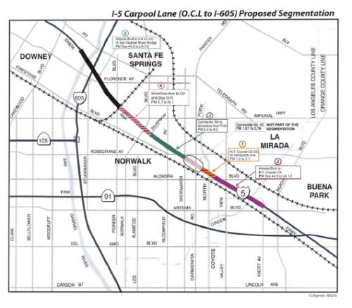 In September 2010, the CTC received notice of a
proposal to amend the Corridor Mobility Improvement Account (CMIA)
Program, the State Transportation Improvement Program (STIP) and the
Traffic Congestion Relief Program (TCRP) for the Route 5 High Occupancy
Vehicle (HOV), Orange County Line to Route 605 project (PPNO 2808) in Los
Angeles County as follows: Split the project into five constructible
segments Revise the programmed components for the overall project Revise
the schedule for staging and construction purposes. This project is a
$1.24 billion project and includes $387,000,000 in Proposition 1B - CMIA
funding. This project will widen Interstate 5 through the addition of one
mixed-flow lane and one HOV lane in each direction from just south of
Artesia Avenue to just north of the Florence Avenue overcrossing. The
Route 5 corridor is one of the most congested areas in the Los Angeles
basin. It connects Los Angeles county (population 10 million) and Orange
County (population 3 million), two of California’s largest counties.
Construction of this project will eliminate the bottleneck as a result of
the lane drop between the Orange / Los Angeles County line, improve the
performance of major intersections and interchanges along the corridor and
improve access to regional transit and HOV facilities. The project will
also upgrade the corridor to meet current Department and FHWA design
standards, improve freeway Level of Service during AM and PM peak hours,
reduce travel time delays and congestion related accidents and improve the
mobility in the region. The proposal is to split the $1.24 billion project
into five manageable segments to facilitate construction staging and
delivery, and maximize efficiency and contract bidding competitiveness.
The proposed segments are:
In September 2010, the CTC received notice of a
proposal to amend the Corridor Mobility Improvement Account (CMIA)
Program, the State Transportation Improvement Program (STIP) and the
Traffic Congestion Relief Program (TCRP) for the Route 5 High Occupancy
Vehicle (HOV), Orange County Line to Route 605 project (PPNO 2808) in Los
Angeles County as follows: Split the project into five constructible
segments Revise the programmed components for the overall project Revise
the schedule for staging and construction purposes. This project is a
$1.24 billion project and includes $387,000,000 in Proposition 1B - CMIA
funding. This project will widen Interstate 5 through the addition of one
mixed-flow lane and one HOV lane in each direction from just south of
Artesia Avenue to just north of the Florence Avenue overcrossing. The
Route 5 corridor is one of the most congested areas in the Los Angeles
basin. It connects Los Angeles county (population 10 million) and Orange
County (population 3 million), two of California’s largest counties.
Construction of this project will eliminate the bottleneck as a result of
the lane drop between the Orange / Los Angeles County line, improve the
performance of major intersections and interchanges along the corridor and
improve access to regional transit and HOV facilities. The project will
also upgrade the corridor to meet current Department and FHWA design
standards, improve freeway Level of Service during AM and PM peak hours,
reduce travel time delays and congestion related accidents and improve the
mobility in the region. The proposal is to split the $1.24 billion project
into five manageable segments to facilitate construction staging and
delivery, and maximize efficiency and contract bidding competitiveness.
The proposed segments are:
The project is funded from a variety of sources, including $387 million of CMIA funds. The Proposition 1B Bond Act mandates that the inclusion of a project in the CMIA program be based on demonstration that the project can commence construction or implementation no later than December 31, 2012. The project location spans through both industrial and residential areas, with the need to acquire or obtain easements for 344 parcels. Right of way issues on a project of this magnitude are substantial. There were delays due to changes in the Code of Civil Procedures for Order of Possessions, changes in the Streets and Highways Code regarding the right of way appraisal process and delays due to the closure of Department 59 of the Los Angeles Superior Court which hears eminent domain cases. Many parcels were identified as needing further investigation, monitoring, or clean up, leading to additional delays in the right of way process. Right of way mapping and acquisition activities were further delayed due to staffing issues related to the state mandated furlough program and the lack of available STIP and TCRP funding.
In November 2010, the CTC amended the Corridor Mobility Improvement Account (CMIA) Program, the State Transportation Improvement Program (STIP) and the Traffic Congestion Relief Program (TCRP) for the Route 5 High Occupancy Vehicle (HOV), Orange County Line to Route 605 project (PPNO 2808) in Los Angeles County as follows: ’149; Split the project into five constructible segments ’149; Revise the programmed components for the overall project ’149; Revise the schedule for staging and construction purposes. The Route 5 HOV Orange County Line to Route 605 project (PPNO 2808) is a $1.24 billion project and includes $387,000,000 in Proposition 1B - CMIA funding. This project will widen Interstate 5 through the addition of one mixed-flow lane and one HOV lane in each direction from just south of Artesia Avenue to just north of the Florence Avenue overcrossing. The proposed segments are:
This project is funded from a variety of sources, including $387 million of CMIA funds. The Proposition 1B Bond Act mandates that the inclusion of a project in the CMIA program be based on demonstration that the project can commence construction or implementation no later than December 31, 2012. It is proposed to consolidate the CMIA funding into Segments 1, 3, and 4. These are the segments the Department is confident can be delivered by the 2012 deadline through active risk management. The key areas that have been focused on are right of way acquisition and utilities. Due to issues affecting delivery, the schedule has now slipped as shown in the following table. These issues included the complexities of the project and its affect on the cities along the corridor (La Mirada, Santa Fe Springs, Norwalk, and Downey), the individual City’s concerns that affected negotiation and approval of each City’s Freeway Agreement. Additionally, the project location spans through both industrial and residential areas, with the need to acquire or obtain easements for 344 parcels. Right of way issues on a project of this magnitude are substantial. There were delays due to changes in the Code of Civil Procedures for Order of Possessions, changes in the Streets and Highways Code regarding the right of way appraisal process and delays due to the closure of Department 59 of the Los Angeles Superior Court which hears eminent domain cases. Many parcels were identified as needing further investigation, monitoring, or clean up, leading to additional delays in the right of way process. Right of way mapping and acquisition activities were further delayed due to staffing issues related to the state mandated furlough program and the lack of available STIP and TCRP funding. The most significant right of way challenges are within the limits of segments 2 and 5. These segments include 114 parcels, mostly commercial, with extensive right of way acquisition and utility relocation issues. The overall construction estimate has increased due to the discovery of previously undocumented existing utilities, unanticipated changes to required design strategies and more costly foundation designs due to unfavorable soil conditions in the area. It should be noted, however, that the end of construction and project benefits for the entire corridor will be realized by the end of 2016, as indicated in the original CMIA Baseline Agreement schedule.
In August 2011, the CTC updated the schedule for this project, which will add one HOV lane and one mixed flow lane in each direction on the I-5 mainline freeway, reconstruct Alondra Avenue bridge, Alondra Avenue/North Fork Coyote Creek bridge, and reconstruct adjacent frontage roads. This project was originally planned to be ready for advertisement in March 2011. However, difficulties in obtaining necessary federal and county permits for the project, including right of entry permits to conduct hazardous waste investigations, delayed the project baseline design, R/W and construction milestones. In March 2012, it was reported that construction was about to begin on the $110 million project. The Alondra Boulevard Bridge Project is expected to be completed by mid-2015.
In August 2011, it was reported that construction is
expected to start in late 2011 and continue through 2016 on the
approximately $1.6 billion, six-mile widening project. The project will
include an estimated 365 parcels of land to be acquired. Most of the
affected property owners have been notified as of August 2011 that their
properties are required and will be visited or have already been visited
by agents to discuss the valuation of the site, sale and relocation. The
only unknown properties impacted might be a small percentage in the
Florence Avenue area, pending completion of design, which is about 80%
finished. Plans are to widen the freeway, currently averaging three lanes
in each direction, to five lanes both ways including a high occupancy
vehicle, or carpool, lane. The widening will match the width of the
freeway in Orange County to the point east of La Mirada. The project has
been divided into six segments, two in Santa Fe Springs and four in
Norwalk:
(Source: Los Angeles Wave)
In May 2013, it was reported that Caltrans and the Los Angeles County Metropolitan Transportation Authority (LACMTA) propose to amend the CMIA Baseline Agreement, the 2012 STIP and Traffic Congestion Relief Program (TCRP) Project 42 for the Route 5 Carpool Lane-Orange County Line to I-605 project (I-5 South Corridor project) in Los Angeles County to program an additional $35,709,000 from Los Angeles County’s Regional Improvement Program share balance and to update the project funding plan and schedule for the corridor. This solves a known funding gap on the corridor. As has been previously reported, the location of this project is extremely complex, with the Department’s Risk Management Plan indicating potential increases for acquiring right of way and associated costs for delays and hazardous materials. Specifically, city requirements necessitated setbacks more than originally planned which added significant right of way costs and additional complications with public utilities. The FHWA began requirements that property be purchased at the value of existing mortgages if the amounts were higher than fair market value, significantly adding to right of way costs. Additional scope added at the Valley View Bridge also increased right of way and construction costs. In December 2012, the Commission approved a financial allocation adjustment (Assembly Bill 608) for award savings on the I-5 North – Empire/Burbank project, returning $35,709,000 in RIP funds to Los Angeles County’s regional share balance. LACMTA now proposes to program the $35,709,000 to the I-5 South Corridor to fund increases to support and capital components on the various segments. This action, along with the proposal to increase federal demonstration and CMAQ funding will further close the gap in funding for the overall project.
In June 2013, the CTC approved amending the 2012 STIP, the CMIA Baseline Agreement, and TCRP Project #42 for the Route 5 Carpool Lane-Orange County Line to I- 605 project (I-5 South Corridor project) in Los Angeles County to program an additional $35,709,000 from Los Angeles County’s share balance and to update the project funding plan and schedule for the corridor.
In December 2014, it was reported that the project
still has four years to go. Contractors for Caltrans have torn the freeway
apart, demolished bridges and rebuilt them, and removed some of the off-
and on-ramps. It’s all part of the $1.8 billion, 6.7-mile widening
project to add a general-purpose lane and a car pool lane on each side to
the existing six-lane freeway. The state also has purchased 426 parcels
– some in part, other in full – including residential,
commercial, industrial, governmental uses. One of the largest to go was
the seven-unit shopping center at the northwest corner of Florence Avenue
and Orr and Day Road. The widening project consists of six segments
– two of which have yet to start. The Alondra Boulevard project
– from just north of Valley View Avenue to just north of Alondra is
80% complete. The Carmenita Road segment from just north of Alondra to
Shoemaker Avenue is 56% done; Rosecrans and Bloomfield Avenue from
Shoemaker to Silverbow Avenue, 43%; and Imperial Highway/Pioneer Boulevard
from Silverbow to Orr and Day Road, 42%. The Florence Avenue segment to
the north and Valley View Avenue to the south have yet to begin.The next
significant milestone expected to be completed will be the new Carmenita
Road bridge. The road will be widened from its two-lane width to 10 lanes.
It is expected to be completed in mid-2015.
(Source: Pasadena Star News, 11/29/2014)
The 2020 STIP, approved at the March 2020 CTC meeting,
included PPNO 2808A, Carmenita Rd interchange (IIP)(TCRP)(rpt 6-10)(CCA
6-19, in the Interregional portion of the STIP with no change in
programming: $151K in prior year closeout funding.
(Source: March 2020 CTC Agenda, Item 4.7, 2020 STIP
Adopted 3/25/2020)
In July 2021, it was reported that as of the end of
July, new lanes on the south side of the freeway will open from half way
between the Alondra Boulevard and Valley View Avenue bridges to the Orange
County line. The work is part of the $1.8 billion widening project on I-5
from the Orange County line to I-605 Freeway, which will see a new
general-purpose lane and a carpool lane on each side of the existing
six-lane freeway. The Valley View $631 million phase, which will be the
last area on the freeway to be completed, includes a reconstruction of the
65-year-old bridge, widening it from four to six lanes, adding an
underpass for the railroad just to the south of the street and realignment
of frontage roads. The Valley View phase is 81% complete.
(Source: Whittier Daily News, 7/29/2021)
In July 2022, it was reported that the final segment of
the widening had opened: a carpool and a regular lane northbound from the
Orange county line in La Mirada to Alondra Boulevard in Santa Fe Springs.
This is the final segment of the $1.9 billion widening project that began
late in 2011 with the Carmenita Road interchange. Caltrans in February
2022 opened a stretch of freeway from Alondra to the 605 and later in
April opened the entire southbound side). However, the project is not
quite complete. Two more lanes need to be opened on the Valley View Avenue
bridge, increasing the number from four to six. Further, the southbound
onramp and a ramp connecting South Firestone to the bridge still must be
completed. This should be done by late summer.
(Source: Whittier Daily News, July 1, 2022)
Route 5 South HOV Lane-Segment: Route 91 to Coyote Creek
In June 2015, the CTC allocated $19,690,000 towards the widening from from Artesia Boulevard (≊ 005 ORA 42.36L) to Coyote Creek Overcrossing (005 LA 000.34).
Route 5 South HOV Lane-Segment: N Fork Coyote Creek OC to Marquardt Ave
In August 2011, the CTC approved $6,736,000 in Prop 1B state-administered CMIA project fundings for the Route 5 South HOV Lane-Segment 1 in Santa Fe Springs, from North Fork Coyote Creek Overcrossing (005 LA 000.34) to Marquardt Avenue (≊ 005 LA 1.802). This funding will reconstruct Alondra Avenue bridges (≊ 005 LA 1.7), widen I-5 freeway by adding two lanes in each direction (one mixed flow and one HOV), and reconstruct frontage roads.
On November 28, 2011, the CTC awarded the construction contract with a cost savings of 20,308,000, reducing the original CMIA allocation for construction from $65,555,000 to $45,247,000, from the I-5 Carpool Lane - Orange County Line to I-605 (Segment 1) project (PPNO 4153) in Los Angeles County.
Route 5 South HOV Lane-Segment: Valley View / Alondra Bridges
In July 2014, construction began on the $1.8 billion I-5 Freeway expansion near Norwalk. The initial impact was on the northbound lanes between Valley View Avenue (≊ 005 LA 1.204) and Rosecrans Avenue (≊ 005 LA 3.475). Construction will follow through the summer, closing four off- and on-ramps and shifting traffic into other lanes as work is done. The Shoemaker Avenue bridge over the freeway reopened to much fanfare in May. Updated project information can be found at i-5info.com.
Route 5 South HOV Lane-Segment: Carmenita Road
![[TCRP 43]](maps/005-tcrp-43.jpg) In his 2006 Strategic Growth Plan, Governor Schwartzenegger proposed widening and improving the SB Carmenita Road Interchange (≊ 005 LA 2.44). This is
TCRP Project #43. This project, costing $165 million, should start in
summer 2009. In November 2007, the CTC had more information on this
interchange. The proposed project is the re-construction of an interchange
at Route 5 and Carmenita Road. The project would provide added capacity
for two HOV lanes and two mixed flow lanes, as well as provide for a grade
separation for a railroad crossing south of the freeway. It has received a
mitigated negative EIR. The reconstruction design proposes an arterial
overcrossing structure with a railroad grade separation (maintaining
existing freeway profiles). The scope of work includes raising the profile
grade of Carmenita Road to span both the Route 5 freeway and the Union
Pacific Railroad located to the southwest of Route 5. An overcrossing
structure above the freeway and an overhead structure above the railroad
will be constructed. The interchange will be reconstructed to be
consistent with the ultimate configuration of the Route 5 HOV project.
In his 2006 Strategic Growth Plan, Governor Schwartzenegger proposed widening and improving the SB Carmenita Road Interchange (≊ 005 LA 2.44). This is
TCRP Project #43. This project, costing $165 million, should start in
summer 2009. In November 2007, the CTC had more information on this
interchange. The proposed project is the re-construction of an interchange
at Route 5 and Carmenita Road. The project would provide added capacity
for two HOV lanes and two mixed flow lanes, as well as provide for a grade
separation for a railroad crossing south of the freeway. It has received a
mitigated negative EIR. The reconstruction design proposes an arterial
overcrossing structure with a railroad grade separation (maintaining
existing freeway profiles). The scope of work includes raising the profile
grade of Carmenita Road to span both the Route 5 freeway and the Union
Pacific Railroad located to the southwest of Route 5. An overcrossing
structure above the freeway and an overhead structure above the railroad
will be constructed. The interchange will be reconstructed to be
consistent with the ultimate configuration of the Route 5 HOV project.
Ground for this segment was broken in late June 2011. The bridge is two lanes wide at present. The new bridge will widen it to 10 lanes, according to Caltrans, with a scheduled completion date of 2015. The $380 million project is financed by federal, state and local funding, which includes $15 million from the state’s 2006 Proposition 1B and $288.7 million programmed through Metro. This project is the first of six, totaling $1.24 billion, to improve I-5 from the Orange County line to the San Gabriel River Freeway (I-605). The Carmenita project will replace the existing two-lane steel overpass with a ten-lane concrete structure nearly five times its current size, and widen the freeway by adding one High Occupancy Vehicle (HOV), or carpool lane, and one general purpose lane in each direction from Alondra Boulevard to Shoemaker Avenue, a distance of 1.2 miles.
Route 5 South HOV Lane-Segment: Shoemaker Ave to Silverbow Ave
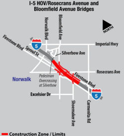 In April 2012, the CTC approved
$335 million total allocation for two segments of the I-5 South Corridor
Widening and Improvement Projects from the Los Angeles/Orange County line
to I-605 (≊ 005 LA 2.804 to ≊ 005 LA 3.976)
In April 2012, the CTC approved
$335 million total allocation for two segments of the I-5 South Corridor
Widening and Improvement Projects from the Los Angeles/Orange County line
to I-605 (≊ 005 LA 2.804 to ≊ 005 LA 3.976)
In February 2013, it was reported that work had begun on Segment 3, from Shoemaker Avenue to Silverbow Avenue. This will widen the 5 freeway for 1.2 miles between Shoemaker and Silverbow avenues by adding a general purpose lane and HOV lane in both directions. The project will also widen three bridges over the freeway — at Shoemaker, Rosecrans and Bloomfield. Metro is contributing $42 million of the $214 million cost of the project, with Metro’s money coming from Prop C (1990) and Measure R (2008) sales tax increases approved by county voters. The Rosecrans, Shoemaker and Bloomfield Avenue bridges will be demolished and reconstructed to accommodate the wider freeway.
In January 2018, it was reported that, for the first
time since 1954, drivers did not have to use a circuitous detour to get
from the northern segment of Bloomfield (~ 005 LA 3.661) to the southern
segment. In 1954, construction of I-5 resulted in Bloomfield deadending on
the S side of the freeway at Rosecrans Avenue — you could reconnect
about a quarter-mile to the east by picking up Firestone and continuing N
to Bloomfield. As part of the $1.9 billion I-5 widening project between
I-605 and the Orange County line, Caltrans elevated the freeway and
created an underpass for Bloomfield (and reconnecting the two ends). Once
complete, the existing six-lane freeway will expand with a general purpose
and car-pool lanes on each side. Other parts of the major project done
include bridges at Alondra Boulevard, Carmenita Road and Shoemaker Avenue.
Meanwhile, the new Florence Avenue bridge is expected to open later in
2018. The Norwalk and Pioneer boulevards and Imperial Highway phases also
are expected to be completed by the end of 2018. The new Valley View
Avenue bridge isn’t expected to open until 2020.
(Source: Whittier Daily News, 1/10/2018)
In November 2018, Caltrans tweeted that "The brand new
Norwalk Bl off ramp from NB I-5 in #Norwalk is scheduled to OPEN at 5am
Wed 11/21." On 11/30/18, Caltrans District 7 reported that the new Norwalk
Blvd. off ramp from northbound I-5 is open to the public after a four
month closure (~ LA 4.391). The ramp is part of a project to add lanes to
I-5 through Norwalk and to reconstruct the I-5 interchange at Norwalk
Blvd. Where the ramp meets Norwalk Blvd., there are now three lanes: left
turn to San Antonio Dr; right turn onto Norwalk Blvd.; or straight to
Imperial Highway.
(Source: District 7 Blog, 11/30/2018)
In November 2019, it was reported that Caltrans has
announced the opening of a fourth lane in each direction of I-5 through
Santa Fe Springs and Norwalk. The lane opening is part of a $1.9 billion
bond project adding one general purpose lane and one carpool lane in each
direction of I-5 between the I-605 and the Orange County line. In October,
a fourth northbound lane on the I-5 opened to traffic from Alondra
Boulevard to north of Imperial Highway. A fourth southbound lane opened
from Imperial Highway down to the Orange County line at Artesia Boulevard.
When the Florence Avenue interchange project finishes in spring 2020,
Caltrans will extend the open fourth lanes to the I-605 interchange. The
entire project is anticipated to wrap up by late 2021, when the Valley
View Avenue interchange project completes.
(Source: Downey Patriot, 11/4/2019)
In February 2022, it was reported that a carpool lane
will be opened from Alondra Boulevard to I-605. This is part of the
$1.8 billion, 6.7-mile I-5 widening project between the Orange
County border and I-605 that has been more than 30 years in the making.
Under the widening project begun in 2011, one regular lane and a carpool
lane are being added to the freeway, making for five lanes on each side.
There are six segments in the project, all but the Valley View Avenue are
mostly complete. The south side of the carpool lane will open all at once
and will be next milestone. Completion is projected for mid-2022,
according to the Caltrans website on the project.
(Source: Whittier Daily News, 2/8/2022)
Route 5 South HOV Lane-Segment: Silverbow to Orr and Day Road
In April 2012, the CTC approved $335 million total allocation for two segments of the I-5 South Corridor Widening and Improvement Projects from the Los Angeles/Orange County line to I-605 (≊ 005 LA 2.804 to ≊ 005 LA 3.976)
In May 2013, it was reported that Metro and Caltrans broke ground in late May on the I-5 Carpool Lane Widening/Imperial Highway and Pioneer Boulevard Project, the fourth of six segments to begin construction. The I-5 Carpool Lane Widening/Imperial Highway and Pioneer Boulevard Project will widen nearly two miles of freeway in Norwalk by adding one carpool lane and one regular lane in each direction from Silverbow Avenue to Orr and Day Roads; and bridges at San Antonio Drive, Imperial Highway, and Pioneer Boulevard will be rebuilt to accommodate the wider freeway. The improvements also include a new southbound I-5 off-ramp at Imperial Highway, new sound walls and frontage roads. The project is primarily funded ($167.5 million) by Proposition 1B, a 2006 voter-approved transportation bond. To date, nearly $15 billion in Proposition 1B funds have been put to work statewide. The project also received $104 million in state transportation funds and $30.5 million from Metro’s Proposition C and Measure R.
In August 2013, it was reported that Caltrans will fully close the southbound Santa Ana Freeway (Interstate 5) off-ramp at Pioneer Boulevard/Imperial Highway (≊ 005 LA 4.98) beginning Thursday, August 15 at 8 a.m. The ramp will remain fully closed for eight months, through April 2014, when a new elevated off-ramp is complete and re-opens.
Firestone Blvd / Downey Widening (≊ 005 LA 3.636)
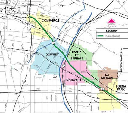 In April 2008, the CTC reviewed a notice of preparation for an EIR for
roadway improvements near Commerce. The proposed project would construct
additional lanes and upgrades to existing lanes and shoulders to current
standards. The project is programmed in the 2006 State Transportation
Improvement Program for environmental only. The project is fully funded
for Project Approval/Environmental Document in the amount of $2,592,000 in
the 2006 State Transportation Improvement Program (Transportation
Facilities Account) - Regional Improvement Program ($432,000) and Federal
Demonstration funds ($2,160,000). Depending on the alternative selected,
the total estimated project cost ranges from $900 million to $1.6 billion
(including right of way and construction). Construction is estimated to
begin in Fiscal Year (FY) 2016-17. The proposal intially saw the following
options:
In April 2008, the CTC reviewed a notice of preparation for an EIR for
roadway improvements near Commerce. The proposed project would construct
additional lanes and upgrades to existing lanes and shoulders to current
standards. The project is programmed in the 2006 State Transportation
Improvement Program for environmental only. The project is fully funded
for Project Approval/Environmental Document in the amount of $2,592,000 in
the 2006 State Transportation Improvement Program (Transportation
Facilities Account) - Regional Improvement Program ($432,000) and Federal
Demonstration funds ($2,160,000). Depending on the alternative selected,
the total estimated project cost ranges from $900 million to $1.6 billion
(including right of way and construction). Construction is estimated to
begin in Fiscal Year (FY) 2016-17. The proposal intially saw the following
options:
According to the Caltrans website, the improvements to I-5 will finally remove the left-exit for Firestone Blvd.
In November 2011, the Downey Patriot provided more information. According to the Downey public works department, 12 homes in northeast Downey will be impacted by the widening freeway, which will overtake Dollison Drive and turn several streets in the area into cul-de-sacs. Florence Avenue, one of the major frontage roads along the I-5 Freeway, will also be widened to accommodate another lane, which is expected to help ease traffic along the overcrossing from Studebaker Road to Orr and Day Road. By 2013, all six projects will be under construction. Caltrans officials anticipate construction will conclude in 2016.
In March 2013, it was reported that the NB I-5 Firestone off-ramp (the infamous left-exit) would close permanently in April 2013.
In January 2021, it was reported that a banner reading
“NO MORE LANES” was placed on a pedestrian overcrossing over
I-5 Freeway in the city of Downey. “No more lanes” is a slogan
used by the Happy City Coalition, a group that recently formed to oppose
Metro and Caltrans’ plan to demolish hundreds of homes to widen
I-605 and I-5 through Downey. The coalition believes “Widening the freeway as a
‘solution’ to traffic is state sanctioned violence against a
predominantly Latinx community, that follows in @metrolosangeles racist
practice of bulldozing Black & Latino communities for the construction
of freeways and highways”. The impact of widening, however, is an
artifact of much older decisions that placed freeways through communities
that couldn't afford to protest or were red-lined to create a path of
least resistance.
(Source: Streetsblog LA, 1/1/2021)
I-605/I-5 Interchange Improvements (~ LA 6.667)
The 2018 STIP, approved at the CTC March 2018 meeting, appears to allocate $18,170 in Advance Programming Development Element funds in FY20-21 for PPNO 4624, Rt 605/5 Interchange improvements (~ LA 6.667).
In March 2020, the CTC approved the 2020 STIP, which
appears to move the funding for this project from FY20-21 to FY21-22.
(Source: March 2020 CTC Agenda, Item 4.7, 2020 STIP
Adopted 3/25/2020)
In March 2016, the Los Angeles MTA presented its full proposal for what
transit lines could be built—and when—if Los Angeles County
voters approve a half-cent sales tax increase in November 2016. This
proposal included funding for the I-5 South Corridor Improvements (I-605
to I-710). The new project will add 1 Mixed-Flow lane and 1 HOV lane in
each direction, from I-710 to I-605 for a total of 7 miles, for a total of
5 Mixed-Flow lanes and 1 HOV lane in each direction.
(Source: Los Angeles Times 3/18/2016; Metro Board Report 3/24/2016)
Los Angeles County — I-710 to Route 134
In July 2019, it was reported that bridge construction is proceeding just
off the I-5 Atwater Village, wherea giant white beam is sticking out of
the Los Angeles River (~ LA 23.706). That large white structure is part of
a bridge that, when complete, will connect pedestrians, cyclists, and
equestrians traveling between Atwater Village and Griffith Park.
Construction on the North Atwater Bridge began in the spring of 2018, and
now the bridge’s larger pieces are starting to materialize in the
river bed. Shirley Lau, a civil engineer with the city’s engineering
bureau, says the bridge’s “superstructure” will be up by
the end of the year. That matches up with earlier projections that pegged
the bridge being complete this fall. While construction is underway on the
North Atwater Bridge, a portion of the bike path closest to the project is
closed and will remain shuttered until December.
(Source: Curbed LA, 7/9/2019)
For a short period of time in October 2015, a sign error mistakenly
labeled "Los Feliz Blvd" as "Los Fezil Blvd" (≊ 005 LA 24.33).
Luckily, someone was there to take a picture. The sign fail was the fault of the manufacturer, and that Caltrans' design engineers—who have
professional licensing throughout California—wrote very specific
instructions for the sign to be made. However, the manufacturer, which was
hired by a subcontractor, messed up. The Caltrans inspector on site
quickly noticed the misspelling after workers put up the sign, and took it
down within 30 minutes, Chandler said. Crews then put back up the original
sign they had that they had been trying to replace. The reason this sign
was being replaced in the first place was because Caltrans has been
working for months repaving I-5. One of the safety enhancements was to
upgrade the signage on the freeway with newer signs that are more
reflective so they're easier for drivers to see at night. The
subcontractor will be delivering a new and correct sign to Caltrans to
replace the "Los Fezil Blvd" one, at no extra cost since it was the
manufacturer's mistake, by November.
(Source: LAist, 10/29/2015)
I-5 HOV Lanes - Route 134 to Route 210.
Route 134 Interchange
There appear to be plans for a study to improve the I-5/Route 134 interchange (≊ 005 LA 26.793) (March 2001 CTC Agenda). This study should be complete in early 2001; it is District 7 TCRP Project #154. It plans to explore completing the "back moves", i.e., from Eastbound Route 134 to Northbound I-5, and from Southbound I-5 to Westbound Route 134.
In Burbank, there are plans to construct a new interchange. [Per Sept. 2002 CTC Agenda.]
HOV Lane Project - Route 134 to Route 170 (Overall)
There are plans to add HOV lanes between Route 134 and Route 170. This is not on the TCRP list, but is SAFETEA-LU High Priority Project #570, which funded $400K. It was considered by the CTC in May 2001, but there has been no action since. However, the Corridor Mobility Improvement Account allocated $73 million for this project. According to the Daily News, the cost is about $605 million, and construction should start in spring 2009. In May 2008, the scope was changed to add an Empire interchange to the project. It will be constructed in four segments: I-5 HOV lanes from N of Buena Vista to Route 170; lanes from S of Empire Ave to Buena Vista, including the Empire interchange; S of Burbank Blvd to S of Empire Ave; and Route 134 to S of Burbank Blvd. This also involves railroad realingment. The second and third segments have been moved to FY 2009-2010. In July 2008, this was formalized by the CTC. This project is to construct one HOV lane in each direction for approximately ten miles on Route 5 from Route 134 to Route 170. The work involves the reconstruction and modification of the Burbank Boulevard interchange, the realignment of a short segment of Route 5, railroad realignment and elevation, and the construction of a grade separation at Buena Vista. The amendment added the Empire Avenue Interchange project to the scope of the Route 5 CMIA Project. This would close a one-mile gap, completing the HOV lanes along the Route 5 corridor from Route 134 to Route 170. Benefits would include mainline improvement, direct access to the Burbank airport, and safety enhancements as a result of the elimination of an adjacent railroad at-grade crossing. The cost and funding for the combined project is equal to the sum of the cost and funding of the individual projects. The combined cost is $609,539,000.
In July 2009, the CTC received a proposal to use local Proposition C funds to move forward with the HOV lane project in Burbank. The plan also involves funding changes to the other two segments along the corridor to consolidate all CMIA funds on the Route 5-South of Burbank Boulevard to south of Empire Avenue project (PPNO 3986) and STIP programming on the Route 5-South of Empire Avenue to north of Buena Vista Street project (PPNO 3985). With respect to the segment from South of Burbank Boulevard to south of Empire Avenue: The total project cost has increased from $50,844,000 to $123,765,000. The majority of the increase is due to the need to realign a portion of the mainline and reconfigure the interchange from a cloverleaf type interchange to a tight diamond interchange to meet geometric standards. The need to acquire additional property, the complexity of the interchange, as well as additional utility relocation costs substantially increased the right of way and construction estimates. With respect to the segment from South of Empire Avenue to north of Buena Vista Street: The total project cost has increased from $248,627,000 to $315,500,000. The majority of the increase is due to the extensive railroad work on the project. During design, it was determined to be more cost effective for the railroad work to be completed by Southern California Regional Rail Authority (Metrolink) through a C&M contract. The C&M agreement streamlined the design and approval process, brought in railroad experts and placed Metrolink in direct responsibility for their own lines. As details of the design evolved, the estimates for the project were updated to reflect the complex staging and coordination of the railroad and roadway. This is particularly challenging because both freeway and railroad must be kept in operation during the entire construction period.
In May 2012, it was reported that costs for this project were coming in higher than expected (which would be covered by reallocating money from different funds). In particular, there was a $9,000,000 cost increase to the design phase. The increase was because (a) The initial proposal of replacing the flood control channel with a shallower but wider covered channel in order to maintain the existing freeway elevation was not acceptable to the US Army Corps of Engineers. The recommendation was to cap the existing channel using concrete piles and precast slabs. This resulted in the redesign of 20 – 30 percent of the completed highway and construction staging plans. (b) Plans for the relocation of utilities within the railroad right of way were not acceptable to the Burbank City Council because of the length of construction. Alternate methods of utility relocation were redeveloped and designed. (c) It was necessary to redesign portions of the railroad plans to be consistent with the reworked utility relocation and the redesigned roadway staging plans. The additional design work activities, along with extremely complicated right of way coordination, resulted in a seven month delay to project delivery. The design has now been delivered and was scheduled for a construction allocation at the May 2012 Commission meeting.
HOV Lane Project - Route 134 to Route 170 Segment: Route 134 to S of Burbank Blvd
In late April 2011, Caltrans broke ground on the segment from Magnolia to Route 134. The $57.8 million project will create a high-occupancy vehicle lane between the Ventura Freeway and Magnolia Boulevard in Burbank, a segment of 2.7 miles in each direction.
In January 2012, it was reported that construction was back on track for the HOV construction between Route 134 and Magnolia Blvd in Burbank. Construction had been delayed so that Caltrans could iron out electricity and gas line issues with the city-owned utilities in Glendale and Burbank. Construction on this segment is expected to be competed in 2014.
In September 2019, it was reported that with the
completion of the Empire interchange, it is time for three of the five
Burbank Boulevard onramps and offramps to shut down for long-term
construction. Accordingly, the northbound off-ramp to westbound Burbank
Boulevard, the southbound offramp and the westbound onramp to I-5 south
have been shut down. Caltrans says drivers in need for a detour for the
northbound I-5 loop off-ramp to westbound Burbank Blvd. can continue north
I-5 and exit at Empire Avenue/San Fernando Blvd., turn right and take San
Fernando Blvd., then turn right on Burbank Blvd. Drivers can take the
following detour options for the Southbound I-5 off-ramp to Burbank Blvd.:
(1) Exit at Empire Avenue; turn right on Empire Avenue; turn right on
Lincoln Street; turn right on Victory Place and continue to Burbank Blvd.
(2) Exit at Empire Avenue; turn left and take San Fernando Blvd. to
Burbank Blvd. (3) Exit at Verdugo Avenue; turn right and take Front Street
to Burbank Blvd. The detour to the westbound Burbank Blvd. loop on-ramp to
southbound I-5 is to use the Empire Avenue onramp or the southbound I-5
on-ramp at Verdugo Avenue/Front Street. The entire I-5 Freeway
project’s completion is slated for 2021.
(Source: CBS LA, 9/30/2019)
In April 2021, it was reported that Caltrans announced
that new HOV lanes are open to motorists on Northbound and Southbound I-5
between Route 134 and Magnolia Boulevard in Burbank. With the opening of
this new 2.7-mile-long segment of carpool lanes, there remains only one
final segment to complete in Burbank before motorists have continuous HOV
lanes stretching more than 18 miles on I-5 from Route 134 to Route 14 near
Santa Clarita. The final 2.2-mile link is under construction in Burbank
between Magnolia Boulevard and Buena Vista Street. It is scheduled for
completion by early 2022 including a new I-5 Burbank Boulevard bridge and
interchange.
(Source: SCV News, 4/8/2021)
HOV Lane Project - Route 134 to Route 170 Segment: S of Burbank Blvd to S of Empire Ave
In late May 2012, the CTC approved $224.1 million for work on the I-5 HOV lanes from Magnolia Boulevard to Buena Vista Street in Burbank. The project extends from Empire Avenue to Burbank Boulevard and includes interchange modifications and railroad realignment. The work is scheduled to begin in early 2013 and the total project cost is estimated at $452 million.
In March 2020, it was reported that a 36-hour weekend
closure of the road was scheduled for April 25-27, 2020 as part of a
project to demolish and replace the Burbank Boulevard bridge over the
freeway. As part of this project, Burbank Boulevard between San Fernando
Boulevard and Front Street will be closed in both directions to vehicles,
cyclists and pedestrians starting at 12:01 a.m. on March 14, 2020 and will
reopen sometime in 2021. The new bridge will be longer than the old one
because I-5 is being widened to add carpool lanes in both directions. That
also means more lanes on Burbank Boulevard, bicycle lanes in both
directions and a wide sidewalk. The I-5 shutdown will likely be the
largest freeway closure in the Los Angeles area since 10-mile sections of
I-405 Freeway were closed during weekends in July 2011 and September 2012,
dubbed "Carmageddon" 1 and 2.
(Source: NBC LA, 3/5/2020)
In April 2020, it was reported that the Burbank Blvd
bridge demolition went smoothly. The Burbank Boulevard bridge was
demolished by giant hydraulic hammers which broke off chunks that fell on
a 2-foot-deep (0.61 meter) bed of sand placed underneath to prevent damage
to freeway pavement. The closure at the east end of the San Fernando
Valley began Saturday and demolition of the bridge was completed before
noon Sunday, earlier than expected. There is a great time-lapse video of
the demolition on YouTube; a 4-minute long version is also available.
(Source: NBC Los Angeles, 4/27/2020)
In June 2021, the CTC approved (with recommendations) a
request for an additional $46,413,000 in construction capital and
$8,000,000 in construction support for the State-Administered Multi-
Funded STIP/Proposition 1B CMIA/SLPP High Occupancy Vehicle/Empire Avenue
and Burbank Boulevard Interchange (North HOV Corridor) project (PPNO
07-3985; ProjID 0700021119; EA 1218W) on I-5 in Los Angeles County, to pay
for claims and complete the construction contract. The I-5 North HOV
Corridor project consists of four segments (Segments 1 thru 4). The total
cost for the corridor is approximately $910 million. The Department has
completed the construction of three segments (Segments 1, 2, and 4). This
project, the North HOV Corridor project on I-5 (Segment 3) (07-LA-5
30.0/31.6) is the last segment of the corridor to complete construction.
The project would widen the freeway to add an HOV lane in each direction,
construct railroad grade separations at two locations, reconfigure the
Empire Avenue interchange, and reconstruct the Burbank Boulevard bridge
and interchange. This project will extend the life of the pavement, reduce
maintenance cost and improve operation, safety, traffic flows, air
quality, and mobility for commuters and freight. Soundwalls, retaining
walls, and Traffic Operations System elements were also constructed or
installed as part of this project. The recommendations from the CTC
included (1) Request the Independent Office of Audits and Investigations
do an audit of this project and report back to the Commission when
complete. (2) $12,629,000 be provided by the Los Angeles County
Metropolitan Transportation Authority from local sources and report back
on the source of the funds to the Commission in August. (3) Allocate
$41,784,000 from the STIP Interregional Improvement Program. The cost
increase came from loads of claims on the project, the majority of which
are related to delays that include escalation costs (e.g., labor,
equipment, and material). These include delays due to utility relocation
and railroad work - 82%; Differing site conditions related to hazardous
waste, subsurface condition - 3%; Contract Change Orders due to design
revisions - 15%. There were also all sorts of utility relocation problems.
Here's the stick, also from the agenda item: "If this Supplemental Funds
Request is not approved, the Department will not meet its legal obligation
to compensate the contractor per the agreed-upon claim settlement and
interest on the settlement agreement will continue to accrue until it is
paid. If the negotiated settlement is not paid by June 30, 2021, the
contractor has the right to void the settlement agreement, and it will
cost the Department and taxpayers more to complete the project." All of
these claims is likely why the CTC demanded the audit.
(Source: June 2021 CTC Agenda, Agenda Item
2.5e.(9))
In November 2021, it was reported that a reconstructed
Burbank Boulevard bridge is projected to reopen on Nov. 24. The bigger
bridge will accommodate the freeway’s new layout, expanding from a
total of six lanes to 10 — three in each direction for vehicles
traveling on Burbank Boulevard and two turn lanes in each direction toward
the on-ramp. The $355-million freeway widening project, which started
construction in 2014 and is projected to conclude in the spring or summer
of 2022, is itself the final piece of Caltrans’ 5 Freeway
improvement initiative, which has replaced pavement and added carpool
lanes.
(Source: Burbank Leader via Outlook Newspapers, 11/13/2021)
HOV Lane Project - Route 134 to Route 170 Segment: Lanes from S of Empire Ave to Buena Vista, including the Empire interchange
In November 2010, the CTC approved combining the Route 5 Empire Avenue Interchange project (PPNO 3985) and the Route 5 Burbank Boulevard reconstruction project (PPNO 3986) for staging and construction purposes and to revise the schedule and funding plan accordingly. As background, at its meeting in July 2008, the Commission approved a CMIA baseline amendment for the Route 5 HOV widening project in Los Angeles County to combine the original CMIA project (PPNO 0142F) with the STIP Route 5 HOV/Empire Interchange project (PPNO 3985) and split the resultant project into four constructible segments. Two of the segments (PPNOs 0142F and 3987) have been delivered. It is now proposed to combine the remaining two segments (PPNO 3985 and 3986) for construction purposes.
In March 2011, Caltrans broke ground on a nearly $70-million project that will add new carpool lanes on both directions to the 4.4-mile stretch of the I-5 between the Route 170 Freeway interchange and Buena Vista Street. Funding for the project comes from nearly $40 million in federal stimulus money and $22.6 million in Los Angeles County Proposition C revenue. In addition to the carpool lanes, the project will also include repairing damaged pavement, installation of sound walls and the realignment of the Hollywood Way on- and off-ramps. Crews will first reconstruct the Empire Avenue interchange. The new interchange will be at West Empire Avenue near the Scott Road off-ramps to the I-5 and will connect Empire Avenue west of Victory Place to San Fernando Boulevard through an undercrossing with Victory Place, railroad tracks and the freeway. The off-ramp will be converted to allow full access to the freeway from Empire Avenue and San Fernando Boulevard. The existing San Fernando Boulevard undercrossing of the freeway will be eliminated. In one of the largest of the project’s impacts, the Burbank Boulevard bridge over the I-5 will be closed for nearly 14 months as crews reconstruct the overpass with new on- and off-ramps starting in 2013. Demolishing the Burbank Boulevard bridge will partially cut off access to the downtown area. Vehicles traveling northbound on the I-5 will only be able to turn right to reach the Burbank Town Center and vehicles traveling southbound will only have the option of turning right toward Costco and the Empire Center.
In February 2012, it was reported that Caltrans was
offering contractors millions of dollars in incentives to finish the
Burbank portion of the I-5 project ahead of schedule. The incentives come
after representatives for Caltrans heard concerns that the work on the I-5
corridor through Burbank would isolate neighborhoods around the Empire
Center and limit access to Bob Hope Airport. They hope the incentives will
shave up to a year off the project timeline. An estimated $5 million to $7
million in incentives for the contractors will shorten the construction
time by six to nine months for the Empire Interchange and four to six
months for the Burbank Boulevard interchange if the early benchmarks are
met, according to the agencies. About $2 million to $3 million in
incentives will help with the Burbank interchange work. Some of the
concern arose from a request to close San Fernando Boulevard to facilitate
railroad and utility relocation work. The agencies estimated the street
could be closed for roughly three years, prompting fears among Burbank
officials that the closure would isolate some residents. The early closure
of San Fernando is critical to accommodating a project schedule that
preserves state funding for the project, transportation officials have
said. Further delays would result in a funding lapse that would jeopardize
the entire project.
(Source: Los Angeles Times, 2/24/2012)
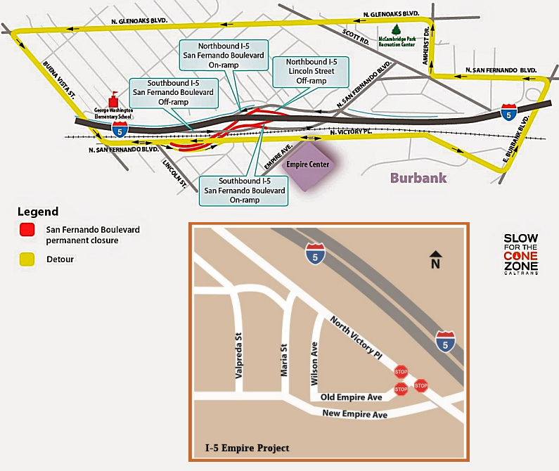 In May 2014, as part of the Empire project, Caltrans permanently closed a
portion of San Fernando Road. Specifically, the northbound I-5 Lincoln
Street off-ramp and southbound San Fernando Boulevard on-ramp will be
closed permanently. The southbound Scott Road/Burbank Boulevard off-ramp
will be closed when San Fernando Boulevard is closed and will be
integrated into the new Empire Avenue interchange. This is part of a $355
million project that will improve I-5 in Burbank between Magnolia
Boulevard and Buena Vista Street. It includes elevating the railroad
tracks, building a new interchange at Empire Avenue, reconstructing the
Burbank Boulevard Bridge, adding carpool lanes in both directions and
more.
In May 2014, as part of the Empire project, Caltrans permanently closed a
portion of San Fernando Road. Specifically, the northbound I-5 Lincoln
Street off-ramp and southbound San Fernando Boulevard on-ramp will be
closed permanently. The southbound Scott Road/Burbank Boulevard off-ramp
will be closed when San Fernando Boulevard is closed and will be
integrated into the new Empire Avenue interchange. This is part of a $355
million project that will improve I-5 in Burbank between Magnolia
Boulevard and Buena Vista Street. It includes elevating the railroad
tracks, building a new interchange at Empire Avenue, reconstructing the
Burbank Boulevard Bridge, adding carpool lanes in both directions and
more.
In May 2019, there was additional information on the
rework on the Empire Avenue interchange. Existing Empire Avenue is
becoming "Old" Empire Avenue, with a 3-way stop at Victory Place. Maria
Street is being extended to meet "New" Empire Avenue, and "New" Empire
Avenue will pass under Victory Place and I-5 to connect with the
continuation of San Fernando Road on the other side of I-5.
(Source: My5LA Tweet, 5/31/2019)
At the end of September 2019, it was reported that the
newly-constructed Empire Avenue interchange has opened.
(Source: CBS LA, 9/30/2019)
In January 2020, it was reported that the signage for
the Scott Road exit was removed, and replaced with signage for Empire
Avenue/San Fernando Road.
(Source: Caltrans District 7 Retweet, 1/31/2020)
HOV Lane Project - Route 134 to Route 170 Segment: I-5 HOV lanes from N of Buena Vista to Route 170
In May 2010, Caltrans put out a request for bid to construct HOV lanes, retaining walls, sound walls and replace concrete pavement in Burbank from 0.3km South of the Cohasset Street Undercrossing (≊ 005 LA 31.675) to 0.1km North of the Sheldon Street Overcrossing (≊ 005 LA 36.075). This includes replacement of the Cohasset St. Bridge, built in 1960. The estimate was $63M.
 In April 2023, a segment of "green out" fell off a sign on Route 134 at Victory
Blvd (~ 07-LA-134 4.788), exposing the US 99 designation that formerly
applied to I-5 (near ~ 07-LA-5 27.195). Caltrans replaced it with a
temporary patch that just covered the Route 99 shield with an I-5 shield.
Eventual plans are to replace the entire assembly.
In April 2023, a segment of "green out" fell off a sign on Route 134 at Victory
Blvd (~ 07-LA-134 4.788), exposing the US 99 designation that formerly
applied to I-5 (near ~ 07-LA-5 27.195). Caltrans replaced it with a
temporary patch that just covered the Route 99 shield with an I-5 shield.
Eventual plans are to replace the entire assembly.
(Source: $LA Times, 4/18/2023; Freeways of LA, 4/22/2023)
Caltrans Freight Corridor Improvement Project (Route 134 to Templin Highway, LA 27.0 to LA R67.0)
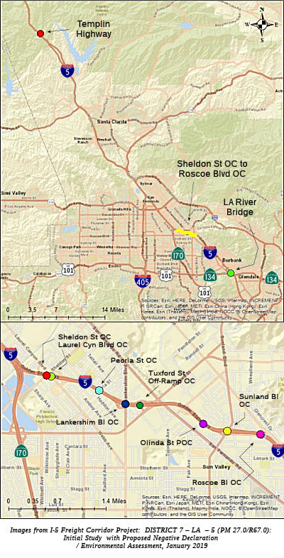 In February 2019, it was reported that Caltrans was holding initial public meetings on the
proposed Caltrans Freight Corridor Improvement Project
on I-5 in Los Angeles County. The proposed project involves improvements
at bridges on I-5 from Route 134 (Ventura Freeway) in Glendale to Templin
Highway north of the Santa Clarita Valley in northern LA County. It would
provide increased vertical clearance of 16 feet, 6 inches at eight bridges
in the Sun Valley area of Los Angeles and eliminate load capacity
restrictions for heavy loads at the Los Angeles River Bridge, the
I-5/Route 134 interchange and the Templin Highway undercrossing.
In February 2019, it was reported that Caltrans was holding initial public meetings on the
proposed Caltrans Freight Corridor Improvement Project
on I-5 in Los Angeles County. The proposed project involves improvements
at bridges on I-5 from Route 134 (Ventura Freeway) in Glendale to Templin
Highway north of the Santa Clarita Valley in northern LA County. It would
provide increased vertical clearance of 16 feet, 6 inches at eight bridges
in the Sun Valley area of Los Angeles and eliminate load capacity
restrictions for heavy loads at the Los Angeles River Bridge, the
I-5/Route 134 interchange and the Templin Highway undercrossing.
(Source: SCV News, 2/13/2019)
According to the initial study, the purpose of the I-5
Freight Corridor Improvement Project is to:
(Source: I-5 Freight Corridor Project: DISTRICT 7 – LA – 5 (PM 27.0/R67.0): Initial Study with Proposed Negative Declaration / Environmental Assessment, January 2019)
The project addresses restrictions from reduced vertical clearance as established in Caltrans’ Highway Design Manual and load capacity restrictions as identified in federal guidelines. The proposed project will increase vertical clearance at Roscoe Blvd. Overcrossing (OC), Sunland Blvd. OC, Olinda St. Pedestrian Overcrossing (POC), Tuxford Off-ramp OC, Lankershim Blvd. OC, Peoria St. OC, Laurel Canyon Blvd. OC, and Sheldon St. OC. This will be accomplished by replacing the bridges and raising the bridge profiles by approximately 1 to 2 feet at the Overcrossings and about 4 feet at Olinda St. POC. The proposed project will also eliminate the load capacity restrictions for heavy loads at the Los Angeles River Bridge and Separation and Templin Highway Undercrossing by repairing the steel girders and un-staggering the steel cross frames at the Los Angeles River Bridge and Separation and by replacing the Templin Highway Undercrossing. It is expected that each bridge will have shallow spread footing at abutments and possibility of deep foundation at bent locations. Utilities will be protected in place or relocated during the construction of the bridges. The bridges located in Sun Valley will be widened to accommodate the State of California’s Complete Streets Policies. Complete streets will include facilities that are planned, designed, operated, and maintained to provide safe mobility for all users, including bicyclists, pedestrians, transit vehicles, truckers, and motorists, appropriate to the function and context of the facility. These facilities will include ADA curb ramps, sidewalks, bike lanes, and aesthetic treatments at all bridges in Sun Valley. Olinda St. POC will also be converted to a combined Pedestrian/Bicycle Overcrossing (BOC). The proposed project includes the following bridges, listed from south to north:
The Build Alternative is proposed to go into construction under three separate phases (or segments):
In July 2019, the Federal Register published a Notice
of Final Federal Agency Actions on Proposed Highway in California related
to this project. The actions by the Federal agencies, and the laws under
which such actions were taken, are described in the Final Environmental
Assessment (FEA) with Finding of No Significant Impact (FONSI) for the
project, approved on May 30, 2019, and in other documents in the FHWA
project records.
(Source: Federal Notice, 7/22/2019)
In December 2019, the CTC had on its agenda for future
consideration of funding the following project: 07-LA-5, PM 27.0/R67.0 I-5
in Los Angeles County. Construct roadway improvements including increasing
vertical clearances on a portion of I-5 in Los Angeles County. (PPNO
5281). This project is located at various locations on I-5 from Route 134
to the Templin Highway Undercrossing in Los Angeles County. This project
proposes to improve freight efficiency and replace 10 bridges to provide
vertical clearance of 16’- 6 and rehabilitate two bridges. The
proposed project addresses the current non-standard load bridge vertical
clearance and load capacity restrictions resulting in detour and delay of
travel time. This project is not fully funded and is currently programmed
in the 2016 SHOPP for $15.6 million for PA&ED and estimated to begin
in 2021. The total estimated project cost is $414.8 million. The scope, as
described for the preferred alternative, is consistent with the project
scope programmed by the Commission in the 2016 SHOPP.
(Source: December 2019 CTC Agenda, Agenda Item
2.2c.(1))
In February 2022, it was announced that as part of
Gavin Newsom’s $1.1 billion Clean California initiative, Caltrans is
awarding funding for beautification projects along the state highway
system. One project is the Interstate 5 Sun Valley Beautification
(~ 07-LA-5 34.625/39.059). The project will improve the aesthetic
appearance of roadside and interchanges at Roscoe Boulevard, Sunland
Boulevard, Penrose Street, Tuxford Street, Lankershim Boulevard, Laurel
Canyon Boulevard, Sheldon Street, Branford Street, Osbourne Street, Terra
Bella Street, Van Nuys Boulevard, and Paxton Street by installing wall
fencing & vines, restoring irrigation systems, replacing dead plants
with new plants, installing new irrigation systems and stabilizing eroding
soil areas with decorative and/or colored Rock Slope Protection (RSP).
Installing a rock blanket, stamped concrete, and slope paving. Estimated
cost: $6.053 million. Estimated completion date: June 10, 2023.
(Source: SCVNews, 2/17/2022)
HOV Lane Project: Route 170 to Route 14 (07-LA-5 ~ 36.336/39.373)
The SAFETEA-LU act, enacted in August 2005 as the reauthorization of TEA-21, provided the following expenditures for or near this route:
In late September 2010, Caltrans broke ground on a $140.2-million project to add carpool lanes to a nearly 10 miles of I-5 from Route 170 (≊ 005 LA 36.336) to Route 118 (≊ 005 LA 39.373). The project will also widen under-crossings and reconstruct the carpool connector between Route 170 and I-5. The project is scheduled to be completed in fall 2015.
![[TCRP 41.1, 41.2]](maps/005-tcrp-41.jpg) There is also a plan to add HOV lanes from Route 170 to Route 118, and from Route 118 to Route 14 (TCRP Project #41). There are various alternatives, owing
to the nature of the I-5/Route 170 interchange, but the basic plan is to
add one HOV lane in each direction, with truck lanes in the section near
Route 14. The overall project involves the construction of one High
Occupancy Vehicle (HOV) lane in each direction in the median on Route 5,
from Route 170 to Route 14. The project also involves constructing new
soundwalls on each side of freeway, widening several under-crossings, ramp
improvements, and reconstructing Route 5/170 Interchange to provide direct
HOV connectors between Route 5 and Route 170. The overall project has been
segmented into two subprojects for implementation: #41.1 (Segment 1):
Route 118 to Route 14 ’150; HOV lanes with mitigating soundwalls;
#41.2 (Segment 2): Route 170 to Route 118 ’150; HOV lanes. Bids for
the HOV lane project were $15,790,000 over the engineer’s estimate,
likely due to industry wide material shortage of concrete and reinforcing
steel and by increases in oil prices resulting in higher costs for asphalt
concrete and fuel. Instead of descoping the project, Caltrans utilized
$7,000,000 in TCRP funds from Project #50 (Route 71 Freeway) and an
additional $8,790,000 provided by the Los Angeles County Metropolitan
Transportation Authority (LACMTA) to allow the project proceed according
to the revised schedule. This was originally scheduled for completion in
October 2009. In June 2006, the CTC agenda noted that the HOV lanes for
the #41.1 portion, Route 118 to Route 14, are currently under
construction, and that construction of the soundwalls will commence upon
the completion of the HOV lanes. However, completion of the HOV lanes was
extended to Fiscal Year 2011 due to delays in awarding the project and for
additional working days for the construction contract. As for the #41.2
portion, Route 170 to Route 118, the June 2006 CTC agenda noted that the
project’s cost has increased due to a revised noise report requiring
additional soundwalls, additional widening to meet FHWA requirements, and
the escalation in cost of construction materials, such as steel and
concrete, and right-of-way. The schedule was updated to allow adequate
time to complete design and right-of-way acquisition and begin
construction in the FY 2007-08; completion (as of June 2006) was scheduled
for Fiscal Year 2009. Construction actually started in October 2010.
There is also a plan to add HOV lanes from Route 170 to Route 118, and from Route 118 to Route 14 (TCRP Project #41). There are various alternatives, owing
to the nature of the I-5/Route 170 interchange, but the basic plan is to
add one HOV lane in each direction, with truck lanes in the section near
Route 14. The overall project involves the construction of one High
Occupancy Vehicle (HOV) lane in each direction in the median on Route 5,
from Route 170 to Route 14. The project also involves constructing new
soundwalls on each side of freeway, widening several under-crossings, ramp
improvements, and reconstructing Route 5/170 Interchange to provide direct
HOV connectors between Route 5 and Route 170. The overall project has been
segmented into two subprojects for implementation: #41.1 (Segment 1):
Route 118 to Route 14 ’150; HOV lanes with mitigating soundwalls;
#41.2 (Segment 2): Route 170 to Route 118 ’150; HOV lanes. Bids for
the HOV lane project were $15,790,000 over the engineer’s estimate,
likely due to industry wide material shortage of concrete and reinforcing
steel and by increases in oil prices resulting in higher costs for asphalt
concrete and fuel. Instead of descoping the project, Caltrans utilized
$7,000,000 in TCRP funds from Project #50 (Route 71 Freeway) and an
additional $8,790,000 provided by the Los Angeles County Metropolitan
Transportation Authority (LACMTA) to allow the project proceed according
to the revised schedule. This was originally scheduled for completion in
October 2009. In June 2006, the CTC agenda noted that the HOV lanes for
the #41.1 portion, Route 118 to Route 14, are currently under
construction, and that construction of the soundwalls will commence upon
the completion of the HOV lanes. However, completion of the HOV lanes was
extended to Fiscal Year 2011 due to delays in awarding the project and for
additional working days for the construction contract. As for the #41.2
portion, Route 170 to Route 118, the June 2006 CTC agenda noted that the
project’s cost has increased due to a revised noise report requiring
additional soundwalls, additional widening to meet FHWA requirements, and
the escalation in cost of construction materials, such as steel and
concrete, and right-of-way. The schedule was updated to allow adequate
time to complete design and right-of-way acquisition and begin
construction in the FY 2007-08; completion (as of June 2006) was scheduled
for Fiscal Year 2009. Construction actually started in October 2010.
In Fall 2022, LA Metro included, as a potential project in its "I-405
Comprehensive Multimodal Corridor Plan", a proposed project that
will construct a direct connector between I-5 SB and Route 118. The
project was ranked in tier 2B.
(Source: Los Angeles Metro, "I-405 Comprehensive Multimodal Corridor Plan", Fall 2022, Appendix E: CMCP Projects List)
Los Angeles County — I-210 to Kern County Line
I-5 Roadway Rehabilitation Project [½ mi S of Route 14 (apx 005 LA R43.877) to 1½ mi N of Lake Hughes Road (apx 005 LA R59.508)]
In 2014 the state will repave I-5 from San Fernando Road (apx 005 LA R43.877) to Lake Hughes Road (apx 005 LA R59.508)
In January 2018, it was reported that Caltrans is
conducting a $171 million project to smooth the drive on I-5 though Santa
Clarita in northern Los Angeles County. The I-5 Roadway Rehabilitation
Project will replace concrete on 15.8 mi. of freeway from a mi. south of
Route 14 (apx 005 LA R43.877) to a mile and a half north of Lake Hughes
Road (apx 005 LA R59.508). To assure a smoother ride, concrete paving will
be continuously upgraded in the outside lanes (lanes three and four). In
lanes one and two, broken slabs will be replaced, and the full length of
lanes one and two will receive profile grinding to ensure a smooth surface
for vehicles. In portions of the roadway with asphalt pavement, concrete
pavement will be installed. The guardrail will be upgraded to the current
standard. Construction of carpool lanes also called HOV or high occupancy
vehicle lanes on I-5 in the area is anticipated under a separate project
following completion of the I-5 Roadway Rehabilitation Project (discussed
below). Metro (Los Angeles County Metropolitan Transportation Authority),
in cooperation with Caltrans, is conducting the final design for the
proposed HOV lanes and extensions of the truck lanes along I-5 from state
Route 14 to south of Parker Road in northern Los Angeles County.
Construction on the HOV lanes is anticipated to begin in 2019.
(Source: Construction Eqpt. Guide, 1/17/2018)
The SAFETEA-LU act, enacted in August 2005 as the reauthorization of TEA-21, provided the following expenditures for or near this route:
Route 14/I-5 HOV Connector (apx 005 LA R45.495)
![[005-014 interchange]](maps/005-014-interchange.jpg) Construction started in late 2008 on a $156 million project to elevate a two-lane
car-pool lane to connect car-pool lanes on I-5 and Route 14. The project
should be done by 2012. The project appears to have gone to bid in
November 2007, with an estimate of $120M for the connectors in Los Angeles
County (Santa Clarita) on I-5 from 0.2 Km South of the Balboa Boulevard
overcrossing to 0.9 Km South of Weldon Canyon and on Route 14 from the
I-5/Route 14 separation to 2.0 Km North of the Sierra Highway
undercrossing. According to the Daily News, in mid-August 2008 transportation officials broke ground on the project. When the $161 million, two-lane elevated connector is
finished in 2012, drivers will no longer have to get out of the car-pool
lane on one freeway and weave through traffic to get back into the
car-pool lane on the other. The direct car-pool lane connector will be the
third in Los Angeles County. The others are at the Route 57/Route 60
interchange in Orange County and the I-105/I-110 interchange in South Los
Angeles. Most of the construction and road closures will be done during
off-peak hours. The roughly half-mile-long, nearly 70-foot-high connector
is being paid for by a mix of federal, state and county transportation
money.
Construction started in late 2008 on a $156 million project to elevate a two-lane
car-pool lane to connect car-pool lanes on I-5 and Route 14. The project
should be done by 2012. The project appears to have gone to bid in
November 2007, with an estimate of $120M for the connectors in Los Angeles
County (Santa Clarita) on I-5 from 0.2 Km South of the Balboa Boulevard
overcrossing to 0.9 Km South of Weldon Canyon and on Route 14 from the
I-5/Route 14 separation to 2.0 Km North of the Sierra Highway
undercrossing. According to the Daily News, in mid-August 2008 transportation officials broke ground on the project. When the $161 million, two-lane elevated connector is
finished in 2012, drivers will no longer have to get out of the car-pool
lane on one freeway and weave through traffic to get back into the
car-pool lane on the other. The direct car-pool lane connector will be the
third in Los Angeles County. The others are at the Route 57/Route 60
interchange in Orange County and the I-105/I-110 interchange in South Los
Angeles. Most of the construction and road closures will be done during
off-peak hours. The roughly half-mile-long, nearly 70-foot-high connector
is being paid for by a mix of federal, state and county transportation
money.
In December 2012, the HOV connector between I-5 and Route 14 opened. The long-awaited connector allows motorists in the HOV lanes on I-5 and Route 14 to remain in the HOV lanes while traveling between the two freeways. It opened in late December and a ribbon-cutting ceremony was held in January 2013 to celebrate the project, which began in 2008 and cost $175.8 million.
I-5 North County Enhancement Project: Route 14 (LA R45.618) to Parker Road Interchange in Castaic (LA R58.99)
The SAFETEA-LU act, enacted in August 2005 as the reauthorization of TEA-21, provided the following expenditures for or near this route:
![[Santa Clarita HOV]](maps/005-santaclarita.jpg) In March 2009, the CTC recieved a draft EIR for review concerning a project
in Los Angeles County will construct high occupancy vehicle lanes in each
direction and roadway improvements from I-5/Route 14 interchange to just
south of Parker Road Interchange near the City of Santa Clarita. The
project is not fully funded. The project is programmed with Safe,
Accountable, Flexible, Efficient Transportation Equity Act: A Legacy for
Users (SAFETEALU) funds and private funds in the amount of $63,200,000.
The total cost of the project is estimated to be between $506,000,000 and
$605,000,000. Assuming the availability of funding, construction is
estimated to begin in Fiscal Year 2010-11. There are three alternatives:
In March 2009, the CTC recieved a draft EIR for review concerning a project
in Los Angeles County will construct high occupancy vehicle lanes in each
direction and roadway improvements from I-5/Route 14 interchange to just
south of Parker Road Interchange near the City of Santa Clarita. The
project is not fully funded. The project is programmed with Safe,
Accountable, Flexible, Efficient Transportation Equity Act: A Legacy for
Users (SAFETEALU) funds and private funds in the amount of $63,200,000.
The total cost of the project is estimated to be between $506,000,000 and
$605,000,000. Assuming the availability of funding, construction is
estimated to begin in Fiscal Year 2010-11. There are three alternatives:
In February 2010, the CTC approved for future consideration a project in Los Angeles County that would construct high occupancy vehicle (HOV) lanes, truck climbing lanes, and additional auxiliary lanes on I-5 from Route 14 on the south to Parker Road on the north. Proposed improvements include extending the existing HOV lanes on Interstate 5 from Route 14 to south of Parker Road and adding truck climbing lanes from the State Route 14 Interchange to Calgrove Boulevard (northbound) and to Pico Canyon Road/Lyons Avenue (southbound). The project is scheduled in phases. The construction of the truck lane improvements from the Route 14 Interchange to south of the Pico Canyon Road/Lyons Avenue Interchange is fully funded with Proposition 1B in the 2008 State Highway Operation and Protection Program for $75,000,000 for capital and support. This phase also includes $55,000,000 of local funds. Construction of this phase is estimated to begin in Fiscal Year 2010-11. The total estimated project cost of all phases is $456,000,000. A Final Environmental Impact Report (FEIR) has been prepared as the project will involve construction activities resulting in biological impacts including the loss of oak woodlands.
In early November 2010, it was reported that funding sources and environmental reviews have been completed for this project, called the "Interstate 5 Gateway Improvement Project". It will be constructed in three phases, cost upwards of $500 million, and will add two truck lanes and a high-occupancy-vehicle lane both southbound and northbound on I-5 from the Route 14 interchange north to Parker Road. Construction will likely not start until late 2011 or 2012. Caltrans, the project lead, has a design team working on the first truck lanes, from Route 14 to Lyons Avenue. Selection of a contractor will start in the fall of 2011, with construction starting shortly after. The project will take two to three years to complete. This first phase alone will cost $130 million. The Los Angeles County Metropolitan Transportation Authority will use $56 million from Measure R, the half-cent sales tax Los Angeles County voters approved in November 2008. Caltrans will pay for the remaining $74 million with SHOPP funds, Raptis said. Federal dollars have helped too, with $1.6 million used for environmental reviews. The second and third phases of the project will add a carpool lane, an auxiliary lane and second truck lanes to Santa Clarita’s stretch of I-5, from the Highway 14 interchange to Parker Road.
In November 2011, it was reported that the first phase of the widening project was going out to bids, with construction anticipated to start in early 2012. The first phase will extend truck lanes from just north of Newhall Pass to Calgrove Boulevard on the northbound side and from the Pico Canyon Road/Lyons Avenue bridge to just north of the Newhall Pass on the southbound side. Caltrans estimated that constructing the first phase would cost $100 million; bids are coming in at $43 million. The $543-million project's second phase will extend high-occupancy vehicle lanes on the I-5 through Santa Clarita.
In May 2012, local and state officials announced a $72-million project to add truck lanes on I-5 through Newhall Pass and into Santa Clarita. The truck lanes are needed to separate heavy big-rig traffic from passenger vehicles and create safer, quicker passage for a growing population in the Santa Clarita Valley. The southbound truck lane will extend 3.7 million from Pico Canyon Road/Lyons Avenue in Santa Clarita to Route 14 (3.7 miles); the northbound lane will run 1.4 miles from Route 14 to Gavin Canyon. Construction is slated to be completed in early 2014.
In December 2014, it was reported that Caltrans held a ribbon-cutting for completion of the I-5 Truck Lane Project. The project, which began construction in May 2012, has added a fifth mixed-flow lane to northbound I-5 between Route 14 and the Gavin Canyon undercrossing, a distance of 1.4 miles. The 3.7 miles of southbound I-5 improvements include a fifth mixed-flow lane between Pico Canyon Road/Lyons Avenue and a half-mile south of Gavin Canyon, and a new segment of truck lane that begins north of Weldon Canyon and merges with the existing truck lane north of the Route 14 connector. New median and outside retaining walls were also built to accommodate the widening.
 Int. 5") In April 2018, it was reported that Metro was applying
for TCRP (Trade Corridor Relief Program) funds in addition to SB1 funds
for the Interstate 5 Golden State Chokepoint Relief Project, which would
add an HOV lane and truck lanes between Route 14 and Parker Road in the
Santa Clarita area. I-5 is a critical international trade corridor
stretching nearly 800 miles in California and running from Mexico to
Canada. This segment is hemmed in by mountains and there are no parallel
freeways — which makes traffic highly vulnerable to traffic
accidents and weather disruptions. Project estimates found it would save
2.2 million hours of truck travel time valued at $35 million over the
first 20 years of operation in addition to speeding up car travel and
making it safer by separating cars and trucks.
In April 2018, it was reported that Metro was applying
for TCRP (Trade Corridor Relief Program) funds in addition to SB1 funds
for the Interstate 5 Golden State Chokepoint Relief Project, which would
add an HOV lane and truck lanes between Route 14 and Parker Road in the
Santa Clarita area. I-5 is a critical international trade corridor
stretching nearly 800 miles in California and running from Mexico to
Canada. This segment is hemmed in by mountains and there are no parallel
freeways — which makes traffic highly vulnerable to traffic
accidents and weather disruptions. Project estimates found it would save
2.2 million hours of truck travel time valued at $35 million over the
first 20 years of operation in addition to speeding up car travel and
making it safer by separating cars and trucks.
(Source: Metro The Source, 4/19/2018)
In June 2018, it was reported that on June 8, the U.S.
Department of Transportation released more than $1.5 billion in grants to
fund what it calls "critical freight, highway, and bridge improvements"
via the Infrastructure for Rebuilding America or "INFRA" program created
by the Fixing America's Surface Transportation (FAST) Act of 2015. As
required by the FAST Act, USDOT notified Congress on June 5 about the 26
projects selected to receive the $1.535 billion worth of grants via the
INFRA program; triggering a mandatory 60-day congressional review period
before the agency can, in fact, award them. One of these grants was for
"Interstate 5 Golden State Chokepoint Relief Program (I-5 Component)",
with a proposed award of $ 47,000,000 out of a total project cost of
$500,347,000.
(Source: AASHTO Jounal, 6/8/2018; USDOT Reportof
Awards Under 23 U.S.C. 117 During Fiscal Years (FY) 2017 and FY 2018,
6/4/18)
In November 2018, it was reported that the City of
Santa Clarita was exploring a partnership between the agencies involved in
the I-5 improvements and suggested to report back monthly to identify
traffic patterns and an emergency plan. The emergency plan would be
implemented if the I-5 shut down for accidents, weather or construction.
The agencies include: the City of Santa Clarita, Department of Public
Works, Department of Regional Planning, Los Angeles County Sheriff’s
Department, and Fire Department. All would collaborate with Caltrans and
the California Highway Patrol. The partnership would also analyze traffic
flow and suggest solutions to the traffic issue on I-5 in the Santa
Clarita / Castaic areas. The agencies would also solicit feedback from the
Castaic Town Council and the West Ranch Town Council. The I-5 corridor
through the Santa Clarita Valley has been identified as a “critical
choke point” in California’s highway system, especially when
weather related closures impact areas like Castaic, which have limited
alternate routes. Along the I-210 corridor in the San Gabriel Valley,
Caltrans, in partnership with Los Angeles County Public Works and adjacent
cities, has been developing a very promising Integrated Corridor
Management pilot to improve mobility and handle emergency situations that
heavily impact the freeway. “A similar partnership is needed in the
Santa Clarita Valley along the I-5,” said the motion.
(Source: KHTS AM 1220, 11/27/2018)
In May 2020, the CTC approved the following allocation:
$247,000,000. 07-LA-5 45.0/59.6 & 41.4/43.8. PPNO 07-3189B. ProjID
0700000391. EA 2332E. I-5 Golden State Chokepoint Relief. In northern Los
Angeles County at the I-5 / Route 14 split. Construct truck lanes, HOV
lanes, auxiliary lanes, soundwalls, and an ITS hub station. Widen seven
bridges and improve access to weigh station.
(Source: May 2020 CTC Agenda, Agenda Item 2.5s.(7))
In March 2021, it was reported that construction on
this project may start as early as summer 2021, pending approval from
Metro’s board of directors. The $679 million project is meant to
accommodate for expected population growth, according to a Metro report on
the project, and seeks to improve the mobility of people and freight over
the 13.9-mile stretch on I-5 between Route 14 and Parker Road in Castaic.
The Los Angeles County Metropolitan Transportation Authority, or Metro,
which has worked in collaboration with the state’s Department of
Transportation, plans to realize these improvements through the addition
of an HOV lane in each direction, the extension of trucking lanes,
additional traffic lanes, widening seven bridges and replacing the Weldon
Canyon Bridge. Metro will consider three bids from construction companies
to build the project. Skanska Construction and Santa Clarita’s C.A.
Rassmussen Inc. together submitted the highest proposal at $513.6 million.
Flatiron Security Paving submitted a bid of $406 million, while OHL placed
the apparent lowest bid of just under $390 million. A construction
contract is typically awarded 30-45 days after the board’s approval.
(Source: Signal SCV, 3/22/2021)
In October 2021, details were revealed for the I-5
North County Enhancement Project. The project involves large construction
projects on the I-5 Freeway in the north L.A. County from south of Parker
Road in Castaic all the way to the Route 14 interchange in the Newhall
Pass in an effort to enhance the freeway. As of October 2021, there is
temporary construction signage on I-5. Metro anticipates construction to
begin in early November 2021, with daytime construction activities likely
occurring through November and December. Total completion of the freeway
project is estimated for November 2026. Project components include the
following:
(Source: KHTZ AM 1220, 10/27/2021)
In December 2021, LA Metro held a groundbreaking
ceremonty for the I-5 North County Enhancements Project, which will
improve the operations and safety of the I-5 freeway for motorists in the
Santa Clarita Valley. Metro is planning, designing and managing the
construction of the project in partnership with Caltrans. This
$679-million project is specifically designed to make the I-5 freeway
safer, improve the movement of freight and people and accommodate expected
population growth in the Santa Clarita Valley. Improvements include the
addition of one High Occupancy Vehicle (HOV) lane in each direction along
with other improvements in the 14-mile corridor between Route 14 in Santa
Clarita and Parker Road in Castaic. In addition to new HOV lanes in both
directions, project improvements include a two-mile extension of truck
lanes, construction of sound walls in select locations to reduce freeway
noise, the addition of auxiliary lanes at multiple locations and the
replacement of the Weldon Canyon Road Bridge. These improvements intend to
enhance safety on the freeway by removing trucks from the general-purpose
lanes and adding more space for merging. The project is funded through a
combination of Measure R and Measure M funding specifically set aside for
road and highways projects, along with SB1 and federal dollars. SB1 uses
state gas taxes and vehicle fees to fund roadways, improve transit and
build walking and biking projects. Metro expects the project to be
completed in 2026.
(Source: Metro "The Source", 12/1/2021)
In May 2022, it was reported that the project is
expected to take place in three stages. The first stage, which began in
October 2021, includes worksite staging, median construction and the
addition of HOV lanes and sound walls. This stage is planned to go until
January 2026. The second stage, which includes the addition of the
auxiliary lanes and work on ramps, is set to go from September 2023 to
January 2026. And the third stage, which includes the construction of
exterior retaining walls, is set to begin February 2025 and go to October
2026.
(Source: The Signal, 5/25/2022)
In October 2023, it was reported that as part of the
I-5 North County Enhancements Project, Metro’s contractor OHLA-USA,
will be removing the existing Weldon Canyon Rd Bridge as the new one was
ready for use in late August 2023. Activities include the removal and
demolition of the existing Weldon Canyon Rd bridge superstructure and
columns. Project improvements include the addition of a High Occupancy
Vehicle or carpool lane in each direction, an extension of the truck
lanes, new sound walls and auxiliary lanes and other improvements in the
14-mile corridor between Route 14 in Santa Clarita and Parker Road in
Castaic. Metro expects the project to be completed in 2026.
(Source: LA Metro, 10/30/2023)
High Occupancy Toll Lanes - Santa Clarita Area (Route 14 (LA R45.618) to Parker Road)
In February 2013, it was reported that Metro officials were looking into building a new combination of toll and carpool lanes along 13-1/2 miles of I-5 in northern Los Angeles County (what's new here is the toll aspect). Allowing toll users on the new lanes would allow them to be constructed by 2018, instead of waiting 30 years for sales tax revenue to accumulate for the project. The agency proposes to use Fast Trak toll devices to charge solo or two- occupant vehicles a varying charge for using the lanes, which would be free to carpools with three or more people. The lanes would extend in both directions between the Antelope Valley (14) Freeway on the south, and Parker Road in Castaic, in 2018. Under current Measure R schedules, those lanes are 30 years away from opening.
In April 2013, Members of the Planning and Programming Committee for the Los Angeles County Metropolitan Transportation Authority voted unanimously to approve the toll road concept and file the environmental impact report for the project. As proposed, the project would add two new 13.5-mile carpool lanes through the Santa Clarita Valley from Parker Road in Castaic to the I-5 junction with Route 14, one in each direction.
In May 2013, the CTC received notice of the preparation of an EIR regarding a project in Los Angeles County that will construct high occupancy toll lanes on I-5 from Route 14 to Parker Road in the City of Santa Clarita and unincorporated Los Angeles County. The project was originally proposed to construct high occupancy vehicle lanes. A Final Environmental Impact Report was approved for the project in September of 2009. The Department and the Los Angeles County Metropolitan Transportation Authority are now proposing to implement high occupancy toll lanes instead of the previously proposed high occupancy vehicle lanes on this 13.5-mile portion of I-5. In August 2013, the CTC approved this for future consideration of funding.
In April 2014, it was reported that Metro and Caltrans have decided to publicly finance the HOT project instead of seeking a public-private partnership (known as a PPP). This is because it is less expensive to publicly finance the project by using $352 million in now-available Measure R and other funds and a federal low-interest loan for $175 million. This project as originally proposed was also unusual because it included new sound walls for I-210 in Pasadena and Arcadia and Route 170 and I-405 in Los Angeles, and adding extra lanes for a short stretch of Route 71 in Pomona. Under the public financing deal, those projects will be built separately. The toll revenues would be reinvested and used for transit services and traffic operations in the 5 freeway corridor in the Santa Clarita Valley. The current forecast calls for the HOV lanes on I-5 to open in 2021, the soundwalls to be completed in 2019 and for the additional lane on the southbound side of Route 71 to be done in 2021 and the lane on northbound Route 71 to be finished in 2028.
In March 2016, the Los Angeles MTA presented its full
proposal for what transit lines could be built—and when—if Los
Angeles County voters approve a half-cent sales tax increase in November
2016. This proposal included funding for the I-5 North Capacity
Enhancements (from Route 14 to Lake Hughes Rd.): Conversion of the
existing facility (4 Mixed-Flow lanes in each direction) with a new
project starting from Route 14/I-5 Interchange to Lake Hughes Rd. in
Castaic along I-5 for a total of 14 miles. The new project consists of
adding 1 Truck lane and 1 HOV lane in each direction, while maintaining
existing mixed-flow lanes"
(Source: Los Angeles Times 3/18/2016; Metro Board Report 3/24/2016)
In October 2018, it was reported that U.S. Secretary of
Transportation Elaine Chao came to the Santa Clarita Valley to formalize
the presentation of a $47 million grant to Metro to build truck lanes and
extend high-occupancy vehicle, or carpool, lanes running through the SCV.
Chao was joined by Rep. Steve Knight (R-Palmdale), Los Angeles County 5th
District Supervisor Kathryn Barger and Santa Clarita Mayor Laurene Weste
to talk about the I-5 Golden State Chokepoint Relief Program the grant is
planned for. With the goal of reducing congestion along the I-5, the
program would yield a new southbound 4.7-mile truck lane between Pico
Canyon and Route 14, while a 3.4-mile northbound truck lane would run
between Route 14 and Calgrove Boulevard. The funds also would extend HOV
lanes 13.4 miles from the Route 14 and the I-5 interchange in Santa
Clarita to Parker Road in Castaic. The $47 million Infrastructure for
Rebuilding America grant was awarded through the efforts of Knight and
Barger, Chao said. Metro is contributing over $250 million in local sales
tax dollars for the project, according to Barger’s office.
Metro’s funding will also be matched with more than $200 million in
Senate Bill 1 gas tax funds approved by California legislators in 2017.
(Source: SCV Signal, 10/1/2018)
In January 2012, the CTC approved relinquishement of right of way in the city of Santa Clarita along Route 5 on Wayne Mills Place (07-LA-5-PM R53.5), consisting of collateral facilities.
In June 2008, the CTC approved relinquishment of right of way in the county of Los Angeles, on The Old Road at 0.1 mile north of the Route 126 Freeway (7-LA-5-PM R55.6, 7-LA-126-PM R5.7), consisting of superseded highway right of way.
In November 2019, Caltrans completed installation of a gate just N of
Lake Hughes Road (~ LA R59.546). This gate allows drivers to turn around
and travel back in the other direction when road conditions are dicey. The
gate is said to be about 300 feet north of Lake Hughes Road in Castaic.
When the interstate is closed because of ice and/or snow on the Grapevine,
it will be rolled open to create a turnaround across the median, officials
said.
(Source: ABC23 Bakersfield, 11/26/2019; LATimes
11/26/2019)
In May 2007, there was a report of plans to update I-5 to address the
growth in northern Los Angeles County, where the population is expected to
grow to 1.18M by 2030. Specifically, in Summer 2007, Los Angeles County
plans to start construction on the Hasley Canyon interchange (LA R56.592)
in Castaic. The project will include a bridge replacement and the
construction of roundabouts to ease congestion. That project is expected
to be completed by early 2010. Long-term projects for the freeway include
the construction of a carpool lane as well as a truck climbing lane from
Route 14 to Castaic. Construction on the $259M project is expected to
begin in the summer of 2010. As of May 2007, the City of Santa Clarita was
also constructing the $50M second phase of a project funded by the city of
Santa Clarita to improve the Magic Mountain Parkway freeway interchange.
[Santa Clarita Signal, May 18, 2007]
Gary Richards (Mr. Roadshow) reported that Caltrans will begin replacing the rough concrete with rubberized asphalt in late 2010 from Castaic (apx 005 LA R58.99) to the Visa Del Lago Road overcrossing (apx 005 LA R74.328), a yearlong project.
Templin Slipout (07-LA-5 R66.3/R67.3)
In March 2023, a slipout occurred on I-5 between the
Whitaker Brake Check area (~ LA R67.879) and Templin Highway (~ LA
R65.991), on the SB side of the freeway. A mudslide caused the ground to
give way under the shoulder of the southbound I-5 freeway near Templin
Highway on Thursday, March 30, 2023. Two right lanes remain closed as
CalTrans crews work to repair the damages. The Caltrans website locates
the closure from about 2 miles north of Templin Highway to about 5 miles
north. The repairs will involve the placement of shoring, which is
vertical posts or beams, through the roadway down in through the soil to
the bedrock. The problem is how to do the drilling. Part of the challenge
is that while the slope created by the rainfall is naturally taking any
future rains away from the freeway where it can drain off the hillside,
the slope is not safe enough for crews to lay down sheets of plastic often
seen at the sites of such excavations to protect it from further rain, due
to the current instability of the soil.
(Source: SCV Signal, 3/30/2023)
In June 2023, the CTC received a report of an Emergency
G-11 Allocation made by Caltrans on 04/07/2023: $11,500,000. 07-LA-5
R66.3/R67.3. PPNO 07-6071; ProjID 0723000149; EA 2XG50. I-5 Near Castaic,
from 0.3 mile to 1.3 miles north of Templin Highway. Winter storms from
January through March 2023 caused a slope failure on the southbound side
of the freeway, which continued eroding over several days until guardrail
posts were fully exposed and two lanes of traffic needed to be closed for
public safety. This project will construct a new temporary lane on the
inside shoulder, remove unsuitable material, construct a retaining wall,
rebuild the slope with geogrid, repair damaged shoulder pavement, and
place erosion control. (Additional $100,000 was allocated for right of way
purposes.). Allocation: CON ENG $1,500,000; CONST $10,000,000. Initial
G-11 Allocation 04/07/2023.
(Source: June 2023 CTC Agenda, Agenda Item 2.5f.(1) #50)
In June 2023, the CTC amended the following project
into the 2022 SHOPP: 07-LA-5 R66.3/R67.3 PPNO 07-6071; ProjID 0723000149;
EA 2XG50. I-5 Near Castaic, from 0.3 mile to 1.3 miles north of Templin
Highway. Remove unsuitable slide material, construct a retaining wall, and
rebuild the slope with geogrid. Note: Winter storms from January
through March 2023 caused a slope failure on the southbound side of the
freeway, which continued eroding over several days until guardrail posts
were fully exposed and two lanes of traffic needed to be closed for public
safety. This project will construct a new temporary lane on the inside
shoulder, remove unsuitable material, construct a retaining wall, rebuild
the slope with geogrid, repair damaged shoulder pavement, and place
erosion control. Allocation ($ × 1,000): PA&ED $0; PS&E $0;
R/W Sup $100; Con Sup $1,500; R/W Cap $100; Const Cap $10,000; TOTAL
$11,700. FY22-23.
(Source: June 2023 CTC Agenda, Agenda Item 2.1a.(1a) #45)
In August 2011, the CTC approved $130,000,000 in SHOPP funding for repairs in and near Gorman, from Vista Del Lago (apx 005 LA R74.328) to the Kern County Line (apx 005 LA 88.566), that will rehabilitate 127 lane miles of road way to improve safety and ride quality. Project will replace pavement on outside shoulders, grind and overlay median shoulders and ramps, place concrete termini on seven ramps, install ADA curbs, replace bridge approach and departure slabs, and replace dike.
I-5 "Westside Extension" — Kern → Tulare → Kings → Fresno → Madera → Merced → Stanislaus → San Joaquin Counties
In November 2007, Caltrans put out a request for bids to remove the Brake Check area N of Lebec from 0.1 Km North of Cressey Cattlepass Bridge to 0.7 Km South of the Lebec Road Overcrossing (06N-Ker-5 3/3.6). This had been closed since 1995.
The SAFETEA-LU act, enacted in August 2005 as the reauthorization of TEA-21, provided the following expenditures for or near this route:
According to Gary Roberts (Mr. Roadshow), plans call for the widening I-5 to six lanes through Madera, Fresno, Kings, Tulare and Kern counties. Long-range plans call for eight lanes. But don't hold your breath.
In March 2012, the CTC authorized SHOPP funding on I-5, 06-Fre-5 22.8/26.8 Near Coalinga, from north of Tuolumne Avenue to south of Route 33. $2,171,000 to construct double thrie beam median barrier to reduce the number and severity of traffic collisions along 4 centerline miles.
The SAFETEA-LU act, enacted in August 2005 as the reauthorization of TEA-21, provided the following expenditures for or near this route:
Tumey Gulch Bridge Replacement Project (06-Fre-5, PM 44.4/45.4)
 The following project was included in the final adopted 2018 SHOPP in March 2018: PPNO 6725. 06-Fresno-5 44.4/45.4. On I-5
Near Mendota, at Tumey Gulch Bridge No. 42-0246L/R. Replace bridge. Begin
Con: 7/3/2020. Total Project Cost: $16,531K.
The following project was included in the final adopted 2018 SHOPP in March 2018: PPNO 6725. 06-Fresno-5 44.4/45.4. On I-5
Near Mendota, at Tumey Gulch Bridge No. 42-0246L/R. Replace bridge. Begin
Con: 7/3/2020. Total Project Cost: $16,531K.
In December 2018, the CTC approved for future
consideration of funding a project located on I-5 near Mendota in Fresno
County that proposes to replace the existing Tumey Gulch Bridges
(No’s 42-0246L and 42-0246R) with new bridges. The project proposes
to address deficiencies of the bridges and safety issues by replacing them
with new bridges of a different design due to existing soil conditions.
The proposed project is estimated to cost approximately $16.5 million.
This project is currently fully funded and currently programmed in the
2018 SHOPP for approximately $16.5 million. Construction is estimated to
begin in 2020. The scope, as described for the preferred alternative, is
consistent with the project scope programmed by the Commission in the 2018
SHOPP. The CTC also approved an allocation of $1,900,000 for Project
Support and Engineering for 06-Fre-5 44.4/45.4. PPNO 6725. Project No.
0615000046. I-5 Near Mendota, at Tumey Gulch Bridge No. 42—0246L/R.
Replace bridge.
(Source: December 2018 CTC Minutes, Agenda Item
2.2c(1); December 2018 CTC Minutes, Agenda Item 2.5b(2b), Item 13)
In June 2020, the CTC approved the following allocation
for CONST and CON ENG: $15,851,000. 06-Fre-5 44.4/45.4. PPNO 06-6725.
ProjID 0615000046. EA 0S830. I-5 near Mendota, at Tumey Gulch Bridge No.
42-0246L/R. Outcome/Output: Replace deficient structure with new
bridge to address settlement and movement at the abutments. As part of
this allocation request, the Department is requesting to extend the award
of the construction contract an additional 6 months beyond the 6 month
deadline.
(Source: June 2020 CTC Agenda, Agenda Item 2.5b.(1)
#14)
In January 2022, the CTC approved a supplemental
allocation request for $13,564,000 (24.5 percent increase) allocation in
Construction Capital and $3,100,000 (10.7 percent increase) allocation in
Construction Support for the SHOPP Bridge Replacement project, on I-5, in
Fresno County. (EA 0S830, PPNO 6725). The construction capital and support
cost estimates are greater than the programmed amount following a delay
for construction to complete environmental mitigation and refinement of
the project scope and final design during the PS&E phase. The cost
increase is due to inflation of material prices, the extension of the
structure approach slabs, and the modification to the median detour. In
April 2020, this project originally reached RTL with a cost certification
of $12,851,000 (17.9 percent over the programmed amount). There was a cost
increase due to a refined design with the structure approach slabs. The
structure approach slabs were extended 500 feet to account for the
increased profile of the roadway. The design of the original detour
utilized a temporary bridge with a median crossover. Since bicyclists are
allowed on this segment of the highway, it was found that the width of the
proposed detour did not accommodate them. Therefore, the detour was
changed to utilize a wider temporary road in the median using culverts,
embankment, and bridge decking to allow bicyclists to use this segment of
highway. This alternative increased the cost of the detour by $1,000,000.
This detour reduced the construction time by one season, and it will also
be utilized on another project. In May 2020 , during the environmental
pre-construction surveys, a Giant Kangaroo Rat was discovered, and the
project was delayed two years to complete environmental mitigation. The
delay was a result of no mitigation banks available for Giant Kangaroo
Rats. The Department released a Request for Proposal for the purchase of
mitigation credits. This delay resulted in an increase of 5.5 percent to
the construction capital due to inflation.
(Source: January 2022 CTC Agenda, Agenda Item
2.5d.(2))
Truck Turn Radius Improvements (10-Merced-152 11.3, 10-Merced-5 6.3)
The following project was included in the final adopted 2018 SHOPP in March 2018: PPNO 3214. 10-Merced-152 11.3. Route 152 Near Los Banos, at Route 33 Interchange; also on Route 5 (MER PM 6.3) at Route 165 Interchange. Improve the truck turn radius. Begin Con: 6/15/2022. Total Project Cost: $4,529K.
In August 2020, the CTC approved the following
financial allocation: $64,000 for R/W Sup. 10-Mer-152 PM 11.2. PPNO 3214
ProjID 1017000005 EA 0T680. Route 152 Near Los Banos, at Route 33
Interchange; also Route 5 (PM 6.3) at Route 165 Interchange. Improve the
truck turn radius.
(Source: August 2020 CTC Agenda, Agenda Item
2.5b.(2a) #32)
In August 2011, the CTC approved $1,271,000 in SHOPP funding for repairs near Santa Nella at the Santa Nella Weigh Station Facilities (~ 005 MER 23.577) that would restore two structures, improve lighting and replace guardrail to improve safety for vehicle traffic.
Interstate 5/Sperry Road Interchange Project (10-Sta-5, PM 15.8/15.9)
 In January 2021, the CTC approved for future consideration of funding 10-Sta-5, PM
15.8/15.9. Interstate 5/Sperry Road Interchange Project.
Construct improvements to the I-5 / Sperry Road interchange in Stanislaus
County. (MND) (EA 0G420) (Local Funds). The project is located on I-5 near
the City of Patterson in Stanislaus County. The Department, in cooperation
with the Stanislaus County and the City of Patterson proposes to construct
improvements to the existing I-5/Sperry Road interchange. This project is
not fully funded and is estimated to cost $18.3 million. Additional
funding is anticipated to come from future federal, state, or local funds.
The estimated construction start is in the summer of 2023. A Mitigated
Negative Declaration (MND) has been completed. The project will result in
less than significant impacts to the environment after mitigation. The
following resource areas may be impacted by the project: biological
resources. Avoidance and minimization measures will reduce any potential
effects on the environment. These measures include, but are not limited
to, the purchase of upland habitat mitigation credits for California tiger
salamander.
In January 2021, the CTC approved for future consideration of funding 10-Sta-5, PM
15.8/15.9. Interstate 5/Sperry Road Interchange Project.
Construct improvements to the I-5 / Sperry Road interchange in Stanislaus
County. (MND) (EA 0G420) (Local Funds). The project is located on I-5 near
the City of Patterson in Stanislaus County. The Department, in cooperation
with the Stanislaus County and the City of Patterson proposes to construct
improvements to the existing I-5/Sperry Road interchange. This project is
not fully funded and is estimated to cost $18.3 million. Additional
funding is anticipated to come from future federal, state, or local funds.
The estimated construction start is in the summer of 2023. A Mitigated
Negative Declaration (MND) has been completed. The project will result in
less than significant impacts to the environment after mitigation. The
following resource areas may be impacted by the project: biological
resources. Avoidance and minimization measures will reduce any potential
effects on the environment. These measures include, but are not limited
to, the purchase of upland habitat mitigation credits for California tiger
salamander.
(Source: January 2021 CTC Agenda, Agenda Item
2.2c.(1))
![[TCRP 108]](maps/005-tcrp-108.jpg) TCRP Project #108 plans to add a
northbound lane to the freeway through the Mossdale "Y", from I-205 (~ 005
SJ R12.593) to Route 120 (~ 005 SJ R14.872) in San Joaquin County —
specifically, to extend the #1 lane in the northbound direction of Route 5
from Route 205 to Route 120. The project will provide five continuous
through-lanes on northbound Route 5 within this segment. In June 2006, it
was reported to the CTC that the project is ready to go to construction,
but that the schedule required updating due to the previous transportation
funding shortfalls (with a corresponding escalation of project costs). The
project is now scheduled to complete in FY 2006-2007.
TCRP Project #108 plans to add a
northbound lane to the freeway through the Mossdale "Y", from I-205 (~ 005
SJ R12.593) to Route 120 (~ 005 SJ R14.872) in San Joaquin County —
specifically, to extend the #1 lane in the northbound direction of Route 5
from Route 205 to Route 120. The project will provide five continuous
through-lanes on northbound Route 5 within this segment. In June 2006, it
was reported to the CTC that the project is ready to go to construction,
but that the schedule required updating due to the previous transportation
funding shortfalls (with a corresponding escalation of project costs). The
project is now scheduled to complete in FY 2006-2007.
In June 2022, the Draft 2022 Program Environmental Impact Report for the
Regional Transportation Plan/Sustainable Communities Strategy (RTP/SCS)
was released. It included the following projects:
(Source: Draft Program EIR for the RTP/SCS, June 2022)
In September 2011, it was reported that the pavement rehabilitation near Stockton is taking an interesting approach. This approach, known as "continuously reinforced concrete pavement", is made from concrete reinforced with steel and is estimated to last 40 years. Concrete roads in the state are more commonly built with breaks - called joints - that help keep the surface from cracking as the concrete changes shape. Using reinforcing steel makes this project different.
French Camp Road Interchange
The SAFETEA-LU act, enacted in August 2005 as the reauthorization of TEA-21, provided the following expenditures for or near this route:
Seemingly related to HPP #3494, during its April 2006 meeting the CTC considered the draft EIR for construction of an interchange at French Camp Road (San Joaquin County Sign Route J9), together with an extension of Sperry Road in the City of Stockton in San Joaquin County (PM 22.1/23.6). There were three alternatives being considered: (1) Full-Build Alternative: Interchange improvements, auxiliary lanes, and eight-lane Sperry Road extension; (2) Reduced-Build Alternative: Interchange improvements, auxiliary lanes, and four-lane Sperry Road extension; (3) No-Build Alternative. The report found that there will be potentially significant impacts associated with traffic circulation changes and biological issues, and thus indicated that an Environmental Impact Report is being prepared.
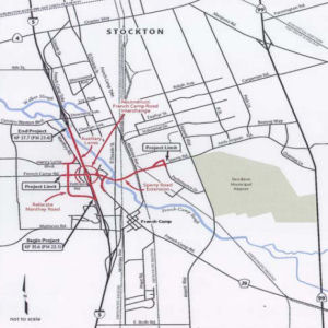 Seemingly related to HPP #2067,
during its July and September 2006 meetings the CTC considered
reprogramming funds into a project to reconstruct the interchange at I-5
and French Camp Road in the city of Stockton (City). In the 2006 STIP,
SJCOG proposed programming construction funding in FY 2007-08 for the
project. The Commission was unable to program the project in the 2006
STIP, due to insufficient funding capacity for San Joaquin County. Since
the adoption of the 2006 STIP, SJCOG and the City have been looking for
ways to fully fund this project. The City is the implementing agency for
the project, and indicates the environmental document of the project is
nearly complete. The PS&E phase will be done and the project will be
ready for construction in FY 2009-10. SJCOG is requesting the Commission
reprogram the $16,667,000 from Route 12 (Bouldin Island) Passing Lanes
(PPNO 7350) to CON in FY 2009-10 for the new I-5/French Camp Interchange
project. The $16,667,000 of RIP funds, in combination with $23,333,000 of
local funds from the City, will fully fund the project. In July 2009, the
CTC approved this for future consideration of funding, given the negative
FEIR.
Seemingly related to HPP #2067,
during its July and September 2006 meetings the CTC considered
reprogramming funds into a project to reconstruct the interchange at I-5
and French Camp Road in the city of Stockton (City). In the 2006 STIP,
SJCOG proposed programming construction funding in FY 2007-08 for the
project. The Commission was unable to program the project in the 2006
STIP, due to insufficient funding capacity for San Joaquin County. Since
the adoption of the 2006 STIP, SJCOG and the City have been looking for
ways to fully fund this project. The City is the implementing agency for
the project, and indicates the environmental document of the project is
nearly complete. The PS&E phase will be done and the project will be
ready for construction in FY 2009-10. SJCOG is requesting the Commission
reprogram the $16,667,000 from Route 12 (Bouldin Island) Passing Lanes
(PPNO 7350) to CON in FY 2009-10 for the new I-5/French Camp Interchange
project. The $16,667,000 of RIP funds, in combination with $23,333,000 of
local funds from the City, will fully fund the project. In July 2009, the
CTC approved this for future consideration of funding, given the negative
FEIR.
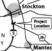 In December 2007, the CTC received an EIR regarding a project near Stockton
that would construct roadway improvements including a new interchange on
Route 5 near Stockton. The project is fully funded in the 2006 State
Transportation Improvement Program (STIP). The total estimated project
cost, capital and support, is $40,000,000. Construction is estimated to
begin in Fiscal Year 2009-10.
In December 2007, the CTC received an EIR regarding a project near Stockton
that would construct roadway improvements including a new interchange on
Route 5 near Stockton. The project is fully funded in the 2006 State
Transportation Improvement Program (STIP). The total estimated project
cost, capital and support, is $40,000,000. Construction is estimated to
begin in Fiscal Year 2009-10.
In January 2011, it was reported that the I-5/French Camp Interchange project was programmed in the 2010 STIP with $18,229,000 in Regional Improvement Program (RIP) funds for construction in Fiscal Year (FY) 2012-13. The RIP programming had been delayed twice due to limited STIP capacity. However, the City of Stockton had continued with project development using local funds. It was expected that this project will be ready for a RIP allocation in June 2011, and an advance allocation was not feasible, nor was an AB 3090 replacement project. Therefore, it was proposed that the CTC delete $18,229,000 RIP construction from this project, fund construction with $18,229,000 of SJCOG Measure K funds, and begin construction in August 2011. (Information Only in January 2011). This was approved in March 2011.
In August 2016, the CTC authorized relinquishment of two segments of right of way in the city of Stockton (City) along Route 5 at French Camp Road (10-SJ-5-PM R22.5), consisting of collateral facilities. The City, by freeway agreement dated January 29, 2008, agreed to accept title upon relinquishment by the State. The 90-day notice period expires July 24, 2016. At the same time, the CTC also authorized relinquishment of six segments of right of way in the county of San Joaquin (County) along Route 5 between Manthey Road and French Camp Road (10-SJ-5-PM R22.0/R22.7), consisting of collateral facilities. The County, by freeway agreement dated May 13, 2008, agreed to accept title upon relinquishment by the State. The 90-day notice period expires July 21, 2016.
Stockton Auxilliary Lanes (10-SJ-05 25.1/28.6)
In January 2011, the CTC approved for future consideration of funding a project in San Joaquin County that will construct HOV lanes, auxiliary lanes, traffic operation systems, soundwalls and rehabilitate pavement. Phase 1 of this project, from 8th Street Undercrossing (PM 25.0) to Hammer Lane Undercrossing (PM 32.9) is programmed in the Corridor Mobility Improvement Account. Total estimated project cost of Phase 1 is $119,500,000 for capital and support. Construction of Phase 1 is estimated to begin in Fiscal Year 2010-11. Resources that may be impacted by the project include: farmlands, visual resources, biological resources, water quality, paleontological resources, residential relocations, and noise. Potential impacts associated with the project can all be mitigated to below significance through proposed mitigation measures.
In August 2012, the CTC approved SHOPP funding of $41,779,000 on I-5 SJ PM 25.1/28.6 in and near Stockton, from Charter Way to Country Club Boulevard. Outcome/Output: Rehabilitate roadway, including reconstruction of the existing eight freeway lanes, widening inside shoulders, reconstructing outside shoulders and auxiliary lanes in order to improve safety and ride quality along 28 lane miles.
![[Rte 5 Widening]](maps/005-stockton2.jpg) There are also plans to add an Auxilliary Lane from the Monte Diablo on-ramp (~ 005
SJ 28.04) to the Country Club off-ramp, northbound. In March 2009, the CTC
recieved more specifics on this project in the notice of preparation of an
EIR. The proposed project would construct two additional lanes on Route 5
(one in each direction) between Country Club Boulevard and Eight Mile
Road, modify two existing interchanges (Hammer Lane and Eight Mile Road),
and construct two interchanges (Otto Drive and Gateway Boulevard). It is
proposed that the project be funded from San Joaquin Measure K funds,
future bond funds, developer contributions, and local public facility fees
generated by ongoing development. The total estimated project cost is
$500,000,000. Construction of the mainline improvements is estimated to
begin in Fiscal Year (FY) 2010, with the interchange improvements to
follow in phases with final completion estimated for FY 2020. The
alternatives being considered are:
There are also plans to add an Auxilliary Lane from the Monte Diablo on-ramp (~ 005
SJ 28.04) to the Country Club off-ramp, northbound. In March 2009, the CTC
recieved more specifics on this project in the notice of preparation of an
EIR. The proposed project would construct two additional lanes on Route 5
(one in each direction) between Country Club Boulevard and Eight Mile
Road, modify two existing interchanges (Hammer Lane and Eight Mile Road),
and construct two interchanges (Otto Drive and Gateway Boulevard). It is
proposed that the project be funded from San Joaquin Measure K funds,
future bond funds, developer contributions, and local public facility fees
generated by ongoing development. The total estimated project cost is
$500,000,000. Construction of the mainline improvements is estimated to
begin in Fiscal Year (FY) 2010, with the interchange improvements to
follow in phases with final completion estimated for FY 2020. The
alternatives being considered are:
A project to add HOV lanes in North Stockton was submitted to the Corridor Mobility Improvement Account for funding ($225 million). It was not recommended for funding.
Stockton Channel Viaduct Bridge Improvements (10-SJ-05, PM 26.1/27.6)
In December 2015, the CTC approved the following SHOPP funding: 10-SJ-05 26.5 I-5 In Stockton, at the Stockton Channel Viaduct Bridge No. 29-0176 L/R. Bridge rehabilitation to address structural and load carrying capacity deficiencies. $815,000K.
In August 2021, the CTC approved for future
consideration of funding 10-SJ-05, PM 26.1/27.6. Stockton Channel
Viaduct Bridge Improvements. Replace the northbound and southbound
Stockton Channel Viaduct Bridges on I-5 in San Joaquin County. (MND) (PPNO
3133) (SHOPP). This project is located on I-5 from post mile 26.1 to 27.6,
in San Joaquin County. The Department proposes to replace the northbound
and southbound Stockton Channel Viaduct Bridges (Bridge № 29-0176L
and 29-0176R). This project is currently programmed in the 2020 SHOPP for
a total of $22,971,000 which includes Plans, Specifications, and
Estimates. Construction is estimated to begin in 2025. The scope, as
described for the preferred alternative, is consistent with the project
scope as programmed by the Commission in the 2020 SHOPP. A copy of the MND
has been provided to Commission staff. The project will result in less
than significant impacts to the environment after mitigation. The
following resource areas may be impacted by the project: paleontological
and biological resources. Avoidance and minimization measures will reduce
any potential effects on the environment. These measures include, but are
not limited to, creation and implementation of a paleontological
mitigation plan as well as the purchasing credits from a mitigation bank
or paying into an in-lieu fee program to mitigate permanent impacts to
waters and riparian vegetation. As a result, an MND was completed for this
project.
(Source: August 2021 CTC Agenda, Agenda Item
2.2c.(1))
Sacramento Area — Sacramento and Yolo Counties
In January 2018, the CTC amended the following into the SHOPP: 03-Sac-5
10.8/11.6 I-5 Near Elk Grove, from Elk Grove Boulevard Overcrossing to 0.4
mile south of Laguna Boulevard Overcrossing. Extend Elk Grove Boulevard
onramp merge lane in the northbound direction. PA&ED: 02/15/2018 R/W:
04/15/2018 RTL: 05/01/2018 BC: 10/15/2018 Total Cost: $1,240,000.
(Source: CTC Agenda, January 2018, Agenda Item 2.1a(1))
South Sacramento HOV Lanes (~ 005 SAC 12.994 to ~ 005 SAC 26.654)
In Sacramento County, HOV lanes are planned between the I-5/I-80 interchange (~ 005 SAC 26.654) and Pocket Road (~ 005 SAC 16.147) (STIP Project #1, June 2002 CTC Agenda Item 2.5b(1))
![[Map]](maps/005-elk-grove-hov.jpg) In his 2006 Strategic Growth Plan, Governor Schwartzenegger proposed constructing HOV lanes in Sacramento County. In December 2007, the CTC received notice of
preparation of an EIR regarding construction of these lanes. The proposed
project would construct bus/carpool lanes on a portion of Route 5 in and
near Sacramento in Sacramento County. The project is not fully funded.
Sacramento Transportation Authority has agreed to contribute $121 million
of Measure A funding. The total estimated project cost is $200,000,000.
This project should be ready for construction in Fiscal Year 2011-12,
depending on the availability of funds.
In his 2006 Strategic Growth Plan, Governor Schwartzenegger proposed constructing HOV lanes in Sacramento County. In December 2007, the CTC received notice of
preparation of an EIR regarding construction of these lanes. The proposed
project would construct bus/carpool lanes on a portion of Route 5 in and
near Sacramento in Sacramento County. The project is not fully funded.
Sacramento Transportation Authority has agreed to contribute $121 million
of Measure A funding. The total estimated project cost is $200,000,000.
This project should be ready for construction in Fiscal Year 2011-12,
depending on the availability of funds.
In May 2013, the CTC received notice of the preparation of an EIR for a project in Sacramento County will add bus/carpool lanes to I-5 from 1.1 miles south of Elk Grove Boulevard (apx 005 SAC 10.802) to US 50 (apx 005 SAC 22.461). The project is programmed in the 2012 State Transportation Improvement Program for design and right of way only. The total estimated cost for construction and support is $125,200,000. Depending on the availability of funding, construction is estimated to begin in Fiscal Year 2017-18. There are four alternatives under consideration: (1) No Build Alternative; (2) Bus/Carpool HOV lanes in both directions plus additional lanes in each direction from 1.1 miles south of Elk Grove Blvd. to just south of the I-5/US 50 interchange; (3) Includes the construction of mixed flow or general-purpose lanes in both directions rather than HOV lanes; (4) convert an existing lane to a HOV lane. This alternative would re-stripe and sign the existing inside shoulder lane to prohibit non-HOV traffic during peak periods.
In October 2013, the CTC considered for future approval
of funding an FEIR regarding a project that would construct High Occupancy
Vehicle lanes and sound walls in both directions from US 50 (apx 005 SAC
22.461) to Morrison Creek on I-5 (~ 005 SAC 12.994). Phase 1 is funded
through Plans, Specification, and Estimate with federal dollars, and is
programmed in the 2012 State Transportation Improvement Program for Right
of Way only. The total estimated cost is $127,200,000 for capital and
support. Depending on the availability of funding, construction is
estimated to begin in Fiscal Year 2017-18. The scope, as described for the
preferred alternative, is consistent with the project scope programmed by
the Commission in the 2012 State Transportation Improvement Program. Phase
2 (PPNO 5836) will construct High Occupancy Vehicle Lanes from Morrison
Creek (~ 005 SAC 12.994) to south of Stone Lake Creek (apx 005 SAC 8.841).
Phase 2 is not yet funded. The total estimated cost for capital and
support is $70,600,000. Depending on the availability of funding,
construction is estimated to begin in Fiscal Year 2019-20.
(Note: Neither of the named creeks above are
actually named on the bridges. A tip of the hat to Sacramento Area Creeks Council's "Know Your Creeks" page, and particularly, their Sacramento County Creeks Map, for helping me discover where Morrison and Stone Lake Creeks were.)
In the SB1 Project List, as of June 2018, under the Solutions for Congested Corridors Program program, the following appears: Sac 5 Corridor Enhancement Project/I-5 HOV Lanes-Phase 1: In Sacramento County, on I-5, from Beach Lake Bridge at Morrison Creek (SAC 012.40) to US 50 (apx 005 SAC 22.461). Construct: 17 lane miles of HOV or bus/carpool lanes; Class IV Bikeways parallel to I-5 on Franklin Blvd from Big Horn Blvd in the City of Elk Grove to the Cosumnes River Light Rail Station at the intersection of Franklin Blvd and Cosumnes River Blvd in the City of Sacramento; Two new sound walls near Freeport Blvd and Pocket Road. $15,000,000.
In April 2019, it was reported that construction would
begin in July 2019 on a $382 million project along the I-5 corridor from
the river to Elk Grove. Caltrans will be installing HOV lanes, resurfacing
the road, and demolishing a pedestrian overpass near 43rd
Street which is not ADA compliant. The project is expected to take four to
six years.
(Source: CBS 13 Sacramento, 4/26/2019)
In July 2019, it was reported that Caltrans was
announcing the start of a massive, several-year-long $370 million
reconstruction project, which includes replacing the road surface. The
project will take three years and involve extensive lane closures at
times, prompting traffic congestion and detours, officials said. Project
finish date is set for late 2022. The project will include the addition of
carpool, or high-occupancy vehicle lanes in both directions south of
downtown. State officials say they want to add the lanes now to prepare
for several thousand planned housing units in the coming years in the
Delta Shores area of Sacramento and south of there. The project area will
run from one mile south of Elk Grove Boulevard to the bridge over the
American River, just north of downtown.
(Source: SacBee, 7/26/2019)
Cosumnes River Boulevard Interchange (~ 005 SAC 14.804)
![[Consumnes River Blvd Bridge]](maps/005-sactobridge.jpg) In March 2009, the CTC approved for future consideration of funding a project
located in the southwest quadrant of the City of Sacramento that would
extend Cosumnes River Boulevard from its current westerly terminus at
Franklin Boulevard to an interchange at I-5 (~ 005 SAC 14.804), and then
farther west to an at-grade intersection with Freeport Boulevard (Route 160) in the currently unincorporated town of Freeport. The project would
improve route continuity, reduce existing and projected traffic congestion
improving traffic safety, and redistribute traffic along I-5, thereby
reducing travel time and delay. The proposed action would accommodate
future development of the project area both west and east of I-5 in
accordance with the land uses in the adopted City of Sacramento General
Plan. The EIR evaluated two build alternatives in addition to the no build
alternative. Alternative A: Franklin to Freeport North Alignment and
Alternative B: Franklin to Freeport South Alignment. Alternative A was
identified as the preferred alternative because it would avoid bisecting
the Bufferlands property, has the support of the local landowners, and
parallels the Lower Northwest Interceptor alignment and the Freeport
Regional Water Project pipeline, thereby reducing right-of-way
requirements for roads and utilities. According to Caltrans, the project
is estimated to cost $110,172,000 and is fully funded with STIP
($15,608,000) and Local ($94,564,000) funds.
In March 2009, the CTC approved for future consideration of funding a project
located in the southwest quadrant of the City of Sacramento that would
extend Cosumnes River Boulevard from its current westerly terminus at
Franklin Boulevard to an interchange at I-5 (~ 005 SAC 14.804), and then
farther west to an at-grade intersection with Freeport Boulevard (Route 160) in the currently unincorporated town of Freeport. The project would
improve route continuity, reduce existing and projected traffic congestion
improving traffic safety, and redistribute traffic along I-5, thereby
reducing travel time and delay. The proposed action would accommodate
future development of the project area both west and east of I-5 in
accordance with the land uses in the adopted City of Sacramento General
Plan. The EIR evaluated two build alternatives in addition to the no build
alternative. Alternative A: Franklin to Freeport North Alignment and
Alternative B: Franklin to Freeport South Alignment. Alternative A was
identified as the preferred alternative because it would avoid bisecting
the Bufferlands property, has the support of the local landowners, and
parallels the Lower Northwest Interceptor alignment and the Freeport
Regional Water Project pipeline, thereby reducing right-of-way
requirements for roads and utilities. According to Caltrans, the project
is estimated to cost $110,172,000 and is fully funded with STIP
($15,608,000) and Local ($94,564,000) funds.
In December 2012, the CTC approved allocating $18,191,000 for the locally administered multi-funded Proposition 1B State-Local Partnership Program (SLPP)/State Transportation Improvement Program (STIP) I-5 / Cosumnes River Boulevard Interchange (PPNO 3L42). The project will construct interchange and roadway extensions for the I-5 / Cosumnes River Boulevard Interchange in the city of Sacramento, between the Meadowview Road and Laguna Boulevard Interchanges on Route 5.
A portion of this roadway is already constructed, extending from Franklin Boulevard east to Route 99, where the roadway becomes Calvine Road within unincorporated area of Sacramento County. Calvine Road is a major arterial, extending to the east to Grant Line Road and servicing major growth areas in south Sacramento County. The proposed project will improve circulation in southern Sacramento by providing route continuity between I-5 and Route 99. In addition, this project will provide access to land currently targeted for development in the City and County General Plans. Traffic studies predict that this project will accommodate anticipated travel demand through the year 2025. Construction of the I-5/Cosumnes River Boulevard interchange was originally identified in a study of the Route 148 corridor conducted by the Department in the early 1960s. On February 27, 1963, the Department adopted the Route 148 freeway corridor segment between I-5 and Route 99. In 1974, the Commission withdrew the freeway designation of Route 148 due to financial constraints. In a memorandum dated July 1, 1974, the County of Sacramento’s Department of Public Works recommended that the City of Sacramento maintain the adopted route as an east-west transportation corridor that would be less than freeway status. The City of Sacramento then embarked on the necessary steps to begin preserving right-of-way within the Route 148 corridor. On November 4, 1981, the Sacramento City Council certified an Environmental Impact Report for the Route 148 Arterial Plan and adopted the route alignment for the arterial. That approval allowed the City to begin reserving the right-of-way for the future development of Route 148 and to construct segments of the approved route as funds became available. After approval of the Route 148 Arterial Plan, the name of the proposed facility was changed to Cosumnes River Boulevard. The names Route 148 and Cosumnes River Boulevard are synonymous and refer to the same proposed facility within the city of Sacramento. The estimated construction cost for the interchange is $36,000,000 and right of way costs are roughly $6,000,000. The project is programmed in the State Transportation Improvement Program and includes funds from the Regional Surface Transportation Program, Sales Tax Measure A, and local developer fees.
2007 CMIA. Two projects on I-5 near Sacramento were submitted to the Corridor Mobility Improvement Account for funding. These projects were a I-5 to Route 113 direct connector, auxiliary lanes from Consumnes River to Pocket Rd, and the Richards Blvd interchange ramp widening. None were recommended for funding.
American River Bridges (03-Sacramento-5 PM 22.1/26.7)
In March 2018, it was reported that Caltrans is
exploring what could be the biggest Sacramento freeway redo in modern
times – tearing down and replacing the twin freeway bridges that
carry I-5 over the American River. Caltrans says the half-mile spans just
north of downtown are among 45 pinch-points the agency has identified on
three major freight corridors – I-5, I-80, I-10/Route 60 –
that force oversized trucks onto sometimes long and costly detours. In
some cases, overpasses are too low. A notorious one on I-80 in Berkeley
less than 5 miles from the Oakland port is only 14 feet, 9 inches tall,
more than a foot lower than the 16-foot modern federal standard for
existing bridges. Federal standards for new bridges are 16 feet, 6 inches.
In other cases, 1960s-era bridges are no longer considered strong enough
to carry extra-heavy commercial vehicles that traverse state highways
daily. In Sacramento, officials have identified three "no-go" zones for
big trucks, all within a few miles of each other on I-5 near downtown. The
most notable are the dual spans over the American River and Discovery
Park. The other two are bridges over land, one that carries I-5 traffic
over the downtown railyard and another over Broadway just south of
downtown. Some heavy trucks, typically more than 80,000 pounds, will take
a 51-mile detour by exiting I-5 at Florin Road or farther south. From
there, they work their way over to Sunrise Boulevard, then use Greenback
Lane and Elkhorn Boulevard and finally loop back to Route 99 to rejoin I-5
near the airport. The costs of the potential projects are high, and the
number of vehicles involved is low compared to the average daily traffic
using those freeways. The vehicles in question are the biggest of
commercial trucks, larger than the typical 80,000-pound supermarket or
Costco delivery trucks. They typically require a special permit in
California and include 9-axle or larger trucks carrying cranes and other
large construction equipment; parts of prefabricated buildings; farm
equipment; or electric transformers. Sometimes they travel at slow speeds
at night with CHP escorts. Statewide, Caltrans officials say they issued
about 146,000 permits for single trips to oversized vehicles in 2017.
That's 400 trips a day. The physical condition of the I-5 bridges over the
American River add to the uncertainty. The state recently downgraded their
load carrying capacities, and no truck heavier than 80,000 pounds –
about the size of a large supermarket delivery truck – is allowed on
them. If Caltrans decides to tear down and replace all three I-5 sections,
the tab could hit $1.5 billion. That could include carpool lanes and a
separate area for bicycles and pedestrians. But work could span more than
five years and would involve extensive lane closures – and possibly
full freeway closures at times. The project would require a formal
environmental review process, during which the state will solicit public
comment and concerns. If engineers determine they can keep the existing
spans but strengthen them to hold bigger trucks, the retrofit cost would
be considerably less, about $400 million.
(Source: Sacramento Bee, 3/5/2018)
The 2020 SHOPP, approved in May 2020, included the
following Bridge Restoration item of interest (carried over from the 2018
SHOPP): 03-Sacramento-5 PM 22.1/26.7 PPNO 5868 Proj ID 0317000340 EA
3H390. I-5 in the city of Sacramento, from 0.5 mile south of Route 50 to
Route 80 at South Connector Undercrossing No. 24-0267 (PM 22.42) and at
American River Viaduct No. 24-0068L/R (PM 24.82). Improve to standard
truck capacity. Programmed in FY21-22, with construction scheduled to
start in October 2022. Construction, R/W, PS&E, R/W Sup, and Con
Sup phase(s) are NOT authorized. Total project cost is $247,230K,
with $179,810K being capital (const and right of way) and $67,420K being
support (engineering, environmental, etc.).
(Source: 2020 Approved SHOPP a/o May 2020)
More detail was in a withdrawn item in the June 2021
minutes: 03-Sac-05, PM 22.460. I-5 Permit Load Mobility Improvement
Project. Improve freight efficiency along I-5 by strengthening or
replacing the South Connector Undercrossing to meet current permit rating
standards in Sacramento County. (ND) (PPNO 5868) The project is located on
I-5 at post mile 22.460 in Sacramento County. The Department proposes to
improve freight efficiency along the I-5 by removing load carrying
restrictions for oversize/overweight vehicles and addressing any
identified structural deficiencies that necessitate the repair or
replacement of the South Connector Undercrossing structure. This project
is currently programmed in the 2020 SHOPP for a total of $247,230,000.
Construction is estimated to begin in 2022-23. The scope, as described for
the preferred alternative, is consistent with the project scope programmed
by the Commission in the 2020 SHOPP.
(Source: June 2021 CTC Agenda, Agenda Item
2.2c.(1))
In June 2022, the CTC approved the following
construction phase SHOPP allocation: $8,101,000. 03-Sac-5 22.4. PPNO
03-5868; ProjID 0317000340; EA 3H390. I-5 In the city of Sacramento, at
South Connector Undercrossing № 24-0267. Outcome/Output: Improve
freight mobility by strengthening structure for permit loads. Future
consideration of funding approved under Resolution E-21-49; June 2021.
Allocation: CON ENG $1,250,000; CONST $8,000,000.
(Source: June 2022 CTC Agenda, Agenda Item 2.5b.(1)
#4)
I-5 Depressed Section Repair/Renovation (~ 005 SAC 22.461 to 005 SAC 24.657)
Also in Sacramento, the city of Sacramento has plans to bridge over the depressed section of I-5 to reconnect to its waterfront.
There are also plans to close the depressed section of freeway in 2008 for major repair work lasting eight months. The sunken section of freeway has sprung leaks, and the roadway is in danger of flooding if a heavy winter storm hits. Beginning in February or March and lasting through October, Caltrans will close one or two freeway lanes in each direction from Richards Boulevard (apx 005 SAC 24.657) on the north to the I-5 junction with US 50 (apx 005 SAC 22.461) on the south. This section of freeway is the busiest stretch on I-5, north of Los Angeles. Caltrans officials said they had contemplated doing the $55 million project the normal way—at night and during weekends—but figured that could take five years. The portion of the freeway, called the "boat section," is 34 years old and sits beneath river level, literally surrounded by water. Years of leaks are crumbling the roadway. Drainage pipes have become clogged with silt and can't keep up. Workers will dig up the roadway, replace the extensive pump and drain system underneath, then rebuild the road and a 6-inch concrete slab underneath. The new drainage system will be electronically controlled and monitored. Until the fix, Caltrans inspectors will continue to drive through the section during storms to see if the pumps are keeping up.
Route 5 Managed Lanes, Route 50 to Sacramento River Bridge (~ SAC 22.614 to ~ SAC 34.52)
In March 2021, it was reported that Caltrans is looking
to ease traffic along I-5 from downtown Sacramento through a multi-million
dollar improvement project that could include toll lanes. Caltrans is
looking at the stretch of I-5 that extends from US 50 to the Yolo County
line. The project aims to reduce congestion while increasing the number of
people that can travel the busy route. The proposal includes plans to
widen the freeway and bridges, increase bicycle and pedestrian access,
adding ramp meters, and toll lanes in both directions. Project
alternatives include the addition of 2+ or 3+ person High Occupancy
Vehicle (HOV) lanes, a 2+ or 3+ person High Occupancy Toll Lane (HOT)
where only single-occupancy vehicles are charged, or even a no-build
alternative. The project cost is estimated at more than $300 million and
could cost as much as $500 million. If approved, it could take until 2028
from the time the project is rolled out until completion, construction
wouldn’t be likely to start until 2025. Caltrans is currently in the
public comment phase.
(Source: ABC 10, 3/3/2021)
In June 2021, the CTC approved amending the STIP to use
the funding available through the 2021 Mid-Cycle STIP and share
distribution of the federal Coronavirus Response and Relief Supplemental
Appropriations Act of 2021 funds (COVID Relief Funds) to add a new project
to the STIP: Route 5 Managed Lanes, Route 50 to Sacramento River Bridge
(PPNO 5860); program $3,700K to the PA&ED phase in FY 2021-22.
(Source: June 2021 CTC Agenda, Agenda Item
2.1a.(19))
In January 2024, the CTC approved an amendment to
remove the Interstate 5 Managed Lanes Project, in Sacramento County, from
the 2022 Trade Corridor Enhancement Program. The agenda item noted that
the 2022 Trade Corridor Enhancement Program includes $10 million in Plans,
Specifications, and Estimates funding for the Interstate 5 Managed Lanes
Project in Sacramento County. The project’s sponsors, the Sacramento
Area Council of Governments and the Sacramento Transportation Authority,
did not meet the December 31, 2023 deadline to file a Notice of
Determination and report do not anticipate completion for an additional 12
months. Therefore, consistent with the 2022 Trade Corridor Enhancement
Program guidelines, staff recommended the removal of the Interstate 5
Managed Lanes Project from the 2022 Trade Corridor Enhancement Program.
The project may still apply for funding in future Trade Corridor
Enhancement Program cycles.
(Source: January 2024 CTC Agenda, Agenda Item 4.14)
In March 2005, the CTC considered a resolution to vacate the public’s right to use roadway connectors from I-5 in the City of Sacramento, along I-5 between N Street and Capitol Mall and between Capitol Mall and L Street (03-Sac-5 PM 23.5). The connectors were constructed around 1964 as part of the I-5 freeway project. At the time, Capitol Mall (formerly LRN 6 which was signposted as US 40) was the principal route for traffic traveling between Sacramento and San Francisco resulting in high volumes of inter-regional and local traffic using the same corridor. Upon completion of the freeway system in Sacramento, inter-regional traffic on Capitol Mall was almost completely eliminated. Traffic operation studies have concluded that these connectors are no longer necessary. The connectors are currently maintained by the City of Sacramento and reimbursed by Caltrans. Terminating the public’s right to use the connectors creates excess land that can be combined with other excess parcels and sold.
In July 2010, the CTC authorized relinquishment of right of way in the city of Sacramento along Route 5 at Richards Boulevard (3-Sac-5-PM 24.7) on Bercut Drive and Jibboom Street, consisting of collateral facilities.
In March 2018, it was reported that the CTC approved funding for several
projects directed at improving freight traffic through Sacramento. This
includes a $247 million bridge project to replace structures on the I-5
South Connector Undercrossing between U.S. Highway 50 and I-80 in an
effort to improve permit load capabilities. Another project will shore up
the West End Viaduct along I-5 so that the bridge can accommodate heavier
loads. The projects in the Sacramento are scheduled for completion between
2022 and 2026. [In May 2023, the CTC amended the 2022 SHOPP to remove the
West End Viaduct project (03-Sac-5 23.6/24.3; PPNO 03-5863; ProjID
0316000190; EA 1H610) as the project no longer aligns with district
priorities for this segment.
(Source: May 2023 CTC Agenda, Agenda Item 2.1a.(1f) #1)
Capital Region Freight - I-5 (03-Sac-5 27.6/34.3)
 In October 2022, the CTC approved the following additional allocation from the Budget Act
of 2020, Budget Act Items 2660-301-3291 and 2660-302-0890 funds for the
following locally-administered SB 1 LPP (Formulaic) project: $562,000.
03-Sac-5 27.6/34.3. PPNO 03-5876; ProjID 0320000240; EA 4H581. Capital
Region Freight - I-5. On I-5 in Sacramento County from 0.1 mile
south of Arena Blvd Interchange Interchange to 0.4 mile south of Yolo
County line. Construct acceleration and deceleration merge lanes and
Intelligent transportation system (ITS) infrastructure. Supplemental funds
are needed to Award. Allocation: Const Cap $562,000. Total revised amount
$15,211,000. In December 2020, the project was programmed for $30,100,000
in Construction Capital in the TCEP for allocation in Fiscal Year 2022-23.
In May 2022, the project received an allocation for the same amount that
was programmed, of which the TCEP-Regional share is $16,089,000 and
TCEP-State share is $14,011,000. Bids were opened in August 2022, and the
amount required to award to the lowest bidder exceeded the amount
available from project allocated funds. The contract received six bids, of
which the lowest bid is 2.6 percent above the Engineer’s Estimate
(EE). The five remaining bids ranged from 4.8 to 21.6 percent over the EE.
The Department has evaluated and analyzed the bids for trends and
irregularities. The cost increases on this project are largely attributed
to the current state of the economy including supply shortages, inflation,
and fluctuating fuel prices. The Department is confident that the project
will be awarded to the lowest responsible bidder. The major unit price
differences, between the EE and lowest responsible bid, are related to the
following bid items: • Traffic Control System - 50 percent higher
(increased by $149,000) • Class 2 Aggregate Base - 55 percent higher
(increased by $1,220,000) • Ground Anchors - 70 percent higher
(increased by $475,000). In aggregate, these items amount to an increase
of $1,844,000 over the EE. These items were offset by the other items of
work that were under the EE, resulting in a net increase of $1,208,000.
In October 2022, the CTC approved the following additional allocation from the Budget Act
of 2020, Budget Act Items 2660-301-3291 and 2660-302-0890 funds for the
following locally-administered SB 1 LPP (Formulaic) project: $562,000.
03-Sac-5 27.6/34.3. PPNO 03-5876; ProjID 0320000240; EA 4H581. Capital
Region Freight - I-5. On I-5 in Sacramento County from 0.1 mile
south of Arena Blvd Interchange Interchange to 0.4 mile south of Yolo
County line. Construct acceleration and deceleration merge lanes and
Intelligent transportation system (ITS) infrastructure. Supplemental funds
are needed to Award. Allocation: Const Cap $562,000. Total revised amount
$15,211,000. In December 2020, the project was programmed for $30,100,000
in Construction Capital in the TCEP for allocation in Fiscal Year 2022-23.
In May 2022, the project received an allocation for the same amount that
was programmed, of which the TCEP-Regional share is $16,089,000 and
TCEP-State share is $14,011,000. Bids were opened in August 2022, and the
amount required to award to the lowest bidder exceeded the amount
available from project allocated funds. The contract received six bids, of
which the lowest bid is 2.6 percent above the Engineer’s Estimate
(EE). The five remaining bids ranged from 4.8 to 21.6 percent over the EE.
The Department has evaluated and analyzed the bids for trends and
irregularities. The cost increases on this project are largely attributed
to the current state of the economy including supply shortages, inflation,
and fluctuating fuel prices. The Department is confident that the project
will be awarded to the lowest responsible bidder. The major unit price
differences, between the EE and lowest responsible bid, are related to the
following bid items: • Traffic Control System - 50 percent higher
(increased by $149,000) • Class 2 Aggregate Base - 55 percent higher
(increased by $1,220,000) • Ground Anchors - 70 percent higher
(increased by $475,000). In aggregate, these items amount to an increase
of $1,844,000 over the EE. These items were offset by the other items of
work that were under the EE, resulting in a net increase of $1,208,000.
(Source: October 2022 CTC Agenda, Agenda Item
2.5s.(11))
In July 2023, it was reported that Caltrans has broken
ground the first phase of a project designed to improve traffic on I-5
through Natomas. The $39 million project will include construction of new
auxiliary lanes near the Sacramento International Airport and the addition
of ramp meters as well as signage to help improve safety in the area. The
new lanes are designed to ease traffic congestion and improve flow,
particularly where I-5 and Route 99 merge and at Del Paso Road and Arena
Boulevard. Additional auxiliary lanes will allow for vehicles to exit the
freeway earlier towards the Sacramento International Airport. More than
175,000 vehicles, including 21,000 trucks travel on I-5 between Arena
Boulevard and the airport daily. The project is being funded by $22
million from the recent federal bipartisan Infrastructure Investment and
Jobs Act and $17 million from California SB 1. Motorists can expect
construction and delays on I-5 between Arena Blvd and the Yolo County line
through July 2025, when the project is scheduled to be completed.
(Source: Natomas Buzz, 7/11/2023)
Metro Air Parkway
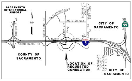 In May 2018, the CTC accepted the environmental document and approved for future consideration
of funding the Metro Air Parkway/I-5 Interchange Project (~ SAC 31.452).
The Project will construct a new road connection to the I-5 Freeway by
extending the Metro Air Parkway, constructing an interchange with a loop
on-ramp in the southwest quadrant, building a three lane overcrossing to
accommodate future freeway design concepts, relocating South Bayou Way and
North Bayou Way, realigning drainage ditches, and repositioning overhead
utilities. The Project is estimated to cost $20,000,000 and is fully
funded through construction with private funds secured by the Metro Air
Park property owners. Construction is estimated to begin in Fiscal Year
2018-19.
In May 2018, the CTC accepted the environmental document and approved for future consideration
of funding the Metro Air Parkway/I-5 Interchange Project (~ SAC 31.452).
The Project will construct a new road connection to the I-5 Freeway by
extending the Metro Air Parkway, constructing an interchange with a loop
on-ramp in the southwest quadrant, building a three lane overcrossing to
accommodate future freeway design concepts, relocating South Bayou Way and
North Bayou Way, realigning drainage ditches, and repositioning overhead
utilities. The Project is estimated to cost $20,000,000 and is fully
funded through construction with private funds secured by the Metro Air
Park property owners. Construction is estimated to begin in Fiscal Year
2018-19.
(Source: CTC Minutes, May 2018 Agenda Item 2.2c(10))
In June 2018, the CTC approved a new public road
connection: 03-Sac-5-PM 31.4, New Public Road Connection to I-5 at Metro
Air Parkway Interchange in the county of Sacramento. The County of
Sacramento (County) proposes to construct a new public road connection to
I-5 by means of a new interchange located at PM 31.4. The Metro Air
Parkway/I-5 interchange will provide primary entrance and egress to the
Metro Air Park Special Planning Area (SPA), an industrial business park.
The proposed interchange is the most cost effective solution for providing
adequate access to the SPA while maintaining acceptable level of service
on I-5 and adjacent interchanges within the project limits. Within the
project limits, I-5 is a four-lane freeway that runs east and west, with a
70-84 foot median and continuous thrie-beam barrier. The County developed
the plans for the interchange in response to the aforementioned SPA. In
July of 1999, the Department approved the Project Study Report and the
Project Report (PR) on December 20, 2010. Soon after, the project was put
on hold due to a lack of project construction funding. On April 11, 2018,
the Department approved a Supplemental PR that documented updates to the
traffic analysis and geometric approval drawings and confirmed the
findings in previously completed technical studies. The proposed
interchange will be constructed in two phases. Phase One (Interim) of the
project will construct portion of a Type L-7 overcrossing interchange with
single-lane northbound diagonal on and off-ramp, a single-lane southbound
diagonal off-ramp and a single-lane southbound loop on-ramp. Phase One
construction is expected to be complete by 2020. Based on traffic studies,
it is anticipated that Phase Two (Ultimate) construction of the
interchange will be needed after year 2030. Ultimate improvements will add
a single-lane northbound loop on-ramp and a single-lane southbound
diagonal on-ramp, widen the overcrossing and modify the ramp terminal
intersections. In addition, continuous auxiliary lanes will be constructed
on I-5 in the northbound and southbound directions between Route 99 and
Metro Air Parkway. Traffic congestion thresholds as annotated in the
cooperative agreement executed on April 23, 2018 will initiate the
Ultimate phase of construction. Phase One is fully funded through
construction with private developer fees collected and administered by the
County. The construction cost estimate of Phase One is $18.6 million. The
Federal Highway Administration granted final approval for the break in
access to the interstate on August 23, 2011.
(Source: CTC Agenda, June 2018 Agenda Item 2.3b(1))
In June 2020, the CTC approved an allocation of
$1,940,000 for the locally-administered Proposition 1B (Prop 1B) Trade
Corridor Improvement Fund (TCIF) Metro Air Parkway Northbound Auxiliary
Lane (PPNO 8575) project: 03-Sac-5 30.2/31.2 PPNO 03-8575 ProjID
0320000096 EA 1J130 Metro Air Parkway Northbound Auxiliary Lane.
In Sacramento on I-5 from the Route 99 interchange to Metro Air Parkway
interchange. Construct northbound auxiliary lane. The programmed TCIF
funds are to be split: $0 for construction engineering and $1,940,000 for
construction capital. Future consideration of funding approved under
Resolution E-18-54; May 2018. ALLOCATION IS CONTINGENT UPON APPROVAL OF A
BUDGET REVISION BY THE DEPARTMENT FINANCE AND ON THE PASSAGE OF THE 2020
BUDGET ACT
(Source: June 2020 CTC Agenda, Agenda Item
2.5g.(5a))
In August 2011, the CTC approved $13,734,000 in SHOPP funding for repairs near Sacramento, from Sacramento River Bridge (~ 005 YOL 0.01) to 0.2 mile north of Adams Creek Bridge (~005 YOL R13.80), that will rehabilitate 49.0 lane miles of roadway to improve the ride quality, prevent further deterioration of the traveling surface, minimize costly roadway repairs and extend the pavement service life.
In August 2011, the CTC approved $277,000 in SHOPP funding, programmed in Fiscal Years 2012-13 and 2013-14, for repairs in Nevada, Sacramento and Yolo Counties on Route 5, Route 20 and US 50 at various locations that will upgrade crash cushions and guardrail to meet the current National Cooperative Highway Research Program (NCHRP) 350 standards and improve safety.
North of Sacramento — Colusa, Glenn, Tehama, Shasta, Siskiyou Counties
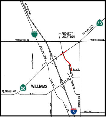 In October 2014, the CTC approved a future road
connection to I-5 as part of a project related to Route 20. The project is
located approximately 2,000 feet east of the I-5/Route 20 interchange in
the City of Williams (~ 005 COL R18.692) in Colusa County. The project
will create a new public road connection between the I-5 northbound
off-ramp and Husted Road, construct improvements on Route 20 for turning
movements, extend Margurite Street 3,200 feet from Ella Street to Route 20, and install a concrete culvert and drainage for the new segment of
Margurite Street. As a result of this project the designation of Route 20
between I-5 and Husted Road will change from “freeway” to
“controlled access expressway”. Impacts that require
mitigation measures to be reduced to a less than significant level relate
to Transportation & Traffic, Cultural Resources, Paleontology, Air
Quality, Noise, Biological Resources and Climate Change. Mitigation
measures include, but are not limited to: preparation and implementation
of a traffic management plan, monitoring efforts for archaeological and
paleontological artifacts during construction including measures to
address the inadvertent discovery of cultural or paleontological
resources, development and implementation of a lead compliance plan,
measures to reduce noise, dust and emissions from construction equipment
and operations, implementation of erosion control and stormwater pollution
prevention measures, preconstruction surveys and establishment of buffer
zones and other avoidance and compensatory measures to minimize impacts to
nesting birds, the Swainson’s Hawk, the Burrowing Owl, and the Giant
Garter Snake, and measures to minimize the spread of invasive plant
species. The project is estimated to cost $6,860,000 and is fully funded
through construction with STIP ($3,500,000) and Local ($3,360,000) funds.
Construction is estimated to begin in fiscal year 2014/15.
In October 2014, the CTC approved a future road
connection to I-5 as part of a project related to Route 20. The project is
located approximately 2,000 feet east of the I-5/Route 20 interchange in
the City of Williams (~ 005 COL R18.692) in Colusa County. The project
will create a new public road connection between the I-5 northbound
off-ramp and Husted Road, construct improvements on Route 20 for turning
movements, extend Margurite Street 3,200 feet from Ella Street to Route 20, and install a concrete culvert and drainage for the new segment of
Margurite Street. As a result of this project the designation of Route 20
between I-5 and Husted Road will change from “freeway” to
“controlled access expressway”. Impacts that require
mitigation measures to be reduced to a less than significant level relate
to Transportation & Traffic, Cultural Resources, Paleontology, Air
Quality, Noise, Biological Resources and Climate Change. Mitigation
measures include, but are not limited to: preparation and implementation
of a traffic management plan, monitoring efforts for archaeological and
paleontological artifacts during construction including measures to
address the inadvertent discovery of cultural or paleontological
resources, development and implementation of a lead compliance plan,
measures to reduce noise, dust and emissions from construction equipment
and operations, implementation of erosion control and stormwater pollution
prevention measures, preconstruction surveys and establishment of buffer
zones and other avoidance and compensatory measures to minimize impacts to
nesting birds, the Swainson’s Hawk, the Burrowing Owl, and the Giant
Garter Snake, and measures to minimize the spread of invasive plant
species. The project is estimated to cost $6,860,000 and is fully funded
through construction with STIP ($3,500,000) and Local ($3,360,000) funds.
Construction is estimated to begin in fiscal year 2014/15.
In February 2022, it was reported that Orland will be receiving funds as
part of Governor Gavin Newsom’s $1.1 billion Clean California
initiative. Specifically, money from Caltrans will help fund the Orland
Interchange Beautification Project (~ 03-Gle-5 R25.439) . This $2.7
million project, which is set to begin construction in July and be
completed by December, will improve and upgrade the I-5 and Route 32
interchange. Enhancements will include sculpture artwork, slope paving,
and the installation of inert landscape materials.
(Source: Glenn County Transcript, 2/16/2022)
In 2007, the CTC did not recommend funding requests for improvements to the South Avenue interchange in Tehama County (~ 005 TEH R7.487).
Los Molinos Phase III Project / 99W & Gyle Road (County Sign Route A11/Fmr. US 99W ∥ 02-TEH-05 R13.974/R24.919)
In May 2017, the CTC authorized deletion of the Los Molinos Phase III project (PPNO 2528) from the STIP. Additionally, TCTC also proposes to amend the 99W & Gyle Road (~ 005 TEH R13.969) to South Main Street & I-5 Overcrossing project (PPNO 2569) in Tehama County to delay Design (PS&E) and construction by one Fiscal Year (FY) and increase the project funding. The Los Molinos Phase III project is programmed in the 2016 STIP for improvements along State Route 99 including paved shoulders and pedestrian improvements. The project is the last phase of a series of improvements in Los Molinos and was delayed until FY 20-21 due to funding constraints realized in the 2016 STIP cycle. The project was going to be delivered in conjunction with a project with a similar scope programmed in the 2016 State Highway Operations and Protection Program (SHOPP) which will update this location to current American’s with Disabilities Act (ADA) requirements. The SHOPP project scope includes curb ramps, sidewalk gap closures, drainage, paving and lighting. However, due to ADA mandates, the SHOPP project cannot be delayed but is able to incorporate the scope in the Los Molinos Phase III Project. The 99W & Gyle Road to South Main Street & I-5 Overcrossing project is programmed in the 2016 STIP with the Environmental (PA&ED) phase programmed in FY 17-18 and PS&E in FY 18-19. Also as part of the 2016 STIP, construction was reduced by $2,595,000 and delayed from FY 18-19 to FY 19-20. This road is the adopted I-5 alternate detour route which is used by oversized permitted vehicles and is critical for local manufacturing, lumber and agriculture industries. The project scope includes resurfacing and reconfiguring the roadway as well as work at the signalized intersection of South Main Street and I-5. In lieu of upgrading the signalized intersection, a roundabout is now being considered at that location which has added work to the environmental analysis and project cost. [Note: Although the street is named "State Highway 99W", it does not appear to have postmile mileage, and so may be former state highway. Note that Gyle Road is County Sign Route A11.]
Additionally, in June 2017, the CTC amended the SHOPP to delete the Los Molinos Phase II project and to amend in the changes above.
In May 2021, the CTC received notice that Tehama County
proposes to delay construction (CON) for the 99W and Gyle Road to South
Main Street and I-5 Overcrossing project (PPNO 2569) in Tehama County. The
99W and Gyle Road to South Main Street and I-5 Overcrossing project (PPNO
2569) is currently programmed in STIP for Plans, Specifications and
Estimate (PS&E), and CON phases. The scope of work consists of
resurfacing and reconfiguring pavement delineation/reflective markers, and
various improvements on 99W (formerly old Route 99W) from Gyle Road to
South Main Street and various intersection improvements at I-5
interchange. The STIP entry shows the scope as “In Tehama from Gyle
Road intersection of 99W (formerly old Route 99) and extends north to Red
Bluff ending at I-5 overcrossing.” Complications associated with the
COVID-19 pandemic have caused delays to project delivery. Tehama County
has been forced to focus its limited staff on COVID-19 mitigation efforts,
rather than focusing on projects that are still in early phases. At this
point, it has become apparent that it is not feasible for the project to
continue according to its current schedule. Delaying CON will align the
construction with the current PS&E schedule which was also impacted by
COVID-19 in early 2020. Those delays were also the reasons for previously
approved PS&E allocation extension. Therefore, Tehama County is
proposing to delay CON from 2021-22 to 2022-23. This STIP amendment was
approved in June 2021.
(Source: May 2021 CTC Agenda, Agenda Item
2.1b.(10); June 2021 CTC Agenda, Agenda Item 2.1a.(12))
There are plans to add a truck climbing lane near Red Bluff (appears to be near Wilcox Road, ~ 005 TEH 31.014). This was discussed during the March 2005 CTC Meeting, Agenda Item 2.2c.(1). This project is fully funded in the 2004 State Highway Operation and Protection Program (SHOPP), and had a negative environmental declaration.
In January 2012, the CTC approved 2.9 million to extend on-ramps and reduce the number and severity of collisions at the Bowman Road overcrossing on I-5 (~ 005 TEH 41.511) just south of Cottonwood.
In August 2008, the CTC approved relinquishment of right of way along I-5 in the county of Tehama near Red Bluff at Adobe Road (~ 005 TEH R27.442), consisting of a relocated and reconstructed county road.
In August 2011, the CTC approved $41,999,000 in SHOPP funding for repairs in Tehama and Shasta Counties, in and near Red Bluff, from south of Adobe Road (~ 005 TEH R27.442) to the Gas Point Road Overcrossing (~ 005 SHA 0.907) that will rehabilitate 40.9 lane miles of roadway to improve the ride quality, prevent further deterioration of the road surface, minimize the costly roadway repairs and extend the pavement service life.
Cottonwood Hills Truck Climbing Lanes (005 SHA R1.2/R4.2)
In 2007, the CTC considered a number of requests for funding from the Corridor Mobility Improvement Account (CMIA). one request was funded: Cottonwood Hills Truck Climbing Lanes ($22.902M) (005 SHA R1.2/R4.2).
In August 2011, it was reported that Caltrans recently
wrapped up a $16.479 million dollar project that saw a third lane open
over Cottonwood Hill. A new lane was installed in the north and southbound
directions on I-5 from Gas Point Road (~ 005 SHA 0.907) to Deschutes Road
(~ 005 SHA R4.292). Construction on the project started in June of 2011,
and while rain delayed the completion, it was still finished on schedule.
Tullis Construction was the main contractor, but the entire project was a
group effort between Caltrans, Shasta Regional Transportation Planning
Agency, Shasta County and Tullis Construction. A portion of the
project—$13.7 million—was funded by California’s
Proposition 1B.
(Source: Anderson Valley Post)
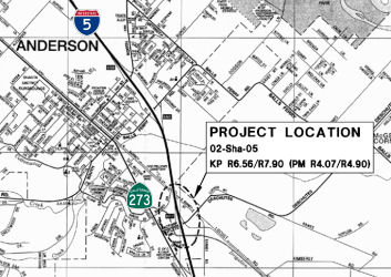 In April 2012, the CTC approved
$6 million for the City of Anderson to fund for construction of the
Deschutes Road/Factory Outlets Drive roundabout east of I-5 (~ 005 SHA
R4.292). The allocation will allow Anderson and California Department of
Transportation officials to move forward with construction likely to start
in August 2012. Construction should be completed and the roundabout
operating by late-summer 2013. Construction plans include a new northbound
off-ramp from I-5 to Deschutes Road and a modern roundabout intersection
that will connect three roads and a freeway on-ramp to the off-ramp, all
without need of a signal light. Also included is a new retaining wall, a
pathway for pedestrians and bicycles as well as lighting and landscaping
at the roundabout intersection.
In April 2012, the CTC approved
$6 million for the City of Anderson to fund for construction of the
Deschutes Road/Factory Outlets Drive roundabout east of I-5 (~ 005 SHA
R4.292). The allocation will allow Anderson and California Department of
Transportation officials to move forward with construction likely to start
in August 2012. Construction should be completed and the roundabout
operating by late-summer 2013. Construction plans include a new northbound
off-ramp from I-5 to Deschutes Road and a modern roundabout intersection
that will connect three roads and a freeway on-ramp to the off-ramp, all
without need of a signal light. Also included is a new retaining wall, a
pathway for pedestrians and bicycles as well as lighting and landscaping
at the roundabout intersection.
In his 2006 Strategic Growth Plan, Governor Schwartzenegger proposed constructing an additional freeway lane in both directions in Shasta County.
Redding Anderson Six Lane (RASL) Project (02-Sha-5, PM R3.8/R11.7)
In April 2012, Caltrans was holding open houses regarding plans to widen I-5 to six lanes between Anderson and south Redding. The estimated $60 million project will connect with the six freeway lanes currently scheduled for completion by August or September 2012 in Redding and with the existing six lanes south of Deschutes Road in Anderson that were completed in September 2011.
In December 2016, the CTC approved for future consideration of funding a project in Shasta County that will add new lanes on I-5 from the city of Anderson to just south of the city of Redding. The project is programmed in the 2016 State Transportation Improvement Program. The project is not fully funded. The total estimated cost is $65,886,000 for capital and support. Depending on the availability of funding, construction is estimated to begin in Fiscal Year 2020-21. The scope, as described for the preferred alternative, is consistent with the project scope programmed by the Commission in the 2016 State Transportation Improvement Program.
The 2018 STIP, approved at the CTC March 2018 meeting, appears to extend and adjust this project into the 2017 STIP, which shows: PPNO 3445A Redding to Anderson-Six Lane-Phase 1 "Little Easy" being adjusted from $12.796M to $14.396M, with construction moved to FY18-19.
The 2018 STIP, approved at the CTC March 2018 meeting, appears to allocate $1.6M in Advance Project Development Element (APDE) funding for PPNO 3597 North Redding, 6-Lane (APDE). This appears to be the Interstate 5 Union Pacific Redding to Anderson Six-Lane Project. . The project’s major components are as follows:
Additional elements include intelligent transportation
systems (ITS), electrical infrastructure, safety enhancements, and
signage.The total rural project cost is $108,215,000. A state and local
share of $80,608,000 (74%) has been assembled in partnership with the
State of California, Shasta Regional Transportation Agency (SRTA/MPO),
City of Anderson, and Shasta County. The TIGER request is for $25,000,000,
or 23% of the project cost. The project runs from SHA R3.8 in the City of
Anderson to SHA R7.0 south of the City of Redding.
(Source: Project TIGER Request, October 2017)
In May 2018, it was reported that the California
Transportation Commission has approved spending $65.7 million to expand
I-5 from four to six lanes from Redding to Anderson. The project would add
one additional northbound and southbound lane to the freeway, replace a
bridge over Union Pacific railroad tracks in Anderson, upgrade lighting,
rehabilitate pavement on exits and add new median barriers and other
improvements. Widening the freeway would tie into sections of I-5 that are
already three lanes in both directions in Redding and Anderson. The $65.7
million is the last piece of funding needed for construction of the $120
million project, said Eric Orr, Caltrans project manager. A large portion
of the money, about $92 million, for the project comes from a 12-cent
increase in taxes on gasoline and a 20-cent diesel tax increase. Both went
into effect this year. If the gas tax is repealed, the I-5 widening
project would still proceed because the money has already been programmed.
However, without proceeds collected from the increased fuels tax, the work
widening I-5 would have been delayed for many more years. The project is
expected to take about three years to complete, with four lanes remaining
open during the day. There will likely be some lane closures at night.
(Source: Record Searchlight, 5/17/2018)
In October 2018, the CTC approved a request for an
additional $6,182,000 in Trade Corridor Enhancement Program (TCEP) and
$5,593,000 in State Transportation Improvement Program (STIP) funding for
the multi-funded TCEP/STIP project (PPNO 3445A) on I-5 in Shasta County,
to award the construction contract. The project has State Highway
Operation Protection Program (SHOPP) and Non-SHOPP funds, consisting of
STIP-RIP, TCEP (Regional), TCEP (State) and Local funds. This supplemental
fund request is for TCEP State funds and STIP-RIP funds to cover the
Non-SHOPP portion of the cost increase. This project is located on I-5 in
Shasta County between the I-5/Route 273 Separation, and 0.4 mile south of
the Chum Creek Road Overcrossing, in and near the city of Anderson. The
project will improve roadway safety and increase capacity by widening the
roadway and structures from 4 lanes to 6 lanes, by replacing/widening the
following: The South Anderson Overhead, the Anderson Creek bridges,
Deschutes Road, Balls Ferry, the North Street Undercrossing and the Tormey
Drain bridges. The project will also make pavement and drainage
improvements, upgrade overhead signs, add ITS elements, ramp
modifications, and construct retaining walls and concrete barriers. The
contract award status is pending approval of this request for supplemental
funds by the Commission. If the Commission approves this request,
construction would begin in November 2018, and would take 532 working days
for completion in October 2021. The increase was due to limited suppliers,
and limited supplies, increased complexity, and increased material costs.
(Source: October 2018 CTC Agenda Item 2.5e.(5))
In January 2019, it was reported that Caltrans District
2 announced the start of construction of the Redding to Anderson Six Lane
Project on I-5 in Shasta County. The project will add an additional
northbound lane and southbound lane on I-5 for 7.5 miles from the Route 273 and I-5 separation just south of the outlet mall in Anderson to just
south of the Bonnyview and Churn Creek Road interchange near Redding,
making it a continuous six-lane facility. Preliminary construction began
in late 2018 and will continue throughout the winter. Tree cutting,
burning and disposal, structure preparation and related work is taking
place in the median and along Caltrans’ right of way. Other
improvements include rehabilitating the exiting pavement, new median
barrier, guard railing, overhead signs and upgraded lighting. Safety
improvements include longer acceleration lanes for slower moving trucks.
The project includes the widening of eight structures as well as
replacement of the Anderson Creek Bridge and the South Anderson Railroad
Overhead. Moving into spring and summer of 2019, the public can expect
lane closures on I-5 during the evening, if needed. Traffic will be
shifted onto new I-5 alignments while bridges are staged for construction.
The I-5 onramps and offramps may be closed for up to five days and local
detours for freeway access will be clearly marked.
(Source: Redding Daily News, 1/30/2019)
In March 2019, it was announced that the Redding to
Anderson Six-Lane (RASL) Project will have a formal groundbreaking on
4/4/2019. The “RASL” Project is slated to be completed in
three years. The project is a partnership with Shasta Regional
Transportation Agency (SRTA), City of Anderson, and Shasta County.
Construction will be carried on by contractor J.F. Shea Construction and a
group of subcontractors. Preliminary construction began in late 2018 and
it will continue throughout this winter. Tree cutting, burning and
disposal, structure preparation and related work is taking place in the
median and along Caltrans’ right of way. Currently, no traffic
delays or other traffic impacts are anticipated due to this work, but we
remind the public to be a partner in safety and slow down. The Redding to
Anderson Six-Lane Project will add an additional northbound and southbound
lane on I-5 for 7.5 miles from the Route 273/I-5 separation (in Anderson)
to just south of the Bonnyview/Churn Creek Road interchange near Redding,
making it a continuous 6 lane facility. Other improvements include
rehabilitating the existing pavement, new median barrier, guard railing,
overhead signs, and upgraded lighting. Safety improvements include longer
acceleration lanes for slower moving trucks. The project also includes the
widening of 8 structures as well as replacement of the Anderson Creek
Bridge and the South Anderson Railroad Overhead. I-5 traffic will be
managed with additional Intelligent Transportation Systems.
(Source: District 2 FB Post, 3/4/2019)
The 2020 STIP, approved at the March 2020 CTC meeting,
adjusted the programming for this project as follows:
(Source: March 2020 CTC Agenda, Item 4.7, 2020 STIP
Adopted 3/25/2020)
| PPNO | Project | Prior | 20-21 | 21-22 | 22-23 | 23-24 | 24-25 |
| 3445A | Redding-Anderson, 6-Ln(Ph1) (SHOPP)(TCEP)(supplemental) | 5,593K | 0 | 0 | 0 | 0 | 0 |
In 2007, the CTC did not recommend funding requests to expand the route to 6 lanes from Bechelli (~ 005 SHA R11.929) to Churn Creek S of Redding (~ 005 SHA R12.158) or construct a I-5/Route 44 direct connector (~ 005 SHA R15.329), and widening the route to 6 lanes from Bonnyview (~ 005 SHA R12.144) to Riverside (~ 005 SHA R6.734) in North Anderson.
Redding Widening (~ SHA R10.55/R17.543)
In May 2011, the CTC amended the baseline agreement for a project that will widen I-5 by adding an additional lane in the northbound (NB) and southbound (SB) directions from 0.3 mile south of Smith Road (~ SHA R10.55) to 0.2 mile north of the Route 5/Route 299 Separation (~ SHA R17.543)
In July 2011, Caltrans removed safety cable barriers
installed along the I-5 median through Redding. The cables were installed
in 2009 to prevent vehicles from crossing the median into oncoming lanes
during traffic incidents. They were removed as part of a project to widen
the freeway through Redding. When the $2.2 million cable barrier was
installed Caltrans had plans to widen the freeway but had no definite
timeline when it would receive funding. The Shasta Regional Transportation
Planning Agency regularly applied for the needed funds, but didn't expend
the award (which occurred in 2011). I-5 is being widened to three lanes in
both directions from the Smith Road overcrossing south of Redding (~ SHA
R10.85), to north of the Hilltop Drive overcrossing (~ SHA R16.139). The
money to widen the highway comes from 2006's Proposition 1B, which was
approved by voters statewide and allows the state to sell up to $20
billion in bonds to pay for transportation and transit projects. When the
widening project is complete, the cables will be reinstalled, for
$443,000. Except for a section of highway between Cypress Avenue and the
Route 44 interchange, where there will be a concrete barrier, after the
widening is done there will be cable barriers from Gas Point Road to just
north of the Route 44 interchange.
(Source: Redding Searchlight, 7/7/11)
In November 2011, it was reported that a $5.9 million project to add two lanes to southbound I-5 at the Route 44 interchange was completed ahead of schedule, thanks in part to a financial incentive from the California Department of Transportation. Caltrans had offered the contractor $64,500 for early completion. Work on the bridge over Route 44 should wrap up in summer 2012.
In May 2021, the CTC allocated the indicated funding for the following
minor SHOPP project: $1,250,000 Shasta 02-Sha-5 11.5/12.8. I-5 In Shasta
County, in and near Redding from 0.6 mile north of Smith Road Overcrossing
to 0.1 mile south of Loma Vista Drive. Outcome/Output: Extend
auxiliary lane. EA 2H800 ProjID 0217000010. (Financial Contribution Only
(FCO) to the city of Redding.) (This is a substitute project for EA
02-0J380.)
(Source: May 2020 CTC Agenda, Agenda Item 2.5a #2)
In January 2013, the CTC approved a $3.7 million bridge rehabilitation
project that includes 19 spans in Shasta and Siskiyou counties. These
bridges are Flume Creek Road, Creekside, Conant Road, Castella Sidehill
Viaduct, Castella, Soda Creek Road, South Dunsmuir, Willow Street,
Dunsmuir Avenue, South Mt. Shasta, Moonlit Oaks Avenue, Oberlin Road,
Yreka Creek, Miner Street, Miner Street, North Yreka Separation, and
Henley Way. The bridges will be rehabilitated by replacing their damaged
decks. The decks will be sealed with methacrylate, a viscous material that
acts as a bonding agent that keeps the water out to better protect the
steel structure. Workers also will place polyester concrete overlays and
repair joint seals on the bridges. Work is expected to start in summer
2013 and be complete before fall 2013.
(Source: Redding Record Searchlight, 1/10/13)
Fix 5 Cascade Gateway (02-Sha-5, PM R14.8/R20.0)
The 2020 STIP, approved at the March 2020 CTC meeting,
adjusted the programming for this project as follows:
(Source: March 2020 CTC Agenda, Item 4.7, 2020 STIP
Adopted 3/25/2020)
| PPNO | Project | Prior | 20-21 | 21-22 | 22-23 | 23-24 | 24-25 |
| 3597 | North Redding, 6-Lane (APDE) | 1,600K | 0 | 0 | 0 | 0 | 0 |
| 3597 | North Redding, 6-Lane (APDE) | -1,600K | 4,800K | 0 | 0 | 0 | 0 |
| 3597 | Fix 5 Cascade Gateway | 1,600K | 0 | 0 | 2,908K | 0 | 0 |
 In October 2022, the CTC approved for future consideration of funding the
following project for which a Mitigated Negative Declaration (MND) has
been completed: Fix 5 Cascade Gateway Project. I-5 in Shasta
County (02-Sha-5, PM R14.8/R20.0). Widen I-5 from four to six lanes, from
0.3 mile north of the Cypress Avenue Overcrossing, to 0.6 mile north of
the Oasis Road Undercrossing, in the City of Redding, in Shasta County.
(PPNO 3597) The project is located on I-5 between postmile R14.8 and
R20.0, in Shasta County. The Department proposes to widen I-5 from four to
six lanes in the City of Redding from 0.3 mile north of the Cypress Avenue
Overcrossing to 0.6 mile north of the Oasis Road Undercrossing. This
project is currently programmed in the 2022 State Transportation
Improvement Program (STIP) for a project total of $64,990,000, which
includes Right of Way (capital and support) and Construction (capital).
Construction is estimated to begin in 2026-27. The scope, as described for
the preferred alternative, is consistent with the project scope as
programmed by the Commission in the 2022 STIP.
In October 2022, the CTC approved for future consideration of funding the
following project for which a Mitigated Negative Declaration (MND) has
been completed: Fix 5 Cascade Gateway Project. I-5 in Shasta
County (02-Sha-5, PM R14.8/R20.0). Widen I-5 from four to six lanes, from
0.3 mile north of the Cypress Avenue Overcrossing, to 0.6 mile north of
the Oasis Road Undercrossing, in the City of Redding, in Shasta County.
(PPNO 3597) The project is located on I-5 between postmile R14.8 and
R20.0, in Shasta County. The Department proposes to widen I-5 from four to
six lanes in the City of Redding from 0.3 mile north of the Cypress Avenue
Overcrossing to 0.6 mile north of the Oasis Road Undercrossing. This
project is currently programmed in the 2022 State Transportation
Improvement Program (STIP) for a project total of $64,990,000, which
includes Right of Way (capital and support) and Construction (capital).
Construction is estimated to begin in 2026-27. The scope, as described for
the preferred alternative, is consistent with the project scope as
programmed by the Commission in the 2022 STIP.
(Source: October 2022 CTC Agenda, Agenda Item
2.2c.(1))
In October 2022, the CTC approved the following
allocation from the Budget Act of 2020, Budget Act Item 2660-301-3291
funds for the following locally-administered SB 1 LPP (Formulaic) project:
$1,873,000. 02-Sha-5 R14.8/R20. PPNO 02-3597; ProjID 0215000083; EA 0H920.
Fix 5 Cascade Gateway / I-5 Improvements Shasta. I-5 in Shasta
County in Redding from 0.3 mile north of Cypress Avenue Undercrossing to
0.6 mile north of Oasis Road Overcrossing. Provide standard vertical
clearance over I-5 at the Northbound Route 273/Northbound I-5 connector
ramp. Provide improved vertical clearance under four structures at I-5 at
Twin View Boulevard and Route 299 crossings. Add a third mixed-flow
through lane. Install high tension cable barrier and concrete barrier in
the median as determined by the median width. Construct four auxiliary
lanes. Widen seven bridges. Upgrade bridge rails on both sides. Place
overhead signs, guide signs and warning signs as recommended by Traffic
Operations. Remove and replace existing guardrail and end treatments.
Allocation: PS&E $1,071,000; RW $111,000; RW Sup $27,000. Concurrent
future consideration of funding under Resolution E-22-75; October 2022.
(Source: October 2022 CTC Agenda, Agenda Item
2.5s.(6))
In July 2023, it was reported that the CTC allocated
$70 million to fund the Fix 5 Cascade Gateway in Redding and Shasta
County, which will restore and improve a large section of I-5 to allow
more room to merge at the on- and off-ramps while helping reduce merging
conflicts at multiple state routes that intersect in this area.
(Source: Construction Equipment Guide, 7/24/2023)
In January 2024, the CTC approved for future
consideration of funding the following project: 02-Sha-5, PM R13.9/R23.2,
02-Teh-5, PM 40.7. Fix 5 Cascade Gateway Project/Cascade SHOPP
Project. Construction of a truck only lane on I-5, installation of
an electric charging station for heavy duty vehicles, pave and improve
facility elements within the project limits, in Shasta and Tehama
Counties. (Subsequent MND) (PPNO 3597 and PPNO 3790) (STIP) (SHOPP). The
project is located on I-5 from postmile (PM) R13.9 to R23.2, in Shasta
County, and at PM 40.7, in Tehama County. The project will install a
truck-only lane in the northbound and southbound directions of travel,
construct and extend auxiliary lanes between interchanges, widen bridges
with rail upgrades, install median barrier, install signage, upgrade
drainage facilities, install and upgrade traffic management system
elements, paving, and install a vehicle charging facility. The project is
currently programmed in the 2022 State Transportation Improvement Program
(STIP). The total programmed amount which includes Right of Way (Support
and Capital), and Construction (Support and Capital) is $82,311,000 from
STIP, Regional Improvement Program, Trade Corridor Enhancement Program,
Corona Response and Relief Supplemental Appropriations Act, and State
Highway Operation and Protection Program. Construction is estimated to
begin in Fiscal Year 2024-25. The scope, as described for the preferred
alternative, is consistent with the project scope as programmed by the
Commission in the 2022 STIP. A copy of the MND has been provided to
Commission staff. The project will result in less than significant impacts
to the environment after mitigation. The following resource areas may be
impacted by the project: biological resources. Avoidance, minimization,
and mitigation measures will reduce any potential effects on the
environment. These measures include, but are not limited to, on-site
restoration for impacts to sensitive habitat, and coordination with
permitting agencies to determine appropriate measures to minimize the
potential for impacts to wildlife connectivity. As a result, a MND was
completed for this project. The Commission approved the project for future
consideration of funding on October 13, 2022, under Resolution E-22-75.
Since the approval of the MND, there have been changes to the project and
a Subsequent MND was prepared pursuant to CEQA. These changes include
constructing a truck-only lane instead of the originally proposed
multi-use lane, construction of a new medium and heavy-duty electric
vehicle charging facility, minor changes to the postmiles, and the
addition of the Cascade SHOPP project. As a result, a Subsequent MND was
completed pursuant to CEQA.
(Source: January 2024 CTC Agenda, Agenda Item 2.2c.(2))
In May 2011, Caltrans closed a culvert under I-5 near Mountain Gate that locals had used to cross the freeway (somewhere near 005 SHA R24.528). Caltrans requires workers accessing the culvert to first test the air quality inside the culvert for the presence of toxic gases and an appropriate oxygen level — between 19.5 and 23.5 percent. Then, it mandates laborers pair up, with one person inside working while another watches, to rescue the other if he passes out. Workers regularly encounter rattlesnakes, posing serious danger to a single person in the culvert. Given this, Caltrans could not have the culvert open to the public; Caltrans is facing a lawsuit from the family of a man who died after crawling through a culvert in Mariposa County in 2010 to reach a famous scenic view. Those wishing to cross the freeway must now use a traditional overpass with a 40 mph speed limit and about four feet of room to walk.
Pit River Bridge № 06-0021 (02-Sha-005 R028.14)
In June 2022, it was reported that California highway
officials are making plans to either repair or replace the Pit River
Bridge over Lake Shasta. The 81-year-old bridge, which carries an average
19,400 vehicles a day, is a major freight hauling route not only for
trucking on I-5, but also for rail transportation. The federal government
no longer wants to own the bridge, which was built during the construction
of Shasta Dam during the late 1930s and early 40s and is still owned by
the U.S. Bureau of Reclamation. The bureau wants to divest itself from the
bridge by 2040, and so Caltrans needs a new highway bridge built by then.
Construction to either upgrade the current bridge or build a new bridge
across Lake Shasta near the current Pit River Bridge — likely won't
begin until at least 2035. Plans and studies are already being drawn up on
what to do with the current bridge. Caltrans' first choice would be to
upgrade the current bridge, to widen it and straighten out the sharp
curves at the north and south ends of the 3,600-foot span. However, that
may not work because Lake Shasta is so deep where the current span crosses
the lake. The current span also is narrow, compared to other bridges over
the lake, such as the Antlers Bridge, making it difficult to keep lanes of
the bridge open while the existing bridge is widened. The original bridge
was built before Lake Shasta filled with water. When the lake is full,
more than 350 feet of the bridge footings are under water. There are few,
if any, bridge piers anywhere in the world that are as deep under water as
the Pit River Bridge. To widen the current bridge could require
reinforcing the current bridge piers — which would be risky business
under 350 feet of water. To work under water that deep would also drive up
the cost. The latest designs for a structure to replace the bridge show
bridge footings set closer to the shores, which avoids the problem of
sinking piers hundreds of feet below the water line. Caltrans has three
bridge designs it released to the public, with two of them suspension
bridges with towers that resemble those on the Golden Gate Bridge. A third
design features arches over the roadway, with suspension cables connected
to the bridge deck. The cost for designing, planning, environmental
studies and obtaining rights of way is estimated at about $200 million,
according to Caltrans. Construction would cost another $2 billion to $4
billion. But Caltrans considers the bridge important to the West Coast
economy. A 2014 Caltrans study determined the economy in California and
the rest of the Pacific Coast would suffer a loss of about $10 million a
day if the bridge was shut down. There are also railroad impacts, as a UP
line runs across the bridge. Union Pacific's railroad is one of the few
directly connecting California to Oregon and Washington. If the Pit River
Bridge was no longer usable, Union Pacific trains moving goods from the
Port of Oakland through Northern California to Oregon and Washington would
have to detour to Salt Lake City and then back to the West Coast. What
happens to the current bridge after 2040 is up to Union Pacific and the
Bureau of Reclamation; but the federal agency has indicated it does not
want to own or operate the bridge after 2040.
(Source: Redding Record Searchlight via MSN, 6/22/2022)
Antlers Bridge (005 SHA R039.98).
In June 2007, the CTC considered authorization for replacement of a bridge in Shasta County near Redding. This project is fully funded in the 2006 State Highway Operation and Protection Program (SHOPP). The total estimated project cost is $213,881,000. Construction is estimated to begin in FY 2009-10. The project will involve construction activities in the environmentally sensitive habitat of the bald eagle, a federally listed threatened species. In addition, visual concerns related to the construction of a larger bridge than currently exists resulted in a Mitigated Negative Declaration being completed for this project. This could be the Antlers Bridge. In May 2009, Caltrans advertised a project for replacement of the I-5 Sacramento River bridge at Antlers ($230 million)—the project also includes relocating the approaches to the bridge to ease sharp curves on I-5, and entails a massive road cut.
 In April 2016, it was reported that the Antlers Bridge
was nearing completion, and that it featured artwork that will only be
visible for a short time: twenty-five-foot largemouth colorful concrete
bass leaping at minnows is repeated four times on the new Antlers Bridge
under construction on Interstate 5 about 25 miles north of Redding.
There's a few of the art from the current Antlers Bridge spanning the
lake’s Sacramento Arm at Lakehead; however when traffic switches to
the new bridge, which is expected to happen in late summer or fall 2016,
the I-5 blur-by will no longer be a viewing option. The artwork is 150
feet above the lake bottom, or 65 feet from the surface of a full Shasta
Lake. After the old bridge, built in 1941, is demolished, the best places
to angle for a view will be from the shoreline or boat. The art reflects
Caltrans' philosophy of providing a sense of place and grace to designs,
of incorporating aesthetic elements into projects. Tutor-Saliba
Corporation is contractor for the $125 million bridge replacement. About 1
percent of a project’s budget can be for architectural/aesthetic
features. With the Antlers Bridge it’s about 0.2 percent—or
$250,000. Largemouth bass seemed a good choice for Antlers Bridge because
of their link to the lake. The idea began with senior bridge architect
Javier Chavez in the Caltrans Sacramento office (since retired), and
became a collaborative effort with others in the architecture unit and
district office. Turning fish on paper into something concrete was
complicated. The massive fish first were carved in foam, with plenty of
back and forth to get eye sockets and other details just right. The foam
sculptures then were used to make rubber molds for the concrete. Once the
fish in a relief were on the bridge, it was time to bring in the
colorists. Jim Currie of Currie’s Quality Painting in Redding and
Jerry Stuart of Jerry Stuart Painting Company practiced on a ground-level
mockup before stepping into the small basket of a hydraulic lift to color
the bridge fish. They used stain, which permeates the concrete and will
hold up better than paint to winter rains and searing summer sun in the
canyon. Currie and Stuart applied the stain mostly with sprayers. There
was much taping to be done to protect from overspray. Currie, a longtime
fisherman, wanted the colors to be realistic, not cartoonish. Hues were
meticulously blended and multiple coats applied. Each panel took a week or
so. Work days were eight to 10 hours. It was highly challenging – as
in being way off the ground. The painters also did the faux stonework on
the bridge abutments. They had to be sure their work didn’t get in
the way of the bridge builders.
In April 2016, it was reported that the Antlers Bridge
was nearing completion, and that it featured artwork that will only be
visible for a short time: twenty-five-foot largemouth colorful concrete
bass leaping at minnows is repeated four times on the new Antlers Bridge
under construction on Interstate 5 about 25 miles north of Redding.
There's a few of the art from the current Antlers Bridge spanning the
lake’s Sacramento Arm at Lakehead; however when traffic switches to
the new bridge, which is expected to happen in late summer or fall 2016,
the I-5 blur-by will no longer be a viewing option. The artwork is 150
feet above the lake bottom, or 65 feet from the surface of a full Shasta
Lake. After the old bridge, built in 1941, is demolished, the best places
to angle for a view will be from the shoreline or boat. The art reflects
Caltrans' philosophy of providing a sense of place and grace to designs,
of incorporating aesthetic elements into projects. Tutor-Saliba
Corporation is contractor for the $125 million bridge replacement. About 1
percent of a project’s budget can be for architectural/aesthetic
features. With the Antlers Bridge it’s about 0.2 percent—or
$250,000. Largemouth bass seemed a good choice for Antlers Bridge because
of their link to the lake. The idea began with senior bridge architect
Javier Chavez in the Caltrans Sacramento office (since retired), and
became a collaborative effort with others in the architecture unit and
district office. Turning fish on paper into something concrete was
complicated. The massive fish first were carved in foam, with plenty of
back and forth to get eye sockets and other details just right. The foam
sculptures then were used to make rubber molds for the concrete. Once the
fish in a relief were on the bridge, it was time to bring in the
colorists. Jim Currie of Currie’s Quality Painting in Redding and
Jerry Stuart of Jerry Stuart Painting Company practiced on a ground-level
mockup before stepping into the small basket of a hydraulic lift to color
the bridge fish. They used stain, which permeates the concrete and will
hold up better than paint to winter rains and searing summer sun in the
canyon. Currie and Stuart applied the stain mostly with sprayers. There
was much taping to be done to protect from overspray. Currie, a longtime
fisherman, wanted the colors to be realistic, not cartoonish. Hues were
meticulously blended and multiple coats applied. Each panel took a week or
so. Work days were eight to 10 hours. It was highly challenging – as
in being way off the ground. The painters also did the faux stonework on
the bridge abutments. They had to be sure their work didn’t get in
the way of the bridge builders.
(Source: Enjoy Magazine, 3/24/2016)
In May 2016, it was reported that some are upset about
the mural on the Antlers bridge. Their concern? Once the old bridge is
torn down, no one will be able to see the mural (so why spend the money).
Caltrans, on the other hand, is confident that thousands of people will
get to enjoy the murals because many boaters, swimmers, and water skiers
frequent the area. As for the cost, $250,000 of the budget went into the
aesthetics of the bridge including the rock detailing and the fish art.
That's less than half a percent of the total cost of the project. This
particular project took advantage of some toll credit so now it's being
reimbursed and 100 percent federal funding. The federal money was
allocated for the project in 2009 and has already been set aside to
complete the bridge. The complete project from construction to demolition
is expected to be completed by November or December 2016.
(Source: KRCR, May 2016)
The bridge received the 2014 Roads and Bridges Top 10
Bridges award. It cost $131,000,000, and was constructed on a new parallel
alignment just east of the existing bridge, spanning the Sacramento River
arm of Shasta Lake, California’s third largest lake and largest
reservoir. The bridges are twin cast-in-place segmental box girder
superstructures consisting of 5 spans, 1,942’ long and 104’
wide connected with diaphragms at the piers as well as a full length
closure pour, connecting the wings. The superstructure depth varies from
29’-6” deep to 12’ deep. The structure, designed for a
100-year life, consists of 13 million pounds of steel and more than 36,000
cubic yards of concrete. The bridge incorporates several aesthetic and
environmental details. The structure includes 16 bat houses under the pier
table diaphragms, along with two large-mouth bass motifs on the webs of
the pier tables. The project is located in a high seismic area and
incorporates complex earthquake-resistant design details. Additionally,
project challenges included seasonal water level fluctuations of
approximately 50’-70’ and difficult access – piers that
extend over 120’ above the water and 100’ to the bottom of the
lake.
(Source: Finley Engineering Group, undated)
In October 2023, the CTC approved the following
supplemental allocation: $300,000. 02-Sha-5 R39.0/R41.2. PPNO 02-3090;
ProjID 0200000288; EA 37890. I-5 Near Lakehead, at Sacramento River Bridge
№ 06-0089 (Antlers). Outcome/Output: Replace bridge. Supplemental
funds are needed to Close-out Contract. CEQA - MND, 1/19/2007;
Re-validation 5/23/2011 NEPA - EIS, 1/19/2007; Re-validation 5/23/2011
Future consideration of funding approved under Resolution E-07-07; June
2007. Total revised amount $41,530,000. The project realized cost
increases due to claims filed by the contractor that are in arbitration.
Arbitration is entering into the second phase, and is anticipated to be
finalized in six to nine months. The arbitration process has been
prolonged and required extensive expert testimony witnesses. Funding is
nearly exhausted and is only expected to last two to three more months at
current burn rates. The requested additional funds are anticipated to be
sufficient to complete the arbitration process and ensure expert testimony
can be prepared and finalized to support the State's case in arbitration
proceedings, minimizing exposure to contractor claims, and close out the
project.
(Source: October 2023 CTC Agenda, Agenda Item 2.5e.(6))
In October 2016, it was reported that a small stretch of roadway near
Exit 707 (Vollmers) (~ 005 SHA 45.66) has had at least 10 semi truck
crashes in the 2014-2016 — including four so far in October 2016 and
three in the same month of 2014. Virtually all of the crashes at the exit
alternately called "Vollmers," "Dog Creek" and "Delta" happened in the
rain, and eight of the 10 occurred in October. The wet weather is only one
common factor in the crashes. The spot has a curve that's known to the CHP
and truckers alike. "The way it curves and that situation of the road
(being wet) causes them just about 100 percent of the time to connect with
that guardrail," CHP Sgt. Matt Larsen said, referring to the crashes. But
the California Department of Transportation's District 2 office in Redding
says the road is fine — people just need to drive more carefully.
Others in the trucking industry say signs can be the reminder — or
first notice —a trucker needs to avoid catastrophe. Caltrans uses
skid tests to measure how well a road will hold up in such conditions, and
one conducted there at the beginning of the year had "good" results, said
Caltrans District 2 Spokeswoman Denise Yergenson. However, CHP officials
say the October factor is probably not a coincidence — the first
rains of the year make roads extra slick, since oil and other liquids
embedded in the asphalt are activated into liquid form again. The area was
recently re-graded. By Caltrans policy, most types of warning signs are
only posted if the stretch of roadway is out of compliance with standards.
(Source: Redding Record-Searchlight, 10/22/2016)
In October 2008, the CTC considered relinquishment of right of way in the county of Shasta near the Pollard Flat overcrossing along Route 5 (2-Sha-5-PM R50.4/R50.9), consisting of relocated or reconstructed county roads or frontage roads.
In June 2019, it was reported that bridges on I-5 at the Sims Road
Undercrossing in Shasta County and the Crag View Drive Undercrossing in
Shasta and Siskiyou counties will be replaced thanks to a $24.8 million
project using funding from the California Transportation Commission. The
specific allocation was $24,836,000 covering construction and construction
engineering for 02-Sha-5 56.6/58.1: I-5 near Pollard Flat, from 0.8 mile
south to 0.7 mile north of Sims Road Undercrossing No. 06-0111 (SHA
57.41); also 02-Sha-5 66.3/67.0, 02-Sis-5 0.00/0.04 from 0.5 mile south to
0.2 mile north of Crag View Drive Undercrossing No. 06-0095 (SHA 066.84).
Outcome/Output: Replace two bridges by constructing precast concrete
bridges to address moisture driven concrete cracking and provide standard
acceleration length from the onramps. PPNO 02-3543. ProjID 0218000047. SB
1 Baseline Agreement approval under Resolution SHOPP-P-1819-04B; October
2018. NEPA - CE, 1/30/2018; Re-validation 3/22/2019.
(Source: Siskiyou Daily News, 6/1/2019; May 2019 CTC Meeting, Agenda Item 2.5b.(1) Item 2)
In April 2012, the CTC authorized $373,000 to construct a viewing area on I-5, at Castella Vista Point (~ 005 SHA 62.435).
In May 2018, it was reported that the CTC approved spending $57 million
to rebuild the pavement on I-5 from Dunsmuir (~SIS 1.79) to Mount Shasta
(~ SIS R10.328). The work includes rebuilding the southbound lanes and
shoulders with reinforced concrete, widening a bridge at Mott Road (~ SIS
5.607), replacing guardrails and signs, as well as improved striping and
drainage and electrical work.
(Source: Record Searchlight, 5/18/2018)
According to Gary Araki, in 2006 Caltrans made a change in the City of Weed. Pre-2006, the transition from SB I-5 to Route 97 used to direct motorists to use exit 747 (005 SIS R18.854), the Central Weed exit; traffic then was routed to use S Weed Blvd, and then turn right to get on to Route 97. In Summer 2006, new signage went up directing SB traffic to exit 748, Edgewood Road (005 SIS R19.534), which is now signed with "To Route 97" (and the Central Weed signage has been removed for Route 97) . In other words, Route 97 traffic is suggested to use Route 265 to get to Route 97 in Weed.
In August 2011, the CTC approved $22,000,000 in SHOPP funding for repairs near Weed, from 0.1 mile south of Route 5/Route 97 Separation (~ 005 SIS R18.95) to 0.1 North Edgewood Overhead (005 SIS R025.22), that will rehabilitate 25.2 lane miles of roadway to improve the ride quality, prevent further deterioration of the road surface, minimize the costly roadway repairs and extend the pavement service life.
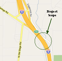 In October 2009, the CTC
approved for future consideration of funding a project that will replace
the Shasta River Bridge (note that this bridge is not on I-5 proper, but
appears to be on the former US 99 alignment next to I-5) (005 SIS
R022.62). The existing bridge is a two span concrete bridge built in 1922.
The new bridge will be placed in the same location as the existing bridge
and will be a single span concrete structure on piles with two traffic
lanes. The project is estimated to cost $1,542,000. The project is
programmed for funding with STIP ($177,000) and Highway Bridge Program
($1,365,000) funds. Construction is estimated to begin in fiscal year
2009/10. On September 23, 2009 the County provided confirmation that the
scope addressed in the MND is consistent with the scope of work that is
programmed in the STIP.
In October 2009, the CTC
approved for future consideration of funding a project that will replace
the Shasta River Bridge (note that this bridge is not on I-5 proper, but
appears to be on the former US 99 alignment next to I-5) (005 SIS
R022.62). The existing bridge is a two span concrete bridge built in 1922.
The new bridge will be placed in the same location as the existing bridge
and will be a single span concrete structure on piles with two traffic
lanes. The project is estimated to cost $1,542,000. The project is
programmed for funding with STIP ($177,000) and Highway Bridge Program
($1,365,000) funds. Construction is estimated to begin in fiscal year
2009/10. On September 23, 2009 the County provided confirmation that the
scope addressed in the MND is consistent with the scope of work that is
programmed in the STIP.
In May 2012, the CTC authorized SHOPP funding on I-5, in Siskiyou County, 02-Sis-5 R50.6/52.1 Near Yreka, from 0.6 mile south of Shasta River Bridge to 0.2 mile south of Vista Point. $8,200,000 to replace bridge decks and upgrade the structures to maintain structural integrity, reduce the risk to lives and properties, and to meet the current seismic strengthening standards.
In August 2011, the CTC approved $52,000,000 in SHOPP funding for repairs near Yreka, from 0.3 mile south of Shasta River Bridge (~ 005 SIS R050.86) to 0.1 mile south of Klamath River Road Undercrossing (~ 005 SIS R058.00), that will rehabilitate 28.0 lane miles of roadway to improve the ride quality, prevent further deterioration of the road surface, minimize the costly roadway repairs and extend the pavement service life.
In August 2016, the CTC approved for future consideration of funding a project on I-5 (02-Sis-5, PM R58.1) in Siskiyou County that will rehabilitate the water and waste water systems and construct a break room at the Randolph Collier Safety Roadside Rest Area near the city of Yreka. The project is programmed in the 2016 State Highway Operation and Protection Program. The total programmed amount is $7,496,000 for capital and support. Construction is estimated to begin in Fiscal Year 2016-17. The scope, as described for the preferred alternative, is consistent with the project scope programmed by the Commission in the 2016 State Highway Operation and Protection Program.
 Commuter Lanes
Note: More information on HOV construction is in the Status section above.
In San Diego County, HOV lanes exist between the Mexico and US ports of entry (just a bit S of 005 SD R0.305). These require four or more passengers, and operate 24 hours a day on weekdays. Note that, at least in terms of postmiles. 005 SD 0.0 does not exist, the statewide odometer starts at 0.0 at R0.305.
HOV lanes are also planned for I-5 in San Diego as follows:
In Orange County, HOV lanes have been constructed on I-5 between the Route 91 and the Pacific Coast Highway (Route 1). The first segment to open was between Route 405 and Tustin Ranch Road; this opened in October 1992. In November 1995, the segment between Tustin Ranch Road and .2 mi S of 4th Street in Tustin opened. In May 1996, the following segments opened: (1) .1 mi S of Avery Parkway to I-405; (2) .2 mi S of 4th Street to the Santa Ana River, and (3) Route 1 to Ortega Highway. In June 1996, the segment between Ortega Highway and Avery Parkway, opened. HOV lanes between Route 22 and Route 91 opened in 2001. All lanes require two or more occupants, and are always in operation.
In Los Angeles County, planning for HOV lanes on I-5 between Route 91 and I-605 begain with an EIR that was discussed on the January 2002 CTC Agenda, Agenda Item 2.2a). See the main status section for more details on this construction, which was still in progress as of the start of 2018.
There are currently no plans to widen or add HOV between Route 710 and Route 134. The right of way in this area is too constrained to permit such construction.
As of 2018, there was construction in progress to add HOV lanes between Route 134 and Route 170. This is discussed in deep detail in the status section.
HOV lanes have been constructed between Route 170 and Route 118, and between Route 118 and Route 14.
HOV lanes are under construction between Route 14 (LA R45.618) to Parker Road Interchange in Castaic (LA R58.99). There are plans for these eventually to be HOT lanes.
In Stockton, lanes have been constructed/are under construction between 8th Street Undercrossing (005 SJ 25.0) to Hammer Lane Undercrossing (005 SJ PM 32.9).
In October 2013, the CTC considered for future approval of funding an FEIR regarding a project that would construct High Occupancy Vehicle lanes and sound walls in both directions from US 50 (apx 005 SAC 22.461) to Morrison Creek on I-5 (~ 005 SAC 12.994). Phase 1 is funded through Plans, Specification, and Estimate with federal dollars, and is programmed in the 2012 State Transportation Improvement Program for Right of Way only. The total estimated cost is $127,200,000 for capital and support. Depending on the availability of funding, construction is estimated to begin in Fiscal Year 2017-18. Phase 2 (PPNO 5836) will construct High Occupancy Vehicle Lanes from Morrison Creek (~ 005 SAC 12.994) to south of Stone Lake Creek (apx 005 SAC 8.841). Phase 2 is not yet funded. The total estimated cost for capital and support is $70,600,000. Depending on the availability of funding, construction is estimated to begin in Fiscal Year 2019-20.
In Sacramento County, HOV lanes are planned between the I-5/I-80 interchange (~ 005 SAC 26.654) and Pocket Road (~ 005 SAC 16.147) (STIP Project #1, June 2002 CTC Agenda Item 2.5b(1))
 Historical Route
The segment of Route 5 from Route 10 to Route 99, and from the northern I-5/Route 99 junction to the Oregon border, is designated as part of "Historic US Highway 99" by Assembly Concurrent Resolution 19, Chapter 73, in 1993.
Some portions of I-5 have been signed as part of Historic Route 99:
ACR 26 requested the Department of Transportation, upon application by an interested local agency or private entity, to identify any section of former U.S. Highway Route 6 that is still a publicly maintained highway and that is of interest to the applicant, and to designate that section as Historic U.S. Highway Route 6. Chaptered July 3, 2007. Resolution Chapter 67.
 Naming
Historically, the portion of this route from the Mexican border to the roads connecting to Route 72 is close to the original "El Camino Real" (The Kings Road). This portion has officially been designated as "El Camino Real by Assembly Bill 1769, Chapter 1569, in 1959.
 The entire route in California has been submitted to be part of the National Purple Heart Trail. The Military Order of the Purple Heart
is working to establish a national commemorative trail for recipients of
the Purple Heart medal, which honors veterans who were wounded in combat.
All states in the union will designate highways for inclusion in the
commemorative trail, and all of the designated highways will be
interconnected to form the National Purple Heart Trail. Named by Senate
Concurrent Resolution 14, Resolution Chapter 79, July 10, 2001.
The entire route in California has been submitted to be part of the National Purple Heart Trail. The Military Order of the Purple Heart
is working to establish a national commemorative trail for recipients of
the Purple Heart medal, which honors veterans who were wounded in combat.
All states in the union will designate highways for inclusion in the
commemorative trail, and all of the designated highways will be
interconnected to form the National Purple Heart Trail. Named by Senate
Concurrent Resolution 14, Resolution Chapter 79, July 10, 2001.
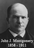 The segment of Route 5 from the Mexico border (~ 005 SD R0.4) to
Route 94 (~ 005 SD R15.02) is named the "John J. Montgomery Freeway".
John J. Montgomery (1858-1911) was one of the pioneers in the field of
aviation. He was born in in Yuba City, California, in 1858, and moved to
Oakland when he was 5. He was always interested in flight. He attended St.
Ignatius College in San Francisco (MS, circa 1880), and Santa Clara
College (PhD, 1901). In 1894 Montgomery joined the faculty of St Joseph's
College, Rohnerville, California, where he taught mathematics while
continuing studies of air and water current impacts on edged surfaces,
parabolic and plane. He later experimented with 4 foot and 8 foot
wingspread model aeroplanes and built a wind-tunnel to vary experiments in
degrees of parabolic wing-curve and length, fore and aft, rudder and rear
stabilizer control. At Santa Clara College (now University), he worked
part time for Rev. Richard H. Bell, S.J., on improvements in the Marconi
Wireless. Montgomery patented an "Improvement in Aeroplanes" in 1906 and
in 1909 completed an electric typewriter and patented an alternating
current rectifier, which he sold to a San Francisco company. His findings
and airplane designs finally earned him a well-deserved place with Octave
Chanute and Dr. Samuel Pierpont Langley as American pioneers in controlled
flight before the Wright brothers. It was named by Assembly Concurrent
Resolution 16, Chapter 83, in 1949.
The segment of Route 5 from the Mexico border (~ 005 SD R0.4) to
Route 94 (~ 005 SD R15.02) is named the "John J. Montgomery Freeway".
John J. Montgomery (1858-1911) was one of the pioneers in the field of
aviation. He was born in in Yuba City, California, in 1858, and moved to
Oakland when he was 5. He was always interested in flight. He attended St.
Ignatius College in San Francisco (MS, circa 1880), and Santa Clara
College (PhD, 1901). In 1894 Montgomery joined the faculty of St Joseph's
College, Rohnerville, California, where he taught mathematics while
continuing studies of air and water current impacts on edged surfaces,
parabolic and plane. He later experimented with 4 foot and 8 foot
wingspread model aeroplanes and built a wind-tunnel to vary experiments in
degrees of parabolic wing-curve and length, fore and aft, rudder and rear
stabilizer control. At Santa Clara College (now University), he worked
part time for Rev. Richard H. Bell, S.J., on improvements in the Marconi
Wireless. Montgomery patented an "Improvement in Aeroplanes" in 1906 and
in 1909 completed an electric typewriter and patented an alternating
current rectifier, which he sold to a San Francisco company. His findings
and airplane designs finally earned him a well-deserved place with Octave
Chanute and Dr. Samuel Pierpont Langley as American pioneers in controlled
flight before the Wright brothers. It was named by Assembly Concurrent
Resolution 16, Chapter 83, in 1949.
(Image Source: Wikipedia)
The segment of Route 5 starting from Route 94 (~ 005 SD R15.02) in San Diego to the southern I-405/I-5 junction (~ 005 ORA 21.193) is designated the "San Diego Freeway". It was named by the State Highway Commission on April 25, 1957. San Diego refers to the eventual southern terminus of the route (after all merges). The name refers to Saint Didacus of Alcalá, a Franciscan saint of the 15th century. The bay was named by Vizcaíno in 1602, the mission in 1769, the county in 1850 and the new city in 1856.
 The portion of I-5 from Leucadia Boulevard
(~ 005 SD R42.697) to La Costa Avenue (~ 005 SD R44.068) in the City of
Encinitas is officially named the "C.H.P. Officer Stephen M. Linen, Jr.
Memorial Freeway". It was named in memory of California Highway
Patrol Officer Stephen M. Linen, Jr.. Officer Linen, Jr. was killed in the
line of duty during the morning of August 12, 2001 while issuing a
citation on I-5 near Leucadia Boulevard in Encinitas when a
drunken-driving suspect collided into his patrol vehicle and struck the
officer. Born on July 22, 1970, Officer Linen graduated from California
State University, San Diego with a degree in Criminal Justice in 1993. He
joined the CHP on July 25, 1994., and began service in the Monterey area
as an officer on January 26, 1995. He made significant contributions to
traffic safety and assisting the motoring public while assigned to the
Monterey, San Diego, and Oceanside Area offices. He was nominated for the
Burn Institute's "Spirit of Courage Award" for his 1998 act of bravery and
heroism when he rescued a man trapped in a burning vehicle on I-5 in San
Diego. Named by Senate Concurrent Resolution 24, Chapter 127, 9/12/2003.
The portion of I-5 from Leucadia Boulevard
(~ 005 SD R42.697) to La Costa Avenue (~ 005 SD R44.068) in the City of
Encinitas is officially named the "C.H.P. Officer Stephen M. Linen, Jr.
Memorial Freeway". It was named in memory of California Highway
Patrol Officer Stephen M. Linen, Jr.. Officer Linen, Jr. was killed in the
line of duty during the morning of August 12, 2001 while issuing a
citation on I-5 near Leucadia Boulevard in Encinitas when a
drunken-driving suspect collided into his patrol vehicle and struck the
officer. Born on July 22, 1970, Officer Linen graduated from California
State University, San Diego with a degree in Criminal Justice in 1993. He
joined the CHP on July 25, 1994., and began service in the Monterey area
as an officer on January 26, 1995. He made significant contributions to
traffic safety and assisting the motoring public while assigned to the
Monterey, San Diego, and Oceanside Area offices. He was nominated for the
Burn Institute's "Spirit of Courage Award" for his 1998 act of bravery and
heroism when he rescued a man trapped in a burning vehicle on I-5 in San
Diego. Named by Senate Concurrent Resolution 24, Chapter 127, 9/12/2003.
(Image Source: Find a Grave Memorial)
 The portion of I-5 from Tamarack Avenue (~ 005 SD R49.277) to
Route 78 (~ 005 SD R51.259) in the City of Carlsbad is officially named
the "C.H.P. Officer Sean Nava Memorial Freeway". Named in memory of
California Highway Patrol Officer Sean Nava. Officer Nava was killed in
the line of duty during the morning of October 28, 2000 while
investigating an earlier traffic collision on I-5 in the City of Carlsbad
when a drunken driving suspect collided into him. Born on April 8, 1967,
in West Covina, Officer Nava served his country as an Army Military Police
Officer in Germany and in Herlong, California. As an Army Military Police
Officer, he conducted undercover narcotics investigations with the Army
Criminal Investigation Division. Sean Nava was honorably discharged at the
rank of sergeant. He joined the California Highway Patrol on July 31,
1989. His first assignment was in the San Jose Area. He made significant
contributions to traffic safety and assisting the motoring public while
assigned to the Monterey, San Diego, and Oceanside Area offices, and was
posthumously awarded the Medal of Valor for his off-duty act of bravery
and heroism when he attempted to rescue the driver of a vehicle that had
collided with a residence and propane tank, and subsequently erupted in
flames. Without regard to his own personal safety, Sean Nava and a citizen
made repeated attempts to rescue the trapped driver. Named by Senate
Concurrent Resolution 24, Chapter 127, 9/12/2003.
The portion of I-5 from Tamarack Avenue (~ 005 SD R49.277) to
Route 78 (~ 005 SD R51.259) in the City of Carlsbad is officially named
the "C.H.P. Officer Sean Nava Memorial Freeway". Named in memory of
California Highway Patrol Officer Sean Nava. Officer Nava was killed in
the line of duty during the morning of October 28, 2000 while
investigating an earlier traffic collision on I-5 in the City of Carlsbad
when a drunken driving suspect collided into him. Born on April 8, 1967,
in West Covina, Officer Nava served his country as an Army Military Police
Officer in Germany and in Herlong, California. As an Army Military Police
Officer, he conducted undercover narcotics investigations with the Army
Criminal Investigation Division. Sean Nava was honorably discharged at the
rank of sergeant. He joined the California Highway Patrol on July 31,
1989. His first assignment was in the San Jose Area. He made significant
contributions to traffic safety and assisting the motoring public while
assigned to the Monterey, San Diego, and Oceanside Area offices, and was
posthumously awarded the Medal of Valor for his off-duty act of bravery
and heroism when he attempted to rescue the driver of a vehicle that had
collided with a residence and propane tank, and subsequently erupted in
flames. Without regard to his own personal safety, Sean Nava and a citizen
made repeated attempts to rescue the trapped driver. Named by Senate
Concurrent Resolution 24, Chapter 127, 9/12/2003.
(Image Source: Find a Grave, California Assn of Highway Patrolmen)
 The portion of I-5 from La Costa Avenue (PM SD R44.071) to Cannon Road (PM SD R47.975) in
the City of Carlsbad is named the “CAL-FIRE Chief William R.
Clayton Memorial Highway”. It was named in memory of William
R. Clayton, who died on January 28, 2018. Clayton was a renowned
Department of Forestry and Fire Protection (CAL-FIRE) Chief. Beginning his
50-year career in firefighting with the United States Forest Service at
the Cleveland National Forest in southern California, Bill Clayton also
served as a Fire Captain for the Orange County Fire Department, and as the
Assistant Chief at the Rainbow Conservation Camp for CAL-FIRE. Clayton
also served as the Division Chief for CAL-FIRE, becoming the most
decorated CAL-FIRE Chief in the history of that agency. After initially
retiring from CAL-FIRE in 1998, Bill Clayton felt the call to return to
service and rejoined the agency until he retired again in 2006, when he
joined the Sycuan Fire Department as its Chief. Bill Clayton later shared
his experience and expertise as a consultant throughout the United States
and around the world, traveling to Australia, Portugal, South America, and
Iraq to teach wildland firefighting and emergency management. Bill Clayton
was awarded his first CAL-FIRE Medal of Valor in 1998 for his actions
during a 1997 fire in Escondido, when he drove through a 50-foot wall of
flames to rescue three people from their home near Lake Wohlford. Bill
Clayton received several other awards and recognitions throughout his
career and was presented with his second Medal of Valor in 2006 for his
extraordinary efforts in both the Paradise and Cedar fires in the County
of San Diego in 2003, when his courageous actions saved the lives of
hundreds of people and prevented the devastation of downtown Julian. Named
by Senate Resolution SCR 12, Resolution Chapter 81, 07/16/21.
The portion of I-5 from La Costa Avenue (PM SD R44.071) to Cannon Road (PM SD R47.975) in
the City of Carlsbad is named the “CAL-FIRE Chief William R.
Clayton Memorial Highway”. It was named in memory of William
R. Clayton, who died on January 28, 2018. Clayton was a renowned
Department of Forestry and Fire Protection (CAL-FIRE) Chief. Beginning his
50-year career in firefighting with the United States Forest Service at
the Cleveland National Forest in southern California, Bill Clayton also
served as a Fire Captain for the Orange County Fire Department, and as the
Assistant Chief at the Rainbow Conservation Camp for CAL-FIRE. Clayton
also served as the Division Chief for CAL-FIRE, becoming the most
decorated CAL-FIRE Chief in the history of that agency. After initially
retiring from CAL-FIRE in 1998, Bill Clayton felt the call to return to
service and rejoined the agency until he retired again in 2006, when he
joined the Sycuan Fire Department as its Chief. Bill Clayton later shared
his experience and expertise as a consultant throughout the United States
and around the world, traveling to Australia, Portugal, South America, and
Iraq to teach wildland firefighting and emergency management. Bill Clayton
was awarded his first CAL-FIRE Medal of Valor in 1998 for his actions
during a 1997 fire in Escondido, when he drove through a 50-foot wall of
flames to rescue three people from their home near Lake Wohlford. Bill
Clayton received several other awards and recognitions throughout his
career and was presented with his second Medal of Valor in 2006 for his
extraordinary efforts in both the Paradise and Cedar fires in the County
of San Diego in 2003, when his courageous actions saved the lives of
hundreds of people and prevented the devastation of downtown Julian. Named
by Senate Resolution SCR 12, Resolution Chapter 81, 07/16/21.
(Image source: North County Daily Star, 2/15/2021)
 The portion of Route 5 between Harbor
Drive (~ 005 SD R54.391) and Route 78 (~ 005 SD R51.259), in the County of
San Diego, is named the Oceanside Police Officer Daniel S. Bessant
Memorial Highway". It was named in memory of Officer Daniel S.
Bessant, who was born in Oceanside, California, on October 16, 1981.
Officer Bessant attended local schools in Oceanside where his father
served as a member of the faculty. He then served with the Oceanside
Police Department for six years, three years as a police officer and three
years as a civilian with the department. On December 20, 2006, Officer
Bessant was killed in the line of duty while assisting another officer
with a traffic stop and was shot from behind by a gang member who was not
involved in the traffic stop. Officer Bessant's father, in his role as a
teacher, had tried unsuccessfully to intervene with one of the gang
members convicted of killing Officer Bessant after noticing that the young
man was becoming involved with gangs. Named by Assembly Concurrent
Resolution 100, Resolution Chapter 109, on September 4, 2012.
The portion of Route 5 between Harbor
Drive (~ 005 SD R54.391) and Route 78 (~ 005 SD R51.259), in the County of
San Diego, is named the Oceanside Police Officer Daniel S. Bessant
Memorial Highway". It was named in memory of Officer Daniel S.
Bessant, who was born in Oceanside, California, on October 16, 1981.
Officer Bessant attended local schools in Oceanside where his father
served as a member of the faculty. He then served with the Oceanside
Police Department for six years, three years as a police officer and three
years as a civilian with the department. On December 20, 2006, Officer
Bessant was killed in the line of duty while assisting another officer
with a traffic stop and was shot from behind by a gang member who was not
involved in the traffic stop. Officer Bessant's father, in his role as a
teacher, had tried unsuccessfully to intervene with one of the gang
members convicted of killing Officer Bessant after noticing that the young
man was becoming involved with gangs. Named by Assembly Concurrent
Resolution 100, Resolution Chapter 109, on September 4, 2012.
(Image Source: Find a Grave Memorial)
 The segment of Route 5 between the Basilone Road exit (~
005 SD R71.375) and the main gate of USMC Camp Pendleton to the S (~ 005
SD R54.402) is named the Gunnery Sergeant John Basilone Memorial
Freeway. Sgt. Basilone was a member of "C" Company, 1st
Battalion, 7th Regiment, 1st Marine Division who was
in charge of two sections of heavy machine guns defending a narrow pass
that led to Henderson Airfield in Guadalcanal, Solomon Islands, during
WWII (1942). Sgt. Basilone, at great risk to life, battled through hostile
lines to provide shells for his gunners. For this, he recieved the
Congressional Medal of Honor. Later, in 1944, he rejoined the USMC and, on
Iwo Jima, single-handedly destroyed an enemey blockhouse while braving a
bombardment of enemy heavy caliber file. For this, he was posthumously
awarded the Navy Cross and the Purple Heart, and has a life-sized bronze
statue in Raritan, NJ. He also has a destroyer, U.S.S. Basilone, named
after him (subsequently scuttled, as it was no longer seaworthy). There is
a 2nd status in honor of Sgt. Basilone somewhere in San Diego,
as well as a bridge and a football field. Supposedly, a postal stamp with
his likeness will be issued in 2005. Named by Senate Concurrant Resolution
25, Resolution Chapter 72, on July 23, 1999.
The segment of Route 5 between the Basilone Road exit (~
005 SD R71.375) and the main gate of USMC Camp Pendleton to the S (~ 005
SD R54.402) is named the Gunnery Sergeant John Basilone Memorial
Freeway. Sgt. Basilone was a member of "C" Company, 1st
Battalion, 7th Regiment, 1st Marine Division who was
in charge of two sections of heavy machine guns defending a narrow pass
that led to Henderson Airfield in Guadalcanal, Solomon Islands, during
WWII (1942). Sgt. Basilone, at great risk to life, battled through hostile
lines to provide shells for his gunners. For this, he recieved the
Congressional Medal of Honor. Later, in 1944, he rejoined the USMC and, on
Iwo Jima, single-handedly destroyed an enemey blockhouse while braving a
bombardment of enemy heavy caliber file. For this, he was posthumously
awarded the Navy Cross and the Purple Heart, and has a life-sized bronze
statue in Raritan, NJ. He also has a destroyer, U.S.S. Basilone, named
after him (subsequently scuttled, as it was no longer seaworthy). There is
a 2nd status in honor of Sgt. Basilone somewhere in San Diego,
as well as a bridge and a football field. Supposedly, a postal stamp with
his likeness will be issued in 2005. Named by Senate Concurrant Resolution
25, Resolution Chapter 72, on July 23, 1999.
(Image Source: Marine Parents)
![[Steed]](images/005-steed.jpg) The segment of Route 5 between the Avenida San Luis Rey exit (presumably 005 ORA 0.642,
which is the Ave. San Luis Rey overcrossing, as there is no exit with that
name) and the Camino De Estrella exit (005 ORA 5.80) in the City of San
Clemente is officially designated the "Officer Richard T. Steed
Memorial Highway". It was named in memory of San Clemente Police
Officer Richard (Rick) Thomas Steed. Steed was born on December 27, 1947,
to Henry and Martha Steed, and grew up in Alexandria, Virginia with his
brother Hank and sister Donna. After high school, Steed enlisted in the
United States Marine Corps, where he served for eight years and rose to
the rank of Staff Sergeant. During his service Rick spent one tour of duty
in Vietnam as a radio technician in the Recon Platoon, and also served in
Okinawa. Rick was awarded a Navy Commendation Medal, a Good Service Medal,
and a Combat Action Ribbon. He also earned his jump wings. While still on
active duty Rick became interested in law enforcement and became a reserve
police officer with the San Clemente Police Department in July 1975. After
receiving his associate of arts degree in criminal justice from Saddleback
Community College, Rick was hired as a full-time police officer with the
San Clemente Police Department on June 6, 1977. Officer Steed attended the
Police Academy at Los Medanos College in Pittsburgh, California, where he
was elected class president. On his final patrol shift, on November 29,
1978, Officer Steed answered a call for medical aid in an adjacent beat.
Officer Steed announced his arrival to the dispatcher and indicated that
he saw a subject approaching from behind his vehicle. As he exited the car
and turned toward the subject, Officer Steed was immediately, and without
provocation, shot twice with a .38 caliber handgun, and died from those
injuries. A massive manhunt involving multiple law enforcement agencies
resulted in apprehending the suspect and retrieving the murder weapon. The
suspect was incarcerated in a state mental hospital. Officer Steed is the
only San Clemente police officer to die in the line of duty was of 2011.
Officer Steed was enshrined on Honor Rolls in the Santa Ana Courthouse,
Sacramento, and Washington, D.C., and named in the Honor Roll and Officer
Down Memorial Internet Web sites, and on memorial bricks in the Vietnam
section of the Saddleback College Veterans Memorial and at the Marine
Corps Museum in Quantico, Virginia. Additionally, a 64-acre park and
sports complex was named the Richard T. Steed Memorial Park, and a plaque
prominently displayed at Park Semper Fi near the San Clemente Pier. Named
by Assembly Concurrent Resolution 33, Resolution Chapter 73, on August 23,
2011. The dedication was written up in the Orange County Register on 11/29/11. The article notes that the actual sign drops the word "Officer", and indicates there is an attempt in
process to correct the sign and include the fact he was a San Clemente
Police officer. The sign was later corrected.
The segment of Route 5 between the Avenida San Luis Rey exit (presumably 005 ORA 0.642,
which is the Ave. San Luis Rey overcrossing, as there is no exit with that
name) and the Camino De Estrella exit (005 ORA 5.80) in the City of San
Clemente is officially designated the "Officer Richard T. Steed
Memorial Highway". It was named in memory of San Clemente Police
Officer Richard (Rick) Thomas Steed. Steed was born on December 27, 1947,
to Henry and Martha Steed, and grew up in Alexandria, Virginia with his
brother Hank and sister Donna. After high school, Steed enlisted in the
United States Marine Corps, where he served for eight years and rose to
the rank of Staff Sergeant. During his service Rick spent one tour of duty
in Vietnam as a radio technician in the Recon Platoon, and also served in
Okinawa. Rick was awarded a Navy Commendation Medal, a Good Service Medal,
and a Combat Action Ribbon. He also earned his jump wings. While still on
active duty Rick became interested in law enforcement and became a reserve
police officer with the San Clemente Police Department in July 1975. After
receiving his associate of arts degree in criminal justice from Saddleback
Community College, Rick was hired as a full-time police officer with the
San Clemente Police Department on June 6, 1977. Officer Steed attended the
Police Academy at Los Medanos College in Pittsburgh, California, where he
was elected class president. On his final patrol shift, on November 29,
1978, Officer Steed answered a call for medical aid in an adjacent beat.
Officer Steed announced his arrival to the dispatcher and indicated that
he saw a subject approaching from behind his vehicle. As he exited the car
and turned toward the subject, Officer Steed was immediately, and without
provocation, shot twice with a .38 caliber handgun, and died from those
injuries. A massive manhunt involving multiple law enforcement agencies
resulted in apprehending the suspect and retrieving the murder weapon. The
suspect was incarcerated in a state mental hospital. Officer Steed is the
only San Clemente police officer to die in the line of duty was of 2011.
Officer Steed was enshrined on Honor Rolls in the Santa Ana Courthouse,
Sacramento, and Washington, D.C., and named in the Honor Roll and Officer
Down Memorial Internet Web sites, and on memorial bricks in the Vietnam
section of the Saddleback College Veterans Memorial and at the Marine
Corps Museum in Quantico, Virginia. Additionally, a 64-acre park and
sports complex was named the Richard T. Steed Memorial Park, and a plaque
prominently displayed at Park Semper Fi near the San Clemente Pier. Named
by Assembly Concurrent Resolution 33, Resolution Chapter 73, on August 23,
2011. The dedication was written up in the Orange County Register on 11/29/11. The article notes that the actual sign drops the word "Officer", and indicates there is an attempt in
process to correct the sign and include the fact he was a San Clemente
Police officer. The sign was later corrected.
(Image sources: Original Sign - OCR 11/29/2011; CorrectedSign
- OCR 1/28/2012; Officer Down Memorial Page)
 The portion of I-5 between Camino Las Ramblas (ORA 6.761) and the Ortega Highway (ORA
9.428) in the County of Orange is named the "Long Beach Fire Captain
David Rosa Memorial Highway". It was named in memory of Long Beach
Fire Captain David Rosa, a 17-year veteran of the Long Beach Fire
Department, assigned to Fire Station 10 in the central part of Long Beach.
Rosa was shot as he responded to an explosion at a senior living complex,
19 minutes after he and his fellow fire personnel had arrived at the scene
of an explosion and subsequent fire. He and his crew, including
Firefighter Ernesto Torres, who was also injured, had responded to a
predawn call to Covenant Manor, a high-rise housing complex for seniors
where they had been met with gunfire from the now burning complex. David
Rosa at the young age of 45 died later that same day from his wounds. As a
young man, David Rosa always put others before himself and possessed the
ability to be focused amid chaos which made him a natural fit to be a
first responder. When he was struck by gunfire while responding to the
explosion at the high-rise senior apartment complex, David Rosa was doing
what he did every day, running selflessly toward danger to protect the
most vulnerable. David Rosa was also a great storyteller and teacher who
led by example and who was humble, grounded, faithful, and loyal; but most
of all, he was loved, and he knew how to love others back. Long Beach Fire
Captain David Rosa always made you feel like you were the only person that
mattered to him. Named by Senate Concurrent Resolution (SCR) 159, Res.
Chapter 234, 9/11/2018.
The portion of I-5 between Camino Las Ramblas (ORA 6.761) and the Ortega Highway (ORA
9.428) in the County of Orange is named the "Long Beach Fire Captain
David Rosa Memorial Highway". It was named in memory of Long Beach
Fire Captain David Rosa, a 17-year veteran of the Long Beach Fire
Department, assigned to Fire Station 10 in the central part of Long Beach.
Rosa was shot as he responded to an explosion at a senior living complex,
19 minutes after he and his fellow fire personnel had arrived at the scene
of an explosion and subsequent fire. He and his crew, including
Firefighter Ernesto Torres, who was also injured, had responded to a
predawn call to Covenant Manor, a high-rise housing complex for seniors
where they had been met with gunfire from the now burning complex. David
Rosa at the young age of 45 died later that same day from his wounds. As a
young man, David Rosa always put others before himself and possessed the
ability to be focused amid chaos which made him a natural fit to be a
first responder. When he was struck by gunfire while responding to the
explosion at the high-rise senior apartment complex, David Rosa was doing
what he did every day, running selflessly toward danger to protect the
most vulnerable. David Rosa was also a great storyteller and teacher who
led by example and who was humble, grounded, faithful, and loyal; but most
of all, he was loved, and he knew how to love others back. Long Beach Fire
Captain David Rosa always made you feel like you were the only person that
mattered to him. Named by Senate Concurrent Resolution (SCR) 159, Res.
Chapter 234, 9/11/2018.
(Image Source: LB Press Telegram, 6/28/2018)
 The portion of I-5 from El Horno Street (ORA 10.001) to
Crown Valley Parkway (ORA 13.776) in the County of Orange as the “Senior
Master Sergeant John James Paoletti Memorial Highway”. It was
named in memory of Senior Master Sergeant John James Paoletti (John), who
was born in November 1924, in Alpha, New Jersey. John was the 3rd
of 10 children of immigrants from Foggia, Italy, to the United States in
1919. Domenico went on to serve his adopted country in the United States
Army in the 99th Infantry Division during World War I and,
during his service, he received many distinctions of honor, including the
Purple Heart. John attended Phillipsburg High School in Phillipsburg, New
Jersey, when in July 1943, he and many of his fellow classmates were
drafted into the United States Army to help fight in World War II (he
later went on to receive a general equivalency diploma (GED)). John was
sent to Camp Davis in North Carolina for basic infantry training, then
traveled on the Queen Elizabeth to Europe, with Germany as the eventual
destination. John was assigned to a radar and searchlight company in the
United States Army’s 99th Infantry Division, the same
Infantry Division his father served in during World War I. As boots on the
ground in Germany during the Battle of the Bulge, John and his 99th
Infantry Division were the first complete infantry division to cross the
Rhine River to capture the Remagen Bridge, which proved pivotal in their
mission to collapse the Ruhr Pocket. John was hit with shrapnel in his
right eye and knee during the battles while pushing towards the Town of
Moosburg, which had several prisoners of war (POW) camps, and, once at the
camps, they fought and liberated over 100,000 Allied POWs, including
members of their own 99th Infantry Division who were captured
during the Battle of the Bulge. On May 6, 1945, World War II ended, and
John was sent to join the United States Army’s 2nd
Infantry Division for the Invasion of Japan. John was awarded the Combat
Infantryman Badge (CIB), Combat Central Europe Rhineland, on May 20, 1945.
In February 1946, John was honorably discharged from the United States
Army, but in May 1949, John reenlisted into the United States Air Force
and was sent to Francis E. Warren Air Force Base in Cheyenne, Wyoming.
John’s distinguished United States Air Force career included
numerous cryptology assignments, many of which were classified. John moved
to the San Clemente in 1996; and dedicated his retirement years to
volunteering to teach young pupils the great history of the United States
by sharing his World War II experience. He created an hour-long
presentation, complete with detailed maps, war memorabilia, wartime
uniforms, and photos to engage pupils on what it was like to be boots on
the ground during the Battle of the Bulge, and John regularly closed his
presentation with this quote, “If you can read this thank a teacher.
If you can read it in English, thank a veteran” John was an active
participant at the South Orange County Veterans Center, where he enjoyed
support and fellowship with fellow World War II and Korean War veterans.
He died November 14, 2020. Named by Assembly Resolution ACR 208, Res. Chapter 171, 09/06/22.
The portion of I-5 from El Horno Street (ORA 10.001) to
Crown Valley Parkway (ORA 13.776) in the County of Orange as the “Senior
Master Sergeant John James Paoletti Memorial Highway”. It was
named in memory of Senior Master Sergeant John James Paoletti (John), who
was born in November 1924, in Alpha, New Jersey. John was the 3rd
of 10 children of immigrants from Foggia, Italy, to the United States in
1919. Domenico went on to serve his adopted country in the United States
Army in the 99th Infantry Division during World War I and,
during his service, he received many distinctions of honor, including the
Purple Heart. John attended Phillipsburg High School in Phillipsburg, New
Jersey, when in July 1943, he and many of his fellow classmates were
drafted into the United States Army to help fight in World War II (he
later went on to receive a general equivalency diploma (GED)). John was
sent to Camp Davis in North Carolina for basic infantry training, then
traveled on the Queen Elizabeth to Europe, with Germany as the eventual
destination. John was assigned to a radar and searchlight company in the
United States Army’s 99th Infantry Division, the same
Infantry Division his father served in during World War I. As boots on the
ground in Germany during the Battle of the Bulge, John and his 99th
Infantry Division were the first complete infantry division to cross the
Rhine River to capture the Remagen Bridge, which proved pivotal in their
mission to collapse the Ruhr Pocket. John was hit with shrapnel in his
right eye and knee during the battles while pushing towards the Town of
Moosburg, which had several prisoners of war (POW) camps, and, once at the
camps, they fought and liberated over 100,000 Allied POWs, including
members of their own 99th Infantry Division who were captured
during the Battle of the Bulge. On May 6, 1945, World War II ended, and
John was sent to join the United States Army’s 2nd
Infantry Division for the Invasion of Japan. John was awarded the Combat
Infantryman Badge (CIB), Combat Central Europe Rhineland, on May 20, 1945.
In February 1946, John was honorably discharged from the United States
Army, but in May 1949, John reenlisted into the United States Air Force
and was sent to Francis E. Warren Air Force Base in Cheyenne, Wyoming.
John’s distinguished United States Air Force career included
numerous cryptology assignments, many of which were classified. John moved
to the San Clemente in 1996; and dedicated his retirement years to
volunteering to teach young pupils the great history of the United States
by sharing his World War II experience. He created an hour-long
presentation, complete with detailed maps, war memorabilia, wartime
uniforms, and photos to engage pupils on what it was like to be boots on
the ground during the Battle of the Bulge, and John regularly closed his
presentation with this quote, “If you can read this thank a teacher.
If you can read it in English, thank a veteran” John was an active
participant at the South Orange County Veterans Center, where he enjoyed
support and fellowship with fellow World War II and Korean War veterans.
He died November 14, 2020. Named by Assembly Resolution ACR 208, Res. Chapter 171, 09/06/22.
(Image source: Tribute Archive; Shorecliffs Beach Club)
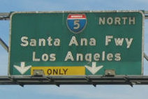 The segment of Route 5 from the southern I-405/I-5 junction (~ 005 ORA 21.193) to the
Route 5/Route 10/Route 60/US 101 interchange (~ 005 LA 16.326) is named
the "Santa Ana" Freeway. It was named by its location. Technically,
this is the start of US 101; SB of this interchange I-5 was US 101 until
interstate highway numbering came into being).
The segment of Route 5 from the southern I-405/I-5 junction (~ 005 ORA 21.193) to the
Route 5/Route 10/Route 60/US 101 interchange (~ 005 LA 16.326) is named
the "Santa Ana" Freeway. It was named by its location. Technically,
this is the start of US 101; SB of this interchange I-5 was US 101 until
interstate highway numbering came into being).
 The segment of Route 5 from
northbound Tustin Ranch Road (~ ORA 28.224) to southbound Tustin Ranch
Road (~ ORA R.28.456) in the City of Tustin is named the "Officer and
Medal of Valor Recipient Waldron G. Karp Memorial Highway". It was
named in memory of Tustin Police Department Officer Waldron G. Karp, who,
pn January 7, 1973, at 31 years of age, succumbed to gunshot wounds
sustained one month earlier when he was shot while assisting Orange County
Sheriff’s Department deputies on a call involving a man with a
rifle. Becoming a police officer was Karp’s dream job after he
served in the United States Navy during the Vietnam War, and he served his
community honorably. For his courage in the line of duty, Officer Karp was
awarded the Medal of Valor by the Tustin Police Department in 2015, the
highest honor awarded by the department. Officer Karp is the only Tustin
Police Department officer to be killed in the line of duty, and the story
of Officer Karp’s death has been passed from one generation of
Tustin Police Department officers to the next. To commemorate Officer
Karp’s service, the City of Tustin established the Wally Karp
Memorial Ceremony, which honors and retells his story, and established the
Wally Karp Memorial Scholarship, which is awarded to a local high school
student. Named by Assembly Concurrent Resolution (ACR) 149, Res. Chapter
144, 8/17/2018.
The segment of Route 5 from
northbound Tustin Ranch Road (~ ORA 28.224) to southbound Tustin Ranch
Road (~ ORA R.28.456) in the City of Tustin is named the "Officer and
Medal of Valor Recipient Waldron G. Karp Memorial Highway". It was
named in memory of Tustin Police Department Officer Waldron G. Karp, who,
pn January 7, 1973, at 31 years of age, succumbed to gunshot wounds
sustained one month earlier when he was shot while assisting Orange County
Sheriff’s Department deputies on a call involving a man with a
rifle. Becoming a police officer was Karp’s dream job after he
served in the United States Navy during the Vietnam War, and he served his
community honorably. For his courage in the line of duty, Officer Karp was
awarded the Medal of Valor by the Tustin Police Department in 2015, the
highest honor awarded by the department. Officer Karp is the only Tustin
Police Department officer to be killed in the line of duty, and the story
of Officer Karp’s death has been passed from one generation of
Tustin Police Department officers to the next. To commemorate Officer
Karp’s service, the City of Tustin established the Wally Karp
Memorial Ceremony, which honors and retells his story, and established the
Wally Karp Memorial Scholarship, which is awarded to a local high school
student. Named by Assembly Concurrent Resolution (ACR) 149, Res. Chapter
144, 8/17/2018.
(Image Source: Find A Grave)
 The segment of I-5
from Ball Road (OC 55-670 at ORA 37.638) to the exit for Route 91
Eastbound (ORA 42.671), within the County of Orange is named the “Tommy
Lasorda Memorial Highway” (signed name: Tommy Lasorda
Dodger Legend Memorial Highway). It was named in memory of Tommy
Lasorda, who for more than eight decades was the face of the Los Angeles
Dodgers. Thomas Charles Lasorda was born in September 1927, in Norristown,
PA. Tommy Lasorda started his baseball career straight out of Norristown
High School with the Philadelphia Phillies for the 1945 season. Lasorda
spent two years in the military before a record-setting return to the
baseball scene with the Schenectady Blue Jays, where he pitched a
remarkable 25-strikeout game. In 1949, the then Brooklyn Dodgers drafted
him from the Phillies, sending him to a new home where he pitched for the
Greenville Spinners and the Montreal Royals, where he led the Royals to
four minor league championships. Lasorda made his major league debut on
August 5, 1954, with the Brooklyn Dodgers, where he played for two seasons
before being traded to the Kansas City Athletics in 1956, where he pitched
for one season. After the 1960 season, Tommy Lasorda ended his playing
career and became a scout for the Los Angeles Dodgers until 1965 and then
a minor league manager from 1966 to 1972, and, in 1973, he made his way
back to Major League Baseball (MLB) as a third base coach for the Los
Angeles Dodgers, where in 1976, he took the reins to manage the Dodgers
for two decades. Tommy Lasorda’s amazing accomplishments as the Los
Angeles Dodgers manager include 1,599 career wins, which currently ranks
22nd all-time in MLB history, four National League pennants,
eight division titles, and becoming the pride of the great City of Los
Angeles with two World Series Championship titles in 1981 and 1988. Tommy
Lasorda’s 16 wins in 30 National League Championship games managed
were the most of any manager at the time of his retirement, his 61
postseason games managed rank fourth all-time, and he managed four
All-Star games. As manager of the Los Angeles Dodgers, Tommy Lasorda
managed nine players who won the National League Rookie of the Year Award.
Tommy Lasorda was regarded by many as baseball’s most popular
ambassador; and was bestowed a number of baseball-related awards,
including being named Manager of the Year of the National League twice and
after his retirement. In 1997, he was inducted into the National Baseball
Hall of Fame as a manager and the Dodgers retired his number two uniform
number. Lasorda came out of retirement to manage the United States
National Team at the 2000 Summer Olympics in Sydney, Australia, where he
brought pride to our country by leading the Americans to the gold medal,
beating a favored Cuban team that had won the gold medal at the prior two
Olympics, and in doing so, he became the first manager to win a World
Series championship and lead a team to Olympic gold medal. Tommy
Lasorda‘s humanitarianism and spirit of goodwill made him a legend
throughout the world, as evidenced by many awards, including being a
distinguished recipient of the Legion of Honor Award, and in June 2005,
President George W. Bush asked Lasorda to serve as a delegate to attend
the United States National Day at the World Exposition in Aichi, Japan,
where in 2008, the government of Japan conferred upon him the Order of the
Rising Sun, Gold Rays with Rosette, which represents the fourth-highest of
eight classes associated with the award, and was presented in
acknowledgment of his contributions to Japanese baseball. Tommy Lasorda
was a generous humanitarian with boundless enthusiasm and was a great man
who always gave time to those who asked of him. As for why this sign is in
Orange County, as opposed to near Dodger Stadium on Route 110 or I-5,
Lasorda and his wife Joan settled in Fullerton, California, which was
their home for more than 50 years. Named by Assembly Resolution ACR 67, Res. Chapter 115, Statutes of 2021, 09/07/21. The signs were installed in late February 2023 on the northbound and southbound lanes
between Lincoln Avenue and Ball Road.
The segment of I-5
from Ball Road (OC 55-670 at ORA 37.638) to the exit for Route 91
Eastbound (ORA 42.671), within the County of Orange is named the “Tommy
Lasorda Memorial Highway” (signed name: Tommy Lasorda
Dodger Legend Memorial Highway). It was named in memory of Tommy
Lasorda, who for more than eight decades was the face of the Los Angeles
Dodgers. Thomas Charles Lasorda was born in September 1927, in Norristown,
PA. Tommy Lasorda started his baseball career straight out of Norristown
High School with the Philadelphia Phillies for the 1945 season. Lasorda
spent two years in the military before a record-setting return to the
baseball scene with the Schenectady Blue Jays, where he pitched a
remarkable 25-strikeout game. In 1949, the then Brooklyn Dodgers drafted
him from the Phillies, sending him to a new home where he pitched for the
Greenville Spinners and the Montreal Royals, where he led the Royals to
four minor league championships. Lasorda made his major league debut on
August 5, 1954, with the Brooklyn Dodgers, where he played for two seasons
before being traded to the Kansas City Athletics in 1956, where he pitched
for one season. After the 1960 season, Tommy Lasorda ended his playing
career and became a scout for the Los Angeles Dodgers until 1965 and then
a minor league manager from 1966 to 1972, and, in 1973, he made his way
back to Major League Baseball (MLB) as a third base coach for the Los
Angeles Dodgers, where in 1976, he took the reins to manage the Dodgers
for two decades. Tommy Lasorda’s amazing accomplishments as the Los
Angeles Dodgers manager include 1,599 career wins, which currently ranks
22nd all-time in MLB history, four National League pennants,
eight division titles, and becoming the pride of the great City of Los
Angeles with two World Series Championship titles in 1981 and 1988. Tommy
Lasorda’s 16 wins in 30 National League Championship games managed
were the most of any manager at the time of his retirement, his 61
postseason games managed rank fourth all-time, and he managed four
All-Star games. As manager of the Los Angeles Dodgers, Tommy Lasorda
managed nine players who won the National League Rookie of the Year Award.
Tommy Lasorda was regarded by many as baseball’s most popular
ambassador; and was bestowed a number of baseball-related awards,
including being named Manager of the Year of the National League twice and
after his retirement. In 1997, he was inducted into the National Baseball
Hall of Fame as a manager and the Dodgers retired his number two uniform
number. Lasorda came out of retirement to manage the United States
National Team at the 2000 Summer Olympics in Sydney, Australia, where he
brought pride to our country by leading the Americans to the gold medal,
beating a favored Cuban team that had won the gold medal at the prior two
Olympics, and in doing so, he became the first manager to win a World
Series championship and lead a team to Olympic gold medal. Tommy
Lasorda‘s humanitarianism and spirit of goodwill made him a legend
throughout the world, as evidenced by many awards, including being a
distinguished recipient of the Legion of Honor Award, and in June 2005,
President George W. Bush asked Lasorda to serve as a delegate to attend
the United States National Day at the World Exposition in Aichi, Japan,
where in 2008, the government of Japan conferred upon him the Order of the
Rising Sun, Gold Rays with Rosette, which represents the fourth-highest of
eight classes associated with the award, and was presented in
acknowledgment of his contributions to Japanese baseball. Tommy Lasorda
was a generous humanitarian with boundless enthusiasm and was a great man
who always gave time to those who asked of him. As for why this sign is in
Orange County, as opposed to near Dodger Stadium on Route 110 or I-5,
Lasorda and his wife Joan settled in Fullerton, California, which was
their home for more than 50 years. Named by Assembly Resolution ACR 67, Res. Chapter 115, Statutes of 2021, 09/07/21. The signs were installed in late February 2023 on the northbound and southbound lanes
between Lincoln Avenue and Ball Road.
(Image source: Baseball Hall of Fame; Image source: LA Times, 3/2/2023)
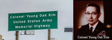 The portion of southbound I-5 in the County
of Orange, from the eastbound Route 91 exit (ORA 42.671) to near its
boundary with the County of Los Angeles (ORA 44.382) is named the "Colonel
Young Oak Kim, United States Army, Memorial Highway". It was named
in memory of Young Oak Kim, born in 1919 in the City of Los Angeles to
Soon Kwon Kim and Nora Koh, who had four sons, two daughters, and one
adopted son. Young Oak Kim graduated from Belmont High School and attended
Los Angeles City College, but dropped out to help support his impoverished
family. The United States Army refused his enlistment until Congress
enacted a law subjecting Asian Americans to conscription and Young Oak Kim
was drafted on January 31, 1941. After spending six months as an engineer,
Young Oak Kim was selected for Infantry Officer Candidate School at Fort
Benning, Georgia, and, upon graduating in January 1943, was assigned to
the United States 100th Infantry Battalion, a unit composed of
Japanese Americans from Hawaii. Fearing ethnic conflict between Young Oak
Kim and the Japanese American troops, the battalion commander offered Kim
a transfer to another battalion, but Kim remained, saying, “There
are no Japanese nor Korean here, we’re all Americans and we’re
fighting for the same cause”. The 100th Infantry
Battalion was sent to fight in North Africa and then in Italy where Young
Oak Kim’s map-reading skills and determination led to success in
several battles and “impossible missions”. Second Lieutenant
Kim’s first deployment was in Salerno, Italy, as part of the Allied
offensive against German forces, during which he was wounded near Santa
Maria Oliveto, and was subsequently awarded a Silver Star and his first
Purple Heart. Young Oak Kim was then promoted to first lieutenant and
participated in the Battle of Monte Cassino as part of the Allied attempt
to liberate Rome from German control. In planning for Operation Diadem,
the Allies needed to determine the location of German tank units. First
Lieutenant Kim, as an officer in the joint United States 100th
Infantry Battalion and 442nd Regimental Combat Team,
volunteered to capture German soldiers to gain military intelligence. On
May 16, 1944, with Private First Class Irving Akahoshi, First Lieutenant
Kim crawled into German-held territory near Cisterna, Italy, and captured
two German soldiers during daylight hours while the enemy rested for
evening watch. Using the intelligence from the two captured German
soldiers, the Allies broke the Gustav Line and liberated Rome. For his
actions, First Lieutenant Kim was awarded the Distinguished Service Cross
and the Italian Bronze Medal of Military Valor in 1944, and the Italian
War Cross for Military Valor in 1945. First Lieutenant Kim also led
elements of the 100th Infantry Battalion in battles at
Belvedere and Pisa, which helped break the Gothic Line, and enabled the
Allies to occupy Pisa without casualties. In France, First Lieutenant Kim
was the 100th Infantry Battalion’s operations officer,
and fought in battles that liberated the towns of Bruyères and
Biffontaine, but he sustained severe wounds from enemy fire in
Biffontaine, and was granted a six-month leave in Los Angeles, California,
in late 1944. Germany surrendered shortly before he could return to the
European Theater of Operations, and Kim, now a captain, was honorably
discharged from the United States Army. For his actions, Captain Kim
received a second Purple Heart and a French Croix de Guerre, along with a
plaque dedicated to him on a Biffontaine church wall. After leaving the
United States Army, Young Oak Kim started a successful self-service
laundry, which was rare at the time, and earned five times his salary as
an Army captain, but, two years later in 1950, war broke out in Korea and
he left the business and reenlisted in the Army. Young Oak Kim stated,
“As a Korean, the most direct way to help my father’s country
even a little, and as a United States citizen, the most direct way to
repay even a little of the debt owed to Korea by the United States, was to
go to Korea, pick up a gun, and fight”. At his request, Young Oak
Kim was sent to East Asia, which was the first time he had ever been to
Korea, and, by pretending not to know Korean and with help from people he
knew during World War II, he was able to join the infantry. Young Oak Kim
was assigned to the 31st Infantry Regiment of the 7th
Infantry Division in April 1951 as an intelligence officer and operations
officer under Lieutenant General William J. McCaffrey, who had scouted
him. Young Oak Kim rescued many United States and South Korean soldiers
during battle with the 31st Infantry Regiment playing a major
role in pushing Chinese troops back above the 38th parallel,
which was first crossed by his unit. In August 1951 during Operation
Piledriver, Young Oak Kim’s unit was mistakenly bombarded by the 555th
Field Artillery Battalion because it was able to advance too far north
past Kimhwa to appear friendly. He was severely injured in the friendly
fire incident, but was saved by doctors from Johns Hopkins University who
were in Tokyo, and he returned to Korea after two months of recuperation.
Upon his return, Lieutenant General McCaffrey put him in command of the
regiment’s 1st Battalion and promoted him to major,
making Young Oak Kim the first minority officer to command an army
battalion in United States history. Under Major Kim’s command, the
battalion adopted an orphanage in Seoul and cared for more than 500 war
orphans, enabling the orphans to grow up to become artists, musicians, and
other successful professionals. After fighting for nearly a year, Major
Kim left Korea in September 1952, and, in 2003, the South Korean
government honored him for his service to society. After serving in the
Korean War, Major Kim became an instructor at the United States Army
Infantry School in Fort Benning, Georgia, then served in Germany as a
staff officer and was promoted to lieutenant colonel in 1959, and then
became an instructor at the United States Army Command and General Staff
College. Major Kim returned to Korea in the early 1960s as a United States
military advisor to the South Korean army, during which time he was
promoted to the rank of colonel. After serving in the United States Army
for 30 years, Young Oak Kim attended California State University Dominguez
Hills to study history, but left after a year to advocate for greater
causes—racial equality, youths, the elderly, and the poor. In 1973,
Young Oak Kim joined Special Service for Groups (SSG), a nonprofit health
and human services organization dedicated to building and sustaining
community-based programs that address the needs of vulnerable and diverse
multiethnic communities. Young Oak Kim was nominated to be a board member
for the United Way by George Nishinaka, the head of SSG, and went on to
become the first person to serve on that board for 10 years. As a United
Way board member, Young Oak Kim recognized underserved ethnic communities
and worked to provide them with linguistically and culturally competent
services. When Young Oak Kim joined the United Way board, the Chinatown
Service Center was the only Asian United Way service center, but he added
Japanese, Filipino, Vietnamese, and Korean American centers to United
Way’s network, and helped to diversify the board through the
addition of three more Asian American board members. Young Oak Kim also
helped found the Korean Youth Cultural Center, was a founding member of
the Korean American Coalition, and, from 1986 to 1988, served as a member
of Serving the Family and Friends of the Keiro Homes. Throughout the
1990s, Young Oak Kim served as chairman of the Center for Pacific Asian
Family and, under his leadership, the organization became the largest
women’s shelter in southern California. In 1986, Young Oak Kim
cofounded the Korean Health, Education, Information and Research Center
(KHEIR) to provide recent, uninformed immigrants in southern California
with health care information and services, and, as one of largest ethnic
charity organizations today, KHEIR continues to help immigrants obtain
health care and offers them bilingual services in English, Spanish, and
Korean. From 1989 to 2005, Young Oak Kim served as chairman of 100th/442nd/MIS
WWII Memorial Foundation, a veteran’s association of Japanese
American soldiers who fought during World War II. Young Oak Kim also
cofounded the Go for Broke Monument, the Go for Broke National Educational
Center, and the Japanese American National Museum. These community efforts
were instrumental in providing new immigrants with the tools to acclimate
and become self-sufficient. On December 29, 2005, Colonel Kim passed away
at Cedars-Sinai Medical Center in Los Angeles, California, leaving a
strong legacy of community service to the residents of southern
California. Named by Assembly Concurrent Resolution (ACR) 188, Res.
Chapter 122, 7/10/2018.
The portion of southbound I-5 in the County
of Orange, from the eastbound Route 91 exit (ORA 42.671) to near its
boundary with the County of Los Angeles (ORA 44.382) is named the "Colonel
Young Oak Kim, United States Army, Memorial Highway". It was named
in memory of Young Oak Kim, born in 1919 in the City of Los Angeles to
Soon Kwon Kim and Nora Koh, who had four sons, two daughters, and one
adopted son. Young Oak Kim graduated from Belmont High School and attended
Los Angeles City College, but dropped out to help support his impoverished
family. The United States Army refused his enlistment until Congress
enacted a law subjecting Asian Americans to conscription and Young Oak Kim
was drafted on January 31, 1941. After spending six months as an engineer,
Young Oak Kim was selected for Infantry Officer Candidate School at Fort
Benning, Georgia, and, upon graduating in January 1943, was assigned to
the United States 100th Infantry Battalion, a unit composed of
Japanese Americans from Hawaii. Fearing ethnic conflict between Young Oak
Kim and the Japanese American troops, the battalion commander offered Kim
a transfer to another battalion, but Kim remained, saying, “There
are no Japanese nor Korean here, we’re all Americans and we’re
fighting for the same cause”. The 100th Infantry
Battalion was sent to fight in North Africa and then in Italy where Young
Oak Kim’s map-reading skills and determination led to success in
several battles and “impossible missions”. Second Lieutenant
Kim’s first deployment was in Salerno, Italy, as part of the Allied
offensive against German forces, during which he was wounded near Santa
Maria Oliveto, and was subsequently awarded a Silver Star and his first
Purple Heart. Young Oak Kim was then promoted to first lieutenant and
participated in the Battle of Monte Cassino as part of the Allied attempt
to liberate Rome from German control. In planning for Operation Diadem,
the Allies needed to determine the location of German tank units. First
Lieutenant Kim, as an officer in the joint United States 100th
Infantry Battalion and 442nd Regimental Combat Team,
volunteered to capture German soldiers to gain military intelligence. On
May 16, 1944, with Private First Class Irving Akahoshi, First Lieutenant
Kim crawled into German-held territory near Cisterna, Italy, and captured
two German soldiers during daylight hours while the enemy rested for
evening watch. Using the intelligence from the two captured German
soldiers, the Allies broke the Gustav Line and liberated Rome. For his
actions, First Lieutenant Kim was awarded the Distinguished Service Cross
and the Italian Bronze Medal of Military Valor in 1944, and the Italian
War Cross for Military Valor in 1945. First Lieutenant Kim also led
elements of the 100th Infantry Battalion in battles at
Belvedere and Pisa, which helped break the Gothic Line, and enabled the
Allies to occupy Pisa without casualties. In France, First Lieutenant Kim
was the 100th Infantry Battalion’s operations officer,
and fought in battles that liberated the towns of Bruyères and
Biffontaine, but he sustained severe wounds from enemy fire in
Biffontaine, and was granted a six-month leave in Los Angeles, California,
in late 1944. Germany surrendered shortly before he could return to the
European Theater of Operations, and Kim, now a captain, was honorably
discharged from the United States Army. For his actions, Captain Kim
received a second Purple Heart and a French Croix de Guerre, along with a
plaque dedicated to him on a Biffontaine church wall. After leaving the
United States Army, Young Oak Kim started a successful self-service
laundry, which was rare at the time, and earned five times his salary as
an Army captain, but, two years later in 1950, war broke out in Korea and
he left the business and reenlisted in the Army. Young Oak Kim stated,
“As a Korean, the most direct way to help my father’s country
even a little, and as a United States citizen, the most direct way to
repay even a little of the debt owed to Korea by the United States, was to
go to Korea, pick up a gun, and fight”. At his request, Young Oak
Kim was sent to East Asia, which was the first time he had ever been to
Korea, and, by pretending not to know Korean and with help from people he
knew during World War II, he was able to join the infantry. Young Oak Kim
was assigned to the 31st Infantry Regiment of the 7th
Infantry Division in April 1951 as an intelligence officer and operations
officer under Lieutenant General William J. McCaffrey, who had scouted
him. Young Oak Kim rescued many United States and South Korean soldiers
during battle with the 31st Infantry Regiment playing a major
role in pushing Chinese troops back above the 38th parallel,
which was first crossed by his unit. In August 1951 during Operation
Piledriver, Young Oak Kim’s unit was mistakenly bombarded by the 555th
Field Artillery Battalion because it was able to advance too far north
past Kimhwa to appear friendly. He was severely injured in the friendly
fire incident, but was saved by doctors from Johns Hopkins University who
were in Tokyo, and he returned to Korea after two months of recuperation.
Upon his return, Lieutenant General McCaffrey put him in command of the
regiment’s 1st Battalion and promoted him to major,
making Young Oak Kim the first minority officer to command an army
battalion in United States history. Under Major Kim’s command, the
battalion adopted an orphanage in Seoul and cared for more than 500 war
orphans, enabling the orphans to grow up to become artists, musicians, and
other successful professionals. After fighting for nearly a year, Major
Kim left Korea in September 1952, and, in 2003, the South Korean
government honored him for his service to society. After serving in the
Korean War, Major Kim became an instructor at the United States Army
Infantry School in Fort Benning, Georgia, then served in Germany as a
staff officer and was promoted to lieutenant colonel in 1959, and then
became an instructor at the United States Army Command and General Staff
College. Major Kim returned to Korea in the early 1960s as a United States
military advisor to the South Korean army, during which time he was
promoted to the rank of colonel. After serving in the United States Army
for 30 years, Young Oak Kim attended California State University Dominguez
Hills to study history, but left after a year to advocate for greater
causes—racial equality, youths, the elderly, and the poor. In 1973,
Young Oak Kim joined Special Service for Groups (SSG), a nonprofit health
and human services organization dedicated to building and sustaining
community-based programs that address the needs of vulnerable and diverse
multiethnic communities. Young Oak Kim was nominated to be a board member
for the United Way by George Nishinaka, the head of SSG, and went on to
become the first person to serve on that board for 10 years. As a United
Way board member, Young Oak Kim recognized underserved ethnic communities
and worked to provide them with linguistically and culturally competent
services. When Young Oak Kim joined the United Way board, the Chinatown
Service Center was the only Asian United Way service center, but he added
Japanese, Filipino, Vietnamese, and Korean American centers to United
Way’s network, and helped to diversify the board through the
addition of three more Asian American board members. Young Oak Kim also
helped found the Korean Youth Cultural Center, was a founding member of
the Korean American Coalition, and, from 1986 to 1988, served as a member
of Serving the Family and Friends of the Keiro Homes. Throughout the
1990s, Young Oak Kim served as chairman of the Center for Pacific Asian
Family and, under his leadership, the organization became the largest
women’s shelter in southern California. In 1986, Young Oak Kim
cofounded the Korean Health, Education, Information and Research Center
(KHEIR) to provide recent, uninformed immigrants in southern California
with health care information and services, and, as one of largest ethnic
charity organizations today, KHEIR continues to help immigrants obtain
health care and offers them bilingual services in English, Spanish, and
Korean. From 1989 to 2005, Young Oak Kim served as chairman of 100th/442nd/MIS
WWII Memorial Foundation, a veteran’s association of Japanese
American soldiers who fought during World War II. Young Oak Kim also
cofounded the Go for Broke Monument, the Go for Broke National Educational
Center, and the Japanese American National Museum. These community efforts
were instrumental in providing new immigrants with the tools to acclimate
and become self-sufficient. On December 29, 2005, Colonel Kim passed away
at Cedars-Sinai Medical Center in Los Angeles, California, leaving a
strong legacy of community service to the residents of southern
California. Named by Assembly Concurrent Resolution (ACR) 188, Res.
Chapter 122, 7/10/2018.
(Image Source: CHP Facebook page; Young Oak Kim Center)
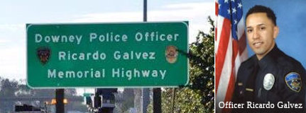 The portion of I-5 between the San Gabriel River Bridge (bridge number 53-213) at post
mile 005 LA 7.06 and the Rio Hondo River Bridge (bridge number 53-639) at
post mile 005 LA 9.46 in the City of Downey in the County of Los Angeles
County is named the "Downey Police Officer Ricardo Galvez Memorial
Highway". City of Downey Police Officer Ricardo Galvez was born in
April 1986 in the City of Los Angeles. He was raised in the Cities of Los
Angeles and Bell Gardens, California, where he attended elementary school
and high school. Ricardo began his law enforcement career in 2006 when he
was hired by the Downey Police Department as a police aide. In 2008,
Ricardo enlisted in the United States Marine Corps Reserve and was
stationed out of the Cities of Pico Rivera and Los Alamitos. Ricardo
served as a Marine Corps Reservist for approximately six years, during
which time he was deployed overseas as part of Operation Iraqi Freedom in
Afghanistan and Iraq. Ricardo was hired by the Downey Police Department as
a police cadet in March 2010, graduated from the Orange County
Sheriff’s Academy in September 2010, and began his career as a
Downey Police Officer when he was sworn in on September 2, 2010. Over the
next five years, Ricardo worked patrol, establishing himself as a
competent and compassionate police officer, and strove to be a K-9
officer, volunteering to become an “agitator” to better
prepare himself for the position. On November 18, 2015, after finishing a
training session with the department’s K-9 team, Ricardo returned to
the station to complete his shift and, while he was seated in his vehicle
adjacent to the police station, two individuals approached his car on foot
and the individual on the driver’s side of the vehicle fired one
round from a handgun into Ricardo’s vehicle, striking and killing
him. Ricardo’s compassion and willingness to help others was always
on display, and he routinely volunteered his time to coach kids from his
home neighborhood in Boyle Heights at “State Park”. That
willingness to help was evident when Ricardo, after stopping an elderly
female for having expired registration and discovering that she had
recently lost her husband and did not have the money to register her
vehicle, decided to let her go with a warning and then paid her
registration himself. Ricardo was an avid runner and fitness fanatic who
could often be seen training for the Baker to Vegas Challenge Cup Relay,
which is often referred to as the ultimate foot pursuit, and is a
difficult 20 stage, 120-mile relay race that starts in Baker, California,
and ends in Las Vegas, Nevada. Ricardo was not only a valued member of his
Baker to Vegas Challenge Cup Relay team, but was also instrumental in
organizing the Downey Police squad for the event. Named by Senate
Concurrent Resolution (SCR) 111, Res. Chapter 95, Statutes of 2016, on
August 5, 2016.
The portion of I-5 between the San Gabriel River Bridge (bridge number 53-213) at post
mile 005 LA 7.06 and the Rio Hondo River Bridge (bridge number 53-639) at
post mile 005 LA 9.46 in the City of Downey in the County of Los Angeles
County is named the "Downey Police Officer Ricardo Galvez Memorial
Highway". City of Downey Police Officer Ricardo Galvez was born in
April 1986 in the City of Los Angeles. He was raised in the Cities of Los
Angeles and Bell Gardens, California, where he attended elementary school
and high school. Ricardo began his law enforcement career in 2006 when he
was hired by the Downey Police Department as a police aide. In 2008,
Ricardo enlisted in the United States Marine Corps Reserve and was
stationed out of the Cities of Pico Rivera and Los Alamitos. Ricardo
served as a Marine Corps Reservist for approximately six years, during
which time he was deployed overseas as part of Operation Iraqi Freedom in
Afghanistan and Iraq. Ricardo was hired by the Downey Police Department as
a police cadet in March 2010, graduated from the Orange County
Sheriff’s Academy in September 2010, and began his career as a
Downey Police Officer when he was sworn in on September 2, 2010. Over the
next five years, Ricardo worked patrol, establishing himself as a
competent and compassionate police officer, and strove to be a K-9
officer, volunteering to become an “agitator” to better
prepare himself for the position. On November 18, 2015, after finishing a
training session with the department’s K-9 team, Ricardo returned to
the station to complete his shift and, while he was seated in his vehicle
adjacent to the police station, two individuals approached his car on foot
and the individual on the driver’s side of the vehicle fired one
round from a handgun into Ricardo’s vehicle, striking and killing
him. Ricardo’s compassion and willingness to help others was always
on display, and he routinely volunteered his time to coach kids from his
home neighborhood in Boyle Heights at “State Park”. That
willingness to help was evident when Ricardo, after stopping an elderly
female for having expired registration and discovering that she had
recently lost her husband and did not have the money to register her
vehicle, decided to let her go with a warning and then paid her
registration himself. Ricardo was an avid runner and fitness fanatic who
could often be seen training for the Baker to Vegas Challenge Cup Relay,
which is often referred to as the ultimate foot pursuit, and is a
difficult 20 stage, 120-mile relay race that starts in Baker, California,
and ends in Las Vegas, Nevada. Ricardo was not only a valued member of his
Baker to Vegas Challenge Cup Relay team, but was also instrumental in
organizing the Downey Police squad for the event. Named by Senate
Concurrent Resolution (SCR) 111, Res. Chapter 95, Statutes of 2016, on
August 5, 2016.
(Image Source: Downey PD; LBPress
Telegram 1/15/2016)
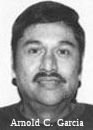 The portion of I-5 between East Olympic Boulevard (~ 005 LA
14.132) and South Atlantic Boulevard (~ 005 LA 12.723), in the City of
Commerce, is officially named the "Arnold C. Garcia Memorial Highway".
This segment was named in honor of Arnold C. Garcia, a Los Angeles County
Probation Department group supervisor, who worked the graveyard shift at
the Dorothy E. Kirby Center, supervising locked cottages housing some of
Los Angeles County's youngest and most troubled offenders. As all Los
Angeles County Probation Department employees, Arnold C. Garcia was
equipped with only two weapons: muscle and guile. Although department
guidelines recommend one guard for every 10 juveniles in custody, Arnold
C. Garcia was charged with watching over a 20-bed cottage. During night
shifts at the center, Arnold C. Garcia frequently bent the rules, bringing
candy and videos for the most well-behaved wards. According to coworkers,
he always had his Bible in hand, passing the lonely hours by praying for
the wards. On April 4, 1994, Arnold C. Garcia heard a knock from inside
one of the bedroom doors. The ward inside, who was serving time for
burglary and possession of a concealed weapon, asked for permission to use
the restroom. After opening the door, Arnold C. Garcia was struck in the
head with a metal object from a disassembled desk in the room. The alleged
assailant fled with another ward, but was captured a short time later.
Arnold C. Garcia was the first Los Angeles County Probation Department
employee killed in the line of duty since the department was formed in
1903, and the tragic death of Arnold C. Garcia serves as a symbol of the
increasingly hazardous mission faced by employees at Los Angeles County's
three juvenile halls and 20 probation camps. Named by Assembly Concurrant
Resolution (ACR) 130, 8/30/2010, Resolution Chapter 111.
The portion of I-5 between East Olympic Boulevard (~ 005 LA
14.132) and South Atlantic Boulevard (~ 005 LA 12.723), in the City of
Commerce, is officially named the "Arnold C. Garcia Memorial Highway".
This segment was named in honor of Arnold C. Garcia, a Los Angeles County
Probation Department group supervisor, who worked the graveyard shift at
the Dorothy E. Kirby Center, supervising locked cottages housing some of
Los Angeles County's youngest and most troubled offenders. As all Los
Angeles County Probation Department employees, Arnold C. Garcia was
equipped with only two weapons: muscle and guile. Although department
guidelines recommend one guard for every 10 juveniles in custody, Arnold
C. Garcia was charged with watching over a 20-bed cottage. During night
shifts at the center, Arnold C. Garcia frequently bent the rules, bringing
candy and videos for the most well-behaved wards. According to coworkers,
he always had his Bible in hand, passing the lonely hours by praying for
the wards. On April 4, 1994, Arnold C. Garcia heard a knock from inside
one of the bedroom doors. The ward inside, who was serving time for
burglary and possession of a concealed weapon, asked for permission to use
the restroom. After opening the door, Arnold C. Garcia was struck in the
head with a metal object from a disassembled desk in the room. The alleged
assailant fled with another ward, but was captured a short time later.
Arnold C. Garcia was the first Los Angeles County Probation Department
employee killed in the line of duty since the department was formed in
1903, and the tragic death of Arnold C. Garcia serves as a symbol of the
increasingly hazardous mission faced by employees at Los Angeles County's
three juvenile halls and 20 probation camps. Named by Assembly Concurrant
Resolution (ACR) 130, 8/30/2010, Resolution Chapter 111.
(Image Source: Officer Down Memorial Page)
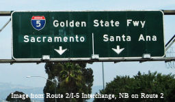 The segment from the Route 5/Route 10/Route 60/US 101 interchange (~ 005 LA
16.335) to Route 14 (~ 005 LA R45.51) is officially named the "Golden
State" Freeway. It was named by the Metropolitan Transportation
Engineering Board (MTEB) on February 28, 1958, based on the fact that the
route traverses the "Golden State" of California. The first segment of the
Golden State Freeway opened in 1954 (the segment from the Route 7 (now
Route 14)/US 6/US 99 Junction to Weldon Canyon); the last in 1975. The
truck route dates to 1954. [The MTEB came into existence sometime after
the passage of the Collier-Burns Highway Act of 1947 and lasted until the
freeway system was finalized in the late 1950s. It was described as "...a
voluntary group of the administrative officials of State, County and
forty-three of the Municipalities within the Los Angeles Metropolitan
District." Among the forty-seven members of the LAMTAC were the following
notables: Leonard K. Firestone, Firestone Tire an Rubber Co.; M. Richard
Gross, Treasurer, Richfield Oil Co.; Kenneth W. Kendricks, Dist. Sales
Mgr., Standard Oil of California; Harry March, Secretary, Signal Oil Co.;
J.W. Miller, Union Oil Co.; D.W. Sanford, Vice President, Goodyear Tire
and Rubber Co.; and R.D. Stetson, Manager, LA Div., Shell Oil.]
The segment from the Route 5/Route 10/Route 60/US 101 interchange (~ 005 LA
16.335) to Route 14 (~ 005 LA R45.51) is officially named the "Golden
State" Freeway. It was named by the Metropolitan Transportation
Engineering Board (MTEB) on February 28, 1958, based on the fact that the
route traverses the "Golden State" of California. The first segment of the
Golden State Freeway opened in 1954 (the segment from the Route 7 (now
Route 14)/US 6/US 99 Junction to Weldon Canyon); the last in 1975. The
truck route dates to 1954. [The MTEB came into existence sometime after
the passage of the Collier-Burns Highway Act of 1947 and lasted until the
freeway system was finalized in the late 1950s. It was described as "...a
voluntary group of the administrative officials of State, County and
forty-three of the Municipalities within the Los Angeles Metropolitan
District." Among the forty-seven members of the LAMTAC were the following
notables: Leonard K. Firestone, Firestone Tire an Rubber Co.; M. Richard
Gross, Treasurer, Richfield Oil Co.; Kenneth W. Kendricks, Dist. Sales
Mgr., Standard Oil of California; Harry March, Secretary, Signal Oil Co.;
J.W. Miller, Union Oil Co.; D.W. Sanford, Vice President, Goodyear Tire
and Rubber Co.; and R.D. Stetson, Manager, LA Div., Shell Oil.]
 The portion of I-5 between West Burbank
Boulevard in the city of Burbank (~ 005 LA 29.761) and Hollywood Way in
the City of Los Angeles (~ 005 LA 32.375) is named the Burbank Police
Officer Matthew Pavelka Memorial Freeway. It was named in memory of
Burbank Police Officer Matthew Pavelka (1977-2004). Officer Pavelka served
in the United States Air Force from 1997 to 2001, where he was awarded two
medals for meritorious service. He was hired as a Police Recruit in August
of 2002, attended the Ventura County Sheriff's Academy, and was promoted
to Police Officer in January of 2003. He was just 26 years of age when he
was called to assist veteran Officer Gregory Campbell with a routine
traffic stop at the Ramada Inn on North San Fernando Road on the night of
November 15, 2003. Tragically, the two men Officer Campbell had pulled
over opened fire, injuring Officer Campbell and killing Officer Pavelka.
Officer Pavelka was the first police officer to be killed in the line of
duty in the Burbank Police Department's 82 year history. Named by Assembly
Concurrent Resolution 156, August 19, 2004, Chapter 150.
The portion of I-5 between West Burbank
Boulevard in the city of Burbank (~ 005 LA 29.761) and Hollywood Way in
the City of Los Angeles (~ 005 LA 32.375) is named the Burbank Police
Officer Matthew Pavelka Memorial Freeway. It was named in memory of
Burbank Police Officer Matthew Pavelka (1977-2004). Officer Pavelka served
in the United States Air Force from 1997 to 2001, where he was awarded two
medals for meritorious service. He was hired as a Police Recruit in August
of 2002, attended the Ventura County Sheriff's Academy, and was promoted
to Police Officer in January of 2003. He was just 26 years of age when he
was called to assist veteran Officer Gregory Campbell with a routine
traffic stop at the Ramada Inn on North San Fernando Road on the night of
November 15, 2003. Tragically, the two men Officer Campbell had pulled
over opened fire, injuring Officer Campbell and killing Officer Pavelka.
Officer Pavelka was the first police officer to be killed in the line of
duty in the Burbank Police Department's 82 year history. Named by Assembly
Concurrent Resolution 156, August 19, 2004, Chapter 150.
(Image Source: Burbank POA)
 The portion of I-5 from Route 118 (~ 005 LA 39.416) to Route 170
(~ 005 LA 36.244) in the County of Los Angeles is named the "Ritchie
Valens Memorial Highway". It was named in memory of Richard Steven
Valenzuela, who would come to be known internationally as “Ritchie
Valens,” who was born on May 13, 1941, in Pacoima, California, a
neighborhood in the San Fernando Valley region of Los Angeles. Ritchie
Valens was raised with musical influences of traditional Mexican mariachi
music and flamenco guitar, African American rhythm and blues vocal groups,
and jump blues, leading him to express an interest in making music of his
own. Ritchie Valens was encouraged by his father to learn to play the
guitar and trumpet, and his love for music later led him to teach himself
the drums. Ritchie Valens became popular for bringing his guitar to his
school, Pacoima Junior High School, to sing and play songs to his friends
in the bleachers. Ritchie Valens, at 16 years of age, accepted an
invitation to play guitar and sing vocals in a local garage band, the
Silhouettes, a diverse group that reflected Pacoima’s ethnic mix and
was composed of African American, Chicano, and Japanese American members.
Ritchie Valens and the Silhouettes played at dances, gatherings, and
parties throughout the northeast end of the San Fernando Valley, and
Valens’ boisterous vocals and expert guitar skills helped draw big
crowds, leading him to be known as “Little Richard of the
Valley”. Ritchie Valens was discovered by a talent scout one night
in May 1958 when the Silhouettes packed the American Legion Hall in
Pacoima. Ritchie Valens was invited by Bob Keane, the owner and president
of Del-Fi Records in Hollywood, California, to audition for his record
label, eventually signing him to a solo recording contract with Del-Fi
Records on May 27, 1958. Ritchie Valens’ first recorded original,
“Come On, Let’s Go,” was recorded in July 1958, and
became an immediate success. Ritchie Valens struck even greater success
with his second single, a dual-sided record featuring the songs “La
Bamba,” an acknowledgment of his Chicano heritage, and
“Donna,” an ode to his high school girlfriend, Donna Ludwig,
whom he met at San Fernando High School, which sold over one million
copies, and was awarded a gold disc by the Recording Industry Association
of America. Ritchie Valens’ career skyrocketed, and in the remaining
months of 1958, he appeared on Dick Clark’s “American
Bandstand” television show, performed alongside Buddy Holly, and
played at Alan Freed’s Christmas Jubilee in New York City. Ritchie
Valens began traveling the Midwest in early 1959 as a member of a
multimember rock ’n’ roll tour called “The Winter Dance
Party”. Ritchie Valens’ promising career was heartbreakingly
cut short when, on February 3, 1959, after leaving a performance in Clear
Lake, Iowa, at the tender young age of 17, he passed away in a private
airplane accident with fellow musicians Buddy Holly and J.P. “The
Big Bopper” Richardson, a tragedy that was later eternalized as
“the day the music died”. To this day, Ritchie Valens is
regarded as a rock and roll pioneer and the forefather of the Chicano rock
movement, inspiring others at a time when there were very few Latinos in
American rock music. Ritchie Valens’ rendition of “La
Bamba,” featuring successful blending of traditional Latin American
music with classic rock ’n’ roll music, proved to be a
historic recording that would come to influence other famous Chicano
musicians .Named by Assembly Concurrent Resolution (ACR) 23, 8/30/2017,
Res. Chapter 128, Statutes of 2017. On August 25, 2018, the Valens family,
neighborhood leaders, as well as state and local leaders, came together to
celebrate the unveiling of The Ritchie Valens Memorial Highway signage.
The portion of I-5 from Route 118 (~ 005 LA 39.416) to Route 170
(~ 005 LA 36.244) in the County of Los Angeles is named the "Ritchie
Valens Memorial Highway". It was named in memory of Richard Steven
Valenzuela, who would come to be known internationally as “Ritchie
Valens,” who was born on May 13, 1941, in Pacoima, California, a
neighborhood in the San Fernando Valley region of Los Angeles. Ritchie
Valens was raised with musical influences of traditional Mexican mariachi
music and flamenco guitar, African American rhythm and blues vocal groups,
and jump blues, leading him to express an interest in making music of his
own. Ritchie Valens was encouraged by his father to learn to play the
guitar and trumpet, and his love for music later led him to teach himself
the drums. Ritchie Valens became popular for bringing his guitar to his
school, Pacoima Junior High School, to sing and play songs to his friends
in the bleachers. Ritchie Valens, at 16 years of age, accepted an
invitation to play guitar and sing vocals in a local garage band, the
Silhouettes, a diverse group that reflected Pacoima’s ethnic mix and
was composed of African American, Chicano, and Japanese American members.
Ritchie Valens and the Silhouettes played at dances, gatherings, and
parties throughout the northeast end of the San Fernando Valley, and
Valens’ boisterous vocals and expert guitar skills helped draw big
crowds, leading him to be known as “Little Richard of the
Valley”. Ritchie Valens was discovered by a talent scout one night
in May 1958 when the Silhouettes packed the American Legion Hall in
Pacoima. Ritchie Valens was invited by Bob Keane, the owner and president
of Del-Fi Records in Hollywood, California, to audition for his record
label, eventually signing him to a solo recording contract with Del-Fi
Records on May 27, 1958. Ritchie Valens’ first recorded original,
“Come On, Let’s Go,” was recorded in July 1958, and
became an immediate success. Ritchie Valens struck even greater success
with his second single, a dual-sided record featuring the songs “La
Bamba,” an acknowledgment of his Chicano heritage, and
“Donna,” an ode to his high school girlfriend, Donna Ludwig,
whom he met at San Fernando High School, which sold over one million
copies, and was awarded a gold disc by the Recording Industry Association
of America. Ritchie Valens’ career skyrocketed, and in the remaining
months of 1958, he appeared on Dick Clark’s “American
Bandstand” television show, performed alongside Buddy Holly, and
played at Alan Freed’s Christmas Jubilee in New York City. Ritchie
Valens began traveling the Midwest in early 1959 as a member of a
multimember rock ’n’ roll tour called “The Winter Dance
Party”. Ritchie Valens’ promising career was heartbreakingly
cut short when, on February 3, 1959, after leaving a performance in Clear
Lake, Iowa, at the tender young age of 17, he passed away in a private
airplane accident with fellow musicians Buddy Holly and J.P. “The
Big Bopper” Richardson, a tragedy that was later eternalized as
“the day the music died”. To this day, Ritchie Valens is
regarded as a rock and roll pioneer and the forefather of the Chicano rock
movement, inspiring others at a time when there were very few Latinos in
American rock music. Ritchie Valens’ rendition of “La
Bamba,” featuring successful blending of traditional Latin American
music with classic rock ’n’ roll music, proved to be a
historic recording that would come to influence other famous Chicano
musicians .Named by Assembly Concurrent Resolution (ACR) 23, 8/30/2017,
Res. Chapter 128, Statutes of 2017. On August 25, 2018, the Valens family,
neighborhood leaders, as well as state and local leaders, came together to
celebrate the unveiling of The Ritchie Valens Memorial Highway signage.
(Image source: Pacoima Historical Society; Biography)
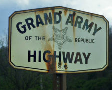 The segment of Route 5 that was cosigned with US 6
(i.e., from Route 14 to Route 110) was named the "Grand Army of the
Republic Highway" by Assembly Concurrent Resolution 33, Chapter 73,
in 1943. The GAR is a membership organization founded in Decatur, Illinois
on April 6, 1866 by Benjamin F. Stephenson. It's membership was limited to
honorably discharged veterans of the Union Army, Navy, Marine Corps or the
Revenue Cutter Service who had served between April 12, 1861 and April 9,
1865. The GAR is responsible for the establishment of Memorial Day, which
began in 1868 when GAR Commander-in-Chief John A. Logan issued General
Order No. 11 calling for all Departments and Posts to set aside the 30th
of May as a day for remembering the sacrifices of fallen comrades. The
final Encampment of the Grand Army of the Republic was held in
Indianapolis, Indiana in 1949 and the last member, Albert Woolson died in
1956 at the age of 109 years.
The segment of Route 5 that was cosigned with US 6
(i.e., from Route 14 to Route 110) was named the "Grand Army of the
Republic Highway" by Assembly Concurrent Resolution 33, Chapter 73,
in 1943. The GAR is a membership organization founded in Decatur, Illinois
on April 6, 1866 by Benjamin F. Stephenson. It's membership was limited to
honorably discharged veterans of the Union Army, Navy, Marine Corps or the
Revenue Cutter Service who had served between April 12, 1861 and April 9,
1865. The GAR is responsible for the establishment of Memorial Day, which
began in 1868 when GAR Commander-in-Chief John A. Logan issued General
Order No. 11 calling for all Departments and Posts to set aside the 30th
of May as a day for remembering the sacrifices of fallen comrades. The
final Encampment of the Grand Army of the Republic was held in
Indianapolis, Indiana in 1949 and the last member, Albert Woolson died in
1956 at the age of 109 years.
[Information on the GAR excerpted from the pages of the Sons of Union Veterans of the Civil War].
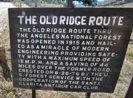 Portions of this route from the vicinity of Route 14 to the I-5/Route 99 junction are
historically named the "Ridge Route". Michael Ballard's site can provide additional specifics. The Ridge Route first opened in 1915 and
was paved four years later using mule-powered graders. The 20-foot wide
ribbon of concrete hugged the top of the San Gabriel and Tehachapi
Mountains - often precariously - as it climbed over the Tejon Pass. A trip
from L.A. to Bakersfield took 12 hours, and could be a harrowing
experience. Since funds for blasting were non-existent at the time of its
construction, its engineers were forced to follow the contours of the
hills. This created nearly 700 curves in one 36-mile stretch between
Castaic and Gorman. The road was just wide enough for two Model-T's to
pass, and to jump one of its few curbs could send a vehicle tumbling
hundreds of feet down a canyon. Stretches of the route were so steep that
it was common to see cars, which lacked fuel pumps at the time, going up
backwards. The current I-5 routing from Route 138 south to Castaic is a
bit to the west of the old Ridge Route. From Route 138 to Grapevine, I-5
parallels or sits on the alignment (the southbound lanes up the hill from
the San Joaquin Valley sit on the old road). Sometime in the 30's, a new
road was built away from the original Ridge Route; this was US 99. I-5
follows most of this alignment, with the exception of the section between
Templin Hwy (at Violin Summit, north of Castaic) and Smokey Bear Rd
(formerly Hungry Valley Rd). Most of that alignment is now under Pyramid
Lake. You can still travel the Ridge Route: From Los Angeles, take I-5
north, exit at Lake Hughes Rd, turn right, and turn left after a few
blocks on Ridge Route (yes, that's the street name). It winds its way
through the mountains, although most of the curves have been now cut off.
You can still see many of the original concrete patches. It comes out at
Lake Elizabeth Rd. (Los Angeles County Sign Route N2) Turn left, and you eventually meet
up with Route 138. Additionally, a 17.6 mile stretch that runs through the
Angeles National Forest was placed on the National Registry of Historic
Places in 1997. This section has been closed to the public since floods
washed out parts of it in 2005. But one Saturday a month the gates are
opened to allow a group of Ridge Route Preservation Organization (RRPO) volunteers entry for the "privilege" of cleaning drains and clearing rocks in hopes of re-opening
the old road in the near future. You can find much more history at the RRPO website, and there is also a good article on the Ridge Route from the Automobile Club.
Portions of this route from the vicinity of Route 14 to the I-5/Route 99 junction are
historically named the "Ridge Route". Michael Ballard's site can provide additional specifics. The Ridge Route first opened in 1915 and
was paved four years later using mule-powered graders. The 20-foot wide
ribbon of concrete hugged the top of the San Gabriel and Tehachapi
Mountains - often precariously - as it climbed over the Tejon Pass. A trip
from L.A. to Bakersfield took 12 hours, and could be a harrowing
experience. Since funds for blasting were non-existent at the time of its
construction, its engineers were forced to follow the contours of the
hills. This created nearly 700 curves in one 36-mile stretch between
Castaic and Gorman. The road was just wide enough for two Model-T's to
pass, and to jump one of its few curbs could send a vehicle tumbling
hundreds of feet down a canyon. Stretches of the route were so steep that
it was common to see cars, which lacked fuel pumps at the time, going up
backwards. The current I-5 routing from Route 138 south to Castaic is a
bit to the west of the old Ridge Route. From Route 138 to Grapevine, I-5
parallels or sits on the alignment (the southbound lanes up the hill from
the San Joaquin Valley sit on the old road). Sometime in the 30's, a new
road was built away from the original Ridge Route; this was US 99. I-5
follows most of this alignment, with the exception of the section between
Templin Hwy (at Violin Summit, north of Castaic) and Smokey Bear Rd
(formerly Hungry Valley Rd). Most of that alignment is now under Pyramid
Lake. You can still travel the Ridge Route: From Los Angeles, take I-5
north, exit at Lake Hughes Rd, turn right, and turn left after a few
blocks on Ridge Route (yes, that's the street name). It winds its way
through the mountains, although most of the curves have been now cut off.
You can still see many of the original concrete patches. It comes out at
Lake Elizabeth Rd. (Los Angeles County Sign Route N2) Turn left, and you eventually meet
up with Route 138. Additionally, a 17.6 mile stretch that runs through the
Angeles National Forest was placed on the National Registry of Historic
Places in 1997. This section has been closed to the public since floods
washed out parts of it in 2005. But one Saturday a month the gates are
opened to allow a group of Ridge Route Preservation Organization (RRPO) volunteers entry for the "privilege" of cleaning drains and clearing rocks in hopes of re-opening
the old road in the near future. You can find much more history at the RRPO website, and there is also a good article on the Ridge Route from the Automobile Club.
(Source: Some material came from an article on the RRPO in The Signal in March 2010; Image source: SCV Signal)
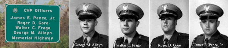 The portion of I-5 between the Rye
Canyon Road overcrossing (~ 005 LA R54.167) and Magic Mountain Parkway (~
005 LA R53.516) in the County of Los Angeles is named the "California
Highway Patrol Officers James E. Pence, Jr., Roger D. Gore, Walter C.
Frago, and George M. Alleyn Memorial Highway". It was named in honor
of four CHP officers who made significant contributions to traffic safety
and to the motoring public while assigned to the Newhall Area Office and
who were killed in the line of duty in the early morning hours of April 6,
1970, by armed assailants during a traffic enforcement stop in Newhall:
California Highway Patrol Officer James E. Pence, Jr., badge number 6885;
California Highway Patrol Officer Roger D. Gore, badge number 6600;
California Highway Patrol Officer Walter C. Frago, badge number 6573; and
California Highway Patrol Officer George M. Alleyn, badge number 6290.
Named by Senate Concurrent Resolution (SCR) 93, Resolution Chapter 92, on
8/11/2006.
The portion of I-5 between the Rye
Canyon Road overcrossing (~ 005 LA R54.167) and Magic Mountain Parkway (~
005 LA R53.516) in the County of Los Angeles is named the "California
Highway Patrol Officers James E. Pence, Jr., Roger D. Gore, Walter C.
Frago, and George M. Alleyn Memorial Highway". It was named in honor
of four CHP officers who made significant contributions to traffic safety
and to the motoring public while assigned to the Newhall Area Office and
who were killed in the line of duty in the early morning hours of April 6,
1970, by armed assailants during a traffic enforcement stop in Newhall:
California Highway Patrol Officer James E. Pence, Jr., badge number 6885;
California Highway Patrol Officer Roger D. Gore, badge number 6600;
California Highway Patrol Officer Walter C. Frago, badge number 6573; and
California Highway Patrol Officer George M. Alleyn, badge number 6290.
Named by Senate Concurrent Resolution (SCR) 93, Resolution Chapter 92, on
8/11/2006.
(Image Sources: Flikrriver; LA Morgue Files)
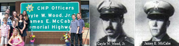 The portion of Route 5 between Palomas Wash
Bridge (005 LA R060.52) and 5 miles north of Palomas Wash Bridge (005 LA
R065.52) in the County of Los Angeles is named the "CHP Officers Gayle
W. Wood, Jr. and James E. McCabe Memorial Highway". It was named in
memory of California Highway Patrol (CHP) officers Gayle W. Wood, Jr. and
James Edward McCabe. Officer Gayle Wesley Wood, Jr. was born March 26,
1937, to Gayle and Dorothy Wood, in Barstow, California. He graduated from
Glendale High School in 1954, and attended Life Pacific College. He was
employed by the Huntington Beach Police Department as a car and motorcycle
driver prior to becoming a CHP officer. Officer Wood, graduated from the
CHP Academy in 1969 and was president of his class, and upon graduation he
was assigned to the Santa Ana Area Office. After approximately one year
with that office, CHP Officer Wood was transferred to the South Los
Angeles Area and was assigned to motorcycle duty until being transferred
to the Van Nuys Airport in 1973 as a helicopter pilot, where he spent the
remainder of his career. Officer James Edward McCabe was born July 8,
1944, to Bud and Ruth McCabe in Los Angeles, California. Officer McCabe
graduated from Don Bosco High School in 1962, and continued his education
by attending California State University, Los Angeles, where he graduated
with a Bachelor of Science Degree in Police Science and Administration in
1974. Prior to joining the CHP, Officer McCabe earned his helicopter
license and joined the army, where he served in the Air Operations
Division in Vietnam. Officer McCabe graduated from the CHP Academy in 1971
and was assigned to the West Los Angeles Area Office, where he earned his
emergency medical technician and paramedic certificates, and was
subsequently transferred to the Malibu Area Office, back to the West Los
Angeles Area Office, and finally to the Van Nuys Airport for Air
Operations, where he spent the remainder of his career. On September 1,
1978, the state suffered a tragic loss when these officers made the
ultimate sacrifice while performing their sworn duty. Named by Assembly
Concurrent Resolution 70, Resolution Chapter 109, on September 28, 2011.
The portion of Route 5 between Palomas Wash
Bridge (005 LA R060.52) and 5 miles north of Palomas Wash Bridge (005 LA
R065.52) in the County of Los Angeles is named the "CHP Officers Gayle
W. Wood, Jr. and James E. McCabe Memorial Highway". It was named in
memory of California Highway Patrol (CHP) officers Gayle W. Wood, Jr. and
James Edward McCabe. Officer Gayle Wesley Wood, Jr. was born March 26,
1937, to Gayle and Dorothy Wood, in Barstow, California. He graduated from
Glendale High School in 1954, and attended Life Pacific College. He was
employed by the Huntington Beach Police Department as a car and motorcycle
driver prior to becoming a CHP officer. Officer Wood, graduated from the
CHP Academy in 1969 and was president of his class, and upon graduation he
was assigned to the Santa Ana Area Office. After approximately one year
with that office, CHP Officer Wood was transferred to the South Los
Angeles Area and was assigned to motorcycle duty until being transferred
to the Van Nuys Airport in 1973 as a helicopter pilot, where he spent the
remainder of his career. Officer James Edward McCabe was born July 8,
1944, to Bud and Ruth McCabe in Los Angeles, California. Officer McCabe
graduated from Don Bosco High School in 1962, and continued his education
by attending California State University, Los Angeles, where he graduated
with a Bachelor of Science Degree in Police Science and Administration in
1974. Prior to joining the CHP, Officer McCabe earned his helicopter
license and joined the army, where he served in the Air Operations
Division in Vietnam. Officer McCabe graduated from the CHP Academy in 1971
and was assigned to the West Los Angeles Area Office, where he earned his
emergency medical technician and paramedic certificates, and was
subsequently transferred to the Malibu Area Office, back to the West Los
Angeles Area Office, and finally to the Van Nuys Airport for Air
Operations, where he spent the remainder of his career. On September 1,
1978, the state suffered a tragic loss when these officers made the
ultimate sacrifice while performing their sworn duty. Named by Assembly
Concurrent Resolution 70, Resolution Chapter 109, on September 28, 2011.
(Image Sources: SCV Signal, 10/14/2011; ODMP - Wood; ODMP - McCabe)
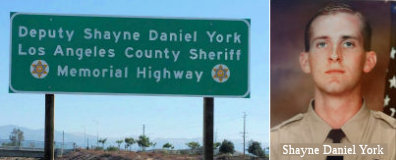 The portion of I-5 between Newhall Ranch Road (005 LA R053.57) and Hasley Canyon Road
(005 LA R56.596) in Los Angeles County is named the "Los Angeles
County Sheriff’s Deputy Shayne Daniel York Memorial Highway".
It was named in memory of Deputy Shayne Daniel York, who faithfully served
the Los Angeles County Sheriff’s Department as a deputy sheriff
assigned to the East Facility of the Peter J. Pitchess Detention Center.
Deputy York committed his life to his family and friends, and his career
to the Los Angeles County Sheriff’s Department and to the safety of
his fellow deputies and the residents of Los Angeles County. On August 14,
1997, Deputy York and his fiancée were at a Buena Park beauty salon
when two armed men entered and attempted to rob the business and its
patrons. Deputy York, his fiancée, and the other patrons of the salon
were ordered to lie face-down on the floor. When one of the men identified
Deputy York as a law enforcement officer, he shot Deputy York in the back
of the head. Deputy York died two days later, on August 16, 1997, at just
26 years of age. Named by Assembly Concurrent Resolution (ACR) 16, Res.
Chapter 86, Statutes of 2015, on July 1, 2015.
The portion of I-5 between Newhall Ranch Road (005 LA R053.57) and Hasley Canyon Road
(005 LA R56.596) in Los Angeles County is named the "Los Angeles
County Sheriff’s Deputy Shayne Daniel York Memorial Highway".
It was named in memory of Deputy Shayne Daniel York, who faithfully served
the Los Angeles County Sheriff’s Department as a deputy sheriff
assigned to the East Facility of the Peter J. Pitchess Detention Center.
Deputy York committed his life to his family and friends, and his career
to the Los Angeles County Sheriff’s Department and to the safety of
his fellow deputies and the residents of Los Angeles County. On August 14,
1997, Deputy York and his fiancée were at a Buena Park beauty salon
when two armed men entered and attempted to rob the business and its
patrons. Deputy York, his fiancée, and the other patrons of the salon
were ordered to lie face-down on the floor. When one of the men identified
Deputy York as a law enforcement officer, he shot Deputy York in the back
of the head. Deputy York died two days later, on August 16, 1997, at just
26 years of age. Named by Assembly Concurrent Resolution (ACR) 16, Res.
Chapter 86, Statutes of 2015, on July 1, 2015.
(Image Sources: LA County Sheriff Dept on Twitter)
 Dye") The 4.735-mile portion of I-5
between PM LA R68.818 and PM LA R73.553 in the County of Los Angeles is
named the "Jeffrey “Jef” Dye Memorial Highway". It
was named in memory of Jeffrey “Jef” Dye of the Ventura County
Sheriff’s Office, who was born in the City of San Fernando,
California in October 1968. Jef was raised in the City of Fillmore,
California, where he attended Fillmore High School, graduating in 1986;
Jef continued his education and earned an associate degree in criminology
and a bachelor of science degree in computer science. Jef began his
professional career as an Investigative Assistant with the Ventura County
District Attorney’s Office, after which he focused on Digital
Forensics and CyberCrime and worked at General Dynamics,
PricewaterhouseCoopers, and, most recently, Bank of America as Vice
President of Global Information Security. On August 28, 2016, Jef joined
the Ventura County Sheriff’s Office’s Fillmore Mountain Search
and Rescue (SAR) Team; Jef completed extensive training in technical
rescue operations, rope systems, advanced first aid, and search area
management. Jef was appointed to the team’s board of directors as
secretary, providing valuable organization and leadership to the members
of the Fillmore Mountain Search and Rescue Team. Jef responded to many
emergency search and rescue incidents for individuals injured, lost, or
otherwise in distress in the wilderness backcountry of California’s
national forests; Jef lived the search and rescue motto, “So that
others may live”. On February 2, 2019, Jef and his teammates were
traveling on I-5 south of the City of Gorman en route to a training
exercise during a heavy rainstorm; Jef and his teammates observed a
serious vehicle rollover accident in the center divider involving a
vehicle with multiple occupants. Jef and his teammates self-activated and
began an emergency response hoping to save lives in jeopardy; during the
triage and medical treatment in progress by Jef and his teammates, a
second vehicle lost control and crashed into the existing accident scene,
mortally injuring Jef and critically injuring many of his teammates. Jef
did not hesitate when putting himself in harm’s way to provide
needed emergency medical assistance to a family in distress and in need of
immediate medical attention. Named by Assembly Concurrent Resolution (ACR)
147, Res. Chapter 44, 09/14/20.
The 4.735-mile portion of I-5
between PM LA R68.818 and PM LA R73.553 in the County of Los Angeles is
named the "Jeffrey “Jef” Dye Memorial Highway". It
was named in memory of Jeffrey “Jef” Dye of the Ventura County
Sheriff’s Office, who was born in the City of San Fernando,
California in October 1968. Jef was raised in the City of Fillmore,
California, where he attended Fillmore High School, graduating in 1986;
Jef continued his education and earned an associate degree in criminology
and a bachelor of science degree in computer science. Jef began his
professional career as an Investigative Assistant with the Ventura County
District Attorney’s Office, after which he focused on Digital
Forensics and CyberCrime and worked at General Dynamics,
PricewaterhouseCoopers, and, most recently, Bank of America as Vice
President of Global Information Security. On August 28, 2016, Jef joined
the Ventura County Sheriff’s Office’s Fillmore Mountain Search
and Rescue (SAR) Team; Jef completed extensive training in technical
rescue operations, rope systems, advanced first aid, and search area
management. Jef was appointed to the team’s board of directors as
secretary, providing valuable organization and leadership to the members
of the Fillmore Mountain Search and Rescue Team. Jef responded to many
emergency search and rescue incidents for individuals injured, lost, or
otherwise in distress in the wilderness backcountry of California’s
national forests; Jef lived the search and rescue motto, “So that
others may live”. On February 2, 2019, Jef and his teammates were
traveling on I-5 south of the City of Gorman en route to a training
exercise during a heavy rainstorm; Jef and his teammates observed a
serious vehicle rollover accident in the center divider involving a
vehicle with multiple occupants. Jef and his teammates self-activated and
began an emergency response hoping to save lives in jeopardy; during the
triage and medical treatment in progress by Jef and his teammates, a
second vehicle lost control and crashed into the existing accident scene,
mortally injuring Jef and critically injuring many of his teammates. Jef
did not hesitate when putting himself in harm’s way to provide
needed emergency medical assistance to a family in distress and in need of
immediate medical attention. Named by Assembly Concurrent Resolution (ACR)
147, Res. Chapter 44, 09/14/20.
(Image source: VC Star)
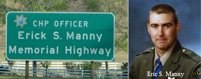 The portion of I-5 from the Fort Tejon Exit (005 KER
4.856) to the Grapevine Exit (~ 005 KER 10.404R) in Kern County is named
the "CHP Officer Erick S. Manny Memorial Highway" This segment was
named in memory of CHP Officer Erick S. Manny. Erick S. Manny was born on
May 24, 1970, in Bakersfield, California. He attended Highland High School
in Bakersfield, where he was a three-sport athlete, participating in
baseball, football, and wrestling. Manny entered the California Highway
Patrol Academy on November 13, 2000, and, after graduating, was assigned
to the Fort Tejon CHP office on May 11, 2001. Officer Manny was killed in
the line of duty on December 21, 2005, when he was in pursuit of a
speeding driver on I-5 near the "Grapevine," when he lost control of his
patrol car. Named by Assembly Concurrent Resolution (ACR) 58, Resolution
Chapter 114, on 9/10/2007.
The portion of I-5 from the Fort Tejon Exit (005 KER
4.856) to the Grapevine Exit (~ 005 KER 10.404R) in Kern County is named
the "CHP Officer Erick S. Manny Memorial Highway" This segment was
named in memory of CHP Officer Erick S. Manny. Erick S. Manny was born on
May 24, 1970, in Bakersfield, California. He attended Highland High School
in Bakersfield, where he was a three-sport athlete, participating in
baseball, football, and wrestling. Manny entered the California Highway
Patrol Academy on November 13, 2000, and, after graduating, was assigned
to the Fort Tejon CHP office on May 11, 2001. Officer Manny was killed in
the line of duty on December 21, 2005, when he was in pursuit of a
speeding driver on I-5 near the "Grapevine," when he lost control of his
patrol car. Named by Assembly Concurrent Resolution (ACR) 58, Resolution
Chapter 114, on 9/10/2007.
(Image Sources: Flikr; Calif Assn of Highway Patrolmen)
Between the southern Route 5/Route 99 junction (~ 005 KER R15.103L) and Woodland (~ 005 YOL R7.022), this route is named the "West Side Freeway". It was named by location (on the "west side" of the San Joaquin Valley). There have also been references to this as the "Apollo Freeway".
 Between Route 152 (~ 005 MER 17.713) and Route 165 (~ 005
MER 6.04), this route is named the "CHP Officer Alfred R Turner
Memorial Highway". CHP Officer Alfred R. Turner was born in a little
log and rock house in rural Chester, Arkansas on February 9, 1940. He
moved to Susanville, California in 1944, and joined the United States Navy
at age 17. Seven years after joining the California Highway Patrol, on
December 16, 1975, Officer Alfred R. Turner was shot and killed by a
motorist on I-5 near Los Banos, after stopping the vehicle because of a
burned-out headlight. Officer Turner was unaware that the car he stopped
had just been stolen in San Leandro, and when the officer stepped out of
his patrol car, the motorist exited his vehicle, and, as the two men began
walking toward each other, the motorist suddenly pulled a .357 magnum
revolver and opened fire. Officer Turner was hit with three bullets, but
returned fire and hit his assailant with five shots. Officer Turner,
although critically wounded, managed to return to his patrol car and radio
for help. He died 12 days later. Named by Senate Concurrent Resolution 80,
Chapter 97, on July 14, 1998.
Between Route 152 (~ 005 MER 17.713) and Route 165 (~ 005
MER 6.04), this route is named the "CHP Officer Alfred R Turner
Memorial Highway". CHP Officer Alfred R. Turner was born in a little
log and rock house in rural Chester, Arkansas on February 9, 1940. He
moved to Susanville, California in 1944, and joined the United States Navy
at age 17. Seven years after joining the California Highway Patrol, on
December 16, 1975, Officer Alfred R. Turner was shot and killed by a
motorist on I-5 near Los Banos, after stopping the vehicle because of a
burned-out headlight. Officer Turner was unaware that the car he stopped
had just been stolen in San Leandro, and when the officer stepped out of
his patrol car, the motorist exited his vehicle, and, as the two men began
walking toward each other, the motorist suddenly pulled a .357 magnum
revolver and opened fire. Officer Turner was hit with three bullets, but
returned fire and hit his assailant with five shots. Officer Turner,
although critically wounded, managed to return to his patrol car and radio
for help. He died 12 days later. Named by Senate Concurrent Resolution 80,
Chapter 97, on July 14, 1998.
(Image Source: California Assn of Highway Patrolmen)
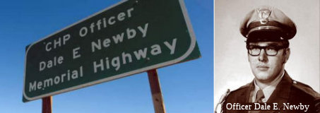 I-5 from Eight Mile Road (~ 005 SJ 35.283) to French Camp
Road (~ 005 SJ R22.52) in Stockton is officially designated as the "CHP
Officer Dale E. Newby Memorial Highway". Officer Dale E. Newby
graduated from the California Highway Patrol Academy and was appointed a
peace officer of the great State of California on April 24, 1967. He was
killed while in the line of duty on July 17, 1982, during a traffic stop
at I-5 and Eight Mile Road. He had stopped a motorist for speeding and
erratic driving, After scuffling with the motorist, an ex-mental patient,
Officer Newby was shot and killed. The tragedy was compounded when the
gunman fled the area and took a hostage, who was subsequently shot and
killed by the perpetrator prior to taking his own life. An estimated 850
people attended Officer Newby's funeral, including law enforcement
personnel from Massachusetts, Oklahoma, Ohio, New Jersey, Florida,
Louisiana, and Michigan, in addition to then Governor Edmund G. Brown, Jr.
and then Lieutenant Governor Mike Curb. Officer Newby was only 36 years of
age at the time of his death and was survived by his wife, Beverly, and
their three sons, Sean, Jeffrey, and Dale, Jr. Named by Senate Concurrent
Resolution 89, Chapter 155, September 11, 2002.
I-5 from Eight Mile Road (~ 005 SJ 35.283) to French Camp
Road (~ 005 SJ R22.52) in Stockton is officially designated as the "CHP
Officer Dale E. Newby Memorial Highway". Officer Dale E. Newby
graduated from the California Highway Patrol Academy and was appointed a
peace officer of the great State of California on April 24, 1967. He was
killed while in the line of duty on July 17, 1982, during a traffic stop
at I-5 and Eight Mile Road. He had stopped a motorist for speeding and
erratic driving, After scuffling with the motorist, an ex-mental patient,
Officer Newby was shot and killed. The tragedy was compounded when the
gunman fled the area and took a hostage, who was subsequently shot and
killed by the perpetrator prior to taking his own life. An estimated 850
people attended Officer Newby's funeral, including law enforcement
personnel from Massachusetts, Oklahoma, Ohio, New Jersey, Florida,
Louisiana, and Michigan, in addition to then Governor Edmund G. Brown, Jr.
and then Lieutenant Governor Mike Curb. Officer Newby was only 36 years of
age at the time of his death and was survived by his wife, Beverly, and
their three sons, Sean, Jeffrey, and Dale, Jr. Named by Senate Concurrent
Resolution 89, Chapter 155, September 11, 2002.
(Image Sources: Recordnet; Calif Assn of Highway Patrolmen)
I-5 from Stockton (~ 005 SJ 26.259) to Sacramento (~ 005 SAC 22.475) is officially named the "Carlton E. Forbes Freeway". It was named by Assembly Concurrent Resolution No. 62, Chapter 26, in 1982. Carlton E. Forbes was Chief Engineer of the California Department of Transportation from 1974 to his retirement in 1980.
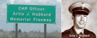 The portion of I-5 from Pocket Road (~ 005 SAC 16.127) to
the southern boundary of the City of Sacramento (~ 005 SAC 14.047) is
named the "CHP Officer Artie J. Hubbard Memorial Freeway". This
segment was named in memory of California Highway Patrol Officer Artie J.
Hubbard. Officer Hubbard was born on December 17, 1951, in Stockton,
California. He graduated from East Union High School in Manteca,
California in 1970. After high school, Officer Hubbard attended Delta
College and graduated in 1973 with an AA degree in Criminal Justice. He
joined the California Highway Patrol in January of 1974. After completing
academy training, he reported to the Central Los Angeles Office.
Throughout Officer Hubbard's years in Central Los Angeles, he was assigned
to motorcycle patrol, as a field training officer, and worked protective
services details. In 1984, Officer Hubbard was voluntarily transferred to
the South Sacramento Office. On April 5, 1985, Officer Hubbard was
involved in a serious car accident, where he sustained major head
injuries. While bravely responding to an 11-99 (officer needs help) call,
Officer Hubbard failed to negotiate a curve and his CHP Mustang slid off
the roadway and struck a utility pole. He was placed on life support and
was cared for in his parents' home for more than ten years. Tragically, on
December 8, 1995, Officer Hubbard, 43, succumbed to his injuries as a
result of the collision. Named by Senate Concurrent Resolution (SCR) 12,
Resolution Chapter 73, on 7/12/2005.
The portion of I-5 from Pocket Road (~ 005 SAC 16.127) to
the southern boundary of the City of Sacramento (~ 005 SAC 14.047) is
named the "CHP Officer Artie J. Hubbard Memorial Freeway". This
segment was named in memory of California Highway Patrol Officer Artie J.
Hubbard. Officer Hubbard was born on December 17, 1951, in Stockton,
California. He graduated from East Union High School in Manteca,
California in 1970. After high school, Officer Hubbard attended Delta
College and graduated in 1973 with an AA degree in Criminal Justice. He
joined the California Highway Patrol in January of 1974. After completing
academy training, he reported to the Central Los Angeles Office.
Throughout Officer Hubbard's years in Central Los Angeles, he was assigned
to motorcycle patrol, as a field training officer, and worked protective
services details. In 1984, Officer Hubbard was voluntarily transferred to
the South Sacramento Office. On April 5, 1985, Officer Hubbard was
involved in a serious car accident, where he sustained major head
injuries. While bravely responding to an 11-99 (officer needs help) call,
Officer Hubbard failed to negotiate a curve and his CHP Mustang slid off
the roadway and struck a utility pole. He was placed on life support and
was cared for in his parents' home for more than ten years. Tragically, on
December 8, 1995, Officer Hubbard, 43, succumbed to his injuries as a
result of the collision. Named by Senate Concurrent Resolution (SCR) 12,
Resolution Chapter 73, on 7/12/2005.
(Image sources: Flikr; Calif Assn of Highway Patrolmen)
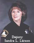 I-5 between Q
Street (~ 005 SAC 23.067) and J Street (~ 005 SAC 23.68) in the City of
Sacramento is named the "Deputy Sheriff Sandra Powell-Larson Memorial
Highway". This segment was named in memory of Sacramento County
Deputy Sheriff Sandra Powell-Larson, who died in the line of duty at 48
years of age while transporting state prisoners on northbound I-5 at 375
feet south of R Street in Sacramento. Deputy Sheriff Powell-Larson
graduated from Rio Linda High School in 1968, and began her career with
the Sacramento County Department of Social Services. She continued her
county career with the Sacramento County District Attorney's Office while
becoming a Sacramento County Reserve Deputy Sheriff. Deputy Sheriff
Powell-Larson became a full-time Sacramento County Deputy Sheriff on
September 30, 1974, while continuing her secondary education at Sacramento
City College, where she received an Associate of Arts degree in criminal
justice. Deputy Sheriff Powell-Larson was known by her fellow officers for
her dedication to the Sacramento County Sheriff's Officers Association,
and to the protection of the citizens of our state. Deputy Sheriff
Powell-Larson was the first female officer to die in the line of duty in
the over 150 -year history of the Sacramento County Sheriff's Office.
Named by Senate Concurrent Resolution (SCR) 96, Resolution Chapter 113, on
8/18/2006.
I-5 between Q
Street (~ 005 SAC 23.067) and J Street (~ 005 SAC 23.68) in the City of
Sacramento is named the "Deputy Sheriff Sandra Powell-Larson Memorial
Highway". This segment was named in memory of Sacramento County
Deputy Sheriff Sandra Powell-Larson, who died in the line of duty at 48
years of age while transporting state prisoners on northbound I-5 at 375
feet south of R Street in Sacramento. Deputy Sheriff Powell-Larson
graduated from Rio Linda High School in 1968, and began her career with
the Sacramento County Department of Social Services. She continued her
county career with the Sacramento County District Attorney's Office while
becoming a Sacramento County Reserve Deputy Sheriff. Deputy Sheriff
Powell-Larson became a full-time Sacramento County Deputy Sheriff on
September 30, 1974, while continuing her secondary education at Sacramento
City College, where she received an Associate of Arts degree in criminal
justice. Deputy Sheriff Powell-Larson was known by her fellow officers for
her dedication to the Sacramento County Sheriff's Officers Association,
and to the protection of the citizens of our state. Deputy Sheriff
Powell-Larson was the first female officer to die in the line of duty in
the over 150 -year history of the Sacramento County Sheriff's Office.
Named by Senate Concurrent Resolution (SCR) 96, Resolution Chapter 113, on
8/18/2006.
(Image Source: California Police Officers Memorial Foundation)
In local usage, I-5 between Sacramento and Red Bluff is called the "West Side Highway". This name derives from the fact the route runs along the west side of the valley.
The interchange of I-5 and US 50 in Sacramento County (~ 005 SAC 22.591) is named the "California State Engineer Memorial Interchange". It was named in tribute to past, present, and future state engineers and related professionals and in honor of the 50th anniversary of the Professional Engineers in California Government (PECG). The men and women who serve Californians as engineers and closely related professionals throughout state government are persons of skill, intelligence, and advanced training who deserve to be recognized for their dedicated service. California’s state engineers and related professionals have paid a high price in serving our state with at least 37 on-the-job deaths in their ranks over the last century. The Legislature desires to promote the safety of the state’s employees and to encourage motorists traveling in and through the state to exercise caution and care when encountering a work zone. California’s state engineers design and inspect the state’s highways and bridges, ensure that schools and hospitals are safe during earthquakes, improve air and water quality, work to reduce fossil fuel emissions, and perform countless other professional functions that create jobs and protect public safety in our state. The Professional Engineers in California Government (PECG) was organized in 1962 in the San Francisco Bay Area area to represent state engineers and address the safety concerns associated with state service, and 2012 represents the 50th anniversary of the organization. PECG represents approximately 13,000 professional engineers, architects, land surveyors, engineering geologists, and closely related professionals serving the public in state government. Nam ed by Assembly Concurrent Resolution 100, Resolution Chapter 109, on September 4, 2012.
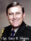 The interchange of Route 5 and Route 113 (~ 005 YOL
R7.113) is named the "CHP Sergeant Gary R. Wagers Memorial Interchange"
This interchange was named in memory of CHP Sergeant Gary R. Wagers, who
died in a patrol vehicle collision in the line of duty while pursuing a
traffic violator at high speed in the early morning hours of March 15,
2001, on Route 113 at the interchange with Route 5, in Woodland. Sergeant
Wagers graduated high school in Allegan, Michigan and was a graduate of
California State University, Sacramento. He joined the California Army
National Guard in 1970 and retired in 1998 at the rank of Lieutenant
Colonel, after receiving many awards, including the Army Achievement
Medal, Reserve Commendation Medal, Meritorious Service Medal, and the
National Defense Medal. He graduated from the California Highway Patrol
Academy and was appointed as a State Traffic Officer on August 9, 1979; he
was promoted to the rank of State Traffic Sergeant on March 1, 1992. He
served in the West Los Angeles, Westminster, South Sacramento, Riverside,
Santa Ana, and Woodland Areas as well as at CHP Headquarters and
California Highway Patrol Air Operations. Named by Assembly Concurrent
Resolution (ACR) 16, Resolution Chapter 70, on 07/07/2005.
The interchange of Route 5 and Route 113 (~ 005 YOL
R7.113) is named the "CHP Sergeant Gary R. Wagers Memorial Interchange"
This interchange was named in memory of CHP Sergeant Gary R. Wagers, who
died in a patrol vehicle collision in the line of duty while pursuing a
traffic violator at high speed in the early morning hours of March 15,
2001, on Route 113 at the interchange with Route 5, in Woodland. Sergeant
Wagers graduated high school in Allegan, Michigan and was a graduate of
California State University, Sacramento. He joined the California Army
National Guard in 1970 and retired in 1998 at the rank of Lieutenant
Colonel, after receiving many awards, including the Army Achievement
Medal, Reserve Commendation Medal, Meritorious Service Medal, and the
National Defense Medal. He graduated from the California Highway Patrol
Academy and was appointed as a State Traffic Officer on August 9, 1979; he
was promoted to the rank of State Traffic Sergeant on March 1, 1992. He
served in the West Los Angeles, Westminster, South Sacramento, Riverside,
Santa Ana, and Woodland Areas as well as at CHP Headquarters and
California Highway Patrol Air Operations. Named by Assembly Concurrent
Resolution (ACR) 16, Resolution Chapter 70, on 07/07/2005.
(Image Source: Calif Assn of Highway Patrolmen)
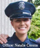 The portion of I-5 from Greenbay Road (Bridge 15-0060, COL R3.149)
to the Salt Creek Bridge (Bridge 15-0005R, COL R7.991) in the County of
Colusa is named the Officer Natalie Corona Memorial Highway. It
is named in memory of 22-year-old Davis Police Department Officer Natalie
Corona, who was killed in the line of duty. Officer Corona was from
Arbuckle, California, a long-time employee and volunteer at the Arbuckle
Parks and Recreation Department, and was extremely well loved by the
Arbuckle community. The eldest daughter of a retired Colusa County
Sheriff’s Department deputy and an Arbuckle elementary school
teacher, Officer Corona dreamed of following her father, who served for 26
years with the department and is now the Colusa County District 1
Supervisor, into a career in law enforcement. Officer Corona earned an
associate’s degree in administration of justice from Yuba College
and began working as a Community Service Officer for the Davis Police
Department in 2016. Even after funding for her position ended, Officer
Corona continued to show up to work as a volunteer for her position with
the Davis Police Department. Officer Corona graduated from the Sacramento
training academy in July 2018, was sworn into the Davis Police Department
on August 2, 2018, and completed her field training just before Christmas
of 2018. Sadly, while handling a three-vehicle minor injury accident on
Thursday, January 10, 2019, in Davis, California, Officer Corona was
ambushed by a gunman not associated with the accident. Named by ACR 66, Res. Chapter 113, Statutes of 2019, on 07/10/19.
The portion of I-5 from Greenbay Road (Bridge 15-0060, COL R3.149)
to the Salt Creek Bridge (Bridge 15-0005R, COL R7.991) in the County of
Colusa is named the Officer Natalie Corona Memorial Highway. It
is named in memory of 22-year-old Davis Police Department Officer Natalie
Corona, who was killed in the line of duty. Officer Corona was from
Arbuckle, California, a long-time employee and volunteer at the Arbuckle
Parks and Recreation Department, and was extremely well loved by the
Arbuckle community. The eldest daughter of a retired Colusa County
Sheriff’s Department deputy and an Arbuckle elementary school
teacher, Officer Corona dreamed of following her father, who served for 26
years with the department and is now the Colusa County District 1
Supervisor, into a career in law enforcement. Officer Corona earned an
associate’s degree in administration of justice from Yuba College
and began working as a Community Service Officer for the Davis Police
Department in 2016. Even after funding for her position ended, Officer
Corona continued to show up to work as a volunteer for her position with
the Davis Police Department. Officer Corona graduated from the Sacramento
training academy in July 2018, was sworn into the Davis Police Department
on August 2, 2018, and completed her field training just before Christmas
of 2018. Sadly, while handling a three-vehicle minor injury accident on
Thursday, January 10, 2019, in Davis, California, Officer Corona was
ambushed by a gunman not associated with the accident. Named by ACR 66, Res. Chapter 113, Statutes of 2019, on 07/10/19.
(Image Source: Officer Down Memorial Page)
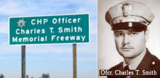 The portion of I-5 between County Road 25 (~ 005 GLE
R21.817) and Route 32 (~ 005 GLE R25.296) in the County of Glenn is named
the "CHP Officer Charles T. Smith Memorial Highway". It was named
in memory of Officer Charles Taylor Smith, who was born April 9, 1928, in
Denison, Texas, and had four siblings, Tom, William, Virginia, and Vickie.
Officer Smith graduated from Armijo High School in Fairfield, California,
and joined the United States Marine Corps shortly thereafter; and after
two years in the United States Marine Corps, and after achieving the rank
of officer, Charles Smith married his best friend, Juanita (Jae), on
November 15, 1948, and had two wonderful children, Terry and Toni. Officer
Smith graduated from the California Highway Patrol Academy in 1952, and,
upon graduation, was assigned to the El Centro Area. Officer Smith was
killed in the line of duty on September 9, 1956, during what appeared to
be a routine traffic stop for a speeding violation. Both occupants of the
vehicle were absent without leave from the United States Marine Corps and
were on a crime spree. While he was frisking the driver of the vehicle,
the passenger shot Officer Smith three times in the back. Despite being
fatally wounded, Officer Smith returned fire and fatally shot both
suspects. Named by Assembly Concurrent Resolution 75, Resolution Chapter
113, on September 28, 2011.
The portion of I-5 between County Road 25 (~ 005 GLE
R21.817) and Route 32 (~ 005 GLE R25.296) in the County of Glenn is named
the "CHP Officer Charles T. Smith Memorial Highway". It was named
in memory of Officer Charles Taylor Smith, who was born April 9, 1928, in
Denison, Texas, and had four siblings, Tom, William, Virginia, and Vickie.
Officer Smith graduated from Armijo High School in Fairfield, California,
and joined the United States Marine Corps shortly thereafter; and after
two years in the United States Marine Corps, and after achieving the rank
of officer, Charles Smith married his best friend, Juanita (Jae), on
November 15, 1948, and had two wonderful children, Terry and Toni. Officer
Smith graduated from the California Highway Patrol Academy in 1952, and,
upon graduation, was assigned to the El Centro Area. Officer Smith was
killed in the line of duty on September 9, 1956, during what appeared to
be a routine traffic stop for a speeding violation. Both occupants of the
vehicle were absent without leave from the United States Marine Corps and
were on a crime spree. While he was frisking the driver of the vehicle,
the passenger shot Officer Smith three times in the back. Despite being
fatally wounded, Officer Smith returned fire and fatally shot both
suspects. Named by Assembly Concurrent Resolution 75, Resolution Chapter
113, on September 28, 2011.
(Image Sources: Appeal Democrat; Calif. Assn of Highway Patrolmen)
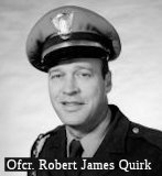 The portion of Route 5, from
the Sunset Hills Drive overcrossing at 005 TEH 38.716 to the Nine Mile
Hill overcrossing at 005 TEH 36.371, in the County of Tehama, is named the
"California Highway Patrol Officer Robert James Quirk Memorial Highway".
It was named after California Highway Patrol Officer Robert James Quirk.
Born in 1922, Officer Quirk enlisted in the United States Navy in January
1942 and completed Naval Aviator Training. He was commissioned as a
Lieutenant Junior Grade and saw action on the Philippine Islands while
serving as a squadron commander of B-24 bombers and flew multiple bombing
raids during the battle of Kwajalein. He was recognized for his many
achievements and, in 1947, and was honorably discharged from the Navy. In
1951, Officer Quirk moved to San Diego, California, and began working at
Consolidated Aircraft Company. In 1954, Officer Quirk was hired by the CHP
and assigned to the Compton CHP Office where he worked from 1955 until
1963, when he was transferred to the Red Bluff CHP Office where he served
until his untimely death in 1971. On April 11, 1971, after being involved
in a foot pursuit, during which time he singlehandedly caught three
suspects, Officer Quirk suffered a fatal heart attack. Following in his
father’s footsteps is his son, Sergeant Ken Quirk of the Storey
County Nevada Sheriff’s Department, who demonstrates the highest
standards of law enforcement while carrying his father’s handcuffs
and wearing his father’s brass belt buckle. Named by Assembly
Concurrent Resolution (ACR 3), Resolution Chapter 73, on 8/15/2013.
The portion of Route 5, from
the Sunset Hills Drive overcrossing at 005 TEH 38.716 to the Nine Mile
Hill overcrossing at 005 TEH 36.371, in the County of Tehama, is named the
"California Highway Patrol Officer Robert James Quirk Memorial Highway".
It was named after California Highway Patrol Officer Robert James Quirk.
Born in 1922, Officer Quirk enlisted in the United States Navy in January
1942 and completed Naval Aviator Training. He was commissioned as a
Lieutenant Junior Grade and saw action on the Philippine Islands while
serving as a squadron commander of B-24 bombers and flew multiple bombing
raids during the battle of Kwajalein. He was recognized for his many
achievements and, in 1947, and was honorably discharged from the Navy. In
1951, Officer Quirk moved to San Diego, California, and began working at
Consolidated Aircraft Company. In 1954, Officer Quirk was hired by the CHP
and assigned to the Compton CHP Office where he worked from 1955 until
1963, when he was transferred to the Red Bluff CHP Office where he served
until his untimely death in 1971. On April 11, 1971, after being involved
in a foot pursuit, during which time he singlehandedly caught three
suspects, Officer Quirk suffered a fatal heart attack. Following in his
father’s footsteps is his son, Sergeant Ken Quirk of the Storey
County Nevada Sheriff’s Department, who demonstrates the highest
standards of law enforcement while carrying his father’s handcuffs
and wearing his father’s brass belt buckle. Named by Assembly
Concurrent Resolution (ACR 3), Resolution Chapter 73, on 8/15/2013.
(Image Source: Officer Down Memorial Page)
 The portion of Route 5 between Gyle Road (~ 005 TEH R13.962) and Flores Avenue (~ 005 TEH
R19.772) in Tehama County is named the "Nomlaki Highway" This
segment was named in honor of the people of the Nomlaki Indian Nation, who
are the original native inhabitants of Tehama County and have lived in the
region since time immemorial. Historically, the Nomlaki greeted the
Spanish explorers when they came into Tehama County with the Alferez
Gabriel Moraga expedition in 1808. The boundaries of the Nomlaki lands
changed with the arrival of the Europeans, but once extended within the
Sacramento River Valley including most of present-day Tehama County. The
Nomlaki had a sophisticated social, political, and religious structure and
were wise stewards of the land and natural resources. The original trails
through the Mendocino National Forest and connecting the valley and the
mountains were cleared and used by the Nomlaki, some of which evolved into
current highways in Tehama and Glenn Counties. Alas, of its original
25,000 acres, the Nomlaki tribal government now has jurisdiction over only
approximately 2,300 acres of federal trust land concentrated in a
reservation in Tehama County. Named by Senate Concurrent Resolution (SCR)
15, Resolution Chapter 93, on 7/12/2007.
The portion of Route 5 between Gyle Road (~ 005 TEH R13.962) and Flores Avenue (~ 005 TEH
R19.772) in Tehama County is named the "Nomlaki Highway" This
segment was named in honor of the people of the Nomlaki Indian Nation, who
are the original native inhabitants of Tehama County and have lived in the
region since time immemorial. Historically, the Nomlaki greeted the
Spanish explorers when they came into Tehama County with the Alferez
Gabriel Moraga expedition in 1808. The boundaries of the Nomlaki lands
changed with the arrival of the Europeans, but once extended within the
Sacramento River Valley including most of present-day Tehama County. The
Nomlaki had a sophisticated social, political, and religious structure and
were wise stewards of the land and natural resources. The original trails
through the Mendocino National Forest and connecting the valley and the
mountains were cleared and used by the Nomlaki, some of which evolved into
current highways in Tehama and Glenn Counties. Alas, of its original
25,000 acres, the Nomlaki tribal government now has jurisdiction over only
approximately 2,300 acres of federal trust land concentrated in a
reservation in Tehama County. Named by Senate Concurrent Resolution (SCR)
15, Resolution Chapter 93, on 7/12/2007.
(Image Source: Alaska Roads (Oscar Voss), Indian Country Today)
Historically, the portion of this route from Red Bluff (~ 005 TEH 28.38) to the Oregon state line was called the "Cascade Wonderland Highway".
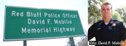 The portion of Route 5 from the Riverside Avenue
overcrossing (~ 005 TEH R23.344) to the North Red Bluff overcrossing
(presumably ~ 005 TEH 28.38) in the City of Red Bluff is named the "Officer
David F. Mobilio Memorial Highway". It was named in memory of
Officer David F. Mobilio, who was born and raised in the San Francisco Bay
area, and graduated from Saratoga High School in 1990. Officer Mobilio
moved to the City of Chico, where he met and married Linda Dias, the true
love of his life, and decided to pursue his dream of becoming a law
enforcement officer. Officer Mobilio graduated from the Butte College
Police Academy on November 30, 1995. On October 17, 1997, David Mobilio
was hired as a Level II Reserve Police Officer for the Red Bluff Police
Department and in 1998 he was promoted to a full-time, permanent police
officer. After approximately two years of service as a patrol officer
responding to calls ranging from vandalism, domestic violence, robbery,
drug violations, and driving under the influence, Officer Mobilio was
assigned as a Drug Abuse Resistance Education (DARE) Officer for the Red
Bluff Police Department, providing antidrug-use education to elementary
schoolchildren. On November 19, 2002, Officer Mobilio covered the
graveyard shift for another officer, and at approximately 1:30 a.m. he
checked out at a gas station to fuel his patrol car. Following several
minutes without communication from Officer Mobilio, thedispatcher
attempted to make radio contact with him. Following several more minutes
of no response, a sergeant was dispatched to the location and found
Officer Mobilio shot to death near his patrol car. Officer Mobilio had
been ambushed while fueling his patrol car by an unknown suspect who was
later apprehended with the assistance of many allied law enforcement
agencies and who was subsequently convicted of murdering Officer Mobilio.
Named by Senate Concurrent Resolution 78, Resolution Chapter 88, on August
24, 2012.
The portion of Route 5 from the Riverside Avenue
overcrossing (~ 005 TEH R23.344) to the North Red Bluff overcrossing
(presumably ~ 005 TEH 28.38) in the City of Red Bluff is named the "Officer
David F. Mobilio Memorial Highway". It was named in memory of
Officer David F. Mobilio, who was born and raised in the San Francisco Bay
area, and graduated from Saratoga High School in 1990. Officer Mobilio
moved to the City of Chico, where he met and married Linda Dias, the true
love of his life, and decided to pursue his dream of becoming a law
enforcement officer. Officer Mobilio graduated from the Butte College
Police Academy on November 30, 1995. On October 17, 1997, David Mobilio
was hired as a Level II Reserve Police Officer for the Red Bluff Police
Department and in 1998 he was promoted to a full-time, permanent police
officer. After approximately two years of service as a patrol officer
responding to calls ranging from vandalism, domestic violence, robbery,
drug violations, and driving under the influence, Officer Mobilio was
assigned as a Drug Abuse Resistance Education (DARE) Officer for the Red
Bluff Police Department, providing antidrug-use education to elementary
schoolchildren. On November 19, 2002, Officer Mobilio covered the
graveyard shift for another officer, and at approximately 1:30 a.m. he
checked out at a gas station to fuel his patrol car. Following several
minutes without communication from Officer Mobilio, thedispatcher
attempted to make radio contact with him. Following several more minutes
of no response, a sergeant was dispatched to the location and found
Officer Mobilio shot to death near his patrol car. Officer Mobilio had
been ambushed while fueling his patrol car by an unknown suspect who was
later apprehended with the assistance of many allied law enforcement
agencies and who was subsequently convicted of murdering Officer Mobilio.
Named by Senate Concurrent Resolution 78, Resolution Chapter 88, on August
24, 2012.
(Image Sources: KRCR; Mobilio Scholarship Page)
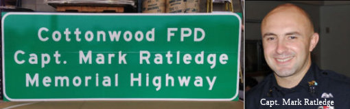 The portion of Route 5 from the Bowman Road overcrossing (~ 005
TEH 41.546) to the northbound Main Street on ramp (~ 005 SHA 1.937) in the
City of Cottonwood is named the "Captain Mark Ratledge Memorial
Highway" (signed as the "Cottonwood FPD Capt. Mark Ratledge
Memorial Highway"). It was named in memory of Captain Mark
Ratledge, who began serving the Cottonwood Fire Department as a volunteer
in 2003, was promoted to Captain in 2008, and served the department for
nine years utilizing expertise he obtained while performing the perilous
duties of fire protection as a member of the Redding Fire Department and
the United States Forest Service. Captain Ratledge was always willing to
share his knowledge and skill as a Training Officer for the Cottonwood
Fire Department. Captain Ratledge died, at 35 years of age, on February
29, 2012, after being struck by an out-of-control vehicle while he was
working the scene of another accident. Named by Senate Concurrent
Resolution 78, Resolution Chapter 88, on August 24, 2012.
The portion of Route 5 from the Bowman Road overcrossing (~ 005
TEH 41.546) to the northbound Main Street on ramp (~ 005 SHA 1.937) in the
City of Cottonwood is named the "Captain Mark Ratledge Memorial
Highway" (signed as the "Cottonwood FPD Capt. Mark Ratledge
Memorial Highway"). It was named in memory of Captain Mark
Ratledge, who began serving the Cottonwood Fire Department as a volunteer
in 2003, was promoted to Captain in 2008, and served the department for
nine years utilizing expertise he obtained while performing the perilous
duties of fire protection as a member of the Redding Fire Department and
the United States Forest Service. Captain Ratledge was always willing to
share his knowledge and skill as a Training Officer for the Cottonwood
Fire Department. Captain Ratledge died, at 35 years of age, on February
29, 2012, after being struck by an out-of-control vehicle while he was
working the scene of another accident. Named by Senate Concurrent
Resolution 78, Resolution Chapter 88, on August 24, 2012.
(Image Source: GoFundMe, National Fallen Firefighters Foundation)
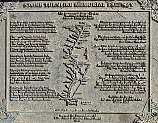 The portion of Route 5
between the Pit River Bridge in Shasta County (~ 005 SHA R28.447) and the
Shasta-Siskiyou County line is officially designated the "Stone
Turnpike Memorial Freeway". In the decade of the Gold Rush, miners,
farmers, and merchants of the Counties of Shasta and Siskiyou were unable
to communicate with the outside world or bring their produce to market
except over dangerous pack trails due to the rugged terrain in the
Sacramento River Canyon. After other wagon road building efforts failed,
Elias B. Stone and his sons secured a state franchise to build a wagon
road. With brawn, black powder, mules, and oxen, the Stone family built
nine bridges across the Sacramento River, 15 bridges across creeks and
gulches, and a narrow road notched into the Sacramento River Canyon's
walls, running 43 miles, from the Siskiyou-Shasta county line to the Stone
family's ferry boat and landing on the Pit River, a few miles above that
river' s junction with the Sacramento River. The Stone family completed
the Stone Turnpike in the Sacramento River Canyon in 1861, but after only
a few months of collecting tolls, disaster, in the form of the worst
winter storm known in the area to that time, destroyed most of their work.
The Stone family mortgaged all of its property and rebuilt a better toll
road despite several legal entanglements. Other parties finally gained
full control of the Stone family's company and the Stone Turnpike in 1868.
In the 1870s, the Stone Turnpike became the major north to south stage
route to Oregon; in 1887, the steel rails of the Central Pacific Railroad
displaced the Stone Turnpike in some sections to complete the rail link
into southern Oregon. In 1915, the dusty old stage road became Shasta
County's part of the Pacific Highway, the predecessor of US 99,
which is now I-5. Named by Assembly Concurrent Resolution No. 94, Chapter
98, in 1994.
The portion of Route 5
between the Pit River Bridge in Shasta County (~ 005 SHA R28.447) and the
Shasta-Siskiyou County line is officially designated the "Stone
Turnpike Memorial Freeway". In the decade of the Gold Rush, miners,
farmers, and merchants of the Counties of Shasta and Siskiyou were unable
to communicate with the outside world or bring their produce to market
except over dangerous pack trails due to the rugged terrain in the
Sacramento River Canyon. After other wagon road building efforts failed,
Elias B. Stone and his sons secured a state franchise to build a wagon
road. With brawn, black powder, mules, and oxen, the Stone family built
nine bridges across the Sacramento River, 15 bridges across creeks and
gulches, and a narrow road notched into the Sacramento River Canyon's
walls, running 43 miles, from the Siskiyou-Shasta county line to the Stone
family's ferry boat and landing on the Pit River, a few miles above that
river' s junction with the Sacramento River. The Stone family completed
the Stone Turnpike in the Sacramento River Canyon in 1861, but after only
a few months of collecting tolls, disaster, in the form of the worst
winter storm known in the area to that time, destroyed most of their work.
The Stone family mortgaged all of its property and rebuilt a better toll
road despite several legal entanglements. Other parties finally gained
full control of the Stone family's company and the Stone Turnpike in 1868.
In the 1870s, the Stone Turnpike became the major north to south stage
route to Oregon; in 1887, the steel rails of the Central Pacific Railroad
displaced the Stone Turnpike in some sections to complete the rail link
into southern Oregon. In 1915, the dusty old stage road became Shasta
County's part of the Pacific Highway, the predecessor of US 99,
which is now I-5. Named by Assembly Concurrent Resolution No. 94, Chapter
98, in 1994.
(Image Source: Historical Marker Database)
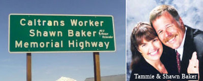 The portion of Route 5 in Siskiyou County from PM 35.7 to PM 39.5, inclusive
is designated as the Shawn Baker Memorial Highway. It
was named in memory of Shawn Baker, born in 1963. Mr. Baker served his
country in the United States Navy for five years. In 1999, Mr. Baker and
his family moved to Siskiyou County and eventually settled in Weed,
California. On January 31, 2001, Mr. Baker began his career with the
Department of Transportation as a permanent-intermittent equipment
operator in Yreka, California, and then transferred to the Yreka special
projects crew in April 2004. Mr. Baker was hired as a permanent full-time
equipment operator in November 2004, then transferred to the Grass Lake
maintenance crew in December 2004 and the Yreka special projects crew in
April 2006. On April 24, 2013, a group of eight Caltrans District 2
employees was performing rock scaling operations to remove loose material
from a rocky hillside on State Highway Route 96 near Happy Camp in
Siskiyou County when a rock slide occurred, tragically killing Mr. Baker
and Mr. Jones, and injuring a third employee. Named by Senate Concurrent
Resolution 53, Resolution Chapter 4, on 2/3/2014.
The portion of Route 5 in Siskiyou County from PM 35.7 to PM 39.5, inclusive
is designated as the Shawn Baker Memorial Highway. It
was named in memory of Shawn Baker, born in 1963. Mr. Baker served his
country in the United States Navy for five years. In 1999, Mr. Baker and
his family moved to Siskiyou County and eventually settled in Weed,
California. On January 31, 2001, Mr. Baker began his career with the
Department of Transportation as a permanent-intermittent equipment
operator in Yreka, California, and then transferred to the Yreka special
projects crew in April 2004. Mr. Baker was hired as a permanent full-time
equipment operator in November 2004, then transferred to the Grass Lake
maintenance crew in December 2004 and the Yreka special projects crew in
April 2006. On April 24, 2013, a group of eight Caltrans District 2
employees was performing rock scaling operations to remove loose material
from a rocky hillside on State Highway Route 96 near Happy Camp in
Siskiyou County when a rock slide occurred, tragically killing Mr. Baker
and Mr. Jones, and injuring a third employee. Named by Senate Concurrent
Resolution 53, Resolution Chapter 4, on 2/3/2014.
(Image Source: George Baker Obituary; Mt Shasta News)
 The portion of Route 5 in Siskiyou County from PM 41.5 (R41.5, near Shamrock
Road / Old Hwy 99 N of Grenada CA) to PM 43.5 (R43.5, near Shamrock and
Schulmeyer Rd), inclusive, is designated as the Robert Jones Memorial
Highway. Robert Jones was born in 1973 in Yreka, California. The
Department of Transportation hired Mr. Jones in November 2005 as a
temporary employee for the Mount Shasta maintenance crew; Mr. Jones became
a permanent-intermittent equipment operator for the Mount Shasta
maintenance crew in November 2006, and then transferred to the Yreka
special projects crew in December 2006. In June 2008, Mr. Jones was hired
as a permanent full-time equipment operator for the Grass Lake maintenance
crew, then transferred to the Yreka special projects crew in December
2010. In his spare time, Mr. Jones deeply enjoyed his time as a volunteer
firefighter at the Mayten Fire Department. On April 24, 2013, a group of
eight Caltrans District 2 employees was performing rock scaling operations
to remove loose material from a rocky hillside on Route 96 near Happy Camp
in Siskiyou County when a rock slide occurred, tragically killing Mr.
Baker and Mr. Jones, and injuring a third employee. Named by Senate
Concurrent Resolution 53, Resolution Chapter 4, on 2/3/2014.
The portion of Route 5 in Siskiyou County from PM 41.5 (R41.5, near Shamrock
Road / Old Hwy 99 N of Grenada CA) to PM 43.5 (R43.5, near Shamrock and
Schulmeyer Rd), inclusive, is designated as the Robert Jones Memorial
Highway. Robert Jones was born in 1973 in Yreka, California. The
Department of Transportation hired Mr. Jones in November 2005 as a
temporary employee for the Mount Shasta maintenance crew; Mr. Jones became
a permanent-intermittent equipment operator for the Mount Shasta
maintenance crew in November 2006, and then transferred to the Yreka
special projects crew in December 2006. In June 2008, Mr. Jones was hired
as a permanent full-time equipment operator for the Grass Lake maintenance
crew, then transferred to the Yreka special projects crew in December
2010. In his spare time, Mr. Jones deeply enjoyed his time as a volunteer
firefighter at the Mayten Fire Department. On April 24, 2013, a group of
eight Caltrans District 2 employees was performing rock scaling operations
to remove loose material from a rocky hillside on Route 96 near Happy Camp
in Siskiyou County when a rock slide occurred, tragically killing Mr.
Baker and Mr. Jones, and injuring a third employee. Named by Senate
Concurrent Resolution 53, Resolution Chapter 4, on 2/3/2014.
(Image Source: Caltrans Facebook Page)
 Named Structures
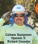 The interchange between I-5 and
Route 905 in the County of San Diego (~ 005 SD 3.093) is named the "Caltrans
Equipment Operator II Richard Gonzalez Memorial Interchange" . It
was named in memory of Caltrans Equipment Operator II Richard Gonzalez, a
dedicated maintenance worker. Richard Gonzalez, while working on a special
programs crew at the connector of I-15 and Route 94, was struck on the
morning of June 20, 2011, and died in the line of duty at the age of 52 as
a result of injuries sustained in the collision. Richard Gonzalez was an
exemplary employee who gained the respect of supervisors, management, and
peers for his devotion to the values of integrity, commitment, and
teamwork. Richard Gonzalez's passion was restoration of classic cars and
serving as a mentor and role model to his family and friends. Named by
Senate Concurrent Resolution 52, Resolution Chapter 94, on September 15,
2011.
The interchange between I-5 and
Route 905 in the County of San Diego (~ 005 SD 3.093) is named the "Caltrans
Equipment Operator II Richard Gonzalez Memorial Interchange" . It
was named in memory of Caltrans Equipment Operator II Richard Gonzalez, a
dedicated maintenance worker. Richard Gonzalez, while working on a special
programs crew at the connector of I-15 and Route 94, was struck on the
morning of June 20, 2011, and died in the line of duty at the age of 52 as
a result of injuries sustained in the collision. Richard Gonzalez was an
exemplary employee who gained the respect of supervisors, management, and
peers for his devotion to the values of integrity, commitment, and
teamwork. Richard Gonzalez's passion was restoration of classic cars and
serving as a mentor and role model to his family and friends. Named by
Senate Concurrent Resolution 52, Resolution Chapter 94, on September 15,
2011.
(Image Source: Caltrans Website)
Bridge 57-487, at Del Mar Heights Road in Del Mar in San Diego county (005 SD R034.13), is named the "David A. Hoffman Memorial Bridge". It was built in 1964, and was named by Senate Concurrent Resolution 60, Chapter 69, in 1988. David Hoffman, a 30 year old Caltrans engineer, was killed by an errant motorist as he supervised a construction project on I-5 near Oceanside on March 16, 1987.
 Bridges 57-845, 57-844, the Route 54/Route 5 interchange (005 SD 009.40), is named the "George R.
Volland Memorial Bridge". George R. Volland, United State Navy
veteran of three wars, died of a heart attack brought on by the effort he
exerted to assist the children who were injured in a tragic bus accident
in Martinez on June 23, 1976. It was named by Assembly Concurrent
Resolution 60, Chapter 30 in 1998.
Bridges 57-845, 57-844, the Route 54/Route 5 interchange (005 SD 009.40), is named the "George R.
Volland Memorial Bridge". George R. Volland, United State Navy
veteran of three wars, died of a heart attack brought on by the effort he
exerted to assist the children who were injured in a tragic bus accident
in Martinez on June 23, 1976. It was named by Assembly Concurrent
Resolution 60, Chapter 30 in 1998.
(Image source: AARoads)
 The Mission Avenue bridge over I-5 in the City of Oceanside (57-813 005 SD R031.32)is named the Dr.
Martin Luther King, Jr. Memorial Bridge to honor the life and
achievements of Dr. Martin Luther King, Jr. Dr. Martin Luther King, Jr.
(January 15, 1929 – April 4, 1968) was an American clergyman, doctor
of theology, activist, and leader in the African American Civil Rights
Movement, who is best known for his role in the advancement of civil
rights using nonviolent civil disobedience. Dr. King, who has become a
national icon, became a Baptist minister and a civil rights activist early
in his career. Dr. King led the 1955 Montgomery Bus Boycott and helped
found the Southern Christian Leadership Conference (SCLC) in 1957, serving
as its first president. With the SCLC, Dr. King led an unsuccessful
struggle against segregation in Albany, Georgia in 1962, and organized
nonviolent protests in Birmingham, Alabama that attracted national
attention following television news coverage of the brutal police
response. Dr. King also helped to organize the 1963 March on Washington,
D.C., where he delivered his “I Have a Dream” speech. There,
he established his reputation as one of the greatest orators in American
history and said to the crowd: “With this faith we will be able to
hew out of the mountain of despair a stone of hope. With this faith we
will be able to transform the jangling discords of our nation into a
beautiful symphony of brotherhood”. On October 14, 1964, Dr. King
received the Nobel Peace Prize for combating racial inequality through
nonviolence. In 1965, he and the SCLC helped to organize the Selma to
Montgomery marches, and the following year, he took the movement north to
Chicago. In the final years of his life, Dr. King expanded his focus to
include poverty and the Vietnam War. Dr. King was assassinated on April 4,
1968, in Memphis, Tennessee and was posthumously awarded the Presidential
Medal of Freedom and the Congressional Gold Medal. Martin Luther King, Jr.
Day was established as a United States federal holiday in 1986 and a
memorial statue on the National Mall in Washington, D.C. was opened to the
public in 2011. Named by Assembly Concurrent Resolution 41, Resolution
Chapter 64, on August 5, 2013.
The Mission Avenue bridge over I-5 in the City of Oceanside (57-813 005 SD R031.32)is named the Dr.
Martin Luther King, Jr. Memorial Bridge to honor the life and
achievements of Dr. Martin Luther King, Jr. Dr. Martin Luther King, Jr.
(January 15, 1929 – April 4, 1968) was an American clergyman, doctor
of theology, activist, and leader in the African American Civil Rights
Movement, who is best known for his role in the advancement of civil
rights using nonviolent civil disobedience. Dr. King, who has become a
national icon, became a Baptist minister and a civil rights activist early
in his career. Dr. King led the 1955 Montgomery Bus Boycott and helped
found the Southern Christian Leadership Conference (SCLC) in 1957, serving
as its first president. With the SCLC, Dr. King led an unsuccessful
struggle against segregation in Albany, Georgia in 1962, and organized
nonviolent protests in Birmingham, Alabama that attracted national
attention following television news coverage of the brutal police
response. Dr. King also helped to organize the 1963 March on Washington,
D.C., where he delivered his “I Have a Dream” speech. There,
he established his reputation as one of the greatest orators in American
history and said to the crowd: “With this faith we will be able to
hew out of the mountain of despair a stone of hope. With this faith we
will be able to transform the jangling discords of our nation into a
beautiful symphony of brotherhood”. On October 14, 1964, Dr. King
received the Nobel Peace Prize for combating racial inequality through
nonviolence. In 1965, he and the SCLC helped to organize the Selma to
Montgomery marches, and the following year, he took the movement north to
Chicago. In the final years of his life, Dr. King expanded his focus to
include poverty and the Vietnam War. Dr. King was assassinated on April 4,
1968, in Memphis, Tennessee and was posthumously awarded the Presidential
Medal of Freedom and the Congressional Gold Medal. Martin Luther King, Jr.
Day was established as a United States federal holiday in 1986 and a
memorial statue on the National Mall in Washington, D.C. was opened to the
public in 2011. Named by Assembly Concurrent Resolution 41, Resolution
Chapter 64, on August 5, 2013.
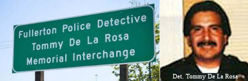 The interchange of I-5 and Rout 91 in the City of Fullerton (~ 005 ORA 42.211R) is named the “Fullerton
Police Detective Tommy De La Rosa Memorial Interchange”. It
was named in memory of Fullerton Police Detective Tommy De La Rosa, who at
43 years of age paid the ultimate sacrifice in the line of duty. Detective
De La Rosa was born on May 12, 1947, and served his country during the
Vietnam War while in the Marine Corps. Detective De La Rosa joined the
Fullerton Police Department on September 26, 1980. While off duty,
Detective De La Rosa liked to speak with children from neighborhoods heavy
with drugs, gangs, and prostitution and urge them to be good and stay in
school. On June 21, 1990, Detective De La Rosa was ambushed and shot five
times during an undercover reverse sting narcotics operation, but,
although gravely injured, was still able to return fire and fatally wound
one of the suspects before succumbing to his injuries. Three other
suspects were convicted of Detective De La Rosa’s murder and were
sentenced to life without parole. Detective De La Rosa provided the public
with exemplary service and dedication to his job throughout his nine-year
career with the Fullerton Police Department. Named by Senate Concurrent
Resolution (SCR) 28, Res. Chapter 128, Statutes of 2015, on July 22, 2015.
The interchange of I-5 and Rout 91 in the City of Fullerton (~ 005 ORA 42.211R) is named the “Fullerton
Police Detective Tommy De La Rosa Memorial Interchange”. It
was named in memory of Fullerton Police Detective Tommy De La Rosa, who at
43 years of age paid the ultimate sacrifice in the line of duty. Detective
De La Rosa was born on May 12, 1947, and served his country during the
Vietnam War while in the Marine Corps. Detective De La Rosa joined the
Fullerton Police Department on September 26, 1980. While off duty,
Detective De La Rosa liked to speak with children from neighborhoods heavy
with drugs, gangs, and prostitution and urge them to be good and stay in
school. On June 21, 1990, Detective De La Rosa was ambushed and shot five
times during an undercover reverse sting narcotics operation, but,
although gravely injured, was still able to return fire and fatally wound
one of the suspects before succumbing to his injuries. Three other
suspects were convicted of Detective De La Rosa’s murder and were
sentenced to life without parole. Detective De La Rosa provided the public
with exemplary service and dedication to his job throughout his nine-year
career with the Fullerton Police Department. Named by Senate Concurrent
Resolution (SCR) 28, Res. Chapter 128, Statutes of 2015, on July 22, 2015.
(Image Source: Fullerton PD)
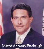 The I-5/I-710 interchange (~ 005 LA 13.752) in Los
Angeles County is officially named the "Marco Antonio Firebaugh
Interchange". This interchange was named in memory of Marco Antonio
Firebaugh, who at the age of 39 years was running for the California State
Senate when he succumbed to health ailments on March 21, 2006. Born in
Tijuana, Mexico on October 13, 1966, Firebaugh emigrated to the United
States when he was a young boy. He worked hard to pay his own way through
school and earned his bachelor of arts degree in political science from
the University of California, Berkeley and a law degree from the UCLA
School of Law. He was the first in his family to attend college and was
committed to the notion that free universal public education is the
cornerstone of our democratic society and worked hard to improve
educational opportunities for all California students. Firebaugh was
elected to the California State Assembly at the age of 32 years; and he
served in the California State Assembly from 1998 to 2004, representing
the 50th Assembly District located in southeast Los Angeles
County. During his tenure in the Assembly, Firebaugh was recognized for
his impressive legislative and advocacy record on behalf of California's
working families and their children, establishing him as a leader and role
model in the Latino community. He demonstrated outstanding leadership in
introducing legislation aimed at improving the lives of immigrants and
low-income families including undocumented immigrants who come to
California to work and give their children a better life. He authored air
quality legislation that provides funding for the state's most important
air emissions reductions programs and that ensures that state funding be
targeted to low-income communities that are most severely impacted by air
pollution. He also authored legislation funding a mobile asthma treatment
clinic known as a Breathmobile to provide free screenings and treatment
for school children in southeast Los Angeles and fought hard in the
Legislature to make California the first state to outlaw smoking in a
vehicle carrying young children to protect them from the hazards created
by breathing secondhand smoke. In 2002, he championed AB540, which allowed
undocumented California high school students to pursue a college education
and pay in-state tuition fees. From 2002 to 2004, Firebaugh served as
Chairman of the California Latino Legislative Caucus where he was
responsible for managing the development of the Latino Caucus' annual
"Agenda for California's Working Families" as a policy document that
focuses on issues affecting California's diverse population. Because of
his effectiveness both as a policymaker and political leader, Marco
Antonio Firebaugh was appointed Majority Floor Leader in 2002, and served
as Floor Leader from 2002 to 2004, making him the highest ranking Latino
in the Assembly and one of the chief negotiators for Assembly Democrats.
Firebaugh also served six years on the State Allocation Board, which
provides funding for public school construction and modernization. Named
by Assembly Concurrent Resolution (ACR) 142, Resolution Chapter 132, on
9/7/2006.
The I-5/I-710 interchange (~ 005 LA 13.752) in Los
Angeles County is officially named the "Marco Antonio Firebaugh
Interchange". This interchange was named in memory of Marco Antonio
Firebaugh, who at the age of 39 years was running for the California State
Senate when he succumbed to health ailments on March 21, 2006. Born in
Tijuana, Mexico on October 13, 1966, Firebaugh emigrated to the United
States when he was a young boy. He worked hard to pay his own way through
school and earned his bachelor of arts degree in political science from
the University of California, Berkeley and a law degree from the UCLA
School of Law. He was the first in his family to attend college and was
committed to the notion that free universal public education is the
cornerstone of our democratic society and worked hard to improve
educational opportunities for all California students. Firebaugh was
elected to the California State Assembly at the age of 32 years; and he
served in the California State Assembly from 1998 to 2004, representing
the 50th Assembly District located in southeast Los Angeles
County. During his tenure in the Assembly, Firebaugh was recognized for
his impressive legislative and advocacy record on behalf of California's
working families and their children, establishing him as a leader and role
model in the Latino community. He demonstrated outstanding leadership in
introducing legislation aimed at improving the lives of immigrants and
low-income families including undocumented immigrants who come to
California to work and give their children a better life. He authored air
quality legislation that provides funding for the state's most important
air emissions reductions programs and that ensures that state funding be
targeted to low-income communities that are most severely impacted by air
pollution. He also authored legislation funding a mobile asthma treatment
clinic known as a Breathmobile to provide free screenings and treatment
for school children in southeast Los Angeles and fought hard in the
Legislature to make California the first state to outlaw smoking in a
vehicle carrying young children to protect them from the hazards created
by breathing secondhand smoke. In 2002, he championed AB540, which allowed
undocumented California high school students to pursue a college education
and pay in-state tuition fees. From 2002 to 2004, Firebaugh served as
Chairman of the California Latino Legislative Caucus where he was
responsible for managing the development of the Latino Caucus' annual
"Agenda for California's Working Families" as a policy document that
focuses on issues affecting California's diverse population. Because of
his effectiveness both as a policymaker and political leader, Marco
Antonio Firebaugh was appointed Majority Floor Leader in 2002, and served
as Floor Leader from 2002 to 2004, making him the highest ranking Latino
in the Assembly and one of the chief negotiators for Assembly Democrats.
Firebaugh also served six years on the State Allocation Board, which
provides funding for public school construction and modernization. Named
by Assembly Concurrent Resolution (ACR) 142, Resolution Chapter 132, on
9/7/2006.
(Image Source: Marco's Obituary)
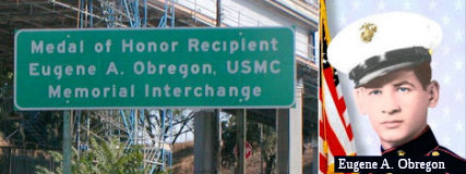 The I-5/I-10/Route 60/U 101 interchange (~ 005 LA 16.335), commonly referred to as the East Los
Angeles Interchange, is named the "Medal of Honor Recipient , Eugene A.
Obregon, USMC, Memorial Interchange" (it was originally named the "Marine
Private First Class Eugene A. Obregon Interchange"). This
interchange was named in memory of Medal of Honor Recipient Eugene A.
Obregon, USMC. While serving as an ammunition carrier with Golf Company,
Third Battalion, Fifth Marine Regiment, First Marine Division
(Reinforced), during the Korean War, PFC Obregon was killed in action on
September 26, 1950. The machine-gun squad of Private Obregon was
temporarily pinned down by hostile fire; and during this time, he observed
a fellow marine fall wounded in the line of fire. Armed only with a
pistol, Private Obregon unhesitantly dashed from his cover position to the
side of the fallen marine. Firing his pistol with one hand as he ran,
Private Obregon grasped his comrade by the arm, and despite the great
peril to himself, dragged the marine to the side of the road. Still under
enemy fire, Private Obregon was bandaging the marine's wounds when hostile
troops began approaching their position. Quickly seizing the wounded
marine's rifle, Private Obregon placed his own body as a shield in front
of the wounded marine and lay there firing accurately and effectively into
the approaching enemy troops until he, himself, was fatally wounded by
enemy machine-gun fire. By his courageous fighting spirit, and loyal
devotion to duty, Private Obregon enabled his fellow marines to rescue the
wounded marine. By fate and courage, Private Obregon is one of the valiant
Mexican Americans to receive the Congressional Medal of Honor, the
nation's highest military honor for bravery. Named by Senate Concurrent
Resolution (SCR) 109, Resolution Chapter 66, on 6/26/2008.
The I-5/I-10/Route 60/U 101 interchange (~ 005 LA 16.335), commonly referred to as the East Los
Angeles Interchange, is named the "Medal of Honor Recipient , Eugene A.
Obregon, USMC, Memorial Interchange" (it was originally named the "Marine
Private First Class Eugene A. Obregon Interchange"). This
interchange was named in memory of Medal of Honor Recipient Eugene A.
Obregon, USMC. While serving as an ammunition carrier with Golf Company,
Third Battalion, Fifth Marine Regiment, First Marine Division
(Reinforced), during the Korean War, PFC Obregon was killed in action on
September 26, 1950. The machine-gun squad of Private Obregon was
temporarily pinned down by hostile fire; and during this time, he observed
a fellow marine fall wounded in the line of fire. Armed only with a
pistol, Private Obregon unhesitantly dashed from his cover position to the
side of the fallen marine. Firing his pistol with one hand as he ran,
Private Obregon grasped his comrade by the arm, and despite the great
peril to himself, dragged the marine to the side of the road. Still under
enemy fire, Private Obregon was bandaging the marine's wounds when hostile
troops began approaching their position. Quickly seizing the wounded
marine's rifle, Private Obregon placed his own body as a shield in front
of the wounded marine and lay there firing accurately and effectively into
the approaching enemy troops until he, himself, was fatally wounded by
enemy machine-gun fire. By his courageous fighting spirit, and loyal
devotion to duty, Private Obregon enabled his fellow marines to rescue the
wounded marine. By fate and courage, Private Obregon is one of the valiant
Mexican Americans to receive the Congressional Medal of Honor, the
nation's highest military honor for bravery. Named by Senate Concurrent
Resolution (SCR) 109, Resolution Chapter 66, on 6/26/2008.
(Image source: Flikr; Alchetron)
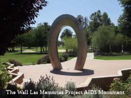 In downtown Los Angeles (~ 005 LA 18.868) there are signed directing motorists to "The
Wall Las Memorias Project AIDS monument". This designation relates
to the The Wall Las Memorias Project, which was founded in 1993 with the
mission of educating the Latino community about the HIV/AIDS epidemic and
building an eternal monument to honor loved ones who have died from that
disease. It was envisioned by local community activist, Richard Zaldivar,
who believed that a public symbol would create a focal point for
discussion and healing among those impacted by the HIV/AIDS epidemic. Over
the past decade, The Wall Las Memorias Project has built support for the
AIDS monument through innovative prevention programs, leadership training,
and grassroots community organizing, which have led to a coalition of
elected officials, community-based organizations, churches, schools,
entertainers, union leaders, and community members. It was designed by
architect David Angelo and public artist Robin Brailsford, and is located
at Lincoln Park in the historic community of Lincoln Heights, northeast of
downtown Los Angeles. It is designed as a Quetzalcoatl serpent, an Aztec
symbol for rebirth, and it consists of eight wall panels, six murals
depicting life with AIDS in the Latino community and two granite panels
containing the names of individuals who have died from AIDS, and includes
a serene park setting for personal meditation. The sign is located on SB
I-5 between exit 135 and 136, and on NB I-5 between Plaza de la Raza and
the Main Street sign. Named by Senate Concurrent Resolution (SCR) 3,
Resolution Chapter 102, on 7/16/2007.
In downtown Los Angeles (~ 005 LA 18.868) there are signed directing motorists to "The
Wall Las Memorias Project AIDS monument". This designation relates
to the The Wall Las Memorias Project, which was founded in 1993 with the
mission of educating the Latino community about the HIV/AIDS epidemic and
building an eternal monument to honor loved ones who have died from that
disease. It was envisioned by local community activist, Richard Zaldivar,
who believed that a public symbol would create a focal point for
discussion and healing among those impacted by the HIV/AIDS epidemic. Over
the past decade, The Wall Las Memorias Project has built support for the
AIDS monument through innovative prevention programs, leadership training,
and grassroots community organizing, which have led to a coalition of
elected officials, community-based organizations, churches, schools,
entertainers, union leaders, and community members. It was designed by
architect David Angelo and public artist Robin Brailsford, and is located
at Lincoln Park in the historic community of Lincoln Heights, northeast of
downtown Los Angeles. It is designed as a Quetzalcoatl serpent, an Aztec
symbol for rebirth, and it consists of eight wall panels, six murals
depicting life with AIDS in the Latino community and two granite panels
containing the names of individuals who have died from AIDS, and includes
a serene park setting for personal meditation. The sign is located on SB
I-5 between exit 135 and 136, and on NB I-5 between Plaza de la Raza and
the Main Street sign. Named by Senate Concurrent Resolution (SCR) 3,
Resolution Chapter 102, on 7/16/2007.
(Image Source: Wall Las Memorias Project)
 The I-5/Route 134 interchange is named the "Gene Autry Memorial Interchange"
(~ 005 LA 26.979). Gene Autry was best known as a singing cowboy of stage and screen. Wikipedia says the following about Autry: Orvon Grover "Gene" Autry (September 29,
1907 – October 2, 1998), nicknamed The Singing Cowboy, was an
American singer, songwriter, actor, musician and rodeo performer who
gained fame largely by singing in a crooning style on radio, in films, and
on television for more than three decades beginning in the early 1930s.
Autry was the owner of a television station (KTLA), several radio stations
(KSFO, KMPC, KOGO), and the Los Angeles/California/Anaheim Angels Major
League Baseball team from 1961 to 1997. From 1934 to 1953, Autry appeared
in 93 films, and between 1950 and 1956 hosted The Gene Autry Show
television series. During the 1930s and 1940s, he personified the
straight-shooting hero—honest, brave, and true—and profoundly
touched the lives of millions of Americans. Autry was also one of the most
important pioneering figures in the history of country music, considered
the second major influential artist of the genre's development after
Jimmie Rodgers. His singing cowboy films were the first vehicle to carry
country music to a national audience. In addition to his signature song,
"Back in the Saddle Again", and his hit "At Mail Call Today", Autry is
still remembered for his Christmas holiday songs, most especially his
biggest hit "Rudolph, the Red-Nosed Reindeer" as well as "Frosty the
Snowman", "Here Comes Santa Claus", and "Up on the House Top". Autry is
responsible for the creation of the "Cowboy Code" of behavior. Autry is a
member of both the Country Music Hall of Fame and Nashville Songwriters
Hall of Fame, and is the only person to be awarded stars in all five
categories on the Hollywood Walk of Fame, for film, television, music,
radio, and live performance. The named interchange is near the Gene Autry
Western Heritage Museum, opened in 1988. Named by SCR 17, Resolution
Chapter 61, on July 16, 1999.
The I-5/Route 134 interchange is named the "Gene Autry Memorial Interchange"
(~ 005 LA 26.979). Gene Autry was best known as a singing cowboy of stage and screen. Wikipedia says the following about Autry: Orvon Grover "Gene" Autry (September 29,
1907 – October 2, 1998), nicknamed The Singing Cowboy, was an
American singer, songwriter, actor, musician and rodeo performer who
gained fame largely by singing in a crooning style on radio, in films, and
on television for more than three decades beginning in the early 1930s.
Autry was the owner of a television station (KTLA), several radio stations
(KSFO, KMPC, KOGO), and the Los Angeles/California/Anaheim Angels Major
League Baseball team from 1961 to 1997. From 1934 to 1953, Autry appeared
in 93 films, and between 1950 and 1956 hosted The Gene Autry Show
television series. During the 1930s and 1940s, he personified the
straight-shooting hero—honest, brave, and true—and profoundly
touched the lives of millions of Americans. Autry was also one of the most
important pioneering figures in the history of country music, considered
the second major influential artist of the genre's development after
Jimmie Rodgers. His singing cowboy films were the first vehicle to carry
country music to a national audience. In addition to his signature song,
"Back in the Saddle Again", and his hit "At Mail Call Today", Autry is
still remembered for his Christmas holiday songs, most especially his
biggest hit "Rudolph, the Red-Nosed Reindeer" as well as "Frosty the
Snowman", "Here Comes Santa Claus", and "Up on the House Top". Autry is
responsible for the creation of the "Cowboy Code" of behavior. Autry is a
member of both the Country Music Hall of Fame and Nashville Songwriters
Hall of Fame, and is the only person to be awarded stars in all five
categories on the Hollywood Walk of Fame, for film, television, music,
radio, and live performance. The named interchange is near the Gene Autry
Western Heritage Museum, opened in 1988. Named by SCR 17, Resolution
Chapter 61, on July 16, 1999.
(Image Source: Wikipedia)
 The interchange of I-5 and Rout 118 in the City of Los Angeles (~ 005 LA 39.416) is named the "David
M. Gonzales Medal of Honor World War II Memorial Interchange". It
is named in memory of David M. Gonzales, Private First Class (PFC), United
States Army. Gonzales was born in 1923 in East Los Angeles and raised in
Pacoima, California. David M. Gonzales joined the Army during World War II
on March 31, 1944, at Fort MacArthur, and was deployed to the Philippines
as an infantry replacement in December 1944. PFC Gonzales’ heroic
service on the Villa Verde Trail in Luzon, Philippines, on April 25, 1945,
earned him, posthumously, the Congressional Medal of Honor. On April 25,
1945, PFC Gonzales and his unit, Company A, 127th Infantry, 32nd
Division, were pinned down by enemy fire when a 500-pound bomb exploded in
the company’s perimeter, burying five men of Company A. Without
hesitation, PFC Gonzales seized an entrenching tool, and, under a hail of
fire, crawled 15 yards to his entombed comrades, while his commanding
officer, who also rushed forward to help, was struck and instantly killed
by machine gun fire. Undismayed, PFC Gonzales set to work swiftly with the
entrenching tool, and continued to dig out the five trapped men, while
enemy sniper fire and machine gun bullets struck him. After PFC Gonzales
had successfully freed one of the men, he stood up to be able to dig
faster, despite the fact that such a position exposed him to greater
danger, and while he successfully freed another man, PFC Gonzales was
mortally wounded by enemy fire as he finished liberating the third trapped
man. In the words of President Harry Truman, “Private
Gonzales’ valiant and intrepid conduct exemplified the highest
tradition of the military service”. The other two buried soldiers
were later saved when the intense enemy fire subsided. PFC Gonzales was
killed on April 25, 1945, while serving our country and saving the lives
of his comrades on the field of battle during World War II. PFC Gonzales
was survived by his then 25-year-old widow, his one-year-old son, and his
mother. Named by Senate Concurrent Resolution No. 72, Resolution Chapter
148, September 05, 2014.
The interchange of I-5 and Rout 118 in the City of Los Angeles (~ 005 LA 39.416) is named the "David
M. Gonzales Medal of Honor World War II Memorial Interchange". It
is named in memory of David M. Gonzales, Private First Class (PFC), United
States Army. Gonzales was born in 1923 in East Los Angeles and raised in
Pacoima, California. David M. Gonzales joined the Army during World War II
on March 31, 1944, at Fort MacArthur, and was deployed to the Philippines
as an infantry replacement in December 1944. PFC Gonzales’ heroic
service on the Villa Verde Trail in Luzon, Philippines, on April 25, 1945,
earned him, posthumously, the Congressional Medal of Honor. On April 25,
1945, PFC Gonzales and his unit, Company A, 127th Infantry, 32nd
Division, were pinned down by enemy fire when a 500-pound bomb exploded in
the company’s perimeter, burying five men of Company A. Without
hesitation, PFC Gonzales seized an entrenching tool, and, under a hail of
fire, crawled 15 yards to his entombed comrades, while his commanding
officer, who also rushed forward to help, was struck and instantly killed
by machine gun fire. Undismayed, PFC Gonzales set to work swiftly with the
entrenching tool, and continued to dig out the five trapped men, while
enemy sniper fire and machine gun bullets struck him. After PFC Gonzales
had successfully freed one of the men, he stood up to be able to dig
faster, despite the fact that such a position exposed him to greater
danger, and while he successfully freed another man, PFC Gonzales was
mortally wounded by enemy fire as he finished liberating the third trapped
man. In the words of President Harry Truman, “Private
Gonzales’ valiant and intrepid conduct exemplified the highest
tradition of the military service”. The other two buried soldiers
were later saved when the intense enemy fire subsided. PFC Gonzales was
killed on April 25, 1945, while serving our country and saving the lives
of his comrades on the field of battle during World War II. PFC Gonzales
was survived by his then 25-year-old widow, his one-year-old son, and his
mother. Named by Senate Concurrent Resolution No. 72, Resolution Chapter
148, September 05, 2014.
(Image source: Aerotech News; Wikipedia)
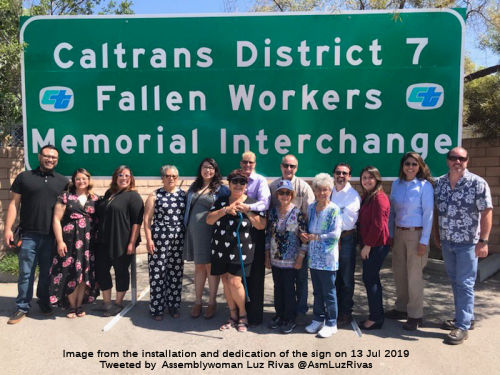 The interchange at I-210 and I-5 (LA 5
R43.904; LA 210 R0.000) in the County of Los Angeles is designated as the
"Caltrans District 7 Fallen Workers Memorial Interchange".
Highway construction is one of the most dangerous occupations in the
United States. The risk of death is seven times higher for highway workers
than for other workers, according to a study conducted by the Occupational
Safety and Health Administration of the United States Department of Labor.
The Department of Transportation (Caltrans) has lost 185 employees since
1921. On average, 1,000 Caltrans vehicles are struck each year, and, in
addition to the danger to workers, an estimated 85 to 90 percent of people
who are killed in highway work zones are drivers and their passengers. The
following workers in District 7 are memorialized with this designation:
The interchange at I-210 and I-5 (LA 5
R43.904; LA 210 R0.000) in the County of Los Angeles is designated as the
"Caltrans District 7 Fallen Workers Memorial Interchange".
Highway construction is one of the most dangerous occupations in the
United States. The risk of death is seven times higher for highway workers
than for other workers, according to a study conducted by the Occupational
Safety and Health Administration of the United States Department of Labor.
The Department of Transportation (Caltrans) has lost 185 employees since
1921. On average, 1,000 Caltrans vehicles are struck each year, and, in
addition to the danger to workers, an estimated 85 to 90 percent of people
who are killed in highway work zones are drivers and their passengers. The
following workers in District 7 are memorialized with this designation:
In addition to law enforcement and Department of California Highway Patrol officers, contracted highway workers are also at risk of death. The latest data shows that speeding was a factor in more than 35 percent of all fatal work zone crashes, and most work zone fatalities are the result of rear-end collisions caused by driver distraction, inattention, or aggressive driving. Caltrans has adopted a “Slow for the Cone Zone” campaign to raise public awareness and to ask motorists to be alert, slow down, allow extra following room, expect sudden stops, never drive impaired, and avoid distractions, including the use of cell phones, in highway work zones. Fines are doubled in highway work zones and can easily total $1,000 or more for drivers who speed, drive aggressively, text, are otherwise distracted, or cause collisions in a highway work zone. Named by Assembly Concurrent Resolution (ACR) 263, Res. Chapter 220, 9/11/2018.
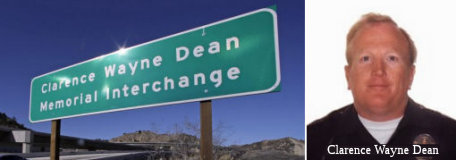 The I-5/Route 14 interchange (005 LA R045.58) is
officially designated the "Clarence Wayne Dean Memorial Interchange".
Officer Clarence Wayne Dean was a 26-year veteran motorcycle cop for the
Los Angeles Police Department. He lived in Lancaster, north of the city,
and worked out of the Van Nuys station in the San Fernando Valley. He
joined the Los Angeles force in 1968 after four years in the Marines,
leaving the military with the rank of sergeant. He had been a motorcycle
officer for ten years. In November 1993 he hurt his back and took a desk
job. A few weeks later, he returned to work healthy enough to go back on
the street. On January 17, 1994, a 6.6 earthquake struck the San Fernando
Valley's Northridge area. The Newhall Pass sections of the I-5/Route 14
freeway interchange collapsed. Officer Dean was unaware of the collapse.
While rounding a turn on a soaring overpass, he sailed into space astride
his motorcyle, unable to stop. The interchange was renamed the "Clarence
Wayne Dean Memorial Interchange" in his honor. Named by Assembly
Concurrent Resolution No. 111, Chapter 64, in 1994.
The I-5/Route 14 interchange (005 LA R045.58) is
officially designated the "Clarence Wayne Dean Memorial Interchange".
Officer Clarence Wayne Dean was a 26-year veteran motorcycle cop for the
Los Angeles Police Department. He lived in Lancaster, north of the city,
and worked out of the Van Nuys station in the San Fernando Valley. He
joined the Los Angeles force in 1968 after four years in the Marines,
leaving the military with the rank of sergeant. He had been a motorcycle
officer for ten years. In November 1993 he hurt his back and took a desk
job. A few weeks later, he returned to work healthy enough to go back on
the street. On January 17, 1994, a 6.6 earthquake struck the San Fernando
Valley's Northridge area. The Newhall Pass sections of the I-5/Route 14
freeway interchange collapsed. Officer Dean was unaware of the collapse.
While rounding a turn on a soaring overpass, he sailed into space astride
his motorcyle, unable to stop. The interchange was renamed the "Clarence
Wayne Dean Memorial Interchange" in his honor. Named by Assembly
Concurrent Resolution No. 111, Chapter 64, in 1994.
(Image Sources: Washington Times; Find A Grave)
At the junction of Route 5 with Route 126 (~ 005 LA R55.217), there will be a "1915 Ridge Route Highway Historical Monument". Begun in 1914 and completed in late 1915, the Ridge Route Highway, officially named the "Castaic-Tejon Route," connected Castaic Junction in Los Angeles County to Bakersfield. It was one of the first products of the newly formed State Bureau of Highways, paid for through the passage of a 1910 bond act. It was considered an engineering marvel of its day and was the first mountain highway built in California. Many credit the 1915 Ridge Route Highway, which opened up travel and commerce between the Los Angeles basin and the San Joaquin Valley, with having prevented California from separating into two separate states. Workers carved out the original 20-foot wide roadway by using horse and mule drawn scrapers and graders, going from ridge top to ridge top across the western San Gabriel mountains. Originally completed as an oiled, graded gravel road, the 1915 Ridge Route Highway was paved in 1919; and was well known for its 697 curves, the most notorious of which was Deadman's Curve near Tejon, that if added together, would make 110 complete circles. The 1915 Ridge Route Highway was replaced in 1933, by a straighter, three-lane highway, which was later widened and became Route 99. On September 25, 1997, 17.6 miles of the 1915 Ridge Route Highway south of Gorman, was accepted into the National Registry of Historic Places. Named by Assembly Concurrent Resolution 98, Chapter 150, October 2, 2001. Note: The Ridge Route Preservation Organziation (RRPO) worked with Assemblyman Runner (author of ACR 98) for the purpose of getting permission to place a historical marker at Castaic Junction, the official beginning of the route on the southern end. ACR 98 directs Caltrans to issue RRPO a permit to construct the monument. Unfortunately, after the passage of ACR 98, they ran into a road block with the permit. They are currently working to resolve the issue.
 Portions of the route between Santa Clarita and the I-5 / Route 99 split have been
referred to as "The Ridge Route". The first usage of the term
dates back to 1913, and a report in the May 1913 California Highway
Bulletin about the reasonings for the then named "Tejon Route" being
chosen over the alternate route through Tehachapi Pass and Lancaster. In
this report, the survey photo refers to the Los Angeles-Bakersfield
segment of LRN 4 as the "Tejon-Castaic Ridge Route." Later, an article in
the July 1916 California Highways & Public Works refers to the Los
Angeles-Bakersfield segment of LRN 4 with multiple names: the
Castaic-Tejon Ridge Road, Castaic Road, Castaic Ridge Road and as Ridge
Route. By 1924, the successor publication California Highways &
Public Works refered to what had been the Castaic-Tejon Ridge Route simply as just the "Ridge Route". The term, broadly, was a reference for
the Los Angeles to Bakersfield segment of LRN 4, but notably the section
through Tejon Pass. In 1933 a rerouting of a portion of the Ridge Route took place; this was called the Ridge Route Alternate and was a
bypass of the more haggard segments of the orginial Los
Angeles-Bakersfield Ridge Route corridor. In 1949, CHPW stated that the
definition of the Ridge Route was now the 44 miles of US 99/LRN 4 from the
city limits of Los Angeles to the Kern County line. This made clear the
Grapevine was a separate segment. The new alignment of I-5 was shifted
above what was built as Ridge Route Alternate through Piru Gorge. Pyramid
Dam was constructed in Piru Gorge which bisected the grade of Ridge Route Alternate. Various portions of the original Ridge Route remain. As for the
name, it refers to the fact that the original routing ran along the ridge
of the canyon.
Portions of the route between Santa Clarita and the I-5 / Route 99 split have been
referred to as "The Ridge Route". The first usage of the term
dates back to 1913, and a report in the May 1913 California Highway
Bulletin about the reasonings for the then named "Tejon Route" being
chosen over the alternate route through Tehachapi Pass and Lancaster. In
this report, the survey photo refers to the Los Angeles-Bakersfield
segment of LRN 4 as the "Tejon-Castaic Ridge Route." Later, an article in
the July 1916 California Highways & Public Works refers to the Los
Angeles-Bakersfield segment of LRN 4 with multiple names: the
Castaic-Tejon Ridge Road, Castaic Road, Castaic Ridge Road and as Ridge
Route. By 1924, the successor publication California Highways &
Public Works refered to what had been the Castaic-Tejon Ridge Route simply as just the "Ridge Route". The term, broadly, was a reference for
the Los Angeles to Bakersfield segment of LRN 4, but notably the section
through Tejon Pass. In 1933 a rerouting of a portion of the Ridge Route took place; this was called the Ridge Route Alternate and was a
bypass of the more haggard segments of the orginial Los
Angeles-Bakersfield Ridge Route corridor. In 1949, CHPW stated that the
definition of the Ridge Route was now the 44 miles of US 99/LRN 4 from the
city limits of Los Angeles to the Kern County line. This made clear the
Grapevine was a separate segment. The new alignment of I-5 was shifted
above what was built as Ridge Route Alternate through Piru Gorge. Pyramid
Dam was constructed in Piru Gorge which bisected the grade of Ridge Route Alternate. Various portions of the original Ridge Route remain. As for the
name, it refers to the fact that the original routing ran along the ridge
of the canyon.
(Source: Gribblenation Blog (Tom Fearer), "When did people begin to refer to the "Ridge Route" as "The Grapevine?" (former US Route 99 and Interstate 5)", March 2022; Images sources: Waymarking; Wikimedia Commons; Historical Marker Database)
 Portions of the route between Santa Clarita and the I-5 / Route 99 split have been
referred to as "The Grapevine". This dates back to the February
1925 California Highways & Public Works, which referred to the segment
of LRN 4 in Grapevine Canyon as the "Grapevine Grade," which was
the northern end of the Ridge Route. This was a reference to the
portion of the route in Castac Pass through Grapevine Canyon west of the
Old Tejon Pass. A survey in 1853 found Castac Pass through Grapevine
Canyon to be a far more viable route for travelers and the primary
alignment was of the Stockton-Los Angeles Road was shifted west from Old
Tejon Pass. Castac Pass had a far lower terminal elevation at
approximately 4,200 feet above sea level and had a gentler grade through
Grapevine Canyon. In 1854, a U.S. Army Garrison was established at Fort
Tejon in Grapevine Canyon near modern Lebec to protect settlers and
travelers along the Stockton-Los Angeles Road. In time Castac Pass became
known as Fort Tejon Pass and eventually simply Tejon Pass. There were
various upgrades to the Grapevine Grade over time; the final upgrade to
the Old Ridge Route in Grapevine Canyon was between Lebec and Fort Tejon
and opened on August 31, 1936. In writing about this, the October 1936
California Highways & Public Works refers to Grapevine Canyon as "The
Grapevine" in numerous paragraphs. This appears to be the first reference
something resembling the modern nickname. By 1949, CHPW was making a clear
distinction between the portion of the route in LA County, between the
City Limits of LA and the border with Kern County (this was the Ridge
Route), and the portion in Kern County going down the hill (this
was the Grapevine Grade). As for the name, in 1772, searching
for a shorter pass between San Diego and Monterey, Acting Governor of Alta
California Pedro Fages discovered a canyon pass that led southbound
towards the Santa Clarita Valley. He named it "La Cañada de Las Uvas"
or “Canyon of the Grapes” because of an abundance of wild
grapevines along the route. Although it proved to be an excellent pass,
early travelers were forced to hack their way through thickets of wild
grapevines. Today, you can still see wild grapes growing along the canyons
that, at quick glance, easily resemble ivy. Note that Grapevine
does not refer to the routing of the highway itself; in particular, the
notable "French Switch" where the north and south carriageways switch
sides near Castaic.
Portions of the route between Santa Clarita and the I-5 / Route 99 split have been
referred to as "The Grapevine". This dates back to the February
1925 California Highways & Public Works, which referred to the segment
of LRN 4 in Grapevine Canyon as the "Grapevine Grade," which was
the northern end of the Ridge Route. This was a reference to the
portion of the route in Castac Pass through Grapevine Canyon west of the
Old Tejon Pass. A survey in 1853 found Castac Pass through Grapevine
Canyon to be a far more viable route for travelers and the primary
alignment was of the Stockton-Los Angeles Road was shifted west from Old
Tejon Pass. Castac Pass had a far lower terminal elevation at
approximately 4,200 feet above sea level and had a gentler grade through
Grapevine Canyon. In 1854, a U.S. Army Garrison was established at Fort
Tejon in Grapevine Canyon near modern Lebec to protect settlers and
travelers along the Stockton-Los Angeles Road. In time Castac Pass became
known as Fort Tejon Pass and eventually simply Tejon Pass. There were
various upgrades to the Grapevine Grade over time; the final upgrade to
the Old Ridge Route in Grapevine Canyon was between Lebec and Fort Tejon
and opened on August 31, 1936. In writing about this, the October 1936
California Highways & Public Works refers to Grapevine Canyon as "The
Grapevine" in numerous paragraphs. This appears to be the first reference
something resembling the modern nickname. By 1949, CHPW was making a clear
distinction between the portion of the route in LA County, between the
City Limits of LA and the border with Kern County (this was the Ridge
Route), and the portion in Kern County going down the hill (this
was the Grapevine Grade). As for the name, in 1772, searching
for a shorter pass between San Diego and Monterey, Acting Governor of Alta
California Pedro Fages discovered a canyon pass that led southbound
towards the Santa Clarita Valley. He named it "La Cañada de Las Uvas"
or “Canyon of the Grapes” because of an abundance of wild
grapevines along the route. Although it proved to be an excellent pass,
early travelers were forced to hack their way through thickets of wild
grapevines. Today, you can still see wild grapes growing along the canyons
that, at quick glance, easily resemble ivy. Note that Grapevine
does not refer to the routing of the highway itself; in particular, the
notable "French Switch" where the north and south carriageways switch
sides near Castaic.
(Source: Gribblenation Blog (Tom Fearer), "When did people begin to refer to the "Ridge Route" as "The Grapevine?" (former US Route 99 and Interstate 5)", March 2022; Los Angeles Almanac; Image sources: Bakersfield Californian; Paso Robles Daily News)
Bridge 22-0025 (005 SAC 000.01), over the Sacramento River between Sacramento and Yolo counties, was named the "Elkhorn Bridge" or "Elkhorn Causeway" through historical and long usage. The name relates to the location, which is near where the Elkhorn Ferry used to run. The ferry may have run as late as 1971.
In 1969, the Elkhorn Bridge (005 SAC 000.01) was renamed the "Vietnam Servicemen Memorial Bridge" by Senate Concurrent Resolution 145, Chapter 357. The Vietnam Servicemen Memorial Bridge is dedicated to the memory of over 600 men from Sacramento, Placer, Yolo, Yuba and El Dorado County who were killed in action in South Vietnam.
Bridge 24-0004 (SAC 020.00), the bridge over the Sacramento River connecting Sacramento and Yolo counties, is named the "Pioneer Memorial Bridge". It was built in 1966.
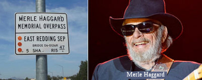 The portion of Route 5 at the interchange of I-5 and Route 44 in
Shasta County in the City of Redding (~ 005 SHA R15.457) is named the "Merle
Haggard Memorial Overpass". It was named in memory of Merle Ronald
Haggard, who was born to James and Flossie Haggard in April 1937, in
Oildale, just north of Bakersfield, California. Merle’s father was a
railroad worker, and Merle grew up during the Great Depression. He lived
with his family in a boxcar that they had converted into a home. As a
child, Merle suffered from a respiratory condition that frequently kept
him out of school and confined to bed rest. James Haggard died from a
brain tumor when Merle was nine years of age. After his father’s
death, Merle became rebellious. In an attempt to straighten her son out,
his mother put him in several juvenile detention centers, but it had
little effect on Merle’s behavior. As a teenager, Merle fell in love
with country music, particularly the songs of Bob Wills, Lefty Frizzell,
and Hank Williams. When he was 12 years of age, Merle was given his first
guitar by his older brother. He then taught himself how to play by
listening to records. Continuing to rebel, he went to Texas with his
friend Bob Teague and, after returning to California, he moved to Modesto,
where he made his performing debut with Teague at a bar named the Fun
Center. The two were paid five dollars and given all the beer that they
could drink. In 1958, at 20 years of age, Merle was sentenced to the
California State Prison at San Quentin for burglary and an attempted
escape from county jail. While serving a two-and-one-half-year term, he
played in the prison’s country band and took high school equivalency
courses. In 1959, he was a member of the audience that witnessed Johnny
Cash’s first performance at San Quentin. Merle Haggard would later
be officially pardoned in 1972 by then-Governor Ronald Reagan. In 1962,
Merle Haggard signed with a small label called Tally Records for which he
recorded five songs, including his debut single, “Sing a Sad
Song,” which rose to No. 19 on the country music charts. In 1965, he
formed his own band, The Strangers, before signing with Capitol Records,
and later that year the band released its debut self-titled album. The
group’s followup album, “Swinging Doors,” reached No. 1
on the country music charts the following year, and in 1967 the
group’s single “I’m a Lonesome Fugitive” did the
same. Later that year, Merle Haggard continued his runaway success with
“Branded Man,” his first self-penned No. 1 song. During the
remainder of the 1960s, Merle Haggard produced a string of No. 1 singles,
culminating with what would become his signature song and his most
controversial recording, “Okie from Muskogee.” Released in
1969, the song became an anthem for middle Americans whose patriotism and
traditional values were under attack from Vietnam War protesters and
hippies. “Okie from Muskogee” crossed over to the pop charts
and in 1970 earned Merle Haggard the Country Music Association’s
awards for Single, Entertainer, and Top Male Vocalist of the Year. The
album of the same name also won Album of the Year. All told, Merle Haggard
released nearly 70 albums and 600 songs, 250 of which he wrote himself.
Among his most memorable albums were “The Fightin’ Side of
Me” (1970), “Someday We’ll Look Back” (1971),
“If We Make It Through December” (1974), and “A Working
Man Can’t Get Nowhere Today” (1977). In 1982, he recorded a
duet album with George Jones called “A Taste of Yesterday’s
Wine,” which yielded the chart toppers “Yesterday’s
Wine” and “C.C. Waterback.” The following year, he
collaborated with Willie Nelson to record the widely praised compilation
“Pancho & Lefty.” In addition to an impressive title
track, “Pancho & Lefty” featured the touching ballads
“It’s My Lazy Day,” “Half a Man,”
“Reasons to Quit,” and “All the Soft Places to
Fall”. Merle Haggard was elected to the Songwriters Hall of Fame in
1977. In 1994, his wealth of artistic achievements, including 38 No. 1
hits, earned him induction into the Country Music Hall of Fame. Though his
musical output waned over the years, he continued to find success with
albums such as “If I Could Fly” (2000), “Haggard Like
Never Before” (2003), and his 2015 reunion album with Willie Nelson,
“Django & Jimmie,” which placed him atop the country music
charts one more time. In 2008, Merle Haggard was diagnosed with lung
cancer and underwent surgery to remove a tumor. Reflecting on the
situation, he referred to it as “the greatest test of my
fortitude”. Merle Haggard died at home on his northern California
ranch in Palo Cedro in Shasta County on April 6, 2016, his 79th
birthday. He had been suffering from double pneumonia and had to cancel a
string of scheduled concerts with Willie Nelson. The 11 days he spent
trying to recover from his illness had become so difficult that he
reportedly told his friends and family that he would die on his birthday.
Named by Senate Concurrent Resolution 139, Res. Chapter 180, 9/9/2016.
The portion of Route 5 at the interchange of I-5 and Route 44 in
Shasta County in the City of Redding (~ 005 SHA R15.457) is named the "Merle
Haggard Memorial Overpass". It was named in memory of Merle Ronald
Haggard, who was born to James and Flossie Haggard in April 1937, in
Oildale, just north of Bakersfield, California. Merle’s father was a
railroad worker, and Merle grew up during the Great Depression. He lived
with his family in a boxcar that they had converted into a home. As a
child, Merle suffered from a respiratory condition that frequently kept
him out of school and confined to bed rest. James Haggard died from a
brain tumor when Merle was nine years of age. After his father’s
death, Merle became rebellious. In an attempt to straighten her son out,
his mother put him in several juvenile detention centers, but it had
little effect on Merle’s behavior. As a teenager, Merle fell in love
with country music, particularly the songs of Bob Wills, Lefty Frizzell,
and Hank Williams. When he was 12 years of age, Merle was given his first
guitar by his older brother. He then taught himself how to play by
listening to records. Continuing to rebel, he went to Texas with his
friend Bob Teague and, after returning to California, he moved to Modesto,
where he made his performing debut with Teague at a bar named the Fun
Center. The two were paid five dollars and given all the beer that they
could drink. In 1958, at 20 years of age, Merle was sentenced to the
California State Prison at San Quentin for burglary and an attempted
escape from county jail. While serving a two-and-one-half-year term, he
played in the prison’s country band and took high school equivalency
courses. In 1959, he was a member of the audience that witnessed Johnny
Cash’s first performance at San Quentin. Merle Haggard would later
be officially pardoned in 1972 by then-Governor Ronald Reagan. In 1962,
Merle Haggard signed with a small label called Tally Records for which he
recorded five songs, including his debut single, “Sing a Sad
Song,” which rose to No. 19 on the country music charts. In 1965, he
formed his own band, The Strangers, before signing with Capitol Records,
and later that year the band released its debut self-titled album. The
group’s followup album, “Swinging Doors,” reached No. 1
on the country music charts the following year, and in 1967 the
group’s single “I’m a Lonesome Fugitive” did the
same. Later that year, Merle Haggard continued his runaway success with
“Branded Man,” his first self-penned No. 1 song. During the
remainder of the 1960s, Merle Haggard produced a string of No. 1 singles,
culminating with what would become his signature song and his most
controversial recording, “Okie from Muskogee.” Released in
1969, the song became an anthem for middle Americans whose patriotism and
traditional values were under attack from Vietnam War protesters and
hippies. “Okie from Muskogee” crossed over to the pop charts
and in 1970 earned Merle Haggard the Country Music Association’s
awards for Single, Entertainer, and Top Male Vocalist of the Year. The
album of the same name also won Album of the Year. All told, Merle Haggard
released nearly 70 albums and 600 songs, 250 of which he wrote himself.
Among his most memorable albums were “The Fightin’ Side of
Me” (1970), “Someday We’ll Look Back” (1971),
“If We Make It Through December” (1974), and “A Working
Man Can’t Get Nowhere Today” (1977). In 1982, he recorded a
duet album with George Jones called “A Taste of Yesterday’s
Wine,” which yielded the chart toppers “Yesterday’s
Wine” and “C.C. Waterback.” The following year, he
collaborated with Willie Nelson to record the widely praised compilation
“Pancho & Lefty.” In addition to an impressive title
track, “Pancho & Lefty” featured the touching ballads
“It’s My Lazy Day,” “Half a Man,”
“Reasons to Quit,” and “All the Soft Places to
Fall”. Merle Haggard was elected to the Songwriters Hall of Fame in
1977. In 1994, his wealth of artistic achievements, including 38 No. 1
hits, earned him induction into the Country Music Hall of Fame. Though his
musical output waned over the years, he continued to find success with
albums such as “If I Could Fly” (2000), “Haggard Like
Never Before” (2003), and his 2015 reunion album with Willie Nelson,
“Django & Jimmie,” which placed him atop the country music
charts one more time. In 2008, Merle Haggard was diagnosed with lung
cancer and underwent surgery to remove a tumor. Reflecting on the
situation, he referred to it as “the greatest test of my
fortitude”. Merle Haggard died at home on his northern California
ranch in Palo Cedro in Shasta County on April 6, 2016, his 79th
birthday. He had been suffering from double pneumonia and had to cancel a
string of scheduled concerts with Willie Nelson. The 11 days he spent
trying to recover from his illness had become so difficult that he
reportedly told his friends and family that he would die on his birthday.
Named by Senate Concurrent Resolution 139, Res. Chapter 180, 9/9/2016.
Bridge 06-021, the Pit River Arm Bridge at Shasta Lake (005 SHA R028.14) in Shasta county, is named the "Veterans of Foreign Wars Memorial Bridge". It was built in 1941, and named by Senate Concurrent Resolution 59, Chapter 150, in 1994. The Veterans of Foreign Wars of the United States traces its roots back to 1899 when veterans of the Spanish-American War (1898) and the Philippine Insurrection (1899-1902) founded local organizations to secure rights and benefits for their service. After chapters were formed in Ohio, Colorado and Pennsylvania, the movement quickly gained momentum. By 1915, membership grew to 5,000; by 1936, membership was almost 200,000. The VFW planned the establishment of the Veterans Administration, and has been a tireless promoter for veteran's rights. More information on the organization can be found at http://www.vfw.org/.
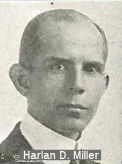 According to the Caltrans publication "Named Freeways, Highways, Structures and Other Appurtenances in California, 1996", Bridge
06-027 (005 SHA 045.54), at Dog Creek in Shasta county, is named the Harlan
D. Miller Bridge. Harlan D. Miller, Chief of the California
Highway Commission Bridge Department from 1924 to 1926, advocated
aesthetically pleasing as well as physically substantial bridges. It was
built in 1956, and named by Senate Concurrent Resolution 140 in 1974. This
was a replacement for the old concrete arch bridge, built on the
Pacific Highway in 1927 and now decommissioned. According to California
Highways and Public Works, Jan 28, that bridge was was also named after
Harlan D. Miller, who was the chief bridge engineer for the California
Highway Commission. At the time of his appointment, Mr. Miller had been
engaged in engineering work for nineteen years, and was formerly connected
with the bridge department of the New York Central Railroad and held a
similar position with the state of New Yark. Mr. Miller assumed the
position of acting bridge engineer in 1923, at the time all bridge work
was transferred from the ·divisions to headquarters and placed under
a centralized department. The department was been considerably enlarged
under his direction. He was a graduate of the Case School of Applied
Science in Cleveland, Ohio, where he was elected a member of the Sigma Xi,
the scientific honor society. He has been with the California Highway
Commission for five years. Mr. Miller died on October 19, 1926. A few days
before his death, the CHC designated he structure as the Harlan D. Miller
bridge in recognition of his service to the state. You can still see the
old bridge from I-5 if you know where to look, and that the Caltrans
Library has a lovely photo showing both the new bridge and the old bridge.
According to the Caltrans publication "Named Freeways, Highways, Structures and Other Appurtenances in California, 1996", Bridge
06-027 (005 SHA 045.54), at Dog Creek in Shasta county, is named the Harlan
D. Miller Bridge. Harlan D. Miller, Chief of the California
Highway Commission Bridge Department from 1924 to 1926, advocated
aesthetically pleasing as well as physically substantial bridges. It was
built in 1956, and named by Senate Concurrent Resolution 140 in 1974. This
was a replacement for the old concrete arch bridge, built on the
Pacific Highway in 1927 and now decommissioned. According to California
Highways and Public Works, Jan 28, that bridge was was also named after
Harlan D. Miller, who was the chief bridge engineer for the California
Highway Commission. At the time of his appointment, Mr. Miller had been
engaged in engineering work for nineteen years, and was formerly connected
with the bridge department of the New York Central Railroad and held a
similar position with the state of New Yark. Mr. Miller assumed the
position of acting bridge engineer in 1923, at the time all bridge work
was transferred from the ·divisions to headquarters and placed under
a centralized department. The department was been considerably enlarged
under his direction. He was a graduate of the Case School of Applied
Science in Cleveland, Ohio, where he was elected a member of the Sigma Xi,
the scientific honor society. He has been with the California Highway
Commission for five years. Mr. Miller died on October 19, 1926. A few days
before his death, the CHC designated he structure as the Harlan D. Miller
bridge in recognition of his service to the state. You can still see the
old bridge from I-5 if you know where to look, and that the Caltrans
Library has a lovely photo showing both the new bridge and the old bridge.
(Image source: California Highways and Public Works, Dec 1924)
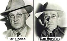 Bridge 06-192L (005 SHA R051.80), the Sacramento River Bridge O.H., is officially named the "Earl Sholes Memorial Bridge", and the
highway bridge 06-193L (005 SHA R052.11), is officially named the "Dan
Heryford Memorial Bridge". On May 25, 1950, in the vicinity of the
twin bridges, Shasta County Undersheriff Earl Sholes and Shasta County
Deputy Sheriff Dan Heryford were killed by two prisoners that the officers
were transporting to Redding on charges that the prisoners had stolen a
motor vehicle. Named by Senate Concurrent Resolution No. 2, Chapter 61, in
1997.
Bridge 06-192L (005 SHA R051.80), the Sacramento River Bridge O.H., is officially named the "Earl Sholes Memorial Bridge", and the
highway bridge 06-193L (005 SHA R052.11), is officially named the "Dan
Heryford Memorial Bridge". On May 25, 1950, in the vicinity of the
twin bridges, Shasta County Undersheriff Earl Sholes and Shasta County
Deputy Sheriff Dan Heryford were killed by two prisoners that the officers
were transporting to Redding on charges that the prisoners had stolen a
motor vehicle. Named by Senate Concurrent Resolution No. 2, Chapter 61, in
1997.
(Image source: Officer Down Memorial Page - Sholes - Heryford)
This route also has the following Safety Roadside Rest Areas:
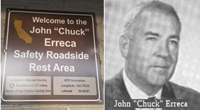 John "Chuck" Erreca (Panoche), in Merced County (~ MER 0.702), 0.7 mi N of the Fresno County Line. John Erreca was a former
member of the California Highway Commission and a former director of the
Department of Public Works. In the Los Banos area, he was a farmer and
cattleman. He was a member of the Los Banos City Council and served as
the mayor. Upon his appointment to the Highway Commission he resigned
from the City Council. In 1953 Erreca was elected to the board of
directors of the League of California Cities, and served as president of
the League in 1959. He was also the chairman of the League's highway
committee. He is a past president of the Merced County Livestock
Association and president of the board of directors of the Merced County
Spring Fair.
John "Chuck" Erreca (Panoche), in Merced County (~ MER 0.702), 0.7 mi N of the Fresno County Line. John Erreca was a former
member of the California Highway Commission and a former director of the
Department of Public Works. In the Los Banos area, he was a farmer and
cattleman. He was a member of the Los Banos City Council and served as
the mayor. Upon his appointment to the Highway Commission he resigned
from the City Council. In 1953 Erreca was elected to the board of
directors of the League of California Cities, and served as president of
the League in 1959. He was also the chairman of the League's highway
committee. He is a past president of the Merced County Livestock
Association and president of the board of directors of the Merced County
Spring Fair. Larry Combs Memorial Rest Stop (Westly), in Stanislaus County (~ STA 27.249), 0.9 mi S of the San Joaquin County Line. Named in memory of Larry Combs, a leadworker
for the Department of Transportation assigned to the operation and
service of all roadside rest stops for District 10 of the Department of
Transportation, which included the Westly rest stop off I-5 in the
County of Stanislaus. Larry Combs was well recognized as an outstanding
employee of the Department of Transportation who gave the people of
California selfless, dedicated service that resulted in improved and
superior maintenance of roadside rest stops. Named by Senate Concurrent
Resolution 84, Chapter 166, August 30, 2004.
Larry Combs Memorial Rest Stop (Westly), in Stanislaus County (~ STA 27.249), 0.9 mi S of the San Joaquin County Line. Named in memory of Larry Combs, a leadworker
for the Department of Transportation assigned to the operation and
service of all roadside rest stops for District 10 of the Department of
Transportation, which included the Westly rest stop off I-5 in the
County of Stanislaus. Larry Combs was well recognized as an outstanding
employee of the Department of Transportation who gave the people of
California selfless, dedicated service that resulted in improved and
superior maintenance of roadside rest stops. Named by Senate Concurrent
Resolution 84, Chapter 166, August 30, 2004.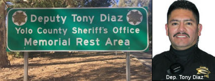 Deputy Tony Diaz, Yolo County Sheriff’s
Office, Memorial Rest Area (Dunnigan), in Yolo County (~ YOL R26.364), 0.5 mi N of Dunnigan. This rest area is named the Deputy Tony Diaz, Yolo County
Sheriff’s Office, Memorial Rest Area. It was named after
Jose Antonio “Tony” Diaz, who was born in Jacona, Mexico, in
1970. During the summers of 1986 to 1989, he worked tirelessly in the
fields of farmers in Solano County. After completing high school, Tony
assisted farmworkers as Assistant Program Services Manager with the
Human Development Corporation, and after transferring to the corporate
office, he developed a passion for computer technology. In 1999, the
Yolo County Information Technology (IT) Department hired Tony and
assigned him to the Yolo County Sheriff’s Office. While assigned
to IT he became interested in law enforcement and attended the Yuba
College Police Academy in 2004. The Yolo County Sheriff’s Office
hired Tony on August 22, 2004, and his peers described him as a gentle,
hardworking man who was proud of his family and community. On June 15,
2008, Deputy Diaz attempted to stop a known parolee suspected of driving
under the influence with a child in the vehicle. After he failed to
yield, Deputy Diaz pursued the driver into the town of Dunnigan, where
he stopped on County Road 5 near County Road 99W. The suspect fled on
foot. While Deputy Diaz checked on the child in the vehicle, he was shot
from behind; he succumbed to his injuries a few hours later at Woodland
Memorial Hospital. Deputy Diaz’ name was engraved into the
National Law Enforcement Officers Memorial in Washington, D.C., and the
California Peace Officers Memorial at the State Capitol. Named by
Assembly Concurrent Resolution (ACR) 15, August 5, 2013, Resolution
Chapter 63.
Deputy Tony Diaz, Yolo County Sheriff’s
Office, Memorial Rest Area (Dunnigan), in Yolo County (~ YOL R26.364), 0.5 mi N of Dunnigan. This rest area is named the Deputy Tony Diaz, Yolo County
Sheriff’s Office, Memorial Rest Area. It was named after
Jose Antonio “Tony” Diaz, who was born in Jacona, Mexico, in
1970. During the summers of 1986 to 1989, he worked tirelessly in the
fields of farmers in Solano County. After completing high school, Tony
assisted farmworkers as Assistant Program Services Manager with the
Human Development Corporation, and after transferring to the corporate
office, he developed a passion for computer technology. In 1999, the
Yolo County Information Technology (IT) Department hired Tony and
assigned him to the Yolo County Sheriff’s Office. While assigned
to IT he became interested in law enforcement and attended the Yuba
College Police Academy in 2004. The Yolo County Sheriff’s Office
hired Tony on August 22, 2004, and his peers described him as a gentle,
hardworking man who was proud of his family and community. On June 15,
2008, Deputy Diaz attempted to stop a known parolee suspected of driving
under the influence with a child in the vehicle. After he failed to
yield, Deputy Diaz pursued the driver into the town of Dunnigan, where
he stopped on County Road 5 near County Road 99W. The suspect fled on
foot. While Deputy Diaz checked on the child in the vehicle, he was shot
from behind; he succumbed to his injuries a few hours later at Woodland
Memorial Hospital. Deputy Diaz’ name was engraved into the
National Law Enforcement Officers Memorial in Washington, D.C., and the
California Peace Officers Memorial at the State Capitol. Named by
Assembly Concurrent Resolution (ACR) 15, August 5, 2013, Resolution
Chapter 63. 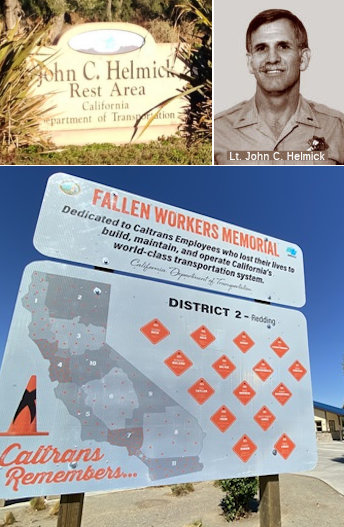 Lieutenant John C. Helmick Memorial Rest Area
(Corning), in Tehama County (~ TEH R10.352), 1.3 mi N of Corning. Named by Assembly Concurrent Resolution 123, Chapter 65, in 1990. Lt.
John Helmick was a CHP officer who died in the line of duty on February
27, 1989 in an auto accident in Chico. He was the highest-ranking CHP
officer and first area commander to die in the line of duty in CHP
history. Helmick, who died at the age of 42, had served as the Red Bluff
area commander since June 1988. During his tenure, he provided sound
leadership and guidance, and unconditional friendship.
Lieutenant John C. Helmick Memorial Rest Area
(Corning), in Tehama County (~ TEH R10.352), 1.3 mi N of Corning. Named by Assembly Concurrent Resolution 123, Chapter 65, in 1990. Lt.
John Helmick was a CHP officer who died in the line of duty on February
27, 1989 in an auto accident in Chico. He was the highest-ranking CHP
officer and first area commander to die in the line of duty in CHP
history. Helmick, who died at the age of 42, had served as the Red Bluff
area commander since June 1988. During his tenure, he provided sound
leadership and guidance, and unconditional friendship.In August 2023, it was reported that Caltrans District 2 unveiled the
District 2 Fallen Highway Workers Memorial. at the Helmick and Collier Roadside Rest
Areas on I-5 to honor the workers who died in the line of duty and to
encourage travelers to drive responsibly.
(Source: District 2 on X/Twitter, 8/15/2023; Appeal Democrat, 9/5/2023)
The workers honored on the sign, as of September 2023, were:
(Source: Appeal Democrat, 9/5/2023)
 Herbert S. Miles (Red Bluff), in Tehama County, 5.7 mi N of Red Bluff (~ TEH 34.708). Herbert S. Miles
was district highway engineer for State Highway District 2 from 1956 to
1974, during which time he developed 20 safety roadside rests in the
district for the safety and comfort of the traveling public. This was
named by Senate Concurrent Resolution 47, Chapter 91, in 1984.
Herbert S. Miles (Red Bluff), in Tehama County, 5.7 mi N of Red Bluff (~ TEH 34.708). Herbert S. Miles
was district highway engineer for State Highway District 2 from 1956 to
1974, during which time he developed 20 safety roadside rests in the
district for the safety and comfort of the traveling public. This was
named by Senate Concurrent Resolution 47, Chapter 91, in 1984.
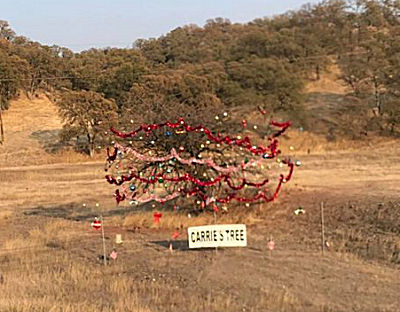 Just before the rest area is a tree that—in the Christmas season—is decorated "Charlie
Brown" style. It is known as Carrie’s Christmas Tree
and its located just before the roadside rest area. It stands there
all by itself all decked out with bright-colored Christmas tree
decorations. In the early 1960s when major reconstruction work began
to get underway on that section of the highway, Cottonwood resident
and lover of trees Carrie Bogue asked the road officials if she
could dig up the tree and move it out of harm’s way. It was an
osage orange and pretty rare in Northern California. She was denied
her simple request. Work on the highway continued and somehow her
tree managed to remain standing through the reconstruction work.
However, a few years later, it died. And then, in 1966, a few years
after the tree died, Carrie died. She was 93 years old. Carrie had
many friends. Among them were Ruth and Cary Chadwick of Anderson who
had been friends of Carrie’s for at least 40 years. They knew
the story of Carrie and her tree, and one day as they were driving
by the “dead” tree, they noticed it had miraculously
come back to life! And of course they thought it was Carrie, now in
the form of a tree. The Chadwick’s had known Carrie well.
Carrie had told them, and others, that if she could come back to
life after death, she wanted to come back as a tree. And so,
according to the Chadwick’s, and to everyone else who knew
Carrie well, there she was, alive again, this time as a tree, just
as she wished. That Christmas season, in 1967, the Chadwick’s
decorated Carrie’s tree. They covered the tree with bright
garlands, tinsels and bows for everyone to see as they passed by on
the highway that had now become a freeway. Over the years, the tree
grew larger and taller making it more difficult for the
Chadwick’s to decorate. They continued decorating her tree for
at least twenty more years until their old ages and poor health
began getting in the way. In approximately 1990, their friends Dale
and Larry McClure, also of Cottonwood, began helping them out. A few
years later, the McClure’s became the lone decorators of
Carrie’s tree. For two years the tree stood undecorated until
the Hoofard and Lopez families decided to take over. For years they
decorated it without anyone knowing they were the decorators, until
a family friend drove by and spotted them. They decided it was time
to let everyone know who they were. On the same day every year this
thoughtful family meets at the tree to bring happiness to everyone
that travels I-5. They love hearing people honk and wave from both
directions and they love hearing how much joy it brings to people.
They said they will continue the tradition until it’s time for
the next generation to take over. They have added lights to the tree
and have also placed a sign big enough to easily read from the
freeway that proclaims it as “Carrie’s Tree”. The
family members are Cynthia & Martin Hoofard, their daughter
Rebecca Lopez, her husband David Lopez, their daughter Shania and
son Jacob (Jake), Shania’s boyfriend Nathan and his son Slade,
and Rebecca’s brother Dale Hoofard and his wife Nicola and
their kids Kannon, Julia & Bodie.
Just before the rest area is a tree that—in the Christmas season—is decorated "Charlie
Brown" style. It is known as Carrie’s Christmas Tree
and its located just before the roadside rest area. It stands there
all by itself all decked out with bright-colored Christmas tree
decorations. In the early 1960s when major reconstruction work began
to get underway on that section of the highway, Cottonwood resident
and lover of trees Carrie Bogue asked the road officials if she
could dig up the tree and move it out of harm’s way. It was an
osage orange and pretty rare in Northern California. She was denied
her simple request. Work on the highway continued and somehow her
tree managed to remain standing through the reconstruction work.
However, a few years later, it died. And then, in 1966, a few years
after the tree died, Carrie died. She was 93 years old. Carrie had
many friends. Among them were Ruth and Cary Chadwick of Anderson who
had been friends of Carrie’s for at least 40 years. They knew
the story of Carrie and her tree, and one day as they were driving
by the “dead” tree, they noticed it had miraculously
come back to life! And of course they thought it was Carrie, now in
the form of a tree. The Chadwick’s had known Carrie well.
Carrie had told them, and others, that if she could come back to
life after death, she wanted to come back as a tree. And so,
according to the Chadwick’s, and to everyone else who knew
Carrie well, there she was, alive again, this time as a tree, just
as she wished. That Christmas season, in 1967, the Chadwick’s
decorated Carrie’s tree. They covered the tree with bright
garlands, tinsels and bows for everyone to see as they passed by on
the highway that had now become a freeway. Over the years, the tree
grew larger and taller making it more difficult for the
Chadwick’s to decorate. They continued decorating her tree for
at least twenty more years until their old ages and poor health
began getting in the way. In approximately 1990, their friends Dale
and Larry McClure, also of Cottonwood, began helping them out. A few
years later, the McClure’s became the lone decorators of
Carrie’s tree. For two years the tree stood undecorated until
the Hoofard and Lopez families decided to take over. For years they
decorated it without anyone knowing they were the decorators, until
a family friend drove by and spotted them. They decided it was time
to let everyone know who they were. On the same day every year this
thoughtful family meets at the tree to bring happiness to everyone
that travels I-5. They love hearing people honk and wave from both
directions and they love hearing how much joy it brings to people.
They said they will continue the tradition until it’s time for
the next generation to take over. They have added lights to the tree
and have also placed a sign big enough to easily read from the
freeway that proclaims it as “Carrie’s Tree”. The
family members are Cynthia & Martin Hoofard, their daughter
Rebecca Lopez, her husband David Lopez, their daughter Shania and
son Jacob (Jake), Shania’s boyfriend Nathan and his son Slade,
and Rebecca’s brother Dale Hoofard and his wife Nicola and
their kids Kannon, Julia & Bodie.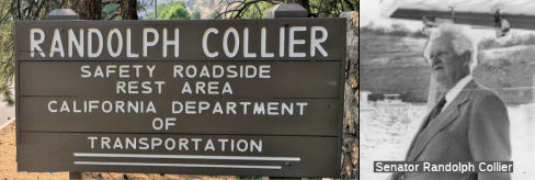 Randolph E. Collier (Klamath), in Siskiyou County (~ SIS R58.009L), 2.5 mi N of Route 96. Senator Randolph Collier
was elected to the State Legislature from 1938-1976 to represent
Humboldt, Mendocino, Sonoma, Lake, Trinity, Del Norte and Siskiyou
counties. Although he was recognized as a leader in many fields of
legislation, Collier gained statewide and national fame in the planning
and financing of highways. He was the principal author of the
Collier-Burns Act of 1947 which brought about the California Highway
Plan. The state's highway system served as a model throughout the nation
in that the state assumed responsibility for state highways in cities.
Other improvements came with the Highway Act of 1953 which stepped up
the California freeway program and the adoption of the California
Freeway and Expressway System in 1959. His interest in ecological
preservation introduced legislation to provide proper regulation of
California's timberlands and protection for wild rivers. He worked with
local authorities in providing parks and recreational facilities for the
public. Senate committees on which Collier had served include
Governmental Efficiency, Finance, Revenue and Taxation, Insurance and
Finance Institutions, and Transportation.
Randolph E. Collier (Klamath), in Siskiyou County (~ SIS R58.009L), 2.5 mi N of Route 96. Senator Randolph Collier
was elected to the State Legislature from 1938-1976 to represent
Humboldt, Mendocino, Sonoma, Lake, Trinity, Del Norte and Siskiyou
counties. Although he was recognized as a leader in many fields of
legislation, Collier gained statewide and national fame in the planning
and financing of highways. He was the principal author of the
Collier-Burns Act of 1947 which brought about the California Highway
Plan. The state's highway system served as a model throughout the nation
in that the state assumed responsibility for state highways in cities.
Other improvements came with the Highway Act of 1953 which stepped up
the California freeway program and the adoption of the California
Freeway and Expressway System in 1959. His interest in ecological
preservation introduced legislation to provide proper regulation of
California's timberlands and protection for wild rivers. He worked with
local authorities in providing parks and recreational facilities for the
public. Senate committees on which Collier had served include
Governmental Efficiency, Finance, Revenue and Taxation, Insurance and
Finance Institutions, and Transportation. National Trails
 This route is part of the De Anza National Historic Trail.
 The portion of this route that was part of US 6 (i.e., from
Route 110 to Route 14) was part of the "Midland Trail.
The portion of this route that was part of US 6 (i.e., from
Route 110 to Route 14) was part of the "Midland Trail.
 The portion of this route N of Los Angeles that was originally part of US 99 (i.e., from Route 10 to Route 99) was part of the
"National Parks to Park Highway".
The portion of this route N of Los Angeles that was originally part of US 99 (i.e., from Route 10 to Route 99) was part of the
"National Parks to Park Highway".
 The portion of I-5 N of Sacramento was part of the "Pacific
Highway".
The portion of I-5 N of Sacramento was part of the "Pacific
Highway".

 The portion of this route from I-205 to Route 120
(former US 50) was part of the coast-to-coast "Lincoln Highway" and
the "Victory Highway". A good page with the history of the Lincoln
Highway can be found here. It notes that a 1924 guide book noted that Elk Grove had a population of
500, an express company, telegraph, and no tourist accommodations, while
Arno was listed with a population of 100, with meals, a garage, and gas
available, one express company, one telegraph company, telephone, one
general business place, and one public school. The same Guide lists Galt
with a population of 985 with three hotels, two garages, large fruit
orchards, and 'The longest iron bridge in California, one mile south of
Galt. It also notes that trucks from the Calaveras Cement Company brought
cement to pour on the road bed that was given free of charge by many
cement companies along the way. In the early 1930's the federal government
and the state funds created another state-wide route called Route 99. The
new highway skirted the town of Galt east of the Lincoln Highway. The old
Lincoln Highway south of Dry Creek Bridge became known as "Lower
Sacramento Road", and that portion of the Lincoln Highway that ran through
Galt was named "Lincoln Way" to remind the citizens of the community that
Galt had played a significant role in the history of transcontinental
transportation.
The portion of this route from I-205 to Route 120
(former US 50) was part of the coast-to-coast "Lincoln Highway" and
the "Victory Highway". A good page with the history of the Lincoln
Highway can be found here. It notes that a 1924 guide book noted that Elk Grove had a population of
500, an express company, telegraph, and no tourist accommodations, while
Arno was listed with a population of 100, with meals, a garage, and gas
available, one express company, one telegraph company, telephone, one
general business place, and one public school. The same Guide lists Galt
with a population of 985 with three hotels, two garages, large fruit
orchards, and 'The longest iron bridge in California, one mile south of
Galt. It also notes that trucks from the Calaveras Cement Company brought
cement to pour on the road bed that was given free of charge by many
cement companies along the way. In the early 1930's the federal government
and the state funds created another state-wide route called Route 99. The
new highway skirted the town of Galt east of the Lincoln Highway. The old
Lincoln Highway south of Dry Creek Bridge became known as "Lower
Sacramento Road", and that portion of the Lincoln Highway that ran through
Galt was named "Lincoln Way" to remind the citizens of the community that
Galt had played a significant role in the history of transcontinental
transportation.
![]() This route is part of the Volcanic Legacy Scenic Byway All American Road, between Route 44 and US 97.
This route is part of the Volcanic Legacy Scenic Byway All American Road, between Route 44 and US 97.
 Business Routes
The following are Route 5 Business Loops or surface street former routings. The webside AAroads has a page on I–5 Business Routes, as well as individual information page for most of these business route segments; links to those segments are shown as [AAroads].
 Exit Information
 Other WWW Links
 Interstate Submissions
Approved as chargeable Interstate on 7/7/1947; the original routing was along Route 99, this was later changed to the westerly realignment. This route was originally approved as I-5 (with the route splitting near Tracy into I-5W (current I-580 and I-505) and I-5E). In November 1957, the California Department of Highways suggested using I-11 for this route (to permit use of I-3 [I-280] and I-5 [I-680] in the San Francisco Bay Area, and I-7 [I-405] and I-9 [I-605] in the Los Angeles area), but this was rejected.
As noted above, the designation I-5 was proposed in November 1957 for what is now I-680.
 Scenic Route
[SHC 263.3] From the international boundary near Tijuana to Route 75 near the south end of San Diego Bay; and from San Diego opposite Coronado to Route 74 near San Juan Capistrano; and from Route 210 near Tunnel Station to Route 126 near Castaic; and from Route 152 west of Los Banos to Route 580 near Vernalis; and from Route 44 near Redding to the Shasta Reservoir; and from Route 89 near Mt. Shasta to Route 97 near Weed; and from Route 3 near Yreka to the Oregon state line near Hilts.
 Classified Landcaped Freeway
The following segments are designated as Classified Landscaped Freeway:
| County | Route | Starting PM | Ending PM |
| San Diego | 5 | R0.14 | 3.54 |
| San Diego | 5 | 3.70 | 4.89 |
| San Diego | 5 | 5.15 | 9.66 |
| San Diego | 5 | 9.78 | R19.49 |
| San Diego | 5 | R19.73 | R20.10 |
| San Diego | 5 | R20.28 | R32.69 |
| San Diego | 5 | R32.78 | R34.76 |
| San Diego | 5 | R36.08 | R36.52 |
| San Diego | 5 | R37.20 | R37.55 |
| San Diego | 5 | R39.26 | R41.98 |
| San Diego | 5 | R42.56 | R42.84 |
| San Diego | 5 | R46.52 | R46.73 |
| San Diego | 5 | R47.25 | R48.72 |
| San Diego | 5 | R48.89 | R50.94 |
| San Diego | 5 | R51.01 | R54.05 |
| San Diego | 5 | R54.17 | R54.86 |
| San Diego | 5 | R72.03 | R72.37 |
| Orange | 5 | 0.00 | 7.11 |
| Orange | 5 | 8.29 | 8.68 |
| Orange | 5 | 8.68 | 8.78 |
| Orange | 5 | 8.92 | 12.66 |
| Orange | 5 | 12.72 | 14.79 |
| Orange | 5 | 14.84 | 19.46 |
| Orange | 5 | 19.64 | 20.17 |
| Orange | 5 | 20.50 | 21.51 |
| Orange | 5 | 21.56 | 21.80 |
| Orange | 5 | 22.04 | 23.92 |
| Orange | 5 | 24.84 | 25.19 |
| Orange | 5 | 25.98 | 26.71 |
| Orange | 5 | 26.71 | 26.89 |
| Orange | 5 | 26.89 | 33.28 |
| Orange | 5 | 33.52 | 34.48 |
| Orange | 5 | 34.59 | 36.81 |
| Orange | 5 | 36.93 | 44.40 |
| Los Angeles | 5 | 1.51 | 1.69 |
| Los Angeles | 5 | 2.25 | 2.66 |
| Los Angeles | 5 | 2.73 | 3.00 |
| Los Angeles | 5 | 3.32 | 7.06 |
| Los Angeles | 5 | 7.17 | 8.39 |
| Los Angeles | 5 | 8.53 | 9.43 |
| Los Angeles | 5 | 10.88 | 11.69 |
| Los Angeles | 5 | 12.63 | 13.06 |
| Los Angeles | 5 | 13.57 | 14.25 |
| Los Angeles | 5 | 14.38 | 18.53 |
| Los Angeles | 5 | 18.56 | 18.99 |
| Los Angeles | 5 | 19.04 | 20.05 |
| Los Angeles | 5 | 20.25 | 20.45 |
| Los Angeles | 5 | 20.73 | 25.94 |
| Los Angeles | 5 | 26.30 | 27.09 |
| Los Angeles | 5 | 27.19 | 28.73 |
| Los Angeles | 5 | 28.80 | 34.45 |
| Los Angeles | 5 | 34.49 | 41.01 |
| Los Angeles | 5 | R51.24 | R51.63 |
| San Joaquin | 5 | 23.95 | 26.52 |
| San Joaquin | 5 | 26.96 | 29.56 |
| San Joaquin | 5 | 29.65 | 34.26 |
| Sacramento | 5 | 10.66 | 11.05 |
| Sacramento | 5 | 11.90 | 12.33 |
| Sacramento | 5 | 16.00 | 16.52 |
| Sacramento | 5 | 16.62 | 17.79 |
| Sacramento | 5 | 17.84 | 23.78 |
| Sacramento | 5 | 24.18 | 24.82 |
| Sacramento | 5 | 25.32 | 26.69 |
| Sacramento | 5 | 29.71 | 30.13 |
| Sacramento | 5 | 30.18 | 30.44 |
| Sacramento | 5 | 32.54 | 32.94 |
| Sacramento | 5 | 33.72 | 33.98 |
| Yolo | 5 | R7.02 | R7.74 |
| Yolo | 5 | R7.83 | R9.01 |
| Colusa | 5 | R6.39 | R7.36 |
| Colusa | 5 | R17.82 | R18.0 |
| Colusa | 5 | R18.57 | R18.86 |
| Glenn | 5 | R8.86 | R9.08 |
| Glenn | 5 | R9.55 | R9.96 |
| Glenn | 5 | R25.41 | R25.70 |
| Tehama | 5 | R8.85 | R9.19 |
| Tehama | 5 | R24.46 | R25.42 |
| Tehama | 5 | R25.73 | R26.81 |
| Tehama | 5 | R27.29 | R27.46 |
| Tehama | 5 | R27.46 | R27.78 |
| Tehama | 5 | R28.30 | R30.17 |
| Shasta | 5 | R0.44 | R0.69 |
| Shasta | 5 | R5.08 | R5.82 |
| Shasta | 5 | R11.94 | R15.73 |
| Shasta | 5 | R19.12 | R21.40 |
| Shasta | 5 | R21.71 | R22.47 |
| Siskiyou | 5 | R47.15 | R47.73 |
 Blue Star Memorial Highway
The portion of this route that is former US 99 was designated as a "North-South Blue Star Memorial Highway" by Senate Concurrent Resolution 33, Ch. 82 in 1947. This route (I-5) was designated as a "North-South Blue Star Memorial Highway" by Senate Concurrent Resolution 61, Ch. 116 in 1971.
 Interregional Route
[SHC 164.10] Entire route.
 Statistics
Overall statistics for Route 5:
 Pre-1964 Legislative Route
The route that was to become LRN 5 was first defined in 1909 as running “From Stockton to Santa Cruz via Oakland, 116.9 mi”. In 1927, it was defined as a primary highway, running “From Stockton to Santa Cruz by way of Hayward, together with a connection from Hayward to Oakland”.
The route was extended in 1933 when a segment from Stockton to Mokelumne Hill was added. In 1935, the Streets and Highways Code was defined, codified the route into law as Route 5 as follows (earlier definitions had been as a state route, without a specific number):
It was not a primary highway. In 1961, Chapter 1146 rerouted the highway in San Jose, changing the definition to:
Chapter 2155 in 1963 extended the route to West Point.
The signage of this route was as follows:
Near Warm Springs, this segment also includes a short spur from LRN 69 (present-day I-880) to LRN 5 (I-680); this is present-day Route 262.
LRN 5 was signed as Route 9/Route 21 between Warm Springs and Irvington, near Mission San Jose. This is part of present-day I-680.
LRN 5 then ran between the present-day Route 238/I-680 junction near Irvington to the (signed) Route 9/US 50 junction near Hayward. This is present-day Route 238.
LRN 5 was then signed as US 50 (present-day I-580) to Stockton.
In Stockton, LRN 5 (US 50) ran cosigned with Route 4 from Center St/El Dorado St. to Mariposa Road, where Route 4 split off as LRN 75. Portions of this are present-day I-5. LRN 5 (US 50) continued along Main St to LRN 4 (US 99), where it had a discontinuity (see part 3)
© 1996-2020 Daniel P. Faigin.
Maintained by: Daniel P. Faigin
<webmaster@cahighways.org>.
 Route 4
 Route 6