
State Route 284
Click here for a key to the symbols used. An explanation of acronyms may be found at the bottom of the page.
 Routing
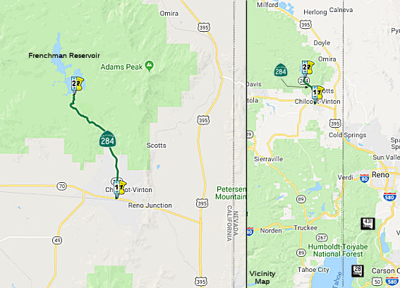 From Route 70 at Chilcoot to Frenchman Reservoir.
 Post 1964 Signage History
In 1970, Chapter 1473 defined Route 284 as “Route 70 at Chilcoot to
Frenchman Reservoir.”
Chapter 1473 appear to have been contingent that an existing roadway be
built to State Highway Standards. To that end Frenchman Lake was
completed as a California Department of Water Resources irrigation project
by 1961 along Little Last Chance Creek. The existing Frenchman Lake
Road appears to have been improved during the Frenchman Lake project and
was adopted as the alignment of Route 284. Notably modern Frenchman
Lake Road appears on the 1935 Division of Highways Map of Plumas County
north of Chilhoot.
(Source: Tom Fearer, Gribblenation Blog, "California State Route 284")
 Naming
 Other WWW Links
 Statistics
Overall statistics for Route 284:
- Total Length (1995): 8 miles
- Average Daily Traffic (1992): 510
- Mileage Classification: Rural: 8; Sm. Urban: 0; Urbanized: 0.
- Previous Federal Aid Mileage: FAS: 8 mi.
- Functional Classification: Collector: 8 mi.
- Counties Traversed: Plumas.
 Pre-1964 Legislative Route
In 1959, Chapter 1062 defined LRN 284 as “[LRN 2] to [LRN 241] via
Switzer Canyon”. This was 1964-1994 Route 171 from I-5 to I-805 via
Switzer Canyon. .
Acronyms and Explanations:
- "LRN" refers to the Pre-1964 Legislative Route Number.
"US" refers to a US Shield signed route.
"I" refers to an Eisenhower Interstate signed route.
"Route" usually indicates a state shield signed route, but said route may be signed as US or I.
- Previous Federal Aid (pre-1992) categories:
Federal Aid Interstate (FAI); Federal Aid Primary (FAP);
Federal Aid Urban (FAU); and Federal Aid Secondary (FAS).
Current Functional Classifications (used for aid purposes):
Principal Arterial (PA); Minor Arterial (MA);
Collector (Col); Rural Minor Collector/Local Road (RMC/LR). Note that ISTEA repealed the previous Federal-Aid System, effective in 1992, and established the functional classification system for all public roads.
- Other frequently used terms: California Transportation Commission (Commission or CTC), California Department of Transportation (Department or Caltrans), Regional Improvement Program (RIP), Interregional Improvement Program (IIP), State Transportation Improvement Program (STIP), State Highway Operation and Protection Program (SHOPP), Traffic Congestion Relief Program (TCRP), Clean Air and Transportation Improvement Act of 1990 (Proposition 116), High Speed Passenger Train Bond Program (Proposition 1A), Highway Safety, Traffic Reduction, Air Quality, and Port Security Bond Act of 2006 (Proposition 1B), Corridor Mobility Improvement Account (CMIA), State Route 99 Bond Program (RTE or SR 99), Local Bridge Seismic Retrofit Account (LBSRA), Trade Corridors Improvement Fund (TCIF), Highway-Railroad Crossing Safety Account (HRCSA), State-Local Partnership Program (SLPP), Environmental Phase (PA&ED), Design Phase (PS&E), Right of Way (R/W), Fiscal Year (FY), Active Transportation Program (ATP), Trade Corridor Enhancement Program (TCEP), Local Partnership Program (LPP), Local Streets and Roads Program (LSRP), Solutions for Congested Corridors Program (SCCP).
 Route 283
 Route 285
© 1996-2020 Daniel P. Faigin.
Maintained by: Daniel P. Faigin
<webmaster@cahighways.org>.

 California Highways: