
 California Highways:
Click here for a key to the symbols used. An explanation of acronyms may be found at the bottom of the page.
 Routing
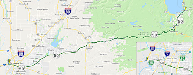
 From Route 80 west of Sacramento to the Nevada
state line near Lake Tahoe via Placerville.
From Route 80 west of Sacramento to the Nevada
state line near Lake Tahoe via Placerville.
 Alternate Routes
Alternate US 50 is signed along a route consisting of county mileage and portions of Route 88 and Route 89. It runs from US 50 near Pollock Pines, then S and E on Sly Park Road and Mormon Emigrant Trail, including a 20 mi segment of National Forest Highway 5. It joins Route 89 at Picketts Junction, continuing until the north Route 89 junction. From there it follows Route 89 until it rejoins US 50 at the foot of Meyers Grade.
In the portion of the route not cosigned with existing state mileage, there are temporary postmiles that do not fit state standards. The route is a detour routing for those times when US 50 is closed. This happens frequently enough that it was felt to be appropriate to sign the route as Alternate US 50.
The mile markers were put in after the 1997/1998 winter season for ease of managing the snow removal operations. During the 1997/1998 winter, when the large slides closed US 50 and snow removal operations were made all season long to the Trail, the lack of markers made control of operations difficult. The markers were placed the following spring/summer. Despite the choice of labels, those portions of Alternate US 50 not already in the state highway system (i.e., Route 88 and Route 89) have not been added to the state highway system; they are county or forest roads maintained by the appropriate jurisdictions. In particular, Sly Park Rd. and Mormon Emigrant Trail are El Dorado County roads and are not state highway. Mormon Emigrant Trail was repaved for use as the detour as a part of the contract to repair US 50. There are Alternate US 50 postmiles on Mormon Emigrant Trail; those are used by CHP and Caltrans as reference when the road is in use as Alternate US 50. There are also Alternate US 50 shields posted along the route, and some signs showing distance to control cities, coupled with an Alternate US 50 sign package (i.e. shields). These are covered when not in use.
 Post 1964 Signage History
 ▸As defined in 1963, Route 50 was the route from Route 80 in
Sacramento to the Nevada state line near Lake Tahoe via Placerville. The
"Route 80" referred to in this routing is what is now Route 51, i.e., BR
80.
▸In 1981, Chapter 292 changed Route 50 to run from "Route 80 in
West of Sacramento". The Route 80 referred to in this definition
was the new definition of Route 80 that was the bypass around
Sacramento, so this effectively added the former portion of Route 80
between Route 51 and the new junction with Route 80 to the legislative
definition Route 50. The segment added is FAI 305, meaning it is acually
interstate mileage, but isn't signed as interstate mileage. Note that the
added segment is (co-)signed as Business Route 80 ("Capitol City Freeway").
West Sacramento
The West Sacrament portion of this route was originally part of US 40 and US 99W. With the 1964 renumbering, this segment became part of I-80. When the Sacramento rearrangement occurred in 1981, I-80 was realigned to a new northerly routing previously proposed as I-880, and the older freeway became Business Route 80—US 50 between I-80 and Route 99, and unsigned Route 51 between Route 99 and I-80 near Roseville. As the older I-80 was constructed using interstate funds, the segment was administratively designated as FAI 305 (I-305), but this number is not defined legislatively. It is important to note that, although it is now signed as US 50, this segment was never part of historic US 50.
Within Sacramento, early LRN 6 departed the City via
the I Street Bridge to West Sacramento. The I Street Bridge opened
to traffic over the Sacramento River in 1911 as a swing span carrying the
Southern Pacific Railroad and highway traffic. The original
definition of LRN 6 from the 1909 First State Bond Act was Sacramento west
to Woodland Junction. From West Sacramento (then known as
Washington), LRN 6 traversed the Yolo Causeway to the City of Davis. The
Yolo Causeway was first referenced in 1913 as an upcoming bridge to be
constructed over Stony Creek north of Orland as part of the Pacific
Highway and LRN 7. The Stony Creek Bridge was to have a planned
length of 1,200 feet and would feature a arch concrete design, with an
anticipated opening during December 1913. By 1914, the design of the
upcoming Yolo Causeway included three miles of concrete trestles, and
would connect to LRN 6 from West Sacramento to Davis (also designed and
out for construction bid). Early plans for LRN 6 had it connect from
the I Street Bridge to the upcoming Yolo Causeway. The causeway opened in
May 1916.
(Source: Gribblenation Blog (Tom Fearer), "Former US Route 99 West from West Sacramento to Red Bluff", August 2021)
The M Street Bridge was originally constructed as a
railroad swing structure in 1911. The M Street Bridge was utilized by the
Sacramento North Railway, Oakland Antioch & Eastern Railway and
Northern Electric Railway. The construction of LRN 6 and the Yolo
Causeway saw roadway lanes added to the M Street Bridge as part of the
realignment of the highway. In 1925, a fire that destroyed the existing
Sacramento Northern Railroad Subway on LRN 6 in West Sacramento, and bids
were put out by the State to construct a new subway and eliminate a blind
curve. By 1927, the subway had been completed and it connected to a
completed M Street Bridge approach in West Sacramento, providing a new
alignment of US 99/US 40/LRN 6 through the 1926 Sacramento Northern
Railroad Subway. In 1934, the Tower Bridge (future Route 275) opened. The
Tower Bridge was a direct replacement for the previous M Street
Bridge. During the process of construction of the Tower Bridge the M
Street Bridge was removed and US 99W/US 40/LRN 6 crossed the Sacramento
River via a temporary structure. Unlike the swing design of the M
Street Bridge, the design of the Tower Bridge features a vertical lift
span.
(Source: Gribblenation Blog (Tom Fearer), "Former US Route 99 West from West Sacramento to Red Bluff", August 2021)
By 1935, US 99W entered West Sacramento multiplexed
with US 40 on LRN 6 over the M Street Bridge west from downtown
Sacramento. US 99W/US 40 traversed West Sacramento westward on Capitol
Avenue towards the Yolo Causeway. US 99W/US 40 then followed LRN 6 west on
the Yolo Causeway towards what is now County Road 32A and the grade of
I-80 through Webster siding into Davis. US 99W/US 40 enteried Davis on LRN 6 via Olive Drive, and then split onto LRN 7 via Richards Boulevard over
the Southern Pacific Railroad.
(Source: Gribblenation Blog (Tom Fearer), "Former US Route 99 West from West Sacramento to Red Bluff", August 2021)
The first leg of what would become US 50/FAI I-305
appears on the 1951 Division of Highways State Map City Insert. A
new planned freeway bypass for US 40/US 99W is shown as a proposed highway
following south of Capitol Avenue in West Sacramento. This
particular segment of US 40/US 99W was a segment of LRN 6. The subsequent
West Sacramento Freeway, opened 6/15/1954, was a four mile realignment of
US 40/US 99W from the eastern end of the Yolo Causeway to the Tower
Bridge, costing ~$4,500,000.
(Source: Gribblenation Blog (Tom Fearer), “US Route 50 in West Sacramento and Sacramento (hidden Interstate 305)”, January 2021)
 In 1954, the West Sacramento Freeway opened. The West Sacramento
Freeway served as a limited access realignment of US 99W/US 40/LRN 6 off
Capitol Avenue from the Tower Bridge west to the Yolo Causeway. The West
Sacramento Freeway was designed with wide lane systems at either end allow
for an additional bridge over the Sacramento River just S of Tower
Bridge—this permits the Yolo Causeway to be widened, and allows US 99W/US 40/LRN 6 to serve as a full bypass of downtown Sacramento.
The US 99W and US 40 intersection in Davis was shifted to a new
interchange configuration, which is currently where Route 113 transitions
from I-80 in Davis. The freeway includes seven cloverleaf structures
connecting the main road and crossroads. The center median is wide enough
to accommodate a third lane on each side in the future. The roadway off
the S side of the freeway near the Tower Bridge can be extended to connect
with a future crossing of the Sacramento River downstream from the present
bridge. The freeway eliminated a hazardous three-lane stretch
through business areas where reduced speed limits were in effect. It cost
$3,500,000 to construct (1954 dollars), plus right of way costs of
$1,000,000 (1954 dollars).
In 1954, the West Sacramento Freeway opened. The West Sacramento
Freeway served as a limited access realignment of US 99W/US 40/LRN 6 off
Capitol Avenue from the Tower Bridge west to the Yolo Causeway. The West
Sacramento Freeway was designed with wide lane systems at either end allow
for an additional bridge over the Sacramento River just S of Tower
Bridge—this permits the Yolo Causeway to be widened, and allows US 99W/US 40/LRN 6 to serve as a full bypass of downtown Sacramento.
The US 99W and US 40 intersection in Davis was shifted to a new
interchange configuration, which is currently where Route 113 transitions
from I-80 in Davis. The freeway includes seven cloverleaf structures
connecting the main road and crossroads. The center median is wide enough
to accommodate a third lane on each side in the future. The roadway off
the S side of the freeway near the Tower Bridge can be extended to connect
with a future crossing of the Sacramento River downstream from the present
bridge. The freeway eliminated a hazardous three-lane stretch
through business areas where reduced speed limits were in effect. It cost
$3,500,000 to construct (1954 dollars), plus right of way costs of
$1,000,000 (1954 dollars).
(Source: Gribblenation Blog (Tom Fearer), "Former US Route 99 West from West Sacramento to Red Bluff", August 2021; Folsom Telegraph, 6/17/1954 via Joel Windmiller 1/29/2023;
Sacramento Bee, 4/30/1951 via Joel Windmiller 2/1/2023)
In 1967, a portion of the West Sacramento Freeway from
West Acres Road to the Tower Bridge became Route 275. This was due to the
shift of I-80 onto the new connector over the Sacramento River east to
what was the US 99E Freeway. At this point, I-80 was still running through
Sacramento, this this new connector was S of Tower Bridge.
(Partial Source: Gribblenation Blog (Tom Fearer),
“US Route 50 in West Sacramento and Sacramento (hidden Interstate 305)”, January 2021)
The freeway portion was built in three segments: the first in 1962 from the Sacramento County line to Sunrise Blvd; the second in 1972 from 34th Street to near Watt Avenue, and the third and final stage in 1975. When built, this segment was part of I-80. In 1981, with the Sacramento rearrangement, is was renumbered as US 50 (which had been previously truncated to end at the I-80/Route 99 interchange). Note that the original US 50 did not connect between what is now I-5 and US 99 in Manteca, but rather in connected in Stockton on Charter Way (former Route 4).
 In 1958, planning was underway for what would be called the W-X Freeway.
There were three proposals under review, all including a four-level
interchange where the route met the N/S freeway of Route 99. At this time,
the routing was US 40 and US 99W between W Sacramento and near 30th
Street, and US 50 E of 30th Street. The US 40 segment was later
I-80, and is now Business Route 80 and US 50 (and FAI I-305 unsigned). The N/S freeway
was US 99 S of US 50, and US 99E and US 40 N of US 50; this was later
renumbered to be Route 99 S of US 50, and I-80 N of US 50 (and that became
Business Route 80 and Route 51 unsigned). The upper half of the image to the right
(click on the image for a larger, more detailed, view) shows the A and B
alternatives. The heavy black lines are Alternative A; the parallel broken
lines are Alternative B. Alternative A puts the freeway between T and U; B
moves the route between S and T between 10th and 25th.
There would also be a new Sacramento River bridge. Alternative C, in the
lower half of the image, puts the traffic closer to the center of the city
and provides a freeway crossing of the railroad. The C alternative swings
the freeway N at 8th to between P and Q streets.
In 1958, planning was underway for what would be called the W-X Freeway.
There were three proposals under review, all including a four-level
interchange where the route met the N/S freeway of Route 99. At this time,
the routing was US 40 and US 99W between W Sacramento and near 30th
Street, and US 50 E of 30th Street. The US 40 segment was later
I-80, and is now Business Route 80 and US 50 (and FAI I-305 unsigned). The N/S freeway
was US 99 S of US 50, and US 99E and US 40 N of US 50; this was later
renumbered to be Route 99 S of US 50, and I-80 N of US 50 (and that became
Business Route 80 and Route 51 unsigned). The upper half of the image to the right
(click on the image for a larger, more detailed, view) shows the A and B
alternatives. The heavy black lines are Alternative A; the parallel broken
lines are Alternative B. Alternative A puts the freeway between T and U; B
moves the route between S and T between 10th and 25th.
There would also be a new Sacramento River bridge. Alternative C, in the
lower half of the image, puts the traffic closer to the center of the city
and provides a freeway crossing of the railroad. The C alternative swings
the freeway N at 8th to between P and Q streets.
(Source: Sacramento Bee, 12/18/1958 via Joel Windmiller, 2/5/2023)
By 1963, the planned extension of the West Sacramento
Freeway east to the US 99E Freeway was shown on the state highway map,
designated as planned alignments of LRN 6 from the Sacramento River to 15th/16th
Street and LRN 11 east to the US 99E Freeway.
(Source: Gribblenation Blog (Tom Fearer), “US Route 50 in West Sacramento and Sacramento (hidden Interstate 305)”, January 2021)
 In 1980 and 1981, California planned a major switch in Sacramento. I-880,
which had been originally planned as a northern bypass of Sacramento
(defined in 1964 as "Route 80 between Harbor Boulevard and the Yolo
Causeway west of Sacramento to Route 80 near Watt Avenue") had a problem.
Sacramento had diverted the funds that were going to build a new I-80 to
current Interstate standards between Watt Avenue and downtown Sacramento
into transit, leaving a substandard I-80. The problem segment, for the
Interstate designation, was the segment between the junction between the
former US 99/US 50 junction near downtown (now Route 99/I-80) proceeding N
to Watt (primarily, the curve around the river). The decision was made to
move the I-80 designation onto I-880, and figure out the rest. So, on
September 24th, 1980, California petitioned AASHTO to
redesignate I-80 between what was then I-880 in W Sacramento continuing
5.3 miles east as an extension of US 50 and administratively as I-305
(because that segment was up to Interstate standards). The substandard
portion, N from the junction with Route 99, would become simply a state
highway. The relocation of I-80 and extension of US 50 are shown to be
approved by the AASHTO on December 1st, 1980. Following this,
in 1981, Chapter 292 transferred the northern bypass of Sacramento, which
had been designated as I-880, to I-80. The only change to US 50 was to
clarify that it was now the junction with I-80 in West Sacramento. The
former segment of I-80 from Route 99 to the new I-80 was numbered Route 51, but it was signed as I-80 Business Loop.
In 1980 and 1981, California planned a major switch in Sacramento. I-880,
which had been originally planned as a northern bypass of Sacramento
(defined in 1964 as "Route 80 between Harbor Boulevard and the Yolo
Causeway west of Sacramento to Route 80 near Watt Avenue") had a problem.
Sacramento had diverted the funds that were going to build a new I-80 to
current Interstate standards between Watt Avenue and downtown Sacramento
into transit, leaving a substandard I-80. The problem segment, for the
Interstate designation, was the segment between the junction between the
former US 99/US 50 junction near downtown (now Route 99/I-80) proceeding N
to Watt (primarily, the curve around the river). The decision was made to
move the I-80 designation onto I-880, and figure out the rest. So, on
September 24th, 1980, California petitioned AASHTO to
redesignate I-80 between what was then I-880 in W Sacramento continuing
5.3 miles east as an extension of US 50 and administratively as I-305
(because that segment was up to Interstate standards). The substandard
portion, N from the junction with Route 99, would become simply a state
highway. The relocation of I-80 and extension of US 50 are shown to be
approved by the AASHTO on December 1st, 1980. Following this,
in 1981, Chapter 292 transferred the northern bypass of Sacramento, which
had been designated as I-880, to I-80. The only change to US 50 was to
clarify that it was now the junction with I-80 in West Sacramento. The
former segment of I-80 from Route 99 to the new I-80 was numbered Route 51, but it was signed as I-80 Business Loop.
(Partial source: Gribblenation Blog (Tom Fearer),
“US Route 50 in West Sacramento and Sacramento (hidden Interstate 305)”, January 2021)
Capital City Freeway (Business Route 80)
As noted above, in Yolo County, between the Yolo County line and post mile 3.16, US 50 was once signed as Business Loop 80.
In Sacramento County, between the Yolo County line and post mile 2.48, US 50 was once signed as Business Route 80. In other words, the portion between the US 50/Business Route 80 interchange to the junction with I-80 in W. Sacramento is signed
as Business Route 80 to provide continuity of signage with the segment of Business Route 80 that
runs N to I-80 (actual Route 51). Note that after the Business Route 80/US 99/US 50
interchange, westbound US 50 is signed on one sign as "CA 99 TO I-80 I-5".
The portion that is the former "WX" freeway was signed variously as Business Route 80
or Business Route 80/US 50.
In 1996, Business Route 80 (Route 51 and US 50/I-305) were designated the "Capital City Freeway".
The signage as Business Route 80 was deemphasized in the 2016
resigning of the route, based on a a number of things. First, a desire to
simplify things and just sign it as one route and not a multitude of
routes. Secondly, more and more people are referring to the joint US 50/BR
80 multiplex as simply US 50. A good example is the 2015 "Fix50" project
on a portion of that freeway. Another factor was that the legislative
descriptions of the route. The legislative description for Route 51
mandates that it be signed as Business Route 80; the legislative description of Route 50 includes no such requirement. So basically, Business Route 80 is becoming a
Business spur, but there's no plans to update the signing to reflect such
a change. A side effect of this is that the Capital City Freeway name will
be emphasized on Route 51 and only Route 51. The project engineer also
realized there was a need to better sign Route 99 through the break in the
route, between the Oak Park Interchange and the junction with I-5 near the
airport.
(Source: Joe Rouse @ AAroads, 9/25/2015)
A part of the WX portion of the Capitol City Freeway (former LRN 11, between Route 99 and Route 160) actually corresponds to formerly signed US 50 (Broadway between Stockton Boulevard and 16th Street, which was US 50 until 1954). It appears that the WX Freeway (including former LRN 11) was also originally proposed to be US 50 as early as 1964; this early designation obviously was not signed in favor of I-80 and was only a temporary plan.
US 50 E of Sacramento to Placerville
The historic aerials site site shows some changes to interchanges in the Sacramento area since 1965. In 1965, the US 50 freeway ended at Folsom Blvd west of Sunrise Blvd. From the EB perspective, there was no left turn to get on the freeway–all lanes were aligned to connect directly to the freeway. To continue onto Folsom Blvd involved a channelized right turn. To continue west on Folsom Blvd at that intersection required a left hand turn.
The interchange of US 50 with Sunrise Blvd. is larger than normal, because Sunrise Blvd was, for a short time in the 1970s, designated as Route 65 south of US 50 in anticipation of the freeway routing. This route was relinquished in 1976. On one of the piers for the overcrossing, you can see where it used to call the structure "50/65 separation." The interchange was a cloverleaf until around 2001, when it was converted to a partial cloverleaf.
Riverton (~ ED 39.606) and Meyers (~ ED 71.24)
 In May 1964, a proposed relocation and adoption was
proposed for US 50 between Riverton and 0.5 mi E of Phillips. The proposed
route generally follows the N side of the canyon to give the route a
southern exposure in winter weather. Between Twin Bridges and Camp
Sacramento the base line crosses the existing highway several times and
the American River twice in the interest of minimum standards for grade
and alignment. At the Sierra Ski Ranch the route crosses to the S side of
the canyon to avoid a snowfall area. This adoption connects with the 1963
adoption of 5.7 mi near Echo Summit, including a 4,850' tunnel. Ten years
later, in 1974, Caltrans was receiving public comment on a decision to
rescind the realignment and upgrade route adoption along a 28 mi segment
of US 50 between Riverton (~ ED 39.606) and Meyers (~ ED 71.24), including
a tunnel at Echo Summit.
In May 1964, a proposed relocation and adoption was
proposed for US 50 between Riverton and 0.5 mi E of Phillips. The proposed
route generally follows the N side of the canyon to give the route a
southern exposure in winter weather. Between Twin Bridges and Camp
Sacramento the base line crosses the existing highway several times and
the American River twice in the interest of minimum standards for grade
and alignment. At the Sierra Ski Ranch the route crosses to the S side of
the canyon to avoid a snowfall area. This adoption connects with the 1963
adoption of 5.7 mi near Echo Summit, including a 4,850' tunnel. Ten years
later, in 1974, Caltrans was receiving public comment on a decision to
rescind the realignment and upgrade route adoption along a 28 mi segment
of US 50 between Riverton (~ ED 39.606) and Meyers (~ ED 71.24), including
a tunnel at Echo Summit.
(Source: Sacramento Bee, 10/16/1962, Sacramento Bee, 5/12/1964,
Sacramento Bee, 1/24/1963 and Sacramento Bee, 4/11/1974 via Joel
Windmiller, 2/23/2023)
 Pre 1964 Signage History
The current definition of Route 50 begins with portion that was never part of the original US 50. This is the short segment of freeway between the US 50/Business Loop 80 interchange (really the Route 50/Route 51 interchange) and the connection with I-80 to the west. This was part of the 1909 LRN 6 between I-80 in W. Sacramento and Route 160 (former US 40), and 1897 LRN 11 between present-day Route 160 (former US 40) and Route 99. It was signed as US 40 between I-80 and Route 160. For a time, the segment was planned to be signed as I-305, but that signage never occured. Although legislatively part of Route 50, this segment is (for the most part) signed as Business Loop 80 (there may be one or two US 50 signs). Lastly, note that the portion between Route 275 west of Sacramento to Route 160 in Sacramento was signed (for a time) as Route 275, although that ended in 1967.
US 50 ran E out of Sacramento along Folsom Blvd, and was LRN 11 until the Nevada border. The portion between Route 99 and Folsom was defined in 1897, as was the portion between Placerville and Lake Tahoe. The remainder was defined in 1909.
Former US 50 South and West of Sacramento
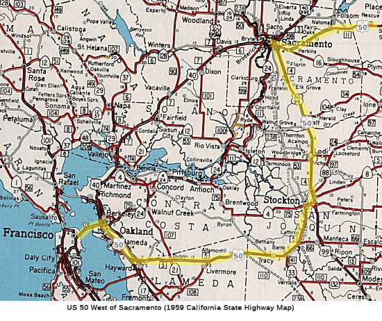 Original US 50
In 1933, US 50 did not extend to Oakland. Rather, US 50
followed Castro Valley Boulevard into Hayward, ending near the current
Route 238/I-580 junction, at US 101E (which followed current Route 238
south to San Jose, and current I-580 north to Oakland). A 1936 map shows
US 50 starting at US 40 (San Pablo Ave) in Berkeley, then running along 38th
Street and Moss Ave into Oakland. A slight jog on Vernon, and then it
continued S along Elmwood, Grand, and then Excelsior. Excelior turned into
Hopkins. It jogged again along Birdsall and Meldon onto Camden (in front
of Mills College). At Foothill Blvd, it continued SE along Foothill, then
along Hollywood Blvd back to Foothill into San Leandro. Foothill briefly
became Grand, and then Foothill again. This is approximately the route of
current I-580. Note that much of this route was later renamed MacArthur
(certainly much of Excelsior and Foothill).
(Source: Old Oakland, 1936 map)
It appears that by 1936, US 50 may have started in San Francisco, running E across the Bay Bridge cosigned with US 40 (current I-80; LRN 68). It continued down what became MacArthur Blvd as US 50 (LRN 5; now I-580) to the vicinity of San Leandro. Old Business Route 50 followed Cypress Street to the Broadway exit, then went down the frontage streets to Grand Ave. and across to MacArthur. Between San Francisco and the vicinity of Hayward (where US 50 turned east), it was cosigned as Alternate US 101. It then travelled E across present I-580 (LRN 5) to what is now I-205. [Part of this was Altamont Pass Road; see the page on I-480 for details] It continued across the route of present-day I-205 to 5 mi NE of Banta (near the present I-5 junction); this was all LRN 5. It then ran N along a routing roughly corresponding the present I-5 to 3 mi NE of Stockton (it was cosigned briefly with Route 4 in Stockton), where it joined US 99 (to this point, it was LRN 5).
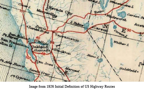 The remainder of the route is the original US 50. The original 1926 plan did not have US 50 extending to
Sacramento; rather, the plan was to have it follow current Alt US 50 to US 40 east of Reno, and end there. The 1928 plan, however, did include US 50,
and US 50 was first signed in California in 1928. The 1928 definition had
US 50 running from Sacramento to the Nevada-California state line at the
south end of Lake Tahoe via Placerville. It was US 48 that continued US 99
from Stockton into the Bay Area.
The remainder of the route is the original US 50. The original 1926 plan did not have US 50 extending to
Sacramento; rather, the plan was to have it follow current Alt US 50 to US 40 east of Reno, and end there. The 1928 plan, however, did include US 50,
and US 50 was first signed in California in 1928. The 1928 definition had
US 50 running from Sacramento to the Nevada-California state line at the
south end of Lake Tahoe via Placerville. It was US 48 that continued US 99
from Stockton into the Bay Area.
US 48
In the mid-1930's, former US 48 was combined into the US 50 routing. US 48 originally started near French Camp near Manteca and ran via Tracy and Hayward to San Jose (shown clearly on this 1927 map). It was cosigned with US 99 into Sacramento; this segment was LRN 4, defined in 1909. It appears that the portion of US 101E from Hayward to San Jose was former US 48.
So, why did US 48 become US 50? It seems the decision
to extend US 50 over what was then US 48 had two rationales applied: the
first was that when the Bay and Golden Gate bridge plans were finalized in
the very early 1930's the Division of Highways proposed eliminating the
E/W split of US 101 from San Jose to, respectively, ferry terminals in
Oakland and San Francisco (the ferries rejoined the route at the Sausalito
ferry terminal). There was at the same time a desire to extend US 50,
which originally ended at the corner of 16th & L streets in
Sacramento, all the way to the S.F. Bay; the rather clumsy multiplex SW on
US 99 to Stockton was instituted, along with the subsumption of the former
southern iteration of US 99W (today's I-5 south of Stockton and Route 120
east through Manteca); it then replaced US 48 to Hayward, the original
western terminus of that route, and then used the original US 101E
alignment to reach the ferry terminal at the foot of Broadway in Oakland,
a configuration that lasted a few years until the Bay Bridge was opened,
when it was rerouted to, along with US 40 coming in from the north, the
eastern approach to the bridge before crossing the Bay and, for a while,
terminating at Bryant and 10th Streets (the latter US 101) in
San Francisco. In short, the US 48 designation and signage didn't last
long enough to make an impression on the driving public.
(Source: Sparker on AAroads)
Livermore to Tracy
 Around 1937-1938, the routing of US 50 near Altamont was changed. Between
Greenvale and Mountain House, US 50 was aligned off the Altamont Pass
Highway to a new alignment. It appears that the pre-1937 alignment used
Byron, Grant Line, and Altamont Pass through the Pass, connecting to 11th
Street in Tracy. This routing was renumbered I-205 and I-580 in 1964.
Around 1937-1938, the routing of US 50 near Altamont was changed. Between
Greenvale and Mountain House, US 50 was aligned off the Altamont Pass
Highway to a new alignment. It appears that the pre-1937 alignment used
Byron, Grant Line, and Altamont Pass through the Pass, connecting to 11th
Street in Tracy. This routing was renumbered I-205 and I-580 in 1964.
(Source: Oakland Tribune, 8/3/1938, via Joel Windmiller, 2/3/2023)
The plan was for the new Altamont Pass to be ready for
opening on Labor Day 1938. The existing road had been inadequate to handle
modern high-speed traffic owing to limited sight distances and tortuous
curves. The new road provides for two lanes of traffic in each direction,
separated by a four foot dividing strip. At Greenville, approximately 3 mi
E of Livermore, the new routing crosses the tracks of the Western Pacific
RR and the Southern Pacific RR with a new overhead structure. At Redmond
(or Stone Cut) approx. 3 mi E of Greenville, the railroads are crossed
again with an underpass for the Western Pacific and an overpass for the
Southern Pacific. The overhead structure provides for two 23' two-lane
highway traffic roadways and two 3' pedestrian lanes, with a 4'
separation.
(Source: Tracy Press, 3/18/1938 via Joel Windmiller, 2/20/2023)
Stockton
Stockton was along the route of the Lincoln Highway
(which generally followed what became US 50). The Lincoln Highway was
formally dedicated on October 31st, 1913 and would be aligned
south from Sacramento southward towards Stockton via the existing highway
corridor. From Galt, the Lincoln Highway southwards followed
existing LRN 4/Lower Sacramento Road through Woodbridge and Lodi onward
into Stockton. The original alignment of the Lincoln Highway through
Stockton followed Pacific Avenue, Maple Street, El Dorado Street, Weber
Avenue, Center Street and French Camp Parkway towards French Camp.
LRN 4 (which would become Route 99), by 1917, was planned as a direct
alignment from Galt to Lodi, bypassing Woodbridge. The LRN 4
realignment used an eastern approach to Stockton via today's Cherokee
Road. Thus, by 1920, the route of Lincoln Highway through Stockton
followed Cherokee Road, Waterloo Road, Wilson Way, Weber Avenue, Center
Street and French Camp Turnpike. As the US highway system came into place
in 1926, US 99 entered Stockton along the Lincoln Highway/LRN 4 from Lodi
towards French Camp, where it intersected US 48 (future US 50). By 1927, a
new bridge over Stockton Diverting Canal would serve as a new entrance for
US 99/LRN 4 into the City of Stockton via an extension of Wilson Way (it
opened in 1929). In 1927, the first Carquinez Bridge over Carquinez Strait
near Vallejo opened to traffic, resulting in the realignment of the
Lincoln Highway out of Stockton and Altamont Pass onto the new structure
multiplexed with the Pacific Highway.
(Source: Gribblenation Blog (Tom Fearer), “The Lincoln Highway, US Route 99 and US Route 50 in Stockton”, May 2021)
In 1929, a planned relocation of existing US 99/LRN 5
between Stockton and French Camp was announced along a new grade intended
to replace French Camp Turnpike south of Stockton. This was required as
the existing road had been aligned over high dirt fill. The
relocation would result in the state abandoning the existing State Highway
on French Camp Turnpike upon completion to the new grade of US 99/LRN 5.
Additionally, LRN 4 had been relocated in 1928 from being aligned from
Stockton towards Manteca via French Camp and Lathrop, following Mariposa
Road and Hogan Road south from Wilson Way in Stockton on a more direct
alignment towards Manteca. This shifted US 99 out of French Camp and
Lathrop on the new new direct highway to Manteca. The Division of
Highways subsequently made a request to the AASHO during February 1929 to
extend US 48 via LRN 5 to US 99/LRN 4 in Stockton, aligned over the new
grade of LRN 5 from French Camp northward into Stockton. The
proposal included an additional southern spur of US 48 to connect with US 99/LRN 4 in Manteca This was rejected by AASHO, who offered instead
to truncate US 48 from San Jose to Hayward and from French Camp to
Mossdale. This alternative conceptualized US 101E and the US 99W/US 99E split from Stockton-Manteca. The truncation of US 48, creation
of US 101E and creation of the US 99W/US 99E Stockton-Manteca split was
approved in April of 1929 by the AASHO Executive Committee.
(Source: Gribblenation Blog (Tom Fearer), “The Lincoln Highway, US Route 99 and US Route 50 in Stockton”, May 2021)
By 1930, US 99/LRN 4 entered Stockton southbound via
Wilson Way. At the intersection of Wilson Way and Charter Way US 99E/LRN 4 split towards Manteca via Charter Way eastbound and Mariposa
Road southbound. US 99W/LRN 5 split towards French Camp via Charter
Way westbound and McKinley Avenue (now El Dorado Street) southbound. In
June 1931, the Division of Highways requested AASHO to extend US 50 from
Stockton to Oakland. The AASHO approved US 50 to subsume all of
remaining US 48 shortly afterward. The extension of US 50 aligned it
through Stockton via Wilson Way on a multiplex of US 99 /LRN 4 and onward
towards French Camp via what had been US 99W/LRN 5. US 99 south of Wilson
Way reverted to a single mainline route to following what had been US 99E/LRN 4 via Mariposa Road and Hogan Road. In 1935, the Charter Way
underpass (subway) under the SPRR Tracks was constructed, opening in 1937.
More subways followed. By 1946, an ongoing project to convert 8.2 miles of
US 99/US 50/LRN 4 between Stockton and Lodi to a limited access four lane
expressway was in progress, originating at the Calaveras River four miles
north of Stockton at the end of Wilson Way and including construction of
two new concrete travel lanes. At this time, there were also plans to
convert US 99/LRN 4 to freeway from the Calaveras River south to Mariposa
Road via a bypass of Stockton. The Stockton Bypass opened in 1950.
By this time, US 99/US 50/LRN 4 bypassed Wilson Way in favor of the
Stockton Bypass. US 50/LRN 5 departed US 99 and the Stockton Bypass
at Charter Way. Route 4 westbound traversed northward from
Farmington Road onto a multiplex of US 99/LRN 4 on the Stockton Bypass to
Charter Way, departing the Stockton Bypass at Charter Way where it began a
multiplex through Stockton on US 50/LRN 5. There were occasional at-grade
intersections. By late 1957, the planned freeway upgrade to US 50/LRN 5
from the San Joaquin River north to Richards Avenue in French Camp was in
progress, including an interim improvement that would expand US 50/LRN 5
to four lanes from French Camp to Charter Way in Stockton. By 1959,
US 50/LRN 5 was split into one-way couplets immediately south of Charter
Way. Eastbound US 50 reached Charter Way via El Dorado Street
(formally McKinley Avenue) whereas westbound US 50 departed via Center
Street. I-5 was announced by 1960; it extended 256 miles north from
Wheeler Ridge towards Stockton as a western bypass. The West Side
Freeway (I-5) was intended to replace US 50 from the outskirts of Tracy
towards Stockton and supplement US 99 north of Wheeler Ridge. The
Harding Way underpass was fully completed by August 25th, 1960
and provided a grade separation for US 99/US 50 under the Southern Pacific
Railroad. The Calaveras River-Lodi freeway segment of US 99/US 50/LRN 4 was completed during November 1963 alongside the Lodi Bypass
Freeway. US 50 was truncated back to Sacramento in 1963, but remained
field signed until the early 1970s and the completion of I-5 in the area.
El Dorado Street south of Charter Way was relinquished by 1975; Charter
Way would remain part of Route 4 into the early 1990s when it was finally
relinquished due to the Crosstown Freeway being completed between Route 99
and I-5.
(Source: Gribblenation Blog (Tom Fearer), “The Lincoln Highway, US Route 99 and US Route 50 in Stockton”, May 2021)
Lodi and Galt
As noted above, when the Lincoln Highway was dedicated
in 1913, it would be aligned from Galt southwards following existing LRN 4
on Lincoln Way and Lower Sacramento Road through Woodbridge onward to
Lodi. By 1917, a direct alignment was planned from Galt to Lodi that would
bypass Woodbridge, using an eastern approach to Stockton via what is now
known as Woodson Road and Cherokee Lane. Upon completion of the
Carquinez Bridge in 1927, the Lincoln Highway was realigned out of
Stockton and Altamont Pass onto the new structure multiplexed with the
Pacific Highway. This just left US 99 on LRN 4. US 50 was extended from
Sacramento to Oakland in 1931, taking over former US 48. Cherokee Lane was
widened and paved in the early 1930s. In 1938, work was started on the
realignment of US 99/US 50/LRN 4 in Galt. This would move US 99/US 50/LRN 4 off of Lincoln Way and Woodson Road in Galt onto a bypass
route. The new bypass route of Galt eliminated numerous curves and
saved traffic 0.57 miles of travel. In 1942, the Mokelumne River
Bridge west of Lodi opened on a new alignment of Route 12/LRN 53.
The bridge project included an adoption of existing Kettleman Lane east
from Terminous to Lodi. This new alignment of Route 12/LRN 53
shifted the multiplex of US 99/US 50 north from Kettleman Lane to Victor
Road. In 1946, 8.2 miles of US 99/US 50/LRN 4 between Stockton and Lodi
was converted to a limited access four lane expressway, originating at the
Calaveras River four miles north of Stockton at the end of Wilson Way. In
1954, construction started on the Sacramento-Lodi Freeway segment of US 99/US 50/LRN 4. This was completed in the 1956-1957 timeframe. The freeway
bypass of Lodi was completed in 1963.
(Source: Gribblenation Blog (Tom Fearer), “The Lincoln Highway, US Route 99 and US Route 50 in Lodi and Galt”, May 2021)
US 50 Approach into Sacramento
At Mossdale, where I-5 and CA-120 meet, there are several crossings of the San Joaquin River. At this point, there is an older routing of US-50 (now serving Manthey Road, a frontage road), then the pre-I-5 routing of US-50 (now serving the connector from WB 120 to SB 5). These crossings (including an old SP crossing) were all drawspans at one time (vertical lift for the railroadl; the other two were bascules). Next are the fixed spans of I-5. Then there is the WP (UP) bridge south of I-5, which looks like it used to be a swing span. El Dorado Street in French Camp is also the old US-50, and there are a couple of old state traffic lights and lamp poles in that area. Information on the US 50 routing around Tracy may be found with I-580.
In the 1940's, US 50 entered Sacramento on Stockton Blvd, turning left on 5th Ave, right onto Sacramento Blvd, left onto Broadway, right onto 16th Street, and left on M Street/Folsom Blvd, cosigned with Route 16 into Perkins. By 1960, the South Sacramento Freeway (current Route 99, although it was cosigned with US 50 until the 1970s) was constructed to south of Broadway and 29th Street. At the junction of Broadway and 29th (near the current interchange of Route 51, US 50, and Route 99), US 99W and 99E began; US 99W followed Broadway and 15th/16th on the old routing of US 50/US 99 into downtown (this later became Route 160, but was never Route 24 or US 40 in this portion). US 99E however was co-signed with US 50 north via 29th and 30th to Folsom Boulevard, where US 50 then made the right turn going eastbound with Route 16 to Perkins. Around 1954, clearing had begun for the "WX" portion of the US 50 freeway. By the mid-1960s, Route 50 was temporarily placed on the 29/30 Freeway (co-signed with US 99E and I-80) between the current Route 51/US 50/Route 99 junction and Folsom Boulevard; this arrangement only lasted until the El Dorado Freeway (US 50 east of the Route 99 interchange) was completed.
US 50 from Sacramento to the Nevada State Line
US 50 in Sacramento
Tom Fearer has identified the following as the original
routing of US 50 in Sacramento:
(Source: Gribblenation Blog, "Highways in and around Old Sacramento; US 40, US 99W, CA 16, CA 24, CA 70, CA 99, CA 275, and more", 12/16/2018)
The Gribblenation Blog, "Highways in and around Old Sacramento; US 40, US 99W, CA 16, CA 24, CA 70, CA 99, CA 275, and more" provides a detailed history of the various highways (US 40, US 99, Route 16, Route 24, Route 70, Route 99, Route 275, Route 51, I-5, and I-80 in the Old Sac area.
There was also a Bypass US 50, portions of which were LRN 98. The routing had Bypass US 50 continuing north on 65th Street to rejoin US 50/then-Route 16 at Folsom Boulevard.
The October/November 1962 California Highways &
Public Works announced a freeway alignment of US 50/LRN 11 had been
adopted from Stockton Boulevard in Sacramento east to Brighton.
(Sources: Gribblenation Blog (Tom Fearer) “Former US Route 50 and the South Lincoln Highway from Folsom east to Placerville”, 6/2021)
The First State Highway
The origin of the Lake Tahoe Wagon Road is stated to
begin with the opening of Johnson's Pass in 1852. Johnson's Pass was
opened as an emigrant trail by Colonel J.B. Johnson between Carson Valley
westward via a cutoff following the south shore of Lake Tahoe (then Lake
Bigler) and South Fork American River to Placerville. Prior to the
opening of Johnson's Pass most emigrant travel traversed the Sierra Nevada
Mountains to the south via Carson Pass. In 1853 Congress ordered survey to
locate a possible route for a railroad line over the Sierra Nevada
Mountains. The conclusion of the 1853 Congressional survey suggested
any route over the Sierra Nevada Mountains was infeasible due to deep
snows which occurred every winter.
(Sources: Fedco Reporter (Richard
Bauman), Joel Windmiller (site deprecated); Gribblenation Blog (Tom
Fearer) “Former US Route 50 and the South Lincoln Highway from Folsom east to Placerville”, 6/2021)
In 1850, the state created the Office of Surveyor
General, with the duty to suggest roads. In 1855, there was public demand
for a road from the Sacramento Valley to Carson Valley in Nevada, and the
legislature passed a bill ordering the Surveyor General to survey a good
wagon road over the Sierra Nevada Mountains, and authorized bids for
construction of the Emigrant Wagon Road. No funds were
appropriated at the time. The State of California ordered its own survey
in 1855 to investigate the feasibility of constructing a wagon road from
Sacramento Valley east to Carson Valley. The survey concluded that the
only viable options for a wagon road would be at Johnson's Pass or Carson
Pass, and Johnson's Pass was the better choice due to the lower elevation
potentially permitting all-year travel. During 1857 the counties of; Yolo,
Sacramento and El Dorado contributed $50,000 dollars towards construction
of a wagon road over Johnson's Pass. In November 1858, the road was
finally completed. Lack of legislative support for the road led to it
being privatized and becoming a toll road. The Lake Tahoe Wagon Road east
of Placerville had become a El Dorado County public highway during 1886.
(Sources: Fedco Reporter (Richard
Bauman), Joel Windmiller (site deprecated); Gribblenation Blog (Tom
Fearer) “Former US Route 50 and the South Lincoln Highway from Folsom east to Placerville”, 6/2021)
On March 26th, 1895, the legislature created
the State Bureau of Highways and approved the creation of the Lake
Tahoe State Highway. The Lake Tahoe State Highway was defined
to originate near Smith's Flat at the intersection of the Placerville Road
(Lake Tahoe Wagon Road) and Newtown Road. The Lake Tahoe State
Highway was to cross the Sierra Nevada Mountains easterly to the Nevada
State Line via Johnson's Pass following the existing Lake Tahoe Wagon
Road. The Lake Tahoe State Highway became effective upon being
signed into law on February 28th, 1896 and was the first
California State Highway.
(Sources: Fedco Reporter (Richard
Bauman), Joel Windmiller (site deprecated); Gribblenation Blog (Tom
Fearer) “Former US Route 50 and the South Lincoln Highway from Folsom east to Placerville”, 6/2021)
The Lake Tahoe State Highway was extended westward from
Smith's Flat was part of the legislative changes in 1897 Legislative Ch.
176, which authorized "A public highway or wagon road shall be built from
a point on the E limits of the city of Sacramento to Folsom in Sacramento
Cty as near practicable along the route of the present most direct line of
county roads between these two points...” This resulted in the state
taking over the former toll road, then known as the Placerville Road.
The 1897 extension of the Lake Tahoe State Highway left some gaps from
Folsom eastward to Placerville. The first work conducted on the Lake
Tahoe State Highway was a new 80-foot stone arch bridge over the South
Fork American River at Riverton which was completed during
1901.
(Sources: Fedco Reporter (Richard
Bauman), Joel Windmiller (site deprecated); Gribblenation Blog (Tom
Fearer) “Former US Route 50 and the South Lincoln Highway from Folsom east to Placerville”, 6/2021)
Over the years, the road was upgraded from a dirt road, to an oil cover road, to asphalt and concrete. This is the route of present-day US 50.
US 50 from Carson City west to California State Line
largely follows the previous paths of the Walton Toll Road and Lake Tahoe
Toll Road. The Walton Toll Road was opened 1862 and followed Kings Canyon
westward over Spooner Summit to the saw mills of Glenbrook on the east
shore of Lake Tahoe. In 1863 the Lake Bigler Toll Road Company bought out
the Walton Toll Road and consolidated it with the Lake Tahoe Road to the
south which at the time took the Kingsbury Grade to Carson City.
Connecting the Walton Toll Road with the Lake Tahoe Road required building
a one-lane trestle bridge around the western edge of the Washoe Scared
Site known as Cave Rock. There had a previous primitive road around Cave
Rock as early as the 1840s.
(Source: Gribblenation Blog: Lake Tahoe Circle Tour Part 3, 10/2018)
US 50 from Folsom to Placerville
Note: Much of the following is summarized from the Gribblenation Blog “Former US Route 50 and the South Lincoln Highway from Folsom east to Placerville” (Tom Fearer). See the blog for a lot more details, including links to source publications and maps.
US 50 ran E out of Sacramento along Folsom Blvd, and was LRN 11 until the Nevada border. The portion between Route 99 and Folsom was defined in 1897, as was the portion between Placerville and Lake Tahoe. The remainder was defined in 1909.
The Lincoln Highway was formally dedicated on October
31st, 1913 and would cross the Sierra Nevada Mountains via
North/South branches. The South Lincoln Highway entered the State of
California from Stateline, Nevada and followed LRN 11 west towards
Sacramento. The Lincoln Highway Association's Official Map shows the
following alignment of the first generation South Lincoln Highway from
Folsom eastward into Placerville:
(Sources: Gribblenation Blog (Tom Fearer) “Former US Route 50 and the South Lincoln Highway from Folsom east to Placerville”, 6/2021)
The US Route System within California was approved by
California Highway Commission with no changes recommended by January
1926. Originally US 50 was not slated to replace the South Lincoln
Highway in California. It was to terminate at US 40 near Wadsworth, NV.
But by the November 1926 finalization of the system, it included US 50
being extended to a terminus at US 99 in Sacramento via the South Lincoln
Highway/LRN 11.
(Sources: Gribblenation Blog (Tom Fearer) “Former US Route 50 and the South Lincoln Highway from Folsom east to Placerville”, 6/2021)
 In 1962, it was reported that two alternate routings were
under consideration for a 2.7 E/W segment of the El Dorado Freeway (LRN 11
(US 50)) between a point near 34th and T Streets and Brighton.
Alternate A would follow an alignment just S of the Southern Pacific RR
tracks along R Street between 34th and 57th Streets,
then it would turn S to a corridor just S of S Street and then N to the
intersection of Folsom and Jed Smith Drive (now State University Drive).
This would cost $15.4 million and displace 611 structures. Alternate B
would follow an alignment between the T-U Streets alley and V Street from
34th to 57th Street and then would follow Alignment
A to Brighton. This would cost $17 million and displace 813 structures.
The city's preference was Alternative A. It appears Alternative A was
chosen.
In 1962, it was reported that two alternate routings were
under consideration for a 2.7 E/W segment of the El Dorado Freeway (LRN 11
(US 50)) between a point near 34th and T Streets and Brighton.
Alternate A would follow an alignment just S of the Southern Pacific RR
tracks along R Street between 34th and 57th Streets,
then it would turn S to a corridor just S of S Street and then N to the
intersection of Folsom and Jed Smith Drive (now State University Drive).
This would cost $15.4 million and displace 611 structures. Alternate B
would follow an alignment between the T-U Streets alley and V Street from
34th to 57th Street and then would follow Alignment
A to Brighton. This would cost $17 million and displace 813 structures.
The city's preference was Alternative A. It appears Alternative A was
chosen.
(Source: Sacramento Bee, 5/18/1962 via Joel Windmiller, 2/2/2023)
Upon completion of the Carquinez Bridge in 1927, the
South Lincoln Highway was realigned in Folsom off of US 50/LRN 11 over the
American River (now Lake Natoma) via the 1919 Rainbow Bridge, and followed
Greenback Lane westward to reach the US 40 and the North Lincoln Highway.
Construction of the 1919 Rainbow Bridge led to the abandonment of the 1893
Folsom Truss Bridge, which was disassembled and shipped to be used on the
Klamath River of Siskiyou County. The 1893 Folsom Truss Bridge was to be
placed along Walker Road on the Klamath River north of Yreka near US 99/Pacific Highway. In 1937, there was a major realignment project along
US 50/LRN 11 southwest of Placerville towards Folsom, with a goal of
saving 1.9 miles of travel and eliminating numerous short radius curves. A
new bridge over Weber Creek is featured as part of the new alignment of US 50/LRN 11 which bypassed the older route via Forni Road. The new
alignment of US 50/LRN 11 was dedicated on June 19th, 1938 and
is now largely part of Mother Lode Drive. Additional realignments occured
in 1939-1940 from the outskirts of Folsom to two miles east of
Clarksville, This realignment completely bypassed Clarksville to the
north.
(Sources: Gribblenation Blog (Tom Fearer) “Former US Route 50 and the South Lincoln Highway from Folsom east to Placerville”, 6/2021)
In 1949, the Folsom Bypass.was opened. The Folsom
Bypass saved 2.9 miles of travel originating west of Nimbus east through
Folsom to the Southern Pacific Railroad crossing near White Rock Station
and Clarksville. In 1957, US 50/LRN 11 on Folsom Boulevard had been
converted to four lanes from the Brighton Underpass in Sacramento east to
Alder Creek in Folsom. The Folsom Bypass branched to the N of the
existing highway at a point about 1 mi W of Nimbus. Circling Nimbus, it
crossed the SP Railroad tracks, and the Folsom Highway, at a grade
crossing at a point between Nimbus and Natomas about 5 mi W of Folsom.
From that point, it ran in a straight line to join the existing highway at
a point where that road crosses the SP tracks NE of White Rock, where a
concrete overpass was constructed.
(Sources: Gribblenation Blog (Tom Fearer) “Former US Route 50 and the South Lincoln Highway from Folsom east to Placerville”, 6/2021; Folsom Telegraph 6/25/1948 via Joel Windmiller, 8/26/2023 )
 In 1940, the Clarksville Cutoff opened. The cutoff is six miles long, running
from a point 3¾ mi E of Folsom to a point 2¼ E of Clarksville.
The saving in distance is 2 mi over the old highway that winds around by
Whiterock.
In 1940, the Clarksville Cutoff opened. The cutoff is six miles long, running
from a point 3¾ mi E of Folsom to a point 2¼ E of Clarksville.
The saving in distance is 2 mi over the old highway that winds around by
Whiterock.
(Source: Sacramento Bee, 10/9/1940 via Joel Windmiller, 8/26/2023)
In 1947, there was a realignment of US 50/LRN 11 from
Shingle Spring east to the outskirts of El Dorado. The realignment
was 3.4 miles in length and saved 0.4 miles in travel from the previous
alignment. The new Shingle Springs-El Dorado alignment of US 50
reduced the number of curves from 35 down to 6. The alignment can be found
today via Mother Lode Drive from Shingle Road east to Pleasant Valley
Road.
(Sources: Gribblenation Blog (Tom Fearer) “Former US Route 50 and the South Lincoln Highway from Folsom east to Placerville”, 6/2021)
Between Shingle Springs and Perks Corner, US 50 used to take a routing on what is now Mother Lode Drive.
 In 1956, the state held hearings on potential freeway
routings to the E and W of Placerville: Specifically, from Perks Corner to
the W city limits of Placerville, and from Washington Street to the
railroad crossing E of Placerville. The alignment would be just N of the
existing road between Perk Corner and the El Dorado County Fairgrounds,
and then run eastward through the old Form ranch and join the existing
Placerville Freeway at the west city limits. The segment at the E end of
Placerville would begin at the Washington Street interchange and run N of
the existing road to the vicinity of the Seventh Day Adventist School. It
would then parallel the existing road on the N to a junction with the
present route just E of the railroad crossing.
In 1956, the state held hearings on potential freeway
routings to the E and W of Placerville: Specifically, from Perks Corner to
the W city limits of Placerville, and from Washington Street to the
railroad crossing E of Placerville. The alignment would be just N of the
existing road between Perk Corner and the El Dorado County Fairgrounds,
and then run eastward through the old Form ranch and join the existing
Placerville Freeway at the west city limits. The segment at the E end of
Placerville would begin at the Washington Street interchange and run N of
the existing road to the vicinity of the Seventh Day Adventist School. It
would then parallel the existing road on the N to a junction with the
present route just E of the railroad crossing.
(Source: Publication unnamed, 1956, via Joel Windmiller, 1/29/2023)
In the early 1950s, construction started on the bypass
of Placerville. In 1951, planning began for a bypass of the Placerville
Business District on Main Street. The project allocation is stated
to include grade separations over the Southern Pacific Railroad and
Washington Street. The project is stated to begin at the Southern
Pacific Railroad crossing east of Placerville and terminating at Five Mile
Terrace. This continued until 1955 when the completion of the
Clarksville-Shingle Springs Expressway and Placerville Freeway segments
were announced.
(Sources: Gribblenation Blog (Tom Fearer) “Former US Route 50 and the South Lincoln Highway from Folsom east to Placerville”, 6/2021)
The West Placerville Freeway was completed in 1963,
beginning at the western City Limit of Placerville, crossing Weber Creek
and intersecting existing Mother Lode Drive at Perks Corner. The
West Placerville Freeway opened to traffic on August 15th, 1963
and saw the 1938 Weber Creek Bridge removed from the State Highway
System. The Folsom-Clarksville US 50 freeway segment is was
completed during November 1965. Also in 1965, it was announced that funds
had been allocated to extend the Folsom-Clarksville freeway segment of US 50 to the existing West Placerville segment. By 1970, US 50 had been
completed on a freeway grade west from Placerville to Shingle Springs. The
Clarksville-Shingle Springs freeway segment of US 50 was completed during
the early 1970s.
(Sources: Gribblenation Blog (Tom Fearer) “Former US Route 50 and the South Lincoln Highway from Folsom east to Placerville”, 6/2021)
Note: The freeway adoption for the segment from Riverton to Meyers occurred in the 1963-1964 timeframe, and is discussed in the post-1964 section above.
Echo Summit (~ ED 66.807)
In 1938, US 50/LRN 11 was realigned off of Johnson's
Pass to Echo Summit, which made keeping the highway open over the crest of
the Sierra Nevada Mountains during winter more feasible.
(Sources: Gribblenation Blog (Tom Fearer) “Former US Route 50 and the South Lincoln Highway from Folsom east to Placerville”, 6/2021)
The modern alignment of US 50 over Echo Summit was
completed between 1936 and 1947. The upper part, moving the alignment from
the old Lincoln Highway routing over Johnson Pass south to Echo Summit,
was done in 1936-1939. US 50 jumped over to Echo Summit to Johnson Pass
sometime between 1940 and 1942. The lower part, replacing the gated road
down to Meyers, was completed in 1947, after a break for the war. There's
an article about the upgrading of this section of US 50 in the Sept./Oct.
1947 issue of "California Highways and Public Works" An upcoming project
to replace one of the 1936-1939 bridges which hangs on the cliff above
Christmas Valley is going to force a full closure of US 50 for an extended
time in 2019 or 2020. There has already been plenty of consternation among
the South Lake Tahoe business community about the closure, because the
"Alternate US 50" routing over Route 88/Carson Pass really isn't an
adequate alternative to US 50. The old Johnson Pass Road is still open but
it is narrow with some extremely tight curves, so it's totally
unacceptable as a detour for normal US 50 traffic.
(Source: AARoads Discussion from Gonealookin and Max R, June 2017)
 In 1962, the California Highway Commission adopted a freeway routing for US 50 in Lake Tahoe. Joel Windmiller posted the adoption map in the
California's Historic Highways group on FB:
In 1962, the California Highway Commission adopted a freeway routing for US 50 in Lake Tahoe. Joel Windmiller posted the adoption map in the
California's Historic Highways group on FB:
(Source: California's Historic Highways of FB, 6/2/2020)
 Business Routes
 Freeway
 [SHC 253.1] Entire route. Signed as US Highway except for portions in Sacramento and Yolo counties. It is signed as Business Loop 80 from
Route 80 to Route 51. It is constructed to freeway standards from Route 80
to Placerville, from Placerville to Smith Flat, and from Camino to Pollock
Pines. Added to the Freeway and Expressway system in 1959.
 Status
Ocean City, Maryland Mileage
![[Ocean City Sign]](images/ocean-city.jpg) At the beginning of this route is a sign that shows the distance to Ocean City
MD. The original version of this sign was often stolen, so it was replaced
with a significantly larger sign with three destinations. However, the
replacement has a significant error: The mileage to Ocean City MD is 3073
mi, not 3037. This has been reported, so who knows how long this
incarnation of the sign will last. Thanks to Joel Windmiller for the
photo.
At the beginning of this route is a sign that shows the distance to Ocean City
MD. The original version of this sign was often stolen, so it was replaced
with a significantly larger sign with three destinations. However, the
replacement has a significant error: The mileage to Ocean City MD is 3073
mi, not 3037. This has been reported, so who knows how long this
incarnation of the sign will last. Thanks to Joel Windmiller for the
photo.
In May 2016, the history of the "Ocean City MD" mileage
was reported by CapRadio. In the 1980s John R. Cropper, Jr. worked as the
head of statewide highway maintenance for Caltrans. Cropper, 92 in 2016,
was the man who instigated the sign listing Ocean City, MD as 3073 down
the road. He had seen a similar sign pointing to Sacramento while on
vacation in Ocean City MD. He thought, ‘well, that’s a pretty
good idea, we should reciprocate.’ Luckily, he had the authority to
do so. He got a lot of static from Caltrans people because he had been
conducting a campaign to get rid of unnecessary signs — and this
really was an unnecessary sign. According to a 2002 article in the
Sacramento Bee, the sign was stolen twice, once in 1999 and then again two
years later. Caltrans redesigned the sign to include the distances to
Placerville and South Lake Tahoe, making it bigger and harder to throw in
the back of a truck. But when the new sign went up there was a problem
with the mileage. Instead of 3,073 miles to Ocean City, the sign
incorrectly read 3,037. Caltrans noticed the error and placed a cover over
the last two numbers correcting the mistake. The Bee article reported that
it would have taken two to three months and more than $1,000 to replace
the whole sign; the patch solution cost $10. As for the Ocean City MD side
of the sign, that came from Ed Buck, a Maryland highway engineer in the
late ‘70s and early ‘80s. It was his idea to mark the eastern
end of US 50 in Ocean City.
(Source: CapRadio, 5/6/2016. The source has a picture of the original sign, as well as the sign in Ocean City MD)
In December 2017, it was reported that there are plans
to update the mileage on the sibling sign on the Eastern end of US 50 in
Ocean City, MD. While there is no disputing that traveling from the
Eastern Shore of Maryland to the Sacramento Valley is a long haul, the
exact length of the highway has changed since the sign was posted in the
early 1980s. There are no official lengths for interstate and U.S. routes,
but a Federal Highway Administration spokesman said that - of the best
information available - the distance of U.S. 50 is currently 3,008 miles.
The number has fluctuated over time due to modifications in the route
itself at various points in the twelve states it passes through. "The
mileage very likely changed. We built the Salisbury Bypass. Our folks are
saying other states, through the years, may have also built bypasses as
well," Charlie Gischlar with the Maryland State Highway Administration
said. Gischlar says MDSHA engineers are looking into the total length of
the highway and once the number is verified, the sign can be updated. It
is unknown if Caltrans will make a parallel change when MDSHA does.
(Source: WBOC 16, 12/28/2017)
In August 2011, the CTC approved $277,000 in SHOPP funding, programmed in Fiscal Years 2012-13 and 2013-14, for repairs in Nevada, Sacramento and Yolo Counties on Route 5, Route 20 and US 50 at various locations that will upgrade crash cushions and guardrail to meet the current National Cooperative Highway Research Program (NCHRP) 350 standards and improve safety.
Postmile Note: Mileage W of the interchange of US 50/Route 99/Route 51 (Business Route 80) in Sacramento County is L mileage. PM reset to 0 at that interchange, and continue E restarting from 0.
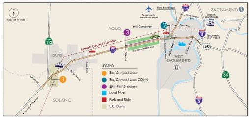
Yolo Route 80 Managed Lanes Project (~ 04-SOL-80 40.791 to 03-YOL-80 9.506, 03-YOL-50 0.00 to 03-SAC-50 L0.118)
 In December 2017, it was reported that Caltrans is hoping to ease congestion on the stretch of
highway on I-80 between Sacramento and Dixon by adding 21 miles of bus and
carpool lanes on both the east and west bound sides of the freeway. The
proposal – which would expand a portion of I-80 from 3 to 4 lanes on
both sides – would extend from Kidwell Road near Dixon all the way
to the corridor where I-80 meets I-5 and US 50. It would also expand the
bike path through the Yolo Bypass. Caltrans says their projections show
the additional carpool lanes could decrease traffic delays by as much as
38% during the evening traffic rush and by 53% in the morning. The
proposal is estimated to cost between $500-$750 million, and Caltrans
hopes more, if not all, of it would be covered by revenue from
California’s new gas tax. If it gets approved, construction is
expected to begin in the summer of 2021.
In December 2017, it was reported that Caltrans is hoping to ease congestion on the stretch of
highway on I-80 between Sacramento and Dixon by adding 21 miles of bus and
carpool lanes on both the east and west bound sides of the freeway. The
proposal – which would expand a portion of I-80 from 3 to 4 lanes on
both sides – would extend from Kidwell Road near Dixon all the way
to the corridor where I-80 meets I-5 and US 50. It would also expand the
bike path through the Yolo Bypass. Caltrans says their projections show
the additional carpool lanes could decrease traffic delays by as much as
38% during the evening traffic rush and by 53% in the morning. The
proposal is estimated to cost between $500-$750 million, and Caltrans
hopes more, if not all, of it would be covered by revenue from
California’s new gas tax. If it gets approved, construction is
expected to begin in the summer of 2021.
(Source: KXTV ABC 10, 12/6/2017)
In May 2018, it was reported that Caltrans has started
to hold public meetings regarding a 16-mile widening of I-80 through Yolo
and Solano counties. The initial idea, Caltrans says, is to build a
carpool lane, also known as a high occupancy vehicle or diamond lane, east
of Dixon to the Sacramento County line in West Sacramento. That would
widen the freeway in key bottleneck spots that occur where I-80 merges
down to three lanes. While the problem affects weekday commuters, some of
the worst slowdowns occur when Bay Area and Sacramento residents alike
cram onto I-80 for weekend getaways. The most challenging section would be
the Yolo Causeway, the 3-mile elevated bridge and berm that crosses the
Yolo floodplain between Davis and West Sacramento. A fourth lane in each
direction would extend to the Sacramento River on I-80 at the Bryte Bend
Bridge and on US 50 at the Pioneer Memorial Bridge, which carries commuter
traffic into downtown Sacramento. The project could cost $400 million.
Caltrans plans to apply for state and federal grants to cover the cost.
Project officials said, they would consider charging a toll for peak-hour
users if the state can't fund the project other ways — and if an
economic analysis shows a toll lane makes sense. The state tentatively
plans to begin construction of the I-80 Yolo/Solano widening project in
2024. The project will include improvements to the causeway bike and
pedestrian path.
(Source: Sacramento Bee, 6/4/2018)
In November 2019, it was reported that Caltrans is
moving ahead with plans to ease traffic congestion plaguing I-80 from
Solano County through Natomas in north Sacramento. Besides making roadway
improvements, it hopes to add a commuter lane in each direction on the
Yolo Causeway, which is the source of slowdowns during commute hours and
on weekends. It will present several ideas for public input at an I-80
improvement open house scheduled in November 2019. Among the solutions
could be a toll lane or a two-way lane that would be switched according to
the volume of vehicles going in one direction or the other. A bicycle or
pedestrian add-on in the causeway is also possible because it would be
cheaper than widening the causeway for vehicle traffic. The solutions
could range from $100 million to $600 million. Additional public meetings
are likely to be held in West Sacramento and Sacramento at later dates.
Construction on the improvements is scheduled to begin in the summer of
2024.
(Source: Fox 40 News, 11/15/2019)
 In February 2020, it was reported that Caltrans was
holding community meetings on the Yolo/I-80 Corridor Improvement project.
The Yolo/I-80 Corridor project proposes improvements to I-80 from Kidwell
Road west of Davis to West El Camino Avenue, including US 50 to the I-5
interchange in Sacramento. Some of the options under consideration include
adding additional lanes to the freeway between the Yolo-Solano County line
and the Yolo Causeway, as well as adding lanes to the causeway itself and
building a separated bicycle/pedestrian crossing over the bypass.
In February 2020, it was reported that Caltrans was
holding community meetings on the Yolo/I-80 Corridor Improvement project.
The Yolo/I-80 Corridor project proposes improvements to I-80 from Kidwell
Road west of Davis to West El Camino Avenue, including US 50 to the I-5
interchange in Sacramento. Some of the options under consideration include
adding additional lanes to the freeway between the Yolo-Solano County line
and the Yolo Causeway, as well as adding lanes to the causeway itself and
building a separated bicycle/pedestrian crossing over the bypass.
(Source: Davis Enterprise, 2/19/2020)
In June 2021, the CTC approved amending the STIP to use
the funding available through the 2021 Mid-Cycle STIP and share
distribution of the federal Coronavirus Response and Relief Supplemental
Appropriations Act of 2021 funds (COVID Relief Funds) to add a new project
to the STIP: Yolo Route 80 Managed Lanes Project (PPNO 8922); program
$4,000K to the PA&ED phase in FY 2021-22.
(Source: June 2021 CTC Agenda, Agenda Item
2.1a.(19))
In July 2021, it was reported that the Federal Highway
Administration (FHWA) awarded the Yolo County Transportation District
$85.9 million in grant funding to improve traffic flow in the I-80
corridor on the west side of the Sacramento-Yolo metro area. Project
elements include: implementing approximately 17 miles of managed lanes
(i.e., Express or Toll lanes) from the Yolo/Solano County line through
Yolo County to West El Camino Avenue on I-80 and to I-5 on US-50 in
Sacramento County; the construction of new lanes on some segments and
restriping to add lanes or using existing lanes for approximately 2.7
miles of the project; adding ITS elements along I-80 and US-50, including
fiber optics, detection, changeable message signs, and ramp meters;
improvements to the Yolo Causeway cycling and pedestrian facility through
reduced curve radii and additional crosswalk, sidewalk lighting, and
safety elements. The project will also include two auxiliary lanes and
will add ramp meters at seven locations.
(Source: FHWA Grant Award, July 2021)
In August 2021, virtual open houses were held for this
project. The project information page notes that the proposal is to
construct improvements consisting of managed lanes, pedestrian/bicycle
facilities, and Intelligent Transportation System (ITS) elements along
I-80 and US-50 from Kidwell Road near the eastern Solano County boundary
(near Dixon), through Yolo County, and to West El Camino Avenue on I-80
and I-5 on US-50 in Sacramento County. The project proposes to add managed
lanes on I-80 and US 50 by a combination of lane conversion, restriping,
shoulder and median reconstruction with a concrete barrier. Drainage
modifications would be required due to median reconstruction in the
locations to which sheet flow currently drains. Existing Intelligent
Transportation System, (ITS) elements and infrastructure would be expanded
and modified and would include ramp meters, fiber-optic conduit and
cables, and overhead signs. Utility relocation would also occur. The Build
Alternatives are listed below. While each Build Alternative proposes a
different managed lane type, only two unique geometric footprints are
proposed (e.g., Build Alternatives 2-6 and Build Alternative 8).
Build Alternative 7 would not construct new lanes. This project
contains a number of standardized project features, which are employed on
most if not all Caltrans projects and were not developed in response to
any specific environmental impact resulting from the proposed project.
(Source: Project Page, retrieved 9/1/2021)
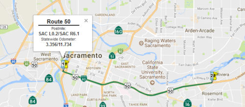
HOV Lanes - Sacramento County - I-5 (SAC L0.2) to Watt Ave (SAC R6.1)
In his 2006 Strategic Growth Plan, Governor Schwartzenegger proposed constructing HOV lanes in Sacramento County.
In September 2007, the CTC approved a resolution to approve a project for future consideration of funding: construct Bus/Carpool lanes near Sacramento on Route 50. This would be the portion roughly from I-5 to Sunset.
In July 2017, it was reported that an environmental
group has sued Caltrans over the state’s plans to build carpool
lanes on US 50 in downtown Sacramento, saying the state has failed to
analyze the health impacts on local residents from potential increased
vehicle emissions. The lawsuit, filed by the Environmental Council of
Sacramento earlier this month in Sacramento Superior Court, is focused on
the state’s plan to extend its existing US 50 carpool system west
from Watt Avenue to I-5. The freeway already has a set of carpool lanes
running east from Watt Avenue into El Dorado County. Caltrans chose not to
conduct a full environmental review of the new project, indicating it
believes the project is not expected to create significant environmental
issues. The environmental group said it would support a carpool lane
extension through downtown if the state were to turn two existing lanes
into carpool lanes rather than expand the freeway, which environmentalists
say will encourage more sprawl-style growth, cause more people to drive
longer distances, and increase “greenhouse gas emissions that
contribute to climate change.” Caltrans tentatively plans to begin
construction of the $187 million project in 2019, if it can obtain the
funds. The state bills the project as a way to use the freeway more
efficiently, reduce travel times by adding traffic flow capacity through
that corridor, and to increase the incentive for commuters to ride-share
and carpool.
(Source: Sacramento Bee, 7/17/2017)
 In August 2017, the CTC approved for future consideration
of funding 03-Sac-50, PM L0.2/R6.1 Sac 50 Phase 2 High Occupancy Vehicle
Lane Project: This project in Sacramento County will add High Occupancy
Vehicle lanes to a portion of US 50 in and near the city of Sacramento.
The project is not fully funded. The estimated project cost is $151
million. Partial funding of $13.3 million for preliminary engineering,
environmental studies, design and right of way work is anticipated from
the local Measure A Transportation Sales Tax program. Construction is
tentatively scheduled to begin in Fiscal Year 2018-19. A copy of the MND
has been provided to Commission staff. The project will result in less
than significant impacts to the environment after mitigation. The
following resource area may be impacted by the project: paleontological
resources. Avoidance and minimization measures will reduce any potential
effects on the environment. These measures include, but are not limited
to, a Paleontological Monitoring Plan shall be prepared and implemented
for the project. As a result, an MND was completed for this project.
In August 2017, the CTC approved for future consideration
of funding 03-Sac-50, PM L0.2/R6.1 Sac 50 Phase 2 High Occupancy Vehicle
Lane Project: This project in Sacramento County will add High Occupancy
Vehicle lanes to a portion of US 50 in and near the city of Sacramento.
The project is not fully funded. The estimated project cost is $151
million. Partial funding of $13.3 million for preliminary engineering,
environmental studies, design and right of way work is anticipated from
the local Measure A Transportation Sales Tax program. Construction is
tentatively scheduled to begin in Fiscal Year 2018-19. A copy of the MND
has been provided to Commission staff. The project will result in less
than significant impacts to the environment after mitigation. The
following resource area may be impacted by the project: paleontological
resources. Avoidance and minimization measures will reduce any potential
effects on the environment. These measures include, but are not limited
to, a Paleontological Monitoring Plan shall be prepared and implemented
for the project. As a result, an MND was completed for this project.
In April 2018, it was reported that state highway
officials, light rail officials and a group of local environmental
activists worked out a behind-the-scenes deal to position local rail and
freeway operators for new state funds to help speed up the east county
commute into downtown on US 50. The massive $452 million plan involves
several changes to the highway, to some city streets, and to light rail
service, including two high-profile projects, extending the US 50
high-occupancy vehicle (HOV) lanes all the way into downtown, and for the
first time in the region, creating a limited-stop express light rail
service during peak commute hours. Currently, the US 50 HOV, or carpool,
lanes run from the hills in of El Dorado County to Watt Avenue. Caltrans
will extend those lanes westward through downtown as far as the Pioneer
Bridge over the Sacramento River (SAC L0.0) into West Sacramento (YOL 0.0
to YOL 3.14). The work will include sound walls in the Stockton Boulevard
and 65th Street areas. Planning documents indicate work could
begin in 2019 and conclude in 2024. Sacramento Regional Transit, for its
part, will also upgrade its light rail service along that corridor. The
plan came together last week when local environmentalists and Caltrans
resolved a years-long dispute over the state's efforts to expand US 50, an
environmental representative said on Friday. Initially, the Environmental
Council of Sacramento (ECOS) and the city of Sacramento opposed adding
carpool lanes on US 50 in downtown, contending it was a narrow,
car-focused and ultimately unsatisfactory solution to east county
congestion. The Sacramento City Council in 2002 voted nearly unanimously
against funding to even study the idea. Several council members at the
time said HOV lanes - which become regular all-user lanes during
non-commute hours - would just encourage more suburban sprawl and more
traffic. More recently, city officials have looked more favorably on the
plan, and have cooperated with Caltrans to use some related project money
to make improvements to city streets near US 50 in the downtown area. That
includes money to turn 14 blocks of Broadway, near the Department of Motor
Vehicles headquarters, into a more pedestrian and bicycle friendly street,
and build a new block-long street just east of 28th Street
between X Street and Broadway, allowing drivers to use X Street instead of
Broadway to access the Route 99 southbound on-ramp. For its part, ECOS
twice sued Caltrans to stop US 50 carpool lane plans. The most recent of
those lawsuits became the fulcrum for last week's negotiated deal. ECOS
President Ralph Propper said his group formally agreed to set aside that
lawsuit in exchange for Caltrans' agreement to commit more funds to
improve light rail service in the corridor, in hopes of making that
service more of a real alternative for commuters. The last step to turn
the plans into reality comes next month. Caltrans and SacRT already have
some of the funding they need. But they need more. They have applied
jointly, along with the city of Sacramento for $115,000 in state funds to
complete the financing. That money would come from Senate Bill 1, the
state gas tax increase passed last year by the governor and the
Democratically controlled state Legislature. Their SB1 funding request got
a critical boost last week when the California Transportation Commission
staff recommended that it’s commissioners allocate $110 million to
the project, almost the entire amount local entities are seeking. The
commission will decide in May.
(Source: Sacramento Bee, 4/30/2018)
In the SB1 Project List, as of June 2018, under the Solutions for Congested Corridors Program program, the following appears: US 50 Multimodal
Corridor Enhancement Project / US 50 HOV Lanes (I-5 to Watt Ave): In
Sacramento County on US 50, from I-5 to 0.8 mile east of Watt Avenue.
Construct 14 lane miles of HOV (or bus/carpool) lanes, widen twelve bridge
structures, construct sound walls from Stockton Blvd to 65th
Street, incorporate Intelligent Transportation System (ITS) elements into
the HOV system, and replace and/or upgrade ancillary facilities including
drainage systems, overhead signs, lighting, approach slabs, guard rail,
and safety barriers. Light Rail expansion along the US 50 corridor from
Sunrise Blvd to Downtown Folsom. Construct 8,963 feet of double tracking
(siding). In City of Sacramento on Broadway, from 16th Street
to Franklin Boulevard and the SR 99 on ramp, implement complete streets
strategies by modifying the roadway network running parallel to US 50.
$110,300,000. For construction purposes, project EA 3F360, PPNO 3301 to be
combined with related SHOPP project EA 0H080, PPNO 6177 under EA 03-0H08U
(see below)
(Source: March 2019 CTC Minutes, Agenda Item 2.5s.(6))
In March 2019, the CTC approved an allocation of
$90,000,000 for the State-Administered Senate Bill 1 (SB 1) Solutions for
Congested Corridors Program (SCCP) US 50 Multimodal Corridor Enhancement
Project/US 50 HOV Lanes (I-5 to Watt Avenue) project (PPNO 3301), on the
State Highway System, in Sacramento County, programmed in Fiscal Year
2019-20. Project details: Sacramento 03-SAC-50 L0.2/R6.1. PPNO 03-3301.
Proj ID 0312000216. US 50 Multimodal Corridor Enhancement
Project/US 50 HOV Lanes (I-5 to Watt Ave). In Sacramento County
on US 50, from I-5 to 0.8 mile east of Watt Avenue. Construct 14 lane
miles of HOV (or bus/carpool) lanes, widen twelve bridge structures,
construct sound walls from Stockton Boulevard to 65th Street,
incorporate Intelligent Transportation System (ITS) elements into the HOV
system, and replace and/or upgrade ancillary facilities including drainage
systems, overhead signs, lighting, approach slabs, guard rail, and safety
barriers. Future Consideration of Funding approved under Resolution
E-17-49; August 2017. Contribution from other sources: $286,900,000
Capital and $25,800,000 Support from concurrent SHOPP advance allocation
under Resolution FP-18-61; March 2019. Additional contributions from Local
funds: $2,000,000 for Capital and $1,000,000 for Support. As part of this
allocation request, the Department is requesting 88-months for the period
of project completion. CONTINGENT ON THE PASSAGE OF THE 2019 BUDGET ACT.
(Source: March 2019 CTC Minutes Agenda Item 2.5s.(6))
In March 2019, the CTC approved the following
allocation. This appears to be a different project than that Multimodal
Corridor Enhancement / US 50 HOV Lanes. $312,700,000 Sacramento 03-Sac-50
L0.6/R5.3 PPNO 03-6177. Proj ID 0315000074. US 50 In the city of
Sacramento, from Route 5 to Watt Avenue. Outcome/Output: Rehabilitate
pavement with continuously reinforced concrete pavement, increase vertical
clearances at overcrossings, widen onramps to add ramp metered lanes,
upgrade curb ramps, and replace concrete barrier, structure approach
slabs, lighting, signs, Intelligent Transportation System (ITS) elements,
and guardrail. This project will improve safety, ride quality, and traffic
operations. CONTINGENT ON THE PASSAGE OF THE 2019 BUDGET ACT.
(Source: March 2019 CTC Minutes, Agenda Item 2.5b.(4) Project 2)
In March 2021, it was reported that Caltrans was
starting a a four-year effort to modernize and widen US 50 from I-5 to
Watt Avenue in downtown Sacramento. The $460 million projects not only is
the most expensive in the region’s history, but it is also one of
the most unusual. The state will construct a third freeway bridge between
the two existing elevated sections of the freeway through downtown,
between W and X streets. The new bridge will be attached to the two
existing eastbound and westbound spans, essentially turning the W-X into a
nearly block-wide superstructure, allowing space for new carpool or
High-Occupancy Vehicle lanes in each direction. To do that, Caltrans will
have to slice off the interior concrete section of each of the two
existing bridges – basically the center median area – to affix
the new bridge. Elmhurst will get a new soundwall, and light rail will get
funding for extra service to the city of Folsom. The main goal for the
project is to extend the existing US 50 carpool or HOV lanes from Watt
Avenue into downtown where they will end just before US 50 hits I-5. That
will create the longest tandem of carpool lanes in the region, running
from El Dorado Hills into downtown. Caltrans also is adding carpool lanes
on I-5 through south Sacramento to the southern edge of downtown. State
highway officials also are doing initial planning work now to extend those
carpool lanes on I-5 through downtown, over the American River and through
Natomas to Sacramento International Airport. The US 50 project includes
plans to lower the freeway about one foot for a mile through the East
Sacramento area in order to create more room for taller freight trucks to
pass under crossings, such as the 48th, 51st and 59th
street bridges. Another section of the freeway also will be lowered
between Watt and Howe avenues, where it is bridged by the Occidental Drive
overpass. Caltrans will also be rebuilding about seven miles of the
freeway surface in both directions between Watt Avenue and the Route 99
interchange.
(Source: Email from Joel Windmiller, 3/23/2021)
In December 2023, the CTC considered a supplemental
allocation request of $16,130,000 $12,394,000
(5.1 3.9 percent increase) in Construction Capital
for 03-Sac-50 L0.2/R6.1. PPNO 03-6254; ProjID 0319000029; EA 0H08U. US 50
In the city of Sacramento, from I-5 to Watt Avenue. Rehabilitate
pavement with continuously reinforced concrete pavement, increase vertical
clearances at overcrossings, widen onramps to add ramp metered
lanes, upgrade curb ramps, and replace concrete barrier, structure
approach slabs, lighting, signs, Intelligent Transportation System
elements, and guardrail. Also, construct 14 lane miles of HOV
(or bus/carpool) lanes, widen 12 bridge structures, construct sound walls
from Stockton Boulevard to 65th Street, incorporate Intelligent
Transportation System elements into the HOV system, replace and/or upgrade
ancillary facilities including drainage systems and overhead signs.
Outcome/Output: This project will improve safety, ride quality, and
traffic operations. Supplemental funds are needed to Complete
Construction. EA 0H080/PPNO 03-6177 combined with EA 3F360/PPNO 03-3301
for construction under EA 0H08U/PPNO 03-6254 to utilize the Design-Build
delivery method. EA 0H080/PPNO 03-6177: CEQA - CE, 8/13/2018; NEPA - CE,
8/13/2018. EA 3F360/PPNO 03-3301: CEQA - MND, 5/31/2017; NEPA - FONSI,
5/31/2017; Future consideration of funding approved under Resolution
E-17-49; August 2017. Total revised SHOPP amount $331,920,000. This
supplemental funds request addresses cost increases due to unanticipated
work, pending changes, and the replenishment of the project contingency
for future unknown risks. Increases reasons included: (1) Delay in
acquiring Construction and Maintenance (C&M) Agreement from Union
Pacific Railroad (UPRR); (2) Unsound concrete at the Folsom Boulevard
Undercrossing; (3) Pending changes: There is an $11,101,000 ($9,540,000
for Rehab and $1,561,000 for HOV) increase in construction cost from
several pending change orders proposed to address a variety of issues:;
and (4) Contingency replenishment due to unknown risks.
(Source: December 2023 CTC Agenda, Agenda Item 2.5e.(6))
In May 2013, it was reported that Caltrans will close a section of the
elevated W-X freeway (US 50) through central Sacramento in each direction
for two months in Spring 2014 for major repairs. The construction zone
will run from 14th (~ SAC L1.304) to 26th (~ SAC
L2.207) streets. The $46 million project may be the biggest fix ever on
the freeway, which is 45 years old as of 2013. Officials say inspections
show the road surface on the elevated bridge section is cracking from
years of traffic and water intrusion, and in need of a complete redo.
Caltrans plans to add 4 inches of new road surface made out of concrete
reinforced with shreds of steel, extending the freeway surface lifespan
another 20 years. The work also includes widening all shoulders by 2.5
feet to meet modern width standards, building new safety barriers on the
viaduct's flanks, and reinforcing an estimated 144 concrete bridge pillars
with steel rods to make them more earthquake resistent. Several ramps and
connectors are expected to be closed at some point during the project.
They include connectors to and from Route 99, as well as the 10th
and 16th street ramps.
(Source: Sacramento Bee, 5/12/13)
Westbound Auxiliary Lane - 65th to Howe (03-Sac-50 R2.6/R3.8)
The following project was included in the final adopted 2018 SHOPP in March 2018: PPNO 6200. 03-Sacramento-50 R2.6/R3.8. US 50 In the city of Sacramento, from 65th Street to east of Howe Avenue. Construct westbound auxiliary lane. Begin Con: 10/1/2019. Total Project Cost: $3,930K.
In January 2019, the CTC approved the following
allocation: $4,075,000 Sacramento 03-Sac-50 R2.6/R3.8 Route 50 In the city
of Sacramento, from 65th Street to east of Howe Avenue.
Outcome/Output: Construct westbound auxiliary lane to reduce congestion
and improve operations and mobility. Also realign and widen southbound
Howe Avenue onramp to add a ramp metering lane.
(Source: January 2019 CTC Minutes, Agenda Item 2.5b.(1) Item 6)
Hornet Drive Interchange (03-Sac-50 R3.5)
The following project was included in the final adopted 2018 SHOPP in March 2018: PPNO 6242. 03-Sacramento-50 R3.5. US 50 In the city of Sacramento, at Hornet Drive eastbound offramp. Widen ramp, add signal and right-turn lane. Begin Con: 4/9/2019. Total Project Cost: $2,720K.
In December 2018, the CTC approved the following SHOPP
allocation: $2,040,000. Sacramento. 03-Sac-50. R3.5 Route 50 In the city
of Sacramento, at Hornet Drive eastbound offramp. Outcome/Output: Realign offramp to a T-intersection, add new signal, lighting, crosswalk, fiber optic line, and camera. This project will improve safety and traffic operations. PPNO 03-6242.
(Source: December 2018 CTC Minutes, Item 2.5b(1) Item 3)
In February 2009, the CTC approved relinquishment of right of way in the city of Sacramento along Route 50 adjacent and parallel to the eastbound off ramp to 65th Street (SAC R2.649), consisting of nonmotorized transportation facilities, namely a pedestrian walkway.
Watt Interchange Improvements (~SAC R5.316)
TCRP Project #126 will widen the US 50/Watt Avenue Interchange (~SAC R5.316) and do various improvements. In April 2012, the CTC voted to approve $25.9 million for interchange improvements at Watt Avenue. The project will construct multi-modal improvements at the US 50 and Watt Avenue interchange and on Watt Avenue between Kiefer Boulevard and La Riviera Drive. Improvements will include modification of the US 50 and Watt Avenue interchange to a partial cloverleaf configuration, construction of a dedicated transit-way and related facilities to support the initial working segment of Bus Rapid Transit (BRT), and construction of a dedicated bicycle and pedestrian pathway through the interchange to separate these modes from vehicular traffic. The project is estimated to cost $50,376,000. The project is funded with State ($32,458,000) funds, Federal ($4,380,000) funds, and Local ($13,538,000) funds. The project is proposed by sponsor for consideration of CMIA Savings. Construction is estimated to begin in fiscal year 2012/13.
In December 2012, the CTC approved un-programming $5,112,000 of the $6,280,000 in TCRP programmed for construction. This just reduces the amount for future reimbursement.
HOV Lanes - Sacramento County - Watt Ave (~SAC R5.362) to Sunrise Blvd (~ SAC 12.502)
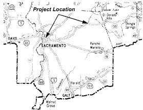 In March 2007, the CTC considered a draft EIR regarding a project in Sacramento
County is to construct roadway improvements near the city of Sacramento.
The project is programmed in the 2006 State Transportation Improvement
Program. The overall project is fully funded. Project Development,
however, is fully funded in the Regional Transportation Improvement
Program and the Interregional Transportation Program. The total estimated
project cost is $165 million. Construction is estimated to begin in Fiscal
Year 2009-10. The project is programmed in the Corridor Mobility
Improvement Account program for $80 million. The following alternatives
are being considered:
In March 2007, the CTC considered a draft EIR regarding a project in Sacramento
County is to construct roadway improvements near the city of Sacramento.
The project is programmed in the 2006 State Transportation Improvement
Program. The overall project is fully funded. Project Development,
however, is fully funded in the Regional Transportation Improvement
Program and the Interregional Transportation Program. The total estimated
project cost is $165 million. Construction is estimated to begin in Fiscal
Year 2009-10. The project is programmed in the Corridor Mobility
Improvement Account program for $80 million. The following alternatives
are being considered:
In July 2009, the CTC approved an amendment of the Corridor Mobility Improvement Account (CMIA) program project baseline agreement for the Route 50 HOV project (PPNO 6199C) in Rancho Cordova, from Watt Avenue to Sunrise Boulevard. The approved baseline agreement included $67,125,000 in STA Measure A funds for construction ($53,125,000 capital and $14,000,000 for support). Due to reduced sales tax receipts, Measure A funds were not available in this amount. This amendment reduces Measure A funds for construction to $48,702,000, and adds Congestion Mitigation and Air Quality (CMAQ) and Proposition 1B State and Local Partnership (SLPP) funds to fully fund construction and construction support.
Bradshaw Road to Mather Field Road Auxiliary Lanes (03-SAC_50 R7.7/R9.5)
") The following project was included in the final adopted 2018 SHOPP in March 2018: PPNO 6197. 03-Sacramento-50 R7.7/R9.5. US 50 In and near Rancho Cordova, from Bradshaw Road to Mather Field Road.
Operational improvements that construct auxiliary lanes in both westbound
and eastbound directions. Begin Con: 5/15/2021. Total Project Cost:
$9,498K.
The following project was included in the final adopted 2018 SHOPP in March 2018: PPNO 6197. 03-Sacramento-50 R7.7/R9.5. US 50 In and near Rancho Cordova, from Bradshaw Road to Mather Field Road.
Operational improvements that construct auxiliary lanes in both westbound
and eastbound directions. Begin Con: 5/15/2021. Total Project Cost:
$9,498K.
In June 2019, the CTC approved the following support
phase allocation: $853,000 03-SAC-50 R7.7/R9.5 PPNO 6197 Proj ID
0300001101 US 50 In and near Rancho Cordova, from Bradshaw Road to Mather
Field Road. Operational improvements that construct auxiliary lanes in
both westbound and eastbound directions. PS&E $750,000 R/W Support
$103,000. (As part of this allocation request, the Department is
requesting to extend the completion of the R/W Sup phase an additional 5
beyond the 36 month deadline.)
(Source June 2019 CTC Minutes, Agenda Item
2.5b.(2a) Item 15)
The 2020 SHOPP, approved in May 2020, included the
following Mobility item of interest (carried over from the 2018 SHOPP):
03-Sacramento-50 PM R7.7/R9.5 PPNO 6197 Proj ID 0300001101 EA 1F150. US 50
in and near Rancho Cordova, from Bradshaw Road to Mather Field Road.
Operational improvements that construct auxiliary lanes in both westbound
and eastbound directions. Programmed in FY20-21, with construction
scheduled to start in February 2021. Total project cost is $10,140K, with
$7,902K being capital (const and right of way) and $2,238K being support
(engineering, environmental, etc.).
(Source: 2020 Approved SHOPP a/o May 2020)
In October 2020, the CTC approved the following
allocation for construction: $9,020,000 for Sacramento 03-Sac-50 PM
R7.7/R9.5. PPNO 03-6197 ProjID 0300001101 EA 1F150. US 50 In Rancho
Cordova, from Bradshaw Road to Mather Field Road. Outcome/Output:
Construct auxiliary lanes in both westbound and eastbound directions to
improve highway operations and mobility. Con Eng $1,080,000; Const
$7,800,000. (CEQA - CE, 9/30/2019; Re-validation 8/13/2020) (NEPA - CE,
9/30/2019; Re-validation 8/13/2020)
(Source: October 2020 CTC Agenda, Agenda Item
2.5b.(1) #4)
The SAFETEA-LU act, enacted in August 2005 as the reauthorization of TEA-21, provided the following expenditures on or near this route:
Zinfandel Drive Interchange Improvements (SAC 10.9/11.1)
The 2018 STIP, approved at the CTC March 2018 meeting, appears to note the completion of PPNO 1670, US 50 SAC 10.9/11.1, Within the city of Rancho Cordova on Zinfandel Drive from Olson Drive to White Rock Road: Construct Ramp and intersection improvements to the US 50 at Zinfandel Drive and intersection improvements at Zinfandel and White Rock Road.
Sunrise Blvd Interchange, Rancho Cordova (~ SAC 12.502)
TCRP Project #134 will make modifications to the US 50/Sunrise Blvd interchange (~ SAC 12.502)
According to an article in the Sacramento Bee in January 2004, the city of Rancho Cordova is planning a new US 50 interchange, east of Sunrise Boulevard (~ SAC 12.502). The goal of this interchange would be to relieve traffic from Sunrise Blvd, where traffic counts from August 2003 show more than 80,000 cars per day travel on Sunrise Boulevard south of the American River at US 50. The new interchange between Sunrise Boulevard and Hazel Avenue would serve proposed development south of the freeway, including more than 30,000 homes in Rancho Cordova.
In May 2014, the CTC received notice of a draft EIR for comment. The project in question is located partially within the City of Rancho Cordova and partially in unincorporated Sacramento County. The proposed project will construct a new interchange over US Highway 50 (US 50) between Sunrise Boulevard and Hazel Avenue in Rancho Cordova including auxiliary lanes between Post Miles 12.5 and 15.8. The project will also construct a new four lane arterial known as Rancho Cordova Parkway extending south from the new interchange to White Rock Road. The City of Rancho Cordova is serving as the lead agency under the California Environmental Quality Act (CEQA) and Caltrans is the lead agency under the National Environmental Policy Act (NEPA). No funding under the purview of the Commission is currently programmed for this project; however, it is anticipated that the Commission will be asked to take action on this project in the future to approve a new public road connection. The alternatives considered for the proposed project include:
In terms of general widening, as of April 2003, there has been widening from Sunrise Blvd to El Dorado Hills Blvd (~ SAC 12.502 to ED 0.875), giving 4 lanes in each direction between Sunrise and Hazel and 3 lanes in each direction from Hazel to El Dorado Hills. Plans call for adding an additional lane in each direction between El Dorado Hills and Shingle Springs. Plans to add lanes west of Sunrise Blvd have not been finalized.
The SAFETEA-LU act, enacted in August 2005 as the reauthorization of TEA-21, provided the following expenditures on or near this route:
HOV Lanes - El Dorado Hills to Bass Lake (~ ED 0.000 to ED R3.25)
In 2007, the CTC considered a number of requests for funding from the Corridor Mobility Improvement Account (CMIA). Two requests were funded: $20M for HOV lanes from the El Dorado Cty Line to the Bass Lake Interchange, and $80M for Phase 1 of the HOV lanes from Watt Ave to Sunrise Blvd. Requests to add EB and WB auxiliary lanes from Sunrise to Folsom Blvd, and route improvements from Trout Creek to Ski Run Blvd were not recommended for funding. In May 2008, the HOV project was extended by eliminating the one mile gap between the existing truck lanes, it will also eliminate the existing truck lane merge at the El Dorado Hills Blvd/Latrobe Rd Interchange. Furthermore, the additional work will allow for improved staging of traffic as well as eliminating impacts due to future construction.
![[Latrobe to Shingle]](maps/050-el-dorado.jpg) In September 2008, the CTC also considered reconstructing the El Dorado Hills
Blvd/Latrobe Rd Interchange. This project in El Dorado County would
reconstruct the El Dorado Hills Boulevard-Latrobe Road Interchange and
make improvements to Route 50 associated with the interchange. For the
purposes of construction, a portion of this project is included in Phase 1
of the Route 50 High Occupancy Vehicle (HOV) Lane project from El Dorado
Hills Boulevard to South Shingle Road/Ponderosa Road Overcrossing (PM 0.0
to PM R9.1). Phase 1 begins at the El Dorado County line to just west of
Bass Lake Road (PM 0.0 to PM 2.9) and is programmed with corridor mobility
improvement account funds, congestion mitigation air quality funds,
regional surface transportation program funds, and local traffic impact
mitigation funds. The total estimated cost of Phase 1, capital and
support, is $44,568,000. The cost associated with the interchange
improvements is $13,000,000. Construction is estimated to begin in Fiscal
Year 2008-09.
In September 2008, the CTC also considered reconstructing the El Dorado Hills
Blvd/Latrobe Rd Interchange. This project in El Dorado County would
reconstruct the El Dorado Hills Boulevard-Latrobe Road Interchange and
make improvements to Route 50 associated with the interchange. For the
purposes of construction, a portion of this project is included in Phase 1
of the Route 50 High Occupancy Vehicle (HOV) Lane project from El Dorado
Hills Boulevard to South Shingle Road/Ponderosa Road Overcrossing (PM 0.0
to PM R9.1). Phase 1 begins at the El Dorado County line to just west of
Bass Lake Road (PM 0.0 to PM 2.9) and is programmed with corridor mobility
improvement account funds, congestion mitigation air quality funds,
regional surface transportation program funds, and local traffic impact
mitigation funds. The total estimated cost of Phase 1, capital and
support, is $44,568,000. The cost associated with the interchange
improvements is $13,000,000. Construction is estimated to begin in Fiscal
Year 2008-09.
In September 2008, the CTC considered for future funding roadway widening along Route 50 between the El Dorado Hills Boulevard Undercrossing to South Shingle Road/Ponderosa Road Overcrossing (PPNO 3283A). This project in El Dorado County will construct bus-carpool lanes in the eastbound and westbound lanes. Phase 1, from the El Dorado County line to just west of Bass Lake Road (PM 0.0 to PM 2.9), is programmed with corridor mobility improvement account funds, congestion mitigation air quality funds, regional surface transportation program funds and local traffic impact mitigation (TIM) funds. The total estimated cost of Phase 1, capital and support, is $44,568,000. The second phase, from west of Bass Lake Road to South Shingle Road/Ponderosa Road Overcrossing is estimated to cost $55,000,000. Phase 2 is funded entirely from local TIM funds. Construction for both phases is estimated to begin in Fiscal Year 2008-09.
In October 2011, the CTC amended the CMIA baseline for the HOV Lanes El Dorado Hills Boulevard to Bass Lake project - Phase 1 (PPNO 3283A) to add the scope of the US 50 HOV Lanes - Bass Lake to Cambridge Road Interchange project -Phase 2A, Segment 1 (PPNO 3283B), and update the funding plan and delivery schedule. In addition, this combined project will now use the title, “US 50 HOV Lanes - El Dorado County,” which reflects the original project and added scope. The Commission, at the June 2011 meeting, approved funding for the additional scope under Resolution CMIA-P-1011-07.
In December 2011, the CTC approved $9.5 million in funding to add 2.3 miles for a carpool lane on US 50 between Bass Lake Road and Cambridge Road in El Dorado County.
Latrobe Road/El Dorado Hills Boulevard Interchange Improvement Phase 2B Project (03-ED-50 0.7/1.1)
 In December 2022, the CTC accepted the Final
Environmental Impact Report and Addenda for the Latrobe Road/El Dorado
Hills Boulevard Interchange Improvement Phase 2B Project (Project) in El
Dorado County and approved the Project for future funding consideration.
The Project will construct eastbound on-and-off ramp interchange
improvements on US 50 at the Latrobe Road and El Dorado Hills Boulevard
interchange ramps in El Dorado County. On May 23, 2000, the El Dorado
County Board of Supervisors adopted the Final Environmental Impact Report
and found that the Project would not have a significant effect on
the environment after mitigation. On November 5, 2002, the El Dorado
County Board of Supervisors re-adopted the Final Environmental Impact
Report and provided additional clarification regarding Alternative 1
per the Writ of Mandamus. The County also issued three Addenda to address
minor, non-substantial design changes. The El Dorado County Board of
Supervisors approved the Addenda accordingly: the first Addendum was
approved on March 6, 2005, the second Addendum was approved on August 5,
2008, and the third Addendum was approved on February 16, 2012. On
November 8, 2022, the County confirmed that the Final Environmental Impact
Report and Addenda remain valid and that there are no new identified
impacts requiring mitigation. This project goes back to the "HOV Lanes -
El Dorado Hills to Bass Lake" project. Back in September 2008, the
CTC considered reconstructing the El Dorado Hills Blvd/Latrobe Rd
Interchange. That project would reconstruct the El Dorado Hills
Boulevard-Latrobe Road Interchange and make improvements to Route 50
associated with the interchange. For the purposes of construction, a
portion of that project was included in Phase 1 of the Route 50 High
Occupancy Vehicle (HOV) Lane project from El Dorado Hills Boulevard to
South Shingle Road/Ponderosa Road Overcrossing (PM 0.0 to PM R9.1). This
project is what is left.
In December 2022, the CTC accepted the Final
Environmental Impact Report and Addenda for the Latrobe Road/El Dorado
Hills Boulevard Interchange Improvement Phase 2B Project (Project) in El
Dorado County and approved the Project for future funding consideration.
The Project will construct eastbound on-and-off ramp interchange
improvements on US 50 at the Latrobe Road and El Dorado Hills Boulevard
interchange ramps in El Dorado County. On May 23, 2000, the El Dorado
County Board of Supervisors adopted the Final Environmental Impact Report
and found that the Project would not have a significant effect on
the environment after mitigation. On November 5, 2002, the El Dorado
County Board of Supervisors re-adopted the Final Environmental Impact
Report and provided additional clarification regarding Alternative 1
per the Writ of Mandamus. The County also issued three Addenda to address
minor, non-substantial design changes. The El Dorado County Board of
Supervisors approved the Addenda accordingly: the first Addendum was
approved on March 6, 2005, the second Addendum was approved on August 5,
2008, and the third Addendum was approved on February 16, 2012. On
November 8, 2022, the County confirmed that the Final Environmental Impact
Report and Addenda remain valid and that there are no new identified
impacts requiring mitigation. This project goes back to the "HOV Lanes -
El Dorado Hills to Bass Lake" project. Back in September 2008, the
CTC considered reconstructing the El Dorado Hills Blvd/Latrobe Rd
Interchange. That project would reconstruct the El Dorado Hills
Boulevard-Latrobe Road Interchange and make improvements to Route 50
associated with the interchange. For the purposes of construction, a
portion of that project was included in Phase 1 of the Route 50 High
Occupancy Vehicle (HOV) Lane project from El Dorado Hills Boulevard to
South Shingle Road/Ponderosa Road Overcrossing (PM 0.0 to PM R9.1). This
project is what is left.
(Source: December 2022 CTC Agenda, Agenda Item
2.2c.(4))
In December 2022, the CTC approved the following STIP
allocation: $874,000. 03-ED-50 0.7/1.1. PPNO 03-5606; ProjID 0322000029;
EA 4PSEL. Latrobe Road/ El Dorado Hills Blvd Interchange Improvements
Phase 2B. On US 50 in El Dorado Hills, from PM 0.7 to PM 1.1.
Construct remaining ultimate improvements to the eastbound on- and
off-ramps at the El Dorado Hills Blvd / Latrobe Road Interchange.
Improvements include reconstruction of the EB diagonal on-ramp, EB on-ramp
auxiliary lane, and the EB loop off-ramp. CEQA - EIR, 05/23/2000;
Re-validation 02/28/2012. NEPA - FONSI, 08/23/2000; Re-validation
04/13/2012. Concurrent consideration of funding under Resolution E-22-104;
December 2022. Allocation: PS&E $874,000.
(Source: December 2022 CTC Agenda, Agenda Item
2.5c.(2))
Silva Valley Parkway (~ ED R1.826R)
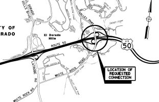 In March 2012, the CTC approved
for future consideration of funding a project that will construct a new
interchange at Silva Valley Parkway (~ ED R1.826R). The project will
construct a new interchange connection to US 50 that will include a six
lane overcrossing, new signalized diagonal off-ramps, diagonal on-ramps,
and loop on-ramps. The mainline will be improved to include east and west
auxiliary lanes between El Dorado Hills Boulevard and the new interchange.
The project will result in significant unavoidable impacts to
transportation/circulation and noise. Specifically, the project would
result in a lower level of service on the eastbound slip on-ramp resulting
in congestion impacting the ability for on-ramp traffic to merge into thru
traffic; possible temporary vibration-induced annoyance to residents
during hard rock blasting during construction; and temporary construction
related noise in proximity to existing residential land north and south of
the project site. Mitigation measures and/or alternatives to the proposed
project that would substantially reduce or avoid these significant
unavoidable impacts are infeasible. The County found that there were
several benefits that outweigh the unavoidable adverse environmental
effects of the project. These benefits include, but are not limited to,
providing transportation facilities to accommodate planned growth as noted
in the 2004 County General Plan and the El Dorado Hills Specific Plan;
improve traffic circulation to Silva Valley Parkway, El Dorado Hills
Boulevard Interchange, Bass Lake Road Interchange, US 50, Serrano Parkway,
Latrobe Road, and White Rock Road; improve the El Dorado County
sustainable transportation system by augmenting the US 50 HOV and ramp
metering facilities; and improve safe pedestrian mobility by providing a
significant north-south pedestrian facility crossing of US 50. The County
established a Mitigation Monitoring Program to ensure that the mitigation
measures specified for the project are implemented. The project is
estimated to cost $60 million and will be constructed in two phases. The
project is funded with SLPP ($1 million) funds and Local ($59 million)
funds. Construction of phase one is estimated to begin in fiscal year
2012/13.
In March 2012, the CTC approved
for future consideration of funding a project that will construct a new
interchange at Silva Valley Parkway (~ ED R1.826R). The project will
construct a new interchange connection to US 50 that will include a six
lane overcrossing, new signalized diagonal off-ramps, diagonal on-ramps,
and loop on-ramps. The mainline will be improved to include east and west
auxiliary lanes between El Dorado Hills Boulevard and the new interchange.
The project will result in significant unavoidable impacts to
transportation/circulation and noise. Specifically, the project would
result in a lower level of service on the eastbound slip on-ramp resulting
in congestion impacting the ability for on-ramp traffic to merge into thru
traffic; possible temporary vibration-induced annoyance to residents
during hard rock blasting during construction; and temporary construction
related noise in proximity to existing residential land north and south of
the project site. Mitigation measures and/or alternatives to the proposed
project that would substantially reduce or avoid these significant
unavoidable impacts are infeasible. The County found that there were
several benefits that outweigh the unavoidable adverse environmental
effects of the project. These benefits include, but are not limited to,
providing transportation facilities to accommodate planned growth as noted
in the 2004 County General Plan and the El Dorado Hills Specific Plan;
improve traffic circulation to Silva Valley Parkway, El Dorado Hills
Boulevard Interchange, Bass Lake Road Interchange, US 50, Serrano Parkway,
Latrobe Road, and White Rock Road; improve the El Dorado County
sustainable transportation system by augmenting the US 50 HOV and ramp
metering facilities; and improve safe pedestrian mobility by providing a
significant north-south pedestrian facility crossing of US 50. The County
established a Mitigation Monitoring Program to ensure that the mitigation
measures specified for the project are implemented. The project is
estimated to cost $60 million and will be constructed in two phases. The
project is funded with SLPP ($1 million) funds and Local ($59 million)
funds. Construction of phase one is estimated to begin in fiscal year
2012/13.
In August 2012, the CTC approved a new public road connection to US 50 at Silva Parkway (ED 1.8). This is in support to a proposal from the County of El Dorado to construct a new Silva Valley Parkway interchange on US 50 between the El Dorado Hills Boulevard/Latrobe Road interchange and the Bass Lake Road interchange, just east of the Clarksville Undercrossing along the existing Sylva Valley Parkway. The existing Silva Valley Parkway will be renamed Old Sylva Valley Parkway. The purpose of the project is to relieve congestion to US 50 due to commercial and residential development in the areas surrounding the proposed interchange and to accommodate planned growth as noted in the County’s General Plan. Studies for this interchange project started in the 1980’s. The project was approved by El Dorado County in 1990 and by the Department in 1991; however, due to lack of funding the project was put on hold. Since then local development and traffic impact fees have been collected to fund the project and the project was restarted in 2010. Community just west of the proposed new interchange. It crosses under US 50 at the Clarksville Undercrossing. The proposed project will construct a new Silva Valley Parkway interchange with a six-lane overcrossing (four through lanes and two deceleration lanes to the loop on-ramps), diagonal on and off-ramps, and loop on-ramps. The US 50 mainline will be improved to include east and west auxiliary lanes between El Dorado Hills Boulevard and the new interchange. The new Silva Valley Parkway will provide shoulders for bicycle and pedestrian access, while bike and pedestrian access will also be provided along the existing Silva Valley Parkway.
In January 2013, the CTC authorized $1,000,000 to El Dorado County LTC for the Silva Valley Parkway / US 50 Interchange. This project, in El Dorado County at the Silva Valley Parkway, will construct the overpass, on and off ramps, signalized intersection, bicycle and pedestrian facilities.
In August 2011, the CTC approved $11,500,000 in SHOPP funding for repairs near El Dorado Hills, from 0.3 mile east of Bass Lake Road to Route 49 Junction in Placerville (~ ED R2.95 to ED 17.625), that will rehabilitate 49.2 lane miles of roadway to improve the ride quality, prevent further deterioration of the traveling surface, minimize costly roadway repairs and extend the pavement service life.
In July 2006, the CTC considered Resolution No. R-3639, relinquishing right of way in the County of El Dorado at PM ED 5.0, at Cambridge Road, consisting of reconstructed and relocated county road.
Cameron Park Interchange (~ ED 6.585)
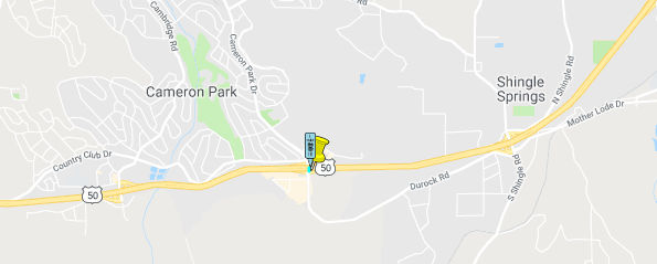 In August 2018, it was reported that the El Dorado County Board of Supervisors narrowed down the
options for an updated interchange connecting US 50 and Cameron Park
Drive. The update is necessary to handle an anticipated increase in
traffic flow, according to a report from county Department of
Transportation engineers Katie Jackson and Natalie Porter. Along with
Dokken Engineering and transportation consulting firm DKS Associates,
county transportation staff have been looking at four possible
configurations, ranging from $43.5 million to $61.9 million. Funding for
the project will come from Traffic Impact Mitigation (TIM) fees, which are
imposed upon builders to ensure they pay for any additional traffic their
development projects bring to the area. Staff has been looking at the
interchange update since 2008, Jackson said. Initial costs for
alternatives ranged between $74 million and $107 million. In 2016, when
TIM fees were readjusted, project costs dropped to $87.3 million. Still,
staff was directed to identify less expensive alternatives. The unanimous
vote from supervisors on Tuesday eliminated option two of four, which
involved an eastbound off-ramp on Rodeo Road. Though it would have used an
under-utilized road, this alternative was the most expensive and included
nearly three-quarters of a mile of additional travel for those heading
eastbound to Cameron Park Drive. The three other options are up for future
consideration:
In August 2018, it was reported that the El Dorado County Board of Supervisors narrowed down the
options for an updated interchange connecting US 50 and Cameron Park
Drive. The update is necessary to handle an anticipated increase in
traffic flow, according to a report from county Department of
Transportation engineers Katie Jackson and Natalie Porter. Along with
Dokken Engineering and transportation consulting firm DKS Associates,
county transportation staff have been looking at four possible
configurations, ranging from $43.5 million to $61.9 million. Funding for
the project will come from Traffic Impact Mitigation (TIM) fees, which are
imposed upon builders to ensure they pay for any additional traffic their
development projects bring to the area. Staff has been looking at the
interchange update since 2008, Jackson said. Initial costs for
alternatives ranged between $74 million and $107 million. In 2016, when
TIM fees were readjusted, project costs dropped to $87.3 million. Still,
staff was directed to identify less expensive alternatives. The unanimous
vote from supervisors on Tuesday eliminated option two of four, which
involved an eastbound off-ramp on Rodeo Road. Though it would have used an
under-utilized road, this alternative was the most expensive and included
nearly three-quarters of a mile of additional travel for those heading
eastbound to Cameron Park Drive. The three other options are up for future
consideration:
(Source: Mountain Democrat, 7/30/2018)
There are plans to construct a new interchange near the city of Cameron Park. There are also plans to create a new public road connection and interchange near Shingle Springs, at PM ED 11.4. As of December 2008, the location was better identified as Missouri Flat Road N of Cameron Park.
In May 2012, it was reported that Caltrans is is completing work ahead of schedule on a tunnel under US 50 near the El Dorado Road exit (~ ED R13.985) that officials hope wildlife will begin using to get to the other side of the highway. An eight foot tall fence will help funnel the animals to the tunnel entrance. This tunnel is the first to be built under US 50 and, at 203 feet in length and 12 feet high by 12 feet wide, is also the largest in the area.
Placerville through the Nevada State Line
Western Placerville Interchanges Project (~ ED 15.365 to 16.798)
The SAFETEA-LU act, enacted in August 2005 as the reauthorization of TEA-21, provided the following expenditures on or near this route:
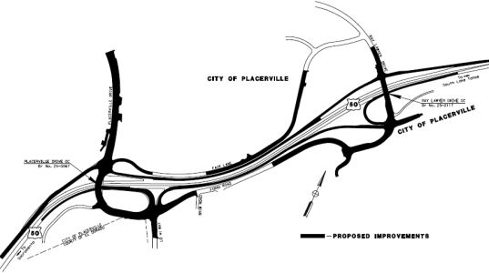 In April 2012, the CTC approved for future consideration of funding a project
that is located in the City of Placerville in El Dorado County. The
project will widen and improve segments of Forni Road, Fair Lane,
Placerville Drive, and Ray Lawyer Drive. Improvements to these roadways
will be made in conjunction with modifications and improvements to
eastbound and westbound US 50 ramps to and from Forni Road, Placerville
Drive, and Ray Lawyer Drive. The estimated project cost is approximately
$40 million for the overall Western Placerville Interchanges Project, of
which the Ray Lawyer Drive improvements are estimated to cost $10,800,000.
The project is programmed with State ($5,542,000) funds. The project is
proposed by sponsor for consideration of CMIA Savings. The remaining
project costs will be programmed as available and applicable from local
funds, Traffic Impact Mitigation Fees, Regional, State, and Federal
transportation sources. Construction is estimated to begin in 2012.
In April 2012, the CTC approved for future consideration of funding a project
that is located in the City of Placerville in El Dorado County. The
project will widen and improve segments of Forni Road, Fair Lane,
Placerville Drive, and Ray Lawyer Drive. Improvements to these roadways
will be made in conjunction with modifications and improvements to
eastbound and westbound US 50 ramps to and from Forni Road, Placerville
Drive, and Ray Lawyer Drive. The estimated project cost is approximately
$40 million for the overall Western Placerville Interchanges Project, of
which the Ray Lawyer Drive improvements are estimated to cost $10,800,000.
The project is programmed with State ($5,542,000) funds. The project is
proposed by sponsor for consideration of CMIA Savings. The remaining
project costs will be programmed as available and applicable from local
funds, Traffic Impact Mitigation Fees, Regional, State, and Federal
transportation sources. Construction is estimated to begin in 2012.
In May 2012, the CTC approved a public road connection in support of this project at Ray Lawyer Drive. The overall Western Placerville Interchanges project will consist of replacing the existing Placerville Drive/Forni Road overcrossing to meet vertical clearance standards and provide sufficient width for future US 50 widening; constructing new on and off ramps at Ray Lawyer Drive overcrossing; widening of eastbound ramps at Forni Road/Placerville Drive; and widening and overlay portions of Forni Road, Placerville Drive, and Fair Lane. This project also proposes construction of new eastbound auxiliary lanes from Forni Road to Ray Lawyer Drive and westbound from Ray Lawyer Drive to the Placerville Drive interchange; Ray Lawyer Drive will be widened and extended 820 feet south; Forni Road will be realigned and widened and will terminate at a new signalized intersection at the new Justice Center Driveway/Ray Lawyer Drive intersection. The project also includes Class II bike lanes on both sides of Placerville Drive, Forni Road and Ray Lawyer Drive. Sidewalks are included along at least one side of all of the local streets except for Fair Lane. These improvements will provide safer routes for pedestrian and bicycle travelers.
In October 2012, it was reported that construction was complete on $80 million worth of widening and interchange reconfigurations in the Missouri Flat and Forni roads area, including two new lanes on the Weber Creek Bridge.
In May 2017, the CTC allocated an additional financial contribution of $470,000 for a project on US 50 in the City of Placerville, at Ray Lawyer Drive (Western Placerville Interchange Phase 2). Outcome/Output: Construct eastbound US 50 offramp and associated improvement to Forni Road and Ray Lawyer Drive.
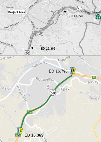 In August 2017, the CTC approved for future consideration of funding 03–
 Placer
El Dorado County Western Placerville Interchange Project:
Construct interchange improvements to Placerville Drive and Forni Road on
US 50. The Project will construct improvements to the existing US 50/Placerville Drive/Forni Road Interchanges with the addition of ramps to
the existing Ray Lawyer Drive Overcrossing. On June 24, 2014, the
Placerville City Council adopted the Final Supplemental Environmental
Impact Report and Mitigated Negative Declaration for the Project and found
that the Project will not have a significant effect on the environment
after mitigation. Impacts that require mitigation measures to be reduced
to less than significant levels relate to biological resources, hazardous
materials and traffic circulation. Mitigation measures include, but are
not limited to: restrict construction activities between February 15
through August 31 to avoid the nesting season, implement invasive species
control measures, conduct soil sampling to monitor hazardous materials,
prepare a Stormwater Pollutant Prevention Plan, and implement a Traffic
Management Plan during construction. On June 13, 2017, the City confirmed
that the preferred alternative set forth in the Final Supplemental
Environmental Impact Report is consistent with the Project scope of work
programmed by the Commission. The Project is estimated to cost $11,624,620
and is fully funded through construction with State Transportation
Improvement Program Funds ($5,542,000), Congestion Mitigation and Air
Quality Funds ($2,766,000), Urban Funds ($272,000), State Highway
Operation Protection Program Funds ($470,000), State Bond Transit Funds
($1,430,620), El Dorado Irrigation District Relocation Funds ($809,000)
and Local Funds ($335,000). Construction is estimated to begin in Fiscal
Year 2017/18.
Also in August 2017, the CTC approved an allocation of $5,542,000 for the locally administered Western Placerville Interchanges Phase 2 (PPNO 1217A) project in El Dorado County, programmed in the STIP: El Dorado 03-ED-50 16.5/16.5 Western Placerville Interchanges Phase 2. In the city of Placerville, on US 50 at Ray Lawer Drive. Upgrade Interchange. Construct Eastbound US 50 offramp and associated improvements to Forni Road and Ray Lawyer Drive. Outcome/Output: Interchange: 1 new interchange completed (Eastbound). The STIP allocation is split as follows: $970,000 for construction engineering and $4,572,000 for construction capital.
The 2018 STIP, approved at the CTC March 2018 meeting, appears to delete the funding for PPNO 1217A. It shows the project (noted above) in the 2016 STIP, but it is not listed in the Proposed 2018 Programming. The STIP shows that $5,542K was allocated in the 2016 STIP, which corresponds to what was reported in August 2017.
In June 2020, the CTC approved the following CONST
allocation for a locally-administered LPP (Formulaic/Competitive) project:
$1,070,000 03-ED-50 16.4/16.8. PPNO 03-3336 ProjID 0319000152 EA 37282.
Western Placerville Interchanges Phase 2.2-Eastbound On-Ramp. On US 50 in
the City of Placerville, separate, but geographically adjacent to the
Western Placerville Interchanges Phase 2 project, on US 50 at Ray Lawyer
Drive. Construct eastbound on-ramp. (Future consideration of funding
approved under Resolution E-12-16; April 2012.) (Concurrent allocation for
SHOPP Minor A FCO Project EA 03-37282 under Resolution FP-19-89; June
2020) (Contribution from other sources: $ 2,070,000, of which $1,000,000
of SHOPP Minor A FCO Project EA 03-37282) (Time extension for FY 18-19 CON
expires on 06/30/2020)
(Source: June 2020 CTC Agenda, Agenda Item
2.5s.(2b) #1)
In August 2022, the CTC authorized relinquishment of a Park and Ride Lot
and collateral facilities in the city of Placerville (3 segments,
03-ED-50-PM 16.3/16.5), along US 50 on Ray Lawyer Drive and Forni Road,
under the terms and conditions as stated in the relinquishment agreement
dated May 16, 2017. The City, by Resolution No 8999 dated August 24,
2021, waives the 90-day notice requirement and accepts title upon
relinquishment by the State.
(Source: August 2022 CTC Agenda, Agenda Item 2.3c)
In March 2014, the CTC authorized relinquishment of right of way in the city of Placerville along Route 50 between Ray Lawyer Drive and Mosquito Road (~ ED 16.513 to ED 18.544), consisting of collateral and non-motorized transportation facilities. The City, by relinquishment agreement dated January 14, 2014, waived the 90-day notice requirement and agreed to accept title upon relinquishment by the State.
Placerville Vicinity Acceleration Lanes (03-ED-50 18.7/21.9)
In October 2023, the CTC revised the following project
in the 2022 SHOPP: 03-ED-50 18.7/21.9. PPNO 03-3337; ProjID 0319000280; EA
0J400. US 50 In and near Placerville, from west of Carson Road
Overcrossing to west of Still Meadows Road; also at 5 Mile Road in
westbound direction (PM 22.6/22.9); also near Camino, from 1.1
miles west of Snow Road Undercrossing to east of Sawmill Undercrossing (PM
24.2/R29.1). Rehabilitate pavement, construct acceleration
lane, upgrade facilities to Americans with Disabilities Act (ADA)
standards, rehabilitate drainage systems, upgrade concrete barrier, signs,
and Transportation Management System (TMS) elements, and construct
maintenance vehicle pullouts. Note: Update description, construction
support, and construction capital to add the scope of constructing
acceleration lane for improved safety and operations. This
additional need will be funded through Infrastructure Investment and Jobs
Act (IIJA) funds. Allocation ($ × 1,000): PA&ED $2,250; PS&E
$2,310; R/W Sup $500; Con Sup $3,150 $3,800; R/W
Cap $610 $760; Const Cap $32,950 $36,150;
TOTAL $41,770 $45,770.
(Source: October 2023 CTC Agenda, Agenda Item 2.1a.(1d) #7)
In January 2024, the CTC revised the following project
in the 2022 SHOPP: 03-ED-50 18.7/21.9. PPNO 03-3337; ProjID 0319000280; EA
0J400. US 50 In and near Placerville, from west of Carson Road
Overcrossing to west of Still Meadows Road; also at 5 Mile Road in
westbound direction (PM 22.6/22.9); also near Camino, from 1.1 miles west
of Snow Road Undercrossing to east of Sawmill Ridgeway
Drive Undercrossing (PM 24.2/R29.1). Rehabilitate pavement,
construct acceleration lane, upgrade facilities to Americans with
Disabilities Act (ADA) standards, rehabilitate drainage systems, upgrade
concrete barrier, signs, and Transportation Management System (TMS)
elements, and construct maintenance vehicle pullouts. Note: Update
project description to correct the name of the undercrossing.
(Source: January 2024 CTC Agenda, Agenda Item 2.1d #6)
Placerville Safety Improvements / Camino Safety Project (03-ED-50, PM 21.95/24.45)
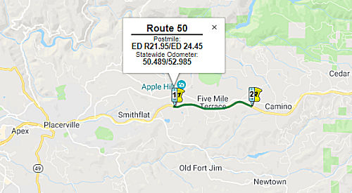 In January 2018, the CTC amended the following project in the SHOPP: 03-ED-50
 22.0/24.3
21.9/24.5. US 50 Near Placerville and Camino, from 0.1
0.2 mile west of Still Meadows Road to 0.1 0.4
mile east of Upper Carson Road. Install median barrier, widen shoulders,
and construct acceleration/deceleration lane, construct an
undercrossing, and construct access to the undercrossing from local
roads. Total Cost: $47,000,000 $48,000,000.
(Source: CTC Agenda, January 2018, Agenda Item 2.1a(1))
In October 2018, the CTC approved for future
consideration of funding the following project for which a Mitigated
Negative Declaration (MND) has been completed: US 50 in El Dorado County
(03-ED-50, PM 21.95/24.45). Construct safety improvements along a portion
of US 50 near the city of Placerville. (PPNO 3290). This project is
located on US 50 near Placerville and Camino in El Dorado County. The
proposed project will improve the safety of this portion of highway. The
project proposes to install concrete median barriers, widen outside
shoulders to standard widths, and install acceleration/deceleration lanes.
This proposed project addresses the need to improve the higher than
statewide average collision rates in this area. The proposed project is
estimated to cost approximately $38.3 million. This project is currently
funded and programmed in the 2018 SHOPP for approximately $48.0 million.
Construction is estimated to begin in 2019. The scope, as described for
the preferred alternative, is consistent with the project scope programmed
by the Commission in the 2018 SHOPP.
(Source: October 2018 CTC Agenda Item 2.2c.(1))
In February 2020, it was reported that construction on
this $55.4 million highway project was set to start in summer 2020.
Caltrans was expected to open bids in mid-February, but due to the number
of inquiries, the bidding period was extended until March 4. That means
construction won’t start until May or June 2020. The work will be
done in two phases. A new barrier will be installed between the eastbound
and westbound lanes on a nearly 6-mile corridor in Camino, which stretches
between Still Meadow Road and Carson Road. In the latest 10-year period,
175 vehicle collisions have happened on that stretch of road, four of
which were fatal. For years, Caltrans has tried to come up with a way to
fill in the median without completely cutting off access to Camino Heights
from the westbound lanes, and eastbound lanes from Apple Hill and Camino.
The agency wants to build a full interchange at Carson Road, but
hasn’t been able to get enough money to build it. So this current
project will include the construction of an undercrossing that will allow
traffic to go from Carson Road on the north side underneath the highway
and connect to an extended Sierra Blanca Road on the south side of the
highway. The project will still leave an opening for an interchange to be
completed later, if the funding comes along. The project also includes
some culvert work on US 50 farther west in Placerville, as well as
building a tunnel for wildlife that will go underneath the highway. Of the
total $55.4 million for the project, $7.3 million is coming from El Dorado
County, $5.5 million is coming from state funding and the rest is federal
funding.
(Source: Biz Journals, 2/20/2020)
In June 2021, it was reported that Caltrans was hosting
a public meeting to update the community on the US 50 Camino Safety
Project. This $55 million project consists of installing a continuous
concrete median barrier on US 50 from Still Meadows Road to Carson Road
that will eliminate left-hand turns at at-grade intersections. A new
undercrossing is being built to provide access north and south of the
highway. The project also includes drainage improvements, a wildlife
undercrossing and local road improvements. The El Dorado County Department
of Transportation provided $7.3 million in funding for the project.
Construction started in August 2020 and completion is expected by December
2022.
(Source: Caltrans District 3, 6/18/2021)
In April 2022, it was reported that a key component of
the US 50 Camino Safety Project has been completed, allowing work to
proceed on the remaining elements of the $55.4 million project.
Specifically, the two El Dorado Irrigation District water lines have been
replaced, clearing the way for the contractor, Security Paving Inc., to
move ahead with local road improvements, which include a roundabout
connecting to the new Pondorado Undercrossing being built. This safety
project consists of installing a continuous 56-inch-high concrete median
barrier on a three-mile stretch of US 50 from Still Meadows Road to
“upper” Carson Road that will restrict left turns at all
at-grade intersections. This segment of US 50 has seen numerous
collisions, including multiple fatalities, over the past decade.
(Source: South Tahoe Now, 4/8/2022)
In September 2022, it was reported that the roundabout
and undercrossing on the US 50 Camino Safety Project opened to traffic.
This is likely the interchange at Carson Road.
(Source: District 3 on Twitter, 9/26/2022)
In August 2023, the CTC authorized relinquishment of
right of way consisting of collateral facilities to the County of El
Dorado along US 50 on Camino Heights Drive, Sierra Blanca Drive, and
Pondorado Road, (03-ED-50-PM 23.2/23.5, 1 segment) under the terms and
conditions as stated in the relinquishment agreement dated May 12, 2023.
The County, by Resolution No. 072-2023, dated May 2, 2023, agreed to waive
the 90-day notice requirement and accept title upon relinquishment by the
State.
(Source: August 2023 CTC Agenda, Item 2.3c)
In December 2009, Caltrans removed a boulder the size of a pickup truck from the highway near Bridal Veil Falls (~ ED 37.667), 17 miles east of Placerville.
In February 2017, it was reported that a section of US 50 crumbled
farther down the hillside early Tuesday near Bridal Veil Falls (~ ED
37.667), offering the latest dramatic reminder of how vulnerable Sierra
highways have became in the winter 2017 deluge of rain and snow. Though
the damaged road did not result in injuries, it prompted the closure of
both westbound lanes and will reduce traffic to one lane in each direction
for months to come. Crews will work on stabilizing the slope and fixing
the highway, according to Caltrans. The slope supporting the highway at
Bridal Veil Falls, 2 miles east of Fresh Pond, slipped several feet last
week, requiring the closure of the westbound No. 2 lane next to the
shoulder. The damage increased this week, affecting the No. 1 lane,
Caltrans said.
(Source: Sacramento Bee, 2/21/2017)
In August 2011, the CTC approved $1,200,000 in SHOPP funding for repairs in Nevada, Butte, Sutter, El Dorado, and Placer Counties at various locations. These repairs will upgrade metal beam guardrail end treatments to comply with the National Cooperative Highway Research Program Report 350 standards.
Echo Summit Stabilization (~ ED 66.807)
In May 2010, the CTC approved for future consideration of funding a project in El Dorado County that will upgrade deteriorating rock wall parapets at seven locations along Route 50 near Echo Lake. The parapets will be upgraded by constructing modified Type 736 concrete barriers on Portland cement slabs. The project is fully funded in the 2010 State Highway Operation and Protection Program. Total estimated project cost is $5,568,000 for capital and support. Construction is estimated to begin in Fiscal Year 2010-11. The project will involve construction activities that will result in traffic delays and construction related dust and exhaust emissions. In addition, construction activities will be occurring in the immediate area of the Upper Myers Grade, a National Register Eligible historic property.
In March 2011, Caltrans began a project to repair Route 50 at Echo Summit on the route to Lake Tahoe. Construction will include new guardrails and a 3-foot-high cement barrier in place of the crumbling 18-inch-tall rock and sandbag roadside wall, which was built in the 1930s. A stabilizing slab will be placed under the roadway and masonry along the support wall will be upgraded. Two official detours have been announced. US 50 motorists en route to South Lake Tahoe will be rerouted to Route 16 out of Sacramento to Route 49 and then onto Route 88 and Route 89. Travelers closer to Placerville will be directed onto Route 49 which will lead them to Route 88. A website on the detours may be found at http://www.way2tahoe.com/index.aspx. The construction will begin at the soonest possible date after April 15, 2011.
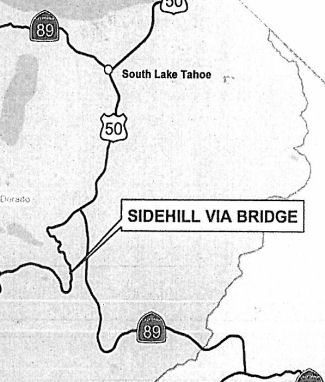 In March 2015, the CTC received notice of preparation of
an EIR for a project in El Dorado County that will rehabilitate or replace
the Echo Summit Sidehill Viaduct seven miles west of South Lake Tahoe on
US 50. The project is programmed in the 2014 State Highway Operation and
Protection Program (SHOPP). The total estimated cost is $9,060,000 for
capital and support. Construction is estimated to begin in Fiscal Year
2017-18. The scope, as described for the preferred alternative, is
consistent with the project scope programmed by the Commission in the 2014
SHOPP. In addition to the no-build opportunity, the following alternatives
are under consideration:
In March 2015, the CTC received notice of preparation of
an EIR for a project in El Dorado County that will rehabilitate or replace
the Echo Summit Sidehill Viaduct seven miles west of South Lake Tahoe on
US 50. The project is programmed in the 2014 State Highway Operation and
Protection Program (SHOPP). The total estimated cost is $9,060,000 for
capital and support. Construction is estimated to begin in Fiscal Year
2017-18. The scope, as described for the preferred alternative, is
consistent with the project scope programmed by the Commission in the 2014
SHOPP. In addition to the no-build opportunity, the following alternatives
are under consideration:
In December 2015, the CTC updated the cost for the following SHOPP project: 03-ElD-50 67.3 US 50 Near South Lake Tahoe, west of South Lake Tahoe at Echo Summit Sidehill Viaduct Bridge No. 25-0044. Rehabilitate or Replace bridge:
| PA&ED | PS&E | RW | Const |
| $16K | |||
| $624K | $1,317K | $16K | $1,502K |
In June 2018, the CTC approved for future consideration
of funding the following project: 03-ED-50, PM 67.3 Echo Summit Sidehill
Viaduct Replacement Project: Replace existing viaduct on US 50 in El
Dorado County. (MND) (PPNO 3304) (SHOPP). This project is located on US 50
near South Lake Tahoe, in El Dorado County and proposes to replace the
Echo Summit Sidehill Viaduct with a new single-span bridge. The project
proposes to address the current poor conditions and ongoing problems of
the deck surface, bridge superstructure and substructure, concrete
spalling and severe cracks. The project also proposes to upgrade existing
metal beam guardrail, concrete transition barriers, asphalt concrete
grinding at the bridge approaches and new concrete on the approach
roadway. The proposed project is estimated to cost $6.0 million in capital
construction. The project is fully funded and is currently programmed in
the 2016 SHOPP for approximately $12.0 million which includes Construction
(capital and support) and Right of Way (capital and support). The project
is estimated to begin construction in 2019. The scope, as described for
the preferred alternative, is consistent with the project scope programmed
by the Commission in the 2016 SHOPP.
(Source: CTC Agenda, June 2018 Agenda Item 2.2c(1))
In November 2018, it was reported that the 2019
construction season will bring work on the "US Highway 50 Echo Summit
Sidehill Viaduct Replacement Project," located about 7 miles from South
Lake Tahoe. This project will replace the bridge coming down off Echo
Summit. The bridge was originally built in 1938 and repaired in the 1970s
and again in the 1980s. This project is expected to be completed in two
construction seasons, during which motorists can expect one-way traffic
control and should plan accordingly for delays. In Spring 2020,
there will be a full closure of US 50 for up to 14 days for bridge deck
work. In 2019, work will be done underneath the bridge to build the
support structures.
(Source: Tahoe Daily Tribune, 11/11/2018; TahoeDaily
Tribune, 4/23/2019)
In July 2019, it was reported that the Echo Summit
project contractor originally considered using a platform to work off of
the highway, which didn’t turn out to be a feasible option. As of
July 2019, crews were excavating for the new footing at “abutment
2” using a crane to lift loads from below. After getting both new
abutments constructed this season, the new bridge deck will be installed
next year. A full closure of US 50 for up to 14 days is anticipated to
allow for the bridge deck work. Completion of this project is scheduled
for fall of 2020.
(Source: Tahoe Daily Tribune, 7/2/2019)
In September 2019, it was reported that a full closure
of US 50 over Echo Summit that was scheduled for mid-October 2019 won't
happen until 2020 Caltrans said. Bridge girders needed for a $14.1 million
construction project will not be ready in time, Caltrans said in an
update. About a half-mile of the highway was originally scheduled to be
closed the latter half of October 2019, creating a lengthy detour for
drivers trying to get to South Lake Tahoe. Instead, the contractor for the
bridge project will winterize the job site and come back in 2020. Besides
the bridge girders, the project includes paving the approaches to the
bridge, constructing new barrier walls and demolishing the existing
structure that was built in 1939.
(Source: KRCA, 9/10/2019)
In August 2020, it was reported that after a delay in
getting materials in 2019, Caltrans has scheduled a full closure of US 50
for the Echo Summit Sidehill Viaduct Replacement Project for two weeks
beginning Friday, Sept. 18. After the delay last year, the contractor on
the project was going to install the bridge girders in June of 2020, but
many wanted that timeframe postponed due to the the opening of tourist
season after COVID-related closures in Spring 2020. The closure is
required to install seven 96-foot bridge girders and associated work.
There will be one-way traffic control 24/7 scheduled to begin Sunday,
Sept. 13 until Friday, Sept. 18 to demolish the existing bridge before
installing the girders. The full closure of US 50 is set to start Friday,
Sept. 18 and expected to conclude on Friday, Oct. 2. Weather or other
unexpected delays may prolong the closure.
(Source: South Tahoe Now, 8/18/2020)
In September 2020, it was reported that US 50 over Echo
Summit opened five days ahead of schedule after bridge improvements.
Caltrans shut down US 50 west of South Lake Tahoe on Sept. 18 to install
seven 96-foot bridge girders, to pour ultra-high-performance concrete to
connect the girders, to build barrier walls and approach slabs, to apply a
polyester overlay on the bridge and to pave the bridge, among other work.
Caltrans and contractor Q&D Construction also safely removed large
concrete portions of the old bridge, including using spider excavators
over a precariously steep grade. The $14.1 million project replaced the
existing bridge, which was finished in 1939. Work started in May 2019.
Using accelerated bridge construction that closed the highway, the project
was accelerated by about three months and completed in two seasons rather
than extending into 2021.
(Source: KOLO 8 News Now, 9/27/2020)
In December 2020, Caltrans acknowledged the completion
of the US 50 Echo Summit Sidehill Viaduct Replacement Project with a
virtual ribbon cutting. Employing an accelerated bridge construction
method (ABC), Q&D Construction was able to complete the $14.1 million
project three months ahead of schedule. The original bridge (two lanes,
129-ft. long and two spans), constructed in 1939 for $25,000 in El Dorado
County, served motorists for more than 80 years as the primary route
between Sacramento, Calif., and South Lake Tahoe. The new structure, two
lanes and 96-ft. long single span, meets current safety and seismic
standards. The work was complex as crews from Q&D also took on the
difficult challenge of safely removing large concrete portions of the old
bridge, which utilized specialized equipment – Kaiser S2 spider
excavators positioned over a precariously steep grade on the side of the
mountain and operated by Dyer All Terrain Excavation. The work began in
May 2019 with the construction of the abutments under the bridge and
related elements. In Summer 2019, crews focused on constructing the
substructure beneath and around the existing structure. Between Labor Day
and the winter shut-down in 2020, crews resumed work that required lane
closures. Extensive planning and layout work was done prior to the
marathon closure to ensure cranes were sized appropriately and would fit
between the uphill cliff and the hinge point of the road. Tolerances were
so tight that the Link Belt ATC 3210 [210 ton hydraulic crane]
counterweight nicked the bark of a tree on the uphill side of the road
with the crane positioned as close to the downhill edge as our engineer
would allow. They didn't have an inch to spare. The old bridge was
demolished over a nine day span. Crews focused their efforts on the
outside half of the 24-ft. wide bridge while traffic remained on the
western half. The precast, prestressed girders were installed with
ultra-high-performance concrete used to permanently interlock the
longitudinal joints. The use of this type of concrete was a first on a
Caltrans project at this high elevation – 7,240 ft. above sea level.
(Source: Caltrans District 3 on FB; Construction Equipment Guide, 6/2/2021)
In September 2021, it was reported that the Echo Summit
project won an award from the Western Association of State Highway
Transportation for Best Use of Technology & Innovation, Small
category.
(Source: Equipment World, 9/20/2021)
US 50/Route 89 Roundabout (03-ED-50 PM 70.62)
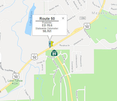 In March 2017, the CTC approved for future consideration of funding a project located in El
Dorado County near the town of Meyers (03-ED-89, PM 8.592; 03-ED-50 PM
70.62) that proposes to convert the US 50/Route 89 intersection into a
three-leg roundabout. The proposed roundabout will have single lane
approaches on all three legs to reduce the number and/or severity of
collisions. This project is programmed in the 2016 SHOPP for $5,240,000 in
Construction (capital and support) and Right of Way (capital and support).
Construction is estimated to beginning in Fiscal Year 2017-18. The scope,
as described for the preferred alternative, is consistent with the project
scope programmed by the Commission in the 2016 State Highway Operation and
Protection Program.
In March 2017, the CTC approved for future consideration of funding a project located in El
Dorado County near the town of Meyers (03-ED-89, PM 8.592; 03-ED-50 PM
70.62) that proposes to convert the US 50/Route 89 intersection into a
three-leg roundabout. The proposed roundabout will have single lane
approaches on all three legs to reduce the number and/or severity of
collisions. This project is programmed in the 2016 SHOPP for $5,240,000 in
Construction (capital and support) and Right of Way (capital and support).
Construction is estimated to beginning in Fiscal Year 2017-18. The scope,
as described for the preferred alternative, is consistent with the project
scope programmed by the Commission in the 2016 State Highway Operation and
Protection Program.
In May 2018, it was reported that a three-year, $56.9
million project (2018 is the second year) involves rebuilding a 2-mile
stretch of U.S. 50 from the "Y" with Route 89 (03-ED-89, PM 8.592;
03-ED-50 PM 70.62) to Trout Creek Bridge (ED 077.33). The rebuilding
includes widening the roadway to provide 6-foot shoulders for bike lanes
in both directions, replacing traffic signals, rebuilding curbs, gutters
and sidewalks, and improving the pavement cross slope, according to
Caltrans. Aside from aesthetic improvements, the project also is designed
to help lake clarity by building drainage systems to treat stormwater
runoff. It is part of the larger Lake Tahoe Environmental Improvement
Program, a multi-agency effort created to protect and improve the natural
and recreational resources of the Lake Tahoe Basin. Work in summer 2018
will stretch from Winnemucca Avenue to Silver Dollar Avenue, in addition
to repaving the Y intersection, according to Caltrans. Work will start at
Winnemucca and move east.
(Source: Tahoe Daily Tribune, 5/2/2018)
In June 2018, the CTC was informed of the following allocation: 2.5f(3) Item 2: $4,973,000 03-ED-50 70.6. PPNO 3303. US 50 Near Myers, at the intersection with Route 89 South. Outcome/Output: Improve safety by constructing a 3-leg roundabout with a bypass lane in the westbound direction at a two-way stop controlled intersection. This project will reduce the number and severity of collisions.
In November 2018, it was reported that in the 2018
construction season, Caltrans completed Phase Two of the three-phase "Y to
Trout Creek Bridge Project" that is reconstructing US 50 from the "Y"
intersection with Route 89 to the Trout Creek Bridge. Phase Two focused on
the stretch of highway from Winnemucca Avenue to Silver Dollar Avenue. As
part of the Lake Tahoe Environmental Improvement Program, this project was
designed to protect Lake Tahoe's water quality by rebuilding underground
storm drain systems. Now, storm water runoff is captured and filtered to
keep dirt, oil and litter from reaching the lake. Additional community
benefits include widening the highway to provide 6-foot shoulders for
safer bike access as well as new traffic signals at the intersection of
Lodi Avenue and US 50. Sidewalks on both sides of the highway have also
been reconstructed. In 2019, the final phase of the Y to Trout Creek
Bridge Project will focus on Phase Three, from Silver Dollar Avenue to the
Trout Creek Bridge, with a projected completion date of winter 2019. 2019
will also bring work in Meyers, where Caltrans will replace the existing
T-intersection at Route 89 and US 50 with a three-leg roundabout.
Currently, the junction just past the weigh-in station does not have
traffic stops controlling vehicle flow. This project was designed to
improve safety and reduce the number of collisions at the intersection.
(Source: Tahoe Daily Tribune, 11/11/2018)
In April 2019, it was reported that the project
will also include a westbound bypass lane, and should be completed in Fall
2019.
(Source: Tahoe Daily Tribune, 4/23/2019)
In September 2019, it was reported that the Caltrans
contractor working on the roundabout at the intersection of Route 89 and
US 50 has completed concrete work on the bypass lane. The $4.1M project
converted a T-intersection into a three-leg roundabout with a bypass lane.
(Source: South Tahoe Now, 9/6/2019)
Pioneer Trail/US Highway 50 Intersection Safety Improvement Project (03-ED-71.3/71.6)
In January 2024, the CTC approved for future
consideration of funding the following project: 03-ED-71.3/71.6 Pioneer
Trail/US Highway 50 Intersection Safety Improvement Project. Convert
signalized T-intersection at the intersection of US 50 and Pioneer Trail
to roundabout. (MND) (PPNO 3355) (LPP). On January 4, 2022, the County
adopted the Mitigated Negative Declaration for the Project and found that
the Project would not have a significant effect on the environment after
mitigation. On December 21, 2023, the County confirmed that the
environmental document remains valid, there are no new identified impacts
requiring mitigation, and the environmental document is consistent with
the Project scope of work programmed by the Commission.
(Source: January 2023 CTC Agenda, Agenda Item 2.2c.(3))
Tahoe Safety Project (03-ED-50-75.4 to 03-ED-50-80.1)
 In March 2021, it was reported that Caltrans was seeking feedback on a proposed safety
project (EA 03-4H890, PPNO 0319000072) on US 50 in South Lake Tahoe. The
purpose of this $16.8 million project is to reduce vehicle collisions with
those who walk and bicycle within this segment of the highway (also
referred to as Lake Tahoe Boulevard within city limits) from the junction
of Route 89 at the “Y” to Pioneer Trail. The project proposes
to improve roadway lighting and implement a complete street vision for the
corridor by installing a green bike lane treatment and enhanced visibility
crosswalks. Placement of the proposed green bike lane treatment will be
focused in areas where bike and vehicle conflicts have occurred as well as
near driveway areas and in bike lane extensions approaching intersections.
The project will also improve bicycle signage throughout the project
limits and install a two-stage turn queue box for bike crossings at
multiple locations for additional bicycle safety. In addition, the project
scope of work includes installing pedestrian signals at mid-block
crossings between Truckee Road and River Drive (PM 76.3), between Brockway
Avenue and Blue Lake Avenue (PM 77.0), and between Herbert Avenue and Ski
Run Boulevard (PM 79.1). These mid-block crossings will provide cyclists
and pedestrians a safe opportunity to cross the highway. A full signalized
intersection will be installed at Johnson Avenue (PM 78.8). Typically,
bicyclists operate as both vehicles and pedestrians depending on the
context, rider abilities, availability, quality, and efficiency of the
facilities. This project will mark and color all intersections and
pedestrian crossings. The final environmental document is anticipated to
be approved in May, with bid advertising in the summer of 2023.
Construction is expected to begin in the spring or summer of 2024 and
scheduled for completion in the fall or winter of 2025.
In March 2021, it was reported that Caltrans was seeking feedback on a proposed safety
project (EA 03-4H890, PPNO 0319000072) on US 50 in South Lake Tahoe. The
purpose of this $16.8 million project is to reduce vehicle collisions with
those who walk and bicycle within this segment of the highway (also
referred to as Lake Tahoe Boulevard within city limits) from the junction
of Route 89 at the “Y” to Pioneer Trail. The project proposes
to improve roadway lighting and implement a complete street vision for the
corridor by installing a green bike lane treatment and enhanced visibility
crosswalks. Placement of the proposed green bike lane treatment will be
focused in areas where bike and vehicle conflicts have occurred as well as
near driveway areas and in bike lane extensions approaching intersections.
The project will also improve bicycle signage throughout the project
limits and install a two-stage turn queue box for bike crossings at
multiple locations for additional bicycle safety. In addition, the project
scope of work includes installing pedestrian signals at mid-block
crossings between Truckee Road and River Drive (PM 76.3), between Brockway
Avenue and Blue Lake Avenue (PM 77.0), and between Herbert Avenue and Ski
Run Boulevard (PM 79.1). These mid-block crossings will provide cyclists
and pedestrians a safe opportunity to cross the highway. A full signalized
intersection will be installed at Johnson Avenue (PM 78.8). Typically,
bicyclists operate as both vehicles and pedestrians depending on the
context, rider abilities, availability, quality, and efficiency of the
facilities. This project will mark and color all intersections and
pedestrian crossings. The final environmental document is anticipated to
be approved in May, with bid advertising in the summer of 2023.
Construction is expected to begin in the spring or summer of 2024 and
scheduled for completion in the fall or winter of 2025.
(Source/Image Source: Tahoe Daily Tribune, 3/5/2021)
In June 2008, the CTC relinquished right of way in the county of El Dorado, between Elks Club Drive and Sawmill Road (~ ED 72.561 to ED 72.71), consisting of state highway right of way, for the purpose of constructing a bike path.
In June 2016, the CTC authorized relinquishment of right of way in the city of South Lake Tahoe along Route 50 between Trout Creek and Ski Run Boulevard (03-ED-50-PM 77.3/79.3 - 11 Segments), consisting of nonmotorized transportation facilities, namely sidewalks and appurtenant facilities. The City, by letter dated April 12, 2016, and by cooperative agreement dated October 27, 2008, agreed to waive the 90-day notice requirement and accept title upon relinquishment by the State.
In January 2012, the CTC approved $3.53 milllion to construct water quality collection and treatment facilities to comply with the California Regional Water Quality Control Board on Route 50, in South Lake Tahoe, west of Ski Run Boulevard to Wildwood Avenue (~ ED 79.274 to ED 79.548).
Lake Tahoe Bypass (~ ED 80.022 to Nevada)
In June 2013, it was reported that the Tahoe
Transportation District has plans to reroute US 50 on a bypass around
downtown Lake Tahoe. The plan would turn a 1.1-mile section of the current
highway, from Pioneer Trail in California to Lake Parkway in Nevada, into
a local “main street.”The realignment would allow for
environmentally sustainable landscaping, a pedestrian-friendly promenade,
a bicycle trail and the kind of transit options local, state and regional
officials and business leaders have been clamoring for in the casino
corridor for decades.However, the bypass itself would have to be built
through at least one neighborhood... meaning that, depending on the chosen
alignment, that historic buildings could be flattened along with dozens of
other homes and businesses. In support of their plan, Tahoe Transportation
District officials released an economic analysis that shows how bypassing
US 50 through town would increase retail sales along the corridor by
between $16 million and $25 million annually. The district has outlined
four realignment alternatives, two of which would place US 50 on a local
road called Lake Parkway. Another option would put only westbound traffic
on Lake Parkway and make the existing highway one-way heading east. The
fourth option would leave US 50 alone and build an elevated promenade, or
skywalk, overhead. The alternatives must still go through an environmental
review, which is expected to take at least 16 months, before a preferred
alternative can be chosen. Final approval by the transportation district,
the Tahoe Regional Planning Agency and Federal Highway Administration, is
not expected for another two or three years.
(Las Vegas Sun, 6/25/2013)
 As of January 2016, it appears the Tahoe Bypass project remains in environmental review
based on the official project page, with the draft environmental document
coming out in the first quarter of 2016 according to the project webpage:
http://www.tahoetransportation.org/us50. A community open house was held on January 26, 2016. Funding remains an
obstacle to any construction project. The alternatives currently are
described as follows:
As of January 2016, it appears the Tahoe Bypass project remains in environmental review
based on the official project page, with the draft environmental document
coming out in the first quarter of 2016 according to the project webpage:
http://www.tahoetransportation.org/us50. A community open house was held on January 26, 2016. Funding remains an
obstacle to any construction project. The alternatives currently are
described as follows:
(Source: Andy3175 @ AAroads, 1/30/2016)
In November 2018, it was reported that the EIS was up
for a vote, with the preferred alternative being Alternative B. In late
October, the Tahoe Regional Planning Agency (TRPA) provided an updated
presentation on the US 50 South Shore Community Revitalization Project,
including plans for the next steps. The project reroutes US 50 from its
current location in front of Heavenly Village and the casinos to behind
Raley's, the Village Center and Harrahs Tahoe. As part of th project, a
"Main Street" plan was shown to the board, one that plans on connecting
the community, its visitors, recreation and economic hubs with a shift of
the highway behind Raley's and the casinos. The co-lead agency on the
bi-state project, the Tahoe Transportation District (TTD), has held
numerous public meetings on the road alignment and have utilized many of
the ideas presented over the years (TRPA is the other co-lead). They have
been working with those living in the neighborhoods that will be affected,
businesses in the area as well as public safety departments and other
locals. The planning diagram shows the establishment of a center from
MontBleu and Hard Rock in the east to the area of the new highway reroute
to the west. There will be designated open space along with visual open
space, a connection between the bed base and recreational opportunities,
and an improvement of connectivity through the creation of complete
streets. Upon completion the project would connect the amenities with the
separate parts of the South Shore, combining all into one. The South Lake
Tahoe plan would create a spine to highlight a pedestrian and transit
oriented street with retail, dining, entertainment and events. The anchors
would be destination recreation, resort hotels and a year-round events
venue (planned for parking lot of MontBleu), and the connections would be
the lake, regional bike and pedestrian trails, and mountain activities and
trails. All of this expected revitalization is estimated in a reduction of
20-40 percent of automobile trips. The key to the success will be parking
lots, and cooperation between entities has begun to have them available
when the project is completed. Caltrans would be the agency in California
that acquires properties that are in the path of the new highway. Before
any homes or apartments are removed, TTD will have 76 deed-restricted and
affordable replacement housing units built for those who live in the plan
area. An MOU (memorandum of understanding) with Pacific Development is
already underway to build those units, and another 33 will be built as
part of the project. There is an option for an additional 91 units. A
neighborhood park is also planned for the neighborhood adjacent to the new
highway along with street lighting, sidewalks, a transit stop and improved
pedestrian access to the Raley's and retail. The new area might be called
"Rocky Point" after a street in the area. The new highway would go through
the area of Primrose and Moss Roads. Douglas County has been saving
$300,000 a year through a five cent gas tax to go towards the project that
would fix up Stateline and the areas east to Kingsbury Grade. The Loop
Road would end with a roundabout at the intersection of US 50 and Lake
Parkway adjacent to MontBleu. Nevada Department of Transportation (NDOT)
will be the lead agency on the Nevada side. The Environmental Impact
Statement (EIS) on the proposed project will come back to the Tahoe
Regional Planning Agency (TRPA) board for a vote during their two-day
meeting November 14-15, 2018. This next step though is a vote on the
project during the next Tahoe Transportation District meeting November 9.
If approved, the US 50 South Shore Community Revitalization Project will
be ready to start the planning process in January 2019. TRPA has dedicated
funds to start on the plan.
(Source: SouthTahoeNow.Com, 11/1/2018)
On 11/15/2018, TTD secured approval from the Tahoe
Regional Planning Agency Governing Board on the final joint environmental
document (EIR/EIS/EIS) for the US 50/South Shore Community Revitalization
Project. The final EIR/EIS/EIS is available on the TTD Project Website.
(Source: US 50/South Shore Community Revitalization Project Website, 11/23/2018)
In August 2019, it was reported that the Tahoe Regional
Planning Agency was hosting an open house on the US 50 Main Street
Management Plan. The Main Street Management Plan pertains to the US 50
South Shore Community Revitalization Project, more commonly referred to as
the Loop Road. The plan calls for realigning US 50 behind on the casino
corridor and Heavenly Village area — from Pioneer Trail on the
California side to Lake Parkway on the Nevada side. The current US 50
alignment through the area is intended to become a “main
street” area. The informational meeting included a series of
stations where attendees provided input on the planning stages, including
draft streetscape options that incorporate bike lanes, pedestrian space,
transit, parking and more.
(Source: Tahoe Daily Tribune, 8/25/2019)
 Commuter Lanes
HOV lanes are in the planning stages for the following segments: 9th Street to Mayhew, Mayhew to Sunrise Blvd.
As of November 2002, according to Joe Rouse, the last segment of the HOV lanes on US-50 in Sacramento and El Dorado Counties was open. The HOV lanes begin at Sunrise Blvd and end at El Dorado Hills Blvd/Latrobe Rd. They are part time lanes, restricted only from 6 - 10 AM mornings and 3 - 7 PM evenings. The widening project also included reconstruction of the Sunrise interchange from a full cloverleaf to a partial cloverleaf interchange, and adding new lanes at the Hazel Avenue interchange.
This carpool lane will eventually be extended eastward to Ponderosa Road and may extend westward into downtown Sacramento. Work has also just started on adding a carpool lane on I-80 between Longview Drive and Riverside Avenue in Roseville. Once this project is complete (2005), additional widening work will then take place between Riverside and CA-65. This may either come in the form of an extension of the carpool lane, a new mixed-flow lane, or auxiliary lanes. Carpool lanes are also planned for I-80 from Longview west to I-5.
In July 2005, the CTC received a notice of EIR preparation for Route 50 in Sacramento County. The alternatives being considered are Alternative 5B — Construct HOV lanes with eastbound drop ramp at 10th Street and westbound drop ramp at 16th Street; Alternative 6B — Construct HOV lanes with eastbound drop ramp at 10th Street and westbound drop ramp at 21st Street; Alternative 7B — Construct HOV lanes with eastbound drop ramp at 21st Street and westbound drop ramp at Riverside Boulevard; Alternative 10D — Construct HOV lanes in the median without drop ramps; and No Build.
 Naming
The portion of this route in metropolitan Sacramento was named the "El Dorado Freeway".
") In 1996, the portion that is cosigned as Business Route 80 between I-80 and the Route 50/Route 99/Route 51 interchange (~ YOL
0.509 to SAC L2.345) was renamed the "Capital City Freeway".
In 1996, the portion that is cosigned as Business Route 80 between I-80 and the Route 50/Route 99/Route 51 interchange (~ YOL
0.509 to SAC L2.345) was renamed the "Capital City Freeway".The interchange of I-5 and US 50 in Sacramento County (~ SAC L0.243) is named the "California State Engineer Memorial Interchange". It was named in tribute to past, present, and future state engineers and related professionals and in honor of the 50th anniversary of the Professional Engineers in California Government (PECG). The men and women who serve Californians as engineers and closely related professionals throughout state government are persons of skill, intelligence, and advanced training who deserve to be recognized for their dedicated service. California’s state engineers and related professionals have paid a high price in serving our state with at least 37 on-the-job deaths in their ranks over the last century. The Legislature desires to promote the safety of the state’s employees and to encourage motorists traveling in and through the state to exercise caution and care when encountering a work zone. California’s state engineers design and inspect the state’s highways and bridges, ensure that schools and hospitals are safe during earthquakes, improve air and water quality, work to reduce fossil fuel emissions, and perform countless other professional functions that create jobs and protect public safety in our state. The Professional Engineers in California Government (PECG) was organized in 1962 in the San Francisco Bay Area area to represent state engineers and address the safety concerns associated with state service, and 2012 represents the 50th anniversary of the organization. PECG represents approximately 13,000 professional engineers, architects, land surveyors, engineering geologists, and closely related professionals serving the public in state government. Nam ed by Assembly Concurrent Resolution 100, Resolution Chapter 109, on September 4, 2012.
The portion of this route between I-5 and Route 99 (~ SAC L0.243 to SAC L2.386) is known as the "WX Freeway" (because it overlays W and X Streets).
Historically, the portion of this route from Route 160 to South Lake Tahoe (~ SAC L1.359 to Nevada) was part of "El Camino Sierra" (Road to the Mountains).
") The portion of this route from Bradshaw Road to the eastern Sacramento County Line (~ SAC R7.768 to SAC 23.136) is named the "William
Alexander Leidesdorff, Jr. Memorial Highway". It was named in memory
of William Alexander Leidesdorff, Jr., a prominent civic leader and
pioneer in the successful quest for California to become the 31st
state in the United States. William Alexander Leidesdorff, Jr. (October
23, 1810 – May 18, 1848) was one of the earliest biracial-black U.S.
citizens in California and one of the founders of the city that became San
Francisco. A highly successful, enterprising businessman, he was a West
Indian immigrant of African Cuban, possibly Carib, Danish and Jewish
ancestry. He was Treasurer of the City of San Francisco, owned the largest
home in the city, constructed the first City Hotel, built the first
commercial shipping warehouse, and donated the land to build the first
public school in California. Born in St. Croix, Virgin Islands in 1810 to
Anna Marie Sparks, an African woman, and William Leidesdorff, Sr., a
citizen of Denmark In 1841, Leidesdorff sailed the first United States
shipping vessel, the Julia Ann, into the sleepy Mexican fishing Village of
Yerba Buena, modern day San Francisco, to establish a world maritime
center. In 1843, he was naturalized as a Mexican citizen in order to
facilitate acquiring a vast land grant from the Mexican authorities in the
Sacramento Valley, and was an early advocate of creating dual United
States citizenship. In 1844, William Alexander Leidesdorff, Jr. obtained
title to Rancho Rio de Los Americanos, well over 35,000 acres of prime
real estate along the south bank of the American River. His global trade
and commerce projects financed, developed, and helped stabilize the
Sacramento Valley. In 1845, he accepted the position of United States
Vice-Consul to the Mexican Alta California region; as such, he was the
first African-American diplomat in history, and was affectionately known
as the "African Founding Father of California". In 1846, he was an active
leader in the Bear Flag Revolt during the Mexican-American War. He went on
to captain the first and only steam ship in California prior to the Gold
Rush of 1848, the Sitka. His maiden steam voyage up the Sacramento River
is immortalized on the California State Seal and recognizes his vision for
increased maritime transportation of California's agricultural products to
world markets. In 1848, prior to his untimely death from brain fever, he
received official notification of vast quantities of gold on his immense
cattle and wheat ranch along today's Route 50 corridor. He is buried near
the entrance of the Old San Francisco Mission Delores Sanctuary. Named by
Assembly Concurrent Resolution 131, Chapter 41, May 3, 2004.
The portion of this route from Bradshaw Road to the eastern Sacramento County Line (~ SAC R7.768 to SAC 23.136) is named the "William
Alexander Leidesdorff, Jr. Memorial Highway". It was named in memory
of William Alexander Leidesdorff, Jr., a prominent civic leader and
pioneer in the successful quest for California to become the 31st
state in the United States. William Alexander Leidesdorff, Jr. (October
23, 1810 – May 18, 1848) was one of the earliest biracial-black U.S.
citizens in California and one of the founders of the city that became San
Francisco. A highly successful, enterprising businessman, he was a West
Indian immigrant of African Cuban, possibly Carib, Danish and Jewish
ancestry. He was Treasurer of the City of San Francisco, owned the largest
home in the city, constructed the first City Hotel, built the first
commercial shipping warehouse, and donated the land to build the first
public school in California. Born in St. Croix, Virgin Islands in 1810 to
Anna Marie Sparks, an African woman, and William Leidesdorff, Sr., a
citizen of Denmark In 1841, Leidesdorff sailed the first United States
shipping vessel, the Julia Ann, into the sleepy Mexican fishing Village of
Yerba Buena, modern day San Francisco, to establish a world maritime
center. In 1843, he was naturalized as a Mexican citizen in order to
facilitate acquiring a vast land grant from the Mexican authorities in the
Sacramento Valley, and was an early advocate of creating dual United
States citizenship. In 1844, William Alexander Leidesdorff, Jr. obtained
title to Rancho Rio de Los Americanos, well over 35,000 acres of prime
real estate along the south bank of the American River. His global trade
and commerce projects financed, developed, and helped stabilize the
Sacramento Valley. In 1845, he accepted the position of United States
Vice-Consul to the Mexican Alta California region; as such, he was the
first African-American diplomat in history, and was affectionately known
as the "African Founding Father of California". In 1846, he was an active
leader in the Bear Flag Revolt during the Mexican-American War. He went on
to captain the first and only steam ship in California prior to the Gold
Rush of 1848, the Sitka. His maiden steam voyage up the Sacramento River
is immortalized on the California State Seal and recognizes his vision for
increased maritime transportation of California's agricultural products to
world markets. In 1848, prior to his untimely death from brain fever, he
received official notification of vast quantities of gold on his immense
cattle and wheat ranch along today's Route 50 corridor. He is buried near
the entrance of the Old San Francisco Mission Delores Sanctuary. Named by
Assembly Concurrent Resolution 131, Chapter 41, May 3, 2004.
(Image source: Wikipedia)
 The interchange at Hazel Avenue and US 50 in the County of Sacramento (~ SAC 15.779) is named the "Senator
Dave Cox Memorial Interchange". Named in memory of State Senator
Dave Cox, who was first elected to the California State Senate in November
2004, and was reelected in 2008. Senator Cox represented the residents of
the First Senate District, which includes all or portions of the Counties
of Alpine, Amador, Calaveras, El Dorado, Lassen, Placer, Plumas, Modoc,
Mono, Nevada, Sacramento, and Sierra. Senator Cox served as Chair of the
Senate Committee on Local Government, Vice Chair of the Senate Committee
on Appropriations, and as a member of the Senate Committee on Banking,
Finance and Insurance, the Senate Committee on Energy, Utilities and
Communications, the Senate Committee on Public Employment and Retirement,
and the Senate Committee on Health. Senator Cox was first elected to the
California State Assembly in November 1998, and the voters overwhelmingly
re elected reelected him in 2000 and 2002. In March of 2001, the Members
of the Assembly Republican Caucus elected then Assembly Member Cox to
serve as their Assembly Republican Leader, a position he held until
January of 2004. During his tenure as Assembly Republican Leader, Dave Cox
led efforts to successfully unite the Republican Caucus against proposals
to raise billions of dollars in new taxes while advocating for a stronger
economy and jobs climate. Dave Cox led the fight against tripling of the
car tax and helped trim waste from the state budget, freeing up money
needed to fund essential education, public safety, and health care
programs. Senator Cox served as a Member of Governor Arnold
Schwarzenegger’s Transition Team. In January of 2009, Senator Cox
was awarded the Patti Mattingly Distinguished Legislator Award by the
Regional Council of Rural Counties. Senator Cox was recognized as the
California Building Industry Association Outstanding Legislator of 2003,
and as Legislator of the Year by the American Electronics Association in
2002, the Consulting Engineers and Land Surveyors of California in 2001,
and the California Business Properties Association in 2001. Senator Cox
was awarded the President’s Award by the California State
Association of Counties in 2001 in recognition of his commitment to
developing sound public policy and service to the citizenry of California.
In 2004, the Northern California Power Agency named Senator Cox as its
State Legislator of the Year. The California State Sheriffs’
Association recognized Senator Cox as one of their Outstanding Senators in
2005, 2007, and 2008; and Prior to his election to the State Assembly,
Senator Cox served for six years on the Sacramento County Board of
Supervisors. Senator Cox also served as a member of the Sacramento
Municipal Utility District Board of Directors, Senior Warden for St.
Francis Episcopal Church of Fair Oaks, and a member of the boards of
directors for the American Red Cross, the Sacramento Metropolitan Chamber
of Commerce, Easter Seals, and KVIE-Channel 6, where he served as Chairman
in 1982. Senator Cox earned a Bachelors in Business Administration at the
University of San Diego in 1961, and a Master of Science in Taxation
Degree at Golden Gate University in 1983. It was named in honor of Senator
Cox’s service to his constituents, the Senate of the State of
California, and to all residents of the state. Named by Senate Concurrent
Resolution 97, Resolution Chapter 105, on August 31, 2012.
The interchange at Hazel Avenue and US 50 in the County of Sacramento (~ SAC 15.779) is named the "Senator
Dave Cox Memorial Interchange". Named in memory of State Senator
Dave Cox, who was first elected to the California State Senate in November
2004, and was reelected in 2008. Senator Cox represented the residents of
the First Senate District, which includes all or portions of the Counties
of Alpine, Amador, Calaveras, El Dorado, Lassen, Placer, Plumas, Modoc,
Mono, Nevada, Sacramento, and Sierra. Senator Cox served as Chair of the
Senate Committee on Local Government, Vice Chair of the Senate Committee
on Appropriations, and as a member of the Senate Committee on Banking,
Finance and Insurance, the Senate Committee on Energy, Utilities and
Communications, the Senate Committee on Public Employment and Retirement,
and the Senate Committee on Health. Senator Cox was first elected to the
California State Assembly in November 1998, and the voters overwhelmingly
re elected reelected him in 2000 and 2002. In March of 2001, the Members
of the Assembly Republican Caucus elected then Assembly Member Cox to
serve as their Assembly Republican Leader, a position he held until
January of 2004. During his tenure as Assembly Republican Leader, Dave Cox
led efforts to successfully unite the Republican Caucus against proposals
to raise billions of dollars in new taxes while advocating for a stronger
economy and jobs climate. Dave Cox led the fight against tripling of the
car tax and helped trim waste from the state budget, freeing up money
needed to fund essential education, public safety, and health care
programs. Senator Cox served as a Member of Governor Arnold
Schwarzenegger’s Transition Team. In January of 2009, Senator Cox
was awarded the Patti Mattingly Distinguished Legislator Award by the
Regional Council of Rural Counties. Senator Cox was recognized as the
California Building Industry Association Outstanding Legislator of 2003,
and as Legislator of the Year by the American Electronics Association in
2002, the Consulting Engineers and Land Surveyors of California in 2001,
and the California Business Properties Association in 2001. Senator Cox
was awarded the President’s Award by the California State
Association of Counties in 2001 in recognition of his commitment to
developing sound public policy and service to the citizenry of California.
In 2004, the Northern California Power Agency named Senator Cox as its
State Legislator of the Year. The California State Sheriffs’
Association recognized Senator Cox as one of their Outstanding Senators in
2005, 2007, and 2008; and Prior to his election to the State Assembly,
Senator Cox served for six years on the Sacramento County Board of
Supervisors. Senator Cox also served as a member of the Sacramento
Municipal Utility District Board of Directors, Senior Warden for St.
Francis Episcopal Church of Fair Oaks, and a member of the boards of
directors for the American Red Cross, the Sacramento Metropolitan Chamber
of Commerce, Easter Seals, and KVIE-Channel 6, where he served as Chairman
in 1982. Senator Cox earned a Bachelors in Business Administration at the
University of San Diego in 1961, and a Master of Science in Taxation
Degree at Golden Gate University in 1983. It was named in honor of Senator
Cox’s service to his constituents, the Senate of the State of
California, and to all residents of the state. Named by Senate Concurrent
Resolution 97, Resolution Chapter 105, on August 31, 2012.
(Image sources: Sen. Ted Gaines Newsletter, Galt Herald)
 French Memorial Highway") The portion of US 50 in the County of El Dorado
from (ED 0.01) to the Latrobe Road Under Crossing (ED 0.857) is named the
"Deputy Sheriff Robert “Bobby” French Memorial Highway".
It was named in memory of Sacramento County Deputy Sheriff, Robert "Bobby"
French, born in January 1965, who was killed in the line of duty on August
30, 2017. Deputy Sheriff French was a 21-year veteran of the Sacramento
County Sheriff’s Department and was a training officer with the
north area patrol division. He was well respected and he was someone
deputies would go to for advice and counsel according to Sheriff Scott
Jones . Even at 52 years of age and with 21 years on the force, Deputy
Sheriff French still loved the daily routines of being a cop: putting on
the uniform, talking to community members, and driving his patrol car
around the vast suburban landscape north of the American River. Deputy
Sheriff French was a patrol deputy since 2000 and a training officer who
mentored new deputies. On his days off, he also worked as a school
resource officer for the San Juan Unified School District. Deputy Sheriff
French was a resident of El Dorado Hills. Named by Assembly Concurrent
Resolution (ACR) 212, Res. Chapter 153, 8/17/2018.
The portion of US 50 in the County of El Dorado
from (ED 0.01) to the Latrobe Road Under Crossing (ED 0.857) is named the
"Deputy Sheriff Robert “Bobby” French Memorial Highway".
It was named in memory of Sacramento County Deputy Sheriff, Robert "Bobby"
French, born in January 1965, who was killed in the line of duty on August
30, 2017. Deputy Sheriff French was a 21-year veteran of the Sacramento
County Sheriff’s Department and was a training officer with the
north area patrol division. He was well respected and he was someone
deputies would go to for advice and counsel according to Sheriff Scott
Jones . Even at 52 years of age and with 21 years on the force, Deputy
Sheriff French still loved the daily routines of being a cop: putting on
the uniform, talking to community members, and driving his patrol car
around the vast suburban landscape north of the American River. Deputy
Sheriff French was a patrol deputy since 2000 and a training officer who
mentored new deputies. On his days off, he also worked as a school
resource officer for the San Juan Unified School District. Deputy Sheriff
French was a resident of El Dorado Hills. Named by Assembly Concurrent
Resolution (ACR) 212, Res. Chapter 153, 8/17/2018.
(Image source: Facebook; Hartford Courant)
 The portion of US 50 in El Dorado County from Cambridge Road Over Crossing 2583 (PM ED
4.962) to Cameron Park Drive Under Crossing 25-84 (PM ED 6.570) is named
the "Deputy Sheriff Danny P. Oliver Memorial Highway". It was
named in memory of Danny P. Oliver, who grew up in the Del Paso Heights
neighborhood of Sacramento and graduated from Grant High School. Growing
up in that “tough part” of town “allowed him to
understand people” and gave him a street sense that served him well
as a sheriff’s deputy, according to his wife. While Danny
Oliver’s father was a firefighter and would have enjoyed having his
son seek the same professional path, Danny instead gravitated toward a
career in law enforcement. He attended the sheriff’s academy and
finished at the top of his class academically while his wife worked two
jobs to support his training and their family. Deputy Sheriff Oliver
joined the Sacramento County Sheriff’s Department in 1999 and worked
the graveyard shift for a decade. Deputy Sheriff Oliver was a dedicated
street cop who always showed up for work an hour early and went after the
worst criminals on his beat. Though he loved catching the “bad
guys,” Deputy Sheriff Oliver also had a soft side. He once arrested
a woman on a drug charge who was with her daughter. She appeared stable,
so he uncuffed the suspect and let her sit with her young daughter. As he
left them, the suspect’s daughter called Deputy Sheriff Oliver a
teddy bear—a term that became his nickname in the department. Deputy
Sheriff Oliver was also dedicated to his family. He helped his daughters
with their schoolwork and did CrossFit exercises with them, but he never
felt that they had to be like him. . Deputy Sheriff Oliver also had a soft
heart and enjoyed connecting with the Sacramento County community he was
charged with protecting, answering emails from concerned citizens, and
never declining to attend a neighborhood meeting. Deputy Sheriff Oliver,
at 47 years of age, was shot and killed on October 24, 2014, in the
parking lot of a Motel 6 on Arden Way in Sacramento County as he and
Deputy Sheriff Michael David Davis, Jr., who was on assignment as an
acting detective, were investigating a suspicious vehicle. A male occupant
of the vehicle had opened fire on the deputies with a 9mm handgun,
striking Deputy Sheriff Oliver in the forehead. The man and a female
occupant then fled in the vehicle as his partner returned fire. A short
distance away the male shot a civilian when the couple attempted to
carjack the man’s pickup truck. The couple then carjacked two other
vehicles as they continued fleeing the area. The man suspected of killing
Deputy Sheriff Oliver, Luis Enrique Monroy-Bracamonte, is also accused in
the shooting death of Placer County Deputy Sheriff Michael David Davis,
Jr. that same day in the City of Auburn. Named by Senate Concurrent
Resolution 152, Res. Chapter 184, 9/9/2016.
The portion of US 50 in El Dorado County from Cambridge Road Over Crossing 2583 (PM ED
4.962) to Cameron Park Drive Under Crossing 25-84 (PM ED 6.570) is named
the "Deputy Sheriff Danny P. Oliver Memorial Highway". It was
named in memory of Danny P. Oliver, who grew up in the Del Paso Heights
neighborhood of Sacramento and graduated from Grant High School. Growing
up in that “tough part” of town “allowed him to
understand people” and gave him a street sense that served him well
as a sheriff’s deputy, according to his wife. While Danny
Oliver’s father was a firefighter and would have enjoyed having his
son seek the same professional path, Danny instead gravitated toward a
career in law enforcement. He attended the sheriff’s academy and
finished at the top of his class academically while his wife worked two
jobs to support his training and their family. Deputy Sheriff Oliver
joined the Sacramento County Sheriff’s Department in 1999 and worked
the graveyard shift for a decade. Deputy Sheriff Oliver was a dedicated
street cop who always showed up for work an hour early and went after the
worst criminals on his beat. Though he loved catching the “bad
guys,” Deputy Sheriff Oliver also had a soft side. He once arrested
a woman on a drug charge who was with her daughter. She appeared stable,
so he uncuffed the suspect and let her sit with her young daughter. As he
left them, the suspect’s daughter called Deputy Sheriff Oliver a
teddy bear—a term that became his nickname in the department. Deputy
Sheriff Oliver was also dedicated to his family. He helped his daughters
with their schoolwork and did CrossFit exercises with them, but he never
felt that they had to be like him. . Deputy Sheriff Oliver also had a soft
heart and enjoyed connecting with the Sacramento County community he was
charged with protecting, answering emails from concerned citizens, and
never declining to attend a neighborhood meeting. Deputy Sheriff Oliver,
at 47 years of age, was shot and killed on October 24, 2014, in the
parking lot of a Motel 6 on Arden Way in Sacramento County as he and
Deputy Sheriff Michael David Davis, Jr., who was on assignment as an
acting detective, were investigating a suspicious vehicle. A male occupant
of the vehicle had opened fire on the deputies with a 9mm handgun,
striking Deputy Sheriff Oliver in the forehead. The man and a female
occupant then fled in the vehicle as his partner returned fire. A short
distance away the male shot a civilian when the couple attempted to
carjack the man’s pickup truck. The couple then carjacked two other
vehicles as they continued fleeing the area. The man suspected of killing
Deputy Sheriff Oliver, Luis Enrique Monroy-Bracamonte, is also accused in
the shooting death of Placer County Deputy Sheriff Michael David Davis,
Jr. that same day in the City of Auburn. Named by Senate Concurrent
Resolution 152, Res. Chapter 184, 9/9/2016.
(Image sources: Sacramento Bee; Officer Down Memorial Page)
 Russell Memorial Fwy") The portion of US 50, in the vicinity of eastbound PM ED 08.533
and westbound PM ED 08.598 in the community of Shingle Springs in El
Dorado County, is named the "CHP Officer Douglas "Scott" Russell
Memorial Freeway" This segment was named in memory of Douglas
"Scott" Russell, who was born on September 18, 1960, in Castro Valley. He
graduated from Amador High School in 1978, where he played offensive
tackle on the football team, saxophone in the school band, and clarinet in
the marching band, and he later attended Chabot College for two years
before joining the California Highway Patrol (CHP) Academy. After
graduation from the academy in October of 1985, Officer Russell, CHP badge
number 11619, served four years in Hayward. Officer Russell later had
assignments in the Bridgeport area and the Investigative Services Section,
where he was selected to serve on the Campaign Against Marijuana Program.
In June of 2000, Officer Russell was assigned to the Placerville area.
Officer Russell was admired for his keen investigative skills, strong work
ethic, enchanting sense of humor, impressive athletic ability, stunning
professionalism, and heartfelt concern for the safety and well being of
others. Officer Russell was well respected by his fellow officers and
supervisors, which earned him Officer of the Year in 2003. In his spare
time, Officer Russell was an avid golfer and forged many life-long
friendships while on the golf course. On July 31, 2007, Officer Russell
was tragically struck by a fleeing suspect's vehicle as he deployed a
spike strip to end a pursuit on eastbound US 50 in the community of
Shingle Springs in El Dorado County. Officer Russell was married to the
love of his life, Lynn McCourtney, in April of 1997. They enjoyed dining
out with friends, spending time in their backyard oasis, and entertaining
during the Christmas holidays. In 2007 Lynn was diagnosed with breast
cancer. Officer Russell went into battle alongside his wife. He was a
wonderful caregiver and even shaved his head in show of support when his
wife was undergoing chemotherapy. Officer Russell is survived by his wife,
Lynn M. Russell, as well as his mother Betty Elliot, sister, Heidi Kaye,
nephew Scott Kaye, and nieces Danielle and Dawn Kaye. Officer Russell will
always be admired for his hard work and dedication to the CHP and the
citizens of California. Officer Russell was an outstanding man and will
never be forgotten. Named by Senate Concurrent Resolution (SCR) 100,
Resolution Chapter 70, on 8/4/2010.
The portion of US 50, in the vicinity of eastbound PM ED 08.533
and westbound PM ED 08.598 in the community of Shingle Springs in El
Dorado County, is named the "CHP Officer Douglas "Scott" Russell
Memorial Freeway" This segment was named in memory of Douglas
"Scott" Russell, who was born on September 18, 1960, in Castro Valley. He
graduated from Amador High School in 1978, where he played offensive
tackle on the football team, saxophone in the school band, and clarinet in
the marching band, and he later attended Chabot College for two years
before joining the California Highway Patrol (CHP) Academy. After
graduation from the academy in October of 1985, Officer Russell, CHP badge
number 11619, served four years in Hayward. Officer Russell later had
assignments in the Bridgeport area and the Investigative Services Section,
where he was selected to serve on the Campaign Against Marijuana Program.
In June of 2000, Officer Russell was assigned to the Placerville area.
Officer Russell was admired for his keen investigative skills, strong work
ethic, enchanting sense of humor, impressive athletic ability, stunning
professionalism, and heartfelt concern for the safety and well being of
others. Officer Russell was well respected by his fellow officers and
supervisors, which earned him Officer of the Year in 2003. In his spare
time, Officer Russell was an avid golfer and forged many life-long
friendships while on the golf course. On July 31, 2007, Officer Russell
was tragically struck by a fleeing suspect's vehicle as he deployed a
spike strip to end a pursuit on eastbound US 50 in the community of
Shingle Springs in El Dorado County. Officer Russell was married to the
love of his life, Lynn McCourtney, in April of 1997. They enjoyed dining
out with friends, spending time in their backyard oasis, and entertaining
during the Christmas holidays. In 2007 Lynn was diagnosed with breast
cancer. Officer Russell went into battle alongside his wife. He was a
wonderful caregiver and even shaved his head in show of support when his
wife was undergoing chemotherapy. Officer Russell is survived by his wife,
Lynn M. Russell, as well as his mother Betty Elliot, sister, Heidi Kaye,
nephew Scott Kaye, and nieces Danielle and Dawn Kaye. Officer Russell will
always be admired for his hard work and dedication to the CHP and the
citizens of California. Officer Russell was an outstanding man and will
never be forgotten. Named by Senate Concurrent Resolution (SCR) 100,
Resolution Chapter 70, on 8/4/2010.
(Image source: Mountain Democrat; Mountain Democrat)
 Ishmael") The portion of US 50 in the County of El Dorado from east
of the Missouri Flat Road Overcrossing OC#25-121 (post mile R15.08) to
west of the Ray Lawyer Drive Overcrossing OC#25-117 (post mile 16.32) is
named the Deputy Sheriff Brian “Ish” Ishmael Memorial
Highway. It was named in memory of Brian David “Ish”
Ishmael, who was born in Placerville, California in December 1981. Brian
was a local child who attended schools in the County of El Dorado,
graduating from Ponderosa High School in 2000. In high school, Brian
showed a special interest in, and excelled at, auto body shop and peer
counseling. It was during these early years that Brian made some of his
lifelong friendships, which would lead him to meeting his wife, Katie, at
the age of 16. After high school, Brian moved to Texas where he attended
Universal Technical Institute, but he maintained his close friendships in
the County of El Dorado. After returning from Texas, Brian became an auto
body technician, and, although he loved working on cars, Brian regretted
not having served in the military and found he had a calling to become a
police officer. With his 30th birthday approaching, Brian felt
it was his last chance to follow through on his dream of becoming a police
officer. With a wife and two young daughters at home, and while working
full time, Brian entered the Basic Law Enforcement Academy offered through
American River College. After completing his training, Brian found his
first law enforcement family with the Placerville Police Department in
March 2013. In October 2015, Brian found his final law enforcement family
with the El Dorado County Sheriff’s Office and, as he did in every
facet of his life, Brian immediately became a favorite of his partners and
all who met him on a personal and professional level. Brian’s
demeanor while performing law enforcement duties exemplified fairness,
compassion, and a willingness to serve, which will leave a lasting
impression on those with whom he came in contact throughout his career.
Brian, who was meant to be a police officer and took much pride in wearing
the badge, was a hard worker, a role model, and leader who shared his joy
for life with everyone he met. In the early hours of October 23, 2019,
Brian was on patrol and responded to a call for a theft of marijuana from
what was later found to be an illegal marijuana grow. Brian and his
off-duty ride-along were immediately met with gunfire and returned fire.
During the gun battle, Brian was struck multiple times. The off-duty
officer, having also been shot, was able to assist in removing Brian from
the scene in an attempt to save his life. Sadly, Brian passed away in the
ambulance on the way to the same hospital where he was born 37 years
before. After an extensive investigation, three men who were tending the
illegal marijuana grow and the homeowner were arrested. Named by Senate
Concurrent Resolution (SCR) 89, Res. Chapter 34, 09/11/20.
The portion of US 50 in the County of El Dorado from east
of the Missouri Flat Road Overcrossing OC#25-121 (post mile R15.08) to
west of the Ray Lawyer Drive Overcrossing OC#25-117 (post mile 16.32) is
named the Deputy Sheriff Brian “Ish” Ishmael Memorial
Highway. It was named in memory of Brian David “Ish”
Ishmael, who was born in Placerville, California in December 1981. Brian
was a local child who attended schools in the County of El Dorado,
graduating from Ponderosa High School in 2000. In high school, Brian
showed a special interest in, and excelled at, auto body shop and peer
counseling. It was during these early years that Brian made some of his
lifelong friendships, which would lead him to meeting his wife, Katie, at
the age of 16. After high school, Brian moved to Texas where he attended
Universal Technical Institute, but he maintained his close friendships in
the County of El Dorado. After returning from Texas, Brian became an auto
body technician, and, although he loved working on cars, Brian regretted
not having served in the military and found he had a calling to become a
police officer. With his 30th birthday approaching, Brian felt
it was his last chance to follow through on his dream of becoming a police
officer. With a wife and two young daughters at home, and while working
full time, Brian entered the Basic Law Enforcement Academy offered through
American River College. After completing his training, Brian found his
first law enforcement family with the Placerville Police Department in
March 2013. In October 2015, Brian found his final law enforcement family
with the El Dorado County Sheriff’s Office and, as he did in every
facet of his life, Brian immediately became a favorite of his partners and
all who met him on a personal and professional level. Brian’s
demeanor while performing law enforcement duties exemplified fairness,
compassion, and a willingness to serve, which will leave a lasting
impression on those with whom he came in contact throughout his career.
Brian, who was meant to be a police officer and took much pride in wearing
the badge, was a hard worker, a role model, and leader who shared his joy
for life with everyone he met. In the early hours of October 23, 2019,
Brian was on patrol and responded to a call for a theft of marijuana from
what was later found to be an illegal marijuana grow. Brian and his
off-duty ride-along were immediately met with gunfire and returned fire.
During the gun battle, Brian was struck multiple times. The off-duty
officer, having also been shot, was able to assist in removing Brian from
the scene in an attempt to save his life. Sadly, Brian passed away in the
ambulance on the way to the same hospital where he was born 37 years
before. After an extensive investigation, three men who were tending the
illegal marijuana grow and the homeowner were arrested. Named by Senate
Concurrent Resolution (SCR) 89, Res. Chapter 34, 09/11/20.
(Image source: Mountain Democrat)
Another name historically applied to the portion of this route from E of Smith Flat (~ ED 20.384 to Nevada) to Lake Tahoe is the "Lake Tahoe Wagon Road".
 The portion of this route commencing at PM ED 38.5, which is west of Ice House Road
outside of Pollock Pines, and terminating at PM ED 40.5 in El Dorado
County is named the "Stephanie Marie Frazier Memorial Highway".
This segment was named in memory of Stephanie Marie Frazier, who was born
on October 12, 1980 and passed away on December 16, 2000, when she was
just 20 years of age, from injuries sustained in an automobile accident on
US 50 near Ice House Road. As a child, Stephanie attended Tabernacle
Baptist School in Concord, California until the eighth grade, and
subsequently attended high school at Liberty Union High School in
Brentwood, California, where she was on the volleyball team, basketball
team, and swim team. After graduating from high school in 1998, Stephanie
attended Diablo Valley College in Pleasant Hill, California as a full-time
student where she was on the student council and supported herself
financially through her employment with Dennis Tierney and Associates.
Stephanie's dream was to attend the University of California at Davis, and
she had been accepted to transfer there in the fall of 2001, to major in
managerial economics. Stephanie's life was taken on December 16, 2000,
when another car crossed over the center divider on US 50, just west of
Ice House Road, and hit the car in which Stephanie and her sister,
Lindsey, were riding. The accident occurred during finals week, and for
the first time in its history, Diablo Valley College awarded an honorary
associate of arts degree in Stephanie's memory during its graduation
ceremony. After the accident, Stephanie's family worked diligently with
the Department of Transportation to improve US 50 where the accident
occurred, analyzing 14 years of accident data, and hiring a highway
traffic consultant who suggested specific improvements to make that
portion of the highway safer. In July 2006, the majority of those changes
were completed, including restriping the dangerous section, doubling
maintenance patrols, and in 2007, a special deicing agent will be placed
on the road. The Frazier family also established a nonprofit foundation in
Stephanie's memory, the Stephanie Marie Frazier Memorial Foundation, to
provide meals to families whose children are hospitalized. Through their
program, the Network of Care, which serves 31 hospitals in 12 counties
throughout the state, they have helped over 10,000 families with the gifts
of comfort, hope, and nourishment. Named by Senate Concurrent Resolution
(SCR) 22, Resolution Chapter 88, on 7/10/2007.
The portion of this route commencing at PM ED 38.5, which is west of Ice House Road
outside of Pollock Pines, and terminating at PM ED 40.5 in El Dorado
County is named the "Stephanie Marie Frazier Memorial Highway".
This segment was named in memory of Stephanie Marie Frazier, who was born
on October 12, 1980 and passed away on December 16, 2000, when she was
just 20 years of age, from injuries sustained in an automobile accident on
US 50 near Ice House Road. As a child, Stephanie attended Tabernacle
Baptist School in Concord, California until the eighth grade, and
subsequently attended high school at Liberty Union High School in
Brentwood, California, where she was on the volleyball team, basketball
team, and swim team. After graduating from high school in 1998, Stephanie
attended Diablo Valley College in Pleasant Hill, California as a full-time
student where she was on the student council and supported herself
financially through her employment with Dennis Tierney and Associates.
Stephanie's dream was to attend the University of California at Davis, and
she had been accepted to transfer there in the fall of 2001, to major in
managerial economics. Stephanie's life was taken on December 16, 2000,
when another car crossed over the center divider on US 50, just west of
Ice House Road, and hit the car in which Stephanie and her sister,
Lindsey, were riding. The accident occurred during finals week, and for
the first time in its history, Diablo Valley College awarded an honorary
associate of arts degree in Stephanie's memory during its graduation
ceremony. After the accident, Stephanie's family worked diligently with
the Department of Transportation to improve US 50 where the accident
occurred, analyzing 14 years of accident data, and hiring a highway
traffic consultant who suggested specific improvements to make that
portion of the highway safer. In July 2006, the majority of those changes
were completed, including restriping the dangerous section, doubling
maintenance patrols, and in 2007, a special deicing agent will be placed
on the road. The Frazier family also established a nonprofit foundation in
Stephanie's memory, the Stephanie Marie Frazier Memorial Foundation, to
provide meals to families whose children are hospitalized. Through their
program, the Network of Care, which serves 31 hospitals in 12 counties
throughout the state, they have helped over 10,000 families with the gifts
of comfort, hope, and nourishment. Named by Senate Concurrent Resolution
(SCR) 22, Resolution Chapter 88, on 7/10/2007.
(Image sources: Romick in Oakley; Legacy)
 Hallenbeck Memorial Highway") The portion of US 50 from the intersection
with Mount Ralston Road (PM ED R61.845) to Echo Summit (PM ED R66.483) in
the County of El Dorado (near the community of Twin Bridges) is named the
"Firefighter Michael “Mikey” Hallenbeck Memorial Highway".
It was named in memory of Michael “Mikey” Hallenbeck, a
resident of Shingle Springs, California, who in 2015 was in his first year
as a firefighter working as a member of Organized Crew 36 of the Lake
Tahoe Basin Management Unit of the United States Forest Service, which is
responsible for 191,000 acres of national forest lands. Prior to becoming
a firefighter, Michael had been employed as a ski lift operator in the
Lake Tahoe area. In early August 2015, the Sierra Fire started in the
jurisdiction of Michael’s firefighting unit, and Michael was struck
by a falling tree while fighting to control the blaze. Michael, 21, later
succumbed to the injuries he tragically sustained while combating the
Sierra Fire. Michael’s sacrifice serves as a reminder of the heroic
work done by men and women, like Michael, who put themselves in danger,
and of the importance of continuing to learn from these misfortunes and
adjusting safety measures during the arduous wildfire season. Named by
Senate Concurrent Resolution 149, Res. Chapter 182, 9/9/2016.
The portion of US 50 from the intersection
with Mount Ralston Road (PM ED R61.845) to Echo Summit (PM ED R66.483) in
the County of El Dorado (near the community of Twin Bridges) is named the
"Firefighter Michael “Mikey” Hallenbeck Memorial Highway".
It was named in memory of Michael “Mikey” Hallenbeck, a
resident of Shingle Springs, California, who in 2015 was in his first year
as a firefighter working as a member of Organized Crew 36 of the Lake
Tahoe Basin Management Unit of the United States Forest Service, which is
responsible for 191,000 acres of national forest lands. Prior to becoming
a firefighter, Michael had been employed as a ski lift operator in the
Lake Tahoe area. In early August 2015, the Sierra Fire started in the
jurisdiction of Michael’s firefighting unit, and Michael was struck
by a falling tree while fighting to control the blaze. Michael, 21, later
succumbed to the injuries he tragically sustained while combating the
Sierra Fire. Michael’s sacrifice serves as a reminder of the heroic
work done by men and women, like Michael, who put themselves in danger,
and of the importance of continuing to learn from these misfortunes and
adjusting safety measures during the arduous wildfire season. Named by
Senate Concurrent Resolution 149, Res. Chapter 182, 9/9/2016.
(Image source: Tahoe Fund; National Fallen Fire Fighters Foundation)
 Named Structures
Bridge 24-0004 (L000.01), the bridge over the Sacramento River connecting Sacramento and Yolo counties, is named the "Pioneer Memorial Bridge". It was built in 1966.
 The Mather Field Road overcrossing in Rancho Cordova (Bridge 24-0175, SAC R009.51) is named the
"Alice Livingston Memorial Overcrossing". Alice Livingston was born
Elisa Espinosa, the third of eight children, on August 4, 1936, in
Norwalk, California. She graduated from Huntington Beach Union High School
and Orange County Coast Community College. In 1958, she moved to Spain,
working for the United States government as a civil service employee. She
married an airman in the US Air Force and gave birth to her first daughter
Terrie. In 1962, she returned to the United States, settling in El Cajon,
California, where she gave birth to her second daughter Susan. In December
1979, she moved with her younger daughter to Sacramento, California, and
began more than 20 years of service with the California State Assembly as
a member of the Assembly stenography pool. In January 1980, Alice
Livingston joined the staff of the Assembly Committee on Revenue and
Taxation, chaired by then Assembly Member Wadie Deddeh. In 1983, she began
working for then Speaker pro Tempore Frank Vicencia. In March 1987, she
began working for the Assembly Transportation Committee, where she
provided exemplary service as committee secretary under several chairs
over the course of 15 years; including former Assembly Members Richard
Katz (1987-95), Antonio Villaraigosa (1995-96), and Larry Bowler
(1996-97), then Assembly Members and current Senators Kevin Murray
(1997-99) and Tom Torlakson (1999-2001), and finally Chair Assembly Member
John Dutra. Alice Livingston grew to serve as a mentor to others in the
position of committee secretary, and was ultimately designated to help
train staff for the position. In May 2002, she fell ill and was later
diagnosed with lung cancer, ultimately succumbing to the condition at the
age of 65 on the morning of Thursday, June 6, 2002. In the midst of her
illness, she continued to inquire about her colleagues in the Legislature
and the daily business of the Assembly Transportation Committee,
requesting copies of the Senate and Assembly Daily Files and offering
several times to "come in and help out at work". During her years of
service to the Legislature, and most notably her tenure as a committee
secretary, Alice Livingston served with great distinction and ceaseless
dedication, observing the highest standards of conduct and ethics as a
professional Legislative staff member. Named by Assembly Concurrent
Resolution 223, Chapter 144, on September 3, 2002.
The Mather Field Road overcrossing in Rancho Cordova (Bridge 24-0175, SAC R009.51) is named the
"Alice Livingston Memorial Overcrossing". Alice Livingston was born
Elisa Espinosa, the third of eight children, on August 4, 1936, in
Norwalk, California. She graduated from Huntington Beach Union High School
and Orange County Coast Community College. In 1958, she moved to Spain,
working for the United States government as a civil service employee. She
married an airman in the US Air Force and gave birth to her first daughter
Terrie. In 1962, she returned to the United States, settling in El Cajon,
California, where she gave birth to her second daughter Susan. In December
1979, she moved with her younger daughter to Sacramento, California, and
began more than 20 years of service with the California State Assembly as
a member of the Assembly stenography pool. In January 1980, Alice
Livingston joined the staff of the Assembly Committee on Revenue and
Taxation, chaired by then Assembly Member Wadie Deddeh. In 1983, she began
working for then Speaker pro Tempore Frank Vicencia. In March 1987, she
began working for the Assembly Transportation Committee, where she
provided exemplary service as committee secretary under several chairs
over the course of 15 years; including former Assembly Members Richard
Katz (1987-95), Antonio Villaraigosa (1995-96), and Larry Bowler
(1996-97), then Assembly Members and current Senators Kevin Murray
(1997-99) and Tom Torlakson (1999-2001), and finally Chair Assembly Member
John Dutra. Alice Livingston grew to serve as a mentor to others in the
position of committee secretary, and was ultimately designated to help
train staff for the position. In May 2002, she fell ill and was later
diagnosed with lung cancer, ultimately succumbing to the condition at the
age of 65 on the morning of Thursday, June 6, 2002. In the midst of her
illness, she continued to inquire about her colleagues in the Legislature
and the daily business of the Assembly Transportation Committee,
requesting copies of the Senate and Assembly Daily Files and offering
several times to "come in and help out at work". During her years of
service to the Legislature, and most notably her tenure as a committee
secretary, Alice Livingston served with great distinction and ceaseless
dedication, observing the highest standards of conduct and ethics as a
professional Legislative staff member. Named by Assembly Concurrent
Resolution 223, Chapter 144, on September 3, 2002.
(Image source: Flikr)
The bicycle bridge on the Hazel Avenue overpass over US 50 (Bridge 24-0366, SAC 16.17) is named the George M. Clark Memorial Bicycle Bridge. It was named in memory of George M. Clark (1938-1996), who died while on a hike looking for new species of flowers in Lake County, California. He worked at Aerojet General Corporation as a chemist, was an avid outdoorsman and was President of the California Native Plant Society. As a resident of Orangevale, he commuted by bicycle to his job at Aerojet every day. was instrumental in convincing the County of Sacramento to construct a bicycle bridge over US 50 at Hazel Avenue between Fair Oaks and Rancho Cordova to provide a safe bicycle route through this heavily traveled corridor. Named by Assembly Concurrent Resolution 151, August 19, 2004, Chapter 149.
 Bridge 25-0005, the "Weber Creek Bridge" in El Dorado county (ED 015.42), is officially designated the "El Dorado County Vietnam
Veterans Bridge". Named by Assembly Concurrent Resolution No. 7,
Chapter 51, in 1993.
Bridge 25-0005, the "Weber Creek Bridge" in El Dorado county (ED 015.42), is officially designated the "El Dorado County Vietnam
Veterans Bridge". Named by Assembly Concurrent Resolution No. 7,
Chapter 51, in 1993.
(Image source: Facebook)
 The overcrossing that spans Route 50 at Ray Lawyer Drive in the County of El
Dorado (~ ED 16.527) (near Placerville) is named the "Staff Sergeant
Sky R. Mote Memorial Overcrossing". It was named in memory of Staff
Sergeant Sky R. Mote, who was assigned to the 1st Marine
Special Operations Battalion at Camp Pendleton, California. Staff Sgt.
Mote was killed August 10, 2012, in Helmand province, Afghanistan, along
with two other Marines. Staff Sergeant Mote was born in Bishop,
California, and raised by his father and his new wife, in El Dorado,
California. From an early age, he spoke of joining the military, motivated
in part by a love of airplanes and the desire to work with them. Staff
Sergeant Mote graduated from Union Mine High School in El Dorado in 2003
and joined the Marines that same year. He deployed to Iraq as a
bomb-disposal specialist, and twice to Afghanistan to work with the
Marines special forces. After his death, people who served with Staff
Sergeant Mote spoke about his heroism in battle. In one case, a captain
spoke of stepping on an improvised explosive device in Afghanistan, and of
how Mote found his way to him, applying tourniquets and preventing him
from bleeding to death. Staff Sergeant Mote received the Navy Cross, a
Purple Heart, a Navy-Marine Corps Commendation Medal, a Navy-Marine Corps
Achievement Medal, two Combat Action Ribbons, and three Good Conduct
Medals. By his undaunted courage, intrepid fighting spirit, and unwavering
devotion to duty in the face of certain death, Staff Sergeant Mote saved
his comrades from further injury or possibly death, thereby reflecting
great credit upon himself and upholding the highest traditions of the
Marine Corps and the United States Naval Service. It was named by Assembly
Concurrent Resolution 97, Resolution Chapter 37, on 05/30/14.
The overcrossing that spans Route 50 at Ray Lawyer Drive in the County of El
Dorado (~ ED 16.527) (near Placerville) is named the "Staff Sergeant
Sky R. Mote Memorial Overcrossing". It was named in memory of Staff
Sergeant Sky R. Mote, who was assigned to the 1st Marine
Special Operations Battalion at Camp Pendleton, California. Staff Sgt.
Mote was killed August 10, 2012, in Helmand province, Afghanistan, along
with two other Marines. Staff Sergeant Mote was born in Bishop,
California, and raised by his father and his new wife, in El Dorado,
California. From an early age, he spoke of joining the military, motivated
in part by a love of airplanes and the desire to work with them. Staff
Sergeant Mote graduated from Union Mine High School in El Dorado in 2003
and joined the Marines that same year. He deployed to Iraq as a
bomb-disposal specialist, and twice to Afghanistan to work with the
Marines special forces. After his death, people who served with Staff
Sergeant Mote spoke about his heroism in battle. In one case, a captain
spoke of stepping on an improvised explosive device in Afghanistan, and of
how Mote found his way to him, applying tourniquets and preventing him
from bleeding to death. Staff Sergeant Mote received the Navy Cross, a
Purple Heart, a Navy-Marine Corps Commendation Medal, a Navy-Marine Corps
Achievement Medal, two Combat Action Ribbons, and three Good Conduct
Medals. By his undaunted courage, intrepid fighting spirit, and unwavering
devotion to duty in the face of certain death, Staff Sergeant Mote saved
his comrades from further injury or possibly death, thereby reflecting
great credit upon himself and upholding the highest traditions of the
Marine Corps and the United States Naval Service. It was named by Assembly
Concurrent Resolution 97, Resolution Chapter 37, on 05/30/14.
(Image source: Village Life)
Bridge No. 25-0098 and Bridge No. 25-0099 (ED R044.12 and R044.24) near the junction of Alder Creek and the South Fork of the American River are officially designated the "El Dorado County Veterans Bridges". They were built in 1990, and named by Senate Concurrent Resolution No. 58, Chapter 134, in 1994.
 National Trails
Lincoln Highway
 This part was part of the coast-to-coast "Lincoln Highway" between the Nevada border and the junction with US 40 into
San Francisco. The Lincoln Highway presently would encompass not only US 50, but a portion of I-5 and a portion of I-580.
This part was part of the coast-to-coast "Lincoln Highway" between the Nevada border and the junction with US 40 into
San Francisco. The Lincoln Highway presently would encompass not only US 50, but a portion of I-5 and a portion of I-580.
Folsom was one of the cities on the Lincoln Highway.
Folsom built a new bridge, the Rainbow Bridge, across the American River
to help with the transport of agricultural goods to the Transcontinental
Railroad in neighboring Placer County. In March 2021, it was reported that
the Lincoln Highway Association had mounted Lincoln Highway
guideposts in Folsom.
(Source: Adventures in California History, “Folsom, a Lincoln Highway Community”, 3/26/2021)
 This route (in fact, the entire original US 50 route) was
also part of the "Victory Highway".
This route (in fact, the entire original US 50 route) was
also part of the "Victory Highway".
 The portion of the route between Stockton and the California border was part of the original "Santa Fe Trail".
 Portions of this route approximate the National Pony Express Trail, specifically the segments between Sacramento and the Nevada State
Line in South Lake Tahoe, although some segments veer of the current route
onto older routings.
Portions of this route approximate the National Pony Express Trail, specifically the segments between Sacramento and the Nevada State
Line in South Lake Tahoe, although some segments veer of the current route
onto older routings.
The portion of this route from Placerville to Lake Tahoe was named the "Pioneer Trail".
 Statistics
Overall statistics for US 50:
 Interstate Submissions
 The portion of US 50 from the Business Route 80/I-80 interchange in W. Sacramento
to the Business Route 80/Route 99/US 50 junction in Sacramento, approximately 5 miles,
is still on the books as being chargable I-305, although that specific
route number is not used by the state. The FHWA Interstate Route log,
however, shows it as 8 miles. I-305 was approved as chargable interstate
in May 1980.
The portion of US 50 from the Business Route 80/I-80 interchange in W. Sacramento
to the Business Route 80/Route 99/US 50 junction in Sacramento, approximately 5 miles,
is still on the books as being chargable I-305, although that specific
route number is not used by the state. The FHWA Interstate Route log,
however, shows it as 8 miles. I-305 was approved as chargable interstate
in May 1980.
US 50 was submitted for inclusion in the interstate system in 1968; not accepted.
 Exit Information
 Other WWW Links
 Scenic Route
[SHC 263.4] From Route 49 near Placerville to the Nevada state line near Lake Tahoe.
 Classified Landcaped Freeway
The following segments are designated as Classified Landscaped Freeway:
| County | Route | Starting PM | Ending PM |
| Yolo | 50 | 0.00 | 2.69 |
| Sacramento | 50 | L0.28 | L2.48 |
| Sacramento | 50 | R0.00 | R2.89 |
| Sacramento | 50 | R3.00 | R4.59 |
| Sacramento | 50 | R5.75 | R6.24 |
| Sacramento | 50 | R9.53 | R10.00 |
| Sacramento | 50 | R10.25 | R10.73 |
| Sacramento | 50 | 12.08 | 12.84 |
| El Dorado | 50 | 18.04 | 18.64 |
| El Dorado | 50 | 18.97 | 19.32 |
| El Dorado | 50 | 20.16 | 20.48 |
 Blue Star Memorial Highway
The portion of this route that is former US 40 was designated as a "Blue Star Memorial Highway" by Senate Concurrent Resolution 33, Ch. 82 in 1947.
 Interregional Route
[SHC 164.13] Entire route.
 Pre-1964 Legislative Route
The route that would become LRN 50 was first defined in 1915 by Chapter 283, which authorized the location and survey of a route "commencing at the town of Rumsey, in the county of Yolo and following generally the meanderings of Cache Ck...to the town of Lower Lake, in the county of Lake" (this was later repealed in 1935). The 1919 Third Bond Act defined a similar route running from Rumsey to Lower Lake. In 1933, the route was extended with a portion from [LRN 50] near Rumsey to [LRN 7] near Woodland. The route was codified in the 1935 highway code as:
"[LRN 15] to Sacramento via Rumsey and Woodland"
This definition remained until the 1963 renumbering. It was signed as Route 16 between Route 20 (LRN 15) and Capitol Ave. in Sacramento. It was signed as Route 24 (although this is no longer part of Route 24) between Capitol Avenue and E across Broadway until Freeport Blvd (Route 24/US 99W junction).
© 1996-2020 Daniel P. Faigin.
Maintained by: Daniel P. Faigin
<webmaster@cahighways.org>.
 Route 49
 Route 51