
 California Highways:
Click here for a key to the symbols used. An explanation of acronyms may be found at the bottom of the page.
 Routing
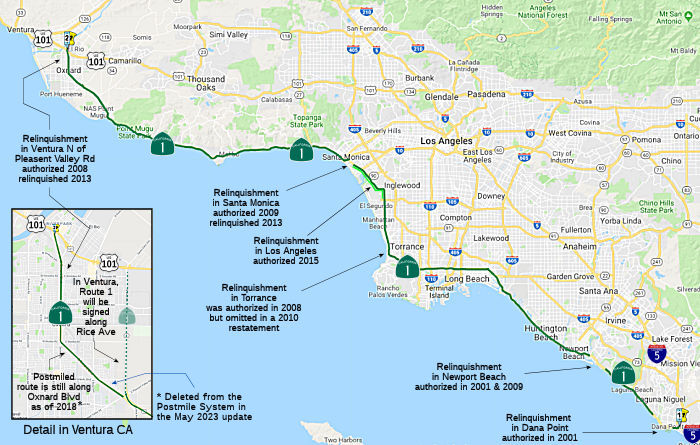 (a) Route 5 south of San Juan Capistrano to Route 101 near
El Rio except for the portion of Route 1 relinquished:
(a) Route 5 south of San Juan Capistrano to Route 101 near
El Rio except for the portion of Route 1 relinquished:
(1) Within the city limits of the City of Dana Point between the western edge of the San Juan Creek Bridge and Eastline Road at the city limits of the City of Laguna Beach.
(2) Within the city limits of the City of Newport Beach between Jamboree Road and Newport Coast Drive.
(3) Within the city limits of the City of Santa Monica between the southern city limits and Route 10.
(4) Within the city limits of the City of Oxnard between Pleasant Valley Road and Route 101.
(g) The relinquished former portions of Route 1 within the Cities of Dana Point, Newport Beach, Santa Monica, and Oxnard are not state highways and are not eligible for adoption under Section 81. For those relinquished former portions of Route 1, the Cities of Dana Point, Newport Beach, Santa Monica, and Oxnard shall maintain within their respective jurisdictions signs directing motorists to the continuation of Route 1. The City of Newport Beach shall ensure the continuity of traffic flow on the relinquished portions of Route 1 within its jurisdiction, including, but not limited to, any traffic signal progression.
(h) Upon a determination by the commission that it is in the best interest of the state to do so, the commission may, upon terms and conditions approved by it, relinquish to the City of Los Angeles the portion of Route 1 within the city between the southern city limit of the City of Santa Monica (~ LA 33.3) and Route 105 (~ LA 25.9), if the department and the City of Los Angeles enter into an agreement providing for that relinquishment. The following conditions shall apply upon relinquishment:
(1) The relinquishment shall become effective on the date following the county recorder’s recordation of the relinquishment resolution containing the commission’s approval of the terms and conditions of the relinquishment.
(2) On and after the effective date of the relinquishment, the relinquished portion of Route 1 shall cease to be a state highway.
(3) The portion of Route 1 relinquished under this subdivision shall be ineligible for future adoption under Section 81.
(4) The City of Los Angeles shall ensure the continuity of traffic flow on the relinquished portion of Route 1, including any traffic signal progression, to the extent applicable.
(5) For the portion of Route 1 relinquished under this subdivision, the City of Los Angeles shall install and maintain within its jurisdiction, signs directing motorists to the continuation of Route 1 to the extent deemed necessary by the department.
Change Notes:
In 2001, AB 635, Chapter 757, 10/11/2001 authorized relinquishment of the portion of Route 1 that is located within the city limits of Dana Point and is between the western edge of the San Juan Creek channel overcrossing and the city limits of the City of Laguna Beach to the City of Dana Point. It was up for relinquishement in January 2005... and again in July 2005.
In 2008, AB 1366, Chapter 717, 9/30/2008 authorized relinquishment of the portion of Route 1 located within the city limits of that city and between Pleasant Valley Road and US 101, as well as reauthorizing the Dana Point relinquishment:
(g) (1) The commission may relinquish to the City of Dana Point, the portion of Route 1 that is located within the city limits of that city and is between the western edge of the San Juan Creek channel overcrossing and the city limits of the City of Laguna Beach, upon terms and conditions the commission finds to be in the best interests of the state, if the commission and the city enter into an agreement providing for that relinquishment. (2) A relinquishment under this subdivision shall become effective immediately following the county recorder's recordation of the relinquishment resolution containing the commission's approval of the terms and conditions of the relinquishment. (3) On and after the effective date of the relinquishment, that portion of Route 1 so relinquished shall cease to be a state highway. (4) For portions of Route 1 that are relinquished under this subdivision, the City of Dana Point shall maintain within its jurisdiction signs directing motorists to the continuation of Route 1.
(h) The commission may relinquish to the City of Oxnard the portion of Route 1 that is located within the city limits of that city and is between Pleasant Valley Road and Route 101, upon terms and conditions the commission finds to be in the best interests of the state, if the commission and the city enter into an agreement providing for that relinquishment. (1) A relinquishment under this subdivision shall become effective immediately after the county recorder records the relinquishment resolution that contains the commission's approval of the terms and conditions of the relinquishment. (2) On and after the effective date of the relinquishment, that portion of Route 1 relinquished shall cease to be a state highway and may not be considered for future adoption under Section 81. (3) For portions of Route 1 relinquished under this subdivision, the City of Oxnard shall maintain within its jurisdiction signs directing motorists to the continuation of Route 1.
Note: In March 2013, the CTC authorized relinquishment of the item (h) right of way in the city of Oxnard on Route 1 from Pleasant Valley Road to Route 101, under terms and conditions as stated in the relinquishment agreement, determined to be in the best interest of the State. Authorized by Chapter 717, Statutes of 2008, which amended Section 301 of the Streets and Highways Code.
Note that the following two previously authorized relinquishments were not in AB 1366, and thus appear to have been silently unauthorized:
In 2001, SB 290, Chapter 825, 10/13/2001 authorized relinquishment of the portion of Route 1 that is located between Jamboree Road and the southern city limits of the City of Newport Beach to the City of Newport Beach. This was up for consideration by the CTC in June 2004.
In 2008, AB 2326, Chapter 639, 9/30/2008 authorized relinquishment of the portion of Route 1 within the City of Torrance:
(a) The commission may relinquish to the City of Torrance the portion of Route 1 that is located within the city limits of the city, upon terms and conditions the commission finds to be in the best interests of the state.
(b) A relinquishment under this section shall become effective immediately following the recordation by the county recorder of the relinquishment resolution containing the commission's approval of the terms and conditions of the relinquishment.
(c) On and after the effective date of the relinquishment, both of the following shall occur: (1) The portion of Route 1 relinquished under this section shall cease to be a state highway. (2) The portion of Route 1 relinquished under this section may not be considered for future adoption under Section 81.
(d) The city shall ensure the continuity of traffic flow on the relinquished portion of Route 1, including, but not limited to, any traffic signal progression.
(e) For the portion of Route 1 that is relinquished, the city shall maintain within its jurisdiction signs directing motorists to the continuation of Route 1.
In 2009, SB 532 (Chapter 189, 10/11/2009) authorized relinquishment of the portion in Santa Monica by adding Section 301.2 (this portion was relinquished in May 2012):
(a) Notwithstanding Section 301, the commission may relinquish to the City of Santa Monica the portion of Route 1 that is located within the city limits of the city, from where the route crosses the city limit south of Ozone Street to the Route 10 westbound offramp, pursuant to a cooperative agreement between the city and the department, upon terms and conditions the commission finds to be in the best interests of the state.
(b) A relinquishment under this section shall become effective immediately following the recordation by the county recorder of the relinquishment resolution containing the commission's approval of the terms and conditions of the relinquishment.
(c) On and after the effective date of the relinquishment, both of the following shall occur: (1) The portion of Route 1 relinquished under this section shall cease to be a state highway. (2) The portion of Route 1 relinquished under this section may not be considered for future adoption under Section 81.
(d) For the portion of Route 1 that is relinquished, the City of Santa Monica shall maintain within its jurisdiction signs directing motorists to the continuation of Route 1.
In 2009, AB 344 (Chapter 238, 10/11/2009) reauthorized relinquishment of the portion in Newport Beach by adding Section 301.3:
(a) The commission may relinquish to the City of Newport Beach the portion of Route 1 that is located between Jamboree Road and the Santa Ana River, within the city limits of the City of Newport Beach, upon terms and conditions the commission finds to be in the best interests of the state.
(b) A relinquishment under this section shall become effective immediately following the county recorder's recordation of the relinquishment resolution containing the commission's approval of the terms and conditions of the relinquishment.
(c) On and after the effective date of the relinquishment, both of the following shall occur: (1) The portion of Route 1 relinquished under this section shall cease to be a state highway. (2) The portion of Route 1 relinquished under this section shall be ineligible for future adoption under Section 81.
(d) The City of Newport Beach shall ensure the continuity of traffic flow on the relinquished portions of Route 1, including, but not limited to, any traffic signal progression.
(e) For those portions of Route 1 that are relinquished, the City of Newport Beach shall maintain within its jurisdiction signs directing motorists to the continuation of Route 1.
In 2010, SB 1318 (9/29/10, Chapter 491) changed the definition of this segment to clarify relinquishments by adding " except for the portion of Route 1 relinquished: (1) Within the city limits of the City of Dana Point between the western edge of the San Juan Creek Bridge and Eastline Road at the city limits of the City of Laguna Beach. (2) Within the city limits of the City of Newport Beach between Jamboree Road and Newport Coast Drive." SB 1318 also rewrote all the relinquishment subsections from (g) onward as:
(g) The relinquished former portions of Route 1 within the City of Dana Point and the City of Newport Beach are not state highways and are not eligible for adoption under Section 81. For those relinquished former portions of Route 1, the City of Dana Point and the City of Newport Beach shall maintain within their respective jurisdictions signs directing motorists to the continuation of Route 1. The City of Newport Beach shall ensure the continuity of traffic flow on the relinquished portions of Route 1 within its jurisdiction, including, but not limited to, any traffic signal progression.
(h) The commission may relinquish to the City of Oxnard the portion of Route 1 that is located within the city limits of that city and is between Pleasant Valley Road and Route 101, upon terms and conditions the commission finds to be in the best interests of the state, if the commission and the city enter into an agreement providing for that relinquishment. (1) A relinquishment under this subdivision shall become effective immediately after the county recorder records the relinquishment resolution that contains the commission's approval of the terms and conditions of the relinquishment. (2) On and after the effective date of the relinquishment, that portion of Route 1 relinquished shall cease to be a state highway and may not be considered for future adoption under Section 81. (3) For portions of Route 1 relinquished under this subdivision, the City of Oxnard shall maintain within its jurisdiction signs directing motorists to the continuation of Route 1.
SB 1318 had the interesting side effect of omitting any mention of the following previously authorized relinquishments:
The 2008 authorization of relinquishment (AB 2326, Chapter 639, 9/30/2008) of the portion of Route 1 within the City of Torrance. Note that this was dropped earlier in the confusion of some 2008 bills.
In 2013, SB 788 (Chapter 525, 10/10/13) clarified the definition of this segment to:
The 2013 Traversable Highways report noted, for the portion between the northerly Newport Beach city limits and Jamboree Road: City of Newport Beach is not willing to accept relinquishment at no cost.
In 2014, AB 2752 (Chapter 345, 9/15/2014) added Oxnard to the list of cities with relinquished portions and added segment (4), and deleted item (h) regarding relinquishment to the city of Oxnard. [Note: It appears that Oxnard has rerouted Route 1 onto Rice Ave (see below), but there is no signage. (ref)]
In 2015, AB 810 (Chapter 561, 10/07/15) authorized relinquishment of a specified portion of Route 1 to the City of Los Angeles by adding:
(h) Upon a determination by the commission that it is in the best interest of the state to do so, the commission may, upon terms and conditions approved by it, relinquish to the City of Los Angeles the portion of Route 1 within the city between the southern city limit of the City of Santa Monica (approximately postmile 33.3) and Route 105 (approximately postmile 25.9), if the department and the City of Los Angeles enter into an agreement providing for that relinquishment. The following conditions shall apply upon relinquishment:
(1) The relinquishment shall become effective on the date following the county recorder’s recordation of the relinquishment resolution containing the commission’s approval of the terms and conditions of the relinquishment.
(2) On and after the effective date of the relinquishment, the relinquished portion of Route 1 shall cease to be a state highway.
(3) The portion of Route 1 relinquished under this subdivision shall be ineligible for future adoption under Section 81.
(4) The City of Los Angeles shall ensure the continuity of traffic flow on the relinquished portion of Route 1, including any traffic signal progression, to the extent applicable.
(5) For the portion of Route 1 relinquished under this subdivision, the City of Los Angeles shall install and maintain within its jurisdiction, signs directing motorists to the continuation of Route 1 to the extent deemed necessary by the department.
 Post 1964 Signage History
This segment was defined in 1963 (Chap. 385).
In January 2023, it was noted that Rice Avenue has finally been signed as
Route 1 on US 101 SB (no sign on SB yet). However, the Rice Avenue segment
is not yet in the Postmile system. Additionally, as of the May 2023 update
to the ArcGIS data that underlies the postmile system, the Oxnard Blvd
segment had been deleted.
(Source: Chris Sampang on AARoad, "Re: Route 1/Rice Avenue in Oxnard", 1/24/2023)
Orange Coast Freeway and the Pacific Coast Freeway
 In August 1967, the Los Angeles Times provided a summary
of all the Pacific Coast Freeway proposals. The overall proposal would
have cost over $750 million, and would have run from lower Orange County
to mid-Ventura County. In the end, only one small piece in Ventura County
was constructed. The plan for the freeway (working from N to S) was to
start at the Ventura Freeway in Oxnard. It would follow a SE-ly line
inland of Oxnard, and then become the present PCH through Ventura County,
where all 19 miles had been adopted and 7 mi constructed S of Oxnard. In
LA County, 14.4 miles had been adopted (as of 1967) to Malibu Canyon Road,
with the freeway following the present highway to Trancas Beach where it
would move inland and eventually be constructed on "shelves" above Malibu
Beach. This was a compromise between the CHC and local interests, who
battled for several years to have the freeway located in the hills above
Malibu. About 9 mi of the freeway, part of a 19 mi segment, contains the
controversial causeway section from Malibu Canyon Road to the end of the
Santa Monica Freeway. This was expected to be adopted in 1969 (it wasn't).
From Santa Monica the freeway went inland in the vicinity of Lincoln Blvd,
although the routing hadn't been determined. This section would terminate
at Imperial Highway S of LAX. Five miles from Imperial Highway to Artesia
Ave were removed by the 1967 legislature, and 5 mi from Artesia Ave to
Hawthorne Ave were removed in 1965. This gap would be filled by the
Century (future I-105, then Route 42) Freeway, and the Hawthorne (Route 107) freeway. The Pacific Coast Freeway would resume at Hawthorne. At a
point near Vermont Avenue and Anaheim St in Wilmington, 10.7 mi of the
freeway had been adopted through Long Beach, generally following Anaheim
St and 7th Street, joining an interchange with I-605 and I-405.
In Orange County, adopted portions of the freeway (7.5 mi) swing back to
the coast from the interchange and then run inland of Huntington Beach,
coming back to the coast at Newport Beach. The end of the adopted routing
was at Buck Gully near MacArthur Blvd in Corona Del Mar. The 16.9 mi
segment from this point to the San Diego Freeway (I-5) had not been
selected by 1967. There were a number of points of controversy:
In August 1967, the Los Angeles Times provided a summary
of all the Pacific Coast Freeway proposals. The overall proposal would
have cost over $750 million, and would have run from lower Orange County
to mid-Ventura County. In the end, only one small piece in Ventura County
was constructed. The plan for the freeway (working from N to S) was to
start at the Ventura Freeway in Oxnard. It would follow a SE-ly line
inland of Oxnard, and then become the present PCH through Ventura County,
where all 19 miles had been adopted and 7 mi constructed S of Oxnard. In
LA County, 14.4 miles had been adopted (as of 1967) to Malibu Canyon Road,
with the freeway following the present highway to Trancas Beach where it
would move inland and eventually be constructed on "shelves" above Malibu
Beach. This was a compromise between the CHC and local interests, who
battled for several years to have the freeway located in the hills above
Malibu. About 9 mi of the freeway, part of a 19 mi segment, contains the
controversial causeway section from Malibu Canyon Road to the end of the
Santa Monica Freeway. This was expected to be adopted in 1969 (it wasn't).
From Santa Monica the freeway went inland in the vicinity of Lincoln Blvd,
although the routing hadn't been determined. This section would terminate
at Imperial Highway S of LAX. Five miles from Imperial Highway to Artesia
Ave were removed by the 1967 legislature, and 5 mi from Artesia Ave to
Hawthorne Ave were removed in 1965. This gap would be filled by the
Century (future I-105, then Route 42) Freeway, and the Hawthorne (Route 107) freeway. The Pacific Coast Freeway would resume at Hawthorne. At a
point near Vermont Avenue and Anaheim St in Wilmington, 10.7 mi of the
freeway had been adopted through Long Beach, generally following Anaheim
St and 7th Street, joining an interchange with I-605 and I-405.
In Orange County, adopted portions of the freeway (7.5 mi) swing back to
the coast from the interchange and then run inland of Huntington Beach,
coming back to the coast at Newport Beach. The end of the adopted routing
was at Buck Gully near MacArthur Blvd in Corona Del Mar. The 16.9 mi
segment from this point to the San Diego Freeway (I-5) had not been
selected by 1967. There were a number of points of controversy:
(Source: LA Times August 20, 1967, via email from Will Poundstone,
1/1/2024)
Orange Coast Freeway / Pacific Coast Freeway (Orange County)
As of July 1, 1964, part (1) was planned as freeway for the entire route (i.e., through Orange, Los Angeles, and Ventura counties). Construction of this as freeway was killed around the same time as the Whitnall Fwy, Route 64.
On May 22, 1964, a portion of the Pacific Coast Freeway in Orange County, from 0.8 mile south of MacArthur Boulevard to 0.2 mile north of Adams Boulevard, 10.2 miles, estimated to cost $63.4 million, had a route adoption.
In June 1957, the CTC considered a proposal for the
routing of the Orange Coast Freeway, an inland route to replace Pacific
Coast Highway. It was to connect Long Beach to the southern end of the San
Diego Freeway at Capistrano Beach. It would cut through Newport Beach at
16th street and go through Laguna Beach. There was no specific map at the
time, nor a freeway agreement. The initial plan for Laguna Beach was to
bisect the community, but resulted in the opposition mobilizing. This only
made the state develop firmer plans in secret. By October 1964, the county
finally said it had to go around Laguna Beach and stay away from the
coast. However, in Dana Point, it would cross Del Obispo. A 1969 report
noted that "the Dana Point Harbor and the Coast Freeway, are going to
produce more change in the area in the next 10 years than in the last
200.” The renamed Pacific Coast Freeway, from Corona Del Mar to
Capistrano, became eighth on the priority list of Orange County freeways
with a proposed “scenic highway” designation. Opposition
continued. Laguna Niguel homeowner associations opposed the plan, as it
was estimated 665 residents would need to move. The freeway would go
through Dana Point where Dana Hills High School now sits. There were also
plans to make Golden Lantern an off ramp and a six lane highway to the
Harbor, with a 40-foot easement removing 10 homes on the east side between
PCH and Selva Road. Supervisors in Newport Beach supported the plan...
until it was determined that there would be impacts in Newport
Beach. that remains today. Despite the objection of residents, the
Fifth District Supervisor, Ronald Caspers of Newport Beach, made the
motion to approve the acquisition saying it was the least costly option.
By August 1972, the governor signed three bills deleting the proposed
Pacific Coast Freeway.
(Source: Dana Point Times, 9/19/2014)
In Newport Beach in 1970, the Newport Beach City
Council and California Department of Highways signed the freeway agreement
for the Pacific Coast Freeway. It would have been a coastal freeway
– 12 lanes wide in places – that would have run through the
heart of Newport and include five-level interchanges at Newport Boulevard
and West Coast Highway and MacArthur Boulevard and East Coast Highway. It
would have split the town, separating the harbor and beaches from the rest
of the town. A massive bridge would be built over the Santa Ana River, and
the freeway would run through West Newport atop a 35-foot-high embankment.
The strip of West Newport businesses along the Coast Highway would be
wiped out along with hundreds of Newport Shores. Along
Mariners’ Mile, there were two options. One, to remove all the
businesses along the inland side of West Coast Highway and build a
double-deck portion of the freeway wedged between PCH and the bluff. Two
– and this was the route they chose – run the freeway up the
bluff into the Cliff Haven neighborhood near Ensign Intermediate School
and remove hundreds of homes, including the blufftop mansions along Kings
Road. There would have been a massive interchange at the entrance to
Corona del Mar village, with five levels and its highest point 90 feet up.
It would have been one-half mile long and one-quarter of a mile wide and
wipe out more than 80 acres. In Corona del Mar, it would have run behind
5th Street, in the path of what’s now Harbor View Elementary School
and the OASIS Senior Center, 90 feet below grade and cross Buck Gully via
a large bridge. Although the council was in favor, organized opposition
formed. They lobbyied state and federal officials, published an eight page
mini-newspaper, collected more than 20,000 signatures on a petition
protesting the freeway (for a town with only 50,000 residents). They
gathered double the amount of signatures needed to put a referendum
regarding the freeway on the ballot. The election in 1971 drew the
then-largest turnout in Newport Beach history, and, not surprisingly, the
referendum passed in a landslide with 85% voting to stop the freeway. The
route was later killed in 1972.
(Source: William Lobel in Stu News Newport, reviewed 10/21/2023)
Note: The Newport Beach in the Rearview Mirror podcast has two episodes on the Pacific Coast Freeway: Ep 14: The Coastal Freeway: A Concrete Monster Almost Unleashed on Newport and Ep 15: The Coastal Freeway: A Postscript
 The Pacific Coast Freeway in Orange County, as of 1966,
turned south from Route 22 on 7th Street, skirting the wetlands inland
from Seal Beach, and pass by Huntington Harbor to the then-proposed Route 39 freeway, which extended due N-S between Beach Blvd. and Golden West
Avenue. The likely rationale behind this odd routing was that the portion
between the I-405/I-605/Route 22 interchange and Route 39 needed to avoid
Huntington Harbor; hence, it stayed well inland. When it intersected the
Route 39 freeway alignment, it turned south following the Route 39
trajectory for a mile or so before turning SE again to parallel Pacific
Coast Highway (PCH) -- but slightly inland to avoid (a) the wetlands
immediately north of PCH and (b) the Edison power plant in SE Huntington
Beach. Prior to the mid '70's, when the deletions took place, the Route 1
adopted alignment in L.A. and Orange counties was hardly linear in nature;
it twisted around to avoid obstacles along or near its projected alignment
(refineries in Torrance and Wilmington, business districts and CSULB in
Long Beach, Huntington Harbor and the more densely-developed parts of
Huntington Beach, etc.). Interestingly, the original route that was
formally adopted in the '60's showed the adopted route directly south of
the I-405/I-605/Route 22 interchange as Route 240; it is unclear if Route 1 was to remain on PCH between Route 22 and Route 240 -- or whether any
conceptual freeway corridor paralleling PCH was under study or discussion;
no map ever showed a future alignment anywhere near that section of PCH.
[A study the City of Long Beach did in the mid-'70s regarding this
corridor (in which they recommended the Division of Highways drop the
proposed freeway route), Route 1 would have used the Route 240 corridor.
An alternate routing that used the PCH corridor between 7th Street and
Seal Beach would have been feasible, since there was almost no development
along that corridor until the mid-'70s. ] It would have likely been a
non-starter in any case, since it would have passed through Belmont
Shores, a proverbial "poster child" for upscale NIMBY activity. This
arrangement was different by 1971, when Route 243 (the original
designation of the northern extension of I-605 between I-10 and I-210) was
added to the Interstate system that year while the extension was under
construction (it was never signed as anything but I-605); Route 240 also
disappeared that year, replaced by Route 1. The original adopted route did
pass through the US Navy facility, which at that time contained the
wetlands yet to be protected by the future Coastal Commission. But any
activity toward development of this alignment was dead by the late '70's
(Gianturco + Coastal Commission = no new freeways anywhere near the
coast). It's probable that the section through Navy land was never
formalized by an agreement between the two entities (Navy & the
Division of Highways), so it was likely left off the 1969 state map until
such an accord could be reached -- a point made moot by the overall route
deletion a few years later. The 1981 map's depiction of the corridor was
likely due to mis-or non-communication between the Gousha researchers and
state agencies, since by that time the deletion of both the Route 1 and
Route 39 freeways had taken place. The whole notion of deploying a freeway
through Navy territory, coastal wetlands, and anywhere in the vicinity of
Huntington Harbor always seemed to be an exercise in futility. Even before
the mass adopted-route deletions of 1978-82, the only viable freeway
arrangement in the area was to let traffic remain on I-405 to the Route 39
freeway alignment, and take it down to/near the beach from there.
Obviously even that concept would have been dead meat by the end of the
'70's. In any case, all of these routes, along with the adopted section of
the Route 39 freeway between Route 1 and I-5 near Buena Park was deleted
soon after the Long Beach segment. The Route 1 freeway would have veered
inland near Fountain Valley, and would have intersected Route 55 in Costa
Mesa right about 19th Street, where the current Route 55 freeway ends.
Curiously, the original projected path east of there is similar to the
present location of the Route 73 toll road; both closely bypassed UC
Irvine to the south of campus.
The Pacific Coast Freeway in Orange County, as of 1966,
turned south from Route 22 on 7th Street, skirting the wetlands inland
from Seal Beach, and pass by Huntington Harbor to the then-proposed Route 39 freeway, which extended due N-S between Beach Blvd. and Golden West
Avenue. The likely rationale behind this odd routing was that the portion
between the I-405/I-605/Route 22 interchange and Route 39 needed to avoid
Huntington Harbor; hence, it stayed well inland. When it intersected the
Route 39 freeway alignment, it turned south following the Route 39
trajectory for a mile or so before turning SE again to parallel Pacific
Coast Highway (PCH) -- but slightly inland to avoid (a) the wetlands
immediately north of PCH and (b) the Edison power plant in SE Huntington
Beach. Prior to the mid '70's, when the deletions took place, the Route 1
adopted alignment in L.A. and Orange counties was hardly linear in nature;
it twisted around to avoid obstacles along or near its projected alignment
(refineries in Torrance and Wilmington, business districts and CSULB in
Long Beach, Huntington Harbor and the more densely-developed parts of
Huntington Beach, etc.). Interestingly, the original route that was
formally adopted in the '60's showed the adopted route directly south of
the I-405/I-605/Route 22 interchange as Route 240; it is unclear if Route 1 was to remain on PCH between Route 22 and Route 240 -- or whether any
conceptual freeway corridor paralleling PCH was under study or discussion;
no map ever showed a future alignment anywhere near that section of PCH.
[A study the City of Long Beach did in the mid-'70s regarding this
corridor (in which they recommended the Division of Highways drop the
proposed freeway route), Route 1 would have used the Route 240 corridor.
An alternate routing that used the PCH corridor between 7th Street and
Seal Beach would have been feasible, since there was almost no development
along that corridor until the mid-'70s. ] It would have likely been a
non-starter in any case, since it would have passed through Belmont
Shores, a proverbial "poster child" for upscale NIMBY activity. This
arrangement was different by 1971, when Route 243 (the original
designation of the northern extension of I-605 between I-10 and I-210) was
added to the Interstate system that year while the extension was under
construction (it was never signed as anything but I-605); Route 240 also
disappeared that year, replaced by Route 1. The original adopted route did
pass through the US Navy facility, which at that time contained the
wetlands yet to be protected by the future Coastal Commission. But any
activity toward development of this alignment was dead by the late '70's
(Gianturco + Coastal Commission = no new freeways anywhere near the
coast). It's probable that the section through Navy land was never
formalized by an agreement between the two entities (Navy & the
Division of Highways), so it was likely left off the 1969 state map until
such an accord could be reached -- a point made moot by the overall route
deletion a few years later. The 1981 map's depiction of the corridor was
likely due to mis-or non-communication between the Gousha researchers and
state agencies, since by that time the deletion of both the Route 1 and
Route 39 freeways had taken place. The whole notion of deploying a freeway
through Navy territory, coastal wetlands, and anywhere in the vicinity of
Huntington Harbor always seemed to be an exercise in futility. Even before
the mass adopted-route deletions of 1978-82, the only viable freeway
arrangement in the area was to let traffic remain on I-405 to the Route 39
freeway alignment, and take it down to/near the beach from there.
Obviously even that concept would have been dead meat by the end of the
'70's. In any case, all of these routes, along with the adopted section of
the Route 39 freeway between Route 1 and I-5 near Buena Park was deleted
soon after the Long Beach segment. The Route 1 freeway would have veered
inland near Fountain Valley, and would have intersected Route 55 in Costa
Mesa right about 19th Street, where the current Route 55 freeway ends.
Curiously, the original projected path east of there is similar to the
present location of the Route 73 toll road; both closely bypassed UC
Irvine to the south of campus.
(Source: Scott Parker (Sparker) at AARoads, 8/12/2016; 8/13/2016; 8/13/2016; DTComposer at AAroads, 8/14/2016)
 There were originally plans for a Pacific Coast Freeway
in Long Beach. It is shown in the 1966 State Highway Map, as well as a
1966 Thomas Brothers. It originally was to follow the western section of
Route 22 (E. 7th Street) east to the present I-405/I-605/Route 22
interchange complex. The "Pacific Coast" freeway concept through Long
Beach was deleted about 1978 by the CTC on the advice of Ms. Gianturco,
the head of Caltrans in the mid-1970s.
There were originally plans for a Pacific Coast Freeway
in Long Beach. It is shown in the 1966 State Highway Map, as well as a
1966 Thomas Brothers. It originally was to follow the western section of
Route 22 (E. 7th Street) east to the present I-405/I-605/Route 22
interchange complex. The "Pacific Coast" freeway concept through Long
Beach was deleted about 1978 by the CTC on the advice of Ms. Gianturco,
the head of Caltrans in the mid-1970s.
Pacific Coast Freeway (Long Beach / Los Angeles Beach Cities)
According to Scott Parker, while the Lomita-Torrance
segment of the Pacific Coast/Hawthorne freeway system was rife with
controversy, it was the Route 1 segment east of there traveling through
Wilmington and Long Beach that attracted the most attention as well as
negative sentiments and subsequent comments, since it tore up a number of
old-stock houses and commercial structures by passing through an arguably
historic district immediately north of downtown Long Beach (more or less
along 10th Street). Unlike the Torrance section to the west, this one had
been formally adopted, with the ROW "set in stone", since the early '60's.
Its eastern end segued onto Route 22 on East 7th Street, which fed
directly east into the I-405/I-605 interchange. By the beginning of 1975,
Caltrans had acquired about half of the required ROW west as far as the
west limits of the adopted section, at Western Ave. in Harbor City;
construction, slated to start in late 1978 or early 1979, was to proceed
east to west. With the advent of the decidedly anti-freeway Gianturco
regime at Caltrans at the beginning of 1975, a review of urban freeway
mileage -- whether formally adopted or simply future corridor concepts --
was underway as the beginning of a major "purge". The Long Beach section,
since even within its advanced planning stages was the subject of
localized protests against its development, stood out -- and became the
well-publicized "poster child" for the program of eliminating as much
unbuilt urban freeway mileage as possible. So by mid-1976 the plans had
been shelved, the adoption rescinded, and the ROW put up for sale; the
last state-owned property had been disposed of by 1980. Of course the
Torrance extension, which had been on indefinite hold since 1974, was
itself formally rescinded at the same time -- so the full Route 1/Route 107 "loop" from the east side of Long Beach to I-405 in the Lawndale
vicinity was off the books after that. And with the Coastal Commission
having, after 1977, effective "veto power" over projects within the
shoreline watershed (which decidedly included the territory traversed by
that loop), the entire notion of a freeway approximating that original
concept would be D.O.A. from that point forward.
(Source: Scott Parker on AARoads ("Re: The Torrance Freeway would have changed the face of the South Bay"), 7/19/2019)
According to a 1971 report by the City of Long Beach
about the Pacific Coast Freeway (Route 1), most of the freeway proposals
for the route in adjoining cities had been killed (with the exceptions of
the route adoptions in Huntington Beach and Newport Beach), so that the
freeway, once envisioned as running from Oxnard to San Juan Capistrano,
would only run from the Harbor Freeway across Long Beach to the San
Gabriel River Freeway (indeed, the report refers to the route as the
Crosstown Freeway as often as it refers to it as the Pacific Coast
Freeway). Since the truncated freeway would be of little benefit, the Long
Beach City Manager requested that the State Division of Highways remove
the route from the Freeway and Expressway system. The proposed route in
Long Beach would have run to the south of Pacific Coast Highway (between
Anaheim Street and 10th Street) and a portion of the Pacific Electric
right-of-way; the truncated route would have then turned northeast to
connect to the western stub of the Route 22 freeway (7th Street) and I-405
and I-605.
(Thanks to Daniel Thomas for finding this
information)
In the Palos Verdes area, the Pacific Coast Freeway
would have connected to the Hawthorne Freeway (Route 107). Whether that
freeway (Route 107) would have been solely signed as Route 107 or
augmented by auxiliary signs (particularly SB and on the approach signage
from I-405) as "TO Route 1" is unknown. One of the corollary aspects of
areas with an outsized level of NIMBY activity (such as Palos Verdes) is
property valuation. The topography of Palos Verdes is indeed one aspect:
North Palos Verdes runs along the northern base of the Palos Verdes hills;
to the north is a wide alluvial slope that flattens out a bit south of
PCH/Route 1. That alluvial contains large-tract properties; it is zoned
for horse ownership, so those with the means to afford horses as well as
the sizeable properties required to stable and maintain them have flocked
to this area. It's not only prime NIMBY country, but the properties here
are also much more expensive to acquire. The decision to veer the proposed
Route 1 northward west of Vermont Street and more closely parallel PCH was
likely resultant from a combination of topography, finances, and the
desire to avoid opposition/complaints from folks with the outsize
capability to make their case heard -- and with a better-than-average
chance of getting what they wanted. It is likely closely related to the
choice not to project/propose a freeway routing closer to the extant Route 1 alignment through Redondo, Hermosa, and Manhattan Deploying a freeway
paralleling Sepulveda (Route 1 alignment in the area) would have been a
non-starter. Bowing to the obvious, the Division of Highways, and later
Caltrans, avoided the routing. Even though they had their master 1959
freeway & expressway plan (with some significant '65 revisions), they
had learned to choose their battles carefully -- avoiding planning
facilities where they weren't wanted -- particularly where those objecting
had a good chance of prevailing! In the Lomita area, one of the principal
obstacles to the east-west Route 1 freeway was the presence of the
Torrance Airport along Crenshaw Blvd.; it, along with Hawthorne and Santa
Monica airports, was one of the main "bases" for corporate jets owned
and/or used by the local aerospace industry -- and as such, had virtually
sacrosanct local status. Any freeway in the immediate area would have had
to limit any vertical aspects of deployment, such as flyovers, high berms,
etc. so as not to be construed as interfering with airport operation. The
proposed Route 1 freeway routing skirted the southern end of the airport
just north of PCH. The freeway would likely have been sited below grade
along that stretch, so any interchanges with intersecting streets would
not rise significantly above ground level.
(Source: Scott Parker (Sparker) at AAroads, 8/14/2016)
Pacific Coast Freeway (Santa Monica and Malibu)
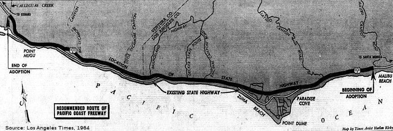
Remarkably, plans were under review to construct this freeway as an ocean causeway in the Malibu area (and you thought oil-rigs were bad!) California Highway and Public Works, March-April 1964, said:
This is the longest freeway planned in District VII; it will extend about 113 miles from the Ventura Freeway north of Oxnard to Serra Junction at Capistrano Beach, in Orange County. The only portions constructed to date are a 6.8 mile section south of Oxnard, and a connection between the Pacific Coast Highway and the San Diego Freeway in Capistrano Beach. Briefly, the status of the route, from north to south in the district, is as follows:
El Rio to Oxnard: location of the route is being considered in connection with the Oxnard Bypass, on which two public hearings have been held.
Oxnard to Calleguas Creek, 6.8 miles constructed in 1957.
Conversion of the existing three-lane Pacific Coast Highway to freeway standards in the vicinity of Point Mugu Naval Station is planned for the future.
Calleguas Creek to Malibu Canyon Road: California Highway Commission hearing on adoption of route, about 22 miles, was held in Santa Monica February 25, 1964, and two district hearings were held in 1961.
Malibu Canyon Road to terminus of the Santa Monica Freeway in the City of Santa Monica: In addition to conventional inland locations, route location studies on this 13-mile section are considering the possibility of locating all or part of the freeway on a causeway offshore in the ocean; an alignment along the existing shoreline on a widened beach; or various combinations of causeway and shoreline locations.
In 1961, the U.S. Army Corps of Engineers was engaged by the Division of Highways to study the feasibility of the marine location. A report of this study, received in November 1963, is being reviwed by the division and other interested state agencies. The report covers only the marine phase of the project. Conventional land locations are being studied by the division.
The Corps of Engineers investigated nine alternate offshore and onshore freeway alignments involving earth fills and embankments, beach widening and structures. [...] The report concluded that:
- It is engineering feasible to construct the proposed freeway on a marine alignment.
- A joint highway-recreational facility extending from Santa Monica to Malibu would enhance the recreational potential of the area.
- Maintenance of sand bypassing operations in connection with each of the plans considered are feasible.
- It is not expected that builidng any of the considered projects would post any insurmountable problems to the construction industry.
From Santa Monica south to the end of the route, location studies are being made except in the following areas: 10 miles in Orange County (Huntington Beach-Newport Beach) already adopted; 14 miles between El Segundo and the Harbor Freeway in Wilmington; and about 3 miles between the Marina Del Rey and Olympic Boulevard on the Santa Monica Freeway.
On February 25, 1964, the CHC held a hearing regarding the Pacific Coast Freeway (Route 1) from Malibu Canyon Road to terminus of Santa Monica Freeway in the City of Santa Monica, 13 miles. The 22.5-mile section of this freeway from Malibu Canyon Road north to Point Mugu was under consideration by the California Highway Commission for route adoption.
Regarding the Pacific Coast Freeway in Santa Monica, the Santa Monica Surf in 2003 noted:
Along with the company Seaway Enterprises Incorporated of Beverly Hills, John Drescher (a local businessman), crafted an ambitious scheme. On July 19, 1961, Seaway Enterprises presented the City Council with a thirty-page document, complete with artist renderings, proposing the construction of an island causeway off the coast. Located 4,000 feet from shore, the 30,000-foot long causeway would run parallel to the coastline from Santa Monica beach all the way north to Malibu. In the middle of this artificial archipelago would stretch a 200-foot wide freeway called "Sunset Seaway." It was a remarkable concept. Not only would the brand new highway alleviate the pressure on the coastal road but it would also provide an additional 2.5 million square feet of public beach facing the ocean. The new beaches would accommodate "up to 50,000 persons on peak days," according to the Seaway Enterprises document. In addition to the new land, the area of water between the natural shoreline and the artificial causeway would become a series of marinas accommodating 1,700 small craft.
On August 29 1961, with Santa Monica City Manager Ernest N. Mobley leading the charge, the Santa Monica City Council established a Causeway and Freeway Committee to "consider and recommend on the desirability and feasibility of the causeway proposal made by Seaway Enterprises and/or any similar proposal." One of the most challenging questions facing committee members was: "Where would all the rock come from?" When the Santa Monica breakwater was constructed in the early thirties, quarry stone had been shipped in barges all the way from Catalina Island; specifically, it was on barges that were towed by tugs and then dumped into the bay at the side of the breakwater. In the case of Sunset Seaway, the estimated tonnage clocked in at a staggering 97 million cubic yards of landfill for the causeway alone and an additional 2.5 million tons of rock to construct a submerged reef to protect it. According to Drescher’s proposal, the causeway would be a phased operation. Rock from the nearby mountains would first be used to create a protective reef. Once in place, the initial landfill for the causeway would come from terracing the mountains, creating an ideal location for new property while at the same time providing some much-needed tonnage. To do this, there would be a conveyor system crossing over Pacific Coast Highway; resulting in millions of tons of rock passing over the heads of motorists below.
What killed the project was reality. The reality, learned from experience in the Marina Del Rey project, that tidal forces would require regular and costly dredging for silt. The reality of opposition from residents. The reality of construction costs. The reality of legal and legislative headaches, requiring watertight inter-agency agreement just to get the project into planning phases. The reality of the environmental effects of taking 97 million cubic yards of landfill from the nearby Santa Monica Mountains and piling it into the ocean to create a six mile landmass on which to build a highway. The reality of LA Councilman Marvin Braude opposing any city contributions to the project. In September 1965, Governor Edmund "Pat" Brown vetoed the causeway bill. The Causeway Freeway Commission was disbanded in 1966.
The segment in Santa Monica was relinquished in May 2012.
 In February 1964, it was reported that there were a
variety of routes under consideration for the Route 1 freeway in Malibu.
The Orange Route was shown to be running very far inland; and there was
another route with a marine location (consistent with the Pacific Coast
Freeway proposal for Santa Monica).
In February 1964, it was reported that there were a
variety of routes under consideration for the Route 1 freeway in Malibu.
The Orange Route was shown to be running very far inland; and there was
another route with a marine location (consistent with the Pacific Coast
Freeway proposal for Santa Monica).
(Source: Valley Times, 2/5/1964, via Will Poundstone, 1/1/2024)
 In February 1964, the CHC adopted a freeway routing for Route 1 between Malibu Canyon Road and Pt.
Mugu. This routing follows the general alignment of the existing Route 1
from just W of Malibu Canyon Road to just E of Corral Canyon Road, then
swings inland slightly to Latigo Canyon Road, and continues W-ly approx
3/4 to 1/4 mi inland from the existing highway, rejoining the latter just
W of Trancas Canyon Road. It then continues along the existing highway to
Pt. Mugu except for a short stretch near the western limits of the
adoption. The plans called for construction of a six-lane freeway with
room to expand to eight-lanes when required at an estimated cost of $41.6
million, including rights of way. See the page for Route 64 for an
illustration of the Route 64/Route 1 interchange at Malibu Canyon. This
routing is also shown in the 1966 Thomas Brothers Guide for Los Angeles
County, and it shows on the 1966 State Highway Map, although it is gone by
the 1967 map. A 1973 Thomas Brothers doesn't show this routing in Los
Angeles County, but does show the portion in Ventura County.
In February 1964, the CHC adopted a freeway routing for Route 1 between Malibu Canyon Road and Pt.
Mugu. This routing follows the general alignment of the existing Route 1
from just W of Malibu Canyon Road to just E of Corral Canyon Road, then
swings inland slightly to Latigo Canyon Road, and continues W-ly approx
3/4 to 1/4 mi inland from the existing highway, rejoining the latter just
W of Trancas Canyon Road. It then continues along the existing highway to
Pt. Mugu except for a short stretch near the western limits of the
adoption. The plans called for construction of a six-lane freeway with
room to expand to eight-lanes when required at an estimated cost of $41.6
million, including rights of way. See the page for Route 64 for an
illustration of the Route 64/Route 1 interchange at Malibu Canyon. This
routing is also shown in the 1966 Thomas Brothers Guide for Los Angeles
County, and it shows on the 1966 State Highway Map, although it is gone by
the 1967 map. A 1973 Thomas Brothers doesn't show this routing in Los
Angeles County, but does show the portion in Ventura County.
(Image Source: Los Angeles Times 1964 via Joel Windmiller,
2/23/2023)
Pacific Coast Freeway (Oxnard)
The existing freeway/expressway section along the
original Route 1 alignment of Oxnard Blvd near Port Mugu/Port Hueneme (~
VEN 9.792 (near Callegues Creek Rd) to ~ VEN 16.185 (Oxnard and Rose))
dates from US 101 Alternate days (1957), with deployment preceding the
introduction of the California Freeway & Expressway System by a year
or two. Although this is currently (2021) in the postmile system,
“official” Route 1 exits the old freeway alignment at Rice
Avenue.
(Source: Scott Parker on AARoads, “Re: Route 1/Rice Avenue in Oxnard”, 3/4/2021)
 Pre 1964 Signage History
  The portion of this segment from San Juan Capistrano to Oxnard was added to the state highway system in 1919 as LRN 60. The segment,
opened in the late 1920s as part of the Roosevelt Highway, a 1,400-mile
road that traced the western margin of the United States. Nationally,
Americans found the first highway linking the Mexican and Canadian borders
an appropriate memorial for the country's late and famously
internationalist president, Theodore Roosevelt. Locally, Southern
Californians celebrated the reduced travel time between the various beach
towns of the region; the Roosevelt Highway represented the first direct
link between Newport Beach and Laguna Beach and between Ventura and Santa
Monica. There's a good summary of the early history, including pictures,
on the LA As Subject pages from KCET.
The portion of this segment from San Juan Capistrano to Oxnard was added to the state highway system in 1919 as LRN 60. The segment,
opened in the late 1920s as part of the Roosevelt Highway, a 1,400-mile
road that traced the western margin of the United States. Nationally,
Americans found the first highway linking the Mexican and Canadian borders
an appropriate memorial for the country's late and famously
internationalist president, Theodore Roosevelt. Locally, Southern
Californians celebrated the reduced travel time between the various beach
towns of the region; the Roosevelt Highway represented the first direct
link between Newport Beach and Laguna Beach and between Ventura and Santa
Monica. There's a good summary of the early history, including pictures,
on the LA As Subject pages from KCET.
The legislative route was extended in 1925 a bit further north to El Rio (Chapter 309). The segment (Jct. US 101 at Serra to Jct. US 101 at El Rio via Santa Monica) was first signed as Route 3 in 1934 as part of the initial state signing of highways. It was the "Roosevelt Highway" south from El Rio. The highway was named after President Theodore Roosevelt. By October 1935, was also signed as US 101A, and for portions was co-signed with US 6 and US 91.
As for the numbering as US101A: On July 20, 1935, the highway department notified AASHTO:
In accordance with the rights delegated to the individual states, we have designated the State Highway from Junction US 101 north of El Rio in Ventura County south along the coast to a junction with US 101 at Serra as Alternate US 101.
Practically all of the area this route traverses is incorporated, and the designation conforms to that given for an Alternate Route.
We would like to have this route shown in the description of US Numbered Routes.
AASHTO subsequently approved this alternate route on September 26, 1937, with an effective date of January 1, 1938. The current Route 1 number was signed in 1964.
In Dana Point, there is a marker celebrating Route 1: specifically, a
31-foot-tall tower spelling out PCH in golden letters. It is along NB
Pacific Coast Highway, just past the Route 1 bridge over San Juan Creek.
It recognizes the Capistrano Beach Curve, where US 101A split from US 101.
It is a miniature version of one of 36 Richfield Oil towers, erected at
roughly 50-mile intervals from the Mexican border to the Canadian border.
The Dana Point segment was completed in 1929.
(Source: PCH Monument, 8/19/2021)
Laguna Canyon Road and parts of the Coast Highway were first paved in 1923. Laguna Beach’s portion officially launched in 1926 with a ribbon-cutting ceremony welcoming traffic between Newport and Dana Point along the highway.
In 1924, an agreement was finalized with The Irvine Company on the route
of Pacific Coast Highway between Newport Beach and Dana Point to fill the
gap in Orange County. This segment of the Coast highway opened in 1926.
(Source: Crystal Cove Timeline)
In Huntington Beach, in 1913, the South Coast Improvement Association
incorporated to agitate for a coast road. In 1916 the New Coast Boulevard
announced. The wide spot in the road called Los Patos was at the top of
the bluffs just above the point where Warner Ave. crosses the
highway. The routing paralleled the route of the Pacific Electric
along the coast.
(Source: Pacific Coast Highway and Huntington Beach, 8/15/2011)
In Seal Beach, in 1916, Orange County Board of Supervisors awarded a
contract to Lee Garnsey to construct a road along the coast from Seal
Beach to Huntington Beach. The price for three miles of road between Seal
Beach and Huntington Beach? $16,900. The road opened in August 1917 after
Seal Beach removed 600 feet of sand blocking road access and repaired the
bridge over Anaheim Bay that ran parallel to the Pacific Electric bridge
and connected to Electric Avenue. First segments brought people to the Joy
Zone (relocated from the 1915 Pan Pacific Exposition), which had a wooden
roller coaster, the carnival games, a traveling circus, and the usual
accoutrements. Coaster lasted until 1937. In Seal Beach, the highway
crosses Bolsa Chica Wetlands and a Naval Base. Between 1943 and 1949, the
routing was moved inland slightly from the mouth of Anaheim Bay. The
original route was along Anaheim Bay Road; former routing is visible on SE
side of inlet.
(Source: December 8th in Seal Beach History, 12/8/2019)
Long Beach
The Los Alamitos Traffic Circle was the point where
Route 1/Former Route 3/US 101A/US 91 and Route 19/US 91 came together. The
Los Alamitos Traffic Circle was located at the junction of State Street,
Bennett Avenue and Hathaway Avenue. 1934 Sign Route 3 (Route 1
today) followed the entirety of LRN 60, which by proxy took it through Los
Alamitos Traffic Circle in Long Beach. Sign Route 3 was renumbered
as US 101A in 1935; the 1964 renumbering changed it to the current Route 1. Also meeting in the traffic circle was Route 19/LRN 168, which in 1947
was cosigned with US 91. US 91 would also be extended West along US 101A
to meet US 6. The Los Alamitos Traffic Circle originally only had what is
now the inner circle. The inner circle transitioned the implied
connection of Route 3/LRN 60 from Hathaway Avenue to State Street (both
were renamed by 1944 to Pacific Coast Highway). LRN 168 joined the traffic
circle via Bennett Avenue, which is now Lakewood Blvd. In 1942, the
traffic circle was expanded and widened, with the original plan being to
have six highways enter it (however, only three were constructed). The
expansion added an outer ring which had been built by the city of Long
Beach and Los Angeles County. The original inner Los Alamitos
Traffic Circle was expanded to increase capacity on US 101A/LRN 60. In
1993, Caltrans reconfigured Los Alamitos Traffic Circle to modern
roundabout conventions. Route 19 was relinquished in the city of
Long Beach via AB 2132 Chapter 877 in 1998.
(Source: Gribblenation Blog (Tom Fearer), "Los Alamitos Traffic Circle; current California State Route 1/former US Route 101 Alternate and US Route 91", 2/7/2022)
There was also a planned Los Alamitos Diagonal from Norse Way to about Palo Verde and Anaheim to mirror Los Coyotes Diagonal with the two diagonals intersecting at about Spring and Woodruff with another Traffic Circle, which doesn’t exist.
South Bay Beach Cities (Palos Verdes through El Segundo)
State Street in Long Beach became the Redondo-Wilmington Road through the South Bay. LRN 60 ran along Redondo-Wilmington Road around 1930, dig a jog north along Hawthorne, and then continued along Redondo-Wilmington Road through Los Palos Verdes. This routing was originally slightly to the S of the current route, seemingly along today's Newton St. By the 1940s, this had moved to a slightly northern alignment, and connected without the jog along Hawthorne. This was renamed Coast Highway and then PCH by 1950.
There has been some interesting discussions regarding
the route of this segment (Route 3/US 101A, future Route 1) in the Los
Angeles South Bay in the early 1940s. According to one map, it angled
slightly northeasterly the current alignment in the middle of Redondo
Beach, directly intersecting Camino Real (Sepulveda coming in from
Torrance), then sharply angled northwest and then northeast at the north
end of Redondo Beach. One explanation for this is an alignment that leaves
the current route at Francesca Avenue, then follows Francesca (which
angles just east of north then curves back northwest) and crosses the
current alignment again to intersect Catalina Avenue (formerly Pacific
Avenue), then back to the current alignment at the Hermosa Beach line.
Another probable old alignment through Torrance is Newton Street, which
skirts the base of the Palos Verdes Hills and intersects (or intersected)
PCH at an angle on both ends. This runs through the once-independent
village of Walteria, now essentially indistinguishable from the rest of
Torrance.
(Source: Steve Riner)
LRN 60 then ran to Esplanade and Pacific (meeting at
Ave I), running along Catalina and Pacific (later Catalina) to meet
Sepulveda Blvd (originally El Camino Real, at least as far N as Gould) at
the Hermosa Beach Bounday (Anita St). By 1928ish*, Route 1 had
been moved to Elena (between Ave I and Diamond Street) and Camino Real
(between Diamond and Gould)**. This is why today’s
Catalina branches off of PCH as it does – it was the pre-Elena
routing. Elena and a portion of Camino Real became Pacific Coast Highway
sometime between 1956 and 1959. Note that S of Torrance Blvd in Redondo,
two blocks E of where PCH is, Sepulveda continues S and then E to become
Willow in Long Beach. Camino Real and Sepulveda Blvd S of Torrance Blvd
were never part of Route 1. North of Torrance Blvd, however, Camino Real
and Sepulveda Blvd were part of Route 1; these were later renamed as
Pacific Coast Highway up to the Los Angeles City line at Imperial Highway
(with the exception of the City of Manhattan Beach).
(Sources: * 1928 City of Redondo Map; ** 1943 USGS Map)
Route 1 (Sepulveda, now PCH) had a discontinuity through the oil fields of El Segundo before 1930. 1930/1931 maps show it as under construction between Rosecrans and El Segundo. That segment was completed by 1939.
At Imperial Highway, Route 1 becomes Sepulveda Blvd
(briefly) through the airport, and then splits off NW as Lincoln Blvd. As
noted above, the name "Sepulveda Blvd" originally continued S through El
Segundo, Manhattan Beach, and Hermosa Beach as far as the Redondo Beach
Boundary, where Pacific (now Catalina) split off of the route. Overtime,
cities adopted the Pacific Coast Highway name. The first was Hermosa
Beach, which formally adopted the name of Pacific Coast Highway in 1947 to
possibly end a dispute to whether to name the route Sepulveda or Camino
Real.* The next was El Segundo, which dropped the Sepulveda
name in favor of Pacific Coast Highway in 2018.** Manhattan
Beach started discussing the name change in 2013⁂, and
even had it on the City Council agenda in 2018†, but
ultimately decided to retain the name Sepulveda‡.
(Sources: * Wikipedia, 11/4/2023; ** Daily Breeze, 6/4/2018;⁂ Easy Reader News, 9/25/2013; † City of Manhattan Beach, 8/17/2018; ‡ Manhattan Beach News, 12/13/2018)
City of Los Angeles (Southern Segment): LAX, Westchester, Marina Del Rey, and Venice
Briefly running along Sepulveda through the airport (for varying distances over time), the route continued as Lincoln through Westchester, Port Ballona (now Marina Del Rey), Culver City, Venice, and Santa Monica.
 1929 maps show Lincoln splitting off of Sepulveda at about the center of the
current runway tunnel, S of Century Blvd (which was originally San Antonio
Street before the numbered streets were extended that far S). By 1950,
runway extension resulted in Sepulveda being diverted W S of Century to
avoid the runway extension, where it met Lincoln, went around the runway,
to meet back at present-day Sepulveda and Imperial. There were plans to
extend Century across to the Pershing. The tunnel under the LAX runways
opened in April 1953 as part of the airport expansion to the Interim
terminal. The tunnel was funded by a half-and-half combination of a 1945
airport bond issue and a special federal grant. Construction, estimated at
$3.5 million, began in 1949. When the 1,909-foot-long divided tunnel was
finished four years later, it was the only traffic tunnel beneath a large
airport runway in the country After the tunnel was completed. Lincoln then
ended at Century, and the route turned E to Sepulveda, where it turned R
(and Sign Route 7 ended). By 1964, Lincoln was in its current
configuration along the Northern edge of the airport.
1929 maps show Lincoln splitting off of Sepulveda at about the center of the
current runway tunnel, S of Century Blvd (which was originally San Antonio
Street before the numbered streets were extended that far S). By 1950,
runway extension resulted in Sepulveda being diverted W S of Century to
avoid the runway extension, where it met Lincoln, went around the runway,
to meet back at present-day Sepulveda and Imperial. There were plans to
extend Century across to the Pershing. The tunnel under the LAX runways
opened in April 1953 as part of the airport expansion to the Interim
terminal. The tunnel was funded by a half-and-half combination of a 1945
airport bond issue and a special federal grant. Construction, estimated at
$3.5 million, began in 1949. When the 1,909-foot-long divided tunnel was
finished four years later, it was the only traffic tunnel beneath a large
airport runway in the country After the tunnel was completed. Lincoln then
ended at Century, and the route turned E to Sepulveda, where it turned R
(and Sign Route 7 ended). By 1964, Lincoln was in its current
configuration along the Northern edge of the airport.
Moving to the Port Ballona/Marina Del Rey and Venice area: By 1923, Lincoln was constructed S of Santa Monica to Washington, and the PE lines along Culver existed. By 1924, Lincoln ran from Santa Monica to about Washington Blvd. Sepulveda was Arizona Ave, and Manchester was Defiance. There is no indication of the state highway. Culver was the Pacific Electric line to Redondo Beach. By 1930, there was a road along Culver to Playa Del Rey. By 1930-1931, there was perhaps a 1-2 lane hard surfaced road from Culver to Washington, and Lincoln now continued S to meet Arizona (Sepulveda) about where the tunnel is today. By 1943, the route across the wetlands was 4 lanes. By 1934, Manchester and Jefferson had assumed their current names. However, the segment between Culver and Washington looked to be two lanes. Development of Westchester had just started. The wetlands were mostly oilfields. In 1951, dredging of the marina began. By the mid 1960s, Lincoln had its current configuration including the parclo interchange with Culver (likely built as part of Marina construction). By the mid 1970s, construction of the Route 90 Freeway/Expressway had reached Lincoln. Currently, there is an effort to replace the Route 90 Freeway with a linear park and housing.
Santa Monica
Lincoln Blvd itself appears to go back to 1894. The alignment to present-day maps in the USGS maps before 1924 appears to be off a bit – it appears to show a route with the path of Lincoln, but closer to Beverly or 6th. However, that would mean massive realignment of the Santa Monica street grid, which is highly unlikely. There was a discontinuity between Colorado and future Olympic due to the Railroad Tracks. By 1920, Lincoln was constructed across the railroad tracks
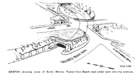 The McClure Tunnel (originally
called the Santa Monica Tunnel) was constructed in 1935 to eliminate the
necessity of climbing the Palisades bluff (i.e., the California Incline),
and to eliminate the crossing of main city streets and crossing of the
railway tracks on Ocean Avenue in the city of Santa Monica. With
completion of the tunnel, through traffic proceeding south along the usual
highway may go through the bluffs and under the intersection of Colorado
Street and Ocean Avenue and under the tracks of the Pacific Electric
Railway and then continue South on Lincoln Boulevard toward San Diego.
What is interesting about the tunnel is its construction method.
Traditional tunnels are constructed by boring. In order to secure
satisfactory alignment at reasonable cost it was found necessary to build
the tunnel on a curve and make it cross under a portion of the Palisades
Park area. In order to secure necessary vertical clearance without
dropping the tunnel floor to such extent as would make necessary the
reconstruction of a valuable sewer system, or on the otber hand raising
the top of the tunnel to such extent that a hump would appear in the track
and street above, the designers were forced to make the tunnel flat and
wide. Lastly, the ground upon which the tunnel had to be built was not
rock and was not capable of safely supporting the load required. The
ground was reinforced by driving concrete piles into it so that the piles
might act as a substitute for rock. In the case of this tunnel it was also
discovered that it was cheaper to construct it via cut and cover, building
a barrel as a culvert and then replacing the dirt, park, and streets
above. A portion of the street is almost flush with the crown of the
tunnel arch. The tunnel is a rigid frame structure resembling a very flat
arch with a span of 56' and has a clearance above the pavement of 21'. The
tunnel is constructed in 40' foot sections and each of these sections
contains approximately 420 yd3 of concrete and 32 tons of bar
reinforcing steel. The tunnel was dedicated February 1, 1936.
The McClure Tunnel (originally
called the Santa Monica Tunnel) was constructed in 1935 to eliminate the
necessity of climbing the Palisades bluff (i.e., the California Incline),
and to eliminate the crossing of main city streets and crossing of the
railway tracks on Ocean Avenue in the city of Santa Monica. With
completion of the tunnel, through traffic proceeding south along the usual
highway may go through the bluffs and under the intersection of Colorado
Street and Ocean Avenue and under the tracks of the Pacific Electric
Railway and then continue South on Lincoln Boulevard toward San Diego.
What is interesting about the tunnel is its construction method.
Traditional tunnels are constructed by boring. In order to secure
satisfactory alignment at reasonable cost it was found necessary to build
the tunnel on a curve and make it cross under a portion of the Palisades
Park area. In order to secure necessary vertical clearance without
dropping the tunnel floor to such extent as would make necessary the
reconstruction of a valuable sewer system, or on the otber hand raising
the top of the tunnel to such extent that a hump would appear in the track
and street above, the designers were forced to make the tunnel flat and
wide. Lastly, the ground upon which the tunnel had to be built was not
rock and was not capable of safely supporting the load required. The
ground was reinforced by driving concrete piles into it so that the piles
might act as a substitute for rock. In the case of this tunnel it was also
discovered that it was cheaper to construct it via cut and cover, building
a barrel as a culvert and then replacing the dirt, park, and streets
above. A portion of the street is almost flush with the crown of the
tunnel arch. The tunnel is a rigid frame structure resembling a very flat
arch with a span of 56' and has a clearance above the pavement of 21'. The
tunnel is constructed in 40' foot sections and each of these sections
contains approximately 420 yd3 of concrete and 32 tons of bar
reinforcing steel. The tunnel was dedicated February 1, 1936.
The McClure Tunnel replaced an earlier railroad tunnel
shown this 1898 film from Thomas Edison's production company. As early as 1886, the Southern Pacific bored a tunnel through Santa Monica's ocean bluffs so that trains
traveling through the Santa Monica Arroyo—a natural drainage that
once marked the southern edge of town—could turn parallel to the
beach toward a long shipping wharf up the coast. Pacific Electric trolleys
later used this curved tunnel, which remained in service until shortly
before its rotted wooden frame collapsed in 1935. By then the state had
already drafted plans to reconfigure the historic conduit. When the dust
settled in 1936, Olympic Boulevard traced the old path of the railroad
through the arroyo, and a wide, arched concrete tunnel curved through the
bluffs where the wooden railroad shaft had been.
(Source: Southland Blog, 4/29/14)
There is some confusion separating the route of LRN 60 from LRN 163, due to poor maps. In 1933, Chapter 767 defined the following route as part of the state highway system: "Continue Roosevelt Highway from the point where it intersects with Santa Monica Canyon Road at and in Santa Monica to a point where, if so continued, it would intersect with Windward Avenue in Venice, Los Angeles, California. Said road is now commonly known and designated as Ocean Front and parallels the Pacific Ocean a short distance therefrom." In 1935, this was added to the highway code as LRN 163, with the routing: "[LRN 60] in Santa Monica, at the point where [LRN 60] leaves the ocean, to Windward Avenue in Venice via a road commonly known and designated as Ocean Park“ However, this was rapidly amended later in 1935 by Chapter 274 to be: "[LRN 60] in Santa Monica, a a point southerly of the westerly extension of Wilshire Boulevard in Santa Monica to Windward Avenue in Venice via Prominade in Santa Monica and Ocean Front Walk in the City of Los Angeles“ In 1937, Chapter 50 reworded the definition for LRN 163 again: "[LRN 60] at a point near Colorado Avenue in Santa Monica to a connection with Windward Avenue in the city of Los Angeles“ This ended up being the Colorado Avenue Grade Separation: The Colorado Avenue Grade Separation project was a cooperative project between Public Works Administration and Division of Highways; it was designed out of a need to relieve traffic overflowing onto US 101A/LRN 60 in Santa Monica. LRN 163 would be constructed underneath Colorado Avenue (via what is now Moomat Ahiko Way), and would connect US 101A/LRN 60 to Ocean Avenue. The Colorado Avenue Grade Separation was completed in July 1940. Maps are a bit unclear as to the distinction between LRN 60 and LRN 163 in the area.
Prior to the tunnel, LRN 60 used the California
Incline. Circa 1905, the tracks of the Los Angeles & Independence R.R.
ran where PCH is today. In 1905, Santa Monica had plans for three
inclines: A foot path departing from Idaho Avenue would meet a vehicular
roadway departing from California Avenue halfway down the bluff-face. The
two would continue to the beach as one multi-modal route spanning over
1700 feet long. Linda Vista Walk from Idaho Avenue is now called the Idaho
Trail, and Linda Vista Drive from California Avenue is now known as the
California Incline. The third incline was built for pedestrians at the
foot of Oregon Avenue (now Santa Monica Boulevard). Originally referred to
as the Oregon Trail, it became known as the Sunset Trail in 1916. In 1932,
the WPA funded a widening project that increased the California Incline
from twenty to forty feet wide. The beach road was also widened to extend
the Roosevelt Highway through Santa Monica. LRN 60 was routed off the
incline when the Santa Monica Tunnel was opened to highway traffic. The
Incline was rebuilt in 2015.
(Source: Santa Monica Conservancy "The California Incline")
In 1941, the Roosevelt Highway was renamed Pacific Coast Highway in much of Southern California.
Malibu
Through Malibu, one intransigent landowner, May Rindge,
had blocked the construction of the route. Since at least the 1890s, a
primitive road had existed, but reached a locked gate at the property line
of Rindge's 17,000-acre ranch. Rindge and her late husband had long fought
to keep homesteaders off her ranch, and in 1906 she forced the politically
powerful Southern Pacific to divert its Santa Barbara line around Malibu
and though the San Fernando Valley. In 1907, the county proposed extending
the coastal road through Malibu, and in response Rindge posted armed
guards at the entrances to her ranch and challenged the county's power of
eminent domain in court. By 1911 surveying had begun for the Coastline
State Highway, a road designed to stretch along the shore from Oregon to
San Diego. By 1913, the first public automobile path was constructed along
the Rindge family property. Undaunted by the progress of modern society,
May built her own car path parallel to the newly constructed State road,
which she despised and destroyed with dynamite. In 1916, the LA County
Board of Supervisors declared eminent domain along the coast of Malibu.
The court cases were extremely complex and imbued with intense hostility,
with Rindge sabotaging the public's efforts to lay roads with extreme
measures. Such measures ranged from employing armed guards on horseback to
patrol her property and enforce locked gates to digging up roads and
replacing them with alfalfa and pigs. The road's prospects improved in the
early 1920s when it was incorporated into the newly planned Roosevelt
Highway. The U.S. Supreme Court upheld the county's right to appropriate
the land for the highway in 1923, and the dispute finally came to an end
in 1925 when a superior court judge granted the county title to the
right-of-way in return for $107,289. Delayed by the litigation, the Malibu
segment of the Roosevelt Highway was the last to start construction and
open. In February 1925, California Highways and Public Works noted that
the contract for the grading of the Coast Boulevard through Malibu Ranch
was awarded. But Mrs. Rindge hadn’t conceded to the inevitable, as
she was still in court, appealing every decision made by any court on any
level. In 1925, Mrs. Rindge refused to accept a check for $98,623 ($1.15
million in today's dollars) as a county payment for a strip of land 80
feet wide and 19 miles long that Superior Court Judge Frederick Valentine
ordered condemned for the state highway. On October 23, 1926,
construction crews completed 16.13 miles of roadway grading through the
Rancho (from Arroyo Sequit to Las Flores Canyon), paving the way for
construction of the Roosevelt Highway. The final opening occurred on June
29, 1929, when California Governor C.C. Young, flanked by Miss Mexico and
Miss Canada, cut the ceremonial ribbon and a parade of 1,500 cars sped by
to navigate the road's curves. 1929, the “Roosevelt Highway”
opened between Santa Monica and Oxnard, 22 years after the first court
action. More than 1,000 cars showed up for the ribbon-cutting ceremony
eager to be the first lucky ones to glide north on the freshly-paved
roads. For all her troubles, Mrs. Rindge’s family fortune had been
sucked dry and she was left with only $8,000. She was now forced to sell
off or lease her land to pay off her massive debts. With the stock
market crash of 1929 and the Great Depression, all the land, stocks,
businesses and other assets Mrs. Rindge controlled in the Rindge Estate
and the Marblehead Land Co, crumbled to nothing, and by 1935 she was
bankrupt. Mrs. Rindge would die in 1941, penniless and confined to a
hospital bed in Los Angeles.
(Source: KCET Website; CurbedLA
11/21/2018; Metro Primary Resource, 10/23/2023)
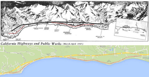 In 1947, California rerouted
Route 1 in the Malibu area, but it appears the old routing is still
visible and used. The 1947 project eliminated the last remaining original
20' pavement along Route 1 between Ventura and Dana Point. The project was
constructed in 3 units: the first was a line change around a slide at
Latigo Canyon; the second relocated the highway around slide and slipout
areas between Corral Creek and Malibu Creek; the third was between Latigo
Creek and Corral Creek. The new roadway was an 80' wide divided highway
with 2 lanes in each direction. It was also on a higher elevation a bit
further away from the beach.
In 1947, California rerouted
Route 1 in the Malibu area, but it appears the old routing is still
visible and used. The 1947 project eliminated the last remaining original
20' pavement along Route 1 between Ventura and Dana Point. The project was
constructed in 3 units: the first was a line change around a slide at
Latigo Canyon; the second relocated the highway around slide and slipout
areas between Corral Creek and Malibu Creek; the third was between Latigo
Creek and Corral Creek. The new roadway was an 80' wide divided highway
with 2 lanes in each direction. It was also on a higher elevation a bit
further away from the beach.
Ventura County Line marked the edge of Rancho Topanga Malibu and thus the Rindge Ranch. But Rindge, through Marblehead Property, owned additional land adjacent to the Rancho. In particular, they owned the land continuing W up the coast to W of Little Sycamore Creek. Today, you may know this land as either the home of Neptune’s Net Restaurant or the home of the Wilshire Blvd Temple Camps: Camp Hess Kramer and Gindling Hilltop Camp (clap clap). It is likely that Yerba Buena Road was a major road inland across to Calabasas before Roosevelt Highway was opened, as it was the only cross-canyon road on the Ventura County side; there was nothing else cross canyon until Mulholland Highway a few miles into LA County (and the Rancho).
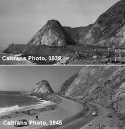 North of Malibu, extensive work was done to reroute the highway around Point
Mugu. When highway engineers began plotting the route in 1919, the rocky
promontory of Point Mugu presented a colossal challenge. Point Mugu was a
near-vertical ridge of resistant volcanic rock -- an igneous dike that in
a distant epoch intruded the Topanga formation's softer sedimentary
strata--standing some 150 feet tall against the pounding surf. As the
westernmost tip of the Santa Monicas, it represented the last visible
portion of the rugged mountain range. Just north and west of the point,
the land opened up as the Oxnard Plain, while the thrust fault that gave
rise to the Santa Monica mountains plunges beneath the waters of the
Pacific only to reemerge far to the west as the northern Channel Islands.
In 1923-24, Division of Highways engineers blasted a road cut around the
base of the headlands. Workers scaled the cliff with ropes and drilled a
series of 30-foot holes into the rock. Into the holes went 18 tons of hand
grenade powder left over from World War I and 25 tons of black blasting
powder, and down came 108,000 cubic yards of rock – much of it used
as fill for the adjacent road embankments. By October 1924, a narrow road
snaked around the point where waves once lashed at its stony face. This
roadway was narrow, dangerous and eroding away. A spate of fatal accidents
demonstrated this. Weather was often a factor, but so was the tight,
275-foot radius curve around the point. Drivers plunged their cars off the
road and into the Pacific – sometimes leaving little trace except
for bloodstained rocks. The tip of Point Mugu earned the dark moniker Dead
Man's Rock, and in 1930 Inspector Kenneth C. Murphy of the California
Highway Patrol appealed to the state highway commission for help. The
commission complied. In October 1937, an army of day laborers began
carving a 200-foot-deep road cut through Point Mugu. Workers used 107 tons
of explosives, a diesel shovel, a bulldozer, ten dump trucks, and five
jackhammers to carve out the new 60-foot-wide roadway. Where the highway
once bent around Point Mugu, it would now plow straight through the stony
wall. By February 1940, their work was complete. The original road around
the rocks survived as a scenic bypass (it's since eroded away), but the
main highway now sliced through Point Mugu, leaving only a rocky stub
where the Santa Monica Mountains once thrust themselves into the Pacific
with a final flourish. This permitted PCH to run to the east of Mugu Rock
as it does today.
North of Malibu, extensive work was done to reroute the highway around Point
Mugu. When highway engineers began plotting the route in 1919, the rocky
promontory of Point Mugu presented a colossal challenge. Point Mugu was a
near-vertical ridge of resistant volcanic rock -- an igneous dike that in
a distant epoch intruded the Topanga formation's softer sedimentary
strata--standing some 150 feet tall against the pounding surf. As the
westernmost tip of the Santa Monicas, it represented the last visible
portion of the rugged mountain range. Just north and west of the point,
the land opened up as the Oxnard Plain, while the thrust fault that gave
rise to the Santa Monica mountains plunges beneath the waters of the
Pacific only to reemerge far to the west as the northern Channel Islands.
In 1923-24, Division of Highways engineers blasted a road cut around the
base of the headlands. Workers scaled the cliff with ropes and drilled a
series of 30-foot holes into the rock. Into the holes went 18 tons of hand
grenade powder left over from World War I and 25 tons of black blasting
powder, and down came 108,000 cubic yards of rock – much of it used
as fill for the adjacent road embankments. By October 1924, a narrow road
snaked around the point where waves once lashed at its stony face. This
roadway was narrow, dangerous and eroding away. A spate of fatal accidents
demonstrated this. Weather was often a factor, but so was the tight,
275-foot radius curve around the point. Drivers plunged their cars off the
road and into the Pacific – sometimes leaving little trace except
for bloodstained rocks. The tip of Point Mugu earned the dark moniker Dead
Man's Rock, and in 1930 Inspector Kenneth C. Murphy of the California
Highway Patrol appealed to the state highway commission for help. The
commission complied. In October 1937, an army of day laborers began
carving a 200-foot-deep road cut through Point Mugu. Workers used 107 tons
of explosives, a diesel shovel, a bulldozer, ten dump trucks, and five
jackhammers to carve out the new 60-foot-wide roadway. Where the highway
once bent around Point Mugu, it would now plow straight through the stony
wall. By February 1940, their work was complete. The original road around
the rocks survived as a scenic bypass (it's since eroded away), but the
main highway now sliced through Point Mugu, leaving only a rocky stub
where the Santa Monica Mountains once thrust themselves into the Pacific
with a final flourish. This permitted PCH to run to the east of Mugu Rock
as it does today.
(Source: KCET, 7/28/2014)
Through Oxnard, the routing originally ran along Oxnard Blvd from Mugu Rock to El Rio. Around 1957, a freeway alignment was constructed from just SE of the Naval Base (Callengus Creek Road) to Rose. In 2012, Route 1 was routed off Oxnard Blvd at Pleasant Valley and onto Rice Road to US 101. However, as of 2023, this routing is not signed, and is not in the Postmile System. Oxnard Blvd in Oxnard was funded for relinquishment in 2013; also portions of 5th and Vineyard (but may still have signs). Many folks still remember the SB exit at Wagon Wheel Road and the roadside motel and attractions there – now Oxnard Flats Condos.
 Status
In June 2016, it was reported that a Pacific Coast Highway Corridor Study
by Caltrans and the Orange County Transportation Authority suggests the
possibility of grant-funded roundabouts at El Camino Real’s
intersections with Camino Capistrano, Camino San Clemente and Avenida
Estacion. It’s part of an analysis of ways to improve safety and
mobility for drivers, transit passengers, bicyclists and pedestrians along
a 37-mile PCH corridor from Seal Beach to San Clemente. El Camino Real in
San Clemente is former Route 1 (officially, Route 1 rejoins I-5 a bit to
the north, just above Capistrando Beach). The old Coast Highway/ECR in San
Clemente exits from the Route 1 mainline at 001 ORA R0.79. The goal for
intersections is to reduce conflicts between pedestrians, cyclists and
vehicles. San Clemente City Council members got a synopsis from OCTA on
June 13. Joe Alcock, an OCTA manager who worked on the study, said that
left-turn bike boxes or left-turn signal phases would be a low-level
option for the intersections, while roundabouts are a higher-cost option.
Funding could be available to cities through a competitive process. The
city already plans to reconfigure El Camino Real along the 0.9-mile
stretch from Camino Capistrano to Avenida Estacion, creating a two-way
bikeway on the southbound side of the highway as a continuation of Dana
Point’s existing two-way bikeway, which ends at Camino Capistrano.
(Source: OC Register, 6/22/2016)
Laguna Canyon Channel Bridge No. 55 1106 (12-Ora-1 9.39)
The following project was included in the final adopted 2018 SHOPP in March 2018: PPNO 2293. 12-Orange-1 9.3. Route 1 In Laguna Beach, at Route 133 (Broadway Street). Replace bridge. Begin Con: 11/19/2019. Total Project Cost: $4,660K.
In June 2019, the CTC approved the following SHOPP
scope amendment: 12-Ora-1 9.3 9.4 PPNO 2293 ProjID
1213000086 Route 1 In Laguna Beach, at Route 133 (Broadway Street).
Replace bridge. The post mile has been revised to better describe the
location of work. Increase construction capital because geotechnical
investigations revealed the existence of wet and sandy soil that will need
to be excavated and backfilled with concrete slurry. Updated cost: $6,681K
(Source: June 2019 CTC Minutes Agenda Item 2.1a.(1)
Scope Item 118)
In May 2020, the CTC approved the following allocation:
$4,271,000. 12-Ora-1 PM 9.4. PPNO 12-2293. ProjID 1213000086. EA 0M990.
Route 1 in Laguna Beach, at Route 133 (Broadway Street) at Laguna Canyon
Channel Bridge No. 55-1106. Outcome/Output: Remove and replace
bridge. CON ENG $600,000; CONST $3,571,000. (As part of this allocation
request, the Department is requesting to extend the award of the
construction contract an additional 6 months beyond the 6 month deadline.)
(Source: May 2020 CTC Agenda, Agenda Item 2.5b.(1)
#27)
In April 2016, it was reported that Orange County Transportation
Authority, which partnered with Caltrans to study 37 miles of the highway
from Seal Beach to San Clemente, provided the findings from the study to
the six coastal city councils. The Pacific Coast Highway Corridor Study
identified transit problems and opportunities across the stretch as well
as seven subareas, broken down from north to south into Seal Beach (apx
001 ORA 33.224), Huntington Beach (apx 001 ORA 24.649), Newport Beach (apx
001 ORA 19.715), Newport Coast (apx 001 ORA 13.812), Laguna Beach (apx 001
ORA 9.42), Dana Point (apx 001 ORA R1.077) and San Clemente. Several
safety issues among bikes, pedestrians and vehicles arose, OCTA Planning
Director Kurt Brotcke said during his presentation to board members. Other
issues include frequent closures for events, inconsistent aesthetic
treatments to the roadway and delays due to traffic congestion and high
volumes of pedestrian crossings. In Seal Beach, conflicts occur among
bikers, pedestrians and motorists in areas without designated bicycle
facilities or sidewalks, the study states. The Huntington Beach area sees
heavy pedestrian crossings and traffic back-ups due to full parking lots,
and signal timing is not optimized. Heavy pedestrian activity in the
Mariner’s Mile and Corona del Mar areas of Newport Beach creates
traffic, while the Newport Coast area experiences conflicts between
bicycles and vehicles using the right-turn lanes on Newport Coast Drive.
Pacific Coast Highway through the Laguna Beach area has a constrained
width and narrow or missing sidewalks. The Dana Point area lacks
pedestrian facilities and bicycle routes and has stretches that cannot
withstand floodwaters. And the San Clemente area has insufficient
pedestrian facilities and conflicts between road users at several
intersections, according to the study. The City of Newport Beach and OCTA
have already started moving forward with improvements at 27 traffic
signals along a nine-mile stretch of the highway between west Newport
Beach and Newport Coast. The City Council this month approved an agreement
with OCTA to install signal equipment and fiber optic cable, update signal
timing and install closed-circuit television cameras along Coast Highway
at Superior, Riverside Avenue and Dover Drive. The project is expected to
enhance traffic signal coordination. Much of the estimated $2.25-million
project will be funded by a county grant. Newport Beach has agreed to chip
in $450,000.
(Source: OC Register, April 11, 2016; LATimes,
5/2/2016)
In September 2016, it was reported that brighter lights, intersections
where pedestrians can cross from all corners at the same time and
bicyclists who stay off Coast Highway are suggestions that Laguna city
leaders offered in reaction to a study of the state highway conducted by
the Orange County Transportation Authority and Caltrans. The study found
that Coast Highway through Laguna Beach (apx 001 ORA 9.42) is narrow and
lacks sidewalks. The Dana Point segment lacks sidewalks, as well as
bicycle routes, and has stretches of roadway that frequently flood. In San
Clemente, there are roadway segments without sidewalks and there have been
reports of near collisions at several intersections. In Seal Beach, there
have been issues among bikers, pedestrians and motorists in areas without
designated bicycle lanes or sidewalks, the study states. Huntington Beach
has heavy pedestrian crossings, and parking overflow backs up onto the
roadway. Signals are also not well-synchronized. Heavy pedestrian activity
in the Mariner’s Mile and Corona del Mar areas of Newport Beach
creates traffic on the road, and in Newport Coast, there have been issues
between bicycles and vehicles using the right-turn lane onto Newport Coast
Drive. Laguna Beach Mayor Pro Tem Toni Iseman expressed concern about
adding bicycle lanes to Coast Highway, as suggested by the report.
(Source: OC Register, 9/20/2016)
In March 2017, it was reported that Newport Beach (apx 001 ORA 19.715)
residents expressed their discontent to city officials at a recent public
workshop regarding proposed changes to Mariners’ Mile, a 1.3-mile
zone of Coast Highway (Route 1). The current plan outlines strategies to
alleviate automotive congestion and encourage pedestrian movement for the
area but eliminated the idea of any particular theme. Residents expressed
their disappointment to hear the idea of a nautical theme for the locale
being disregarded, demanding to know why the design would not be
implemented. Buildings along Mariners’ Mile are no longer nautical,
according to Newport Beach city staff. The city hopes to improve traffic
flow through Mariners’ Mile. The plan is to expand Coast Highway to
six lanes. Currently, the road consists of four to five lanes between
Dover Drive and Newport Boulevard. Residents voiced their disapproval
about expanding Coast Highway and changing the infrastructure. Some
residents were opposed to drawing more automobiles or people to the area.
The conceptual plan also includes replacing street parking with a public
parking structure, building a bridge for pedestrians to cross Coast
Highway as well as providing alternative routes for bike lanes to go
through residential streets such as Avon.
(Source: The Log, 3/9/2017)
In July 2022, it was reported that Caltrans is planning upcoming
improvements on PCH in Surf City, one of several projects approved in
Orange County after the California Transportation Commission allocated
$700 million in May to repair and improve transportation infrastructure
throughout the state. More than a third of the funding comes from Senate
Bill 1, the Road Repair and Accountability Act of 2017. The improvements
seek to make the area more bike and pedestrian friendly, while also
improving overall safety. Construction is set to begin in January 2025.
Caltrans officials said the $14.8-million project in Huntington Beach will
add several upgrades on PCH, including rehabilitating pavement, replacing
traffic loop detectors and guardrails, adding Class II bike lanes and
upgrading facilities to Americans with Disabilities Act standards. In
other areas, a Class III bike lane will be accessible, meaning that
bicyclists will need to share the road with motorists. Signs will be
placed along Route 1 making travelers aware. This appears to be the
allocation of $19.052 million for 12-Ora-1 13.0/33.6, PPNO 12-2330; ProjID
1216000002; EA 0P680. Route 1 In and near Newport Beach, Huntington Beach
and Seal Beach, from Crystal Heights Drive to Los Angeles county line.
Outcome/Output: Replace traffic signals, upgrade concrete barrier, make
pedestrian and bicycle upgrades at intersections and crosswalks, and
upgrade facilities to Americans with Disabilities Act (ADA) standards. The
$14.8 million specifically refers to an allocation of $14,824,000 for
12-Ora-1 29.9/33.7, PPNO 12-2499A, ProjID 1215000149; EA 0P590; Route 1 In
Huntington Beach, from Warner Avenue to Los Angeles County line.
Outcome/Output: Rehabilitate pavement by grinding and placing Hot Mix
Asphalt (HMA), replace traffic loop detectors and guardrail, add
Class II bike lanes, and upgrade facilities to Americans with Disabilities
Act (ADA) standards.
(Source: Daily Pilot, 7/12/2022; May 2022 CTC Agenda, Agenda Item 2.5b.(1) #25 and #26)
In September 2021, it was reported that Caltrans plans a complete streets
project on ~18 miles of Pacific Coast Highway from the Orange County line
(~ LA 0.000) to Paseo De Las Delicias in Torrance (~ LA 18.001) – in
the cities of Lomita, Long Beach, Los Angeles, and Torrance. Caltrans
plans to add sidewalks (where they are missing), pedestrian beacons, and
striping/markings. Estimated cost is $606,000.
(Source: Streetsblog LA, 9/22/2021)
In August 2015, it was reported that Caltrans is beginning a process to
replace or repair the Alamitos Bay Bridge (001 LA 000.98) on Pacific Coast
Highway. The bridge was built in 1959 over the river channel between
Second Street and Loynes Drive. It was widened eight years later, but now
has been deemed seismically deficient (in danger of collapse in an
earthquake). According to a Caltrans report, the bridge still is safe to
use, but an inspection discovered cracks in the concrete curb, potholes on
the roadway and cracks in some of the piles and piers. Erosion also has
deteriorated the banks under the bridge. This project could have
particular significance because it is just north of the Second Street-PCH
intersection that some say is the most congested in the city, and is in
the middle of the SEADIP (Southeast Area Development and Improvement Plan)
area now being studied for an updated land use plan. The Second Street-PCH
intersection and PCH itself play key roles in some of the proposed plans.
PCH is a southern gateway into Long Beach. Traffic along the state highway
has been a sticking point for proposed developments in the area. At the
same time, the city has little control over the highway’s
configuration because Caltrans maintains it as a state highway. Three
alternatives will be considered: a no-build alternative, an option to
retrofit the existing bridge and complete replacement with a wider bridge.
(Source: Gazettes, 8/3/2015)
In August 2019, the CTC approved the following SHOPP allocation:
$1,273,000. 07-LA-1 3.5. Route 1 In Long Beach, at Lakewood Boulevard
(Route 19) at the Los Alamitos Traffic Circle. Outcome/Output: Upgrade the
existing roundabout to a standard configuration by adding pavement
markings and guide signs to better direct motorists and control movements.
This project will reduce the number and severity of collisions.
(Source: August 2019 CTC Agenda, Agenda Item
2.5b.(1) Item 36)
In late March 2007, the City of Torrance indicated its desire to take
over the segment of this route within its city limits (apx 001 LA 14.24 to
001 LA 18.215). Specifically, the Torrance City Council voted unanimously
to send a letter indicating its interest in having the state Department of
Transportation relinquish control of the 5-mile segment of Pacific Coast
Highway and 6-mile stretch of Hawthorne Boulevard within Torrance limits.
Sending the letter is a precursor to an estimate the city is required to
provide to Caltrans of the cost of bringing each road up to a "state of
good repair." City staff members believe it will cost $25M to $30M for
each road, which the state would provide to the city in the form of a
one-time payment. Bringing the route under city control will allow the
city to improve the timing of signal lights to improve traffic flow and
reduce the bureaucracy needed to upgrade the roads.
(Source: Daily Breeze, 3/29/2007)
The intersection with Route 107 in Torrance (apx 001 LA 15.975) is being reconstructed under TCRP Project #46. This project was to reconstruct the intersection of Hawthorne Boulevard (Route 107) and Pacific Coast Highway (Route 1) by adding turn pockets. The cost to complete PA&ED was significantly underestimated in the original application, and additional TCRP funds are required to complete the phase. With R/W estimated to be over $26,000,000, the overall project cost has exceeded the total TCRP funds available. Per the September 2006 CTC Agenda, until such time as the City of Torrance and the Department can identify additional funds to complete PS&E, R/W, and Construction, those phases have been put on hold. In order to complete PA&ED and closeout the phase, an additional $467,000 of TCRP funds is required. Note: According to the Daily Breeze on 3/29/2007, this project was originally began by the City of Torrance, and was to consist of a right turn lane from northbound Hawthorne Boulevard to eastbound Pacific Coast Highway. The project was estimated to cost about $2 million. Caltrans took over the project, changed the scope of the improvements to include the entire intersection, studied and designed it at a cost of $2 million, and concluded that upgrading the entire intersection would cost $15 million.
In August 2011, the CTC approved $450,000 in SHOPP funding for repairs along Route 1 from Torrance to Malibu from Camino De Las Colinas Road (apx 001 LA 18.05) to Sunset Boulevard (001 LA LA 39.326) that will construct Americans with Disabilities Act (ADA) curb ramps at 13 locations to upgrade curb ramps to comply with ADA standards.
In July 2011, Metro approved about $1.24 million in Measure R funding to improve Route 1 (Pacific Coast Highway) from Artesia Boulevard (001 LA 21.926) to Anita Street (apx 001 LA 20.619), and the intersection of Route 1and Aviation Boulevard under the program—split as $240,000 for Route 1 from Artesia to Anita and $1 million for the Route 1-Aviation junction.
A study in late 2009 indicated that nearly half of the 125 intersections on the oft-congested 11-mile stretch of Pacific Coast Highway between Torrance and El Segundo need improvements to help traffic flow better. The same study found that many of those upgrades would be relatively easy and inexpensive to implement. Fifty-four of the 125 intersections need modifications along the major commuter route, the study said. The yearlong, $100,000 study included not only analysis and observations by transportation experts, but motorists who drive the route on a regular basis, according to the South Bay Cities Council of Governments, which commissioned the study. The study also found that the three busiest intersections along PCH were Rosecrans Avenue in Manhattan Beach (001 LA 23.927) and Hawthorne (apx 001 LA 15.962) and Crenshaw boulevards (apx 001 LA LA 14.632) in Torrance. The single worst stretch of crowded highway: the segment between Rosecrans Avenue and Manhattan Beach Boulevard. The study also found that Manhattan Beach Boulevard in Manhattan Beach is a "significant choke point" during the evening commute, but southbound traffic usually continues without stopping until vehicles hit Pier Avenue/Aviation Boulevard in Hermosa Beach. (More Details).
In February 2017, it was reported that the City of El Segundo was
revisiting a proposal to change the name of Sepulveda Boulevard (Route 1)
to Pacific Coast Highway — a move proponents say will give
businesses along the corridor a beachy rebranding. The idea to rename the
2-mile stretch of Route 1 that runs through the city from Imperial Highway
(apx 001 LA 25.881) to Rosecrans Avenue came from the El Segundo Economic
Development Advisory Council in 2013, when it launched an ambitious
marketing campaign to attract new businesses. The efforts have paid off,
winning El Segundo the title of most business-friendly city in Los Angeles
County in 2015 and surpassing a goal of attracting 100 new businesses by
the city’s centennial. The last time outreach was conducted in 2014,
the results were mixed: 41 percent of the 86 mostly business owners who
responded to surveys liked the idea, 45 percent didn’t, and 14
percent were indifferent. According to city staff, Caltrans would prefer
having neighboring Manhattan Beach — where the street also is named
Sepulveda Boulevard — sign off as well, but the city has not taken a
formal stance and did not respond to a letter from Mayor Suzanne Fuentes
in 2015. Sepulveda Boulevard becomes Pacific Coast Highway in Hermosa
Beach to the south and Lincoln Boulevard north of Los Angeles
International Airport. It becomes Pacific Coast Highway again in Santa
Monica (N of the McClure Tunnel). Sepulveda Boulevard has a strong
identity in Manhattan Beach, according to historian and former mayor Jan
Dennis, who is writing a book just on its history in the city. Manhattan
Beach was unwilling to change the name of Artesia Boulevard to Redondo
Beach Boulevard when business owners in north Redondo Beach lobbied for
that idea in recent years, also with the aim of enhancing the area’s
beach identity. In April, it was reported that the El Segundo City Council
decided to initiate the name change process without conducting a new round
of surveys with businesses on the 2-mile stretch of Route 1 that bisects
the town, something that produced mixed results in 2014. If the change is
approved by Caltrans, it would make the name of the street inconsistent in
Manhattan Beach as it runs through the South Bay, going from PCH in El
Segundo, to Sepulveda Boulevard in Manhattan Beach, and back to PCH again
in Hermosa Beach and Redondo Beach. El Segundo Public Works Director Ken
Berkman said he is still waiting on Caltrans to answer some questions
about the process, mostly to do with logistics. The agency previously
indicated it would prefer having Manhattan Beach on board as well. The
name change is expected to take a year to 18 months to complete, giving
businesses time to transition, Berkman said, and could cost the city
$15,000. Mail sent to Sepulveda Boulevard addresses would be forwarded for
the first 18 months. The City Council still has to pass a formal
resolution that would be submitted with its application to Caltrans
(Source: Daily Breeze, 2/8/2017; DailyBreeze,
4/19/2017)
In June 2018, Caltrans tweeted: "In #ElSegundo this past weekend street
signs were installed changing the name of Sepulveda Bl. to Pacific Coast
Hwy between Imperial Hwy & Rosecrans Av. - in the city of El Segundo
only, as requested by the city & permitted in advance by Caltrans"
(Source: Caltrans District 7 Twitter, 6/4/2018)
Sepulveda Tunnel
In September 2012, it was reported that construction was beginning on the $3.5 million Sepulveda Tunnel retrofitting project (apx 001 LA 26.355) that promises to better illuminate the road with energy efficient LED lighting. Construction is scheduled to start the first week of October 2012 and continue through November 16, 2012. The work will resume after the holidays, from January 2, 2013 and continue through June 20, 2013. The majority of the work will take place in the overnight hours. The work inside the tunnel, which runs underneath a runway on the south side of Los Angeles International Airport, will address poor visibility and other safety issues. The work is part of a collaborative effort between state and local agencies. Rosendahl brought Los Angeles World Airports, Bureau of Street Lighting, Bureau of Street Services, Department of General Services, and CalTrans to the table to figure out a plan to not only renovate but also maintain the tunnel. The agencies agree to be responsible for tunnel upkeep, properly sweep and maintain the roadway, and power wash the walls and ceiling.
In March 2013, the LED lighting project was completed.
LAX Rework (LA 26.968)
In April 2019, it was reported that Los Angeles airport
officials have called for an expansion and reorganization of the
nation’s second-busiest airport, including changes to existing
runways and the construction of a passenger terminal east of Sepulveda
Boulevard. In a 142-page environmental document, city airport officials said the expansion would bring more sophisticated facilities for travelers, improve
runway safety, and add at least 21 gates for domestic and international
flights. There is some impact of this work on Route 1 (which will also be
impacted by the future relinquishment of the segment of Route 1 between
I-105, S of LAX and the Santa Monica City Limits). The primary impacts
would be reconfiguration of the connections to 96th Street and the
entrances from Sepulveda to the Airport proper, the reconstruction of
roadways across Sepulveda Blvd (Route 1) including the extension of
passenger terminal walkways and roadways.
(Source: Los Angeles Times, 4/5/2019)
Lincoln Blvd - Playa Del Rey
There is a regional transportation improvement project to widen the following portions of Route 1 in Los Angeles County: between 92nd and Grand; between 33rd Street and Rosecrans Avenue; between Hughes Terrace to La Tijera Blvd; between Figi Way and Hughes Terrace. This will also include demolishing the Culver Blvd overcrossing (apx 001 LA 30.926) and constructing a new six-lane overcrossing with longer spans, as well as removal of some medians to turn them into traffic lanes.
In March 2018, it was reported that Caltrans was
hosting a community meeting to discuss plans for widening Lincoln
Boulevard between Jefferson Boulevard in Playa Vista and Fiji Way in
Marina del Rey. The heavily trafficked 0.6-mile stretch of Lincoln
traverses the upper and lower segments of the ecologically sensitive
Ballona Wetlands Ecological Reserve. The project, still in its early
development stages, includes widening the Lincoln Boulevard bridge over
Ballona Creek and the Culver Boulevard bridge over Lincoln. The project
may entail work that touches the wetlands, but everything is in the
preliminary stages. Caltrans is considering two sets of plans. The first
would realign Lincoln and its Culver interchange to the east, expanding
the Lincoln Boulevard bridge to accommodate three traffic lanes in each
direction (instead of two) plus a sidewalk and bicycle lanes on each side.
A new Culver bridge would maintain the existing traffic configuration but
add a sidewalk and bicycle lanes to connect with the Ballona Creek Bike
Path. The other plan would maintain the existing Lincoln Boulevard
alignment by widening the roadway on both sides to accommodate three
traffic lanes, sidewalk and bicycle lanes over the bridge, while also
widening the Culver bridge to include bike paths and a sidewalk.
(Source: The Argonaut, 3/27/2018)
Lincoln Blvd - Santa Monica
In August 2011, the Santa Monica City Council approved
a resolution accepting responsibility for the section of Lincoln
Boulevard, also called Route 1, which runs from the I-10 Freeway to the
southern city limits (apx 001 LA 33.319). Santa Monica officials have been
pushing for control over sections of Lincoln Boulevard since 1996, when
City Hall won control over portions of both Lincoln and Santa Monica
(Route 2) boulevards. In 2009, the California Legislature approved a bill
greenlighting Santa Monica to assume responsibility for the southern
section. That bill became effective Jan. 1, 2010. Under the previous
arrangement, the Santa Monica Public Works Department had the authority to
fill potholes, but major repairs, like sealing the road or adding
additional asphalt emulsion, were the responsibility of cash-strapped
Caltrans. This resulted in Lincoln having one of the lowest scores (i.e.,
being in the worst shape) in Santa Monica. It will cost approximately $2.2
million to bring the 1-mile section of road up to snuff and repair the
curb, gutter and sidewalk damage that has wreaked havoc on the roadway.
Caltrans isn't required to pay for those improvements, particularly after
responsibility trades hands from state to City Hall, but it is its
practice to do so.
(Source: Santa Monica Daily Press)
In May 2012, the CTC authorized relinquishment of right of way in the city of Santa Monica on Route 1 between Route 10 (apx 001 LA R34.553) and the southeasterly city limits (001 LA 33.319), under terms and conditions as stated in the relinquishment agreement scheduled to be signed by the City Manager by May 5, 2012. The City Council authorized the City Manager to sign the relinquishment agreement during the City Council meeting dated August 23, 2011. Authorized by Chapter 189, Statutes of 2009, which added Section 301.2 of the Streets and Highways Code.
In October 2013, the CTC authorized $2.2 million in Santa Monica on Route 1, from Dewey Street (001 LA 33.303) to Route 10 (apx 001 LA R34.553), with the goal of relinquishing 5.2 miles of roadway (Lincoln Boulevard) to local jurisdiction. City will accept ownership, maintenance, operation and liability over the relinquished facilities.
In April 2017, it was reported that the City of Santa
Monica had finalized its design for a relinquished portion of Route 1,
along Lincoln Blvd s of Olympic Blvd (near I-10, the Route 1/Route 2
junction, apx 001 LA R34.591) to Ozone Ave. The first wave of changes will
include: (*) A dedicated bus lane during peak hours; (*) Curb extensions;
(*) ADA-compliant sidewalk ramps; (*) New crosswalks and improvements to
existing ones; (*) Nearly 50 new trees. The project does not include the
creation of a formal bike lane, though it will allow for bike riders to
use up to 5 feet of the bus lane. An earlier staff report had pegged costs
for the first phase at about $2.5 million. A second, more expensive phase,
is ultimately planned. It would involve adding stormwater filtration
infrastructure and pedestrian lighting.
(Source: CurbedLA, 4/27/2017)
In January 2018, it was reported that the City of Santa Monica was
considering the Gateway Master Plan, which will address planning in the
area “adjacent to the I-10 Freeway that links Downtown to the Civic
Center” and to Santa Monica High School, and it could include
covering the freeway with decking that could create new space for a park
(this appears to include the portion of the freeway that, although
considered I-10, is really Route 1). Previous reports on capping the park
had explored extending the McClure Tunnel and covering the freeway from
Fourth Street (001 LA 35.037) to Ocean Avenue (001 LA 35.11). The new
staff report says the Gateway Master Plan offers “a unique
opportunity for strengthening connections over the freeway right of
way.” It also says the cap park would be a way to offer “an
enlarged green space for outdoor enjoyment” where there previously
was none. By removing the visual and physical barrier between the
city’s downtown and its civic center area, the park could create a
new link between the two sections of the city. The report also notes that
by providing access to “peripheral parking opportunities,” the
park might be able to reduce car congestion in the city’s downtown.
(Source: CurbedLA, 1/8/2018)
A (temporary) installation of a statue of Mario of the Mario Brothers has
been installed atop a column on I-10 freeway (actually, Route 1, as the
visible location is ~ 001 LA R34.812) in Santa Monica. The character is
visible from the corner of Olympic and 5th Street and to vehicles entering
the freeway at that intersection. It is the work of Bohemia Incorporated
and the arts duo said the location had been on their radar for years but
it took some time to figure out what to put there. The Styrofoam sculpture
is about 32 inches tall and is painted to match the concrete it sits atop.
(Source: Santa Monica Daily Press, 7/22/17)
In December 2020, it was reported that the McClure Tunnel (~ LA 35.208)
and several nearby ramps will temporarily close in January to facilitate
upgrades to the freeway. Workers will be installing new lights, a high
friction road surface, speed warning system and the county’s first
queue warning system. Caltrans Public Information Officer Eric Menjivar
said a field investigation team looked at the McClure Tunnel and chose it
as the site of the first system for several reasons. He said the
transition from a traditional freeway system to a highway with possible
traffic hazards made it an ideal location for the warning. In addition to
the queue warning, he said the new road surface and speed warnings will be
installed to improve safety. While the speed notices will tell drivers if
they’re coming in too fast, the new road surface will help keep cars
in their lanes. Construction is scheduled to start the first week of
January 2021. Aldridge Electric is the contractor on this $6.3 million
project, which is anticipated to be completed in Spring 2021.
(Source: Santa Monica Daily Press, 12/22/2020)
Note: For information on the Santa Monica Pier (approx 001 LA 35.242), see Route 187, as the pier was originally part of that route.
In April 2017, it was reported that a new type of crosswalk beacon has
been installed by Caltrans on Route 1 (Pacific Coast Highway) in the
Pacific Palisades neighborhood of Los Angeles. The system is popularly
known as a HAWK beacon (the acronym is derived from High-intensity
Activated crossWalK). More precisely, it is referred to as a Pedestrian
Hybrid Beacon (PHB). The installation is designed to provide superior
awareness and enhanced safety when pedestrians use the crosswalk. This is
the second PHB in operation that was installed by Caltrans District 7,
which includes the counties of Los Angeles and Ventura. The first is on
Route 1 at Second Street in the city of Manhattan Beach. When a pedestrian
activates the button, the Pedestrian Hybrid Beacon uses flashing and solid
lights to instruct drivers to stop. As seen from a driver’s point of
view, the configuration of the PHB consists of two red lenses side-by-side
over a single yellow lens. The new PHB was installed in March 2017 on
Route 1 north of Temescal Canyon Boulevard near Palisades Bowl Mobile Home
Park (apx 001 LA 38.109).
(Source: Caltrans District 7 Blog, 4/7/2017)
In October 2016, the CTC authorized vacation of right of way in the city of Malibu along Route 1 from 0.4 miles west of Tuna Canyon Road to 0.2 miles east of Tuna Canyon Road (PM 41.1/41.7), consisting of superseded highway right of way. In December 2016, this vacation resolution was amended to correct an incorrect corporation name in a reservation.
Malibu Safety Improvements
In February 2012, it was reported that the Southern California Association of Governments and the city of Malibu have posted a bid for a Pacific Coast Highway Safety Study for all modes of travel along the 21 mile stretch between the eastern (001 LA 40.744) and western edges of Malibu (apx 001 LA 61.603). The Scope of Work document indicates that the "study will examine current conditions along the roadway and determine accident patterns based on roadway geometry, adjacent land-uses and/or other factors that may be unique to Malibu. The study will analyze and identify potential strategies, (engineering, education and enforcement) to promote improved safety along PCH for all modes of travel including bicycling and walking." The Scope of Work also breaks the long, skinny city into four sections for the study to examine, including: 1) Topanga Canyon Road to Big Rock Road, 2) Big Rock Road to Cross Creek Road, 3) Cross Creek Road to Busch Drive, and 4) Busch Drive to Western City Limits." A $300,000 grant (pdf) from Caltrans provides most of the funding for this portion of the study, which is expected to take 24 months to complete.
In June 2015, it was reported that the Malibu City
Council approved a plan to make Malibu safer. The plan recommends 150 road
improvements, both large and small, which include extending bike lanes,
adding traffic circles, fixing cracked roads, and adding more parking
lots. The $20 million project is hoping to get funding through L.A.
County's Measure R sales tax, or through federal or state grants. The plan
stems from a study three years in the works. It finds that PCH's busy
shoulders are especially hazardous because bicyclists, pedestrians, parked
cars and buses are all competing to use it. The study says drivers make
dangerous parallel parking moves while going at 45 to 55 mph because the
only other alternative to this free on-street parking is paid parking lots
and valet. The study finds that it's confusing for drivers who want to
park alongside PCH because the street signs and painted red curbs are
inconsistent, causing even more reckless driving. Local Malibu residents
apparently even put up fake no-parking signs to keep outsiders from taking
up their on-street parking spots. Additional recommendations include
extending the bike lane from Zuma Beach across the city. The plan also
proposes that the most dangerous part of PCH by Las Flores Canyon Road
(apx 001 LA 44.121), which has a sharp curve, should be widened. There are
also two intersections within 150 feet of each other there, and the plan
recommends that one of the signals be removed to make it safer. It also
proposes that Malibu parking lots be added so that folks will stop parking
alongside the shoulder of the road, where cyclists bike through. The
report recommends bike lanes and raised medians, additional pedestrian
crosswalks and designated underpasses. It also considers the possibility
of a state-of-the-art traffic-signal timing system that could be adjusted
for real-time conditions. The existing system was built piecemeal, and
engineers must manually change signal times at many intersections.
Pedestrian-activated flashing lights at crosswalks are also on the list,
as is lane narrowing in the city's western end to encourage vehicles to
slow down.
(Source: LAist, 6/22/2015, LATimes,
7/13/2015)
In December 2023, it was reported that an ambitious
multi-million-dollar project has begun to improve safety and traffic flow
along the Pacific Coast Highway in Malibu, including the area where four
Pepperdine University students were killed in a crash in October 2023. As
part of the “Traffic Signal Synchronization Project,” crews
will install communication lines between existing traffic signals on PCH
between John Tyler Drive and Topanga Canyon Boulevard. Officials said this
will allow signals to be controlled remotely by Caltrans to lower speeds
and reduce congestion. The project also includes new surveillance cameras
at each intersection, new signal poles, electronic message signs and other
improvements. The $34.6 million project was approved by the Malibu City
Council in 2017 to deal with traffic flow and safety concerns, well before
the Oct. 17 crash that claimed the lives of Pepperdine students Niamh
Rolston, Peyton Stewart, Asha Weir and Deslyn Williams. The project is
expected to take up to a year to complete. Additionally, a $4.2-million
contract approved in early December will allow Caltrans to move forward on
a draft list of 30 upgrades — including enhanced striping in curves,
optical speed bars (stripes spaced at gradually decreasing distances to
make drivers aware of their speed), speed feedback signs, speed limit
markings on the pavement and replacement of safety corridor signs.
(Source: KTLA, 12/4/2023; Los Angeles Times, 12/20/2023)
Las Flores Canyon / Rambla Pacifica Intersection (07-LA-1 43.9/44.4)
In June 2021, it was reported that Caltrans has
presented a list of proposed operational improvements the agency believes
will reduce the number of collisions at the double red-light intersection
where Rambla Pacifico and Las Flores Canyon roads meet Pacific Coast
Highway (~ 001 LA 44.114) within about 50 feet of each other. In the
city’s last traffic study, the Pacific Coast Highway Safety Study of
2015, a total of 114 accidents were reported at Rambla Pacifico and Las
Flores from 2012 through 2014. Those collisions resulted in three deaths
and 81 injuries. Caltrans proposes to extend the left turn lane for PCH
east/southbound traffic turning onto Las Flores. At the same time, the
agency would also remove the left turn lane that allows west/northbound
PCH traffic to turn left into the gas station at Rambla Pacifica. There
was also commissioner concern about traffic going in and out of the
Duke’s Malibu Restaurant parking lot at PCH and Las Flores Canyon.
Other Caltrans proposed improvements included an Americans with
Disabilities Act (ADA) curb ramp, which is already included in the
city’s traffic signal synchronization project. In 2022, Caltrans
plans to use SHOPP funds for a pavement rehabilitation project to make
crosswalk improvements. That same year, the agency also hopes to replace
the aging PCH bridge over Las Flores Creek—the decades-old structure
has had several repairs over the years due to traffic collisions. The
estimated cost for everything is $3.532 million, funded by the state
through SHOPP—the State Highway Operation and Protection Program, a
“fix-it-first” program—and construction would begin fall
2022. In late June 2021, it was reported that CTC had approved $1.6
million for a project on Las Flores Canyon Road in Malibu that will
install protected left-turn signal phases for southbound traffic, extend
the left-turn lane, upgrade facilities to Americans with Disabilities Act
standards, and upgrade signal poles, mast arms and hardware.
(Source: Malibu Times, 6/9/2021; Spectrum1 News, 6/24/2021)
Also in June 2021, the CTC approved the following SHOPP
amendment: 07-LA-1 44.1/44.2 43.9/44.4. PPNO 5505
ProjID 0719000001 EA 07-35490. In Malibu, from 0.2 mile south to 0.3
mile north of Las Flores Canyon Road to Rambla Pacifico
Street. Install protected left-turn signal phases for southbound
movements, extend left-turn lane, upgrade facilities to Americans with
Disabilities (ADA) standards, and upgrade signal poles, mast arms, and
hardware. Note: Curb ramps and crash cushions are being removed from this
project because of R/W conflicts, utility conflicts, or because they are
on private property and will be constructed by other projects. A
signal pole will be removed from the scope because it is outside of the
Department's R/W. Reduce construction capital because of these scope
changes. Update postmiles to include the project's advance warning
flashing beacons. Const Cap $4,009K $3,532K; Total
$7,358K $6,881K. (Concurrent COS allocation under
Resolution FP-20-86; June 2021.)
(Source: June 2021 CTC Agenda, Agenda Item
2.1a.(2d) #28)
Lastly, in June 2021, the CTC approved the following
pre-construction allocation: 07-LA-1 43.9/44.4. PPNO 5505; ProjID
0719000001; EA 35490. Route 1 In Malibu, from 0.2 mile south to 0.3 mile
north of Las Flores Canyon Road. Install protected left turn signal
phases for southbound movements, extend left-turn lane, upgrade facilities
to Americans with Disabilities (ADA) standards, and upgrade signal poles,
mast arms, and hardware. (Concurrent amendment under SHOPP Amendment
20H-009; June 2021.) Allocation: PS&E $1,462,000 R/W Sup $21,000
(21-22)
(Source: June 2021 CTC Agenda, Agenda Item
2.5b.(2a) #17)
In January 2021, the CTC approved the following minor SHOPP allocation:
#1 $1,306,000 Los Angeles 07-LA-1 R48.7/R50.6. On Pacific Coast Highway
Route 1, at Malibu Seafood Restaurant north of Pureco Canyon and south of
Corral Canyon. Outcome/Output: Install pedestrian crossing with a flashing
Pedestrian Hybrid Beacon system, striping, signs, and pavement markings.
EA 4V010 ProjID 0718000265. (This is a substitute project for EA
07-4V190.)
(Source: January 2021 CTC Agenda, Agenda Item 2.5a.
#1)
A small portion in Malibu was up for vacation in April 2003: 07-LA-1-PM 50.9 Route 1 in the City of Malibu.
Trancas Creek Bridge (07-LA-1 PM 56.5/56.9)
") In March 2018, the CTC approved for future consideration of funding a project
to replace the existing Trancas Creek Bridge with a new bridge structure
on Route 1 (07-LA-1, PM 56.4/56.9). The project also proposes to promote
multimodal transportation with a Class II bike lane. The project is
estimated to cost $53.0 million. The project is fully funded and
programmed in the 2016 SHOPP for an estimated total of $49.9 million,
which includes Construction (capital and support) and Right-of-Way
(capital and support). Construction is estimated to begin in Fiscal Year
2021-22. The scope, as described for the preferred alternative, is
consistent with the project scope programmed by the Commission in the 2016
SHOPP.
In March 2018, the CTC approved for future consideration of funding a project
to replace the existing Trancas Creek Bridge with a new bridge structure
on Route 1 (07-LA-1, PM 56.4/56.9). The project also proposes to promote
multimodal transportation with a Class II bike lane. The project is
estimated to cost $53.0 million. The project is fully funded and
programmed in the 2016 SHOPP for an estimated total of $49.9 million,
which includes Construction (capital and support) and Right-of-Way
(capital and support). Construction is estimated to begin in Fiscal Year
2021-22. The scope, as described for the preferred alternative, is
consistent with the project scope programmed by the Commission in the 2016
SHOPP.
(Source: CTC Minutes, March 2018 Agenda Item
2.2c(1))
In June 2018, the CTC amended the 2018 SHOPP for this
project, noting "Preliminary engineering and consultation with the Los
Angeles Dept. of Public Works has determined that a longer bridge is
needed to address storm flows. The longer bridge will require
significantly more complex right of way which will take an estimated 24
months to acquire and can not be completed within the current schedule.
The right of way capital costs are increased in anticipation of real
estate price inflation." Construction is now shown in FY20-21. Total Cost
is now $54.933M.
(Source: CTC Agenda, June 2018 Agenda Item 2.1a(2)
Item 42)
The 2020 SHOPP, approved in May 2020, included the
following Bridge Preservation item of interest (carried over from the 2018
SHOPP): 07-LA-1 PM 56.5/56.9 PPNO 4498 Proj ID 0712000094 EA 29140. Route 1 in Malibu, from Guernsey Avenue to Trancas Canyon Road/Broad Beach Road.
Replace bridge. Programmed in FY20-21, with construction scheduled to
start in March 2021. Total project cost is $54,933K, with $46,628K being
capital (const and right of way) and $8,305K being support (engineering,
environmental, etc.),
(Source: 2020 Approved SHOPP a/o May 2020)
In October 2020, the CTC approved the following SHOPP
Construction Phase allocation: $17,509,000 for Los Angeles 07-LA-1 PM
56.5/56.9. Route 1 In Malibu, from Guernsey Avenue to Trancas Canyon
Road/Broad Beach Road. Outcome/Output: Replace
bridge. The new bridge will resolve scour issues and provide for a
higher flood capacity. Con Eng $3,100,000; Const $11,628,000. (CEQA - MND,
6/29/2017; Re-validation 9/10/2020) (NEPA - FONSI, 6/29/2017;
Re-validation 9/10/2020) (Future consideration of funding approved under
Resolution E-18-19; March 2018.) (SB 1 Baseline Agreement approved under
Resolution SHOPP-P-1819-04B; October 2018.)
(Source: October 2020 CTC Agenda, Agenda Item
2.5b.(4) #1)
In June 2022, it was reported that road closures start
June 1, 2022 in Malibu for the California Department of Transportation's
Trancas Bridge Replacement Project. Roadway restriping and k-rail
replacement will close one lane in each direction from 7 p.m. to 6 a.m.
6/2/22 on Route 1, Pacific Coast Highway, near Trancas Canyon Road. The
shoulder will also be closed. A temporary traffic signal and crosswalk
will pop up on Guernsey Avenue starting 6/2/22 with intermittent lane and
shoulder closures at Guernsey Avenue. The crosswalk will open around 10
a.m. 6/2/22. The demolition of the bridge will occur 6/3/22 between 7 a.m.
and 3 p.m. Constructed is expected to finish in summer 2024. The new
bridge will have 12-foot traffic lanes, bike lanes, pedestrian lanes and
10-foot shoulders, according to the city of Malibu. a six-foot median will
separate the different directions of traffic.
(Source: Malibu Patch, 6/1/2022)
In December 2023, the CTC approved for future
consideration of funding the following project for which a MND and an
Addendum have been completed: Trancas Creek Bridge Replacement
Project Route 1 in Los Angeles County. Replace the Trancas Creek
Bridge on Route 1 in the City of Malibu, in Los Angeles County. (07-LA-1,
PM 56.4/56.9; PPNO 07-4498) The project is located on Route 1 from PM 56.5
to PM 56.9, in Los Angeles County. The Department proposed to replace the
Trancas Creek Bridge on Route 1 in the City of Malibu. The project is
currently programmed in the 2020 SHOPP. The total programmed amount, which
includes Right of Way (Support and Capital), and Construction (Support and
Capital) is $54,933,000. Construction began in 2019-20. The scope, as
described for the preferred alternative, is consistent with the project
scope as programmed by the Commission in the 2020 SHOPP. A copy of the MND
has been provided to Commission staff. The Commission approved the project
for future consideration of funding on March 21, 2018, under Resolution
E-18-19. Since the approval of the MND, there has been a change to the
project and an Addendum was prepared pursuant to CEQA. The change involves
the need to relocate the Los Angeles County Waterworks waterline due to
the effects from the 2018 Woolsey Fire. The project change does not meet
the criteria outlined in CEQA Guidelines Section 15162 to prepare a
Subsequent MND. The Department subsequently completed an Addendum to the
MND pursuant to CEQA. The Department has approved this project for
construction. This approval and the Addendum will satisfy the
environmental requirements for this stage of the planning process.
(Source: December 2023 CTC Agenda, Agenda Item 2.2c.(2))
In December 2023, the CTC considered a request for an
additional $8,100,000 (65.8 percent increase) in Construction Capital and
$3,200,000 (87.5 percent increase) in Construction Support for07-LA-1
56.5/56.9, PPNO 07-4498; ProjID 0712000094; EA 29140. Route 1 In Malibu,
from Guernsey Avenue to Trancas Canyon Road/Broad Beach Road.
Outcome/Output: Replace bridge. Supplemental funds are needed to Complete
Construction. CEQA - MND, 6/29/2017; Re-validation 9/10/2020 NEPA - FONSI,
6/29/2017; Re-validation 9/10/2020 Future consideration of funding
approved under Resolution E-18-19; March 2018.
Total revised amount $29,105,000 Concurrent addendum for the previously
approved Future Consideration of Funding under Resolution E-23-162A;
December 2023. The project has experienced an increase in Construction
Support from the additional inspection, coordination, and administration
derived from the additional work and project delays. The utility-related
delays along with the differing site conditions that resulted in extended
pile driving, additional pavement removal, and structure backfill-related
activities have resulted in more time and effort required to complete the
work for both stages of construction. The support
cost increase due to these changes is $1,500,000. Because of the extended
length of the piles to meet the required pile-bearing capacity, the
contractor hired certified welders to splice-weld the added pile
lengths. The Department exhausted additional support resources to
perform the testing and inspection of these specialized welds during the
first stage of construction and the added support resources will be
required for the other stage of construction. The support cost increase
due to the changes in pile lengths is $1,000,000. The additional
geotechnical investigation and drilling at the site were required to
confirm the subsurface conditions discovered during the initial pile
driving work. The bridge design team analyzed the results of the
investigation and provided a revised pile design. These activities
were not anticipated and required additional support resources in the
amount of $500,000. During construction and excavation for the first stage
of construction, the contractor uncovered buried railroad tracks, which
led the Department to report this unanticipated finding to the State
Historic Preservation Office (these were likely from the Rindge's
railroad). Ongoing archaeological monitoring of the project site is
required, particularly concerning Native American resources. Such
monitoring tasks include any soil disturbance activities such as clearing
and grubbing, roadway excavation, shoring, pile driving, structure
excavation, and demolition of the existing bridge. The support cost
increase for these activities is $200,000. The additional Construction
Support needed to complete construction of Stages 1 and 2 totals
$3,200,000.
(Source: December 2023 CTC Agenda, Agenda Item 2.5e.(10))
In March 2019, the CTC made the following emergency allocation:
$6,900,000 Los Angeles 07-LA-1 40.7/59.9. Route 1 In and near Malibu, from
Route 27 to Route 23. The Woolsey Fire began on November 8, 2018. The fire
has burned over 96,000 acres and destroyed existing wood posts, signs,
guardrail, support slopes, and fire debris are collecting in the drainage
systems. This project will clean fire debris, repair drainage systems,
guardrail, signs, and slopes.
(Source: March 2019 CTC Minutes, Agenda Item
2.5f.(1) Item 12)
State Route 1 (Pacific Coast Highway) Drainage Rehabilitation and Bridge Replacement at Solstice Canyon Creek (LA 50.36) (07-LA-01, PM 37.67/62.86, 07-Ven-01, PM 0.00/0.92)
 In May 2019, the CTC approved for future consideration of funding a project
that will provide drainage restoration at 19 locations on Route 1 in the
cities of Los Angeles, Malibu and unincorporated areas within Los Angeles
and Ventura Counties. The proposed project addresses the need to repair
and rehabilitate existing drainage along Route 1. The project proposes to
restore full functionality of the drainage facilities and prevent further
deterioration. More significantly, the proposed project also will include
replacement of the existing bridge/culvert on Solstice Canyon Creek
(Bridge № 53-0030, LA 50.36, built in 1947). The proposed
replacement of the bridge and culvert will address the need to improve
flood water conveyance and hydraulic conditions to facilitate movement of
the endangered steelhead trout population. The project is fully funded and
currently programmed in the 2018 State SHOPP for an estimated total of
$25.9 million, which includes Construction (capital and support) and Right
of Way (capital and support). The project is estimated to begin in 2022.
In May 2019, the CTC approved for future consideration of funding a project
that will provide drainage restoration at 19 locations on Route 1 in the
cities of Los Angeles, Malibu and unincorporated areas within Los Angeles
and Ventura Counties. The proposed project addresses the need to repair
and rehabilitate existing drainage along Route 1. The project proposes to
restore full functionality of the drainage facilities and prevent further
deterioration. More significantly, the proposed project also will include
replacement of the existing bridge/culvert on Solstice Canyon Creek
(Bridge № 53-0030, LA 50.36, built in 1947). The proposed
replacement of the bridge and culvert will address the need to improve
flood water conveyance and hydraulic conditions to facilitate movement of
the endangered steelhead trout population. The project is fully funded and
currently programmed in the 2018 State SHOPP for an estimated total of
$25.9 million, which includes Construction (capital and support) and Right
of Way (capital and support). The project is estimated to begin in 2022.
(Source: May 2019 CTC Minutes, Agenda Item
2.2c.(1))
In January 2023, the CTC approved for future
consideration of funding the following project for which a Mitigated
Negative Declaration (MND) and an Addendum have been completed: State
Route 1 (Pacific Coast Highway) Drainage Rehabilitation and Bridge
Replacement at Solstice Canyon Creek. Route 1 in Los Angeles and
Ventura Counties ((07-LA-01, PM 37.67/62.86, 07-Ven-01, PM 0.00/0.92)).
Construct roadway improvements including drainage and replacement of an
existing bridge on Route 1, in Los Angeles and Ventura Counties. (PPNO
4846). This project is located on Route 1, in the cities of Los Angeles,
Malibu and unincorporated areas within Los Angeles and Ventura Counties.
The Department proposes to repair, rehabilitate, and restore full
functionality of the drainage facilities and prevent further
deterioration. The project also includes replacement of the existing
bridge/culvert on Solstice Canyon Creek (Bridge № 53-0030, LA 50.36,
built in 1947) that will address the need to improve flood water
conveyance and hydraulic conditions to facilitate movement of the
endangered Southern California steelhead population. This project is
currently programmed in the 2020 SHOPP for a total of $48,954,000 which
includes Construction (capital and support) and Right of Way (capital and
support). The project is estimated to begin in 2023. The scope, as
described for the preferred alternative, is consistent with the project
scope programmed by the Commission in the 2020 SHOPP.A MND was prepared
because of potential biological resource impacts. A copy of the MND has
been provided to Commission staff. The Commission approved the project for
future consideration of funding on May 16, 2019, under Resolution E-19-39.
The change in scope includes the addition of a public undercrossing to
provide beach access at Solstice Canyon Creek Bridge. The Department
subsequently completed an Addendum to the MND pursuant to the California
Environmental Quality Act. The Department has approved this project for
construction. This approval and the Addendum will satisfy the
environmental requirements for this stage of the planning process.
(Source: January 2023 CTC Agenda, Agenda Item 2.2c.(5))
In January 2023, the CTC approved an allocation request
for $34,856,000 for the SHOPP Drainage System Restoration project on Route 1, in Los Angeles and Ventura Counties, to advertise the project.
This project is located on Route 1 in the Cities of Los Angeles and
Malibu, from south of Temescal Canyon Road to the Ventura County
line and from the Los Angeles County line to north of Tonga Street, in
Los Angeles and Ventura Counties (07-LA-01, PM 37.67/62.86,
07-Ven-01, PM 0.00/0.9, PPNO 07-4846, ProjID 0715000090; EA 31350).
The project will rehabilitate drainage culverts and replace a culvert with
a bridge at Solstice Creek to allow for fish passage. The Solstice
Creek location has been identified in the Fish Passage Annual Legislative
Report to remediate fish passage barrier. In April 2016, this project
was programmed in the SHOPP for $4,384,000 in Construction Capital
and $685,000 in Construction Support for allocation in Fiscal Year
2019-20. In June 2017, the project was amended to revise the programmed
amount to $1,535,000 in Construction Support. In January 2018, the project
was amended again to revise the programmed amount to $7,900,000 in
Construction Capital and $2,750,000 in Construction Support, due to a
delay in the delivery schedule that was moved out to 2020-21. In June
2019, the project was again amended to modify the scope and revise the
programmed amount to $16,217,000 in Construction Capital and $6,200,000 in
Construction Support. In May 2020, the project was further amended
to modify the scope and revise the programmed amount to $20,900,000 in
Construction Capital and $5,000,000 in Construction Support. In June
2021, the project received a 20-month allocation time extension for the
construction phase. In June 2022, the project received a 13-month
expenditure time extension to complete the Plans, Specifications, and
Estimate (PS&E) phase. In November 2022, the Engineer’s Estimate
(EE) reflected the need of $28,006,000 in Construction Capital (34.0
percent over the programmed amount) and $6,850,000 in Construction Support
(37.0 percent over the programmed amount). If this allocation request is
approved, the Department plans to advertise the project in April 2023 and
begin construction in August 2023. Construction is planned for six
construction seasons with a duration of 1,180 working days. The
Construction Capital estimate is greater than the original programmed
amount due to the modification of the stream bed design for the Solstice
Creek Bridge, relocation of county water lines, disposal of contaminated
soil and ground water, and trenchless installation of two culverts.
The Construction Support estimate is greater that the programmed amount
due to resources needed for full time consultant specialists and the need
to add additional working days to the project.
(Source: January 2023 CTC Agenda, Agenda Item 2.5d.(2))
Rock Slope Protection near Yerba Buena Road (07-Ven-1 1.5)
In December 2022, the CTC amended the following
long-lead project into the SHOPP: 07-Ven-1 1.5. PPNO 07-5799; ProjID
0721000082; EA 37580. Route 1 Near Malibu, at 0.4 mile north of Yerba
Buena Road. Restore wave damaged Rock Slope Protection (RSP). Allocation
($ × 1,000): PA&ED $1,393; ⊘PS&E
$3,269; ⊘R/W Sup $297; ⊘Con Sup $2,923; ⊘R/W
Cap $512; ⊘Const Cap $11,631;
Total $20,025. Begin Const 7/21/2028. Concurrent COS allocation
under Resolution FP-22-33; December 2022. “⊘”
indicates phase not programmed.
(Source: December 2022 CTC Agenda, Agenda Item
2.1a.(1b) #1)
In December 2022, the CTC approved the following
pre-construction phase SHOPP allocation: $1,393,000. 07-Ven-1 1.5. PPNO
07-5799; ProjID 0721000082; EA 37580. Route 1 Near Malibu, at 0.4 mile
north of Yerba Buena Road. Restore wave damaged Rock Slope Protection
(RSP). (Long Lead Project) Concurrent Amendment under SHOPP Amendment
22H-005; December 2022. Allocation: PA&ED $1,393,000.
(Source: December 2022 CTC Agenda, Agenda Item
2.5b.(2a) #8)
Sycamore Canyon / Point Mugu Slope Restoration (07-Ven-01 4.0/4.2)
In October 2016, the CTC added the following project into the SHOPP: 7-Ven-1 4.0/4.2 | Route 1 In Ventura County, south of Point Mugu State Park (PM 4.0) and Sycamore Canyon Road (PM 4.2). Construct secant walls at two locations as a permanent slope restoration solution to stabilize the slope and prevent continued erosion. Allocation: $766K (R/W), $27.179MM (C), Support (PA & ED $1.2MM / PS & E $1.9MM / RW Sup $100K / Con Sup $2.6MM / Total $5.8MM). FY 19/20. [This project is of particular interest, as it is located right below the Wilshire Blvd Temple Camps (at Route 1 and Yerba Buena Road (7-Ven-1 1.215)]
In August 2021, the CTC allocated $56,254,000 for the
SHOPP permanent slope restoration project on Route 1 near Oxnard (07-Ven-1
4.0/4.2), from 0.4 to 0.2 mile south of Sycamore Canyon Road, in Ventura
County. (PPNO 4930, ProjID 0715000286, EA 31820). Route 1 Near Oxnard,
from 0.4 to 0.2 mile south of Sycamore Canyon Road. Outcome/Output:
Construct secant walls at two locations as a permanent slope restoration
solution to stabilize the slope and prevent continued erosion. (Future
consideration of funding approved under Resolution E-19-73; August 2019.)
(Two month time extension for CONST and CON ENG approved under Waiver
21-59; June 2021.) (As part of this allocation request, the Department is
requesting to extend the completion of construction an additional twelve
months beyond the 36 month deadline.) Allocation: CON ENG
$4,350,000; CONST $54,615,000. Caltrans says the slope has been
structurally undermined by severe surf erosion. The erosion caused cracks
and displacements of the roadway shoulder. The retaining wall at post mile
4.0 is 600 feet long and the second retaining wall at post mile 4.2 is 200
feet long. Caltrans construction workers will be drilling holes for
'cast-in-drilled-holes' piles to form a wall at the shoulder of the
roadway without slope excavation. The structural beams will then be
inserted in 100-feet deep holes and concrete will be poured in to complete
the pile. There will also be rock scaling on the hillside along the
northbound lanes of PCH from September 2021 to October 2021. Workers will
remove loose rocks in the area and a steel mesh netting will be attached
to the hillside to prevent falling rocks. Flatiron Construction-Drill Tech
Drilling & Shoring, Inc. will partner with Caltrans for this project.
The project is set to begin on September 20, 2021 and is expected to be
completed in spring 2023.
(Source: August 2021 CTC Agenda, Agenda Item
2.5b.(4); KEYT, 9/14/2021)
In December 2023, the CTC approved the following amendment to a project
in the 2022 SHOPP: 07-Ven-1 4.4/4.8. PPNO 07-5614; ProjID 0719000268; EA
36010. Route 1Near Malibu, from Sycamore Canyon Road to 0.4 mile north of
Sycamore Canyon Road. Replace bridge and construct secant wall to
stabilize erosion. Note: Sea level rise and wave run-up policies are
being developed and will require additional time to finalize, additional
time is needed to study all alternatives, and stakeholder requests are
being resolved. All these issues are impacting delivery of PA&ED, and
the delivery year for the project will need to be delayed one fiscal year.
Changes: Shift construction delivery years to the right one year to
FY25-26.
(Source: December 2023 CTC Agenda, Agenda Item 2.1a.(1d) #30)
In December 2018, it was reported that, in October 2018, waves eroded
away the beach across the street from the giant landmark sand dune …
at Thornehill Broome State Beach (VEN 5.588). In particular, waves have
chewed into the sand bench that has held the highway since 1926, where a
10-foot vertical scarp stretches directly beneath the fog line for about
100 feet. Money from the gas tax hike … and other tax sources
… has been shuffled by the California Transportation Commission for
the repair project. It is estimated that $7.5 million will be needed to
repair damaged slope and shoulder, place boulders to protect the slope,
and repair any damaged utilities.
(Source: Malibu Times, 12/8/2018)
Rice Avenue Rerouting
Route 1 in Oxnard is currently undegoing extensive construction at the Pleasant Valley Road Interchange (apx 001 VEN 15.061). When this construction is complete in June 2003, Route 1 will be routed onto Rice Ave vice Oxnard Blvd. In 2008, the Ventura County Star reported that on January 1, 2009, the designation of Route 1 will be moved from Oxnard Boulevard to Rice Avenue. That will give the Port of Hueneme a more efficient and direct route to US 101, As part of the Route 1 redesignation, the California Transportation Commission provided $30.5 million to improve and expand the Rice Avenue-US 101 interchange. That project is expected to be completed in 2012. Having control of Oxnard Boulevard will enable the city to undertake a variety of traffic improvement and beautification measures. The city will sequence traffic signals to allow traffic to flow more smoothly and will also install a computerized sensor system to reduce waiting times at intersections, he said. The redesignation of Route 1 also will allow the city to move heavy trucks off Oxnard Boulevard, which also will improve traffic. New landscaping, sidewalks and parking along the main thoroughfare downtown are also in the works. [What's interesting here is that the postmile tool map at the time showed Route 1 on Rice, but postmiles are along Oxnard Blvd. As of 2023, Route 1 has been almost completely relinquished in Oxnard]
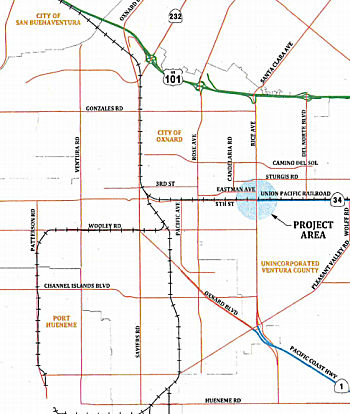 In December 2012, it was reported that the City of Oxnard had regained control of Oxnard Boulevard
(the former routing of Route 1). This permits the city to reroute Route 1
in Oxnard down Rice Avenue, where construction of a new interchange at US 101 recently ended, except for landscaping and minor touch-ups. The city
also has a grant to design and build a bridge on Rice over railroad tracks
just north of Fifth Street, a potential trouble spot for the high volume
of truck traffic shuttling goods to and from the Port of Hueneme. The
agreement with Caltrans concerns Oxnard Boulevard as well as some segments
of Fifth Street and Vineyard Avenue now under state control. The portion
of Fifth that is affected runs from Oxnard Boulevard to Rice. The Vineyard
strip sits between US 101 and Oxnard Boulevard. The move would give the
city ownership of the roads, which means local officials would control
permits and other issues for streets, sidewalks, medians and driveways. An
estimated $15 million in improvements is needed to bring the streets up to
city standards, according to a staff report, and ongoing maintenance costs
are estimated at $100,000 a year. The upgrades can be paid for by
development fees and grants, the report says, and Caltrans is requesting a
$1 million, one-time payment to the city that can be used for ongoing
maintenance costs.
In December 2012, it was reported that the City of Oxnard had regained control of Oxnard Boulevard
(the former routing of Route 1). This permits the city to reroute Route 1
in Oxnard down Rice Avenue, where construction of a new interchange at US 101 recently ended, except for landscaping and minor touch-ups. The city
also has a grant to design and build a bridge on Rice over railroad tracks
just north of Fifth Street, a potential trouble spot for the high volume
of truck traffic shuttling goods to and from the Port of Hueneme. The
agreement with Caltrans concerns Oxnard Boulevard as well as some segments
of Fifth Street and Vineyard Avenue now under state control. The portion
of Fifth that is affected runs from Oxnard Boulevard to Rice. The Vineyard
strip sits between US 101 and Oxnard Boulevard. The move would give the
city ownership of the roads, which means local officials would control
permits and other issues for streets, sidewalks, medians and driveways. An
estimated $15 million in improvements is needed to bring the streets up to
city standards, according to a staff report, and ongoing maintenance costs
are estimated at $100,000 a year. The upgrades can be paid for by
development fees and grants, the report says, and Caltrans is requesting a
$1 million, one-time payment to the city that can be used for ongoing
maintenance costs.
(Source: VC Star, 11/26/2012)
In June 2013, the CTC authorized $1,000,000 for improvements in the city of Oxnard from Pleasant Valley Road to Route 101, from Oxnard Boulevard to Rice Avenue, and from Oxnard Boulevard to Route 101 in order to relinquish roadway
In February 2016, it was reported that although Rice
Avenue is now Route 1, but the only place that was indicated on US was a
Route 1 shield on exit 62B Oxnard Blvd -- which was greened out.
Additionally, the Route 1 NB shield was greened out on NB Pacific Coast
High at Pleasant Valley Road (though not at the offramp itself); there is
a standalone TO US 101 shield on NB Route 1 where it transitions onto Rice
Avenue; and the END Route 34 sign is still up on WB 5th approaching Oxnard
Blvd.
(Source: "Route 1/Rice Avenue in Oxnard" @ AAroads)
On AAroads, it was noted that District 7 was unlikely
to adopt Rice Ave. until the RR grade separation at Rice Ave. and Fifth
St. is completed. The baseline agreement for that separation was signed
8/18/2018. The separation was approved by the CTC as part of the Trade
Corridor Enhancement Program at the May 2018 CTC meeting. The project is
at the Rice Avenue, Fifth Street (Route 34), and UPRR Intersection. The
project also includes construction of two connector roads, one in the
southeast quadrant and another in the southwest quadrant of the Rice
Avenue grade separation, to provide access between Rice Avenue and Fifth
Street. The estimated completion of construction is in 2023.
(Source: Richardwm15 on AAroads, "Re: Route 1/Rice Avenue in Oxnard", 1/17/2019; Rice/FifthSeparation
Baseline Agreement)
In March 2023, it was reported that eight years after a
deadly train crash in Oxnard, the city and Caltrans have the funding lined
up for a $117 million bridge over the tracks that would prevent any future
collisions of trains and vehicles. The Rice Avenue railroad crossing has
long been known as one of Ventura County's most dangerous, even before a
2015 crash between a truck and a Metrolink commuter train. The bridge is
set to be finished in 2028, but the city and Caltrans recently ran into a
snag in acquiring some of the property they need. In February 2023, the
California Department of Transportation filed a lawsuit against the United
Water Conservation District, a public agency that manages the Santa Clara
River watershed, to take a small United Water property along Rice Avenue
through eminent domain. The city of Oxnard is overseeing the bridge
project, but Caltrans is in charge of acquiring the property, because the
project lies at the intersection of two state highways: Rice Avenue is
Route 1 in that area, and Fifth Street, which runs parallel to the
railroad tracks, is Route 34. The United Water property is about a quarter
of an acre, on the east side of Rice. Under it is a well that pumps water
to farmers on the Oxnard Plain, when surface water from the river isn't
available. That well could co-exist with the new bridge, said Anthony
Emmert, United Water's assistant general manager. But servicing the well
during and after bridge construction would be tricky, and the agency
wasn't able to reach an agreement with Caltrans to buy the property. The
city is wrapping up the design phase now. The state will probably release
the construction funds in about a year, so the city plans to put the
project out to bid then, with a four-year construction schedule. The
project involves moving Rice Avenue a little to the east, widening it and
building a 416-foot, six-lane bridge so that the road passes over both
Fifth Street and the railroad tracks.
(Source: VC Star, 3/21/2023)
In May 2023, the CTC had on its agenda a request from
the City of Oxnard to delay the grade separation project for a year.
Specifically, the City of Oxnard (City) requested a 12-month time
extension to allocate funding for the Construction (CON) phase of the Rice
Avenue & Fifth Street Grade Separation Rail Project. The City
encountered delays during the Right of Way (RW) phase. The project will
construct a grade separation at the intersection of Rice Avenue and Fifth
Street, in the City of Oxnard. The Union Pacific Railroad tracks run
parallel to Route 34 and Fifth Street. The grade separation will elevate
Rice Avenue over both Route 34, Fifth Street, and the railroad crossing.
At the June 2018 meeting, the Commission approved an allocation of
$13,906,000, for the Right of Way (RW) and Plans, Specifications, and
Estimate (PS&E) phases of the project. In December 2019, the
Commission approved a supplemental allocation of $18,663,000 for the
PS&E and RW phases, and a programming amendment to update the baseline
agreement, benefits, project delivery schedule, preconstruction, and
construction costs. The City has completed the PS&E phase but requires
additional time to acquire needed parcel acquisitions in order to complete
the RW phase. The delay is due to oil well ownership liability on
the impacted property, which has delayed final appraisals, offers, and
condemnation of three parcels. Two parcels are targeted to seek a
Resolution of Necessity at the May 2023 meeting. However, the property
owner of the remaining parcel is expected to request an appearance before
the Commission to contest the condemnation. This is expected to take place
at the June 2023 meeting. The project cannot request the CON allocation
until these issues are resolved. Therefore, City is requested a 12-month
time extension to allocate the CON phase from June 30, 2023 to June 30,
2024.
(Source: May 2023 CTC Agenda, Agenda Item 2.8a.(12))
In October 2013, the CTC relinquished right of way in the city of Oxnard adjacent to Route 1 and US 101 on Wagon Wheel Road (apx 001 VEN 20.655), consisting of collateral facilities.
 Naming
 Officially named "Pacific Coast Highway" per State Highway Code §635. The name derives from the fact the highway runs along the
Pacific Coast. This designation came from Assembly Bill 1769, Chapter
1569, in 1959.
Officially named "Pacific Coast Highway" per State Highway Code §635. The name derives from the fact the highway runs along the
Pacific Coast. This designation came from Assembly Bill 1769, Chapter
1569, in 1959.
(Image source: Flikr)
Maps based on the 1956 freeway plan show a coastal freeway, named the "Pacific Coast Freeway" or "Ocean Freeway" between Malibu Canyon and Seal Beach. This route would have run to the W of Los Angeles International Airport along Vista Del Mar. The portion of this route constructed to freeway standards in Ventura County is named the "Pacific Coast Freeway" (per the book LA Freeways), and opened in 1957.
The portion of this route from its southern terminus in the City of San Juan Capistrano (001 ORA R0.202) to its intersection with Goldenwest Street in the City of Huntington Beach (apx 001 ORA 25.88) is named the "Orange County Korean War Veterans Memorial Highway". It was named in honor of the 50th anniversary of the Korean War, for June 25, 2000, marked the 50th anniversary of the invasion of South Korea by North Korea and the start of the three-year Korean War with combat hostilities ending upon the signing of an armistice agreement by the United Nations and North Korea on July 27, 1953.
 The portion of this route from the intersection of Goldenwest Street in Huntington Beach (apx 001 ORA 25.88) to the
intersection of Westminster Avenue in Long Beach (apx 001 LA 0.59) is
officially named the "U.S. Submarine Veterans of WWII Memorial Highway."
This segment is near the U.S. Submarine Veterans WWII National Memorial
West located at the Seal Beach Naval Weapons Station, which honors the 52
boats and over 3,500 sailors lost on World War II submarines and the two
submarines lost in the Cold War, the Thresher and the Scorpion. Named by
Assembly Concurrent Resolution 98, Chapter 103, August 14, 2000.
The portion of this route from the intersection of Goldenwest Street in Huntington Beach (apx 001 ORA 25.88) to the
intersection of Westminster Avenue in Long Beach (apx 001 LA 0.59) is
officially named the "U.S. Submarine Veterans of WWII Memorial Highway."
This segment is near the U.S. Submarine Veterans WWII National Memorial
West located at the Seal Beach Naval Weapons Station, which honors the 52
boats and over 3,500 sailors lost on World War II submarines and the two
submarines lost in the Cold War, the Thresher and the Scorpion. Named by
Assembly Concurrent Resolution 98, Chapter 103, August 14, 2000.
(Image sources: U.S. Submarine Memorials and
Artifacts Locator File: Memorials by State, NamesProject
by State)
 The portion of Route 1 that runs between
Coil Street (apx 001 LA 9.454) and the east side of the main entrance to
the Tesoro Refinery (apx 001 LA 8.776), in the community of Wilmington in
the County of Los Angeles, is named the "Honorable Jenny Oropeza
Memorial Overcrossing". Named in memory of Jenny Oropeza, who was a
lifelong public servant and active in her community. She was elected to
the Long Beach Unified School District Board of Education, the Long Beach
City Council, the California State Assembly, and finally to the California
State Senate. During her time as a member of the California Legislature,
Jenny Oropeza was a champion for public transportation, health care,
education, clean air, equality, and prevention of cancer. Former Senator
Oropeza was so admired by her constituents and community that since her
death she has been honored by the Democratic Women's Study Club in Long
Beach, which posthumously awarded her the Political Leadership Award. In
future years the award will be called the Jenny Oropeza Political
Leadership Award. Additionally, the Long Beach Community Hispanic
Association (Centro CHA) posthumously awarded Senator Oropeza the Create
Change Community Service Excellence Award, which will in future years be
called the Create Change: Jenny Oropeza Community Service Excellence
Award. In recognition of former Senator Oropeza, the Long Beach Lambda
Democratic Club created the Jenny Oropeza Ally of the Year Award, which
was, similar to the two previously mentioned awards, first awarded in
2011. As a tribute to former Senator Oropeza's dedication to fostering
protections for key state public health programs, the Los Angeles County
Affiliate of Susan G. Komen for the Cure, in joint collaboration with the
six other California-based Komen affiliates, known as "the California
Collaborative," established the Senator Jenny Oropeza Public Policy
Internship position. The City of Long Beach named the community center in
Cesar E. Chavez Park the Jenny Oropeza Community Center and the Los
Angeles Unified School District dedicated the Jenny Oropeza Global Studies
Academy at the Rancho Dominguez Preparatory School. Shortly after taking
office in 2000, then Assembly Member Oropeza, became aware that the
Alameda Corridor would open in 2002 and all the planned bridges, designed
to prevent cars from having to wait for trains to pass at street level,
would be completed, except the bridge on Route 1 (Pacific Coast Highway)
in the community of Wilmington, the busiest route along the Alameda
Corridor. At the time, Route 1 bisected the Equilon Refinery and was
therefore the most complicated and expensive bridge to build. Furthermore,
there was not enough funding available to complete the bridge on Route 1.
Former Assembly Member Oropeza brought together the interested parties,
including the California Department of Transportation, the Alameda
Corridor Transportation Authority, the Metropolitan Transportation
Authority, the Equilon Refinery, the Union Pacific Railroad, and the City
of Los Angeles to solve this problem and was able to help facilitate $107
million in funding from a combination of sources which included state
transportation funds, state Proposition 116 bond funds, federal
demonstration funds, Metropolitan Transportation Authority funds, and
railroad funds. Former Assembly Member Oropeza was also successful in her
pursuit to have the long bridge built. This design not only eliminated the
train and car conflicts on the Alameda Corridor, but also eliminated these
same conflicts on Alameda Street and the San Pedro Branch of the Union
Pacific Railroad. Named by Senate Concurrent Resolution 79, Resolution
Chapter 102, on August 29, 2012.
The portion of Route 1 that runs between
Coil Street (apx 001 LA 9.454) and the east side of the main entrance to
the Tesoro Refinery (apx 001 LA 8.776), in the community of Wilmington in
the County of Los Angeles, is named the "Honorable Jenny Oropeza
Memorial Overcrossing". Named in memory of Jenny Oropeza, who was a
lifelong public servant and active in her community. She was elected to
the Long Beach Unified School District Board of Education, the Long Beach
City Council, the California State Assembly, and finally to the California
State Senate. During her time as a member of the California Legislature,
Jenny Oropeza was a champion for public transportation, health care,
education, clean air, equality, and prevention of cancer. Former Senator
Oropeza was so admired by her constituents and community that since her
death she has been honored by the Democratic Women's Study Club in Long
Beach, which posthumously awarded her the Political Leadership Award. In
future years the award will be called the Jenny Oropeza Political
Leadership Award. Additionally, the Long Beach Community Hispanic
Association (Centro CHA) posthumously awarded Senator Oropeza the Create
Change Community Service Excellence Award, which will in future years be
called the Create Change: Jenny Oropeza Community Service Excellence
Award. In recognition of former Senator Oropeza, the Long Beach Lambda
Democratic Club created the Jenny Oropeza Ally of the Year Award, which
was, similar to the two previously mentioned awards, first awarded in
2011. As a tribute to former Senator Oropeza's dedication to fostering
protections for key state public health programs, the Los Angeles County
Affiliate of Susan G. Komen for the Cure, in joint collaboration with the
six other California-based Komen affiliates, known as "the California
Collaborative," established the Senator Jenny Oropeza Public Policy
Internship position. The City of Long Beach named the community center in
Cesar E. Chavez Park the Jenny Oropeza Community Center and the Los
Angeles Unified School District dedicated the Jenny Oropeza Global Studies
Academy at the Rancho Dominguez Preparatory School. Shortly after taking
office in 2000, then Assembly Member Oropeza, became aware that the
Alameda Corridor would open in 2002 and all the planned bridges, designed
to prevent cars from having to wait for trains to pass at street level,
would be completed, except the bridge on Route 1 (Pacific Coast Highway)
in the community of Wilmington, the busiest route along the Alameda
Corridor. At the time, Route 1 bisected the Equilon Refinery and was
therefore the most complicated and expensive bridge to build. Furthermore,
there was not enough funding available to complete the bridge on Route 1.
Former Assembly Member Oropeza brought together the interested parties,
including the California Department of Transportation, the Alameda
Corridor Transportation Authority, the Metropolitan Transportation
Authority, the Equilon Refinery, the Union Pacific Railroad, and the City
of Los Angeles to solve this problem and was able to help facilitate $107
million in funding from a combination of sources which included state
transportation funds, state Proposition 116 bond funds, federal
demonstration funds, Metropolitan Transportation Authority funds, and
railroad funds. Former Assembly Member Oropeza was also successful in her
pursuit to have the long bridge built. This design not only eliminated the
train and car conflicts on the Alameda Corridor, but also eliminated these
same conflicts on Alameda Street and the San Pedro Branch of the Union
Pacific Railroad. Named by Senate Concurrent Resolution 79, Resolution
Chapter 102, on August 29, 2012.
(Image Source: LB Press Telegram, 11/24/2014)
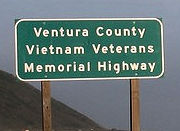 The portion of this route in Los Angeles County (001 LA *) is also officially named
the "Los Angeles County Vietnam Veterans Memorial Highway".
Additionally, the portion in Ventura County (001 VEN *) is named the "Ventura
County Vietnam Veterans Memorial Highway". It was named this because
Route 1 has a strong historical significance for the military personnel of
the Vietnam War era as it passes beside a significant number of California
military bases (United States Naval Weapons Station at Seal Beach, the
United States Coast Guard Headquarters at Long Beach, Vandenberg Air Force
Base, Point Mugu Naval Weapons Station, the United States Coast Guard
Station at Oxnard, the Ventura County Naval Base, Camp San Luis Obispo
Military Reserve, the Ventura County California Air National Guard Base,
the United States Naval Reservation at Monterey, and Fort Hunter Liggett)
on which military personnel were trained and dispatched to Vietnam. More
than 350,000 California veterans served in the Vietnam War, which resulted
in 40,000 of them being wounded and 5,822 killed or missing in action,
representing more than 10 percent of the nation's total casualties. Los
Angeles County has the largest number of Vietnam veterans in California
and 1,857 of its residents were killed or missing in action during that
war. More Californians received the Medal of Honor, the Bronze Star, and
the Purple Heart than veterans of any other state. The Los Angeles County
portion was named by Assembly Concurrent Resolution 115, Chapter 94, July
12, 2000. The Ventura County portion was named by Assembly Concurrent
Resolution 135, Chapter 89, June 27, 2002.
The portion of this route in Los Angeles County (001 LA *) is also officially named
the "Los Angeles County Vietnam Veterans Memorial Highway".
Additionally, the portion in Ventura County (001 VEN *) is named the "Ventura
County Vietnam Veterans Memorial Highway". It was named this because
Route 1 has a strong historical significance for the military personnel of
the Vietnam War era as it passes beside a significant number of California
military bases (United States Naval Weapons Station at Seal Beach, the
United States Coast Guard Headquarters at Long Beach, Vandenberg Air Force
Base, Point Mugu Naval Weapons Station, the United States Coast Guard
Station at Oxnard, the Ventura County Naval Base, Camp San Luis Obispo
Military Reserve, the Ventura County California Air National Guard Base,
the United States Naval Reservation at Monterey, and Fort Hunter Liggett)
on which military personnel were trained and dispatched to Vietnam. More
than 350,000 California veterans served in the Vietnam War, which resulted
in 40,000 of them being wounded and 5,822 killed or missing in action,
representing more than 10 percent of the nation's total casualties. Los
Angeles County has the largest number of Vietnam veterans in California
and 1,857 of its residents were killed or missing in action during that
war. More Californians received the Medal of Honor, the Bronze Star, and
the Purple Heart than veterans of any other state. The Los Angeles County
portion was named by Assembly Concurrent Resolution 115, Chapter 94, July
12, 2000. The Ventura County portion was named by Assembly Concurrent
Resolution 135, Chapter 89, June 27, 2002.
(Image source: Flikr)
 In 10/15/2008, the City of Los Angeles designated Lincoln Boulevard (Route 1)
between La Tijera (apx 001 LA 27.677) and Sepulveda Boulevard (apx 001 LA
27.346) as "Officer Tommy Scott Square". This commemorates the
death of the first Airport Police officer killed in the line of duty in
the department's 59-year-history. Scott, 35, died April 29, 2005, while
trying to detain a transient walking along the airport perimeter. The man
first got into Scott's patrol car and drove off with Scott trying to stop
him. With Scott hanging onto the side of the car, the man hit a fire
hydrant, killing the 4-year veteran of the police force. William Sadowski,
46, pleaded not guilty by reason of insanity last month to a charge of
first-degree murder. The death devastated the close-knit, independent
police department. Scott, who had worked for the city department of parks
before becoming a police officer, joined the force Oct. 7, 2001 and
graduated from Rio Hondo Police Academy on Feb. 21, 2002. At the April 29,
2009 ceremony Airport police and city officials unveiled two street signs
on Lincoln -- one facing the northbound traffic and the other southbound
-- near where Scott was killed. A bronze plaque was put up earlier.
In 10/15/2008, the City of Los Angeles designated Lincoln Boulevard (Route 1)
between La Tijera (apx 001 LA 27.677) and Sepulveda Boulevard (apx 001 LA
27.346) as "Officer Tommy Scott Square". This commemorates the
death of the first Airport Police officer killed in the line of duty in
the department's 59-year-history. Scott, 35, died April 29, 2005, while
trying to detain a transient walking along the airport perimeter. The man
first got into Scott's patrol car and drove off with Scott trying to stop
him. With Scott hanging onto the side of the car, the man hit a fire
hydrant, killing the 4-year veteran of the police force. William Sadowski,
46, pleaded not guilty by reason of insanity last month to a charge of
first-degree murder. The death devastated the close-knit, independent
police department. Scott, who had worked for the city department of parks
before becoming a police officer, joined the force Oct. 7, 2001 and
graduated from Rio Hondo Police Academy on Feb. 21, 2002. At the April 29,
2009 ceremony Airport police and city officials unveiled two street signs
on Lincoln -- one facing the northbound traffic and the other southbound
-- near where Scott was killed. A bronze plaque was put up earlier.
(Image Source: LA Airport Police Office Association, Summer 2009)
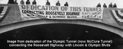 Route 1 was originally named the "Roosevelt
Highway", after President Theodore Roosevelt.
Route 1 was originally named the "Roosevelt
Highway", after President Theodore Roosevelt.
(Image source: Pinterest)
 Named Structures
 The Aliso Creek Bridge, Bridge № 55-0003, on Route 1, in the County of Orange,
at ORA 6.49, is named the “Officer Jon Coutchie Memorial Bridge”.
It was named in memory of Jon Steven Coutchie, who was born in October
1971, in Tucson, Arizona and, shortly thereafter, moved with his family to
southern California. After his distinguished service in the military and
his honorable discharge from the United States Army, Jon realized that he
wanted to continue his service to the public and applied for a part-time
jailer position with the Laguna Beach Police Department. Seeing
Jon’s great potential, the Laguna Beach Police Department sponsored
Jon through the Goldenwest Police Academy in 2008; and Jon successfully
completed his police officer training in March 2009 and, upon his
graduation, was immediately sworn in as a Laguna Beach police officer. Jon
showed a passion for traffic issues and displayed expertise in accident
investigation. Following this interest, Jon applied and was selected for a
coveted motor officer position with the Laguna Beach Police Department in
March 2013. On the evening of September 21, 2013, while traveling
northbound on the Pacific Coast Highway in an attempt to locate a vehicle
that was being driven recklessly and that had eluded another officer, Jon
was involved in a collision that took his life. Named by SCR 74, Res. Chapter 2, Statutes of 2024, on 01/18/24.
The Aliso Creek Bridge, Bridge № 55-0003, on Route 1, in the County of Orange,
at ORA 6.49, is named the “Officer Jon Coutchie Memorial Bridge”.
It was named in memory of Jon Steven Coutchie, who was born in October
1971, in Tucson, Arizona and, shortly thereafter, moved with his family to
southern California. After his distinguished service in the military and
his honorable discharge from the United States Army, Jon realized that he
wanted to continue his service to the public and applied for a part-time
jailer position with the Laguna Beach Police Department. Seeing
Jon’s great potential, the Laguna Beach Police Department sponsored
Jon through the Goldenwest Police Academy in 2008; and Jon successfully
completed his police officer training in March 2009 and, upon his
graduation, was immediately sworn in as a Laguna Beach police officer. Jon
showed a passion for traffic issues and displayed expertise in accident
investigation. Following this interest, Jon applied and was selected for a
coveted motor officer position with the Laguna Beach Police Department in
March 2013. On the evening of September 21, 2013, while traveling
northbound on the Pacific Coast Highway in an attempt to locate a vehicle
that was being driven recklessly and that had eluded another officer, Jon
was involved in a collision that took his life. Named by SCR 74, Res. Chapter 2, Statutes of 2024, on 01/18/24.
(Image source: Officer Down Memorial Page; LinkedIn)
 The Los Alamitos Bay Bridge (bridge number 53-0064, 001 LA 000.98), and any successor bridge, on Route 1 south of Loynes Drive and north of
East 2nd Street, in the City of Long Beach, is named the "Joan Lind
Van Blom Memorial Bridge". Joan Lind Van Blom was the first woman
to win an Olympic medal for the United States in rowing, winning a silver
medal in the single sculls at the 1976 Olympic Games in Montreal and in
the quadruple sculls at the 1984 Olympic Games in Los Angeles, and was a
member of the team that boycotted the 1980 Olympic Games in Moscow. Van
Blom won 14 national titles during her career, holds 11 world records on
the indoor ergometer, and medaled internationally as a coach in the Pan
American Games. She also motivated students to live healthy and active
lives, through her 35-year career with the Long Beach Unified School
District as a physical education teacher and curriculum leader (she
retired 2012), where she was instrumental in securing a million-dollar
grant for rowing machines in each of the school district’s nine high
schools. Van Blom taught educators how to teach students to enjoy an
active lifestyle and her Facebook page has countless entries from fellow
competitors, educators, and friends sharing their appreciation for her
gentle guidance over the years. On August 21, 2013, at the Pete Archer
Rowing Center, Joan Lind Van Blom collapsed after an indoor rowing session
and was diagnosed with glioblastoma multiforme, the most aggressive form
of brain cancer. While fighting the disease, she continued to be a role
model of grace and style by sharing memories with friends and expressing
gratitude to those with whom she teamed, taught, and contacted. Joan Lind
Van Blom died the morning of Friday, August 28, 2015. Van Blom was
inducted into the Wilson High School, Long Beach State 49er, Century Club,
and National Rowing halls of fame and was declared a lifetime member of
the Long Beach Rowing Association, marking her never-ending achievement in
advocacy for the sport and healthy living;. For all her accomplishments,
dedication to rowing, and contributions to the sport’s growth, in
December 2014, at the USRowing Annual Awards Reception in Jacksonville,
Florida, Joan Lind Van Blom was named the recipient of the 2014 USRowing
Ernestine Bayer Award, formerly Woman of the Year, which recognizes
outstanding contributions to women’s rowing or to an outstanding
woman in rowing. On March 7, 2015, the Beach Crew Alumni Association
dedicated a women’s Resolute 8+ racing shell as the Joan Lind Van
Blom. Named by Senate Concurrent Resolution (SCR) 102, Res. Chapter 94,
Statutes of 2016, on August 5, 2016.
The Los Alamitos Bay Bridge (bridge number 53-0064, 001 LA 000.98), and any successor bridge, on Route 1 south of Loynes Drive and north of
East 2nd Street, in the City of Long Beach, is named the "Joan Lind
Van Blom Memorial Bridge". Joan Lind Van Blom was the first woman
to win an Olympic medal for the United States in rowing, winning a silver
medal in the single sculls at the 1976 Olympic Games in Montreal and in
the quadruple sculls at the 1984 Olympic Games in Los Angeles, and was a
member of the team that boycotted the 1980 Olympic Games in Moscow. Van
Blom won 14 national titles during her career, holds 11 world records on
the indoor ergometer, and medaled internationally as a coach in the Pan
American Games. She also motivated students to live healthy and active
lives, through her 35-year career with the Long Beach Unified School
District as a physical education teacher and curriculum leader (she
retired 2012), where she was instrumental in securing a million-dollar
grant for rowing machines in each of the school district’s nine high
schools. Van Blom taught educators how to teach students to enjoy an
active lifestyle and her Facebook page has countless entries from fellow
competitors, educators, and friends sharing their appreciation for her
gentle guidance over the years. On August 21, 2013, at the Pete Archer
Rowing Center, Joan Lind Van Blom collapsed after an indoor rowing session
and was diagnosed with glioblastoma multiforme, the most aggressive form
of brain cancer. While fighting the disease, she continued to be a role
model of grace and style by sharing memories with friends and expressing
gratitude to those with whom she teamed, taught, and contacted. Joan Lind
Van Blom died the morning of Friday, August 28, 2015. Van Blom was
inducted into the Wilson High School, Long Beach State 49er, Century Club,
and National Rowing halls of fame and was declared a lifetime member of
the Long Beach Rowing Association, marking her never-ending achievement in
advocacy for the sport and healthy living;. For all her accomplishments,
dedication to rowing, and contributions to the sport’s growth, in
December 2014, at the USRowing Annual Awards Reception in Jacksonville,
Florida, Joan Lind Van Blom was named the recipient of the 2014 USRowing
Ernestine Bayer Award, formerly Woman of the Year, which recognizes
outstanding contributions to women’s rowing or to an outstanding
woman in rowing. On March 7, 2015, the Beach Crew Alumni Association
dedicated a women’s Resolute 8+ racing shell as the Joan Lind Van
Blom. Named by Senate Concurrent Resolution (SCR) 102, Res. Chapter 94,
Statutes of 2016, on August 5, 2016.
(Image Sources: Gazettes Sports, 3/27/2019; LBUSD
News, 2/4/2016)
 Tunnel 53-008, in Santa Monica, is named the "Robert E. McClure Tunnel" (001 LA 35.179). It opened on February 1, 1936, and was
named by Assembly Concurrent Resolution 234, Chapter 393, in 1969. Robert
McClure was the editor and publisher of the Santa Monica Evening Outlook,
a delegate to the 1964 Republican Convention, and a member of the
California Highway Commission from 1954 to 1962. He is remembered as "the
father of the Santa Monica Freeway". The Tunnel was previously named the
Olympic Tunnel.
Tunnel 53-008, in Santa Monica, is named the "Robert E. McClure Tunnel" (001 LA 35.179). It opened on February 1, 1936, and was
named by Assembly Concurrent Resolution 234, Chapter 393, in 1969. Robert
McClure was the editor and publisher of the Santa Monica Evening Outlook,
a delegate to the 1964 Republican Convention, and a member of the
California Highway Commission from 1954 to 1962. He is remembered as "the
father of the Santa Monica Freeway". The Tunnel was previously named the
Olympic Tunnel.
(Image source: AARoads; UCLA Special Collections)
 Freeway
[SHC 253.2] From the Los Angeles-Ventura County line to Route 101 near El Rio; constructed as freeway for 8 mi S of Oxnard.
 Scenic Route
[SHC 263.2] From Route 5 south of San Juan Capistrano to Route 19 near Long Beach; and from Route 187 near Santa Monica to Route 101 near El Rio.
 Classified Landcaped Freeway
The following segments are designated as Classified Landscaped Freeway:
| County | Route | Starting PM | Ending PM |
| Orange | 1 | 0.00 | 0.33 |
| Orange | 1 | 0.58 | 0.87 |
| Los Angeles | 1 | R34.58 | 35.20 |
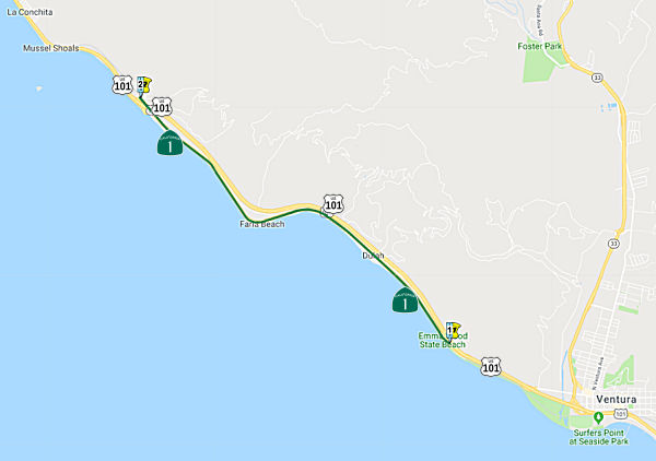 From Route 101 at Emma Wood State Beach, 1.3 mi north of Route 33, to Route 101, 2.8 mi south of the Ventura-Santa Barbara county line at Mobil Pier
Undercrossing.
From Route 101 at Emma Wood State Beach, 1.3 mi north of Route 33, to Route 101, 2.8 mi south of the Ventura-Santa Barbara county line at Mobil Pier
Undercrossing.
Post 1964 Signage HistoryThis segment was added to Route 1 in 1980 (Chap. 740). It was likely added to reflect completion of the freeway portion of US 101 in the area, as the routing was former US 101. In 1992, Chap. 1243 changed "State Park" to "State Beach".
Pre 1964 Signage History This segment was originally added to the state highway system in 1909 as part of US 101, LRN 2. It was signed as US 101.
This was the first section of PCH to be constructed. The route along this
portion of coastline opened up in 1913 as the Rincon Causeway or the
Rincon Sea Level Road as the first driveable coastal route for motorists.
Traffic could pass along the coastal beaches of Santa Barbara Channel
previously only during low tide. Previously, the established
all-weather routing through the area prior to the Rincon Causeway was over
Casistas Pass (today's Route 150). Portions were originally a wooden
causeway (although mostly to the NW: Rincon Pt. to Punto Gordo. This was a
very problematic road with nails, and lots water damage. At the time, the
ACSC recommended Casistas Pass Road (now Route 150). It was replaced by a
paved roadway in 1924.
(Source: Research for California Highways Route by Route, Ep 2.03)
In 1960, the freeway bypass was completed from Emma Wood State Beach north to the Mobil Pier Undercrossing near Sea Cliff. US 101 was then re-routed onto this freeway bypass, and the former routing became a portion of Route 1.
StatusVentura Overhead Bridge Replacement (07-Ven-1 21.5)
In June 2021, the CTC approved the following SHOPP
amendment: 07-Ven-1 21.5 PPNO 4972 ProjID 0716000025 EA 07-31960. Near the
city of Ventura, at Ventura Overhead № 52-0040. Replace
corroded steel spans of bridge and upgrade bridge railing to current
standards. Replace bridge. Note: The bridge will be
replaced rather than repaired, because during project development, it was
determined that it was more cost effective to replace the 87 year old
bridge than to retrofit it. Change the delivery year to FY22-23 because
the design will take more time, and increase construction capital,
support, and R/W capital to support the new design. Revised numbers: Con
Sup $1,650K ⇒ $5,247K; R/W Cap $983K ⇒ $4,378K; Const Cap
$3,565K ⇒ $28,096K; Total $10,438K ⇒ $41,961K.
(Source: June 2021 CTC Agenda, Agenda Item
2.1a.(2d) #40)
In October 2022, the CTC approved a request for an
additional $4,100,000 in Capital Outlay Support (COS), for the SHOPP
Bridge Rehabilitation project on Route 1, in Ventura County, to complete
the Plans,
Specifications, and Estimate (PS&E) phase. The project (07-Ven-1 21.5
PPNO 4972 ProjID 0716000025 EA 07-31960) is located on Route 1 near the
City of Ventura, at the Ventura Overhead Bridge № 52-0040, in
Ventura County. The project will replace the bridge. The project
realized a cost increase due to the outcome of the cost/benefit analysis
that showed
replacing the bridge would be a more cost-effective strategy than
rehabilitating the bridge. The existing bridge spans over the Union
Pacific Railroad (UPRR) and consists of 11 reinforced concrete spans and
one steel span. The project was originally programmed to replace the
steel span and upgrade the bridge railing to current standards. However,
during the PS&E phase, it was determined that the entire bridge would
require a seismic retrofit. With the additional work that was
identified and the age of the bridge, the Department performed a
cost/benefit analysis, and a decision was made that replacing the bridge
would be more cost effective than retrofitting it. The analysis
shows a savings of $350,000 with an extended life of 45 years for the
bridge replacement in lieu of the seismic retrofit option. In June 2021,
the project was amended to reflect the change of the bridge replacement
strategy, move out the delivery year, and revise the cost for the
unallocated phases. Since the PS&E phase was in the fiscal year in
which it was programmed and had been allocated, an adjustment to the cost
could not occur, per SHOPP Guidelines. These supplemental funds will be
used to adjust design plans, and increase coordination with the
Department’s Division of Structures, California Coastal Commission,
State Parks and Recreation, utility companies, and UPRR. The funds
will also be utilized to RTL the project, advertise, award, and approve
the contract.
(Source: October 2022 CTC Agenda, Agenda Item
2.5e.(10))
In August 2012, the CTC approved SHOPP funding of $16,400,000 on Route 1 PM 22.5/22.0 near the city of Ventura, from 1.0 mile north of the Ventura Overhead to 4.8 mile south of the Seacliff Overhead and Separation. Outcome/Output: Replace 1,800 feet of existing seawall to protect the roadway from sea wave forces. Also, reconstruct and pave adjacent roadway shoulder and bicycle lane, construct new public access stairway and Americans with Disabilities Act (ADA) compliant ramp to the beach.
NamingThis segment appears to be called "Pacific Coast Highway".
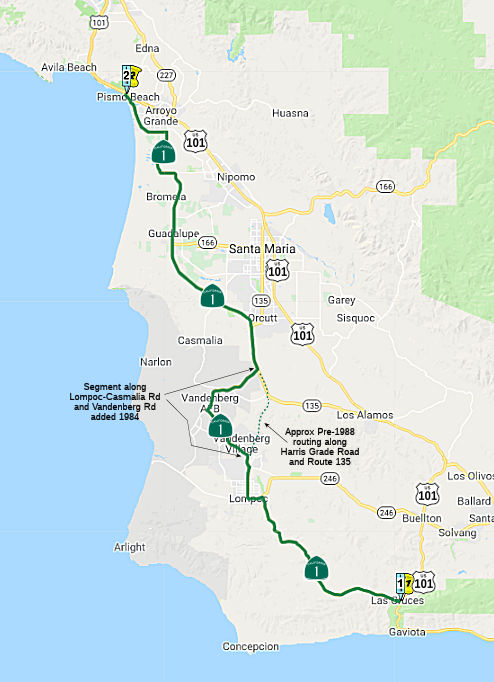 From Route 101 near Las Cruces to Route 101 in Pismo Beach via the vicinity of
Lompoc, Vandenberg Air Force Base, and Guadalupe.
From Route 101 near Las Cruces to Route 101 in Pismo Beach via the vicinity of
Lompoc, Vandenberg Air Force Base, and Guadalupe.
(a) Upon the commission determining that it is in the best interest of the state to do so, the commission may, upon terms and conditions it approves, relinquish to the City of Pismo Beach the portion of Route 1 within the city limits of the City of Pismo Beach if the department and the City of Pismo Beach enter into an agreement providing for that relinquishment.
(b) A relinquishment under this section shall become effective on the date following the county recorder’s recordation of the relinquishment resolution containing the commission’s approval of the terms and conditions of the relinquishment.
(c) On and after the effective date of the relinquishment, all of the following shall occur:
(1) The relinquished portion of Route 1 shall cease to be a state highway.
(2) The relinquished portion of Route 1 shall be ineligible for future adoption under Section 81.
(3) The City of Pismo Beach shall ensure the continuity of traffic flow on the relinquished portion of Route 1, including, but not limited to, any traffic signal progression.
(4) For the relinquished portion of Route 1, the City of Pismo Beach shall maintain signs within its jurisdiction directing motorists to the continuation of Route 1.
Post 1964 Signage HistoryIn 1963, this segment was defined as being from "near Las Cruces to Route 101 near Pismo Beach via the vicinity of Lompoc and Guadalupe". In 1984, it was clarified via an added section that Route 1 also included that portion of the Lompoc-Casmalia Road and Vandenburg Road in the County of Santa Barbara from the intersection of the Lompoc-Casmalia Road and Route 1 north of Lompoc near Mission Hills to the intersection of Vandenburg Road and Route 1 south of Orcutt.
 In 1975, the CHC published a notice of intent to rescind the freeway adoption of a 9.5 mi
portion of Route 1 between 2 mi N of the Santa Ynez River and Route 135 at
Harriston.
In 1975, the CHC published a notice of intent to rescind the freeway adoption of a 9.5 mi
portion of Route 1 between 2 mi N of the Santa Ynez River and Route 135 at
Harriston.
(Source: Lompoc Record, 4/25/1975 via Joel Windmiller, 2/25/2023)
 In 1966, a new expressway to serve Vandenberg AFB was opened. Prior to 1966, only two
narrow, winding ribbons of asphalt passed through the old Camp Cooke (now
VAFB) area (presumably, the original Lompoc-Casmalia Road). The new
expressway consisted of a portion of Vandenberg Road to the VAFB Main Gate
and a portion of Route 1 between the Lompoc Urban Limits and Orcutt.
In 1966, a new expressway to serve Vandenberg AFB was opened. Prior to 1966, only two
narrow, winding ribbons of asphalt passed through the old Camp Cooke (now
VAFB) area (presumably, the original Lompoc-Casmalia Road). The new
expressway consisted of a portion of Vandenberg Road to the VAFB Main Gate
and a portion of Route 1 between the Lompoc Urban Limits and Orcutt.
(Source: CHPW, Jan/Feb 1967)
In 1988, the route was relocated to better serve Vandenberg AFB by incorporation of the route of former County Sign Route S20 along Lompoc Casmalia Road between Lompoc and the Base Main Gate at Vandenberg Road, and the expressway along Vandenberg Road. The previous alignment of Route 1 became Harris Grade Road from the intersection of the former County Sign Route S20 with Route 1 at the Lompoc Urban Limits to the junction with Route 135 near E San Antonio Road, and Route 135 from that junction to Vandenberg Road. In 1992, Chap. 1243 deleted the clarification and changed the definition of this segment to the "Route 101 near Las Cruces to Route 101 near Pismo Beach via the vicinity of Lompoc, Vandenberg Air Force Base, and Guadalupe."
In 2019, SB 504 (Chapter 506, 10/3/2019) authorized relinquishment in the City of Pismo Beach by adding Section 301.5:
(a) Upon the commission determining that it is in the best interest of the state to do so, the commission may, upon terms and conditions it approves, relinquish to the City of Pismo Beach the portion of Route 1 within the city limits of the City of Pismo Beach if the department and the City of Pismo Beach enter into an agreement providing for that relinquishment.
(b) A relinquishment under this section shall become effective on the date following the county recorder’s recordation of the relinquishment resolution containing the commission’s approval of the terms and conditions of the relinquishment.
(c) On and after the effective date of the relinquishment, all of the following shall occur:
(1) The relinquished portion of Route 1 shall cease to be a state highway.
(2) The relinquished portion of Route 1 shall be ineligible for future adoption under Section 81.
(3) The City of Pismo Beach shall ensure the continuity of traffic flow on the relinquished portion of Route 1, including, but not limited to, any traffic signal progression.
(4) For the relinquished portion of Route 1, the City of Pismo Beach shall maintain signs within its jurisdiction directing motorists to the continuation of Route 1.
Pre 1964 Signage History  In 1933, LRN 56 was extended to include the remainder of this
segment (Chapter 767) with the addition of "(a) a segment from [LRN 2]
near Las Cruces via Lompoc and Guadalupe to [LRN 2] near Pismo". This
change essentially took a portion of former LRN 2 that existed on the
route between Los Alimos and Santa Maria. It is possible that at this
time, US 101 received a new formal routing between those points (or one
was planned) By the time of the 1935 codification of LRN 2, there were
multiple segments defined: the main segment (San Francisco to the
International Boundary Line near Tia Juana via San Diego and National
City), and two additional segments: Orcutt to [LRN 2] S of Santa Maria,
and Harriston to [LRN 2] near Los Alimos. The segment between Harriston
and Orcutt had been transferred to LRN 56, and had become part of
Sign Route 1.
In 1933, LRN 56 was extended to include the remainder of this
segment (Chapter 767) with the addition of "(a) a segment from [LRN 2]
near Las Cruces via Lompoc and Guadalupe to [LRN 2] near Pismo". This
change essentially took a portion of former LRN 2 that existed on the
route between Los Alimos and Santa Maria. It is possible that at this
time, US 101 received a new formal routing between those points (or one
was planned) By the time of the 1935 codification of LRN 2, there were
multiple segments defined: the main segment (San Francisco to the
International Boundary Line near Tia Juana via San Diego and National
City), and two additional segments: Orcutt to [LRN 2] S of Santa Maria,
and Harriston to [LRN 2] near Los Alimos. The segment between Harriston
and Orcutt had been transferred to LRN 56, and had become part of
Sign Route 1.
Route 1 from Vandenberg SFB joins Route 135 S of Orcutt, and leaves that routing after a few miles where Route 1 veers to the W as Cabrillo Highway, and Route 135 continues into Orcutt as the Orcutt Expwy. Route 135 was LRN 2. The portion of Route 135 cosigned with Route 1 was LRN 2 until 1933-1935, when it became part of LRN 56. By 1935, US 101 had been rerouted to the E along its present route, with Sign Route 1 coming into Orcutt, turning on Clark, then on Blosser, and across Solomon to Cabrillo Highway. Route 135 appears to have been an unsigned branch from US 101. The expressway appears to have been constructed around 1966. Signage for Route 135 shows up around 1969. Past Orcutt, Route 1 continues to Guadalupe, while Route 135 and US 101 continue to Santa Maria
By 1935, this route was under construction between Orcutt and Pismo Beach (in segments). This was signed as Route 1 in the initial 1934 state signage of routes, although a small segment may have been part of US 101.
In 1934, this segment was signed as part of Route 1 (Jct. US 101 at Las Cruces, via Cambria, Santa Cruz, San Francisco, Pt. Reyes, and Westport to US 101 at Fortuna).
Route 1 enters this area S of Oceano, turns W at Valley Road, NW at the railroad tracks, crosses via an overpass to the ocean side, continuing along the beaches and coast to rejoin US 101 N of Pismo. Historically, in Oceano, it turned on Railroad Street, crossed the tracks, and ran along Railroad Street. This was bypassed once the overpass was built.
StatusSalsipuedes Creek Bridge (05-SB-1 15.6)
 In January 2016, the CTC approved for future consideration of funding a
project that will replace the Salsipuedes Creek Bridge on Route 1 near the
city of Lompoc (appx 001 SB 15.614). The project is programmed in the 2014
State Highway Operation and Protection Program. The total estimated cost
is $14,098,000 for capital and support. Construction is estimated to begin
in Fiscal Year 2017-18. The scope, as described for the preferred
alternative, is consistent with the project scope programmed by the
Commission in the 2014 State Highway Operation and Protection Program. The
project will result in less than significant impacts to the environment
after mitigation. The following resource area may be impacted by the
project: biological resources. Avoidance and minimization measures will
reduce any potential effects on the environment. These measures include,
but are not limited to, all work in the creek channel will occur between
June 1 and October 31, at least two biologists will be retained to monitor
on-site activities, non-native species will be removed from the project
area to the extent feasible, and the construction of a National Marines
Fisheries Service approved rock ramp to improve steelhead passage
conditions.
In January 2016, the CTC approved for future consideration of funding a
project that will replace the Salsipuedes Creek Bridge on Route 1 near the
city of Lompoc (appx 001 SB 15.614). The project is programmed in the 2014
State Highway Operation and Protection Program. The total estimated cost
is $14,098,000 for capital and support. Construction is estimated to begin
in Fiscal Year 2017-18. The scope, as described for the preferred
alternative, is consistent with the project scope programmed by the
Commission in the 2014 State Highway Operation and Protection Program. The
project will result in less than significant impacts to the environment
after mitigation. The following resource area may be impacted by the
project: biological resources. Avoidance and minimization measures will
reduce any potential effects on the environment. These measures include,
but are not limited to, all work in the creek channel will occur between
June 1 and October 31, at least two biologists will be retained to monitor
on-site activities, non-native species will be removed from the project
area to the extent feasible, and the construction of a National Marines
Fisheries Service approved rock ramp to improve steelhead passage
conditions.
In June 2018, the CTC approved the following
allocation: $7,506,000 Santa Barbara 05-SB-1 15.6. PPNO 1501. Route 1 Near
Lompoc, at the Salsipuedes Creek Bridge No. 51-0095. Outcome/Output:
Replace the existing bridge to address scour critical issues and preserve
the integrity of the structure.
(Source: CTC Agenda, June 2018 Agenda Item 2.5b(1) Item 28)
In December 2018, the CTC approved a request for an additional $985,000 for the State Highway Operation Protection Program (SHOPP) Bridge Scour Mitigation project (PPNO 1501) on Route 1, in Santa Barbara County, to award the construction contract. This is an increase of 19% for construction capital. The project is located on Route 1 near the city of Lompoc, in Santa Barbara County. The project will construct a new bridge to replace the existing Salsipuedes Creek Bridge (appx 001 SB 15.614); which has been listed as scour critical since June 1995. The project also includes improving the creek bed by constructing a separate fish passage and removing a check-dam and other obstructions that cause erosion and bridge scour. The performance measure is to replace one bridge, which conforms to the Commission approved Transportation Asset Management Plan. The contract award status is pending approval of this request for supplemental funds by the Commission. Construction would begin in January 2019, and would take 310 working days to be completed in two construction seasons, by October 2020.
Although 14 contractors, sub-contractors and material
suppliers obtained contract plans for the project, only two contractors
submitted bids for this project. The Department contacted several
contractors, including those who did not submit bids, to discuss the bid
results. The contractors stated that this project is located at a site
with challenging topography, and includes many difficult, specialty
contract items. Some of the difficult items on this contract include the
off-site assembly of 100 foot long reinforcement cages for the bridge pile
foundation, the transporting these cages to the site and then the lowering
of them into place below the existing bridge. Other difficult tasks
include the removal of large boulders from an environmentally sensitive
site to build a 365 footlong fish ladder. The difficulty to perform this
bridge work in a restricted work area presented added challenges and
higher risks to contractors. These factors influenced the bidding process
by limiting the number of bidders, which resulted in higher contract bids.
The Engineer's Estimate (EE) was developed appropriate for the project,
including the challenging work location of the existing bridge. And
although the Department did not anticipate the limited number of bidders,
as it observed that contract plans packages were requested by 14
contractors, the EE was still undervalued as the current trends were below
expectations.
(Source: December 2018 CTC Minutes, Agenda Item 2.5e.(8))
In January 2020, it was reported that the project to
replace the Salsipuedes Creek Bridge and construct a retaining wall and
fish passage on Route 1 near Lompoc was continuing, with a traffic switch
onto the newly constructed southbound bridge on 1/22/2020. The 24/7
traffic signal will be temporarily turned off during this traffic switch.
Motorists will encounter traffic control via a pilot car and flaggers from
9 am until 3 pm. When the traffic switch is complete, the traffic signal
will be restored allowing two-way traffic on the southbound bridge and
construction to begin on the northbound bridge. The width of each lane
during construction has been reduced to 11½ feet without shoulders.
Oversized vehicles must use an alternate route during this project. The
contractor for this $5 million project is CalPortland Construction of
Santa Maria, CA. This project is expected to be complete by the end of
2020.
(Source: Edhat, 1/21/2020)
Santa Maria River Bridge (05-SB-01, PM 50.3/50.6 05-SLO-01, PM 0.0/0.3)
") In October 2017, the CTC amended the SHOPP to add the
following long-lead item: 05-SLO-1 0.0/0.3: On Route 1 in San Luis Obispo
County: Near Guadalupe, at the Santa Maria River Bridge № 49 -0042;
also in Santa Barbara County (PM 50.3/50.6). The bridge is scour critical
and needs to be replaced. The existing bridge will be used for traffic
handling during construction and then demolished. The highway will need to
be realigned as a result of the new bridge location. The new bridge will
provide standard lane and shoulder widths and include a protected walkway.
In October 2017, the CTC amended the SHOPP to add the
following long-lead item: 05-SLO-1 0.0/0.3: On Route 1 in San Luis Obispo
County: Near Guadalupe, at the Santa Maria River Bridge № 49 -0042;
also in Santa Barbara County (PM 50.3/50.6). The bridge is scour critical
and needs to be replaced. The existing bridge will be used for traffic
handling during construction and then demolished. The highway will need to
be realigned as a result of the new bridge location. The new bridge will
provide standard lane and shoulder widths and include a protected walkway.
The following project was included in the final adopted 2018 SHOPP as a "Long Lead Project" in March 2018: PPNO 2650. 05-San Luis Obispo-1 0.0/0.3. Route 1 Near Guadalupe, at the Santa Maria River Bridge № 49-0042; also in Santa Barbara County (PM 50.3/50.6). The bridge is scour critical and needs to be replaced. The existing bridge will be used for traffic handling during construction and then demolished. The highway will need to be realigned as a result of the new bridge location. The new bridge will provide standard lane and shoulder widths and include a protected walkway. * PA&ED phase(s) is authorized. No construction start date. Total Project Cost: $45,690K.
In October 2019, the CTC amended the SHOPP regarding
this item: 05-SLO-1 0.0/0.3. PPNO 2650. Proj ID 0516000074. EA 1H440.
Route 1 Near Guadalupe, at the Santa Maria River Bridge № 49-0042;
also in Santa Barbara County (PM 50.3/50.6). The bridge is scour critical
and needs to be replaced. The existing bridge will be used for traffic
handling during construction and then demolished. The highway will need to
be realigned as a result of the new bridge location. The new bridge will
provide standard lane and shoulder widths and include a protected walkway.
Const capital increased to $33,880K. PA&ED and PS&E pushed to
FY20-21. Note: Construction capital increase is due to updated cost
estimate reflecting current market pricing for structure and roadway work.
(Source: October 2019 CTC Agenda, Agenda Item
2.1a.(1) Long Lead Item 3)
The 2020 SHOPP, approved in May 2020, included the
following Bridge Preservation item of interest (carried over from the 2018
SHOPP): 05-San Luis Obispo-1 PM 0.0/0.3 PPNO 2650 Proj ID 0516000074 EA
1H440. Route 1 near Guadalupe, at the Santa Maria River Bridge №
49-0042; also in Santa Barbara County (PM 50.3/50.6). The bridge is scour
critical and needs to be replaced. The existing bridge will be used for
traffic handling during construction and then demolished. The highway will
need to be realigned as a result of the new bridge location. The new
bridge will provide standard lane and shoulder widths and include a
protected walkway. Programmed in FY22-23, with construction scheduled to
start in April 2023. Total project cost is $51,109K, with $34,410K being
capital (const and right of way) and $16,699K being support (engineering,
environmental, etc.).
(Source: 2020 Approved SHOPP a/o May 2020)
In June 2020, the CTC approved the following amendment
to the 2020 SHOPP Long Lead project: 05-SLO-1 0.0/0.3. PPNO 2650 ProjID
0516000074 EA 1H440. Route 1 near Guadalupe, at the Santa Maria River
Bridge № 49-0042; also in Santa Barbara County (PM 50.3/50.6). The
bridge is scour critical and needs to be replaced. The existing bridge
will be used for traffic handling during construction and then demolished.
The highway will need to be realigned as a result of the new bridge
location. The new bridge will provide standard lane and shoulder widths
and include a protected walkway. Adjust PS&E cost from $4,290K to
$3,517K, and R/W Cap from $530K to $744K, changing the total to $50,550K.
Decrease PS&E due to the use of a new lower escalation rate of 3.2%
and revised support estimate. Increase R/W capital due to added parcel,
title and escrow, increase in mitigation permit fees, and additional
underground utility identification.
(Source: June 2020 CTC Agenda, Agenda Item
2.1a.(5f) #3)
In August 2020, the CTC approved the following
amendment to the 2020 SHOPP Long Lead project: 05-SLO-1 PM 0.0/0.3 PPNO
2650 ProjID 0516000074 EA 1H440. Route 1 Near Guadalupe, at the Santa
Maria River Bridge № 49-0042; also in Santa Barbara County (PM
50.3/50.6). The bridge is scour critical and needs to be replaced. The
existing bridge will be used for traffic handling during construction and
then demolished. The highway will need to be realigned as a result of the
new bridge location. The new bridge will provide standard lane and
shoulder widths and include a protected walkway. Note: Correction to
amounts programmed for PS&E ($3,517K), R/W support ($455K),
construction support ($9,660K), R/W capital ($744K), and construction
capital ($33,880) that were incorrectly reported at the June 2020 CTC
meeting as unprogrammed.
(Source: August 2020 CTC Agenda, Agenda Item
2.1a.(2d) #10)
In January 2021, the CTC approved for future
consideration of funding 05-SB-01, PM 50.3/50.6 05-SLO-01, PM 0.0/0.3. Santa
Maria River Bridge Replacement. Replace the Santa Maria River
Bridge on Route 1 at the border of San Luis Obispo County and Santa
Barbara County. (MND) (PNNO 2650) (SHOPP). This project is located on
Route 1 at the border of San Luis Obispo County and Santa Barbara County,
just north of the City of Guadalupe. The project proposes to replace
the Santa Maria River Bridge, realign roadways, replant vegetation, and
relocate utilities. This project is fully funded and is currently
programmed in the 2020 SHOPP for a total of $50,550,000 which includes
Construction (capital and support) and Right of Way (capital and support).
Construction is estimated to begin in 2023. The scope, as described for
the preferred alternative, is consistent with the project scope programmed
by the Commission in the 2020 SHOPP. A Mitigated Negative
Declaration (MND) has been completed. The project will result in
less than significant impacts to the environment after mitigation.
The following resource areas may be impacted by the project: biological
resources. Avoidance and minimization measures will reduce any
potential effects on the environment. These measures include, but are not
limited to, restoring red-legged frog habitat disturbed by construction.
(Source: January 2021 CTC Agenda, Agenda Item
2.2c.(1))
In January 2021, the CTC approved the following
pre-construction SB1 support phase allocation(s): (2b) #7. $3,718,000
(PS&E; $3,517,000 programmed); $455,000 (R/W Sup). 05-SLO-1 0.0/0.3.
PPNO 05-2650; ProjID 0516000074; EA 1H440. Route 1 Near Guadalupe, at the
Santa Maria River Bridge № 49-0042; also in Santa Barbara County (PM
50.3/50.6). The bridge is scour critical and needs to be replaced. The
existing bridge will be used for traffic handling during construction and
then demolished. The highway will need to be realigned as a result of the
new bridge location. The new bridge will provide standard lane and
shoulder widths and include a protected walkway. (Concurrent
consideration of funding under Resolution E-21-06; January 2021.)
Prog Year 22-23.
(Source: January 2021 CTC Agenda, Agenda Item
2.5b.(2b) #7)
In January 2022, the CTC approved the following SHOPP
amendment: 05-SLO-1 PM 0/0.3. PPNO 05-2650; ProjID 0516000074; EA 1H440.
Route 1 Near Guadalupe, at the Santa Maria River Bridge № 49-0042;
also in Santa Barbara County (PM 50.3/50.6). The bridge is scour
critical and needs to be replaced. The existing bridge will be used
for traffic handling during construction and then demolished. The highway
will need to be realigned as a result of the new bridge location. The new
bridge will provide standard lane and shoulder widths and include a
protected walkway. Allocation change ($1000s): R/W Cap $744 ⇒
$1,030; TOTAL $50,550 ⇒$50,836. Note: Increase right of way capital
due to increase in the Department's share of utility verification cost and
increase in mitigation cost.
(Source January 2022 CTC Agenda, Agenda Item
2.1a.(1d) #13)
In June 2023, the CTC amended the following project in
the 2022 SHOPP: 05-SLO-1 PM 0/0.3. PPNO 05-2650; ProjID 0516000074; EA
1H440. Route 1 Near Guadalupe, at the Santa Maria River Bridge №
49-0042; also in Santa Barbara County (PM 50.3/50.6). The bridge is
scour critical and needs to be replaced. The existing bridge will be
used for traffic handling during construction and then demolished. The
highway will need to be realigned as a result of the new bridge location.
The new bridge will provide standard lane and shoulder widths and include
a protected walkway. Note: Split landscape mitigation planting
into project EA 1H441/PPNO 05-2650Y and split biological monitoring into
Project EA 1H442/PPNO 05-2650X from parent project EA 1H440/PPNO 05-2650.
Allocation ($ × 1,000): Const Cap $33,880 $32,640.
(Source: June 2023 CTC Agenda, Agenda Item 2.1a.(1d) #41)
In January 2012, the CTC authorized vacation of right of way in the county of San Luis Obispo along Route 1 at Willow Road (apx 001 SLO 5.054), consisting of superseded highway right of way no longer needed for State highway purposes.
Naming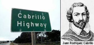 This segment is officially named Cabrillo Highway" in the State Highway Code, §635. Juan Rodríquez Cabrillo was the leader of one of the
first European expeditions to California. In 1542, Cabrillo led the first
European expedition to explore what is now the west coast of the United
States. Cabrillo was commissioned by Pedro de Alvarado, Governor of
Guatemala, for a voyage up the California coast under the flag of Spain.
Cabrillo hoped to find the fabulously wealthy cities known as Cibola,
believed to be somewhere on the Pacific coast beyond New Spain, and a
route connecting the North Pacific to the North Atlantic. Cabrillo reached
"a very good enclosed port" which is now San Diego bay, on September 28,
1542, naming it "San Miguel". He probably anchored his flagship, the San
Salvador at Ballast Point on Point Loma's east shore. Six days later, he
departed San Diego sailing northward and exploring the uncharted coast
line of California. The expedition reached San Pedro on October 6, Santa
Monica on the 9th, San Buenaventura on the 10th, Santa Barbara on the 13th
and Pt. Concepcion on the 17th. Because of adverse winds Cabrillo turned
back, harboring at San Miguel Island, and did not progress beyond Santa
Maria until November 11. With a favorable wind later that day they reach
the "Sierra de San Martin," probably Cape San Martin and the Santa Lucia
Mountains in southern Monterey County. Struck by a storm and blown out to
sea, the two vessels are separated and do not rejoin until the 15th,
probably near Año Nuevo north of Santa Cruz. The next day they
drifted southward, discovering "Bahía de los Pinos" and "Cabo de
Pinos." These are most likely Monterey Bay and Point Pinos. On the 18th
they turned south, passing snow-capped mountains (the Santa Lucias), and
on November 23 returned to their harbor at San Miguel Island, where they
remained for nearly three months. Cabrillo died January 3, 1543, on San
Miguel Island, and may have been buried on Catalina Island. He died from
complications of a broken leg incurred from a fall during a brief skirmish
with natives. It was named by Assembly Bill 1769, Chapter 569, in 1959.
This segment is officially named Cabrillo Highway" in the State Highway Code, §635. Juan Rodríquez Cabrillo was the leader of one of the
first European expeditions to California. In 1542, Cabrillo led the first
European expedition to explore what is now the west coast of the United
States. Cabrillo was commissioned by Pedro de Alvarado, Governor of
Guatemala, for a voyage up the California coast under the flag of Spain.
Cabrillo hoped to find the fabulously wealthy cities known as Cibola,
believed to be somewhere on the Pacific coast beyond New Spain, and a
route connecting the North Pacific to the North Atlantic. Cabrillo reached
"a very good enclosed port" which is now San Diego bay, on September 28,
1542, naming it "San Miguel". He probably anchored his flagship, the San
Salvador at Ballast Point on Point Loma's east shore. Six days later, he
departed San Diego sailing northward and exploring the uncharted coast
line of California. The expedition reached San Pedro on October 6, Santa
Monica on the 9th, San Buenaventura on the 10th, Santa Barbara on the 13th
and Pt. Concepcion on the 17th. Because of adverse winds Cabrillo turned
back, harboring at San Miguel Island, and did not progress beyond Santa
Maria until November 11. With a favorable wind later that day they reach
the "Sierra de San Martin," probably Cape San Martin and the Santa Lucia
Mountains in southern Monterey County. Struck by a storm and blown out to
sea, the two vessels are separated and do not rejoin until the 15th,
probably near Año Nuevo north of Santa Cruz. The next day they
drifted southward, discovering "Bahía de los Pinos" and "Cabo de
Pinos." These are most likely Monterey Bay and Point Pinos. On the 18th
they turned south, passing snow-capped mountains (the Santa Lucias), and
on November 23 returned to their harbor at San Miguel Island, where they
remained for nearly three months. Cabrillo died January 3, 1543, on San
Miguel Island, and may have been buried on Catalina Island. He died from
complications of a broken leg incurred from a fall during a brief skirmish
with natives. It was named by Assembly Bill 1769, Chapter 569, in 1959.
(Image sources: American Road Trips; Wikipedia)
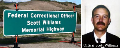 The portion of Route 1 between the California Boulevard
exit (apx 001 SB M29.877) and the Santa Lucia Canyon Road/Floradale Avenue
exit in Lompoc (apx 001 SB R26.647) is named the Correctional Officer Scott Williams Memorial Highway". It was named in memory of
Federal Correctional Officer Scott Williams , who was violently murdered
on April 3, 1997 by an inmate while working as a Federal Correctional
Officer at the United States Penitentiary in Lompoc. Officer Williams was
born in Ventura and graduated from Lompoc High School in 1986. Upon
graduating from high school, Officer Williams enlisted in and honorably
served the United States Marine Corps, receiving numerous awards for his
outstanding service. In December of 1990, Officer Williams, as a
reservist, was called to active duty to serve in Operation Desert Storm
and received the "Marine of the Year" award. After serving his country
overseas, Officer Williams returned to serve his country at home. Upon his
return, Officer Williams began working for the Federal Bureau of Prisons
in Lompoc as a Federal Correctional Officer in 1993 and was selected as a
member of the Special Operations Response Team. Officer Williams was
actively involved in his community, where he volunteered with the local
Men's Club and the Lions Club. Officer Williams' death is a tragic
reminder that the law enforcement officers who serve the public risk their
lives on a daily basis. Named by Senate Concurrent Resolution 28,
Resolution Chapter 91, on September 15, 2011.
The portion of Route 1 between the California Boulevard
exit (apx 001 SB M29.877) and the Santa Lucia Canyon Road/Floradale Avenue
exit in Lompoc (apx 001 SB R26.647) is named the Correctional Officer Scott Williams Memorial Highway". It was named in memory of
Federal Correctional Officer Scott Williams , who was violently murdered
on April 3, 1997 by an inmate while working as a Federal Correctional
Officer at the United States Penitentiary in Lompoc. Officer Williams was
born in Ventura and graduated from Lompoc High School in 1986. Upon
graduating from high school, Officer Williams enlisted in and honorably
served the United States Marine Corps, receiving numerous awards for his
outstanding service. In December of 1990, Officer Williams, as a
reservist, was called to active duty to serve in Operation Desert Storm
and received the "Marine of the Year" award. After serving his country
overseas, Officer Williams returned to serve his country at home. Upon his
return, Officer Williams began working for the Federal Bureau of Prisons
in Lompoc as a Federal Correctional Officer in 1993 and was selected as a
member of the Special Operations Response Team. Officer Williams was
actively involved in his community, where he volunteered with the local
Men's Club and the Lions Club. Officer Williams' death is a tragic
reminder that the law enforcement officers who serve the public risk their
lives on a daily basis. Named by Senate Concurrent Resolution 28,
Resolution Chapter 91, on September 15, 2011.
(Image Sources: CBP 33 Western Region Blog, 12/7/2012; FBP Fallen Heroes Page)
 The portion of Route 1 between Route 166 (apx 001 SB 49.154) and the Santa Barbara
County line (apx 001 SB 50.606) is named the "Vietnam Veterans Memorial
Highway". It was named in honor of the Vietnam Veterans living on
the Central Coast. Route 1 has a strong historical significance for the
military personnel of the Vietnam War era as it passes through the central
coast region, and is home to many veterans' museums and memorials. The
State of California has the largest United States veteran population in
the nation, making California home to more than 7,000,000 veterans and
dependents representing more than 10 percent of California's population.
More California residents currently serve as active duty military
personnel than do residents of any other state. More than 350,000
California veterans served in the Vietnam War, 40,000 of whom were wounded
and 5,822 of whom were missing in action or killed, representing more than
10 percent of the nation's total casualties in that war. More California
residents gave their lives in the Vietnam War than residents of any other
state, and more Californians were awarded the Medal of Honor, the Bronze
Star, or the Purple Heart than veterans of any other state. 220 young men
and women from the City of Guadalupe served their country in the Vietnam
War, three of whom bravely made the ultimate sacrifice. The residents of
Santa Barbara County wish to express their gratitude and appreciation for
the sacrifices these Vietnam veterans made for their country by creating a
veterans recognition corridor that hopefully will become an ongoing
memorial for veterans and their families. Named by Senate Concurrent
Resolution 26, Resolution Chapter 90, on September 15, 2011.
The portion of Route 1 between Route 166 (apx 001 SB 49.154) and the Santa Barbara
County line (apx 001 SB 50.606) is named the "Vietnam Veterans Memorial
Highway". It was named in honor of the Vietnam Veterans living on
the Central Coast. Route 1 has a strong historical significance for the
military personnel of the Vietnam War era as it passes through the central
coast region, and is home to many veterans' museums and memorials. The
State of California has the largest United States veteran population in
the nation, making California home to more than 7,000,000 veterans and
dependents representing more than 10 percent of California's population.
More California residents currently serve as active duty military
personnel than do residents of any other state. More than 350,000
California veterans served in the Vietnam War, 40,000 of whom were wounded
and 5,822 of whom were missing in action or killed, representing more than
10 percent of the nation's total casualties in that war. More California
residents gave their lives in the Vietnam War than residents of any other
state, and more Californians were awarded the Medal of Honor, the Bronze
Star, or the Purple Heart than veterans of any other state. 220 young men
and women from the City of Guadalupe served their country in the Vietnam
War, three of whom bravely made the ultimate sacrifice. The residents of
Santa Barbara County wish to express their gratitude and appreciation for
the sacrifices these Vietnam veterans made for their country by creating a
veterans recognition corridor that hopefully will become an ongoing
memorial for veterans and their families. Named by Senate Concurrent
Resolution 26, Resolution Chapter 90, on September 15, 2011.
(Image source: Corco Highways)
Freeway[SHC 253.2] From Route 101 near Las Cruces to Route 227 south of Oceano.
Scenic Route[SHC 263.2] From Route 101 at Las Cruces to Route 246 near Lompoc; and from Route 227 south of Oceano to Route 101 near Pismo Beach.
 National Trails
 This route is part of the De Anza National Historic Trail.
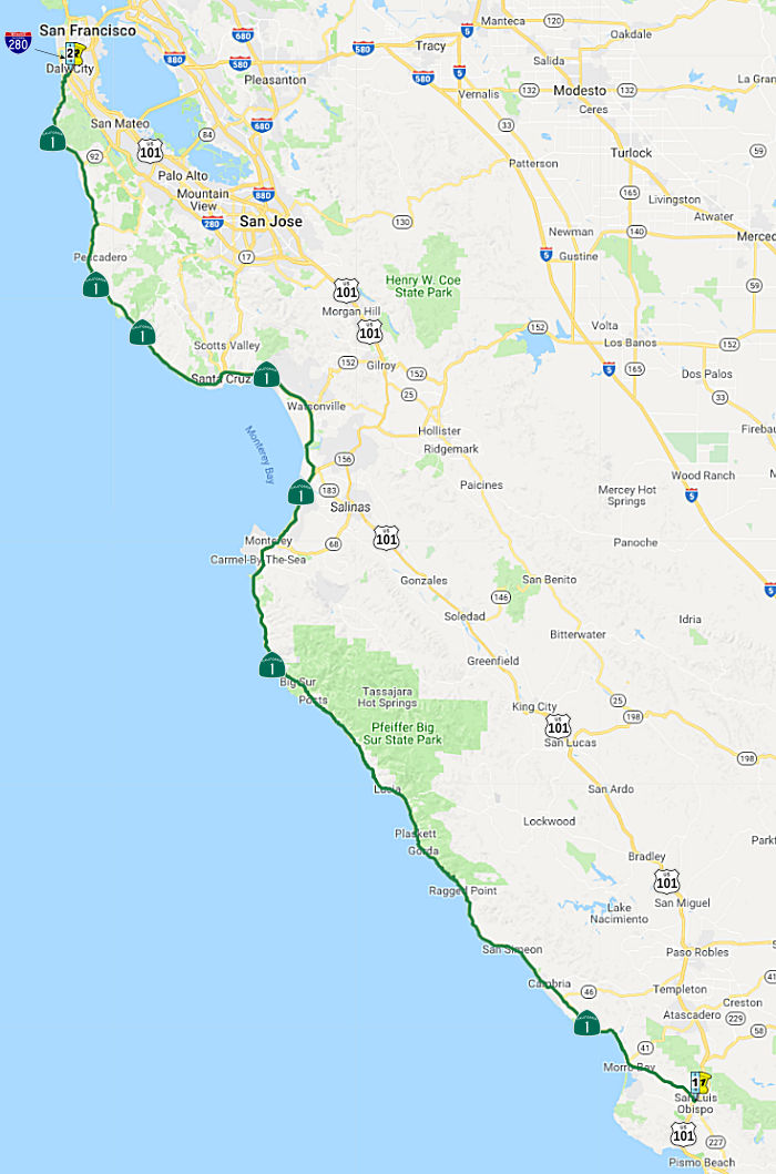 From Route 101 in San Luis Obispo to Route 280 south of San Francisco along the
coast via Cambria, San Simeon, and Santa Cruz.
From Route 101 in San Luis Obispo to Route 280 south of San Francisco along the
coast via Cambria, San Simeon, and Santa Cruz.
Post 1964 Signage HistoryThe original definition of this segment in 1963 (Chap. 385) was "San Luis Obispo to Route 280 south of San Francisco along the coast via Cambria, San Simeon and Santa Cruz." In 1968, this was clarified by Chap. 282. to note that the route was from Route 101 in San Luis Obispo.
San Luis Obispo
According to Scott Presnel, at one time there was
supposed to be a freeway bypass of Route 1 from Cuesta College (W of SLO)
to US 101 in San Luis Obispo; however the city of San Luis Obispo voted to
delete the freeway bypass and with Caltrans it became a thing of a past.
This is also mentioned on a District 5 Fact Sheet for the route, where planning Segment 7 of the route has the note: " Evaluate bypass/relinquishment of segments 7 and 8A (alternate
route from Route 101 to Cuesta College)." Segment 7 runs from the US 101
Ramps at Santa Rosa Street (SLO PM 16.77) in San Luis Obispo to City
Limits at Highland Drive (SLO PM 17.80). The planning report where this is
mentioned appears to not be online; there appears to be no cooberation of
the deletion (or the adoption, for that matter).
(Source: ACSCMapCollector @ AARoads, 7/13/2016)
At the end of December 1962, the SLO Telegram-Tribune
noted the following about highway construction in the SLO area:
(Source: SLO Tribune, 12/28/2018)
Cambria
 In 1957, the CTC adopted a freeway routing that would relocate 3½ mi of the
existing route in Cambria. The route would begin just E of the present
highway at Weymouth St. in Cambria Pines, and extend easterly on a line S
of the present highway to the vicinity of Cambria Pines Manor, where it
would cross to N of the existing highway and connect with a freeway route
towards Cayucos adopted in February 1957. The existing highway at the time
is Main Street today. Note that what the map shows as Route 41 was
renumbered as Route 46 in 1964.
In 1957, the CTC adopted a freeway routing that would relocate 3½ mi of the
existing route in Cambria. The route would begin just E of the present
highway at Weymouth St. in Cambria Pines, and extend easterly on a line S
of the present highway to the vicinity of Cambria Pines Manor, where it
would cross to N of the existing highway and connect with a freeway route
towards Cayucos adopted in February 1957. The existing highway at the time
is Main Street today. Note that what the map shows as Route 41 was
renumbered as Route 46 in 1964.
(Source: via Joel Windmiller, 1/27/2023)
In late 1962, construction began on a two-lane
relocation of Route 1 to bypass the town of Cambria to the south. The
project begins 1.5 miles south and ends 1/2 mile south of San Simeon Creek
north of Cambria. Completion of this $1,300,000 project is expected in
September 1963.
(Source: SLO Tribune, 12/28/2018)
Big Sur
Many of the bridges in the Big Sur
areas—especially the historic ones—are maintained using a
high-tech process known as electrochemical chloride extraction (ECE).
Through this process, engineers are able to reverse the decay of these
reinforced concrete bridges. Electricity is run through the bridge, and it
extracts the elements that participate in the corrosion of the rebar. The
ECE process takes place over the course of several months, without closing
the bridge to traffic, by wrapping electrically charged anodes around key
parts of the structure. In the 2020-2021 period, the Malpaso Creek Bridge
received the treatment over the course of 305 days, at a cost of about $1
million to taxpayers. Caltrans also uses cameras and motion-sensing ground
monitors to can identify trouble spots before a major rock slide occurs.
When a problem point is identified, Caltrans sends out teams for
“rock scaling,” rappelling down a cliff face and shaking off
loose rock while the roadway is closed. More routine maintenance includes
cleaning out the hundreds of culverts that divert water beneath the road
when it traverses a canyon. Naturally, many of these century-old drainage
channels are no longer up to snuff, and their failures can lead to
significant slides (such as the 2021 Rat Creek Slide). While the highway
was shut down, the culvert was replaced by one double in size.
(Source: Nob Hill Gazette, “An Ode to Highway 1”, 1/5/2022)
Note that the 75-mile stretch of Route 1 between San Carpoforo Creek in San Luis Obispo County and the Carmel River in Monterey County is governed by the "Big Sur Coast Highway Management Plan", dated March 2004. The CHMP consists of the Corridor Management Plan (CMP) and a series of Management Guidelines. The CMP summarizes the inventory of corridor resources and qualities, describes the issues and challenges investigated by the five working groups, an action plan for addressing the issues and a framework for implementation. The three guidelines address Corridor Aesthetics; Landslide Management & Storm Damage Response; and Vegetation Management. Together these documents provide the framework for ongoing collaboration to meet stakeholders’ common vision for the corridor. The documents can be found on the Monterey County planning pages.
Big Sur has been consistently plagued with land and mud
slides throughout its life. The problem is that it is essentially the only
artery through the area. The ONLY other road across the mountains after
Route 46 is Nacimiento-Fergusson Road near Mill Creek: A 24.2 mile road
that connect Route 1 to Fort Hunter Liggett. Completed sometime between
1935-1938. About two-thirds of the road is a wide single lane roadway with
no center line
Barely signed from Route 1 and is easily missed. Sections have a 14% grade
with lots of hairpin turns. Connects to County Sign Route G14, which connects to US 101.
It may be closed without notice when there are live fire exercises on the
Army base. Heavily damaged in in the early 202xs due to fires and has not
been fully been rebuilt. Closures of Route 1 due to mud slides can isolate
those who live on/near the Sur. This often results in the need for
multi-hour detours either S through SLO, or N through Carmel, or through
N-F, depending on where one lives.
There are regularly winter storms that result in slides that close Route 1 for months or over a year. This is is some of the more major ones; we're not even bothering to discuss closures less than a week, which seem to happen almost every year.
In 2017, just south of Pfeiffer Big Sur State Park, shifting earth damaged a pier supporting a bridge over the 320 feet deep Pfeiffer Canyon. Caltrans immediately closed the highway on February 12, 2017 and announced the next day that the Pfeiffer Canyon Bridge was damaged beyond repair and would have to be replaced. The previous Pfeiffer Canyon Bridge was constructed by 1968 and was a concrete box girder design. The 1968 bridge replaced a wooden road bridge which likely was in place when Route 1 was being built in the Big Sur region in the 1930s The new bridge design is a single steel span which should in theory be a much better design to clear the slide zone in Pfeiffer Canyon.
Carmel
 In 1953, it was reported that a 3.5 mi section of Route 1 was adopted by the CHC and
declared to be a freeway. The routing extended from the Carmel River to
the S city limits of Monterey, following the existing highway, deviating
at a few points to accommodate interchanges. The adoption was done early
to reserve right of way; construction would depend on available funds. The
plans at the time called for the route to be developed as a four-lane
highway. However, as of 2023, the freeway construction never materialized.
In 1953, it was reported that a 3.5 mi section of Route 1 was adopted by the CHC and
declared to be a freeway. The routing extended from the Carmel River to
the S city limits of Monterey, following the existing highway, deviating
at a few points to accommodate interchanges. The adoption was done early
to reserve right of way; construction would depend on available funds. The
plans at the time called for the route to be developed as a four-lane
highway. However, as of 2023, the freeway construction never materialized.
(Source: The Californian, 1/22/1953 via Joel Windmiller, 1/27/2023)
There were once plans to reroute this segment in Carmel across a new freeway in Hatton Canyon (MON 72.91, where County Sign Route G16 meets Route 1). This section was for a realignment of Route 1 from Carmel Valley Road to the Pacific Grove Interchange of Route 1 and Route 68. The Hatton Canyon is a scenic and environmentally sensitive area, comprised of undeveloped land that includes one of the few genetically pure Monterey Pine forests left in the world, significant coastal habitat and recreation areas, as well as diverse wildlife. Although originally planned for a freeway alignment, the Department of Transportation determined that a freeway bypass in the Hatton Canyon was not currently viable. As a result, AB 434 (Chapter 136, 7/31/2002) rescinded the route adoption, dated January 9, 1956, for the realignment of Route 1 in Hatton Canyon near the City of Carmel-by-the-Sea; furthermore, it nullified the freeway agreement, dated April 8, 1997, related to that realignment. The property located in Hatton Canyon was declared to be surplus state property located within the coastal zone, as defined in Section 30103 of the Public Resources Code, and the Department of Transportation was directed sell its ownership interest in the Hatton Canyon for the purpose of creating or adding to a state park.
Castroville
Until the early 1980s, Route 1 entered Castroville from the south via Route 156 eastbound (the current freeway), then exited at the diamond interchange for Merritt Street and continued northwest via Merritt. However, by the mid-1980s, the current Castroville bypass was constructed; as a consequence, the portion of freeway on Route 1 between Merritt Street and the bypass became an extension of Route 156, and Merritt Street became part of Route 183.
Santa Cruz
Back in the 1960's, Caltrans proposed creating a
freeway bypass of Route 1 along the Mission Street corridor. The Santa
Cruz City Council endorsed a proposal which would have paralleled Mission
Street to the north, cutting through some neighborhoods along the entire
route. The nearby residents appealed this decision all the way to the
California Transportation Commission, which sided with the residents and
chose their alternative of an alignment on the northern outskirts of town
through the recently-opened University of California Santa Cruz (UCSC).
This is what is legislatively Route 100. However, UCSC strongly objected
to this new alignment, and eventually the entire bypass issue was dropped.
Early UCSC planners wanted to re-route Route 1 up through Pogonip, across
the future campus and down through Wilder Ranch to meet up with the coast
road west of town.
(Source: Santa Cruz Streets, h/t Aaroads; SantaCruz
Sentinel, 2/11/2019)
Pacifica and Half-Moon Bay
In August 1965, it was reported that there were four
alternatives announced for a freeway between Half Moon Bay and Montara.
The S route ran along the ocean's edge, whereas the R route followed along
the old Ocean Shore Railway right of way. The X route followed the present
Coast Highway route, and the H route skirted the eastern foothills. There
were two cross-over points: A W route connecting the X route with the H
route S of the built-up portion of Half Moon Bay, and a P route N of Half
Moon Bay crossing back to the X route again. The H route ran just behind
the Half Moon Bay High School. N of town, the S, R, and H alternatives all
eventually rejoin the X route, and the freeway continues along the present
right of way through El Grenada. There it joined the route from Pacifica
already adopted. The cost of the alternatives would vary from $42.8
million for the 19.5mi XS route along the ocean beach, to a low of $39.1
million for the 18.7 mi XWH route swinging around Half Moon Bay proper.
(Source: Redwood City Tribune 8/26/1965, via email from Will
Poundstone, 1/1/2024)
There were once plans for a bypass of Pacifica and
Half-Moon Bay. This was quashed by 1982 jointly by Adriana Gianturco, the
largely anti-freeway head of Caltrans at the time and the then-nascent
California Coastal Commission. Essentially all adopted freeways along
Route 1 were deleted between 1976 and 1982; existing facilities were
"grandfathered" in. The later Devil's Slide tunnel bypass was simply to
keep Route 1 open between Pacifica and Half Moon; the original cliffside
route was considered too unstable to maintain.
(Source: Scott Parker (Sparker) at AARoads, 8/12/2016)
Devil's Slide
The Devil's Slide area of Route 1 closed due to slides
for 2 years in 1995 and had a 6 month closure in 2006 due to an eroding
road deck. Eventually Route 1 was realigned through the Tom Lantos Tunnels
which were under construction from 2005 to 2013 (see below for all the
status reports during the construction). Both tunnels are about 4,000 in
length and carry on direction of highway travel. In 2014 the former grade
of Route 1 was converted to the 1.3 mile Devil's Slide Trail which has
dual trailheads at both ends of the Tom Lantos Tunnels.
(Source: Gribblenation Blogs: California State Route 1 Tom Lantos Tunnels/Old California State Route 1 Devil's Slide, 2/13/2019)
Pre 1964 Signage History The portion of this segment from San Simeon to Carmel was added to the state highway system in 1919 as the first segment of LRN 56. It was
extended southward to Cambria in 1921 (Chapter 837). It was extended
further southward to San Luis Obispo in 1931 (Chapter 82). It was also
extended northerly (again as LRN 56) to San Francisco in 1933 (Chapter
767).
San Luis Obispo
Tom Fearer notes that originally US 101, upon
descending Cuesta Pass southbound, entered the City of San Luis Obispo via
Monterey Street. From Monterey Street, US 101 utilized Santa Rosa
Street and Higuera Street southbound through downtown San Luis
Obispo. Upon departing downtown San Luis Obispo, US 101 would have
stayed on Higuera Street southward towards Pismo Beach and Arroyo
Grande. Beginning in 1934, US 101 picked up Route 1 at the
intersection of Monterey Street/Santa Rosa Street where the two would
multiplex to Pismo Beach. Circa 1923, LRN 2 (future US 101) used Monterey
Street, Chorro Street and Higuera Street headed southbound through SLO,
with major highways departing LRN 2 at Broad Street southward and Santa
Rosa Street northward. It is unclear when through route of LRN 2
shifted from Chorro Street to Santa Rosa Street. However, by 1931, LRN 56
(Route 1) was using Santa Rosa St to enter SLO meeting US 101 at Monterey
St and continuing along Higuera towards Pismo Beach; by 1933, LRN 147
(future Route 227) was using Broad Street and terminating at US 101 at
Higuera.
(Source: Gribblenation Blog (Tom Fearer), "Former US Route 101 and California State Route 1 in San Luis Obispo", July 2021)
In 1948, a new four lane alignment of US 101/Route 1/LRN 2 from Miles Station 6.6 miles north to Marsh Street in San Luis
Obispo opened. This new segment realigned both highways northbound
onto an alignment that entered downtown San Luis Obispo via Marsh
Street. Northbound US 101/Route 1/LRN 2 multiplexed on Marsh Street
onto Santa Rosa Street towards the split at Monterey Street. At
Monterey Street, US 101/LRN 2 departed towards Cuesta Pass whereas Route 1/LRN 56 stayed on Santa Rosa Street towards Morro Bay. This shift
saw LRN 147 (Route 227) truncated to a new terminus at the intersection of
Broad Street and Marsh Street. The freeway bypass realignment
occured in 1952-1953, from Marsh Street 2.3 miles to San Luis Obispo
Creek. This alignment removed US 101/Route 1/LRN 2 off the surface streets
of downtown San Luis Obispo onto a new limited access grade that entered
San Luis Obispo on a multiplex to the Santa Rosa Street exit, where Route 1 would split towards Morro Bay via LRN 56. Northbound US 101
continued on LRN 2 towards an existing expressway segment in Cuesta
Pass. LRN 147 was extended via a one-couplet on Higuera Street and
Marsh Street to a new terminus at US 101/Route 1/LRN 2.
(Source: Gribblenation Blog (Tom Fearer), "Former US Route 101 and California State Route 1 in San Luis Obispo", July 2021)
In Morro Bay, Route 1 ran along Main Street until the freeway bypass was built. In Cayucos, Route 1 ran along Ocean Ave before the freeway bypass. In Harmony, Route 1 ran along Old Creamery Road. Atascadero Road in Morro Bay was where Route 1 met US 466, which in 1964 became Route 41. Green Valley Road, N of Harmony, became the new routing for Route 46 around 1970.
In Cambria, before the freeway, Route 1 ran along Main Street. It may have also run along Moonstone Beach Drive. Route 1 would have met Sign Route 41 at Santa Rosa Creek Road until the highway was renumbered to the south in 1964 and replaced by Route 46. Construction of a rerouting of Route 46 onto Green Valley started in 1966, and was completed sometime between 1971-1975, which moved the junction S of Cambria. It was likely necessitated by the construction of the freeway routing through Cambria, which moved Route 1 far away from Main St. and the junction with the original Sign Route 41/Route 46 junction.
The original alignment of Route 1 was through San Simeon on SLO-San
Simeon Road. Route 1 was moved off of SLO-San Simeon Road to the modern
alignment running past Hearst Castle Road between 1943 and 1960. The
Arroyo del Puerto Bridge on SLO-San Simeon Road dates back to 1916 and was
part of the original LRN 56/Route 1 alignment. Route 1 originally ran
through San Simeon on Main Street. In Cambria, Route 1 would have met Sign
Route 41 at Santa Rosa Creek Road the 1964 highway renumbering, when US 466 was renumbered as Route 41, and Sign Route 41 became Route 46.
(Source: Gribblenation Blog, California State Route 1 in Big Sur, August 2018)
Tom Fearer, in the Gribblenation Blog "California State Route 1; the Cabrillo Highway through Big Sur and the Monterey Peninsula", has a detailed history of the routing from Monterey through Big Sur to Carmel. This is excerpted from there: A trail from
Monterey southward to El Rancho Sur between the Little Sur and Big Sur
River existed as early 1853. This trail was declared a public road by
Monterey County in 1855. By 1870 the trail had been improved to a wagon
road as far south as Bixby Creek. By 1886 the trail south to the vicinity
of Sycamore Canyon at W.B. Post's Ranch had been improved enough to allow
wagon travel. Today much of this old wagon road exists as Coast Road from
the Bixby Creek Bridge south to Andrew Molera State Park. After an 1894
trip, Dr. John Roberts petitioned the state legislature to build a roadway
between Carmel and San Simeon. The crux of the argument for a coastal
roadway was that it help national defense during World War I. In 1919 the
State Legislature approved $1,500,000 dollar bond to build LRN 56 from
Carmel south to San Simeon. LRN 56 between Carmel and San Simeon first
appears on the 1920 Division of Highways Map as an unbuilt highway. In
1921 the Legislature extended LRN 56 south to Cambria. The Division of
Highways assumed control of the existing road between Cambria and San
Simeon while a section of LRN 56 near Ragged Point north to the Monterey
County line appear as under construction. The March 1926 California
Highways and Public Works Guide cites that the Division of Highways
assumed control of the existing highway from Carmel south to the Big Sur
River. By 1928 work on the highway was approaching Gorda. The December
1931 California Highways and Public Works Guide details the construction
of the Garrapata Creek and Granite Creek Bridges. The Garrapata Creek
Bridge is cited to have opened in November of 1931 and the Granite Creek
Bridge was anticipated to open in early 1932. In 1931, LRN 56 was extended
south to San Luis Obispo, and a construction segment south out of Carmel
to Point Sur appears on the 1932 State Highway Map. The dedication
ceremony for the opening the Bixby Creek Bridge was held on November 28,
1932. In 1933 LRN 56 was extended south to LRN 2 (US 101) near Las Cruces
and north to Ferndale to LRN 1 (also US 101). Subsequently LRN 56 was
routed through the Monterey Peninsula on what had been a previously
locally maintained highway. LRN 56 appears completed in Big Sur on the
1934 Division of Highways Map aside from a segment near Lopez Point. On
June 27th, 1937 Route 1 opened entirely through Big Sur and as the
Carmel-San Simeon Highway.
(Source: Gribblenation Blog "California State Route 1; the Cabrillo Highway through Big Sur and the Monterey Peninsula")
The original impetus for a highway between Carmel and San Simeon came
from a doctor named John L.D. Roberts. One day a shipwreck required Dr.
Roberts to ride to Point Sur, taking him nearly four hours to reach Point
Sur to care for the injured. He recognized the need for a road and
photographed the land between San Simeon and Carmel and has been credited
with being the first surveyor of this rocky stretch of coast.
Roberts’ early efforts influenced Senator Elmer S. Rigdon of
Cambria, who worked to obtain a 1917 appropriation from the state
legislature for a survey of the alignment, as part of a larger bill for
highway surveys throughout the state. These surveys helped convince the
Highway Commission that the route was feasible. Funding for construction
was approved in a 1919 bond measure. Initial estimates came in at
$1.5 million. Federal funds were appropriated and in 1921 voters approved
additional state funds.
(Source: Nob Hill Gazette, “An Ode to Highway 1”, 1/5/2022)
Eventually, the route was codified as a legislative route: LRN 56. It
first appears on the 1920 State Highway Map between Carmel and San Simeon
as an unbuilt highway. In 1921 the Legislature extended LRN 56 to Cambria
which is reflected on the 1922 State Highway Map. The Division of Highways
assumed control of the existing road between Cambria and San Simeon while
a section of LRN 56 near Ragged Point north to the Monterey County line
appears under construction. In 1924 a section of LRN 56 south of Big Sur
appears under construction.
(Source: Gribblenation Blog, California State Route 1 in Big Sur, August 2018)
Earth-moving on the Carmel–San Simeon leg began in 1921 and was
immediately challenged by the elements. Equipment regularly fell off
cliffs and into the ocean. Dynamite, then a popular excavation method,
destabilized many cliffs. By 1924, construction was halted due to labor
shortages in the remote area, only to resume in 1928 with the introduction
of convict labor. Seventy thousand pounds of dynamite blasted through the
granite, marble and sandstone of the rugged terrain and lime was smelted
for making concrete. The heaviest construction was in the 65-mile section
between Spruce Creek and the area north of San Simeon. More than 10
million cubic yards of rock was blown away. In 1945, work crews found some
of the original dynamite sticks under a section of the road.
(Source: Nob Hill Gazette, “An Ode to Highway 1”, 1/5/2022)
By 1924, construction was halted due to labor shortages in the remote area, only to resume in 1928 with the introduction of convict labor. San Quentin Prison set up three temporary prison camps to provide the labor for the road. One was set up by Little Sur River, one at Kirk Creek and later one was established at Anderson Creek. Inmates were paid 35 cents per day and their prison sentences reduced in return for their hard work. Locals like John Steinbeck also worked on the road. In 1937 that the Carmel– San Simeon Highway was formally dedicated by Governor Frank Merriam at a ceremony near Pfeiffer Big Sur State Park. By that point, 29 of 32 planned bridges had been completed along the route, all designed by California State Bridge Engineer Frederick Panhorst. Those bridges, notably the Bixby Creek Bridge, have since become world-famous tourist attractions.
By 1928 work on LRN 56 north from Ragged Point continued into Monterey
County approaching Gorda. In 1931 LRN 56 was extended south to San Luis
Obispo which is reflective on the 1932 State Highway Map. A third
construction segment south out of Carmel to Point Sur also appears on the
1932 State Highway Map. By 1934 Route 1 was applied to LRN 56. LRN 56
appears completed on the State Highway Map aside from a segment in the
middle which crossed by Lopez Point. On June 27th, 1937, the Carmel–
San Simeon Highway was formally dedicated by Governor Frank Merriam at a
ceremony near Pfeiffer Big Sur State Park and Route 1 opened entirely
through Big Sur. It was was known as the Roosevelt Highway. By that point,
29 of 32 planned bridges had been completed along the route, all designed
by California State Bridge Engineer Frederick Panhorst. The surface of
Route 1 in Big Sur when it opened was oiled earth aside from the segment
north of the community of Big Sur.
(Source: Gribblenation Blog, California State Route 1 in Big Sur, August 2018; Nob Hill Gazette, “An Ode to Highway 1”, 1/5/2022)
It wasn’t until the mid 1950s that the highway was open all year; before then, it was gated to non-residents (that is, local traffic only; no tourist or through traffic) during the winter months.
In 1934, this segment was signed as part of signed Route 1 (Jct. US 101 at Las Cruces, via Cambria, Santa Cruz, San Francisco, Pt. Reyes, and Westport to US 101 at Fortuna). In fact, the October 1934 California Highways and Public Works Guide cites that the very first Sign State Route Shield was installed as part of Route 1 in Carmel.
It appears that Old Cremery Road was the original routing through the
town of Harmony (apx 001 SLO 44.057).
(Ref: DTComposer at AAroads)
Within Carmel the original alignment of Route 1/LRN 56 was along the same
corridor the modern highway takes north near Hatton Canyon from Carmel
Valley Road (County Sign Route G16) north to Carpenter Street. From Carpenter Street the
initial route of Route 1/LRN 56 continued north atop the same right-of-way
the modern freeway uses to Munras Avenue. Route 1/LRN 56 north continued
into downtown Monterey onto Abrego Street. Within downtown Monterey the
original route of Route 1/LRN 56 followed Abrego Street and turned on Del
Monte Avenue. Route 1/LRN 56 originally continued north on Del Monte
Avenue through Seaside onward towards Marina. Within Marina Route 1/LRN 56
originally followed Del Monte Boulevard. North of Marina ROute 1/LRN 56
followed Lapis Road towards Neponset and Salinas River. Originally Route 1
crossed the 1914 Neponset Truss Bridge next to the Southern Pacific
Monterey Branch. Originally Route 1/LRN 56 northbound entered Castroville
via Preston Road where it turned left at Merritt Street. Route 1/LRN 56
appears shifted onto Fremont Street from Munras Avenue in downtown
Monterey through Seaside on the 1942 Division of Highways Map.
(Source: Gribblenation Blog "California State Route 1; the Cabrillo Highway through Big Sur and the Monterey Peninsula")
The portion of the route in the Monterey area originally ran along Munras and North Fremont in Monterey (apx. 001 MON R77.531), Fremont in Seaside, merging at the N end of Seaside into Del Monte Ave. Del Monte ran along the current freeway routing through Fort Ord into Marina, where it ran along the current Del Monte Ave.
 In 1950, the CHC considered the adoption of a freeway routing for the relocation of a
portion of Route 1 within the boundaries of Fort Ord. The recommended
route is 4.1 mi in length between the S boundary of Fort Ord and 0.6 mi S
of the N boundary (note: Fort Ord is now CSU Monterey Bay). The route
follows the existing highway except for a section between N Coe Avenue and
N of Gigling Road. On this section, the recommended route runs on a direct
northerly line E of the present highway, which swings westerly
approximately parallel with the Southern Pacific RR tracks. The initial
plans are to construct a four-lane freeway with provision for future
expansion to six lanes. As of 2023, it does not appear that the
pre-freeway road is still present.
In 1950, the CHC considered the adoption of a freeway routing for the relocation of a
portion of Route 1 within the boundaries of Fort Ord. The recommended
route is 4.1 mi in length between the S boundary of Fort Ord and 0.6 mi S
of the N boundary (note: Fort Ord is now CSU Monterey Bay). The route
follows the existing highway except for a section between N Coe Avenue and
N of Gigling Road. On this section, the recommended route runs on a direct
northerly line E of the present highway, which swings westerly
approximately parallel with the Southern Pacific RR tracks. The initial
plans are to construct a four-lane freeway with provision for future
expansion to six lanes. As of 2023, it does not appear that the
pre-freeway road is still present.
(Source: Unnamed publication, 1950, via Joel Windmiller, 2/14/2023)
Originally Route 1/LRN 56 northbound entered Castroville via Preston Road
where it turned left at Merritt Street. Route 156/LRN 22 westbound entered
Castroville by way of an at-grade crossing of the Southern Pacific
Railroad from Castroville Boulevard onto Salinas Street. Route 156/LRN 22
made a right had turn on Merritt Street and met Route 1/LRN 56 at Preston
Road. Route 183/LRN 118 northbound entered Castroville on Merritt Street
and terminated at Route 156/LRN 22 at Salinas Street. Former Route 1 on
Preston Road juts west of Merritt Street and crosses Tembladera Slough on
a bridge with an unknown build date. Former Route 1 on Preston Road
continues west to the present split in the Route 1/Route 156 freeways.
(Source: Gribblenation Blog: Historic Highway Alignments in Castroville (CA 1, CA 156 and CA 183))
In Watsonville (apx 001 SCR R1.403), Main Street and Salinas Road were the original Route 1 routings before the freeway bypass and new bridge over the Pajaro were built.
Freedom Boulevard between Freedom (apx 001 SCR R3.756) and Aptos (apx. 001 SCR 9.969) was the original Route 1 before the current bypass (originally a surface road, now freeway) was proposed.
 On May 23, 1928, the board of supervisors of San
Francisco, San Mateo, and Santa Cruz counties formed Joint Highway
District 9, which had the sole purpose of constructing a public highway
along the ocean shore between Santa Cruz and San Francisco, under the
provisions of the joint highway district act of 1917. According to the
records, "proceedings for formation of the district were initiated by the
Santa Cruz county board of supervisors by resolution adopted on May 7,
1927, which declared that the public interest required the construction of
a public highway 'the general location and course of which shall be
commencing within the county of Santa Cruz at a point of connection with a
main public highway already existing and extending northerly as closely as
practical to the shore line of the Pacific Ocean, through the county of
San Mateo, and into the county of San Francisco to a suitable point
connecting within said county' ". This route was called the Ocean
Shore Highway. In 1933, the Ocean Shore Highway was designated as
LRN 56, and a year later, it was signed as Sign Route 1. The original
estimated cost of $5.3 million was divided between the counties
proportionally: San Francisco 55%, San Mateo 30%, and Santa Cruz 15%,
although that was adjusted later to be San Mateo 31⅔% and Santa Cruz
13⅓%. As of 1955, 53.7 mi of the Ocean Shore Highway had been
constructed with ~ 14.7 mi remaining to be improved. Construction
contracts had been awarded for the 1.5 mi segment from just N of Finney
Creek to 1 mi N of New Years Creek. The district remained in operation at
least through 1955.
On May 23, 1928, the board of supervisors of San
Francisco, San Mateo, and Santa Cruz counties formed Joint Highway
District 9, which had the sole purpose of constructing a public highway
along the ocean shore between Santa Cruz and San Francisco, under the
provisions of the joint highway district act of 1917. According to the
records, "proceedings for formation of the district were initiated by the
Santa Cruz county board of supervisors by resolution adopted on May 7,
1927, which declared that the public interest required the construction of
a public highway 'the general location and course of which shall be
commencing within the county of Santa Cruz at a point of connection with a
main public highway already existing and extending northerly as closely as
practical to the shore line of the Pacific Ocean, through the county of
San Mateo, and into the county of San Francisco to a suitable point
connecting within said county' ". This route was called the Ocean
Shore Highway. In 1933, the Ocean Shore Highway was designated as
LRN 56, and a year later, it was signed as Sign Route 1. The original
estimated cost of $5.3 million was divided between the counties
proportionally: San Francisco 55%, San Mateo 30%, and Santa Cruz 15%,
although that was adjusted later to be San Mateo 31⅔% and Santa Cruz
13⅓%. As of 1955, 53.7 mi of the Ocean Shore Highway had been
constructed with ~ 14.7 mi remaining to be improved. Construction
contracts had been awarded for the 1.5 mi segment from just N of Finney
Creek to 1 mi N of New Years Creek. The district remained in operation at
least through 1955.
(Source: Santa Cruz Sentinal, 12/4/1955 via Joel Windmiller,
2/16/2023)
During 1928 Santa Cruz County constructed a new bridge over Aptos Creek
along Soquel Drive. During 1933, LRN 56 was extended north from
Carmel to Fernbridge. The extension of LRN 56 brought it along the
coast of Santa Cruz County, which aligned it directly through Aptos on
Soquel Drive. The extension of LRN 56 through Aptos brought the 1928
Aptos Creek Bridge directly under Division of Highways maintenance.
In 1944, the expansion of Route 1/LRN 56 to a four-lane divided highway
between Santa Cruz and Aptos was added to a list of approved post World
War II projects by the California Highway Commission. In 1949, the
new Santa Cruz-Aptos freeway alignment opened, and spanned from Morrissey
Avenue in Santa Cruz to Rob Roy Junction south of Aptos.
(Source: Gribblenation Blog (Tom Fearer), "Former California State Route 1 in Aptos", August 2022)
Modern Route 1 follows the coastline south passing Bean Hollow State
Beach. The original alignment of Route 1 continued south on Stage Road to
Pescadero and used Pescadero Creek Road (apx 001SM 13.567) in addition to
Bean Hollow Road to meet the modern highway. The original alignment from
Half Moon Bay south to Bean Hollow State Beach appears to have been
replaced by the modern alignment sometime between 1940 to 1942.
(Source: Gribblenation Blog: November Bay Area Trip Part 7; California State Route 1 from I–280 south to CA 17, 11/2017)
Prior to the arrival of Europeans a well established Native American
overland trail existed over Montara Mountain north of Half Moon Bay.
This trail was replaced in 1879 when San Mateo County completed the Half
Moon Bay-Colma Road as a stage route. The Half Moon Bay-Colma Road
eased access to the community of Half Moon Bay and connected several
others (namely; San Gregorio, Pescadero, Swanton and Davenport) via an
existing stage road south to Santa Cruz. San Mateo County seeing a need
for a better road over Montara Mountain completed what was then known as
"Coastside Highway" (now Old Pedro Mountain Road) by 1915 as a replacement
for the Half Moon Bay-Colma Road. Coastside Highway traversed
Montara Mountain via the 922 foot high Saddle Pass.
(Source: Gribblenation Blog (Tom Fearer), "Former alignments of California State Route 1 from Santa Cruz north to Half Moon Bay", August 2021)
Early alignments of Route 1 in this area in the mid-1930s included:
(Source: Gribblenation Blog (Tom Fearer), "Former alignments of California State Route 1 from Santa Cruz north to Half Moon Bay", August 2021)
 In the 1960s, the CHC considered a proposed freeway routing for Route 1 between Moss Beach
and Pacifica, moving well inland from the problematic Devils Slide area.
Although the routing may have been adopted, the freeway was never
constructed.
In the 1960s, the CHC considered a proposed freeway routing for Route 1 between Moss Beach
and Pacifica, moving well inland from the problematic Devils Slide area.
Although the routing may have been adopted, the freeway was never
constructed.
(Source: Via Joel Windmiller, 2/12/2023)
By the late 1930s, new alignments were in the works for the segment
originating a half mile from Davenport 8.2 miles north to the San Mateo
County Line. By the end of 1939, a new alignment of Route 1 from Davenport
north to Waddell Creek near the San Mateo County Line was opened that
eliminated 133 curves. It replaced Old Coast Road, Cement Plant Road,
Davenport's Landing Road and Swanton Road, and bypassed the community of
Swanton. By 1940, planning was in progress for realignment of Route 1 around Pescadero and San Gregorio. This alignment opened in 1941 and
begin at Lake Lucerne and eliminated 214 curves northward bypassing San
Gregorio. In the process, it eliminated the routings along Bean
Hollow Road, Pescadero Creek Road and Stage Road from the State Highway
System.
(Source: Gribblenation Blog (Tom Fearer), "Former alignments of California State Route 1 from Santa Cruz north to Half Moon Bay", August 2021)
South of Half Moon Bay Route 1 approaches Purisima Creek and Route 84 at
San Gregorio Road (apx 001 SM 18.189). The original alignment of Route 1
was more inland along Verde Road and Stage Road.
(Source: Gribblenation Blog: November Bay Area Trip Part 7; California State Route 1 from I–280 south to CA 17, 11/2017)
Main Street in Half Moon Bay (apx 001 SM 28.743) is old Route 1; this was supplanted in the mid 1950s by the Half Moon Bay Bypass.
In 1954, the remaining 10 miles of Route 1 south past Pigeon Point
Lighthouse to the Santa Cruz County Line were in the realignment planning
stages. A small segment of Route 1 in Santa Cruz County at Laguna Creek
(now Majors Creek) had been brought up to modernized standards and
replaced Scaroni Road.
(Source: Gribblenation Blog (Tom Fearer), "Former alignments of California State Route 1 from Santa Cruz north to Half Moon Bay", August 2021)
The original alignment of Route 1 between 1915 and 1935, prior to the
Devil's Slide alignment, between Montara (apx SM 001 36.629) and Pacifica
was over Pedro Mountain Road. Old Pedro Mountain Road, then known as
"Coastside Highway" was a replacement for the Half Moon Bay-Colma
Road. Coastside Highway traversed Montara Mountain via the 922 foot
high Saddle Pass via a modernized asphalted roadway with gentle 5% average
grade that made it far easier for the average car to traverse compared to
the Half Moon Bay-Colma Road. This route was added to the state highway
system with the extension of LRN 56 in 1933. Route 1/LRN 56 in 1935
approached Old Pedro Mountain Road through Farallone City and Montara via
Farallone Boulevard, 4th Street, Audubon Avenue, George Street and Elm
Street; it entered Rockaway Beach on what is now Higgins Way. By
1937, work had started on the Devil's Slide routing, which was 5.903 miles
in length compared to the 10.618 miles on existing Old Pedro Mountain
Road. Devil's Slide also had 13,821 feet less in curvature and 1,174
less feet in elevation variance compared to Old Pedro Mountain Road.
Old Pedro Mountain Road now exists as a hiking and mountain bike trail
within the McNee Ranch annex of Montara State Beach.
(Source: Gribblenation Blogs: Former California State Route 1 over Old Pedro Mountain Road, 7/25/2021)
The Devil's Slide, which opened 11/11/1937, is the second alignment of
Route 1 between Pacifica and Montara in San Mateo County while the Tom
Lantos Tunnels are the third alignment. The Devil's Slide refers to a
promontory region between Pacifica and Half Moon Bay which is part of the
Montara Mountain sub-range of the Santa Cruz Mountains. Devil's Slide in
particular has natural slopes approaching 50% in places which makes the
area particularly landslide prone. Most historic transportation access
prior to the 20th Century sought to avoid Devil's Slide and it wasn't
until 1905 when the Ocean Shore Railway started building a line through
area. In 1935 construction of a new alignment of Route 1 began at Devil's
Slide and was completed by 1936. The Devil's Slide section of Route 1 was
one of the historically most infamous along the entire highway with the
first major closure coming in 1940 due to a rock slide. The Devil's Slide
area of Route 1 closed due to slides for 2 years in 1995 and had a 6 month
closure in 2006 due to an eroding road deck. Eventually Route 1 was
realigned through the Tom Lantos Tunnels which were under construction
from 2005 to 2013 (see below for all the status reports during the
construction). Both tunnels are about 4,000 in length and carry on
direction of highway travel. In 2014 the former grade of Route 1 was
converted to the 1.3 mile Devil's Slide Trail which has dual trailheads at
both ends of the Tom Lantos Tunnels.
(Source: Gribblenation Blogs: November Bay Area Trip Part 7; California State Route 1 from I–280 south to CA 17, 11/2017;CaliforniaState
Route 1 Tom Lantos Tunnels/Old California State Route 1
Devil's Slide, 2/13/2019; Former California State Route 1 over Old Pedro Mountain Road, 7/25/2021)
By 1957, Route 1 ran northward up the coast through an unincorporated group of communities that later incorporated as Pacifica (apx SM R42.571). The highway then entered Daly City near the coast, and ran northward along the bottom of the high cliff next to the beach west of the Palisades section of Daly City. At what is now the abandoned Thornton Beach area, Route 1 sharply veered eastward and crossed what was then Skyline Blvd (Pre-1964 Route 5, later Route 35). Route 1 then ran eastward through the Westlake part of Daly City on a wide divided road that was then known as Alemany Blvd. Route 1 proceeded eastward on Alemany Blvd in Daly City until it reached Junipero Serra Blvd. The highway then turned northward at a 90° angle at Junipero Serra Blvd. Route 1 entered San Francisco as Junipero Serra Blvd, as it does today. Later Alemany Blvd. (which ended at Junipero Serra in Daly City just south of the San Francisco border, and restarted about ¼ mile north inside of San Francisco and proceeded eastward) was renamed as John Daly Blvd. The name of Knowles Road in Daly City (which was a continuation of Alemany in Daly City, beginning at the Alemany/Junipero Serra junction) was also changed to the John Daly Blvd., which essentially fused two streets that continued into each other, anyway. The earthquake of 1957 destroyed the cliffside portion of Route 1 in Daly City and so that year it was rerouted from the Daly City-Pacifica border from staying along the coast to instead proceeding northwest at the border and joining present-day Route 35 near the current Route 1/ Route 35 interchange. Route 1 then came to run northward to the east of the Palisades section of Daly City and no longer to the west of this district. In the 1960's there was a sign on Route 1 (when divers were headed South) near the Route 35 interchange indicating that Santa Cruz was 70 miles away (down Route 1). Also Skyline Drive never joined or intersected with either of these routes at its northern dead end. Skyline Drive was always a dead end there. Two maps (here and here) show a distinct route W of Skyline between Edgemar and Thornton, but there appears to be no present day street in that position.
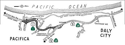 According to CHPW, the original
rerouting of Route 1 from Edgemar (apx 001 SM R45.112) to Skyline
Boulevard (035 SM R28.678, 001 SM R46.648) was completed by 1960; it was
constructed after traffic engineers felt the Thornton-Edgemar route would
be too congested as Daly City grew, and after 17 major closures between
1950 and 1957 (the worst being a 120 day closure). However, the original
interchange with Skyline and Route 1 was a trumpet; this was modified when
the Route 1 freeway was extended to I-280, to bypass Thornton Beach and
the Westlake district of Daly City completly. At the time, Route 5 (now
Skyline Boulevard/Route 35) was expressway in the portions that became
co-signed with Route 1 (from Pacifica north to John Daly Boulevard, which
was then Alemany Boulevard) until I-280 was finished. The route from
Edgemar to Skyline Boulevard was originally adopted on November 17, 1952;
LRN 55 between Alemany (John Daly) and the Edgemar area was completed in
December 1954, and the contract for construction of the Route 1 freeway
was awarded on May 3, 1957 to the McCammon, Wunderlich, and Wunderlich
Company of Palo Alto.
According to CHPW, the original
rerouting of Route 1 from Edgemar (apx 001 SM R45.112) to Skyline
Boulevard (035 SM R28.678, 001 SM R46.648) was completed by 1960; it was
constructed after traffic engineers felt the Thornton-Edgemar route would
be too congested as Daly City grew, and after 17 major closures between
1950 and 1957 (the worst being a 120 day closure). However, the original
interchange with Skyline and Route 1 was a trumpet; this was modified when
the Route 1 freeway was extended to I-280, to bypass Thornton Beach and
the Westlake district of Daly City completly. At the time, Route 5 (now
Skyline Boulevard/Route 35) was expressway in the portions that became
co-signed with Route 1 (from Pacifica north to John Daly Boulevard, which
was then Alemany Boulevard) until I-280 was finished. The route from
Edgemar to Skyline Boulevard was originally adopted on November 17, 1952;
LRN 55 between Alemany (John Daly) and the Edgemar area was completed in
December 1954, and the contract for construction of the Route 1 freeway
was awarded on May 3, 1957 to the McCammon, Wunderlich, and Wunderlich
Company of Palo Alto.
Parts of the route between Thornton Beach and Santa Cruz were recycled in the 1920's and 1930's from the abandoned r/w of the Ocean Shore Railroad. At least one book on the Ocean Shore was published that can shed some light on the process. The portion along the cliffs in Daly City (abandoned after the 1957 earthquake, and therefore logically shown on the 1955 map) was directly on the railroad alignment, as were some other pre-freeway portions of the road in Pacifica, Montara-Half Moon Bay, and Scott Creek-Santa Cruz. The southern part of the Devils Slide segment is on the railroad alignment, but overall the RR took a lower-altitude line across the slide than the present highway. For details, see: Jack R. Wagner, "The Last Whistle"; 1974, Howell-North Books, Berkeley, CA.
References indicate that a in 1957 the area near Mussel Rock marked the epicenter the Daly City Earthquake, measuring 5.3, which resulted in ground shaking and landsliding above the coastal bluffs in the Westlake Palisades area with an estimated $1 million damage. A picture from the archives of the 1957 Daly City Earthquake clearly shows a highway or road starting at what is now John Daly Boulevard, heading south on the steep cliff along the water's edge. Today there is nothing left of the road on the hillside—neither a lip or ledge. This is because Route 1 was rerouted after the earthquake. The section of Alemany Blvd west of the interchange was later reopend for a few years from the old Route 1/Route 35 interchange heading straight west to the ocean and Thornton State Beach was built there where this road met the ocean. The road was not reopened soouthward from this State Beach where Route 1 had previously run northward rom Pacifica south of this beach. After a few years, the road to this Beach from the interchange became unstable, and the road was closed once again, and now all that is left of this connection to the Beach is a tiny stub of road heading west from the Route 1/Route 35 interchange approximately 1 block long leading to a fenced off dead end. A portion of the pre-1957 alignment is still accessible; it is used as a vista point now and some of it leads off into a cliff into nowhere. It is accessible near the Edgemar neighborhood (the exits for Manor Drive and Monterey Road). The portion between Westline Drive and Thornton Beach is now covered by Mussel Rock Park and Northridge Park; a portion still remains (albeit closed off almost always) west of Route 35/John Daly at Thornton State Beach as an access road (usually fenced off with "ROAD CLOSED" sign) into the beach. An old grass median is visible; it is a two lane road that does not seem to be well-maintained at all (due to lack of usage). A small finger of the road is visible from John Daly Boulevard, as what looks to be a continuation of the road behind a fence with a Road Closed sign. Skyline Boulevard just north of the I-280 exists as a four-lane expressway for a short stretch. Where the two sides merge, the grade for the southbound side continues north for a few feet, paved, and is actually a part of the paved hiking trail to its side.
StatusNote: This is broken into multiple small segments to simplify placing of news regarding significant storm and other damage along the Big Sur portion of Route 1 along the central coast.
Big Sur Highway 1 Sustainable Transportation Demand Management Plan
In November 2019, it was reported that Caltrans is working on a Big Sur Highway 1 Sustainable Transportation Demand Management Plan, available online at www.sustainablehighway1.com. The Plan's goal is to “preserve the rugged and scenic nature of the Big Sur experience for all people through balanced, adaptive management strategies that encourage the use of transit and active transportation to enhance the travel experience and support sustainable corridor access.” The concern, according to the website, is that “private automobile use along the highway is increasingly unsustainable — reducing the quality of the visitor experience, creating operational concerns and degrading the natural, human, and historical attributes of the highway.” The Caltrans plan aims to “address issues associated with the Highway 1 corridor, including limited off-highway parking, visitors walking along the highway, increased travel times, identifying potential electric-vehicle charging stations and other operational concerns,” according to the website. As discussed a meeting held Oct. 29 in Cambria, subsequently repeated in Carmel Valley the next day and at the Big Sur Multi-Agency Advisory Committee meeting on Nov. 1, some of the proposed solutions to those issues include:
Some have suggested that the Big Sur stretch of Route 1
become a toll road, but current California laws don’t support
establishing new toll roads. Even if they did, drivers must have a
“free parallel option” to the toll route. There is no such
option on the Cambria-to-Carmel section of Highway 1, the oceanfront route
to Big Sur and beyond.
(Source: San Luis Obispo Tribune, 11/5/2019)
PPNO 1105, Route 1/Route 41 IC, operational improvements (SB1)
The 2018 STIP, approved at the CTC March 2018 meeting, appears to allocate $3.390M in construction funding in FY21-22 for PPNO 1105, Route 1/Route 41 IC, operational improvements (SB1).
The 2020 STIP, approved at the CTC March 2020 meeting,
adjusts the programmed allocation for PPNO 1105 Route 1/41 IC, operational
improvements (SB1), moving the programmed funds from FY21-22 to FY22-23.
(Source: March 2020 CTC Agenda, Item 4.7, 2020 STIP
Adopted 3/25/2020)
Old Creek Bridge (SLO 24.5)
 The following project was included in the final adopted 2018 SHOPP in March 2018: PPNO 0072A. 05-San Luis Obispo-1 24.5. Route 1 Near Morro Bay, at Old Creek Bridge No. 05-49-0070R. Replace
bridge. Begin Con: 11/13/2020. Total Project Cost: $10,049K.
The following project was included in the final adopted 2018 SHOPP in March 2018: PPNO 0072A. 05-San Luis Obispo-1 24.5. Route 1 Near Morro Bay, at Old Creek Bridge No. 05-49-0070R. Replace
bridge. Begin Con: 11/13/2020. Total Project Cost: $10,049K.
In June 2018, the CTC approved for future consideration
of funding the following project: 05-SLO-1, PM 24.46 Old Creek Bridge
Project: Replace existing bridge on Route 1 in San Luis Obispo County.
(MND) (PPNO 0072A) (SHOPP). This project is located along Route 1 near
Cayucos in San Luis Obispo County. The project proposes to either widen
and retrofit, or replace the existing northbound Old Creek Bridge (No.
49-0070R). The project also proposes to address the seismic deficiencies
of the bridge by retrofitting the existing structure or replacing the
bridge with a new structure and improve bicycle access across the bridge.
This proposed project is estimated to cost a total of $10.1 million. The
project is fully funded and is currently programmed in the 2018 SHOPP for
approximately $10.1 million which includes Construction (capital and
support) and Right of Way (capital and support). The project is estimated
to begin construction in FY 19-20. The scope, as described for the
preferred alternative, is consistent with the project scope programmed by
the Commission in the 2018 SHOPP.
(Source: CTC Agenda, June 2018 Agenda Item 2.2c(1))
In May 2019, the CTC approved the following SHOPP
Amendment: 05-SLO-1 34.5 PPNO 0072A. ProjID 0515000098. Near Morro Bay, at
Old Creek Bridge No. 05-49-0070R. Replace bridge.
Increase const. support to $2,702K, const. capital to $10,836K; total est.
to $17,487K. Note: Construction capital increase is due to change in
traffic handling requiring complex stage handling, increase in item cost
estimates to reflect current market pricing, and construction of a work
platform above the creek to accommodate permit that does not allows for
water diversion previously assumed.
(Source: CTC Agenda Item 2.1a.(1) Amend Item 50)
In June 2021, it was reported that the CTC allocated
$12 million to replace the Old Creek Bridge on Route 1 near Morro Bay.
This project will also include improved bridge rails, guardrail, highway
shoulders and rock slope protection. Specifically, in June 2021 the CTC
approved the following allocation: $12,639,000. 05-SLO-1 34.5. PPNO
05-0072A; ProjID 0515000098; EA 0L722. Route 1 Near Morro Bay, at Old
Creek Bridge No. 49-0070R. Outcome/Output: Replace bridge, provide
standard bridge rails and shoulders, install rock slope protection, and
upgrade guardrail and end treatments. (Future consideration of funding
approved under Resolution E-18-62; June 2018.) (Twelve month time
extension for CONST and CON ENG approved under Waiver 20-31; June
2020.) Allocation: CON ENG $2,702,000 CONST $10,836,000.
(Source: KSBY, 6/28/2021; June 2021 CTC Agenda, Agenda Item 2.5b.(1) #19)
Toro Creek Bridges (SLO 32.6)
The following project was included in the final adopted 2018 SHOPP in March 2018: PPNO 0072. 05-San Luis Obispo-1 32.6. Route 1 In Morro Bay, at Toro Creek Bridge. Replace bridge. Begin Con: 2/4/2021. Total Project Cost: $12,505K.
In August 2018, the CTC approved for future
consideration of funding the following project for which a Mitigated
Negative Declaration (MND) has been completed: Route 1 in San Luis Obispo
County (05-SLO-1, PM 32.6). Replace existing bridge on Route 1 in the city
of Morro Bay. (PPNO 0072) This project is located on Route 1 in the city
of Morro Bay, San Luis Obispo County. The project proposes to replace the
existing northbound bridge (№ 49-0068R) at Toro
Creek. This project proposes to address the existing geometric and seismic
deficiencies by replacing the existing bridge and associated adjacent
roadway with standard bridge rails and standard shoulder widths which are
currently non-standard. The proposed project is estimated to cost $12.5
million. The proposed project is currently programmed in the 2018 SHOPP
for approximately $12.5 which includes Construction (capital and support)
and Right-of-Way (capital and support). Construction is estimated to begin
in funding Fiscal Year 2019-20. The scope, as described for the preferred
alternative, is consistent with the project scope programmed by the
Commission in the 2018 SHOPP.
(Source: August 2018 CTC Agenda Item 2.2c(1))
In May 2019, the CTC approved the following SHOPP
Amendment: 05-SLO-1 32.6. PPNO 0072. ProjID 0515000097. In Morro Bay, at
Toro Creek Bridge № 49-0068R. Replace bridge. Increase
const. cap. to $8,249K. Total est. $15,554K. Note: Construction capital
increase is due to change in constructability of bridge replacement, an
identified increase to the size of piling and casings, and miscellaneous
items previously not identified.
(Source: May 2019 CTC Agenda Item 2.1c.(1) Amend
Item 49)
In December 2020, it was reported that the CTC approved
$10.5 million to replace the Toro Creek Bridge in Morro Bay. Work will
include installing rock slope protection, upgrade of guardrail and end
treatments, and provision of bridge rails and shoulders.
(Source: Paso Robles Press, 12/4/2020)
In December 2020, the CTC approved the following SHOPP
Construction Phase allocation: $10,598,000 for San Luis Obispo 05-SLO-1 PM
32.6. PPNO 05-0072 ProjID 0515000097 EA 0L721. Route 1 In Morro Bay, at
Toro Creek Bridge № 49-0068R. Outcome/Output: Replace
bridge, provide standard bridge rails and shoulders, install rock slope
protection, and upgrade guardrail and end treatments. Con Eng: $2,400,000;
Const $8,249,000. (CEQA - CE, 6/22/2018; Re-validation 6/24/2020) (NEPA -
CE, 6/22/2018; Re-validation 6/24/2020)
(Source: December 2020 CTC Agenda, Agenda Item
2.5b.(1) #10; Paso Robles Press, 12/4/2020)
In May 2022, it was reported that construction was
about to begin on the Toro Creek Bridge. The process will start with
replacing the northbound lanes of the Toro Creek Bridge. The two-span,
ocean-view bridge is near the Dog Beach area north of the Morro Bay strand
area, and about a half mile south of Old Creek Road. Traffic on the scenic
highway will be reduced to a single lane in each direction during the
two-phase project, which is expected to continue into the spring of 2023.
The $5.7 million Caltrans project began May 6, 2022. That’s when the
contractor, Souza Engineering Contracting of San Luis Obispo closed the
northbound and southbound inside/left lanes of the highway. Those two
lanes will remain closed 24/7 for several weeks for construction of a
concrete T-rail safety barrier that will protect the workers during the
eventual bridge demo and rebuilding process on the northbound side of the
scenic highway. Later in May, traffic will transfer to the southbound
lanes, again providing a single lane in each direction, with the lanes
separated for safety by a K-rail divider. That traffic switch will allow
Souza workers to demolish and replace the northbound bridge span. The
southbound span won’t be replaced at this time, because that
separate portion of the bridge is newer and doesn’t require repair
or replacement now.
(Source: San Luis Obispo Tribune, 5/6/2022)
In May 2023, it was reported that the Toro Bridge
construction had been completed. Construction on the new bridge, which
Caltrans says complies with current earthquake, geometric, hydraulic and
structural standards, began in May 2022. The new configuration along Route 1 includes two northbound lanes and one southbound lane over the bridge. A
second southbound lane is expected to reopen in the June timeframe.
(Source: KSBY, 5/30/2023)
In June 2023, the CTC amended the following SB1 project
into the 2022 SHOPP: (1b) #1. 05-SLO-1 32.6. PPNO 05-3165; ProjID
0523000125; EA 1R100. Route 1 Near Morro Bay, at Toro Creek Bridge №
49-0068L. Replace bridge. Concurrent COS allocation under
Resolution FP-22-96; June 2023. Allocation ($ × 1,000): PA&ED
$1,200; PS&E $2,419; R/W Sup $159; Con Sup $1,800; R/W Cap $59; Const
Cap $11,200; TOTAL $16,837. FY24-25. Begin Const: 1/9/2026. Note: The
earlier project replaced 0068R; this project is
replacing 0068L.
(Source: June 2023 CTC Agenda, Agenda Item 2.1a.(1b) #1)
In June 2023, the CTC approved the following SHOPP SB1
Pre-Construction Phase (environmental support, design, and R/W support)
allocation: $1,200,000. 05-SLO-1 32.6. PPNO 05-3165; ProjID 0523000125; EA
1R100. Route 1 Near Morro Bay, at Toro Creek Bridge № 9-0068L.
Replace bridge. Concurrent Amendment under SHOPP Amendment 22H-009; June
2023. Allocation: PA&ED $1,200,000.
(Source: June 2023 CTC Agenda, Agenda Item 2.5b.(2b) #5)
There are plans to make some roadway improvements near Cambria that include passing and left turn lanes. The project is fully funded in the 2006 State Transportation Improvement Program (STIP). The total estimated project cost, support and capital, is $4,389,000. It is estimated to begin construction in Fiscal Year 2008-09. The CTC received the report of a negative mitiaged EIR in December 2007. [Based on the map, apx 001 SLO 43.127)
In Fall 2012, in an attempt to extend the life of the pavement, Caltrans
applied a $2.1 million chip-seal coating. In last fall’s
chip-sealing, the Caltrans contractor used larger aggregate rocks than had
been applied previously on that roadway. They were selected for
durability, for as the “chips” degrade over time, larger ones
could last longer. As opposed to repaving, chip-sealing was significantly
less expensive; full repaving would cost $7 million to $8 million. As soon
as the chip-sealing was complete, however, bicyclists and others began to
complain that the surface was rough. Rocks kicked up by vehicles pelted
cyclists and chipped vehicle paint and windshields. Caltrans has swept
loose rocks from the surface, rolled the pavement in a test area between
Cambria (apx 001 SLO 48.883) and San Simeon (apx 001 SLO 53.017) and hired
the U.C. Davis Pavement Research Center to come up with the best way to
fix the problem. Results are due in May 2013. The agency does expect the
aggregate to smooth out over time as the rocks settle and wear down, but
that doesn't help the summer bicycle season.
(Source: The Cambrian, 4/14/13)
Some portions of this road are being funding for emergency repair near San Simeon due to the fact that the current roadway is likely to be lost in the Winter 2002 storms. In the segment from PM 65.4 to 66.5 in SLO, ocean surf has eroded a 20-foot high bluff to within 2 feet of the edge of the pavement (this is 1.6 mi N of Piedras Blancas Lighthouse Road). In the same area (PM 64.1 to 64.7, 0.3 mi N of Piedras Blancas Lighthouse Road), the surf has eroded a 25 foot high bluff to within 10 feet of the edge of the pavement. [CTC Agenda, August 2002].
Piedras Blancas Realignment Project (05-SLO-01, PM 64.0/R67.2)
![[San Simeon]](maps/001-sansimeon.jpg) There are plans to realign the route near San Simeon. In December 2008, the CTC
reviewed a draft EIR regarding the realingment, but had no comments other
than a need to identify a funding source. The project would realign a
portion of Route 1 from just north of Piedras Blancas Lighthouse to the
Arroyo de la Cruz Bridge near San Simeon. The project is not currently
funding, but is included in the 2008 State Highway Operation and
Protection Program (SHOPP) Long Lead Projects list consistent with
Commission Resolution G-13. This resolution requires the Department to
notify the Commission when project development work begins on SHOPP
projects that are not currently programmed. The total cost of the project
is estimated to be $43,270,000. Construction is estimated to begin in
Fiscal Year 2012-13. There are currently two alternatives:
There are plans to realign the route near San Simeon. In December 2008, the CTC
reviewed a draft EIR regarding the realingment, but had no comments other
than a need to identify a funding source. The project would realign a
portion of Route 1 from just north of Piedras Blancas Lighthouse to the
Arroyo de la Cruz Bridge near San Simeon. The project is not currently
funding, but is included in the 2008 State Highway Operation and
Protection Program (SHOPP) Long Lead Projects list consistent with
Commission Resolution G-13. This resolution requires the Department to
notify the Commission when project development work begins on SHOPP
projects that are not currently programmed. The total cost of the project
is estimated to be $43,270,000. Construction is estimated to begin in
Fiscal Year 2012-13. There are currently two alternatives:
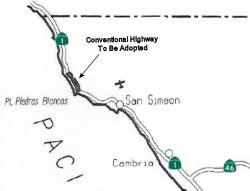 In November 2010, the CTC received a proposal to realign the adopted route
for Route 1 from 0.3 miles north of Point Piedras Blancas to Arroyo De La
Cruz Creek and redesignate it to Conventional Highway. Specifically, the
proposal is to realign Route 1 from one-third of a mile north of Point
Piedras Blancas to Arroyo de la Cruz Creek, north of San Simeon, in San
Luis Obispo County to provide protection of the highway from coastal bluff
erosion. The coastal bluff undulates to and away from the current
alignment of Route 1. In 2005, the bluff was as close as 19 feet from the
highway centerline at PM 65.4, reaching the southbound shoulder of the
highway at two locations. This new alignment was designed to closely
follow the expected 100-year shoreline and minimize environmental impacts.
The project area is located in a rural part of northern San Luis Obispo
County, which closely follows the shoreline between Cambria and Carmel.
Route 1 is designated a rural minor arterial and federal aid primary
route. Route 1 from 0.6 miles north of San Simeon to Rio Road near Carmel
is a California Legal Advisory Route. It serves both regional and
interregional traffic and includes high levels of recreational traffic,
bicycles, and limited commercial users. The section of Route 1 where the
project is located is the only roadway access for emergencies to the
north. Route 1 between San Luis Obispo City limits and the northern San
Luis Obispo County line was designated a State Scenic Highway in 1999. The
Federal Highway Administration declared this highway segment an All
American Road in August 2003, the highest designation under the National
Scenic Byways Program. This project is within the limits of a Freeway
Agreement dated February 9, 1959. Only one connection point exists south
of Arroyo del Oso within the project limits. No local roads exist within
these project limits. From San Simeon to the Monterey County line, Route 1
is a two-lane conventional highway. The design speed on this highway,
based on existing geometric features, is generally 43 mph or higher. The
existing highway in the project area has 10 horizontal curves on rolling
terrain. Lane widths vary from 10-12 feet and paved shoulders vary from
1-8 feet. Non-standard items include horizontal curve radii, vertical
curve length, superelevation rates, vertical sight distance, lane width,
side slopes, and shoulder width. The proposed highway realignment project
will correct all these non-standard features although in some locations
side slopes will be somewhat steeper than standard, to reduce wetland
impacts. Caltrans proposed adopting the new alignment as a conventional
highway, which is consistent with the District 5 2006 Transportation
Concept Report and the Hearst agreement. This project is also included in
the 2005 Regional Transportation Plan for San Luis Obispo County. The
current capital cost estimate is $50.1 million. Construction of this
project will be in two phases. The project is programmed in the 2010 State
Highway Operation and Protection Program for Right of Way capital and
Construction capital in 2013-2014.
In November 2010, the CTC received a proposal to realign the adopted route
for Route 1 from 0.3 miles north of Point Piedras Blancas to Arroyo De La
Cruz Creek and redesignate it to Conventional Highway. Specifically, the
proposal is to realign Route 1 from one-third of a mile north of Point
Piedras Blancas to Arroyo de la Cruz Creek, north of San Simeon, in San
Luis Obispo County to provide protection of the highway from coastal bluff
erosion. The coastal bluff undulates to and away from the current
alignment of Route 1. In 2005, the bluff was as close as 19 feet from the
highway centerline at PM 65.4, reaching the southbound shoulder of the
highway at two locations. This new alignment was designed to closely
follow the expected 100-year shoreline and minimize environmental impacts.
The project area is located in a rural part of northern San Luis Obispo
County, which closely follows the shoreline between Cambria and Carmel.
Route 1 is designated a rural minor arterial and federal aid primary
route. Route 1 from 0.6 miles north of San Simeon to Rio Road near Carmel
is a California Legal Advisory Route. It serves both regional and
interregional traffic and includes high levels of recreational traffic,
bicycles, and limited commercial users. The section of Route 1 where the
project is located is the only roadway access for emergencies to the
north. Route 1 between San Luis Obispo City limits and the northern San
Luis Obispo County line was designated a State Scenic Highway in 1999. The
Federal Highway Administration declared this highway segment an All
American Road in August 2003, the highest designation under the National
Scenic Byways Program. This project is within the limits of a Freeway
Agreement dated February 9, 1959. Only one connection point exists south
of Arroyo del Oso within the project limits. No local roads exist within
these project limits. From San Simeon to the Monterey County line, Route 1
is a two-lane conventional highway. The design speed on this highway,
based on existing geometric features, is generally 43 mph or higher. The
existing highway in the project area has 10 horizontal curves on rolling
terrain. Lane widths vary from 10-12 feet and paved shoulders vary from
1-8 feet. Non-standard items include horizontal curve radii, vertical
curve length, superelevation rates, vertical sight distance, lane width,
side slopes, and shoulder width. The proposed highway realignment project
will correct all these non-standard features although in some locations
side slopes will be somewhat steeper than standard, to reduce wetland
impacts. Caltrans proposed adopting the new alignment as a conventional
highway, which is consistent with the District 5 2006 Transportation
Concept Report and the Hearst agreement. This project is also included in
the 2005 Regional Transportation Plan for San Luis Obispo County. The
current capital cost estimate is $50.1 million. Construction of this
project will be in two phases. The project is programmed in the 2010 State
Highway Operation and Protection Program for Right of Way capital and
Construction capital in 2013-2014.
In January 2015, the CTC authorized $20,755,000 for Route 1 in San Luis Obispo near San Simeon, from north of Piedras Blancas Lighthouse Road to Arroyo De La Cruz Bridge. The project will realign approximately 2.8 highway miles of Route 1 to a new location 475 feet inland away from eroding shore line and construct three bridges to maintain roadway structural integrity and improve highway safety and operation at this location.
 In August 2023, the CTC approved for future consideration of funding
05-SLO-01, PM 64.0/R67.2. Piedras Blancas Realignment Project.
Realign Route 1 near San Simeon, in San Luis Obispo County. (FEIR
Addendums) (PPNO 4928) (SHOPP). The project is located on Route 1, from PM
64.0 to PM R67.2, in San Luis Obispo County. The Department proposes to
realign Route 1, near San Simeon. The project is currently programmed in
the 2014 SHOPP for a total of $74,770,000, which includes Right of Way
(Support and Capital) and Construction (Support and Capital). Construction
began in 2015-16. The scope, as described for the preferred alternative,
is consistent with the project scope as programmed by the Commission in
the 2014 SHOPP. A copy of the FEIR has been provided to Commission staff.
The Commission approved the project for future consideration of funding on
November 4, 2012, under Resolution E-10-89. Since the approval of the
FEIR, there have been changes to the project and two Addendums were
prepared pursuant to CEQA. The Addendum signed on February 24, 2023,
addressed changes in construction details due to plans for the demolition
of the Welsh House. The Department purchased the Welsh property in 2016,
during construction of the highway realignment project and after the
project FEIR was signed. Demolition of the residence would accommodate
additional acreage available for on-site habitat restoration for
mitigation requirements mandated by permits issued by the United States
Army Corps of Engineers, Regional Water Quality Control Board, and the
California Coastal Commission. The Addendum signed on June 26, 2023,
addressed changes in construction details due to the change in off- site
mitigation location. The Arroyo de la Cruz property owned by State Parks
was originally identified as the location for off-site mitigation in the
project FEIR. Because State Parks did not approve a Right of Entry for the
Department to perform the restoration project at the Arroyo de la Cruz
watershed, the Department elected to abandon plans at this location.
Instead, the Department would fulfill mitigation commitments to permitting
agencies by performing habitat restoration at the Sani-Welsh properties
owned by the Department. Because the changes in construction details for
the demolition and restoration aspects of the project are minor and do not
change the significance of the project's environmental impacts, the
Department determined that two Addenda to the 2010 FEIR addressing these
project changes are sufficient to fulfill the environmental review
requirements of the Piedras Blancas Offsite Mitigation, New Location
Project (EA 05-49286). There has been no substantial increase in the
severity of significant effects. No substantial changes in the regulatory
circumstances have occurred. No new alternatives have been identified. The
avoidance and minimization measures proposed in both Addenda are
substantially similar to avoidance, minimization and mitigation measures
provided in the 2010 FEIR. The project changes do not meet the criteria
outlined in CEQA Guidelines Section 15162 and Section 15163 to prepare a
Subsequent or Supplemental FEIR. The Department subsequently completed
Addendums to the FEIR pursuant to CEQA. The Department has approved this
project for construction. This approval and the Addendums will satisfy the
environmental requirements for this stage of the planning process.
In August 2023, the CTC approved for future consideration of funding
05-SLO-01, PM 64.0/R67.2. Piedras Blancas Realignment Project.
Realign Route 1 near San Simeon, in San Luis Obispo County. (FEIR
Addendums) (PPNO 4928) (SHOPP). The project is located on Route 1, from PM
64.0 to PM R67.2, in San Luis Obispo County. The Department proposes to
realign Route 1, near San Simeon. The project is currently programmed in
the 2014 SHOPP for a total of $74,770,000, which includes Right of Way
(Support and Capital) and Construction (Support and Capital). Construction
began in 2015-16. The scope, as described for the preferred alternative,
is consistent with the project scope as programmed by the Commission in
the 2014 SHOPP. A copy of the FEIR has been provided to Commission staff.
The Commission approved the project for future consideration of funding on
November 4, 2012, under Resolution E-10-89. Since the approval of the
FEIR, there have been changes to the project and two Addendums were
prepared pursuant to CEQA. The Addendum signed on February 24, 2023,
addressed changes in construction details due to plans for the demolition
of the Welsh House. The Department purchased the Welsh property in 2016,
during construction of the highway realignment project and after the
project FEIR was signed. Demolition of the residence would accommodate
additional acreage available for on-site habitat restoration for
mitigation requirements mandated by permits issued by the United States
Army Corps of Engineers, Regional Water Quality Control Board, and the
California Coastal Commission. The Addendum signed on June 26, 2023,
addressed changes in construction details due to the change in off- site
mitigation location. The Arroyo de la Cruz property owned by State Parks
was originally identified as the location for off-site mitigation in the
project FEIR. Because State Parks did not approve a Right of Entry for the
Department to perform the restoration project at the Arroyo de la Cruz
watershed, the Department elected to abandon plans at this location.
Instead, the Department would fulfill mitigation commitments to permitting
agencies by performing habitat restoration at the Sani-Welsh properties
owned by the Department. Because the changes in construction details for
the demolition and restoration aspects of the project are minor and do not
change the significance of the project's environmental impacts, the
Department determined that two Addenda to the 2010 FEIR addressing these
project changes are sufficient to fulfill the environmental review
requirements of the Piedras Blancas Offsite Mitigation, New Location
Project (EA 05-49286). There has been no substantial increase in the
severity of significant effects. No substantial changes in the regulatory
circumstances have occurred. No new alternatives have been identified. The
avoidance and minimization measures proposed in both Addenda are
substantially similar to avoidance, minimization and mitigation measures
provided in the 2010 FEIR. The project changes do not meet the criteria
outlined in CEQA Guidelines Section 15162 and Section 15163 to prepare a
Subsequent or Supplemental FEIR. The Department subsequently completed
Addendums to the FEIR pursuant to CEQA. The Department has approved this
project for construction. This approval and the Addendums will satisfy the
environmental requirements for this stage of the planning process.
(Source: August 2023 CTC Agenda, Agenda Item 2.2c.(2) Item 5)
 In October 2017, it was reported that a State Parks plan
for a scenic stretch of Route 1 near Piedras Blancas could one day bring a
dilapidated motel and cafe back to life, along with a campground, cabins
and coastal trail. State Parks has owned the Piedras Blancas Motel &
Cafe property since 2007 (apx 001 SLO R67.12), when the Trust for Public
Lands completed a grant-funded acquisition to prevent commercial
development on the prime oceanfront land. The 1950s-era motel, gas
station, gift shop, latté stop and informal rough-camping sites there
have been closed since before that, with the motel shutting its doors
around 2005. The first phase of the project will involve construction of a
3-mile section of the California Coastal Trail, while a second section of
the trail would be added in the second phase. The motel and campground
would be revamped in the second phase of the project, said Dan Falat,
superintendent of State Parks San Luis Obispo Coast District, which
extends from the Monterey County line to Montaña de Oro. The
café already has been restored (at a cost of $180,000), according to
information that Falat provided. The project would start just south of the
shuttered motel about 17 miles north of downtown Cambria. The camping area
would wrap around an existing house, which Falat said is currently
occupied by a park ranger. The agency is in the process of acquiring from
Caltrans land north of the motel property, between the old and new
alignments of Route 1 north of Piedras Blancas, as mandated by the Hearst
Ranch Conservation Easement.
In October 2017, it was reported that a State Parks plan
for a scenic stretch of Route 1 near Piedras Blancas could one day bring a
dilapidated motel and cafe back to life, along with a campground, cabins
and coastal trail. State Parks has owned the Piedras Blancas Motel &
Cafe property since 2007 (apx 001 SLO R67.12), when the Trust for Public
Lands completed a grant-funded acquisition to prevent commercial
development on the prime oceanfront land. The 1950s-era motel, gas
station, gift shop, latté stop and informal rough-camping sites there
have been closed since before that, with the motel shutting its doors
around 2005. The first phase of the project will involve construction of a
3-mile section of the California Coastal Trail, while a second section of
the trail would be added in the second phase. The motel and campground
would be revamped in the second phase of the project, said Dan Falat,
superintendent of State Parks San Luis Obispo Coast District, which
extends from the Monterey County line to Montaña de Oro. The
café already has been restored (at a cost of $180,000), according to
information that Falat provided. The project would start just south of the
shuttered motel about 17 miles north of downtown Cambria. The camping area
would wrap around an existing house, which Falat said is currently
occupied by a park ranger. The agency is in the process of acquiring from
Caltrans land north of the motel property, between the old and new
alignments of Route 1 north of Piedras Blancas, as mandated by the Hearst
Ranch Conservation Easement.
(Source: SLO Tribune, 10/14/2017)
Polar Star Slide (~ SLO 69.8)
In early January 2023, it was reported that due to the
2023 storms, a slide occurred on Route 1 in San Luis Obispo County,
approximately one mile south of Ragged Point. The slide resulted in the
closure of Route 1 at this location for several weeks to months depending
on the weather. This location is referred to as Polar Star. As a result,
Ragged Point was effectively cut off from access from the south due to the
Polar Star slide. In early February 2023, Caltrans says crews have made
good progress removing slide material and on drainage restoration efforts
so they can reopen that section of the highway to traffic.
(Source: CBS Bay Area, 1/6/2023; KSBY, 2/8/2023)
In March 2023, it was reported subsequent to the Polar
Star Slide on 1/4/2023 (one mile south of Ragged Point in San Luis
County), repairs have stabilized the slope above the roadway and there
have not been any issues since the highway reopened in Feb. 2023. The
slope was cut back to reach a point of stability and approximately 30,000
cubic yards of slide material was removed during this repair.
(Source: KSBY, 3/7/2023)
Ragged Point (SLO 72.721) to Nacimiento-Fergusson Road (MON 18.893)
In October 2013, the CTC considered for future approval a funding a project in San Luis Obispo County that will construct a retaining wall and realign the highway to stabilize a portion of Route 1 near the community of Ragged Point (apx 001 SLO 72.926). The project is programmed in the 2012 State Highway Operation and Protection Program. The total estimated cost is $23,005,000 for capital and support. Construction is estimated to begin in Fiscal Year 2013-14. The scope, as described for the preferred alternative, is consistent with the project scope programmed by the Commission in the 2012 State Highway Operation and Protection Program.
Ragged Point to Limekiln State Part - 2023 Atmospheric River Repairs (05-SLO-1 72.8/74.324, 05-Mon-1 0.0/20.9)
In June 2023, the CTC amended the following project
into the SHOPP: (1a) #35. 05-SLO-72.8/74.324, 05-Mon-1 0.0/20.9. PPNO 05-31023144;
ProjID 0523000073; EA 1Q760. Route 1 Near Gorda, from San Luis Obispo
County Line to Limekiln State Park; also in San Luis Obispo County, from
Ragged Point Inn to Monterey County line (PM 72.8/74.324).
Repair storm damage, including slopes, drainage systems, guardrail, and
pavement. Note: Storm events from December 2022 through January
2023 resulted in multiple landslides and debris flows that impacted
drainage systems, damaged guardrail, undermined the roadway, and damaged
pavement. This project will remove unstable slide material,
reconstruct slopes or construct retaining walls where necessary, remove
debris from drainage systems, repair drainage inlets and culverts, repair
or replace down drains, restore guardrail, reconstruct damaged retaining
structures, and repair and reconstruct the roadway. Allocation ($ ×
1,000): PA&ED $0; PS&E $300; R/W Sup $50; Con Sup $5,000; R/W Cap
$100; Const Cap $18,350; TOTAL $23,800. FY22-23.
(Source: June 2023 CTC Agenda, Agenda Item 2.1a.(1a) #35)
In October 2023, the CTC was informed of the following
emergency allocation: $3,400,000. 05-Mon-1 0.0/20.9. PPNO 05-3144; ProjID
0523000073; EA 1Q760. Route 1 Near Gorda, from San Luis Obispo County Line
to Limekiln State Park; also in San Luis Obispo County, from Ragged Point
Inn to Monterey County line (PM 72.8/74.324). Storm events from December
2022 through January 2023 resulted in multiple landslides and debris flows
that impacted drainage systems, damaged guardrail, undermined the roadway,
and damaged pavement. This project will remove unstable slide
material, reconstruct slopes or construct retaining walls where necessary,
remove debris from drainage systems, repair drainage inlets and culverts,
repair or replace down drains, restore guardrail, reconstruct damaged
retaining structures, and repair and reconstruct the roadway. As work
progressed, 10 additional locations were discovered to have been damaged,
non-operational and need repair or replacement. As well, three sinkholes
have appeared and are undermining the roadway. This supplemental is needed
to install drainage inlets, reconstruct down drains, remove debris,
construct concrete headwalls, place rock slope protection, place cement
slurry backfill, and repair pavement and traffic striping. Initial G-11
Allocation 03/30/2023:$23,350,000; Supplemental G-11
Allocation 08/03/2023: $3,400,000; Revised Allocation: $26,750,000.
(Source: October 2023 CTC Agenda, Agenda Item 2.5f.(1) #19)
In February 2017, it was reported that heavy winter rains had resulted in
rock and mud slides had shut down traffic in both directions south of the
town of Gorda, at the Ragged Point Inn and on a stretch of the road
between Salmon (001 MON 2.166) and Mud (approx 001 MON 6.537) creeks.
(Source: Los Angeles Times, 2/23/2017)
Mud Creek Slide (001 MON 6.537)
 In May 2017, another slide occurred in the vicinity of
Mud Creek (001 MON 6.537). The slide is believed to have been caused by
groundwater that has continued to percolate up and out of the mountains,
months after the winter’s near-record rains. As the steep cliffs
above the ocean became saturated, they collapsed under their own weight
across the highway and into the ocean — where a peninsula of rock
and mud has emerged. Specifically, a hillside near a small ravine known as
Mud Creek collapsed, sloughing an estimated 1.5 million tons of rock and
mud — about a million cubic yards — over the highway and into
the ocean. The landslide was a third of a mile wide and 40 feet at its
deepest. What once was a steep drop into the Pacific was now a broad,
sloping bench extending almost 250 feet beyond the shoreline. By some
estimates, the collapse had added 15 acres to the coast, a little more
than 11 football fields including the end zones. The continued movement of
the quarter-mile-long slide near the Monterey County community of Gorda
has kept Caltrans engineers from taking stock of the situation and
figuring out when — and if — the section of road that serves
as the southern gateway to Big Sur can be repaired and re-opened.The Santa
Lucia Mountains, extending from Cambria to Carmel, are particularly
vulnerable to landslides. This coastal range reveals one of
California’s defining tectonic features — the subduction of
the Farallon Plate under the North American Plate — and the bedrock
here, says Noah Finnegan, a geologist with UC Santa Cruz, has “a
tortured history.” “They have been pervasively fractured and
broken up,” he said. “They have a hard time holding a steep
slope.” In such an environment, water and gravity are great
levelers. The steep and narrow canyons of the coast are frequently scoured
by debris flows, torrents of water skimming off topsoil and rocks at
disastrous velocities. The formidable hillsides are subjected to deeper
subsurface forces that come into play as groundwater shifts the frictional
properties of the soil. Note: See also the naming of "Arlene's Slide" in
the NAMING section for this segment.
In May 2017, another slide occurred in the vicinity of
Mud Creek (001 MON 6.537). The slide is believed to have been caused by
groundwater that has continued to percolate up and out of the mountains,
months after the winter’s near-record rains. As the steep cliffs
above the ocean became saturated, they collapsed under their own weight
across the highway and into the ocean — where a peninsula of rock
and mud has emerged. Specifically, a hillside near a small ravine known as
Mud Creek collapsed, sloughing an estimated 1.5 million tons of rock and
mud — about a million cubic yards — over the highway and into
the ocean. The landslide was a third of a mile wide and 40 feet at its
deepest. What once was a steep drop into the Pacific was now a broad,
sloping bench extending almost 250 feet beyond the shoreline. By some
estimates, the collapse had added 15 acres to the coast, a little more
than 11 football fields including the end zones. The continued movement of
the quarter-mile-long slide near the Monterey County community of Gorda
has kept Caltrans engineers from taking stock of the situation and
figuring out when — and if — the section of road that serves
as the southern gateway to Big Sur can be repaired and re-opened.The Santa
Lucia Mountains, extending from Cambria to Carmel, are particularly
vulnerable to landslides. This coastal range reveals one of
California’s defining tectonic features — the subduction of
the Farallon Plate under the North American Plate — and the bedrock
here, says Noah Finnegan, a geologist with UC Santa Cruz, has “a
tortured history.” “They have been pervasively fractured and
broken up,” he said. “They have a hard time holding a steep
slope.” In such an environment, water and gravity are great
levelers. The steep and narrow canyons of the coast are frequently scoured
by debris flows, torrents of water skimming off topsoil and rocks at
disastrous velocities. The formidable hillsides are subjected to deeper
subsurface forces that come into play as groundwater shifts the frictional
properties of the soil. Note: See also the naming of "Arlene's Slide" in
the NAMING section for this segment.
Independent experts say the solution may require
constructing a sprawling bridge over the troublesome spot or a tunnel deep
in the ground beneath it, a prospect that could take years and cost the
state hundreds of millions of dollars. The best-case scenario for getting
the road open would be putting in a stretch of asphalt, at least
temporarily, on top of the slide once the area dries out come summer. That
option, though, is contingent on soil tests to determine whether the
mountainside is secure. Further, there are no easy alternative routes
inland to serve as detours around the slide (On the Caltrans PostMile Tool, look at Route 1 PM MON 9.066). Pricier fixes include
viaducts that bypass the problem areas as well as tunneling into and below
a landslide. Many have called for such big-ticket repairs at Mud Creek for
decades and some say it may finally be time. Some are likening the
situation to Devil’s Slide in San Mateo County, where Caltrans went
for years trying to clear the highway of wintertime debris before turning
to two 4,200-feet long tunnels at a cost of more than $400 million. At Mud
Creek, the million-plus tons of debris that fell from the mountain is
actually the result of four previous slides, each earning names from the
locals over the years. Last weekend, they came together as one in an
avalanche unlike any since the early ’80s.
(Source: SF Chronicle, 5/25/2017; LATimes,
5/26/2017)
In June 2017, an interesting article triggered by the
Mud Creek slide explored the difficulties that Route 1 in Big Sur has
faced, and why the Mud Creek Slide is particularly difficult. The highway
was built in the early 1930s, and the first recorded slide, closing a
20-mile stretch of road in 1935, happened even before the route was
officially opened. Why are there so many slides? Three reasons, said
landslide expert Kevin Schmidt of U.S. Geological Survey in Menlo Park. It
is a melange of loose rocks. The topography is steep. And it’s
exposed to fierce Pacific storms. Over the next half century, slides
closed the road no fewer than 53 times, according to “A History of
Road Closures Along Highway 1,” a 2001 Caltrans report. There have
been at least a dozen slides since then, including 2017’s collapses.
Until the 1950s, gates were in place at the northern and southern ends and
regularly closed to tourist traffic during the winter. High-end
development and the tourist economy (and local employment dependent
thereupon) ended that. The slides in 2017 presented particular problems.
Previously, Caltrans could correct slides by cutting and bulldozing debris
from the tops of the slides and moving it to the bottoms, decreasing the
angle of the slopes, so it’s less dangerous and more stable. A 1983
slide-repair project was the largest earth-moving operation in Caltrans
history — and created massive, barren scars — while dumping
great quantities of sediments into the ocean. But now the Big Sur coast is
a protected marine sanctuary. That option is now out. Smaller slides can
be addressed by options like walls, buttresses and drainage. Large slides
are hard. There are basically three options. If the geology is
appropriate, tunnel through the slide as was done at the Devil's Slide N
of Santa Cruz. But that's expensive and takes a very long time. Make that
very very, what with EIRs and the cost. The route can be moved inland
— depending on geography — as is being done for the "Last
Chance Grade" on US 101. But in this portion of the coast, the canyons and
nature of the mountains make that equally expensive. Lastly, some way to
stabilize the slide can be found, and you build the road on top of the
slide (later reports indicated that this is the solution Caltrans is
making).
(Source: Mercury News, 6/3/2017)
In August 2017, it was reported that Caltrans had
decided how to address the Mud Creek Slide. Drivers on Route 1 will be
going over — not around or through — the Mud Creek Slide when
the coast route reopens. “The new roadway will be realigned across
the landslide,” the agency said in a news release, adding that the
highway will be “buttressed with a series of embankments, berms,
rocks, netting, culverts and other stabilizing material.” The
planned approach, Caltrans said, would allow the agency to rebuild the
roadway more quickly and at a lower cost than other options such as
“structures, a tunnel or major earthwork that places additional fill
into the ocean.”
(Source: sanluisobispo.com, 8/1/2017)
 In October 2017, the LA Times provided a detailed discussion on the work to
stabilize the Mud Creek Slide and reconstruct the roadway. There are three
main steps. (1) Two 25-foot-tall embankments, built at the base of the
slide’s steepest slope, will protect the highway from avalanches;
(2) the proposed highway replacement is about a quarter-mile long, with a
45 mph speed limit; and (3) there will be a breakwater-like feature,
called a revetment, that will absorb the concussion of waves from ocean
swells and limit the danger of erosion. Upon completion, this barrier will
be 1,400 feet long. This approach is dealing with the estimated 5 million
cubic yards of rock and mud sloughed off this mountain; the volume would
by one estimate fill the Rose Bowl seven times. Work on reconstruction
began within days of the mountain’s failure with reconnaissance.
Five months later, Mud Creek is a closely watched parcel of California
real estate. Microwave units, like traffic cops’ radar guns, survey
the mountain every three minutes, and lasers shoot light on tetrahedral
prisms mounted on 19 boulders, registering the smallest shift. Geologists
and on-site personnel study PET-scan-like images of the slide, colored
green to yellow to red, low risk to high risk. If something moves, the
call goes out. Geologists mapped not only material that slid into the sea,
but also the vertical slope where that material once resided, and
engineers plotted the new road. Because there wasn’t room to go
around the slide, and because a tunnel would be too long, requiring nearly
two miles in order to find stable ground for its entrances and exits, the
best option was to go over the slide. As they sketched the plan, they
secured the site. After carving a network of roads and terraces on top of
the slide, they dug a catch basin at the base of the vertical slope, where
boulders — calving from above — could land without bounding
into the crews below. Sixteen shipping containers, each holding three
K-rails, were brought in as an additional defense. To fight ocean erosion,
they began building the twin breakwaters, technically known as revetments,
on the slide’s northern and southern flanks, and behind each
revetment they plan to build up layers of soil and fabric to keep pressure
on the hillside just below the path of the road. For now, the road is a
sinuous line on paper: two 12-foot lanes and two 4-foot shoulders with
three gradual turns, tuned to 45 mph. There is talk of adding a turnout
with signage explaining the nature of the slide. The California Department
of Transportation, manager of the $40-million project, hopes to see
traffic flowing by the end of next summer.
In October 2017, the LA Times provided a detailed discussion on the work to
stabilize the Mud Creek Slide and reconstruct the roadway. There are three
main steps. (1) Two 25-foot-tall embankments, built at the base of the
slide’s steepest slope, will protect the highway from avalanches;
(2) the proposed highway replacement is about a quarter-mile long, with a
45 mph speed limit; and (3) there will be a breakwater-like feature,
called a revetment, that will absorb the concussion of waves from ocean
swells and limit the danger of erosion. Upon completion, this barrier will
be 1,400 feet long. This approach is dealing with the estimated 5 million
cubic yards of rock and mud sloughed off this mountain; the volume would
by one estimate fill the Rose Bowl seven times. Work on reconstruction
began within days of the mountain’s failure with reconnaissance.
Five months later, Mud Creek is a closely watched parcel of California
real estate. Microwave units, like traffic cops’ radar guns, survey
the mountain every three minutes, and lasers shoot light on tetrahedral
prisms mounted on 19 boulders, registering the smallest shift. Geologists
and on-site personnel study PET-scan-like images of the slide, colored
green to yellow to red, low risk to high risk. If something moves, the
call goes out. Geologists mapped not only material that slid into the sea,
but also the vertical slope where that material once resided, and
engineers plotted the new road. Because there wasn’t room to go
around the slide, and because a tunnel would be too long, requiring nearly
two miles in order to find stable ground for its entrances and exits, the
best option was to go over the slide. As they sketched the plan, they
secured the site. After carving a network of roads and terraces on top of
the slide, they dug a catch basin at the base of the vertical slope, where
boulders — calving from above — could land without bounding
into the crews below. Sixteen shipping containers, each holding three
K-rails, were brought in as an additional defense. To fight ocean erosion,
they began building the twin breakwaters, technically known as revetments,
on the slide’s northern and southern flanks, and behind each
revetment they plan to build up layers of soil and fabric to keep pressure
on the hillside just below the path of the road. For now, the road is a
sinuous line on paper: two 12-foot lanes and two 4-foot shoulders with
three gradual turns, tuned to 45 mph. There is talk of adding a turnout
with signage explaining the nature of the slide. The California Department
of Transportation, manager of the $40-million project, hopes to see
traffic flowing by the end of next summer.
(Source: Los Angeles Times, 11/9/2017)
In March 2018, it was reported that the reconstruction
of Route 1 was on track to reopen sometime in summer 2018. The following
are areas where progress has been made:
(Source: San Luis Obispo Tribune, 3/10/2018)
In May 2018, it was reported that Caltrans has
announced a new target of mid-September to reopen Route 1 at Mud Creek.
Road construction crews have been working to create a new, ¼-mile
roadway over the Mud Creek slide. Caltrans says it will be buttressed with
a series of embankments, berms, rocks, netting, culverts and other
stabilizing material. Another update will be issued in July, and even
after the reopening, lane closures and road work could continue.
(Source: KSBY, 4/30/2018)
In June 2018, the reopening date for the Mud Creek
Slide was updated to the end of July. Caltrans says favorable weather,
longer days and increased productivity by the contractor are allowing them
to open the roadway sooner than previously estimated. Crews are
reconstructing a 1/4-mile highway over the landslide. Caltrans says it
will be buttressed with a series of embankments, berms, rocks, netting,
culverts, and other stabilizing material.
(Source: KSBY, 6/12/2018)
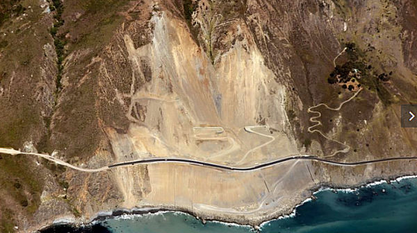 On July 20, 2018, Route 1 up the Big Sur Coast reopened from Cambria to Carmel. A public
ribbon cutting was held at 11 a.m. on July 20 at the Ragged Point Inn to
celebrate the complete of roadwork at the Mud Creek Slide, which has been
closed for more than a year.
On July 20, 2018, Route 1 up the Big Sur Coast reopened from Cambria to Carmel. A public
ribbon cutting was held at 11 a.m. on July 20 at the Ragged Point Inn to
celebrate the complete of roadwork at the Mud Creek Slide, which has been
closed for more than a year.
(Source: Sacramento Bee, 7/3/2018)
The work on the Mud Creek Slide was summarized as
follows in the LA Times: "Unable to excavate the route of the old highway,
the engineers and geologists had decided instead to build the new highway
over the slide itself. It was a novel approach: After the 1983 slide,
debris was shoveled into the ocean, a strategy that changed the landscape
and was criticized for being too intrusive. The new road at Mud Creek, the
engineers realized, needed to be protected from the mountain above and the
ocean below. Drawing upon data from satellites, radar, drilling samples
and computer models, they came up with a plan that was conceptually simple
but challenging to execute. A catch-basin hundreds of feet above the road
was cleared and lined with retaining walls that would catch debris falling
from the mountain. A long breakwater, known as a revetment, was
constructed along the base of the slide to dispel the force of the waves
and minimize erosion." In Big Sur, news of the opening was celebrated at
Nepenthe and at Ventana resort. Hotels and restaurants have already begun
putting out “We are hiring” signs. The Times noted that,
although most drivers will simply speed past on the new road, Caltrans has
placed a small wooden bench on the shoulder of the southbound lanes, just
south of the slide. From here, 14 months of engineering design and
construction can be appreciated at a glance. Carved into the bench beneath
the Caltrans logo and the initials for John Madonna Construction is the
phrase, “Thx John, Mark, Augie & Co.” It is a nod to the
primary construction managers on site and a reminder of the efforts to
control the ever-changing geology of the California coast.
(Source: LA Times, 7/19/2018)
Gorda Realignment (05-Mon-1 8.7/9.1)
In June 2020, the CTC amended the following project
into the SHOPP, which appears to be the permanent resolution of the Mud
Creek Slide: 05-Mon-1 8.7/9.1. PPNO 2850 ProjID 0518000106 EA 1K020. On
Route 1 near Gorda, from north of White Creek Bridge to 2.0 miles south of
Los Burros Road. Realign highway, replace temporary safety features with
permanent safety devices, and install erosion control measures. PA&ED:
752K; PS&E $1,046K; R/W Sup $26K; Con Sup $838K; R/W Cap $4K; Const
Cap $2,176K; Total $4,842K. BC: 6/22/2023.
(Source: June 2020 CTC Agenda, Agenda Item 2.1a.(5a) #3)
In June 2020, the CTC approved the following support
allocation for this project: 05-Mon-1 8.7/9.1 PPNO 2850 ProjID 0518000106
EA 1K020. Route 1 near Gorda, from north of White Creek Bridge to 2.0
miles south of Los Burros Road. Realign highway, replace temporary safety
features with permanent safety devices, and install erosion control
measures. Allocation: PA&ED $752,000
(Source: June 2020 CTC Agenda, Agenda Item 2.5b.(2a) #29)
In June 2022, the CTC amended this project in the SHOPP
as follows: 05-Mon-1 8.7/9.1. PPNO 05-2850; ProjID 0518000106; EA 1K020.
Route 1 Near Gorda, from north of White Creek Bridge to 2.0 miles south of
Los Burros Road. Realign highway, replace temporary safety features
with permanent safety devices, and install erosion control measures.
Note: Right of way acquisition of a parcel required for this
project will need to be completed through the condemnation process. For
this reason the project is delayed by two years. Amendment: FY 22-23
⇒ 24-25.
(Source: June 2022 CTC Agenda, Agenda Item
2.1a.(1d) #26)
Mill Creek Bridge Area Stabilization
The following project was included in the final adopted 2018 SHOPP as a "Long Lead Project" in March 2018: PPNO 3030. 05-Monterey-1 18.5/18.7. Route 1 Near Lucia, north of Mill Creek Bridge. Stabilize highway segment caused by erosion. Note: Environmental Permits may require more than standard storm water treatment BMPs. This would affect cost, project foot print, possible R/W needs, and additional area for environmental review. * PA&ED phase(s) is authorized. Begin Con: 6/1/2025. Total Project Cost: $19,211K.
In January 2023, it was reported that at the Mill Creek
Slide, water and mud are still flowing onto the highway after crews cut
through the saturated soil that made up the landslide material. Caltrans
says the slope above the highway is likely to have a catastrophic failure
in the near future and work at that location has been stopped until crews
can reach the slide from above. On Sunday, Feb. 12, Caltrans expects to
reopen Route 1 from Ragged Point to just south of a landslide at Mill
Creek. However, it's expected to be another six weeks before the highway
is fully reopened through Mill Creek.
(Source: KSBY, 1/24/2023; KSBY, 2/8/2023)
In March 2023, it was reported that the repairs at Mill
Creek are in their final stages according to Caltrans. The Mill Creek
slide took place Jan. 14 at PM 18 in Monterey County. The slope above the
roadway has maintained its integrity during all recent rain events.
Temporary concrete barriers still need to be installed along the
southbound travel lane while permanent guardrail is being manufactured. A
small number of additional repairs still need to be made which require a
period of dry weather before they can be accomplished. Approximately
30,000 cubic yards of material was removed during the repair at Mill
Creek.
(Source: KSBY, 3/7/2023)
Nacimiento-Fergusson Road (MON 18.893) to Lucia (MON 23.108)
Limekiln Creek Bridge
In October 2015, the CTC approved the following SHOPP funding: 5-Mon-1 20.9/21.3 Route 1 Near Lucia from 0.1 mile south to 0.2 mile north of Limekiln Creek Bridge No. 44-0058. Replace bridge. PAED: 12/02/2021 R/W: 03/05/2025 RTL: 04/03/2025 CCA: 12/12/2028 Costs: $704K (R/W); $64,644K (C). Completion: FY24/25 Supporting costs: PA & ED $3,500K; PS & E $0; RW Sup $416K; Con Sup $13,865K; Total $17.781K
The following project was included in the final adopted 2018 SHOPP as a "Long Lead Project" in March 2018: PPNO 2524. 05-Monterey-1 20.9/21.3. Route 1 Near Lucia from 0.1 mile south to 0.2 mile north of Limekiln Creek Bridge No. 44-0058. Replace bridge. Note: Potential R/W concerns relating to a State Park and complexity and duration of environmental studies. * PA&ED phase(s) is authorized. No construction date. Total Project Cost: $83,129K.
In June 2019, the CTC approved the following long lead
project amendment: 05-Mon-1 20.9/21.3 PPNO 2524 ProjID 0514000004. Route 1
Near Lucia, from 0.1 mile south to 0.2 mile north of Limekiln Creek Bridge
No. 44-0058. Replace bridge. Note: Delay project delivery is due to
postponement of PA&ED completion to FY 23-24 to allow for additional
alternatives analysis. Increase in PS&E amount was erroneously not
reported before. Updated total cost: $92,727K. Updated const est. FY27-28.
(Source: June 2019 CTC Minutes, Agenda Item
2.1a.(1) Long Lead Amendment Item 3)
The 2020 SHOPP, approved in May 2020, included the
following Long Lead Bridge Preservation item of interest
(carried over from the 2018 SHOPP): 05-Monterey-1 PM 20.9/21.3 PPNO 2524
Proj ID 0514000004 EA 1F510. Route 1 near Lucia, from 0.1 mile south to
0.2 mile north of Limekiln Creek Bridge No. 44-0058. Replace bridge. Note:
Potential R/W concerns relating to a State Park and complexity and
duration of environmental studies. Programmed in FY24-25, with
construction scheduled to start in August 2025. Total project cost is
$92,727K, with $65,348K being capital (const and right of way) and
$27,379K being support (engineering, environmental, etc.). Only the
PA&ED phase allocation of $3,500K is approved.
(Source: 2020 Approved SHOPP a/o May 2020)
In October 2021, the CTC approved the following Long
Lead Project SHOPP Amendment: 05-Mon-1 20.9/21.3. PPNO 05-2524; ProjID
0514000004; EA 1F510. Route 1 Near Lucia, from 0.1 mile south to 0.2 mile
north of Limekiln Creek Bridge No. 44-0058. Replace bridge. Note:
Increase in construction capital is due to change in design from a five
span to two span bridge to reduce environmental impact. Increase in
construction support is due to additional inspection necessary for
specialized construction method. Increase in R/W cap and R/W sup are due
to necessary closure of state park to prevent pedestrians from walking
under work zone. Accelerate pre-construction schedule to align with
completion of PA&ED. Allocation changes ($1000s, “⊘”
indicates phase not programmed. ): ⊘PS&E
FY24 ⇒ FY23; ⊘R/W Sup
$416 FY24 ⇒ $1,110 FY23; ⊘Con
Sup $13,865 ⇒ $14,288; ⊘R/W
Cap $704 ⇒ $3,319; ⊘Con
Cap $64,644 ⇒ $76,200; Total $92,727 ⇒ $108,015.
(Source: October 2021 CTC Agenda, Agenda Item
2.1a.(1f) #3)
In December 2022, the CTC amended this project in the
SHOPP as follows: 05-Mon-1 20.9/21.3. PPNO 05-2524; ProjID 0514000004; EA
1F510. Route 1 Near Lucia, from 0.1 mile south to 0.2 mile north of
Limekiln Creek Bridge № 44-0058. Replace bridge. Allocation Changes
($ × 1,000): ⊘Con Sup
FY24-25 ⇨ FY25-26; ⊘R/W
Cap $3,319 ⇨ $4,592 FY24-25 ⇨ FY25-26; ⊘Const
Cap $76,200 ⇨ $78,640 FY24-25 ⇨ FY25-26;Total $108,015 ⇨
$111,728. Note: Delay delivery one year because resource agency
coordination with Coastal Commission and State Parks necessary for the
preferred alternative will take additional time . Increase R/W capital
based on updated fees. Update construction capital because of escalation.
Construction support was found to be adequate. “⊘”
indicates phase not programmed.
(Source: December 2022 CTC Agenda, Agenda Item
2.1a.(1d) #14)
In January 2023, the CTC amended the following project
in the 2022 SHOPP: 05-Mon-1 20.9/21.3. PPNO 05-2524; ProjID 0514000004; EA
1F510. Near Lucia, from 0.1 mile south to 0.2 mile north of Limekiln Creek
Bridge № 44-0058. Replace bridge. Note: Show project as fully
funded to correct prior clerical error. Con Sup and Const Cap were
previously shown as "phase not authorized".
(Source: January 2023 CTC Agenda, Agenda Item 2.1a.(1d) #8)
In December 2023, it was reported that Caltrans is
looking to replace the Limekiln Creek Bridge in Big Sur. The bridge, which
sits across Limekiln Creek on Route 1, 50 miles south of Carmel, would be
replaced with a bridge in the same area. Build alternatives under
consideration include two two-span replacement bridges west of the
existing bridge.
(Source: KSBW, 12/22/2023)
Another two projects are taking place at the site of Pitkins Curve and Rain Rocks, along the southern coast of Big Sur near Lucia (approx MON 21.509). Pitkins Bridge and Rain Rocks Rock Shed perch atop the shifting scree of greywacke within the narrowest construction jobsite ever visited. Steel netting is draped over the rockface to contain ceaseless falling rocks. The netting was initially draped with helicopter assistance, then climbers fasten it tightly in place. The rock shed will allow for cars and bicyclists to safely travel this passage and the bridge will connect the rock shed to the northern roadbed. More information and pictures here.
Paul’s Slide (~ 001 MON 21.841)
In July 2017, it was reported that Caltrans has
reopened Route 1 at Paul’s Slide (apx 001 MON 21.841), meaning 35
miles of roadway is now open to the public between the massive Mud Creek
slide in the south and the downed bridge to the north, though access
remains only via Nacimiento-Fergusson Road. Now that Route 1 is open
around the clock at Paul’s Slide, the roadway will be under one-way
reverse traffic control with flaggers on site, giving Caltrans the
opportunity to continue repairing the road and watch for any new movement.
Big waterfalls remain from all the rain this past winter, which makes it
possible for problems to arise, said Susana Cruz, a Caltrans spokeswoman.
One-way control was reported to still be in place as of March 2018.
(Source: Mercury News, 7/19/2017; SanLuis
Obispo Tribune, 3/10/2018)
In February 2023, it was reported that Paul's Slide was
indefinitely closed again after the atmospheric rivers of 2023. In January
2023, at Paul's Slide in Monterey County, Caltrans says the k-rail and
flexible rockfall fence that were installed to catch falling rocks and
debris were no longer working and the slide has moved into the roadway. In
early February 2023, it was reported that the agency was still evaluating
how much more time it will take for repairs on the highway around
Paul’s Slide, where a large landslide moved into the roadway.
Caltrans told the San Jose Mercury News that the agency still needed to
move about 1 million cubic feet of dirt to replace the stretch of road
around Paul’s Slide. In late February, Caltrans was saying that they
expected Paul's Slide to be a long-term closure. In maintaining Paul's
Slide, previously, they could count on removing debris from the bottom of
the slide. The 2023 operation is a top-down slide removal; the most
intense labor and time-involved slide that they've seen in years.
(Source: KSBY, 1/24/2023; LA Times, 2/10/2023; 90.3 KAZU 2/24/2023)
In March 2023, Paul Slide was still closed.
Paul’s Slide reactivated on 1/15/2023 at PM MON 22. For several
years, Caltrans managed debris falling at Paul’s Slide by creating a
catchment area along the northbound shoulder. Concrete barriers and
fencing were utilized as a protective barrier between the travel lanes and
the catchment area. Falling debris would gather in the catchment area
behind the concrete barriers and be removed at a later time. The catchment
area at Paul’s Slide filled with debris and was cleared several
times between November 2022 and January 2023. The reactivation of
Paul’s Slide resulted in slide material overwhelming the catchment
area along the northbound shoulder. The slide pushed concrete barriers
from the northbound shoulder into the center of the roadway. Since
Paul’s Slide reactivated, there has been no meaningful protection
that could be provided for travelers below the slide. While the effects of
the slide on the roadway are visible, the magnitude of the slide above the
roadway is more difficult Caltrans says. Along an almost quarter mile of
the mountain, the 2023 slide displaced a massive amount of material
resulting in a bulging new slide within the larger slide. Caltrans
officials say it is almost like slicing a piece of birthday cake, the
repair strategy calls for a vertical cut to be made on the mountain which
will sculpt the slope in a way that will permit it to regain stability.
This repair has to be made in top-down fashion both for the safety of the
crews removing the slide material and because the toe of the slide is
currently providing a resisting force against downward force of the slide
material above it. Crews have established an initial pathway to the top of
the slide area and have begun to bring material down. A massive earthworks
operation will continue to bring slide material and cut slope down onto
the roadway below. This work will not allow for any travel through
Paul’s Slide while repairs are being made. Material near the roadway
at the toe of the slide cannot be cleared as it is providing a resisting
force to the slide above. There is no meaningful protection to debris
which continues to fall from the slope above which and will continue to do
so during repairs. The amount of material to be removed at Paul’s
Slide is estimated to be on the order of 500,000 cubic yards. This is over
15 times more material than was removed at the Polar Star or Mill Creek
slides according to Caltrans.
(Source: KSBY, 3/7/2023)
In May 2023, the CTC was informed about the following
Emergency G-11 Allocation under Caltrans delegated authority: $55,600,000.
05-Mon-1 20.9/42.2. PPNO 05-3145; ProjID 0523000074; EA 1Q770. Emergency.
Route 1 Near Big Sur, from Limekiln State Park to 0.9 mile south of Castro
Canyon Bridge. The Big Sur coastal area experienced multiple large storm
events from December 2022 through January 2023. The heavy rain along
with high winds resulted in multiple landslides and debris flows which
impacted the highway, drainage systems, rockfall drapery, and
embankments. The Paul's Slide complex became unstable and requires
mitigation to restore functionality and emergency access. This
project will remove slide material, reconstruct fill, restore or replace
culverts, restore damaged highway and embankment portions, restore
rockfall barrier systems, and implement erosion control. CON ENG
$10,000,000; CONST $45,600,000.
(Source: May 2023 CTC Agenda, Agenda Item 2.5f.(1) #42)
In May 2023, the CTC approved the following amendment
to the 2022 SHOPP: 05-Mon-1 20.9/42.2. PPNO 05-3145; ProjID 0523000074; EA
1Q770. Route 1 Near Big Sur, from Limekiln State Park to 0.9 mile south of
Castro Canyon Bridge. Repair storm damage, including slide
mitigation, restoring rockfall barrier systems, and replacing culverts.
Note: The Big Sur coastal area experienced multiple large storm events
from December 2022 through January 2023. The heavy rain along with high
winds resulted in multiple landslides and debris flows which impacted the
highway, drainage systems, rockfall drapery, and embankments. The Paul's
Slide complex became unstable and requires mitigation to restore
functionality and emergency access. This project will remove slide
material, reconstruct fill, restore or replace culverts, restore damaged
highway and embankment portions, restore rockfall barrier systems, and
implement erosion control. Allocation ($ × 1,000): PA&ED $0;
PS&E $0; R/W Sup $50; Con Sup $10,000; R/W Cap $100; Const Cap
$45,600; TOTAL $55,700. FY22-23.
(Source: May 2023 CTC Agenda, Agenda Item 2.1a.(1a) #43)
In May 2023, it was reported that the southern closure
of Route 1 after the 2023 atmospheric river — intially from Ragged
Point in San Luis Obispo County (~ SLO 70.869) to 18.7 miles south of Big
Sur at Big Creek Vista Point in Monterey County (~ MON 27.333) due to a
series of landslides including one at Gilbert's Slide (MON 10.6) —
was moving 21 miles north of Ragged Point, about half a mile south of
Paul’s Slide (~ MON 20.9) on Friday, May 26, 2023. Drivers will not
be able to park in the turnaround area, and Limekiln State Park will
remain closed. Officials are considering opening the Big Sur Coast for
one-way traffic, but that won’t be determined until July 1. The
repairs at Paul’s Slide, which is causing many of the road closures,
are “really at another level,” according to Caltrans. Most
landslides required about 30,000 cubic yards of debris removal following
the winter storms, but Paul’s Slide has about 50,000 cubic yards of
debris to be removed. The slide reactivated, which means debris
began falling again, around the second week of February 2023.
(Source: SFGate, 5/18/2023)
In June 2023, it was reported that Caltrans has
reopened 4 more miles of the Big Sur stretch of Route 1, parts of which
have been shut down since December, but it will still be “several
months” before travelers can drive the full length of the scenic
coastline. This leaves only about 2 miles of the highway inaccessible to
the public, after several months of winter storms caused landslides. The
northbound highway remains closed just south of the entrance to Limekiln
State Park (~ MON 20.9), which is itself shuttered for repairs. The
highway closure at the north end is now at Lucia (~ MON 22.979), about 23
miles north of the San Luis Obispo-Monterey county line and 55 miles from
the Monterey area. There’s still lots of work before two landslide
areas are passable. Crews are still working to clear the adjacent
Paul’s Slide and Dani Creek closures. Repairs at Dani Creek
(immediately north of Paul’s Slide) are expected to continue through
mid-August. Crews have removed debris from the major slip-out area below
the roadway and have been reconstructing the highway embankment, which is
approaching the previous level of the road. Crews will next focus on a
tunneling operation, which will drive a culvert through the fill below the
roadway. Reopening the highway at Paul’s Slide is estimated to be
several months (away). The work at Paul’s Slide is a massive
undertaking to remove an estimated 500,000 cubic yards of material and to
sculpt and stabilize the slope. Progress was slowed there because there is
still a lot of water on the hills at that location and at every hillside
in California.
(Source: $San Luis Obispo Tribune, 6/23/2023)
In November 2023, it was reported that there is still
no estimate for the reopening of Paul's Slide. The two factors that make
it extremely challenging to estimate are continued slide activity and
winter weather. During the summer and early fall, the footprint of
the closed area was about 2 miles between Limekiln State Park to the south
and the town of Lucia to the north. They originally lost the roadway at
Dani Creek. It subsequently reopened about a tenth of a mile south of
Lucia. As of November, the total closure area after the installation of a
new culvert at Dani Creek has shrunk down to about a mile. Beyond the
slide’s massive area and the amount of debris involved in the repair
are the daily challenges (and dangers) of dealing with a mountainside that
continues to erode.
(Source: SF Gate, 11/16/2023)
In December 2023, it was reported that Caltrans has
finally announced a potential opening date for this segment: "Late Spring
2024". Months of work have been put into Paul's Slide, where the highway
was washed out from the 2023 winter storms. Caltrans noted that the
upcoming winter could slow the reopening date if they are also
destructive. Route 1 remains closed to vehicle, bicycle, and pedestrian
traffic for 1.5 miles, between Limekiln State Park to the south, and .6
miles south of the town of Lucia to the north until the Paul's Slide work
is complete.
(Source: KSBW, 12/8/2023)
In February 2024, it was reported that a new slide
along Route 1 in Big Sur has moved the highway closure further north of
Paul's Slide. According to Caltrans, the slide happened near Big Creek
Bridge, located 45 miles south of Carmel-by-the-Sea. The highway was
already closed at Paul's Slide, where damage from the 2023 storms forced
Caltrans to reroute Route 1 away from the cliff. This moves the northern
end of the closure from Paul’s Slide at MON 22, to 1.7 miles north
of the Big Creek Bridge at MON 29.7.
(Source: KSBW, 2/8/2024)
Lucia (MON 23.108) to Gamboa Point (MON 26.243)
No updates.
Gamboa Point (MON 26.243) to Slates Hot Springs (MON 32.624)
In August 2019, the following project was amended into the 2018 SHOPP:
05-Mon-1 27.5/27.7. PPNO 2853. Proj ID 0518000105. EA 1K010. Route 1 Near
Lucia, from 0.6 mile to 0.8 mile south of Big Creek Bridge. Construct
tieback wall, restore roadway and drainage facilities, and install
permanent erosion control measures. PA&ED: $1,049K. PS&E $1,607K.
R/W Sup: $359K. Con Sup: $2,092K. R/W Cap: $163K. Const Cap: $6,925K.
Total: $12,195K. Begin Const: 12/1/2022. (Concurrent COS allocation under
Resolution FP-19-14.)
(Source: August 2019 CTC Agenda/Minutes, Agenda
Item 2.1a.(1) Item 30)
Rat Creek Slide (05-Mon-1 29.6/36.8)
In January 2021, a debris flow from the hillside above
Rat Creek on Route 1 overwhelmed drainage infrastructure, flowed across
the highway, and eroded the road resulting in the complete loss of a
segment of Route 1 at that location. Rat Creek is located at PM 30.2 and
is two miles south of the Esalen Institute. It is about 1 mile south of
the origin of the Dolan Fire in the Dolan Canyon area of Big Sur and is
within the burn scar area. On Thursday, 1/28/21, Caltrans crews, working
from the north doing a post rainstorm assessment of the roadway,
discovered debris flow across the highway at Rat Creek. Before dark on
Thursday, the lane on the coast side of the road had washed out.
Specifically, the biggest problem is a 150-foot-long chasm where the
highway used to run at Rat Creek, two miles south of the Esalen Institute.
That area lies below the “burn scar” left by the Dolan fire,
which blackened about 125,000 acres in August 2020. In addition to the Rat
Creek damage, authorities said about 60 points along the highway suffered
damage. Caltrans later entered into a $5 million emergency contract with
Papich Construction of San Luis Obispo County to assist with the repair of
the highway slide-out. During the repairs, Caltrans has closed Route 1
from Ragged Point to Fuller’s Point just south of Deetjen’s
Big Sur.
(Source: Paso Robles Daily News, 1/31/21; LA Times, 2/1/2021)
In April 2021, it was reported that Route 1 through Big
Sur would reopen by April 30, two months earlier than expected. The
section of the highway near Rat Creek closed after a Jan. 28 mudslide that
washed about 150 feet of roadway into the sea. Caltrans expected the road
to reopen in early summer, but good weather meant the agency was able to
fast-forward work on the project. Crews having been working seven days a
week on the road during daylight hours, Caltrans said. Crews began to fill
the canyon below with compacted dirt in early March. Caltrans is
establishing the base of a new road during early April, which will then be
paved and striped, and will continue construction work after the road is
reopened. Some of the continuing road work will focus on installing a new
redundant drainage system, which will improve water flow during future
storms and make the road more resilient. The agency will also be working
on landscaping and installing permanent guardrails through the early
summer. The work was estimated to cost $11.5 million.
(Source: Pacific Coast Business Times, 4/8/2021; Los Angeles Times, 4/9/2021)
In May 2021, the CTC amended the following project into
the 2020 SHOPP: (1a) #14. 05-Mon-1 29.6/36.8 PPNO 3041 ProjID
0521000015 EA 1N410. Route 1 Near Big Sur, from 1.5 miles north of Big
Creek Bridge to 0.6 mile north of Julia Via Bridge; also from 0.9 mile to
0.5 mile south of Big Creek Bridge (PM 27.2/27.6). Repair
roadway washout, remove debris, and repair culverts. Note: Heavy rainfall
on January 27-28, 2021 caused large debris flows and a major washout at
Rat Creek. The larger than normal debris flow is due to the Dolan Fire
that burned over 128,000 acres in August 2020. The high intensity
storms combined with fire damage debris lead to a blocked existing
sixty-six inch drainage pipe that conveyed the flow under the
embankment. Runoff began to pond behind the roadway embankment until
it overtopped the highway. Resulting drainage water overtopping
eroded the fill on the downstream side, and eventually eroded across both
lanes. This project will clear mud and debris, clear culvert inlets
in the area, and place an enhanced embankment solution and pavement to
restore the eroded roadway. PA&ED $0K; PS&E $600K; R/W Sup
$400K; Con Sup $2,000K; R/W Cap $400K; Const Cap $11,200K TOTAL $14,600K.
(Source: May 2021 CTC Agenda, Agenda Item 2.1a.(1a)
#2)
In May 2021, the CTC was informed of the following
emergency SHOPP allocation under delegated authority: (1) #16.
$13,200,000+$400,000. 05-Mon-1 29.6/36.8. PPNO 05-3041; ProjID 0521000015;
EA 1N410. Route 1 Near Big Sur, from 1.5 miles north of Big Creek Bridge
to 0.6 mile north of Julia Via Bridge; also from 0.9 mile to 0.5 mile
south of Big Creek Bridge (PM 27.2/27.6). Heavy rainfall on January
27th and 28th caused large debris flows and a major washout at Rat Creek.
The larger than normal debris flow is due to the Dolan Fire that burned
over 128,000 acres in August 2020. The high intensity storms
combined with fire damage debris lead to a blocked existing sixty-six inch
drainage pipe that conveyed the flow under the embankment. Runoff
began to pond behind the roadway embankment until it overtopped the
highway. Resulting drainage water overtopping eroded the fill on the
downstream side, and eventually eroded across both lanes. This
project will clear mud and debris, clear culvert inlets in the area, and
place an enhanced embankment solution and pavement to restore the eroded
roadway. R/W SUP $400,000; CON ENG $2,000,000; CONST $11,200,000.
(Source: May 2021 CTC Agenda, Agenda Item 2.5f.(1)
#16)
In August 2021, the CTC was informed of the following
Emergency G-11 Allocation: $4,500,000. 05-Mon-1 29.6/36.8. PPNO 05-3041;
ProjID 0521000015; EA 1N410. Route 1 Near Big Sur, from 1.5 miles north of
Big Creek Bridge to 0.6 mile north of Julia Via Bridge; also from 0.9 mile
to 0.5 mile south of Big Creek Bridge (PM 27.2/27.6). Heavy rainfall
on January 27th and 28th caused large debris flows and a major washout at
Rat Creek. The larger than normal debris flow is due to the Dolan Fire
that burned over 128,000 acres in August 2020. The high intensity
storms combined with fire damage debris lead to a blocked existing
sixty-six inch drainage pipe that conveyed the flow under the
embankment. Runoff began to pond behind the roadway embankment until
it overtopped the highway. Resulting drainage water overtopping
eroded the fill on the downstream side, and eventually eroded across both
lanes. This project will clear mud and debris, clear culvert inlets
in the area, and place an enhanced embankment solution and pavement to
restore the eroded roadway. This supplemental is necessary to repair
damage that was initially unknown due to limited access at the time.
Approximately 190,000 cubic yards of debris were removed versus the 25,000
cubic yards that were originally estimated in addition to four drainage
locations that were originally not identified. Initial G-11
Allocation 03/01/2021: $13,200,000; Supplemental G-11
Allocation 05/12/2021: $4,500,000 (CONST); Revised Allocation:
$17,700,000. (Additional $3,000,000 was allocated for right of way
purposes.)
(Source: August 2021 CTC Agenda, Agenda Item
2.5f.(1) #7)
In October 2021, the CTC was informed of the following
Emergency G-11 Allocation: $5,100,000. 05-Mon-1 29.6/36.8. PPNO 05-3041;
ProjID 0521000015; EA 1N410). On Route 1 Near Big Sur, from 1.5 miles
north of Big Creek Bridge to 0.6 mile north of Julia Via Bridge; also from
0.9 mile to 0.5 mile south of Big Creek Bridge (PM 27.2/27.6). Heavy
rainfall on January 27th and 28th caused large debris flows and a major
washout at Rat Creek. The larger than normal debris flow is due to the
Dolan Fire that burned over 128,000 acres in August 2020. The high
intensity storms combined with fire damage debris lead to a blocked
existing sixty-six inch drainage pipe that conveyed the flow under the
embankment. Runoff began to pond behind the roadway embankment until
it overtopped the highway. Resulting drainage water overtopping
eroded the fill on the downstream side, and eventually eroded across both
lanes. This project will clear mud and debris, clear culvert inlets
in the area, and place an enhanced embankment solution and pavement to
restore the eroded roadway. A first supplemental was necessary to
repair damage that was initially unknown due to limited access at the
time. Approximately 190,000 cubic yards of debris were removed versus the
25,000 cubic yards that were originally estimated in addition to four
drainage locations that were originally not identified. This second
supplemental is necessary due to higher cost associated with limited
access to the outlet that will require specialized equipment, increase in
unit cost for tunneling, and additional rock slope protection (RSP).
Allocation: CON ENG $0; CONST $5,100,000.
(Source: October 2021 CTC Agenda, Agenda Item
2.5f.(1) #12)
In December 2021, the CTC was informed of the following
Emergency G-11 Allocation: $3,850,000. 05-Mon-1 29.6/36.8. PPNO
05-3041; ProjID 0521000015; EA 1N410. Route 1 Near Big Sur, from 1.5 miles
north of Big Creek Bridge to 0.6 mile north of Julia Via Bridge; also from
0.9 mile to 0.5 mile south of Big Creek Bridge (PM 27.2/27.6). Heavy
rainfall on January 27th and 28th caused large debris flows and a major
washout at Rat Creek. The larger than normal debris flow is due to the
Dolan Fire that burned over 128,000 acres in August 2020. The high
intensity storms combined with fire damage debris lead to a blocked
existing sixty-six inch drainage pipe that conveyed the flow under the
embankment. Runoff began to pond behind the roadway embankment until
it overtopped the highway. Resulting drainage water overtopping
eroded the fill on the downstream side, and eventually eroded across both
lanes. This project will clear mud and debris, clear culvert inlets
in the area, and place an enhanced embankment solution and pavement to
restore the eroded roadway. A first supplemental was necessary to
repair damage that was initially unknown due to limited access at the
time. Approximately 190,000 cubic yards of debris were removed versus the
25,000 cubic yards that were originally estimated in addition to four
drainage locations that were originally not identified. A second
supplemental was necessary due to higher cost associated with limited
access to the outlet that will require specialized equipment, increase in
unit cost for tunneling, and additional Rock Slope Protection (RSP).
This third supplemental is necessary to stabilize an additional 6,000 SF
of embankment, 4,000 cubic yards of excavation and removal, and 8,000 tons
of additional RSP.
(Source: December 2021 CTC Agenda, Agenda Item
2.5f.(1) #9)
Slates Hot Springs (MON 32.624) to Grimes Canyon (MON 41.614)
No updates.
Grimes Canyon (MON 41.614) to Big Sur (MON 48.648)
In June 2020, the CTC approved the following support project in this
area: 05-Mon-1 44.5 PPNO 3018 ProjID 0519000154 EA 1M460. Route 1 near Big
Sur, at 1.0 mile south of Pfeiffer Canyon Bridge. Construct retaining wall
to stabilize slope, widen shoulder, repair pavement drainage, and install
erosion control. Allocation: PS&E $1,896,000; R/W Sup $291,000.
(Source: June 2020 CTC Agenda, Agenda Item
2.5b.(2a) #30)
In May 2023, the CTC was informed about the following Emergency G-11
Allocation under Caltrans delegated authority: $32,400,000. 05-Mon-1
44.7/69.8. PPNO 05-3146; ProjID 0523000090; EA 1Q800. Emergency. Route 1
Near Big Sur, from 0.9 mile south of Sycamore Canyon Road to 0.1 mile
north of Corona Road. Storms from December 2022 through January 2023
brought heavy rain and winds, resulting in multiple landslides, debris
flows, blocked culverts, slope damage, pavement distress, guardrail
damage, and debris deposits at bridge piers. This project will
remove sediment and debris, clear and repair culverts, reconstruct and
restore slopes, remove debris at bridges, and restore guardrail and
pavement. CON ENG
$7,000,000. CONST $25,400,000.
(Source: May 2023 CTC Agenda, Agenda Item 2.5f.(1) #43)
Pfeiffer Canyon Bridge (approx MON 46.669)
In February 2017, it was reported that the Pfeiffer
Canyon Bridge (approx MON 46.669) has multiple cracks in one of its
support columns and and has been closed to traffic since Feb. 15. Caltrans
announced after a bridge inspection on Tuesday that the structure is
beyond repair. The closure means travelers can no longer make the complete
road-trip along California's scenic Route 1. Motorists may now only travel
south on Route 1 from Carmel to just south of Palo Colorado in Monterey
County and north from Cambria to Ragged Point in San Luis Obispo County.
"The soil and slide material coming away from the base of the column
created this movement of the bridge," explained Caltrans spokesperson Jim
Shivers. "The bridge moved something like six to seven inches over the
past week or so. We can see some cracks on the structure itself. I can't
really state in what direction it may be moving. We know the structure as
a whole is moving and we know this has caused the bridge to become uneven
in some places."No updates.
(Source: SF Gate, 2/23/2017)
In March 2017, cracked and collapsing Pfeiffer Canyon
Bridge was demolished. Crews will take a 23-foot-wide crane —
already on-site — and drop a 6,000-pound wrecking ball onto the
bridge. Also employed have been blow torches and the hoe ram, among other
things. Since its construction, the entire infrastructure has shifted
several feet and received fractures to two of its three columns. When the
bridge collapses into the canyon after the demolition, its pieces will
either be broken up and hauled away or reused for the new bridge. The
preliminary design for the bridge has been completed along with getting
the permits and approvals from different agencies including the Central
Coast Regional Water Quality Control Board and California Department of
Fish and Wildlife. The cost, including demolition and construction, will
total about $21 million, and building the span will be handled by Golden
State Bridge out of Benicia. It is expected to be ready by mid- to late
September. The 60-foot steel girders have been ordered, will be delivered
by truck and assembled on site to construct the 320-foot span. The future
single-span bridge will be made of steel instead of concrete and will not
incorporate the column supports its predecessor did. In late March, a
steep and narrow half-mile footpath — for local residents, school
children and service workers — opened from sunrise to sunset,
linking both sides of Big Sur’s divide. Access is available only to
authorized people through State Parks-issued waivers and passes. Cyclists
are prohibited from using the trail. Meanwhile, local businesses are
frustrated that Caltrans has ruled out a temporary pedestrian suspension
bridge. “Caltrans seems insensitive to the financial and personal
disaster south of the Pfeiffer Bridge,” said Gregory Hawthorne,
owner of Big Sur’s Hawthorne Gallery and a partner in Post Ranch
Inn. “There is available space for a pedestrian suspension bridge.
This would help facilitate the construction of the new bridge by allowing
workers to move from one side to the other. This would also accommodate a
gurney for the injured, food for families and businesses could be moved by
wagon or wheel barrel. Children could walk to a waiting school bus.”
A temporary bridge could also link tourists to hotels, restaurants and
galleries, he said.
(Source: SLO Tribune, 3/10/2017; MercuryNews,
3/20/2017; Mercury News, 3/28/2017)
In June 2017, it was reported that on July 1, a steep
half-mile trail across Pfeiffer Canyon — connecting the two segments
of Big Sur severed by the downed Pfeiffer Canyon Bridge — will open
to everyone. For months, access to the trail has been restricted to local
residents and workers. Once on the other side of the canyon, a shuttle
will provide transit to Big Sur destinations. (Or you can walk along Route 1.) The half-mile “Community Bypass Trail” starts at Pfeiffer
Big Sur State Park, closed for nearly a year due to last summer’s
Soberanes Fire and last winter’s fierce winter storms. Visitors
access the trail by parking at Pfeiffer Big Sur State Park. Visitors can
also take a shuttle to Pfeiffer Big Sur State Park from Andrew Molera
State Park. This is how it works: You park at Andrew Molera State Park and
the so-called “North Shuttle” delivers you to the Pfeiffer Big
Sur State Park store. The “South Shuttle” will drop you off at
sites along Route 1.
(Source: Mercury News, 6/26/2017)
In July 2017, it was reported that by the end of July,
the girders that will support the 310-foot, single-span bridge across
Pfeiffer Canyon will be delivered, assembled, then launched via rollers,
from one abutment to the other, bringing the construction project closer
to its September completion date. The “engineering feat” of
launching steel girders across Pfeiffer Canyon will be a very slow,
methodical process that leaves no room for error and will be handled by
contractor Golden State Bridge of Benicia. Once the girders are in
position and anchored, concrete can be poured into forms that will create
the bridge deck for the Route 1 roadway that will complete the link from
north to south, except about 35 miles south at the massive Mud Creek
slide. The new Pfeiffer Canyon Bridge replaces a span that was nearly 50
years old. The old bridge was supported by columns that started to fail in
February after heavy winter storms caused slides up and down the Central
Coast including in the canyon below the bridge. The bridge was ultimately
demolished in March as Caltrans engineers, designers and planners moved
forward with a replacement strategy. The transportation agency decided on
a $24 million plan to build a single-span, steel girder structure without
the columns that made the previous configuration vulnerable to landslides.
A portion of the center column of the former structure still protrudes
from the ground below the construction site where the earth continues to
be a bit active. Currently, it’s holding back the slide material.
But on either side of the canyon, huge abutments stand at the ready to
anchor the girders and provide part of the platform of what will
eventually be the finished roadway. The abutments are the most important
part of this engineering feat because they will provide the foundation and
support for the entire bridge. Bore holes, 4 feet in diameter, were
drilled 100 feet into the mountain to bedrock far below, and reinforced
with rebar and concrete. Contractors work atop temporary launch towers 320
feet above the canyon floor, building and positioning the rollers that
will be used to launch the steel girders once they have been delivered and
assembled on the north side of the construction site. On 8/25/2017, crews
began the process of launching steel girders for the new Pfeiffer Canyon
Bridge, which officials now said may not be open until October.
(Source: Mercury News, 7/20/2017; MercuryNews,
8/23/2017)
In mid-October 2017, it was reported that the Pfeiffer
Canyon Bridge was about to reopen. As of the beginning of October, all
that remained was some bridge and guard rail work on the bridge itself.
Caltrans was paving the roadway the first weekend in October, which will
be followed by lane striping. Among the other work yet to be done is
trenching to improve drainage on the existing roadway and grinding down
the road as it approaches the bridge to make for a smooth transition.
Crews will also have to remove the large machinery currently in place as
part of construction work. “We did seven years of work in about
seven months,” a Caltrans spokesman said. “It’s pretty
remarkable what work has been done here, it’s really amazing.”
(Source: Monterey Herald, 10/3/2017)
In June 2018, it was reported that this project was
honored in the 11th annual America’s Transportation Awards.
Sponsored by AASHTO, Socrata, AAA and the U.S. Chamber of Commerce, the
11th annual America’s Transportation Awards competition recognizes
transportation projects in three categories: Quality of Life/Community
Development, Best Use of Technology and Innovation and Operations
Excellence. California DOT (Caltrans) won in the large category (projects
costing more than $200 million) for its Route 91 Corridor Improvement
project, and in the Best Use of Technology and Innovation category for
Caltrans' Route 1/Pfeiffer Canyon Bridge Replacement. Caltrans also won
and award in the medium Operations Excellence category for the Route 191
Realignment Project: Taming the Curves.
(Source: For Construction Pros, 6/13/2018)
Big Sur (MON 48.648) to Carmel Highlands (MON 69.677)
Hurricane Point Widening
In December 2017, the CTC approved for future consideration of funding a project, located north of Big Sur in Monterey County (Hurricane Point to Rocky Creek, 05-Mon-1, PM 58.3/59.8), that proposes to widen shoulders and upgrade guardrails on Route 1. The proposed project also includes work on catch slopes, reinforced slopes, and culverts. The project is fully funded and programmed in the 2016 SHOPP for an estimated total of $8.2 million, which includes Construction (capital and support) and Right-of-Way (capital and support). Construction is estimated to begin in November 2018. The scope, as described for the preferred alternative, is consistent with the project scope programmed by the Commission in the 2016 SHOPP.
In May 2018, it was reported that Caltrans is hoping to
widen sections of Route 1 near Hurricane Point in Big Sur to make the road
safer for drivers. The focus is on a 1.5 mile section stretching from
Rocky Creek past Bixby Bridge and south to Hurricane Point. The plan is to
widen travel lanes from 10.5 feet to 12 feet and increase the average
paved shoulder widths from two feet to four feet. The plan is to use
existing embankments where possible and when needed build retaining walls
on the west side of the road to shore up those embankments. Crews may also
cut into the slope on the east side of the pavement and if acquire
additional property if it is necessary. The project is part of a proactive
plan to make the area safer. The project is about a year out and on is
scheduled to go before the California Coastal Commission. The construction
work would impact pullouts along the highway, potentially inhibiting
coastal access. Caltrans has agreed to give $100,000 to California Coastal
Trail improvements in the area to offset potential impacts. The project,
which would extend from mile marker 57.5 to 60.6, stretches between 1,200
acres of land owned by the U.S. Forest Service and is known as the Brazil
Ranch. The Federal Government bought the ranch in 2002 and it has upland
trails above the project site. The project also include new guard rails,
repaving, a new culvert in one spot and replacement of another culvert.
(Source: KSBW Channel 8, 5/10/2018)
Rocky Creek Bridge № 44-0036 (MON 60.1)
In March 2012, it was reported that, along the northern
Big Sur coast, about a 1/2 hour south of Carmel, work is being done at the
Rocky Creek Bridge (MON 60.13). CalTrans is stabilizing the roadway,
widening the shoulders, upgrading guardrails, and installing a retaining
wall. Judging by the multiple scaffolds, it appears that the bridge, built
in 1932, is undergoing a multi-point inspection.
(Source: The Coast Road, 3/25/2012)
In January 2024, Caltrans released the draft 2024
SHOPP, which contained the following project: 05-Monterey-1 60.1 PPNO
05-3104; ProjID 0522000172; EA 1Q140. Route 1 Near Carmel-by the-Sea, at
Rocky Creek Bridge № 44-0036. Replace bridge rail, overlay bridge
deck, and replace bridge approach railing. Proposed ($ × 1000):
PA&ED: $1,221; PS&E: $2,123; R/W $37; R/W Sup $48; Con $6,532; Con
Sup: $2,154; Total: $12,115. Begin Con: 3/30/2028.
(Source: 2024 Draft SHOPP v4.0, 1/31/2024)
Garrapata Creek Bridge (MON 63.004)
In January 2024, it was reported that a proposed $8.8
million project by Caltrans to install safe new railings on the Garrapata
Creek Bridge — obstructing the ocean view with a higher base,
thicker top rail and smaller arches, reducing the width of the portals
from 10 to 6 inches — has ignited a feud. Currently, the railing of
the historic bridge doesn’t conceal the view — rather, the
beach sails majestically into sight, seemingly unobstructed. But the vista
is under threat, because the remarkable railings at this 1930s-era bridge
— and five other famed “Big Sur Arches” — are
cracking and dangerous, so they must be replaced with sturdier structures.
Once they’re gone, so is the beautiful illusion. Opponents are
issuing a call to arms: Save the railing! Caltrans says the old railing is
beyond repair. While its new design is not a perfect replica, according to
Caltrans it was custom-designed to match the aesthetic character of the
existing railing. The proposed Garrapata Bridge replacement, unveiled in
December 2023, is the result of a years-long effort involving 12 different
prototypes, seven design advisory committee meetings, architectural
historians, public outreach and the expertise of the state’s top
bridge engineer. The current 10-inch wide portals are “catch
points” for vehicle bumpers. In an accident, the railings may not be
strong enough to keep vehicles on the road. Further, modern bicycling
standards require narrower openings between balusters. In addition to a
larger base and thicker rail, the new proposal reduces the number of
arched portals from 760 to 486, or 36%. It shrinks the vertical dimension
of each arch portal by 26% to 40%. Monterey County planners backed a
different design, with 10-inch wide arches that are strengthened with a
metal “U bar.” But the six-inch arches are favored by
Caltrans. The bridge battle now will move to the California Coastal
Commission. Eventually, the fight could end in a courtroom. Built in 1931,
the Garrapata Creek Bridge spans a deep canyon like a concrete ribbon. Its
concrete abutments are anchored into sheer rock walls. The open curved
arches beneath the roadbed soar above the wild creek. Big Sur’s
bridges are narrow — 24 feet wide, far below modern standards that
require 32 feet. Space is shared with bicyclists. When the bridges were
built, a Ford Model A roadster measured only 5½ feet across. The
railings weren’t designed to withstand an impact from today’s
vehicles, which are fast and heavy.
(Source: $ Mercury News 1/4/2024)
Carmel Highlands (MON 69.677) to Monterey (MON R79.307)
In December 2016, the CTC approved for future consideration of funding a project in Monterey County that will improve the roadway and construct a climbing lane on Route 1 near the city of Carmel-by-the-Sea, between Route 1/Rio Road to Carmel Valley Road (05-Mon-1, PM 72.3/72.9). The project is programmed in the 2016 State Transportation Improvement Program. The total estimated cost is $3,600,000 for capital and support. Construction is estimated to begin in Fiscal Year 2017-18. The scope, as described for the preferred alternative, is consistent with the project scope programmed by the Commission in the 2016 State Transportation Improvement Program.
In March 2017, the CTC allocated $3M from the budget for construction funding for a locally administered project on Route 1 near Carmel-by-the-Sea, on Route 1 from Rio Road to Carmel Valley Road (05-Mon-1 72.3/75.2). Construct additional climbing lane, modify intersection, and enhance turn movements.
Carmel River Floodplain Restoration and Environmental Enhancement Project (Carmel River FREE) (~ MON 72.099 to MON 72.38)
In June 2022, the California Coastal Commission
approved (with conditions) Application 3-19-0894 (Carmel River Floodplain
Restoration and Environmental Enhancement Project (Carmel River FREE)).
This project is located along a quarter-mile portion of Route 1 just south
of the Carmel River (~ MON 72.099 to MON 72.38), 106.8-acres inland of the
highway, and 21.6-acres seawards of the highway; a total project area of
133.5-acres just outside and south of the City of Carmel-by-the-Sea. The
goal of the project is to restore the historic Carmel River floodplain
function (via removing Route 1 roadbed fill, elevating Route 1 on a new
bridge, opening up approximately one-quarter mile of river levee, and
restoring about 100 acres of the historic riparian corridor), create a
23-acre agricultural preserve, develop 2.5 miles of public access trails,
and managing the site moving forward to facilitate habitat, access,
agricultural, and related resources. The recommendation notes that
hydrologic connectivity to and across the site was restricted in the early
1930’s after levees were constructed along the river, and after
Route 1 was constructed on an elevated roadbed across the site. In part
due to this artificial alternation river water flows, flooding events in
recent decades that overtop the levees and highway embankment have caused
severe and costly damage to development in the vicinity of the project
site. Among other project activities, the hydrological profile would be
restored by creating 5 “notches” in the southern river levee
inland of Route 1, allowing floodwaters to enter the eastern portion of
the site, and removing the Route 1 roadbed fill and elevating Route 1 on a
new 360-foot bridge, thus effectively reconnecting to the south arm of the
Carmel River lagoon located just seaward of the highway that was restored
in 1997. The project application notes that Route 1 bisects the project
site in a roughly north-south orientation. The highway is built on an
earthen berm that inhibits natural water flows across the historic
southern floodplain, creating a barrier during significant flooding
events. The highway roadway is a two-lane conventional highway with
12-foot-wide travel lanes and four-foot-wide shoulders. To accommodate
water flows along the restored floodplain, the project would remove the
earthen berm along a 360-foot section of the existing Route 1 causeway and
replace it with a bridge (supported by six 56” diameter piles). The
roadway atop the bridge would maintain the two-lane configuration of the
current highway, but the roadway width would be expanded to allow for
wider roadway shoulders (going from four to eight feet), which will
provide a Class II bicycle lane as well as additional space for vehicles
to exit the travel lanes in case of emergency. The eight-foot-wide
shoulders would transition to match the existing four-foot-wide shoulders
at each end of the bridge. At the southern end of the structure, the
roadway will also include a 12-foot-wide center left turn lane. This
long-envisioned turn lane, previously required by Caltrans and Monterey
County during construction of MPRPD’s Palo Corona Regional Park
immediately adjacent to the site, will allow southbound-traveling vehicles
to safely decelerate and turn left across northbound traffic to enter the
lot.
(Source: June 2022 California Coast Commission Minutes, Friday June 10 Agenda Item 13.a)
 In June 2017, it was reported that contractors mispelled two replacement highway signs. The
mispelling could cost Californians on the Central Coast thousands of
dollars, Caltrans said. A new sign along Route 1 in Monterey County, near
Sand City, tells drivers that the exit for Seaside and Del "Ray" Oaks is
coming up in 1 1/4 miles (apx. MON R78.057). Caltrans officials did not
notice the misspelling of Del Rey Oaks until the day after the sign was
installed in mid-June. Another new sign at the exit itself was also
misspelled as "Del Ray Oaks." Fixing the spelling errors will be pricey.
Changing the "a" to an "e" will costs several hundred dollars, Caltrans
spokesperson Susanna Cruz said. To entirely replace the signs, it could
cost thousands of dollars. The misspelled signs will remain up until a
solution is decided on, Caltrans said.
In June 2017, it was reported that contractors mispelled two replacement highway signs. The
mispelling could cost Californians on the Central Coast thousands of
dollars, Caltrans said. A new sign along Route 1 in Monterey County, near
Sand City, tells drivers that the exit for Seaside and Del "Ray" Oaks is
coming up in 1 1/4 miles (apx. MON R78.057). Caltrans officials did not
notice the misspelling of Del Rey Oaks until the day after the sign was
installed in mid-June. Another new sign at the exit itself was also
misspelled as "Del Ray Oaks." Fixing the spelling errors will be pricey.
Changing the "a" to an "e" will costs several hundred dollars, Caltrans
spokesperson Susanna Cruz said. To entirely replace the signs, it could
cost thousands of dollars. The misspelled signs will remain up until a
solution is decided on, Caltrans said.
(Source: KRCA, 6/26/2017)
Monterey (MON R79.307) to Montara (Devil's Slide) (SM R38.522), including Santa Cruz
Surf! Bus Rapid Transit.
In December 2019, it was reported that preliminary
engineering and environmental review work has begun on the $40 million
Route 1 busway project planned for the Monterey branch line rail corridor
between Monterey and Marina. Dubbed “Surf! Bus Rapid Transit,”
the joint project of Monterey Salinas Transit and the Transportation
Agency for Monterey County kicked off its pre-construction work late last
month with MST-hired consultant Kimley-Horn. Completion of the preliminary
work is slated for 2021. The project calls for constructing a 12-foot-wide
reversible busway with shoulders along a six-mile section of the
TAMC-owned rail line right of way parallel to Route 1 from the Contra
Costa Street intersection in Sand City/Seaside (approx MON R79.631) to Del
Monte Boulevard and Palm Avenue in Marina (approx MON R85.44), allowing
buses to operate in both directions. Buses would generally run southbound
toward Monterey during the peak morning hours and northbound toward Marina
during the peak evening hours in an effort to cut down on commuter traffic
congestion on the highway. The project would include key transportation
connections along the route including to the future Marina-Salinas
multi-modal corridor and near CSU Monterey Bay. It would feature amenities
such as seamless pedestrian and bicycle connections, bus stops with ocean
and surf themes, and real-time electronic bus operating time displays. In
December, the TAMC board is considered dedicating up to $1.45 million in
Measure X funds for the preliminary work, as well as agreeing to sign on
as a joint applicant with MST for a state Transit and Intercity Rail
Capital Program grant. The project already has $15 million in allocated
Measure X funding, and TAMC and MST are expected to seek about $25 million
in state grant funding to cover the remainder of the project’s total
capital cost.
(Source: Monterey Herald, 12/3/2019)
In December 2017, the CTC authorized relinquishment of right of way in the county of Monterey along Route 1 on Jensen Road and Hilltop Road (05-Mon-1-PM 99.9/T101.1), consisting of collateral facilities. The County, by Cooperative Agreement dated January 6, 2009, agreed to waive the 90-day notice requirement and accept title upon relinquishment by the State.
In August 2011, the CTC approved $16,944,000 in SHOPP funding for repairs near the city of Santa Cruz, from Pajaro River Bridge (001 MON R101.98) to North Aptos Underpass (001 SCR 10.01), that will rehabilitate 39 lane miles of roadway to improve the ride quality and prevent further deterioration of the road surface.
In August 2005, the CTC considered relinquishment of the portion of Route 1 right of way in the County of Santa Cruz, at Harkins Slough Road (apx 001 SCR R2.255), consisting of a bridge wingwall built and maintained by the County within State Right of Way.
Salinas Road Interchange
 In 2007, the CTC recommended funding of the following projects from the
Corridor Mobility Improvement Account (CMIA): 2-lane expressway, Salinas
Rd interchange in Monterey County (001MON T101.039) ($37,061K requested
and recommended) and auxiliary lanes
In 2007, the CTC recommended funding of the following projects from the
Corridor Mobility Improvement Account (CMIA): 2-lane expressway, Salinas
Rd interchange in Monterey County (001MON T101.039) ($37,061K requested
and recommended) and auxiliary lanes
With respect to the Salinas Road interchange: In October 2008 the CTC recieved the MND regarding its construction on Route 1 between Jensen Road to Trafton Road and convert a two-lane highway to a two-lane expressway. The project is programmed through construction with $9.945 million in Regional Improvement Program, $1.510 million in Interregional Improvement Program, and $37.061 million in Corridor Mobility Improvement Account funds. The total estimated project cost is $48.5 million. Construction is estimated to begin in Fiscal Year 2008-09. A mitigated negative environmental impact declaraction was received. The project will involve construction activities resulting in permanent wetlands loss and visual impacts that will be mitigated to less than significant levels. However, construction was delayed due to the California Budget Crisis in 2008-2009. Construction was to have begun in late 2009 to convert Salinas Road into a three-lane span over Route 1, add traffic signals and remove the dangerous left turn drivers must now make at this intersection. This is delayed.
Highway 1 Corridor Investment Program: San Andreas/Larkin Valley Road to Morrissey Blvd (SCR R7.692 to SCR 15.805)
The SAFETEA-LU act, enacted in August 2005 as the reauthorization of TEA-21, authorized $2,936,000 for High Priority Project #719: Route 1 improvements between Soquel and Morrissey Blvd, including merge lanes and the La Fonda overpass near Santa Cruz.
In 2007, the CTC recommended funding of the following projects from the Corridor Mobility Improvement Account (CMIA): Soquel Ave. (apx 001 SCR 14.844) to Morrissey (~ 001 SCR 15.805) in Santa Cruz County ($16,190K requested and recommended). They did not recommend funding auxiliary lanes from 41st Ave to Soquel Ave. in Santa Cruz County ($17,973K requested) or from Park Ave to Bay/Porter in Santa Cruz County ($21,389K requested). In May 2008, the project was amended to delete Morrissey Ave from the scope. In June 2008, the funding was adjusted.
 In October 2009, the CTC approved
for future consideration of funding a project in Santa Cruz County that
will construct auxiliary lanes on Route 1 from just west of Soquel Avenue
to just east of Morrissey Boulevard, replace the La Fonda Avenue
Overcrossing, and construct roadway improvements. The project is
programmed in the Corridor Mobility Improvement Account and the 2008 State
Transportation Improvement Program, and includes Federal Demonstration
funds, Regional Surface Transportation Program funds, and local funds.
Total estimated project cost is $22,058,000, capital and support.
Construction is estimated to begin in Fiscal Year 2010-11. The scope as
described for the preferred alternative is consistent with the project
scope set forth in the concurrent project baseline amendment. The
amendment will modify the project by eliminating the proposed improvements
at the Morrissey Boulevard Interchange.
In October 2009, the CTC approved
for future consideration of funding a project in Santa Cruz County that
will construct auxiliary lanes on Route 1 from just west of Soquel Avenue
to just east of Morrissey Boulevard, replace the La Fonda Avenue
Overcrossing, and construct roadway improvements. The project is
programmed in the Corridor Mobility Improvement Account and the 2008 State
Transportation Improvement Program, and includes Federal Demonstration
funds, Regional Surface Transportation Program funds, and local funds.
Total estimated project cost is $22,058,000, capital and support.
Construction is estimated to begin in Fiscal Year 2010-11. The scope as
described for the preferred alternative is consistent with the project
scope set forth in the concurrent project baseline amendment. The
amendment will modify the project by eliminating the proposed improvements
at the Morrissey Boulevard Interchange.
In May 2010, the CTC approved amend the CMIA baseline agreement for the Highway 1 Soquel to Morrissey Auxiliary Lanes project (PPNO 6500) in Santa Cruz to revise the project schedule. The start of the Design (PS&E) phase was delayed more than a year because (1) the baseline schedule indicated that the Design phase would start nine months before the end of the Environmental (PA&ED) phase. This is inconsistent with Public Resources Code Section 21150, which requires the environmental document and Future Consideration of Funding to be approved prior to the Design phase allocation. (2( Proposed retaining walls were moved to accommodate the ultimate width of the highway, which will include high occupancy vehicle lanes. This necessitated additional environmental technical studies based on the new project footprint, which caused a delay of nearly four months. The Design phase started on October 15, 2009 upon approval of Future Consideration of Funding and the Design phase allocation. Subsequent milestones have been delayed as a result of the Design phase delay. Completion is now estimated for November 2013, with closeout ending in December 2014.
In August 2011, it was reported that federal transportation officials have raised questions about the controversial $503 million project's lack of progress. In face, the Federal Highway Administration has not only threatened to pull the plug on the project, it told the county's Regional Transportation Commission it could seek payback of $5.5 million. That's the federal government's share of a $12 million environmental impact report that's dragged on for eight years. In order to keep the project alive, the regional transportation commission voted to pursue a smaller, $30 million project: adding exit lanes between 41st Avenue and Soquel Drive and a bike-and-pedestrian bridge over Route 1 near Chanticleer Avenue. The hope is that this would be the first of several segments that together complete the original vision. By pursuing smaller pieces under the umbrella of a single environmental study, the RTC hopes to appease the Federal Highway Administration and move forward incrementally as funds become available. The original plan would add high-occupancy vehicle lanes along a nine-mile length of Route 1 between Soquel Drive and San Andreas Road. It would add auxiliary lanes between exits, as well as three new bike and pedestrian bridges over the freeway.
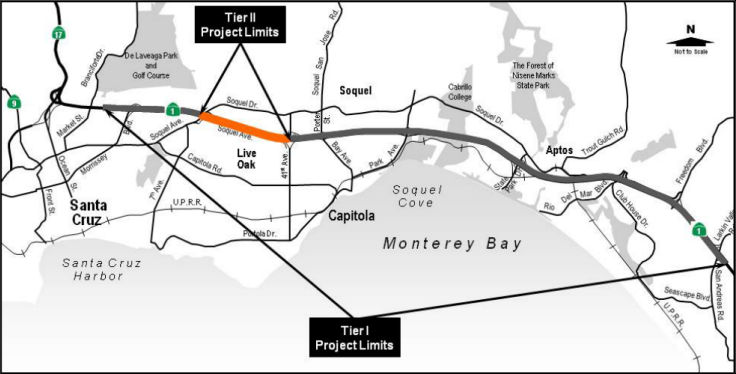 In January 2019, it was reported that the Santa Cruz County Regional
Transportation Commission announced the final Tier I & II
Environmental Impact Report and Environmental Assessment has been
completed and approved for the "Highway 1 Corridor Investment Program."
Additionally, the California Transportation Commission (CTC) approved for
future consideration of funding 5-SCr-1, R7.24/16.13 Santa Cruz Route 1 Project. These appear to be the same programs, as the CTC
describes the project as ilocated on Route 1 in the city of Santa Cruz in
Santa Cruz County. The project proposes to add High Occupancy Vehicle
(HOV) lanes, pedestrian and bicycle overcrossings, and reconstruct
interchanges. The proposed project involves a Tier I component from the
San Andreas-Larkin Valley Road interchange to the Morrissey Boulevard
interchange and a Tier II component from 41st Avenue to Soquel
Avenue/Drive. The purpose of this project proposes to reduce congestion,
improve safety, promote alternative transportation modes and encourage
carpooling and ridesharing. The Santa Cruz County Regional Transportation
Commission’s Regional Transportation Plan proposes this project for
the Senate Bill 1 Solutions for Congested Corridors Program Cycle 2 funds.
The total cost of this proposed Tier II is estimated to be approximately
$36.4 million. Construction is estimated to begin in fiscal year 2021-22.
The Santa Cruz RTC says the same thing: The Highway 1 Corridor Investment
Program is a planning and funding program focused on the section of Route 1 between San Andreas/Larkin Valley Road (SCR R7.692) and Morrissey
Boulevard (~SCR 15.805). The nearly 9-mile long project is looking to ease
congestion, improve safety, encourage carpooling and ridesharing, and
"promote the use of alternative transportation modes as means to increase
transportation system capacity," according to the 644-page FEIR report.
In January 2019, it was reported that the Santa Cruz County Regional
Transportation Commission announced the final Tier I & II
Environmental Impact Report and Environmental Assessment has been
completed and approved for the "Highway 1 Corridor Investment Program."
Additionally, the California Transportation Commission (CTC) approved for
future consideration of funding 5-SCr-1, R7.24/16.13 Santa Cruz Route 1 Project. These appear to be the same programs, as the CTC
describes the project as ilocated on Route 1 in the city of Santa Cruz in
Santa Cruz County. The project proposes to add High Occupancy Vehicle
(HOV) lanes, pedestrian and bicycle overcrossings, and reconstruct
interchanges. The proposed project involves a Tier I component from the
San Andreas-Larkin Valley Road interchange to the Morrissey Boulevard
interchange and a Tier II component from 41st Avenue to Soquel
Avenue/Drive. The purpose of this project proposes to reduce congestion,
improve safety, promote alternative transportation modes and encourage
carpooling and ridesharing. The Santa Cruz County Regional Transportation
Commission’s Regional Transportation Plan proposes this project for
the Senate Bill 1 Solutions for Congested Corridors Program Cycle 2 funds.
The total cost of this proposed Tier II is estimated to be approximately
$36.4 million. Construction is estimated to begin in fiscal year 2021-22.
The Santa Cruz RTC says the same thing: The Highway 1 Corridor Investment
Program is a planning and funding program focused on the section of Route 1 between San Andreas/Larkin Valley Road (SCR R7.692) and Morrissey
Boulevard (~SCR 15.805). The nearly 9-mile long project is looking to ease
congestion, improve safety, encourage carpooling and ridesharing, and
"promote the use of alternative transportation modes as means to increase
transportation system capacity," according to the 644-page FEIR report.
(Source: KSBW, 1/4/2019; January2019
CTC Minutes Agenda Item 2.2c.(6))
According to a press release by
SCCRTC, "For environmental analysis, the Highway 1 Corridor Investment
Program was divided into two components – Tier I (planning-level)
and Tier II (project-level). Tier I evaluates the overall planning-level
concept for the future of the Highway 1 corridor between Santa Cruz and
Aptos while Tier II evaluates specific projects in the program. The Tier I
planning concept for the corridor would be built over time through a
series of smaller, incremental Tier II projects." Those first two projects
include adding an extra lane on both sides of Route 1 between Soquel
Avenue and 41st Avenue, and a bicycle and pedestrian overcrossing at
Chanticleer Avenue. According to the report, the lanes will be 12-feet
wide and will expand the four-lane 1.4 mile stretch of highway into a
six-lane highway. Route 1 project program manager Sarah Christensen said,
"This is a big milestone because now it enables other projects to move
forward in the project level environmental review." The price tag for the
Tier II portion of the project is estimated at $34.8 million. In a
best-case scenario, construction could start on the Tier II project in
2020, with a completion date of 2021.
(Source: KSBW, 1/4/2019; TierI
and Tier II Final Environmental Impact Report/ Environmental
Assessment with a Finding of No Significant Impact)
The recommended Tier 1 alternative, the Tier I Corridor HOV Lane Alternative, would expand the existing four-lane highway to a six-lane facility by adding one HOV lane in each direction next to the median and auxiliary lanes on the outside in each direction. Expanding the highway from four lanes to six lanes would be achieved by building the new lane in the existing freeway median and widening the freeway footprint in those locations where the median is not wide enough to fit the new lane. The Tier I Corridor HOV Lane Alternative would modify or reconstruct all nine interchanges within the project limits to improve merging operations and ramp geometry. The Bay Avenue/Porter Street and 41st Avenue interchanges would be modified to operate as one interchange, with a frontage road to connect the two halves of the interchange. Where feasible, design deficiencies on existing ramps would be corrected. Ramp metering and HOV bypass lanes and mixed-flow lanes would be added to Route 1 on-ramps within the project limits; on-ramp transit stops would also be provided. The Tier I Corridor HOV Lane Alternative would include auxiliary lanes between Freedom Boulevard and Bay Avenue/Porter Street and between 41st Avenue and Soquel Avenue/Drive. Transportation Operations System infrastructure, such as changeable message signs, highway advisory radio, microwave detection systems, and vehicle detection systems, would also be provided under the Tier I Corridor TSM Alternative. One difference between the Tier I Corridor HOV Alternative and the Tier I Corridor TSM Alternative is that the Tier I Corridor HOV Alternative would not construct a northbound auxiliary lane between State Park Drive and Park Avenue.
Bridge structures and the Capitola Avenue overcrossing would be modified or replaced to accommodate the proposed HOV lanes. New and widened highway crossing structures would include shoulder and sidewalk facilities to accommodate pedestrians and bicycles. The Tier I Corridor HOV Lane Alternative would include three new pedestrian/bicycle overcrossings over Route 1 at Mar Vista Drive, Chanticleer Avenue, and Trevethan Avenue. The proposed interchange improvement would also enhance pedestrian and bicycle facilities along local roadways within the interchange areas.
The two existing Santa Cruz Branch Line Railroad bridges over Route 1 in Aptos would be replaced with longer bridges at the same elevation, and the highway profile would be lowered to achieve standard vertical clearance under the bridge to make room for the HOV and auxiliary lanes and to minimize environmental impacts. These bridges would include improvements to pedestrian and bicycle facilities. The existing Route 1 bridge over Aptos Creek, located between the two railroad bridges, has two traffic lanes in each direction and would be widened on the outside, northbound and southbound, to accommodate the HOV and auxiliary lanes.
Tier 1 alternatives not recommended were:
In the short term, the recommended approach was the Tier II Auxiliary Lane Alternative, which would add an auxiliary lane to both the northbound and southbound sides of Route 1 between the 41st Avenue and Soquel Avenue/Drive interchanges. In addition, an Americans with Disabilities Act-compliant pedestrian and bicycle overcrossing would be constructed at Chanticleer Avenue. The total roadway widening would be approximately 1.4 miles along Route 1. The auxiliary lanes included in this alternative are transportation system management features that will help improve operations in the near-term. The new auxiliary lanes would be 12 feet wide. In the southbound direction, the width needed for the new lane would be added in the median, and the median barrier would be shifted approximately 5 feet toward the northbound side of the freeway to make room for the new lane and a standard 10-foot wide shoulder. Where the new southbound lane meets the existing ramps, outside shoulder widening would occur to achieve standard 10-foot wide shoulders. In the northbound direction, the project proposes to pave a 10-foot-wide median shoulder and widen to the outside to add the 12-foot wide auxiliary lane and a new 10-foot wide shoulder.
The pedestrian/bicycle overcrossing constructed at Chanticleer Avenue would connect to a new 360-foot long by 6-foot wide sidewalk on Chanticleer Avenue on the south side of Route 1. The sidewalk, located along the south side of Soquel Drive, would be separated from the street by a 4-foot wide park strip.
Retaining walls would be constructed as part of the roadway widening along Route 1, with a total of four separate walls: three on the north side of the roadway and one on the south side. One of the retaining walls would start after the 41st Avenue on-ramp and extend approximately 150 feet; two other retaining walls on the northbound side would be 375 and 408 feet. On the southbound side, a 350-foot-long wall would be constructed along the highway mainline and Soquel Avenue, over the Rodeo Creek Gulch culvert.
In January 2019, the CTC approved the following funding
for a locally-administered STIP project on the state highway system:
$3,320,000 Santa Cruz County Regional Transportation Commission (SCCRTC) /
Santa Cruz 05-SCR-1 13.6/14. Route 1 41st Avenue to Soquel Avenue
Auxiliary Lanes. Near the city of Santa Cruz and Capitola, from 41st
Avenue to Soquel Avenue. Construct auxiliary lanes and construct
bicycle/pedestrian overcrossing near Chanticleer Avenue. Concurrent
Consideration of Funding under Resolution E-19-14; January 2019.
(Source: January 2019 CTC Minutes, Agenda Item 2.5c.(2) Item 2)
In October 2019, it was reported that the Santa Cruz
County Regional Transportation Commission held a community meeting
regarding the Route 1 Auxiliary Lanes and Chanticleer Bicycle/Pedestrian
Overcrossing project, which extends from 41st Avenue to Soquel Drive. The
project aims to improve traffic on Route 1 and to improve bicycle and
pedestrian access on Chanticleer Avenue in Santa Cruz. The estimated cost
of the project is more than $34.2 million and is expected to start in
2022, depending on funding. At the meeting, the RTC sought community input
on the design of the Chanticleer Overcrossing, with one option being a
blue wave theme and the other showing marine life. Following the meeting,
the commission sent out a survey to gather more input on the aesthetics..
(Source: Santa Cruz Sentinal, 10/24/2019)
In June 2020, the CTC approved amending the Formulaic
Program of Projects in the Local Partnership Program (LPP) to program
$302,000 for Santa Cruz County Regional Transportation Commission to fund
environmental for the Route 1 - Freedom Blvd. to State Park Dr. Auxiliary
Lanes and Bus on Shoulders project, for Fiscal Year 2020-21. The project
will construct auxiliary lanes, modify shoulders, construct soundwalls and
retaining walls, bridge improvements, and construct bike and pedestrian
facilities. The project will improve traffic flow, increase safety,
improve travel times and reliability and improve pedestrian and bike
accessibility.
(Source: June 2020 CTC Agenda, Agenda Item 4.21)
In June 2020, the CTC approved amending the Local
Partnership Formulaic Program – Advance Program of Projects to
program $888,000 for Santa Cruz County Regional Transportation Commission
to fund environmental for the Route 1-Freedom to State Auxiliary Lanes and
Bus on Shoulders project in Fiscal Year 2020-21. The project will
construct auxiliary lanes, modify shoulders, construct soundwalls and
retaining walls, bridge improvements, and construct bike and pedestrian
facilities. The project will improve traffic flow, increase safety,
improve travel times and reliability, and improve pedestrian and bike
accessibility.
(Source: June 2020 CTC Agenda, Agenda Item 4.23)
In July 2022, it was reported that the Santa Cruz
County Regional Transportation Commission and California Transportation
Commission (Caltrans) are pausing plans for a High Occupancy Vehicle lane
after a court ruling ordered Caltrans to revise a report completed more
than three years ago. The challenge came from the Campaign for Sustainable
Transportation and the Sierra Club and was in response to the Highway 1
Tier I/Tier II Environmental Impact Report/Environmental Assessment that
was prepared collaboratively between the two transportation commissions
and certified in 2019. The Tier I level for highway corridor projects are
classified on the Santa Cruz transportation commission’s website as
“planning-level” while Tier II efforts are
“project-level.” In essence, Tier I planning for the highway
corridor is built over time through a series of incremental Tier II
projects. The ruling, which came from the Superior Court of California,
was in favor of a challenge to a Tier I conceptual planning analysis for
High Occupancy Vehicle lanes along the Highway 1 corridor. Challenges
against Tier II projects including an expansion of auxiliary lanes and
creation of a bicycle and pedestrian over-crossing at Chanticleer Avenue,
were rejected, according to a media release from the Santa Cruz
transportation commission. The Chair of the Campaign for Sustainable
Transportation hopes that the RTC will seize the opportunity to reexamine
their course of action. The Campaign argues that the relief provided
through auxiliary lanes will be short lived and that the congestion issue
is better addressed by establishing a firm “bus-only” lane on
the shoulder of the highway. According to the Santa Cruz commission, the
High Occupancy Vehicle lane project has a baseline funding year of 2035,
but current plans create a shared passage for buses through a combination
of auxiliary and bus-on-shoulder lanes. A media release from the Santa
Cruz commission states that Caltrans must recirculate to the public a
focused draft Environmental Impact Report that address three areas of the
Tier I highway project: The 2035 baseline year for the High Occupancy
Vehicle Lane, updates to the Tier I project description, and a study of
the health effects for Mobile Source Air Toxins (MSATs) resulting from the
project. According to the release, Caltrans and Santa Cruz commission
staff plan to address the court’s order and publicly recirculate an
updated analysis in the coming months.
(Source: $Mercury News, 7/19/2022)
 In September 2022, it was reported that plans to
widen Highway 1 from Santa Cruz to Aptos and create new overcrossings for
cyclists and walkers were advanced by the Santa Cruz Regional
Transportation Commission. The plans include improvements for
walkers and cyclists on the Capitola Avenue bridge over Route 1, as well
as new footbridges over Highway at Chanticleer Avenue in Live Oak and at
Mar Vista Drive in Aptos. The first phase of work is expected to
start in Fall 2022 from Morrissey Boulevard in Santa Cruz to Bay Avenue in
Capitola. Transportation commissioners voted unanimously to spend $1.8
million from Measure D money to pay for increased costs of the first phase
of the project. Santa Cruz County voters approved Measure D in 2016 to pay
for transportation projects. The Route 1 work has three phases:
In September 2022, it was reported that plans to
widen Highway 1 from Santa Cruz to Aptos and create new overcrossings for
cyclists and walkers were advanced by the Santa Cruz Regional
Transportation Commission. The plans include improvements for
walkers and cyclists on the Capitola Avenue bridge over Route 1, as well
as new footbridges over Highway at Chanticleer Avenue in Live Oak and at
Mar Vista Drive in Aptos. The first phase of work is expected to
start in Fall 2022 from Morrissey Boulevard in Santa Cruz to Bay Avenue in
Capitola. Transportation commissioners voted unanimously to spend $1.8
million from Measure D money to pay for increased costs of the first phase
of the project. Santa Cruz County voters approved Measure D in 2016 to pay
for transportation projects. The Route 1 work has three phases:
(Source: Santa Cruz Local, 9/1/2022)
 In April 2023, it was reported that this three-phase $100
million multimodal corridor project has broken ground. It has three
phases, with the first phase focusing on pedestrian bridges and
bus-on-shoulder lanes. Phase one is from 41st avenue to Soquel Drive, and
includes a bus-on-shoulder improvements as well as an auxiliary lane to
connect Soquel to 41st avenue. It also includes a bike and pedestrian
bridge over Chanticleer Avenue. The addition of the bus lane on the
shoulder is groundbreaking in its own right, as with it, Santa Cruz County
will become the only county in California to have a bus-on-shoulder lane
on its highway, with hopes that it will help with traffic congestion.
There are two more phases to this project. Phase two includes the
replacement of the Capitola Avenue over crossing, along with more bike
lanes. Phase three includes more bus lanes from State Park to Freedom and
an over crossing across the highways along the rail lines. April also saw
the start of a public review and comment window for a newly released
environmental impact report detailing the last phase of the project. The
project, overseen by the Santa Cruz Regional Transportation Commission and
Caltrans, involves establishing a combination of auxiliary lanes and
bus-on-shoulder facilities from Freedom Boulevard to State Park Drive,
along with construction of Segment 12 of the Coastal Rail Trail. The rail
trail segment includes 1.2 miles of a bicycle and pedestrian trail along
the Santa Cruz Branch Rail Line complete with four overcrossings.
In April 2023, it was reported that this three-phase $100
million multimodal corridor project has broken ground. It has three
phases, with the first phase focusing on pedestrian bridges and
bus-on-shoulder lanes. Phase one is from 41st avenue to Soquel Drive, and
includes a bus-on-shoulder improvements as well as an auxiliary lane to
connect Soquel to 41st avenue. It also includes a bike and pedestrian
bridge over Chanticleer Avenue. The addition of the bus lane on the
shoulder is groundbreaking in its own right, as with it, Santa Cruz County
will become the only county in California to have a bus-on-shoulder lane
on its highway, with hopes that it will help with traffic congestion.
There are two more phases to this project. Phase two includes the
replacement of the Capitola Avenue over crossing, along with more bike
lanes. Phase three includes more bus lanes from State Park to Freedom and
an over crossing across the highways along the rail lines. April also saw
the start of a public review and comment window for a newly released
environmental impact report detailing the last phase of the project. The
project, overseen by the Santa Cruz Regional Transportation Commission and
Caltrans, involves establishing a combination of auxiliary lanes and
bus-on-shoulder facilities from Freedom Boulevard to State Park Drive,
along with construction of Segment 12 of the Coastal Rail Trail. The rail
trail segment includes 1.2 miles of a bicycle and pedestrian trail along
the Santa Cruz Branch Rail Line complete with four overcrossings.
(Source: KSBY, 4/20/2023; Santa Cruz Sentinel, 4/20/2023)
In June 2023, it was reported that Granite Construction
has won a $29 million contract to widen Route 1 in Santa Cruz. Work
includes the construction of four retaining walls, one soldier pile
retaining wall and a 650-foot-long box girder pedestrian bridge over Route 1 at Chanticleer Avenue. The work will widen the freeway in both
directions from Soquel Avenue in Santa Cruz to 41st Avenue in nearby
Capitola, with an additional lane of travel in each direction added to the
existing earth median. The firm will utilize 27,000 tons of subbase
and base and 18,600 tons of hot mix asphalt from its Salinas Hot Plant in
the area. Work commenced in May, and is expected to be complete in
December 2024.
(Source: Construction Dive, 6/6/2023)
In December 2023, it was reported that the third and
final phase of the project is still in the environmental review stage. In
June, the California Transportation Commission staff recommended that the
agency reject the Santa Cruz County Regional Transportation
Commission’s (RTC) request to fund the phase in June. The RTC plans
to reapply for funding in 2025, but in December 2023, it held a public
input event as staff prepares for the design phase. Phase 3, which
involves the area of Route 1 between State Park Drive and Freedom
Boulevard in Aptos, includes constructing a variety of pedestrian/bicycle
bridges over the highway like those planned in the project’s other
phases. It also includes about two miles of the Coastal Rail Trail, the
stretch between State Park Drive and Rio Del Mar Boulevard known as
Segment 12.
(Source: Lookout Santa Cruz, 12/4/2023)
Route 1 - State Park to Bay/Porter Auxiliary Lanes Project (PPNO 0073C) (05-SCR-1 10.4/13.3)
The 2018 STIP, approved at the CTC March 2018 meeting, appears to allocate $1.83M in Advance Project Development Element (APDE) funding for PPNO 0073C Rt 1,
State Park-Bay/Porter, aux lanes. These lanes would run from State Park
Drive to Bay Ave/Porter St. (~ SCR 10.541 to SCR 13.343). The project area
includes a total of approximately 2.5 miles of auxiliary lanes on Route 1
between the respective interchanges to be evaluated and constructed as a
single project. The project will include the reconstruction of the
Capitola Avenue overcrossing to accommodate the auxiliary lanes and long
term vision of the Highway 1 Corridor. The specific project will construct
northbound and southbound auxiliary lanes between the State Park Drive and
Park Avenue Interchanges and between Park Ave and Bay/Porter Interchanges
on Route 1, with retaining walls, sound walls, new drainage facilities and
rehabilitate freeway sections as needed and pavement overlay. The project
also includes the reconstruction of the Capitola Avenue Overcrossing to
accommodate the future vision of the Highway 1 Corridor and to provide a
wider sidewalk, continuation of bike lanes, and bridge lighting.
(Source: 2018 RTIP)
In August 2019, the CTC approved the following
allocation: 05-SCR-1 10.4/13.3 PPNO 0073C Proj ID 0518000116 EA 0C733.
Route 1 - State Park to Bay/Porter Auxiliary Lanes. Near Capitola and
Aptos, Route 1 from State Park Drive to Bay/Porter Interchanges. Construct
auxiliary lanes between interchanges. Includes reconstruction of the
Capitola Avenue overcrossing to accommodate new lanes on Route 1. (APDE).
PA&ED $1,830,000
(Source: August 2019 CTC Agenda, Agenda Item
2.5c.(2) #2)
In October 2019, it was reported that the Santa Cruz
County Regional Transportation Commission held a community meeting
regarding the Route 1 Auxiliary Lanes and Capitola Avenue Overcrossing
project that extends from the State Park Drive exit (~ SCR 10.538) to the
Bay Avenue/Porter Street exit (~ SCR 13.348). The project aims to improve
traffic on Route 1 by adding auxiliary lanes from one on-ramp to the next
off-ramp, and to improve bicycle and pedestrian travel routes on Capitola
Avenue. The project is estimated to cost about $83.2 million and is
planned to start construction in 2024 — if enough funds are
available. About $72.3 million funds are still needed, according to the
RTC. The RTC is expected to start a draft environmental impact
report/environmental assessment in the fall or winter 2020.
(Source: Santa Cruz Sentinal, 10/24/2019)
The 2020 STIP, approved in March 2020, retains the
programmed allocation of $1,830K.
(Source: March 2020 CTC Agenda, Item 4.7, 2020 STIP
Adopted 3/25/2020)
In June 2020, the CTC noticed a 2020 STIP amendment at
the request of the Santa Cruz County Regional Transportation Commission
(SCCRTC) to delete the Mar Vista Bike/Pedestrian Overcrossing (PPNO1968)
project and reprogram the scope and funds to Route 1 - State Park to
Bay/Porter Auxiliary Lanes project (PPNO 0073C), in Santa Cruz County. The
resolution background material noted that the Mar Vista Bike/Pedestrian
project was originally programmed in the 2006 STIP. The project was a
component of the larger Route 1 Corridor - High Occupancy Vehicle (HOV)
and Traffic System Management (TSM) Alternative project. The project level
environmental review for the Mar Vista Bike/Pedestrian Overcrossing (Mar
Vista) project was delayed until after the program level tier 1
environmental document was completed for the corridor, at the request of
the Federal Highway Administration (FHWA). It noted that project is
currently programmed with $6,779,000 in Regional Improvement Program (RIP)
funds with construction programmed in Fiscal Year 2022-23. With
respect to the State Route 1 - State Park to Bay/Porter Auxiliary Lanes
(Bay Porter) project, it was first programmed in the 2018 STIP as an
advance project development project; Bay Porter has local funds and RIP
funds programmed to the environmental phase. The environmental review for
the Mar Vista project revealed costs that exceeded the available funding.
In an effort to address the increased cost, a strategy was developed to
combine the Mar Vista project with the Bay Porter project since they are
in the same area. Combining the two projects, which are on similar
schedules, will create cost efficiencies by streamlining the environmental
studies and construction of the improvements. The combining of the
projects would also lower the cost and save time, compared to stand alone
projects, while eliminating the duplication of efforts and studies in the
same areas and additional construction contracts and administration. The
project cost for the Mar Vista, as a stand-alone project, exceeds its
current funding. Whereas combining it with Bay Porter, can bring
additional benefits and make a combined Bay Porter/Mar Vista more
competitive for various grant programs as a multi-modal project that
includes bus, bike, pedestrian and highway elements. The proposed
programming strategy is to delete the Mar Vista project, reprogram all
funds to the Bay Porter project and update Bay Porter project scope to
include the bike and pedestrian overcrossing. The Bay Porter project cost
is currently estimated at $73,000,000 but the project is not fully funded.
The combined project is estimated to be $88,955,000 with the construction
phase unfunded. SCCRTC is currently looking at ways to find the additional
funding to fully fund the project. The amendment was approved at the
August 2020 CTC meeting.
(Source: June 2020 CTC Agenda, Agenda Item
2.1b.(2); August 2020 CTC Meeting, Agenda Item 2.1a.(4))
The June 2021 CTC Agenda provide more information on
this project (although the item was withdrawn, according to the minutes):
05-SCr-01, PM 10.54/13.44 Santa Cruz Route 1 Auxiliary Lanes.
Widen Route 1 to include auxiliary lanes and to accommodate
bus-on-shoulder operations in Santa Cruz County. (FEIR) (PPNO 0073C)
(STIP). This project is located on Route 1 from post mile 10.54 to 13.44,
in Santa Cruz County. The Department proposes to widen Route 1 to include
auxiliary lanes and to accommodate bus-on- shoulder operations between
State Park Drive and Bay Avenue/Porter Street interchanges. The project
also proposes to replace the Capitola Avenue overcrossing with a bridge
that accommodates pedestrian and bicycle traffic, and to build a new
pedestrian and bicycle overcrossing at Mar Vista Drive. The project is
fully funded and is currently programmed in the 2020 State Transportation
Improvement Program (STIP) for a total of $88,955,000, which includes
local funds, Senate Bill 1, Surface Transportation Program fund, Solutions
for Congested Corridors Program funds, and Local Partnership Program
funds. Construction is estimated to begin in 2022-23. The scope, as
described for the preferred alternative, is consistent with the project
scope programmed by the Commission in the 2020 STIP. A copy of the FEIR
has been provided to Commission staff. Resources that may be impacted by
the project include aesthetic, biological, natural communities, wetlands
and other waters, geology and soils, and transportation. Potential impacts
associated with the project can all be mitigated to below significance
with the exception of aesthetics and transportation, for which a Statement
of Overriding Considerations was prepared. As a result, an FEIR was
prepared for the project.
(Source: June 2021 CTC Agenda, Agenda Item
2.2c.(14))
In January 2023, the CTC approved an allocation of
$72,160,000 for 05-SCr-1 10.54/13.44. PPNO 05-0073C; ProjID 0518000116; EA
0C733. State Route 1 - State Park to Bay/Porter Auxiliary Lanes.
Near Capitola and Aptos, Route 1 from State Park Drive to Bay/Porter
Interchanges. Construct auxiliary lanes between interchanges.
Includes reconstruction of the Capitola Avenue overcrossing to accommodate
new lanes on Route 1 and improve bicycle and pedestrian facilities; hybrid
bus-on- shoulder/auxiliary lane facility between Bay Ave/Porter St and
State Park Dr (total distance 3 miles); bicycle/pedestrian overcrossing of
Route 1 at Mar Vista Dr with sidewalk, ADA ramps, and intersection
improvements at bridge approaches; additional project elements: add
emergency pullouts and enforcement areas, sound wall, retaining walls,
improved median barrier, lighting, overhead signs, traffic monitoring
stations, drainage, and drought-tolerant landscaping. CEQA - EIR,
05/10/2021; Re-validation 11/16/2022. NEPA - FONSI, 05/10/2021;
Re-validation 11/16/2022. Right of Way Certification: 12/02/2022.
Contribution from other sources: $10,000,000. Future consideration of
funding approved under Resolution E-21-69; June 2021. RIP/22-23 CONST
$4,929,000; SCCP/22-23 CON ENG $8,760,000 CONST $44,077,000; LPP-C/22-23
CONST $14,394,000.
(Source January 2023 CTC Agenda, Agenda Item 2.5s.(6))
PPNO 1968: Rt 1 Mar Vista Bike/Pedestrian Overcrossing (PM SCR 10.9)
The 2018 STIP, approved at the CTC March 2018 meeting, appears to adjust the allocation for PPNO 1968, Rt 1 Mar Vista bike/ped overcrossing, at PM SCR 10.9 in Aptos, at Mar Vista Drive. Construct a new bicycle and pedestrian accessible structure over Route 1 and McGregor Drive (frontage road). The 2018 STIP changes the funding from $6.114M to $6.779M, and delays the project to FY19-20 and FY20-21.
The 2020 STIP, approved at the CTC March 2020 meeting,
retains the programmed funding but shifts the project even later: $1,850K
slipped to FY21-22 and $4,929K slipped to FY22-23..
(Source: March 2020 CTC Agenda, Item 4.7, 2020 STIP
Adopted 3/25/2020)
In June 2020, the CTC amended the 2020 STIP at the
request of the Santa Cruz County Regional Transportation Commission
(SCCRTC) to delete the Mar Vista Bike/Pedestrian Overcrossing (PPNO1968)
project and reprogram the scope and funds to Route 1 - State Park to
Bay/Porter Auxiliary Lanes project (PPNO 0073C), in Santa Cruz County. The
resolution background material noted that the Mar Vista Bike/Pedestrian
project was originally programmed in the 2006 STIP. The project was a
component of the larger Route 1 Corridor - High Occupancy Vehicle (HOV)
and Traffic System Management (TSM) Alternative project. The project level
environmental review for the Mar Vista Bike/Pedestrian Overcrossing (Mar
Vista) project was delayed until after the program level tier 1
environmental document was completed for the corridor, at the request of
the Federal Highway Administration (FHWA). It noted that project is
currently programmed with $6,779,000 in Regional Improvement Program (RIP)
funds with construction programmed in Fiscal Year 2022-23. With
respect to the State Route 1 - State Park to Bay/Porter Auxiliary Lanes
(Bay Porter) project, it was first programmed in the 2018 STIP as an
advance project development project; Bay Porter has local funds and RIP
funds programmed to the environmental phase. The environmental review for
the Mar Vista project revealed costs that exceeded the available funding.
In an effort to address the increased cost, a strategy was developed to
combine the Mar Vista project with the Bay Porter project since they are
in the same area. Combining the two projects, which are on similar
schedules, will create cost efficiencies by streamlining the environmental
studies and construction of the improvements. The combining of the
projects would also lower the cost and save time, compared to stand alone
projects, while eliminating the duplication of efforts and studies in the
same areas and additional construction contracts and administration. The
project cost for the Mar Vista, as a stand-alone project, exceeds its
current funding. Whereas combining it with Bay Porter, can bring
additional benefits and make a combined Bay Porter/Mar Vista more
competitive for various grant programs as a multi-modal project that
includes bus, bike, pedestrian and highway elements. The proposed
programming strategy is to delete the Mar Vista project, reprogram all
funds to the Bay Porter project and update Bay Porter project scope to
include the bike and pedestrian overcrossing. The Bay Porter project cost
is currently estimated at $73,000,000 but the project is not fully funded.
The combined project is estimated to be $88,955,000 with the construction
phase unfunded. SCCRTC is currently looking at ways to find the additional
funding to fully fund the project.
(Source: June 2020 CTC Agenda, Agenda Item
2.1b.(2))
PPNO 0073A: 41st to Soquel, Auxiliary Lanes, Bike/Pedestrian bridge (SCR 13.6/14.9)
The 2018 STIP, approved at the CTC March 2018 meeting, appears to adjust the allocation for PPNO 0073A, Rt 1, 41st-Soquel, aux lanes, bike/ped bridge, from $2.25M to $6M. This project, at SCR 13.6/14.9, near the city of Santa Cruz and Capitola, from 41st Avenue to Soquel Avenue will construct auxiliary lanes and construct bicycle/pedestrian overcrossing near Chanticleer Avenue.
The 2020 STIP, approved at the CTC March 2020 meeting,
adjusts the programmed allocation as follows:
(Source: March 2020 CTC Agenda, Item 4.7, 2020 STIP
Adopted 3/25/2020)
| PPNO | Project | Prior | 20-21 | 21-22 | 22-23 | 23-24 | 24-25 |
| 0073A (SCCRTC) | Rt 1, 41 st-Soquel, aux lanes, bike/ped bridge (16S-16) | 3,320K | 0 | 1,921K | 0 | 0 | 0 |
| 0073A (SCCRTC) | Rt 1, 41 st-Soquel, aux lanes, bike/ped bridge (16S-16) | 0 | 0 | -1,921K | 0 | 0 | 0 |
| 0073A (Caltrans) | 41 St-Soquel, aux lns, bus on shoulder, bike/ped bridge (SB1) | 0 | 0 | 6,835K | 0 | 0 | 0 |
Southbound Route 17 Connector Realignment (05-SCR-01 16.7/17.0, 05-SCR-17 0.0/0.3)
In August 2016, the CTC authorized funding for a project on Route 1, in and near Santa Cruz (05-SCR-01 16.7/17.0), from 0.1 mile south of Route 1/Route 17 Separation to 0.4 mile south of Pasatiempo Overcrossing; also on Route 17 (PM 0.0/0.3). Realign southbound Route 17 connector to southbound Route 1. $658K for right of way acquisition, and $5,811K for construction. The project (PPNO 2636) was included in the final adopted 2018 SHOPP in March 2018.
In October 2018, the CTC approved an allocation of
$8,508,000 for the State Highway Operation Protection Program (SHOPP)
Collision Reduction Safety Improvement project (PPNO 2422) on Route 17, in
Santa Cruz County. This project proposes to improve safety of Route 17
(southbound) in Santa Cruz County from the southbound exit ramp to Route 1
to the entrance ramp from Pasatiempo Drive. Due to the higher than average
collision rate, the project proposes to construct a retaining wall and
widen the outside shoulder to 10 feet to improve stopping sight distance.
This section of Route 17 is experiencing a pattern of roadway departure
collisions, often when the pavement is wet. This existing ROute 17
(southbound) has a one (1) to 4-foot outside shoulders with limited
stopping sight distance, because of the hillside cut slope between SCL 0.2
and SCL 0.5. This project will widen the outside shoulder to 10 feet;
widening the outside shoulder will improve the stopping sight distance to
500 feet for a design speed of 55 mph. The project was programmed in the
2016 SHOPP for a construction allocation in Fiscal Year 2017-18; which is
from July 1, 2017 to June 30, 2018. If the Department does not obtain an
allocation during this programmed fiscal year, a time extension for the
Construction allocation is required to keep the project programming
active. On June 28, 2018, the Commission approved a four-month time
extension for this project that will expire on October 31, 2018. Storm
damage in Fiscal Year 2016-17 caused a major slope failure within the
limits of the project. While current best practice is to obtain
geotechnical investigations early in the Project Approval and
Environmental Document (PA&ED) phase, the storm damage priorities
delayed that work. As this is a collision reduction project, the
Department determined that it was best that the project move forward with
the preliminary geotechnical information, and follow up with the more
detailed geotechnical investigations during during Plans, Specifications
and Estimate (PS&E) phase. Ultimately, the storm damage work delayed
the geotechnical drilling until late in the PS&E phase.
(Source: October 2018 CTC Agenda Item 2.5d.(2))
In August 2020, the CTC received notice of the
following delegated allocation: $7,913,000. 05-SCr-1 16.7/17.0. PPNO
05-2636 ProjID 0516000020 EA 1H060. Route 1 In and near Santa Cruz, from
0.1 mile south of Route 1/Route 17 Separation to 0.4 mile south of
Pasatiempo Overcrossing; also on Route 17 (PM 0.0/0.3). Outcome/Output:
Improve safety by realigning connector ramp, constructing concrete
barrier, and adding high visibility striping on southbound Route 17
connector to southbound Route 1. This project will reduce the number and
severity of collisions.
(Source: August 2020 CTC Agenda, Agenda Item
2.5f.(3) #5)
PPNO 4658: Rt 1/9 Intersection Modifications (SCR 17.5/17.7)
 The 2018 STIP, approved at the CTC March 2018 meeting, appears to increase the allocation for PPNO 4658, Rt 1/9 Intersection modifications, from $329K to
$2.853M. This project, on Route 1 from SCR 17.5/17.7 and Route 9 from SCR
0.0/0.2, is in the city of Santa Cruz, at the junction of Route 1 and
Route 9. Construct turn lanes and bike lanes.
The 2018 STIP, approved at the CTC March 2018 meeting, appears to increase the allocation for PPNO 4658, Rt 1/9 Intersection modifications, from $329K to
$2.853M. This project, on Route 1 from SCR 17.5/17.7 and Route 9 from SCR
0.0/0.2, is in the city of Santa Cruz, at the junction of Route 1 and
Route 9. Construct turn lanes and bike lanes.
The 2020 STIP, approved at the CTC March 2020 meeting,
retains the 2018 STIP programming.
(Source: March 2020 CTC Agenda, Item 4.7, 2020 STIP
Adopted 3/25/2020)
In August 2020, the CTC approved for future
consideration of funding a project is located in Santa Cruz County on
Route 1 (05-SCr-1, PM 17.5/17.7) and Route 9 (05-SCr-9, PM 0.0/0.2) in the
City of Santa Cruz. The project proposes to construct turn lanes and bike
lanes. This project is fully funded and is currently programmed in the
2020 State Transportation Improvement Program (STIP) for a total of
$11,846,000 which includes Construction (capital and support) and Right of
Way (capital and support) with Regional Improvement Program funds, federal
and local dollars.
(Source: August 2020 CTC Agenda, Agenda Item
2.2c.(1))
In May 2022, it was reported that this project -- where
Route 1 and Route 9 and River St come together -- will add several new
dedicated and shared turning lanes to the area and install new safety
lighting, green-painted bicycle lanes, improved sidewalks and ramps and
new shoulders. A stream culvert once bracketed by shrubbery, Route 1, a
eucalyptus grove and a Central Home Supply yard will be protected by a
permanent sound wall after protected steelhead trout were found in the
waters. A much-maligned large yellow and blue “Welcome to River
Street/Downtown Santa Cruz” road sign, first installed in 2001,
would not be returned to the intersection. Instead, a vertical sign with
“Santa Cruz” on it, similar to those seen along the
city’s other borders, is scheduled to provide the community’s
new introduction at the intersection. According to a project information
sheet: The proposed improvements that will be constructed include the
following: (1) Widen the section of Route 9 (River Street ) between Route 1 and Fern Street to create a second northbound lane and to provide triple
left turn lanes southbound as vehicles leave Harvey West Area heading
south on Route 1; (2) Provide green bike lanes on Route 9 and River
Street, and upgraded pedestrian access ramps and crosswalks. (3) Widen the
section of River Street near the Gateway Shopping Center to create two
right turn lanes, one through lane, and one shared through/left-turn lane.
This will ease traffic flow from downtown to the Harvey West Area and in
the southbound direction on Route 1 (4) Add a second left turn lane from
Route 1 (southbound direction) onto Route 9 (River Street). This
will ease the flow of traffic from the Westside of Santa Cruz as it
travels southbound Route 1. Traffic in this direction now uses the single
lane left turn lane to enter the Harvey West Area. (5) Add a right turn
line on Route 9 (River Street) at its intersection with Encinal Street.
This will ease the flow of traffic heading up River Street (northbound
direction) and turning into the Tannery Arts Center. The project has
received all necessary approvals and funding to construct the project
starting in April/May 2021 and continuing into early 2022. The cost of
construction is estimated at approximately $6 million and funding comes
from local developer fees, gas tax and State/Federal grants.
(Source: Santa Cruz Sentinel, 5/18/2022)
In October 2011, the CTC approved $1.3 million to construct ¾ mile of concrete median barrier between Route 9 (apx 001 SCR 17.576) and High Street (apx 001 SCR 18.054) in the City of Santa Cruz.
Scotts Creek Bridge № 36-0031 Replacement (05-SCr-1 31.3/32.0)
In March 2023, the CTC approved amending the 2022 SHOPP
to include the following Long Lead item: 05-SCr-1 31.3/32.0. PPNO 05-3137;
ProjID 0520000048; EA 1M720. Route 1 Near Davenport, at Scotts Creek
Bridge № 36-0031. Replace bridge. Long Lead Project. Concurrent COS
allocation under Resolution FP-22-57; March 2023. Note: Project will have
extensive environmental impacts with significant biological studies,
coordination with multiple permitting agencies, and a higher level
environmental document. Allocation ($ × 1,000): PA&ED $4,530; ⊘PS&E $6,615; ⊘R/W
Sup $365; ⊘Con Sup $14,255; ⊘R/W Cap $895; ⊘Const
Cap $110,000; TOTAL $136,660. Begin Const: 9/18/2034.
(Source: March 2023 CTC Agenda, Agenda Item 2.1a.(1c) #4)
In March 2023, the CTC approved the following
pre-construction project support phase SHOPP (2a) or SB1 (2b) allocation:
$4,530,000. 05-SCr-1 31.3/32.0. PPNO 05-3137; ProjID 0520000048; EA 1M720.
Route 1 Near Davenport, at Scotts Creek Bridge № 36-0031. Replace
bridge. Long Lead Project. Concurrent Amendment under SHOPP Amendment
22H-007; March 2023. As part of this allocation request, the
Department is requesting to extend the completion of PA&ED an
additional 27 months beyond the 36 month deadline. PA&ED
$4,530,000. FY33-34.
(Source: March 2023 CTC Agenda, Agenda Item 2.5b.(2a) #15)
Pescadero Creek Sea Level Rise Realignment (04-SM-1 13.1/13.6)
In October 2023, the CTC amended the following project
into the SHOPP: 04-SM-1 13.1/13.6. PPNO 04-2916Q; ProjID 0422000443; EA
1Y180. Route 1 Near Pescadero, from 0.5 mile south of Pescadero Creek Road
to Pescadero Creek Road. Realign roadway inland to address sea level rise
and eroding bluff. Concurrent COS allocation under Resolution FP-23-39;
October 2023. Allocation ($ × 1,000): PA&ED $1,980; PS&E
$1,720; R/W Sup $360; ⊘Con Sup
$3,360; ⊘R/W Cap $488; ⊘Const Cap $15,829; TOTAL
$23,737. Begin Const: 11/1/2028.
(Source: October 2023 CTC Agenda, Agenda Item 2.1a.(1a) #12)
In October 2023, the CTC approved the following
preconstruction phase allocations for a 2022 SHOPP Project: $1,980,000.
04-SM-1 13.1/13.6. PPNO 04-2916Q; ProjID 0422000443; EA 1Y180. Route 1
Near Pescadero, from 0.5 mile south of Pescadero Creek Road to Pescadero
Creek Road. Realign roadway inland to address sea level rise and eroding
bluff. Concurrent Amendment under SHOPP Amendment 22H-012; October 2023.
Allocation (FY27-28): PA&ED $1,980,000.
(Source: October 2023 CTC Agenda, Agenda Item 2.5b.(2a) #9)
In August 2011, the CTC approved $185,000 in SHOPP funding to stabilize and repair slope and install Rock Slope Protection at one location damaged by heavy rainfall near Pescadero, 0.4 mile south of Pescadero Creek Road (~ SM 13.174).
In October 2020, it was reported that the city of Half Moon Bay broke
ground on a traffic safety project along Route 1 that will realign its
intersection with Main Street and Higgins Canyon Road (~ SM 27.752). The
intersection between Route 1 and the two roads is currently regulated only
by stop signs. The city’s project would convert those stop signs to
traffic signals and add signalized pedestrian crossings and designated
pavement markings for bicycles on southbound Main Street. The
highway’s intersection with Higgins Canyon Road will also be
entirely realigned for improved safety, adding landscaped highway medians
and a pair of large concrete entry structures that will funnel traffic
safely to Main Street, according to the city. City officials expect the
project to be completed in late 2021. The city will use funds for the
project from San Mateo County’s Measure A, which voters first passed
in 1988 and extended in 2004 to provide funding for transit infrastructure
projects. The Route 1 project accounts for the southern portion of the
city’s Highway 1 Safety Operational Improvement Project,
which is intended to improve traffic safety and flow along the highway
between North Main Street and Spindrift Way and between Wavecrest Road and
Seymour Street.
(Source: Local News Matters (Bay Area), 10/3/2020)
Moss Beach State Route 1 Congestion & Safety Improvements Project (~ SM 34.847/SM 35.954)
 In September 2023, it was reported that there are plans for improvements in Moss Beach. The
goal of the project is to improve traffic flow and safety within the
project area, which includes three major intersections: Route 1/16th
Street (SM 35.871), Route 1/California Avenue (SM 35.224), and Route 1/Cypress Avenue (SM 34.96). Improvements for the intersections and
surrounding project area may include roundabouts, signals, dedicated turn
lanes, high-visibility crosswalks, pedestrian walkways, bus stop
enhancements, and bike lanes. The plan includes two primary alternatives.
Alternative 1 has roundabouts at Cypress and California, with a signal at
16th Street. There are two suboptions, one with a raised median and one
without. Alternative 2 has signals at Cypress, California, and 16th
Streets. The county has a project page at https://www.smcgov.org/planning/moss-beach-sr-1 where folks can sign up for email updates. As background: In 2009, the
County began an intensive community-based planning process along Highway 1
with the Highway 1 Safety and Mobility Improvement Study. The study
engaged citizens in developing short- and long-term transportation
improvements to better serve pedestrians and people traveling by car and
bike in Miramar, El Granada, and Princeton (Phase 1) and in Moss Beach and
Montara (Phase 2). The San Mateo County Board of Supervisors adopted Phase
1 and Phase 2 in 2009 and 2012, respectively. In 2012, the County received
$1.5 million in countywide transportation funds to design and permit these
congestion-reducing and safety-enhancing projects. The Highway 1
Congestion and Safety Improvement Project Preliminary Planning Study was
completed in 2015, which further defined potential improvements. In 2021,
the TA Board of Directors approved a grant (see Item 11b) to support
Project Initiation for the Moss Beach SR-1 Congestion and Safety
Improvements Project. In 2022, the San Mateo County Board of Supervisors
adopted Connect the Coastside, a plan that's development identified
additional potential improvements in the Moss Beach area to better
accommodate future transportation needs.
In September 2023, it was reported that there are plans for improvements in Moss Beach. The
goal of the project is to improve traffic flow and safety within the
project area, which includes three major intersections: Route 1/16th
Street (SM 35.871), Route 1/California Avenue (SM 35.224), and Route 1/Cypress Avenue (SM 34.96). Improvements for the intersections and
surrounding project area may include roundabouts, signals, dedicated turn
lanes, high-visibility crosswalks, pedestrian walkways, bus stop
enhancements, and bike lanes. The plan includes two primary alternatives.
Alternative 1 has roundabouts at Cypress and California, with a signal at
16th Street. There are two suboptions, one with a raised median and one
without. Alternative 2 has signals at Cypress, California, and 16th
Streets. The county has a project page at https://www.smcgov.org/planning/moss-beach-sr-1 where folks can sign up for email updates. As background: In 2009, the
County began an intensive community-based planning process along Highway 1
with the Highway 1 Safety and Mobility Improvement Study. The study
engaged citizens in developing short- and long-term transportation
improvements to better serve pedestrians and people traveling by car and
bike in Miramar, El Granada, and Princeton (Phase 1) and in Moss Beach and
Montara (Phase 2). The San Mateo County Board of Supervisors adopted Phase
1 and Phase 2 in 2009 and 2012, respectively. In 2012, the County received
$1.5 million in countywide transportation funds to design and permit these
congestion-reducing and safety-enhancing projects. The Highway 1
Congestion and Safety Improvement Project Preliminary Planning Study was
completed in 2015, which further defined potential improvements. In 2021,
the TA Board of Directors approved a grant (see Item 11b) to support
Project Initiation for the Moss Beach SR-1 Congestion and Safety
Improvements Project. In 2022, the San Mateo County Board of Supervisors
adopted Connect the Coastside, a plan that's development identified
additional potential improvements in the Moss Beach area to better
accommodate future transportation needs.
(Source: Coastside Buzz, 9/28/2023, Mid-Coast Community Council, County Project Page)
The concept for the 16th Street signal is to
essentially merge 16th Street and Carlos Street into one intersection.
However, one design proposed doing so in a way that allows northbound cars
to make a right onto Carlos Street before the signal, but cars wanting to
go left, or southbound, from Carlos Street would have to use the signal.
The reason 16th Street is being addressed is because an Environmental
Impact Report prepared for the Cypress Point Affordable Housing Community
Project described the Carlos Street and Route 1 intersection as dangerous
because of limited visibility. Consultants recommended closing access to
the northern end of Carlos Street until the county and Caltrans complete
this project to improve safety, which will take seven years at a minimum.
According to the county’s traffic simulation of road conditions in
2050, roundabouts and signals designs could reduce wait times at the
intersections by an average of 40 percent compared to not building
anything. However, the additional infrastructure could add an extra 30
seconds of travel for people driving through Moss Beach.
(Source: Half Moon Bay Review, 10/10/2023)
Devils Slide (001 SM R38.522/SM R39.369)
The Devil’s Slide story goes back to the late 1800s when travel between Pacifica and Montara just north of Half Moon Bay was a challenging, if not treacherous, journey over San Pedro Mountain. In 1905 a railroad and tunnel seemed like a good answer to the transportation dilemma. Tracks were laid starting north and south in anticipation of connecting San Francisco to Santa Cruz, but the 1906 earthquake caused damage and delays that would alter the plan. By the 1920s improved roads made trucking goods so much more competitive that the northern rail tunnel was closed.
The rocks of Devils Slide have defined life on the coast since 1937, when
the "Sea-Level Boulevard" was built on the former railroad bed. The
construction of Route 1 in 1937 promised a safer route for all vehicles
traveling this thread, drawing more tourists and development to coastal
communities. But Mother Nature did not yield readily to progress. A
one-mile stretch of Route 1 happened to be cut into a layer of sedimentary
rock folded over 900-foot granite cliffs by tectonic movement. Trapped
underground water weakens the sedimentary rock above while crashing waves
and vigorous tides erode the bottom of the slip, facilitating
Devil’s Slide’s millions-year natural journey into the
Pacific. From 1940 forward, Route 1 was plagued by closures as though
Mother Nature was determined to shrug off the road on her back with
rain-driven rock falls and slides. By the 1960s constant costly repairs to
the Devil’s Slide section of Route 1 finally forced Caltrans to
scream “uncle.” Their solution was a controversial six-lane
freeway bypass over Montara Mountain. The debate raged on for three
decades as Devil’s Slide continued its temperamental protests with
recurring closures. All that keeps the road in place, clinging
precariously to the cliffs, are giant bolts and cables. Nine times, Route 1 at Devils Slide has closed.
(Source for the above: Monterey Herald, 6/8/2016)
In September 2004, Senate Bill 792 required the Department of Transportation to sell and transfer certain property under its control in the County of San Mateo as surplus state property to the Department of Parks and Recreation for state park purposes. This bill was in response to San Mateo County Measure T (1996), which proclaimed that the construction of a surface bypass in this area would seriously damage the watersheds, wildlife habitats, and parks of Montara and San Pedro Mountains, and directing the amendment of their local coastal program to provide for a tunnel alternative to such a bypass. After Caltrans determined that a freeway bypass over Montara Mountain ("Devils Slide") is not currently viable, the property located in the existing Martini Creek Devil's Slide bypass right-of-way for the realignment of Route 1 from the northern boundary of the town of Montara (State Parcel Number 39874) to past the alignment summit over Montara Mountain (State Parcel Number 39873 and a large portion of State Parcel Number 39872), hereinafter "the Martini Creek Bypass Alignment," became surplus state property located within the coastal zone. This bill relinquishes the property, in order to add it to the McNee Ranch Acquisition area of Montara State Beach. Surprisingly, this transfer removes the last hurdle for the state Department of Transportation, which has been trying since the late 1950s to create a bypass for slide-prone Highway 1 between Pacifica and Montara. Caltrans officials hope to begin work in January 2005 on a pair of 4,000-foot tunnels that will speed drivers under San Pedro Mountain, completing the project by 2010. San Mateo County approved the $270 million project in May, but the tunnel was held up when the state Coastal Commission filed an appeal in July, pending transfer of the surplus Caltrans property near the tunnel to the state Parks Department.
 In 2006, it was reported that there are plans for a $270
million project to build a tunnel for Route 1 between Pacifica and
Montara. In 2006, it was shut for four months, sending commuters on long
detours and threatening coastal businesses. A closing in 1995 lasted
nearly six months. The plan is to replace the highway with a tunnel. For
more information, see this article. According to the article, the realization of the Devil's
Slide tunnel would culminate a saga that began with environmentalists and
residents battling a planned six-lane highway between San Francisco and
San Luis Obispo in the 1960s and led to them convincing the state's giant
transportation department to build the twin-bore tube through Montara
Mountain. According to the Half Moon Bay Review in 2006, the
construction bids for the tunnel came in over $32 million over the
original Caltrans estimate. Caltrans had first pegged the price of the
tunnel at $240 million, estimating construction time at about five years.
The low bid, presented by Kiewit Pacific, came in at $272.4 million with
construction expected to take 1,500 calendar days. A second bid - made by
a joint venture of construction companies Shea, Traylor and Atkinson -
came in nearly $50 million more than Kiewit's and asked for an additional
year to complete the work. After the contact is ready, preparation work
may begin in spring 2007 to provide the site with adequate drainage and
better stability. The proposed 4,200-foot-long twin tunnels will bypass
the Devil's Slide section of Highway 1 by an inland route through Montara
Mountain. The boring for the tunnel began in September 2007. The twin
tunnels will connect to a graceful and lofty set of bridges spanning a
scenic canyon. The $322 million project will be ready for traffic by late
2010. The tunnels, four-fifths of a mile long, will be built in stable
rock far from the cliffs that are sliding into the sea. The bridge
construction spares precious wetlands. The long-haunted stretch of old
Route 1 will be turned into a 1.2-mile recreation area, while the new road
will be a reliable thoroughfare. The tunnels at Devils Slide are estimated
to be completed in 2011, and the final cost will be about $325 million.
In 2006, it was reported that there are plans for a $270
million project to build a tunnel for Route 1 between Pacifica and
Montara. In 2006, it was shut for four months, sending commuters on long
detours and threatening coastal businesses. A closing in 1995 lasted
nearly six months. The plan is to replace the highway with a tunnel. For
more information, see this article. According to the article, the realization of the Devil's
Slide tunnel would culminate a saga that began with environmentalists and
residents battling a planned six-lane highway between San Francisco and
San Luis Obispo in the 1960s and led to them convincing the state's giant
transportation department to build the twin-bore tube through Montara
Mountain. According to the Half Moon Bay Review in 2006, the
construction bids for the tunnel came in over $32 million over the
original Caltrans estimate. Caltrans had first pegged the price of the
tunnel at $240 million, estimating construction time at about five years.
The low bid, presented by Kiewit Pacific, came in at $272.4 million with
construction expected to take 1,500 calendar days. A second bid - made by
a joint venture of construction companies Shea, Traylor and Atkinson -
came in nearly $50 million more than Kiewit's and asked for an additional
year to complete the work. After the contact is ready, preparation work
may begin in spring 2007 to provide the site with adequate drainage and
better stability. The proposed 4,200-foot-long twin tunnels will bypass
the Devil's Slide section of Highway 1 by an inland route through Montara
Mountain. The boring for the tunnel began in September 2007. The twin
tunnels will connect to a graceful and lofty set of bridges spanning a
scenic canyon. The $322 million project will be ready for traffic by late
2010. The tunnels, four-fifths of a mile long, will be built in stable
rock far from the cliffs that are sliding into the sea. The bridge
construction spares precious wetlands. The long-haunted stretch of old
Route 1 will be turned into a 1.2-mile recreation area, while the new road
will be a reliable thoroughfare. The tunnels at Devils Slide are estimated
to be completed in 2011, and the final cost will be about $325 million.
(Image source: Denman Real Estate Group)
In June 2010, it was reported that good progress was being made on the
tunnel. The buildings and the bridges are finished, and the tunnel diggers
are expected to bust through the north end of the mountain by Fall 2010.
Each of the roughly 4,200-foot bores - 30 feet wide and 24 feet
high—is about 90% of the way through the mountain. The contractor,
Kiewit Pacific, is using the New Austrian Tunneling Method, which involves
analyzing the kind of soil that's being excavated and using different
types of machinery to get through it. The main diggers are the road
header, which features a long arm with a pair of 2½-foot-wide
spinning wheels—covered with carbide-tipped spikes—and an
excavator workers refer to as the T. rex. The road header is used on
harder soils and rocks. It bites into the earth and gnaws it into smaller
pieces. A series of rotating metal plates moves what's left onto a
conveyor belt that lifts the muck into a truck that carries it to a
disposal site on the side of the mountain, just outside the south portal.
The smaller T. rex works similarly, but on softer soils. Once the hole is
extended, workers secure it by installing arched metal ribs and coat the
tunnel walls with sprayed concrete, applied by a remote-controlled robot.
The thickness varies from 4 to 14 inches, depending on the stability of
the soil. Next, a bright yellow sheet of plastic waterproofing material is
installed to protect the tunnel. Two layers of reinforcing steel bars come
next, and then the whole thing is smothered in a thicker, smoother layer
of concrete, using an overhead gantry that straddles the tunnels and
slides on rails. Although it's known as the final coat, enamel panels and
a brighter paint job will be applied before the tunnel is opened to
traffic. By Fall 2011, the finished tunnel should open to traffic. This
will be California's first highway tunnel built since 1964, when the third
bore of the East Bay's Caldecott Tunnel (Route 24) opened.
(Source: San Francisco Chronicle, 6/19/10)
In October 2010, it was reported that the Devil's Slide tunnel had broken through near Pacifica. This was about a month ahead of schedule. When the break-through happened, there was a ceremony on the north side of San Pedro mountain, where workers excavating the northbound bore of the Devil's Slide tunnel smashed through a sprayed concrete coating, opening a small hole through the mountain slope. They then enlarged that hole to about 8 by 8 feet and emerged to greet a crowd of dignitaries and other invited guests gathered atop the Devil's Slide bridges.
In January 2011, it was reported that all excavation was completed.
In July 2011, the completion date was pushed back to late 2012. That is more than a year later than the general contractor estimated when it started construction on the $342 million project in 2007. The variability of the rock and convergence - or movement of the soil - has delayed the project. Crews have had to do more reinforcement work than called for in the original plans as well. Although crews completed excavation in January, digging continued to complete the bottom portion of the bore. Every time they run into a new kind of rock, they have to dismantle the equipment.
In February 2012, it was reported that concrete roadways into the tunnel have been completed. The concrete roadways under construction inside the bores are a little more than 21 feet wide and sit between two emergency walkways. Workers are putting 5 inches of concrete atop a 1-inch layer of asphalt that sits atop another 5 inches of concrete placed atop a crushed-rock base. Each tunnel will accommodate a single lane of traffic, 12 feet wide, with an 8-foot shoulder on the right and a 2-foot shoulder on the left. The 8-foot shoulder will serve double duty as a place for stalled cars to pull off the road as well as for bicyclists to pedal through the tunnel. Most bike riders, however, will probably choose to pedal along the current stretch of highway, which will become a bike trail and park offering spectacular cliff-top views of the Pacific Ocean. The remaining work on the tunnel includes installation of 32 jet-powered fans - 16 in each bore - to provide ventilation, enamel-covered curved panels that will line the walls, electrical systems and a water line, as well as completing landscaping outside the portals and finishing touches to the fake rock walls at the entrances. The northbound tunnel will open first to allow crews to build safe connections to Route 1. Southbound traffic will follow a week or two later. Once the tunnels are open, crews will build parking lots on both sides.
In November 2012, it was reported that the opening of the tunnels had been delayed until early 2013. The extension is related to safety and electronics testing, including the ventilation system and cameras monitoring activity inside the tunnel. Once those are complete, Caltrans must finish the road connections between Route 1 and the tunnels.
 In late March 2013, the Devil's Slide tunnels opened. The opening of a
tunnel, and not a 4.5-mile freeway bypass to the east, is the result of a
remarkable grass-roots coalition of environmentalists and Coastside
residents who rose up to oppose the agency's plans for an inland route.
The four-lane bypass would have cut McNee Ranch State Park in half and,
activists feared, opened the coast to more aggressive development. Devils
Slide -- less than a quarter-mile of steep, crumbling rock between
Pacifica and Montara -- has tormented travelers since the late 19th
century. The promontory forms the western flank of San Pedro Mountain,
rising abruptly from the Pacific Ocean to a height of about 1,000 feet.
Its presence sealed off the coast from the sort of development that
occurred in Pacifica and Daly City during the mid-20th century. In 1937,
Caltrans carved a 5.9-mile extension of Route 1 into the cliffs, just down
the slope from a more primitive road built in 1879. It suffered its first
major closure the following year. Fatal accidents, with cars plunging into
the rocks at surf's edge, became a regular occurrence. By the 1960s, state
and county officials were eyeing a bypass of four to six lanes that would
run east of San Pedro Mountain. The road was tied to a bold idea for
development on the sparsely populated coast. But the plan collided with
the burgeoning environmental movement. The Sierra Club and others sued to
block the project in 1972, sparking an epic legal and political fight that
reached a climax in 1996 when county voters overwhelmingly approved a
ballot measure in favor of a tunnel. The twin tunnels are each 30 feet
wide and 4,200 feet long, making them the second-longest in California
behind the Wawona Tunnel in Yosemite National Park. The excavation
involved removing about 11.4 million cubic feet of rock from inside San
Pedro Mountain. Each tunnel is equipped with sensors that monitor heat as
well as nitrous oxide and carbon monoxide levels. The tunnels are
monitored by cameras 24 hours a day. Tunnel operators can override
motorists' car stereos to communicate during emergencies. There are 16
powerful jet fans affixed to the ceiling of each tunnel to provide
ventilation in the event of a fire or other incident. The southern
entrances to the tunnels are covered in a fake rock surface, created by a
man who worked on Disneyland's Indiana Jones ride, that is designed to
blend into surroundings.
In late March 2013, the Devil's Slide tunnels opened. The opening of a
tunnel, and not a 4.5-mile freeway bypass to the east, is the result of a
remarkable grass-roots coalition of environmentalists and Coastside
residents who rose up to oppose the agency's plans for an inland route.
The four-lane bypass would have cut McNee Ranch State Park in half and,
activists feared, opened the coast to more aggressive development. Devils
Slide -- less than a quarter-mile of steep, crumbling rock between
Pacifica and Montara -- has tormented travelers since the late 19th
century. The promontory forms the western flank of San Pedro Mountain,
rising abruptly from the Pacific Ocean to a height of about 1,000 feet.
Its presence sealed off the coast from the sort of development that
occurred in Pacifica and Daly City during the mid-20th century. In 1937,
Caltrans carved a 5.9-mile extension of Route 1 into the cliffs, just down
the slope from a more primitive road built in 1879. It suffered its first
major closure the following year. Fatal accidents, with cars plunging into
the rocks at surf's edge, became a regular occurrence. By the 1960s, state
and county officials were eyeing a bypass of four to six lanes that would
run east of San Pedro Mountain. The road was tied to a bold idea for
development on the sparsely populated coast. But the plan collided with
the burgeoning environmental movement. The Sierra Club and others sued to
block the project in 1972, sparking an epic legal and political fight that
reached a climax in 1996 when county voters overwhelmingly approved a
ballot measure in favor of a tunnel. The twin tunnels are each 30 feet
wide and 4,200 feet long, making them the second-longest in California
behind the Wawona Tunnel in Yosemite National Park. The excavation
involved removing about 11.4 million cubic feet of rock from inside San
Pedro Mountain. Each tunnel is equipped with sensors that monitor heat as
well as nitrous oxide and carbon monoxide levels. The tunnels are
monitored by cameras 24 hours a day. Tunnel operators can override
motorists' car stereos to communicate during emergencies. There are 16
powerful jet fans affixed to the ceiling of each tunnel to provide
ventilation in the event of a fire or other incident. The southern
entrances to the tunnels are covered in a fake rock surface, created by a
man who worked on Disneyland's Indiana Jones ride, that is designed to
blend into surroundings.
(Source/Image Source: San Jose Mercury News, 3/25/13)
In July 2013, information was provided on the fate of the former Route 1
roadbed bypassed by the tunnels. The county will operate the Devils Slide
Trail, which will run 1.3 miles between parking lots Caltrans has
constructed near the northern and southern portals to a pair of bypass
tunnels that opened in March. The county's plan calls for the trail to be
about 24 feet wide, with two 6-foot bicycle lanes to the east and a
12-foot walking path closer to the cliff's edge. The county envisions
building two scenic overlooks, each with coin-operated spotting scopes and
benches, as well as restrooms and drinking fountains. The trail will be
fenced on either side, mostly with 3-foot concrete barriers known as
K-rails, according to the plan. The county may paint the barriers an earth
tone to blend in with the scenery. The overlooks will be surrounded by
metal guardrails strung with cables. The county has budgeted nearly $2
million to prepare the trail. The work will begin after the county takes
over the roadway in August 2013. The work includes "microsurfacing" the
pavement, or coating it with a polymer to create a smoother surface, which
will benefit bicyclists. It also includes signs, trail striping and some
cyclone fencing to shield peregrine falcons that have been nesting on the
southern end of Devils Slide.
(Source: San Jose Mercury News, 7/24/13)
In February 2014, it was reported that rallies had started against a proposed Caltrans project in Pacifica. The project -- which Caltrans says would seek to reduce environmental impacts -- would widen Route 1 from Sharp Park Golf Course to Rockaway Beach from four to six lanes. The goal is to ease traffic congestion during peak hours. The project would require land acquisition, including several businesses.
In March 2014, the CTC approved for future consideration of funding a project in San Mateo County that will widen a portion of Route 1 from four lanes to six lanes in the city of Pacifica. The project is not fully funded. The project is programmed in the 2012 State Transportation Improvement Program. The total estimated cost is $53,250,000 for capital and support. Depending on the availability of funds, construction is estimated to begin in Fiscal Year 2014-15.
In August 2013, the CTC authorized relinquishment of right of way in the county of San Mateo on Route 1 in the Devil’s Slide area, consisting of superseded highway right of way.
In October 2019, the CTC amended the following project into the 2018
SHOPP: 04-SM-1 39.0. PPNO 2031K. Proj ID 0420000001. EA 1AA00. Route 1
Near Pacifica, at the Thomas Lantos (Devil's Slide) Tunnels. Install
emergency power system. Total Cost: $3,700K. It also approved the
following emergency allocation: 04-SM-1 39.0. PPNO 2031K Proj ID
0420000001 EA 1AA00. On Route 1 Near Pacifica, at the Thomas Lantos
(Devil's Slide) Tunnels. On March 12, 2019, the single power source to the
city of Pacifica and surrounding area, including the Tom Lantos Tunnel,
was interrupted due to an electrical outage at the PG&E Pacifica
substation. The power loss affected the tunnels for more than nine hours
and a detour was needed due to the battery backup system at the tunnels
only has an endurance of about forty-five minutes. This project will
install a backup electrical generator system, strengthened foundation,
electrical conduit trenching, and a fuel system with filtration, moisture
separation, and self-circulation pumps. $12,500,000
(Source: October 2019 CTC Agenda, Agenda Item
2.1a.(1) Item 16; Agenda Item 2.5f.(1) #13)
North of Devil's Slide (001 SM R39.369 to I-280 near Daly City (001 SM R47.747))
San Pedro Creek Bridge
The SAFETEA-LU act, enacted in August 2005 as the reauthorization of TEA-21, authorized $2,500,000 for High Priority Project #51: Route 1 San Pedro Creek Bridge replacement in Pacifica (001 SM 40.83). San Pedro Creek is currently flood-prone, and the bridge needs to be replaced in order to provide 100-year storm capacity.
In October 2013, the CTC received a MND for future consideration of funding regarding a project located on Route 1 from post mile 40.6 to 40.8 spanning San Pedro Creek in San Mateo County. The project will replace the existing bridge with a 63-foot wide by 140-foot long structure consisting of two 12-foot lanes, two 8-foot wide shoulders and a 12-foot wide separated pedestrian/Class I bicycle path. The project also includes rebuilding a 990-foot long section of roadway at the southern end of the bridge, and a 570-foot long section of roadway at the northern end of the bridge as well as the widening of San Pedro Creek to provide the capacity needed to accommodate 100-year flood flows under the bridge.
In September 2016, it was reported that plans to widen Route 1 in
Pacifica (apx 001 SM R42.588) have run into a new legal roadblock with a
federal judge’s ruling that Caltrans gave misleading information to
federal officials about the project’s impact on two imperiled
species, the California red-legged frog and the San Francisco garter
snake. Caltrans had assured the federal government that it had agreed to
protect 5.14 nearby acres of the creatures’ habitat from development
— without mentioning that the parcel had been already protected from
development by a 1996 agreement between Pacifica and the California
Coastal Commission, said U.S. District Judge Vince Chhabria of San
Francisco. The judge ordered the state agency to begin a new consultation
process with federal wildlife officials on the highway project’s
likely impact on the two species. Caltrans has proposed widening 1.3 miles
of the Pacific Coast Highway (Route 1) from four to six lanes to relieve
congestion on the route that runs through the San Mateo County community.
Formally approved in 2013, the project is budgeted at $52 million. Its
future is uncertain, however. Caltrans officials have indicated the
project is “on the shelf,” with no funding yet approved, and
may never be built. The judge said Caltrans has acknowledged that the
construction would destroy 6.61 acres of habitat for the red-legged frog
and garter snake and would displace the creatures from an additional 2.95
acres during construction. To compensate, the state agency told federal
officials it would preserve 5.14 acres of habitat owned by the city of
Pacifica and improve conditions on another 5.46 acres to make the land
more attractive to the two species.
(Source: SFGate, 9/6/2016)
NamingThis segment is officially named "Cabrillo Highway" in SHC 635. It was named by Assembly Bill 1769, Chapter 569, in 1959.
Historically, this segment was named the "San Simeon Highway". This is because the segment starts at San Simeon, the home of Hearst Castle.
 The segment of Rout 1from Kansas Avenue (001 SLO 20.890) to Canet Road (001 SLO 25.580) in the County of San Luis Obispo is named the "Charles I. Walter Memorial
Highway". It was named in memory of Charles I. Walter, who was born
and raised on his parents’ large dairy ranch, which was located near
the former United States Army Camp San Luis Obispo and where parts of the
California Polytechnic State University now exist. Walter’s father
immigrated from Switzerland and purchased the first 5,000 acres of his
property in the County of San Luis Obispo to run a dairy ranch in the late
1880s, and later purchased an additional 3,000 acres adjacent to the
ranch. In 1923, Charles “Carlos” Walter passed away, leaving
his wife, Mary, and his five children to take care of each other and the
ranch, and in 1941, during World War II, the United States Government took
over the ranch by eminent domain. It was at this time that two of Charles
Walter’s children, Charles I. Walter and his brother, Elmer Walter,
started the Walter Brothers Construction Company, which specialized in the
operation of heavy equipment and road construction. After World War II,
most of the ranch that was not still used by the United States Army was
given to Cuesta College and the California Polytechnic State University,
and a portion of the property is still called the Walter Ranch. From that
time, until his death in 1978, Charles I. Walter played a significant role
in the construction of over 200 miles of freeway and expressway in the
State of California, and most particularly, portions of Route 1 in the
County of San Luis Obispo. Charles I. Walter was very involved in helping
the San Luis Obispo County Historical Society, the Special Olympics, and
other endeavors and was very generous with his time and resources
throughout the county when needed. As a county native and design
professional, Charles I. Walter was involved for over 45 years with the
physical environment of the County of San Luis Obispo, as well as with its
documentation and the celebration of the county’s history. The
five-mile portion of Route 1 that was named runs through the old Walter
family ranch. Named by Assembly Concurrent Resolution 88, Resolution
Chapter 140, 9/7/2017.
The segment of Rout 1from Kansas Avenue (001 SLO 20.890) to Canet Road (001 SLO 25.580) in the County of San Luis Obispo is named the "Charles I. Walter Memorial
Highway". It was named in memory of Charles I. Walter, who was born
and raised on his parents’ large dairy ranch, which was located near
the former United States Army Camp San Luis Obispo and where parts of the
California Polytechnic State University now exist. Walter’s father
immigrated from Switzerland and purchased the first 5,000 acres of his
property in the County of San Luis Obispo to run a dairy ranch in the late
1880s, and later purchased an additional 3,000 acres adjacent to the
ranch. In 1923, Charles “Carlos” Walter passed away, leaving
his wife, Mary, and his five children to take care of each other and the
ranch, and in 1941, during World War II, the United States Government took
over the ranch by eminent domain. It was at this time that two of Charles
Walter’s children, Charles I. Walter and his brother, Elmer Walter,
started the Walter Brothers Construction Company, which specialized in the
operation of heavy equipment and road construction. After World War II,
most of the ranch that was not still used by the United States Army was
given to Cuesta College and the California Polytechnic State University,
and a portion of the property is still called the Walter Ranch. From that
time, until his death in 1978, Charles I. Walter played a significant role
in the construction of over 200 miles of freeway and expressway in the
State of California, and most particularly, portions of Route 1 in the
County of San Luis Obispo. Charles I. Walter was very involved in helping
the San Luis Obispo County Historical Society, the Special Olympics, and
other endeavors and was very generous with his time and resources
throughout the county when needed. As a county native and design
professional, Charles I. Walter was involved for over 45 years with the
physical environment of the County of San Luis Obispo, as well as with its
documentation and the celebration of the county’s history. The
five-mile portion of Route 1 that was named runs through the old Walter
family ranch. Named by Assembly Concurrent Resolution 88, Resolution
Chapter 140, 9/7/2017.
(Image Source: Tweet from Jordan Cunningham, 2/14/2018)
The segments SLO 71.4/74.3 and MON-0.0/72.3 have been historically called the Carmel-San Simeon Highway.
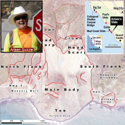 The mud slide just S of the main body of the larger Mud Creek slide has been named Arlene's
Slide by Caltrans (approx 001 MON 8.956). This is in honor of
flagger Arleen Guzzie. It was Guzzie that noticed a hairline crack in the
asphalt near where she was parking her truck to control busy Route 1
traffic along the Big Sur coast. Each day, the crack widened. And grew
longer. She watched as a pretty orange nasturtium flower slowly crept,
oddly, down the ridge. Guzzie told her supervisors: The land is sinking.
Now that 300-foot-wide failing flank of mountain bears her name —
Arleen’s Slide — forever etched into official Caltrans maps
and Big Sur’s history books. For years, as the steep Santa Lucia
Mountains crumble toward the ocean, a warm and gracious Guzzie has stood
between frustrated drivers and deadly boulders. Arleen’s Slide
— along with the much larger Mud Creek slide — have shut down
the dangerous stretch of Route 1 for at least a year. At the edge of
almost every major pile of detritus along the route, she’s been
there — cautiously waving drivers through, or telling them they can
go no further.
The mud slide just S of the main body of the larger Mud Creek slide has been named Arlene's
Slide by Caltrans (approx 001 MON 8.956). This is in honor of
flagger Arleen Guzzie. It was Guzzie that noticed a hairline crack in the
asphalt near where she was parking her truck to control busy Route 1
traffic along the Big Sur coast. Each day, the crack widened. And grew
longer. She watched as a pretty orange nasturtium flower slowly crept,
oddly, down the ridge. Guzzie told her supervisors: The land is sinking.
Now that 300-foot-wide failing flank of mountain bears her name —
Arleen’s Slide — forever etched into official Caltrans maps
and Big Sur’s history books. For years, as the steep Santa Lucia
Mountains crumble toward the ocean, a warm and gracious Guzzie has stood
between frustrated drivers and deadly boulders. Arleen’s Slide
— along with the much larger Mud Creek slide — have shut down
the dangerous stretch of Route 1 for at least a year. At the edge of
almost every major pile of detritus along the route, she’s been
there — cautiously waving drivers through, or telling them they can
go no further.
(Source: Mercury News, 6/25/2017)
 The portion of Route 1 in the County of Monterey from PM MON R75.5 to PM MON R76.5 is
named the “Sergeant 1st Class Sean K. Mitchell Memorial Highway”.
It was named in memory of Sergeant 1st Class Sean K. Mitchell, who died
July 7, 2007 from an injury sustained during a sandstorm while supporting
operations for the Trans-Sahara Counterterrorism Partnership in Kidal,
Mali. Sgt. 1st Class Mitchell was the team leader for Special Operations
Team Alpha 013, Military Intelligence Detachment, Headquarters Support
Company, 1st Battalion, 10th Special Forces Group (Airborne), Stuttgart,
Germany. Born in April 1972, Sgt. 1st Class Mitchell was raised in the
City of Monterey, where he received an Associates of Arts in 2002 in both
Russian and Serbo-Croatian from the Defense Language Institute (DLI),
Foreign Language Center, Monterey. Sgt. 1st Class Mitchell entered the
service in 1997 and received his basic training at Fort Leonard Wood,
Missouri; he then attended the DLI Basic Russian Course at the Presidio of
the City of Monterey, and completed his Advanced Individual Training at
Goodfellow Air Force Base in San Angelo, Texas, in 1999 and was assigned
Bravo Company, 1st Military Intelligence Battalion, Wiesbaden, Germany.
After returning to DLI and completing the Basic Serbo-Croatian Course,
Sgt. 1st Class Mitchell volunteered for airborne duty in 2002 and followon
assignment to the 1st Battalion, 10th Special Forces Group (Airborne),
where he deployed to various locations in Africa and the Balkans, and
served multiple combat tours in Afghanistan. Sgt. 1st Class
Mitchell’s military education also includes the Warrior Leader
Course, Basic Noncommissioned Officer (NCO) Course, Basic Airborne Course,
and the Patrol Medic and Vehicle Reconnaissance Courses. Sgt. 1st Class
Mitchell’s awards and decorations include the Meritorious Service
Medal, Joint Service Commendation Medal with bronze oak leaf cluster, Army
Commendation Medal, Joint Service Achievement Medal, Army Achievement
Medal, Army Good Conduct Medal with 3 knots, National Defense Service
Medal, Armed Forces Expeditionary Medal, Kosovo Campaign Medal, Global War
on Terrorism Service Medal, Armed Forces Service Medal, NCO Professional
Development Ribbon with numeral 2, Army Service Ribbon, Overseas Service
Ribbon, NATO Medal with bronze star device, and the Malian Cross of Valor.
Named by Assembly Resolution ACR 204, Res. Chapter 167, 08/30/22.
The portion of Route 1 in the County of Monterey from PM MON R75.5 to PM MON R76.5 is
named the “Sergeant 1st Class Sean K. Mitchell Memorial Highway”.
It was named in memory of Sergeant 1st Class Sean K. Mitchell, who died
July 7, 2007 from an injury sustained during a sandstorm while supporting
operations for the Trans-Sahara Counterterrorism Partnership in Kidal,
Mali. Sgt. 1st Class Mitchell was the team leader for Special Operations
Team Alpha 013, Military Intelligence Detachment, Headquarters Support
Company, 1st Battalion, 10th Special Forces Group (Airborne), Stuttgart,
Germany. Born in April 1972, Sgt. 1st Class Mitchell was raised in the
City of Monterey, where he received an Associates of Arts in 2002 in both
Russian and Serbo-Croatian from the Defense Language Institute (DLI),
Foreign Language Center, Monterey. Sgt. 1st Class Mitchell entered the
service in 1997 and received his basic training at Fort Leonard Wood,
Missouri; he then attended the DLI Basic Russian Course at the Presidio of
the City of Monterey, and completed his Advanced Individual Training at
Goodfellow Air Force Base in San Angelo, Texas, in 1999 and was assigned
Bravo Company, 1st Military Intelligence Battalion, Wiesbaden, Germany.
After returning to DLI and completing the Basic Serbo-Croatian Course,
Sgt. 1st Class Mitchell volunteered for airborne duty in 2002 and followon
assignment to the 1st Battalion, 10th Special Forces Group (Airborne),
where he deployed to various locations in Africa and the Balkans, and
served multiple combat tours in Afghanistan. Sgt. 1st Class
Mitchell’s military education also includes the Warrior Leader
Course, Basic Noncommissioned Officer (NCO) Course, Basic Airborne Course,
and the Patrol Medic and Vehicle Reconnaissance Courses. Sgt. 1st Class
Mitchell’s awards and decorations include the Meritorious Service
Medal, Joint Service Commendation Medal with bronze oak leaf cluster, Army
Commendation Medal, Joint Service Achievement Medal, Army Achievement
Medal, Army Good Conduct Medal with 3 knots, National Defense Service
Medal, Armed Forces Expeditionary Medal, Kosovo Campaign Medal, Global War
on Terrorism Service Medal, Armed Forces Service Medal, NCO Professional
Development Ribbon with numeral 2, Army Service Ribbon, Overseas Service
Ribbon, NATO Medal with bronze star device, and the Malian Cross of Valor.
Named by Assembly Resolution ACR 204, Res. Chapter 167, 08/30/22.
(Image source: LA Times)
 The portion of Route 1 between Exit 406 for Lightfighter Drive, MON R82.759,
and Exit 404 for Fremont Boulevard and Del Monte Boulevard, MON R80.970,
in the City of Seaside is named the “Staff Sergeant Robert Scott
Johnson Memorial Highway”. It was named in memory of Robert
Scott Johnson, who was born in February 1981, in Monterey, California.
Robert was raised in the Monterey Peninsula community in the County of
Monterey, California, and was a proud product of the Monterey Peninsula
Unified School District. Robert volunteered to serve his country, joining
the United States Army at 18 years of age, completed basic training and
advanced individual training as a Chemical Operations Specialist, and
received his certificate in Toxic Agent Training at Fort Leonard Wood,
Missouri, on December 10, 1999, quickly adapting and excelling in the
military. Specialist Robert Scott Johnson was awarded the Army Achievement
Medal for his dedication to duty and outstanding performance from January
8, 2000, to April 15, 2002, which greatly reflected upon himself, the 172D
Chemical Company, the 541st Maintenance Battalion, the 24th Infantry
Division, and the United States Army. Specialist Johnson was also awarded
the Army Commendation Medal by the Secretary of the Army for meritorious
service while assigned as a Decontamination Specialist from April 12,
2002, to April 11, 2003. Specialist Johnson was promoted from Specialist
to the rank of Sergeant as a noncommissioned officer on February 1, 2003.
He was selected for, attended, and, on March 12, 2003, graduated from the
Eighth Army Wightman Noncommissioned Officers Academy, Korea, and was
awarded a Letter of Commendation on March 12, 2003, for his outstanding
performance during the Army’s physical fitness test by the Command
Sergeant Major, Commandant Noncommissioned Officers Academy, Camp Jackson,
Korea. He also was awarded a Letter of Commendation on March 12, 2003, for
achieving “Academic Excellence” as a result of his desire to
excel and his demonstrated ability in a garrison and field environment,
earning the right to be placed on the Noncommissioned Officers Academy
“Commandant’s List”. He was assigned for overseas
deployment to Iraq in fall 2004. Staff Sergeant Johnson was awarded the
Purple Heart on December 22, 2004, for wounds received in action on
December 21, 2004, and the Bronze Star Medal by the for meritorious
service while assigned to Alpha Company, 1st Battalion, 24th Infantry
Regiment, 1st Brigade, 25th Infantry Division. He gave the ultimate
sacrifice during operations supporting Operation Iraqi Freedom. Staff
Sergeant Robert Scott Johnson, Company A, 1st Battalion, 24th Infantry
Regiment, 1st Brigade, 25th Infantry Division, Multi-National Corps, was
posthumously awarded the Combat Action Badge on June 3, 2005, by the Chief
of the Military Awards Branch for actively engaging, or being engaged by,
the enemy. Named by Assembly Resolution ACR 47, Res. Chapter 135, Statutes of 2021, 09/17/21.
The portion of Route 1 between Exit 406 for Lightfighter Drive, MON R82.759,
and Exit 404 for Fremont Boulevard and Del Monte Boulevard, MON R80.970,
in the City of Seaside is named the “Staff Sergeant Robert Scott
Johnson Memorial Highway”. It was named in memory of Robert
Scott Johnson, who was born in February 1981, in Monterey, California.
Robert was raised in the Monterey Peninsula community in the County of
Monterey, California, and was a proud product of the Monterey Peninsula
Unified School District. Robert volunteered to serve his country, joining
the United States Army at 18 years of age, completed basic training and
advanced individual training as a Chemical Operations Specialist, and
received his certificate in Toxic Agent Training at Fort Leonard Wood,
Missouri, on December 10, 1999, quickly adapting and excelling in the
military. Specialist Robert Scott Johnson was awarded the Army Achievement
Medal for his dedication to duty and outstanding performance from January
8, 2000, to April 15, 2002, which greatly reflected upon himself, the 172D
Chemical Company, the 541st Maintenance Battalion, the 24th Infantry
Division, and the United States Army. Specialist Johnson was also awarded
the Army Commendation Medal by the Secretary of the Army for meritorious
service while assigned as a Decontamination Specialist from April 12,
2002, to April 11, 2003. Specialist Johnson was promoted from Specialist
to the rank of Sergeant as a noncommissioned officer on February 1, 2003.
He was selected for, attended, and, on March 12, 2003, graduated from the
Eighth Army Wightman Noncommissioned Officers Academy, Korea, and was
awarded a Letter of Commendation on March 12, 2003, for his outstanding
performance during the Army’s physical fitness test by the Command
Sergeant Major, Commandant Noncommissioned Officers Academy, Camp Jackson,
Korea. He also was awarded a Letter of Commendation on March 12, 2003, for
achieving “Academic Excellence” as a result of his desire to
excel and his demonstrated ability in a garrison and field environment,
earning the right to be placed on the Noncommissioned Officers Academy
“Commandant’s List”. He was assigned for overseas
deployment to Iraq in fall 2004. Staff Sergeant Johnson was awarded the
Purple Heart on December 22, 2004, for wounds received in action on
December 21, 2004, and the Bronze Star Medal by the for meritorious
service while assigned to Alpha Company, 1st Battalion, 24th Infantry
Regiment, 1st Brigade, 25th Infantry Division. He gave the ultimate
sacrifice during operations supporting Operation Iraqi Freedom. Staff
Sergeant Robert Scott Johnson, Company A, 1st Battalion, 24th Infantry
Regiment, 1st Brigade, 25th Infantry Division, Multi-National Corps, was
posthumously awarded the Combat Action Badge on June 3, 2005, by the Chief
of the Military Awards Branch for actively engaging, or being engaged by,
the enemy. Named by Assembly Resolution ACR 47, Res. Chapter 135, Statutes of 2021, 09/17/21.
(Image source: Find a Grave)
 The portion of Route 1 from Struve Road (001 MON 98.35) to the
Pajaro River (001 MON R101.98), including the new Salinas Road
overcrossing, in the County of Monterey, is named the "Senator Henry
J. Mello Highway". It was named in honor of State Senator Henry J.
Mello, who was born and raised in Watsonville, was the son of Portuguese
immigrant parents, and attended Watsonville High School in Watsonville and
Hartnell College in Salinas. In the 1940s, Henry Mello helped start the
Mello Packing Company, a family apple business, and became involved in
public service as a member of the California Agricultural Advisory Board.
Henry Mello was elected as a Santa Cruz County supervisor in 1966, to the
Assembly in 1976, and to the Senate in 1980, and represented the Counties
of Santa Cruz and San Benito, as well as parts of the Counties of Monterey
and Santa Clara in the Legislature until 1996. Henry Mello quickly rose to
leadership positions by his appointment to the Senate Rules Committee and
his election as Majority Whip and later as Majority Leader, and authored
726 bills, of which 456 were signed into law, with 120 of those bills
focused on senior issues. Henry Mello was proud of his creation of the
California Senior Legislature and authorship of legislation dealing with
Alzheimers, including bills on respite care, adult day health care, and
prevention of senior abuse. Henry Mello was known by his colleagues as a
tough negotiator and for his dedication to his district and constituents.
After leaving the Senate, Henry Mello worked with the Department of
Transportation to prioritize the construction of one of the most important
projects within the state highway system, an overpass to improve traffic
safety on the dangerous intersection of Route 1 and Salinas Road. Named by
Assembly Concurrent Resolution 67, Resolution Chapter 141, on September 2,
2014.
The portion of Route 1 from Struve Road (001 MON 98.35) to the
Pajaro River (001 MON R101.98), including the new Salinas Road
overcrossing, in the County of Monterey, is named the "Senator Henry
J. Mello Highway". It was named in honor of State Senator Henry J.
Mello, who was born and raised in Watsonville, was the son of Portuguese
immigrant parents, and attended Watsonville High School in Watsonville and
Hartnell College in Salinas. In the 1940s, Henry Mello helped start the
Mello Packing Company, a family apple business, and became involved in
public service as a member of the California Agricultural Advisory Board.
Henry Mello was elected as a Santa Cruz County supervisor in 1966, to the
Assembly in 1976, and to the Senate in 1980, and represented the Counties
of Santa Cruz and San Benito, as well as parts of the Counties of Monterey
and Santa Clara in the Legislature until 1996. Henry Mello quickly rose to
leadership positions by his appointment to the Senate Rules Committee and
his election as Majority Whip and later as Majority Leader, and authored
726 bills, of which 456 were signed into law, with 120 of those bills
focused on senior issues. Henry Mello was proud of his creation of the
California Senior Legislature and authorship of legislation dealing with
Alzheimers, including bills on respite care, adult day health care, and
prevention of senior abuse. Henry Mello was known by his colleagues as a
tough negotiator and for his dedication to his district and constituents.
After leaving the Senate, Henry Mello worked with the Department of
Transportation to prioritize the construction of one of the most important
projects within the state highway system, an overpass to improve traffic
safety on the dangerous intersection of Route 1 and Salinas Road. Named by
Assembly Concurrent Resolution 67, Resolution Chapter 141, on September 2,
2014.
(Image Source: Tweet from Jason Hoppin, 7/24/2015; Official Photo)
Ocean Shore Highway is the designation given to the route that was constructed by the Joint Highway District 9, running between Santa Cruz and San Francisco.
 The portion of Route 1 between 0.1 mile north of Green Valley
Road/Harkins Slough Road (001 SCR R2.349) and 0.1 mile north of the Pajaro
River bridge (001 MON R102.08) is named the "CHP Officer John Pedro
Memorial Freeway." It was named in memory of CHP Officer John Pedro
(1965-2002) from Watsonville, California. John Pedro served in the United
States in the Army Reserves from 1987 to 1997, and served in the Air Force
Reserves from 1991 to the time of his death. He played in the band for the
Air Force. He joined the California Highway Patrol on July 31, 1989, as a
cadet and graduated from the California Highway Patrol Academy on December
21, 1989. After he graduated from the Academy, John Pedro was assigned to
the San Jose area, and he was transferred in 1992 to the Redwood City
area, in 1993 back to San Jose area, and in 1994 to the Santa Cruz area.
On June 3, 2002, John Pedro was killed, while on duty, in a traffic
collision. Named by Senate Concurrent Resolution 67, July 16, 2004,
Chapter 118.
The portion of Route 1 between 0.1 mile north of Green Valley
Road/Harkins Slough Road (001 SCR R2.349) and 0.1 mile north of the Pajaro
River bridge (001 MON R102.08) is named the "CHP Officer John Pedro
Memorial Freeway." It was named in memory of CHP Officer John Pedro
(1965-2002) from Watsonville, California. John Pedro served in the United
States in the Army Reserves from 1987 to 1997, and served in the Air Force
Reserves from 1991 to the time of his death. He played in the band for the
Air Force. He joined the California Highway Patrol on July 31, 1989, as a
cadet and graduated from the California Highway Patrol Academy on December
21, 1989. After he graduated from the Academy, John Pedro was assigned to
the San Jose area, and he was transferred in 1992 to the Redwood City
area, in 1993 back to San Jose area, and in 1994 to the Santa Cruz area.
On June 3, 2002, John Pedro was killed, while on duty, in a traffic
collision. Named by Senate Concurrent Resolution 67, July 16, 2004,
Chapter 118.
(Image Source: Flikr - Navymailman 4/3/2011; Officer Down Memorial Page: John Pedro)
 The portion of Route 1 from the Park Avenue Undercrossing
(001 SCR 12.09) to Branciforte Avenue Overcrossing (001 SCR 16.43) in the
County of Santa Cruz is named the "CHP Officer A. Donald Hoover
Memorial Highway." It was named in memory of Officer A. Donald
Hoover, who was born on January 1, 1903, in Wichita, Kansas, to John and
Pearl Hoover. Officer Hoover was an eight-year veteran of the CHP, and
served in the County of Santa Cruz. Officer Hoover was killed on August
31, 1934, while traveling on the Santa Cruz-Watsonville Highway, on a
stretch known to locals as “Slaughterhouse Curve,” when his
motorcycle collided with an automobile, traveling in the opposite
direction, that began turning onto a side road in front of him. The impact
of the collision caused Officer Hoover to lose and never regain
consciousness. Officer Hoover’s dedication and service will be
remembered throughout the CHP and law enforcement community for years, as
the loss was not just to family, friends, and coworkers, but to the entire
community and the state that Officer Hoover served.Named by Assembly
Concurrent Resolution 100, Resolution Chapter 109, on September 4, 2012.
The portion of Route 1 from the Park Avenue Undercrossing
(001 SCR 12.09) to Branciforte Avenue Overcrossing (001 SCR 16.43) in the
County of Santa Cruz is named the "CHP Officer A. Donald Hoover
Memorial Highway." It was named in memory of Officer A. Donald
Hoover, who was born on January 1, 1903, in Wichita, Kansas, to John and
Pearl Hoover. Officer Hoover was an eight-year veteran of the CHP, and
served in the County of Santa Cruz. Officer Hoover was killed on August
31, 1934, while traveling on the Santa Cruz-Watsonville Highway, on a
stretch known to locals as “Slaughterhouse Curve,” when his
motorcycle collided with an automobile, traveling in the opposite
direction, that began turning onto a side road in front of him. The impact
of the collision caused Officer Hoover to lose and never regain
consciousness. Officer Hoover’s dedication and service will be
remembered throughout the CHP and law enforcement community for years, as
the loss was not just to family, friends, and coworkers, but to the entire
community and the state that Officer Hoover served.Named by Assembly
Concurrent Resolution 100, Resolution Chapter 109, on September 4, 2012.
(Image Source: Santa Cruz Patch, 8/21/2013; Calif. Assn. of Hwy. Patrolmen: Donald Hoover)
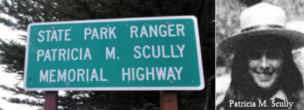 The portion of Route 1 between Route 84 (San Gregorio
Road) at SM 18.189 and Verde Road/Lobitos Creek Road at SM 22.662, is
named the "Ranger Patricia M. Scully Memorial Highway". Named in
memory of California Parks and Recreation Service Ranger Patricia M.
Scully, who was born in April 1951, in Sacramento, California, to Patrick
and Eileen Scully. She was raised on a poultry ranch owned by the Scully
family in Rio Linda, California. Ranger Scully graduated from Rio Linda
High School in June of 1969. She attended American River College for two
years where she played on the field hockey team with her sister Mary, and
then transferred to California State University, Sacramento, where she
received her bachelor of arts degree in social science and anthropology
(archaeology) in January 1974. She was an outstanding student and received
scholarships and awards of merit for her academic achievements. At the
time of her untimely death, Ranger Scully was working on a master of
science degree in anthropology and environmental resources at California
State University, Sacramento, and had completed all coursework and lacked
only a thesis. Ranger Scully joined the California Parks and Recreation
Service in 1974, now named the Department of Parks and Recreation. In late
1974, she graduated from the Parks and Recreation Academy (the Mott
Training Center in Asilomar) after six weeks of training. She was one of
two women among the 38 cadets in academy class 18. Her first assignment
after graduation was to the Big Basin State Park where she received
additional (interpretative) training. Ranger Scully’s last
assignment was as a State Park Ranger 1 at the Pescadero State Park in
Half Moon Bay on the San Mateo coast. When not working, she worked on a
historical survey of Ano Nuevo State Beach. She was dedicated to the
preservation of the environment and the education of the park visitor. She
was a nine-year veteran of the Department of Parks and Recreation at the
time of her death. While on patrol at San Mateo Coast State Beaches, Half
Moon Bay, Ranger Scully was killed by a drunk driver on May 6, 1976. She
became the second female law enforcement officer to be killed in
California. This segment was named to recognize Ranger Scully’s
years of dedicated service to the Department of Parks and Recreation and
to raise awareness about the service risks present to all peace officers,
including rangers with the Department of Parks and Recreation. Named by
Senate Concurrent Resolution 102, Resolution Chapter 120, on September 10,
2012.
The portion of Route 1 between Route 84 (San Gregorio
Road) at SM 18.189 and Verde Road/Lobitos Creek Road at SM 22.662, is
named the "Ranger Patricia M. Scully Memorial Highway". Named in
memory of California Parks and Recreation Service Ranger Patricia M.
Scully, who was born in April 1951, in Sacramento, California, to Patrick
and Eileen Scully. She was raised on a poultry ranch owned by the Scully
family in Rio Linda, California. Ranger Scully graduated from Rio Linda
High School in June of 1969. She attended American River College for two
years where she played on the field hockey team with her sister Mary, and
then transferred to California State University, Sacramento, where she
received her bachelor of arts degree in social science and anthropology
(archaeology) in January 1974. She was an outstanding student and received
scholarships and awards of merit for her academic achievements. At the
time of her untimely death, Ranger Scully was working on a master of
science degree in anthropology and environmental resources at California
State University, Sacramento, and had completed all coursework and lacked
only a thesis. Ranger Scully joined the California Parks and Recreation
Service in 1974, now named the Department of Parks and Recreation. In late
1974, she graduated from the Parks and Recreation Academy (the Mott
Training Center in Asilomar) after six weeks of training. She was one of
two women among the 38 cadets in academy class 18. Her first assignment
after graduation was to the Big Basin State Park where she received
additional (interpretative) training. Ranger Scully’s last
assignment was as a State Park Ranger 1 at the Pescadero State Park in
Half Moon Bay on the San Mateo coast. When not working, she worked on a
historical survey of Ano Nuevo State Beach. She was dedicated to the
preservation of the environment and the education of the park visitor. She
was a nine-year veteran of the Department of Parks and Recreation at the
time of her death. While on patrol at San Mateo Coast State Beaches, Half
Moon Bay, Ranger Scully was killed by a drunk driver on May 6, 1976. She
became the second female law enforcement officer to be killed in
California. This segment was named to recognize Ranger Scully’s
years of dedicated service to the Department of Parks and Recreation and
to raise awareness about the service risks present to all peace officers,
including rangers with the Department of Parks and Recreation. Named by
Senate Concurrent Resolution 102, Resolution Chapter 120, on September 10,
2012.
(Image Sources: Half Moon Bay Review, 10/3/2013; OfficerDown
Memorial Page: Patricia Scully)
A portion of Route 1 midway between Pacifica and Montara in San Mateo County (001 SM R38.544 to 001 SM R39.37) is named the "Devil's Slide". The origin of name is not confirmed but believed to come from the practice of prohibition days gangsters using the once-deserted area to dispose of their enemies into the sea at this precipitous location. However, San Mateo County historian Barbara VanderWerf, who has written two books on the area, asserts in Montara Mountain that "Originally, Devil's Slide meant only the promontory and its inland ridge. In the 1880s, travellers in horse-drawn wagons on the Half Moon Bay-Colma Road, which ran along the top of the ocean bluffs, paused to note the chute-like ridge ending in the massive rock dome. They thought it looked fit for a Devil's Slide and named it so." To avoid the slides, there will soon be a tunnel here.
 Route 1 adjacent to and including the future Devil's Slide
Tunnels in San Mateo County (001 SM R38.544 to 001 SM R39.37) is named the
"Tom Lantos Tunnels at Devil's Slide". This segment was named in
memory of Representative Tom Lantos, a member of the United States House
of Representatives between 1981 and 2008. Tom Lantos was born in Budapest,
Hungary, on February 1, 1928, and was 16 years old when Nazi Germany
occupied his native country. Tom Lantos was a member of the anti-Nazi
underground movement and later was part of the anti-Communist student
movement, and is the only Holocaust survivor to ever serve in the United
States Congress. An American by choice, Tom Lantos received a B.A. and
M.A. in economics from the University of Washington and a Ph. D. in
economics from the University of California, Berkeley. For three decades
prior to being elected to the Congress, Tom Lantos was a professor of
economics at San Francisco State University, an international affairs
analyst for public television, and a consultant to a number of Bay Area
businesses, and served in senior advisory roles to members of the United
States Senate. As a member of the House of Representatives, Tom Lantos
worked diligently to address quality of life issues in Bay Area
communities, with a strong record on environmental protection and efforts
to reform the nation's energy policy. As a former professor and chairman
of the Millbrae Board of Education, Tom Lantos has also been a consistent
supporter of public education. Tom Lantos led a major investigation of
waste, fraud, abuse, and mismanagement at the Department of Housing and
Urban Development, and has been a leader in congressional oversight of
federal programs. As Chairman of the House Committee on Foreign Affairs,
Tom Lantos has been a strong voice for responsible international
involvement and an advocate for participation in international
organizations, with an emphasis on human rights, having also founded the
Congressional Human Rights Caucus and served as its cochairman. Tom Lantos
obtained one hundred fifty million dollars ($150,000,000) in federal funds
for construction of a bypass of the hazardous coastal State Highway Route 1 at Devil's Slide and led the bipartisan congressional effort urging the
President to declare the area eligible for federal disaster assistance,
resulting in San Mateo County being eligible for FEMA's Public Assistance
Program that provides 75 percent reimbursement for repair or replacement
of disaster-damaged public facilities. In April 2007, Tom Lantos
successfully pushed for expedited federal small business loans to private,
for-profit coastal area businesses that have lost significant clientele
due to the closure of Route 1, and he was a staunch advocate of the tunnel
project option for the Devil's Slide Bypass, which prevented the
construction of a destructive and environmentally damaging highway bypass
over Montara Mountain, which was the plan initially proposed by the
Department of Transportation and supported by many people. Named by Senate
Concurrent Resolution (SCR) 71, Resolution Chapter 85, on 7/10/2008.
Route 1 adjacent to and including the future Devil's Slide
Tunnels in San Mateo County (001 SM R38.544 to 001 SM R39.37) is named the
"Tom Lantos Tunnels at Devil's Slide". This segment was named in
memory of Representative Tom Lantos, a member of the United States House
of Representatives between 1981 and 2008. Tom Lantos was born in Budapest,
Hungary, on February 1, 1928, and was 16 years old when Nazi Germany
occupied his native country. Tom Lantos was a member of the anti-Nazi
underground movement and later was part of the anti-Communist student
movement, and is the only Holocaust survivor to ever serve in the United
States Congress. An American by choice, Tom Lantos received a B.A. and
M.A. in economics from the University of Washington and a Ph. D. in
economics from the University of California, Berkeley. For three decades
prior to being elected to the Congress, Tom Lantos was a professor of
economics at San Francisco State University, an international affairs
analyst for public television, and a consultant to a number of Bay Area
businesses, and served in senior advisory roles to members of the United
States Senate. As a member of the House of Representatives, Tom Lantos
worked diligently to address quality of life issues in Bay Area
communities, with a strong record on environmental protection and efforts
to reform the nation's energy policy. As a former professor and chairman
of the Millbrae Board of Education, Tom Lantos has also been a consistent
supporter of public education. Tom Lantos led a major investigation of
waste, fraud, abuse, and mismanagement at the Department of Housing and
Urban Development, and has been a leader in congressional oversight of
federal programs. As Chairman of the House Committee on Foreign Affairs,
Tom Lantos has been a strong voice for responsible international
involvement and an advocate for participation in international
organizations, with an emphasis on human rights, having also founded the
Congressional Human Rights Caucus and served as its cochairman. Tom Lantos
obtained one hundred fifty million dollars ($150,000,000) in federal funds
for construction of a bypass of the hazardous coastal State Highway Route 1 at Devil's Slide and led the bipartisan congressional effort urging the
President to declare the area eligible for federal disaster assistance,
resulting in San Mateo County being eligible for FEMA's Public Assistance
Program that provides 75 percent reimbursement for repair or replacement
of disaster-damaged public facilities. In April 2007, Tom Lantos
successfully pushed for expedited federal small business loans to private,
for-profit coastal area businesses that have lost significant clientele
due to the closure of Route 1, and he was a staunch advocate of the tunnel
project option for the Devil's Slide Bypass, which prevented the
construction of a destructive and environmentally damaging highway bypass
over Montara Mountain, which was the plan initially proposed by the
Department of Transportation and supported by many people. Named by Senate
Concurrent Resolution (SCR) 71, Resolution Chapter 85, on 7/10/2008.
(Image Source: Wikipedia)
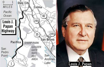 The portion of Route 1 in San Mateo County from the interchange at Skyline
Boulevard (001 SM R46.752) to the southern city limits of the City of
Pacifica (001 SM 40.744) is officially named the "Louis J. Papan
Highway". Louis J. Papan was first elected to the Daly City City
Council in November 1970. In November 1972, he was elected to the
California State Assembly, and was reelected seven times, serving in the
California State Assembly until 1986. He was again elected to the Assembly
in 1996, and was reelected twice, serving as the Dean of the Assembly
until 2002. In the Assembly, Assemblyman Papan was critical in securing
funding for the purchase of Linda Mar Beach and the Pacifica Pier in the
City of Pacifica; and authored legislation necessary to create CalTrain to
serve commuters in San Mateo County. Together with his wife, he founded
John's Closet, a nonprofit organization that to date has helped provide
new clothes for over 7,000 low-income children in San Mateo County. He has
also worked as a tireless and successful advocate for the development and
improvement of all modes of transportation in California; as well as
fighting for the needs of disabled children, and the funding for special
education, child abuse programs. He oversaw the restoration of the
Historic Capitol Building, has served as Chair of the Assembly Committees
on Rules and on Banking and Finance. Named by Assembly Concurrent
Resolution 234, Chapter 176, September 16, 2002. Note: When Papan left
office, he didn't want any accolades -- so other than the naming
resolution, he was "roasted" by the legislature. Assemblywoman Sarah
Reyes, D-Fresno said: "It gives me great pain to stand here and say
something nice about Lou Papan. All I can tell you is I've been down
Highway 1, particularly this stretch, and there is a lot of traffic and a
lot of noise, which is kind of like Lou Papan, and a lot of curves and a
lot of twists and turns, which is kind of like listening to Lou Papan". A
mock analysis of the bill prepared by the staff of the Assembly
Appropriations Committee warned that it would cost $250,000 a year to
replace the signs that would be stolen and cause an additional $300,000 in
increased traffic costs as people flocked to the sign to vandalize it.
Assemblyman Joe Canciamilla, D-Pittsburg, who authored the resolution,
which passed the Assembly 77-0, said, "We have resisted efforts that have
been undertaken by certain parties to make sure this is the one stretch of
California speedway without a posted speed limit." The is a reference to
just one of the things for which Papan gained notoriety -- his fast
driving. He earned the nickname "Leadfoot Lou" in the 1970s when he
received several speeding tickets while driving between Sacramento and his
Peninsula district, where he was coming home every night to be with his
critically ill son, John, and his wife, Irene, who suffered for decades
with a number of serious ailments, including lupus and cancer. And so, the
tribute stands...
The portion of Route 1 in San Mateo County from the interchange at Skyline
Boulevard (001 SM R46.752) to the southern city limits of the City of
Pacifica (001 SM 40.744) is officially named the "Louis J. Papan
Highway". Louis J. Papan was first elected to the Daly City City
Council in November 1970. In November 1972, he was elected to the
California State Assembly, and was reelected seven times, serving in the
California State Assembly until 1986. He was again elected to the Assembly
in 1996, and was reelected twice, serving as the Dean of the Assembly
until 2002. In the Assembly, Assemblyman Papan was critical in securing
funding for the purchase of Linda Mar Beach and the Pacifica Pier in the
City of Pacifica; and authored legislation necessary to create CalTrain to
serve commuters in San Mateo County. Together with his wife, he founded
John's Closet, a nonprofit organization that to date has helped provide
new clothes for over 7,000 low-income children in San Mateo County. He has
also worked as a tireless and successful advocate for the development and
improvement of all modes of transportation in California; as well as
fighting for the needs of disabled children, and the funding for special
education, child abuse programs. He oversaw the restoration of the
Historic Capitol Building, has served as Chair of the Assembly Committees
on Rules and on Banking and Finance. Named by Assembly Concurrent
Resolution 234, Chapter 176, September 16, 2002. Note: When Papan left
office, he didn't want any accolades -- so other than the naming
resolution, he was "roasted" by the legislature. Assemblywoman Sarah
Reyes, D-Fresno said: "It gives me great pain to stand here and say
something nice about Lou Papan. All I can tell you is I've been down
Highway 1, particularly this stretch, and there is a lot of traffic and a
lot of noise, which is kind of like Lou Papan, and a lot of curves and a
lot of twists and turns, which is kind of like listening to Lou Papan". A
mock analysis of the bill prepared by the staff of the Assembly
Appropriations Committee warned that it would cost $250,000 a year to
replace the signs that would be stolen and cause an additional $300,000 in
increased traffic costs as people flocked to the sign to vandalize it.
Assemblyman Joe Canciamilla, D-Pittsburg, who authored the resolution,
which passed the Assembly 77-0, said, "We have resisted efforts that have
been undertaken by certain parties to make sure this is the one stretch of
California speedway without a posted speed limit." The is a reference to
just one of the things for which Papan gained notoriety -- his fast
driving. He earned the nickname "Leadfoot Lou" in the 1970s when he
received several speeding tickets while driving between Sacramento and his
Peninsula district, where he was coming home every night to be with his
critically ill son, John, and his wife, Irene, who suffered for decades
with a number of serious ailments, including lupus and cancer. And so, the
tribute stands...
(Image and Anecdotes Source: SF Gate, 8/22/2002)
Named StructuresBridge 44-053 (MON 32.25), the Lime Creek Bridge in Monterey County, is named the "Harvey Robert Huss Memorial Bridge". It was built in 1975. On February 11, 1973, Harvey “Bobby” Huss, District 5 Maintenance Worker, was battling his way through mud slides on Route 1 near Big Sur to rescue a motorist trapped by the slides. A large culvert at Lafler Canyon plugged up and the water ran over the road and washed it out. Regrettably, the individual who reported the slide did not report that the roadway was gone. When Mr. Huss came around the corner, the road wasn't there, and he fell 300-foot into the canyon below. It was almost a year before his body was recovered. Mr. Huss was posthumously awarded the Medal of Valor, California's highest civilian award for heroism. Named by Assembly Concurrent Resolution 59, Resolution Chapter 33, in 1974.
 The bridge at Burns Creek in the Big Sur area of Monterey County (001 MON 034.24) is officially dedicated to the memory of Thomas M.
Sanders. On June 11, 1991, Thomas Sanders, District 5 Maintenance
Supervisor, was helping CHP direct traffic near the Little Big Sur Bridge
in Monterey County while a tow truck was recovering a car that had gone
over the cliff. A driver, under the influence of drugs, crashed into a
truck that had slowed down due to the recovery efforts. After exchanging
information with the driver, she got back into her car and drove towards
the controlled lane closure. She ignored the closure and continued driving
through a series of cones, narrowly missing a CHP Officer. The officer
attempted to pull her over, but she continued up the highway, drifting
onto the shoulder striking Mr. Sanders. She then collided with the guard
rail and careened across the two lanes coming to a stop. She tried to
leave again, but was stopped by bystanders who took her keys. Mr. Sanders
was rushed to the hospital, but succumbed to his injuries that evening.
Named by Senate Concurrent Resolution No. 48, Chapter 107, in 1997.
The bridge at Burns Creek in the Big Sur area of Monterey County (001 MON 034.24) is officially dedicated to the memory of Thomas M.
Sanders. On June 11, 1991, Thomas Sanders, District 5 Maintenance
Supervisor, was helping CHP direct traffic near the Little Big Sur Bridge
in Monterey County while a tow truck was recovering a car that had gone
over the cliff. A driver, under the influence of drugs, crashed into a
truck that had slowed down due to the recovery efforts. After exchanging
information with the driver, she got back into her car and drove towards
the controlled lane closure. She ignored the closure and continued driving
through a series of cones, narrowly missing a CHP Officer. The officer
attempted to pull her over, but she continued up the highway, drifting
onto the shoulder striking Mr. Sanders. She then collided with the guard
rail and careened across the two lanes coming to a stop. She tried to
leave again, but was stopped by bystanders who took her keys. Mr. Sanders
was rushed to the hospital, but succumbed to his injuries that evening.
Named by Senate Concurrent Resolution No. 48, Chapter 107, in 1997.
(Image source: Caltrans HQ Facebook post)
 Business Routes Freeway
[SHC 253.2] From Route 101 near San Luis Obispo to San Simeon; the northern limits of Carmel to the west city limits of Santa Cruz; the Higgins-Purisima Road to Route 280 south of San Francisco. Constructed as freeway for 5 miles near Morro Bay, from Route 68 to Route 156, from south of Watsonville to Santa Cruz, and from Pacifica to Route 280. Added to the Freeway and Expressway system in 1959 (Chapter 1062).
National Trails This route is part of the De Anza National Historic Trail.
Scenic Route Classified Landcaped FreewayThe following segments are designated as Classified Landscaped Freeway:
| County | Route | Starting PM | Ending PM |
| San Luis Obispo | 1 | 28.56 | 28.89 |
| San Luis Obispo | 1 | 30.01 | 30.24 |
| Monterey | 1 | 74.91 | R84.60 |
| Santa Cruz | 1 | R0.00 | R1.59 |
| Santa Cruz | 1 | R1.74 | R3.37 |
| Santa Cruz | 1 | R3.37 | R3.52 |
| Santa Cruz | 1 | 7.83 | 9.68 |
| Santa Cruz | 1 | 10.22 | 11.18 |
| Santa Cruz | 1 | 11.88 | 13.32 |
| Santa Cruz | 1 | 13.39 | 14.98 |
| Santa Cruz | 1 | 15.09 | 17.41 |
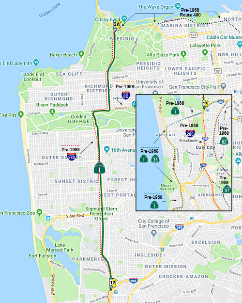 Route 280 near the south boundary of the City and County of San Francisco to
Route 101 near the approach to the Golden Gate Bridge in San Francisco.
Route 280 near the south boundary of the City and County of San Francisco to
Route 101 near the approach to the Golden Gate Bridge in San Francisco.
Post 1964 Signage HistoryThe original definition of this section in 1963 was "A connection from Route 280 to Route 82 near the south boundary of the City and County of San Francisco." In 1968, Chap. 282 changed the routing, moving a routing of Route 1 from Route 280 to Route 82 was transferred to Route 280. This portion of the routing was part of the "Southern Freeway", and was the LRN 225 portion of I-280. As a result, the definition was changed to "Route 280 near the south boundary of the City and County of San Francisco to Route 480 in San Francisco."
In 1991, Chap. 493 reflected the deletion of Route 480, changing the end of the segment to "Route 101 near the approach to the Golden Gate Bridge in San Francisco."
Shortly N of this portion, there appears to have been an alternate routing where Route 1 would have diverged from 19th Avenue, ran slightly to the East, moving to meet the Crosstown Freeway, and then continuing North to the Golden Gate approach. It appears that this routing was, at one time, planned for freeway construction as the "Park Presidio Freeway" and "Junipero Serra Freeway". It appears to have been part of a 1955 traffic plan, which was later deleted as freeway.
There are still remnants of this planning in the segment of Route 1 between 19th Ave. and I-280 Interchange, built in the early 1950s. It is hypothesized that this quasi-freeway section was to have been part of the extension of the Junipero Serra Freeway to Golden Gate Park, and of the Park Presidio Freeway going to the Golden Gate Bridge and eventually to Novato. There are two interchanges on this small stub of freeway, Brotherhood Way and Alemany Boulevard. This segment appears to have been planned to be I-280.
Pre 1964 Signage History This segment was first defined as part of LRN 56 in 1933.
In 1934, this segment was signed as part of signed Route 1 (Jct. US 101 at Las Cruces, via Cambria, Santa Cruz, San Francisco, Pt. Reyes, and Westport to US 101 at Fortuna).
In 1938, before construction of the tunnel through the Presedio, there was a different routing N of Golden Gate Park. This routing ran E along Fulton to Van Ness, where it joined the US 101 routing N along Van Ness and Lombard and Richardson into the Presedio and to the Golden Gate.
The Oct 1934 California Highways & Public Works described the local
importance of Junipero Serra Boulevard, citing a new extension of 19th
Avenue from Sloat Boulevard southward as a feeder road to existing
Junipero Serra Boulevard near the San Mateo County Line. A further
State Highway extension via 19th Avenue and Funston Avenue towards the
Golden Gate Bridge site is also cited. By 1936, a Shell Oil map from
Gousha was showing the following routing for Route 1 from the San Mateo
County Line north to the Hyde Street Pier:
(Source: Gribblenation Blog (Tom Fearer), “The original alignment of California State Route 1 in San Francisco”, February 2021)
In the 1940s, Route 1 through Golden Gate Park was widened on on 19th
Avenue, and was a divided highway through Golden Gate Park. This work was
performed via a Work Progress Administration project. Through the
park itself, Route 1 was not state maintained as part of LRN 56. It
was aligned along the western and northern shores of Stow Lake in Golden
Gate Park. With the completion of the Golden Gate Park segment and
widening of 19th Avenue the present alignment of Route 1 in San Francisco
took shape.
(Source: Gribblenation Blog (Tom Fearer), “The original alignment of California State Route 1 in San Francisco”, February 2021)
In 1938, before construction of the tunnel through the Presidio, there was a different routing N of Golden Gate Park. This routing ran E along Fulton to Van Ness, where it joined the US 101 routing N along Van Ness and Lombard and Richardson into the Presidio and to the Golden Gate.
In 1939, there was ongoing construction of the "Park-Presidio Boulevard"
approach to the Golden Gate Bridge. Negotiations for construction
through the Presidio began in 1935 between the; Military, Golden Gate
Bridge & Highway District and City of San Francisco with the Division
of Highways not taking part. In 1937 the Division of Highways
assumed control the Presidio connector to the Golden Gate Bridge and also
took over negotiations with the Military. Construction through the
Presidio was issued via Military permit to the Division of Highways on
July 27th, 1938. An U.S. Army requirement was for the Presidio
project to be fully limited access through the military reservation.
There was to be a 1300' tunnel under the Presidio Golf Course. Completion
was anticipated for April 1940.
(Source: Gribblenation Blog (Tom Fearer), “The original alignment of California State Route 1 in San Francisco”, February 2021)
In 1958, it was reported in CHPW that, as a portion of the future Golden Gate Freeway, design is underway for a 1.3-mile-long project on Route 1 extending between the Park Presidio Freeway and the Marina approach to the Golden Gate Bridge. This project would have widened the present freeway to eight lanes and revise the interchange at the junction of US 101 and Route 1.
StatusThere appear to be some plans to make a portion of this route an underground tollway. The San Francisco Chronicle published an article on 2/18/2001 where it indicated that transportation planners "said the city should look into building "supercorridor" roads under Van Ness Avenue, 19th Avenue, and Fell and Oak streets." The suggested 19th Avenue tunnel would run five miles, from Junipero Serra Boulevard (apx 001 SF R0.675) through Golden Gate Park and up to Lake Street (apx 001 SF 5.877), with exits at Brotherhood Way, Ocean Avenue, Quintara Street, Lincoln Way and Geary Boulevard. The Van Ness tunnel would run almost two miles, from about Fell to Lombard Street, with exits at Broadway and Geary Boulevard. Along Oak and Fell, the planners suggest an underground road running more than half a mile from Laguna to Divisadero streets. However, the roads would would violate the long-standing general plan for San Francisco, which calls for no new highway capacity.
In April 2021, it was reported that the San Francisco Municipal
Transportation Agency’s Board of Directors approved adding temporary
HOV lines to segments of Route 1 and US 101 cutting through the Richmond
District and Cow Hollow. The temporary lanes are the latest in a nearly
yearlong effort by the city’s largest transit agency to increase
reliability as the pandemic reduced public transit services and turned
more San Franciscans to getting around by car. The plan reserves the lanes
closest to the curb for high-occupancy vehicles on stretches of these
three-lane corridors. The HOV lanes would be implemented on Route 1 from
the beginning of Crossover Drive and Lincoln Way through Golden Gate Park
and on Park Presidio Boulevard past Lake Street. The remaining lanes would
be unaffected. For US 101, a temporary HOV lane would be installed on
Lombard Street and Richardson Avenue, running from Lyon Street to Van Ness
Avenue.
(Source: $
SF Chronicle, 4/20/2021)
NamingOfficially named "Cabrillo Highway" per SHC 635.
Route 1 and Rout 101 from Lake Street (at Route 1) in San Francisco to Waldo Point (Jct Route 1/US 101, north end of Sausalito) across the Golden Gate Bridge is named the "Golden Gate Bridge Freeway". It was named by Senate Concurrent Resolution 11, Chapter 39 in 1954. This was originally planned to run along 19th Street in San Francisco.
Named Structures Tunnel 34-016, at Park Presidio Blvd in San Francisco
through the Presidio of San Francisco between Lake Street and Golden Gate
Bridge is named the "General Douglas MacArthur Tunnel". The tunnel
was constructed from 1938-1940 as part of the "Funston Avenue Approach" to
the Golden Gate Bridge. It opened, with the rest of the Funston Approach,
on April 22, 1940. It was named by Senate Concurrent Resolution 86,
Chapter 94 in 1986. Douglas MacArthur (1880-1964) was a brilliant and
controversial five-star U.S. Army General. Strongly dedicated to country
and duty, and gifted with superior command ability, MacArthur's military
service included important command assignments in the both World Wars and
the Korean War. During World War One, MacArthur commanded the 42nd
"Rainbow" Division of the Allied Expeditionary Force in France. After the
War, MacArthur was superintendant of West Point from 1919-1922. In January
of 1930 he was promoted to full General, 4 stars and named the U.S. Army's
Chief of Staff. MacArthur retired from the Army in 1937, one year after
the President of the Phillipines, Manuel Quezon, appointed him Field
Marshall of the Phillipine Army. In 1941 MacArthur was recalled to active
duty as the U.S. prepared to enter World War Two. By 1942 MacArthur was
Supreme Allied Commander of the Southwest Pacific theater. In January of
1945, MacArthur was promoted to the rank of five star General. On
September 2, 1945 on board the USS Missouri in Tokyo Bay, MacArthur
accepted Japan's unconditional surrender. In June 1950, with the beginning
of the Korean War, MacArthur was appointed the Supreme United Nations
commander. However, on April 11, 1951 he was relieved of his command by
President Truman. This tunnel had been previously unofficially named as
the "Presidio Tunnel", as it passes through the Presidio.
Tunnel 34-016, at Park Presidio Blvd in San Francisco
through the Presidio of San Francisco between Lake Street and Golden Gate
Bridge is named the "General Douglas MacArthur Tunnel". The tunnel
was constructed from 1938-1940 as part of the "Funston Avenue Approach" to
the Golden Gate Bridge. It opened, with the rest of the Funston Approach,
on April 22, 1940. It was named by Senate Concurrent Resolution 86,
Chapter 94 in 1986. Douglas MacArthur (1880-1964) was a brilliant and
controversial five-star U.S. Army General. Strongly dedicated to country
and duty, and gifted with superior command ability, MacArthur's military
service included important command assignments in the both World Wars and
the Korean War. During World War One, MacArthur commanded the 42nd
"Rainbow" Division of the Allied Expeditionary Force in France. After the
War, MacArthur was superintendant of West Point from 1919-1922. In January
of 1930 he was promoted to full General, 4 stars and named the U.S. Army's
Chief of Staff. MacArthur retired from the Army in 1937, one year after
the President of the Phillipines, Manuel Quezon, appointed him Field
Marshall of the Phillipine Army. In 1941 MacArthur was recalled to active
duty as the U.S. prepared to enter World War Two. By 1942 MacArthur was
Supreme Allied Commander of the Southwest Pacific theater. In January of
1945, MacArthur was promoted to the rank of five star General. On
September 2, 1945 on board the USS Missouri in Tokyo Bay, MacArthur
accepted Japan's unconditional surrender. In June 1950, with the beginning
of the Korean War, MacArthur was appointed the Supreme United Nations
commander. However, on April 11, 1951 he was relieved of his command by
President Truman. This tunnel had been previously unofficially named as
the "Presidio Tunnel", as it passes through the Presidio.
(Information on General MacArthur from http://members.tripod.com/~DARTO/macarthur/macarthur.html; Image source: Biography.Com)
 Double Fine Zones
Route 1 between Junipero Serra Boulevard and Lake Street in the City and County of San Francisco, per Senate Bill 1419, Chapter 121, July 10, 2008.
Freeway[SHC 253.2] From Route 280 to the San Francisco county line.
Scenic Route[SHC 263.2] From Route 35 in San Francisco to Route 101 near the approach to the Golden Gate Bridge in San Francisco.
Classified Landcaped FreewayThe following segments are designated as Classified Landscaped Freeway:
| County | Route | Starting PM | Ending PM |
| San Mateo | 1 | R43.21 | R45.12 |
| San Mateo | 1 | R45.28 | R45.50 |
| San Mateo | 1 | R46.42 | R48.56 |
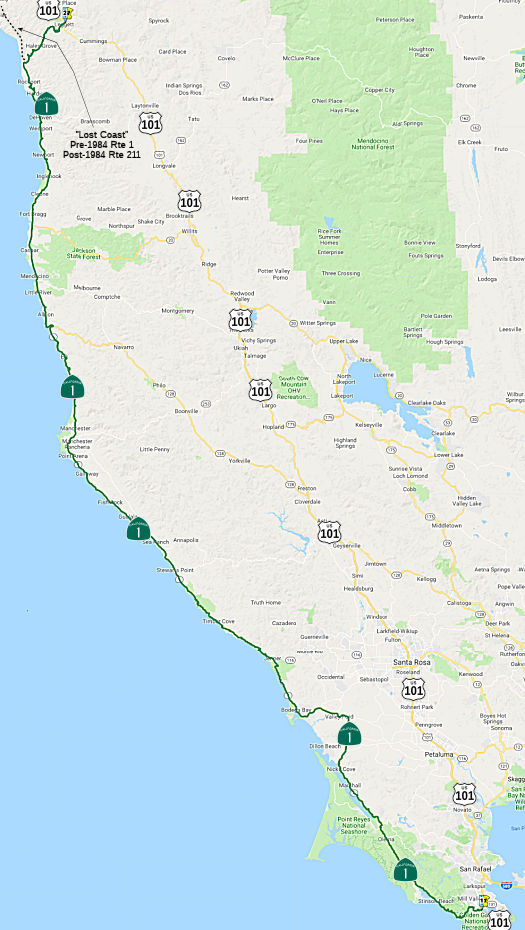 From Route 101 near the southerly end of Marin Peninsula to Route 101 near
Leggett via the coast route through Jenner and Westport.
From Route 101 near the southerly end of Marin Peninsula to Route 101 near
Leggett via the coast route through Jenner and Westport.
Post 1964 Signage HistoryThe 1963 definition of this segment was "Route 101 near the southerly end of Marin Peninsula to Route 101 near Fernbridge via the coast route through Jenner, Westport, and Ferndale." In 1984, Chapter 489 transferred the portion from Rockport to Route 101 near Fernbridge to Route 211. The portion from Rockport to Route 101 near Leggett was transferred from former Route 208, truncating the end to " Route 101 near Leggett via the coast route through Jenner and Westport."
Pre 1964 Signage History The portion of this segment from San Francisco to the Marin-Sonoma County Line was added to LRN 56 as part of the 1933 extension of the
legislative route. Also added in 1933 was the portion from Jenner to
Westport. In 1951, LRN 56 was extended southward to the Marin-Sonoma
County Line and northward to US 101 near Leggett by Chapter 1588.
In a series of three blogs (all three links are in the links section at
the end; the link to the first part is in the “sources”
below), Tom Fearer explored the history of the Shoreline Highway
segment of Route 1, which is between Mill Valley (~ MRN 0.823) and
Ferndale (~ HUM 73.261) and was designated by SCR 91, Chapter 239 in 1957.
State maintenance of the Shoreline Highway begins in 1933 when LRN 56 was
extended south to LRN 2 (US 101) near Las Cruces and north to Ferndale to
LRN 1 (also US 101), as noted above. By 1934, when signed Route 1 was
announced, maps were showing it as a functionally existing highway from
Westport north to Fortuna, and to be state-maintained on both sides of the
Lost Coast. When LRN 56 was extended north to Humboldt County in
1933, it largely incorporated existing roads north of the San Francisco
Bay Area; however many of the roads it planned to traverse were not under
state maintenance:
(Source: Gribblenation Blog (Tom Fearer), “California State Route 1 the Shoreline Highway Part 1; the history of the Shoreline Highway and drive through Marin County”, February 2021)
Sausalito (~ SON 2.076) to Jenner (~ SON 21.207)
 In 1954, the California Highway Commission adopted a mile-long section of
Route 1 between Manzanita and W of Dolan's Corner in Marin County (~ MRN
0.65 to MRN 0.932). The route lies along portions of the existing highway
near Manzanita (where Route 1 splits of US 101) and Dolan's Corner, but
will eliminate the present southerly loop to the Coyote Creek Bridge and
is slightly shorter. It also provides for improved connections to the
Redwood Highway (US 101) at Manzanita, integrated with the construction of
the new Richardson Bay Bridge and approaches. It was noted that it would
be some time before the routing would be constructed, but adopting it
would allow the state to acquire right of way that had been offered at no
cost and to utilize fill material from the Golden Gate Bridge approach
construction on the Waldo Grade. Additionally, because of structural
deterioration, it was found necessary to replace the original Coyote Creek
Bridge with a new structure on the same site. It was planned that the
replacement structure would carry traffic until the adopted route was
constructed. However, based on the maps of 2023, it appears that only the
US 101/Route 1 interchange portion of the new routing was ever
constructed.
In 1954, the California Highway Commission adopted a mile-long section of
Route 1 between Manzanita and W of Dolan's Corner in Marin County (~ MRN
0.65 to MRN 0.932). The route lies along portions of the existing highway
near Manzanita (where Route 1 splits of US 101) and Dolan's Corner, but
will eliminate the present southerly loop to the Coyote Creek Bridge and
is slightly shorter. It also provides for improved connections to the
Redwood Highway (US 101) at Manzanita, integrated with the construction of
the new Richardson Bay Bridge and approaches. It was noted that it would
be some time before the routing would be constructed, but adopting it
would allow the state to acquire right of way that had been offered at no
cost and to utilize fill material from the Golden Gate Bridge approach
construction on the Waldo Grade. Additionally, because of structural
deterioration, it was found necessary to replace the original Coyote Creek
Bridge with a new structure on the same site. It was planned that the
replacement structure would carry traffic until the adopted route was
constructed. However, based on the maps of 2023, it appears that only the
US 101/Route 1 interchange portion of the new routing was ever
constructed.
(Source: Santa Rosa Press Democrat, 8/30/1954 via Joel Windmiller,
4/26/2023)
 In 1962, it was reported that the CHC had a proposed
routing for a scenic highway rerouting of Shoreline Highway from US 101 to
a point S of Olema.
In 1962, it was reported that the CHC had a proposed
routing for a scenic highway rerouting of Shoreline Highway from US 101 to
a point S of Olema.
(Source: Independent-Journal, 4/27/1962 via Joel Windmiller,
1/29/2023)
In 1962, state highway commission hearings began on possible freeways or
improved routings of the Shorline Highway in West Marin. Property owners
in the path of construction protested vigorously. They managed to convince
the county board of supervisors to request a delay of the project so that
a master plan for West Marin could be developed, putting road construction
in better perspective. The board of supervisors reluctantly agreed, in
part to prevent inflation of land values that could hinder the acquisition
of land for the Point Reyes National Seashore. Two years later, county
planners released what they considered to be a moderate West Marin Master
Plan outlining development for the region based on the Shoreline Highway
as a small, low-speed scenic parkway. However, it only exacerbated
opposition among conservationists, who began a campaign to defeat the
parkway permanently by purchasing crucial properties adjacent to the route
and fighting state acquisition efforts in court.
(Source: "REVOLT AGAINST SPRAWL: Transportation and the Origins of the Marin County Growth-Control Regime" (paywall), Louise Nelson Dyble, University of Southern California, Journal of Urban History, Vol. 34 No. 1,
November 2007, via Anneliese Agren, 11/15/2023)
By 1955, there was a new planned alignment of Route 1/LRN 56 providing a
direct inland routing between Valley Ford (~ SON 2.076) and Jenner. On
July 1, 1957, Route 1 between Valley Ford and Jenner via Bodega Bay became
part of LRN 56, having been upgraded via Federal Aid Secondary (FAS)
777. FAS 777 had been under construction since September of 1951 and
included a brand new 8.9 mile road directly linking Valley Ford to Bodega
Bay.
(Source: Gribblenation Blog (Tom Fearer), “California State Route 1 the Shoreline Highway Part 1; the history of the Shoreline Highway and drive through Marin County”, February 2021)
Jenner (~ SON 21.207) to Point Arena (~ MEN 15.028)
Alignment history pending.
Point Arena (~ MEN 15.028) to the Lost Coast (~MEN 77.171)
N of Gualala (~ MEN 1.202), Google Maps shows Iverson Road / Ten Mile Cutoff Road as "Old State Highway", connecting to Riverside Drive and turning back W to Route 1 in Point Arena. Although this is a plausable routing, it is not seemingly borne out by the State Highway Maps: the current routing seems to show from 1930 on; there is no road near Point Arena in the 1928 map.
 In 1954, the California Highway Commission took a preliminary step towards the
replacement of two bridges and straightening a short section of Route 1
near Elk, N of Point Arena in Mendocino County (~ MEN 33.337 to MEN
33.917), with the adoption of a 0.9 mi segment of the highway where it
crosses Bonee Gulch and Greenwood Creek to provide approaches for the
proposed new crossings and to straighten out several curves, including a
right-angle curve at the top of the bluff S of Greenwood Creek. The new
route follows the general course of the existing highway but is for the
most part slightly to the E. The plans call for the replacement of the
Bonee Gulch Bridge with a culvert and for construction of a new bridge
over Greenwood Creek. The culvert at Bonee Gulch will be just to the E of
the existing bridge. The new Greenwood Creek bridge will be a short
distance W of the existing bridge.
In 1954, the California Highway Commission took a preliminary step towards the
replacement of two bridges and straightening a short section of Route 1
near Elk, N of Point Arena in Mendocino County (~ MEN 33.337 to MEN
33.917), with the adoption of a 0.9 mi segment of the highway where it
crosses Bonee Gulch and Greenwood Creek to provide approaches for the
proposed new crossings and to straighten out several curves, including a
right-angle curve at the top of the bluff S of Greenwood Creek. The new
route follows the general course of the existing highway but is for the
most part slightly to the E. The plans call for the replacement of the
Bonee Gulch Bridge with a culvert and for construction of a new bridge
over Greenwood Creek. The culvert at Bonee Gulch will be just to the E of
the existing bridge. The new Greenwood Creek bridge will be a short
distance W of the existing bridge.
(Source: Santa Rosa Press Democrat, 8/30/1954 via Joel Windmiller,
4/26/2023)
 In 1957, the California Highway Commission adopted a routing for the
relocation of 1½ mi of Route 1 S of the Navarro River 21 mi S of Ft.
Bragg (~ MEN 38.794 to MEN 40.268), off of today's Navarro Beach Road and
Navarro Bluff Road (which appear to have originally connected). The new
route generally paralleled the existing highway, but followed higher
terrain several hundred feet inland. The new routing eliminated sharp
curves, steep grades, and a narrow right of way on the existing road.
Plans called for construction of a two-lane highway.
In 1957, the California Highway Commission adopted a routing for the
relocation of 1½ mi of Route 1 S of the Navarro River 21 mi S of Ft.
Bragg (~ MEN 38.794 to MEN 40.268), off of today's Navarro Beach Road and
Navarro Bluff Road (which appear to have originally connected). The new
route generally paralleled the existing highway, but followed higher
terrain several hundred feet inland. The new routing eliminated sharp
curves, steep grades, and a narrow right of way on the existing road.
Plans called for construction of a two-lane highway.
(Source: Ukiah Daily Journal, 3/28/1957, via Joel Windmiller,
4/26/2023)
 In late 1959, meetings were held regarding a new freeway routing for Route 1 through
Mendocino (~ MEN 50.052 to MEN R52.067), to replace the older routing
along Main Street and Lansing Street. The specific section discussed was a
¾ mi segment between Jack Peters Gulch and Russian Gulch. This would
be a northerly extension of a previously adopted routing that bypassed
Main and Lansing between Gordon Lane S of Big River and Jack Peters Gulch.
The freeway would be initially constructed as a two-lane expressway, with
eventual conversion to four lanes.
In late 1959, meetings were held regarding a new freeway routing for Route 1 through
Mendocino (~ MEN 50.052 to MEN R52.067), to replace the older routing
along Main Street and Lansing Street. The specific section discussed was a
¾ mi segment between Jack Peters Gulch and Russian Gulch. This would
be a northerly extension of a previously adopted routing that bypassed
Main and Lansing between Gordon Lane S of Big River and Jack Peters Gulch.
The freeway would be initially constructed as a two-lane expressway, with
eventual conversion to four lanes.
(Source: Santa Rosa Press Democrat 10/11/1959 via Joel Windmiller,
4/26/2023)
Lost Coast Segments (~ MEN 77.171 and points N)
By 1958, the Westport-Leggett (~ MEN 7.131 to MEN 77.171) Spur of LRN 56
was added to the state highway system, with maintenance beginning on July
1, 1957. This segment was part of FAS 504. Mendocino County is said
to have pushed during the fall of 1955 to have the planned
Westport-Leggett Spur of LRN 56 added Federal Aid Secondary system.
Part of the 1951 legislation that added the Westport-Leggett Spur of LRN 56 was that the State would not have to maintain the roadway until it was
brought up to Division of Highways standards. In 1964, this became Route 208, then later it returned to being Route 1.
(Source: Gribblenation Blog (Tom Fearer), “California State Route 1 the Shoreline Highway Part 1; the history of the Shoreline Highway and drive through Marin County”, February 2021)
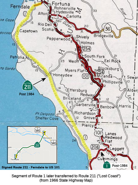 In 1934, most of segment (including the portion later
transferred to Route 211, but excluding the portion that was Route 208)
was signed as part of signed Route 1 (Jct. US 101 at Las Cruces, via
Cambria, Santa Cruz, San Francisco, Pt. Reyes, and Westport to US 101 at
Fortuna). Fernbridge is slightly N of Fortuna, confirming that the current
Route 211 portion was original part of signed Route 1. The portion from
Route 211 near Rockport to Leggett was briefly Route 208 post-1964; this
segment was not assigned a number in 1934.
In 1934, most of segment (including the portion later
transferred to Route 211, but excluding the portion that was Route 208)
was signed as part of signed Route 1 (Jct. US 101 at Las Cruces, via
Cambria, Santa Cruz, San Francisco, Pt. Reyes, and Westport to US 101 at
Fortuna). Fernbridge is slightly N of Fortuna, confirming that the current
Route 211 portion was original part of signed Route 1. The portion from
Route 211 near Rockport to Leggett was briefly Route 208 post-1964; this
segment was not assigned a number in 1934.
LRN 56 (Sign Route 1, eventual Route 211) was extended north to Ferndale
to LRN 1 (US 101) in 1933. Prior to 1933 the legislative description
of LRN 56 had it's north terminus in Carmel and south terminus in San Luis
Obispo. Tom Fearer notes that close examination of the map displayed in
the August 1934 CHPW shows Route 1/LRN 56 as a functionally existing
highway from Westport north to Fortuna. He also notes that the 1934
Division of Highways State Map shows State maintenance of Route 1/LRN 56
from Mendocino north to Fort Bragg. It also shows from Fort Bragg
northward the implied route to Upper Mattole, and from Upper Mattole the
implied through highway through the Lost Coast to Ferndale. Tom also
examined the 1935 Goshua Highway Map of California, which shows Route 1/LRN 56 ending at Westport and the road continuing north to Kenny on Usal
Road. From Kenny the highway to Thorn Junction appears to have
followed Briceland Road to Thorn Junction. From Thorn Junction to
Ettersburg the highway follows Ettersburg Road. From Ettersburg to
Honey Dew the through highway follows Wilder Ridge Road. From Honey
Dew the through route in the Lost Coast follows Mattole Road to Ferndale
and the north segment of Route 1/LRN 56. The 1935 Goshua Map doesn't
offer any evidence that Route 1 was signed by the California State
Automobile Association in the Lost Coast. Tom notes that the first
Division of Highways Map to display a rough planned general alignment of
Route 1/LRN 56 in the Lost Coast was the 1953 edition.
(Source: Tom Fearer, Gribblenation Blog, "Paper Highways; California State Route 1 through the Lost Coast")
In 1956, a spur of LRN 56 was added to connect Route 1 to US 101 at
Leggett. Per the May/June 1958 CHPW, the Westport-Leggett spur of LRN 56
was ultimately signed as part of Route 1 and was part of Federal Aid
Secondary Rte 504. Mendocino County is said to have pushed during
the fall of 1955 to have the planned Westport-Leggett Spur of LRN 56
added. The article goes onto cite that part of the 1951 legislation
that added the Westport-Leggett Spur of LRN 56 was that the State would
not have to maintain the roadway until it was brought up to Division of
Highways standards. Maintenance of the Westport-Leggett Spur of LRN 56 began on July 1, 1957.
(Source: Tom Fearer, Gribblenation Blog, "Paper Highways; California State Route 1 through the Lost Coast")
In the 1964 Renumbering, the spur to Leggett was renumbered to Route 208 (although it was not signed as such). In 1984, Route 208 was officially transferred to Route 1, and the "lost coast" was transferred to Route 211.
StatusIn April 2022, it was reported that a proposed project along US 101 would
elevate a portion of the southbound lane and offramp at the Marin City
exit ; construct a 700-foot floodwall between the highway and a stormwater
pond; and install pumping mechanisms to increase flow from the pond into
the Richardson Bay. The goal is to ease flooding in Southern Marin. The
project also includes an effort to raise Route 1 north of the Manzanita
commuter lot (~ MRN 0.044), which is closed routinely because of flooding.
An automatic tide gate would be installed at the lot and drainage would be
reconstructed. The Mill-Valley-Sausalito multiuse path also would be
raised by about 3 feet. The projects have a rough estimate of $75 million
to $100 million. They are in a draft phase and will likely require an
environmental engineering review, which is expected to take one to two
years.
(Source: East Bay Times, 4/10/2022)
Muir Beach to Stinson Beach Reconstruction
There are plans to reconstruct and stabilize the
roadway just above Slide Ranch (apx 001 MRN 8.082), between Stinson Beach
(apx 001 MRN 12.6) and Muir Beach (apx 001 MRN 6.462). Proposed is a
523-foot-long, 20-foot-high but mostly buried retaining wall anchored by
metal piles sunk 15 feet into the downslope hillside, with just 8 feet of
the wall exposed at the top that would reveal only natural wood lagging. A
5- to 8-foot-wide bench area would be provided at the bottom of the
retaining wall to allow for construction and wall maintenance. The project
at milepost 7.7 near Slide Ranch includes replacement of drainage inlets
and culverts, addition of a metal pipe drain, installation of a metal beam
guard rail, and installation of cable railing along the retaining wall.
The roadbed would be reconstructed and resurfaced in the areas where slope
failure has caused extensive cracking and buckling of the roadway. The
project site is bordered on the upslope by Mount Tamalpais State Park, and
on the downslope by the Golden Gate National Recreational Area. The
downslope would be planted after completion of the six-month project,
scheduled to begin in April 2012. The plan follows completion in 2007 of a
four-month, $25 million road reconstruction project that closed a stretch
of road north of Slide Ranch to Panoramic Highway. A similar project also
shut the road in 2005.
(Source: "Highway 1 repair plan near Stinson outlined", The Oakland Tribune, 5/31/10)
In August 2016, the CTC approved $1,100,000 in funding
to repair the roadway near Stinson Beach, at 2.2 miles north of Panoramic
Highway. During March 2016 storm events, a washout began along the roadway
slope adjacent to Bolinas Lagoon, part of a National Marine Sanctuary.
Later wave action in May caused the slope washout to expand and is now
undermining the southbound lane. Slope armoring can not be environmentally
cleared without a protracted schedule. Shifting the roadway away from the
slope is acceptable to the resource agencies as a temporary repair.
Permanent restoration repairs will require follow-up programming. This
project will pave and allow shifting of the traffic lanes away from the
damaged slope to minimize traffic impacts.
(Source: CTC August 2016, 2.5f(1))
 In October 2017, it was reported that Caltrans planned to reopen storm-damaged Route 1 between
Muir Beach and Stinson Beach by December — if the weather
cooperates. Winter 2016-2017's record rains caused significant problems on
the coastal highway. Caltrans officials said there were 17 storm-related
work sites in Marin, most of those on Route 1. The work has an estimated
cost of more than $75 million. A section of Route 1 in Muir Beach opened
in early May after being closed since January after parts of the road
washed away and down a hillside. San Rafael-based Maggiora & Ghilotti
Inc. got the contract to rebuild those two sections of the highway in Muir
Beach. At one of the spots the roadway washed out and slid down an
embankment, its painted lanes still visible. The repairs required
construction of a retaining wall that is supported by 50-foot-long steel
piles. A series of shafts were drilled into the ground along the length of
the wall. The steel beams were then placed into the shafts and backfilled
with concrete. Timber lagging was installed between the steel beams to
create the wall, which is then backfilled with soils or aggregate. The
final step was repaving the road. In all, 69 piles were placed to support
the roadway in two locations. But another key section of Route 1 to the
north, between Muir Beach and Stinson Beach, where the highway has dipped,
cracked and slipped, was still closed as of October. The reopening date
was initially pegged at early September, then October, and now December is
the new target. To get to Stinson Beach while the segment was closed,
drivers needed to use a detour on Panoramic Highway, which extends the
trip about 13 miles. This involved taking the Panoramic Highway to Frank
Valley/Lower Muir Woods Road (which caused problems as local and tourist
traffic mix, slowing traffic). Making matters worse was the condition of
Frank Valley Road, which itself was compromised because of previous
slides. Parts of it were reduced to one lane for more than a decade. Other
work is also set to start on Route 1. That construction will include
shoring up retaining walls at several locations. Even once it opens,
Caltrans plans to keep signs up with traffic warnings that encourage
people to use the Panoramic detour so Route 1 does not get backed up,
county officials said.
In October 2017, it was reported that Caltrans planned to reopen storm-damaged Route 1 between
Muir Beach and Stinson Beach by December — if the weather
cooperates. Winter 2016-2017's record rains caused significant problems on
the coastal highway. Caltrans officials said there were 17 storm-related
work sites in Marin, most of those on Route 1. The work has an estimated
cost of more than $75 million. A section of Route 1 in Muir Beach opened
in early May after being closed since January after parts of the road
washed away and down a hillside. San Rafael-based Maggiora & Ghilotti
Inc. got the contract to rebuild those two sections of the highway in Muir
Beach. At one of the spots the roadway washed out and slid down an
embankment, its painted lanes still visible. The repairs required
construction of a retaining wall that is supported by 50-foot-long steel
piles. A series of shafts were drilled into the ground along the length of
the wall. The steel beams were then placed into the shafts and backfilled
with concrete. Timber lagging was installed between the steel beams to
create the wall, which is then backfilled with soils or aggregate. The
final step was repaving the road. In all, 69 piles were placed to support
the roadway in two locations. But another key section of Route 1 to the
north, between Muir Beach and Stinson Beach, where the highway has dipped,
cracked and slipped, was still closed as of October. The reopening date
was initially pegged at early September, then October, and now December is
the new target. To get to Stinson Beach while the segment was closed,
drivers needed to use a detour on Panoramic Highway, which extends the
trip about 13 miles. This involved taking the Panoramic Highway to Frank
Valley/Lower Muir Woods Road (which caused problems as local and tourist
traffic mix, slowing traffic). Making matters worse was the condition of
Frank Valley Road, which itself was compromised because of previous
slides. Parts of it were reduced to one lane for more than a decade. Other
work is also set to start on Route 1. That construction will include
shoring up retaining walls at several locations. Even once it opens,
Caltrans plans to keep signs up with traffic warnings that encourage
people to use the Panoramic detour so Route 1 does not get backed up,
county officials said.
(Source: Marin I-J, 3/16/2017; MarinI-J,
10/3/2017)
In January 2018, it was reported that Route 1 between
Muir Beach and Stinson Beach should be reopening. However, it will still
be controlled: Caltrans is warning drivers should anticipate lengthy
delays because there are still six active projects along the section. In
those areas, traffic is reduced to one lane. That means there will be
flaggers and signalized traffic lights, along with stepped-up construction
zone enforcement throughout the entire corridor. The majority of the
remaining projects — including shoring up retaining walls at several
locations — will be complete by June 2018.
(Source: Marin I-J, 1/3/2018)
In January 2024, Caltrans released the draft 2024 SHOPP, which contained
the following long-lead project: 04-Marin-1 18.69. PPNO 04-2914V; ProjID
0421000410; EA 3W630. Route 1 Near San Rafael, at 1.1 miles north of
Horseshoe Hill Road. Remediate fish passage by replacing existing
culvert system with a new bridge. (Long Lead Project) Note: Complex
environmental studies and extensive coordination with permitting agencies.
Proposed ($ × 1000): PA&ED: $2,213; PS&E: $3,246; R/W $177;
R/W Sup $134; Con $13,421; Con Sup: $4,576; Total: $23,767. Only PA&ED
phase is authorized. Begin Con: 3/15/2029.
(Source: 2024 Draft SHOPP v4.0, 1/31/2024)
Lagunitas Bridge (04-Mrn-1, PM 28.4/28.6)
 In March 2015, it was reported that the 86-year-old
bridge that leading to Point Reyes Station (apx 001 MRN 28.488) will be
demolished and replaced in what will be at least a seven-year process
involving public input, lengthy environmental review and years of
construction that will necessitate a temporary one-lane bridge across
Lagunitas Creek. The first real bridge to cross Lagunitas Creek at the
site was built in 1875. Before then, ranchers ran cattle on the east side
of Tomales Bay, but there was no Point Reyes Station. Ferries carried
people across the water until the train station arrived and a town sprung
up, spurring a wooden bridge and, soon after, Levee Road. In 1925 the
county secured a $2.5 million bond to modernize Sir Francis Drake
Boulevard—widening, realigning and paving the dirt
road—because of the rise of automobiles, and to help ranch
operations. The Green Bridge, a 152-foot steel truss bridge built in 1929,
was the culmination of that project. Now, Caltrans says the steel bridge
is deteriorating and vulnerable to an earthquake. Retrofitting, the agency
says, would reduce the bridge’s already deficient weight capacity.
Caltrans has proposed four conceptual alternatives to replace the Green
Bridge that could be modified based on comments. The agency also still
needs to prepare a geotechnical report and a full-blown traffic study. The
ideas for a new bridge include two versions of a steel truss bridge, one
of which looks similar to the current bridge, as well as a concrete bridge
and a suspension cable bridge. The first alternative, a short version of a
steel truss bridge, is similar in style to the current bridge. It comes
with 101-foot long steel trusses on each side, which curve in a gentle arc
as they cross the length of the bridge. Each truss, at its apex, would be
about 12 feet tall. Alternative two is a long version of a steel truss
bridge: the trusses are 150 feet, and there is a roof bracing across the
top, imposing a 15-foot clearance on vehicles. The steel trusses bear some
resemblance to the current bridge, but visually, it’s a lot of
metal. The third alternative is a pre-cast concrete girder bridge.
It could be built quickly (2 years), but the bridge deck would be two feet
higher than the current bridge, resulting in a larger
“footprint” and impacting nearby properties. Alternative four
is a suspension cable bridge, with two concrete, monolith-like towers at
each end connecting the cables. Environmental planners are unsure whether
the concrete bridge or the short steel truss bridge could be permitted,
given their potential environmental impacts. Regardless of which
alternative is chosen, a new bridge will meet modern design standards: two
12-foot lanes, four-foot shoulders on each side, six-foot sidewalks and
wheelchair-accessible ramps at the sidewalks. A draft environmental impact
report should arrive in 2016. The new bridge will be wider due to bigger
lanes, shoulders and sidewalks. Caltrans says that
construction—which will cost $5.8 million, funded by a highway
program—could easily last two or three years. During that time,
Caltrans has proposed a temporary one-lane bridge on the animal clinic
side of the Green Bridge, controlled by a traffic signal on each end.
In March 2015, it was reported that the 86-year-old
bridge that leading to Point Reyes Station (apx 001 MRN 28.488) will be
demolished and replaced in what will be at least a seven-year process
involving public input, lengthy environmental review and years of
construction that will necessitate a temporary one-lane bridge across
Lagunitas Creek. The first real bridge to cross Lagunitas Creek at the
site was built in 1875. Before then, ranchers ran cattle on the east side
of Tomales Bay, but there was no Point Reyes Station. Ferries carried
people across the water until the train station arrived and a town sprung
up, spurring a wooden bridge and, soon after, Levee Road. In 1925 the
county secured a $2.5 million bond to modernize Sir Francis Drake
Boulevard—widening, realigning and paving the dirt
road—because of the rise of automobiles, and to help ranch
operations. The Green Bridge, a 152-foot steel truss bridge built in 1929,
was the culmination of that project. Now, Caltrans says the steel bridge
is deteriorating and vulnerable to an earthquake. Retrofitting, the agency
says, would reduce the bridge’s already deficient weight capacity.
Caltrans has proposed four conceptual alternatives to replace the Green
Bridge that could be modified based on comments. The agency also still
needs to prepare a geotechnical report and a full-blown traffic study. The
ideas for a new bridge include two versions of a steel truss bridge, one
of which looks similar to the current bridge, as well as a concrete bridge
and a suspension cable bridge. The first alternative, a short version of a
steel truss bridge, is similar in style to the current bridge. It comes
with 101-foot long steel trusses on each side, which curve in a gentle arc
as they cross the length of the bridge. Each truss, at its apex, would be
about 12 feet tall. Alternative two is a long version of a steel truss
bridge: the trusses are 150 feet, and there is a roof bracing across the
top, imposing a 15-foot clearance on vehicles. The steel trusses bear some
resemblance to the current bridge, but visually, it’s a lot of
metal. The third alternative is a pre-cast concrete girder bridge.
It could be built quickly (2 years), but the bridge deck would be two feet
higher than the current bridge, resulting in a larger
“footprint” and impacting nearby properties. Alternative four
is a suspension cable bridge, with two concrete, monolith-like towers at
each end connecting the cables. Environmental planners are unsure whether
the concrete bridge or the short steel truss bridge could be permitted,
given their potential environmental impacts. Regardless of which
alternative is chosen, a new bridge will meet modern design standards: two
12-foot lanes, four-foot shoulders on each side, six-foot sidewalks and
wheelchair-accessible ramps at the sidewalks. A draft environmental impact
report should arrive in 2016. The new bridge will be wider due to bigger
lanes, shoulders and sidewalks. Caltrans says that
construction—which will cost $5.8 million, funded by a highway
program—could easily last two or three years. During that time,
Caltrans has proposed a temporary one-lane bridge on the animal clinic
side of the Green Bridge, controlled by a traffic signal on each end.
(Source: Point Reyes Light, 3/26/2015)
The following project was included in the final adopted 2018 SHOPP in March 2018: PPNO 0756K. 04-Marin-1 28.5. On Route 1 Near Point Reyes Station, at Lagunitas Creek Bridge No. 27-0023. Replace bridge. Begin Con: 2/8/2021. Total Project Cost: $28,339K.
In July 2018, it was reported that Caltrans has
unveiled its final design plans to tear down and replace the Green Bridge
to ensure that the critical gateway to Point Reyes Station can withstand
an earthquake. It’s a project the agency says will cost $8 million
and take a year to complete, including a complete closure for up to three
weeks. The agency’s final environmental impact report addressed the
persistent call from community members to reconsider retrofitting the
bridge, but maintained that a replacement is necessary. Caltrans first
discounted the retrofit in its draft of the environmental impact report,
released in summary 2017, citing a three-year timeframe and greater
environmental impacts and arguing that it would be a less safe structure.
Because a retrofit was not an evaluated alternative in the draft, Caltrans
could not go that route without re-writing an entirely new environmental
report. To appease residents, the agency has since issued a variety of
supplemental documents that justify why structural engineers decided a
retrofit would be inadequate. Of the five design alternatives and a
no-build option Caltrans did consider, the agency has selected a
three-span, concrete bridge design with the shorter of two
proposed timelines as its preferred alternative. Including five-foot-wide
shoulders, the bridge will have a roadway that’s 32 feet—six
feet wider than the existing structure—as well as one six-foot
sidewalk. The bridge does not have a truss, or the metal frame
that’s currently painted green, and therefore will not be as tall.
As the narrowest of the designs, it will have the “least distraction
of views toward the creek and of Point Reyes Station” and will
“not detract from community character,” the report states.
During a three-week period scheduled for September 2021, the bridge will
close while construction crews work around the clock to remove the
existing bridge and install the new one. Traffic will be detoured
south-to-north through Olema, along Platform Bridge Road and Point
Reyes-Petaluma Road—a nine-mile route. The alternative timeline for
some of the other designs was three years, with no closures. Caltrans
first introduced the project in 2015, after engineers determined that the
90-year-old structure does not meet current standards for earthquake
resistance. At that time, many locals immediately clamored for a retrofit
rather than a replacement, largely concerned about the strain that a long
construction project would put on the town. Despite some additions from
Caltrans, such as a shorter timeline option, many residents have continued
to fight tooth and nail against the proposed rebuild since the draft
E.I.R. formally discounted a retrofit last summer. The majority of
commenters opposed the project during a comment period on that document at
that time.
(Source: Point Reyes Light, 7/11/2018)
In August 2018 the CTC approved for future
consideration of funding the following project for which a Final
Environmental Impact Report (FEIR) has been completed: Route 1 in Marin
County (04-Mrn-1, PM 28.4/28.6). Replace existing bridge on Route 1 near
Point Reyes in Marin County. (PPNO 0756K) This project is located on Route 1, south of Point Reyes, in Marin County. The project proposes to replace
the Lagunitas Creek Bridge (No. 27-0023), that crosses the Lagunitas
Creek, north of the intersection of Route 1 and Sir Francis Drake
Boulevard. The project proposes to meet current safety and seismic design
standards while providing a safe and stable seismic crossing over
Lagunitas Creek. The proposed project is estimated to cost $28.3 million.
The project is currently programmed in the 2016 State Highway Operation
and Protection Program (SHOPP) for approximately $28.3 million which
includes Construction (capital and support) and Right-of -Way (capital and
support). The project is estimated to begin construction in 2021. The
scope, as described for the preferred alternative, is consistent with the
project scope programmed by the Commission in the 2016 SHOPP.
(Source: August CTC Agenda Item 2.2c.(13))
The 2020 SHOPP, approved in May 2020, included the
following Bridge Preservation item of interest (carried over from the 2018
SHOPP): 04-Marin-1 PM 28.5 PPNO 0756K Proj ID 0413000350 EA 0G642. Route 1
near Point Reyes Station, at Lagunitas Creek Bridge № 27-0023.
Replace bridge. Programmed in FY20-21, with construction scheduled to
start in late February 2021. Total project cost is $28,339K, with $18,052K
being capital (const and right of way) and $10,287K being support
(engineering, environmental, etc.).
(Source: 2020 Approved SHOPP a/o May 2020)
In June 2020, the CTC approved the following SHOPP
amendment for this project: 04-Mrn-1 28.5. PPNO 0756K ProjID 0413000350 EA
0G642. On Route 1 near Point Reyes Station, at Lagunitas Creek Bridge
№ 27-0023. Replace bridge. Allocation changes: Con Sup $2,500K
$2,625K; Const Cap $11,552K $14,350K;
Total $28,339K $31,262K. A lawsuit filed against
the project has encountered court delays due to COVID-19, delaying the
environmental approval. Increase in construction capital is due to
structural design change, use of ultra-high performance concrete, need for
cast-in-drilled-hole concrete piling, and to fulfill permit requirement
for 10-year plant establishment period. Additional construction support is
required for coordination and oversight of the plant establishment period.
(Source: June 2020 CTC Agenda, Agenda Item
2.1a.(5d) #7)
In June 2021, the CTC approved the following amendment
to the 2020 SHOPP: 04-Mrn-1 28.5 PPNO 0756K ProjID 0413000350 EA 04-0G642.
Route 1 Near Point Reyes Station, at Lagunitas Creek Bridge №
27-0023. Replace bridge. Note: Increase construction capital due to
addition of new items such as permeation grouting, temporary water line,
additional rootwad revetment, and temporary signal system. Change in
schedule is due to the recent postponement of a lawsuit hearing which has
delayed revalidation of the environmental document and the right of way
acquisition process. Const Cap $14,350K $15,580K;
Total $31,262K $32,492K. Extend programming
year for Con Sup, R/W Cap, and Const Cap to FY22-23.
(Source: June 2021 CTC Agenda, Agenda Item
2.1a.(1d) #19)
In October 2021, the CTC approved a request for an
additional $1,275,000 in Capital Outlay Support (COS), for 04-Mrn-1 28.5
PPNO 0756K ProjID 0413000350 EA 04-0G642. Route 1 Near Point Reyes
Station, at Lagunitas Creek Bridge № 27-0023. Replace bridge. The
additional funds were requested to complete the Plans, Specifications and
Estimate (PS&E) project phase. The project will replace the
92-year-old Lagunitas Creek Bridge (№ 27-0023), with a new bridge on
the same alignment. The proposed project consists of a bridge replacement
to improve the function and geometrics of the bridge and provide improved
access to pedestrians and bicyclists while still serving as the critical
emergency response route for the larger West Marin County area. The
project had established the environmental study limits during the
Project Approval and Environmental Document (PA&ED) phase based on the
staging and construction work required to replace the structure. These
limits were carried over into PS&E and plans were developed
accordingly. After the 2019 North Bay wildfires, PG&E changed its
powerline easement requirements, and this impacted the project’s
footprint. The PG&E changes now require 15- foot easements on
either side of the overhead powerlines and removal of all trees and brush
within this 30-foot wide easement. This requirement impacted areas outside
the original study limits and triggered additional environmental
studies and revalidation of the environmental document (EIR/EA). The
increase in the project’s footprint required additional in-house and
consultant resources to evaluate temporary and permanent impacts
that were not accounted for in the original budget. In addition to
resource impacts due to PG&E’s requirements, the Department
expended additional resources to assist its Legal Division in the
retrieval and review of documents from multiple sources, including HQ and
District functional groups, for the CEQA lawsuit which was not accounted
for in the initial PS&E budget. In addition, due to the
project’s location, the project requires California Coastal
Commission (CA CC) clearance. The CA CC will require a minimum of two
public outreach meetings, due to the EIR/EA revalidation, prior to
submitting the permit application. This was not originally anticipated nor
accounted for. Also, additional resources will be needed to update the
PS&E to the latest standards and specifications to achieve Ready
to list (RTL) in June 2023. As of October 2021, the project is
currently at 70 percent complete and the remaining budget for the PS&E
phase is $168,000, which is insufficient to complete the phase.
(Source: October 2021 CTC Agenda, Agenda Item
2.5e.(3))
In October 2023, it was reported that Caltrans defeated
another legal challenge against the Lagunitas Creek Bridge project, also
known as “the green bridge,” on Route 1. The bridge crosses
the creek just north of the Sir Francis Drake Boulevard turn toward
Inverness and the coast. The bridge was built in 1929 and sits near the
San Andreas Fault. About 15 years ago, Caltrans determined the bridge does
not meet safety and seismic design standards. It also determined that
retrofitting was not a viable option because of the structure’s
advanced age, according to court filings. Caltrans proposed a bridge
replacement project and began its first community meetings in 2015. In
2018, a group called Friends of the Green Bridge filed a lawsuit alleging
that the project violated the California Environmental Quality Act. The
lawsuit said the state’s final environmental impact report should
have included retrofitting as an option. The plaintiffs also said Caltrans
should have recirculated the draft environmental impact report before
certification because of new information in the final report, according to
a court ruling. The lawsuit landed before Judge Andrew Sweet in Marin
County Superior Court. In 2021, he ruled in favor of Caltrans. The
plaintiffs appealed to the 1st District Court of Appeal in San Francisco.
In a ruling issued on 9/29/2023, a three-judge appellate panel affirmed
the earlier decision by Sweet. “Our independent review of the record
reveals that Caltrans consistently engaged and included the public in
consideration of a retrofit option throughout the environmental review
process,” the ruling said. “And we have concluded that
substantial evidence supports Caltrans’s decision to remove a
retrofit option from further environmental review. Nothing more was
required.” “In response, Caltrans indicated they will be
advancing the project through the California Transportation Commission
(CTC) and will be engaging the community as part of the Coastal
Development Permitting process, including hosting public meetings.
(Source: Marin I-J, 10/16/2023)
In October 2023, the CTC amended the following SB1
project into the SHOPP: 04-Mrn-1 28.4/28.6. PPNO 04-0756K; ProjID
0413000350; EA 0G642. Route 1 Near Point Reyes Station, at Lagunitas Creek
Bridge № 27-0023 and Lagunitas Creek Overflow Bridge №
27-0024. Replace bridges. Concurrent COS allocation under Resolution
FP-23-39; October 2023. Allocation ($ × 1,000): PA&ED $0;
PS&E $1,000; R/W Sup $1,100; Con Sup $4,000; R/W Cap $6,893; Const Cap
$17,986; TOTAL $30,979. Begin Const 12/29/2025.
(Source: October 2023 CTC Agenda, Agenda Item 2.1a.(1b) #1)
In October 2023, the CTC approved for consideration of
funding the following project for which a Final Environmental Impact
Report (FEIR) and an Addendum have been completed: Route 1 in Marin
County. Replace the bridge crossing at Lagunitas Creek on Route 1, in
Marin County. (04-Mrn-01, PM 28.4/28.6; PPNO 0756K). The project is
currently programmed in the 2022 State Highway Operation and Protection
Program (SHOPP) for a total of $32,492,000, which includes Right of Way
(Support and Capital) and Construction (Support and Capital). Construction
began in 2020-21. The scope, as described for the preferred alternative,
is consistent with the project scope as programmed by the Commission in
the 2022 SHOPP. A copy of the FEIR has been provided to Commission staff.
The Commission approved the project for future consideration of funding on
August 16, 2018, under Resolution E-18-116. Since the approval of the
FEIR, there have been changes to the project and an Addendum was prepared
pursuant to the California Environmental Quality Act (CEQA). These changes
include minor revisions to the temporary and permanent impact areas
associated with Lagunitas Creek, the required use of temporary noise
barriers, the temporary relocation of Pacific Gas and Electric Company
power lines, and the temporary relocation of the North Marin Water
District water line. These refinements have extended the project footprint
beyond the areas that were evaluated in the FEIR. Under the revised
project footprint, the sidewalk on the western side of the bridge will be
extended 40-feet to the north of the new bridge along the southbound Route 1 shoulder. The project changes do not meet the criteria outlined in CEQA
Guidelines Section 15162 and Section 15163 to prepare a Subsequent or
Supplemental FEIR. The Department subsequently completed an Addendum to
the FEIR pursuant to CEQA. The Department has approved this project for
construction. This approval and the Addendum will satisfy the
environmental requirements for this stage of the planning process.
(Source: October 2023 CTC Agenda, Agenda Item 2.2c.(4))
In October 2023, the CTC approved the following
preconstruction phase allocations for a 2022 SHOPP SB1 Project:
$2,100,000. 04-Mrn-1 28.4/28.6. PPNO 04-0756K; ProjID 0413000350; EA
0G642. Route 1 Near Point Reyes Station, at Lagunitas Creek Bridge №
27-0023 and Lagunitas Creek Overflow Bridge № 27-0024. Replace
bridges. Future consideration of funding approved under Resolution
FP-18-02; August 2018. Concurrent Amendment under SHOPP Amendment 22H-012;
October 2023. Concurrent addendum for the previously approved Future
Consideration of Funding under Resolution E-23-132A; October 2023.
Allocation (FY24-25): PS&E $1,000,000; R/W Sup $1,100,000.
(Source: October 2023 CTC Agenda, Agenda Item 2.5b.(2b) #4)
Estero Americano Bridge Replacement Project
 In October 2015, the CTC approved for future consideration of funding the Estero Americano
Bridge Replacement Project in Marin and Sonoma Counties, which will
replace the existing bridge spanning Americano Creek on Route 1 near the
town of Valley Ford (apx 001 MRN 50.47). The project is programmed in the
2014 State Highway Operation and Protection Program. The total estimated
cost is $17,256,000 for capital and support. Construction is estimated to
begin in Fiscal Year 2016/17. The scope, as described for the preferred
alternative, is consistent with the project scope programmed by the
Commission in the 2014 State Highway Operation and Protection Program. A
copy of the ND has been provided to Commission staff.
In October 2015, the CTC approved for future consideration of funding the Estero Americano
Bridge Replacement Project in Marin and Sonoma Counties, which will
replace the existing bridge spanning Americano Creek on Route 1 near the
town of Valley Ford (apx 001 MRN 50.47). The project is programmed in the
2014 State Highway Operation and Protection Program. The total estimated
cost is $17,256,000 for capital and support. Construction is estimated to
begin in Fiscal Year 2016/17. The scope, as described for the preferred
alternative, is consistent with the project scope programmed by the
Commission in the 2014 State Highway Operation and Protection Program. A
copy of the ND has been provided to Commission staff.
In August 2016, the CTC approved $14,737,000 for Marin 04-Mrn-1 50.1/50.5 Route 1 near Valley Ford, from 0.4 mile south to 0.2 mile north of Estero Americano Bridge No. 27-0028; also in Sonoma county (PM 0.0 to 0.2). Outcome/Output: Replace structurally deficient structure with new bridge and retaining walls using standard lane and shoulder widths. New bridge and approaches will be constructed at higher elevation to prevent over-topping and roadway flooding. Project also includes willow cutting harvesting, willow propagation and mitigation plantings, and plant establishment period maintenance.
In August 2018, it was reported that the only thing
that could stall the demise of the Estero Americano Bridge demise is the
appearance of a California red-legged frog, the species made famous by
Mark Twain. The Estero-Americano Bridge, built in 1925 along the border of
Marin and Sonoma counties, has a bridge deck with a 2‐foot sag, is
structurally deficient and is subject to periodic flooding from Americano
Creek because it sits low in the landscape, according to Caltrans. The
bridge will be replaced with a longer, concrete box girder bridge that
will be poured on site. In August 2018, the bridge was closed while crews
poured concrete on a section of bridge deck as they continued construction
of the new Estero-Americano Bridge. The new bridge is being built with an
improved height clearance as the old bridge was prone to flooding from the
creek below. The project will cost $9.6 million and is expected to be
finished by the end of the year — unless the red-legged frogs show
up. The Estero Americano project site is about two miles upstream from
where Americano Creek transitions into the Estero Americano near Valley
Ford. The Estero Americano watershed covers 49 square miles and provides
habitat for numerous fish and wildlife species. The Estero Americano has
been categorized as a critical coastal area by the state of California.
Estero Americano ultimately flows toward Bodega Bay and the Gulf of the
Farallones National Marine Sanctuary. The tricolored blackbird, a state
species of special concern, is known to fly around the project area. The
endangered Myrtle’s silverspot butterfly and the threatened
red-legged frog are listed under the federal Endangered Species Act and
also may be present. Red-legged frogs could force work to stop if they
bound into the construction site. Barring any frog cameo, the project will
remove the existing 146-foot-long, 25‐foot-wide bridge and replace
it with a 266-foot-long, 40-foot-wide span. The new bridge will support a
road consisting of 12-foot lanes in each direction and 6-foot shoulders.
The span will be supported on either side by six piers on extensions built
with piles. The bridge will be about 6 feet higher than the existing
bridge and was designed to accommodate a 100-year flood event. It will
also provide more space for wildlife passage beneath the road and result
in an increase in the amount of riparian habitat along Americano Creek.
The bridge will be constructed in two sections; the eventual northbound
lane will be constructed first, to allow the existing bridge to be used
for traffic with one‐way traffic control during further
construction. Traffic will then be shifted onto the new bridge.
One‐way traffic control will continue while the old bridge is
demolished and the second half of the new bridge is completed. Temporary
concrete rails will be placed on the edge of the new structure while the
southbound side is constructed.
(Source: Marin I-J, 8/15/2018)
Sonoma County Safety Improvements (04-Son-1 PM 0.0/58.6)
In October 2020, the CTC amended the following project
into the 2020 SHOPP: 04-Son-1 PM 0.0/58.6 PPNO 0820H ProjID 0413000178 EA
4G780. On Route 1 in Sonoma County, from Marin County line to Mendocino
County line (PM 0.0/58.583). Install centerline rumble strips, widen
shoulders and install wet night visibility striping. PA&ED $2,155K.
PS&E: $1,893K. R/W Sup: $180K. Con Sup: $3,817K. R/W Cap: $314K. Const
Cap: $13,518K. Total: $21,877K.Begin Const: 11/1/2024.
(Source: October 2020 CTC Agenda, Agenda Item
2.1a.(1a) #18)
In October 2020, the CTC approved the following SHOPP
Support Phase allocation: $2,155,000 for PA&ED for 04-Son-1 PM
0.0/58.6. PPNO 01-0820H ProjID 0413000178 EA 4G780. On Route 1 in Sonoma
County, from Marin County line to Mendocino County line (PM 58.583).
Install centerline rumble strips, widen shoulders and install wet night
visibility striping. (Concurrent Amendment under SHOPP Amendment 20H-003;
October 2020.)
(Source: October 2020 CTC Agenda, Agenda Item
2.5b.(2a) #20)
Gleason Beach Realignment
 In January 2015, the CTC received a notice of preparation
for an EIR for a project in Sonoma County S of Jenner (PM 04-Son-1, PM
15.1/15.8, at Gleason Beach, S of Sonoma Coast State Park) that will
realign a portion of Route 1, moving the roadway eastward away from the
coast. The project is programmed in the 2014 State Highway Operation and
Protection Program. The total estimated cost is $36,870,000 for capital
and support. Construction is estimated to begin in Fiscal Year 2017-18.
The scope, as described for the preferred alternative, is consistent with
the project scope programmed by the Commission in the 2014 State Highway
Operation and Protection Program. There are three alternatives, in
addition to the "No Build" alternative:
In January 2015, the CTC received a notice of preparation
for an EIR for a project in Sonoma County S of Jenner (PM 04-Son-1, PM
15.1/15.8, at Gleason Beach, S of Sonoma Coast State Park) that will
realign a portion of Route 1, moving the roadway eastward away from the
coast. The project is programmed in the 2014 State Highway Operation and
Protection Program. The total estimated cost is $36,870,000 for capital
and support. Construction is estimated to begin in Fiscal Year 2017-18.
The scope, as described for the preferred alternative, is consistent with
the project scope programmed by the Commission in the 2014 State Highway
Operation and Protection Program. There are three alternatives, in
addition to the "No Build" alternative:
(Image source: Project Page Overview)
In October 2016, the CTC approved for future consideration of funding a project for which a Final Environmental Impact Report (FEIR) has been completed: Construct a new roadway on a new alignment east of existing alignment of a portion of Route 1 (04-Son-1, PM 15.1/15.7) near the town of Bodega Bay. This project in Sonoma County will realign a portion of Route 1 between the towns of Jenner and Bodega Bay. The project is programmed in the 2016 State Highway Operation and Protection Program. The total programmed amount is $38,370,000 for capital and support. Construction is estimated to begin in Fiscal Year 2016-17. The scope, as described for the preferred alternative, is consistent with the project scope programmed by the Commission in the 2016 State Highway Operation and Protection Program. The project is immediately south of Gleason Beach, and will move Route 1 several hundred feet inland. The alternative selected was Alternative 19A. This will construct a 3,700 foot roadway, with an approximately 900 foot bridge across Scotty Creek.
Also in October 2016, the CTC amended the SHOPP related
to this project as follows: 04-SON-1 15.1/15.8 | Route 1 Near Camet, 0.1
mile north of Del Sol Road. Realign roadway. Additional design support,
construction support and construction capital is needed for the now
identified preferred alternative and evolved scope associated with a new
longer roadway bridge and pedestrian/bicycle bridge required by the
California Coastal Commission permit process. Additional support costs are
also required for extensive coordination with community and resource
agencies to fulfil environmental commitment. Increase in R/W capital cost
is needed for mitigations identified during environmental phase. These
changes add $8,430,000 to the cost of the project. Allocation: $3MM
$5MM (R/W), $21.8MM $24.3MM (C), Support
(PA & ED $8MM / PS & E $1.8MM $5MM / RW Sup
$500K / Con Sup $3.27MM $4MM). FY 17/18.
In May 2018, it was reported that the California
Coastal Commission had posted a public hearing on the project, at the
behest of Caltrans, to allow “more time to address new information
and community concerns in order to move the project forward.” The
project would include a broad concrete bridge spanning Scotty Creek
between Bodega Bay and Jenner. The 850-foot-long bridge is part of a
three-quarter-mile realignment project meant to move Route 1 at Gleason
Beach inland by 400 feet — Caltrans’ solution to the crumbling
cliffside that undermines the roadway on its current route at the
continent’s edge. But even after years of meetings and draft
sketches of how the coastal highway might one day look, many in the region
still are coming to terms with the scale of what’s proposed and its
impact on the view and surrounding landscape. Public officials recognized
the plan conflicts with land-use principles embedded in the California
Coastal Act and Sonoma County’s own coastal land-use policies, which
prioritize the coast’s scenic and visual qualities, among other
protected resources. But Caltrans and Coastal Commission staffers say the
proposal is the least environmentally damaging of 20 viable options for
the site, where the landscape dips down to the creek at ocean level and
crosses actively grazed ranchlands, wetland areas, Native American
archaeological sites and a stream historically populated by endangered
coho salmon and threatened steelhead trout. Caltrans hopes to begin
construction next spring and finish the project in two years. State
agencies proposed an extensive list of conditions and measures meant to
offset interference with the view and ensure sensitive wildlife habitat
and recreational attributes aren’t damaged. They include a $10
million mitigation package, negotiated with Sonoma County planning
officials, that would result in a new 40- to 50-acre park and coastal
trail segment, beach access improvements, stream and habitat restoration,
and a dedicated bike/pedestrian bridge across Scotty Creek. It also
includes cleaning up huge chunks of houses and concrete shed by the
eroding cliff over the past two decades, as landowners frantically sought
to stave off the inevitable loss of bluff-top homes that began falling
into the ocean in 1998.
(Source: Santa Rosa Press Democrat, 5/7/2018)
In May 2019, it was reported that a stretch of
southbound Route 1 on the Sonoma Coast at risk of failure from coastal
erosion for two decades has finally been abandoned — the cracked and
sagging western-most lane shut down for good in mid-May 2019. Abundant
winter rainfall and regular wave action undercutting the deteriorating
bluffs at Gleason Beach have finally made the affected lane too dangerous
for traffic, triggering the emergency closure and switch to a single,
shared lane for all travelers, Caltrans said. Caltrans is still working to
finalize a long-term fix that involves moving a three-quarter-mile stretch
of the roadway inland 400 feet so the cliff’s accelerating retreat
no longer poses a problem for coastal travel. The project includes
construction of an 850-foot- long bridge that would span the Scotty Creek
flood plain, raising the highway above sensitive creek habitat and tribal
heritage sites that otherwise might be disturbed. While Caltrans appeared
poised to seek approval of its bypass plan from the California Coastal
Commission a year ago, it now could be another full year before it is
ready to do, though it also may be sooner, an agency spokeswoman said.
Among the outstanding issues are continued negotiations related to land
and right-of-way acquisitions needed to construct what would be the
largest man-made structure on the Sonoma Coast. The section of coastline
known as Gleason Bleach, located on the rise above Scotty Creek, midway
between Bodega Bay and Jenner, is retreating at an average rate of 14
inches a year, one of the fastest rates of coastal erosion in California.
The cliff side is littered with the debris of fallen homes, concrete
armaments, pillars and other failed attempts to stabilize the bluffs and a
number of homes that once afforded commanding ocean views — until
the land gave way and structures began sliding into the sea about two
decades ago. The geology in that spot is a major factor, along with the
constant wave action, storm runoff and drainage from the cliff top.
Traffic lights have been installed so that one-way traffic control can be
maintained along a 1,200-foot section of the highway for the foreseeable
future. Motorists can expect five- to 10-minute delays.
(Source: Press-Democrat, 5/23/2019)
In June 2019, the CTC deleted the following project
from the SHOPP: 04-Son-1 15.1/15.8 PPNO 0748E ProjID 0400000129.
Route 1 Near Camet, 0.1 mile north of Del Sol Road. Realign roadway.
Delete project. The Coastal Development Permit (CDP) cannot be obtained
prior to the time extension deadline of June 2019. The proposed conditions
on the permit exceed the available project resources. Right of Way parcels
also require additional acquisition time for condemnation. The project
will be reprogrammed with updated cost and schedule in future years.
(Source: June 2019 CTC Minutes, Agenda Item
2.1a.(1) Scope Item 57)
In August 2019, the CTC amended the following project
into the SHOPP: 04-Son-1 15.1/15.7. PPNO 0748E Proj ID 0400000129 EA
0A020. Route 1 Near Carmet, from 0.1 mile to 0.7 mile north of Calle Del
Sol. Realign roadway near Gleason Beach. PS&E $1,800K; R/W Sup $500K;
Con Sup $5,000K; R/W Cap $15,398K; Const Cap $35,824K: TOTAL $58,522K
Begin Const: 7/1/2021. (Concurrent R/W Cap allocation under Resolution
FP-19-13.) (Concurrent COS allocation under Resolution FP-19-14.).
Additionally, the CTC approved the following allocation: 04-Son-1
15.1/15.7. PPNO 0748E Proj ID 0400000129 EA 0A020. Route 1 Near Carmet,
from 0.1 mile to 0.7 mile north of Calle Del Sol. Realign roadway near
Gleason Beach. (Future consideration of funding approved under Resolution
E-16-77; October 2016.) (Concurrent R/W Cap allocation under Resolution
FP-19-13.) (Concurrent amendment under SHOPP Amendment 18H-011.) PS&E
$1,800,000 R/W Sup $500,000. Lastly, at the same meeting, the CTC also
approved $15,398,000 from the Budget Act of 2019, Budget Act Items
2660-302-0042 and 2660-302-0890 for Right of Way capital for this project.
It was noted that this permanent restoration project is located at Gleason
Beach between the coastal towns of Bodega Bay and Jenner along Route 1 in
Sonoma County. There is significant sliding of the coastal slopes in the
area. The project will realign existing Route 1 several hundred feet
inland to maintain long-term connectivity and protect against further
damage from coastal erosion. The project scope requires the Department
acquire 8 parcels, including fee acquisitions, permanent easements, and
temporary construction easements. Utility relocation coordination and
environmental mitigation costs are also anticipated. The original Right of
Way capital programming of $5,000,000 was based on the Right of Way
capital estimate developed in 2017. Approximately 81 percent of that
estimate was attributed to environmental mitigation and the need for a
conservation easement, long-term endowment, and acquisition of mitigation
parcels. The project design has since been refined and additional
mitigation requirements have been identified. As a result, the total
acquisition area has increased, and new utility conflicts must be
addressed. The environmental mitigation estimate increased to account for
visual impacts and public access to a new bridge. The current right of way
capital estimate is $15,398,000; 84 percent of which is the environmental
mitigation requirements.
(Source: August 2019 CTC Agenda/Minutes, Agenda
Item 2.1a.(1) Item 26; Agenda Item 2.5b.(2a) #19; Agenda Item 2.5b.(3))
The 2020 SHOPP, approved in May 2020, included the
following Major Damage Restoration item of interest (carried over from the
2018 SHOPP): 04-Sonoma-1 PM 15.1/15.7 PPNO 0748E Proj ID 0400000129
EA 0A020. Route 1 near Carmet, from 0.1 mile to 0.7 mile north of Calle
Del Sol. Realign roadway near Gleason Beach. Programmed in FY20-21, with
construction scheduled to start in July 2021. Total project cost is
$58,522K, with $51,222K being capital (const and right of way) and $7,300K
being support (engineering, environmental, etc.).
(Source: 2020 Approved SHOPP a/o May 2020)
In October 2020, it was reported that Caltrans is
planning to start construction in 2021 on a new stretch of Route 1 along
the central Sonoma Coast. The agency plans to shift a nearly 3/4-mile
length of roadway 400 feet inland at its farthest point, away from the
edge of a rapidly deteriorating bluff that plunges into the Pacific Ocean.
A large portion would be elevated above Scotty Creek and adjacent
wetlands, becoming the largest man-made structure on the Sonoma County
coast. Work on the $34 million Gleason Beach realignment project could be
underway by Summer 2021, if the California Coast Commission cooperates.
The next step is final approval by the CCC of the project plans, so it can
go out to bid. The current plan involves 2-year construction of a
3,700-foot curving roadway that leaves the current highway at the north
end of Sereno Del Mar, north of Bodega Bay, and rejoins it at Gleason
Beach, the actual beach. In between, where the land falls away, a concrete
850-foot structure will span Scotty Creek at an elevation of about 30
feet, lifting motorists above the flood plain and sensitive wetlands and
habitat. The bridge will be 49 feet wide, with a 6-foot sidewalk on the
ocean side and 6- to 8-foot shoulder for cyclists, as well as see-through
barriers on the outer side of each car lane. The project will remove a
boxy culvert encasing Scotty Creek, improving fish passage and tidal flow.
A task force overseen by Sonoma County will work during the third year
plan for public access to the beach, as well as connectivity to coastal
trails and other potential amenities. The structure is unavoidably large
in order to meet seismic and safety standards, officials said. It is
designed for a 100-year lifespan on a rapidly diminishing landscape,
though it should last longer with maintenance. It is also designed to
reflect traditional coastal bridges, with arched features and colors
intended to blend in with the sand and bluff sides. The project page can
be found at https://gleasonbeachrealignment.org/.
(Source: Press Democrat, 10/20/2020)
In November 2020, it was reported that the California
Coastal Commission has unanimously granted Caltrans approval to realign
Route 1 on the Sonoma Coast, a $34 million project that will shift the
roadway about 400 feet inland and create an 850-foot bridge spanning
Scotty Creek, which flows to the ocean at a popular beach between Bodega
Bay and Jenner. In a hearing in early November 2020, the 12-member
commission and its staff acknowledged the structure’s imposing scale
and inevitable alteration of the scenic viewshed but also praised the
multiagency effort to produce a long-term solution to continued, rapid
erosion of the bluffs. The coastal edge is retreating at a rate of 12 to
14 inches a year along the blufftops at Gleason Beach. The erosion has
destroyed or forced removal of at least a dozen homes while repeatedly
compromising the southbound lane of Highway 1, already forcing Caltrans to
shift the road inland by the width of a full lane. The new project is
designed to last through more than 100 years of rising sea levels and
hastening erosion. Engineers have had to determine how to move the highway
inland while also accounting for potential flooding, sensitive wetlands
and wildlife habitat in Scotty Creek, seismic stability, indigenous
archaeological sites and other concerns. Building a structure that would
span the entire valley between bluffs at a height of about 30 feet was
deemed the best, most conservative solution. The bridge, built to Caltrans
standards with an eye toward providing pedestrian and bicycle access, will
be 49 feet wide, substantially wider than the current road and the largest
structure on the Sonoma Coast. Many coastal residents and conservation
groups continue to oppose the plan, however, and pleaded with
commissioners to insist upon a different approach. Commissioners and staff
spoke of the need to find solutions in the face of changing geologic
conditions and compromised infrastructure along the California coastline
that will require innovation and compromise going forward.
(Source: $$ Press Democrat, 11/8/2020)
In January 2021, the CTC amended the project in the
SHOPP, reducing Const Supp from $5,000K to $3,400K, and R/W Cap from
$15,390K to $7,398K, for a total of $48,922K. Concurrent CONST and CON ENG
allocation under Resolution FP-20-43; January 2021. The amendment split
project EA 0A020/PPNO 04-0748E into a biological mitigation project EA
0A021/PPNO 04-0748R and a stormwater mitigation project EA 0A022/PPNO
04-0748S. Biological mitigation had Con Sup of $1,400K and R/W Cap of
$7,000K; Stormwater mitigation had Con Sup of $200K and R/W Cap of
$1,000K.
(Source: January 2021 CTC Agenda, Agenda Item
2.1a.(1b) #6-8)
In January 2021, the CTC approved the following
allocation: #6. $39,824,000. Sonoma 04-Son-1 15.1/15.7. PPNO 04-0748E
ProjID 0400000129 EA 0A020. Route 1 Near Carmet, from 0.1 mile to 0.7 mile
north of Calle Del Sol. Outcome/Output: Realign roadway near
Gleason Beach by moving the roadway inland which has been eroding due to
sea level rise. The project scope also includes widening to provide
8-foot shoulders, constructing a bridge over Scotty Creek floodplain, and
constructing three access roads to provide connectivity to local
community. Allocation division: CON ENG $3,400,000; CONST $35,824,000.
(Future consideration of funding approved under Resolution E-16-77;
October 2016.) (Concurrent amendment under SHOPP Amendment 20H-005;
January 2021.)
(Source: January 2021 CTC Agenda, Agenda Item
2.5b.(1) #6)
Lastly, in January 2021, the CTC approved Caltrans'
request for an additional $400,000 to complete the Project Plans,
Specifications, and Estimates (PS&E) project phase for SHOPP Project
PPNO 04-0748E ProjID 0400000129 EA 0A020 04-SON-1 15.1/15.7: Route 1 Near
Carmet, from 0.1 mile to 0.7 mile north of Calle Del Sol. Outcome/Output:
Realign roadway near Gleason Beach. This permanent restoration project is
Caltrans’ first coastal managed retreat improvement and consists of
realigning the highway inland and replacing multiple culverts with a
bridge to enhance environmental resources and public access and minimize
impacts to wetlands and habitats. . Due to the extensive coordination
needed for permit approvals and right of way acquisitions, the project had
to be reprogrammed in the 2020 SHOPP. The project requires permits from
several resource agencies, especially a Coastal Development Permit (CDP)
from the California Coastal Commission. The extent of additional
efforts to address pre-mitigation and permit conditions were not known
until after receiving CDP in November 2020. In August 2019, this project
was reprogrammed for delivery in Fiscal Year (FY) 2020-21, and funding for
the PS&E phase was allocated for $1,800,000. With the available
G-12 authority of $380,000, the total allotment for the PS&E phase is
$2,180,000. At the time this project was reprogrammed, Caltrans did not
anticipate a need to have a larger allocation to complete the PS&E
phase. However, as of December 2020, a total of $2,120,000 of the
PS&E phase budget has been expended, and the project design is 95
percent complete. The remaining budget is not adequate to complete
the phase, and additional resources will be needed to complete the project
design, which includes finalizing of mitigation agreements and completion
of the pre-construction CDP permit requirements and preparing the final
contract bid documents to advertise the project, award and approve the
contract to start construction. The project Ready To List (RTL) date
occurred on December 18, 2020, and the amount needed to provide adequate
resources to complete the PS&E phase is $400,000. As ntoed above,
Caltrans requested an allocation of construction capital and support and a
programming amendment to split the project at allocation. When the
project was re-programmed, the PS&E phase estimate accounted for the
mitigation work that is being split from the parent project. There is no
impact on the split projects due to this request. The supplemental
PS&E phase funds are being requested for the parent project only.
(Source: January 2021 CTC Agenda, Agenda Item
2.5e.(3))
The reason for the cost increase is interesting. This
project realigns Route 1 through the scenic Sonoma County coast, which is
home to a myriad of environmentally sensitive species. The public, local
stakeholders and resource agencies have a significant interest in ensuring
implementation of commensurate mitigation for the environmental impacts of
the project. The extensive work over many years to coordinate and engage
with the local communities, stakeholders and resource agencies to resolve
concerns was challenging and required additional unplanned time and
resources, which ultimately led to the successful CDP approval in November
2020. The requested supplemental funds to complete the PS&E phase
include the cost of this unexpected work, and resources to address
pre-mitigation and permit conditions and finalize mitigation agreements
with resource agencies, conservation easement endowment holder, and the
land manager before the start of construction in the Summer of 2021.
Without the supplemental funds, Caltrans will not be able to complete the
PS&E phase to advertise and award the construction contract, and the
funding will lapse. Since the project area is susceptible to erosion
and sea level rise, risks of costly emergency repairs after winter storm
events will continue, and result in additional mitigation requirements by
the resource agencies through emergency repair permits. It will also lead
to likely road closures impacting connectivity for the surrounding
communities.
(Source: January 2021 CTC Agenda, Agenda Item
2.5e.(3))
In October 2021, it was reported that Caltrans has
broken ground on a $33 million state Route 1 realignment project near
Gleason Beach in Sonoma County to protect the roadway from sea-level rise
and erosion. Route 1 near Gleason Beach sits upon coastal bluffs that drop
precipitously into the ocean; the three-year project will realign the
coastal highway north of Bodega Bay and move it eastward away from rapidly
eroding coastal bluffs. The bluffs have been rapidly retreating due to
multiple erosive forces, the greatest of which being waves crashing
against the base of the cliff. As part of the project, Caltrans will also
build a new bridge to span wetlands and Scotty Creek that will include
room for pedestrians and bicyclists. Once Caltrans directs traffic onto
the new bridge, it will remove the old highway from the wetlands and the
existing culvert from the creek. This will allow the creek to reach the
ocean unfettered, where rainbow trout and salmon can migrate upstream
again to old spawning grounds. The bluff erosion has forced the evacuation
of homes west of the highway, and several of the homes have been
demolished to keep debris from sliding into the ocean. Caltrans built a
retaining wall in 2004 and made emergency repairs in 2007.
(Source: Petaluma Patch, 10/19/2021)
In November 2021, it was reported that the first
construction season on Gleason Beach was finished. Steel and concrete
pillars have been erected to support bridge decking that will be built in
Spring 2022; these delineate part of the new routing's path, swooping
inland, curving up to 400 feet away from where the existing highway hugs
the crumbling coast. The final project, in the planning and permitting
stages since 2007, will include an 850-foot-long bridge that will be the
largest human-made structure on the Sonoma Coast, larger than some coastal
residents had hoped. The overall project is multifaceted in its approach
and resulted from years of negotiation and accommodation that will result
in certain offsets, as well. Among them are the daylighting of Scotty
Creek, now confined by a box culvert, improving fish passage; cleanup of
the concrete and constructions materials that have fallen to the base of
the deteriorating cliff, where at least 12 homes have fallen or been
removed since 1998; and improved public access to popular Scotty Beach.
Construction began Aug 20 2021 and wrapped for the season in late November
2021. It will be April 15 2022 before work can begin again because of
regulations surrounding wetlands. The parts of the project impinging on
wetlands will continue seasonally until the entire realignment is
completed in late 2023, or perhaps early 2024.
(Source: Press Democrat, 11/23/2021)
In October 2022, the CTC approved a request for an
additional $8,520,000 in Construction Support for the SHOPP Major Damage
Permanent Restoration project on Route 1, in Sonoma County, to complete
the construction contract. This project (04-Son-1 15.1/15.7, PPNO
04-0748E; ProjID 0400000129; EA 0A020) is located on Route 1 in the
vicinity of Gleason Beach, north of the Carmet community,
in Sonoma County. The project realigns an approximately 4,000-foot
section of highway inland by 400 feet and includes a new 850-foot-long
bridge over Scotty Creek and its floodplain, to address constant coastal
erosion intensified by sea level rise and storms. The Department awarded
the construction contract in May 2021, with 750 working days, and
anticipates Construction Contract Acceptance in November 2024. The
contract is 60 percent complete with 560 working days remaining, with the
new roadway alignment and the new bridge to be in place by November
2022. Weather permitting, paving is expected to be done to shift
traffic onto the new alignment by February 2023, when removal of the
existing highway will start. In June 2023, the Department will be
able to work in the creek to demolish two sets of box culverts.
Other remaining work includes installation of creek diversion, restoration
of the creek channel and wetlands, bridge aesthetics, drainage, utilities,
coastal trail construction, planting, and plant establishment. The
increase in construction support is due to significant efforts and
coordination required to address the environmental complexity of the site
and unanticipated challenges during construction. The high level of
effort needed to meet the environmental permit conditions was not fully
anticipated by the Department, and therefore was not adequately accounted
for at the time of the construction allocation request.
(Source: October 2022 CTC Agenda, Agenda Item
2.5e.(5))
In March 2023, it was reported that the newly
constructed stretch of Route 1 on the Sonoma Coast had opened. Workers put
a rush on final touches for the $60.5 million job so they could get it
open in advance of a storm and several more days of rain forecast after
that. The controversial project included a ¾ mi segment of road, part
of which is an 850-foot-long bridge spanning Scotty Creek near Gleason
Beach. It’s now the largest human-made structure on the Sonoma
Coast. The road’s completion comes after nearly a decade and a half
of debate, planning and temporary fixes to account for erosion along the
coastal bluff that carries the popular, scenic roadway. The project costs
included $22 million in federal funds. Now in its third year of
construction, road realignment between Bodega Bay and Jenner was designed
principally to move motorists away from the crumbling coastline, where the
bluffs are losing up to 14 inches a year to the erosive forces of wind,
waves, storm surge and seepage. At least 12 homes on the undermined bluff
have been destroyed, removed or fallen onto the ocean shore. The
southbound highway also has buckled and cracked in places, forcing
Caltrans to move lanes inland and impose other temporary conditions to
keep traffic moving along the coast. The rising ocean and increased wave
action are expected to carve away about 1½ feet of land per year from
the area by 2050 and 4½ feet per year by 2100, according to the
project environmental impact report. The realignment moves the highway up
to 400 feet away from the existing roadway in a sweeping curve that
includes the 850-foot bridge across Scotty Creek and the surrounding flood
plain. Additional work is still to come in 2023, including removal of a
concrete culvert that impedes fish passage at the mouth of Scotty Creek as
well as parts of the old highway to allow restoration of the surrounding
wetlands. Scotty Creek has historically provided spawning grounds for
endangered coho salmon and steelhead trout. Some of the old highway will
remain as access road to existing structures.
(Source: Press Democrat, 3/8/2023)
In March 2023, the CTC approved an additional
$4,930,000 in Construction Support this project to complete the
construction contract. The increase in Construction support costs is due
to significant efforts and coordination required to address the
environmental complexity of the site and unanticipated challenges during
construction. The level of effort to meet the environmental permit
conditions and respond to changes during construction has been higher than
anticipated and accounted for at the initial construction allocation. The
supplemental funds are necessary to complete construction, plant
establishment, reach CCA by November 2024, and end of project by December
2026. The upcoming work consists of removing the existing highway,
installing a diversion system to demolish two sets of box culverts
starting in June 2023, restoring the creek channel and wetlands, and
finishing bridge aesthetics, drainage, utilities, coastal trail
construction, and plant establishment.
(Source: March 2023 CTC Agenda, Agenda Item 2.5e.(5))
In November 2023, it was reported that public officials
and Caltrans personnel have formally celebrated the newly realigned and
elevated Route 1 near Scotty Creek. The $77.3 million project, two decades
in the making, is designed to survive a century of geologic change on the
central Sonoma Coast. Motorists have been using the new roadway since
March, but a ribbon cutting in November 2023 marked the conclusion of
construction on the new highway and the 850-foot-long span over Scotty
Creek, as well as two access roads. Just a few finishing touches lie ahead
after less than 2½ years of construction. The final cost was
substantially beyond what had been predicted when scoping for the project
got underway, in large part because of the environmental and design
complexity, as well as labor costs involved in completing different
construction tasks within seasonal windows, mitigation measures and right
of way acquisitions. Project approval and environmental documents came to
more than $8.7 million, for instance. Plans, specifications and estimates
totaled about $7.5 million. Rights of way were $8.7 million and
environmental mitigations were about $9.6 million, while construction was
about $42.8 million. Almost a third of the project, more than $23 million,
was funded by federal dollars. Though long estimated to cost somewhere in
the $30-million-plus range, that figure represented only construction and
did not include all project aspects, including those required by the
Coastal Commission to offset impacts to the coast. In addition to ensuring
connectivity on the only route between Bodega Bay and Jenner, there were
pieces of real estate and easements to negotiate, arrangements made for
stream and wetland restoration, plans to lay for improved access and
amenities at Scotty Creek Beach, which became part of the Sonoma County
Regional Parks system three years ago. Crews already have stripped the
pavement from parts of the old highway that will eventually serve as part
of the California Coastal Trail. They also have removed a large, concrete
box culvert that constrained the mouth of Scotty Creek — a recent
move officials hope will invite salmon and steelhead trout back to the
creek to spawn. Daylighting of the creek already has attracted myriad
birds to the area, where they dove and fished Tuesday, including a great
blue heron that fed there during the event. Roberta and Phil Ballard, who
own the land cut through by much of the creek, said they also observed a
river otter playing there last week. Caltrans took advantage of the
disruption at the site to lay fiber optic cables along the highway’s
path to advance expansion of internet connectivity on the coast as part of
the state’s “dig once” middle-mile broadband initiative
for rural communities. The project is Caltrans’ first foray into
what it calls “managed retreat” from unstable, impermanent
coastline that began to undermine the southbound highway lane soon after
drenching 1998 storms undercut the bluffs on which several houses stood,
causing them to collapse onto the beach below.
(Source: $ Press Democrat, 11/16/2023)
Jenner (001 SON 21.241) to Manchester (001 MEN 20.647)
Gualala Downtown Streetscape Improvements (MEN 0.6/1.0)
 The 2018 STIP, approved at the CTC March 2018 meeting, appears to allocate $575K of ADPE funding in PS&E funds in FY19-20 for PPNO 4579, Gualala Downtown
Streetscape Improvements. This project, at MEN 0.6/1.0 in Mendocino County
in Gualala from Center Street to the North Limit to Gualala
(Men-1-0.6/1.0). The project proposes two 11' wide travel lanes, a 12'
wide left-turn lane, 5' Class II bike lane (both sides) and 8' wide
sidewalks (both sides) for most of the project. Sidewalk aprons will help
to reduce conflict points of vehicles entering and leaving Route 1.
Short-term solutions are still being developed, but the hope at this point
is to build a new, adjacent lane inland to carry northbound traffic and
convert the existing northbound lane for use by those traveling south,
Caltrans representatives said. Engineers also are contemplating trying to
stabilize the coastal edge by embedding up to 60 50-foot steel beams
vertically into what had been the southbound lane.
The 2018 STIP, approved at the CTC March 2018 meeting, appears to allocate $575K of ADPE funding in PS&E funds in FY19-20 for PPNO 4579, Gualala Downtown
Streetscape Improvements. This project, at MEN 0.6/1.0 in Mendocino County
in Gualala from Center Street to the North Limit to Gualala
(Men-1-0.6/1.0). The project proposes two 11' wide travel lanes, a 12'
wide left-turn lane, 5' Class II bike lane (both sides) and 8' wide
sidewalks (both sides) for most of the project. Sidewalk aprons will help
to reduce conflict points of vehicles entering and leaving Route 1.
Short-term solutions are still being developed, but the hope at this point
is to build a new, adjacent lane inland to carry northbound traffic and
convert the existing northbound lane for use by those traveling south,
Caltrans representatives said. Engineers also are contemplating trying to
stabilize the coastal edge by embedding up to 60 50-foot steel beams
vertically into what had been the southbound lane.
In March 2020, the CTC approved the 2020 STIP, which
increases the programmed funding for PPNO 4579 "Gualala Downtown
Streetscape Improvs" by adding $900K in FY20-21.
(Source: March 2020 CTC Agenda, Item 4.7, 2020 STIP
Adopted 3/25/2020)
In January 2024, the CTC approved for future
consideration of funding the following project for which a Negative
Declaration (ND) has been completed: 01-Men-1, PM
0.60/1.00. Gualala Downtown Enhancements Project. Build
pedestrian sidewalks, Class II bicycle lanes, and a two-way, left turn
lane on State Route 1, in Mendocino County. (ND) (PPNO 4579 and PPNO
4816). The project is located on Route 1 from postmile (PM) 0.60 to PM
1.00, in Mendocino County. The Department proposes to build pedestrian
sidewalks, Class II bicycle lanes, and a two-way left-turn lane on Route 1. The project is currently programmed in the 2022 State Transportation
Improvement Program (STIP). The total programmed amount which includes
Right of Way (Support and Capital) is $1,815,000 from STIP, Regional
Improvement Program. Construction is estimated to begin in Fiscal Year
2025-26. The scope, as described for the preferred alternative, is
consistent with the project scope as programmed by the Commission in the
2022 STIP.
(Source: January 2024 CTC Agenda, Agenda Item 2.2c.(1))
Ocean Drive Left Turn Lane (01-Men-1 1.0)
In August 2023, the CTC amended the 2022 SHOPP to add
the following project: 01-Men-1 1.0. PPNO 01-4816; ProjID 0123000158; EA
0N180. Route 1 Near Gualala, at intersection with Ocean Drive.
Construct left-turn lane. Concurrent COS allocation under Resolution
FP-23-16; August 2023. Allocation ($ × 1,000): PA&ED $100;
PS&E $318; R/W Sup $11; Con Sup $328; R/W Cap $53; Const Cap $1,037;
TOTAL $1,847. FY23-24 through FY25-26. Begin Const: 4/1/2026.
(Source: August 2023 CTC Agenda, Agenda Item 2.2a.(1a) #42)
In August 2023, the CTC approved the following SHOPP
Pre-Construction Phase (environmental support, design, and R/W support)
allocation: $100,000. 01-Men-1 1.0. PPNO 01-4816; ProjID 0123000158; EA
0N180. Route 1 Near Gualala, at intersection with Ocean Drive. Construct
left-turn lane. Concurrent Amendment under SHOPP Amendment 22H-011; August
2023. Allocation: PA&ED $100,000.
(Source: August 2023 CTC Agenda, Agenda Item 2.5b.(2a) #4)
In January 2024, the CTC approved the following
pre-construction-phase SHOPP allocation: $392,000. 01-Men-1 1.0. PPNO
01-4816; ProjID 0123000158; EA 0N180. Route 1 Near Gualala, at
intersection with Ocean Drive. Construct left-turn lane. Concurrent
consideration of funding under Resolution E-24-01; January 2024.
Programmed (Allocation, if different): PS&E $318,000
($380,000); R/W Sup $11,000 ($12,000).
(Source: January 2024 CTC Agenda, Agenda Item 2.5b.(2a) #3)
Gualala Shoulders Project (01-Men-01, PM 6.4/6.8, 9.2/9.5)
In June 2017, this project’s PS&E phase was
programmed for $978,000 in the SHOPP for completion in Fiscal Year
2019-20. In June 2019, the project was amended to increase the Right
of Way (RW) and Construction Capital amounts to reduce impacts to adjacent
landowners and move out the completion to 2020-21 due to delays in
receiving survey data and longer processing time for the coastal
development permit. The project also received an 11-month allocation
time extension for the PS&E and RW Support phases. In May 2020, the
funds lapsed for the project, and it would be reprogrammed after
completion of the Project Approval and Environmental Document phase.
(Source: January 2024 CTC Agenda, Agenda Item 2.5e.(1))
In December 2021, the CTC approved for future
consideration of funding 01-Men-01, PM 6.4/6.8, 9.2/9.5 Gualala
Shoulders Project Widen the shoulders on Route 1 in Mendocino
County. (MND) (PPNO 4630) (SHOPP). This project is located on Route 1 at
PM 6.4/6.8 and 9.2/9.5 in Mendocino County. The Department proposes to
realign the roadway, widen the shoulders, install guardrail and supporting
retaining walls, replace walls, replace and extend culverts, and relocate
utility poles. This project is currently programmed in the 2020 State
Highway Operation and Protection Program (SHOPP) for a total of $940,000,
which includes Project Approval and Environmental Document (PA&ED).
The total estimated cost of the project is $11,643,000, which includes the
remaining phases that will be reprogrammed after PA&ED is complete.
The scope, as described for the preferred alternative, is consistent with
the project scope as programmed by the Commission in the 2020 SHOPP.
A copy of the MND has been provided to Commission staff. The project
will result in less than significant impacts to the environment
after mitigation.
(Source: December 2021 CTC Agenda, Agenda Item
2.2c.(1))
In March 2022, the CTC adopted the 2022 SHOPP, which
included the following as a new capital amendment: 01-Men-1 6.4/6.8. PPNO
01-4630; ProjID 0116000047; EA 0F710. Route 1 Near Gualala, from north of
Havens Neck Drive to north of Gypsy Flat Road; also from 0.5 mile to 0.3
mile south of Iverson Road (PM 9.3/9.5). Realign roadway and widen lanes
and shoulders. Programmed cost: (× $1000): PS&ED $0; PS&E
$1,157; R/W Sup $659; Con Sup $1,698; R/W Cap $1,933; Const Cap $3,017;
Total $8,464. Begin Const 3/19/2024.
(Source: March 2022 CTC Agenda, Agenda Item 4.25
(SHOPP Adoption), Attch. C (New 2022 SHOPP Capital Project Amendments),
Item #4)
Also in March 2022, the CTC approved the following
allocation: (2a) 01-Men-1 6.4/6.8. PPNO 01-4630; ProjID 0116000047; EA
0F710, Route 1 Near Gualala, from north of Havens Neck Drive to north of
Gypsy Flat Road; also from 0.5 mile to 0.3 mile south of Iverson Road (PM
9.3/9.5). Realign roadway and widen lanes and shoulders. (Future
consideration of funding approved under Resolution E-21-100; January
2022.) (Concurrent Amendment under Resolution G-22-29, Amendment
22H-000; March 2022.) Allocation: PS&E $1,157,000; R/W Sup $659,000.
(Source: March 2022 CTC Agenda, Agenda Item
2.5b.(2a) #1)
In August 2023, the project received G-12 funds
in the amount of $316,000 for PS&E.
(Source: January 2024 CTC Agenda, Agenda Item 2.5e.(1))
In January 2024, the CTC approved the following
supplement allocation in order to allow completion of the PS&E phase:
$290,000. 01-MEN-1 6.4/9.5. PPNO 01-4630; ProjID 0116000047; EA 0F710.
Route 1 Near Gualala, from north of Havens Neck Drive to north of Gypsy
Flat Road; also from 0.5 mile to 0.3 mile south of Iverson Road (PM
9.3/9.5). Outcome/Output: Realign roadway and widen lanes and shoulders.
CEQA - MND, 10/5/2021. NEPA - CE, 10/25/2021. Future consideration of
funding approved under Resolution E-21-100; December 2021. As of January
2024, the PS&E phase was 75 percent complete, with a remaining budget
of $319,000, which is insufficient to complete the phase. The
project realized cost increases due to several iterations of redesign to
avoid condemnation and to reduce constructability risk. At the beginning
of the PS&E phase, there was a thorough evaluation of the proposed
project that highlighted constructability issues resulting in the shifting
of the centerline to minimize risk and avoid environmental impacts. At
project approval the project proposed widening on both sides of the
roadway, shifting the centerline allowed for widening on only one side
minimizing environmental impacts and reducing the number of property
owners impacted as well as minimizing impacts to the public by reducing
working days by 25 percent. Shifting the center line also minimized
impacts to Sensitive Natural Communities and other environmental assets.
The Department worked with property owners through several iterations of
redesign to successfully negotiate right of way contracts without the need
for condemnation. Two property owners objected to the first
proposals for property acquisitions. Both property owners opposed
the project and had requested appearance before the Commission. The
Department diligently worked to accommodate all reasonable options and
were able to come to an agreement after several iterations of redesigns
eliminating the need for condemnation proceedings. With the extensive
coordination with property owners on geometric adjustments and increased
coordination with resource agencies, including the California Coastal
Commission, the support resources exceeded more than what was anticipated
to conduct analysis and design of the project. These design
revisions and coordination required additional support resources that
amount to $290,000 above the G-12 funds. The requested amount is necessary
to perform the remaining tasks necessary to complete design and award the
project.
(Source: January 2024 CTC Agenda, Agenda Item 2.5e.(1))
Fox Gulch Widening (01-Mendocino-1 PM 6.5/9.5)
") In June 2017, the CTC added the following to the SHOPP: 01-Men-1 6.5/9.5 On
Route 1: Near Gualala, from 0.4 mile north of Havens Neck Drive to 0.5
mile south of Iverson Road. Widen shoulders and install edge-line rumble
strips and guardrail. $433,000 (R/W) $519,000 (C) PA&ED: 01/11/2019
R/W: 02/15/2020 RTL: 03/01/2020 BC: 09/15/2020
In June 2017, the CTC added the following to the SHOPP: 01-Men-1 6.5/9.5 On
Route 1: Near Gualala, from 0.4 mile north of Havens Neck Drive to 0.5
mile south of Iverson Road. Widen shoulders and install edge-line rumble
strips and guardrail. $433,000 (R/W) $519,000 (C) PA&ED: 01/11/2019
R/W: 02/15/2020 RTL: 03/01/2020 BC: 09/15/2020
The 2020 SHOPP, approved in May 2020, included the
following Collision Reduction item of interest (carried over from the 2018
SHOPP): 01-Mendocino-1 PM 6.5/9.5 PPNO 4630 Proj ID 0116000047 EA 0F710.
Route 1 near Gualala, from 0.4 mile north of Havens Neck Drive to 0.5 mile
south of Iverson Road. Widen shoulders and install edgeline rumble strips
and guardrail. Programmed in FY20-21, with construction scheduled to start
in October 2021. Total project cost is $4,907K, with $1,789K being capital
(const and right of way) and $3,118K being support (engineering,
environmental, etc.).
(Source: 2020 Approved SHOPP a/o May 2020)
There are plans to realign this route near Point Arena (apx 001 MEN 15.028) in Mendocino County. This is between Schooner and Hearn Gulch, N of Iverson Point.
Manchester (001 MEN 20.647) to Leggett (001 MEN 105.56), including Fort Bragg
Elk Creek Bridge (01-Mendocino-1 PM 31.4)
") In June 2019, the CTC approved the following SHOPP scope amendment: 01-Men-1 31.4
PPNO 4588 ProjID 0113000125. Route 1 Near Fort Bragg, at Elk Creek Bridge
№ 10-0120. Replace
In June 2019, the CTC approved the following SHOPP scope amendment: 01-Men-1 31.4
PPNO 4588 ProjID 0113000125. Route 1 Near Fort Bragg, at Elk Creek Bridge
№ 10-0120. Replace and upgrade bridge rails.
A change in scope from bridge rail replacement to complete bridge
replacement is necessary due to newly identified scour issues. This change
results in increased construction capital and performance, and project
delay to allow for more design time. Updated total cost $13,416K, and
completion is pushed to FY21-22.
(Source: June 2019 CTC Minutes, Agenda Item
2.1a.(1) Scope Item 13)
The 2020 SHOPP, approved in May 2020, included the
following Bridge Preservation item of interest (carried over from the 2018
SHOPP): 01-Mendocino-1 PM 31.4 PPNO 4588 Proj ID 0113000125 EA 0E110.
Route 1 near Fort Bragg, at Elk Creek Bridge № 10-0120. Replace
bridge. Programmed in FY21-22, with construction scheduled to start at the
end of August 2022. Total project cost is $13,416K, with $8,658K being
capital (const and right of way) and $4,758K being support (engineering,
environmental, etc.).
(Source: 2020 Approved SHOPP a/o May 2020)
In June 2021, the CTC approved the following amendment
to the 2020 SHOPP: 01-Men-1 31.4 PPNO 4588 ProjID 0113000125 EA 01-0E110.
Route 1 Near Fort Bragg, at Elk Creek Bridge № 10-0120. Replace
bridge. Note: Additional Construction capital and support is needed after
consultation with the resource agencies resulted in additional work items
such as a clear water diversion system, a required working pad area below
the structure, in- stream habitat restoration, and bio-engineered bank
stabilization. R/W capital increase is due to off-site mitigation required
for impacts to riparian habitat and wetlands. Con Sup $1,759K
$3,000K; R/W Cap $333K $2,250K; Const
Cap $8,325K $10,350K; Total $13,416K
$18,599K.
(Source: June 2021 CTC Agenda, Agenda Item
2.1a.(1d) #11)
In August 2021, the CTC approved a request for an
additional $425,000 in Capital Outlay Support (COS), for the SHOPP Bridge
Replacement project on Route 1, in Mendocino County, to complete the
Project Approval and Environmental Document (PA&ED) project phase.
This project (PPNO 01-4588; ProjID 0113000125; EA 0E110) is located on
Route 1 near the City of Fort Bragg, in Mendocino County (01-MEN-1 31.4).
The project will replace the Elk Creek Bridge (№ 10-0120), with a
new bridge on the same alignment. The proposed project consists of a
bridge replacement to improve the function and geometrics of the bridge
and provide improved access to pedestrians and bicyclists. This project is
programmed for delivery in 2021-22. The PA&ED phase was allocated in
June 2017 for $1,363,000 and received G-12 funds in the amount of
$336,000. In October 2020 the project received supplemental funds in the
amount of $408,000 to update hydraulic and in- stream habitat restoration
within the creek channel due to heavy storm damage. The remaining
budget for the PA&ED phase is $166,000 which is insufficient to
complete the phase. In January 2021 a 20-month time extension was approved
for this phase. The PA&ED phase is currently at 85 percent complete
and is expected to be finished by their extended deadline of February
2022. The project experienced cost increases due to scope modification and
high riparian mitigation ratios. The original scope included bridge
widening and rail upgrade features. However, after the severe winter
storms in January and February of 2016, the Department’s Structure
Maintenance and Investigation staff conducted post storm damage
assessments. The bridge was discovered to have suffered significant
scouring at the piles and consequently lost bearing capacity. The
project scope was then modified to a full bridge replacement to address
the damage. The change in scope had a direct effect on the temporary
and permanent environmental impacts. These impacts resulted in the
need for additional environmental mitigation studies beyond what was
originally anticipated. The project is located near the coast and
requires high riparian mitigation ratios primarily for impacts to
Salmonids. The Department consulted with the resource agencies early in
the process and was able to negotiate for in-stream habitat restoration to
offset the higher off-site mitigation costs. As part of the
mitigation efforts, the Department sought to acquire a 5-acre parcel from
the adjoining property owner for the on-site riparian restoration.
However, after lengthy negotiations, and agreement could not be
reached. This delayed the mitigation efforts and will require the
Department to seek off-site mitigation in another suitable parcel(s)
acceptable to the resource agencies. The lack of mitigation sites along
the Mendocino coast, coupled with setbacks in acquiring mitigation sites,
caused delays and affected completion of the PA&ED phase. Additional
staff time will also be required to identify off-site mitigation, consult
with the resource agencies, and update the environmental document and
draft project report.
(Source: August 2021 CTC Agenda, Agenda Item
2.5e.(1))
In March 2022, the CTC approved for future
consideration of funding 01-Men-01, PM 31.5, PPNO 01-4588. Elk Creek
Bridge Replacement Project. Replace Elk Creek Bridge on Route 1 in
Mendocino County.The proposed project is located on Route 1 at postmile
31.5 in Mendocino County. The project would improve the function and
safety of the Elk Creek bridge by replacing the existing 120 foot, 3-span
bridge with a 140 foot, single span bridge providing 12-foot lanes, 6-foot
shoulders, and a separated pedestrian and bicycle walkway on the west side
of the bridge. This project is currently programmed in the 2020 State
Highway Operation and Protection Program (SHOPP) for a total of
$17,236,000, which includes Plans, Specifications and Estimate, Right of
Way (capital and support), Construction (capital and support).
Construction is estimated to begin in 2022-23. The scope, as described for
the preferred alternative, is consistent with the project scope as
programmed by the Commission in 2020.
(Source: March 2022 CTC Agenda, Agenda Item
2.2c.(1))
Also in March 2022, the CTC approved the following SB1
pre-construction phase allocation: 01-Men-1 31.4. PPNO 01-4588; ProjID
0113000125; EA 0E110. Route 1 Near Fort Bragg, at Elk Creek Bridge №
10-0120. Replace bridge. (Concurrent consideration of funding under
Resolution E-22-11; March 2022.) (Nine month time extension for PS&E
and R/W Sup approved under Waiver 21-59; June 2021.) Allocation: PS&E
- Programmed $1,445,000 Allocated $1,660,000; R/W Sup - Programmed
$191,000 Allocated $221,000.
(Source: March 2022 CTC Agenda, Agenda Item
2.5b.(2b) #2)
In August 2022, the California Coastal Commission
reviewed an application of California Department of Transportation to
demolish and replace an existing two-lane Route 1 bridge over Elk Creek in
rural Mendocino County, approximately 2.5 miles south of the town of Elk.
The existing Elk Creek Bridge was constructed in 1938, and recent
inspections have revealed significant scour issues that threaten the
stability of the bridge. In addition to the structural deficiencies of the
bridge, the existing bridge also has narrow 2-foot-wide shoulders that do
not provide safe access for pedestrians and cyclists and out-of-date,
decayed bridge railings that do not meet current design safety standards.
Caltrans proposes to replace the existing 122-foot-long bridge with a
longer, 140-footlong, full-span, cast-in-place bridge structure founded on
driven steel H-piles. The vehicular lanes would be widened from 11 feet to
12 feet, and bridge shoulders would be widened to 6 feet on both sides to
provide space for cyclists and for disabled vehicles. A 6-foot separated
pedestrian and bicycle pathway would be added to the western side of the
bridge, adjacent to the southbound lane. The proposed project is therefore
critical for maintaining and enhancing safe public access along this
segment of the California coast. The project also proposes certain
improvements within the Elk Creek channel, including the removal of
concrete slope paving and two concrete piers and pier caps from the stream
and the banks of the creek. Additionally, Caltrans proposes to remove
existing unvegetated rock slope protection (RSP) on the northern bank of
the creek and replace it with a bio-engineered and vegetated root wad
revetment under and upstream of the bridge, which would primarily serve to
restore and enhance available natural bank habitat for salmonids but would
also help stabilize the bank and protect the new northern bridge abutment
from erosion. This was approved with some special environmental protection
conditions.
(Source: August 2022 CCC Minutes, Agenda Item
W14.b, August 2022 Application No. 1-22-0446 (Caltrans District 1, Elk))
In January 2023, the CTC amended the following project
in the 2022 SHOPP: 01-Men-1 31.4. PPNO 01-4588; ProjID 0113000125; EA
0E110. Route 1 Near Fort Bragg, at Elk Creek Bridge № 10-0120.
Replace bridge. Note: Split onsite and offsite mitigation and monitoring
work into project EA 0E112/PPNO 01-4588M from parent project EA 0E110/PPNO
01-4588. Allocation ($ × 1,000): PA&ED $1,363; PS&E $1,445;
R/W Sup $191; Con Sup $3,000 ⇨ $2,330; R/W Cap $2,250 ⇨ $400;
Const Cap $10,350 ⇨ $10,032; TOTAL $18,599 ⇨ $15,761.
(Source: January 2023 CTC Agenda, Agenda Item 2.1a.(1d) #1)
In March 2023, the CTC approved the following
construction/construction support phase SHOPP allocation: $13,604,000.
01-Men-1 31.4. PPNO 01-4588; ProjID 0113000125; EA 0E110. Route 1 Near
Fort Bragg, at Elk Creek Bridge № 10-0120. Outcome/Output: Replace
bridge to improve geometric and structural deficiencies of the bridge.
CEQA - MND, 12/22/2021; Re-validation 1/25/2023 NEPA - FONSI, 12/22/2021;
Re-validation 1/25/2023. Future consideration of funding approved under
Resolution E-22-11; March 2022. Twenty month allocation time extension for
CONST and CON ENG approved under Waiver 22-73; June 2022. EA 0E110/PPNO
01-4588 combined for construction with Broadband Middle Mile Network
project EA 01-0L852 under EA 0E11U/ Project ID 0123000069. Allocation: CON
ENG $2,330,000; CONST $10,032,000.
(Source: March 2023 CTC Agenda, Agenda Item 2.5b.(1) #1)
In October 2023, the CTC approved the following
supplemental funding allocation: $2,022,000. 01-Men-1 31.4. PPNO 01-4588;
ProjID 0113000125; EA 0E110. Route 1 Near Fort Bragg, at Elk Creek Bridge
№ 10-0120. Outcome/Output: Replace bridge to improve geometric
and structural deficiencies of the bridge. Supplemental funds are needed
to Award. CEQA - MND, 12/22/2021; Re-validation 1/25/2023 NEPA - FONSI,
12/22/2021; Re-validation 1/25/2023 Future consideration of funding
approved under Resolution E-22-11; March 2022. Total revised amount
$12,926,000. EA 0E110/PPNO 01-4588 combined for construction with
Broadband Middle Mile Network project EA 01-0L852 under EA 0E11U/
Project ID 0123000069. In May 2023, the Department advertised the contract
and held bid opening in July 2023. The contract received four bids,
of which the lowest bid was 8.6 percent above the Engineer’s
Estimate (EE), however the bidder was found to be non-responsive.
The second lowest bid was 17.5 percent above the EE, however this bidder
was also found to be non-responsive. The two remaining bids are 19.5 and
36.5 percent over the EE, respectively. The Department is pursuing
awarding to the third lowest bidder. The cost increases on this project
are largely attributed to the remote location of the bridge, use of a
temporary bridge and creek diversion, and extensive coordination needed
with regulatory agencies due to the environmentally sensitive area. The
unit prices in the EE accounted for the remote location, temporary bridge,
and creek diversion. However, resulting bids were higher than
anticipated as shown by the responsive bidder and escalated unit
costs. The major unit price differences, between the EE and lowest
responsible bid, are related to the following bid items: •
Structural Concrete Items - 105 percent higher ($574,000); •
Temporary Bridge - 25 percent higher ($200,000); • Mobilization - 20
percent higher ($197,000); • Time Related Overhead - 45 percent
higher ($188,000); • Bridge Removal - 110 percent higher ($188,000);
• Imported Borrow - 140 percent higher ($182,000); • Clearing
and Grubbing - 475 percent higher ($143,000). In aggregate, these items
amount to an increase of $1,672,000 over the EE. The remaining increase is
due to minor unit price cost increases of other bid items. The Department
has determined that this request for supplemental funds is in the best
interest of the State to be able to award this project to the lowest
responsive bidder, avoid delays in implementing this important bridge rail
replacement and upgrade project and at any extra costs to the Department
if the project has to be repackaged and/or re-advertised.
(Source: October 2023 CTC Agenda, Agenda Item 2.5e.(2))
In June 2011, the CTC approved $9 million in funding to replace the Greenwood Creek Bridge (001 MEN 33.63) on Route 1 near Elk in Mendocino County. The 56-year-old bridge is nearing the end of its service life and is in need of deck rehabilitation and rail replacement. Additionally,the creek’s channel has shifted over the years and has exposed one of the footings for the bridge. The new bridge will be wider and will include a 5-foot-wide walkway for pedestrians. Project completion is expected by fall 2014.
Also near Elk (apx 001 MEN 34.129), in August 2011 the CTC approved $1.65 million to realign the road and fix damage from storms in the 2005-2006 winter. The road will be shifted to the east because of an unstable slope.
In August 2011, the CTC approved $1,650,000 in SHOPP funding for repairs near Elk, from 1.7 to 1.4 miles south of Navarro River Bridge (001 MEN 40.18), that will repair and realign roadway and reconstruct drainage facilities damaged by heavy rainfall.
Route 128 to Navarro Ridge Road Widening (01-Men-1 41.8/42.3)
In May 2019, the CTC approved the following SHOPP
Support Allocation: 01-Men-1 41.8/42.3. Route 1 Near Albion, from 1.5
miles north of Route 128 to 0.1 mile south of Navarro Ridge Road. Widen
for standard shoulders and install rumble strips and guardrail. PPNO 4578.
ProjID 0112000300. PS&E $385,000. R/W Sup $265,000.
(Source: May 2019 CTC Minutes, Agenda Item
2.5b.(2a) Item 4)
In May 2022, the CTC approved the following SHOPP
Capital Project amendment: 01-Men-1 41.8/42.3. PPNO 01-4578; ProjID
0112000300; EA 0C550. Route 1 Near Albion, from 1.5 miles north of Route 128 to 0.1 mile south of Navarro Ridge Road. Widen for standard shoulders,
improve roadway cross slope, and install rumble strips and guardrail.
Allocation ($ × 1,000): PA&ED $0; PS&E $300; R/W Sup $90; Con
Sup $800; R/W Cap $0; Const Cap $3,994; TOTAL $5,184. Begin Const:
8/29/2023.
(Source: May 2022 CTC Agenda, Agenda Item 2.1a.(1a)
#29)
In March 2023, it was reported that on February 10,
2023, the California Coastal Commission, in a 7-1 vote, denied the Albion
Bridge Stewards’ appeal regarding a Caltrans project set for Route 1
safety improvements adjacent to the Navarro Point Preserve. Without the
Commission’s approval of a de novo review of the project, the Albion
Bridge Stewards, a grass-roots environmental watchdog on the Mendocino
coast, has no more citizen appeal options to state agencies on behalf of
the land affected other than litigation. Caltrans met with the local
citizenry to talk about the scope of the proposed Navarro Safety Project
in September 2019. Prior to that time, the project had cleared multiple
required hurdles and had been earlier granted the needed exemption
required by the California Environmental Quality Agency (CEQA) in March of
2019. Since 2019, the Albion River Stewards has filed record requests
about the project but has never received anything regarding the
geotechnical evaluations conducted that determined the feasibility and the
effectiveness of changes to the Navarro Ridge slope which is subject to
slides in some spots. The group believes that Caltrans doesn’t have
a great track record with drainage and wetlands. The project is estimated
to begin in the summer of 2024 at a cost of approximately $3.96 million.
The plans call for widening the existing shoulders in both directions by
five feet, installing edge-line rumble strips, upgrading the centerline
rumble strip, and installing a metal guardrail. Drainage problems would be
addressed by replacing four culverts with larger ones, extending three
other culverts, and constructing nine drainage outlets. Road widening will
require Caltrans to cut into the slope at the bottom of the
highway’s east side. The height of the redesigned slope may rise
from 13.3 feet up to 55 feet. The incline of the slope, says Caltrans,
“will be similar to existing conditions.” Soil from the cut
will be transferred to the west side of the highway in order to support
road widening on that side. The Albion Bridge Stewards see the Navarro
Ridge area as the gateway north to the county’s unsurpassed ocean
and cliffside landscapes. The group agrees that the highway needs safety
updates, but they contend that the scope of the Caltrans project exceeds
the needs. They appealed in the hope of securing the Coastal
Commission’s agreement that Caltrans must scale down the grading of
the slope to retain more of the original terrace.
(Source: Mendocino Beacon, 3/16/2023)
In June 2023, the CTC approved the following SHOPP
Construction Phase allocation: $5,490,000. 01-Men-1 41.8/42.3. PPNO
01-4578; ProjID 0112000300; EA 0C550. Route 1Near Albion, from 1.5 miles
north of Route 128 to 0.1 mile south of Navarro Ridge Road.
Outcome/Output: Widen shoulders, improve roadway cross slope, and install
rumble strips and guardrail to improve safety. This project will
reduce the number and severity of collisions. EA 0C550/PPNO 01-4578
combined with EA 0E940/PPNO 01-4616 for construction under EA
0C55U/Project ID 0123000047. CEQA - CE, 3/14/2019; Re-validation 5/8/2023.
NEPA - CE, 3/14/2019; Re-validation 5/8/2023. As part of this allocation
request, the Department is requesting to extend the completion of CONST
and CON ENG an additional 51 months beyond the 36 month deadline.
Preconstruction Expenditures (Budget/Expended): PA&ED
$1,138,300 / $1,137,440; PS&E $1,145,000 / $995,763;
R/W Sup $652,000 / $592,046. Allocation (Programmed /
Funded): Con Eng $800,000 / $923,000; Const $3,994,000 /
$4,567,000.
(Source: June 2023 CTC Agenda, Agenda Item 2.5b.(1a) #1)
In May 2019, the CTC approved the following SHOPP
Support Allocation: 01-Men-1 42.3/42.5. Route 1 Near Albion, at Navarro
Ridge Road. Improve drainage, repair erosion, widen shoulders, and repair
roadway. PPNO 4616. ProjID 0115000048. PS&E $480,000. R/W Sup $80,000.
(Source: May 2019 CTC Minutes, Agenda Item
2.5b.(2a) Item 5)
Salmon Creek Bridge № 10-0134 (1-Men-1 42.4/43.3)
 In December 2016, the CTC amended the SHOPP related to the following project: 1-Men-1
42.4/43.3 | Route 1 Near Albion, from 2.2 miles north of Route 128
Junction to 0.2 mile north of Salmon Creek Bridge №10-0134. Bridge
replacement. Additional time is required to complete the project due to
delays to the environmental studies and completion of the PA&ED
milestone. Delays are a result of difficulty acquiring access to adjacent
private property to complete studies, regulatory agencies requiring
further studies of an endangered butterfly related to drought conditions,
lead contamination present at the site and in groundwater and the need to
define the contamination limits, and delays to on-going consultations with
regulatory agencies on environmental impacts. These changes will move the
schedule to FY 19/20.
In December 2016, the CTC amended the SHOPP related to the following project: 1-Men-1
42.4/43.3 | Route 1 Near Albion, from 2.2 miles north of Route 128
Junction to 0.2 mile north of Salmon Creek Bridge №10-0134. Bridge
replacement. Additional time is required to complete the project due to
delays to the environmental studies and completion of the PA&ED
milestone. Delays are a result of difficulty acquiring access to adjacent
private property to complete studies, regulatory agencies requiring
further studies of an endangered butterfly related to drought conditions,
lead contamination present at the site and in groundwater and the need to
define the contamination limits, and delays to on-going consultations with
regulatory agencies on environmental impacts. These changes will move the
schedule to FY 19/20.
The following project was included in the final adopted 2018 SHOPP in March 2018: PPNO 4491, 01-Mendocino-1 42.4/43.3. On Route 1 Near Albion, from 2.2 miles north of Route 128 Junction to 0.2 mile north of Salmon Creek Bridge № 10-0134. Bridge replacement. Begin Con: 3/1/2020. * Const, * Con Sup phase(s) are NOT authorized. Total Project Cost: $61,592K.
In June 2019, the CTC approved the following scope
amendment to the SHOPP: 01-Men-1 42.4/43.3 PPNO 4491 ProjID 0100000155.
Route 1 Near Albion, from 2.2 miles north of Route 128 Junction to 0.2
mile north of Salmon Creek Bridge № 10-0134. Bridge replacement.
Completion delayed to FY21-22. Additional studies found that past bridge
paint sandblast work has caused elevated levels of zinc and lead in the
groundwater and adjacent properties. In coordination with the Department
of Toxic Substance Control, more time is needed to develop a toxic waste
removal plan. This has caused a delay to the project.
(Source: June 2019 CTC Minutes, Agenda Item
2.1a.(1) Scope Item 15)
The 2020 SHOPP, approved in May 2020, included the
following Long Lead Bridge Preservation item of
interest (carried over from the 2018 SHOPP): 01-Mendocino-1 PM 42.4/43.3
PPNO 4491 Proj ID 0100000155 EA 40140. Route 1 near Albion, from 2.2 miles
north of Route 128 Junction to 0.2 mile north of Salmon Creek Bridge
№ 10-0134. Bridge replacement. Note: Significant opposition to this
project until the lead contamination issue is resolved. Extensive lead
abatement is required for the disturbed area prior to resource agencies
approving the environmental permits for this project. Programmed in
FY29-30, with construction scheduled to start in February 2030. Total
project cost is $61,592K, with $43,099K being capital (const and right of
way) and $43,099K being support (engineering, environmental, etc.). Only
PA&ED phase programming is authorized for $5,800K.
(Source: 2020 Approved SHOPP a/o May 2020)
In January 2024, Caltrans released the draft 2024
SHOPP, which contained the following long-lead project: 01-Mendocino-1
42.4 /43.3. PPNO 01-4808; ProjID 0123000091; EA 0M900 . Route 1 Near
Albion, from 2.2 miles north of Route 128 Junction to 0.2 mile north of
Salmon Creek Bridge № 10-0134. Replace bridge. (Long Lead Project)
Note: Complex and lengthy environmental consultation and permitting is
anticipated due to remote location along coastline. Due to complex
structural design, longer design time is anticipated. Proposed ($ ×
1000): PA&ED: $7,390; PS&E: $7,244; R/W $7,924; R/W Sup $1,480;
Con $60,573; Con Sup: $13,310; Total: $97,921. Only PA&ED phase is
authorized. Begin Con: 6/1/2030.
(Source: 2024 Draft SHOPP v4.0, 1/31/2024)
Albion River Bridge № 10-0136 Replacement (01-Men-1 43.3/44.2)
 The following project was included in the final adopted 2018 SHOPP in March 2018: PPNO 4490. 01-Mendocino-1 43.3/44.2. On Route 1 Near Albion, from 3.0 miles north of Route 128 Junction to 0.2
mile north of Albion River Bridge № 10-0136. Bridge replacement.
Begin Con: 12/15/2020. * Const, * Con Sup phase(s) are NOT authorized.
Total Project Cost: $78,945K.
The following project was included in the final adopted 2018 SHOPP in March 2018: PPNO 4490. 01-Mendocino-1 43.3/44.2. On Route 1 Near Albion, from 3.0 miles north of Route 128 Junction to 0.2
mile north of Albion River Bridge № 10-0136. Bridge replacement.
Begin Con: 12/15/2020. * Const, * Con Sup phase(s) are NOT authorized.
Total Project Cost: $78,945K.
In June 2019, the CTC approved the following long lead
project amendment to the SHOPP: 01-Men-1 43.3/44.2 PPNO 4490 ProjID
0100000154. Route 1 Near Albion, from 3.0 miles north of Route 128
Junction to 0.2 mile north of Albion River Bridge № 10-0136. Bridge
replacement. Note: Project delivery year is being moved from FY 19-20 to
22-23 making this a long lead project. The change is due to organized
opposition and legal challenges by a land owner for Permits to Enter (PTE)
needed to conduct environmental studies and geotechnical studies. PS&E
Support, R/W support, construction support and construction capital costs
are escalated to the year of delivery. Total cost est. now $93,908K.
(Source: June 2019 CTC Minutes, Agenda Item
2.1a.(1) Long Lead Amendment Item 1)
The 2020 SHOPP, approved in May 2020, included the
following Bridge Preservation item of interest (carried over from the 2018
SHOPP): 01-Mendocino-1 PM 43.3/44.2 PPNO 4490 Proj ID 0100000154 EA 40110.
Route 1 near Albion, from 3.0 miles north of Route 128 Junction to 0.2
mile north of Albion River Bridge № 10-0136. Bridge replacement.
Programmed in FY22-23, with construction scheduled to start in October
2023. Total project cost is $93,908K, with $73,421K being capital (const
and right of way) and $20,487K being support (engineering, environmental,
etc.).
(Source: 2020 Approved SHOPP a/o May 2020)
In December 2021, the CTC approved a request for an
additional $2,900,000 in Capital Outlay Support (COS) for the SHOPP Bridge
Replacement project on Route 1 in Mendocino County to complete the Project
Approval and Environmental Document (PA&ED) project phase. The project
is located on Route 1 near the town of Albion, in Mendocino County.
The proposed project is to rehabilitate the Albion River Bridge (№
10-0136). The proposed project will improve the function and
geometrics of the bridge and provide improved access to pedestrians and
bicyclists. The project is programmed in the SHOPP for delivery in Fiscal
Year 2022-23. The PA&ED phase was allocated in May 2017 for $5,500,000
and received G-12 funds in the amount of $815,000 in May 2019. The
remaining budget for the PA&ED phase is $546,000, which is
insufficient to complete the phase. In May 2020, the project
received a 26-month time extension to complete technical studies which
expires in August 2022. The Department will seek an amendment prior
to August 2022 to complete PA&ED by April 2024. The Department
is also preparing to amend the project to Long Lead in March 2022.
The Plans, Specifications, and Estimate (PS&E) and Right of Way (RW)
support components will be shown as Long Lead in 2024-25, and the RW
capital, construction capital, and construction support components will be
shown as Long Lead in 2026-27. The PA&ED phase is 70 percent
complete and with most of the technical studies complete, the Department
is confident in delivering this milestone within the extended deadline.
The project is requesting $2,900,000 to address increased public outreach
efforts, an environmental task order, preliminary PS&E activities, and
the use of the Construction Manager/General Contractor (CMGC) process. Due
to multiple actions filed by community members who oppose the replacement
alternative of the existing bridge, the Department was required to expand
its public outreach, preparation, and coordination work. Actions
based upon non-typical resistance from the public, some through the courts
and responses by the Department include:
(Source: December 2021 CTC Agenda, Agenda Item
2.5e.(1))
These factors resulted in having to expend a
significant amount of PA&ED funding and delays to the updates of
environmental field surveys per resource agency requirements.As a result
of community’s interest in this project, the Department has held 15
public information meeting in Albion to update the community on the status
of the project, and its purpose and need, in an effort to build support
for the project. Due to the number of letters and emails that
project opponents have sent to the Department and other State agencies,
the Department has had, and will continue to have, frequent meetings with
other agencies to provide project updates and respond to various opponent
objections to the consideration of bridge replacement alternatives. Since
the project has State and Federal funding, the environmental document will
have to address both NEPA and CEQA requirements. In anticipation of
claims to challenge all aspects of the environmental review for the NEPA
document, the Department decided to prepare an EIS, in lieu of an EA, due
to the increased study of the project’s impacts to address the
public’s concerns. The Department anticipates that this should
prevent the rescission of the environmental document. Although, the
EIS will take longer to deliver, it will result in the project reaching
construction sooner. The CEQA document will be an Environmental
Impact Report (EIR). The additional time and effort required for the
change in environmental document will result in added costs to the
PA&ED phase and result in having to extend the project schedule.
The Department will execute a task order for $1,300,000 with the on-call
Environmental Consultants due to their staff expertise in developing this
level of document.
(Source: December 2021 CTC Agenda, Agenda Item
2.5e.(1))
In March 2022, the CTC adopted the 2022 SHOPP, which
amended this project to be a long lead project in the SHOPP. It was pushed
out to FY26-27. Reason: The project is being delayed because a higher
level environmental document is being pursued. Increase in costs is for
escalation due to longer schedules, changes to delivery method, increased
working days due to permit conditions, and permit fees. Construction
capital costs will be reassessed when more design details are known.Change
the delivery method to CMGC to generate innovative solutions and
efficiencies for this complex project.
(Source: March 2022 CTC Agenda, Agenda Item 4.25
(SHOPP Adoption), Attch. C (List of 2022 SHOPP Long Lead Project
Amendments), Item #1)
In December 2023, the CTC considered a supplemental
allocation $4,440,000 $3,400,000 (72.2
55.3 percent increase) for 01-MEN-1 43.3/44.2. PPNO 01-4490;
ProjID 0100000154; EA 40110. Route 1 Near Albion, from 3.0 miles north of
Route 128 Junction to 0.2 mile north of Albion River Bridge №
10-0136. Bridge replacement. Outcome/Output: This is a Construction
Manager/General Contractor (CMGC) project. (Long Lead Project) This
project is located on Route 1, near Albion, at the Albion River Bridge
(№ 10-0136), in Mendocino County. The project is proposing to
replace the bridge. The bridge is on the National Register of Historic
Places due to its ingenuity in design and material, and having been built
during strict wartime restrictions. The current 969-foot long and
28-foot-wide structure is comprised of timber trusses, concrete abutments,
timber deck with asphalt riding surface, and a mixture of concrete and
timber piles for its support. Had there been no wartime restrictions
on building materials, the Albion River Bridge would have been a concrete
arch structure similar to other bridges along the Mendocino Coast.
Additional PA&ED support funds are needed for the development of new
alternatives that were not in the programmed PID. In response to a
thorough environmental process involving regulatory agency requirements
and public opposition (mostly impacted adjacent property owners), the
Department has worked closely with the Construction Manager (CM) to
develop project alternatives for alignments, and construction staging
areas to address environmental process issues. These efforts
resulted in studying 11 alternatives. The added support costs for
these alternatives involve unprogrammed resources for field surveys,
roadway design, bridge design, environmental field studies, environmental
document changes, construction staging analysis, coordination with
stakeholders, right of acquisition/easement coordination, and extensive
project management. Since the transition to the CMGC delivery method, the
project required an increase in staff resource expenditures above what was
originally estimated and requested for programming. After consultation
with the CM, the location and size of staging areas changed and required
redesign and increased environmental analysis of the new locations.
Additionally, adjacent property owner input also impacted staging
areas. The project currently has a highly detailed project
description and construction scenario than what is typically
utilized. This has resulted in more accurate environmental impacts
and triggered additional studies. The estimate in the previous
supplemental to utilize CMGC was well underestimated for the unforeseen
work activities described above. Additional resources in the amount of
$4,440,000 will be needed to complete the PA&ED activities associated
with analyzing the new alternatives, elevated environmental document, and
increased engagement with stakeholders. The Department has an
aggressive schedule and anticipates completing PA&ED by October 2024.
(Source: December 2023 CTC Agenda, Agenda Item 2.5e.(2))
Jack Peters Creek Bridge Project ( 01-Men-01, PM 51.3/52.1)
In March 2022, and again in April 2022, the CTC
approved for future consideration of funding 01-Men-01, PM 51.3/52.1 PPNO
4682. Jack Peters Creek Bridge Project. Widen bridge and replace
rail on Route 1 in Mendocino County. The project is located on Route 1
from post miles 51.3 to 52.1 in Mendocino County. The proposed project
would upgrade the bridge rails on and widen the Jack Peters Creek
Bridge. This project is currently programmed in the 2020 State
Highway Operation and Protection Program (SHOPP) for a total of
$19,830,000, with Plans, Specifications and Estimates, Right of Way
(capital and support), and Construction (capital and support).
Construction is estimated to begin in 2022-23. The scope, as described for
the preferred alternative, is consistent with the project scope as
programmed by the Commission in the 2020 SHOPP.
(Source: March 2022 CTC Agenda, Agenda Item
2.2c.(9); April 2022 CTC Agenda, Agenda Item 2.2c.(1))
Also in March 2022, the CTC approved the following SB1
pre-construction phase allocation: #3. 01-Men-1 51.8. PPNO 01-4682; ProjID
0117000133; EA 43484. Route 1 Near the Mendocino community, at Jack
PetersCreek Bridge № 10-0150 (PM 51.87). Bridge rail upgrade and
widening. (Concurrent consideration of funding under Resolution E-22-12;
March 2022.) Allocation: PS&E $1,935,000; R/W Sup $260,000.
(Source: March 2022 CTC Agenda, Agenda Item
2.5b.(2b) #3)
In November 2022, the California Coast Commission
approved, with conditions, an application to rehabilitate the bridge over
Jack Peters Creek and connecting roadway areas with new bridge rails and
pedestrian railing; wider shoulders; new separated bicycle and pedestrian
path; widened roadway approaches; new guardrail; and strengthened bridge
abutments, piers, and foundations, along Route 1 between MEN 51.3 and MEN
52.1, with cross streets of Larkin Rd., Lansing St., and County Road 500D,
near unincorporated town of Mendocino, Mendocino County. In the
application, Caltrans proposes to rehabilitate the Route 1 bridge over
Jack Peters Creek in Mendocino County, just north of the town of
Mendocino. The existing Jack Peters Creek Bridge was constructed in 1939.
A seismic retrofit was completed in 1996. Because of the seismic retrofit
work, Caltrans has determined that the bridge does not need to be
replaced. However, Caltrans has determined the bridge needs rehabilitation
with modern safety updates, further structural strengthening, and complete
street improvements. This is because the bridge has decaying, corroding
bridge railings from the 1930s and narrow, almost non-existent, shoulders.
The older bridge rails do not provide adequate safety to withstand
accidents. The narrow shoulders do not provide any access for pedestrians
or any safe access for cyclists. Caltrans would replace the eroded bridge
rails with new bridge rails that are of the type approved by the
Commission in many recent Route 1 bridge projects. The vehicular lanes
would remain at 12 feet to match the highway roadway width approaching the
bridge of 12 feet, and bridge shoulders would be widened to 6 feet on both
sides of the bridge to provide space for cyclists, disabled vehicles, and
better collision avoidance. A 6-foot separated pathway would also be added
to the west side of the bridge structure to provide safe pedestrian access
and a California Coastal Trail crossing over the bridge that will provide
an essential CCT connection north and south. Overall, the rehabilitated
bridge will be 17 feet wider. In order to provide structural stability for
the new weight of the widened bridge for another 75 years in design life
the bridge will be strengthened. The existing two bridge abutments and two
piers would be widened, and the foundations expanded. Because the new
shoulders and bridge rails will widen the bridge and shift the existing
centerline, Caltrans would also shift approximately 1200 feet of the
approaching roadway to the east to meet the new bridge centerline,
maintaining the existing 12-foot lanes and adding approach shoulders that
would taper into existing 4-foot roadway shoulders. The shift east would
require excavation of the slope east of the road (previously constructed
with the highway). The shift east will also allow Caltrans to extend the
California Coastal Trail north and south of the west side of the bridge in
the project area that can enable informal and eventually official
California Coastal Trail connections to Russian Gulch State Park and the
town of Mendocino. The steep coastal bluffs essentially preclude a
direct connection to the shoreline, however the project will also repair
an existing informal trail under the bridge as access to Jack Peters
Creek. Under the current conditions, the deteriorating bridge rails and
narrow shoulders result in unsafe conditions for vehicle users, there is a
lack of access for pedestrians, and unsafe access for cyclists, all of
which currently severely impede public coastal access and recreation, in
conflict with the policies of the Coastal Act protective of these public
coastal resources. The rehabilitated bridge would provide for the first
time a safe, allweather pedestrian crossing of Jack Peters Creek for the
California Coastal Trail as well as improved paved shoulders to provide a
safe crossing for bicyclists on the Pacific Coast Bike Route. The
rehabilitation of the bridge will help ensure the continued safety of the
bridge, extend its design life for another 75 years, and avoid a larger
bridge replacement project.
(Source: November 2022 CCC Agenda, Agenda Item F9.b. Application No. 1-22-0711 (Caltrans District 1, Mendocino Co.))
In August 2023, the CTC approved the following SHOPP
Construction Phase allocation: $17,448,000. 01-Men-1 R51.3/R52.1. PPNO
01-4682; ProjID 0117000133; EA 43484. Route 1 Near the Mendocino
community, at Jack Peters Creek Bridge № 10-0150.
Outcome/Output: Upgrade bridge rails, widen bridge, overlay deck, modify
drainage, and install erosion control. Preliminary Engineering (Programmed
/ Expended): PA&ED $967,500 / $957,292;
PS&E $2,295,000 / $2,163,855; R/W Sup $260,000 / $107,773.
CEQA - MND, 2/28/2022; Re-validation 6/26/2023. NEPA - CE, 2/28/2022;
Re-validation 6/26/2023. Future consideration of funding approved under
Resolution E-22-12; March 2022. Twenty month allocation time extension for
CONST and CON ENG approved under Waiver 22-73; June 2022. Allocation
(Programmed / Funded): CON ENG $3,021,000 / $3,101,000;
CONST $12,789,000 / $14,347,000.
(Source: August 2023 CTC Agenda, Agenda Item 2.5b.(1) #3)
In September 2011, it was reported that construction was completed on a roundabout near Ft. Bragg (001 MEN MEN 59.247). The Fort Bragg roundabout is designed to help drivers on Simpson merge onto Route 1 without the potential traffic bottlenecks that a stoplight could create. It is located at Simpson Lane just south of Fort Bragg. The project cost $4.4 million project and will be completed in Fall 2011.
There are currently plans to replace the Route 1 Noyo River bridge (the original Larsen Memorial Bridge) (001 MEN 60.23), at a cost of $31 million.
Pudding Creek Bridge (01-Men-01, PM 62.12)
 In December 2020, the CTC approved for future consideration of funding the following project for
which a Negative Declaration (ND) has been completed: Route 1 in Mendocino
County (01-Men-01, PM 62.12). Widen bridge and upgrade rail on Route 1 in Mendocino County. (PPNO 4507) This project is located on Route 1
between Elm Street and Pudding Creek Drive in Mendocino County. The
project proposes to widen the Pudding Creek Bridge on Route 1 at post mile
62.12 in Mendocino County. The project would widen the bridge to
accommodate two 12-foot wide lanes, two 8-foot wide shoulders, and two
6-foot wide separated pedestrian walkways and upgrade the bridge rails.
This project is fully funded and is currently programmed in the 2020 SHOPP
for a total of $17,816,000 which includes Construction (capital and
support) and Right of Way (capital and support). Construction is estimated
to begin in 2022. The scope, as described for the preferred alternative,
is consistent with the project scope programmed by the Commission in the
2020 SHOPP.
In December 2020, the CTC approved for future consideration of funding the following project for
which a Negative Declaration (ND) has been completed: Route 1 in Mendocino
County (01-Men-01, PM 62.12). Widen bridge and upgrade rail on Route 1 in Mendocino County. (PPNO 4507) This project is located on Route 1
between Elm Street and Pudding Creek Drive in Mendocino County. The
project proposes to widen the Pudding Creek Bridge on Route 1 at post mile
62.12 in Mendocino County. The project would widen the bridge to
accommodate two 12-foot wide lanes, two 8-foot wide shoulders, and two
6-foot wide separated pedestrian walkways and upgrade the bridge rails.
This project is fully funded and is currently programmed in the 2020 SHOPP
for a total of $17,816,000 which includes Construction (capital and
support) and Right of Way (capital and support). Construction is estimated
to begin in 2022. The scope, as described for the preferred alternative,
is consistent with the project scope programmed by the Commission in the
2020 SHOPP.
(Source: December 2020 CTC Agenda, Agenda Item
2.2c.(1))
In December 2020, the CTC approved the following SHOPP
SB1 Support Phase allocation: $2,825,000 for PS&E and $335,000 for R/W
Sup for 01-Men-1 PM 62.1. PPNO 01-4507 ProjID 0100000672 EA 43480. Route 1
In Fort Bragg at Pudding Creek Bridge №10-0158 (PM 62.12).
Bridge rail upgrade and widening. (Concurrent consideration of funding
under Resolution E-20-111; December 2020.)
(Source: December 2020 CTC Agenda, Agenda Item
2.5b.(2b) #1)
In September 2021, the California Coast Commission
approved (with conditions) Application № 1-21-0074 for a project at
the Route 1 crossing of Pudding Creek (at post mile 62.12), near the north
end of the City of Fort Bragg, Mendocino County. Project Description:
Widen the existing Route 1 bridge over Pudding Creek and its north and
south roadway approaches to widen shoulders and add new pedestrian
railings on both sides of the bridge with connecting sidewalks on both
sides of the roadways approaching the bridge, upgrade bridge
railings and guardrails, and relocate utility lines. The proposed project
would replace outdated 1950s-era bridge railings and widen the bridge to
enable “complete streets” active transportation improvements,
including two eight-foot-wide shoulders for improved cycling access and
two six-foot-wide pedestrian walkways with new bridge railings meeting
current safety standards. On the north and south ends of the bridge, new
6-foot-wide sidewalks and eight-foot-wide shoulders would also be
constructed on both sides of the highway for pedestrian access onto
the bridge. These improvements require widening the existing bridge
abutments and modification of the existing drainage system. The project
would also include upgrading guardrails, new rail lighting, and the
relocation of utility lines that cross the bridge.
(Source: California Coastal Commission Minutes,
September 2021, Agenda Item Thursday 10.1, Application №
1-21-0074)
In January 2022, the CTC approved the following SHOPP
allocation: $11,716,000. 01-Men-1 62.0/62.3. PPNO 01-4507; ProjID
0100000672; EA 43480. Route 1 In Fort Bragg, at Pudding Creek Bridge
№ 10-0158. Outcome/Output: Upgrade bridge rails and widen
the structure to improve safety for vehicles, bicycles, and pedestrians.
(Future consideration of funding approved under Resolution E-20-111;
December 2020.) (Seven month time extension for CONST and CON ENG approved
under Waiver 21-59; June 2021.) Allocation: CON ENG $2,400,000; CONST
$8,300,000.
(Source: January 2022 CTC Agenda, Agenda Item
2.5b.(1) #1)
In November 2023, it was reported that Caltrans joined
state and local officials to celebrate the completion of the Pudding Creek
Bridge project. The $8.5 million Mendocino County project included $1.3
million from Senate Bill (SB) 1, the Road Repair and Accountability Act of
2017. Built in 1959, the 340-foot-long bridge was expanded to accommodate
two 12-foot-wide lanes; two 8-foot-wide shoulders for bicyclists; two
6-foot pedestrian walkways; and upgraded bridge railings. The bridge
project design features steel salmon artwork welded onto both bridge
railings above Pudding Creek. The project also incorporates
“Complete Streets” improvements, including new sidewalks
connecting south to Elm Street and north to Pudding Creek Drive, new storm
sewer drainage and the relocation Fort Bragg’s water and sanitary
sewer lines to the sides of the bridge.
(Source: Redheaded Blackbelt, 11/20/2023)
Cleon Shoulder Widening (01-Men-1 R65.1/65.5)
In October 2018, the CTC amended the 2018 SHOPP to add
the following project: 01-Men-1 R65.1/65.5. PPNO 4656. Project 0117000026.
EA 0G600. Route 1 Near Fort Bragg, from north of Mill Creek Drive to north
of Ward Avenue. Widen shoulders. Est. cost: $5,048,000. Est. const. begin:
9/15/2022. The CTC also approved the following allocation: $833,000.
01-Men-1 R65.1/65.5. Route 1 Near Fort Bragg, from north of Mill Creek
Drive to north of Ward Avenue. Widen shoulders. PPNO 4656. Project
0117000026. EA 0G600.
(Source: October 2018 CTC Agenda Item 2.1a.(1) Item
16; Agenda Item 2.5b.(2a) Item 2)
In June 2021, the CTC approved the following amendment
to the 2020 SHOPP: 01-Men-1 R65.1/65.5. PPNO 4656 ProjID 0117000026 EA
01-0G600. Near Fort Bragg Cleone, from 0.1
mile north of Mill Creek Drive to 0.3 mile north of
Ward Avenue. Widen shoulders. Note: After surveys were completed, it was
determined that an additional 1.03 acres of right-of-way would be
required, thus increasing R/W capital. The increase in construction
capital is due to an increased unit cost for asphalt, an increased number
of drainage inlets and excavation quantities, and a need to use a thicker
pavement section and reinforced concrete pipes. Update project
description to better identify the location. R/W Cap $275K $285K;
Const Cap $1,633K $1,861K; Total $5,048K
$5,286K.
(Source: June 2021 CTC Agenda, Agenda Item
2.1a.(1d) #12)
In May 2022, the CTC was informed of the following
SHOPP Safety Resolution G-03-10 Delegated Allocation: $3,032,000. 01-Men-1
R65.1/65.5. PPNO 01-4656; ProjID 0117000026; EA 0G600. Route 1 Near
Cleone, from 0.1 mile north of Mill Creek Drive to 0.3 mile north of Ward
Avenue. Outcome/Output: Improve safety by widening shoulders.
This project will reduce the number and severity of collisions. (Future
consideration of funding approved under Resolution E-21-18; March 2021.)
Allocation: CON ENG $865,000; CONST $1,861,000. Allocation Date:
04/06/2022.
(Source: May 2022 CTC Agenda, Agenda Item 2.5f.(3) #1)
In August 2017, the CTC approved the following addition to the SHOPP: 01-Men-1 71.2/71.4 Route 1: Near Fort Bragg, from 0.03 mile south to 0.07 mile north of Abalobadiah Creek. Curve improvement and shoulder widening. $263K (R/W) $1,991K (C) $2,941K (Support). PA&ED: 11/01/2018R/W: 02/15/2020RTL: 03/01/2020BC: 08/01/2020
In August 2018, the CTC approved $19,700,000 in emergency SHOPP funding
for Mendocino 01-Men-1 75.5/76.5: Route 1 Near Westport, from 0.6 mile to
1.4 miles north of Blue Slide Gulch. Heavy rainfall in March 2016 caused
sudden movement in the Westport Landslide Complex, causing substantial
settlement and cracking of the roadway. This project will reconstruct the
roadway, repair drainage, install a geotechnical monitoring system, and
install erosion control measures. The work is necessary to prevent further
roadway deterioration and pavement loss and provide a safe alignment for
the traveling public while providing time for a more permanent repair
strategy. Supplemental work is necessary to construct solider pile ground
anchor walls. There have been a series of allocations here:
(Source: August 2018 CTC Agenda Item 2.5f.(1) Item
3)
In March 2017, the CTC approved $3,500,000 in emergency SHOPP funding to repair storm damage near Westport, from 0.3 mile south of Wages Creek Bridge to Soldier Point Sidehill Viaduct (01-Men-1 78.0/83.5). A series of storms starting January 7, 2017 has lead to coastal erosion and drainage failures at multiple locations. The magnitude and number of failures have overwhelmed Maintenance forces and the route continues to be under traffic control. A combination of coastal bluff erosion and failed culverts threatens the roadway at three locations. Coastal bluff erosion resulted in excessive roadway deformation and cracking at another location, and the bluff erosion to the edge of pavement at another results in a 200 foot drop to the ocean below. This project will accommodate immediate needs for traffic control and public safety and to allow for further assessment to develop final repair strategies. The project also allows for immediate repairs of failed drainage to limit additional damage. The project will remove slide debris, stabilize slopes, repair roadway surface, dewater and provide erosion control as necessary.
In June 2011, the CTC approved for future consideration of funding a project that will construct a fish passage project on Route 1 at Dunn Creek in Mendocino County (Bridge 10-0304, MEN 092.83). The project is necessary to comply with the California Department of Fish and Game Incidental Take Permit that was issued for the Ten Mile River Bridge Replacement project located on Route 1, PM 69.2/70.1. The Dunn Creek Fish Passage project is programmed in the 2010 State Highway Operation and Protection Program. Total estimated project cost is $3,552,000 for capital and support. The scope as described for the preferred alternative is consistent with the project scope programmed by the Commission in the 2010 State Highway Operation and Protection Program.
In March 2017, the CTC approved $3,000,000 in emergency SHOPP funding to repair storm damage near Leggett, at 1.2 miles south of Route 101 (01-Men-1 104.4). Following a period of heavy rains starting January 7, 2017, a landslide resulted in complete closure of the roadway. The volume of slide material and continuing movement exceeds Maintenance staff ability to continue to safely control. The site is open to one-way traffic control. The project will provide traffic control, debris removal, place and maintain a debris flow barrier, regrade and stabilize the slope, repair drainage and the roadway surface, and provide erosion control. Geotechnical investigations are on-going to determine a final repair strategy.
NamingRoute 1 and Route 211 from Mill Valley (Marin County) to Ferndale (Humboldt County) are named the "Shoreline Highway". This is because they go along the shoreline. The portion of the route between Rockport and Ferndale (Route 211) is not constructed. The road runs along the Pacific Shore. Named by Senate Concurrent Resolution 91, Chapter 239 in 1957.
 The portion of Route 1 in the City of
Fort Bragg, from Chestnut Street in the south (milepost marker 60.925) to
Elm Street in the north (milepost marker 61.993) is named the "Jere
Melo Memorial Highway". It was named in memory of Jere Melo, who
was born November 12, 1941, and grew up in Mount Shasta, California. Jere
Melo spent two years on active duty with the United States Army, including
a 13-month tour on the 38th parallel in Korea, in command of a Hawk
Missile site. Jere Melo’s career in the timber industry spanned 45
years. He worked as a forester for the Union Lumber Company in Fort Bragg
and as a contractor for Campbell Timberland Management, and dedicated his
life to keeping the woods safe for timber workers and to protecting
forestland from degradation by illegal trespassing, marijuana cultivation,
dumping, and encampments. Jere Melo began his long and distinguished
political career in 1992 when he was appointed to serve on the Fort Bragg
Planning Commission. In 1996, he was elected to his first term on the Fort
Bragg City Council. Jere served as Vice Mayor from 1998 to 2000,
inclusive, and as Mayor from 2000 to 2004, inclusive. At the time of his
death, Jere was in his 15th year and his fourth term of office as a city
council member. He was very active in the League of California Cities, was
the city chair for the Board of the Fort Bragg Fire Protection Authority,
and for 13 years served on the Board of the Mendocino County Local Agency
Formation Commission. In addition, he also had a very strong commitment to
the local fishing industry serving on the Noyo Watershed Alliance, the
Board of the Mendocino Coast Sports Foundation, and the Board of the Fort
Bragg-Otsuchi, along with his wife. Jere Melo was murdered on August 27,
2011, at the age of 69, while patrolling for illegal marijuana growth on
Hawthorne property in Fort Bragg. Named by Assembly Concurrent Resolution
100, Resolution Chapter 109, on September 4, 2012.
The portion of Route 1 in the City of
Fort Bragg, from Chestnut Street in the south (milepost marker 60.925) to
Elm Street in the north (milepost marker 61.993) is named the "Jere
Melo Memorial Highway". It was named in memory of Jere Melo, who
was born November 12, 1941, and grew up in Mount Shasta, California. Jere
Melo spent two years on active duty with the United States Army, including
a 13-month tour on the 38th parallel in Korea, in command of a Hawk
Missile site. Jere Melo’s career in the timber industry spanned 45
years. He worked as a forester for the Union Lumber Company in Fort Bragg
and as a contractor for Campbell Timberland Management, and dedicated his
life to keeping the woods safe for timber workers and to protecting
forestland from degradation by illegal trespassing, marijuana cultivation,
dumping, and encampments. Jere Melo began his long and distinguished
political career in 1992 when he was appointed to serve on the Fort Bragg
Planning Commission. In 1996, he was elected to his first term on the Fort
Bragg City Council. Jere served as Vice Mayor from 1998 to 2000,
inclusive, and as Mayor from 2000 to 2004, inclusive. At the time of his
death, Jere was in his 15th year and his fourth term of office as a city
council member. He was very active in the League of California Cities, was
the city chair for the Board of the Fort Bragg Fire Protection Authority,
and for 13 years served on the Board of the Mendocino County Local Agency
Formation Commission. In addition, he also had a very strong commitment to
the local fishing industry serving on the Noyo Watershed Alliance, the
Board of the Mendocino Coast Sports Foundation, and the Board of the Fort
Bragg-Otsuchi, along with his wife. Jere Melo was murdered on August 27,
2011, at the age of 69, while patrolling for illegal marijuana growth on
Hawthorne property in Fort Bragg. Named by Assembly Concurrent Resolution
100, Resolution Chapter 109, on September 4, 2012.
(Image Source: Anderson Valley Advertiser, 9/1/2011)
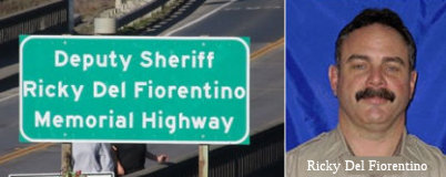 The portion of Route 1 between milepost marker
62.0 and milepost marker 65.0, adjacent to MacKerricher State Park in the
County of Mendocino is officially designated the "Deputy Sheriff Ricky
Del Fiorentino Memorial Highway". It was named in memory of Deputy
Sheriff Ricky Paul Del Fiorentino, was born in 1965 in Napa California.
Del Fiorentino attended Napa High School, Class of 1983, the University of
Oklahoma, and the Napa Valley College Police Academy. Deputy Sheriff Del
Fiorentino began his law enforcement career with the Mendocino County
Sheriff’s Office, from 1988 to 1990, inclusive, then worked with the
Fort Bragg Police Department as a Patrol Officer and Detective, from 1990
to 2000, inclusive, and finally returned to the Mendocino County
Sheriff’s Office as a Deputy Sheriff in 2000. Deputy Sheriff Del
Fiorentino was a defensive tactics instructor, had been a member of the
Mendocino County Sheriff’s Office Special Weapons and Tactics team,
and had been the president of the Coast Chapter of the Police Activities
League.Deputy Sheriff Del Fiorentino was a very visible presence in the
Fort Bragg community, and had also coached wrestling at the local high
school. Deputy Sheriff Del Fiorentino was inducted into the Napa High
School Hall of Fame in 1998, and won a Gold Medal in the 2003 California
Police Olympics in both Greco-Roman and Freestyle wrestling. On March 19,
2014, Deputy Sheriff Del Fiorentino responded to a shooting in Cleone, a
small community a few miles north of Fort Bragg in the County of
Mendocino. Deputy Sheriff Del Fiorentino spotted the suspect vehicle
stopped in the roadway in a residential area and was immediately ambushed
by the suspect who fired numerous rifle rounds into Del Fiorentino’s
patrol vehicle, killing him. Seconds later the suspect fired on a Fort
Bragg Police Lieutenant who killed the suspect in the gun battle. Deputy
Sheriff Del Fiorentino made the ultimate sacrifice in the service of the
residents of the County of Mendocino and the State of California. It was
named by Assembly Concurrent Resolution 159, Resolution Chapter 177,
9/11/2014.
The portion of Route 1 between milepost marker
62.0 and milepost marker 65.0, adjacent to MacKerricher State Park in the
County of Mendocino is officially designated the "Deputy Sheriff Ricky
Del Fiorentino Memorial Highway". It was named in memory of Deputy
Sheriff Ricky Paul Del Fiorentino, was born in 1965 in Napa California.
Del Fiorentino attended Napa High School, Class of 1983, the University of
Oklahoma, and the Napa Valley College Police Academy. Deputy Sheriff Del
Fiorentino began his law enforcement career with the Mendocino County
Sheriff’s Office, from 1988 to 1990, inclusive, then worked with the
Fort Bragg Police Department as a Patrol Officer and Detective, from 1990
to 2000, inclusive, and finally returned to the Mendocino County
Sheriff’s Office as a Deputy Sheriff in 2000. Deputy Sheriff Del
Fiorentino was a defensive tactics instructor, had been a member of the
Mendocino County Sheriff’s Office Special Weapons and Tactics team,
and had been the president of the Coast Chapter of the Police Activities
League.Deputy Sheriff Del Fiorentino was a very visible presence in the
Fort Bragg community, and had also coached wrestling at the local high
school. Deputy Sheriff Del Fiorentino was inducted into the Napa High
School Hall of Fame in 1998, and won a Gold Medal in the 2003 California
Police Olympics in both Greco-Roman and Freestyle wrestling. On March 19,
2014, Deputy Sheriff Del Fiorentino responded to a shooting in Cleone, a
small community a few miles north of Fort Bragg in the County of
Mendocino. Deputy Sheriff Del Fiorentino spotted the suspect vehicle
stopped in the roadway in a residential area and was immediately ambushed
by the suspect who fired numerous rifle rounds into Del Fiorentino’s
patrol vehicle, killing him. Seconds later the suspect fired on a Fort
Bragg Police Lieutenant who killed the suspect in the gun battle. Deputy
Sheriff Del Fiorentino made the ultimate sacrifice in the service of the
residents of the County of Mendocino and the State of California. It was
named by Assembly Concurrent Resolution 159, Resolution Chapter 177,
9/11/2014.
(Image sources: Waymarking; Lost Coast Outpost 3/21/2014)
Named StructuresBridge 10-130 over the Navarro River in Mendocino county (001 MEN 40.18) is named the "Armed Forces of Mendocino County Memorial Bridge". It was constructed in 1949, and was named by Senate Resolution 169 in 1949.
Bridge 10-151, at Russian Gulch in Mendocino county (001 MEN 52.64), is named the "Frederick W. Panhorst Bridge". It was built in 1940, and was named by Senate Concurrent Resolution 145 in 1974. Frederick Panhorst was a Caltrans employee responsible for the construction of the Alameda Creek Bridge. He is a former director of ASCE. In 1960, he received a California State Assembly Resolution of Commendation and California Highway Commission Resolution of Acknowledgement and Appreciation. He served as as an engineer with the Bridge Department of the California Division of Highways from 1927 to 1960. He has a collection of papers on file at the University of Illinois.
Bridge 10-153, over Casper Creek in Mendocino county (001 MEN R54.71), is named the "Ray E. Ware Memorial Bridge". It was built in 1966, and was named by Senate Concurrent Resolution 32 in 1973. Ray E. Ware served as Judge of the Ten Mile Justice Court from 1952 to 1971 and was a tireless advocate for an all weather highway system for California.
Bridge 10-175, over Hare Creek in Mendocino county (001 MEN 59.67), is named the "Sgt. Emil Evenson Memorial Bridge". It was built in 1947, and named by Assembly Concurrent Resolution 27, Chapter 44, in 1948. Sgt. Emil Evenson, a native of the Ft. Bragg area, was killed in action on the island of Attu in the Pacific during World War II.
Bridge 10-176, at the Noyo River in Mendocino county (001 MEN 60.23, since replaced with bridge 10-298), is named the "Lieutenant Charles Larsen Memorial Bridge". It was built in 1948, and named by Assembly Concurrent Resolution 27, Chapter 44, the same year. Lt. Charles Larsen was lost in the Pacific while flying a combat mission during World War II.
 The Pudding Creek Trestle in MacKerricher State Park (near Route 1
near Fort Bragg) (001 MEN 62.12) is named the "Wesley Chesbro Pudding
Creek Trestle". The Pudding Creek Trestle is a
pedestrian-equestrian-bicycle timber stringer bridge over Pudding Creek in
MacKerricher State Park (near Route 1), adjacent to the City of Fort Bragg
in Mendocino County. The trestle is 48 feet above sea level, with a total
length of 515 feet and a deck width of 12 feet. It was built by the Union
Lumber Company in 1915 as a logging railroad trestle. During the early
years of the 20th century, the Union Lumber Company harvested timber from
forests along Ten Mile River, and the Ten Mile Railroad was constructed to
transport logs from those forests, and over Pudding Creek, to the Fort
Bragg mill. For 32 years the Ten Mile Railroad existed as a working
railroad, hauling logs and transporting workers. After World War II,
logging trucks replaced the railroad, and the right-of-way, including the
trestle, were converted for truck use in 1949. All use of the trestle
ended in 1983, and the Department of Parks and Recreation acquired the
unused logging road and nearby headlands in 1995. In 2001, Senator Wesley
Chesbro requested a report on the structural condition of the trestle, and
state engineers concluded that with some structural modifications it could
be safely used by nonmotorized traffic, including pedestrians, bicyclists,
and equestrians, to provide easy access from Fort Bragg to the beaches at
MacKerricher State Park and to create the key link in one of the longest
public trails along the California coast. Senator Chesbro thereupon
committed to securing funding through the State Coastal Conservancy or
from unallocated park bond funds and gathered department heads from
affected state and federal agencies to form a working group to pursue the
project. Thanks to Senator Chesbro’s leadership, the Budget Act of
2003 provided $235,000 in Proposition 40 funds for preliminary plans and
working drawings to rehabilitate the trestle, in 2004, the trestle project
was awarded $1,939,000 in Proposition 40 funds for construction, and in
2006, the project was awarded an additional $1,666,000 to complete the
project. Named by Senate Concurrent Resolution No. 140, Resolution Chapter
151, on September 5, 2014.
The Pudding Creek Trestle in MacKerricher State Park (near Route 1
near Fort Bragg) (001 MEN 62.12) is named the "Wesley Chesbro Pudding
Creek Trestle". The Pudding Creek Trestle is a
pedestrian-equestrian-bicycle timber stringer bridge over Pudding Creek in
MacKerricher State Park (near Route 1), adjacent to the City of Fort Bragg
in Mendocino County. The trestle is 48 feet above sea level, with a total
length of 515 feet and a deck width of 12 feet. It was built by the Union
Lumber Company in 1915 as a logging railroad trestle. During the early
years of the 20th century, the Union Lumber Company harvested timber from
forests along Ten Mile River, and the Ten Mile Railroad was constructed to
transport logs from those forests, and over Pudding Creek, to the Fort
Bragg mill. For 32 years the Ten Mile Railroad existed as a working
railroad, hauling logs and transporting workers. After World War II,
logging trucks replaced the railroad, and the right-of-way, including the
trestle, were converted for truck use in 1949. All use of the trestle
ended in 1983, and the Department of Parks and Recreation acquired the
unused logging road and nearby headlands in 1995. In 2001, Senator Wesley
Chesbro requested a report on the structural condition of the trestle, and
state engineers concluded that with some structural modifications it could
be safely used by nonmotorized traffic, including pedestrians, bicyclists,
and equestrians, to provide easy access from Fort Bragg to the beaches at
MacKerricher State Park and to create the key link in one of the longest
public trails along the California coast. Senator Chesbro thereupon
committed to securing funding through the State Coastal Conservancy or
from unallocated park bond funds and gathered department heads from
affected state and federal agencies to form a working group to pursue the
project. Thanks to Senator Chesbro’s leadership, the Budget Act of
2003 provided $235,000 in Proposition 40 funds for preliminary plans and
working drawings to rehabilitate the trestle, in 2004, the trestle project
was awarded $1,939,000 in Proposition 40 funds for construction, and in
2006, the project was awarded an additional $1,666,000 to complete the
project. Named by Senate Concurrent Resolution No. 140, Resolution Chapter
151, on September 5, 2014.
Bridge 10-161, at 10 Mile River in Mendocino county (001 MEN 69.65), is named the "Frank J. Hyman Memorial Bridge". It was built in 1954, and was named by Senate Concurrent Resolution 33 in 1973. Frank J. Hyman activated the Paul Bunyan Association and was instrumental in forming the Noyo Harbor Commission and the Fort Bragg Rural Fire District in the 1950's.
Freeway[SHC 253.2] From Route 101 near the southerly end of Marin Peninsula to the vicinity of Valley Ford; from Route 128 near the mouth of the Navarro River to Route 101 near Leggett. Added to the F&E system in 1959 (Chap. 1062).
Scenic Route Blue Star Memorial Highway
Route 1, from its junction with I-5 at Dana Point in Orange County to its junction with US 101 at Leggett in Mendocino County was designated as a Blue Star Memorial Highway. This designation was made by Assembly Concurrent Resolution 58, Chapter 108, July 29, 2003.
 Exit Information
 Other WWW Links
 Interregional Route
[SHC 164.10] Entire route.
 Statistics
Overall statistics for Route 1:
 Pre-1964 Legislative Route
The basic routing for what became LRN 1 was first defined in the 1909 First Bond Act, as part of a route from San Francisco to Crescent City. It was extended to the Oregon Border by the 1919 Third Bond Act. Ground was broken for the route in August 1912; a picture of the groundbreaking may be found here.
By 1935, LRN 1 had been codified into the SHC as "from a point in Marin County opposite San Francisco to the Oregon State Line via Crescent City and the Smith River". It was a primary route in its entirety.
LRN 1 corresponds to present-day Route 101 (US 101) and Route 199 (US 199). It was signed as US 101 between the Golden Gate Bridge and the vicinity of Crescent City, and then as US 199 to the Oregon border. Portions of the original route are current Route 254, Route 271, and Route 283.
 Return to State Routes
 Route 2
© 1996-2020 Daniel P. Faigin.
Maintained by: Daniel P. Faigin
<webmaster@cahighways.org>.