
 California Highways:
Click here for a key to the symbols used. An explanation of acronyms may be found at the bottom of the page.
 Routing
 No current segment. Prior to 1964, US 99 ran from the Mexico Border
to the current I-5/Route 99 split as US 99.
No current segment. Prior to 1964, US 99 ran from the Mexico Border
to the current I-5/Route 99 split as US 99.
 Pre 1964 Signage History
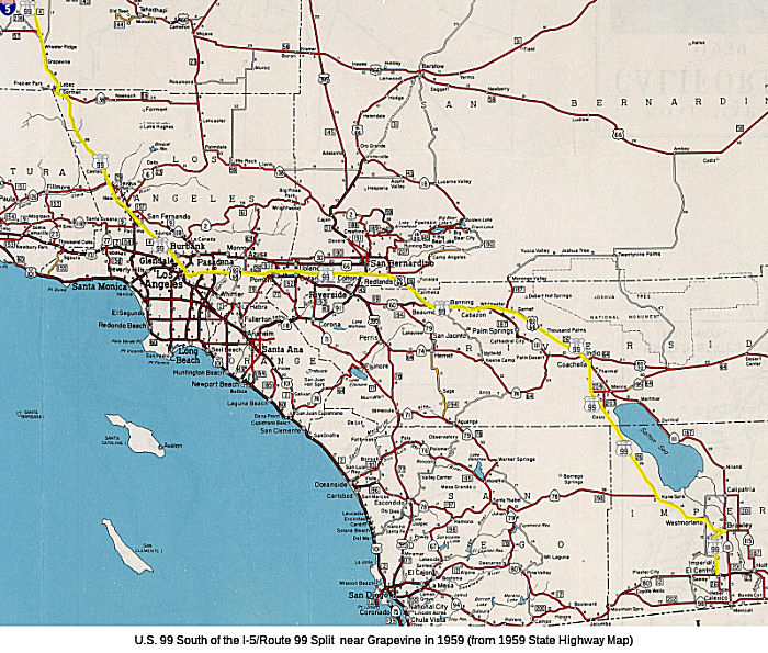 On the southern end, the route ran from the Mexican border to the current
start of Route 99 in Wheeler Ridge, along routings that approximated
current Route 86, Route 60, I-10, and I-5.
On the southern end, the route ran from the Mexican border to the current
start of Route 99 in Wheeler Ridge, along routings that approximated
current Route 86, Route 60, I-10, and I-5.
From Calexico, US 99 traveled north through El Centro and Brawley along roughly present-day Route 86 to Indio. The segment between Indio and El Centro was part of the 1916 LRN 26; the segment from EL Centro to the border at Calexico was a 1931 extension of LRN 26.
The routes that would become LRN 26 and LRN 27was created in 1926 with the definition “an extension of the San Bernardino county state highway lateral to the Arizona State Line near the town of Yuma, Arizona, via the cities of Brawley and El Centro in Imperial County by the most direct and practical route…”. The "San Bernardino county state highway lateral" was LRN 9 (from LRN 4 (US 99) in San Fernando to San Bernardino, this means that LRN 26 initially started near former US 66 in San Bernardino. The terminus was in El Centro, where it met eventual LRN 27 (future US 80, now I-8). LRN 27 continued to Yuma and the Arizona border.
The US Route System, which included US 99, was finalized on November 11,
1926 by the Executive Committee of the American Association of State
Highway Officials ("AASHO"). The November 11, 1926 definition of US 99
followed LRN 26 to its southern terminus at US 80 in El Centro, which was
located on Imperial Avenue at US 80/Adams Avenue.
(Source: Gribblenation Blog (Tom Fearer), “Former US Route 99 through Heber and Calexico to the Mexican Border”, 12/31/2021)
On September 8, 1931 the California Division of Highways proposed an
extension of US 99 from US 80 in El Centro south to the Mexican Border at
Calexico. The proposal letter by the State Highway Engineer to the AASHO
noted that the road through Heber and Calexico to the Mexican Border had
been taken over as part of LRN 26 on August 14, 1931. The temporary
alignment of US 99/LRN 26 followed 4th Street south of US 80/Main Street
in El Centro, Corfman Road, Heber Road through Heber, Imperial Avenue into
downtown Calexico, 3rd Street and Heffernan Avenue in Calexico to the
Mexican Border. The letter noted a streamlined connecting highway north
from Calexico to US 80/LRN 27 east of El Centro was planned as the future
alignment of US 99/LRN 26. The extension to the Mexican Border was
approved by the AASHO Executive Committee on June 22, 1932.
(Source: Gribblenation Blog (Tom Fearer), “Former US Route 99 through Heber and Calexico to the Mexican Border”, 12/31/2021)
The future streamlined route was to be LRN 201, defined in 1933 as the
route “From a point on LRN 26 approximately 2 mi W of Brawley to a
point on said LRN 26 approximately 2 1/2 mi SW of Brawley” and
“Calipatria to Brawley-Holtville Road.”. By 1934 the
definition had been simplified to "LRN 187 near Calipatria to Route 26
east of Heber." Despite LRN 201 being adopted over the planned streamlined
route of US 99 north of Calexico to US 80/LRN 27, it never became part of
the highway. Instead, Route 111 was signed over LRN 201.
(Source: Gribblenation Blog (Tom Fearer), “Former US Route 99 through Heber and Calexico to the Mexican Border”, 12/31/2021)
El Centro
The initial definition of LRN 26 originated in San
Bernardino and terminated in El Centro. LRN 26 (US 99) was located in El
Centro via Imperial Avenue to US 80 at Adams Avenue. In 1931, LRN 26 was
extended to Colton and to the Mexican Border in Calexico; and in late
1931, the California Division of Highways proposed an extension of US 99
from US 80 in El Centro south to the Mexican Border at Calexico. During
June 1932, the extension was approved and US 99 was extended from El
Centro to the Mexican Border in Calexico. The 1931 temporary alignment of
US 99/LRN 26 followed 4th Street south of US 80/Main Street in El Centro,
Corfman Road, Heber Road through Heber, Imperial Avenue into downtown
Calexico, and 3rd Street and Heffernan Avenue in Calexico to the Mexican
Border. There were plans for a streamlined connecting highway north from
Calexico to US 80/LRN 27 east of El Centro as the future alignment of US 99/LRN 26. In 1948, the multiplex of US 99 and US 80 was realigned onto a
bypass of downtown El Centro that began at the intersection of Main
Street/4th Street and continued westward via a 4th Street and Adams Street
to Imperial Highway. US 99 would remain signed through El Centro until US 99 was truncated to the southern end of the Golden State Freeway and the
route was resigned as Route 86 during June 1963.
(Source: Gribblenation Blog (Tom Fearer), "Former US Route 99 in El Centro", 12/2022)
Imperial
LRN 26 (future US 99) was first routed through Imperial
with the 1916 extension of LRN 26, and started to show on maps in 1918 as
a planned highway. By 1924, the alignment of LRN 26 through Imperial
appears to be aligned along Imperial Avenue. The route continued to be
align along Imperial through the 1930s and 1940s; at the end of the 1940s,
it was expanded to 4 lanes. US 99 was realigned immediately east of
Imperial Avenue onto a bypass expressway during 1950. US 99 in Imperial
would be replaced by Route 86 during 1963 when the former was truncated to
downtown Los Angeles.
(Source: Gribblenation Blog (Tom Fearer), "Former US Route 99 in Imperial", Nov 2022)
Brawley
LRN 26 (future US 99) was first routed through Brawley
with the 1916 extension of LRN 26, and started to show on maps in 1918. By
1924, the alignment of LRN 26 through Brawley appears to be on Main Street
and Western Avenue. LRN 26 was signed US 99 in 1926, and by that time,
grading and road improvement was in progress. In 1932, the city of Brawley
requested assistance with improving US 99/LRN 26 on Western Avenue; and in
1933, a 0.4-mile-long contract to realign US 99/LRN 26 in Brawley was
awarded. The new alignment of US 99 on 1st Street was east of Western
Avenue. Repaving occurred in 1946. In 1953, the new New River Bridge was
dedicated, replacing a timber span that had been damaged during the May
1940 earthquake. This alignment remained signed as US 99 until the
truncation of US 99 to Los Angeles in 1963. In the 1964 renumbering, this
became part of Route 86.
(Source: Gribblenation Blog (Tom Fearer), "Former US Route 99 in Brawley", 10/2022)
Westmorland (currently 86 IMP 27.496)
US 99 was aligned on Main Street within Westmorland
from 1926 until it was truncated to downtown Los Angeles in 1963. The
routing is currently Route 86. The route was first planned around 1918.
LRN 26 through Westmorland was not part of any major Auto Trails. In fact,
LRN 26 took a series of ninety-degree jogs between Brawley and
Westmorland. The alignment of LRN 26 through Westmorland appears to be
aligned on Main Street and Center Street. By 1925, LRN 26 was realigned
and surfaced through Westmorland, with the realignment of LRN 26 extending
one mile west of Westmorland. In 1970. signage for Route 78 was extended
through Westmorland via multiplex of Route 86 following the addition of
Ben Hulse Highway as part of the State Highway System. The road connecting
Brawley to Glamis opened on August 13th, 1958, according to a San Diego
Tribune article.
(Source: Gribblenation Blog (Tom Fearer), "Former US Route 99 in Westmorland", September 2022)
In June 1963, US 99 was truncated to the junction of the Golden State (I-5) and San Bernardino (I-10) freeways. In the subsequent renumbering, Route 111 took over the segment from Calexico to Heber, and Route 86 took over the segment from Heber to Indio.
Note that some of the "Historic" signage in Calexico technically
incorrect, but it is close enough for the traveling public as some of the
original route is no longer accessible due to road changes and one-way
restrictions. For example, during 1995 a new border station in Calexico
was opened west of the 1939 station at Heffernan Avenue. Route 111 was
shifted off of the former alignment of US 99 on 3rd Street onto to the new
border station southbound via Imperial Avenue and westbound 2nd Street.
Northbound Route 111 now begins at the 1995 border station, which flows
directly into Imperial Avenue. The border station realignment resulted in
highway changes that made 3rd Street no longer accessible from Imperial
Avenue; this made it functionally impossible to replicate southbound US 99
continuously in Calexico by car (as you cannot make the left turn from
Imperial onto 3rd). Thus the historic signage on 2nd is close enough for
SB traffic (and it is likely where the city wanted the sign to support the
business district). Similarly, although 1993 SCR 19, Chapter 73 named
Route 111 from IMP 0.000-IMP R21.993 as "Historic US Highway 99", Route 111 north of Heber Road (IMP R4.73) was never part of US 99. Close enough
for government work applies here as well, especially when the legislators
are not highway experts, and depend on their staff and the submissions
from the cities for the specifics.
(Source: Gribblenation Blog (Tom Fearer), “Former US Route 99 through Heber and Calexico to the Mexican Border”, 12/31/2021)
From Indio to Beaumont, US 99 was cosigned with US 60 and US 70, and was part of the 1916 LRN 26 segment. This is present-day I-10.
Note: In general, discussions of the planning for the freeway routing, as it would eventually become I-10, is discussed with I-10.
Michael Ballard's website provides additional history, specific routings, and photographs of the segment from Edom (~ 10 RIV 44.323) to Banning (~
10 RIV 13.379). Routings include Varner Road and Garnet Road between
Thousand Palms and Garnet. In Whitewater, Railroad Avenue was US 99. In
Cabazon, Main Street was the routing, It was Johnson Lane between Morongo
Trail and Banning.
(Source: Michael Ballard, SoCal Regional Rocks and Roads, 1/5/2021)
The rough routing of what would become US 99 in the Coachella Valley
dates back to the Bradshaw Trail, a stage route originating in San
Bernardino that crossed the Sonoran Desert east to the Colorado River. The
Bradshaw Trail was plotted in 1862. Another influence on the eventual
route was the Southern Pacific Railroad routing east from Los Angeles to
Arizona City (now Yuma) began during 1873. This line passed through San
Gorgonio Pass and the Coachella Valley on its course through the Sonoran
Desert. The Southern Pacific Railroad would establish numerous siding
facilities and communities in Coachella Valley including Indio (1876),
Woodspur (now Coachella), and Garnet. The early appearances of LRN 26 on
maps shows the route roughly parallel to the SP Railway Line.
(Source: Gribblenation Blog (Tom Fearer), "Former US Route 99-60-70 in Indio and Coachella Valley", May 2022)
In 1934, construction of the Indio-Cutoff Spur of LRN 64 began. This spur
was to serve as a new alignment of US 60/US 70, which would enter
Coachella Valley via Dillon Road and would provide a bypass to the hazards
of Box Canyon. By 1935, the routings were as follows: From the junction
with Route 111/LRN 187, US 99/US 60/US 70/LRN 26 passed through Garnet
siding via what is now Garnet Avenue. From Garnet, US 99/US 60/US 70/LRN 26 followed what is now Varner Road to Edom. From Edom, US 99/US 60/US 70/LRN 26 followed Varner Road to a railroad crossing near what is now
Madison Street to Indio Boulevard towards downtown Indio. US 99/US 60/US 70/LRN 26 originally passed through the downtown Indio business district
via what is now Fargo Street, where it jogged back to Indio Boulevard.
From downtown Indio, US 99/US 60/US 70/LRN 26 ran concurrent to Coachella.
US 99 split via what is Cesar Chavez Street on LRN 26 towards El Centro,
whereas US 60/US 70 followed Grapefruit Boulevard on LRN 64 towards Mecca
and Box Canyon.
(Source: Gribblenation Blog (Tom Fearer), "Former US Route 99-60-70 in Indio and Coachella Valley", May 2022)
In 1939, a realignment and expansion of US 99/US 60/US 70/LRN 26 in Indio
bypassed Fargo Street in favor of a newly continuous Indio Boulevard. By
1941, a new "Palm Springs Junction" opened at the junction of US 99/US 60/US 70/LRN 26 with Route 111/LRN 187. This junction featured channelized
traffic that was carried via two-lanes in each direction of travel on US 99/US 60/US 70/LRN 26. Previously US 99/US 60/US 70/LRN 26 intersected
Route 111/LRN 187 at what is now Tipton Road. By 1943, US 99/US 60/US 70/LRN 26 bypassed downtown Indio via the continuous Indio Boulevard, with
the original alignment of US 99/US 60/US 70/LRN 26 branching towards Fargo
Street. Much of the original alignment of US 99/US 60/US 70/LRN 26 in
downtown Indio was obliterated in modern times to make way for the Jackson
Street Overpass Bridge.
(Source: Gribblenation Blog (Tom Fearer), "Former US Route 99-60-70 in Indio and Coachella Valley", May 2022)
Around 1957, US 99/US 60/US 70/LRN 26 was realigned onto a new four-lane
divided grade between Garnet-Thousand Palms. The realignment of the route
onto an expressway alignment in the Garnet-Thousand Palms corridor
replaced much of Garnet Avenue and Varner Road. Around this time,
conversion to full freeway status started. By 1959, the freeway had been
completed between Thousand Palms and Indio.
(Source: Gribblenation Blog (Tom Fearer), "Former US Route 99-60-70 in Indio and Coachella Valley", May 2022)
Michael also provides original routing and construction details, as well as photographs for the segment from Banning to Calimesa. Routings include Ramsey St. and 6th St in Banning and Beaumont, with the freeway
opening in 1956. Between Beaumont and Calimesa, the route was what
eventually became Desert Lawn Drive.
(Source: Michael Ballard, SoCal Regional Rocks and Roads, 1/16/2021)
The eventual route of US 99 (and US 60 and US 70) in the San Gorgonio
Pass had its origins in the Bradshaw Trail, and the Southern Pacific Railroad that was subsequently laid down. The future route became part of the state highway
system as part of the 1916 Second State Highway Bond Act, eventually
becoming LRN 26. Through Beaumont, LRN 26 was aligned on 6th Street,
Ramsey Street within Banning and Main Street within Cabazon. Over time,
the routing was upgraded to expressway, and finally to freeway. In
particular, the Banning Freeway opened as a replacement for Ramsey Street
during September 1956. The he new US 99/US 60/US 70/I-10/LRN 26 bypass of
Beaumont and Banning opened to traffic during March 1962. The bypass of
Beaumont and Banning included a new interchange between US 60/LRN 19 and
US 99/US 70/I-10/LRN 26. Upon opening the freeway bypass of Beaumont
replaced 6th Street as the through highway in the city. US 60/I-10 was
completed to freeway standards between Banning-Cabazon during December
1964.
(Source: Gribblenation Blog (Tom Fearer), “Former US Routes 99-60-70 in San Gorgonio Pass (Beaumont, Banning and Cabazon)”, April 2022)
The future US 99 was first paved around 1924 between Beaumont and
Redlands. In 1936, changes to the US route system added US 70 to US 99
along this routing. In Calimesa CA, the route ran along Roberts Blvd. This
segment was drivable as recently as 2019, when construction of a housing
development removed the ability to drive Roberts from Singleton. W of
Calimesa, the routing follows Calimesa Blvd. to Live Oak Canyon Rd. Around
1950, US 99/US 70/LRN 26 was expanded to a four-lane expressway over a
9.6-mile project zone that was largely a completely new alignment detached
from than existing Calimesa Boulevard. Upon being upgraded to expressway
standards in 1951, an approximately one-mile segment of former US 99/US 70
was isolated and incorporated into what is now Copper Drive and Roberts
Road. By 1961, the freeway bypass alignment of US 99/US 70/I-10/LRN 26
through Redlands was under construction; when completed, US 99/US 70/I-10
would have 125 continuous miles of freeway and expressway between Los
Angeles and Indio.
(Source: Gribblenation Blog (Tom Fearer), “Former US Route 99-70 in Calimesa”, April 2022; BrianScott
Anderson on FB, 9/30/2019; Michael Ballard, SoCal Regional Rocks and Roads, 1/16/2021)
Redlands: US 99 followed Colton, Orange, State and what is now Redlands
Boulevard prior to 1936-1937. In 1936, US 99/US 70/LRN 26 was realigned
via a new direct alignment from Colton that cut off the previous alignment
on Colton Avenue and Orange Street via an extended diagonal of Central
Boulevard (now Redlands Boulevard). This realignment also included
shifting US 99/US 70/LRN 26 off of the previous alignment on State Street
in downtown Redlands via a new diagonal connecting eastward towards
Beaumont by way of Calimesa. The new alignment of US 99/US 70/LRN 26 onto
the Central Boulevard extension opened to traffic on January 9, 1936.
(Source: Gribblenation Blog (Tom Fearer), "The 1935-1963 Los Angeles-Redlands Corridor of former US Route 99", February 2022)
In 1947, CHPW reported that the segment through E Redlands had been converted into a four-lane divided limited-freeway.
San Bernardino Routings
The original LRNs in San Bernardino were equally convoluted according to Scott Parker (Sparker). The "spine" LRN through the region was LRN 43, which followed Sign Route 18 throughout the region; a number of long-distance LRNs terminated at this legislative route. LRN 26 was US 99 south of the 3rd Street/E Street intersection, following US 99 all the way to the Mexican border at Calexico. LRN 31, which carried US 66 over Cajon Pass to Barstow, and US 91 (which was not extended south of Barstow until 1947) northeast from there to Nevada, began at the junction of Mt. Vernon and 3rd Street and was the Mt. Vernon RR bridge and US 66 east from there. LRN 9 was US 66, and originally US 99, extending west from LRN 31 on 4th Street toward Pasadena. Signed Route 30/Highland Ave. was LRN 190, and North E Street and Kendall Ave. Business US 66 was LRN 191.
Scott Parker (Sparker) noted in that discussion that this arrangement didn't last long; the bridge over the Santa Ana River connecting Colton Ave. in the south reaches of San Bernardino with Valley Blvd. in central Colton was completed circa 1931; LRN 26 and US 99 were rerouted west along that alignment. South E Street from the rerouted US 99/LRN 26 became a realigned but unsigned LRN 43. 3rd Street, still carrying Signed Route 18, became an eastern extension of LRN 9, which terminated at 3rd and E Street at LRN 43 (Signed Route 18 still turned north there). The entirety of Mt. Vernon north of Valley Blvd. in Colton was reassigned to LRN 31; it still carried Signed Route 18 south of 3rd Street until US 395 was commissioned in 1934 to join it. US 99/LRN 26 continued west from Colton on Valley Blvd. into Ontario, where it was renamed Holt Ave.
Similar to 4th street west of Mt. Vernon, 3rd Street
past the original Santa Fe depot (now used by Metrolink & Amtrak) east
of the Mt. Vernon bridge features portions of the original segmented
concrete pavement that once carried US 99 & Signed Route 18. The
east-west Valley Blvd. alignment that eventually became US 99/LRN 26 was
in place as a county facility at the time US 99 was routed through central
San Bernardino, with its east end at or near Mt. Vernon Ave. in Colton.
The delay involved with realigning US 99 was due to the difficulty
experienced in constructing bridges over the Santa Ana River; the riverbed
consists of deep layers of sand and silt lying in scooped-out sandstone
with no supporting bedrock to speak of. Bridge construction over such a
"waterway" required placing concrete caissons deep into the sand and
waiting for them to settle before constructing bridge piers upwards from
them -- then letting the whole assembly settle even more before extending
a bridge deck over the piers. This method has continued to this day; the
I-10, I-215, and Route 210 bridges over the Santa Ana River were deployed
in a similar manner. The original US 99 E Street bridge was the only
exception; it was a relatively light "trestle" structure sitting atop the
silt layers; it was replaced by the present caisson-based structure in the
mid-'60's, a few years after the original I-10 and I-15 (now I-215)
bridges were built.
(Source: Scott Parker (Sparker) @ AAroads, 7/7/2016)
In Colton, US 99/US 70/LRN 26 originally followed I Street (now Valley
Boulevard), Mount Vernon Avenue, Colton Avenue and E Street. This was
multiplexed with US 395/Route 18 on I Street from 8th Street (now La
Cadena Drive) in downtown Colton and north on Mount Vernon Avenue. US 395/Route 18 continued north of Mount Avenue, whereas US 99/US 70/LRN 26
split east on Colton Avenue. In 1937, a new alignment of US 99/US 70/LRN 26 shifted onto an extension of I Street east of downtown Colton (referred
to as the Valley Boulevard) towards a new bridge over the Santa Ana River.
This tied in with the recently completed Central Boulevard extension in
Redlands.
(Source: Gribblenation Blog (Tom Fearer), "The 1935-1963 Los Angeles-Redlands Corridor of former US Route 99", February 2022)
W of San Bernardino to Los Angeles
Note: In general, discussions of the planning for the freeway routing, as it would eventually become I-10, is discussed with I-10.
One of the original routes between San Bernardino and Los Angeles was LRN 9, defined in 1909. At that time (in fact, until the 1930s), the state
Division of Highways could not maintain routes within incorporated cities.
By 1912, the planned route of LRN 9 ran from Riverside to Los Angeles
(although that was not in the formal route definition). The 1909
definition of LRN 9 was San Fernando to San Bernardino; 1933 extended LRN 9 to Montvalvo near Ventura. LRN 9A (which wasn't quiet part of LRN 9) was
an extension of LRN 9 to Redlands. Both LRN 9 and LRN 9A were surveyed in
1913.
(Source: DPF Research, Gribblenation Blog (Tom
Fearer), "The 1926-1934 Los Angeles-Redlands Corridor of former US Route 99", January 2022)
LRN 26 was created by the 1916 Second State Highway Bond Act. The initial
definition of LRN 26/LRN 27 was "an extension of the San Bernardino county
State Highway lateral (LRN 9) to the Arizona State line near the town of
Yuma, Arizona, via the cities of Brawley and El Centro in Imperial County
by the most direct and practical route...". LRN 26 connected San
Bernardino to Redlands via 3rd Street, E Street, Colton Avenue and
Redlands Avenue.
(Source: DPF Research, Gribblenation Blog (Tom
Fearer), "The 1926-1934 Los Angeles-Redlands Corridor of former US Route 99", January 2022)
The initial draft of the US Route System was approved by the Secretary of
Agriculture during November of 1925. The US Route System within California
was approved by California Highway Commission ("CHC") with no changes
recommended. US 99 was given a vague description that had it multiplex
with US 60 from Los Angeles to San Bernardino via LRN 9. US 99 then LRN 26
from San Bernardino to Redlands onwards to the Sonoran Desert. One map shows US 99 running along the old Route 118 (approx. I-210)
routing along the foothills.
(Source: DPF Research, Gribblenation Blog (Tom
Fearer), "The 1926-1934 Los Angeles-Redlands Corridor of former US Route 99", January 2022)
The US Route System was formally approved by the American Association of
State Highway Engineers (AASHO) on November 11, 1926. The AASHO route
description of US 99 states it was to follow LRN 4 over the Ridge Route from Bakersfield into Los Angeles. From Los Angeles, US 99 is only
described as having a next route point in San Bernardino. From the initial
route description of US 99, it is unclear where it transitioned to LRN 9
and began to multiplex US 66. US 66 was described as following LRN 9 from
San Bernardino west to San Fernando, where it would have terminated. See
the US 66 page for information on the early routings of US 66, including
the original terminus in San Fernando and how US 66 was moved to end in
Los Angeles (and later, Santa Monica).
(Source: Gribblenation Blog (Tom Fearer), "The 1926-1934 Los Angeles-Redlands Corridor of former US Route 99", January 2022)
Originally the routing of US 99 from San Bernardino to Los Angeles, circa
1926, was this: West on Colton Ave. (now Redlands Blvd.) to a broad curve
west of Waterman that deposits the route on South E Street. It continued
north on E Street to 3rd Street, where it turned west with south Sign
Route 18 (NB Sign Route 18 continued north on E St.). That continued past
the Santa Fe depot to Mt. Vernon, at the south end of the bridge over the
Santa Fe tracks; US 99 turned north to cross the bridge (this was several
years prior to the commissioning of US 395), while Sign Route 18 turned
south onto Mt. Vernon toward Colton. At the north end of the bridge Mt.
Vernon intersected 4th Street/US 66 West; US 99 turned west there as well,
multiplexing with US 66 into Pasadena. At some point in time between 1926
and 1934 Business US 66 was established; from west to east it diverged
from mainline US 66 at Mt. Vernon, crossing the bridge south with US 99
before turning east with both south US 99 and north Sign Route 18 on 3rd.
Street. It turned north on E Street with Sign Route 18, continuing north
to Highland, where Sign Route 30 crossed and Sign Route 18 turned right
with it. Business US 66 continued north on E Street, which eventually
turned NW and became Kendall Ave. US 66 east continued north on Mt. Vernon
to Highland, where it turned northwest onto Cajon Blvd., the road up the
south side of Cajon Pass, intersecting Business US 66/Kendall Ave. at a
point about 5 miles north.
(Source: Scott Parker (Sparker) @ AAroads, 7/7/2016)
By 1930, things were starting to shift. 1931 saw changes to LRN 26: On the northwestern end, there was a significant extension west of Colton, adding a segment that ran from [LRN 26] near Colton via Pomona to Los Angeles. Specifically, segment (i) of Chapter 82 defined it as "[LRN 26] near Colton via Pomona to Los Angeles". The April 1931 CHPW also discussed the proposal for the route, which referred to it as "a highway from Los Angeles to a connection with [LRN 26] E of Colton". The confusing part here is that the extension did not start in Los Angeles; rather, it started from the eastern border of Los Angeles (roughly the LA River, just E of Eastern Avenue), near Ramona and Garvey. The routing utilized Garvey (much of which was later subsumed by I-10) and Holt Avenue. The rationale for the extension was to provide a mid-point route between LRN 9 (US 66) to the north, and the eventual US 60 routing to the south.
The 1930 Division of Highways Map also shows US 99 as bypassing Los
Angeles entirely via direct routing via multiplex of US 66 on LRN 9 from
San Fernando to Pasadena via Michigan Avenue and Foothill Boulevard. It is
unclear if this is temporary alignment of US 99 given Fletcher Drive and
Eagle Rock Boulevard are not displayed. The 1930 Division of Highways Map
also displays US 99 following LRN 4 via San Fernando Road into Los
Angeles. The map seems to imply that US 99 jogged from San Fernando Road
towards Pasadena via Fletcher Drive, Eagle Rock Boulevard and Colorado
Boulevard. This routing is more consistent with the initial AASHO
description of US 99.
(Source: Gribblenation Blog (Tom Fearer), "The 1926-1934 Los Angeles-Redlands Corridor of former US Route 99", January 2022)
However, at this time, US 99 still used LRN 9. US 99 multiplexed US 66
east from Pasadena following LRN 9 on Foothill Boulevard to Monrovia. From
Monrovia US 99/US 66 continued following LRN 9 via Shamrock Avenue briefly
south to Arcadia and east on Center Street (now Huntington Drive) towards
Azusa. From Azusa US 99/US 66/LRN 9 followed Alosta Avenue through
Glendora and Mesa Avenue (now Foothill Boulevard) to La Verne. From La
Verne US 99/US 66/LRN 9 followed Foothill Boulevard through Claremont and
Upland towards Fontana. From Fontana US 99/US 66/LRN 9 followed San
Bernardino Avenue (now Foothill Boulevard) into San Bernardino. In San
Bernardino US 99/US 66 followed LRN 9 via 4th Street to Mount Vernon
Avenue. US 99 followed Mount Vernon south from 4th Street whereas US 66
split north towards Cajon Pass. US 99 followed the implied path of LRN 9
in San Bernardino via Mouth Vernon Avenue and 3rd Street towards E Street.
US 99 followed E Street to LRN 26 at Colton Avenue and swung eastwards to
Redlands.
(Source: Gribblenation Blog (Tom Fearer), "The 1926-1934 Los Angeles-Redlands Corridor of former US Route 99", January 2022)
In an exchange of letters in 1931, the Division of Highways conveyed a
desire to split US 66 into a mainline routing terminating at US 101 in
downtown Los Angeles and an Alternate Route which bypassed downtown
towards US 101 at Sunset Boulevard. These documents show the terminus
point for US 66 as ending at US 99/San Fernando Road via Fletcher Drive.
US 99 was implied to multiplex US 66 via Fletcher Drive, Eagle Rock
Boulevard and Colorado Boulevard to downtown Pasadena. US 99/US 66 would
have followed Colorado Boulevard east through Pasadena to Santa Anita
Avenue to reach LRN 9 at Foothill Boulevard.
(Source: Gribblenation Blog (Tom Fearer), "The 1926-1934 Los Angeles-Redlands Corridor of former US Route 99", January 2022)
In 1933, LRN 26 was extended from "Los Angeles (Aliso Street) to [LRN 26] near Monterey Park via Ramona Blvd", which completed LRN 26 into downtown Los Angeles. This was the eventual Ramona Expressway that became the San Bernardino Freeway (I-10). 1933 also saw the addition of LRN 161, the Colorado St Extension, and LRN 165, which would become the Pasadena Freeway.
A series of September 1934 letters by the California State Highway
Engineer to the AASHO Executive Secretary noted a recommendation to move
US 99 from Los Angeles to Redlands via LRN 26 through Pomona and Colton.
The California State Highway Engineer noted traffic on US 99 would be
better served traversing downtown Los Angeles and utilizing US 60/LRN 26
directly to reach Redlands. Notably the alignment the sketch map provided
by the California State Highway Engineer shows existing US 99 following
San Fernando Road to US 66 at Arroyo Seco Avenue and a multiplex on US 66/LRN 165 via Figueroa Street to Colorado Boulevard. The same exchange of
letters also notes US 70 had been extended into California with an
endpoint following US 60/LRN 26 into downtown Los Angeles. The routing
definition of US 70 indicated it would multiplex US 99/US 60 east from
downtown Los Angeles to Pomona and onwards to US 60 east to Beaumont.
(Source: Gribblenation Blog (Tom Fearer), "The 1926-1934 Los Angeles-Redlands Corridor of former US Route 99", January 2022; "The 1935-1963 Los Angeles-Redlands Corridor of former US Route 99", February 2022)
After 1934, E of Pomona, US 99 was cosigned only with US 70 to Beaumont (US 60 continued along LRN 77 through Riverside, and thence to Beaumont). This was LRN 26. The portion between Pomona and Colton/San Bernardino was part of the 1931 extension of LRN 26; the portion from San Bernardino to Beaumont was part of the 1916 definition of LRN 26. This is present-day I-10.
The initial routing for LRN 26 followed an interim alignment from
downtown Los Angeles eastward following Macy Street, Mission Street and
Alhambra Avenue towards Pomona. The Ramona Expressway was planned as a
route connecting Macy Street directly to Garvey Avenue. There were also
plans for a Los Angeles-Pomona Arterial that was to follow what is today
Ramona Boulevard. By the mid-1930s, this had been completed from Mountain
View Road east to the city limits of Pomona, and there was a western
segment at Aliso Street and Mission Street in downtown Los Angeles. Upon
reaching Los Angeles via Mednik Avenue, Brooklyn Avenue, and Macy St, US 99/US 60 met US 101/LRN 2 at Sunset Blvd. US 99/US 66 then followed
Broadway and Solano Avenue to the Figueroa St. Tunnels, and then onto
Riverside Drive. The route then went N via US 66/LRN 165 along Arroyo Seco
Blvd to San Fernando Road, where US 99 continued NW.
(Source: Gribblenation Blog (Tom Fearer), "The 1935-1963 Los Angeles-Redlands Corridor of former US Route 99", February 2022)
By mid-1935, Ramona Boulevard was completed and served as the new
alignment of US 99/US 60/US 70/LRN 26 from downtown Los Angeles to
Monterey Park. In 1936, the fourth Figueroa Street Tunnel was completed,
and connected US 99/US 66/Route 11/LRN 165 directly to US 101/LRN 2 at
Sunset Boulevard. This provided a smoother transition for US 99 onto US 60/US 70/LRN 26 via Macy Street towards Ramona Boulevard. In 1937, the Los
Angeles-Pomona Arterial alignment of US 99/US 60/US 70/LRN 26 opened,
providing 27 miles of continuously divided highway with only two traffic
signals. The completion in 1938 of the North Figueroa Street Viaduct and
the Arroyo Seco Parkway (LRN 205) would eliminate the jog in US 99/US 66/CA 11/LRN 165 on Arroyo Seco Boulevard and Riverside Drive; at this
time, US 99/US 6 were realigned onto Avenue 26 approaching the North
Figueroa Street Viaduct. In 1943, the Arroyo Seco Parkway was extended
south to downtown Los Angeles to Adobe Street. This moved US 99/US 66/US 6/Route 11/LRN 165 to a new freeway structure between Avenue 22 and Adobe
Street. The existing Figueroa Street Tunnels were converted to northbound
freeway usage whereas new southbound lanes were routed via the new Los
Angeles River Bridge and an excavated cut.
(Source: Gribblenation Blog (Tom Fearer), "The 1935-1963 Los Angeles-Redlands Corridor of former US Route 99", February 2022)
The portion between the downtown junction of US 99 with US 60/US 70 was originally LRN 26, although the surface route along Valley Blvd was LRN 77 by 1963. This is present-day I-10. The US signage is unclear and likely varied -- at points US 99 being along Ramona (esp. after construction of the freeway), at points running along Valley Blvd. (The extension of LRN 26 from Colton to the eastern limits of Los Angeles along Garvey/Holt was added in 1931; the extension along Ramona Blvd was added in 1933; the alternate routing along Valley Blvd was added as a non-contiguous extension of LRN 77 in 1935).
In 1947, a third segment was added to LRN 161 that would become the
future Golden State Freeway corridor of US 99/US 6; this ran from "LRN 205
near Elysian Park in Los Angeles to a connection with LRN 4 near
Glendale." The eventual Santa Ana Freeway would connect the Ramona Parkway
with San Fernando Road in Glendale; Ramona Parkway, in turn, would become
the San Bernardino Freeway. The Gribblenation Blog cited in the Source
citation provides the details of all the freeway conversions, segment by
segment.
(Source: Gribblenation Blog (Tom Fearer), "The 1935-1963 Los Angeles-Redlands Corridor of former US Route 99", February 2022)
Note: In general, discussions of the planning for the freeway routing, as it would eventually become I-5, is discussed with I-5 or the appropriate other freeway routes.
The original routing of US 99, at least until 1934, was along the LRN 9
routing used by Route 118 (Michigan Ave, Foothill). This is based on some
1930 state highway maps showing US 99 along the route, and then
multiplexing US 66 out of the city. A Division of Highways letter to the
AASHO dated September 6, 1934 indicates US 99 was to be moved onto LRN 26/Ramona Boulevard. pending AASHO approval. A similar letter from the
Division of Highways two days prior details the realignment of US 99 off
of LRN 9 (and multiplex of US Route 66) onto LRN 26.
(Source: Gribblenation FB Poast, 1/21/2022)
There is evidence the route ran along the Aliso Street Viaduct in downtown Los Angeles.
Near downtown, until the construction of the Pasadena Freeway, it ran from cosigned US 60/US 70 along Ramona Blvd to San Fernando Road. Once the first segments of the Pasadena (Arroyo Seco Parkway) and San Bernardino (Ramona Parkway) Freeways were constructed in the early 1940s, US 99 was rerouted to run down the Route 11 (LRN 165, defined in 1933) to cosigned US 66/US 101, and then E to US 60/US 70 (along LRN 2 to LRN 26). Once the Santa Ana Freeway was constructed, US 99 was again resigned to run E directly from the Route 11/US 66 junction to the San Bernardino Freeway (this segment was LRN 4). This is present-day I-5 to the I-10 junction.
In July 2016, it was reported that the area where the Riverside Bridge,
Figueroa, and San Fernando meet will soon have a unique feature that sets
it apart from the rest of the city: a traffic roundabout. Scheduled to be
completed by the end of the year, it's set to be the city’s first.
This intersection is the former intersection of US 99 (San Fernando Road,
replaced by I-5 next to San Fernando Road), US 66 (Figueroa from
Pasadena). The roundabout will measure 100 feet wide and will direct
traffic in four directions without using traditional traffic signals.
(There will be "flashing lights" at four designated pedestrian crossings
around the circle.) The center will be landscaped and feature a granite
statue. Medians will line the streets that intersect at the traffic
circle. It will link to the under-construction Riverside Bridge (expected
to be completed in late 2017) and eventually share the intersection with
park space marking the approximate confluence of the Arroyo Seco and the
LA River.
(Source: Curbed LA, 7/11/2016)
Scott Parker provided some additional history of the routing in Los
Angeles on AARoads:
(Source: Sparker on AARoads "Re: US 66 1935 alignment via Eagle Rock + pre-1936 via Royal Oaks Ave in Monrovia?", 5/17/2019 and 5/17/2019)
LRN 26, the Ramona Parkway, was only a projected line on the map [between 1926 and 1934]; LRN 77 used Valley Blvd. to the L.A. city limits near Eastern Avenue, but state maintenance ceased at that boundary. But ACSC, after it was decided to reroute US 99 off US 66 between San Bernardino and Pasadena circa 1929, signed Valley Blvd. as US 99 to the multi-street intersection of Valley, Mission, and Main Streets; opting to continue west on Main St. to Ave. 20, then turning north until that street crossed Broadway and became San Fernando Road -- which, of course, headed out of town via the San Fernando Valley and the Grapevine. But Ave. 20 was a narrow city street; the Division of Highways assumed maintenance of Daly St. as part of LRN 4 a few blocks east, which itself segued onto Avenue 26 at Pasadena Ave. (then LRN 165); Avenue 26 then merged onto San Fernando Road near the SP Taylor Yard facility north of Arroyo Seco. That whole section, opened about 1931, became signed US 99. When the Ramona Parkway was completed at the end of 1934, Daly St. was extended south via a bridge over the SP tracks to Marengo St., which it used as the access point to the eastbound Ramona Parkway near Soto St. -- at which point US 99 entered the eastbound parkway, also signed as US 60. From 1935 to 1953 both US highways diverged from the parkway at Garvey Street at the west side of Alhambra; Garvey (LRN 26) continued east to Covina, where it segued into Holt Ave. for the climb over Kellogg Hill, descending into Pomona. In 1953 the parkway, by then configured as a full freeway, was opened to Rosemead Ave. near El Monte; with US 70 added by that time, US 60 & US 99 were rerouted over the new facility. Once the eastern extension through El Monte was opened around 1958, it was relabeled the San Bernardino Freeway -- with the portions east of Pomona receiving I-10 signage by late 1958, and the rest of the freeway into L.A. getting such signage by the end of '59, when the freeway was fully completed from L.A. out to US 91 & US 395 in Colton (along with the original I-15 iteration). Upon opening, the I-10 freeway took most of the through truck traffic off US 66 to the north -- a situation that persisted until 2002, when the I-/CA 210 combination was completed east to I-15 in Fontana, with I-10 receiving a bit of relief as a result -- and even more when 210 was built out to I-215 five years later.
Once the Figueroa Tunnels were competed by 1935 and the adjoining L.A. River bridge were completed a couple of years later -- including the left exit onto Figueroa that comprised the connection to the "old road" as well as an access point for the Avenue 26 portion of US 99, it was decided that all the area's trunk highways, including US 99, would be routed to a central point -- that being the corner of Sunset and Figueroa, immediately northwest of downtown L.A. At that time the L.A. Civic Center was being expanded northward; the Division of Highways acceded to city wishes to ensure that as much through traffic as possible passed through the city center. Signage was removed from the remainder of Avenue 26 south of Figueroa as well as Daly and Marengo Streets; US 99 was rerouted along with US 66 and Route 11 down to Sunset & Figueroa, where US 66 turned west with NB US 101 toward Hollywood, Route 11 continued south through downtown toward San Pedro, and US 99 turned east on Sunset, seguing onto Macy to Mission Ave. There US 99 turned south for a block (US 101 continued east on Macy to Pleasant Ave., where it turned south), along with US 60, which had its western terminus at the corner of Macy & Mission, and then turned east on the Ramona Parkway toward Alhambra and Monterey Park. That routing persisted until after WW II, when the Aliso Street extension and the nascent Santa Ana Freeway were built -- the former segueing into the Hollywood Freeway, with the 4-level Interchange opening in '53 -- at which time the state route center shifted onto freeways from surface facilities.
By 1939, US 99 ran cosigned with US 6 from downtown Los Angeles (LRN 4, defined in 1909) to Santa Clarita. Before the freeway was constructed, it ran along San Fernando Road. After the freeway was constructed, it ran along the freeway portion (LRN 161 defined in 1933), bypassing San Fernando Road (which was signed as Business US 99). This is present-day I-5.
Colorado Street Extension (Route 5S)
The Colorado Street Freeway Extension (Route 5S) opened
in 1958 as the Golden State Freeway (then US 99, US 6 and I-5) was being
constructed. The Colorado Freeway Extension would serve as a
temporary realignment of US 99/US 6 off of San Fernando Road and new
alignment of Sign Route 134. US 99 and US 6 followed the Colorado
Street Freeway Extension to San Fernando Road until the Golden State
Freeway was completed to the San Bernardino Freeway in 1962. The
Colorado Street Freeway Extension would be assigned as part of the
original 1964 incarnation of Route 163, but was quickly folded into a
Route 134 Spur by 1965. The corridor would be assigned as part of
Route 5S when the Ventura Freeway extension reached Route 2 (then at
Verdugo Road) in 1969. Note: The Colorado
Street Extension is a formally suffixed route in the Postmile System
(Route 5S), as opposed to having "S" postmiles (i.e., 07-LA-005 S0.0).
(Source: Gribblenation Blog (Tom Fearer), "The Colorado Street Freeway Extension (Interstate 5 Spur in Glendale and Los Angeles)", 2/2024)
As originally defined, Colorado Street ended at San
Fernando Road (US 99 / LRN 4) in the city Glendale. Colorado Street
became a component of LRN 161 in 1933 after the state began to allow the
Division of Highways to maintain State Highways in incorporated
cities. When sign routes were announced in 1934, Sign Route 134 westbound followed a multiplex of US 99/LRN 4 on San Fernando Road
from the end of Colorado Street in Glendale to Alameda Avenue in Burbank.
US 99 along San Fernando Road would be joined by an extended US 6
beginning in 1937. In 1955, construction began on the Golden State Freeway
corridor between the Santa Ana Freeway and Hollywood Freeway; this would
be an eventual rerouting of US 99/US 6/LRN 4, and the route would take it
through the cities of Glendale and Burbank. By 1958, the Colorado
Boulevard Interchange was under construction to connect Sign Route 134 via
LRN 4 to US 99/US 6 on the Golden State Freeway over the Los Angeles River
extending it from San Fernando Road in Glendale. By 1959, the Golden State
Freeway was completed between Alameda Avenue in Burbank south to Glendale
Boulevard in Los Angeles. US 99/US 6 followed an interim alignment on LRN 4 originating at San Fernando Road in Burbank, west on Alameda Avenue,
south on the Golden State Freeway and east on the Colorado Street Freeway
Extension to San Fernando Road in Glendale. Route 134 followed an
interim multiplex of US 99/US 6/LRN 4 on the Golden State Freeway between
Colorado Street north to Alameda Avenue. South of Colorado Boulevard
to Glendale Street, the Golden State Freeway was part of LRN 161. The
completion of the Golden State Freeway from Lankershim Boulevard to the
Santa Ana Freeway in 1962 resulted in the realignment of US 99 to follow
I-5/LRN 4 on the Golden State Freeway directly to the San Bernardino
Freeway, bypassing the Pasadena Freeway and Santa Ana Freeway through
downtown Los Angeles. At this time, the Colorado Street Freeway
Extension was a spur of LRN 4 and solely signed as Route 134. This
segment became part of Route 163, only to go away in 1965 when it became a
spur of Route 134. With the completion of the Ventura Freeway Extension
from I-5 east to Route 2 at Verdugo Road in 1969, Route 134 was rerouted
off of Colorado Street in downtown Glendale north on Route 2/Verdugo Road
to the new segment of the Ventura Freeway. The Colorado Street
Freeway Extension was renumbered as Route 5S (note: it is not I-5S, as it
was never a formal part of the Interstate system)
(Source: Gribblenation Blog (Tom Fearer), "The Colorado Street Freeway Extension (Interstate 5 Spur in Glendale and Los Angeles)", 2/2024)
From Santa Clarita to the current terminus of Route 99 in Wheeler Ridge, US 99 continued N along present-day I-5 (and the predecessor roads, such as "The Old Road" and the Ridge Route. Before 1964, this was signed as US 99 N from the junction with (pre-1964) Route 7 (also known as US 6). This was LRN 4, defined in 1909. It entered Los Angeles along San Fernando Road, (along what was then Route 7) and headed east at Fletcher (in Glendale). For a portion of this, it ran concurrent with US 6.
Note that portions of the original Ridge Route between Gorman and Bailey's were renumbered as LRN 59 (and Sign Route 138) when the Ridge Route Alternative was built in 1933. For detailed histories on the Ridge Route, see the Ridge Route Preservation Organization, the Gribblenation Blog (Tom Fearer) page "Legend of the Ridge Route; a history of crossing the mountains between the Los Angeles Basin and San Joaquin Valley from wagon trails to Interstates", the Historic US 99 Guide, the Ridge Route site and The Ridge Route Communities Museum. They have so much history is it not worth duplicating it here. There were multiple Ridge Routes. The original Ridge Route was LRN 4. This was bypassed in 1933 by the Ridge Route Alternative, which became LRN 4. At that time, the small segment of LRN 4 near Gorman from the Ridge Route Alternative to near Quail Lake (Bailey's) was transferred to LRN 59 to connect LRN 59 (Sign Route 138) to the Ridge Route.
 Naming
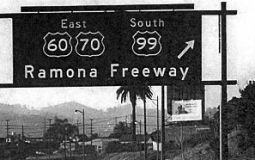 The segment of US 99 that
opened in 1943 from US 101 to US 395 (now I-215), originally signed as US 60 / US 70 / US 99) was named the "Ramona Freeway". Ramona was the
central character in the Helen Hunt Jackson novel Ramona, which was a seminal novel in the early 20th century in creating the
romance of California.
The segment of US 99 that
opened in 1943 from US 101 to US 395 (now I-215), originally signed as US 60 / US 70 / US 99) was named the "Ramona Freeway". Ramona was the
central character in the Helen Hunt Jackson novel Ramona, which was a seminal novel in the early 20th century in creating the
romance of California.
(Image source: Forgotten Highway)
 Portions of the route between Santa Clarita and the I-5 / Route 99 split have been
referred to as "The Ridge Route". The first usage of the term
dates back to 1913, and a report in the May 1913 California Highway
Bulletin about the reasonings for the then named "Tejon Route" being
chosen over the alternate route through Tehachapi Pass and Lancaster. In
this report, the survey photo refers to the Los Angeles-Bakersfield
segment of LRN 4 as the "Tejon-Castaic Ridge Route." Later, an article in
the July 1916 California Highways & Public Works refers to the Los
Angeles-Bakersfield segment of LRN 4 with multiple names: the
Castaic-Tejon Ridge Road, Castaic Road, Castaic Ridge Road and as Ridge
Route. By 1924, the successor publication California Highways &
Public Works refered to what had been the Castaic-Tejon Ridge Route simply as just the "Ridge Route". The term, broadly, was a reference for
the Los Angeles to Bakersfield segment of LRN 4, but notably the section
through Tejon Pass. In 1933 a rerouting of a portion of the Ridge Route took place; this was called the Ridge Route Alternate and was a
bypass of the more haggard segments of the orginial Los
Angeles-Bakersfield Ridge Route corridor. In 1949, CHPW stated that the
definition of the Ridge Route was now the 44 miles of US 99/LRN 4 from the
city limits of Los Angeles to the Kern County line. This made clear the
Grapevine was a separate segment. The new alignment of I-5 was shifted
above what was built as Ridge Route Alternate through Piru Gorge. Pyramid
Dam was constructed in Piru Gorge which bisected the grade of Ridge Route Alternate. Various portions of the original Ridge Route remain. As for the
name, it refers to the fact that the original routing ran along the ridge
of the canyon.
Portions of the route between Santa Clarita and the I-5 / Route 99 split have been
referred to as "The Ridge Route". The first usage of the term
dates back to 1913, and a report in the May 1913 California Highway
Bulletin about the reasonings for the then named "Tejon Route" being
chosen over the alternate route through Tehachapi Pass and Lancaster. In
this report, the survey photo refers to the Los Angeles-Bakersfield
segment of LRN 4 as the "Tejon-Castaic Ridge Route." Later, an article in
the July 1916 California Highways & Public Works refers to the Los
Angeles-Bakersfield segment of LRN 4 with multiple names: the
Castaic-Tejon Ridge Road, Castaic Road, Castaic Ridge Road and as Ridge
Route. By 1924, the successor publication California Highways &
Public Works refered to what had been the Castaic-Tejon Ridge Route simply as just the "Ridge Route". The term, broadly, was a reference for
the Los Angeles to Bakersfield segment of LRN 4, but notably the section
through Tejon Pass. In 1933 a rerouting of a portion of the Ridge Route took place; this was called the Ridge Route Alternate and was a
bypass of the more haggard segments of the orginial Los
Angeles-Bakersfield Ridge Route corridor. In 1949, CHPW stated that the
definition of the Ridge Route was now the 44 miles of US 99/LRN 4 from the
city limits of Los Angeles to the Kern County line. This made clear the
Grapevine was a separate segment. The new alignment of I-5 was shifted
above what was built as Ridge Route Alternate through Piru Gorge. Pyramid
Dam was constructed in Piru Gorge which bisected the grade of Ridge Route Alternate. Various portions of the original Ridge Route remain. As for the
name, it refers to the fact that the original routing ran along the ridge
of the canyon.
(Source: Gribblenation Blog (Tom Fearer), "When did people begin to refer to the "Ridge Route" as "The Grapevine?" (former US Route 99 and Interstate 5)", March 2022; Images sources: Waymarking; Wikimedia Commons; Historical Marker Database)
 Portions of the route between Santa Clarita and the I-5 / Route 99 split have been
referred to as "The Grapevine". This dates back to the February
1925 California Highways & Public Works, which referred to the segment
of LRN 4 in Grapevine Canyon as the "Grapevine Grade," which was
the northern end of the Ridge Route. This was a reference to the
portion of the route in Castac Pass through Grapevine Canyon west of the
Old Tejon Pass. A survey in 1853 found Castac Pass through Grapevine
Canyon to be a far more viable route for travelers and the primary
alignment was of the Stockton-Los Angeles Road was shifted west from Old
Tejon Pass. Castac Pass had a far lower terminal elevation at
approximately 4,200 feet above sea level and had a gentler grade through
Grapevine Canyon. In 1854, a U.S. Army Garrison was established at Fort
Tejon in Grapevine Canyon near modern Lebec to protect settlers and
travelers along the Stockton-Los Angeles Road. In time Castac Pass became
known as Fort Tejon Pass and eventually simply Tejon Pass. There were
various upgrades to the Grapevine Grade over time; the final upgrade to
the Old Ridge Route in Grapevine Canyon was between Lebec and Fort Tejon
and opened on August 31, 1936. In writing about this, the October 1936
California Highways & Public Works refers to Grapevine Canyon as "The
Grapevine" in numerous paragraphs. This appears to be the first reference
something resembling the modern nickname. By 1949, CHPW was making a clear
distinction between the portion of the route in LA County, between the
City Limits of LA and the border with Kern County (this was the Ridge
Route), and the portion in Kern County going down the hill (this
was the Grapevine Grade). As for the name, in 1772, searching
for a shorter pass between San Diego and Monterey, Acting Governor of Alta
California Pedro Fages discovered a canyon pass that led southbound
towards the Santa Clarita Valley. He named it "La Cañada de Las Uvas"
or “Canyon of the Grapes” because of an abundance of wild
grapevines along the route. Although it proved to be an excellent pass,
early travelers were forced to hack their way through thickets of wild
grapevines. Today, you can still see wild grapes growing along the canyons
that, at quick glance, easily resemble ivy. Note that Grapevine
does not refer to the routing of the highway itself; in particular, the
notable "French Switch" where the north and south carriageways switch
sides near Castaic.
Portions of the route between Santa Clarita and the I-5 / Route 99 split have been
referred to as "The Grapevine". This dates back to the February
1925 California Highways & Public Works, which referred to the segment
of LRN 4 in Grapevine Canyon as the "Grapevine Grade," which was
the northern end of the Ridge Route. This was a reference to the
portion of the route in Castac Pass through Grapevine Canyon west of the
Old Tejon Pass. A survey in 1853 found Castac Pass through Grapevine
Canyon to be a far more viable route for travelers and the primary
alignment was of the Stockton-Los Angeles Road was shifted west from Old
Tejon Pass. Castac Pass had a far lower terminal elevation at
approximately 4,200 feet above sea level and had a gentler grade through
Grapevine Canyon. In 1854, a U.S. Army Garrison was established at Fort
Tejon in Grapevine Canyon near modern Lebec to protect settlers and
travelers along the Stockton-Los Angeles Road. In time Castac Pass became
known as Fort Tejon Pass and eventually simply Tejon Pass. There were
various upgrades to the Grapevine Grade over time; the final upgrade to
the Old Ridge Route in Grapevine Canyon was between Lebec and Fort Tejon
and opened on August 31, 1936. In writing about this, the October 1936
California Highways & Public Works refers to Grapevine Canyon as "The
Grapevine" in numerous paragraphs. This appears to be the first reference
something resembling the modern nickname. By 1949, CHPW was making a clear
distinction between the portion of the route in LA County, between the
City Limits of LA and the border with Kern County (this was the Ridge
Route), and the portion in Kern County going down the hill (this
was the Grapevine Grade). As for the name, in 1772, searching
for a shorter pass between San Diego and Monterey, Acting Governor of Alta
California Pedro Fages discovered a canyon pass that led southbound
towards the Santa Clarita Valley. He named it "La Cañada de Las Uvas"
or “Canyon of the Grapes” because of an abundance of wild
grapevines along the route. Although it proved to be an excellent pass,
early travelers were forced to hack their way through thickets of wild
grapevines. Today, you can still see wild grapes growing along the canyons
that, at quick glance, easily resemble ivy. Note that Grapevine
does not refer to the routing of the highway itself; in particular, the
notable "French Switch" where the north and south carriageways switch
sides near Castaic.
(Source: Gribblenation Blog (Tom Fearer), "When did people begin to refer to the "Ridge Route" as "The Grapevine?" (former US Route 99 and Interstate 5)", March 2022; Los Angeles Almanac; Image sources: Bakersfield Californian; Paso Robles Daily News)
 National Trails
 The portion of this route that was part of US 6 (i.e., from
Route 110 to Route 14) was part of the "Midland Trail.
The portion of this route that was part of US 6 (i.e., from
Route 110 to Route 14) was part of the "Midland Trail.
 The portion of this route N of Los Angeles that was originally part of US 99 (i.e., from Route 10 to Route 99) was part of the
"National Parks to Park Highway".
The portion of this route N of Los Angeles that was originally part of US 99 (i.e., from Route 10 to Route 99) was part of the
"National Parks to Park Highway".
US 99 appears to have been part of the "Jefferson Davis Highway". This was an attempt to commemorate the "Lost Cause" or "Southern Cause" narrative of the Civil War. Along US 99, a monument was located near Lebec. This is discussed in more detail on the Trails and Roads page.
 From Route 5 south of Bakersfield to Route 50 in Sacramento.
 Post 1964 Signage History
As defined in 1963, this was segment (a) and ran from "Route 5 south of Bakersfield to Route 80 in Sacramento."
In 1981, Chapter 292 changed "Route 80" to "Route 50", reflecting the renumbering of routes in Sacramento (i.e., I-80 moved to a new alignment that had been I-880; the old I-80 alignment became Route 51 and US 50 (FAI 305), but was signed Business Route 80).
At one point, segments of Route 99 were also signed as "Temporary I-5". Scott Parker (Sparker) at AAroads provided some history of this signage on 7/16/2016:
Between 1972 and 1981, Route 99 also carried "Temporary I-5" shields. These were smaller (24×24) shields, generally posted on Route 99 reassurance assemblies below the Route 99 shield. From top to bottom these assemblies read: (DIRECTION)/(California) Route 99/ (TEMPORARY)/I-5.
Northbound: Temporary I-5 signage began at the I-5 Route 4/Charter Way exit in Stockton, extending east on Charter Way (old US 50 and, east of the Route 4 divergence, unsigned Route 26) to Route 99, then north on Route 99 to (then) I-80 (now Business Route 80 and US 50). After I-5 was completed southward into Sacramento by 1976, "temporary" signage ceased and "TO I-5" appeared on the interchange's BGS (as it does today) in order to direct traffic to the new I-5 alignment. Prior to that time, "Temporary I-5 signage followed the I-80 freeway to northbound Route 113 near Davis, which also received signage as "Temporary I-5" (this was also the routing of the former US 99W). It followed the old US 99W alignment, turning west onto (then) Route 16 at Woodland and following it to a point west of town where US 99W had historically turned north. It then followed the old US 99W routing, which was gradually being bypassed by I-5 construction. The entire Sacramento to Redding portion of I-5 was completed by 1976, at which time the "Temporary I-5" signage was removed from I-80 west of the I-5 junction as well as to the north.
Southbound: Before 1976, Temporary I-5 signage began near Woodland, using Route 113 south to I-80 and I-80 east to Route 99 at the present Business Route 80/US 50/Route 99 interchange southeast of downtown Sacramento. Southbound Route 99 BGS signage on EB I-80 had "Temporary I-5" signage attached in order to expedite through traffic heading for the continuation of I-5 at Stockton. Post-1976, the southbound I-5 ramp to eastbound I-80/south Route 99 was also marked as "Temporary I-5"; while it's unclear whether east I-80 itself ever received temporary I-5 reassurance signage, the ramp to south Route 99 was definitely also signed "Temporary I-5". Southbound Route 99/Temporary I-5 signage mirrored northbound; Temporary I-5 exited at Charter Way and continued west to the newly-constructed I-5 alignment. I-5 itself was built as far north as Hammer Lane in the north reaches of Stockton by 1974; northbound I-5 traffic was instructed to exit at Charter Way; the stub end of I-5 was signed as "Local Traffic Only" (the southbound stub end of I-5 in Sacramento, extending down to Pocket Road, was likewise signed). The final section of I-5 between Stockton and Sacramento was completed in early 1981, at which time the temporary signage along Route 99 and its approach routes was removed.
Pre 1964 Signage History This route was part of the original US highway plan in 1926, and was signed as US 99 from the signage of US highways in 1928 (the original
route ran as far S as El Centro -- see below for information on the routing S of the I–5/Rte 99 junction). Currently, there is a movement to have this cosigned as historic Highway
99. Such signage is authorized by Assembly Concurrent Resolution No. 19,
Chapter 73, approved in 1993. This resolution requests the Department of
Transportation, upon application by an interested local agency or private
group, to identify any section of former U.S. Highway 99 that is still a
publicly maintained highway but is not designated as having formerly been
U.S. Highway 99 and to designate that section as "historic U.S. Highway
99."
The business routes off of Route 99 are portions of the original routing of US 99. This was LRN 4, defined in 1909 into Sacramento; it was cosigned with US 50 from Manteca (present day junction with Route 120) into Sacramento.
Through Bakersfield, the route originally ran along present-day Union Avenue and Golden State Avenue. Portions of this are now present-day Route 204. In 1962, Route 99 was shifted westward to its current routing (at which point, it appears the old routing became part of LRN 141).
Bakersfield
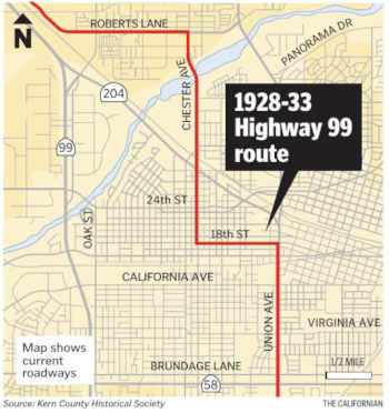 By 1914, LRN 4 (future US 99, future Route 204) from Bakersfield north to Lerdo was
paved and completed to State Highway standards. By 1917, LRN 4 followed
Roberts Lane and Chester Avenue over the Kern River into Bakersfield, and
continued along Chester Avenue, what appears to be 19th Street and Union
Avenue southward through Bakersfield. In 1931, a planned realignment of US 99/LRN 4 within the City of Bakersfield was announced: the plan was to
bypass downtown Bakersfield from Union Avenue northwest towards Beardsley
Canal. This started with a new bridge over the Kern River in 1932, moving
off the Chester Ave Bridge. In 1933, the realignment of US 99/LRN 4 was to
carry the name of "Railroad Route" (approved by the California Highway
Commission on August 26th, 1932). Five railroad crossings were eliminated
by the new routing, including an overhead over the Southern Pacific
Railroad and a new Subway of the Atchison, Topeka & Santa Fe Railroad.
US 99/LRN 4 is realigned off of 19th Street onto California Avenue between
Union Avenue and Chester Avenue to make way for reconstruction of the 1926
Union Avenue Subway. In late 1933, signage of US 466 joined a portion of
the route: from Barstow, US 466 followed LRN 58 over Tehachapi Pass into
Bakersfield, reaching US 99/LRN 4 via Sumner Street at Union Avenue as
opposed to Grove Street (the LRN 58 routing). The bypass route of US 99/LRN 4 around downtown Bakersfield via Golden State Avenue opened to
traffic as of June 2, 1934. The new alignment of US 99/LRN 4 on Golden
State Avenue split northwest from Union Avenue at 20th Street. US 99/LRN 4
on Golden State Avenue crossed through its former alignment at Chester
Avenue via the new 320' diameter Garces Traffic Circle (completed in
1933). Chester Avenue north of Golden State Avenue would be incorporated
into LRN 142 (a former segment of Route 155). In 1935, a new Union Avenue
Subway was completed on US 99/LRN 4 as a replacement for the earlier
substandard 1926 structure. The 1936-37 Division of Highways Map shows US 399 (defined in 1934) co-signed with US 99 on Golden State Avenue. US 399
is shown to multiplex US 99 from Greenfield into downtown Bakersfield via
Union Avenue where it would have terminated at US 466. In 1957, US 99/US 466/LRN 4 on Golden State Avenue was relocated to an overpass of the
Garces Traffic Circle. Connection to LRN 142/Chester Avenue would be made
from the US 99/US 466/LRN 4 overpass via frontage roads. The first units
of the Bakersfield Bypass freeway routing were funded in 1960-1961, and
opened in 1962. US 99 moved to the "West Bakersfield" freeway in 1963. The
West Bakersfield Freeway saw the relinquishment of Union Avenue south of
Brundage Lane/LRN 141, which truncated US 399 out of Bakersfield to US 99
at Pumpkin Center on Taft Highway. US 466 was left as the standalone
mainline route on Golden State Avenue. The US 99 Business Route followed
the former alignment of US 99 on Union Avenue and multiplexed US 466 on
Golden State Avenue. US 399 was removed by AASHO with the great
renumbering in 1964. On April 26th, 1963 the Division of Highways on
behalf of the City of Bakersfield and Kern County submitted a request to
the AASHO Executive Committee for a US 99 Business Route upon the
completion of the West Bakersfield Freeway. The US 99 Business Route as
submitted was to be signed on Houghton Road near the community of Alameda,
Union Avenue and Golden State Avenue through the City of Bakersfield..
This request was considered by the AASHO Executive Committee on June 19th,
1963 and met with their approval. During the 1964 State Highway
Renumbering, what was LRN 141 on Brundage Lane, Union Avenue and Golden
State Avenue became Route 204. US 466 east of Bakersfield to Barstow
became Route 58, and what was US 399 became Route 119 and an extension of
Route 33. The new Route 204 was aligned over Brundage Lane, Union Avenue
and US 466/Golden State Avenue. Former US 99 on Chester Avenue was
reassigned from LRN 142 to Route 155.
By 1914, LRN 4 (future US 99, future Route 204) from Bakersfield north to Lerdo was
paved and completed to State Highway standards. By 1917, LRN 4 followed
Roberts Lane and Chester Avenue over the Kern River into Bakersfield, and
continued along Chester Avenue, what appears to be 19th Street and Union
Avenue southward through Bakersfield. In 1931, a planned realignment of US 99/LRN 4 within the City of Bakersfield was announced: the plan was to
bypass downtown Bakersfield from Union Avenue northwest towards Beardsley
Canal. This started with a new bridge over the Kern River in 1932, moving
off the Chester Ave Bridge. In 1933, the realignment of US 99/LRN 4 was to
carry the name of "Railroad Route" (approved by the California Highway
Commission on August 26th, 1932). Five railroad crossings were eliminated
by the new routing, including an overhead over the Southern Pacific
Railroad and a new Subway of the Atchison, Topeka & Santa Fe Railroad.
US 99/LRN 4 is realigned off of 19th Street onto California Avenue between
Union Avenue and Chester Avenue to make way for reconstruction of the 1926
Union Avenue Subway. In late 1933, signage of US 466 joined a portion of
the route: from Barstow, US 466 followed LRN 58 over Tehachapi Pass into
Bakersfield, reaching US 99/LRN 4 via Sumner Street at Union Avenue as
opposed to Grove Street (the LRN 58 routing). The bypass route of US 99/LRN 4 around downtown Bakersfield via Golden State Avenue opened to
traffic as of June 2, 1934. The new alignment of US 99/LRN 4 on Golden
State Avenue split northwest from Union Avenue at 20th Street. US 99/LRN 4
on Golden State Avenue crossed through its former alignment at Chester
Avenue via the new 320' diameter Garces Traffic Circle (completed in
1933). Chester Avenue north of Golden State Avenue would be incorporated
into LRN 142 (a former segment of Route 155). In 1935, a new Union Avenue
Subway was completed on US 99/LRN 4 as a replacement for the earlier
substandard 1926 structure. The 1936-37 Division of Highways Map shows US 399 (defined in 1934) co-signed with US 99 on Golden State Avenue. US 399
is shown to multiplex US 99 from Greenfield into downtown Bakersfield via
Union Avenue where it would have terminated at US 466. In 1957, US 99/US 466/LRN 4 on Golden State Avenue was relocated to an overpass of the
Garces Traffic Circle. Connection to LRN 142/Chester Avenue would be made
from the US 99/US 466/LRN 4 overpass via frontage roads. The first units
of the Bakersfield Bypass freeway routing were funded in 1960-1961, and
opened in 1962. US 99 moved to the "West Bakersfield" freeway in 1963. The
West Bakersfield Freeway saw the relinquishment of Union Avenue south of
Brundage Lane/LRN 141, which truncated US 399 out of Bakersfield to US 99
at Pumpkin Center on Taft Highway. US 466 was left as the standalone
mainline route on Golden State Avenue. The US 99 Business Route followed
the former alignment of US 99 on Union Avenue and multiplexed US 466 on
Golden State Avenue. US 399 was removed by AASHO with the great
renumbering in 1964. On April 26th, 1963 the Division of Highways on
behalf of the City of Bakersfield and Kern County submitted a request to
the AASHO Executive Committee for a US 99 Business Route upon the
completion of the West Bakersfield Freeway. The US 99 Business Route as
submitted was to be signed on Houghton Road near the community of Alameda,
Union Avenue and Golden State Avenue through the City of Bakersfield..
This request was considered by the AASHO Executive Committee on June 19th,
1963 and met with their approval. During the 1964 State Highway
Renumbering, what was LRN 141 on Brundage Lane, Union Avenue and Golden
State Avenue became Route 204. US 466 east of Bakersfield to Barstow
became Route 58, and what was US 399 became Route 119 and an extension of
Route 33. The new Route 204 was aligned over Brundage Lane, Union Avenue
and US 466/Golden State Avenue. Former US 99 on Chester Avenue was
reassigned from LRN 142 to Route 155.
(Source: Gribblenation Blog (Tom Fearer), “California State Route 204; former US Route 99, US Route 399 and US Route 466 in Bakersfield”, April 2021)
As part of the research for the book "Highway 99: The
History of California’s Main Street," the routings in the
Bakersfield area were investigated. Historical society volunteer Fatima
Bugharin began looking into the history of Route 99 nearly a year and a
half ago. What she found surprised even longtime Bakersfield residents.
They were surprised to learn that Route 99 through Bakersfield once ran
along 18th Street, Chester Avenue and Roberts Lane in Oildale. In
particular, hadn't known that 18th Street was part of that statewide
artery for some six years. Specifically, as Route 99 headed north on Union
(Avenue) the highway took a left on 18th Street. This is because parts of
Union Avenue were still unpaved, and Golden State Avenue wasn't ready. The
clock tower was in the middle of 17th and Chester. 19th Street had the
trolley. So 18th was the chosen route.
(Source: Bakersfield Californian, 6/11/2018)
Famoso (~ KER 44.531). In Famoso, California (~ KER
44.531), the alignment of LRN 4 was plotted through Famoso via
Famoso-Porterville Highway and C Street when it was established in 1910
when the 1909 First State Highway Bond Act was approved. The early
alignment of LRN 4 required north/south traffic to cross the Southern
Pacific Main Freight Line twice in Famoso. During the era of the Auto
Trail, the alignment of LRN 4 through Famoso carried numerous highway
designations including National-Park-to-Park Highway, Inland Route, and
the National Roosevelt Midland Trail. By the mid-1930s, traffic on US 99/LRN 4 and US 466/LRN 33 was already heavy. Removal of at-grade railroad
overpasses were highly desired and generally were a priority for the
Division of Highways on US 99/LRN 4 in San Joaquin Valley during the
1930s. The first reference to a recommendation of a new "railroad subway"
in Famoso appears in the October 1935 CHPW guide. US 99/US 466/LRN 4 is
shown to be aligned over a new subway overpass onto a bypass route of
Famoso on the 1938 Division of Highways State Map. The shift of US 99/US 466/LRN 4 onto the new bypass route extended the southern terminus of
Route 65 within Famoso to the end of C Street. The bypass route of Famoso
used by US 99/US 466/LRN 4 essentially was built on the same grade Route 99 on the Golden State Freeway occupies today.
(Source: Gribblenation Blog "Former US Route 99,US Route 466, and California State Route 65 through Famoso")
McFarland (~ KER 49.782) and Delano (~ KER 57.479). A
1917 CSAA map shows the newly designed LRN 4 following High Street through
downtown Delano southward towards McFarland. North of Delano to Earlimart,
the routing followed modern Armstrong Avenue, Road 144 and Girard Street.
Paving of the route from Lardo (~ KER 35.63) to Delano (~ KER 57.479) was
completed by 1928. By 1935, US 99/LRN 4 was aligned on High Street through
downtown Delano and crossed the Southern Pacific Railroad via a surface
level overpass. An underpass in Delano was constructed in 1936. The Delano
Underpass is described as a 0.97 mile realignment of High Street that
carried four ten foot lanes of US 99/LRN 4. The previous overpass
alignment of US 99/LRN 4 via High Street was considered one of the most
dangerous in San Joaquin Valley. In 1950, US 99/LRN 4 through McFarland
was expanded to divided expressway standards. This expressway upgrade of
US 99/LRN 4 through McFarland bisected the community, even though it was
originally centered west of the Southern Pacific Railroad. In 1956, a
freeway bypass of Delano opened that realigned US 99/LRN 4 off of High
Street, running between one half mile south of the Delano Underpass
northward to the Tulare County Line (the freeway agreement was signed in
1952; construction started in 1954). By 1958, the expressway in McFarland
had been upgraded to freeway standards.
(Source: Gribblenation Blog (Tom Fearer), “Former US Route 99 in McFarland and Delano”, April 2021)
Earlimart (~ TUL 6.654) and Pixley (~ TUL
12.542). In 1917, a California State Automobile Association Map
shows LRN 4 (future Route 99 unconstructed via a plotted line along the
Southern Pacific Railroad between Pixley and Earlimart southward towards
to Delano. The pre-existing right-of-way between Pixley-Earlimart appears
to follow modern day Park Drive, Main Street, Avenue 96, Road 128 and
Bishop Street. The pre-existing right-of-way between Earlimart-Delano
appears to follow modern Armstrong Avenue, Road 144 and Girard Street. In
1926, US 99 was chartered, and construction of a concrete roadway was in
progress by 1929. Within Earlimart former US 99 was aligned on Front Road;
whereas in Pixley, it was aligned on Main Street. In 1953, it was noted
that US 99/LRN 4 was budgeted to be upgraded to an expressway from the
Kern County Line north through Earlimart during the 1954-55 Fiscal Year,
with Earlimart through Pixley scheduled for the FY55-56 year. By late
1956, US 99/LRN 4 had been converted to freeway standards and had opened
from a half mile north of Pixley southward 14 miles to the Kern County
Line. The opening of this segment bypassed Main Street in Pixley and Front
Road in Earlimart. The overpass structures on present day Route 99 show
date stamps of 1955 in Earlimart and 1956 in Pixley. The bypasses of
Earlimart and Pixley were among the earliest true freeway segments of US 99.
(Source: Gribblenation Blog (Tom Fearer), “Former US Route 99 in Earlimart and Pixley”, May 2021)
Route 99 in Tipton and Tulare (~ TUL 18.995 to TUL 29.202)
Note: Information in this subsection was derived from the Gribblenation Blog (Tom Fearer): "Old US Route 99 through Tipton, Tulare, and Tagus Ranch")
The original alignment of LRN 4 (circa 1924) from
Tipton through Tulare was as follows:
(Source: Gribblenation Blog, "Old US Route 99 through Tipton, Tulare, and Tagus Ranch", August 2020)
The original alignment of LRN 4 was not routed through
Tagus Ranch en route north to Goshen but rather Visalia. LRN 4 utilized
the following route from downtown Tulare to reach the City of Visalia:
(Source: Gribblenation Blog, "Old US Route 99 through Tipton, Tulare, and Tagus Ranch", August 2020)
By 1924, LRN 4 was aligned through Tagus Ranch directly
to Goshen, along the following routing:
(Source: Gribblenation Blog, "Old US Route 99 through Tipton, Tulare, and Tagus Ranch", August 2020)
In 1932, LRN 4 (now US 99) was aligned to the east side
of the SP RR tracks from Tipton to Tulare using the following route:
(Source: Gribblenation Blog, "Old US Route 99 through Tipton, Tulare, and Tagus Ranch", August 2020)
The September/October 1958 California Highways &
Public Works cites the Tulare Bypass route of US 99/LRN 4 as fully opening
in 1954. The Tulare Bypass is cited to have been the first full freeway
grade completed in Division of Highways District 6. In 1959, it was noted
that 13.3 miles of US 99/LRN 4 originating in Pixley by way of Tipton to
Tulare Airport was funded for an expressway to freeway conversion in the
1960-61 State Highway Budget.
(Source: Gribblenation Blog, "Old US Route 99 through Tipton, Tulare, and Tagus Ranch", August 2020)
Route 99 in Visalia (~ TUL 35.01 to TUL 39.742)
Note: US 99 was never actually routed through Visalia
and ended up bypassing the City in favor of a direct route from Goshen
southeast to Tulare. US 99 within San Joaquin Valley was aligned over LRN 4, which was added to the State Highway System as part of the 1909 First
State Highway Bond Act. LRN 4 for a time was aligned through Visalia via
Mineral King Avenue, Main Street, and Mooney Boulevard. This early
alignment of LRN 4 through Visalia can be seen on the 1924 Division of
Highways State Map. The initial alignment of US 99 was planned to simply
follow LRN 4 from Sacramento south to Los Angeles. The existing routing of
LRN 4 by the start 1926 would have taken US 99 through Visalia. However,
by 1926, LRN 4 was realigned out of Visalia onto a more direct route
between Goshen and Tulare during 1926. LRN 4 was realigned over what is
now Camp Drive in Goshen southwest via a Southern Pacific frontage road
east of the rails to I Street in Tulare. While Visalia was (and is) the
Tulare County Seat the new alignment of LRN 4 was far more efficient in
terms of getting traffic directly to/from Sacramento and Los Angeles.
Mineral King Road was retained in the State Highway System as part of LRN 10, which would later become Route 198 during 1934. The final version of
the US Route System was approved during November of 1926. This first
official version of the US Route System had US 99 following LRN 4 from
Sacramento and Los Angeles which in turn bypassed Visalia.
(Source: Gribblenation Blog (Tom Fearer) "US Route 99 to Visalia?... ")
On AARoads, Scott Parker noted that local lore is that
LRN 4, normally paralleling the old SP main line through the Valley,
originally took the Visalia "detour" not only to serve that town, the
largest between Bakersfield and Fresno, but also because the right of way
straddling the RR tracks between Tulare and Goshen was owned by Tagus
Ranch, which was reluctant to grant an easement for the highway through
its land (and was politically well-connected enough to mount that
resistance). Eventually an agreement was reached and the highway
constructed -- although an old US 99 landmark pre-freeway was the Tagus
Ranch "farm store", a sort of "farmers' market" a couple of miles north of
Tulare.
(Source: Scott Parker (SParker) on AARoads, "Re: The original planned route of US 99 through Visalia", 4/29/2020)
Route 99 in Goshen and Traver (~ TUL 39.742 to TUL 49.535)
Unless noted otherwise, information in this subsection is derived from the Gribblenation Blog (Tom Fearer), "Old US Route 99 in Goshen, Traver, and the Warlow Rest Area"
The original alignment of LRN 4 south through Traver
and Goshen, circa 1924, was as follows:
(Source: Gribblenation Blog, "Old US Route 99 in Goshen, Traver, and the Warlow Rest Area", August 2020)
By 1926, LRN 4 (US 99) was using a new alignment
between Goshen to Tulare along an eastern Southern Pacific frontage road
to J Street. The relocation of US 99/LRN 4 from Plaza Garage north through
Goshen was announced in January 1932. US 99/LRN 4 was relocated west of
Goshen around 1933/1934 to grade separations over the Southern Pacific
Railroad Main Freight Line and Visalia Spur. The new alignment of US 99/LRN 4 would later be incorporated into the Golden State Freeway. The
1915 Kingsburg Bridge over the Kings River was incorporated circa 1939
into a modernized four lane expressway alignment of US 99/LRN 4. The
expressway project at the Kings River was completed in Spring 1940; the
1915 Kingsburg Bridge was the last two lane structure on US 99/LRN 4
between Sacramento and Los Angeles. US 99/LRN 4 was upgraded to freeway
standards from Traver 5.7 miles north to the Kings River during 1957.
(Source: Gribblenation Blog, "Old US Route 99 in Goshen, Traver, and the Warlow Rest Area", August 2020)
In Traver, California (~ 099 TUL 48.666), there appears
to be an "Old State Route 99" between Avenue 360 and Avenue 368. This was
bypassed, apparently, because a diamond interchange for Merritt Drive (and
freeway upgrade) could not be done right next to the Southern Pacific
line.
(Thanks to Chris Sampang for this information)
Route 99 in Fresno (~ FRE 15.703 to FRE 31.55)
Before the establishment of the Golden State Blvd.
bypass of downtown Fresno, Route 99 took a routing of (from the south)
Railroad Avenue (~ 099 FRE 17.284), Church Street, Hazel St. (possibly E
Street), Cherry Avenue, and Broadway into town, and then north to Railroad
Avenue (now Motel Drive/Business Route 99) via H Street. Broadway is now cut off by
Grizzly Stadium.
(Source: 1938 Map posted on FB by Joel Windmiller)
The first segment of freeway to be constructed in the
San Joaquin Valley was originally part of Route 99 in Fresno. Construction
of the so-called Fresno-Calwa Freeway, a short section of freeway just
south of town, began just after the end of World War II. It survives as a
section of Golden State Boulevard, stretching roughly from Church Avenue
(~ FRE 19.156) to Ventura Street (~ FRE 20.198). It comes complete with
offramps and overpasses, although it’s not a part of the current
Route 99 alignment.
(Source: Fresno Bee, 11/19/2017)
In Fresno, conversion of the highway to expressway and
thence to freeway required moving of a historic church. Specifically, an
8,000-square-foot brick church was moved 300 yards in one piece to make
way for Route 99. This happened in Fresno in 1947, when the German Cross
Church (all 1,800 tons of it, complete with colonnade, bell tower and
stained-glass windows) was moved using railroad rails and steel rollers to
make way for the D Street freeway, as it was known then. The new freeway
bypassed the old highway alignment, which used surface streets such as
Broadway, H Street and Motel Drive through town. It replaced D Street,
which explains why there’s no longer a street by that name on
Fresno’s map. The January/February 1948 issue of CHPW has a fascinating article on the moving of the church.
(Source: CHPW Jan/Feb 1948; FresnoBee
11/19/2017)
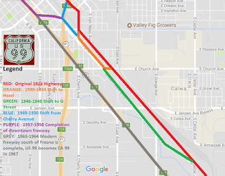 Tom Fearer has attempted to retrace the routing history of US 99 through Fresno. He
has more details on his Gribblenation Blog entry, including some good maps (a downsized copy of one is illustrated to the right; click on the image to go to the full
webpage):
Tom Fearer has attempted to retrace the routing history of US 99 through Fresno. He
has more details on his Gribblenation Blog entry, including some good maps (a downsized copy of one is illustrated to the right; click on the image to go to the full
webpage):
(Source: Provided by Tom Fearer in September 2017)
Note: Tom Fearer has a history of the routing of US 99 through Herndon in his blog entry Old US Route 99 through Herndon, CA.
Within Madera the implied route of LRN 4/US 99 was over Gateway Drive. In
1933 US 99/LRN 4 was joined in Madera by LRN 126 (Route 145). LRN 126 was
aligned through Madera northbound on Madera Avenue where it joined US 99/LRN 4 at Gateway Drive. US 99/LRN 4 and LRN 126 multiplexed north on
Gateway Drive where the latter split eastward on Yosemite Avenue. Around
1958, the freeway bypass around downtown Madera was constructed. The
surface alignment of US 99/LRN 4 on Gateway Drive at that time was a heavy
bottleneck point, especially during holiday weekends; it was also the last
remaining segment of two-lane US 99/LRN 4 with in Division of Highways
District 6. By the start of 1959, the Madera Bypass was opened; Route 145/LRN 126 remained on Gateway Drive between Madera Avenue and Yosemite
Avenue.
(Source: Gribblenation Blog, "Old US Route 99 through Madera on Gateway Drive", August 2020)
The Palm and the Pine (~ MAD 5.752)
Just south of Avenue 11 in Madera County on Route 99 (~
MAD 5.752), is a tribute to the division between Northern and Southern
California: The Palm and the Pine. But their symbolism cannot be mistaken.
The pine tree is north, representing Northern California. The palm tree is
south, representing Southern California. It was established many years ago
that the geographic center of the state is in North Fork to the east of
Route 99 in Madera County. But to see North Fork, you’ll need to get
off the highway and head toward the mountains. The center of the state
that most of the public will likely view is right along Route 99. To be
more exact, you’ll find it between the north and southbound lanes in
the median south of the city of Madera. The pine and palm trees represent
a symbolic separation between Southern California and Northern California.
It’s believed the original trees were planted in the 1920s to
represent the midpoint of the state between the Mexico and Oregon borders.
In the 1980s, the state’s transportation planning agency CalTrans
rolled out plans to bring the highway up to new standards. These plans
called for the destruction of the trees. There was a public outcry,
CalTrans redrew the plans, and the trees remained. That is until 2005 when
a storm toppled the pine tree. It was replaced (by a Cedar Tree) in 2007.
The median is under control of CalTrans and it appears the palm and the
pine will remain there under the care of the transportation agency for
years to come.
(Source: Steve Newvine, Merced County Events, No Date)
In 2021, planning was in progress for 06-Mad-99, PM
0.1-8.1. South Madera 6-Lane. Widen Route 99 from four lanes to
six lanes in Madera County. (MND) (PPNO 6297) (STIP) (TCEP) (SR99). This
project is located on Route 99 from just north of Avenue 7 to Avenue 12
(post miles 0.1 to 8.1) in Madera County. The scope of the project is to
widen Route 99 in Madera County. One lane would be built in each direction
in the highway median to create a six-lane highway. Additionally, the
existing lanes and shoulders of Route 99 would be rehabilitated, and a
concrete median barrier would be installed along with an auxiliary lane at
the Avenue 12 northbound off-ramp. Of key interest is one of the
environmental impacts: Avoidance and minimization measures will reduce any
potential effects on the environment. These measures include, but
are not limited to, relocation of the “Where the Palm Meets the
Pine” landmark in the median;
(Source: June 2021 CTC Agenda, Agenda Item
2.2c.(1))
It is unclear when the Palm and the Pine were first planted.
In October 2021, it was reported that the Historic
Highway 99 Association has plans to recognize the pine and palm trees in
the median of Route 99, between Avenue 12 and 9. Those trees represents
the halfway point along US 99 in California. Northern California is
represented by the pine tree, whereas the palm tree represents Southern
California. The association noted, “In time, we plan to work with
Caltrans to have signage placed at that location to mark it better.
Currently, travelers may or may not notice the trees in the median mixed
in with the oleander.”
(Source: Madera Tribune, 10/2021)
US 99 in Chowchilla (~ MAD 22.727)
Within the City of Chowchilla and much of the immediate
area much of what was former US 99 can be found in the multiple
alignments. The Gribblenation Blog “Former US Route 99 in the Chowchilla Area” provides a detailed history of the route in the Chowchilla area. The original routing of LRN 4, which eventually became US 99 and later Route 99, can be seen following
Chowchilla Boulevard south through the communities of; Minturn,
Chowchilla, and Califa before transitioning onto Fairmead Boulevard. It
then crossed the Southern Pacific Railroad in the community of Berenda at
what is now Road 21. From Berenda, LRN 4 travelled west of the Southern
Pacific Railroad into Madera.
(Source: Gribblenation Blog (Tom Fearer), “Former US Route 99 in the Chowchilla Area” January 2021)
In 1929, there were discussions of a new planned
alignment of US 99/LRN 4 from Berenda Crossing to Califa. It was described
as 4.1 miles and a replacement for the 15 foot wide Fairmead Boulevard on
the eastern side of the Southern Pacific Railroad. The new road was
described following the western side of Southern Pacific Railroad and
crossing at Califa to Chowchilla Boulevard. This new planned alignment of
US 99/LRN 4 would provide a new junction with LRN 32/Pacheco Pass Highway
(future Route 152). It would include a rail subway on US 99/LRN 4 in
Califa to be constructed by the Southern Pacific Railroad.
(Source: Gribblenation Blog (Tom Fearer), “Former US Route 99 in the Chowchilla Area” January 2021)
The Chowchilla Interchange with Route 152 is one the
four original "over/under" RR crossings (one direction goes under the
tracks on the original 2-lane underpass while the other direction, added
later, bridges over the tracks) that Route 99 inherited from US 99 at the
time the shields were swapped in mid-'66. Some of the concerns are the
curvatures of the crossings. As of 2020, there appear to be no current
projects to replace the Chowchilla crossings. If that were to be done,
it's likely both the NB underpass and SB bridge would be replaced because
of the sharp curve coming off the bridge and then passing under the NB
Route 99 to WB Route 152 left-hand ramp. Since not only the SB mainline
curvature but that of the ramp is problematic, the interchange and RR
crossing may be done as one project. When they overlaid the Route 152
interchange over the original intersection circa 1958 or so, the state
speed limit was still 55 -- so curvature such as that wouldn't have been
uncommon. When that project was let (likely 1955-56) I-5 was still planned
as using US 99 in the Valley -- and that section of the road would have
been substandard even with the original more "lax" I-standards of the
time. Note that while the Interstate-grade freeway is in Merced County,the
Chowchilla bypass and the Route 152 interchange are in Madera County. This
means that any improvements might have to cross Caltrans District lines.
The Merced County (District 10) improvements were expedited because it was
the last section of Route 99 from its southern terminus to Sacramento that
hadn't been upgraded to a full freeway -- and Interstate standards have
been applied on all upgrades (with the exception of some low bridge
clearances between Goshen and Kingsburg) since the Turlock bypass in 1973.
On the other hand, District 6's priorities with Route 99 are the section
between the Fresno county line (San Joaquin River crossing) and the city
of Madera; the section from Madera to just south of Route 152 was itself
upgraded over the last 10 years. But the Route 152 junction and the
adjacent Chowchilla bypass is among the oldest full-freeway sections of
Route 99 (Atwater and Manteca are the others of similar vintage) north of
Fresno; an immediate upgrade was not planned. Other district projects,
such as the extension of the Route 180 freeway/expressway east of Fresno
as well as what seems to be a never-ending expansion project through
Kingsburg and Selma are taking priority. Complicating D6/Route 99 issues:
the adjacent High Speed Rail project, which has affected Route 99 from
Fowler north to Madera.
(Source: AARoads discussion, "Re: CA 99", starting 1/2/2020)
In 1957, plans for the Chowchilla Freeway upgrade were
made. The Chowchilla Freeway is described as being aligned east of
Chowchilla Boulevard on a new bypass route. The 1930 Southern Pacific
Railroad subway would be converted from two-way traffic to use exclusively
for northbound US 99 traffic. The junction with Route 152 would be changed
from an at-grade intersection to a series of ramps. Work on the Chowchilla
Freeway broke ground on March 23, 1956 with completion coming in July
1957.
(Source: Gribblenation Blog (Tom Fearer), “Former US Route 99 in the Chowchilla Area” January 2021)
Kahlon Road in southern Merced County near the site of
Athlone siding between Chowchilla and Merced is former US 99. Currently,
Kahlon Road appears to be a normal two lane frontage road, but it was part
of original alignment of US 99 that was eventually widened to a four lane
expressway. The Chowchilla-Merced corridor was the last expressway segment
of Route 99 to be bypassed by a freeway in 2016. After being bypassed, the
former Chowchilla-Merced expressway was narrowed to the two lane
configuration seen on Kahlon Road and Doppler Road today. There is still
evidence of Route 99 shown in the bridge postmiles, such as on Kahlon Road
below at Deadman Creek. The Deadman Creek bridge identification placard
reads “99 MER R5.24.” There is similar signage and bridge
stamping along the Athlone corridor.
(Source: Tom Fearer/Max
Rockatansky on AARoads, "Former US 99/CA 99 Athlone Expressway corridor", 5/27/2022; Gribblenation Blog (Tom Fearer), "Former US Route 99 through Athlone and the last Wheeler Ridge-Sacramento corridor expressway", June 2022)
The Last Mammoth Orange (~ 099 MAD 26.653)
An June 2012 article in the Los Angeles Times provided
an update on the "Mammoth Orange" stand that used to be a fixture on US 99
in Chowchilla (~ 099 MAD 26.653). As of June 2012, the onetime attraction
sat in the Chowchilla storage yard. There's still a key in its cash
register and a soda fountain that might work. But spider webs drape the
ice bin, bird droppings paint the floor and the orange dimple paint is
peeling. However, the Chowchilla City Council was in the process of
deciding between competing bids for ownership of the stand. The orange had
originally been on a two-lane road in Chowchilla but was moved to the side
of US 99 near Route 152 in 1954, a year before the first McDonald's
opened. Its final owners were Doris and Jim Stiggins of Chowchilla, who
bought the stand in 1981. A $40-million Caltrans project at Fairmead (~
099 MAD 22.648) had widened the highway, closed the exit and put the
Stigginses out of business in 2007. The orange, which was on the
California Register of Historical Resources and a candidate for the
National Register of Historic Places, was then moved into storage. In
2008, Chowchilla's redevelopment agency bought the 10-foot orange for
$5,000, planning to restore it to mint condition and move it near the
original site as part of a museum. That never happened, and as of 2012,
two individuals were competing for the orange. One was an individual who
wanted to restore the shell and set up an orange juice stand next to their
antique windmill and cotton-hauling trailer planted with petunias. The
other was the Chowchilla District Historical Society. The eventual winner
was not in the article.
(Los Angeles Times, 6/3/2012)
In February 2018, there was an update that Mammoth
Orange. It is now outside a fossil museum in central California where the
community is making plans to restore it. It closed about 10 years ago. The
city of Chowchilla bought the old stand with the idea of restoring what
was a local landmark, but that never happened. The San Joaquin Valley
Paleontology Foundation stepped in six years ago (around 2012, the date of
the article above) and moved it to the Fossil Discovery Center of Madera
County. The center now wants to restore the Mammoth Orange, because of the
play on words. The first tusk of a mammoth was found at the Fairmead
landfill in 1993 and since then, 15,000 fossils have been found. The
museum was built seven years ago to house and display the collection. The
10-foot-tall structure was built about 1952 of aluminum, stucco and wood
and painted bright orange. In addition to hamburgers, the stand sold
signature orange milkshakes. The first orange-shaped stand opened in Tracy
in the 1920s when air conditioning in automobiles did not exist and people
would stop for a cool drink. By the 1950s, dozens of the stands dotted the
highways of California, especially along Route 99. But freeways and air
conditioning technology emerged and by the 1990s, the Mammoth Orange near
Chowchilla was thought to be the last one still in business. Until now, a
lack of funds have hampered restoration hopes, but the foundation is
teaming up with the Rotary clubs of Madera and Chowchilla to restore it.
(Source: Fresno Bee, 2/25/2018)
US 99 in Merced (~ MER 13.037)
The Gribblenation Blog “Former US Route 99 on 16th Street in Merced” provides additional details on the history and original routings in Merced. The
routing through Merced was part of the original central valley routing in
1909; this eventually became LRN 4. The 1917 CSAA Map shows LRN 4
following 16th Street south through downtown Merced. This alignment, along
the railroad frontage, continued through the designation of the route as
US 99 in 1926. 1934 saw connections with newly designated state routes:
Route 140 (LRN 18) and future Route 59 (LRN 123, signed as Route 59 in
1961). By 1935, state highway maps were showing US 99/LRN 4 on 16th
Street, with Route 140/LRN 18 entering westbound via 21st Street and
terminating at US 99 via M Street. LRN 123 enters Merced via what is now
Martin Luther King Jr. Way and departs towards Snelling via Snelling
Highway. By 1938, Route 140 was extended west from Merced via LRN 122 to
Route 33 in Gustine, and was now routed near what is now Orchard Lane. US 99 and Route 140 multiplexed west through downtown via 16th Street where
the Route 140 split away at V Street.
(Source: Gribblenation Blog (Tom Fearer), “Former US Route 99 on 16th Street in Merced”, January 2021)
In the early 1940s, US 99 was widened, resulting in
several new bridges installed (including at Bear Creek in 1940) and the
removal of the Redwood Gateway Arch. In 1961, Route 59 was signed along
LRN 123: it originally multiplexed US 99/Route 140 on 16th Street in
downtown Merced from R Street (Martin Luther King Jr. Way) to Snelling
Highway.
(Source: Gribblenation Blog (Tom Fearer), “Former US Route 99 on 16th Street in Merced”, January 2021)
Construction of the Merced Freeway bypass began in July
1960, opened between Gerard Avenue north to the Atwater Bypass in June
1964. Upon the completion of the Merced Freeway, Route 140 moved to a
multiplex of US 99 from 16th Street to V Street. Route 59 subsequently
moved to a multiplex of US 99 from R Street (current Martin Luther King
Jr. Way) to V Street.
(Source: Gribblenation Blog (Tom Fearer), “Former US Route 99 on 16th Street in Merced”, January 2021)
Atwater (~ MER 22.698). In the Gribblenation Blog
“Former US Route 99 on Atwater Boulevard in the City of Atwater”, Tom Fearer explores the history of Atwater and the original routing of US 99 in that community. The routing through Atwater was part of the original
central valley routing in 1909; this eventually became LRN 4. The CSAA map
from 1917 shows LRN 4 running along Atwater Blvd through Atwater. In 1926,
with the definition of the US highway system, US 99 was aligned along LRN 4—and so, Atwater Blvd became US 99. In 1956, construction started
on the new 4.5 mile Atwater bypass realignment of US 99/LRN 4. The bypass
opened to traffic on October 14th, 1957.
(Source: Gribblenation Blog (Tom Fearer), “Former US Route 99 on Atwater Boulevard in the City of Atwater”, January 2021)
Livingston (~ MER R28.828 to MER R31.075). In 1926, US 99 was aligned through Livingston via what is now Court Street. US 99
moved to Campbell Boulevard when the Livingston Underpass was opened to
traffic during February 1939. US 99 would be decommissioned in California
by June 1965 and the highway on Campbell Boulevard would become part of
State Route 99. Campbell Boulevard in Livingston was the location of the
last traffic light on Route 99 between Wheeler Ridge and Sacramento.
Campbell Boulevard was bypassed by the current Route 99 freeway in
December 1996.
(Source: Gribblenation Blog (Tom Fearer), "Former US Route 99 in Livingston and the last traffic light", May 2022)
Delhi (~ MER M32.723 to MER R35.55).
 In 1967, hearings were held on the proposed 6-lane Route 99 freeway. The construction displaced an estimated 83 businesses and 71
homes on the present Route 99 Frontage Road, which served as the main
street of Delhi. The proposed route connected on the S to Route 99 from
Livingston, and extend N for 9.3 mi to the (proposed) Turlock Bypass.
According to the hearing announcement, relocation of the highway would
mean that business firms would have to move to Stephens Street, a block
over and parallel to the frontage road. Delhi would have three
interchanges (South, Shanks, Bradbury) and a separation at El Capitan Way.
In 1967, hearings were held on the proposed 6-lane Route 99 freeway. The construction displaced an estimated 83 businesses and 71
homes on the present Route 99 Frontage Road, which served as the main
street of Delhi. The proposed route connected on the S to Route 99 from
Livingston, and extend N for 9.3 mi to the (proposed) Turlock Bypass.
According to the hearing announcement, relocation of the highway would
mean that business firms would have to move to Stephens Street, a block
over and parallel to the frontage road. Delhi would have three
interchanges (South, Shanks, Bradbury) and a separation at El Capitan Way.
(Source: Modesto Bee, 7/1967 via Joel Windmiller, 1/29/2023)
US 99 in Turlock (~ MER R36.348 to STA R6.794)
In the Gribblenation Blog “Former US Route 99 in the City of Turlock”, Tom Fearer explores the history of Turlock and the original routing of US 99 in that
community. The routing through Turlockwas part of the original central
valley routing in 1909; this eventually became LRN 4. The 1917 CSAA map
shows that LRN 4 entered Turlock from the S via First Street on a western
frontage of the Southern Pacific Railroad. It then crossed the Southern
Pacific Railroad via Olive Avenue and turned northwest onto Geer Road. It
then transitioned from Geer Road as an eastern frontage of the Southern
Pacific to Front Street. This alignment was adopted as part of US 99 with
the definition of the US highway system in 1926. In 1939, a new railroad
overpass was constructed in Turlock to correct the original LRN 4 crossing
of the Southern Pacific Railroad in Turlock, which had a 90° angle
(Oliver Avenue). This alignment was replaced by a new temporary crossing
east of downtown Turlock which carried US 99/LRN 4 from First Street to
Golden State Boulevard via an at-grade crossing via a 21° angle. This
was eventually replaced by the Turlock Overhead, which opened to traffic
on April 5th, 1940.
(Source: Gribblenation Blog (Tom Fearer), “Former US Route 99 in the City of Turlock”, January 2021)
 In 1959, the State Highway Engineer presented a proposed routing for the
Turlock Freeway to the CHC. It appears that the CHC went along with this
recommendation.
In 1959, the State Highway Engineer presented a proposed routing for the
Turlock Freeway to the CHC. It appears that the CHC went along with this
recommendation.
(Source: Unnamed publication, 1959 via Joel Windmiller, 2/9/2023)
Freeways came late to Turlock. As of 1961, right of way
acquisition was still proceeding and construction had not started. In
fact, the planned Turlock Bypass alignment didn't appear on state highway
maps until 1967—and then it was just a planned alignment of Route 99. The bypass alignment was upgraded to a freeway bypass of Golden State
Boulevard during the early 1970s, first appearing on state highway maps in
1975.
(Source: Gribblenation Blog (Tom Fearer), “Former US Route 99 in the City of Turlock”, January 2021)
US 99 in Modesto (~ STA R16.039)
In the Gribblenation Blog "Former US Route 99 in Modesto and the 7th Street Bridge", Tom Fearer explores the history of the community and original routing of US 99 in that city. He notes the following (see the cited blog for more details and links to maps):
Within San Joaquin Valley, much of LRN 4 (which later became US 99) incorporated what was the Southern Pacific Railroad frontage roads. A very early LRN 4 in Modesto can be seen on the 1917 California State Automobile Association Map, which shows LRN 4 southbound through Modesto utilizing 9th Street, I Street, 7th Street over the Tuolumne River, and Hatch Road. As part of the construction of LRN 4, a new 7th Street Bridge was constructed in 1916 across the Tuolumne River. US 99 through the late 1920s and early 1930s quickly saw a massive increase of traffic. Said increase in traffic rendered much of US 99 on LRN 4 functionally obsolete, including the 7th Street Bridge. The September/October 1932 California Highways & Public Works discusses a replacement span to the 7th Street Bridge over the Tuolumne River being advanced for contract bid in Nov 1932. The new bridge is cited to have a 50-span Steel Girder/Concrete Deck design. The new bridge over the Tuolumne River would include a realigned US 99/LRN 4 that would eliminate two at-grade rail crossings. The new alignment of US 99/LRN 4 diverged from the original highway via an extension of 9th Street from I Street southward towards Hatch Road. This effectively streamlined US 99/LRN 4 south of downtown Modesto, which in the process removed rail crossings on I Street and Hatch Road. The new alignment of US 99/LRN 4 over the Tuolumne River via the 9th Street extension opened on July 4th, 1933.
In 1954, there were brief mentions that a new freeway alignment for US 99/LRN 4 was being considered by the California Highway Commission through the City of the Modesto. The July/August 1959 California Highways & Public Works cites a District 10 report that stated that an agreement had been reached with the City of Modesto to construct a freeway alignment of US 99/LRN 4. The November/December 1964 California Highways & Public Works announced that the new US 99 freeway through Ceres-Modesto was anticipated to be completed by Spring 1965; it opened to traffic on 6/30/1965.
 In July 1962, it was reported that crews have started work on the Route 99
Modesto Bypass; construction was expected to take 4 years. The freeway was
described as follows: The Prescott Road interchange will allow traffic to
get off onto the existing US 99 (9th Street) and onto links with
Orangeberg and Evergreen Avenue and Briggsmore-Northern Blvds for E/W
access. Woodland Avenue will have an overcrossing with no interchange.
Frontage roads will connect Woodland, Emerald Avenue, and other streets to
meet local traffic needs. Kansas Avenue will have an overcrossing and,
when Route 132 is completed, a complete interchange. The freeway will run
parallel to and in-between 5th and 6th Streets, which will become frontage
roads. G, H, I, K, and L Streets and Sierra Drive will cross over the
freeway, which will be submerged through the older part of town. There
will be a complete interchange at Tuolumne Blvd. A new bridge will carry
the six-lane freeway across the river, and River Road will be extended
under the freeway to connect with Butchertown Road. There will be another
complete interchange at Crows Landing Road and the freeway will then pass
over the Tidewater and Southern Pacific Company RR tracks and the old
highway at Pecos Ave. The Pecos Ave and Hatch Road structures will provide
a complete means for getting on and off the freeay onto 9th Street and for
crossing it and the railroad.
In July 1962, it was reported that crews have started work on the Route 99
Modesto Bypass; construction was expected to take 4 years. The freeway was
described as follows: The Prescott Road interchange will allow traffic to
get off onto the existing US 99 (9th Street) and onto links with
Orangeberg and Evergreen Avenue and Briggsmore-Northern Blvds for E/W
access. Woodland Avenue will have an overcrossing with no interchange.
Frontage roads will connect Woodland, Emerald Avenue, and other streets to
meet local traffic needs. Kansas Avenue will have an overcrossing and,
when Route 132 is completed, a complete interchange. The freeway will run
parallel to and in-between 5th and 6th Streets, which will become frontage
roads. G, H, I, K, and L Streets and Sierra Drive will cross over the
freeway, which will be submerged through the older part of town. There
will be a complete interchange at Tuolumne Blvd. A new bridge will carry
the six-lane freeway across the river, and River Road will be extended
under the freeway to connect with Butchertown Road. There will be another
complete interchange at Crows Landing Road and the freeway will then pass
over the Tidewater and Southern Pacific Company RR tracks and the old
highway at Pecos Ave. The Pecos Ave and Hatch Road structures will provide
a complete means for getting on and off the freeay onto 9th Street and for
crossing it and the railroad.
(Source: Modesto Bee, 7/18/1962 via Joel Windmiller, 2/9/2023. Image
source: Joel Windmiller 2/9/2023 adaption of Modesto Bee 7/18/1962
image)
Salida (~ STA R21.422 to STA R24.304)
Within Salida, former US Route 99 was aligned on Salida
Boulevard running alongside the Union Pacific Railroad. This alignment
started early; a 1917 CSAA map shows LRN 4 (future Route 99) aligned on
Salida Boulevard through Salida. In 1926, it was noted that the routing of
LRN 4 through Salida had two curves removed along, and a fresh gravel
surface was applied by Valley Paving Company. Paving of LRN 4 in Salida
was not far in the future. In 1938, a contract to rebuild 5.8 miles of US 99/LRN 4 between Salida and Modesto was awarded. This project would see US 99/LRN 4 between Salida and Modesto paved in Portland Cement along with
several new reinforced bridging structures being constructed. In 1939,
four miles of US 99/LRN 4 between the northern city limits of Modesto
northward into Salida were expanded to a four lane divided highway. The
expansion of US 99/LRN 4 featured a new 23 foot wide Portland Cement
travel surface being laid out opposite the existing highway. By late 1947,
expansion of US 99/LRN 4 from Salida north to Ripon was completed; the new
bridge over the Stanislaus River was completed by May of 1948. By July
1965, the Modesto Freeway segment of US 99 opened between Ceres northward
as a bypass of downtown Modesto, spanning from Hatch Road south of Modesto
nine miles northward to Prescott Road a couple miles from Salida.
(Source: Gribblenation Blog (Tom Fearer), “Former US Route 99 in Salida”, May 2021)
 In June 1960, it was reported that the CHC had announced it was considering
the adoption of a freeway routing in the vicinity of Salida. The
recommended route is 3.3 mi in length, and runs between the San Joaquin
County line and 0.4 mi S of Pelandale Avenue. It swings about 600' east of
the present highway around the built up area of Salida.
In June 1960, it was reported that the CHC had announced it was considering
the adoption of a freeway routing in the vicinity of Salida. The
recommended route is 3.3 mi in length, and runs between the San Joaquin
County line and 0.4 mi S of Pelandale Avenue. It swings about 600' east of
the present highway around the built up area of Salida.
(Source: Unspecified publication, June 1960 via Joel Windmiller,
2/6/2023)
Ripon (~ SJ 0.009 to SJ 1.876)
 In 1951, the CHC adopted a routing for a future four-lane divided freeway between Ripon and
Manteca. The adoption ended sufficiently S of Manteca so that no
construction expenditures would be lost when the ultimate routing of US 99
through Manteca was determined.
In 1951, the CHC adopted a routing for a future four-lane divided freeway between Ripon and
Manteca. The adoption ended sufficiently S of Manteca so that no
construction expenditures would be lost when the ultimate routing of US 99
through Manteca was determined.
(Source: Oakdale Leader, 10/25/1951 via Joel Windmiller, 2/23/2023)
Between 1965 and 1967 the Division of Highways
reconstructed Route 99 through Ripon as a full freeway of six lanes with
frontage roads and limited access intersections at Main and Milgeo. Full
freeway status was given to Route 99 from a mi N of Ripon to a mi S of
Manteca in 1954.
(Source: Stockton Record, 2/11/1965 via Joel Windmiller, 2/7/2023)
Manteca (~SJ 4.581 to SJ 9.67).
 In 1952, it was reported that there was a dispute over the proposed routing for the
Manteca Bypass. The citizens of Manteca had wanted a route further E than
the proposed and subsequently adopted route—one that bypassed more
of the city and more of the planned development area. Although a
compromise had been reached, the state ultimately vetoed it in favor of
the adopted route.
In 1952, it was reported that there was a dispute over the proposed routing for the
Manteca Bypass. The citizens of Manteca had wanted a route further E than
the proposed and subsequently adopted route—one that bypassed more
of the city and more of the planned development area. Although a
compromise had been reached, the state ultimately vetoed it in favor of
the adopted route.
(Source: Stockton Evening and Sunday Record, 6/23/1952 via Joel
Windmiller, 2/20/2023)
In 1954, it was reported that bids had gone out for
construction of the Manteca Bypass. The 4.5 mi route had been adopted by
the CHC in March 1953. It began at the present highway just NW of Austin
Road (at the northern end of the 4.3 mi section from Ripon completed in
Summer 1954). It runs in a generally northern direction, to the E of the
stockyards, swinging NW after it crosses Sign Route 120 (Yosemite Ave) and
rejoining the existing highway 0.5 mi N of Lathrop Road. Intersections
would be S and N of the city, with overcrossings at Cottage Ave, Louise
Ave, and Lathrop Road. There would also be an interchange with Route 120.
(Source: Ripon Record, 6/10/1954 via Joel Windmiller, 1/27/2023)
Stockton and French Camp (~ SJ 11.458 to SJ 20.596)
US 99 originally deviated from the present Route 99 routing at French Camp Road, running along French Camp Road to El Dorado Street. This is now part of County Sign Route J9. Mariposa Road wasn't added as part of LRN 4 until 1928. Post 1928 the French Camp Road alignment of US 99 was discontinued and the route spun off into E/W segments (which possibly actually was signed in 1929) from Stockton to Manteca until US 50 was extended to the Bay Area. The Gribblenation Blog "The original US Route 99 alignment on Sign County Route J9/French Camp Road" has a detailed history of the route. The following is summarized from that history:
The original alignment of US 99 ran from the current Route 99 Freeway west Frontage Road westward on County Sign Route J9 via French Camp Road to El Dorado Street in French Camp. Originally US 99 had an elongated alignment south of Stockton. US 99 southbound entered Stockton on Wilson Way where turned west on Charter Way and south on McKinley Avenue. US 99 continued south to French Camp via El Dorado Road and onto French Camp Road where it met US 48 at Harlan Road. US 99 continued southeast on French Camp Road to Main Street in Manteca. In 1928, state maintenance of LRN 4 out of Stockton shifted to Mariposa Road. This eventually led to a request by the State of California to the AASHO to extend the east terminus of US 48 to Stockton and create a US 48N to Oakland. The request was for US 48 was borne out of US 99 moving out of French Camp to the new direct alignment between Stockton-Manteca. The AASHO rejected this concept, but offered an alternative that truncated US 48 from San Jose to Hayward and from French Camp to Mossdale. This alternative conceptualized US 101E and the US 99W/US 99E split from Stockton-Manteca. The truncation of US 48, creation of US 101E, and the US 99W/US 99E Stockton-Manteca split was approved in April of 1929 by the AASHO. US 99E largely followed the current CA 99 freeway south to Manteca. US 99W followed McKinley Avenue, El Dorado Street and French Camp Road south to French Camp. From French Camp US 99W continued south to Lanthrop on Harlan Road and Manthey Road where it met the new terminus with US 48. At Yosemite Avenue/LRN 66 the route of US 99W turned eastward towards US 99E in Manteca.
(Source: Gribblenation Blog "The original US Route 99 alignment on SignCounty Route J9/French Camp Road")
Stockton was along the route of the Lincoln Highway
(which generally followed what became US 50). The Lincoln Highway was
formally dedicated on October 31st, 1913 and would be aligned south from
Sacramento southward towards Stockton via the existing highway corridor.
From Galt, the Lincoln Highway southwards followed existing LRN 4/Lower
Sacramento Road through Woodbridge and Lodi onward into Stockton. The
original alignment of the Lincoln Highway through Stockton followed
Pacific Avenue, Maple Street, El Dorado Street, Weber Avenue, Center
Street and French Camp Parkway towards French Camp. LRN 4 (which would
become Route 99), by 1917, was planned as a direct alignment from Galt to
Lodi, bypassing Woodbridge. The LRN 4 realignment used an eastern approach
to Stockton via today's Cherokee Road. Thus, by 1920, the route of Lincoln
Highway through Stockton followed Cherokee Road, Waterloo Road, Wilson
Way, Weber Avenue, Center Street and French Camp Turnpike. As the US highway system came into place in 1926, US 99 entered Stockton along the
Lincoln Highway/LRN 4 from Lodi towards French Camp, where it intersected
US 48 (future US 50). By 1927, a new bridge over Stockton Diverting Canal
would serve as a new entrance for US 99/LRN 4 into the City of Stockton
via an extension of Wilson Way (it opened in 1929). In 1927, the first
Carquinez Bridge over Carquinez Strait near Vallejo opened to traffic,
resulting in the realignment of the Lincoln Highway out of Stockton and
Altamont Pass onto the new structure multiplexed with the Pacific Highway.
(Source: Gribblenation Blog (Tom Fearer), “The Lincoln Highway, US Route 99 and US Route 50 in Stockton”, May 2021)
In 1929, a planned relocation of existing US 99/LRN 5
between Stockton and French Camp was announced along a new grade intended
to replace French Camp Turnpike south of Stockton. This was required as
the existing road had been aligned over high dirt fill. The relocation
would result in the state abandoning the existing State Highway on French
Camp Turnpike upon completion to the new grade of US 99/LRN 5.
Additionally, LRN 4 had been relocated in 1928 from being aligned from
Stockton towards Manteca via French Camp and Lathrop, following Mariposa
Road and Hogan Road south from Wilson Way in Stockton on a more direct
alignment towards Manteca. This shifted US 99 out of French Camp and
Lathrop on the new new direct highway to Manteca. The Division of Highways
subsequently made a request to the AASHO during February 1929 to extend US 48 via LRN 5 to US 99/LRN 4 in Stockton, aligned over the new grade of LRN 5 from French Camp northward into Stockton. The proposal included an
additional southern spur of US 48 to connect with US 99/LRN 4 in Manteca
This was rejected by AASHO, who offered instead to truncate US 48 from San
Jose to Hayward and from French Camp to Mossdale. This alternative
conceptualized US 101E and the US 99W/US 99E split from Stockton-Manteca.
The truncation of US 48, creation of US 101E and creation of the US 99W/US 99E Stockton-Manteca split was approved in April of 1929 by the AASHO
Executive Committee.
(Source: Gribblenation Blog (Tom Fearer), “The Lincoln Highway, US Route 99 and US Route 50 in Stockton”, May 2021)
By 1930, US 99/LRN 4 entered Stockton southbound via
Wilson Way. At the intersection of Wilson Way and Charter Way US 99E/LRN 4
split towards Manteca via Charter Way eastbound and Mariposa Road
southbound. US 99W/LRN 5 split towards French Camp via Charter Way
westbound and McKinley Avenue (now El Dorado Street) southbound. In June
1931, the Division of Highways requested AASHO to extend US 50 from
Stockton to Oakland. The AASHO approved US 50 to subsume all of remaining
US 48 shortly afterward. The extension of US 50 aligned it through
Stockton via Wilson Way on a multiplex of US 99 /LRN 4 and onward towards
French Camp via what had been US 99W/LRN 5. US 99 south of Wilson Way
reverted to a single mainline route to following what had been US 99E/LRN 4 via Mariposa Road and Hogan Road. In 1935, the Charter Way underpass
(subway) under the SPRR Tracks was constructed, opening in 1937. More
subways followed. By 1946, an ongoing project to convert 8.2 miles of US 99/US 50/LRN 4 between Stockton and Lodi to a limited access four lane
expressway was in progress, originating at the Calaveras River four miles
north of Stockton at the end of Wilson Way and including construction of
two new concrete travel lanes. At this time, there were also plans to
convert US 99/LRN 4 to freeway from the Calaveras River south to Mariposa
Road via a bypass of Stockton. The Stockton Bypass opened in 1950. By this
time, US 99/US 50/LRN 4 bypassed Wilson Way in favor of the Stockton
Bypass. US 50/LRN 5 departed US 99 and the Stockton Bypass at Charter Way.
Route 4 westbound traversed northward from Farmington Road onto a
multiplex of US 99/LRN 4 on the Stockton Bypass to Charter Way, departing
the Stockton Bypass at Charter Way where it began a multiplex through
Stockton on US 50/LRN 5. There were occasional at-grade intersections. By
late 1957, the planned freeway upgrade to US 50/LRN 5 from the San Joaquin
River north to Richards Avenue in French Camp was in progress, including
an interim improvement that would expand US 50/LRN 5 to four lanes from
French Camp to Charter Way in Stockton. By 1959, US 50/LRN 5 was split
into one-way couplets immediately south of Charter Way. Eastbound US 50
reached Charter Way via El Dorado Street (formally McKinley Avenue)
whereas westbound US 50 departed via Center Street. I-5 was announced by
1960; it extended 256 miles north from Wheeler Ridge towards Stockton as a
western bypass. The West Side Freeway (I-5) was intended to replace US 50
from the outskirts of Tracy towards Stockton and supplement US 99 north of
Wheeler Ridge. The Harding Way underpass was fully completed by August
25th, 1960 and provided a grade separation for US 99/US 50 under the
Southern Pacific Railroad. The Calaveras River-Lodi freeway segment of US 99/US 50/LRN 4 was completed during November 1963 alongside the Lodi
Bypass Freeway. US 50 was truncated back to Sacramento in 1963, but
remained field signed until the early 1970s and the completion of I-5 in
the area. El Dorado Street south of Charter Way was relinquished by 1975;
Charter Way would remain part of Route 4 into the early 1990s when it was
finally relinquished due to the Crosstown Freeway being completed between
Route 99 and I-5.
(Source: Gribblenation Blog (Tom Fearer), “The Lincoln Highway, US Route 99 and US Route 50 in Stockton”, May 2021)
Lodi and Galt (~ SJ 30.149 to SAC 1.512). As noted
above, when the Lincoln Highway was dedicated in 1913, it would be aligned
from Galt southwards following existing LRN 4 on Lincoln Way and Lower
Sacramento Road through Woodbridge onward to Lodi. By 1917, a direct
alignment was planned from Galt to Lodi that would bypass Woodbridge,
using an eastern approach to Stockton via what is now known as Woodson
Road and Cherokee Lane. Upon completion of the Carquinez Bridge in 1927,
the Lincoln Highway was realigned out of Stockton and Altamont Pass onto
the new structure multiplexed with the Pacific Highway. This just left US 99 on LRN 4. US 50 was extended from Sacramento to Oakland in 1931, taking
over former US 48. Cherokee Lane was widened and paved in the early 1930s.
In 1938, work was started on the realignment of US 99/US 50/LRN 4 in Galt.
This would move US 99/US 50/LRN 4 off of Lincoln Way and Woodson Road in
Galt onto a bypass route. The new bypass route of Galt eliminated numerous
curves and saved traffic 0.57 miles of travel. In 1942, the Mokelumne
River Bridge west of Lodi opened on a new alignment of Route 12/LRN 53.
The bridge project included an adoption of existing Kettleman Lane east
from Terminous to Lodi. This new alignment of Route 12/LRN 53 shifted the
multiplex of US 99/US 50 north from Kettleman Lane to Victor Road. In
1946, 8.2 miles of US 99/US 50/LRN 4 between Stockton and Lodi was
converted to a limited access four lane expressway, originating at the
Calaveras River four miles north of Stockton at the end of Wilson Way. In
1954, construction started on the Sacramento-Lodi Freeway segment of US 99/US 50/LRN 4. This was completed in the 1956-1957 timeframe. The freeway
bypass of Lodi was completed in 1963.
(Source: Gribblenation Blog (Tom Fearer), “The Lincoln Highway, US Route 99 and US Route 50 in Lodi and Galt”, May 2021)
Sacramento Area
Chris Sampang has also attempted to reconstruct the history of Route 99 in the Sacramento area:
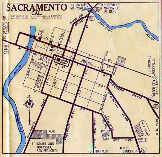 US 99E and US 99W are
established; the map to the right shows the routings. US 99W north and
US 40 westbound followed the older M Street routing out of town. US 99E
began at the junction of L Street (US 40 west of 16th; US 50 east of
16th) and followed US 40 eastbound north on 16th Street to cross the
American River (eventually continuing up (former) Route 256, current
Route 65, Route 70, Route 20, and Route 99 to Red Bluff). Note: the
Auburn Boulevard name was being applied to the northernmost portion of
12th Street (Auburn Boulevard now begins slightly north of North
Sacramento), and Stockton Boulevard north of 5th Avenue (now Broadway),
as well as Alhambra Boulevard and US 50 west into downtown via L Street
may have been part of the routing of US 99 at the time.
US 99E and US 99W are
established; the map to the right shows the routings. US 99W north and
US 40 westbound followed the older M Street routing out of town. US 99E
began at the junction of L Street (US 40 west of 16th; US 50 east of
16th) and followed US 40 eastbound north on 16th Street to cross the
American River (eventually continuing up (former) Route 256, current
Route 65, Route 70, Route 20, and Route 99 to Red Bluff). Note: the
Auburn Boulevard name was being applied to the northernmost portion of
12th Street (Auburn Boulevard now begins slightly north of North
Sacramento), and Stockton Boulevard north of 5th Avenue (now Broadway),
as well as Alhambra Boulevard and US 50 west into downtown via L Street
may have been part of the routing of US 99 at the time.  Late 1950s. A route is proposed for the South Sacramento Freeway,
extending from U Street between 29th and 30th to a point 2 mi S of
Florin Road. Planned as an eight-lane highway, it will eventually be
part of a multi-lane route to Lodi.
Late 1950s. A route is proposed for the South Sacramento Freeway,
extending from U Street between 29th and 30th to a point 2 mi S of
Florin Road. Planned as an eight-lane highway, it will eventually be
part of a multi-lane route to Lodi. With the construction of the North Sacramento Freeway, former US 40/99E (Del Paso Boulevard, El Camino Avenue, and Auburn Boulevard) were reverted to local jurisdiction. For US 99E itself, it followed the constructed portion of the 29/30 Freeway and the Roseville Freeway across the American River through North Sacramento, and then followed the Roseville Freeway northeast with US 40 (and I-80). Route 24 no longer continued to Woodland and Marysville (via Route 16, US 40A, and Route 20), but rather continued north to Marysville more directly via Jiboom Street, Garden Highway, El Centro Road, and US 99E. Also, the Yolo Causeway underwent a complete tear-down and reconstruction to accomodate traffic for I-80.
Nathan Edgars looked at traffic counts, and came up with the following:
Route 80: Tower Bridge, over Capitol/N to 29th-30th, then a break to Broadway at 29th-30th and up 29th-30th
Route 99: from the south to Broadway, then west on Broadway, then a break to the east end of the I Street Bridge and up Jibboom Street
Route 16 cut back to I-5 at the east end of the I Street Bridge
Route 99 removed from P and Q Streets and instead routed back west on Broadway, replacing Route 16, but only to Route 275, where it broke until Jibboom Street
The Gribblenation Blog, "Highways in and around Old Sacramento; US 40, US 99W, CA 16, CA 24, CA 70, CA 99, CA 275, and more" provides a detailed history of the various highways (US 40, US 99, Route 16, Route 24, Route 70, Route 99, Route 275, Route 51, I-5, and I-80 in the Old Sac area.
Route 99 S of Sacramento (South Sacramento Freeway) has several cut-outs for bus stops. These were installed for Sacramento Transit's bus service in the 1960s; the bus-usage signs were removed in the early 1990s (and the current Sacramento transit system, Sacramento Reigonal Transit, only has one daily line on the South Sacramento Freeway).
 There are still times when
Caltrans still missigns the route as US 99. An example from October 2009
involves a sign replacement project on eastbound US 50 on the W/X Freeway
portion, as illustrated to the right. As of December 2009, this sign has
already been corrected.
There are still times when
Caltrans still missigns the route as US 99. An example from October 2009
involves a sign replacement project on eastbound US 50 on the W/X Freeway
portion, as illustrated to the right. As of December 2009, this sign has
already been corrected.
 Status
I-5/Route 99 Split to Northern End of Bakersfield
In May 2018, the CTC approved for future consideration of funding the
following project for which a Negative Declaration (ND) has been
completed: Route 99 in Kern County. Lower roadway profile on a portion
Route 99 near the community of Wheeler Ridge. (PPNO 6876) (06-Ker-99, PM
L0.0/0.6). This project is located at the I-5/Route 99 separation near
Wheeler Ridge in Kern County. The project proposes to improve the vertical
clearance of the I-5/SR 99 Separation Bridge № 50-0240R. The
proposed project aims to accomplish targets of the California Sustainable
Freight Plan and improve major freight and truck mobility by addressing
the current vertical clearance restriction at the existing crossings. The
project proposes to lower northbound and southbound Route 99 to achieve
standard vertical clearance established in the California Highway Design
Manual. The proposed project is estimated to cost $11.4 million. This
project is fully funded and is currently programmed in the 2018 SHOPP for
$11.4 million which includes Construction (capital and support) and
Right-of-Way (capital and support). Construction is estimated to begin in
FY 2018-19. The scope, as described for the preferred alternative, is
consistent with the project scope programmed by the Commission in the 2018
SHOPP.
(Source: CTC Agenda, May 2018 Agenda Item 2.2c(1))
In August 2016, the CTC approved for future consideration of funding a project on Route 99 (06-Ker-99, PM 10.5/20.5) in Kern County that will rehabilitate a ten-mile portion of the existing outside southbound lane of Route 99 near Bakersfield. The project is programmed in the 2016 State Highway Operation and Protection Program. The total programmed amount is $28,973,000 for capital and support. Construction is estimated to begin in Fiscal Year 2016-17. The scope, as described for the preferred alternative, is consistent with the project scope programmed by the Commission in the 2016 State Highway Operation and Protection Program.
In May 2018, the CTC approved for future consideration of funding the
following project for which a Negative Declaration (ND) has been
completed: Route 99 in Kern County. Construct roadway improvements on
Route 99 in and near the city of Bakersfield. (PPNO 6681) (06-Ker-99, PM
10.4/21.2). This project is located on Route 99 through Bakersfield and a
portion of an unincorporated area of Kern County. The project proposes to
rehabilitate pavement and improve vertical clearance at two overcrossings.
The project proposes to replace and lower the roadbed at the Panama Lane
and White Lane overcrossings. The existing vertical clearance at the
existing crossings does not meet the minimum standard required by the
California Highway Design Manual. The project proposes to address this
clearance requirement by lowering the vertical profile of the existing
highway at the overcrossing structures. The proposed project is estimated
to cost $54.7 million. This project is not fully funded and is currently
programmed in the 2018 SHOPP for $53.2 million. Construction is estimated
to begin in FY 2020-21. The scope, as described for the preferred
alternative, is consistent with the project scope programmed by the
Commission in the 2018 SHOPP.
(Source: CTC Agenda, May 2018 Agenda Item 2.2c(1))
Route 99 Widening - Route 119 (~ KER 17.474) to Wilson Road (~ KER 22.082)
In November 2010, the CTC approved amending the STIP to program a new project: Route 99 from Route 119 to Wilson Road project (PPNO 6268). The project will widen the freeway from 6 lanes to 8 lanes between Route 119 and Wilson Road.
In March 2011, the CTC received notice of a prospoal to amend the 2010 STIP to reduce the programming for KCOG’s Planning, Programming and Monitoring (PPNO 6L03), and revise the funding plans for the Route 99 from Route 119 to Wilson Road project (PPNO 6268).
In October 2011, the CTC approved for future consideration of funding a project that will widen Route 99 from six lanes to eight lanes in Bakersfield from Route 119 to Wilson Road. The project is not fully funded. The project is programmed in the 2010 State Transportation Improvement Program for Project Development only. The total estimated cost is $45,200,000 for capital and support. Depending on the availability of funding construction is estimated to begin in Fiscal Year 2012-13. The scope as described for the preferred alternative is consistent with the project scope programmed by the Commission in the 2010 State Transportation Improvement Program. A copy of the MND has been provided to Commission staff. The project will mitigate potential impacts to biological resources to a less than significant level. Potential impacts to the San Joaquin kit fox, a federally listed endangered species, will be mitigated through a combination of measures including training sessions for construction crews, wildlife crossings, and other kit fox avoidance practices. As a result, an MND was completed for this project.
The SAFETEA-LU act, enacted in August 2005 as the reauthorization of TEA-21, provided the following expenditures on or near this route:
Hosking Avenue Interchange (~ KER 18.58)
![[Hosking Interchange]](maps/099-hosking.jpg) In July 2010, the CTC approved for future consideration of funding a project that will construct
a new interchange and public road connection at Hosking Avenue, just N of
Taft Highway, on Route 99 in the city of Bakersfield. The project is
funded with local developer funding. However, the project is being
considered for both state and federal funding if they become available.
Construction is estimated to begin in Fiscal Year 2010-11. Total estimated
project cost is $27,329,000. Specifically, the City of Bakersfield, in
cooperation with Caltrans is proposing to replace the existing Hosking
Avenue overcrossing with a new interchange and create a new public road
access to Route 99 at Hosking Avenue. The construction of a new
interchange at Hosking Avenue will improve the operations of the adjacent
interchanges and arterial roads by providing existing traffic a new point
of direct access to Route 99. This new interchange will also support
planned development and growth in the southwest area of Bakersfield. The
current interchange at Hosking Avenue is an existing 2-lane overcrossing
located approximately 6 miles south of downtown City of Bakersfield,
providing no Route 99 access. Through the project area, Route 99 is a
6-lane freeway. Three miles north of Hosking Avenue, Route 99 widens to an
8-lane freeway through the City center. The adjacent interchanges, Panama
Lane to the north and Route 119 (Taft Highway) to the south, are major
east-west arterials through Bakersfield. The proposed project includes the
construction of a spread diamond interchange with two-loop on-ramps to
Route 99 and replacing the existing 2-lane Hosking Avenue overcrossing
with a new 6- lane structure. Upgrading the existing Hosking Avenue
overcrossing to a 6-lane facility will be consistent with planned local
improvements and will match the City's 6-lane major arterial standard
cross section. Other City and developer-initiated projects both east and
west of the interchange will widen Hosking Avenue concurrently with this
proposed project. The new Hosking Avenue interchange will provide better
access to Route 99 for residential development in the southwest quadrant
of the interchange, currently under construction, and for the proposed
large commercial development in the northeast quadrant. The southeast
quadrant of the interchange is vacant and zoned for residential.
Construction of the Hosking Avenue interchange will lessen future traffic
demand at the adjacent interchanges and local arterial intersections. The
2035 traffic forecast for the Hosking interchange build alternative
indicates that improvements of levels of service at Route 99 mainline and
adjacent interchanges will be modest. It is assumed that the capacity
freed by the Hosking interchange will be backfilled with the increased
traffic demands due to growth in the area. Furthermore, traffic operations
at the neighboring arterial intersections are expected to significantly
improve.
In July 2010, the CTC approved for future consideration of funding a project that will construct
a new interchange and public road connection at Hosking Avenue, just N of
Taft Highway, on Route 99 in the city of Bakersfield. The project is
funded with local developer funding. However, the project is being
considered for both state and federal funding if they become available.
Construction is estimated to begin in Fiscal Year 2010-11. Total estimated
project cost is $27,329,000. Specifically, the City of Bakersfield, in
cooperation with Caltrans is proposing to replace the existing Hosking
Avenue overcrossing with a new interchange and create a new public road
access to Route 99 at Hosking Avenue. The construction of a new
interchange at Hosking Avenue will improve the operations of the adjacent
interchanges and arterial roads by providing existing traffic a new point
of direct access to Route 99. This new interchange will also support
planned development and growth in the southwest area of Bakersfield. The
current interchange at Hosking Avenue is an existing 2-lane overcrossing
located approximately 6 miles south of downtown City of Bakersfield,
providing no Route 99 access. Through the project area, Route 99 is a
6-lane freeway. Three miles north of Hosking Avenue, Route 99 widens to an
8-lane freeway through the City center. The adjacent interchanges, Panama
Lane to the north and Route 119 (Taft Highway) to the south, are major
east-west arterials through Bakersfield. The proposed project includes the
construction of a spread diamond interchange with two-loop on-ramps to
Route 99 and replacing the existing 2-lane Hosking Avenue overcrossing
with a new 6- lane structure. Upgrading the existing Hosking Avenue
overcrossing to a 6-lane facility will be consistent with planned local
improvements and will match the City's 6-lane major arterial standard
cross section. Other City and developer-initiated projects both east and
west of the interchange will widen Hosking Avenue concurrently with this
proposed project. The new Hosking Avenue interchange will provide better
access to Route 99 for residential development in the southwest quadrant
of the interchange, currently under construction, and for the proposed
large commercial development in the northeast quadrant. The southeast
quadrant of the interchange is vacant and zoned for residential.
Construction of the Hosking Avenue interchange will lessen future traffic
demand at the adjacent interchanges and local arterial intersections. The
2035 traffic forecast for the Hosking interchange build alternative
indicates that improvements of levels of service at Route 99 mainline and
adjacent interchanges will be modest. It is assumed that the capacity
freed by the Hosking interchange will be backfilled with the increased
traffic demands due to growth in the area. Furthermore, traffic operations
at the neighboring arterial intersections are expected to significantly
improve.
In August 2016, it was reported that when contractors finished a $1.4
million sign replacement project in late June 2016, they failed to change
out one of those green-and-white exit advisory signs that indicate the
number of exits in the city of Bakersfield. Motorists driving south
through town get an up-to-date look at the state’s ninth largest
city with a new sign that’s positioned north of the 7th Standard
Road/Merle Haggard Drive exit (~ KER R30.539). It reads “Bakersfield
/ Next 12 Exits.” However, NB drivers saw “Bakersfield / Next
5 Exits.” Additionally, that sign was planted just north of the
Panama Lane exit, well within the present-day city limits, which extend
south past Taft Highway. State workers are moving the sign outside city
limits during the September, and give it a yet-newer “exits”
number — 13, because there are 13 exits from NB Route 99 in
Bakersfield. Later in 2016, at a cost of around $1,000, it will be
completely replaced. Caltrans will also move the “Bakersfield city
limits” sign on NB Route 99 because it’s currently located
near White Lane (~ KER 21.068) — also now inside city limits. Both
signs were part of a state freeway sign renewal that began last year and
updated 197 overhead signs on Route 99, Route 58 and Route 178 in city
limits, and 48 ground-mounted signs throughout Kern County.
(Source: Bakersfield.Com, 8/24/2016)
Centennial Corridor / Beltway Improvements (~ KER 22.121 to KER 23.6)
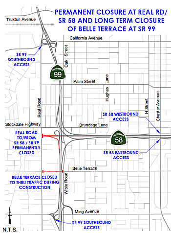 In April 2017, there was an update on the the Route 58 beltway improvements that connect to the
Centennial Corridor. This project provides traffic improvements along
Route 58, from Route 99 to Cottonwood Road, and adds a lane in either
direction along Route 99 in the area between Wilson Road (~ KER 22.121)
and Ming Avenue (~KER 22.617). The project is 60 percent complete;
completion expected in early 2018. Work on the pump plant, which removes
water that collects under the road, on northbound Route 99 near Ming
Avenue continues. Falsework, or temporary support, for the new connector
bridge for Route 99 to eastbound Route 58 is nearly complete. Crews will
begin installing steel for the bridge stems and bottom frame in May 2017.
Work to widen the bridges at P Street, the Bakersfield Corral Overhead (a
railroad bridge), and Madison Street are also underway. Lastly, multiple
retaining and sound walls are being constructed along Route 58 on both
sides of the freeway. Walls and barrier rails are also under construction
along the on- and off-ramps at Chester Avenue, H Street and Union Avenue.
In April 2017, there was an update on the the Route 58 beltway improvements that connect to the
Centennial Corridor. This project provides traffic improvements along
Route 58, from Route 99 to Cottonwood Road, and adds a lane in either
direction along Route 99 in the area between Wilson Road (~ KER 22.121)
and Ming Avenue (~KER 22.617). The project is 60 percent complete;
completion expected in early 2018. Work on the pump plant, which removes
water that collects under the road, on northbound Route 99 near Ming
Avenue continues. Falsework, or temporary support, for the new connector
bridge for Route 99 to eastbound Route 58 is nearly complete. Crews will
begin installing steel for the bridge stems and bottom frame in May 2017.
Work to widen the bridges at P Street, the Bakersfield Corral Overhead (a
railroad bridge), and Madison Street are also underway. Lastly, multiple
retaining and sound walls are being constructed along Route 58 on both
sides of the freeway. Walls and barrier rails are also under construction
along the on- and off-ramps at Chester Avenue, H Street and Union Avenue.
(Source: Bakersfield.Com, 4/20/2017)
In March 2018, the CTC updated the following project in
the SHOPP: 06-Ker-99 22.8/23.6 In Bakersfield, from 0.3 mile south of
Belle Terrace Overcrossing to 0.1 mile north of Route 58, also on Route 58, Route 99 to 0.2 mile east of Route 99 (PM R52.3 to R52.5). Construct
an auxiliary lane, reconstruct an Overcrossing and realign connector ramp.
$30,960,000 in Construction Capital.
(Source: CTC Agenda, March 2018, Agenda 2.1a(1))
In February 2019, it was reported that demolition of
the Belle Terrace Bridge was starting. This would result in access to
Route 58 and to SB Route 99 at Real Road to permanently close on
2/21/2019. EB motorists would then need to access Route 58 by taking
Stockdale Highway / Brundage Lane to the H Street Interchange. WB
motorists would exit Route 58 at Chester Ave. SB motorists would access
Route 99 at either California or Ming Ave.
(Source: Caltrans District 6 FB Post, 2/15/2019)
In May 2019, the CTC approved allocating an additional
$3,300,000 for the previously approved SHOPP Operational Improvement
project (PPNO 6891) on Route 99 and Route 58 in Kern County, to complete
construction. The project will widen traffic lanes, add an auxiliary lane
and improve signs on northbound (NB) Route 99 between Ming Avenue and
Route 58. The project will also replace the Belle Terrace Overcrossing
(OC) and reconstruct the NB Route 99/EB Route 58 connector. The project is
designated as a Financial Contribution Only (FCO) and therefore is not
eligible for G-12 authority. This project is located within a main freight
corridor for California funded with various local funds, SB 1 funds, SHOPP
funds and federal grants. Many of these projects are in various stages of
construction. The overall cost of these projects is estimated to be over
$1 billion dollars. In March 2018, the Commission allocated $30,960,000 in
Construction Capital, and $0 in Construction Support. The City is funding
the cost of Construction Support in the amount of $3,850,000. A
cooperative agreement (Co-Op) between the Department and the City,
designates the City as the construction implementation agency, responsible
for contract administration and associated support cost. The Department,
as a project sponsor, provides project oversight and funding for
additional Construction Capital cost incurred during construction. The
$30,960,000 allocation provided to the City is being invoiced and the
Department is reimbursing for actual allowable costs incurred and paid to
the contractor. In June 2018, the City augmented the allocated
Construction Capital funds and awarded the project contract for
$32,460,000. Construction began in October 2018; the contract status is
currently active with 27 percent of the construction bid items completed.
The project is expected to be completed by April 2020. Since the start of
construction, the project has incurred a funding shortfall due to
agreed-upon contract Change Orders (CO). The City has negotiated with the
contractor, and they both agreed on the amount needed to pay for these
COs, and the Department concurred. The total amount needed to pay for
these COs is $3,500,000. Based on funding proportions and the terms of the
Co-Op agreement , the City will provide $200,000 in local funds, and SHOPP
funds will provide $3,300,000. As with the original allocation, the
$3,300,000 allocation provided to the City is to be invoiced and the
Department will reimburse for actual allowable costs incurred and paid to
the contractor. The Department is requesting a supplemental fund amount of
$3,300,000 in Construction Capital to complete the construction of this
project. Since the City is funding the total cost of Construction Support,
the Department is not requesting any Construction Support funds. When this
supplemental request is approved, the Department and the City have agreed
to amend the Co-Op, requiring that any future cost increases in
construction will not come from SHOPP funds. A major portion of the
construction cost increase is due to differing site conditions at the soil
nail walls. Retaining Walls No. 6 and 62 were type-selected as soil nail
walls based on their proximity to existing Wible Road, and the need for
“top-down” construction. Field soil investigation prior to
wall design, including multiple soil test borings, revealed the existence
of layers of loose to medium dense sands. The geotechnical report did
include measures to mitigate loose, caving sandy soil during construction.
These measures included constructing a berm, using temporary shotcrete to
stabilize the excavation, and using full length temporary casings.
Furthermore, stability testing would be performed to determine the
acceptable lift height of soil and exposure time during excavation. The
wall design option as a soil nail wall type remained unchanged through the
course of design and went through all the required design and
constructability reviews before advertising the project contract. Using
over 2,000 soil nails, the 24-foot-high retaining wall supports a 3,500
feet embankment consisting of loose, sandy soil. During construction,
excavation at the soil nail wall location revealed a more dominant
presence of loose, less competent soils than anticipated and field
excavation activities were halted. The Construction Manager then
collaborated with the Contractor and Geotechnical Engineer to develop a
timely and cost-effective solution that involves “soil mixing”
to stabilize the soil and preventing caving of over 56,000 linear feet of
soil nail bores. Another significant portion of the construction cost
increase is the result of the discovery of an AT&T abandoned conduit
during field preparation to demolish the bridge. The conduit was
discovered inside the bridge and was determined to contain asbestos. An
earlier asbestos survey, that was conducted during the design phase, did
not find any asbestos on the Belle Terrace Bridge. The asbestos conduit
removal will require additional costs to be safely detached prior to
bridge demolition, as contractors are required to adhere to special safety
procedures when dealing with items containing asbestos. The cost
associated with this operation is $550,000. The bridge demolition
operation has been delayed to accommodate a change in the means and
methods for demolition of the bridge and mitigation of the asbestos
containing conduit. The remainder of the cost increase, $475,000 is due to
the additional field work needed to excavate and remove “Unknown
Buried Manmade Objects”; consisting of large, unearthed chunks of
concrete rubble at the project site.
(Source: May 2019 CTC Minutes, Agenda Item
2.5e.(1))
In August 2022, it was reported that there were plans
to permanently close the Stockdale Avenue offramp from SB Route 99. This
was scheduled for August 11, but was pushed back with no new date.
(Source: KGET Bakersfield, 8/17/2022)
In October 2022, it was reported that the Centennial
Corridor project was nearing the finish line. Work was progressing on the
freeway overpass at Route 99 and Stockdale Highway, as well as the last
800' connecting the overpass. The Centennial Corridor project is comprised
of four different phases. The overpass consists of two projects, one
called the Mainline and the other one called the Bakersfield Freeway
Connector, The Bakersfield Freeway Connector is should be completed by the
end of 2022. It consists of that loop ramp from westbound Route 58 to
southbound Route 99 and everything associated with the Ming offramp,
southbound Ming offramp. The southbound Ming Avenue exit is due to open in
October 2022 after a long closure, but it will look different. In order to
separate them from cars merging from the new eastbound connector onto
southbound Route 99, motorists will have to commit to taking the Ming
offramp north of Stockdale Highway – more than a mile before they
actually exit. But that creates another problem – how to keep cars
exiting at Stockdale Highway safely apart from cars getting in line to
exit farther down at Ming. That’s why Caltrans plans to permanently
close the Stockdale exit. City officials oppose that – they want to
maintain direct freeway access to Cal State Bakersfield, Mercy Southwest
Hospital and the Park at Riverwalk and an important developing commercial
corridor.
(Source: KGET Bakersfield 17, 10/12/2022)
In December 2022, the CTC was noticed about the
following forthcoming STIP amendment: Rescind $25,593,000 of Regional
Improvement Program (RIP) funding from the Construction phase of the
Extend Hageman Road Easterly Across Route 99 and connect to Route 204 in
Bakersfield project (PPNO 06-3525; EA 484500; 06-Ker-5 26.700/27.200) and
program $24,093,000 of the RIP funds to the Construction phase of the new
Centennial Corridor EB Route 58 to NB Route 99 Loop Connector project
(PPNO 06-8029; EA 48467; 06-Ker-58 T52.200/R52.400), in Kern County.
According to the background in the agenda item, the RIP funds from the CON
phase of the Hageman Flyover project are being reprogrammed to the CON
phase of Bakersfield Freeway Connector loop project because of a potential
delay in the Hageman Flyover project. The Centennial Corridor EB 58
to NB 99 Loop Connector project is in the City of Bakersfield -
from the eastbound Route 58 freeway to existing northbound Route 99. At
the Route 58/Route 99 Interchange, construct a new connector starting west
of Route 99, on the south side of Route 58 with a bridge spanning over
Route 99 between postmile T52.2/R 52.40, and connecting to northbound
Route 99 between postmile 23.2/23.7.The Bakersfield Freeway Connector Loop
project proposes to construct a loop connector for the EB Route 58 to NB
Route 99 movement at the existing Route 58/Route 99 interchange. In its
existing condition, it takes the traveling public an additional 2.4 miles
to make the connection from EB Route 58 to NB Route 99. The proposed
Bakersfield Freeway Connector Loop project will provide a direct
connection by providing exit at EB Route 58 approximately 250 feet west of
Route 99. The existing EB Route 58/Route 99 grade separation bridge will
be widened to accommodate the connector. The loop ramp will cross over
Wible Road before connecting onto the NB Route 99/Ming Avenue Bypass
On-Ramp. A bridge will be constructed over Wible Road and a retaining wall
will be constructed adjacent to the existing NB Route 99 to EB Route 58
connector. The Ming Avenue Bypass On-ramp will be re-aligned to the east
and the elevation of the on-ramp will be raised to meet the connector,
which will then merge with the Ming Avenue Bypass On-Ramp, retaining walls
are proposed at this location along NB Route 99 and the proposed
connector. After the merge, the single lane will then merge with NB Route 99 prior to the existing westbound (WB) Route 58 to NB Route 99 Connector.
Each phase of the Centennial Corridor Project has been approved and
proceeded to CON except for the Route 58/99 Bakersfield Freeway Connector
Phase 2 project (EA 48467). The supplemental project report for this
project will be approved in late November 2022 and final design will be
completed by June 2023 allowing the project to proceed to CON in Fall
2023. The revised totals show ($ × 1,000): Const Cap 24,093;
PA&ED 500; PS&E 1,500.
(Source: December 2022 CTC Agenda, Agenda Item
2.1b.(2))
 In August 2023, the CTC approved for future consideration of funding
06-Ker-58, PM T31.7/R55.6 06-Ker-99, PM 21.2/26.2. Centennial
Corridor Project. Construct a new alignment for Route 58 to
provide a continuous route along Route 58 from Cottonwood Road on existing
Route 58, east of Route 99 to I-5. Improvements to Route 99 from Wilson
Road to Gilmore Avenue would also be required for the connection with
Route 58, in Kern County. The project is located on Route 58 from PM T31.7
to PM R55.6, and on Route 99 from PM 21.2 to PM 26.2, in Kern County. The
Department proposes to construct a new alignment for Route 58, to provide
a continuous route from Cottonwood Road on existing Route 58, east of
Route 99 to I-5. Improvements to Route 99, from Wilson Road to Gilmore
Avenue, would also be required for the connection with SR 58. The project
is currently programmed in the 2022 STIP for a total of $26,093,000, which
includes Construction (Capital). Construction is estimated to begin in
2025-26. The scope, as described for the preferred alternative, is
consistent with the project scope as programmed by the Commission in the
2022 STIP. A copy of the FEIR has been provided to Commission staff. The
Commission approved the project for future consideration of funding on
March 21, 2018, under Resolution E-18-30. Since the approval of the FEIR,
there have been changes to the project and an Addendum was prepared
pursuant to CEQA. These changes include the addition of a loop connector
for the eastbound Route 58 to NB Route 99 movement at the Route 58/Route 99 interchange and associated adjustments. The loop connector was not
included in the original FEIR due to lack of available funding at the
time. The proposed loop connector is located within the approved
archaeological and architectural Area of Potential Effects, within the
approved Biological Study Area, and within Department right of way. There
are no changes to avoidance, minimization, and/or mitigation measures
since approval of the FEIR in December 2015. The proposed loop connector
would have no significant environmental effects or substantial increase in
the severity of previously identified significant effects. The project
changes do not meet the criteria outlined in CEQA Guidelines Section 15162
and Section 15163 to prepare a Subsequent or Supplemental FEIR. The
Department subsequently completed an Addendum to the FEIR pursuant to
CEQA. The Department has approved this project for construction. This
approval and the Addendum will satisfy the environmental requirements for
this stage of the planning process.
In August 2023, the CTC approved for future consideration of funding
06-Ker-58, PM T31.7/R55.6 06-Ker-99, PM 21.2/26.2. Centennial
Corridor Project. Construct a new alignment for Route 58 to
provide a continuous route along Route 58 from Cottonwood Road on existing
Route 58, east of Route 99 to I-5. Improvements to Route 99 from Wilson
Road to Gilmore Avenue would also be required for the connection with
Route 58, in Kern County. The project is located on Route 58 from PM T31.7
to PM R55.6, and on Route 99 from PM 21.2 to PM 26.2, in Kern County. The
Department proposes to construct a new alignment for Route 58, to provide
a continuous route from Cottonwood Road on existing Route 58, east of
Route 99 to I-5. Improvements to Route 99, from Wilson Road to Gilmore
Avenue, would also be required for the connection with SR 58. The project
is currently programmed in the 2022 STIP for a total of $26,093,000, which
includes Construction (Capital). Construction is estimated to begin in
2025-26. The scope, as described for the preferred alternative, is
consistent with the project scope as programmed by the Commission in the
2022 STIP. A copy of the FEIR has been provided to Commission staff. The
Commission approved the project for future consideration of funding on
March 21, 2018, under Resolution E-18-30. Since the approval of the FEIR,
there have been changes to the project and an Addendum was prepared
pursuant to CEQA. These changes include the addition of a loop connector
for the eastbound Route 58 to NB Route 99 movement at the Route 58/Route 99 interchange and associated adjustments. The loop connector was not
included in the original FEIR due to lack of available funding at the
time. The proposed loop connector is located within the approved
archaeological and architectural Area of Potential Effects, within the
approved Biological Study Area, and within Department right of way. There
are no changes to avoidance, minimization, and/or mitigation measures
since approval of the FEIR in December 2015. The proposed loop connector
would have no significant environmental effects or substantial increase in
the severity of previously identified significant effects. The project
changes do not meet the criteria outlined in CEQA Guidelines Section 15162
and Section 15163 to prepare a Subsequent or Supplemental FEIR. The
Department subsequently completed an Addendum to the FEIR pursuant to
CEQA. The Department has approved this project for construction. This
approval and the Addendum will satisfy the environmental requirements for
this stage of the planning process.
(Source: August 2023 CTC Agenda, Agenda Item 2.2c.(2) Item 6)
In October 2023, the CTC approved the following STIP
allocation: $28,500,000. 06-Ker-58 T52.2/R52.4; 06-Ker-99 23.2/23.7. PPNO
06-8029; ProjID 0623000083; EA 48467. Centennial Corridor EB58 to
NB99 Loop Connector. In the City of Bakersfield from the eastbound
Route 58 to existing northbound Route 99. At the Route 58/Route 99
Interchange, construct a new connector starting west of Route 99, on the
south side of Route 58 with a bridge spanning over Route 99 between
postmile T52.2/R 52.40, and connecting to northbound Route 99 between
postmile 23.2/23.7. CEQA - EIR, 12/04/2015; Re-validation 12/02/2022. NEPA
- EIS, 12/04/2015; Re-validation 12/02/2022. Right of Way Certification:
08/23/2023. Additional $4,407,000 increase will be funded with future Kern
RIP shares. Future consideration of funding approved under Resolution
E-18-30; March 2018. An Addendum for the previously approved Future
Consideration of Funding was approved under Resolution E-23-122A; August
2023. Allocation: CONST $24,093,000 $28,500,000.
(Source: October 2023 CTC Agenda, Agenda Item 2.5c.(2))
In December 2023, the CTC approved for future
consideration of funding the following project for which a FEIR and an
Addendum have been completed: Centennial Corridor Project. Route 58 and Route 99 in Kern County. Construct a new alignment for Route 58, to
provide a continuous route from Cottonwood Road on existing Route 58, east
of Route 99 to I-5. Improvements to Route 99, from Wilson Road to Gilmore
Avenue, would also be required for the connection with Route 58, in Kern
County. (06-Ker-58, PM T31.7/R55.6; 06-Ker-99, PM 21.2/26.2; PPNO 06-8030)
The project is located on Route 58 from PM T31.7 to PM R55.6, and on Route 99 from PM 21.2 to PM 26.2, in Kern County. The Department proposes to
construct a new alignment for Route 58, to provide a continuous route from
Cottonwood Road on existing Route 58, east of Route 99 to I-5.
Improvements to Route 99, from Wilson Road to Gilmore Avenue, would also
be required for the connection with Route 58. The project is currently
programmed in the Trade Corridor Enhancement Program (TCEP). The total
programmed amount, which includes Right of Way (Capital), and Construction
(Capital) is $13,400,000. Construction began in 2023-2024. The scope, as
described for the preferred alternative, is consistent with the project
scope as programmed by the Commission in the TCEP. A copy of the FEIR has
been provided to Commission staff. The Commission approved the project for
future consideration of funding on March 21, 2018, under Resolution
E-18-30 and August 17, 2023, under Resolution E-23-122A. Since the
approval of the FEIR and Addendum, there have been changes to the project
and a new Addendum was prepared pursuant to CEQA. These changes include
the construction of a southbound Route 99 to westbound Route 58 connector
ramp. The ramp would be constructed at the current location of the
southbound Route 99 to Stockdale off-ramp. The existing Stockdale off-ramp
would be permanently closed. The connector ramp would be a fly-over
structure, which would cross over Stockdale Highway, the existing
westbound Route 58 to southbound Route 99 loop connector, and Real Road
before merging to the westbound Route 58. West of Real Road, an existing
retaining wall would be reconstructed to accommodate the new connector
ramp. An additional 470-foot auxiliary lane would be constructed on
westbound Route 58 to accommodate merging. There are no substantial
changes proposed in the new connector ramp that would require major
revisions of the FEIR due to involvement of new significant environmental
effects or a substantial increase in the severity of previously identified
significant effects. The project changes do not meet the criteria outlined
in CEQA Guidelines Section 15162 and Section 15163 to prepare a Subsequent
or Supplemental FEIR. The Department subsequently completed an Addendum to
the FEIR pursuant to CEQA. The Department has approved this project for
construction. This approval and the Addendum will satisfy the
environmental requirements for this stage of the planning process.
(Source: December 2023 CTC Agenda, Agenda Item 2.2c.(2))
☞ Note: For the improvements of the connection with Route 58 (Stockdale Highway, Centennial Corridor, Rosedale Highway), see Route 58 (~ KER 23.596)
24th Street Improvements
In April 2017, an update was provided on the 24th
Street Improvement Project (~ KER 25.64). This project widens, realigns
and restripes 24th Street from west of Route 99 to east of M Street;
realigns and restripes 23rd from west of C Street to east of M Street to
add a lane in each direction. It also includes improvements to the 24th
Street/Route 99 interchange and the northbound Route 99 auxiliary lane;
and widens the Oak Street/24th Street intersection. The design phase of
this project is 65 percent complete; right-of-way acquisition is
completed. The project designer is working to complete the sound wall
construction plans. Sound walls for properties on the north side of 24th
Street could begin in summer 2017. Demolition work is underway on the
north side of 24th Street. Five houses have been removed; eight houses are
scheduled for demolition in April. There were no bidders for the auction
scheduled on April 4 for the five houses available for relocation on the
south side of 24th Street. These properties will be advertised for
demolition in April. The city plans to hold an auction on the house
located at 2312 24th St. on April 27. The successful buyer will relocate
the house from its current location to the new lot fronting Bay Street.
Information can be found on Planet Bids and on the TRIP website.
(Source: Bakersfield.Com, 4/20/2017)
In July 2017, it was reported that the CTC has approved
an $86 million increase to Caltrans' State Route 99 Rehabilitation Project
for next fiscal year, to be used to improve part of 24th Street at Route 99, according to City Manager Alan Tandy's most recent weekly memo to the
Bakersfield City Council. The City of Bakersfield and Caltrans were able
to add the section of 24th Street — from the Kern River Bridge to
Route 99 — into the rehab project. This so-called Segment 1 project
involves widening 24th to four lanes in the westbound direction, expanding
the Route 99 southbound loop on-ramp to two lanes and expanding the
northbound Route 99 off-ramp, Tandy's memo says. Caltrans expects to bid
out the rehab project in about a year and Segment 1 will be one of the
first pieces of work done under it, the memo goes on to say.
(Source: Bakersfield.Com 7/3/2017)
Rosedale Highway Connection Improvements
In June 2015, the CTC authorized $7,467,000 to widen the Southbound off ramp to Rosedale Highway to improve operational efficiency and safety during peak hours of travel on Route 99 in Kern County (06-Ker-99, 25.8/26.2).
In April 2017, it was reported that the Rosedale
Highway connection improvements were nearly complete. The southbound Route 99 auxiliary lane/Rosedale Highway off-ramp improvements were fully opened
in mid-April 2017. Crews are expected to remain in the area for a few more
weeks to complete detail work, such as arranging electrical lines and
irrigation.
(Source: Bakersfield.Com, 4/20/2017)
In May 2014, the CTC approved for future consideration of funding a project in Kern County that will correct the seismic deficiencies of four bridges on Route 99 and Route 178 in Kern County, including the Airport Drive Overcrossing (Bridge Number 50- 0266, ~KER 26.732) and the Golden State Avenue Separation (Bridge Numbers 50-0326 Right, 50-0326 Left, and 50-0326 Center, ~ KER 27.158). The project is programmed in the 2014 State Highway Operation and Protection Program. The total estimated cost is $10,139,000 for capital and support. Construction is estimated to begin in Fiscal Year 2016-17.
Hageman Flyover (06-Ker-5 26.700/27.200)
In April 2017, an update was provided on the Hageman
Flyover. This project connects Hageman Road to Golden State Highway/Route 204 (~ KER 27.158) with roadway across Route 99. The Design Phase is 95
percent complete; but right-of-way acquisition has not started. Caltrans
is finalizing draft plans. The city is working with San Joaquin Valley
Railroad on a construction and maintenance agreement and a California
Public Utilities Commission permit application. Right-of-way appraisals
and acquisition will not begin until design has progressed to 100 percent.
The project will construct the Hageman Road extension from Knudsen Drive
to Golden State Avenue at Airport Drive. The proposed project would
provide a connection between northwestern and downtown Bakersfield. The
project would extend Hageman Road from just east of the intersection with
Knudsen Drive, cross over Route 99, and connect with Golden State Avenue.
The extension of Hageman Road would be a four-lane road with two
12-foot-wide travel lanes in each direction, a 12-foot-wide median with
barrier, and 8-foot-wide outside shoulders. The Knudsen Drive intersection
would have signals. A double-box culvert structure would be built over the
Beardsley Canal lateral, with bridges over the San Joaquin Valley
Railroad, and Route 99. The existing bridge over Airport Drive would be
widened, and ramps at the Airport Drive and Golden State Avenue
interchange would be modified. The roadway section would transition to
match the existing roadway at the west and east ends of the proposed
project.
(Source: Bakersfield.Com, 4/20/2017)
In June 2021, the CTC approved including "Extend
Hageman Rd easterly across SR99 and connect to SR 204 in Bakersfield" in
the list of projects for the Coronavirus Response and Relief Supplemental
Appropriations Act of 2021 (CRRSAA). The CRRSAA Program guidelines require
regions submit a project list for allocation by the Commission prior to
the obligation of funds. Under CRRSAA, the funds may be used for a broad
range of surface transportation purposes listed in Section 113(b) of Title
23 of the U.S. Code and are meant to “prevent, prepare for, and
respond to coronavirus.” Specifically, CRRSAA allows states to cover
revenue losses, which is important given that California’s
State-generated transportation revenues have declined by about $1.5
billion due to the pandemic. Additionally, CRRSAA allows the funds to be
used for preventive and routine maintenance; operations; personnel;
salaries; contracts; debt service payments; and availability payments; as
well as transfers to public tolling agencies. At the March 2021 Commission
meeting, the CTC approved the CRRSAA funding distribution and regional
apportionments. The CRRSAA allocation for this project was $2,565,000.
(Source: June 2021 CTC Minutes, Agenda Item 2.5k)
In December 2022, the CTC was noticed about the
following forthcoming STIP amendment: Rescind $25,593,000 of Regional
Improvement Program (RIP) funding from the Construction phase of the
Extend Hageman Road Easterly Across Route 99 and connect to Route 204 in
Bakersfield project (PPNO 06-3525; EA 484500; 06-Ker-5 26.700/27.200) and
program $24,093,000 of the RIP funds to the Construction phase of the new
Centennial Corridor EB Route 58 to NB Route 99 Loop Connector project
(PPNO 06-8029; EA 48467; 06-Ker-58 T52.200/R52.400), in Kern County.
According to the background in the agenda item, the RIP funds from the CON
phase of the Hageman Flyover project are being reprogrammed to the CON
phase of Bakersfield Freeway Connector loop project because of a potential
delay in the Hageman Flyover project. There is an opportunity to expedite
the Bakersfield Freeway Connector Loop project to be delivered in the same
time frame or earlier. The Hageman Flyover project remains an important
priority project for the region and KCOG and the City of Bakersfield is
committed to delivering this project in the future. This was voted on in
January 2023.
(Source: December 2022 CTC Agenda, Agenda Item
2.1b.(2); January 2023 CTC Agenda, Agenda Item 2.1a.(3))
In July 2023, it was reported that the California
Transportation Commission awarded $9.3 million for the final ramp for the
interchange at Route 99 and Route 58 as part of more than $2.2 billion to
fund projects across the state. According to a news release issued by
KernCOG, the Route 58 mainline connection from Route 99 to the 7-mile
Westside Parkway freeway is scheduled to open to traffic with a
ribbon-cutting in September 2023, providing connectivity to I-5 via
Stockdale Highway west of Bakersfield. Once the connector is open, the
agency said, two more Route 99 / Route 58 interchange ramps will be
completed over the next several years — the Route 58 westbound to
Route 99 northbound and the Route 99 southbound to Route 58 westbound
movements. According to Caltrans, the estimated construction cost for the
Centennial Corridor Southbound Route 99 and westbound Route 58 Connector
project is more than $29 million. It is expected to be complete by summer
2028. The funding to complete the final ramp for the 99-to-58
freeway-to-freeway interchange comes from the Trade Corridor Enhancement
Program. The program is funded by state and federal fuel taxes, including
the Senate Bill 1 Transportation Improvement Fee.
(Source: Tehachapi News, 7/9/2023)
In August 2023, the CTC approved for future consideration of funding
06-Ker-58, PM T31.7/R55.6 06-Ker-99, PM 21.2/26.2. Centennial
Corridor Project. Construct a new alignment for Route 58 to
provide a continuous route along Route 58 from Cottonwood Road on existing
Route 58, east of Route 99 to I-5. Improvements to Route 99 from Wilson
Road to Gilmore Avenue would also be required for the connection with
Route 58, in Kern County. The project is located on Route 58 from PM T31.7
to PM R55.6, and on Route 99 from PM 21.2 to PM 26.2, in Kern County. The
Department proposes to construct a new alignment for Route 58, to provide
a continuous route from Cottonwood Road on existing Route 58, east of
Route 99 to I-5. Improvements to Route 99, from Wilson Road to Gilmore
Avenue, would also be required for the connection with SR 58. The project
is currently programmed in the 2022 STIP for a total of $26,093,000, which
includes Construction (Capital). Construction is estimated to begin in
2025-26. The scope, as described for the preferred alternative, is
consistent with the project scope as programmed by the Commission in the
2022 STIP. A copy of the FEIR has been provided to Commission staff. The
Commission approved the project for future consideration of funding on
March 21, 2018, under Resolution E-18-30. Since the approval of the FEIR,
there have been changes to the project and an Addendum was prepared
pursuant to CEQA. These changes include the addition of a loop connector
for the eastbound Route 58 to NB Route 99 movement at the Route 58/Route 99 interchange and associated adjustments. The loop connector was not
included in the original FEIR due to lack of available funding at the
time. The proposed loop connector is located within the approved
archaeological and architectural Area of Potential Effects, within the
approved Biological Study Area, and within Department right of way. There
are no changes to avoidance, minimization, and/or mitigation measures
since approval of the FEIR in December 2015. The proposed loop connector
would have no significant environmental effects or substantial increase in
the severity of previously identified significant effects. The project
changes do not meet the criteria outlined in CEQA Guidelines Section 15162
and Section 15163 to prepare a Subsequent or Supplemental FEIR. The
Department subsequently completed an Addendum to the FEIR pursuant to
CEQA. The Department has approved this project for construction. This
approval and the Addendum will satisfy the environmental requirements for
this stage of the planning process.
(Source: August 2023 CTC Agenda, Agenda Item 2.2c.(2) Item 6)
In October 2023, the CTC approved the following STIP
allocation: $28,500,000. 06-Ker-58 T52.2/R52.4; 06-Ker-99 23.2/23.7. PPNO
06-8029; ProjID 0623000083; EA 48467. Centennial Corridor EB58 to
NB99 Loop Connector. In the City of Bakersfield from the eastbound
Route 58 to existing northbound Route 99. At the Route 58/Route 99
Interchange, construct a new connector starting west of Route 99, on the
south side of Route 58 with a bridge spanning over Route 99 between
postmile T52.2/R 52.40, and connecting to northbound Route 99 between
postmile 23.2/23.7. CEQA - EIR, 12/04/2015; Re-validation 12/02/2022. NEPA
- EIS, 12/04/2015; Re-validation 12/02/2022. Right of Way Certification:
08/23/2023. Additional $4,407,000 increase will be funded with future Kern
RIP shares. Future consideration of funding approved under Resolution
E-18-30; March 2018. An Addendum for the previously approved Future
Consideration of Funding was approved under Resolution E-23-122A; August
2023. Allocation: CONST $24,093,000 $28,500,000.
(Source: October 2023 CTC Agenda, Agenda Item 2.5c.(2))
Beardsley Canal Project
In November 2010, the CTC approved amending the STIP to program a new project: Route 99 from Route 204 (~ KER 27.158) to Beardsley Canal (~ KER R28.402) project (PPNO 6267). The project will widen the freeway from 6 lanes to 8 lanes between Route 204 and Beardsley Canal.
In March 2011, the CTC received notice of a prospoal to amend the 2010 STIP to reduce the programming for KCOG’s Planning, Programming and Monitoring (PPNO 6L03), and revise the funding plans for the Route 99 from Route 204 to Beardsley Canal project (PPNO 6267).
In August 2011, the CTC approved $88,179,000 in SHOPP funding for repairs near Bakersfield, between Beardsley Canal Bridge and Route 46, that will rehabilitate 62 lane miles of existing Portland Cement concrete pavement to improve safety and ride quality.
In October 2011, the CTC approved for future consideration of funding a project that will widen Route 99 from six lanes to eight lanes from Route 204 to Beardsley Canal Bridge. The project proposes to add a 12-foot lane and a 10-foot inside shoulder in each direction, separated by a concrete median barrier within the existing median.The project is not fully funded. The project is programmed in the 2010 State Transportation Improvement Program for Project Development only. Total estimated project cost is $13,260,000. Depending on the availability of funding construction is estimated to begin in Fiscal Year 2012-13. The scope as described for the preferred alternative is consistent with the project scope programmed by the Commission in the 2010 State Transportation Improvement Program. A copy of the MND has been provided to Commission staff. The project will mitigate potential impacts to biological resources to a less than significant level. Potential impacts to the San Joaquin kit fox, a federally listed endangered species, will be mitigated through a combination of measures including training sessions for construction crews, limited speeds for construction vehicles and daily inspection of potential areas of entrapment. As a result, an MND was completed for this project. In October 2012, the CTC approved $11,300,000 in funding for this project.
In May 2013, the CTC approved deallocation of $1,072,000 in Proposition 1B Route 99 bond funds from the North Bakersfield Widening project (PPNO 6267) in Kern County, thereby reducing the original construction capital allocation of $9,600,000 to $8,528,000, to reflect contract award savings
 TCRP Project #103 will improve the interchange at Seventh Standard Road, north
of Bakersfield (~ KER R30.53). The goal of TCRP Project #103 is to
alleviate congestion and eliminate safety hazards associated with existing
geometrics and an at-grade railroad crossing by providing operational
improvements and constructing interchange modifications. The scope of work
includes improvements to the existing interchange on Route 99, an
additional bridge over Route 99, ramp modifications, widening to four
lanes, realignment of the 7th Street Road, signalization of ramp
intersections, as well as an adjacent grade separation over the Union
Pacific Railroad. The project schedule was updated due to the temporary
suspension of the project until additional funding was identified for
right of way acquisition. With the Public Utilities Commission and the
Union Pacific Railroad providing alternate funding for both Right of Way
and Construction phases, right of way acquisition is now nearing
completion and construction is underway. In August 2007, the CTC amended
the project schedule to indicate completion in FY08/09.
TCRP Project #103 will improve the interchange at Seventh Standard Road, north
of Bakersfield (~ KER R30.53). The goal of TCRP Project #103 is to
alleviate congestion and eliminate safety hazards associated with existing
geometrics and an at-grade railroad crossing by providing operational
improvements and constructing interchange modifications. The scope of work
includes improvements to the existing interchange on Route 99, an
additional bridge over Route 99, ramp modifications, widening to four
lanes, realignment of the 7th Street Road, signalization of ramp
intersections, as well as an adjacent grade separation over the Union
Pacific Railroad. The project schedule was updated due to the temporary
suspension of the project until additional funding was identified for
right of way acquisition. With the Public Utilities Commission and the
Union Pacific Railroad providing alternate funding for both Right of Way
and Construction phases, right of way acquisition is now nearing
completion and construction is underway. In August 2007, the CTC amended
the project schedule to indicate completion in FY08/09.
Northern End of Bakersfield to Tulare
In May 2014, the CTC vacated right of way in the city of Delano along Route 99 just north of Woollomes Avenue (~ KER 54.469), consisting of highway right of way no longer needed for State highway purposes. The City was given a 90-day notice of intent to vacate and did not protest such action.
Delano to Pixley 6-Lanes project (PPNO 7072, EA 0W791) (06-Ker-99, PM 56.4/57.6; 06-Tul-99, PM 0.0/13.5)
 In August 2021, the CTC amended the STIP to add the following project: Delano to Pixley 6-Lanes
project (PPNO 7072, EA 0W791). 06-TUL-99 0.000/13.500. Route 99 Near
Earlimart, from County line Road Overcrossing to 0.7 miles north of Avenue
100 (Court Street) Overcrossing. Widen from 4-lanes to 6-lanes. Also in
Kern County from 0.1 miles south of Cecil Avenue Overcrossing to County
Line Road. Restriped the northbound lanes from lanes to three lanes.
Updated financials ($ × 1,000): R/W Cap: $225; Const Cap: $56,800
⇒ $81,800; PA&ED $3,360 ⇒ $5,160; PS&E $4,450 ⇒
$4,650; R/W Sup $400; Const Sup $10,128 ⇒ $11,100; Total: $75,363
⇒ $103,335. NOTE: (1) Funding shortfall will be covered by a
combination of SR 99 Bond funds and Tulare RIP funds.
In August 2021, the CTC amended the STIP to add the following project: Delano to Pixley 6-Lanes
project (PPNO 7072, EA 0W791). 06-TUL-99 0.000/13.500. Route 99 Near
Earlimart, from County line Road Overcrossing to 0.7 miles north of Avenue
100 (Court Street) Overcrossing. Widen from 4-lanes to 6-lanes. Also in
Kern County from 0.1 miles south of Cecil Avenue Overcrossing to County
Line Road. Restriped the northbound lanes from lanes to three lanes.
Updated financials ($ × 1,000): R/W Cap: $225; Const Cap: $56,800
⇒ $81,800; PA&ED $3,360 ⇒ $5,160; PS&E $4,450 ⇒
$4,650; R/W Sup $400; Const Sup $10,128 ⇒ $11,100; Total: $75,363
⇒ $103,335. NOTE: (1) Funding shortfall will be covered by a
combination of SR 99 Bond funds and Tulare RIP funds.
(Source: August 2021 CTC Agenda, Agenda Item
2.1a.(2))
In January 2022, the CTC approved a Proposition 1B -
State Route 99 Bond Program Amendment to add the Delano to Pixley 4 to
6-Lane Project in Kern and Tulare Counties, and program $25,000,000
$30,900,000 to Right of Way and Construction
Capital in Fiscal Year 2023-24.(PPNO 7072). Specifically, the amendment
programs $3 million to the Right of Way phase in Fiscal Year 2023-24 and
$27.9 million to Construction Capital in Fiscal Year 2023-24
(Source: January 2022 CTC Agenda, Agenda Item 4.16)
In 2022, the CTC approved including "SR-99 Delano to
Pixley 6 lanes" in the list of projects for the Coronavirus Response and
Relief Supplemental Appropriations Act of 2021 (CRRSAA). The CRRSAA
Program guidelines require regions submit a project list for allocation by
the Commission prior to the obligation of funds. Under CRRSAA, the funds
may be used for a broad range of surface transportation purposes listed in
Section 113(b) of Title 23 of the U.S. Code and are meant to
“prevent, prepare for, and respond to coronavirus.”
Specifically, CRRSAA allows states to cover revenue losses, which is
important given that California’s State-generated transportation
revenues have declined by about $1.5 billion due to the pandemic.
Additionally, CRRSAA allows the funds to be used for preventive and
routine maintenance; operations; personnel; salaries; contracts; debt
service payments; and availability payments; as well as transfers to
public tolling agencies. At the March 2021 Commission meeting, the CTC
approved the CRRSAA funding distribution and regional apportionments. The
CRRSAA allocation for this project was $1,028,000.
(Source: August 2022 CTC Minutes, Agenda Item 2.5k)
In October 2023, the CTC approved for future
consideration of funding the following project for which a Final
Environmental Impact Report (FEIR) has been completed: Route 99 in Kern
and Tulare Counties. Improve a segment of Route 99 from a 4-lane highway
to a 6-lane highway. The project also proposes to construct an additional
lane, shoulder, and concrete barrier in the existing median and
rehabilitate the pavement. (06-Ker-99, PM 56.4/57.6; 06-Tul-99, PM
0.0/13.5; PPNO 7072 and PPNO 6963). The project is currently programmed
for a total of $109,235,000. The project is funded through the following
programs: Coronavirus Response and Relief Supplemental Appropriation Act
($1,028,000), State Transportation and Improvement Program (STIP)
($2,972,000), Proposition 1B State Route 99 ($30,900,000) and State
Highway Operation and Protection Program (SHOPP) ($74,335,000).
Construction is estimated to begin 2024-25. The scope, as described for
the preferred alternative, is consistent with the project scope as
programmed by the Commission in the 2022 STIP and SHOPP. A copy of the
FEIR has been provided to Commission staff. Resources in the project area
that may be impacted by the project include visual/aesthetics, hazardous
waste, noise, and Swainson’s hawk. Potential impacts associated with
the project can all be mitigated to below significance with the exception
of Vehicle Miles Traveled (VMT), for which a Statement of Overriding
Considerations and Findings pursuant to the California Environmental
Quality Act was prepared. As a result, a FEIR was prepared for the
project.
(Source: October 2023 CTC Agenda, Agenda Item 2.2c.(6))
Tipton Bridge Replacement (06-Tul-99, PM 19.46)
In March 2018, the CTC approved for future
consideration of funding the following project for which a Negative
Declaration (ND) has been completed: Route 99 in Tulare County. Replace
existing bridge on Route 99 in the city of Tipton. (PPNO 6679) (06-Tul-99,
PM 19.46). This project is located in the city of Tipton on Route 99 and
Avenue 152 in the county of Tulare. The project proposes to replace the
Tipton Bridge at the Avenue 152 overcrossing and mitigate the continued
deterioration and the low vertical clearance of the existing bridge. The
project is estimated to cost $11.5 million which is fully funded and
programmed in the 2016 SHOPP, which includes Construction (capital and
support) and Right-of-Way (capital and support). Construction is estimated
to begin in 2020. The scope, as described for the preferred alternative,
is consistent with the project scope programmed by the Commission in the
2016 SHOPP. The project was also included in the in March 2018: PPNO 6679.
06-Tulare-99 19.4: In Tipton, at Avenue 152 Overcrossing (No. 46-0191).
Replace bridge. Begin Con: 8/3/2020. Total Project Cost: $11,455K.
(Source: CTC Minutes, March 2018 Agenda Item
2.2c(1); final adopted 2018 SHOPP)
In June 2019, the CTC approved the following SHOPP
scope amendment: 06-Tul-99 19.4 PPNO 6679. ProjID 0614000005. In Tipton,
at Avenue 152 Overcrossing (№ 46-0191) №
46-0191. Replace bridge. Increase in construction capital is due
to a change in the superstructure bridge design type and structure depth.
The new strategy will allow for a greater vertical clearance of 16 feet,
10 inches rather than previously planned design of 15 feet, 7 inches
clearance. Updated cost: $14,434K
(Source: June 2019 CTC Minutes, Agenda Item
2.1a.(1) Scope Item 78)
In June 2020, the CTC approved the following allocation
for CONST and CON ENG: $11,520,000. 06-Tul-99 19.4. PPNO 06-6679. ProjID
0614000005. EA 0Q910. On Route 99 in Tipton, at Avenue 152 Overcrossing
No. 46-0191. Outcome/Output: Replace bridge to address the
deteriorated deck and exterior girder.
(Source: June 2020 CTC Agenda, Agenda Item 2.5b.(1)
#18)
In August 2011, the CTC approved $10,500,000 in SHOPP funding near the city of Tulare, from Avenue 152 (~ TUL 19.46) to Elk Bayou Bridge (~ TUL 25.005), that will rehabilitate 10.4 lane miles of pavement to improve safety and ride quality.
In December 2023, the CTC approved relinquishment of right of way,
consisting of collateral facilities, in the County of Tulare (County)
along Route 99 on Avenue 152 (06-Tul-99-PM 19.46, 1 segment). The County,
by letter dated October 4, 2023, agreed to waive the 90-day notice
requirement and accept title upon relinquishment by the State.
(Source: December 2023 CTC Agenda, Agenda Item 2.3c)
PPNO 6369: Tulare 6-Lane N/S Widening -- Ave 200 to Prosperity Ave (TUL 25.4/30.5)
The 2018 STIP, approved at the CTC March 2018 meeting, appears to also adjust PPNO 6369 Tulare 6-Lane N/S widening, Av 200-Prosperity Av (TUL 25.4/30.5), from $3M to $2.150M, with Environmental and Planning in FY20-21.
The 2020 STIP, approved at the March 2020 CTC meeting,
makes no adjustment to the programming on this project, with $2,150K
programmed in FY20-21 for Environmental and Planning. It also included
PPNO 6369, Tulare 6-Lane N/S widen, Av 200-Prosperity Av (IIP)(APDE), in
the Interregional portion of the STIP with one change in programming:
2,000K in FY20-21 and the 6,000K in FY22-23 accelerated to 4,300K in
FY21-22.
(Source: March 2020 CTC Agenda, Item 4.7, 2020 STIP
Adopted 3/25/2020)
In March 2020, the CTC approved a resolution to amend
the Route 99 Bond Program by including the Tulare City Widening Project
and program the design component in Fiscal Year 2021-22 for a total of
$2,070,000 in the Route 99 Program. The Tulare City Widening Project will
widen a 5.1-mile segment of 4-lane freeway to 6-lane freeway on Route 99
from Avenue 200 to Prosperity Avenue.
(Source: March CTC Agenda, Agenda Item 4.24)
 In April 2023, the notice of availability of a Draft EIR
for the State Route 99 Tulare Six-Lane Widening and Paige Avenue
Interchange Improvement was announced. The project proposes to widen Route 99 in the City of Tulare from south of the Avenue 200 Overcrossing to the
north of the Prosperity Avenue Overcrossing, between post miles 25.2 and
30.6 in Tulare County. One lane would be constructed in each direction in
the existing freeway median to create a six-lane freeway. The Paige Avenue
Interchange would be rebuilt into a tight diamond interchange. The
existing on- and off-ramps would be removed and replaced with new ramps
that would lead to and from a single multilane roundabout or two multilane
roundabouts. An additional roundabout would be added on Paige Avenue at
Blackstone Street and another at Laspina Street. Funding will consist of
$230,143,000 in state funds, federal TCEP funding for right of way, and
$162,000,000 for construction. The final EIR is scheduled for completion
in Summer 2023, with right of way acquisition completed in Fall 2023.
Construction should begin in Winter 2027 and complete in Fall 2029.
In April 2023, the notice of availability of a Draft EIR
for the State Route 99 Tulare Six-Lane Widening and Paige Avenue
Interchange Improvement was announced. The project proposes to widen Route 99 in the City of Tulare from south of the Avenue 200 Overcrossing to the
north of the Prosperity Avenue Overcrossing, between post miles 25.2 and
30.6 in Tulare County. One lane would be constructed in each direction in
the existing freeway median to create a six-lane freeway. The Paige Avenue
Interchange would be rebuilt into a tight diamond interchange. The
existing on- and off-ramps would be removed and replaced with new ramps
that would lead to and from a single multilane roundabout or two multilane
roundabouts. An additional roundabout would be added on Paige Avenue at
Blackstone Street and another at Laspina Street. Funding will consist of
$230,143,000 in state funds, federal TCEP funding for right of way, and
$162,000,000 for construction. The final EIR is scheduled for completion
in Summer 2023, with right of way acquisition completed in Fall 2023.
Construction should begin in Winter 2027 and complete in Fall 2029.
(Source: Project Page, 5/7/2023)
According to the Draft EIR, the project proposes one
build alternative, with three design options at the Paige Avenue
Interchange, and a no-build alternative. The project proposes to widen
Route 99 in the City of Tulare from just south of the Avenue 200
Overcrossing to just north of the Prosperity Avenue Overcrossing between
post miles 25.2 and 30.6. One lane would be built in each direction in the
existing freeway median to create a six-lane freeway divided by a concrete
median barrier. The Paige Avenue Interchange would be rebuilt into a tight
diamond interchange. The existing on- and off-ramps would be removed and
replaced with new ramps that would lead to and from a single multi-lane
roundabout or two multi-lane roundabouts. An additional roundabout would
be added on Paige Avenue at Blackstone Street and another at Laspina
Street. The Paige Avenue Overcrossing would be replaced with a wider
structure to add two additional lanes (one lane in each direction) and a
pedestrian/bicycle shared path. The purpose of the project is to relieve
traffic congestion along Route 99 from Avenue 200 to Prosperity Avenue and
improve traffic operational deficiencies at the Paige Avenue Interchange.
These improvements will accommodate truck freight movement in the
industrial area of the City of Tulare. Construction of the Paige Avenue
Interchange and the roundabout would require the closure of the existing
Paige Avenue between Blackstone Street and Laspina Street. The proposed
detour would be through the new Commercial Avenue Interchange, which would
be constructed between Paige Avenue and Avenue 200 and would be open to
traffic by the time the Tulare Six-Lane with Paige Avenue Interchange
Improvement project is in construction. Oleander shrubs and the existing
thrie beam median barrier would be removed and replaced with a concrete
barrier Type 60. The 12-foot-wide additional lane and 8-foot-wide inside
shoulder would be constructed with hot-mix asphalt concrete pavement in
both directions. The nonstandard curve of southbound lanes west of the
Mefford Field Airport would be corrected to align with the northbound
lanes. The existing southbound lanes would be demolished, and three new
lanes would be constructed parallel to the northbound lanes for about 0.75
mile north of the Avenue 200 Overcrossing, between post miles 25.62 and
26.35. All existing guardrails would be replaced with Midwest Guardrail
System components to meet current safety standards. All existing roadway
signs would be replaced with retroreflective sheeting Type XI signs to
meet current safety standards. The existing lighting within the project
limits would be upgraded. New Intelligent Transportation System elements,
such as a changeable message sign and two vehicle detection systems, would
be installed. The existing Intelligent Transportation System components
that would be removed and replaced include a closed-circuit television, 19
traffic census systems, and two traffic census systems/vehicle detection
stations.
(Source: Tulare Six-Lane and Paige Avenue Interchange Improvement On State Route 99 from Avenue 200 to Prosperity Avenue, 06-TUL-99-PM 25.2-30.6, EA 06-48950/Project ID 0614000040, State Clearinghouse Number 2021040498, Draft Environmental Impact Report/Environmental Assessment, March 2023)
In August 2009, the CTC approved relinquishment of right of way in the city of Tulare adjacent to Route 99 on South “K” Street (~ TUL 25.538), consisting of a frontage road and adjacent appurtenant drainage facilities.
Commercial Avenue Interchange (06-Tul-99, PM 26.3/27.6)
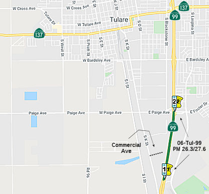 The 2018 STIP, approved at the CTC March 2018 meeting, appears to allocate $9.5M in FY20-21 and FY21-22 to construct PPNO 6940, South Tulare Interchange,
construct. This appears to be either a new interchange at Industrial Ave
(~ TUL 27.094), upgrading Paige Ave (~ TUL 27.598), or another new
interchange in that vicinity. The RTIP describes this as: In Tulare County near Tulare from 0.2 miles north of Airport Overcrossing to Paige Road Overcrossing; Construct new
interchange.
The 2018 STIP, approved at the CTC March 2018 meeting, appears to allocate $9.5M in FY20-21 and FY21-22 to construct PPNO 6940, South Tulare Interchange,
construct. This appears to be either a new interchange at Industrial Ave
(~ TUL 27.094), upgrading Paige Ave (~ TUL 27.598), or another new
interchange in that vicinity. The RTIP describes this as: In Tulare County near Tulare from 0.2 miles north of Airport Overcrossing to Paige Road Overcrossing; Construct new
interchange.
In October 2019, the CTC had on its agenda the
following project for future consideration of funding: 06-Tul-99, PM
26.3/27.6 Route 99 (SR 99) in Tulare County. Construct a new interchange
on Route 99 near the city of Tulare in Tulare County. (PPNO 6940). This
project is located on SR 99 near the city of Tulare in Tulare County. The
project proposes to construct a new interchange at Commercial Avenue. The
proposed project would improve operational performance and relieve traffic
congestion on local roads. The addition of bicycle and pedestrian features
incorporate complete streets elements. The project is not fully funded.
The project is programmed for $4 million for PS&E, with a total of
$5.5 million for Right-of-Way (capital and support). Assuming funding is
available, construction is estimated to begin in 2023. The scope, as
described for the preferred alternative, is consistent with the project
scope programmed by the Commission in the 2018 STIP.
(Source: October 2019 CTC Agenda, Agenda Item
2.2c.(1))
The 2020 STIP, approved at the March 2020 CTC meeting,
adjusts the programming for PPNO 6940 to explicitly reference the
interchange as "Commercial Avenue", and to adjust the funding programmed:
from $4,000K to $6,000K in prior years, moving $5,500 from FY21-22 to
FY20-21, and adding $7,400K in FY21-22.
(Source: March 2020 CTC Agenda, Item 4.7, 2020 STIP
Adopted 3/25/2020)
In September 2020, it was reported that a $16-million
federal grant will bring this long-gestating project to fruition as early
as summer 2025. The project will extend Commercial Avenue over Route 99 to
Laspina Street between the Paige Avenue and Avenue 200 interchanges in
Tulare. Additional lanes will also be added to the highway between
Commercial and Paige to alleviate congestion at the Paige exit. This
interchange will ease congestion during Tulare's annual International Ag
Expo and boost business along the busy goods-movement corridor that
connects southern and northern California through the Central
Valley.Construction is expected to begin in fall 2022 with an anticipated
summer 2025 completion date. The remainder of the $52-million project is
being funded through state grants, local sales taxes, and private
contributions from the International Agri-Center and the Faria family.
(Source: Visalia Times Delta, 9/21/2020)
 In December 2021, the CTC approved a new public road
connection on Route 99 at International Agri-Center Way (formerly known as
Commercial Avenue) in the city of Tulare in Tulare County at PM 26.8. This
project will improve operational performance, relieve traffic congestion
on local roads, increase east-west connectivity on local roads, support
economic development, and increase accessibility to the freeway system.
The traffic projections show an increase in traffic volume that
necessitates facility improvements to relieve the traffic congestion. The
forecasted increase in traffic is anticipated to cause excessive queuing
at the existing ramp termini intersection, and traffic is anticipated to
overflow onto the freeway mainline during peak hours. Additionally, local
circulation across Route 99 is already congested. The project proposes to
construct International Agri-Center Way across Route 99 with a new
interchange with an on-ramp and off-ramp from both directions. The
crossing will connect K Street and Laspina Street. New auxiliary lanes
will be constructed in both directions of Route 99 between the
International Agri-Center Way and Paige Avenue interchanges. This new
interchange will become an additional east-to-west crossing for local
traffic circulation within the vicinity. Additionally, the existing
Blackstone Street will be realigned and extended to connect to
International Agri-Center Way parallel to Route 99. A portion of the
International Agri-Center Way extension, from K Street to Laspina Street
and Blackstone Street, will be relinquished to the City of Tulare upon
completion of the project. A superseding freeway agreement was signed by
the City of Tulare on November 8, 2021 and will be executed by the
Department after the Commission’s approval of the new public road
connection.
In December 2021, the CTC approved a new public road
connection on Route 99 at International Agri-Center Way (formerly known as
Commercial Avenue) in the city of Tulare in Tulare County at PM 26.8. This
project will improve operational performance, relieve traffic congestion
on local roads, increase east-west connectivity on local roads, support
economic development, and increase accessibility to the freeway system.
The traffic projections show an increase in traffic volume that
necessitates facility improvements to relieve the traffic congestion. The
forecasted increase in traffic is anticipated to cause excessive queuing
at the existing ramp termini intersection, and traffic is anticipated to
overflow onto the freeway mainline during peak hours. Additionally, local
circulation across Route 99 is already congested. The project proposes to
construct International Agri-Center Way across Route 99 with a new
interchange with an on-ramp and off-ramp from both directions. The
crossing will connect K Street and Laspina Street. New auxiliary lanes
will be constructed in both directions of Route 99 between the
International Agri-Center Way and Paige Avenue interchanges. This new
interchange will become an additional east-to-west crossing for local
traffic circulation within the vicinity. Additionally, the existing
Blackstone Street will be realigned and extended to connect to
International Agri-Center Way parallel to Route 99. A portion of the
International Agri-Center Way extension, from K Street to Laspina Street
and Blackstone Street, will be relinquished to the City of Tulare upon
completion of the project. A superseding freeway agreement was signed by
the City of Tulare on November 8, 2021 and will be executed by the
Department after the Commission’s approval of the new public road
connection.
(Source: December 2021 CTC Agenda, Agenda Item
2.3b)
In August 2022, the CTC approved
Caltrans' request to amend the minor scope change pertaining to the
outputs for the State-Administered Senate Bill 1 (SB1) Local Partnership
Program (LPP) (Competitive) Route 99/Commercial Ave Interchange project
(PPNO 6940), in Tulare County. The Tulare County Association of
Governments received $9 million in SB1 LPP (Competitive) funds for the
construction (CON) phase of Route 99/Commercial Ave Interchange project.
The project was programmed for allocation in Fiscal Year 2021-22, at the
December 2020 Commission meeting. Under the originally approved scope, the
CON phase of the project includes the construction of a new interchange
and north and south bound auxiliary lanes at Commercial Avenue and Route 99, between 0.9 mile north of the Avenue 200 overcrossing and the Paige
Avenue overcrossing, near the City of Tulare in Tulare County. The new
construction improves the level of service of the interchange and provides
improved access to the nearby Agricultural Center Complex that is needed
to handle the anticipated increase in traffic volumes.The following is a
numbered list of proposed scope changes:
(Source: August 2022 CTC Agenda, Agenda Item
2.1s.(2))
In August 2022, the CTC approved an allocation of
$16,400,000 for the State-Administered multi-funded STIP/SB 1 LPP
(Competitive) Route 99/Commercial Ave Interchange Project (PPNO 6940), on
the State Highway System, in Tulare County (06-Tul-99 26.3/27.6; PPNO
06-6940; ProjID 0616000074; EA 0U880). The allocation consisted of
$9,000,000 from Non-Budget Act Item 2660-801-3290 for construction and
$7,400,000 for construction engineering for the State-Administered
multi-funded STIP/SB 1 LPP (Competitive) project.
(Source: August 2022 CTC Agenda, Agenda Item
2.5s.(8))
In June 2023, it was reported that a groundbreaking
ceremony was held for the Route 99 International Agri-Center Interchange
Project on Route 99 at Commercial Avenue. Officials say the interchange
will reduce traffic congestion and wait times on the road, especially
during events such as the annual International Ag Expo in Tulare. The
interchange project has been in the planning stages since 2016. It is
expected to be complete by the summer of 2025.
(Source: KGET, 6/26/2023)
Tulare (~TUL 30.605) to Goshen (~ TUL 40.335) Widening
In September 2009, the CTC approved for future consideration of funding a project to widen Route 99 from four to six lanes between Prosperity Avenue in Tulare (~TUL 30.605) and north of the North Goshen Overhead in Visalia (~ TUL 40.335), and construct roadway improvements on Route 99 in the city of Tulare. The project is not fully funded. The project is programmed in the 2008 State Transportation Improvement Program for Plans, Specifications and Estimate, and Right of way. The total estimated project cost is $114,800,000, capital and support. The begin construction date is unknown, pending funding availability.
A project to construct a Tagus-Goshen 6-lane (Ave 264 (~ TUL 33.92) to Goshen) was submitted to the Corridor Mobility Improvement Account ($96,800K requested), but was not recommended for funding.
Another project included in the December 2011 TIP update is a project to widen Route 99 from six to eight lanes from Avenue 264, near the former Tagus Ranch north to Caldwell Avenue (Ave 280, ~Caldwell Avenue), west of Visalia. Caltrans will commit $12.2 million to cover most of the construction and administrative costs. TCAG would provide matching funds totaling $8.3 million from state transportation funds allocated to the county. Construction would start in 2015.
In January 2013, the CTC approved de-allocation of $1,273,000 in Proposition 1B State Route 99 (SR99) bond funds for the Tulare to Goshen 6-Lane North Segment project (PPNO 6400A) in Tulare County, thereby reducing the original Route 99 construction capital allocation of $40,000,000 to $38,727,000 to reflect contract award savings.
In June 2015, the CTC approved $20,800,000 towards the Middle Segment (Caldwell) 6-Lane widening. This project is near Visalia, from 1.2 mile south of Avenue 280 to 0.9 mile south of West Visalia Overhead. It will widen the freeway from four to six lanes.
In June 2015, it was reported that the CTC approved
$20.8 million to widen Route 99 in the Visalia area from four lanes to
six.
(Source: Fresno Bee, 6/27/2015)
The 2018 STIP, approved at the CTC March 2018 meeting, appears to combine PPNO 6400E Tagus 6-lane southbound widening and 6400F Tagus 6-lane northbound widening into a single PPNO 6400G Tagus 6-Lane N/S widening, Prosperity Av-Av 280 with a total allocation of $14.888M, with construction in FY20-21 (TUL 30.6/35.2).
Alas, in October 2019, it was reported that inclusion
in the STIP isn't enough if the project isn't ready. In a 2020 Draft
Report, Caltrans announced plans to delete three projects: (1) a project
to expand Route 99 from four to six lanes — three on each side
— between Prosperity Avenue and Avenue 200, near the International
Agri-Center; (2) a project to widen Route 99 to six lanes S of Madera, and
a project to widen Route 46 E of the Cholame Y along the Antelope Grade.
Money for the project comes from the state's Interregional Transportation
Improvement Program, which includes a $2.6 billion fund to improve
transportation and goods movement across the state. The fund is in part
derived from Senate Bill 1, the state's controversial gas tax passed in
2017 and upheld in a failed ballot measure last year. The deletion of the
funds naturally has local politicians upset beliving it to be a "bait and
switch" regarding SB1. However, that isn't the case. SB1 specifically
allocates portions of the revenue from the new transportation improvement
fee to the State Transit Assistance Program and to the Transit and
Intercity Rail Capital Program. Specifically, it allocates two hundred
seventy-five million dollars ($275,000,000) for the interregional share of
the State Transportation Improvement Program. Recall, that this widening
was in the 2018 STIP. One of the projects funded through the STIP is the
Interregional Transportation Improvement Program (ITIP), which has the
purpose to improve interregional mobility for people and goods across the
State of California on highway and passenger rail corridors of strategic
importance. At least 60 percent of that program must be programmed to
projects outside urbanized areas on the Interregional Road System (IRRS)
and for intercity passenger rail. Of this amount, at least 15 percent (9
percent of the ITIP) must be programmed for intercity passenger rail
projects. But STIP capacity over the 2020 five-year FE period has
decreased compared to the capacity in the 2018 five-year FE period, going
from $3.3 billion in the 2018 FE to $2.6 billion in the 2020 FE. The
decrease is primarily attributable to a high level of pre-existing STIP
project commitments for allocated and programmed projects. The 2020 Fund
Estimate provides $52,414,000 in new, additional ITIP funding, but
$52,250,000 of that is immediately eaten up by previous projects that cost
more than expected (in San Luis Obispo and Humboldt counties). That leaves
$164,000 to hand out, which required deletion (or, more specifically,
delay) of $32,494,00 in highway projects to make money available. Removing
these three projects from the 2020 ITIP and saving money on another Route 99 project moves about $61 million to the column of “uncommitted
2020 ITIP programming capacity.” Those uncommitted funds, according
to the draft plan, will be held in reserve “for priority rail
projects and other priorities aligned with Executive Order N-19-19.”
Note that this does not mean the project was deleted. State Transportation
Secretary David Kim says the projects weren’t ready to proceed, and
the funds can be reapplied for in two years. Additionally, other projects
on those roads – for example, work on the Cholame "Y" at the Route 46 / Route 41 intersection, and widening of Route 99 at Tagus – are
still being funded through the ITIP.
(Sources: Visalia Times Delta, 10/9/2019; Streetsblog, 10/31/2019; ABC 30, 10/9/2019; LATimes
10/14/2019; Streetsblog, 10/11/2019; SLOTribune
10/8/2019; New Times, 10/10/2019)
In December 2019, it was reported that, whew, the
project wasn't deleted from the STIP after all. Specifically, Caltrans
released its final 2020 Interregional Transportation Improvement Program
(ITIP) on Dec. 15 issuing a complete reversal of its draft report in
October that deprogrammed $32 million in highway projects including Route 99 in Tulare and Madera counties and Route 46 in Kern County. Valley
lawmakers, local leaders, and transportation entities strongly opposed the
plan from the beginning. The opposition from the Valley was so great, it
forced the California Transportation Commission (CTC) to hold a third
public hearing, one more than is required, in Fresno. In addition to
comments received at three hearings in Modesto, Santa Ana and Fresno,
Caltrans said almost all of the comments it received on the ITIP were
focused on the deprogramming of projects to widen Route 99 from four to
six lanes from Prosperity Avenue south to Avenue 200 through the city of
Tulare and another Highway 99 improvement project in Madera and to improve
safety along Route 46 in Kern County. The CTC will hold two hearings, one
in Northern California on Jan. 30 in Sacramento and another in Southern
California on Feb. 6 in Santa Ana, before making a final determination on
the ITIP.
(Source: Sun Gazette, 12/25/2019)
The 2020 STIP, approved at the March 2020 CTC meeting,
made no changes to the programming PPNO 6400C "Tulare-Goshen, Middle
Segment-Caldwell (RIP), 6-lane (RW CCA 8-18)": It is closing out, $650K in
the hole. The STIP does change the programming for PPNO 6400G "Tagus
6-Lane N/S widening, Prosperity Av-Av 280 (RIP)", decreasing the overall
funding from $14,888K to $10,961, with programmed funding ending in
FY20-21. It also included PPNO 6400G, Tagus 6-Lane N/S widening,
Prosperity Av-Av 280 (IIP), in the Interregional portion of the STIP with
two changes in programming: 11,325K in prior year funding changed to
8,816K, and 71,000K in FY20-21 changed to 64,836K.
(Source: March 2020 CTC Agenda, Item 4.7, 2020 STIP
Adopted 3/25/2020)
In August 2020, the CTC approved the following
financial allocation: $73,451,000. 06-Tul-99 PM 30.6/35.2. PPNO 06-6400G
ProjID 0613000005 EA 36024. Tagus 6-Lane Widening (Combined).
Route 99 Near the city of Tulare, from Prosperity Avenue to 1.2 mile south
of Avenue 280. Widen from four to six lanes. Const $7,337,000; Con Eng
$54,114,000.
(August 2020 CTC Agenda, Agenda Item 2.5c.(1) #3)
In September 2021, a ground breaking ceremony was held
for the Route 99 Tagus Rehab Project, which will add a lane in each
direction between Avenue 272 and Prosperity Avenue.
(Source: District 6 on FB, 9/30/2021)
In December 2021, the CTC approved an amendment to
Resolution FP-20-04, originally approved in August 2020, for the
State-Administered STIP Route 99 Tagus 6-Lane Widening (Combined) project
(PPNO 6400G), in Tulare County, to split out the Tagus Mitigation child
project (PPNO 6400H). The amendment reduces the Tagus 6-Lane Widening
project (PPNO 6400G) IIP CON from $54,114,000 to $50,014,000, splits off
the Tagus Mitigation Child project (PPNO 6400H), and programs the
$4,100,000 IIP funds from the parent to the Mitigation project. Project
Description: 06-Tul-99 30.6/35.2. PPNO 06-6400G; ProjID 0613000005; EA
36024. Tagus 6-Lane Widening (Combined). Route 99 Near the city
of Tulare, from Prosperity Avenue to 1.2 mile south of Avenue 280. Widen
from four to six lanes.
(Source: December 2021 CTC Agenda, Agenda Item
2.5c.(4))
In January 2014, the CTC approved for future consideration of funding a project in Tulare County that will modify the existing interchange at Route 99 and Cartmill Avenue (~ TUL 31.837) in the city of Tulare. The CTC also approved $7,000,000 for construction capital for the exchange modification.
Caldwell Interchange Project (06-Tul-99, PM 35.8/37.1)
 The 2018 STIP, approved at the CTC March 2018 meeting, appears to allocate $15.5M for PPNO 6421 Caldwell Interchange, reconstruct. Near Visalia, at
intersection of Route 99 and Caldwell Avenue (Avenue 280) (~ TUL 36.43);
Reconstruct interchange.
The 2018 STIP, approved at the CTC March 2018 meeting, appears to allocate $15.5M for PPNO 6421 Caldwell Interchange, reconstruct. Near Visalia, at
intersection of Route 99 and Caldwell Avenue (Avenue 280) (~ TUL 36.43);
Reconstruct interchange.
The 2020 STIP, approved by the CTC at the March 2020
meeting, changes the programming for this as follows:
(Source: March 2020 CTC Agenda, Item 4.7, 2020 STIP
Adopted 3/25/2020)
| PPNO | Project | Prior | 20-21 | 21-22 | 22-23 | 23-24 | 24-25 |
| 6421 | Caldwell Interchange, reconstruct | 4,000K | 0 | 5,000K | 6,000K | 0 | 0 |
| 6421 | Caldwell Interchange, reconstruct | -4,000K | 0 | -5,000K | -6,000K | 0 | 0 |
| 6421 | Caldwell Interchange, reconstruct | 5,000K | 0 | 0 | 4,600K | 7,000K | 0 |
In 2022, the CTC approved including "SR-99 Caldwell Ave
Interchange" in the list of projects for the Coronavirus Response and
Relief Supplemental Appropriations Act of 2021 (CRRSAA). The CRRSAA
Program guidelines require regions submit a project list for allocation by
the Commission prior to the obligation of funds. Under CRRSAA, the funds
may be used for a broad range of surface transportation purposes listed in
Section 113(b) of Title 23 of the U.S. Code and are meant to
“prevent, prepare for, and respond to coronavirus.”
Specifically, CRRSAA allows states to cover revenue losses, which is
important given that California’s State-generated transportation
revenues have declined by about $1.5 billion due to the pandemic.
Additionally, CRRSAA allows the funds to be used for preventive and
routine maintenance; operations; personnel; salaries; contracts; debt
service payments; and availability payments; as well as transfers to
public tolling agencies. At the March 2021 Commission meeting, the CTC
approved the CRRSAA funding distribution and regional apportionments. The
CRRSAA allocation for this project was $1,121,022.
(Source: August 2022 CTC Minutes, Agenda Item 2.5k)
In June 2023, the CTC approved the following STIP
amendment, which was noticed at the May 2023 meeting: The SRTA and TCAG
propose to lapse $1,311,000 of COVID-Regional Improvement Program (RIP)
funding from the Cottonwood Lasso Bicycle/Pedestrian Project (CATTLE) in
Shasta County (PPNO 2604), and program $1,311,000 of COVID-RIP funds to
the Route 99/Caldwell Avenue Interchange project (PPNO 6421), in Tulare
County. SRTA will exchange $1,311,000 in COVID-RIP shares with TCAG for
$1,311,000 in TCAG's RIP shares for the CATTLE project (PPNO 2604), which
will be requested at a future Commission meeting. The Shasta
County’s CATTLE project (PPNO 2604) is currently overprogrammed by
$1,611,000 in Plans, Specification & Estimate in 2022-23 ($1,311,000
in COVID-RIP shares and $350,000 in RIP shares). Since COVID-RIP shares
are federal funds and need to be allocated before June 2024, SRTA is
requesting to lapse these funds. Tulare’s Caldwell interchange
project will utilize the COVID-RIP funds in 2023-24 and return funds to
SRTA in regular RIP shares through the RTIP process proposed for the
Construction phase of CATTLE project. As a result of this exchange of
COVID-RIP funding, TCAG is requesting to reduce the regular STIP-RIP
funding for the construction phase of its Caldwell Interchange project by
$1,311,000, from $7,000,000 to $5,689,000, and programming $1,311,000 in
Shasta County COVID-RIP funding in 2023-24. A Memorandum of Understanding
has been approved by the Board of Directors of SRTA and TCAG. TCAG and
SRTA communicated to the Commission about the exchange of COVID-RIP funds.
And the programming changes will be made and approved by the Commission
respectively to TCAG's and SRTA's respective fund balances to reflect the
exchange of funds. In addition, TCAG and SRTA will work together to ensure
that a project in Shasta County is programmed appropriately using the
unprogrammed $1,311,000 in Tulare County’s RIP shares during the
RTIP process.
(Source: June 2023 CTC Agenda, Agenda Item 2.1a.(18))
In July 2023, it was reported that the CTC approved the
following Local Partnership Program project: $15 million to fund the Route 99/Caldwell Avenue Interchange in western Visalia. Called the Safety and
Multi-Modal Project in Tulare County, it will replace a stop
sign-controlled interchange with two roundabouts and a new bridge with
bike lanes and sidewalks to allow access across Route 99 that currently
does not exist.
(Source: Sun-Gazette, 7/2/2023)
In October 2023, the CTC approved the following
amendment request for the Local Partnership Program: The Tulare County
Transportation Authority requests to add the Route 99 and Caldwell Avenue
Interchange Project in Tulare County and program $2,818,000 of its
available 2022 Formulaic Program funding to the Construction phase in
fiscal year 2023-24. This project will reconstruct the interchange on
Route 99 near Caldwell Avenue and construct auxiliary lanes, bicycle
lanes, sidewalks, and a roundabout. The anticipated benefits of this
project are improved safety and reducing congestion.
(Source: October 2023 CTC Agenda, Agenda Item 4.26)
In December 2023, the CTC approved for future
consideration of funding the following project for which a Mitigated
Negative Declaration (MND) and Addendum has been completed: Caldwell
Interchange Project. The project (PPNO 6421) is located
on Route 99 from PM 35.8 to PM 37.1, in Tulare County (06-Tul-99, PM
35.8/37.1). The Department proposes to construct two 192-foot diameter
roundabouts at the southbound ramp and northbound ramp intersections. The
existing northbound loop on-ramp would be eliminated, and a new northbound
slip on-ramp would be constructed. The profile of the existing Avenue 280
overcrossing structure would also be raised to correct non-standard
vertical clearance and would be widened with a new structure. The
Mid-Valley overhead structure would also be replaced. Caldwell Avenue
would be widened to 4-lane configuration at the vicinity of the
roundabouts. The project is currently programmed in the 2022 State
Transportation Improvement Program (STIP). The total programmed amount
which includes Right of Way (Support and Capital), and Construction
(Support and Capital) is $89,450,000 from STIP, Senate Bill 1 Local
Partnership Program, Congestion Mitigation Air Quality, and Coronavirus
Response and Relief Supplemental Appropriation Act. Construction is
estimated to begin 2022-23. The scope, as described for the preferred
alternative, is consistent with the project scope as programmed by the
Commission in the 2022 STIP. A copy of the MND and Addendum has been
provided to Commission staff. The project will result in less than
significant impacts to the environment after mitigation. The following
resource areas may be impacted by the project: biological resources and
habitat. Avoidance, minimization, and mitigation measures will reduce any
potential effects on the environment. These measures include, but are not
limited to, replanting oak trees at a 10:1 ratio on-site and/or at an
off-site location along the same watershed. As a result, a MND was
completed for this project. Since the completion of the MND, there have
been changes to the scope and an Addendum was prepared pursuant to the
California Environmental Quality Act (CEQA). These changes include
relocating the AT&T utility line at the Caldwell Avenue/SR 99
interchange. Relocating the AT&T utility service will require the
installation of two 6-inch conduits on the south side of Avenue 280 under
Road 68. The 6-inch conduits will be approximately 100-feet in length with
a maximum depth of 48-inches. The project would not result in substantial
increases in the severity of significant effects, would not involve
substantial changes in regulatory circumstances, did not identify new
alternatives, and proposed similar avoidance, minimization, and mitigation
measures when compared to the MND. The project changes do not meet the
criteria outlined in CEQA Guidelines Section 15162 to prepare a Subsequent
MND. As a result, the Department prepared an Addendum to the MND pursuant
to CEQA.
(Source: December 2023 CTC Agenda, Agenda Item 2.2c.(1))
In June 2020, the CTC authorized relinquishment of right of way,
consisting of 8 segments of collateral facilities, in the County of Tulare
in the vicinity of Route 99 and Betty Drive (06-Tul-99-PM 40.3/41.0) under
the terms and conditions as stated in the relinquishment agreement dated
August 13, 2013.
(Source: June 2020 CTC Agenda, Agenda Item 2.3c)
Route 99 / Betty Drive in Goshen (~ TUL 40.782)
TCRP Project #140 will add an overpass in the city of Goshen ( 06-Tul-99 39.6/41.3).
In December 2011, the Tulare County Association of Governments (TCAG) updated its Regional Transportation Improvement Program (TIP). The TIP is submitted it to the California Department of Transportation and the California Transportation Commission by March 28 of each year in order for TIP's projects to be included in the state’s TIP funding. The update added a project to start in 2016 that would construct a loop freeway on-ramp to Route 99 at Betty Drive in Goshen. The on-ramp is intended to prevent traffic from backing up at the Betty Drive interchange by installing a loop that cars heading south on the freeway can drive into without stopping, eliminating the need for traffic to stop and turn left to access the on-ramp. Projects to widen Riggin Avenue in the area and to build an overpass above commercial railroad tracks at Betty Drive to reduce traffic congestion around the interchange are under way or complete. About $30 million in construction costs would be covered with money raised through Tulare County’s Measure R half-cent sales tax. Another $5 million in state funds would cover construction administration.
In October 2012, the CTC approved for future consideration of funding a project that will reconstruct the Betty Drive/Route 99 Interchange in Goshen. Betty Drive will become a through-road connecting to the realigned Riggin Avenue on the east side of the interchange and Avenue 308 on the west side.
In December 2016, the CTC allocated the following funding: 06-Tul-99 39.6/41.3 | Route 99 Betty Drive Interchange Improvements. Near Goshen, on Route 99 at Betty Drive. Widen interchange and construct operational improvements. $5,000,000.
In June 2018, it was reported that as of 6/22/2018, the
new Betty Drive bridge was officially open to traffic. The old Betty Drive
bridge will be demolished during nighttime closures the last week of June.
(Source: Caltrans District 6 on Twitter)
In November 2005, the CTC considered relinquishment of 6-Tul-99-PM 40.6: right of way in the County of Tulare, at Avenue 308, consisting of a cul-de-sac.
Goshen to Kingsberg Roadway Improvements/Widening (~ TUL 40.303 to ~ FRE R0.94)
The SAFETEA-LU act, enacted in August 2005 as the reauthorization of TEA-21, provided the following expenditures on or near this route:
There are plans for roadway improvements near Kingsberg. The CTC, in January 2007, considered a resolution to approve for future consideration of funding a project on Route 99 in Tulare and Fresno Counties that will construct roadway improvements near Kingsburg. This project is not fully funded. The project is fully funded for Project Approval and Environmental Document (PA&ED) in the Interregional Improvement Program for $2,202,000. Full funding for the project is being proposed from the State Route 99 Infrastructure Bond Program. The total estimated project cost is $172,600,000. Construction is estimated to begin in Fiscal Year 2010-11. The Fresno Bee reported that work was scheduled to begin in October 2010 at the southern end of the county on a project to widen the highway to six lanes between Kingsburg and Goshen, a stretch that varies between four and five lanes at present. The Kingsburg-to-Goshen segment also involves adding new lanes in the median, except at the Kings River crossing, where the highway will be moved slightly west and the southbound bridge replaced. Project manager Phillip Sanchez said sections of pavement also will be replaced on the northbound side, most of which already is three lanes.
In December 2011, the CTC approved $500K for mitigation landscaping between Goshen and Kingsburg, from the Goshen Overhead to Route 201. In April 2012, the CTC adjusted this project. The current project limits are from 0.2 mile north of the North Goshen Overhead in Tulare County to 0.2 mile north of Route 201 in Fresno County. There is no need to landscape the southernmost 7 miles of the Goshen to Kingsburg project, and it is not possible to provide sufficient landscape mitigation for the Goshen to Kingsburg 6-Lane project within the current project limits. Therefore, the project was amended to move the southern project limit 7 miles to the north and extend the northern project limit 1.4 miles to the north. The revised project limits will be from 0.3 mile south of Merritt Drive in Tulare County to 0.7 mile north of Bethel Avenue in Fresno County.
In March 2016, it was reported that a recently announced $754 million cut
to the state transportation budget over the next five years has put in
jeopardy the widening of Route 180 between Centerville and Minkler on the
way to Kings Canyon and Sequoia National Parks, as well as the continued
widening of Route 99 in Tulare County.
(Source: Fresno Bee, 3/23/2016)
The SAFETEA-LU act, enacted in August 2005 as the reauthorization of TEA-21, provided the following expenditures on or near this route:
TCRP Project #90 widened the freeway to six lanes from Kingsberg (~ FRE R0.94) to Selma (~ FRE 6.19) in Fresno County. Additional funding was up in July 2005. In December 2005, state transportation officials broke ground the $62-million 6-mile project. Field reports indicated it was completed by December 2008.
South Fresno Route 99 Corridor Project: North Avenue Interchange (06-Fre-99 12.5/19.1 )
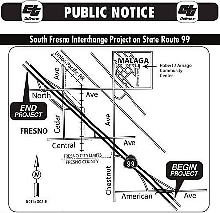 The 2018 STIP, approved at the CTC March 2018 meeting, appears to advance $3,000K for PPNO 6288, South Fresno Interchanges, in FY18-19 for Environmental and
Planning. According to the Fresno COG, the Measure C expenditure plan
incorporates a series of five interchanges along Route 99, including North
(~ FRE 17.251), Cedar (~ FRE 16.954), Central (~ FRE 15.843), Chestnut (~
FRE 15.507), and American Avenues (~ FRE 14.486) that potentially serve
developing commercial interests and a proposed High Speed Rail Heavy
Maintenance Station. These projects were designed as half interchanges
allowing traffic to exit in one direction only. To get bet back on the
freeway the traveler must find the corresponding on-ramp at the next
interchange. Furthermore, the access and exit points are alternately
connected to north/south, then east/west arterials, making it confusing to
navigate. Caltrans no longer uses this ‘half interchange’
concept and has plans to replace the five half interchanges with three
full interchanges. Since the interchanges are functionally related,
Caltrans will have to consider the entire corridor when developing plans
to remedy this situation. Caltrans, Fresno COG, and the Fresno County
Transportation Authority are proposing to environmentally clear all three
interchanges simultaneously, creating significant economies of scale. The
plan will include three distinct construction phases which will be funded
by a combination of Local Measure and Regional STIP funds. Fresno COG is
proposing programming $3 million in Advanced Project Development Element
(APDE) in FY 2018/19. Fresno COG has also programmed $3.7 million in Local
Measure in 2017/18 and 2018/19 to facilitate the programmatic
environmental impact report and preliminary design. We anticipate
programming right-of-way and construction beginning in the 2020 STIP
cycle.
The 2018 STIP, approved at the CTC March 2018 meeting, appears to advance $3,000K for PPNO 6288, South Fresno Interchanges, in FY18-19 for Environmental and
Planning. According to the Fresno COG, the Measure C expenditure plan
incorporates a series of five interchanges along Route 99, including North
(~ FRE 17.251), Cedar (~ FRE 16.954), Central (~ FRE 15.843), Chestnut (~
FRE 15.507), and American Avenues (~ FRE 14.486) that potentially serve
developing commercial interests and a proposed High Speed Rail Heavy
Maintenance Station. These projects were designed as half interchanges
allowing traffic to exit in one direction only. To get bet back on the
freeway the traveler must find the corresponding on-ramp at the next
interchange. Furthermore, the access and exit points are alternately
connected to north/south, then east/west arterials, making it confusing to
navigate. Caltrans no longer uses this ‘half interchange’
concept and has plans to replace the five half interchanges with three
full interchanges. Since the interchanges are functionally related,
Caltrans will have to consider the entire corridor when developing plans
to remedy this situation. Caltrans, Fresno COG, and the Fresno County
Transportation Authority are proposing to environmentally clear all three
interchanges simultaneously, creating significant economies of scale. The
plan will include three distinct construction phases which will be funded
by a combination of Local Measure and Regional STIP funds. Fresno COG is
proposing programming $3 million in Advanced Project Development Element
(APDE) in FY 2018/19. Fresno COG has also programmed $3.7 million in Local
Measure in 2017/18 and 2018/19 to facilitate the programmatic
environmental impact report and preliminary design. We anticipate
programming right-of-way and construction beginning in the 2020 STIP
cycle.
(Source: Fresno COG, December 2017)
In March 2019, Caltrans announced that they will be
holding a public information meeting/scoping session regarding the South
Fresno Interchange Project. The project aims to completely revamp three
interchanges on Route 99 at American Ave, Central Ave and North Ave. This
project is in its earliest stages, so while construction isn't scheduled
to start for at least 5 years, the project will have a huge impact on the
businesses and residents in the area. Currently, there are ten preliminary
alternatives being considered for the interchange locations. Generally,
each alternative proposes to 1) reconstruct and widen the over-crossings,
2) construct new and/or reconstruct existing on and off-ramps, and 3)
provide improvements to adjacent local roads and intersections. A preliminary project study report may be found here.
(Source: Caltrans District 6 Facebook, 3/14/2019)
In March 2020, the CTC approved the 2020 STIP, which appeared to adjusted the programmed funding for PPNO 6288 and plan for expansion, by adding construction funding in FY23-24:
| PPNO | Project | Prior | 20-21 | 21-22 | 22-23 | 23-24 | 24-25 |
| 6288 | South Fresno Interchange (APDE) | 3,000K | 0 | 0 | 0 | 0 | 0 |
| 6288 | South Fresno Interchange (APDE) | -3,000K | 0 | 0 | 0 | 0 | 0 |
| 6288 | South Fresno Interchange | 3,000K | 0 | 0 | 0 | 42,346K | 0 |
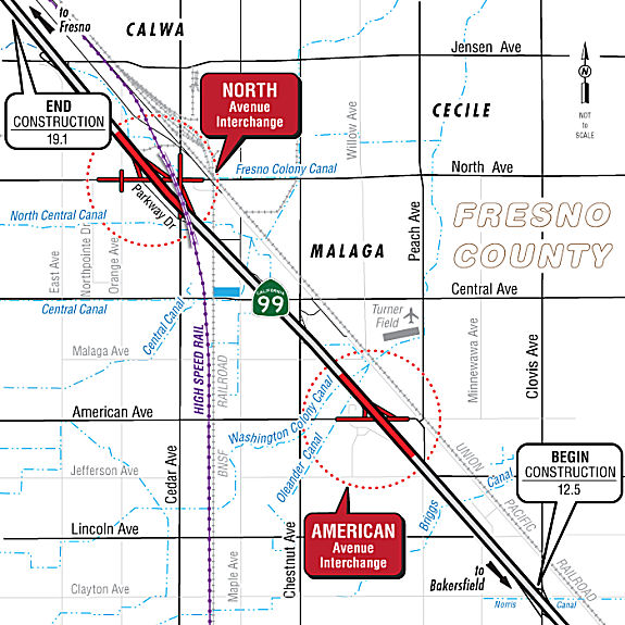 In November 2021, there were additional public hearings on this project. As described on the
project page, Caltrans constructed the Route 99 alignment in 1965 with
partial interchanges (half interchanges) where local roads intersect the
highway in the project area. The project proposes to reconstruct two of
the existing half interchanges to create full interchanges at American
Avenue and North Avenue, with closure of the ramps at Cedar Avenue, which
effectively moves the existing southbound on-ramp and northbound off-ramp
to North Avenue. Two alternatives are proposed at American Avenue, and two
alternatives are proposed at North Avenue. The alternatives differ in the
interchange configuration type proposed at the locations. Each build
alternative proposes to construct a full interchange with different
modifications of typical interchange types to fit within the existing
topography and infrastructure in the area. The proposed build alternatives
are either typical interchange type configurations or they are
modifications of typical types. Two interchange types are being considered
for American Avenue: Alternative 1 Spread Diamond (Type L-2) and
Alternative 2 Partial Cloverleaf (Type L-9). Two interchange types are
being considered at North Avenue: Alternative 2 Modified Partial
Cloverleaf (Type L-9) and Alternative 4 Diverging Diamond Interchange
(DDI). All build alternatives would reconstruct the existing overcrossings
and construct on- and off-ramps to form complete full interchanges, with
sidewalks, curb and gutter, lighting and signalization, and a stormwater
system. The existing half interchange ramps at Cedar Avenue would be
closed. The project started in December 2016 with a Project Study Report;
Environmental Studies began in December 2018. The project is currently in
the Draft EIR phase; with project approval and final documents planned for
June 2022. Design completion is planned for March 2025, with construction
expected to be completed in May 2027. The total cost for the project is
estimated to range from $119 million to $146 million using 2021 dollars.
In November 2021, there were additional public hearings on this project. As described on the
project page, Caltrans constructed the Route 99 alignment in 1965 with
partial interchanges (half interchanges) where local roads intersect the
highway in the project area. The project proposes to reconstruct two of
the existing half interchanges to create full interchanges at American
Avenue and North Avenue, with closure of the ramps at Cedar Avenue, which
effectively moves the existing southbound on-ramp and northbound off-ramp
to North Avenue. Two alternatives are proposed at American Avenue, and two
alternatives are proposed at North Avenue. The alternatives differ in the
interchange configuration type proposed at the locations. Each build
alternative proposes to construct a full interchange with different
modifications of typical interchange types to fit within the existing
topography and infrastructure in the area. The proposed build alternatives
are either typical interchange type configurations or they are
modifications of typical types. Two interchange types are being considered
for American Avenue: Alternative 1 Spread Diamond (Type L-2) and
Alternative 2 Partial Cloverleaf (Type L-9). Two interchange types are
being considered at North Avenue: Alternative 2 Modified Partial
Cloverleaf (Type L-9) and Alternative 4 Diverging Diamond Interchange
(DDI). All build alternatives would reconstruct the existing overcrossings
and construct on- and off-ramps to form complete full interchanges, with
sidewalks, curb and gutter, lighting and signalization, and a stormwater
system. The existing half interchange ramps at Cedar Avenue would be
closed. The project started in December 2016 with a Project Study Report;
Environmental Studies began in December 2018. The project is currently in
the Draft EIR phase; with project approval and final documents planned for
June 2022. Design completion is planned for March 2025, with construction
expected to be completed in May 2027. The total cost for the project is
estimated to range from $119 million to $146 million using 2021 dollars.
(Sources: Caltrans District 6 on FB, 11/2/2021; District 6 Project Page; Caltrans Project Page)
On March 16, 2022, the CTC approved the 2022 State
Transportation Improvement Program, which included the following project:
PPNO 6288A "South Fresno - American Ave Interchange". $4,760,000 in
FY22-23.
(Source: "2022 State Transportation Improvement
Program", Adopted March 16, 2022)
In April 2023, it was reported that South Fresno
community groups in collaboration with Stanford Law Clinic announced a
lawsuit against a proposed interchange that they say will bring more
industrial development and more pollution to the area. In order to improve
what CalTrans says are freeway onramps that don’t meet current
design standards, the agency will build two interchanges at North and
American avenues along Route 99, an area that has experienced massive
amounts of industrial development in the past few years. The project would
improve traffic operations and improve access for businesses in the
surrounding area. Ashley Werner, directing attorney for Leadership Council
for Justice and Accountability said while there is a need for maintenance,
the proposed plan is designed to accommodate an expanding industrial
presence in the area rather than to fix potholes and reroute traffic. At
the same time, the City of Fresno is conducting a truck route study as
part of its South Central Specific Plan to see how mandated paths can
create efficiencies and keep haulers out of neighborhoods. Those route
studies are not yet completed. “CalTrans should be waiting until
these studies are completed to understand the outcomes and how that
affects where we should be developing infrastructure for truck
routes,” Werner said. There are also concerns from local residents.
South Fresno residents fear it will lead to the build-out of more
industrial zoned land, including a 3,000-acre industrial park near the
community of Malaga. Malaga is a small community six miles southeast of
downtown Fresno. This project is not happening in isolation, but against a
backdrop of discriminatory land use transportation practices that spans
back to when Route 99 was first built in the 1950s, said Jacqueline
Maldonado with the Environmental Law Clinic at Stanford Law School. The
highway construction destroyed more than 20 blocks of housing at the time
and divided communities of color and set forth a path that has
disproportionately concentrated industrial development and pollution in
places like Malaga and Calwa, she said. The area has become a center point
for environmental justice concerns and is being watched by state leaders
like California Attorney General Rob Bonta. Community rallies came a month
after Friends of Calwa and Fresno Building Healthy Communities filed suit
against Caltrans and the Federal Highway Administration to halt the
project. The lawsuit claims that Caltrans’ review of the project
“fell significantly short” and that an Environmental Impact
Report “failed to acknowledge the existence of any impacted
communities or sensitive receptors.” The project also failed to
consider conflicts with air quality and land use plans and policies or the
cumulative impacts of the project with other projects up and down the 99
corridor. That includes the impact of extra vehicle capacity in the area.
The suit claims the project is in conflict with state policies promoting
environmental justice, such as SB 1000, which mandate policies to improve
air quality and reduce pollution exposures and “promote public
engagement in the public decision making process.”
(Source: The Business Journal, 4/6/2023; $$ Fresno Bee 4/8/2023)
In May 2023, the CTC received notice of a proposed STIP
amendment that would amend the 2022 STIP to delay Construction Support and
Construction Capital from Fiscal Year 2023-24 to 2024-25 for the South
Fresno Route 99 Corridor project: North Avenue Interchange (PPNO 6288), in
Fresno County. The South Fresno Route 99 Corridor Project: North Avenue
Interchange consolidates the split interchange that has ramps at North
(southbound off-ramp, northbound on-ramp) and Cedar Avenues (northbound
off-ramp, southbound on-ramp) into one interchange at North Avenue. This
will eliminate the non-standard two ramp interchange configuration at both
interchanges and provide for all ramp connections at North Avenue. The
project will improve the regional movement of freight and goods. Traffic
congestion and traffic queueing onto mainline Route 99 would also be
improved along the corridor. This project would also bring the
interchanges up to current design standards in both geometric
configuration and vertical clearance of the overcrossings. The
reconfigured interchanges will also incorporate complete street elements
which will benefit pedestrian and bicycle mobility such as wider shoulders
and new sidewalks. During the environmental phase, the project had a
prolonged engagement with community-based organizations, which required
additional time to hold and have follow up meetings with the local
community groups and incorporate their feedback. This delayed the approval
of the final Environmental Development and Project Report, which has
caused a delay of the design phase. As a result, the Ready to List
milestone estimate has been moved from March 25, 2024 to June 20, 2025. In
June 2023, the CTC approved the STIP amendment.
(Source: May 2023 CTC Agenda, Agenda Item 2.1b.(20); June 2023 CTC
Agenda, Agenda Item 2.1a.(22))
In January 2024, it was reported that a decision by the
Biden administration casts doubt on a planned expansion of Route 99 in
south central Fresno, raising concerns about the project's impact on air
quality and prompting fresh scrutiny from the Environmental Protection
Agency. Citing potential procedural mistakes by the Federal Highway
Administration, Secretary of Transportation Pete Buttigieg has ordered a
reevaluation of the agency's decision to exempt two interchange
expansions, on North and American Avenues, from a Clean Air Act analysis.
According to federal court filings from December 22, Buttigieg and FHWA
chief Shailen Bhatt expressed concerns that the FHWA may have failed to
follow proper protocol under the Clean Air Act when it exempted the
Caltrans projects from the required analysis. The exemption came during
the Trump era, but the Biden administration's reevaluation signals a
potential shift in priorities. The FHWA's decision has reenergized the
lawsuit filed by Fresno-based community groups, who argue that the project
could exacerbate the city's already poor air quality.
(Source: Fresnoland vs Streetsblog, 1/12/2024)
Fresno to Route 152 near Chowchilla
Route 99 Rehabilitation from El Dorado Street to Clinton Avenue Project (FRE 21.2/24.4)
 In February 2023, the Final Environmental Impact report
for this project was published. According to the project page, this is a
roadway rehabilitation project on Route 99 from 0.2 mile south of the El
Dorado Street Overcrossing to the Clinton Avenue Overcrossing (post miles
21.2 to 24.4) in Fresno County. The project is proposing to replace the
existing pavement with Continuously Reinforced Concrete Pavement and build
a 46-foot median. The proposed work would also include replacing the El
Dorado Street (Bridge № 42 0184), Belmont Avenue (Bridge № 42
0186), and Olive Avenue (Bridge № 42 0187) Overcrossings as well as
the Kerman Branch (Bridge № 42 0190) Underpass railroad structure,
widening the Nielsen Avenue (Bridge № 42 0188) and McKinley Avenue
(Bridge № 42 0181) Undercrossings, and removing the Teilman Avenue
(Bridge № 42 0189) Overcrossing. Additionally, the project would
include building auxiliary lanes, retaining walls, and pumping plants. The
purpose of this project is to restore the facility to a state of good
repair so that maintenance exposure and expenditures are minimized.
Bringing the existing roadway features to standard such as vertical
clearances and shoulder widths will be considered. The project will
consider pavement rehabilitation strategies, including consistency with
nearby corridor pavement, long-term corridor plan, constructability,
traffic handling during construction, and long-term cost-effectiveness.
In February 2023, the Final Environmental Impact report
for this project was published. According to the project page, this is a
roadway rehabilitation project on Route 99 from 0.2 mile south of the El
Dorado Street Overcrossing to the Clinton Avenue Overcrossing (post miles
21.2 to 24.4) in Fresno County. The project is proposing to replace the
existing pavement with Continuously Reinforced Concrete Pavement and build
a 46-foot median. The proposed work would also include replacing the El
Dorado Street (Bridge № 42 0184), Belmont Avenue (Bridge № 42
0186), and Olive Avenue (Bridge № 42 0187) Overcrossings as well as
the Kerman Branch (Bridge № 42 0190) Underpass railroad structure,
widening the Nielsen Avenue (Bridge № 42 0188) and McKinley Avenue
(Bridge № 42 0181) Undercrossings, and removing the Teilman Avenue
(Bridge № 42 0189) Overcrossing. Additionally, the project would
include building auxiliary lanes, retaining walls, and pumping plants. The
purpose of this project is to restore the facility to a state of good
repair so that maintenance exposure and expenditures are minimized.
Bringing the existing roadway features to standard such as vertical
clearances and shoulder widths will be considered. The project will
consider pavement rehabilitation strategies, including consistency with
nearby corridor pavement, long-term corridor plan, constructability,
traffic handling during construction, and long-term cost-effectiveness.
(Source: District 6 Project Page, 5/8/2023)
The EIR additionally notes that structures within the
project limits do not meet current standard vertical clearances. The El
Dorado Street Overcrossing, Kerman Branch Underpass, Belmont Avenue
Overcrossing, Teilman Overcrossing, Nielsen Undercrossing, McKinley
Undercrossing, Motel Drive Undercrossing, and Olive Avenue Overcrossing
have nonstandard vertical clearances that could potentially result in
taller vehicles hitting the bottom of the bridges. It also notes that the
structures and roadways that need to be improved to address the needs
above also do not meet other current standards or would not be adequate
for the planned ultimate facility, such as shoulder widths and horizontal
clearance limits. Lastly, it notes that the Belmont Interchange and
McKinley Partial Interchange have nonstandard spacing with other
interchanges, which creates operational issues with motorists changing
lanes and queuing on Route 99. The project proposes to replace the
following bridges: El Dorado Street Overcrossing, Kerman Branch Underpass
(Railroad Underpass), Belmont Avenue Overcrossing, and Olive Avenue
Overcrossing. The project would also remove the Pacific Avenue/Teilman
Avenue Overcrossing and construct cul-de-sacs at the cut ends. The project
would also remove the six existing ramps at the Belmont and McKinley
Avenue Interchanges. Olive Avenue Interchange enhancements are necessary
to mitigate the closures of the Belmont Avenue and McKinley Avenue
Interchange ramps. Also, the project would widen the Nielsen Avenue
Undercrossing and McKinley Avenue Undercrossing in the northbound and
southbound directions. The project would provide Complete Streets features
on the local road crossings. The Complete Streets Elements approach
provides recommendations to encourage walking, bicycling, and transit use.
For this project, these elements include increased width for pedestrians,
bicyclists, transit facilities, and landscaping. Two Build Alternatives
(Alternative 1 and Alternative 2) and a no-Build Alternative are being
considered for this project.
(Source: "El Dorado to Clinton Rehabilitation On State Route 99 between 0.2 mile south of El Dorado Street and the Clinton Avenue Overcrossing 06-FRE-99-PM 21.2-24.4 EA 06-0W800/Project ID 0617000306 State Clearinghouse Number 2019090216 Final Environmental Impact Report/ Environmental Assessment and Section 4(f) Evaluation with Finding of No Significant Impact", February 2023)
In March 2023, the CTC approved for future
consideration of funding the following project for which a Final
Environmental Impact Report (FEIR) has been completed: Route 99 in Fresno
County. Remove the existing pavement and shoulders and replace them with
continuously reinforced concrete pavement. In addition, the project
includes lengthening and/or widening seven structures, replacing three
overcrossings, and one railroad underpass that will provide standard
vertical clearances and longer structure spans to accommodate required
horizontal and vertical clearances, in Fresno County. (06-Fre-99, PM
21.2/24.4; PPNO 6949). The project is located on Route 99 from postmile
21.2 to 24.4, in Fresno County. The Department proposes to remove the
existing pavement and shoulders and replace them with continuously
reinforced concrete pavement. In addition, the project includes
lengthening and/or widening seven structures, replacing three
overcrossings, and one railroad underpass that will provide standard
vertical clearances and longer structure spans to accommodate required
horizontal and vertical clearances. The project is currently programmed in
the 2022 State Highway Operation and Protection Program (SHOPP) for a
total of $367,300,000, of which $293,500,000 is through G-13 contingency.
Construction is estimated to begin 2024-25. The scope, as described for
the preferred alternative, is consistent with the project scope as
programmed by the Commission in the 2022 SHOPP.
(Source: March 2023 CTC Agenda, Agenda Item 2.2c.(10))
In March 2023, the CTC approved the following
pre-construction project support phase SHOPP (2a) or SB1 (2b) allocation:
$20,150,000. 06-Fre-99 21.2/24.4. PPNO 06-6949; ProjID 0617000306; EA
0W800. Route 99 In the city of Fresno, from south of El Dorado Street to
Clinton Avenue. Rehabilitate roadway, repair or replace culverts,
construct pumping plants, and remove or replace bridges. This is a
Construction Manager/General Contractor (CMGC) project. (G13 Contingency)
Concurrent consideration of funding under Resolution E-23-40; March 2023.
As part of this allocation request, the Department is requesting to extend
the completion of R/W Support an additional 12 months beyond the 72 month
deadline. PS&E $18,000,000; R/W Sup $1,800,000 (Programmed) $2,150,000
(Allocated)
(Source: March 2023 CTC Agenda, Agenda Item 2.5b.(2b) #12)
In April 2023, it was reported that a three-mile
stretch of Route 99 through west-central Fresno will undergo a major
facelift starting in 2024, and the price tag for the work is estimated at
about $400 million. The Fresno City Council is considering revisions to
its freeway agreement with Caltrans that will encompass the freeway work
between Clinton Avenue (~ FRE R24.424) and El Dorado Street (~ FRE
21.458), just south of the Route 180 interchange. The extensive work calls
for reconstructing the highway’s concrete pavement and rebuilding
several bridges, as well as closing two sets of on- and off-ramps at
Belmont and McKinley avenues and improving the Olive Avenue interchange
with the freeway. Caltrans also plans to acquire additional right-of-way
property to allow for widening the freeway from its current configuration
of three lanes in each direction to four. Construction is expected to
start in late 2024 and continue into 2029. Closing the Route 99 on- and
off-ramps from Belmont and McKinley avenues without replacing them will
reduce the number of traffic interchanges for drivers. They won’t be
reopened because they are too close to other ramps to provide safe entry
and exit to the freeway, creating traffic congestion during peak commute
hours, according to a staff presentation to the council. However, closing
the Belmont ramps will also erase part of what is currently considered an
important route for commercial truck traffic serving industrial businesses
in the area of Palm and Belmont avenues. The removal of the Belmont Avenue
entrance and exit ramps from Route 99 will require trucks that want
freeway access to use a different route. Caltrans is recommending that H
Street between Divisadero and Fresno streets be designated as a truck
route, as the preferred alternative to minimize impacts to adjacent
neighborhoods. Fresno Street is already a designated truck route between G
Street and Route 99, so the state is recommending extending the truck
route on Fresno Street east to H Street, on the east side of the Union
Pacific Railroad freight rail tracks. Another change that drivers will
eventually confront is a new interchange at Olive Avenue that will include
traffic roundabouts on Olive, both east and west of the freeway to connect
to the on- and off-ramps for both the northbound and southbound highway
lanes. An improved sound wall to shield nearby Roeding Park from the
adjacent freeway noise is also part of the rehabilitation project.
Caltrans reports that it expects its property acquisition for right of way
to add future lanes and its design work for the project to be completed by
April 2024, with construction commencing in the fall of 2024. Work on the
Olive Avenue and El Dorado Street bridges is set for stage one of
construction from the fall of 2024 through 2025, including the new Olive
Avenue roundabouts and connections to adjacent local streets. Throughout
most of 2026, scheduled work includes the permanent closure of the Belmont
and McKinley ramps in February. The McKinley Avenue bridge over Route 99
will be widened, and the existing Tielman Avenue bridge over the freeway
will be removed and cul de sacs built on either side of the freeway.
Rebuilding the freeway lanes with new concrete pavement is planned for
2027 on new outside lanes while keeping three inside lanes moving in each
direction. From late 2027 and throughout 2028, work will shift to the
rebuilding the inner lanes as traffic moves to the outer lanes.
(Source: $$Fresno Bee, 4/19/2023)
In May 2023, the CTC approved the following Right of
Way Capital phase allocation for a Road Preservation SHOPP project:
$23,100,000. 06-Fre-99 21.2/24.4. PPNO 06-6949; ProjID 0617000306; EA
0W800. Route 99 In the city of Fresno, from south of El Dorado Street to
Clinton Avenue. Outcome/Output: Rehabilitate roadway, repair or replace
culverts, construct pumping plants, and remove or replace bridges. This is
a Construction Manager/General Contractor (CMGC) project. Future
consideration of funding approved under Resolution E-23-40; March 2023.
Concurrent Amendment under SHOPP Amendment 22H-008; May 2023. As part of
this allocation request, the Department is requesting to extend the
completion of R/W an additional 12 months beyond the 72 month deadline.
The proposed spending schedule is as follows by Fiscal Year (FY): FY
2020-21: $393,250 FY 2021-22: $24,350 FY 2022-23: $6,839 FY 2023-24:
$22,675,561. This project is located in the City of Fresno, in the County
of Fresno. The project proposes to rehabilitate 3.2 miles of the existing
six-lane freeway pavement with continuously reinforced concrete pavement.
Four overcrossing structures, including a railroad bridge, will be
replaced and lengthened to accommodate traffic staging and the ultimate
freeway facility. Two additional structures will be widened and two
pumping plants replaced. The interchange will be enhanced to absorb
traffic from two adjacent interchanges that will be removed to obtain
standard spacing. Complete streets features will be implemented on local
street connections. This project proposes approximately 44 acquisitions. A
commercial property with two businesses will require a full acquisition
with relocation assistance, demolition, and damages. Three residential
parcels are also considered full acquisitions and require relocation
assistance and demolition. One mobile home park is impacted with a partial
fee acquisition and temporary easement. Due to work being performed close
to the right of way, numerous temporary construction easements are
required on adjacent properties and subsurface easements are required for
retaining walls that have soil nails extending underneath the adjacent
properties. The relocation of utility facilities is also necessary for the
project. The Department will be coordinating with multiple agencies to
address temporary and permanent relocations of gas, water, and fiber optic
lines in three overcrossing structures plus relocations associated with
local roadway work. A railroad agreement is also required for review and
approval of project features impacting the railroad. Although this
allocation request is for the full $23,100,000, the funds will be
committed over multiple fiscal years. The Department has committed
$424,439 through the RW Capital annual allocation to begin right of way
acquisition in 2020-21, 2021-22, and 2022-23. The Department anticipates
committing an additional $22,675,561 in 2023-24.
(Source: May 2023 CTC Agenda, Agenda Item 2.5b.(3))
Fresno HOV Lanes (FRE 22.7/28)
In June 2016, the CTC converted a project to fully funded: Route 99 PM 22.7/28.1 In the city of Fresno, from Belmont Avenue to Shaw Avenue . Install ramp meters and construct auxiliary lanes.
In May 2017, the CTC authorized for future consieration of funding a project in Fresno County that proposes to install ramp metering and two mixed flow lanes, a High Occupancy Vehicle lane, and CHP enforcement pad on Route 99 between Olive Avenue on-ramp and Belmont Avenue off-ramp in the city of Fresno (06-Fre-99, PM 22.7/28.1). This project is programmed in the 2016 SHOPP for $9,624,000 in construction (capital and support) and Right of Way (capital and support). Construction is estimated to begin in October 2017. The scope, as described for the preferred alternative, is consistent with the project scope programmed by the Commission in the 2016 State Highway Operation and Protection Program.
Reconnecting Highways: Roeding Park Pedestrian Bridge (~ FRE 23.036)
 In February 2023, it was reported that a recent Federal
bill has allocated $600,000 for a pedestrian bridge at Parkway Drive on
Route 99 in the city of Fresno. The funding is part of the Reconnecting
Communities Pilot program through the U.S. Department of Transportation.
The money from the Reconnecting Communities pilot grant program is aimed
at planning for a bridge over the freeway to right “historic
wrongs” and connect Parkway Drive and the Jane Addams neighborhood
on the west side of Route 99 with Roeding Park to the east. Other cities
receiving funds are Oakland, Long Beach, Pasadena and San Jose. The pilot
program was established in the nation's Bipartisan Infrastructure Law,
which passed in 2021. The award announcement noted that the construction
of the modern freeway in the 1960s “ushered in a period of sharp
decline for the Jane Addams Neighborhood, a disadvantaged community that
found itself isolated from greenspace, community services, and economic
investment following the (highway) project’s completion. The
isolation played a role in soon establishing Parkway Drive as the
epicenter of human trafficking and crime in the Fresno community, further
leading to disinvestment and community problems.” The Jane Addams
neighborhood stretches along both the west and east sides of the freeway
from Clinton Avenue at the north to Neilsen Avenue at the south — an
area of 5,000 residents in 1,700 households over more than 1,150 acres.
Jane Addams Elementary School is within the neighborhood footprint at
McKinley and Hughes avenues, only about 400 feet west of the freeway. The
only crossings over Route 99 from east to west are main streets that are
often busy with vehicle traffic: Clinton, McKinley, Olive and Belmont
avenues, as well as Teilman Avenue that crosses the freeway near the
Belmont Memorial Park cemetery between Belmont and Nielsen avenues. The
grant requires the city to provide a 20% match, which means Fresno will
pitch in about $150,000 for the planning of the project. City
representatives were unable to provide details on the estimated price for
actual construction or when construction may begin or be completed. A
specific site for the bridge, somewhere between Olive and Belmont avenues,
was also not provided by the city. The planning stages for the bridge will
include community participation, concept drawings, preliminary engineering
and environmental analysis.
In February 2023, it was reported that a recent Federal
bill has allocated $600,000 for a pedestrian bridge at Parkway Drive on
Route 99 in the city of Fresno. The funding is part of the Reconnecting
Communities Pilot program through the U.S. Department of Transportation.
The money from the Reconnecting Communities pilot grant program is aimed
at planning for a bridge over the freeway to right “historic
wrongs” and connect Parkway Drive and the Jane Addams neighborhood
on the west side of Route 99 with Roeding Park to the east. Other cities
receiving funds are Oakland, Long Beach, Pasadena and San Jose. The pilot
program was established in the nation's Bipartisan Infrastructure Law,
which passed in 2021. The award announcement noted that the construction
of the modern freeway in the 1960s “ushered in a period of sharp
decline for the Jane Addams Neighborhood, a disadvantaged community that
found itself isolated from greenspace, community services, and economic
investment following the (highway) project’s completion. The
isolation played a role in soon establishing Parkway Drive as the
epicenter of human trafficking and crime in the Fresno community, further
leading to disinvestment and community problems.” The Jane Addams
neighborhood stretches along both the west and east sides of the freeway
from Clinton Avenue at the north to Neilsen Avenue at the south — an
area of 5,000 residents in 1,700 households over more than 1,150 acres.
Jane Addams Elementary School is within the neighborhood footprint at
McKinley and Hughes avenues, only about 400 feet west of the freeway. The
only crossings over Route 99 from east to west are main streets that are
often busy with vehicle traffic: Clinton, McKinley, Olive and Belmont
avenues, as well as Teilman Avenue that crosses the freeway near the
Belmont Memorial Park cemetery between Belmont and Nielsen avenues. The
grant requires the city to provide a 20% match, which means Fresno will
pitch in about $150,000 for the planning of the project. City
representatives were unable to provide details on the estimated price for
actual construction or when construction may begin or be completed. A
specific site for the bridge, somewhere between Olive and Belmont avenues,
was also not provided by the city. The planning stages for the bridge will
include community participation, concept drawings, preliminary engineering
and environmental analysis.
(Source: Streetsblog LA, 2/28/2023; Fresno Bee, 2/28/2023)
High Speed Rail Project - Fresno (FRE 23.814 - FRE 26.513)
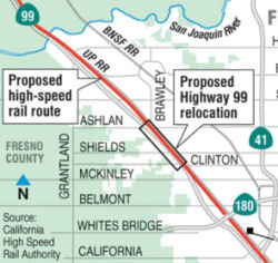 In April 2012, it was reported that construction of
California's High Speed Rail project will require relocating a two-mile
stretch of Route 99 in west-central Fresno (~ FRE 23.814 to FRE 26.513).
Between Ashlan and Clinton avenues, the six-lane freeway snuggles up
against a Union Pacific Railroad yard on the east side, leaving no room to
shoehorn the proposed high-speed rail line into its planned route. The
rail authority's plans call for shoving the freeway westward by 100 feet
or so -- onto property now occupied by a string of businesses. They
include a pair of mini-storage companies, several motels, a mobile-home
park, an RV dealership, a truck stop and an assisted-living facility.
Three off-ramps on that stretch of the southbound highway -- Dakota,
Shields and Princeton avenues -- also would be displaced.
In April 2012, it was reported that construction of
California's High Speed Rail project will require relocating a two-mile
stretch of Route 99 in west-central Fresno (~ FRE 23.814 to FRE 26.513).
Between Ashlan and Clinton avenues, the six-lane freeway snuggles up
against a Union Pacific Railroad yard on the east side, leaving no room to
shoehorn the proposed high-speed rail line into its planned route. The
rail authority's plans call for shoving the freeway westward by 100 feet
or so -- onto property now occupied by a string of businesses. They
include a pair of mini-storage companies, several motels, a mobile-home
park, an RV dealership, a truck stop and an assisted-living facility.
Three off-ramps on that stretch of the southbound highway -- Dakota,
Shields and Princeton avenues -- also would be displaced.
(Source: Fresno Bee, 4/18/2012)
In August 2012, it was reported that the work to shift
Route 99 in Fresno would not start until at least 2014. This was the
conclusion after the California High-Speed Rail Authority voted in August
2012 to approve an agreement with Caltrans for moving the 2.5-mile stretch
of the highway between Ashlan and Clinton avenues. The agreement, worth up
to $226 million, calls for Caltrans to work as a contractor for the rail
authority. The state highway agency will be responsible for design and
construction to nudge the highway over by about 100 feet to accommodate
new high-speed train tracks between the highway and the adjacent Union
Pacific Railroad freight tracks. The rail authority board authorized a
budget of $225,900,000 for the work, which includes acquiring property
from businesses located in the project's path. Caltrans will be
responsible for designing the project, which will displace a string of
businesses that sit along the west side of the highway. A frontage road
and three off-ramps will also be affected.
(Source: Fresno Bee, 8/3/2012)
In April 2017, it was reported that Clinton Ave
overpass crossing southbound Route 99 was demolished in early April as
part of construction clearing the way for the California High-Speed Rail
project. The overpass will be rebuilt as part of the realignment of the
highway for the rail project. According to the California Department of
Transportation, the overpass will be closed for an estimated six months.
Route 99 was closed overnight and rerouted as part of the demolition. More
overnight closures are planned when the segment of the overpass crossing
over northbound lanes of the highway are knocked down.
(Source: Fresno Bee, 4/11/2017)
In August 2018, it was reported that the NB Route 99
Clinton Ave onramp would reopen for traffic. At the same time, the SB
Golden State Blvd onramp to Route 99 would close for 2 months.
(Source: Caltrans News Release, 8/19/2018)
In February 2019, it was reported that California
Department of Transportation (Caltrans) and the California High-Speed Rail
Authority (Authority) held a ribbon-cutting ceremony on February 15 to
mark the completion of work on the “State Route 99 Realignment for
High-Speed Rail” project in the City of Fresno. The project shifted
portions of the highway between Ashlan Avenue and Clinton Avenue 80 to 100
feet to the west to make room for the high-speed rail alignment. At $290
million, this project is the biggest in the history of District 6. Along
with the relocation of the highway, three overcrossings were demolished
and completely reconstructed to accommodate the height and width
requirements of the high-speed train. The realignment is part of the
high-speed rail corridor of projects within the Merced to Fresno project
section. Several improvements were made to the corridor as well, including
the addition of three through lanes and an auxiliary for each direction of
travel. Also, three at-grade onramps were permanently closed to improve
traffic flow and overall safety on the heavily-traveled thoroughfare.
(Source: SCV News, 2/28/2019)
In December 2020, the CTC authorized relinquishment of
06-Fre-99-PM 23.7/26.2 (19 segments), right of way consisting of
superseded portions of Route 99, relocated or reconstructed roads, and
frontage roads, in the city of Fresno between West Weldon Avenue and Swift
Avenue. The City agreed to waive the 90-day notice and accept title upon
relinquishment by the State by letter dated September 15, 2020.
(Source: December 2020 CTC Agenda, Agenda Item
2.3c)
In April 2021, it was noted that the Route 99 NB offramp to Motel Drive
(FRE 24.208, where Golden State Blvd SB passes under Route 99 at the NB
end of Business Route 99 SB near Fresno) is Fresno’s busiest and most
structurally deficient bridge. The bridge lies just southwest of the
Vallarta at Route 99 and Clinton Avenue. 126,000 cars, trucks, and or
motorcycles a day drive over it. The bridge was built in 1955.
(Source: GVWire, 4/14/2021)
North Fresno 6-Lane Project / Island Park 6-Plan Project (FRE 26.513 - MAD R1.571)
In October 2009, the CTC adjusted the baseline agreement related to a project that will widen approximately 6.6 miles of Route 99 from four to six lanes from Ashlan Avenue in the city of Fresno (~FRE 26.513) to 0.6 mile north of Avenue 7 in Madera County (~ MAD R1.571). The Department proposed to amend the Island Park 6-Lane project baseline agreement to split the scope into two projects, the North Fresno 6-Lane project (PPNO 6274A) and the Island Park 6-Lane project (PPNO 6274), and to reflect changes to the financial plan. The split will permit Caltrans to deliver the North Fresno 6-Lane project two years early, and deliver the Island Park 6-Lane project on the original schedule as specified in the project baseline agreement. The Department has determined that a project split will allow early delivery of the southern 3.9 miles of the project, starting at the existing 6-lane freeway at Ashlan Avenue and continuing through the regionally significant Grantland Avenue interchange. The updated schedule shows the first part completing in 2014, and the second part completing in 2018. In May 2010, Caltrans put out a request for bid a project that would widen the freeway and bridges from 4 to 6 lanes in Fresno from 0.2 mile North of the Ashlan Avenue overcrossing to 0.1 mile North of the Grantland Avenue undercrossing. It was reported that the project would start construction in August 2010. Also in the pipeline were the widening of Route 99 to six lanes from Herndon Avenue north to Avenue 7 in southern Madera County, expected to begin in April 2012, and the Veterans Boulevard interchange, to start construction in August 2014.
In August 2010, the CTC approved for future consideration of funding a project that will widen Route 99 from four lanes to six lanes from Grantland Avenue (~ FRE 30.399) to Avenue 7 (~ MAD R1.571) near the city of Herndon (FRE PM 30.3 to MAD PM 1.6). The project is programmed in the State Route 99 Bond Program. Construction is estimated to begin in Fiscal Year 2011-12. Total estimated project cost is $66,050,000 for capital and support. The scope as described for the preferred alternative is consistent with the project scope set forth in the proposed project baseline agreement.
In April 2012, the CTC approved broadening the scope of this project to increase the limits of the Island Park 6-Lane project to include landscaping of the North Fresno 6-Lane project. The revised project limits of the Island Park 6-Lane project will be from 0.2 mile north of Ashlan Avenue to 0.6 mile north of Avenue 7. The cost of the increased scope is included in a revised construction cost presented in April 2012.
TCRP Project #88 will improve the Shaw Interchange (~ FRE 28.144) in northern Fresno.
Veterans Blvd Interchange (06-FRE-99-PM 28.88/30.11)
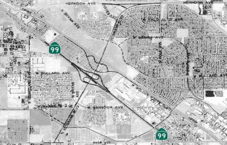 In December 2013, the CTC approved a new public road connection to Route 99 at Veterans Boulevard in
Fresno. In 1984, the City of Fresno first introduced the potential need
for Veterans Boulevard to serve the local community along Route 99.
Veterans Boulevard was to serve as a north-south “super”
arterial for the planned developed land uses in north Fresno. The
interchange would provide additional north-south access from Route 99 to
connect the local community within the project area. This idea was refined
in 1986 with a feasibility study conducted to analyze potential
interchange/grade separation configurations, with the intention of
determining the alternative best suited to the site and the proposed
Veterans Boulevard. In 1991, a Project Initiation Document was completed,
and in 1996, the official plan line for Veterans Boulevard was adopted.
In December 2013, the CTC approved a new public road connection to Route 99 at Veterans Boulevard in
Fresno. In 1984, the City of Fresno first introduced the potential need
for Veterans Boulevard to serve the local community along Route 99.
Veterans Boulevard was to serve as a north-south “super”
arterial for the planned developed land uses in north Fresno. The
interchange would provide additional north-south access from Route 99 to
connect the local community within the project area. This idea was refined
in 1986 with a feasibility study conducted to analyze potential
interchange/grade separation configurations, with the intention of
determining the alternative best suited to the site and the proposed
Veterans Boulevard. In 1991, a Project Initiation Document was completed,
and in 1996, the official plan line for Veterans Boulevard was adopted.
The 2018 STIP, approved at the CTC March 2018 meeting, appears to include funding for PPNO 6289, Veterans Boulevard/State Route 99 Interchange Project/Veterans Boulevard Grade Separation Project, 06-FRE-99-PM 28.88/30.11. The STIP appears to allocate $14,616K in FY19-20, with the remainder coming from SB1 funding. The project proposes to construct a new interchange and railroad grade separation at the proposed Veterans Boulevard alignment on Route 99 between Herndon and Shaw Avenues with the following features:
Three alternatives are being considered for the project: two build alternatives and a No-Build Alternative. The preferred alternative is Alternative 4–Jug Handle. The alternative would include realignment of Golden State Boulevard curving to the west away from the Union Pacific Railroad tracks and Veterans Boulevard. Alternative 4 would be elevated to cross over both Golden State Boulevard and the railroad tracks.
Both build alternatives include a Type L-9 partial cloverleaf interchange connection onto Route 99 at the same location. The primary difference between the two build alternatives involves the Veterans Boulevard layout and how it crosses Golden State Boulevard. In addition to the new interchange and local roadway improvements, a new grade separation is proposed for Veterans Boulevard crossing over the Union Pacific Railroad tracks. The build alternatives propose various designs for the Veterans Boulevard to Golden State Boulevard connection, including the railroad grade separation. Both build alternatives would include building Veterans Boulevard from Shaw Avenue to Herndon Avenue as a six-lane arterial roadway.
Fresno, it its planning document, noted: Veterans Boulevard is our region’s #1 priority project. The project will be ready to list in 2018/19. This project will result in construction of a six-lane arterial roadway in northeast Fresno, a freeway interchange at Route 99, grade separations over the Union Pacific High Speed Rail line and Golden State Blvd. and improvements to the roadways surrounding the project. The project will be constructed in four phases with the requested STIP funding being associated with Phase III, which is the interchange over Route 99. The California High Speed Rail Commission will contribute $28 million to Phase II for grade separation over the Union Pacific and High Speed Rail tracks. The City of Fresno will contribute $27.2 million in local development fees associated with the Phase I and IV connections to major arterials Herndon Ave. and Shaw Ave. The region has contributed $34.4 million in local Measure funds and development impact fees to environmentally clear, design and acquire right-of-way for this $151 million project and will contribute another $45 million to the construction phase. We are requesting $14.616 million in STIP funds in 2019/20 to perfect the construction funding. We will also be requesting $1.8 million of the 2019/20 SB1 Local Partnership Program (LLP) apportionment.
In January 2020, the CTC approved for future
consideration of funding the following project for which a Final
Environmental Impact Report (FEIR) has been completed: Route 99 (SR 99) in
Fresno County (06-Fre-99, PM 28.88/30.11). Construct a new interchange and
separate the grade at Veterans Boulevard and Route 99 in Fresno County.
(PPNO 6995). This project is located on Veterans Boulevard and the Route 99 Interchange in the City of Fresno in Fresno County. The purpose of the
project is to construct a new interchange and railroad grade separation to
provide access and improve circulation between and across Route 99. It
addresses the need to support freight and goods movement, operations and
mobility for current and future traffic demands. The project has been
split into five phases. Some phases are complete, others are in
construction. The estimated total cost of this project is $138.8 million
and is fully funded from the State Transportation Improvement Program,
Senate Bill 1, Local Measure funds, High Speed Rail program and Federal
Grant funds, which include Construction (capital and support) and Right of
Way (capital and support). Construction for the next phases of this
project is anticipated to begin in this Fiscal Year 2019-20 and 2020-21.
(Source: January 2020 CTC Agenda, Agenda Item
2.2c.(5))
In March 2020, the CTC approved the 2020 STIP, which
continued the programmed funding for PPNO 6289 "Rt 99/Veterans Blvd
Interchange, Phase 3".
(Source: March 2020 CTC Agenda, Item 4.7, 2020 STIP
Adopted 3/25/2020)
South Madera 6-Lane Project: Ave 7 to Ave 12 (06-Mad-99 R0.972/R7.5)
The 2020 STIP, approved at the March 2020 CTC meeting,
included PPNO 6297, South of Madera, Ave 7-Ave 12, 6-Lane widen (APDE), in
the Interregional portion of the STIP with one change in programming:
$3,000K in prior year funding (unchanged), and 9,000K in FY21-22 changed
to 6,400K.
(Source: March 2020 CTC Agenda, Item 4.7, 2020 STIP
Adopted 3/25/2020)
At the March 2020 CTC meeting, the CTC approved a resolution to amend the Route 99 Bond Program by including the South Madera 6-Lane Project and program the design component in Fiscal Year 2021-22 for a total of $3,060,000 in the Route 99 Program. The proposed South Madera 6-Lane Project will widen a 5.8-mile section of 4-lane freeway to 6-lane freeway, starting 0.7 miles north from Avenue 7 and ending at Avenue 12 in Madera County.
More detail was in a withdrawn item in the June 2021
minutes: 06-Mad-99, PM 0.1-8.1. South Madera 6-Lane. Widen Route 99 from four lanes to six lanes in Madera County. (MND) (PPNO 6297) (STIP)
(TCEP) (SR99). This project is located on Route 99 from just north of
Avenue 7 to Avenue 12 (post miles 0.1 to 8.1) in Madera County. The scope
of the project is to widen Route 99 in Madera County. One lane would be
built in each direction in the highway median to create a six-lane
highway. Additionally, the existing lanes and shoulders of Route 99 would
be rehabilitated, and a concrete median barrier would be installed along
with an auxiliary lane at the Avenue 12 northbound off-ramp. This project
is currently programmed in the 2020 State Transportation Improvement
Program (STIP) for a total of $110,873,000, which includes STIP funding,
local funds, Proposition 1B SR 99 funds, and Senate Bill 1 Trade Corridor
Enhancement Program funds. Of the total programmed $110,873,000 amount,
there is an unfunded need of $92,500,000. Construction is estimated to
begin in 2023-24. The scope, as described for the preferred alternative,
is consistent with the project scope programmed by the Commission in the
2020 STIP. A copy of the MND has been provided to Commission staff. The
project will result in less than significant impacts to the environment
after mitigation. The following resource areas may be impacted by the
project: aesthetics, paleontology, and greenhouse gases. Avoidance and
minimization measures will reduce any potential effects on the
environment. These measures include, but are not limited to,
relocation of the “Where the Palm Meets the Pine” landmark
in the median; pre-construction training, monitoring,
identification, and curation of significant fossils if discovered; and the
installation of electric vehicle chargers. As a result, an MND was
completed for this project.
(Source: June 2021 CTC Agenda, Agenda Item
2.2c.(1))
In June 2021, the CTC approved amending the STIP to use
the funding available through the 2021 Mid-Cycle STIP and share
distribution of the federal Coronavirus Response and Relief Supplemental
Appropriations Act of 2021 funds (COVID Relief Funds) to increase funding
for a project already in the STIP as follows: Route 99 South of Madera
6-Lane Widening Project (PPNO 6297); program $230K to the R/W Support
phase and $602 to the R/W capital phase in FY 2021-22.
(Source: June 2021 CTC Agenda, Agenda Item
2.1a.(19))
In August 2021, the CTC approved an allocation of
$7,719,000 for the State-Administered Multi-Funded Proposition 1B (Prop
1B) – Route 99 / Senate Bill 1 (SB 1) Trade Corridor Enhancement
Program (TCEP) South Madera 6 Lane project (PPNO 06-6297; ProjID
0612000158; EA 0H220), on the State Highway System, in Madera County.
Route 99 (06-Mad-99 0.1/R8.1) In Madera County, from North of
Fresno-Madera County line to North of Avenue 12. This project will improve
goods movement and passenger travel along State Route 99 by median
widening from 4 to 6 lanes. It will also upgrade drainage, construct
drainage basins and median barrier, and increase vertical clearance at one
structure. (Future Consideration of Funding under Resolution E-21-55; June
2021 (Ed - Which is interesting, as per the June meeting minutes, that
item was withdrawn before the meeting)) (Contribution from other
sources, match: COVID RIP $832,000 and measure funds $9,000 .) Allocation:
TCEP-S/21-22: R/W Sup $508,000; R/W $1,356,000. TCEP-R/21-22: R/W Sup
$762,000; R/W $2,033,000. SR99/21-22: PS&E $3,060,000.
(Source: August 2021 CTC Agenda, Agenda Item
2.5g.(2))
Cottonwood Creek Bridge Replacement (06-Madera-99 7.0/R7.5)
 The following project was included in the final adopted 2018 SHOPP in March 2018: PPNO 6857. 06-Madera-99 R7.0/R7.5. On Route 99 Near the city of Madera, at Cottonwood Creek Bridge №
41-065R, No. 41-0065L and No. 41-0065S. Replace bridges to mitigate
corrosion by chloride latent concrete. Begin Con: 3/2/2022. Total Project
Cost: $36,437K.
The following project was included in the final adopted 2018 SHOPP in March 2018: PPNO 6857. 06-Madera-99 R7.0/R7.5. On Route 99 Near the city of Madera, at Cottonwood Creek Bridge №
41-065R, No. 41-0065L and No. 41-0065S. Replace bridges to mitigate
corrosion by chloride latent concrete. Begin Con: 3/2/2022. Total Project
Cost: $36,437K.
In October 2020, the CTC approved for future
consideration of funding the following project for which a Mitigated
Negative Declaration (MND) has been completed: Route 99 in Madera County.
Replace three bridges on Route 99 over Cottonwood Creek in Madera County.
(06-Madera-99 R7.0/R7.5) (PPNO 6857). This project is located in Madera
County. The Department proposes to replace three existing bridges on Route 99 in Madera County about 1 mile south of the city limit of Madera at
Cottonwood Creek. The project would replace the two Route 99 mainline
bridges (northbound and southbound) over Cottonwood Creek with one bridge
with a decked median. In addition, the project would replace the
northbound off-ramp bridge to Avenue 12/Road 29, which crosses over
Cottonwood Creek. The project is not fully funded and is currently
programmed in the 2020 SHOPP for a total of $5,872,000 and $30,600,000 is
currently through G-13 Contingency. Construction is estimated to begin
2021-2022. The scope, as described for the preferred alternative, is
consistent with the project scope programmed by the Commission in the 2020
SHOPP.
(Source: October 2020 CTC Agenda, Agenda Item
2.2c.(1))
In October 2020, the CTC approved the following SHOPP
SB1 Support Phase allocation: $3,200,000 for PS&E and $100,000 for R/W
Sup for 06-Mad-99 PM R7.0/R7.5 PPNO 06-6857 ProjID 0616000207 EA 0V120. On
Route 99 Near the city of Madera, at Cottonwood Creek Bridge №
41-065R, No. 41-0065L and No.41-0065S. Replace bridges to mitigate
corrosion by chloride latent concrete. (Future consideration of funding
approved under Resolution Pending; October 2020.)
(Source: October 2020 CTC Agenda, Agenda Item
2.5b.(2b) #8)
In January 2022, the CTC approved the following SHOPP
allocation: $32,260,000 06-Mad-99 6.9/R7.5. PPNO 06-6857; ProjID
0616000207; EA 0V120. Route 99 Near the city of Madera, at Cottonwood
Creek Bridge № 41-0065R, № 41-0065L and № 41-0065S. Outcome/Output:
Replace bridges to mitigate corrosion by chloride latent concrete. (Future
consideration of funding approved under Resolution E-20-90; October 2020.)
(Concurrent Amendment under SHOPP Amendment 20H-013; January 2022.)
Allocation: CON ENG $6,100,000; CONST $26,160,000.
(Source: January 2022 CTC Agenda, Agenda Item
2.5b.(1) #9)
In April 2023, it was reported that Caltrans has broken
ground on a project to replace three aging bridges on Route (SR) 99 in
Madera County. The $36.8 million project was made possible by $26 million
in funding from the federal Infrastructure Investment and Jobs Act (IIJA)
of 2021 and $10 million in funding from Senate Bill (SB) 1, the Road
Repair and Accountability Act of 2017. During the ceremonty, Caltrans
unveiled new “Rebuilding CA” highway signs that will be
installed for future infrastructure projects funded by the IIJA and state
investments. The Cottonwood Creek Bridge Replacement Project represents a
partnership between Caltrans and the Madera County Transportation
Commission. The project will replace the two existing two-lane bridges and
one-lane offramp bridge that cross Cottonwood Creek along Route 99 south
of Avenue 12. In their place will be a single, six-lane bridge for both
northbound and southbound traffic. The project will provide future
three-lane capacity for both southbound and northbound Route 99 and is
expected to be completed in fall 2025. A Structure Maintenance and
Investigations Bridge Maintenance Strategy Meeting held on September 1,
2015 recommended replacing the concrete bridges because of steel
corrosion, deck deterioration, and superstructure and substructure
distress related to chloride intrusion. The bridges have a long history of
deck and soffit deterioration. According to a 2011 test on the bridge,
water and salt have reached levels that corrode the steel in the
reinforced concrete of the bridge. The mainline bridge piles on the
northbound and southbound Route 99 bridges are exposed. In addition, the
asphalt overlay on the Route 99 bridges is continually deteriorating,
resulting in repeated emergency repair projects. The northbound and
southbound Route 99 bridges have had spot failures in the decks that have
required patching. The project would repair the decks and the pavement on
the decks of the bridges, which would eliminate costly ongoing maintenance
projects. The soffits (areas between the support beams of the bridge) of
the two structures show cracking, salt residue, spots of distressed
concrete and evidence of full-depth repairs. The Structure Replacement and
Improvement Needs Report also identified the need to upgrade the
non-standard bridge rails.
(Source: Sierra Sun Times, 4/21/2023; Caltrans Project Page, 5/9/2023)
Avenue 12 Interchange Improvements - Madera (~ MAD R7.491)
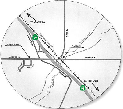 In December 2009, the CTC approved for future consideration of funding a project that will widen Avenue 12
Interchange on Route 99 from two to four lanes, add an onramp to Route 99,
and construct roadway improvements in the city of Madera. The project is
programmed in the State Route 99 Bond Program and the 2008 State
Transportation Improvement Program, and includes local funds. Total
estimated project cost is $68,000,000, capital and support. Construction
is estimated to begin in Fiscal Year 2011-12. The scope as described for
the preferred alternative is consistent with the project scope set forth
in the approved project baseline agreement.
In December 2009, the CTC approved for future consideration of funding a project that will widen Avenue 12
Interchange on Route 99 from two to four lanes, add an onramp to Route 99,
and construct roadway improvements in the city of Madera. The project is
programmed in the State Route 99 Bond Program and the 2008 State
Transportation Improvement Program, and includes local funds. Total
estimated project cost is $68,000,000, capital and support. Construction
is estimated to begin in Fiscal Year 2011-12. The scope as described for
the preferred alternative is consistent with the project scope set forth
in the approved project baseline agreement.
In June 2012, the CTC amended the Route 99 Corridor Bond Program baseline agreement for the Avenue 12 Interchange project in Madera County to increase Right of Way Capital from $6,700,000 to $20,000,000, increase Right of Way Support from $500,000 to $2,000,000, increase Construction Support from $4,800,000 to $7,500,000, and revise the project limits. The project will reconstruct the Route 99/Avenue 12 Interchange in the city of Madera. The Right of Way Capital estimate has increased by $13,300,000, from $6,700,000 to $20,000,000. Detailed engineering has identified the need for full acquisition of three parcels that were originally anticipated to be partial acquisitions. The first parcel includes a gas station with mini mart, the second parcel includes a fast food restaurant, and the third parcel is a vacant commercial property. In order to provide sufficient vertical clearance over Route 99, the profile of Avenue 12 must be raised such that direct access to these businesses from Avenue 12 will be eliminated, thereby necessitating full acquisitions at an additional cost of $7,100,000. All 25 required parcels have current property appraisals, and nine parcels have been settled. The result of the appraisals and settlements to date is an increase of $3,700,000. In addition, potholing has revealed the need for additional utility relocations totaling $2,500,000. It is proposed to fund the Right of Way Capital cost increases from Madera County’s Regional Improvement Program (RIP) shares. The project limits were also revised: Specifically, the off-ramp merge and on-ramp diverge locations were revised during final design, which required a change in postmile limits. The beginning postmile has changed from R7.1 to R6.9, and the ending postmile has changed from R7.9 to R8.2. The revised project location is “from 0.6 mile south of Avenue 12 to 0.7 mile north of Avenue 12”. The project scope has not changed. In December 2012, the CTC approved allocating an additional $1,402,000 in Proposition 1B Route 99 Corridor Bond Program funds and amend the Route 99 Corridor Bond Program baseline agreement for the Avenue 12 Interchange project (PPNO 5346) in Madera County.
Madera Widening - Ave 12 to Ave 17 (~ MAD R7.455 to MAD R14.202)
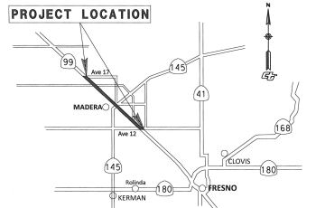 In December 2015, the CTC approved for future
consideration of funding a project in Madera County that will widen a
portion of 99 from four lanes to six lanes in the city of Madera. The
project is programmed in the 2014 State Transportation Improvement
Program. The project is not fully funded. The total estimated cost is
$48,150,000 for capital and support. Depending on the availability of
funds, construction is estimated to begin in Fiscal Year 2018-19. The
scope, as described for the preferred alternative, is consistent with the
project scope programmed by the Commission in the 2014 State
Transportation Improvement Program.
In December 2015, the CTC approved for future
consideration of funding a project in Madera County that will widen a
portion of 99 from four lanes to six lanes in the city of Madera. The
project is programmed in the 2014 State Transportation Improvement
Program. The project is not fully funded. The total estimated cost is
$48,150,000 for capital and support. Depending on the availability of
funds, construction is estimated to begin in Fiscal Year 2018-19. The
scope, as described for the preferred alternative, is consistent with the
project scope programmed by the Commission in the 2014 State
Transportation Improvement Program.
The 2018 STIP, approved at the CTC March 2018 meeting, appears to add no additional funds to PPNO 5335, On Route 99, Madera, Ave 12-Ave 17, widen to 6 lanes. The allocation shows $1,585K for PS&E in FY19-20.
The following project was included in the final adopted 2018 SHOPP in March 2018: PPNO 5335A. 06-Madera-99 R7.5/15.1. On Route 99. In and near Madera, from Avenue 12 Overcrossing to 0.9 mile north of Avenue 17 Overcrossing. Additonal $13M from other contribution for the construction of one new lane in each direction. Roadway rehabilitation. Begin Con: 11/1/2019. Total Project Cost: $62,000K.
In October 2018, it was reported that approved a $69.7
million project to reconstruct drainage systems, upgrade guardrail and
Intelligent Transportation System (ITS) elements, construct one new lane
in each direction and improve 23.5 lane miles of Route 99 from the Avenue
12 Overcrossing to north of the Avenue 17 Overcrossing in the city of
Madera in Madera County.
(Source: Sierra Sun Times, October 2018)
In October 2018, the CTC amended the Route 99 Bond
Program to add the Madera 99 Widening Project from Avenue 12 to Avenue 17
in Madera County at a cost of $15,000,000 in Route 99 funds. The proposed
Madera 99 Widening Project will construct a southbound and northbound lane
in the median on Route 99 between Avenue 12 and Avenue 17 in Madera
County. The CTC also approved the Route 99 Bond Program Project Baseline
Agreement for the Madera 99 Widening Project from Avenue12 to Avenue 17 in
Madera County. Lastly, it also approved an allocation of $14,970,000 for
the State-Administered Proposition 1B Route 99 Madera 99 Widening project
(PPNO 5335), in Madera County, on the State Highway System. The last
action noted that the Department was ready to proceed with this project,
and is requesting an allocation at this time. The allocation is contingent
upon the approval of a budget revision by the Department of Finance. The
allocation is divided into $13,720,000 for construction and $1,250,000 for
construction engineering.
(Source: October 2018 CTC Agenda Item 4.17, Agenda
Item 4.18, Agenda Item 2.5g.(2))
In July 2019, it was reported that construction was set
to start on this segment in August 2019. The work will add a lane on the
northbound side, as well as the southbound side, between Avenue 12 and
Avenue 17. The work is set to happen at night to avoid commuters.
It’s slated to end summer 2020. Multiple funds are being used to pay
for this, with $66 million coming in from the SB1 gas tax. Also, nearly $5
million is being used from Measure T funds — a half-cent sales tax
passed by Madera County voters in 2006. Other funding sources include the
State Route 99 Bond and the Regional Improvement Program. Besides adding
new lanes, the project will also upgrade the Almond Avenue on-ramp,
construct 3,500 feet of drainage systems with 70 new drainage systems,
construct five maintenance vehicle pullouts, and construct a 25,000 foot
concrete barrier.
(Source: KSEE 24, 7/19/2019)
In March 2020, the CTC approved the 2020 STIP, which
continued the programmed close-out funding for PPNO 5335 "Madera, Av 12-Av
17, widen 6 lns (Rt99) (incr 10-18 vote)".
(Source: March 2020 CTC Agenda, Item 4.7, 2020 STIP
Adopted 3/25/2020)
In September 2021, it was reported that the official
ribbon cutting ceremony for the Madera 99 Rehabilitation Project had taken
place. The two year project added an additional lane in both directions,
on State Route 99, from Avenue 12 to Avenue 17. The additional lanes will
improve the flow of traffic, improve safety for drivers and help the flow
of goods and services through the Central Valley and California.
(Source: Caltrans District 6 on FB, 9/16/2021)
In October 2019, it was reported that inclusion
in the STIP isn't enough if the project isn't ready. In a 2020 Draft
Report, Caltrans announced plans to delete three projects: (1) a project
to expand Route 99 from four to six lanes — three on each side
— between Prosperity Avenue and Avenue 200, near the International
Agri-Center; (2) a project to widen Route 99 to six lanes S of Madera, and
a project to widen Route 46 E of the Cholame Y along the Antelope Grade.
Money for the project comes from the state's Interregional Transportation
Improvement Program, which includes a $2.6 billion fund to improve
transportation and goods movement across the state. The fund is in part
derived from Senate Bill 1, the state's controversial gas tax passed in
2017 and upheld in a failed ballot measure last year. The deletion of the
funds naturally has local politicians upset beliving it to be a "bait and
switch" regarding SB1. However, that isn't the case. SB1 specifically
allocates portions of the revenue from the new transportation improvement
fee to the State Transit Assistance Program and to the Transit and
Intercity Rail Capital Program. Specifically, it allocates two hundred
seventy-five million dollars ($275,000,000) for the interregional share of
the State Transportation Improvement Program. Recall, that this widening
was in the 2018 STIP. One of the projects funded through the STIP is the
Interregional Transportation Improvement Program (ITIP), which has the
purpose to improve interregional mobility for people and goods across the
State of California on highway and passenger rail corridors of strategic
importance. At least 60 percent of that program must be programmed to
projects outside urbanized areas on the Interregional Road System (IRRS)
and for intercity passenger rail. Of this amount, at least 15 percent (9
percent of the ITIP) must be programmed for intercity passenger rail
projects. But STIP capacity over the 2020 five-year FE period has
decreased compared to the capacity in the 2018 five-year FE period, going
from $3.3 billion in the 2018 FE to $2.6 billion in the 2020 FE. The
decrease is primarily attributable to a high level of pre-existing STIP
project commitments for allocated and programmed projects. The 2020 Fund
Estimate provides $52,414,000 in new, additional ITIP funding, but
$52,250,000 of that is immediately eaten up by previous projects that cost
more than expected (in San Luis Obispo and Humboldt counties). That leaves
$164,000 to hand out, which required deletion (or, more specifically,
delay) of $32,494,00 in highway projects to make money available. Removing
these three projects from the 2020 ITIP and saving money on another Route 99 project moves about $61 million to the column of “uncommitted
2020 ITIP programming capacity.” Those uncommitted funds, according
to the draft plan, will be held in reserve “for priority rail
projects and other priorities aligned with Executive Order N-19-19.”
Note that this does not mean the project was deleted. State Transportation
Secretary David Kim says the projects weren’t ready to proceed, and
the funds can be reapplied for in two years. Additionally, other projects
on those roads – for example, work on the Cholame "Y" at the Route 46 / Route 41 intersection, and widening of Route 99 at Tagus – are
still being funded through the ITIP.
(Sources: Visalia Times Delta, 10/9/2019; Streetsblog, 10/31/2019; ABC 30, 10/9/2019; LATimes
10/14/2019; Streetsblog, 10/11/2019; SLOTribune
10/8/2019; New Times, 10/10/2019)
In June 2008, the CTC approved relinquishment of right of way in the city of Madera, on Almond Avenue (~ MAD 9.379) easterly of South Gateway Drive, consisting of a reconstructed and relocated city street.
In July 2011, the CTC approved funding for a project to repave four miles of Route 99 in both directions, from the South Madera Overcrossing (~MAD 9.568) to the Avenue 16 Overcrossing (~ MAD 12.785). Existing guardrails, signs, lights and drainage will also be upgraded as part of the project. Design work for the project is currently underway with construction set to begin in the fall. The entire project is expected to be complete by Spring 2013.
Route 99 / Route 145 (~ MAD 10.241) and Gateway Drive Interchange(~ MAD 12.748) - Madera
The SAFETEA-LU act, enacted in August 2005 as the reauthorization of TEA-21, provided the following expenditures on or near this route:
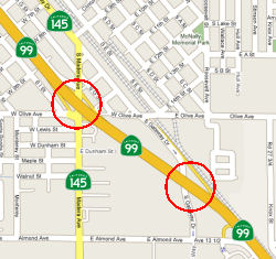 In October 2008, the CTC received notice of a negative environmental impact declaration for
construction of two interchanges near Madera. The project proposes to
reconstruct the existing Route 99/Route 145 (~ MAD 10.241) and Route 99/Gateway Drive (~ MAD 12.748) interchanges within the City of Madera.
The purpose of the project is to relieve congestion at the Route 99/Route 145 Interchange, to provide better access from Route 99 to the Madera
Community Hospital on Almond Avenue and to provide an additional two-way
crossing of Route 99 in South Madera. The project is needed to provide
sufficient capacity for the interchanges to improve existing level of
service deficiencies and to meet Year 2025 traffic projections, as well as
to improve traffic safety by reducing the accident potential. The proposed
modifications will improve both the current and predicted levels of
service for both interchanges. Two alternatives were considered in the
Initial Study. One alternative, the no build alternative, did not meet the
project purpose and need since concerns regarding traffic congestion at
the Route 99/Route 145 Interchange as well as access to Madera Community
Hospital on Almond Avenue from Route 99 would remain unresolved. The
second alternative, the preferred alternative includes:
In October 2008, the CTC received notice of a negative environmental impact declaration for
construction of two interchanges near Madera. The project proposes to
reconstruct the existing Route 99/Route 145 (~ MAD 10.241) and Route 99/Gateway Drive (~ MAD 12.748) interchanges within the City of Madera.
The purpose of the project is to relieve congestion at the Route 99/Route 145 Interchange, to provide better access from Route 99 to the Madera
Community Hospital on Almond Avenue and to provide an additional two-way
crossing of Route 99 in South Madera. The project is needed to provide
sufficient capacity for the interchanges to improve existing level of
service deficiencies and to meet Year 2025 traffic projections, as well as
to improve traffic safety by reducing the accident potential. The proposed
modifications will improve both the current and predicted levels of
service for both interchanges. Two alternatives were considered in the
Initial Study. One alternative, the no build alternative, did not meet the
project purpose and need since concerns regarding traffic congestion at
the Route 99/Route 145 Interchange as well as access to Madera Community
Hospital on Almond Avenue from Route 99 would remain unresolved. The
second alternative, the preferred alternative includes:
The cost estimate for both interchanges totals $18,037,000. According to Caltrans, in May 2005, the project was split into two projects for programming and construction. The Route 99/Gateway Drive Interchange Project was completed in 2006. The project costs totaled $8,138,000. Funding was provided through Regional Improvement Program Funds ($4,700,000) and Local Measure A Funds ($3,438,000). The Route 99/Route 145 Interchange Project, estimated to cost $9,899,000 is scheduled for construction in FY 2008/09 and is fully funded with Regional Improvement Program Funds ($6,400,000), Local Measure A Funds ($1,099,000) and Federal High Priority Projects Program Funds ($2,400,000).
In February 2012, the CTC authorized funding a locally-administered STIP project on Route 99, in Madera County, 06N-Mad-99 10.7/11.2 Route 99/4th Street Interchange Improvements. In the city of Madera, on Fourth Street, from Sunset Avenue to Gateway Drive. $5,148,000 to widen Route 99 bridge to 6 lanes and widen ramps, widen Fourth Street to 4 lanes with median, and add traffic signals coordinated with interchange signals. The project will modify one bridge, install one new traffic signal, construct 0.6 new lane miles, and improve level of service from F to C.
Ellis Street Overcrossing - Madera (~ MAD 13.093)
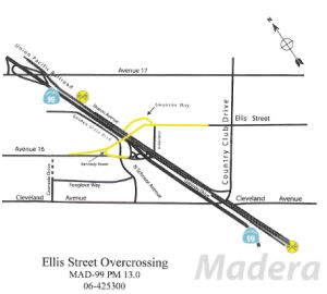 In May 2009, the CTC accepted the mitigated negative
declaration for the Ellis Street Overcrossing Project. The project
includes construction of an overcrossing on Route 99 between Avenue 17 and
Cleveland Avenue in the City of Madera and a new roadway connecting Ellis
Street on the east side of Route 99 with Avenue 16 on the west side of
Route 99. The project will include a crossing over the freeway and
railroad tracks to provide vehicular and pedestrian access to the
residential and commercial areas east of the freeway and reduce the
congestion at the Cleveland Avenue/Gateway Drive/County Club Drive
intersection and at the Route 99/Cleveland Avenue Interchange. The project
is estimated to cost $16,596,000 and is funded with STIP ($8,534,000),
Proposition 1B Local Streets and Roads ($1,746,000) and Local ($6,316,000)
funds. Construction is estimated to begin in fiscal year 2009/10.
In May 2009, the CTC accepted the mitigated negative
declaration for the Ellis Street Overcrossing Project. The project
includes construction of an overcrossing on Route 99 between Avenue 17 and
Cleveland Avenue in the City of Madera and a new roadway connecting Ellis
Street on the east side of Route 99 with Avenue 16 on the west side of
Route 99. The project will include a crossing over the freeway and
railroad tracks to provide vehicular and pedestrian access to the
residential and commercial areas east of the freeway and reduce the
congestion at the Cleveland Avenue/Gateway Drive/County Club Drive
intersection and at the Route 99/Cleveland Avenue Interchange. The project
is estimated to cost $16,596,000 and is funded with STIP ($8,534,000),
Proposition 1B Local Streets and Roads ($1,746,000) and Local ($6,316,000)
funds. Construction is estimated to begin in fiscal year 2009/10.
In 2007, it appeared there was construction ongoing on Route 99 from Fairmead/Berenda (~ MAD R18.637) to Route 152 (~ MAD 22.734), near Chowchillla.
In May 2023, the CTC relinquished right of way
consisting of collateral facilities to the County of Madera (County) along
Route 99 from Avenue 21 to Route 152 (06-MAD-99-PM 19.85/22.75, 6
segments). The County, by freeway agreement, dated June 8, 2004, agreed to
accept the relinquishment and by relinquishment agreement, dated September
2, 2010, agreed to waive the 90-day notice and accept title upon
relinquishment by the State. The County received a 90-day notice on
February 9, 2023 and the 90-day notice expired May 10, 2023.
(Source: May 2023 CTC Minutes, Agenda Item 2.3c)
There are plans to construct a freeway near Fairmead (~ MAD 21.661).
Route 152 near Chowchilla to Modesto
In February 2012, the CTC authorized $1,605,000 in SHOPP funding for work near Chowchilla, from Avenue 24 (~ MAD 23.79) to Le Grand Road (~MER 6.696) to construct two single thrie beam median barriers along 4.4 centerline miles to reduce cross median collisions and improve traffic safety
Chowchilla/Merced Area Widening: Chowchilla River (~ MAD 29.33) to Childs Avenue (~ MER 13.04)
In July 2005, the CTC considered funding to convert 4-lane expressway to 6-lane freeway and construct interchange at Mission Avenue in Merced from Owens Creek Bridge to south of Childs Avenue.
In July 2005, the CTC received a notice of EIR preparation for Route 99 in Madera County to realign and widen to six lane freeway near Merced (NOP). This project consists of two sections: the Plainsburg section (~ MER 3.379) and the Arboleda section (~ MER 6.316). In the Plainsburg section there are four alternatives in addition to the No Build Alternative; in the Arboleda section there are two alternatives in addition to the No-Build Alternative. The four build alternatives currently under consideration for the Plainsburg Section (Alternatives 1A, 1B, 2, and 3) would provide the following features using different alignments:
The two build alternatives currently under consideration for the Arboleda Section (Alternatives 4 and 5) would provide the following:
In March 2006, the CTC approve for future consideration of funding a project in Merced County that will improve a 10.5 mile section of Route 99 from a four lane highway to a six lane expressway. The project is programmed in the 2006 State Transportation Improvement Program (STIP). The overall project is not fully funded. Project development and right of way, however, are fully funded in the Interregional Transportation Improvement Program and Traffic Congestion Relief Program for $35,787,000. The total estimated project cost is $270 million. Construction is estimated to begin in Fiscal Year 2009-10. The project is proposed in the State Route 99 Bond Program. The project runs from the Chowchilla River (~ MAD 29.33) to McHenry Road (~ MER R10.141), and includes interchanges at Arboleda Dr. and Plainsberg Rd.
![[TCRP 104-105]](maps/099-tcrp-104-105.jpg) An Environmental Impact Report is in preparation for widening this route from 4 to 6 lanes, and to replace all
existing bridges, in San Joaquin County [April 2002 CTC Agenda Item
2.2a.(1)]. This is likely TCRP Project #104, which will build 7 miles of
new six-lane freeway from Buchanan Hollow Road (~ MER 4.483) to Healey
Road (~MER R11.314) in Merced Country. There is also TCRP Project #105,
which will build 2 miles of new six-lane freeway from the Madera County
line to Buchanan Hollow Road in Merced County. However, these projects had
their TCRP funds deallocated in September 2005 due to inactivity. In April
2007, the CTC considered amendments to projects #104 and #105. These
amendments would build seven miles of new six-lane freeway south of
Merced, Buchanan Hollow Road (~ MER 4.483) to Healey Road (~MER R11.314)
in Merced County (#104) and build 4.5 miles of new six-lane freeway,
Madera County line (MER 0.0) to Buchanan Hollow Road (~ MER 4.483) in
Merced County (#105). Specifically, TCRP Project #104 will upgrade a
four-lane expressway to a six-lane freeway with an interchange at Arboleda
Road. The project will close at-grade median crossings and improve
capacity on Route 99 and is programmed with $5,000,000 of TCRP funds for
Plans, Specifications and Estimates (PS&E) and Right of Way (R/W)
support and capital. Project Approval and Environmental Document
(PA&ED) and Construction are programmed in the State Transportation
Improvement Program for $144,900,000. TCRP Project #105 will upgrade Route 99 from a four-lane expressway to a six-lane freeway. This project is also
funded with $5,000,000 from the TCRP for PS&E and R/W support. The
project schedule and funding changed due to environmental issues that
delayed the project. This delay escalated construction costs and delayed
project delivery. These projects are now estimated for completion in FY
2012/2013.
An Environmental Impact Report is in preparation for widening this route from 4 to 6 lanes, and to replace all
existing bridges, in San Joaquin County [April 2002 CTC Agenda Item
2.2a.(1)]. This is likely TCRP Project #104, which will build 7 miles of
new six-lane freeway from Buchanan Hollow Road (~ MER 4.483) to Healey
Road (~MER R11.314) in Merced Country. There is also TCRP Project #105,
which will build 2 miles of new six-lane freeway from the Madera County
line to Buchanan Hollow Road in Merced County. However, these projects had
their TCRP funds deallocated in September 2005 due to inactivity. In April
2007, the CTC considered amendments to projects #104 and #105. These
amendments would build seven miles of new six-lane freeway south of
Merced, Buchanan Hollow Road (~ MER 4.483) to Healey Road (~MER R11.314)
in Merced County (#104) and build 4.5 miles of new six-lane freeway,
Madera County line (MER 0.0) to Buchanan Hollow Road (~ MER 4.483) in
Merced County (#105). Specifically, TCRP Project #104 will upgrade a
four-lane expressway to a six-lane freeway with an interchange at Arboleda
Road. The project will close at-grade median crossings and improve
capacity on Route 99 and is programmed with $5,000,000 of TCRP funds for
Plans, Specifications and Estimates (PS&E) and Right of Way (R/W)
support and capital. Project Approval and Environmental Document
(PA&ED) and Construction are programmed in the State Transportation
Improvement Program for $144,900,000. TCRP Project #105 will upgrade Route 99 from a four-lane expressway to a six-lane freeway. This project is also
funded with $5,000,000 from the TCRP for PS&E and R/W support. The
project schedule and funding changed due to environmental issues that
delayed the project. This delay escalated construction costs and delayed
project delivery. These projects are now estimated for completion in FY
2012/2013.
In December 2011, the CTC approved constructing the Arboleda Road Freeway near Merced, on Route 99 from Buchanan Hollow Road to Miles Creek overflow. Convert to 6-lane freeway and construct interchange at Arboleda Road. (TCRP #104).
In December 2011, the CTC approved revision of the funding plan for the Arboleda Road Freeway project (PPNO 5414), which will widen 5.9 miles of Route 99 from four lanes to six lanes from Buchanan Hollow Road to Miles Creek Overflow (~ MER R10.834). The right of way support cost increased from $1,570,000 to $2,570,000, as the project experienced an unexpectedly high level of condemnation-related activity. Of 38 parcels, 27 required the initiation of condemnation activities. Negotiation and condemnation activities were protracted and consumed more support effort than was planned. The appraisal staff encountered several parcels with unexpectedly complicated appraisal questions requiring unique solutions. In addition, due to workload demand in the Department’s Stockton office, some of the appraisal and acquisition work was done by Fresno staff, which resulted in unanticipated travel costs. The right of way capital cost, on the other hand, decreased from $24,900,000 to $23,900,000, as the baseline agreement was based on a worst case estimate for potential right of way requirements. The final design of the preferred alternative resulted in a reduction of right of way requirements and lower costs. Of the 46 parcels that were originally anticipated, only 38 were acquired. Additionally, the schedule required revision. The End Design milestone was delayed by 17 months due to negotiations with the Army Corps of Engineers (ACOE) regarding a permit required by Section 404 of the Clean Water Act. Several mitigation options and parcels were investigated before ACOE approved the permit. The End Right of Way milestone was delayed by 22 months due to condemnation of several parcels. In particular, one group of three parcels was highly contested by the owner and required 14 signatures. These parcels impacted the first stage of the project, so a workaround was not feasible. The design was re-evaluated to minimize impacts, and the parcels were re-appraised. These parcels alone account for more than a year of the delay. The Begin Construction and End Construction milestones are being delayed by 22 months as a direct result of the right of way delay described above. The Begin Closeout milestone is being delayed by 15 months because it is directly related to the End Construction milestone. The baseline schedule incorrectly showed closeout starting eight months after the End Construction milestone. Closeout will actually begin one month after the End Construction milestone, which explains why the delay is 15 months instead of 22 months. The End Closeout milestone is being delayed by 21 months, 15 months of which is a direct result of the Begin Closeout delay described above. The other six months of delay is caused by a mistake in the baseline schedule, which showed a duration of six months for closeout. Closeout requires a duration of 12 months. The updated schedule has the project completing construction in April 2015.
In February 2012, it was reported that the Right of Way cost on TCRP Project #105 increased from $700,000 to $1,200,000. This project experienced an unexpectedly high level of condemnation-related activity. Of 11 parcels, ten required the initiation of condemnation activities. The parcel that did not require condemnation involved railroad negotiations, which took as much time to settle as the other parcels. Negotiation and condemnation activities were protracted and consumed more support effort than was planned. With the remaining parcels, it became necessary to obtain Resolutions of Necessity for all ten parcels. Condemnation suits were filed on five of the parcels. The appraisal staff encountered several parcels with unexpectedly complicated appraisal questions requiring unique solutions, and appraisal staff performed rework on several parcels as a result of required design changes. In addition, due to heavy workload demand in the Department’s Stockton office, the appraisals and acquisition work was performed by Fresno Right of Way staff, which resulted in unanticipated travel costs. On the other hand, the Right of Way capital cost has decreased from $6,477,000 to $5,977,000. In terms of schedule, the End Design milestone was delayed by ten months due to negotiations with the Army Corps of Engineers (ACOE) regarding a permit required by Section 404 of the Clean Water Act. Several mitigation options and parcels were investigated before ACOE approved the permit. The End Right of Way milestone was delayed by eight months due to condemnation of several parcels as just described. As a result, the Begin Construction and End Construction milestones are being delayed by 17 months. Why 17? Ten months are a direct result of the End Design delay. The other seven months of delay are caused by the immediately adjacent and interrelated Arboleda Road Freeway project (PPNO 5414). The Arboleda Road Freeway project must begin eight months before the TCRP Project #105 project. The Arboleda Road Freeway project experienced several delays, which were described under Resolution R99-PA-1112-017 approved in December 2011 and resulted in an additional seven-month delay to this project. There were further delays inthe closeout, resulting in a new closeout date of August 2016.
In Spring 2012, Caltrans put out for bid a project to reconstruct the freeway, interchanges, and bridges near Chowchilla from the Chowchilla River bridge (~ MAD 29.33) to Buchanan Hollow Road (~ MER 4.483). This is replacement and repair of one of the last nice expressway sections on Route 99. There are also a couple of sections of single-slab concrete visible near Buchanan Hollow Road where the expressway bends away from the tracks.
In May 2013, the CTC approved deallocation of $500,000 in Proposition 1B Route 99 bond funds from the Sutter 99 Segment 2 project (PPNO 8361B) in Sutter County; $822,000 in Proposition 1B SR99 bond funds from the Goshen to Kingsburg 6-Lane project (PPNO 6480) in Tulare County; $529,000 in Proposition 1B SR99 bond funds from the Freeway Upgrade & Plainsburg Road I/C project (PPNO 5401) in Merced County; and $341,000 from the Arboleda Road Freeway project (PPNO 5414) in Merced County to reflect final expenditures. The Arboleda Road Freeway project will widen 5.9 miles of Route 99 from four lanes to six lanes from Buchanan Hollow Road to Miles Creek Overflow, and construct an interchange at Arboleda Road. The construction contract was awarded on April 6, 2012, with construction completion scheduled for March 2016. The Mission Avenue Interchange/Freeway project (PPNO 0528D), which is immediately north of the Arboleda Road Freeway project, widened Route 99 from four lanes to six lanes from Owens Creek Bridge to 0.3 mile south of Childs Avenue (~ MER 13.04), and constructed an interchange at Mission Avenue (~ MER R11.71). Construction was completed in April 2008. However, the newly widened freeway was not striped as a 6-lane freeway because it is only two miles long and it connects to a 4-lane freeway on both ends. With the completion of the Arboleda Road Freeway project and the adjacent Freeway Upgrade & Plainsburg Road I/C project (PPNO 5401), Route 99 will be six lanes from the Madera/Merced County line to 0.3 mile south of Childs Avenue, a distance of over 12 miles. Therefore, in October 2013 it was proposed to increase the limits of the Arboleda Road Freeway project to include restriping of the Mission Avenue Interchange/Freeway project.
Madera to Childs Median Barrier (10-Mer-99 0.4/R12.7)
In May 2021, the CTC amended the following project into
the 2020 SHOPP: (1a) #25. 10-Mer-99 0.4/R12.7 PPNO 3510 ProjID 1020000183
EA 1L310. Route 99 In and near the city of Merced, from north of the
Madera County line to south of East Childs Avenue. Construct median
barrier. (Concurrent COS allocation under Resolution FP-20-70; May 2021.)
PA&ED $894K; PS&E $1,384K; R/W Sup $51K; Con Sup $1,856K; R/W Cap
$23K; Const Cap $13,399K TOTAL $17,607K. Begin const. 4/19/2024.
(Source: May 2021 CTC Agenda, Agenda Item 2.1a.(1a)
#25)
In May 2021, the CTC approved the following
pre-construction support phase allocation(s): (2a) #12. $894,000
(PA&ED). 10-Mer-99 0.4/R12.7. PPNO 10-3510; ProjID 1020000183; EA
1L310. Route 99 In and near the city of Merced, from north of the Madera
County line to south of East Childs Avenue. Construct median barrier.
(Concurrent Amendment under SHOPP Amendment 20H-007; May 2021.) Prog. year
23-24.
(Source: May 2021 CTC Agenda, Agenda Item 2.5b.(2a)
#12)
In December 2021, the CTC approved the following SHOPP
Support Phase allocation: 10-Mer-99 0.4/R12.7. PPNO 10-3510; ProjID
1020000183; EA 1L310. Route 99 In and near the city of Merced, from north
of the Madera County line to south of East Childs Avenue. Construct median
barrier. Allocation: PS&E $1,384,000; R/W SUP $51,000.
(Source: December 2021 CTC Agenda, Agenda Item
2.5b.(2a) #13)
In March 2017, the CTC authorized relinquishment of right of way in the county of Merced along Route 99 from 0.3 miles south of South Vista Avenue to 0.3 miles north of McHenry Road (10-Mer-99 PM 1.2/R10.5), consisting of superseded highway and collateral facilities. The County, by freeway agreement dated April 24, 2007 agreed to accept title upon relinquishment by the State. The 90-day notice period expires March 7, 2017.
In January 2022, the CTC authorized relinquishment of right of way,
consisting of collateral facilities, in the county of Merced along Route 99 near South Vista Avenue (10-Mer-99-PM 1.6, 1 Segment). The County,
under the terms and conditions as stated in the freeway agreement dated
April 24, 2007, agreed to accept title upon relinquishment by the State.
The 90-day notice was acknowledged on September 22, 2021, and the 90-day
period expired on December 21, 2021.
(Source: January 2022 CTC Agenda, Agenda Item 2.3c)
In April 2010, the CTC approved relinquishment of right of way in the county of Merced along Route 99 from 0.1 miles south of McHenry Road (near Merced, ~MER R10.027) to Mission Avenue (~ MER R11.712), consisting of superseded highway right of way and collateral facilities.
In March 2011, the CTC authorized relinquishment of right of way in the city of Merced along Route 99 from Mission Avenue (~ MER R11.71) to Parsons Ave (~ MER R12.744), consisting of superseded highway right of way and collateral facilities.
In August 2015, the CTC authorized relinquishment of right of way in the county of Merced at Mission Avenue (~ MER R11.71), consisting of a collateral facility inadvertently omitted from a previous relinquishment.
TCRP #106 - Campus Parkway in Merced (~ MER R11.712) to Yosemite Ave
The SAFETEA-LU act, enacted in August 2005 as the reauthorization of TEA-21, provided the following expenditures on or near this route:
In July 2009, the CTC approved adjusting the funding for a TCRP #106, which will construct a new four-lane, limited access expressway (Campus Parkway) on the east side of the City of Merced from Route 99 to Yosemite Avenue. The work has been divided into three segments: [Segment 1] Route 99 to Childs Avenue; [Segment 2] Childs Avenue to 0.25 mile north of Route 140; [Segment 3] From 0.25 mile north of Route 140 to Yosemite Avenue.
![[TCRP 106]](maps/099-tcrp-106.jpg) TCRP Project #106 will develop a new four-lane, limited access expressway from Mission Avenue to Yosemite
Avenue on the east side of the city of Merced, to support the new
University of California, Merced. In June 2006, the CTC considered TCRP
Application Amendment to redistribute $4,486,000 from Construction to R/W
for this project, as well as updating the project schedule and funding
plan. The project is currently scheduled for completion in FY 2014.
TCRP Project #106 will develop a new four-lane, limited access expressway from Mission Avenue to Yosemite
Avenue on the east side of the city of Merced, to support the new
University of California, Merced. In June 2006, the CTC considered TCRP
Application Amendment to redistribute $4,486,000 from Construction to R/W
for this project, as well as updating the project schedule and funding
plan. The project is currently scheduled for completion in FY 2014.
In April 2019, Merced County reported that the current phase of the Campus Parkway project, which will extend the expressway over Route 140, is nearly 65 percent complete and remains on schedule to be finished in the first quarter of 2020. This relates to the Atwater-Merced Expressway in that the Campus Parkway is part of a planned conceptual loop with the A-M Expressway that supports UC Merced. For a map of the loop system, see the discussion of the Atwater-Merced Expressway under Route 59.
In February 2020, it was reported that local leaders
held a ribbon-cutting for Segment II and a groundbreaking for Segment III
of the Campus Parkway Project at the current end of Campus Parkway near
Route 140 and the route to Yosemite National Park. The $30 million Segment
II extends the four-lane expressway from East Childs Avenue to 1⁄4
mile past Route 140. The new segment includes a traffic signal at Campus
Parkway and East Childs Avenue, a concrete structure crossing the BNSF
railroad tracks and Route 140, and a traffic signal at the intersection of
Route 140 and the “Campus Parkway Access” connector road. This
portion of the Campus Parkway Project was completed ahead of schedule.
Segment III is the largest portion of the project in terms of miles. It
will extend the expressway north to Yosemite Avenue. This segment is
expected to be complete by June 2023. Once Segment III is complete, Campus
Parkway will extend 4.5 miles from East Mission Avenue to Yosemite Avenue.
Segment I from Mission Avenue to East Childs Avenue was completed in 2009.
Campus Parkway is part of the larger “Merced Loop System” that
circles the City of Merced and connects surrounding communities. The
Merced Loop System is designed to reduce congestion, improve connection to
existing highways and stimulate economic development opportunities. Merced
Mayor Mike Murphy praised the project, noting that the interchange at
Route 99 is targeted for a major retail center, and that there’s
land nearby suited for a new industrial park for the region. He said the
already approved development plans are expected to bring 4,800 jobs to
Merced, along with some $250 million in direct and indirect investment.
(Source: Merced County Times, 2/6/2020)
In August 2011, the CTC approved $24,991,000 in SHOPP funding for repairs in the city of Merced, at Merced Overhead and 15th Street Undercrossing (~ MER 14.233), that will widen the 15th Street Undercrossing and replace East Merced Overhead to restore structure’s integrity.
In January 2018, the CTC approved for future consideration of funding the
following project for which a Mitigated Negative Declaration (MND) has
been completed: Route 99 (10-Mer-99, PM 20.1/24.3) in Merced County.
Resurface and restore pavement on a portion of Route 99 in the city of
Atwater. (PPNO 5431). The project is located on Route 99 in the city of
Atwater, Merced County. The project proposes to resurface and restore the
pavement on Route 99 and construct five retention basins. Also proposed in
the project are deceleration lanes at the Applegate northbound and
southbound off-ramps. The project is not fully funded and programmed in
the 2016 SHOPP for an estimated total of $81.8 million, which includes
Construction (capital and support) and Right-of-Way (capital and support).
Construction is estimated to begin in 2020. The scope, as described for
the preferred alternative, is consistent with the project scope programmed
by the Commission in the 2016 SHOPP.
(Source: CTC Agenda, January 2018, Agenda Item 2.2c(1))
In December 2011, the CTC authorized relinquishment of right of way in the county of Merced along Route 99 from the Atwater city limits (~MER 20.532) to 0.3 mile northwesterly of Cressy Way (~ MER 26.266), consisting of collateral facilities. It also authorized relinquishment of right of way in the city of Atwater along Route 99 on Olive Avenue from the westerly city limits to 0.05 mile easterly thereof, consisting of collateral facilities.
In March 2013, the CTC authorized $52,000,000 to widen Route 99 to 6-lane freeway, including demolition of Buhach Road interchange (~ MER 20.527), and construct new interchange near Atwater, from 1.0 mile south of Buhach Road to 0.1 mile north of Buhach Road.
The CTC in July 2002 considered for future funding converting Route 99 from a four lane expressway to a six lane freeway near Atwater. [2.2c.(4)]. As of early 2007, construction was underway on this segment, between Atwater and Livingston (~ MER 21.638 to MER R30.034).
Applegate Overpass (MER 22.756)
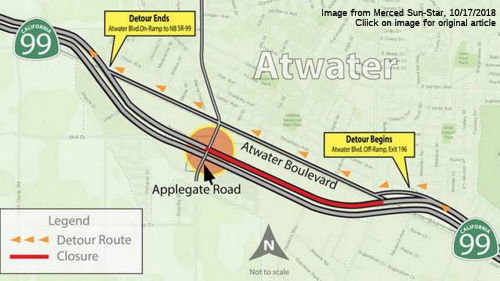 In October 2018, the Applegate Road-Route 99
overpass (MER 22.756) and the northbound fast lane of the highway were
shut down after a big rig struck the overpass, according to California
Highway Patrol. The highway lane was expected to reopen, but Caltrans
later determined the collision caused structural damage and the overpass
was shut down indefinitely. The bridge is the main connector between the
major shopping center south of the highway and the cities of Atwater and
Winton to the north. What happened was that in late September, a 2013
Kenworth big rig towing an excavator on a flatbed trailer was traveling
north in the left lane on Route 99, underneath the Applegate Road
overpass, when the excavator’s boom arm struck the underside of the
bridge, according to the California Highway Patrol. Four girders on the
overpass were damaged. Three are expected to be patched up while the state
of the fourth one remains unclear. The overpass is safe to pass under, but
officials wanted to keep additional weight off the top of it. Caltrans
does not expect to close down any other surface streets or highway lanes
while the overpass is repaired, and repairs have been expedited. The
expectation is that it will be closed at least a month. There have been
previous crashes in the area. The southbound Applegate Road exit was
closed for about a month and re-opened in June 2017 after a fiery crash
involving tanker truck driven by Kamkyo Ramon Gnotsavath, 57, was headed
to the Arco gas station on Bell Lane on May 23, 2017, to deliver 8,600
gallons of gasoline, officials said. The man died in the crash. A similar,
but not deadly, crash happened in June 2018 in the same area. A 2009
Freightliner being driven by 48-year-old Oakland resident Steve Edward
Anderson was traveling south on Route 99 when he attempted to take the
Applegate Road off-ramp at about 7:10 a.m. June 12, CHP said. Emergency
repairs began in mid-October, with work being performed by R.A. Nemetz
Construction, a contractor based in Galt. Repairing the damaged fourth
girder gets underway Saturday, Oct. 27, 2018. The excavator clipped the
underside of the overpass, damaging four girders. Three girders will be
patched with concrete, Caltrans said in a news release, but the fourth
requires reconstruction that will take several weeks to complete.
In October 2018, the Applegate Road-Route 99
overpass (MER 22.756) and the northbound fast lane of the highway were
shut down after a big rig struck the overpass, according to California
Highway Patrol. The highway lane was expected to reopen, but Caltrans
later determined the collision caused structural damage and the overpass
was shut down indefinitely. The bridge is the main connector between the
major shopping center south of the highway and the cities of Atwater and
Winton to the north. What happened was that in late September, a 2013
Kenworth big rig towing an excavator on a flatbed trailer was traveling
north in the left lane on Route 99, underneath the Applegate Road
overpass, when the excavator’s boom arm struck the underside of the
bridge, according to the California Highway Patrol. Four girders on the
overpass were damaged. Three are expected to be patched up while the state
of the fourth one remains unclear. The overpass is safe to pass under, but
officials wanted to keep additional weight off the top of it. Caltrans
does not expect to close down any other surface streets or highway lanes
while the overpass is repaired, and repairs have been expedited. The
expectation is that it will be closed at least a month. There have been
previous crashes in the area. The southbound Applegate Road exit was
closed for about a month and re-opened in June 2017 after a fiery crash
involving tanker truck driven by Kamkyo Ramon Gnotsavath, 57, was headed
to the Arco gas station on Bell Lane on May 23, 2017, to deliver 8,600
gallons of gasoline, officials said. The man died in the crash. A similar,
but not deadly, crash happened in June 2018 in the same area. A 2009
Freightliner being driven by 48-year-old Oakland resident Steve Edward
Anderson was traveling south on Route 99 when he attempted to take the
Applegate Road off-ramp at about 7:10 a.m. June 12, CHP said. Emergency
repairs began in mid-October, with work being performed by R.A. Nemetz
Construction, a contractor based in Galt. Repairing the damaged fourth
girder gets underway Saturday, Oct. 27, 2018. The excavator clipped the
underside of the overpass, damaging four girders. Three girders will be
patched with concrete, Caltrans said in a news release, but the fourth
requires reconstruction that will take several weeks to complete.
(Source: Merced Sun Star, 10/11/2018; MercedSun
Star 10/12/2018; Merced Sun-Star 10/17/2018)
In November 2018, it was reported that the Applegate
Road bridge over Route 99 reopened to traffic in mid-November 2018, more
than five weeks after a truck’s cargo slammed into it and caused
structural damage.
(Source: Merced Sun-Star, 11/20/2018)
In June 2013, the CTC authorized relinquishment of right of way in the city of Atwater along Route 99 on Olive Avenue (~ MER 23.734), consisting of collateral facilities.
In October 2009, the CTC approved relinquishment of right of way in the county of Merced along Route 99 from 0.3 mile east of Arena Way (~ MER 26.351) to the Livingston city limits, consisting of reconstructed county roads and frontage roads. They also approved relinquishment of right of way in the city of Livingston along Route 99 from the east Livingston city limits to 0.05 miles east of Hammett Avenue, consisting of a frontage road.
Livingston Widening (MER 28.2/R37.3)
In December 2014, the CTC approved for future consideration of funding a project on a portion of Route 99 near the town of Livingston in Merced County that will widen an 8.5-mile portion of Route 99 (between MER PM 28.8 and PM 37.3) from four lanes to six lanes within the median. The project is not fully funded. The project is programmed in the 2014 State Transportation Improvement Program. The total estimated cost is $81,820,000 for capital and support. Construction is estimated to begin in Fiscal Year 2017-18. The scope, as described for the preferred alternative, is consistent with the project scope programmed by the Commission in the 2014 State Transportation Improvement Program.
The 2018 STIP, approved at the CTC March 2018 meeting, appears to allocate $5,500K in construction funding in FY21-22 for PPNO 0161A, In Livingston, from 0.8 mile south of Hammatt Avenue to Merced/Stanislaus county line. Widen freeway from two lanes to three lanes in the northbound direction only. PM MER 28.2/R37.3. The SB widening is PPNO 0161B, and does not appear in the 2018 STIP.
In October 2018, the CTC approved amended the Route 99
Bond Program by including the Livingston Widening Northbound Project (PPNO
0161A). The proposed Livingston Widening Northbound Project will widen the
freeway from two lanes to three lanes in the northbound direction of Route 99 from Hammatt Avenue to the Merced/Stanislaus County Line.
(October 2018 CTC Agenda Item 4.17)
In March 2019, the CTC approved an allocation of
$43,080,000 for the multi-funded State-Administered Senate Bill 1 (SB 1)
Trade Corridors Enhancement Program (TCEP)/State Transportation
Improvement Program (STIP)/Proposition 1B Route 99 Program Livingston
Widening Northbound project (PPNO 0161A), on the State Highway System, in
Merced County, programmed in Fiscal Year 2021-22. Details: Merced
10-MER-99 28.2/R37.3. PPNO 10-0161A. Proj ID 1014000167. Livingston
Widening Northbound. Route 99 In Livingston, from 0.8 mile
south of Hammatt Avenue to the Merced/Stanislaus county line. Widen
freeway from two lanes to three lanes in the northbound direction only.
(Future Consideration of Funding approved under Resolution E-14-60;
December 2014. IIP savings of $34,500,000 to be returned to Interregional
share balance. RIP savings of $186,000 to be returned to Merced County
share balance. Non-proportional spending for construction to allow for the
expenditure of Route 99 and TCEP funds before expenditure of RIP funds.
ALLOCATION IS CONTINGENT UPON APPROVAL OF A BUDGET REVISION BY THE
DEPARTMENT OF FINANCE.
(Source: March 2019 CTC Minutes Agenda Item 2.5s.(8))
In March 2020, the CTC approved the 2020 STIP, which
continued the programmed funding for PPNO 0161A "Livingston Widening
Northbound (RIP)(TCEP)" of $5,314K in FY20-21. It also included PPNO
0161A, Livingston 6-lane widening, northbound (IIP)(TCEP), in the
Interregional portion of the STIP with no change in programming: $2,860K
in prior year funding; as well as PPNO 0161B Livingston 6-lane widening,
southbound, with 5,000K in prior year, and 33,950K in FY21-22.
(Source: March 2020 CTC Agenda, Item 4.7, 2020 STIP
Adopted 3/25/2020)
In December 2021, the CTC approved an allocation of
$35,468,000 for the State-Administered STIP Livingston Widening Southbound
project (PPNO 0161B), on the State Highway System, in Merced County.
Project description: 10-Mer-99 28.2/R37.3. PPNO 10-0161B; ProjID
1014000168; EA 0Q122. Livingston Widening Southbound. Route 99
In Livingston, from 0.8 mile south of Hammatt Avenue to Merced/Stanislau
county line. Widen freeway from two lanes to three lanes in the southbound
direction only. Allocation: CON ENG $4,500,000; CONST $30,968,000
($29,450,000 programmed). (CONST increase of $1,518,000 to come from
interregional share balance.) (Future consideration of funding approved
under Resolution E-14-60; December 2014.)
(Source: December 2021 CTC Agenda, Agenda Item
2.5c.(1))
In August 2022, it was reported that Caltrans has
officially began the process of widening Route 99 going southbound between
Turlock and Livingston, adding a third lane for a nine-mile stretch. The
southbound expansion is the second phase of a greater project that saw a
similar highway widening going northbound from Livingston to Turlock,
which took place from November 2019 to April 2021. The southbound widening
will be completed within a similar timeframe, beginning in August 2022
with an expected finish in January 2024. Funds for the southbound project
construction were designated in the 2018 State Transportation Improvement
Program. The Caltrans said the project is necessary to address freeway
capacity restrictions, which is anticipated to reach or exceed existing
capacity on or before 2030. Additionally, Caltrans has viewed the nine
mile stretch as a bottleneck for drivers as it is the only stretch of
freeway between Turlock and Livingston that is currently two lanes wide.
(Source: Turlock Journal, 8/6/2022)
In December 2012, the CTC vacated right of way in the county of Merced along Route 99 at North Pacific Avenue (~ MER R30.699, near Livingston), consisting of superseded highway right of way no longer needed for State highway purposes.
In March 2006, the CTC considered relinquishment of right of way in the city of Merced between Sycamore Avenue and Early Dawn Road ( 10-Mer-99-PM 32.3/36.2), consisting of reconstructed and relocated county roads, frontage roads and cul-de-sacs.
The SAFETEA-LU act, enacted in August 2005 as the reauthorization of TEA-21, provided the following expenditures on or near this route:
In August 2011, the CTC approved $72,611,000 in SHOPP funding for repairs in and near Modesto, from the Merced County Line to the San Joaquin County Line , that will rehabilitate 148 lane miles of roadway to improve the ride quality and prevent further deterioration of the road surface.
Route 99 Turlock Fulkerth Interchange (10-STA-99 R4.1/R4.9)
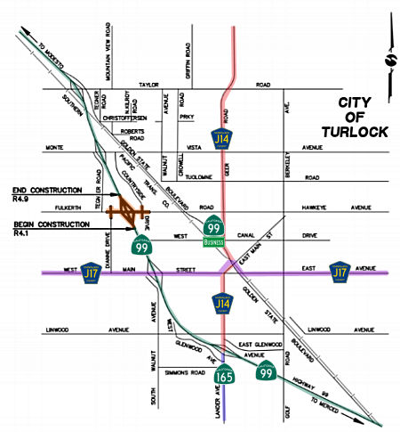 In September 2018, there was an update on the Route 99 Turlock Fulkerth Interchange project.
The project will widen Fulkerth Road to accommodate six to seven lanes,
with five-foot wide shoulders and six-foot wide sidewalks; Widen the
northbound (NB) off-ramp to provide two lanes where it connects to
Fulkerth; Reconstruct the NB on-ramp to provide two mixed-flow lanes and
one future high occupancy vehicle (HOV) preferential lane with provisions
for future ramp metering; Realign the southbound (SB) off-ramp to improve
intersection spacing and provide three lanes where it connects to
Fulkerth; Realign the SB on-ramp to improve intersection spacing, and
provide two mixed- flow lanes and one future HOV preferential lane with
provisions for future ramp metering; Align Dianne Drive with existing Auto
Mall Drive, eliminating the offset local street intersection on Fulkerth
Road; Signalize the Dianne Drive/Fulkerth Road, Route 99 SB ramps/Fulkerth
Road and Route 99 NB ramps/Fulkerth Road intersections. This project
includes $5.5 million from the Local Partnership Program, part of Senate
Bill 1. The project will provide a more efficient interchange at Route 99
and Fulkerth Road, while also improving surface streets adjacent to the
interchange. The on-ramps also will be made ready for future ramp
metering. This project also positively responds to the city’s
Northwest Triangle Specific Plan and the Westside Industrial Specific
Plan. Construction is scheduled to start in October 2018 and the project
is scheduled to be completed December 2019.
In September 2018, there was an update on the Route 99 Turlock Fulkerth Interchange project.
The project will widen Fulkerth Road to accommodate six to seven lanes,
with five-foot wide shoulders and six-foot wide sidewalks; Widen the
northbound (NB) off-ramp to provide two lanes where it connects to
Fulkerth; Reconstruct the NB on-ramp to provide two mixed-flow lanes and
one future high occupancy vehicle (HOV) preferential lane with provisions
for future ramp metering; Realign the southbound (SB) off-ramp to improve
intersection spacing and provide three lanes where it connects to
Fulkerth; Realign the SB on-ramp to improve intersection spacing, and
provide two mixed- flow lanes and one future HOV preferential lane with
provisions for future ramp metering; Align Dianne Drive with existing Auto
Mall Drive, eliminating the offset local street intersection on Fulkerth
Road; Signalize the Dianne Drive/Fulkerth Road, Route 99 SB ramps/Fulkerth
Road and Route 99 NB ramps/Fulkerth Road intersections. This project
includes $5.5 million from the Local Partnership Program, part of Senate
Bill 1. The project will provide a more efficient interchange at Route 99
and Fulkerth Road, while also improving surface streets adjacent to the
interchange. The on-ramps also will be made ready for future ramp
metering. This project also positively responds to the city’s
Northwest Triangle Specific Plan and the Westside Industrial Specific
Plan. Construction is scheduled to start in October 2018 and the project
is scheduled to be completed December 2019.
(Source: Route 99 Fulkerth Interchange Project Page, 11/2018)
In January 2019, the CTC approved an allocation of
$5,510,000 for the locally-administered Route 99/Fulkerth Road Interchange
Improvements Senate Bill 1 (SB 1) Local Partnership Program (LPP) –
Formulaic and Competitive project (PPNO 3414), on the State Highway
System, in Stanislaus County. Route 99 In Stanislaus County at the
interchange of Route 99 and Fulkerth Road in the City of Turlock ramp
widening, modifications, and signalization.
(Source: January 2019 CTC Minutes Agenda Item 2.5s.(2a))
Mitchell/Service/Route 99 Interchange (10-Sta-99, PM 9.5/11.4)
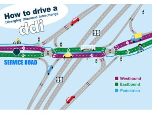 In July 2015, it was reported that Caltrans is acting
slowly to approve a "diverging diamond" design for the future
Mitchell/Service/Route 99 interchange (~ STA R10.167). Caltrans officials
from District 10, which covers Ceres, like the design but it is being
viewed cautiously at state headquarters. If approved, this would be the
first Caltrans approval of the unique "diverging diamond" road design.
Additionally, the proposed interchange - centered on Service Road - would
be closer than the one-mile minimum distance from the next closest
interchange that Caltrans prefers. If Caltrans has misgivings about the
distance to the downtown interchange, Ceres may have to go with a less
desired alternative. The alternative design would seek to correct the way
Mitchell's southbound off-ramp conflicts with the southbound on-ramp but
it would do nothing to improve southbound freeway access to the west side
of Route 99 where the city hopes to see industrial parks built. If
Caltrans decides to try the design, Ceres could be the first city in
California to use it, especially if the project starts in 2020. Ceres
officials like the design, believing it's the best to handle traffic
volumes into 2040, said Wells. That's why triple left-hand turn lanes are
being designed for the intersection of Service and Mitchell roads. That
equates to five or six times to movement potential than exists today. The
design also takes into consideration the limitations caused by the
railroad tracks that run parallel just to the west of Route 99. The
diverging diamond design would allow full freeway access at Service Road.
The interchange design would also eliminate the current way motorists get
off southbound Route 99 at Mitchell Road. Motorists now must stop at the
end of the off-ramp and wait for clearance of southbound Mitchell Road
on-ramp traffic coming from the left. The only freeway access at Mitchell
Road to remain would be the southbound on-ramp and the northbound freeway
on-ramp. In a typical diamond interchange, a vehicle travelling westbound
over a freeway overpass would be on the north side while eastbound
motorists would be on the south side of the overpass. The diverging
diamond flips that, mostly because it allows for less traffic conflicts,
better and increased traffic flows and better access to the freeway.
Proper signage are a "critical component" in keeping motorists from
becoming confused about movement. The diverging diamond is considered
safer than other designs because it results in a slower traffic movement -
about 25-35 mph - and affords less chance for serious accidents. If the
city gets its way, construction would start in about five years and be
completed in 2023. The project depends on the passage of a countywide
half-cent transportation tax in 2016 which would fund approximately $31
million of the project. The city also can use $9 million in Public
Facility Fees collected on new development and would need to obtain state
and federal grants. There is also the possibility of issuing bonds to
finance.
In July 2015, it was reported that Caltrans is acting
slowly to approve a "diverging diamond" design for the future
Mitchell/Service/Route 99 interchange (~ STA R10.167). Caltrans officials
from District 10, which covers Ceres, like the design but it is being
viewed cautiously at state headquarters. If approved, this would be the
first Caltrans approval of the unique "diverging diamond" road design.
Additionally, the proposed interchange - centered on Service Road - would
be closer than the one-mile minimum distance from the next closest
interchange that Caltrans prefers. If Caltrans has misgivings about the
distance to the downtown interchange, Ceres may have to go with a less
desired alternative. The alternative design would seek to correct the way
Mitchell's southbound off-ramp conflicts with the southbound on-ramp but
it would do nothing to improve southbound freeway access to the west side
of Route 99 where the city hopes to see industrial parks built. If
Caltrans decides to try the design, Ceres could be the first city in
California to use it, especially if the project starts in 2020. Ceres
officials like the design, believing it's the best to handle traffic
volumes into 2040, said Wells. That's why triple left-hand turn lanes are
being designed for the intersection of Service and Mitchell roads. That
equates to five or six times to movement potential than exists today. The
design also takes into consideration the limitations caused by the
railroad tracks that run parallel just to the west of Route 99. The
diverging diamond design would allow full freeway access at Service Road.
The interchange design would also eliminate the current way motorists get
off southbound Route 99 at Mitchell Road. Motorists now must stop at the
end of the off-ramp and wait for clearance of southbound Mitchell Road
on-ramp traffic coming from the left. The only freeway access at Mitchell
Road to remain would be the southbound on-ramp and the northbound freeway
on-ramp. In a typical diamond interchange, a vehicle travelling westbound
over a freeway overpass would be on the north side while eastbound
motorists would be on the south side of the overpass. The diverging
diamond flips that, mostly because it allows for less traffic conflicts,
better and increased traffic flows and better access to the freeway.
Proper signage are a "critical component" in keeping motorists from
becoming confused about movement. The diverging diamond is considered
safer than other designs because it results in a slower traffic movement -
about 25-35 mph - and affords less chance for serious accidents. If the
city gets its way, construction would start in about five years and be
completed in 2023. The project depends on the passage of a countywide
half-cent transportation tax in 2016 which would fund approximately $31
million of the project. The city also can use $9 million in Public
Facility Fees collected on new development and would need to obtain state
and federal grants. There is also the possibility of issuing bonds to
finance.
(Source: Ceres Courier, 7/29/2015)
In March 2019, the CTC approved for future
consideration of funding a project located on Route 99 in the city of
Ceres in Stanislaus County (10-Sta-99, PM 9.5/11.4). The project proposes
to improve the Route 99/Service Road/Michell Road Interchange. The
proposed project will provide capacity to accommodate projected increase
in traffic volume. The project proposes to address the issues of
congestion, circulation and access associated with the existing
interchange during peak traffic periods. This project is currently
programmed in the 2018 Federal Transportation Improvement Program for
approximately $83.0 million with anticipated funds coming from the local
Redevelopment Agency, Public Facility Fees and Stanislaus County local
Measure L. Construction is estimated to begin in 2021.
(Source: March 2019 CTC Minutes, Agenda Item 2.2c.(1))
In January 2020, it was reported that Ceres is moving
into detailed design for a new Route 99 interchange near the south end of
town. The $133.5 million project would include a full interchange at
Service Road, which now has a bridge across the highway but does not
directly connect with it. The work also would involve upgrades to the
current Mitchell Road interchange, about half a mile to the south. The
Stanislaus Council of Governments voted 1/15/2020 to allot $6.59 million
toward the design. StanCOG oversees transportation planning in the county.
The project could be done by 2027 if funding comes together, City Manager
Toby Wells said last week. The city plans to pay for it with fees on
developers, redevelopment money and Measure L, a countywide sales tax
approved by voters in 2016.
(Source: Modesto Bee, 1/22/2020)
In May 2020, an update was provided on this project,
which is still in the planning stages. News of the state’s
prediction of a $54 billion budget shortfall for the 2020-21 fiscal year
has officials worrying about the prospects for funding. The council took
action in May 2019 to formally request Caltrans to approve creating a new
connection between Route 99 at Service Road. Caltrans signed on to connect
the planned interchange at Service Road to the freeway. Currently the
project is in its plans, specifications and estimates (PS&E) stage
– work being performed by Nolte Associates (now NV5). The firm has
been involved with the project from its inception. The focus of the work
is to protect all the ultimate right-of-way and best position the city to
pursue the funding necessary to construct the project. The PS&E should
be completed in June 2020 at a cost of $3.89 million. Funds for the design
work are coming from Measure L, the half-cent sales tax approved by voters
in November 2016. Approximately $7 million have been spent to get the
project to the current status. The Stanislaus Council of Governments, or
StanCOG, committed to use $30.74 million of Measure L tax revenue on the
Ceres interchange. More funding is expected from SB 1, the state’s
gas tax increase and car registration fee hike that survived a repeal
effort in November 2018. The entire project is expected to cost somewhere
in the area of $95 million. The city has the option of a design-build
procurement and will have to see how to fund the remaining 35 percent of
plans. The new interchange design would eliminate the way motorists exit
southbound Route 99 at Mitchell Road. The southbound Mitchell Road on-ramp
and Route 99 off-ramps cross each other, so drivers coming off the freeway
must stop and wait for a break in southbound Mitchell Road traffic headed
toward the on-ramp. Under the diverging diamond design, the only freeway
access at Mitchell Road to remain would be the southbound on-ramp and the
northbound freeway on-ramp. The interchange at Service Road will also
include a diverging diamond design. Normally a vehicle travelling
westbound over a freeway overpass would be on the north side while
eastbound motorists would be on the south side of the overpass. The
diverging diamond flips that circulation pattern to allow for less traffic
conflicts, better and increased traffic flow and better access to the
freeway. The city has been planning a new Service/Mitchell/Route 99
interchange since 1997. The original design called for couplets –
where Mitchell Road was southbound and Moore Road was the northbound
movement – but it was scrapped for an expensive 2002 design plan
which Caltrans ultimately rejected in 2009. The city dusted off the
interchange project in 2011 and consulted Caltrans about better designs.
The design calls for the Brickit Court industrial area to be accessible by
Don Pedro Road and not the current route via El Camino Avenue.
(Source: Ceres Courier, 5/13/2020)
In June 2022, it was reported that the City of Ceres is
hoping that construction work will begin by 2025 on the new
Mitchell/Service Road Route 99 interchange, which is still in the design
and planning stages. The city has been planning a new
Service/Mitchell/Route 99 interchange since 1997 and the longer the design
and red tape takes the higher the costs of construction, now estimated to
cost $150 million to $180 million due to inflation. The project consists
of modifications to Mitchell Road’s connection to the freeway and a
complete tear-down and rebuild of the overpass at Service Road with new
connections. Currently Service Road has no freeway access but that will
change with a new northbound onramp and a southbound onramp. The new
interchange design will eliminate the dangerous way motorists exit
southbound Route 99 at Mitchell Road. The southbound Mitchell Road on-ramp
and Route 99 off-ramp cross each other, so drivers coming off the freeway
must stop and wait for a break in southbound Mitchell Road traffic headed
toward the on-ramp. Under the new design, southbound freeway motorists
will be able to exit at Service Road and no longer at Mitchell Road.
However, the existing southbound onramp at Mitchell Road will remain.
Caltrans has approved a “diverging diamond” design for the new
freeway overpass at Service Road. The design requires a different
footprint and the need for property acquisitions for the rights-of-way.
Approximately 14 properties must be purchased for rights-of-way. They
include properties containing dilapidated housing along El Camino Avenue
north of Service Road as well as some commercial properties on Brickit
Court. Right-of-way acquisition will likely take 12 to 18 months and
require a consultant to manage the process and could cost $11 million. The
city has only purchased two of the needed properties. The city spent
$388,960 to buy 2.16 acres at 3912 El Camino Avenue located northwest of
Brickit Court. The property is mostly needed for a future storm drainage
basin and a portion of a future northbound onramp at Service Road. In
December 2015 the city purchased a 2.46-acre parcel at 2807 E. Service
Road for $700,000. The design calls for the Brickit Court industrial area
to be accessible by Don Pedro Road and not the current route via El Camino
Avenue. As of June 2022, the project is in its Plans, Specifications and
Estimates (PS&E) stage – work being performed by the consulting
firm of NV5 (formerly Nolte Associates). The firm has been involved with
the project since its inception. The focus of the work is to protect all
the ultimate right-of-way and best position the city to pursue the funding
necessary to construct the project. The PS&E is approximately 65
percent completed and should be at 95 percent by the end of October 2022.
Over $7 million have been spent to get the project to the current status.
The city doesn’t have anywhere near the funds required to build the
project and will seek out multiple grants and federal funds.
(Source: Ceres Courier, 6/29/2022)
In April 2012, the CTC authorized relinquishment of right of way in the city of Ceres along Route 99 near the Whitmore Avenue Over-Crossing (~ STA R11.906), consisting of collateral facilities.
Hatch Road Auxiliary Lane Project (10-Sta-99, PM 13.4/13.8)
The following project was included in the final adopted 2018 SHOPP in March 2018: PPNO 0037. 10-Stanislaus-99 R13.4/R13.8. Route 99 Near Ceres and Modesto, in the northbound direction from Hatch Road onramp to S. 9th Street offramp. Construct auxiliary lane. Begin Con: 11/16/2020. Total Project Cost: $8,699K.
In December 2018, the CTC approved for future
consideration of funding a project located on Route 99 near Modesto in
Stanislaus County. The project proposes to construct a northbound
auxiliary lane between the Hatch Road/Joyce Avenue on-ramp and the South
9th Street off-ramp. The project also proposes to widen shoulders, and
replace and construct new soundwalls. The proposed project is currently
estimated to cost approximately $8.7 million. This project is fully funded
and currently programmed in the 2018 SHOPP for approximately $8.7 million
which includes Construction (capital and support) and Right of Way
(capital and support). Construction is estimated to begin in 2021. The
scope, as described for the preferred alternative, is consistent with the
project scope programmed by the Commission in the 2018 SHOPP.
(Source: December 2018 CTC Minutes, Agenda Item 2.2c(1))
In August 2020, the CTC approved the following
financial allocation for construction and construction support:
$5,658,000. 10-Sta-99 PM R13.4/R13.8. PPNO 10-0037. ProjID 1015000003 EA
0L870. Route 99 Near Ceres and Modesto, in the northbound direction from
Hatch Road onramp to South 9th Street offramp. Outcome/Output: Construct
northbound auxiliary lane to improve highway operations and mobility.
(Source: August 2020 CTC Agenda, Agenda Item
2.5b.(1) #49)
In April 2017, it was reported that Caltrans is preparing a project that
will install an Automated Warning System on northbound Route 99, allowing
better monitoring of local traffic and weather conditions to benefit
motorists and businesses. Time-saving information will be relayed through
a Changeable Message Sign (CMS) and Caltrans' QuickMap (http://quickmap.dot.ca.gov), which provides near real-time updates on traffic congestion, accidents and
other factors that threaten to delay motorists. The project is scheduled
to start in April 2017 and finish in July 2017. Work on Route 99 will be
performed from Kansas Avenue (~ STA R16.821) to Standiford Avenue/Beckwith
Road (~ STA R20.253), near Ceres and Modesto. The project will install
electronic monitoring equipment along this 2.5-mile stretch of Route 99,
enhancing a critical commercial corridor in the Valley. More than 140,000
vehicles, including 20,000 big rigs, travel Route 99 in Stanislaus County
on a typical day - compared to 91,000 vehicles in 2000 - a 54 percent
increase in 17 years. Caltrans will install a Changeable Message Sign
(CMS) just north of Kansas Avenue, as well as several Traffic Monitoring
Stations (TMS), a closed circuit television camera and a weather
information system on northbound Route 99. The technology will help
quickly identify traffic and weather-related issues, allowing Caltrans to
provide automated updates that will save motorists time and money on their
highway journey. The monitoring stations include traffic loops that will
be installed beneath the roadway, allowing Caltrans' Traffic Monitoring
Center to remotely monitor the speed and volume of traffic. The changeable
sign will automatically alert drivers to congested conditions ahead, and
it can broadcast alternative routes and weather conditions, as well. The
camera will help identify roadway incidents, congestion and other
incidents that could impact the flow of traffic.
(Source: Ceres Courier, 4/12/2017)
In April 2023, it was reported that Modesto will spend about $7 million
examining possible upgrades to the busy Standiford Avenue interchange (~
STA R20.213) on Route 99. The City Council voted for a contract with WMH
Corp., an engineering firm based in San Jose. It will study traffic
patterns, design options and environmental impacts over the next 39
months. Modesto has funding to cover this step, but it is still seeking
money for detailed engineering and construction. The cost was roughly
estimated at $108 million in 2020 by the Stanislaus Council of
Governments, which oversees transportation funding in the county. The
contract with WMH will help pin this down, along with the timeline and
funding sources. A similar process is planned for the Briggsmore Avenue
interchange, a mile to the south. It has even more traffic than
Standiford, and especially convoluted routes for drivers. StanCOG pegged
its cost at $118 million in 2020. The Standiford interchange dates to the
1970s, when the Vintage Faire Mall was the only major retail complex in
northwest Modesto. The bridge over 99 had one lane each way to accommodate
the moderate traffic back then. That area later drew big-box retailers,
housing and other traffic generators on and near Standiford and Sisk Road.
The Standiford bridge got more lanes to handle the load. The interchange
was constructed incrementally in response to changing demands and
available funding over time, according to a staff report to the council.
The rebuilt interchange would have to mesh with the 99 widening envisioned
by the California Department of Transportation. The highway now has three
traffic lanes each way but could add a fourth at some point. The engineers
will have a tight space to work in. Sisk is a highway frontage road, with
four lanes of sometimes heavy traffic. An electrical substation sits on
the northwest corner of Standiford and Sisk. The interchange crosses over
freight tracks with frequent trains. Altamont Corridor Express passenger
service could arrive as soon as late 2026. The Standiford redo happens
amid a changing philosophy about road planning. Engineers for decades have
emphasized motor vehicles over people on foot or bicycle. Caltrans now
seeks “complete streets” in the projects it funds. The public
will be able to comment as WMH studies the options, including different
stages of the environmental study. The contract is for $6.45 million, but
it could grow by $645,000 if additional services are needed.
(Source: $$ Modesto Bee, 4/4/2023)
Route 132 Expressway West (10-Sta-99, PM 15.7/17.5)
☞ Note: Most of the information on this project may be found in the Status section on Route 132, as the only impact on Route 99 is the interchange.
In July 2017, it was reported that Stanislaus County
Board of Supervisors was expected to give its support to rebuilding the
Route 99 SB off-ramp at Kansas Avenue(~ STA R16.821) as part of the Route 132 Expressway project, which will serve as a new, roughly 4-mile route
for Route 132 from Dakota Avenue in west Modesto to Needham Street near
downtown. Supervisors are being asked to recommend to the California
Department of Transportation that the Kansas off-ramp be rebuilt as part
of the project. The alternative is to build a southbound Route 99 off-ramp
at Needham Street. But a staff report says rebuilding the Kansas off-ramp
has the support of Caltrans, Modesto, the county and the Stanislaus
Council of Governments, a regional transportation planning agency.
Building the Needham off-ramp would entail closing the Kansas on- and
off-ramps, which would harm nearby businesses; whereas rebuilding the
Kansas off-ramp will not require any of the businesses to move.
construction on the expressway should start in spring 2019, with its
opening in late 2020. The expressway is phase one of the project to
realign a portion of Route 132 and get it off Maze Boulevard. Phase two
would turn the two-lane expressway into a four-lane highway at an
estimated cost of $132 million. Phase one is being paid for by local,
state and federal funding. Phase one suffered a recent hit when the
California Transportation Commission took about $11 million in
construction funding away, but local officials were able to get more than
$3 million of that back. Local officials will work to get the roughly $8
million from the state or federal government. Phase one also could look to
Measure L — the transportation sales tax voters approved in November
— for all or part of the roughly $8 million.
(Source: Modesto Bee, 7/17/2017)
In May 2018, the CTC received and accepted the
environmental report for, and approved for future consideration of
funding, the following project: Route 132 and Route 99 in Stanislaus
County. Construct a new four-lane freeway along an adopted route from near
Dakota Avenue to Route 99 in the city of Modesto. (PPNO 0944M)
(10-Sta-132, PM 11.0/15.0, 10-Sta-99, PM 15.7/17.5). This project is
located on Route 132 in the city of Modesto in Stanislaus County. The
project proposes to construct a four lane freeway/expressway. Improvements
to the Route 132/Route 99 interchange are also included in the proposed
project. The purpose and need of the proposed project are to improve
regional and interregional circulation within Modesto and Stanislaus
Counties. The proposed project would also relieve traffic congestion along
Route 132. The proposed project is estimated to cost $214.0 million over
two phases. The project is not fully funded and is currently programmed
for $46.4 million in the State Transportation Improvement Program (STIP),
Federal and Local programs. The project is estimated to begin construction
in 2019. The scope, as described for the preferred alternative, is
consistent with the project scope programmed by the Commission in the 2018
STIP.
(Source: CTC Minutes, May 2018 Agenda Item 2.2c(12))
In August 2018, Scott Parker (Sparker) noted on AAroads: The Route 99/Route 132 trumpet interchange was laid out and planned in the mid-50's to serve as the southern "split" point for I-5, originally slated to follow US 99 in the San Joaquin Valley, into I-5W, which would follow Route 132 over to Route 33 and then take a new-terrain route to near Altamont, at which point it would follow US 50 into Oakland; and I-5E (i.e., what became I-580), simply following US 99 north through Stockton and Sacramento. Although the switch to the Westside alignment had been done by 1958, the basic plans for the interchange weren't changed -- but only the preliminary grading was done; no structures were built, and the corridor was only cleared for about a mile west of Route 99. Currently the route has, after 53 years of existence as a partially cleared corridor, been budgeted for construction; it'll be a 4-lane Route 132 facility immediately west of Route 99 but shrinking to a 2-lane undivided expressway after that. It's the only limited-access state highway project in the area since the Turlock bypass was opened in 1973. Instead of freeways, both state and local jurisdictions have concentrated on developing a series of arterials serving the ever-expanding housing area north and east of central Modesto; projects concerning Route 108 (the effective "spine" of the housing expansion) are part & parcel of that regional effort.
In March 2020, it was reported that there are concerns
about the soil being removed for the Route 132 / Route 99 projects. The
issue is the disposal plan for tons of dirt contaminated with toxic
barium, the dirt coming from the former FMC chemical plant, which was
situated north of Kansas Avenue near Route 99. Crews are removing 400,000
cubic yards of dirt to create a sunken expressway on the new route, which
was acquired by the state more than 60 years ago. The two lanes and a
median will pass under Carpenter Road and Rosemore Avenue. The contractor
will soon provide a bypass route for traffic while the Carpenter Road
bridge is constructed. Rosemore will be closed for bridge construction.
When asked about dust control, the city said a certain amount of dust and
haze are natural for the Northern San Joaquin Valley due to agriculture
and windy conditions. City spokesman Thomas Reeves said water is being
sprayed at the construction sites to prevent dust clouds. The excavation
and containment project for the three mounds of barium-tainted soil is
proceeding with a strict regimen of dust control and monitoring to keep
people from being exposed to toxins, the city said. Barium is a dangerous
heavy metal that can affect the lungs, heart and other organs. The state
has said the concentrations of barium, strontium and lead in the soil are
too low to cause cancer and other health problems. Crews are moving a
stockpile of contaminated dirt on the east side of Route 99, near the
south end of Franklin Street. The dirt trucked from that berm is placed
over two mounds in the expressway route on either side of Emerald Avenue.
The berm west of Emerald is about 900 feet long. The tainted soil will be
encapsulated in concrete behind retaining walls and bridge abutments along
the expressway or underneath the pavement. The tainted dirt placed in
“non-traveled” areas will be covered by native soil, the city
said. For years, local residents and critics of the remediation plan had
hoped the contaminated berms would be hauled away from Modesto. That would
cost an estimated $20 million. The contaminated soil operation is
monitored by closed-circuit cameras watched by Caltrans and the state
Department of Toxic Substances Control. “Material handling protocols
are in place to ensure that all personnel working on the project and the
surrounding community are protected from exposure,” the city said.
Workers at the stockpiles are wearing personal protection badges that
detect exposure to barium. Truck beds carrying the tainted dirt are
covered at all times. Decontamination measures are used to make sure
barium is not spread outside the construction zone. Those procedures
include wiping down equipment, tires and workers’ shoes. In
addition, an independent consultant is monitoring the work at the
stockpiles. So far, no barium has been detected above the safe levels
established by the state, the city said.
(Source: Modesto Bee, 3/3/2020)
In Mid-September 2022, Caltrans, the City of Modesto,
and Stanislaus County celebrated completion of Phase One of the Route 132
West Project, a new 3.5-mile expressway alignment to relieve traffic
congestion along Route 132 (Maze Boulevard) between Route 99 and Dakota
Avenue. The purpose of the project is to improve regional and
interregional circulation, relieve traffic congestion along existing Route 132/Maze Boulevard, and improve operations by creating a four-lane
freeway/expressway on a new alignment connecting Route 132 with the City
of Modesto. The project is being built in two phases. It begins at the
intersection of existing Route 132/Maze Boulevard and North Dakota Avenue,
and extends north along North Dakota Avenue for roughly a half mile. South
of Kansas Avenue, at the proposed intersection with North Dakota Avenue,
the new alignment extends east to Route 99 at the Needham Street
overcrossing. The project would also make improvements to the 5th Street
and 6th Street connections to Route 99 including restriping and the
reduction of conflict points between Route 99 and 5th and 6th Streets.
(Source: District 10 on FB, 9/15/2022)
In March 2019, it was reported that the CTC allocated $2.2 million for an
estimated $2.7 million project that will rehabilitate and improve the
structure and increase the vertical clearance of the bridge on the Route 99 overcrossing at Wilson Way (STA R017.71, Bridge 29-0306L/R) in the City
of Stockton in San Joaquin County.
(Source: Sierra Sun Times, 3/25/2019)
Beckwith Road Ramps (10-Sta-99 R18.0/R19.7)
In October 2015, the CTC approved the following SHOPP funding: 10-Sta-99 R18.0/R19.7 Route 99 In Modesto, from north of West Modesto Overhead to south of Beckwith Road. Construct acceleration and deceleration lanes at southbound ramps to improve safety. PAED: 09/01/2015 R/W: 04/01/2016 RTL: 05/01/2016 CCA: 12/01/2017 Costs: $7K (R/W); $4,200K (C) Completion FY15/16 Support costs: PA & ED $645K; PS & E $181K; RW Sup $29K; Con Sup $424K; Total $1,279K
In August 2016, the CTC approved $7,923,000 in funding on Route 99 in Modesto (R18.0/R19.7), from 0.1 mile north of West Modesto Overhead to 0.5 mile south of Beckwith Road. Outcome/Output: Reconstruct off-ramp and construct acceleration and deceleration lanes at southbound ramps to improve safety and reduce the number and severity of collisions.
Route 99/Pelandale Avenue Interchange (~ STA R21.666)
In August 2012, the CTC approved for future consideration of funding a project that County will reconstruct the Route 99/Pelandale Avenue Interchange (~ STA R21.666) in the city of Modesto. The project is not fully funded. The project is programmed in the 2012 State Transportation Improvement Program for Right of Way only. The project is anticipated to be programmed with Route 99 bond program savings for Construction and Construction Support. The total estimated cost is $57,356,000 for capital and support. Construction is estimated to begin in Fiscal Year 2012-13. The scope, as described for the preferred alternative, is consistent with the project scope programmed in the 2012 State Transportation Improvement Program. A copy of the MND has been provided to Commission staff. The project will result in no significant impacts to the environment. Avoidance and minimization measures would reduce any potential effects on noise and paleontological resources. These measures include noise abatement along Route 99 south of Pelandale Avenue and the preparation of a paleontological Mitigation Plan.
In October 2017, the CTC authorized the following financial allocation: 10-Sta-99 R21/R22.1: On Route 99 in Stanislaus County: Pelandale Avenue Interchange. In Modesto and Salida, from 0.75 mile south of Pelandale Avenue to 0.35 mile north of Pelandale Avenue. Reconstruct the Route 99/Pelandale interchange and construct auxiliary lane. $4,336,000
In March 2020, the CTC authorized relinquishment of
right of way, consisting of collateral facilities, in the city of
Modesto (City) along Route 99 on Salida Boulevard and Pelandale
Avenue (10-Sta-99-PM R21.4/R22.0). In May 2020, the CTC authorized
relinquishment of right of way in the same segment, this time consisting
of collateral facilities, in the county of Stanislaus (County)
along Route 99 on Pelandale Avenue and Sisk Road (10-Sta-99-PM
R21.4/R22.0).
(Source March 2020 CTC Agenda, Agenda Item 2.3c; May 2020 CTC Agenda, Agenda Item
2.3c)
Route 219 - Kiernan Ave Interchange (~ STA R22.515)
In June 2012, the CTC approved for future consideration of funding a project that will reconstruct the interchange at Route 219 (Kiernan Avenue), including the overcrossing, on- and off-ramps, and certain roadway segments within the interchange limits. The project is not fully funded. The total estimated project cost is $46,548,000 for capital and support. The project is anticipated to be programmed with Route 99 bond program savings in Fiscal Year 2012-13. Depending on the availability of funding, construction is estimated to begin in Fiscal Year 2012-13.
In January 2013, the CTC approved de-allocation of $3,699,000 in Proposition 1B State Route 99 (SR99) bond funds for the Kiernan Avenue Interchange project (PPNO 9463) in Stanislaus County, thereby reducing the original SR99 construction capital allocation of $37,100,000 to $33,401,000 to reflect contract award savings.
Stanislaus River Bridge № 29-0013 (10-SJ-99, PM 0.0/0.5, 10-Sta-99, PM 24.3/24.8)
In January 2017, the CTC approved for future consideration of funding a project that will replace a portion of the southbound Stanislaus River Bridge № 29-0013 on Route 99 near the city of Ripon (10-SJ-99, PM 0.0/0.5, 10-Sta-99, PM 24.3/24.8). The project is programmed in the 2016 State Highway Operation and Protection Program. The total programmed amount is $23,563,000 for capital and support. Construction is estimated to begin in Fiscal Year 2019-20. The scope, as described for the preferred alternative, is consistent with the project scope programmed by the Commission in the 2016 State Highway Operation and Protection Program.
In March 2020, the CTC approved an additional
$3,867,000 in Capital and Support cost, PPNO 0321 on Route 99, in San
Joaquin County. This ongoing construction contract project will remove and
replace a portion of the 1,220 foot long Route 99 Stanislaus River Bridge,
in the City of Ripon in San Joaquin County. The project will be removing
the 117 year old, 206 foot long, two-lane wide, two concrete arch-span
segment; which now is a part of southbound lanes in the southwest corner
of the larger structure. The current full bridge was constructed in
various segments, as Route 99 was expanded over the decades, around these
two original arch-spans. This project will replace the arch-spans due to
structural deficiencies and life span. There are three piers that support
this 117 year old structure segment, which is located in the river channel
and therefore require in-water work to complete the substructure
foundation replacement. There is a limited work period due to migration in
the river. Finally, access to the project site is also constrained by both
a Union Pacific Railroad (UPRR) trestle and a buried Kinder Morgan high
pressure jet fuel pipeline, located downstream and adjacent to the
project. The project has a temporary construction easement which
encroaches on both of these facilities, and the contract requires that
these external agencies approve operations and coordination of all work
affecting those facilities. The winter of 2019 was an extremely wet year
in California, receiving over 200 percent of the average snowpack per the
Department of Water Resources (DWR). This resulted in water levels in the
Stanislaus River fluctuating significantly during the beginning stages of
the construction project; providing shorter windows to complete the
preparation work necessary to work adjacent to the UPRR railroad. This
affected the UPRR approval process, causing the remaining in-water work to
be delayed about 6 weeks until July 22, 2019, limiting time to complete
the in-water work during the permit window in 2019. Also, shortly after
the in-water work was ready to begin, it was found that the Army Corps of
Engineers (ACOE) Nationwide 404 Permit (Permit) requirement for river
traffic, due to the Goodwin Dam’s continued release of high river
flows, was determined to be outside the scope in the contract documents.
The Permit and the United States Coast Guard (USCG) verbally defined that
there is to be minimal impact to river navigation, or there needs to be an
approved written river closure plan. At the time the project was
developed, water flow was minimal and decreasing annually due to the
drought. It did not appear to the project team that water flow levels
would have significant impact on river navigation during construction,
except during a two week demolition window, so no formal closure plan was
developed. As a result, the contractor had set up to build a temporary
trestle over the river for access and demolition activities.
Unfortunately, in 2019, high river flows from the release of water from
Goodwin Dam would result in limited vertical clearance for river
navigation if the trestle was put into place. As a result, a change was
developed to provide for these various restrictions. However, the
additional delay related to the UPRR reviews, USCG public notice
coordination, and extended high flow days provided insufficient time to
complete the in-water work by the permit restriction of October 15th and
the Department suspended the contract for the winter.
(Source: March 2020 CTC Agenda, Agenda Item
2.5e.(5))
In September 2005, the CTC considered relinquishment of right of way in the County of San Joaquin, at Olive Avenue (near Modesto) and Austin Road (~SJ 4.877), consisting of reconstructed and relocated county roads, frontage roads and cul-de-sacs.
Route 99/Route 120 Connector Improvements near Manteca (10-SJ-99 PM 3.1/6.2)
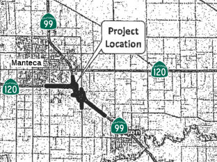 The 2018 STIP, approved at the CTC March 2018 meeting, appears to allocate $13.550 for PPNO 3162, the Route 99/Route 120 Connector near Manteca (~ SJ 5.722)
In October 2019, the CTC had on its agenda for future
consideration of funding the following project: 10-SJ-99 PM 3.1/6.2 Route 99 and Route 120 in San Joaquin County. Construct roadway and interchange
improvements on Route 99 at Route 120 near the city of Manteca in San
Joaquin County. (PPNO 3162, Proj ID 1016000038 EA 1E740). This project is
located near the eastern/southeastern border of the City of Manteca on
Route 99/Route 120 in San Joaquin County. This project proposes to
construct improvements to the Route 99/Route 120 interchange. The project
is divided into three phases. The purpose is to reduce traffic congestion
and improve operations of Route 99 with the Route 120 and Austin Road
interchanges. Phase 1A of this project is currently programmed in the 2018
STIP with $13.6 million in Regional Improvement Program funds and $3.4
million in Senate Bill 1 Local Partnership Program funds for Construction
(capital and support) and Right-of-Way (capital and support). Phase 1A is
currently not fully funded, but it is a candidate for the 2020 SHOPP. The
total cost estimate for this project is $115.3 million which includes all
three phases. Construction is estimated to begin in Fiscal Year 2020-21.
The scope, as described for the preferred alternative, is consistent with
the project scope programmed by the Commission in the 2018 STIP.
(Source: October 2019 CTC Agenda, Agenda Item
2.2c.(1))
Also in October 2019, the CTC approved an allocation of
$3,408,000 for the SB 1 Local Partnership Program (LPP) (Formulaic) Route 99/Route 120 Connector Project (PPNO 3162). Add new auxiliary lanes,
upgrade existing bridges, relocate an at-grade railroad crossing,
intersections, construct additional connector lanes, ramp upgrades, and
new signals/lighting. Due to funding constraints, the Project will be
constructed in three phases. The initial phase will construct a second
lane on the eastbound Route 120 to southbound Route 99 connector and
auxiliary lanes, which will require the partial closure of the Austin
Road/Route 99 interchange. The second phase will widen the connector from
northbound Route 99 to westbound Route 120 to two lanes an widen Route 120
from four lanes to six between Main Street and SR 99. The third phase will
construct braided ramps to the Austin Road interchange to restore full
access.
(Source: October 2019 CTC Agenda, Agenda Item
2.5s.(1))
In February 2020, this project was programmed in the
STIP Regional Improvement Program (RIP) for $10,142,000 in Construction
($4,942,000 in Construction Capital and $5,200,000 in Construction
Support) for allocation in Fiscal Year 2021-22.
(Source: January 2024 CTC Agenda, Agenda Item 2.5s.(4))
The 2020 STIP, approved at the March 2020 CTC meeting,
made a number of adjustments related to this:
(Source: March 2020 CTC Agenda, Item 4.7, 2020 STIP
Adopted 3/25/2020)
| PPNO | Project | Prior | 20-21 | 21-22 | 22-23 | 23-24 | 24-25 |
| 3162 | Rt 99/120 Connector | 3,408K | 10,142K | 0 | 0 | 0 | 0 |
| 3162 | Rt 99/120 Connector | -3,408K | -10,142K | 0 | 0 | 0 | 0 |
| 3162A | Rt 99/120 Connector, Phase 1A | 3,408K | 0 | 10,142K | 0 | 0 | 0 |
| 3162B | Rt 99/120 Connector, Phase 1B | 0 | 0 | 0 | 0 | 7,893K | 0 |
In May 2020, this project’s financial
contribution from the State Highway Operation and Protection Program
(SHOPP), project EA 1E74U/PPNO 3126A, was programmed for $28,736,000 in
Construction Capital for allocation in 2021-22.
(Source: January 2024 CTC Agenda, Agenda Item 2.5s.(4))
In June 2022, the Draft 2022 Program Environmental
Impact Report for the Regional Transportation Plan/Sustainable Communities
Strategy (RTP/SCS) was released. It included the following projects:
(Source: Draft Program EIR for the RTP/SCS, June 2022)
In June 2022, the project received a 20-month
allocation time extension for the Construction phase.
(Source: January 2024 CTC Agenda, Agenda Item 2.5s.(4))
In May 2023, the CTC received notice of a forthcoming
STIP amendment that would amend the 2022 STIP to move $13,125,00 in
Construction (CON) Regional Improvement Program (RIP) funds from Fiscal
Year 2023-24 to 2025-26 for the Route 99/Route 120 Connector Project Phase
1B (PPNO 3162B), in San Joaquin County, per STIP Guidelines. The Route 99/Route 120 Connector Project Phase 1B (PPNO 3162B) project will improve
the connector from northbound Route 120 by widening the connector to two
lanes and adding a merge/weave lane on westbound Route 120 between Route 99 and the Main Street Interchange. The eastbound Route 120 to northbound
Route 99 connector will be replaced with a new structure to allow the
existing Route 99/Route 120 separation structure to be converted to two
westbound lanes. This project is critical to the region, as it will
relieve traffic congestion and improve operation of Route 99 with the
Route 120 and Austin Road Interchanges. Unfortunately, the Phase 1A
component of the project has experienced delays associated with Union
Pacific Rail Road and Pacific Gas and Electric, as many new utility
relocations have been requested by these agencies. These approvals are
required for securing Right of Way certification. The Phase 1B component
of the project is scheduled to begin construction immediately upon the
completion of Phase 1A. As such, an amendment to the programmed CON funds
for Phase 1B is needed. This request is to move the project’s CON
RIP funding from 2023-24 to 2025-26.
(Source: May 2023 CTC Agenda, Agenda Item 2.1b.(21))
In November 2023, the Engineer’s Estimate (EE)
reflected the need for $11,119,000 in Construction Capital (125.0 percent
over the programmed amount) and $5,200,000 in Construction Support (no
increase over the programmed amount) from the STIP-RIP, $1,349,000
in Construction Capital from the LPP (Formulaic), and $32,079,000 in
Construction Capital from the SHOPP. The additional funds are
requested to come from San Joaquin Council of Governments’ (SJCOG)
STIP-RIP shares. The remaining increase will be funded by regionally
administered funds. SJCOG plans to advertise the project in February
2024 and begin construction in May 2024. Construction is planned for
two construction seasons with a duration of 355 working days.
(Source: January 2024 CTC Agenda, Agenda Item 2.5s.(4))
In January 2024, the CTC approved the following
construction phase allocation, which represents a 125% increase in
Construction: $17,668,000. 10-SJ-99 3.1/6.2. PPNO 10-3162A; ProjID
1016000038; EA 1M290. SR 99/120 Connector Project Phase 1A. In
and near the City of Manteca, widen the eastbound Route 120 to southbound
Route 99 connector ramp from one-lane to two lanes; Remove the Austin Road
overcrossing and replace with a new 4-lane structure spanning Route 99 and
UPRR; add a new connecting road from Austin Road to East Woodward Avenue
and Moffat Boulevard and modify the existing UPRR gated crossing at East
Woodward Avenue to conform to the new connector road; modify the existing
northbound Austin Road exit ramp to conform to the higher overcrossing
profile grade; Temporarily close the Austin Road northbound entrance and
southbound exit ramps; resulting in a partial interchange. CEQA - MND,
08/22/2019; Re-validation 11/17/2023. NEPA - CE, 09/25/2019; Re-validation
11/17/2023. Right of Way Certification: 11/15/2023. Future consideration
of funding approved under Resolution E-20-15; March 2020. Time extension
for LPP-F FY 22-23 CONST expires on June 30, 2024 and for RIP FY 21-22
expires on February 29, 2024. Concurrent allocation for SHOPP Project EA
10-1E74U FCO for $32,079,000 under Resolution FP-23-64. Contribution
from other sources: $3,229,000. Additional $6,177,000 increase will be
funded with future SJCOG RIP shares. ALLOCATION IS CONTINGENT UPON THE
APPROVAL OF A BUDGET REVISION BY THE DEPARTMENT OF FINANCE. The
Construction Capital is greater than the programmed amount due to
modifications to the original structure design and adjustments made to the
EE to reflect recent bids for electrical items. A portion of this project
will replace the existing 2-lane Austin Road OC with a 4-lane OC.
The estimate from the Project Report (PR) for the Austin Road OC was
$16,920,000, which included mobilization and contingency. The
current Construction Capital estimate (without mobilization and 10 percent
contingency) is now $22,072,000 or approximately 30 percent higher. Most
of this cost is in the structure footings which required longer and
stiffer piles due to the potentially liquifiable soils compared to what
was estimated before the geotechnical investigations were completed. In
addition, based on comments from the Department’s Structures office,
the project team has redesigned the structure to use a three-column bent
rather than the four-column bent shown in the 65 percent plans. The
roadway costs are currently estimated at $19,930,000, which is
approximately $6,403,000 higher than the PR estimate. The majority
of this increase is attributable to the electrical items, which increased
by a total of $4,055,000. This includes the addition of items to
interconnect the City’s signals, to modify the fiber optic line
installed by the Department in 2018, and to modify the Department’s
traffic count stations that were not anticipated in the PR. The
estimate for the four new traffic signals was approximately $600,000
higher than the PR estimate due to the higher costs of electrical
materials and the new Woodward/Atherton signal is more expensive that the
three-legged signal on the old roadway that bifurcated the Betschart
parcel. Approximately $1,748,000 is attributed to several minor quantity
adjustments to roadway items prior to Ready to List. The remaining cost
changes are attributable to the unit cost adjustments and result in a need
of an additional $6,177,000. The increases will be funded from
future STIP RIP shares, financial contribution from the SHOPP, and
regionally administered funds.
(Source: January 2024 CTC Agenda, Agenda Item 2.5s.(4))
Widening Manteca to Stockton (SJ PM 4.9 to SJ PM R22.488)
The Arch Road interchange in San Joaquin County (groundbreaking: 6/17/02) will be the first SPUI in the central valley and the third in California. It was completed in 2005.
The SAFETEA-LU act, enacted in August 2005 as the reauthorization of TEA-21, provided the following expenditures on or near this route:
![[Stockton]](maps/099-stockton.jpg) In March 2009, the CTC approved for
future consideration of funding a project in San Joaquin County will widen
the highway from four to six lanes in each direction and construct roadway
improvements between Arch Road and Route 4 in the city of Stockton. The
project is programmed in the State Route 99 Bond Program and the 2008
State Transportation Improvement Program, and includes local funds. The
total estimated cost is $250,500,000, capital and support. Construction is
estimated to begin in Fiscal Year 2011-12.
In March 2009, the CTC approved for
future consideration of funding a project in San Joaquin County will widen
the highway from four to six lanes in each direction and construct roadway
improvements between Arch Road and Route 4 in the city of Stockton. The
project is programmed in the State Route 99 Bond Program and the 2008
State Transportation Improvement Program, and includes local funds. The
total estimated cost is $250,500,000, capital and support. Construction is
estimated to begin in Fiscal Year 2011-12.
In July 2010, the CTC approved for future consideration of funding a project that will widen a portion of Route 99 from four lanes to six lanes in the cities of Manteca and Stockton, between S Austin Road (SJ PM 4.9) and Arch Road (SJ PM R22.488). The project is programmed in the Route 99 Bond Program and the 2010 State Transportation Improvement Program. Construction is estimated to begin in Fiscal Year 2011-12. Total estimated project cost is $250,000,000 for capital and support.
It was also reported that the Route 99 Widening in Manteca and San Joaquin project is programmed in the Route 99 Bond Program. The project consists of widening Route 99 from four lanes to six lanes from Route 120 west to 0.4 mile north of Arch Road, and reconstructing the French Camp Road and Lathrop Road interchanges. The baseline project limits would leave a short section of 4-lane highway, from Austin Road to Route 120 west, between two sections of 6-lane highway. It was proposed to extend the southern limit of the project by 0.4 mile to Austin Road to allow for a continuous 6-lane highway. The approved environmental document covers the proposed project limits. It was also noted that according to the baseline schedule, this project would begin construction within three months of the adjacent Route 99 (South Stockton) Widening project (PPNO 7668). This could limit the number of bidders available to perform the work, which could result in higher bids, and increase construction-related traffic impacts. It was proposed to split the Route 99 Widening in Manteca and San Joaquin project into five projects, an environmental only project (Route 99 Widening in Manteca and San Joaquin (Environmental Only), PPNO 7634), a widening project (Route 99 Widening in Manteca and San Joaquin Phase 1, PPNO 7634A), a French Camp Road interchange project (Route 99 Widening in Manteca and San Joaquin Phase 2, PPNO 7634B), a Lathrop Road interchange project (Route 99 Widening in Manteca and San Joaquin Phase 3, PPNO 7634C), and a mitigation planting project (Route 99 Widening in Manteca and San Joaquin Mitigation Planting, PPNO 7634D). The environmental phase has already been completed. The combined cost of the five projects equals the baseline cost of the original project.
In December 2011, it was reported that the state has released $50 million to start the first phase of a $250 million project to widen Route 99 between south Stockton and Manteca. The project will go out to bid in January, and construction could begin as early as spring 2012. The project will widen the freeway to six lanes by building new lanes in the existing median and adding soundwalls and auxiliary lanes. The 8.3-mile stretch of road heads south from Arch Road to Austin Road, south of the Route 120 interchange. Landscaping also is planned. The next two phases to build interchanges along the way will follow, possibly for completion in 2015. The $250 million for the project comes from San Joaquin County's half-cent Measure K sales tax, bond funds approved by state voters in 2006 and other state funds. A second $250 million project to widen Route 99 also is expected to begin construction in 2012. That project would build new interchanges and widen the freeway from four to six lanes between the Crosstown Freeway and Arch Road in south Stockton.
In Spring 2012, Caltrans put out for bid reconstruction of the segment from 0.8 Mile south of the French Camp Road undercrossing(~SJ 11.498) to 0.3 mile north of the Arch Road Undercrossing. This is a complete rebuild of that segment, with the old freeway, in some parts, being many feet below the new roadway. This also eliminates a bridge with open concrete railing plus some older signage.
In January 2013, it was reported that the CTC approved $10,485,000 for a Prop. 1B project that includes widening lanes from 4 to 6 lanes from just north of Arch Road to just south of Route 4.
In February 2013, it was reported that construction was
soon to start to widen Route 99 through south Stockton, a $214 million
project intended to relieve traffic congestion and create a safer and more
modern roadway. Construction work will bring temporary delays and detours
until the project's expected completion date in 2015. Drivers will see
some permanent changes taking shape, with the replacement or addition of
interchanges in places and the removal of on- and off-ramps in others.
Spanning from near the Crosstown Freeway south to Arch-Airport Road, it is
part of another widening project under way that will widen Route 99 from
four to six lanes through Manteca. The project replaces access points at
the same level as the highway, instead using interchanges with more room
to speed up to merge with traffic. Originally slated as a $250 million
project, the south-Stockton widening came in from bidding at $214 million.
It is paid for with $132 million from Proposition 1B, a transportation
bond approved by voters statewide in 2006. It also receives $47.5 million
from Measure K, the 1/2-cent sales tax approved by voters in San Joaquin
County. Those changes required more space, which means Caltrans needed to
acquire property. It amounts to all or part of 133 parcels of land. Most
of these were already bought from the property owners.
(Source: Recordnet.com, 2/21/13)
It will be constructed in stages, starting with building a new interchange at Golden Gate Avenue. That will be ready for use before work crews close the interchange at Dr. Martin Luther King Jr. Boulevard.
In July 2015, it was reported that Caltrans had
completed the Route 99 widening project that started in Stockton and ran
all the way to the Yosemite exit at Route 120. Along with the widening of
Route 99 to six lanes, Lathrop and French Camp Roads are now more user
friendly. The new on- and off-ramps encourage drivers to get off the road
and spend money in Manteca. The project was funded by two voter measures
-- $89 million came from a 2006 voter-approved transportation bond. The
remaining $36 million came from a local 1 cent sales tax. The project also
constructed a sound barrier wall for residents and a concrete median to
improve safety.
(Source: Fox 40 News, 7/16/2015)
In November 2016, it was reported that the 4-mile
expansion of Route 99 from the Crosstown Freeway near Hwy. 4 to Arch Road
in Stockton was complete. Caltrans and the San Joaquin Council of
Governments built an interchange, over crossings and upgraded the Mariposa
Road Interchange. It was a $214 million project, where $132 million came
from a transportation bond approved by voters in 2006, and $47 million
came from local Measure K. The daily commute hours saved will be 4,722
hours.
(Source: KCRA 3, 11/2/2016)
Operational Improvements: Austin Rd to Rte 120 (10-San Joaquin-99 PM 4.6/5.3)
The 2020 SHOPP, approved in May 2020, included the
following NEW Mobility item of interest: 10-San Joaquin-99 PM 4.6/5.3 PPNO
3126A Proj ID 1018000159 EA 1E74U. Route 99 in Manteca, from south of
Austin Road to south of Route 99/Route 120 Separation. Operational
improvements by lengthening and reconstructing overcrossing and railroad
overhead, eliminate one interchange, and upgrade safety barriers.
Financial Contribution Only (FCO) to San Joaquin Council of Governments
(SJCOG) for construction implementation. Programmed in FY21-22, with
construction scheduled to start at the end of February 2022. Total project
cost is $29,019K, with $28,736K being capital (const and right of way) and
$283K being support (engineering, environmental, etc.).
(Source: 2020 Approved SHOPP a/o May 2020)
In August 2021, the CTC approved the following
preconstruction allocation: 10-SJ-99 4.6/5.3. PPNO 10-3126A; ProjID
1018000159; EA 1E74U. Route 99 In Manteca, from south of Austin Road to
south of Route 99/Route 120 Separation. Operational improvements by
lengthening and reconstructing overcrossing and railroad overhead,
eliminate one interchange, and upgrade safety barriers. Financial
Contribution Only (FCO) to San Joaquin Council of Governments (SJCOG) for
construction implementation. (Future consideration of funding approved
under Resolution E-19-86; October 2019.) (Two month time extension for
PS&E approved under Waiver 21-59; June 2021.) Allocation: PS&E
$20,000.
(Source: August 2021 CTC Agenda, Agenda Item
2.5b.(2a) #20)
In January 2024, the CTC approved the following
construction-phase SHOPP allocation: $32,079,000. 10-SJ-99 4.6/5.3. PPNO
10-3126A; ProjID 1018000159; EA 1E74U. Route 99 In Manteca, from 0.3 mile
south of Austin Road to 0.2 mile south of Route 99/Route 120 Separation. Outcome/Output:
Make operational improvements by lengthening and reconstructing
overcrossing and railroad overhead, eliminate one interchange, and upgrade
safety barriers. Financial Contribution Only (FCO) to San Joaquin Council
of Governments (SJCOG) for construction implementation. CEQA - MND,
8/22/2019; Re-validation 11/17/2023. NEPA - CE, 9/25/2019; Re-validation
11/17/2023. Twenty month allocation time extension for CONST approved
under Waiver 22-73; June 2022. Related non-SHOPP allocation for EA
1M290/PPNO 10-3162A under Resolutions FP-23-69 and LPP-A-2324-27; January
2024. SHOPP project 10-1E74U/PPNO 3126A combined with non-SHOPP project EA
1M290/PPNO 3162A for construction under EA 1M290/Project ID 1016000038.
Pre-Construction Phase: Budgeted (Actual, if different):
PA&ED $263,000 ($164,731); PS&E $20,000 ($19,512);
R/W Sup $0 ($0). Construction Phase - Programmed (Allocation,
if different): CONST $28,736,000 ($32,079,000).
(Source: January 2024 CTC Agenda, Agenda Item 2.5b.(1) #18)
In August 2021, the CTC authorized relinquishment of 5 segments of
right-of-way, consisting of collateral facilities in the county of San
Joaquin along Route 99 on Lathrop Road (10-SJ-99-PM 7.4/11.9), under the
terms and conditions as stated in the Freeway Agreement dated November 9,
2010. The County, by letter dated February 19, 2021, agreed to waive the
90-day notice requirement and accept title upon relinquishment by the
State. In May 2022, the CTC amended Relinquishment Resolution R-4073,
adopted by the Commission on August 18, 2021 and recorded at the San
Joaquin County Recorder as Document 2021-166392 on October 4, 2021, which
contained an incorrect reference within the legal description. Resolution
R-4073 relinquishes right of way, consisting of collateral facilities, in
the county of San Joaquin along Route 99 on Lathrop Road, under the terms
and conditions as stated in the Freeway Agreement dated November 9, 2010.
The County, by letter dated February 19, 2021, agreed to waive the 90-day
notice requirement and accept title upon relinquishment by the State.
(Source: August 2021 CTC Agenda, Agenda Item 2.3c;
May 2022 CTC Agenda, Agenda Item 2.3c)
In March 2017, the CTC authorized relinquishment of right of way in the city of Manteca along Route 99 along Main Street and West Lathrop Road (10-SJ-99 PM 8.8/9.2), consisting of collateral facilities. The City, by freeway agreement dated August 3, 2010 agreed to accept title upon relinquishment by the State. The 90-day notice period expired January 15, 2017.
In October 2019, the CTC authorized relinquishment of right of way in the
county of San Joaquin (County) along Route 99 between West Lathrop Road
and Brunswick Road (10-SJ-99-PM 9.5/9.8), consisting of collateral
facilities. The County by freeway agreement dated November 9, 2010, agreed
to accept the relinquishment and by letter signed August 5, 2019, agreed
to waive the 90-day notice requirement and accept title upon
relinquishment by the State.
(Source: October 2019 CTC Agenda, Agenda Item 2.3c)
In April 2012, the CTC authorized relinquishment of right of way in the city of Stockton along Route 99 on the 99 Frontage Road (Kingsley Road), ~ SJ 14.344, north of Arch Road, consisting of a collateral facility.
In August 2021, the CTC authorized relinquishment of right-of-way,
consisting of collateral facilities in the county of San Joaquin along
Route 99 on Clark Drive (10-SJ-99-PM 15.6), under the terms and conditions
as stated in the Freeway Agreement dated March 3, 2009. The County, by
letter dated February 19, 2021, agreed to waive the 90- day notice
requirement and accept title upon relinquishment by the State.
(Source: August 2021 CTC Agenda, Agenda Item 2.3c)
Mariposa Road (~ SJ 16.727) / Charter Way (~SJ 17.538)
2007 CMIA. A project on Route 99 in Stockton (widening and operational improvements) in San Joaquin ($50M) was submitted to the Corridor Mobility Improvement Account (CMIA) for funding. It was not recommended for funding. Neither was the Central Galt Interchange. In May 2008, there was a Draft EIR in circulation regarding this that proposed four alternatives:
Farmington Road Vertical Clearance (10-SJ-99 PM 16.8/17.6)
In March 2020, the CTC approved the following financial
allocation:10-SJ-99 PM 16.8/17.6. PPNO 3148. ProjID 1013000265. EA 0X310.
On Route 99 and Route 4: In Stockton, at Route 4/Route 99 Separation
(Farmington Road) Bridge № 29-0155. Outcome/Output: Replace
structure to provide standard vertical clearance, reconstruct approaching
roadway, including approach slabs, curb ramps, sidewalk, guardrail,
fencing, signs, drainage, landscaping, and electrical elements. Financial
allocation: $10,832,000.
(Source: March 2020 CTC Agenda, Agenda Item
2.5b.(1) #26)
Martin Luther King Jr Interchange - Stockton (~ SJ 18.034)
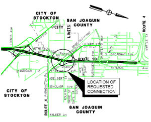 In May 2009, the CTC approved a public road connection to
Route 99 at Dr. Martin Luther King Jr. Boulevard, in the county of San
Joaquin. The San Joaquin Council of Governments (SJCOG), in conjunction
with the City of Stockton, San Joaquin County, and the Department, are
proposing to construct a new interchange at Route 99 and Dr. Martin Luther
King Jr. Boulevard in San Joaquin County, near the junction with Route 4.
Within the project limits, Route 99 is a four-lane freeway with four
closely spaced interchanges. Traffic in the project area is highly
congested during peak hours, with high demand from both regional and local
traffic. These high traffic volumes, coupled with localized traffic
weaving on Route 99, cause traffic to slow down to below acceptable
levels. The proposed project is expected to improve the safety and
operations of Route 99. In order for this project to proceed, Commission
approval is required for the new public road connection to Route 99 at Dr.
Martin Luther King Jr. Boulevard. This two mile section of Route 99 is a
four-lane divided freeway with 12-foot wide travel lanes, 8-foot wide
outside shoulders, and 5-foot wide inside shoulders. The median width
varies from 36 feet to 26 feet between Mariposa Road and the Crosstown
Freeway, Route 4 west of Route 99. Route 4 is not continuous through this
area. Ramp connectors from Route 99 to Route 4 east of Route 99 are
provided at Farmington Road interchange. Proposed improvements will
include freeway widening to six-lanes, reconstruction of structures to
accommodate a future eight-lane facility, construction of auxiliary lanes
in both directions from Mariposa Road interchange to the Crosstown
Freeway, modification and reconstruction of the Mariposa Road interchange,
removal of the Farmington Road interchange, removal of the Charter Way
interchange, and construction of the new Dr. Martin Luther King Jr.
Boulevard interchange. Golden Gate Avenue will be realigned and renamed
Dr. Martin Luther King Jr. Boulevard. In addition, approximately 0.2 miles
of Route 4, east of Route 99, will be reconstructed to align with Dr.
Martin Luther King Jr. Boulevard at the new interchange, hence providing
route continuity between Route 99 and Route 4.
In May 2009, the CTC approved a public road connection to
Route 99 at Dr. Martin Luther King Jr. Boulevard, in the county of San
Joaquin. The San Joaquin Council of Governments (SJCOG), in conjunction
with the City of Stockton, San Joaquin County, and the Department, are
proposing to construct a new interchange at Route 99 and Dr. Martin Luther
King Jr. Boulevard in San Joaquin County, near the junction with Route 4.
Within the project limits, Route 99 is a four-lane freeway with four
closely spaced interchanges. Traffic in the project area is highly
congested during peak hours, with high demand from both regional and local
traffic. These high traffic volumes, coupled with localized traffic
weaving on Route 99, cause traffic to slow down to below acceptable
levels. The proposed project is expected to improve the safety and
operations of Route 99. In order for this project to proceed, Commission
approval is required for the new public road connection to Route 99 at Dr.
Martin Luther King Jr. Boulevard. This two mile section of Route 99 is a
four-lane divided freeway with 12-foot wide travel lanes, 8-foot wide
outside shoulders, and 5-foot wide inside shoulders. The median width
varies from 36 feet to 26 feet between Mariposa Road and the Crosstown
Freeway, Route 4 west of Route 99. Route 4 is not continuous through this
area. Ramp connectors from Route 99 to Route 4 east of Route 99 are
provided at Farmington Road interchange. Proposed improvements will
include freeway widening to six-lanes, reconstruction of structures to
accommodate a future eight-lane facility, construction of auxiliary lanes
in both directions from Mariposa Road interchange to the Crosstown
Freeway, modification and reconstruction of the Mariposa Road interchange,
removal of the Farmington Road interchange, removal of the Charter Way
interchange, and construction of the new Dr. Martin Luther King Jr.
Boulevard interchange. Golden Gate Avenue will be realigned and renamed
Dr. Martin Luther King Jr. Boulevard. In addition, approximately 0.2 miles
of Route 4, east of Route 99, will be reconstructed to align with Dr.
Martin Luther King Jr. Boulevard at the new interchange, hence providing
route continuity between Route 99 and Route 4.
Route 26/Route 99 Separation № 29-0142 (~ 10-SJ-099 19.305)
The 2020 SHOPP, approved in May 2020, included the
following Bridge Preservation item of interest (carried over from the 2018
SHOPP): 10-San Joaquin-26 PM 1.1 PPNO 3169 Proj ID 1016000032 EA 1F170.
Route 26 near Stockton, at Route 26/Route 99 Separation No. 29-0142 (PM
1.11). Establish standard vertical clearance. Programmed in FY20-21, with
construction scheduled to start in July 2021. Total project cost is
$17,202K, with $11,543K being capital (const and right of way) and $5,659K
being support (engineering, environmental, etc.).
(Source: 2020 Approved SHOPP a/o May 2020)
In June 2021, the CTC approved the following
allocation: $11,735,000. 10-SJ-26 1.11. PPNO 10-3169; ProjID 1016000032;
EA 1F170. Route 26 Near Stockton, at Route 26/99 Separation No. 29-0142.
Outcome/Output: Establish standard vertical clearance by raising the
existing structure, reconstruct bridge approaches, widen shoulders, and
construct sidewalks. Allocation (includes savings and other sources): CON
ENG $3,221,000 CONST $11,536,000.
(Source: June 2021 CTC Agenda, Agenda Item 2.5b.(1)
#29)
In March 2022, it was reported that Caltrans was
preparing to begin a project that will improve vertical clearance for
freight vehicles by replacing the Route 26/Fremont Street Overcrossing of
Route 99 (~ 10-SJ-099 19.305 / 10-SJ-026 1.11) in Stockton. Completion is
expected in late 2022. This bridge replacement project was awarded to AB
Construction Inc. (Berkeley, CA), who will perform the bridge replacement
work required to provide the 16-feet, six-inch standard vertical clearance
in order to eliminate high-load bridge strikes. The existing structure
currently has low clearance and has experienced damaged bridge girders due
to several high-load strikes. The project will also improve mobility and
promote active transportation by installing new sidewalks with overhead
lighting on the new overcrossing. Beginning in March 2022, motorist
traffic over the Route 26/Fremont Street Overcrossing will be reduced to
one-lane in both the eastbound and westbound directions while the old
bridge is demolished, and the new overcrossing is constructed. The bridge
replacement will be done in alternating phases, beginning with the north
side of the bridge (westbound direction.) Once this work is complete, work
with shift to the south side of the bridge (eastbound direction)
(Source: Caltrans District 10 on FB, 3/3/2022)
In September 2011, the CTC approved relinquishment of right of way in the county of San Joaquin along Route 99 from 0.4 mile south of East Hammer Lane to 0.3 mile north of East Hammer Lane (near Stockton), consisting of collateral facilities.
In December 2011, the CTC authorized relinquishment of right of way in the city of Stockton along Route 99 on Hammer Lane (~ SJ 22.964) between Moreland Streets and Maranatha Drive, consisting of collateral facilities.
In March 2013, the CTC relinquished right of way in the county of San Joaquin along Route 99 at Hammer Lane (~ SJ 22.964), consisting of collateral facilities inadvertently omitted from a previous relinquishment.
North of Stockton to Sacramento
In May 2011, the CTC approved relinquishment of right of way in the county of San Joaquin along Route 99 from the Calaveras River Overcrossing (~ SJ 21.814) near Stockton to 0.2 mile north thereof.
In June 2012, the CTC relinquished right of way in the county of San Joaquin along Route 99 on Cherokee and Waterloo Roads (near Stockton), consisting of collateral facilities inadvertently omitted from a previous relinquishment (~ SJ 20.843).
In August 2011, the CTC approved $2,504,000 in SHOPP funding for repairs near Lodi, from 0.5 mile north of Harney Lane (~ SJ 28.481) to East Pine Street, that will rehabilitate 4.5 lane miles of pavement to improve safety and ride quality.
Victor Road Bridge Clearance (10-SJ-99, PM 30.7/31.3)
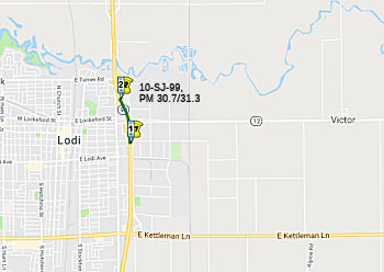 In January 2018, the CTC amended the SHOPP as follows:
10-SJ-99 30.9/31.3: Route 99 In Lodi, from south of Route 12 (Victor Road)
to south of Turner Road. Realign northbound onramp,
In January 2018, the CTC amended the SHOPP as follows:
10-SJ-99 30.9/31.3: Route 99 In Lodi, from south of Route 12 (Victor Road)
to south of Turner Road. Realign northbound onramp, lower mainline
ramp vertical profile for increased vertical clearance increase
bridge vertical clearance, and construct auxiliary lane. Updated
total cost: $15,803,000.
(Source: CTC Agenda, January 2018, Agenda Item 2.1a(1))
In October 2018, the CTC authorized for future
consideration of funding the following project for which a Mitigated
Negative Declaration (MND) has been completed: Route 99 in San Joaquin
County (10-SJ-99, PM 30.7/31.3). Construct roadway improvements on a
portion of Route 99 at the Victor on-ramp in the city of Lodi. (PPNO 3145)
This project is located on Route 99 in Lodi in San Joaquin County, between
the Victor Road northbound (NB) on-ramp and the Turner Road northbound
off-ramp. This project proposes to improve the vertical clearance for
vehicles by raising the elevation of three overcrossing bridges, realign
and widen the Route 99 NB on-ramp from Victor Road, add a NB auxiliary
lane on Route 99 between Victor Road and Turner Road, construct retaining
walls and storm water drainage systems. The proposed project addresses the
need to improve turning radius, specifically freight trucks, at the Victor
Road/Route 12 NB on-ramp and the clearance height on Route 99 at three
bridge overcrossing structures. The proposed project is currently
estimated to cost approximately $16.4 million. This project is fully
funded and is currently programmed in the 2018 SHOPP for approximately
$16.4 million which includes Construction (capital and support) and-Right
of-Way (capital and support). Construction is estimated to begin in fiscal
year 2019-20. The scope, as described for the preferred alternative, is
consistent with the project scope programmed by the Commission in the 2018
SHOPP.
(Source: October 2018 CTC Agenda Item 2.2c.(1))
In June 2020, it was reported that the CTC approved
funding for the Route 99 Victor Road /Route 12 Ramp Realignment Project in
San Joaquin County: The $15 million project will realign the northbound
on-ramp between Victor Road and Turner Road in Lodi. Specifically, at its
June 2020 meeting, the CTC approved the following allocation for CONST and
CON ENG: $14,992,000. 10-SJ-99 30.9/31.3. PPNO 10-3145. ProjID 1014000134.
EA 1C280. Route 99 in Lodi, from 0.1 mile south of Route 12 (Victor Road)
to 0.3 mile south of Turner Road. Outcome/Output: Improve traffic
operations by realigning the northbound onramp, increasing bridge vertical
clearance and constructing an auxiliary lane. Twelve month time extension
for CONST and CON ENG approved under Waiver 19-29; June 2019.
(Source: Source:
The Pinetree.Net, 6/26/2020; June 2020 CTC Agenda, Agenda Item 2.5b.(1) #31)
Turner Road Interchange Operational Improvements (10-SJ-99 31.3/31.6)
 In December 2021, the CTC approved the following State-Administered LPP (Formulaic)
Project allocation: $1,629,000. 10-SJ-99 31.3/31.6. PPNO 10-3045; ProjID
1014000090; EA 1C260. Turner Road Interchange Operational
Improvements. Route 99 In Lodi, at the Route 99/Turner Road
intersection. Realign the existing southbound off- and on-ramps and
construct a roundabout.
In December 2021, the CTC approved the following State-Administered LPP (Formulaic)
Project allocation: $1,629,000. 10-SJ-99 31.3/31.6. PPNO 10-3045; ProjID
1014000090; EA 1C260. Turner Road Interchange Operational
Improvements. Route 99 In Lodi, at the Route 99/Turner Road
intersection. Realign the existing southbound off- and on-ramps and
construct a roundabout.
(Source: December 2021 CTC Agenda, Agenda Item
2.5s.(1))
In October 2022, the CTC approved the following
allocation from Non-Budget Act Item 2660-801-3290 funds for the following
locally-administered SB 1 LPP (Formulaic) project: $3,100,000. 10-SJ-99
31.3/31.6. PPNO 10-3045; ProjID 1014000090; EA 1C260. Turner Road
Interchange Operational Improvements. Route 99 in Lodi, at the
Route 99/Turner Road intersection. Realign the existing southbound off-
and on-ramps and construct a roundabout. Allocation: CONST $3,100,000.
Previous allocation for CONST for $1,368,000 approved under Resolution
LPP-A-2122-11; December 2021. Concurrent Programming Amendment under
Resolution LPP-P-2223-04; October 2022. Related Allocation Amendment under
Resolution LPP-A-2223-13; October 2022. Contribution from other sources:
$5,688,000
(Source: October 2022 CTC Agenda, Agenda Item
2.5s.(2) #2)
In November 2022, it was reported that improvements are
coming to what’s called the "Northern gateway into Lodi" off Route 99. The project aims to help with traffic flow on and off Route 99 and the
Turner Road Interchange area in Lodi. The off-ramp section between Pioneer
Drive and Turner Way will be reconstructed for two-way traffic. The area
will also have new access for bicyclists and pedestrians that wasn't there
before. The on-ramp from Pioneer Drive to southbound Route 99 will be
longer to make for safer driving conditions. The improvements will take
traffic out of a residential neighborhood and put it more directly on the
highway. This means less traffic around Lawrence Elementary School due to
drivers headed to Turner Road. There will also be a new roundabout off
Route 99 to control traffic. The $6 million project is set to be done in
the fall of 2024 with the help of Lodi, Caltrans, and the San Joaquin
Council of Governments.
(Source: ABC 10, 11/15/2022)
In April 2023, it was reported that the Route 99
Southbound off-ramp to Turner Road and access from Turner Road to Cherokee
will be closed starting 5/1/2023 to all traffic through early October for
construction. This project will improve the local circulation through the
Route 99/ Turner Road interchange by converting the off-ramp roadway
section between Pioneer Drive and Turner Road to allow two-way traffic and
new access for bicyclists and pedestrians. The project will also lengthen
the acceleration lane from Pioneer Drive to southbound Route 99 which will
help with merging onto the freeway. Landscaping and hardscaping
improvements are also planned throughout the project limits to enhance
this northern gateway into the City of Lodi. The result of the project
will be safer access and more direct local access to Turner Road for all
modes of transportation. This project is a product of years of planning
and the successful partnership between the City of Lodi, Caltrans and the
San Joaquin Council of Governments.
(Source: City of Lodi on FB, 4/28/2023)
In December 2023, it was reported, that per the city of
Lodi, the new Route 99/Turner Road Interchange opened to traffic on
12/14/2023. The new traffic signal at Cherokee Lane/Pioneer Drive (SB
Route 99 on-ramp) would be fully-operational on 12/20/2023. The project
consisted of a new roundabout at South Cherokee Lane, the lengthening of
the southbound Route 99 off-ramp at Turner Road, and a new traffic signal
at the Pioneer Drive/Cherokee Lane on-ramp intersection. Additionally, new
overhead and in-pavement lighting, bike lanes and sidewalks to promote
safe and more options for pedestrians and bicyclists was included.
(Source: District 10 on FB, 12/11/2023; Local News Matters, 12/13/2023)
Galt and Elk Grove Auxiliary Lanes (03-Sac-99 0.1/1.6, 11.8/21.6)
 In March 2021, the CTC approved Caltrans' request for an additional $1,500,000 in
construction capital for the SHOPP Pavement Rehabilitation project (PPNO
6924) on Route 99 in Sacramento County to add auxiliary lanes to the
project. The original project was: 03-Sac-99 0.1/1.6, PPNO 03-6924 ProjID
0315000198 EA 0H480 Route 99 In Galt, from the San Joaquin County line to
Simmerhorn Road; also in the cities of Elk Grove and Sacramento, from 1.0
mile south of Elk Grove Boulevard to Martin Luther King Jr. Boulevard (PM
11.8/21.6). Outcome/Output: Pavement rehabilitation. The original
plan for the project was to rehabilitate pavement on Route 99 in the
cities of Elk Grove and Sacramento, from 1.0 mile south of Elk Grove
Boulevard to Martin Luther King Jr. Boulevard and in Galt, from the San
Joaquin County line to Simmerhorn Road. The project would preserve and
extend the life of the existing pavement and improve ride quality to the
traveling public. On northbound Route 99, it will improve traffic merging
and weaving operations and American with Disabilities Act components are
also included in the project. Caltrans received an allocation in May 2019
for $43,309,000 in construction capital and $3,600,000 in construction
support. The project bids came in below the Engineer’s Estimate and
the project was awarded for $36,152,800 in construction capital. The
project is currently 44 percent complete with 35 percent of the time used.
In March 2021, the CTC approved Caltrans' request for an additional $1,500,000 in
construction capital for the SHOPP Pavement Rehabilitation project (PPNO
6924) on Route 99 in Sacramento County to add auxiliary lanes to the
project. The original project was: 03-Sac-99 0.1/1.6, PPNO 03-6924 ProjID
0315000198 EA 0H480 Route 99 In Galt, from the San Joaquin County line to
Simmerhorn Road; also in the cities of Elk Grove and Sacramento, from 1.0
mile south of Elk Grove Boulevard to Martin Luther King Jr. Boulevard (PM
11.8/21.6). Outcome/Output: Pavement rehabilitation. The original
plan for the project was to rehabilitate pavement on Route 99 in the
cities of Elk Grove and Sacramento, from 1.0 mile south of Elk Grove
Boulevard to Martin Luther King Jr. Boulevard and in Galt, from the San
Joaquin County line to Simmerhorn Road. The project would preserve and
extend the life of the existing pavement and improve ride quality to the
traveling public. On northbound Route 99, it will improve traffic merging
and weaving operations and American with Disabilities Act components are
also included in the project. Caltrans received an allocation in May 2019
for $43,309,000 in construction capital and $3,600,000 in construction
support. The project bids came in below the Engineer’s Estimate and
the project was awarded for $36,152,800 in construction capital. The
project is currently 44 percent complete with 35 percent of the time used.
(Source: March 2021 CTC Agenda, Agenda Item
2.5e.(15))
During construction, Caltrans determined that the
project will be able incorporate three auxiliary lanes in the northbound
direction, from a future project, at a cost of $1,500,000, by simply
modifying the striping and adding incidental work. These elements are
planned in the SHOPP for Fiscal Year 2028-29, which is in the 9th-year of
the District Asset Management. Although the funding is within the original
CTC Allocation and the G-12 Authority, the Department’s G-12
delegation does not allow for an increase in funding to increase scope.
Therefore, Caltrans requested supplemental funding of $1,500,000 in
construction capital for the added improvements. The limits of the three
northbound auxiliary lanes on Route 99 are from Sheldon Road to Calvine
Road - Cosumnes River Boulevard; Laguna Boulevard - Bond Road to Sheldon
Road; and Elk Grove Boulevard to Laguna Boulevard - Bond Road. The work
for these auxiliary lanes will consist of additional overhead signs,
concrete barriers for sign structures, and additional guardrail systems.
The addition of these auxiliary lanes will enhance safety, reduce traffic
congestion by reducing the weaving of traffic, and enhance traffic
operations, in general, through the Route 99 corridor. Caltrans analyzed
past collision history and potential issues due to narrower shoulders on
this corridor. There is a 21 percent expected collision reduction by
constructing the auxiliary lanes. This collision reduction is achieved by
reducing weaving type collisions from vehicles entering the freeway and
not having to merge into the mainline traffic. For an early delivery of
the auxiliary lanes by nine years, 183 collisions total are projected to
be eliminated from the three locations based on past collisions in these
areas. If the auxiliary lanes were to wait to be constructed nine years in
FY 2028-29 as a standalone project, it is estimated to cost approximately
$5,000,000 for both construction capital and construction support.
However, with the escalation factored in for the planned year of
construction in 2028-29 that cost could escalate to $6,600,000 for
construction capital and construction support. If the three auxiliary
lanes are done with this project, the public would also benefit in that
the construction mobilization in the future would be avoided a second time
within the same project limits.
(Source: March 2021 CTC Agenda, Agenda Item
2.5e.(15))
Central Galt Interchange (~ SAC 0.807)
The SAFETEA-LU act, enacted in August 2005 as the reauthorization of TEA-21, provided the following expenditures on or near this route:
As of July 2012, it was reported that the new C Street Overcrossing was almost complete with just a few finishing touches remaining before the bridge will be ready for traffic. Fairway Dr. and the new on-ramp to Southbound Route 99 have been paved but will remain closed to traffic to allow additional work to be completed in the area. A Street was being realigned between Lincoln Way and the A Street Overcrossing. On the other side of the freeway the Contractor was also working to reconstruct Boessow Road between the C Street Overcrossing and Crystal Way.
![[Central Galt Interchange]](maps/099-galt.jpg) In August 2012, information was posted about improvements in Galt. The goal of the Central Galt
Interchange project is to modify the existing interchange at Route 99.
Currently, the traffic conditions are extremely congested during the
morning and afternoon hours. Most of the congestion occurs at the C
street/Fairway Drive/Route 99 southbound off-ramp intersection and Boessow
Road/Route 99 northbound on and off-ramp. Some of the improvements that
have been included in the design of the project are:
In August 2012, information was posted about improvements in Galt. The goal of the Central Galt
Interchange project is to modify the existing interchange at Route 99.
Currently, the traffic conditions are extremely congested during the
morning and afternoon hours. Most of the congestion occurs at the C
street/Fairway Drive/Route 99 southbound off-ramp intersection and Boessow
Road/Route 99 northbound on and off-ramp. Some of the improvements that
have been included in the design of the project are:
In October 2012, it was reported that Caltrans and the city of Galt on Friday started construction on the Central Galt interchange on Route 99. The $41 million project includes extending and expanding the north and southbound onramps and exits to improve safety and traffic flow. The project also includes improved lighting, and a safer pedestrian crossing with bicycle access through the interchange. The project will be funded by state transportation bonds and Sacramento County transportation sales tax funds.
In October 2023, it was reported that the Galt City Council was reviewing
early concepts for an interchange at Walnut Avenue and Route 99 (~ SAC
2.702). The city contracted consultants to develop initial possibilities
for an interchange where Walnut meets Route 99. The resulting designs
involve a balance between cost, disruption, and Caltrans requirements. The
next step is seeking community input via public meetings. The goal is to
complete traffic circulation in Galt, improving sustainability, efficiency
and safety; the envisioned build-out would occur around 2030. The
proposals assume that the city finds funding for the project, which is
estimated to cost $30 million to $100 million. To arrive at the six options under consideration, city staff and the contractor (GHD Group) developed 20 options, which they then narrowed down to the ones
most worth considering. All of the concepts would create a bridge across
Route 99, with some offering a relatively traditional setup, and others
using newer road designs that may help traffic flow but are more expensive
or less familiar to drivers. The current off/on-ramps to Route 99 do not
include a bridge crossing the highway. To comply with Caltrans
regulations, all of the arrangements would divert east and west Stockton
boulevards to some extent. In some cases, the frontage roads would pass
through nearby neighborhoods and property. Versions with less impact leave
East Stockton in place while West Stockton passes through private land
south of Walnut. Specific property acquisitions are unknown and subject to
change, as it is relatively easy to modify the designs at this stage.
There are also discussions about a pair of roundabouts like the ones at
Twin Cities Road.
(Source: Galt Herald Online, 10/27/2023)
The 2022 SHOPP included the following new project: 03-Sac-99 6.0 /7.1.
PPNO 6936; ProjID 0321000023; EA 1J630. Route 99 Near Elk Grove, from Arno
Road to south of Dillard Road at Willow Slough Bridge № 24-0046L/R.
Replace existing south bridge, close the median gap between southbound and
northbound bridges, widen shoulders, upgrade guardrail, and install
Transportation Management System (TMS) elements. Total Project Cost:
$17,520K. Begin Con: 10/20/2025.
(Source: “2022 State Highway Operation
And Protection Program, Fiscal Years 2022-23 through 2025-26”,
March 17, 2022)
Cosumnes Bridge Replacement CM/GC Project (03-Sac-99 7.1/9.4)
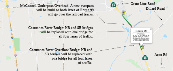 In December 2018, Granite Construction Incorporated
(NYSE: GVA) announced that it has been selected by the California
Department of Transportation (Caltrans) as the Construction
Manager/General Contractor (CM/GC) for the estimated $113 million Cosumnes
Bridge Replacement CM/GC Project in Sacramento County, ~ SAC 8.539. The
Cosumnes Bridge Replacement Project is located on Route 99, in Elk Grove,
CA. Project scope includes the removal and replacement of four bridges
over the Cosumnes River and to relinquish an underpass railroad structure,
requiring partial realignment of Route 99 southbound.
In December 2018, Granite Construction Incorporated
(NYSE: GVA) announced that it has been selected by the California
Department of Transportation (Caltrans) as the Construction
Manager/General Contractor (CM/GC) for the estimated $113 million Cosumnes
Bridge Replacement CM/GC Project in Sacramento County, ~ SAC 8.539. The
Cosumnes Bridge Replacement Project is located on Route 99, in Elk Grove,
CA. Project scope includes the removal and replacement of four bridges
over the Cosumnes River and to relinquish an underpass railroad structure,
requiring partial realignment of Route 99 southbound.
(Source: Daily Journal, 12/17/2018)
The project fact sheet describes the project as follows: The project is located on Route 99, in Sacramento County, in and near Elk Grove, from 0.3 mile south of Dillard Road Overcrossing to 0.6 mile south of Grant Line Road. The project proposes to replace four bridges, relinquish an underpass (UP) structure {requiring partial realignment of Route 99 southbound (SB) with a new overhead (OH) structure}, and rehabilitate/replace the bridge deck/barrier railings on an overcrossing (OC) structure. The four bridges to be replaced are Cosumnes River Overflow Bridge, Bridge № 24-0021R/L, and Cosumnes River Bridge, Bridge № 24-0020R/L. The structure to be relinquished is the McConnell Underpass, Bridge № 24-0048L. The new structure to be constructed is the McConnell Overhead, Bridge № 24-0048L. On Dillard Road OC, Bridge № 24-016, the project will replace the non-standard bridge railing, remove the deck AC surfacing, and place a polyester concrete deck overlay. In addition, the project will reconstruct/overlay the OC approaches and ramp, replace structure approach guard railing on and beneath the OC, along the freeway that are shielding OC columns. A Roadway Informational System (RWIS) will also be installed on the freeway and ramps, just north and south of Dillard Road OC. Other proposed electrical work includes installing a fiber optic cable along freeway, and upgrading existing freeway lighting. The project also proposes to abandon the SB on and off ramps to Eschinger Road, and relinquish an UP structure (McConnell UP, Bridge № 24-0048L) to Union Pacific Railroad.
The project fact sheet noted that the original work
scope (widen Route 99 SB structures, seismically retrofit Route 99 SB/NB
structures, and replace Dillard OC Barrier Rails) and related roadway
approach work that was proposed in the PR does not address current
deficiencies and long term needs of the transportation facility along this
stretch of Route 99. Upon further investigation by technical staff, it was
determined that all four bridges are scour critical. A load rating
analysis was performed on these four structures also. The results of the
analysis indicates that should the calculated scour occur, live loads from
permit vehicles would exceed the design capacity of a majority of the
piles for each structure.
(Source: CGMC Nomination Project Fact Sheet)
On AAroads, Scott Parker noted that this means that of
the four original "over/under" RR crossings (one direction goes under the
tracks on the original 2-lane underpass while the other direction, added
later, bridges over the tracks) that Route 99 inherited from US 99 at the
time the shields were swapped in mid-'66, two were gone by the mid-80's
(south of Route 46/Famoso and the Route 198 interchange near Goshen) with
two remaining: Chowchilla and Elk Grove. This construction eliminates one
more: the crossing south of Grant Line Road in Elk Grove. That over/under
is being reconstructed as double bridges, with the SB underpass (which
featured a low 14'5" clearance) bypassed by a new bridge adjacent to the
existing NB bridge; at this point, the berms are being constructed with
the actual bridge to follow. Also, the NB 2-lane bridge is being widened
to accommodate shoulders (the new SB bridge will be able to accommodate 3
lanes+ shoulders). However, there are no immediate plans to widen or
replace the series of older bridges immediately to the south crossing the
Consumnes River floodplain. Several miles to the south, the section
through Galt has been rebuilt with some new bridges (the old Route 104
interchange remains the same, however); but the interim section, about 5-6
miles, will remain the same for the time being. But the most egregious
substandard structure (the old underpass) will be history.
(Source: Sparker on AARoads, "Re: CA 99 ", 1/2/2020)
In June 2019, the CTC approved the following CM/GC
SHOPP amendment: 03-Sac-99 7.1/9.4 PPNO 6912 ProjID 0312000069. Route 99
In and near Elk Grove, from 0.3 mile south of Dillard Road Overcrossing to
south of Grant Line Road (replace Consumnes River Bridge №
24-0020L/R, and Consumnes River Overflow Bridge № 24 -0021L/R;
upgrade bridge rails at Dillard Road Overcrossing Bridge № 24-0163;
construct new McConnell Overhead Bridge № 24-0048L. Bridge seismic
retrofit, bridge scour retrofit, bridge rail replacement, and bridge
replacement. Increase in construction capital is to build a wider
McConnell Overhead bridge to accommodate both northbound and southbound
directions with standard vertical and horizontal alignment. Coordination
with Union Pacific Railroad (UPRR) resulted in design change, which will
allow UPRR to improve freight mobility in the future. Updated cost:
$184,000K. Also CMGC Projects Item 2-6. 03-Sac-99 7.1/9.4 . Route 99 In
and near Elk Grove, from 0.3 mile south of Dillard Road Overcrossing to
south of Grant Line Road (replace Consumnes River Bridge № 24
-0020L/R, and Consumnes River Overflow Bridge № 24-0021L/R; upgrade
bridge rails at Dillard Road Overcrossing No. 24-0163; construct new
McConnell Overhead № 24-0048L. Construct embankment for McConnell
Overhead, and install associated drainage facilities and erosion control.
Split the Construction Manager/General Contractor (CMGC) parent project EA
0F280/PPNO 03-6912 into five children projects EA 0F281/PPNO 03-6912A, EA
0F282/PPNO 03-6912B, EA 0F283/PPNO 03-6912C, EA 0F284/PPNO 03-6912D, and
EA 0F285/PPNO 03-6912E to be constructed as independent construction
contract work packages.
(Source: June 2019 CTC Meeting, Agenda Item
2.1a.(1) CMGC Projects Item 1-6)
In June 2019, the CTC approved for future consideration
of funding a project located on Route 99, south of the Dillard Road
overcrossing to south of Grant Line Road near the city of Elk Grove in
Sacramento County (03-Sac-99, PM 7.1/9.4). The project proposes to replace
four bridge structures, improve the Dillard Road Overcrossing, relinquish
the McConnell Underpass, replace the McConnell overhead structure, and
realign the southbound lanes. The proposed project addresses the current
structural and seismic deficiencies of the four Cosumnes bridges, the
non-standard horizontal and vertical clearances of the existing southbound
McConnell underpass and structural deficiencies of the Dillard Road
Overcrossing. In addition, the two southbound Cosumnes River bridges have
sub-standard freeway/expressway bridge shoulder widths that may contribute
to the higher than statewide average collision data. The project is
currently programmed in the 2018 SHOPP for an estimated total of $139
million which includes Construction (capital and support) and Right-of-
Way (capital and support). Construction is estimated to begin in 2020. The
scope, as described for the preferred alternative, is consistent with the
project scope programmed by the Commission in the 2018 SHOPP.
(Source: June 2019 CTC Minutes, Agenda Item
2.2c.(1))
In August 2019, the CTC authorized the following
allocations related to this project:
(Source: August 2019 CTC Agenda, Agenda Item
2.5b.(1) Items 12, 13, 14)
In October 2019, it was reported that Caltrans and
Granite Construction Inc. broke ground on a three-year, $158 million
bridge project on Route 99 south of Elk Grove. The project will replace
the Route 99 bridges over the Cosumnes River. North of the river, crews
will also build a new overpass so that both northbound and southbound
traffic on Route 99 will cross over the railroad tracks. The first
construction task, however, is building a temporary road alignment next to
the northbound lanes that traffic will use during construction. The
current Cosumnes River Bridge was built in the 1950s. The barriers are not
up to current design standards, and in the river, the water is washing
away dirt and sediment from around the foundation of the bridge,
potentially degrading the foundation. Currently there are four bridges.
Northbound and southbound traffic is divided, and each direction has a
bridge over the river and river overflow. After work is complete, both
directions of traffic will be together on the same two structures, which
will allow for wider shoulders. Also as part of the project, Route 99 will
be moved away from the McConnell Underpass, which takes the southbound
direction of highway underneath a railroad line. The underpass is too low,
and has caused accidents; it is also not up to current design standards in
terms of sight clearance. Crews will build a new overpass, so both
directions of traffic go over the tracks. Work is set to take place over
three seasons, so the road is set to be open by the end of 2022.
(Source: Sacramento Business Journal, 10/22/2019)
In December 2019, the CTC authorized the following
construction allocation on this project: $44,340,000. 03-Sac-99 7.1/9.4
Route 99 In and near Elk Grove, from 0.3 mile south of Dillard Road
Overcrossing to 0.6 mile south of Grant Line Road. Early Work Package No.
4 for Cosumnes River Bridge Construction Manager/General Contractor (CMGC)
parent project EA 0F280. Outcome/Output: Construct pre-cast concrete
girder bridge over the railroad at McConnell Overhead № 24-0048L,
and construct temporary bridge superstructures and approach paving at
Cosumnes River Overflow No. 24-0021L/R. (Future consideration of funding
approved under Resolution E-19-50; June 2019.) (Concurrent amendment under
SHOPP Amendment 18H-013; December 2019.)
(Source: December 2019 CTC Agenda, Agenda Item
2.5b.(1) #9)
In January 2020, the CTC amended the 2018 SHOPP to
split the Construction Manager/General Contractor (CMGC) parent project EA
0F280/PPNO 03-6912 into project EA 0F285/PPNO 03-6912E as Early Work
Package No. 5 to be constructed as independent construction contract. Also
added was Early Work Package No. 4, Construct pre-cast concrete girder
bridge and approach paving over the railroad at McConnell Overhead №
24-0048L, and Early Work Package No. 5, Construct temporary bridge
superstructures and approach paving at Cosumnes River Overflow No.
24-0021L/R. The CTC also approved a financial allocation of $25,990,000
for Work Package #4, and a financial allocation of $10,590,000 for Work
Package #5.
(Source: January 2020 CTC Agenda, 2.1a.(1g) Items
1, 2, and 3, Agenda Item 2.5b.(1) #10, #11)
In March 2020, the CTC amended the SHOPP and approved
the following financial allocation: 03-Sac-99 PM 7.1/9.4. PPNO 6912D.
ProjID 0319000204. EA 0F284. Route 99 in and near Elk Grove, from 0.3 mile
south of Dillard Road Overcrossing to 0.6 mile south of Grant Line Road.
Early Work Package No. 4 for Cosumnes River Bridge Construction
Manager/General Contractor (CMGC) parent project EA 0F280. Outcome/Output:
Construct bridge over the railroad at McConnell Overhead № 24-0048L.
(Future consideration of funding approved under Resolution E-19-51; June
2019.) (Concurrent amendment under SHOPP Amendment 18H-015; March 2020.)
Financial allocation: $20,210,000. The CTC also approved another financial
allocation related to this: 03-Sac-99 PM 7.1/9.4. PPNO 6912F. ProjID
0320000123. EA 0F286. Route 99 in and near Elk Grove, from 0.3 mile south
of Dillard Road Overcrossing to 0.6 mile south of Grant Line Road. Early
Work Package No. 6 for Cosumnes River Bridge Construction Manager/General
Contractor (CMGC) parent project EA 0F280. Outcome/Output: Remove
and replace Cosumnes River Bridge № 24-0020L/R and Cosumnes River
Overflow No. 24-0021L/R (structure work only). (Future consideration of
funding approved under Resolution E-19-51; June 2019.) (Concurrent
amendment under SHOPP Amendment 18H-015; March 2020.) (As part of this
allocation request, the Department is requesting to extend the completion
of CONST and CON ENG an additional 12 months beyond the 36 month
deadline.) Financial allocation: $70,360,000.
(Source: March 2020 CTC Agenda, Agenda Item
2.5b.(1) #10, #11)
In May 2020, the CTC approved the following allocation:
$61,967,000. 03-Sac-99 PM 7.1/9.4 PPNO 03-6912 ProjID 0312000069 EA 0F280
Route 99 in and near Elk Grove, from 0.3 mile south of Dillard Road
Overcrossing to 0.6 mile south of Grant Line Road. Outcome/Output:
Replace Cosumnes River Bridge № 24-0020L/R, and Cosumnes River
Overflow Bridge № 24-0021L/R , upgrade bridge rails at Dillard Road
Overcrossing No. 24-0163, construct new McConnell Overhead №
24-0392. This is a Construction Manager/General Contractor (CMGC) project.
CON ENG: $5,800,000; CONST $56,167,000.
(Source: May 2020 CTC Agenda, Agenda Item 2.5b.(1)
#10)
In May 2020, it was announced that Granite has been
awarded the Child Project 4 (CP4) portion of the Construction
Manager/General Contractor (CM/GC) contract of the Cosumnes Bridge
Replacement Project by the California Department of Transportation
(Caltrans) in Sacramento County, California. The Cosumnes Bridge
Replacement Project is located on Route 99, in Elk Grove, California.
Project scope includes the removal and replacement of four bridges over
the Cosumnes River as well as replacing two existing railroad overhead and
underpass bridges with a single new overhead bridge, requiring partial
realignment of Route 99 southbound. Granite completed the early work
portion of this project in December 2019 that included the construction of
two approaches to the new overhead railroad bridge, foundations and
approach fills for two temporary alignment bridge widenings, and
procurement of the precast girders for the railroad bridge. Construction
is expected to begin in June 2020 and conclude in October 2022.
(Source: Business Wire, 5/26/2020)
In June 2020, it was reported that crews are replacing
the Cosumnes River Bridges and the Cosumnes River Overflow Bridges with
two new bridge structures. The current structures are in need of
replacement due to age, wear and outdated design to improve overall
mobility and safety through this corridor. The southbound McConnell
underpass and the existing northbound McConnell Overhead structure will be
replaced with a single McConnell Overhead structure for both northbound
and southbound Route 99. The plan is to relinquish the McConnell Underpass
(Bridge № 24-0048L) to Union Pacific Railroad. The Cosumnes Bridge
Replacement Project will also improve the Dillard Road Overcrossing.
(Source: Email from Joel Windmiller, 6/24/2020)
In February 2021, it was reported that the Union
Pacific underpass structure (McConnell UP, Bridge № 24-0048L, ~ SAC
8.793) had been bypassed. In May 2021, it was reported that the former
McConnell Underpass (Subway) had been filled in with concrete.
(Source: Emails from Joel Windmiller, 2/27/2021 and
5/3/2021)
In September 2022, it was reported that the Cosumnes
bridge replacement project on Route 99 is complete. It started in fall
2019 and construction finished two years ahead of schedule, despite supply
chain issues. The $208.3 million project received nearly $106 million from
Senate Bill 1, and more than $102 million came from the State Highway and
Operation and Protection Program (SHOPP). State and local governments
worked together to replace the Cosumnes River bridge and Overflow bridge
with two new ones. They also replaced the McConnell overhead and made
improvements to the Dillard Road overcrossing. The project spans from
south of Dillard Road overcrossing to south of Grant Line road, in and
near Elk Grove.
(Source: ABC 10 Sacramento, 9/6/2022)
Elk Grove to Calvine Aux Lanes (03-Sacramento-99 PM 12.7/16.0)
The 2020 SHOPP, approved in May 2020, included the
following NEW Mobility item of interest: 03-Sacramento-99 PM 12.7/16.0
PPNO 6930 Proj ID 0316000193 EA 1H630. Route 99 in Elk Grove, from Elk
Grove Boulevard to south of Calvine Road. Construct two auxiliary lanes
and upgrade four ramp metering systems. Programmed in FY22-23, with
construction scheduled to start in February 2023. Total project cost is
$23,030K, with $18,420K being capital (const and right of way) and $4,610K
being support (engineering, environmental, etc.).
(Source: 2020 Approved SHOPP a/o May 2020)
In March 2022, the CTC adopted the 2022 SHOPP, which
amended the following project already in the SHOPP: 03-Sacramento-99 PM
12.7/16.0 PPNO 6930 Proj ID 0316000193 EA 1H630. Route 99 in Elk Grove,
from Elk Grove Boulevard to south of Calvine Road. Construct two southbound
auxiliary lanes, construct concrete median barrier, extend storage
lane at southbound Elk Grove Boulevard offramp, and upgrade four
five ramp metering systems. Programmed funding amendement
($×1000): Const Cap $19,700. Total $24,630. Reason: Note: Update
scope to include concrete median barrier, additional ramp meter, and
extend storage lane at southbound Elk Grove Boulevard offramp to improve
safety and operations. Increase in construction capital is due to this
additional scope.
(Source: March 2022 CTC Agenda, Agenda Item 4.25
(SHOPP Adoption), Attch. C (List of 2022 SHOPP Amendments (Cost, Scope,
Schedule and Technical Changes. Includes Federal Emergency Relief.) ),
Item #9)
In May 2022, the CTC approved the following
pre-construction phase SHOPP allocation: $1,860,000. 03-Sac-99 12.7/16.0.
PPNO 03-6930; ProjID 0316000193; EA 1H630. Route 99 In Elk Grove, from Elk
Grove Boulevard to south of Calvine Road. Construct two southbound
auxiliary lanes, construct concrete median barrier, extend storage lane at
southbound Elk Grove Boulevard offramp, and upgrade five ramp metering
systems. Allocation: FY22-23 PS&E $1,610,000 ($1,550,000 Programmed);
R/W Sup $250,000.
(Source: May 2022 CTC Agenda, Agenda Item 2.5b.(2a) #10)
In August 2023, the CTC approved the following SHOPP
Construction Phase allocation: $25,096,000. 03-Sac-99 12.7/16.3. PPNO
03-6930; ProjID 0316000193; EA 1H630. Route 99 In Elk Grove, from Elk
Grove Boulevard to Calvine Road. Outcome/Output: Construct two southbound
auxiliary lanes, upgrade culvert, construct concrete median barrier,
extend storage lane at southbound Elk Grove Boulevard offramp, and upgrade
five ramp metering systems. This project will reduce congestion, improve
highway operation and mobility. Preliminary Engineering (Budget / Expended):
PA&ED $1,091,000 / $1,021,271; PS&E $1,971,000
/ $1,555,000; R/W Sup $250,000 / $88,101.
CEQA - CE, 3/29/2022; Re-validation 6/21/2023. NEPA - CE, 3/29/2022;
Re-validation 6/21/2023. Two month allocation time extension for CONST and
CON ENG approved under Waiver 23-72; June 2023. Allocation (Programmed / Funded):
CON ENG $2,000,000 / $2,000,000; CONST $19,700,000 / $23,096,000.
(Source: August 2023 CTC Agenda, Agenda Item 2.5b.(1) #12)
Sheldon Road Interchange - Elk Grove (~SAC 14.868)
The SAFETEA-LU act, enacted in August 2005 as the reauthorization of TEA-21, provided the following expenditures on or near this route:
In August 2008, officials from Elk Grove to Rancho Cordova, Folsom and El Dorado County will gather for a historic summit that will focus on the long-proposed connector/expressway linking I-5, Route 99 and US 50.
![[TCRP 135 - From City of Elk Grove Website]](maps/099-tcrp-135.jpg) TCRP Project #135 will reconstruct and expand the Route 99/Sheldon Road
interchange. These improvements will provide efficient accessibility to
and from Route 99, as well as improvement to Sheldon Road to accommodate
the current and projected traffic volumes for the City of Elk Grove.
Planned improvements include construction of a two-lane southbound loop
off-ramp and a diagonal southbound on-ramp within the southwest quadrant;
construction of a two-lane northbound loop on-ramp with one mixed flow
lane and one high-occupancy vehicle (HOV) bypass lane and a diagonal
northbound off-ramp within the southeast quadrant; construction of a
diagonal northbound on-ramp within the northeast quadrant; replacement of
the existing bridge over Route 99 (which dates to 1957); addition of bike
lanes, landscaped medians, and sidewalks on Sheldon Road; installation of
on-ramp metering with high-occupancy vehicle (HOV) bypass lanes; and
relocation and expansion of the existing Park & Ride lot. The project
is anticipated to be completed by Fall 2009.
TCRP Project #135 will reconstruct and expand the Route 99/Sheldon Road
interchange. These improvements will provide efficient accessibility to
and from Route 99, as well as improvement to Sheldon Road to accommodate
the current and projected traffic volumes for the City of Elk Grove.
Planned improvements include construction of a two-lane southbound loop
off-ramp and a diagonal southbound on-ramp within the southwest quadrant;
construction of a two-lane northbound loop on-ramp with one mixed flow
lane and one high-occupancy vehicle (HOV) bypass lane and a diagonal
northbound off-ramp within the southeast quadrant; construction of a
diagonal northbound on-ramp within the northeast quadrant; replacement of
the existing bridge over Route 99 (which dates to 1957); addition of bike
lanes, landscaped medians, and sidewalks on Sheldon Road; installation of
on-ramp metering with high-occupancy vehicle (HOV) bypass lanes; and
relocation and expansion of the existing Park & Ride lot. The project
is anticipated to be completed by Fall 2009.
In June 2012, the CTC approved for future consideration of funding a project that will modify the existing Elk Grove Boulevard/Route 99 Interchange by adding a northbound on-ramp to Route 99 from East Stockton Boulevard through Caltrans right-of-way, eliminating left turns and the traffic signal on Elk Grove Boulevard at the existing northbound on-ramp, adding a traffic signal at the northbound ramp intersection on East Stockton Boulevard, and modifying the southbound on-ramp intersection.
In March 2013, the CTC approved $5,000,000 to add northbound on-ramp, remove existing traffic signal, add second left turn lane to southbound on-ramp, and add northbound deceleration lane at the Elk Grove Blvd/Route 99 Interchange.
21st Street Bridge (SAC 22.594)
In June 2021, Caltrans had a four-day closure of both
directions of Route 99 to replace the 21st Street Bridge (SAC 22.594).
This was the longest closure of Route 99 in Sacramento history. Crews are
also closing the mainline westbound Business Route 80/US 50/Route 51 to southbound
Route 99, and the westbound and eastbound US 50 connector ramps to
southbound Route 99. In addition, the following ramps are scheduled to be
closed: 16th Street to eastbound US 50; 29th Street/H Street to westbound
Business Route 80; 29th Street/N Street to westbound Business Route 80; 29th Street/T Street to SB
Route 99; Broadway to southbound Route 99; southbound Route 99 to 12th
Street; northbound Route 99 to 12th Street; 14th Avenue/30th Street to
southbound Route 99; Fruitridge Road to northbound Route 99; Fruitridge
Road to northbound Route 99; East 47th Avenue to northbound Route 99; and
West 47th Avenue to northbound Route 99. For around 100 hours,
construction crews will work around the clock using new technology to
rapidly replace the bridge over 21st Avenue, a process that would
otherwise take up to six months without completely shutting down the
highway. The current bridge is 62 years old and deteriorating. The
technique being used is to assemble bridges in different places, make sure
all the bridges are fitted correctly, bring them there and then assemble
them. The 21st Avenue Undercrossing was built in 1959 and widened in 1974.
There is currently corrosion on the surface deck, concrete spalling,
cracks, the joint seals need to be replaced, and the bridge deck has begun
to deteriorate due to wear and tear from high traffic volumes, freight
movement, weather and age. Caltrans is replacing the bridge deck before
emergency operations are necessary. The bridge deck replacement is part of
the $5.9 million SAC 99 21st Avenue Project, which includes replacing the
sound walls, the concrete median barrier and installing brighter lighting
for the 21st Street Undercrossing. The project is possible thanks to funds
from Senate Bill 1 (SB 1) and expected to be completed by the fall of
2021. The contractor for the project is Bridgeway Civil Constructors, Inc.
Over the four day closure, construction crews demolished the previous
62-year-old bridge over 21st Avenue, installed support beams for the new
bridge, poured concrete and re-paved the road. The final activity was
putting a polyester overlay over the concrete they poured, with the goal
to make the new bridge more durable and longer-lasting. Crews will also
spend the last day inspecting the new bridge, installing medians between
the northbound and southbound lanes, re-striping the pavement and
reconstructing the barriers on the sides of the bridge.
(Source: Caltrans Press Release, 5/27/2021; Fox 40, 6/3/2021; California News Times, 6/4/2021; Fox 40, 6/15/2021)
General Route 99 (Southern Segment)
In his 2006 Strategic Growth Plan, Governor Schwartzenegger proposed a complete corridor enhancement master plan. This included conversion of a number of expressway sections to freeway, and widening a number of freeway sections. This will bring the corridor to a full freeway standard, add capacity/lanes overall, improve and add interchanges, and make other improvements. The project is estimated to cost $8.8 million. The project is currently funded with Local ($8.8 million) funds. Due to local fund revenue shortfalls construction is estimated to start in fiscal year 2015/16. The project is a potential candidate for future bond savings. Construction will begin in fiscal year 2012/13 if bond savings are granted.
The SAFETEA-LU act, enacted in August 2005 as the reauthorization of TEA-21, provided the following expenditures on or near this route:
Route 99 as an Interstate Highway
The SAFETEA-LU act, enacted in August 2005 as the reauthorization of TEA-21, provided the following expenditures on or near this route:
Shafter Assemblyman Dean Florez has proposed creating a Route 99 supercorridor, in four phases, between Grapevine and Fresno. Fresno Mayor Alan Autry is lobbying federal officials to upgrade Route 99 and make it part of the nearly 47,000-mile interstate system. Backer says that say Fresno is the largest U.S. city (440,000 residents) not tied to the interstate system, and the absence of a federal highway is one reason national and international firms refuse to locate there. Preservationists oppose the change on historical grounds, as the old stagecoach trail that is now Route 99 was the longest toll-free road in the world—it the road traveled by the immigrants from Oklahoma, described by Steinbeck, Saroyan, McWilliams and Chavez. Everyone agrees on upgrading of the condition of the highway. This has been captured in a Master Plan for the Route 99 Corridor, which among other things, proposes applying for the designation Interstate 9. There were lots of discussions about including this funding in the 2005 Transportation Bill. Converting Route 99 to an interstate would mean rebuilding it to the higher standards or winning a federal waiver. Caltrans estimates the cost of a conversion at $20 billion to $25 billion. In contrast, the agency says it would cost $6 billion to widen Highway 99 to six or more lanes if interstate standards aren't applied. The difference is due to bridge retrofitting and improvement. Route 99 might alternatively be designated a High Priority Corridor. This would allow Route 99 to compete with more than 40 other highways for $3.3 billion over six years.
The Fresno Bee provided more specifics: The legislation in question states "Section 1105(e)(5)(A) of the Intermodal Surface Transportation Act of 1991 (105 Stat. 2032; 115 Stat. 872) is amended by striking 'and subsection (c)(45)' and inserting the following: 'subsection (c)(45), and subsection (c)(54).' " What this does is make Route 99 eligible for Interstate designation, but doesn't directly designate it as an interstate. This lets the federal Transportation Department and the California Department of Transportation negotiate a long-range plan for the upgrading of the highway to meet interstate standards. Interstates, for instance, must maintain medians of at least 36 feet in rural areas. Paved shoulders on the right must be at least 10 feet wide. Bridges must offer at least 16 feet of clearance. A crucial part of future negotiations would identify which interstate standards might be waived. Bridge heights originally designed to permit passage of missile-bearing military trucks, for instance, could be waived, while highway shoulder requirements might be retained. The legislation doesn't spell out such details; that will be up to state and federal negotiators. The language did make it into the final bill, which was signed in August 2005. Some folks are suggesting that this might be designated as I-7. The legislation also included widening Route 99 between Goshen and Kingsburg and building a parkway connecting the highway to the new University of California at Merced campus.
 Business Routes Naming
Historically, the route was named the "Golden State Highway" between Sacramento and Bakersfield. This is because the route ran the length of the "Golden State".
Route 99/I-5 Split to Bakersfield
The portion of this route from the I-5/Route 99 junction to Bakersfield is part of the historic "Ridge Route". More details on the Ridge Route can be found on the page for I-5.
The portion of this route between the southern terminus of Rout 99, three and one-half miles south of Mettler (KER 00) and the northern Kern County line in Delano at County Line Road (KER 57.356) (County Sign Route J44) is named the "Kern County Korean War Veterans Memorial Highway". This is in honor of the 42 Kern County military personnel killed in action in Korea, the three who died while missing, the two who died while captured, and the six who died from wounds, and the approximately 8,120 Korean War veterans who presently live in Kern County. Named by Assembly Concurrent Resolution 46, Resolution Chapter 54, filed May 31, 2001.
 The interchange of Route 99 and Route 166 in the County of Kern (~ KER 2.763)
is named the "CHP Officer Gerald E. Dormaier Memorial Interchange".
It was named in memory of Officer Gerald E. Dormaier, California Highway
Patrol (CHP) Badge No. 4654, who was born in June 1938, in Arvin,
California. Dormaier graduated from Bakersfield High School in 1955, went
on to Bakersfield College, and then joined the United States Air Force
shortly thereafter. Dormaier was a member of the Future Farmers of America
poultry judging team in high school and won first place over 17 other
judging teams in a San Joaquin Valley poultry judging contest held at
Fresno State College. Prior to joining the California Highway Patrol,
Dormaier worked in Kern County’s oil fields. Dormaier graduated from
the California Highway Patrol Academy in 1966, and during his 14 years
with the CHP, served in the Los Angeles, Anaheim, Tejon, Buellton,
Truckee, and Bakersfield areas. Officer Dormaier was killed in the line of
duty on December 25, 1980, when he and his partner, Officer Jerry Bean,
CHP Badge No. 6105, were attempting to set up road control for an
overturned propane truck. Officer Dormaier was standing on the side of the
road when a speeding tanker truck came barreling through the fog. The
driver attempted to stop, causing the vehicle to jackknife near the center
divider, striking Officer Dormaier and the patrol car. Officer Bean
attempted to revive his partner and administered CPR until the ambulance
arrived. Officer Dormaier was taken to Mercy Hospital, but unfortunately
he succumbed to his injuries. Named by Assembly Concurrent Resolution
(ACR) 78, Res. Chapter 155, Statutes of 2015, on September 3, 2015.
The interchange of Route 99 and Route 166 in the County of Kern (~ KER 2.763)
is named the "CHP Officer Gerald E. Dormaier Memorial Interchange".
It was named in memory of Officer Gerald E. Dormaier, California Highway
Patrol (CHP) Badge No. 4654, who was born in June 1938, in Arvin,
California. Dormaier graduated from Bakersfield High School in 1955, went
on to Bakersfield College, and then joined the United States Air Force
shortly thereafter. Dormaier was a member of the Future Farmers of America
poultry judging team in high school and won first place over 17 other
judging teams in a San Joaquin Valley poultry judging contest held at
Fresno State College. Prior to joining the California Highway Patrol,
Dormaier worked in Kern County’s oil fields. Dormaier graduated from
the California Highway Patrol Academy in 1966, and during his 14 years
with the CHP, served in the Los Angeles, Anaheim, Tejon, Buellton,
Truckee, and Bakersfield areas. Officer Dormaier was killed in the line of
duty on December 25, 1980, when he and his partner, Officer Jerry Bean,
CHP Badge No. 6105, were attempting to set up road control for an
overturned propane truck. Officer Dormaier was standing on the side of the
road when a speeding tanker truck came barreling through the fog. The
driver attempted to stop, causing the vehicle to jackknife near the center
divider, striking Officer Dormaier and the patrol car. Officer Bean
attempted to revive his partner and administered CPR until the ambulance
arrived. Officer Dormaier was taken to Mercy Hospital, but unfortunately
he succumbed to his injuries. Named by Assembly Concurrent Resolution
(ACR) 78, Res. Chapter 155, Statutes of 2015, on September 3, 2015.
(Image source: Assemblyman Rudy Salas, CHP Memorial Page)
 The interchange of Route 99 and Route 119 (~ KER 17.548) is named the "Deputy
Daniel Lee Archuleta Memorial Interchange". Named in memory of
Daniel Lee Archuleta, who was born in Huntington Beach, California. Daniel
Lee Archuleta attended Golden West College, where he received an Associate
of Arts degree on October 20, 1996, and subsequently attended California
State University at Long Beach, where he received a bachelor's degree on
May 28, 1999. Daniel Lee Archuleta attended, and graduated from, the
academy of the Los Angeles County Sheriff's Department at East Los Angeles
College on February 20, 2001, and began employment with the Los Angeles
County Sheriff's Department in February of 2001. Archuleta was hired by
the Kern County Sheriff's Department on October 5, 2002, and was assigned
to the Support Services Bureau, the Training Division, and the Resource
Pool, and also worked temporarily in the Court Services Division. Daniel
Lee Archuleta transferred to the Law Enforcement Bureau, South Area
Substation Division, Taft Court on November 2, 2002, and on May 27, 2003,
he entered the Field Training Officer Program and was promoted to Deputy
Sheriff II on October 4, 2003. Daniel Lee Archuleta was killed on
September 12, 2004, when his patrol vehicle rolled over on Tupman Road,
just north of the west Kern County town of Tupman, while he was traveling
south on Tupman Road responding to an emergency call. A deputy from the
Kern County Sheriff's Department driving north on Tupman Road found the
battered patrol vehicle in the southbound lane of Tupman Road, and Daniel
Lee Archuleta was found dead at the scene. California Highway Patrol
investigative units from Bakersfield and Fresno were called to the scene
but were unable to ascertain the cause of the accident. Named by Senate
Concurrent Resolution 50, Resolution Chapter 86, on August 24, 2012.
The interchange of Route 99 and Route 119 (~ KER 17.548) is named the "Deputy
Daniel Lee Archuleta Memorial Interchange". Named in memory of
Daniel Lee Archuleta, who was born in Huntington Beach, California. Daniel
Lee Archuleta attended Golden West College, where he received an Associate
of Arts degree on October 20, 1996, and subsequently attended California
State University at Long Beach, where he received a bachelor's degree on
May 28, 1999. Daniel Lee Archuleta attended, and graduated from, the
academy of the Los Angeles County Sheriff's Department at East Los Angeles
College on February 20, 2001, and began employment with the Los Angeles
County Sheriff's Department in February of 2001. Archuleta was hired by
the Kern County Sheriff's Department on October 5, 2002, and was assigned
to the Support Services Bureau, the Training Division, and the Resource
Pool, and also worked temporarily in the Court Services Division. Daniel
Lee Archuleta transferred to the Law Enforcement Bureau, South Area
Substation Division, Taft Court on November 2, 2002, and on May 27, 2003,
he entered the Field Training Officer Program and was promoted to Deputy
Sheriff II on October 4, 2003. Daniel Lee Archuleta was killed on
September 12, 2004, when his patrol vehicle rolled over on Tupman Road,
just north of the west Kern County town of Tupman, while he was traveling
south on Tupman Road responding to an emergency call. A deputy from the
Kern County Sheriff's Department driving north on Tupman Road found the
battered patrol vehicle in the southbound lane of Tupman Road, and Daniel
Lee Archuleta was found dead at the scene. California Highway Patrol
investigative units from Bakersfield and Fresno were called to the scene
but were unable to ascertain the cause of the accident. Named by Senate
Concurrent Resolution 50, Resolution Chapter 86, on August 24, 2012.
(Image source: National Law Enforcement Officers Memorial Fund)
 The intersection of Route 99 and White Lane in
Bakersfield (~ KER 21.095) is named the "Mark C. Salvaggio Interchange".
It was named in honor of Mark C. Salvaggio, a native Californian who
graduated from California State University, Bakersfield in 1972. After
obtaining his teaching credential, Mark C. Salvaggio taught seventh and
eighth grade students in the Arvin Union School District for more than 30
years, from 1972 until his retirement in 2004. He also was a distinguished
member of the Bakersfield City Council, representing Ward 7 for nearly 20
years, from 1985 to 2004. During his tenure on the Bakersfield City
Council, Mark C. Salvaggio served as Vice Mayor from December 2000 to
December 2002, and as a council member was instrumental in numerous
projects that benefitted the community, including the Kern River Parkway
Plan, construction of the Northeast Bakersfield Water Treatment Plant, the
extension of the Bakersfield Bike Path, the establishment of the
Bakersfield Educational Studies Area, and the enhancement of the White
Lane-Route 99 Interchange in Bakersfield. He has received numerous awards
and commendations for his community service. Named by Senate Concurrent
Resolution (SCR) 53, Resolution Chapter 39, on 4/26/2006.
The intersection of Route 99 and White Lane in
Bakersfield (~ KER 21.095) is named the "Mark C. Salvaggio Interchange".
It was named in honor of Mark C. Salvaggio, a native Californian who
graduated from California State University, Bakersfield in 1972. After
obtaining his teaching credential, Mark C. Salvaggio taught seventh and
eighth grade students in the Arvin Union School District for more than 30
years, from 1972 until his retirement in 2004. He also was a distinguished
member of the Bakersfield City Council, representing Ward 7 for nearly 20
years, from 1985 to 2004. During his tenure on the Bakersfield City
Council, Mark C. Salvaggio served as Vice Mayor from December 2000 to
December 2002, and as a council member was instrumental in numerous
projects that benefitted the community, including the Kern River Parkway
Plan, construction of the Northeast Bakersfield Water Treatment Plant, the
extension of the Bakersfield Bike Path, the establishment of the
Bakersfield Educational Studies Area, and the enhancement of the White
Lane-Route 99 Interchange in Bakersfield. He has received numerous awards
and commendations for his community service. Named by Senate Concurrent
Resolution (SCR) 53, Resolution Chapter 39, on 4/26/2006.
(Image source: Bakersfield.Com)
 The interchange at Route 99 and eastbound Route 58 (~ KER 23.489) in the
County of Kern is named the "CHP Officer Gerald N. Harris Memorial
Interchange". It was named in memory of Officer Gerald Nathan
Harris, who was born in 1938 in the City of Bakersfield, California.
Officer Harris graduated from North High School in 1957, and enlisted in
the United States Marine Corps shortly thereafter. After several years of
service, he was honorably discharged on December 5, 1965. Officer Harris
was a service salesman employed by Three Way Chevrolet prior to becoming a
California Highway Patrol Officer. Officer Harris graduated from the
Department of the California Highway Patrol Academy in 1967 with Academy
Class CTC-IV-67, and was assigned to the Santa Fe Springs Area, where he
served for approximately one year before being transferred to the
Bakersfield Area, where he spent the remainder of his career. Officer
Harris, badge number 5554, was killed in the line of duty on February 27,
1974, while directing traffic at an intersection in the City of
Bakersfield, where he was struck by a hit-and-run driver. The impact of
the collision left Officer Harris with a broken leg and other injuries,
which, at the time, did not appear to be life threatening. When Officer
Harris subsequently required special medical treatment, the president of
Continental Telephone in the City of Bakersfield volunteered his
company’s medical plane to take him to a hospital in San Francisco
for special treatment, but Officer Harris, unfortunately, died shortly
thereafter from an embolism. Officer Harris was a hardworking, dedicated
officer who loved his job and enjoyed the people with whom he worked, and
who, throughout his career, received several letters commending him on his
exemplary service, including one from then Wasco Chief of Police, Robert
Duke, and several thank you letters from those whose lives he saved or
changed dramatically. Officer Harris was good natured, gracious, honest
and loyal, and would always go out of his way to help those in need. In
his spare time, he enjoyed weight lifting, the Police Olympics, softball,
volunteering to teach bicycle safety to children in schools, and spending
time with his family and friends. Named by Senate Concurrent Resolution
119, Resolution Chapter 131, August 28, 2014.
The interchange at Route 99 and eastbound Route 58 (~ KER 23.489) in the
County of Kern is named the "CHP Officer Gerald N. Harris Memorial
Interchange". It was named in memory of Officer Gerald Nathan
Harris, who was born in 1938 in the City of Bakersfield, California.
Officer Harris graduated from North High School in 1957, and enlisted in
the United States Marine Corps shortly thereafter. After several years of
service, he was honorably discharged on December 5, 1965. Officer Harris
was a service salesman employed by Three Way Chevrolet prior to becoming a
California Highway Patrol Officer. Officer Harris graduated from the
Department of the California Highway Patrol Academy in 1967 with Academy
Class CTC-IV-67, and was assigned to the Santa Fe Springs Area, where he
served for approximately one year before being transferred to the
Bakersfield Area, where he spent the remainder of his career. Officer
Harris, badge number 5554, was killed in the line of duty on February 27,
1974, while directing traffic at an intersection in the City of
Bakersfield, where he was struck by a hit-and-run driver. The impact of
the collision left Officer Harris with a broken leg and other injuries,
which, at the time, did not appear to be life threatening. When Officer
Harris subsequently required special medical treatment, the president of
Continental Telephone in the City of Bakersfield volunteered his
company’s medical plane to take him to a hospital in San Francisco
for special treatment, but Officer Harris, unfortunately, died shortly
thereafter from an embolism. Officer Harris was a hardworking, dedicated
officer who loved his job and enjoyed the people with whom he worked, and
who, throughout his career, received several letters commending him on his
exemplary service, including one from then Wasco Chief of Police, Robert
Duke, and several thank you letters from those whose lives he saved or
changed dramatically. Officer Harris was good natured, gracious, honest
and loyal, and would always go out of his way to help those in need. In
his spare time, he enjoyed weight lifting, the Police Olympics, softball,
volunteering to teach bicycle safety to children in schools, and spending
time with his family and friends. Named by Senate Concurrent Resolution
119, Resolution Chapter 131, August 28, 2014.
(Image source: Scoopnet; Calif. Assn. of Highway Patrolmen)
 The interchange between Rout 99, Route 204, and Airport Drive in Bakersfield (~ KER 26.8) is named the
"Richard Alan Maxwell Memorial Interchange". State Traffic
Officer Richard Alan Maxwell began his career in law enforcement with his
appointment to the California Highway Patrol on May 15, 1989, and was
killed in the line of duty on July 11, 1994. Officer Richard Maxwell was
shot and killed as he made a traffic stop in front of the suspect's house.
As he was waiting for backup to arrive the suspect and his father both
began to attack him. The father ran into the open garage to retrieve a
shotgun and while doing so the suspect shot Officer Maxwell in the face
and, as he sat on the driveway, was shot in the throat. CPR was
administered but he later died at a local hospital. Officer Maxwell had
served with the California Highway Patrol for five years. Named by Senate
Concurrent Resolution 60, Chapter 135, in 1994, and Assembly Concurrent
Resolution No. 119, Chapter 147, in 1994.
The interchange between Rout 99, Route 204, and Airport Drive in Bakersfield (~ KER 26.8) is named the
"Richard Alan Maxwell Memorial Interchange". State Traffic
Officer Richard Alan Maxwell began his career in law enforcement with his
appointment to the California Highway Patrol on May 15, 1989, and was
killed in the line of duty on July 11, 1994. Officer Richard Maxwell was
shot and killed as he made a traffic stop in front of the suspect's house.
As he was waiting for backup to arrive the suspect and his father both
began to attack him. The father ran into the open garage to retrieve a
shotgun and while doing so the suspect shot Officer Maxwell in the face
and, as he sat on the driveway, was shot in the throat. CPR was
administered but he later died at a local hospital. Officer Maxwell had
served with the California Highway Patrol for five years. Named by Senate
Concurrent Resolution 60, Chapter 135, in 1994, and Assembly Concurrent
Resolution No. 119, Chapter 147, in 1994.
(Image source: Find a Grave, Officer Down Memorial Page)
 The interchange at Route 65 (06-KER-065 R0.000) and Route 99 (06-KER-099
R29.878) in the County of Kern is named the “Kern County
Sheriff’s Office Deputy Phillip Campas Memorial Interchange”.
It was named in memory of Kern County Sheriff’s Office Deputy
Phillip Campas, who was born in Bakersfield. Campas attended East
Bakersfield High School where he was the starting quarterback and, after
graduating high school, Campas joined the United States Marine Corps.
Campas was deployed to Afghanistan in 2008 as a machine gunner and in
2010, he graduated from a Marine Corps drill instructor school and served
in that capacity for the next three years. Campas was dedicated to the
Marine Corps, and during his service, Campas was awarded the Navy and
Marine Corps Achievement Medal, the Combat Action Ribbon, the Afghanistan
Campaign Medal, the Global War on Terrorism Service Medal, the Marine
Corps Drill Instructor Ribbon, and numerous other medals reflecting
honorably on his military career. In 2015, Campas was honorably discharged
from the Marine Corps, moved his family back to the City of Bakersfield,
and, shortly thereafter, graduated from the Kern County Sheriff’s
Office’s Kern Regional Training Center Academy for peace officers,
where he was the class leader and received the honor of top overall
recruit. In February 2016, Campas was hired by the Kern County
Sheriff’s Office and started his career as a deputy sheriff. Campas
had numerous roles with the Kern County Sheriff’s Office, including
a patrol deputy, special weapons and tactics team (SWAT) operator,
assistant rangemaster, honor guard member, physical training (PT)
instructor, and recruit training officer (RTO). In addition to his duties
at the Kern County Sheriff’s Office, Campas volunteered his time as
an instructor and mentor to the teens involved in the Devil Pups
organization, where he made a lasting impact challenging, educating, and
helping young boys and girls learn self-confidence and responsibility.
Campas served his Kern County community faithfully for five years until
the end of his watch on Sunday, July 25, 2021. On that afternoon, at
approximately 1:00 p.m., deputies from the Kern County Sheriff’s
Office responded to a 911 dispatch reporting that an armed man, the
subject of a restraining order, was at a home near the intersection of 1st
Street and Poplar Avenue in the City of Wasco, and that screaming and
gunfire could be heard in the background of the 911 call. Responding
deputies encountered a woman fleeing the home who stated that at least two
people inside the home had been shot, and the suspect then fired at
deputies and barricaded himself in the home. The Kern County
Sheriff’s Office’s deployed its SWAT team and a standoff
ensued. At approximately 3:00 p.m., the suspect opened fire on members of
the SWAT team as they approached the home, striking Campas and another
deputy, and both deputies were transported to a local hospital where,
tragically, Campas succumbed to his wounds. Named by Senate Resolution SCR 75, Res. Chapter 104, 08/01/22.
The interchange at Route 65 (06-KER-065 R0.000) and Route 99 (06-KER-099
R29.878) in the County of Kern is named the “Kern County
Sheriff’s Office Deputy Phillip Campas Memorial Interchange”.
It was named in memory of Kern County Sheriff’s Office Deputy
Phillip Campas, who was born in Bakersfield. Campas attended East
Bakersfield High School where he was the starting quarterback and, after
graduating high school, Campas joined the United States Marine Corps.
Campas was deployed to Afghanistan in 2008 as a machine gunner and in
2010, he graduated from a Marine Corps drill instructor school and served
in that capacity for the next three years. Campas was dedicated to the
Marine Corps, and during his service, Campas was awarded the Navy and
Marine Corps Achievement Medal, the Combat Action Ribbon, the Afghanistan
Campaign Medal, the Global War on Terrorism Service Medal, the Marine
Corps Drill Instructor Ribbon, and numerous other medals reflecting
honorably on his military career. In 2015, Campas was honorably discharged
from the Marine Corps, moved his family back to the City of Bakersfield,
and, shortly thereafter, graduated from the Kern County Sheriff’s
Office’s Kern Regional Training Center Academy for peace officers,
where he was the class leader and received the honor of top overall
recruit. In February 2016, Campas was hired by the Kern County
Sheriff’s Office and started his career as a deputy sheriff. Campas
had numerous roles with the Kern County Sheriff’s Office, including
a patrol deputy, special weapons and tactics team (SWAT) operator,
assistant rangemaster, honor guard member, physical training (PT)
instructor, and recruit training officer (RTO). In addition to his duties
at the Kern County Sheriff’s Office, Campas volunteered his time as
an instructor and mentor to the teens involved in the Devil Pups
organization, where he made a lasting impact challenging, educating, and
helping young boys and girls learn self-confidence and responsibility.
Campas served his Kern County community faithfully for five years until
the end of his watch on Sunday, July 25, 2021. On that afternoon, at
approximately 1:00 p.m., deputies from the Kern County Sheriff’s
Office responded to a 911 dispatch reporting that an armed man, the
subject of a restraining order, was at a home near the intersection of 1st
Street and Poplar Avenue in the City of Wasco, and that screaming and
gunfire could be heard in the background of the 911 call. Responding
deputies encountered a woman fleeing the home who stated that at least two
people inside the home had been shot, and the suspect then fired at
deputies and barricaded himself in the home. The Kern County
Sheriff’s Office’s deployed its SWAT team and a standoff
ensued. At approximately 3:00 p.m., the suspect opened fire on members of
the SWAT team as they approached the home, striking Campas and another
deputy, and both deputies were transported to a local hospital where,
tragically, Campas succumbed to his wounds. Named by Senate Resolution SCR 75, Res. Chapter 104, 08/01/22.
(Image source: Bakersfield Now)
The portion of Route 99 between McFarland to Tulare (~ KER 49.654 to TUL 16.675) is named the "Veterans of Foreign Wars of the United States Memorial Highway". It was named by Senate Concurrent Resolution 54, Chapter 19, in 1992.
The portion of Route 99 between the City of Tulare and the City of Fresno (~ TUL 16.675 to FRE 19.294) is officially designated the "Pearl Harbor Survivors Memorial Highway". Named by Senate Concurrent Resolution No. 13, Chapter 81, in 1993.
 The portion of Rout 99 from the Fresno/Tulare County Line (FRE 0.0) to the Mountain View
Avenue Overcrossing (~ FRE R3.8) in the County of Fresno is officially
designated the "CHP Officers Brian M. Law and Juan J. Gonzalez
Memorial Highway". It was named in memory of CHP officers Brian M.
Law and Juan J. Gonzalez. Officer Brian Mitchio Law was born in 1979 in
Redwood City, California. Prior to joining the California Highway Patrol,
Officer Law served in the United States Marine Corps and the United States
Air Force. Officer Law, graduated from the California Highway Patrol
Academy in April 2008 with the Cadet Training Class III-07 and, upon
graduation, he was assigned to the Oakland Area, where he served for
approximately five years before being transferred to the Fresno Area. At
the time of his death, Officer Law and his wife were about to open a
kickboxing studio for women in North Fresno—Fight Girl
Fitness—into which he had put his “heart and soul”.
Officer Juan Jaime Gonzalez was born in 1981, graduated from Fresno State
University, and was a member of the Nu Alpha Kappa fraternity. Officer
Gonzalez had dreams of becoming a California Highway Patrol Officer since
five years of age and, in 2008, that dream came true. Officer Gonzalez
graduated from the California Highway Patrol Academy in April of 2008 with
the Cadet Training Class III-07 and, upon graduation, he was assigned to
the San Jose Area, where he served for approximately two years before
being transferred to the Fresno Area. On February 17, 2014, the state
suffered a tragic loss when California Highway Patrol Officers Brian M.
Law and Juan J. Gonzalez were killed in a single vehicle crash while
responding to an accident, thereby making the ultimate sacrifice while
performing their sworn duty. Officers Law and Gonzalez were riding in the
same patrol car responding to an accident which had been incorrectly
reported in the opposite direction. Nearing the scene of the accident, the
officers swerved to avoid one of the pedestrians that had been involved in
the accident and struck a guardrail, which caused their vehicle to
overturn. Both officers suffered fatal injuries and were pronounced dead
at the scene. Named by Assembly Concurrent Resolution 158, Resolution
Chapter 176, September 11, 2014.
The portion of Rout 99 from the Fresno/Tulare County Line (FRE 0.0) to the Mountain View
Avenue Overcrossing (~ FRE R3.8) in the County of Fresno is officially
designated the "CHP Officers Brian M. Law and Juan J. Gonzalez
Memorial Highway". It was named in memory of CHP officers Brian M.
Law and Juan J. Gonzalez. Officer Brian Mitchio Law was born in 1979 in
Redwood City, California. Prior to joining the California Highway Patrol,
Officer Law served in the United States Marine Corps and the United States
Air Force. Officer Law, graduated from the California Highway Patrol
Academy in April 2008 with the Cadet Training Class III-07 and, upon
graduation, he was assigned to the Oakland Area, where he served for
approximately five years before being transferred to the Fresno Area. At
the time of his death, Officer Law and his wife were about to open a
kickboxing studio for women in North Fresno—Fight Girl
Fitness—into which he had put his “heart and soul”.
Officer Juan Jaime Gonzalez was born in 1981, graduated from Fresno State
University, and was a member of the Nu Alpha Kappa fraternity. Officer
Gonzalez had dreams of becoming a California Highway Patrol Officer since
five years of age and, in 2008, that dream came true. Officer Gonzalez
graduated from the California Highway Patrol Academy in April of 2008 with
the Cadet Training Class III-07 and, upon graduation, he was assigned to
the San Jose Area, where he served for approximately two years before
being transferred to the Fresno Area. On February 17, 2014, the state
suffered a tragic loss when California Highway Patrol Officers Brian M.
Law and Juan J. Gonzalez were killed in a single vehicle crash while
responding to an accident, thereby making the ultimate sacrifice while
performing their sworn duty. Officers Law and Gonzalez were riding in the
same patrol car responding to an accident which had been incorrectly
reported in the opposite direction. Nearing the scene of the accident, the
officers swerved to avoid one of the pedestrians that had been involved in
the accident and struck a guardrail, which caused their vehicle to
overturn. Both officers suffered fatal injuries and were pronounced dead
at the scene. Named by Assembly Concurrent Resolution 158, Resolution
Chapter 176, September 11, 2014.
(Image Source: Visalia Times Delta; CHP Memorial (Law); CHP Memorial (Gonzalez))
 Lehn Memorial Highway") The portion of Route 99 between Mountain View Crossing in southern Fresno County (near
Kingsburg) (~ FRE R3.8) to the San Joaquin River on the northern boundary
(on the northern edge of Fresno) (~ MAD 0.036) is named the "William
"Bill" Lehn Memorial Highway". Named in honor of Fresno Police
Officer William "Bill" Lehn, killed while in the line of duty on June 21,
1994, when his Fresno Police Department motorcycle collided with a car
while he was attempting to make a traffic stop. Officer Lehn was born in
Hanford and raised in Lemoore, graduating in 1974 from Lemoore High
School. He began his career in law enforcement in 1979 when he joined the
City of San Joaquin Police Department. In 1980, he was hired by the Kings
County Sheriff's Department where he was a deputy until he was hired by
the Fresno Police Department in 1986. He was a well liked officer who was
remembered as a pleasure to know and to work with. He died at the age of
38. Named by Assembly Concurrent Resolution 30, Chaptered 7/2/2003,
Chapter 82.
The portion of Route 99 between Mountain View Crossing in southern Fresno County (near
Kingsburg) (~ FRE R3.8) to the San Joaquin River on the northern boundary
(on the northern edge of Fresno) (~ MAD 0.036) is named the "William
"Bill" Lehn Memorial Highway". Named in honor of Fresno Police
Officer William "Bill" Lehn, killed while in the line of duty on June 21,
1994, when his Fresno Police Department motorcycle collided with a car
while he was attempting to make a traffic stop. Officer Lehn was born in
Hanford and raised in Lemoore, graduating in 1974 from Lemoore High
School. He began his career in law enforcement in 1979 when he joined the
City of San Joaquin Police Department. In 1980, he was hired by the Kings
County Sheriff's Department where he was a deputy until he was hired by
the Fresno Police Department in 1986. He was a well liked officer who was
remembered as a pleasure to know and to work with. He died at the age of
38. Named by Assembly Concurrent Resolution 30, Chaptered 7/2/2003,
Chapter 82.
(Image source: Gribblenation; Find a Grave)
 The Route 41/Route 99 interchange (~ FRE 19.596) in downtown
Fresno is named the "Rosa Parks Interchange". Rosa Parks (born
February 4, 1913, in Tuskegee, Alabama) is considered the "Mother of the
Modern Day Civil Rights Movement". This fame started when she was arrested
on December 1, 1955, in Montgomery, Alabama, for refusing to give up her
seat on a bus to a white man. Her arrest was the impetus for a boycott of
Montgomery buses, led by Dr. Martin Luther King, Jr., and joined by
approximately 42,000 African Americans for 381 days. On November 13, 1956,
the United States Supreme Court ruled that Montgomery's segregation law
was unconstitutional, and on December 20, 1956, Montgomery officials were
ordered to desegregate buses. Rosa Parks refusal to surrender her seat in
compliance with Montgomery's segregation law inspired the civil rights
movement, which has resulted in the breakdown of numerous legal barriers
and the lessening of profound discrimination against African Americans in
this country. Her courage and conviction laid the foundation for equal
rights for all Americans and for the Civil Rights Act of 1964. Rosa Parks
was the first woman to join the Montgomery chapter of the NAACP, and was
an active volunteer for the Montgomery Voters League. She cofounded the
Rosa and Raymond Parks Institute for Self Development in 1987 with Elaine
Easton Steele to motivate and direct youth to achieve their highest
potential through the "Pathways to Freedom" program. She is the recipient
of many awards including the Presidential Medal of Freedom, the nation's
highest civilian honor, the Congressional Gold Medal of Honor, the highest
honor Congress can bestow upon a civilian, and the first International
Freedom Conductor Award from the National Underground Railroad Freedom
Center. Named by Senate Concurrent Resolution 3, Chaptered 7/16/2003,
Chapter 98.
The Route 41/Route 99 interchange (~ FRE 19.596) in downtown
Fresno is named the "Rosa Parks Interchange". Rosa Parks (born
February 4, 1913, in Tuskegee, Alabama) is considered the "Mother of the
Modern Day Civil Rights Movement". This fame started when she was arrested
on December 1, 1955, in Montgomery, Alabama, for refusing to give up her
seat on a bus to a white man. Her arrest was the impetus for a boycott of
Montgomery buses, led by Dr. Martin Luther King, Jr., and joined by
approximately 42,000 African Americans for 381 days. On November 13, 1956,
the United States Supreme Court ruled that Montgomery's segregation law
was unconstitutional, and on December 20, 1956, Montgomery officials were
ordered to desegregate buses. Rosa Parks refusal to surrender her seat in
compliance with Montgomery's segregation law inspired the civil rights
movement, which has resulted in the breakdown of numerous legal barriers
and the lessening of profound discrimination against African Americans in
this country. Her courage and conviction laid the foundation for equal
rights for all Americans and for the Civil Rights Act of 1964. Rosa Parks
was the first woman to join the Montgomery chapter of the NAACP, and was
an active volunteer for the Montgomery Voters League. She cofounded the
Rosa and Raymond Parks Institute for Self Development in 1987 with Elaine
Easton Steele to motivate and direct youth to achieve their highest
potential through the "Pathways to Freedom" program. She is the recipient
of many awards including the Presidential Medal of Freedom, the nation's
highest civilian honor, the Congressional Gold Medal of Honor, the highest
honor Congress can bestow upon a civilian, and the first International
Freedom Conductor Award from the National Underground Railroad Freedom
Center. Named by Senate Concurrent Resolution 3, Chaptered 7/16/2003,
Chapter 98.
(Image source: The Negro Woman in History Blog)
 The portion of Route 99 between the Cities of Fresno and Madera (~ FRE 20.755
to MAD 10.888) is (also) officially named "The 100th
Infantry Battalion Memorial Highway". At the time of the Pearl
Harbor attack on December 7, many Nisei served in the Federalized 298th
and 299th Infantry of the Hawaii National Guard, inducted through three
military drafts prior to Pearl Harbor. 1,432 Nisei soldiers transferred
out of the 298th and 299th into the “Hawaiian Provisional Infantry
Battalion” and sailed from Honolulu on the SS Maui on June 5, 1942.
Upon arrival in Oakland, they were then activated into the “100th
Infantry Battalion (Separate);” “separate” meaning not
attached to any other military unit, literally a military orphan outfit.
On September 2, 1943, the 100th landed in Oran, North Africa. On September
5th the 100th was assigned to the 133rd Regiment, 34th Division. On
September 22, 1943, the 100th made an amphibious landing at the Salerno
beachhead as part of the 34th “Red Bull” Division. Tough
battles, especially at Cassino, marked the harsh, bitter route of the
100th from Salerno to Rome. For the Cassino battles alone, the 100th
suffered 48 casualties, 144 wounded, and 75 hospitalized for trench foot.
The 100th landed at Salerno with over 1,300 personnel, but after Cassino
only 521 remained. The “Guinea Pig Battalion” had now become
known as the “Purple Heart Battalion.” On March 10, April 2,
and May 24, 1944, three waves of replacements from the 442nd arrived,
replenishing the ranks of the 100th with 555 replacement troops. On June
26, 1944, the 100th, still retaining its name “100th Infantry
Battalion” began fighting with the 442nd Regimental Combat Team and
fought together until the surrender of Germany on May 8, 1945.
The portion of Route 99 between the Cities of Fresno and Madera (~ FRE 20.755
to MAD 10.888) is (also) officially named "The 100th
Infantry Battalion Memorial Highway". At the time of the Pearl
Harbor attack on December 7, many Nisei served in the Federalized 298th
and 299th Infantry of the Hawaii National Guard, inducted through three
military drafts prior to Pearl Harbor. 1,432 Nisei soldiers transferred
out of the 298th and 299th into the “Hawaiian Provisional Infantry
Battalion” and sailed from Honolulu on the SS Maui on June 5, 1942.
Upon arrival in Oakland, they were then activated into the “100th
Infantry Battalion (Separate);” “separate” meaning not
attached to any other military unit, literally a military orphan outfit.
On September 2, 1943, the 100th landed in Oran, North Africa. On September
5th the 100th was assigned to the 133rd Regiment, 34th Division. On
September 22, 1943, the 100th made an amphibious landing at the Salerno
beachhead as part of the 34th “Red Bull” Division. Tough
battles, especially at Cassino, marked the harsh, bitter route of the
100th from Salerno to Rome. For the Cassino battles alone, the 100th
suffered 48 casualties, 144 wounded, and 75 hospitalized for trench foot.
The 100th landed at Salerno with over 1,300 personnel, but after Cassino
only 521 remained. The “Guinea Pig Battalion” had now become
known as the “Purple Heart Battalion.” On March 10, April 2,
and May 24, 1944, three waves of replacements from the 442nd arrived,
replenishing the ranks of the 100th with 555 replacement troops. On June
26, 1944, the 100th, still retaining its name “100th Infantry
Battalion” began fighting with the 442nd Regimental Combat Team and
fought together until the surrender of Germany on May 8, 1945.
(Image source; AARoads; 100th Batallion; Military Wiki)
 Memorial Highway") The portion of Route 99 from
the San Joaquin River in northern Fresno (~ MAD 0.036) to the
Madera/Merced County line in Madera County (~ MAD 29.357) is named the "Steven
Lindblom Memorial Freeway". Named in honor of Madera County
Sheriff's Deputy Steven Lindblom, who was killed by gunfire in 1975 when a
deranged gunman ambushed him from a barricaded residence upon his response
to a hostage situation. Named by Assembly Concurrent Resolution 35,
Chaptered 7/2/2003, Chapter 83.
The portion of Route 99 from
the San Joaquin River in northern Fresno (~ MAD 0.036) to the
Madera/Merced County line in Madera County (~ MAD 29.357) is named the "Steven
Lindblom Memorial Freeway". Named in honor of Madera County
Sheriff's Deputy Steven Lindblom, who was killed by gunfire in 1975 when a
deranged gunman ambushed him from a barricaded residence upon his response
to a hostage situation. Named by Assembly Concurrent Resolution 35,
Chaptered 7/2/2003, Chapter 83.
(Image source: Find a Grave)
 The portion of Route 99 between Athlone Road (S of Merced) (~ MER 4.896) and
Worden Avenue (~ MER 8.008) in Merced County is officially named the "CHP
Officer
James J. Schumacher, Jr., Memorial Highway". CHP Officer James J.
Schumacher was a graduate of Luther Burbank High School in Sacramento, and
attended Golden West College. Her served in the United States Army, where
he achieved the rank of Sergeant. After graduating from the CHP Academy,
he was appointed to the California Highway Patrol on May 19, 1969. An
admired and respected 12-year veteran of the California Highway Patrol, he
served in the South Los Angeles, Westminster, and Merced areas. Officer
Schumacher was killed while in the line of duty, early on the morning of
June 13, 1981, on Route 99 approximately four miles south of Merced. He
had just finished writing a speeding ticket and was standing approximately
four feet off the highway while obtaining the ticketed driver's signature
and warning the ticketed driver to be careful pulling out onto the
highway, when he was struck by another car driven at a high rate of speed
by a driver who had fallen asleep at the wheel. He died instantly from
massive injuries to his head and body. The tragedy was made worse by the
theft of Officer Schumacher's badge from the scene of the accident by a
bystander--it being the tradition of the California Highway Patrol since
its inception, to memorialize a fallen officer by presenting his or her
badge to the officer's family. Officer Schumacher was only 33 years of age
at the time of his death and was survived by his wife, Roberta, and their
sons, James, then aged 9, and Andrew, then aged 7, his parents, three
sisters, and two brothers, one of whom was a fellow officer in the
California Highway Patrol. He died only five miles north from where
California Highway Patrol Officer Al Johnson died, when he was struck by a
drunk driver while writing out a ticket, in August of 1972. Named by
Assembly Concurrent Resolution 111, Chapter 32, April 22, 2002.
The portion of Route 99 between Athlone Road (S of Merced) (~ MER 4.896) and
Worden Avenue (~ MER 8.008) in Merced County is officially named the "CHP
Officer
James J. Schumacher, Jr., Memorial Highway". CHP Officer James J.
Schumacher was a graduate of Luther Burbank High School in Sacramento, and
attended Golden West College. Her served in the United States Army, where
he achieved the rank of Sergeant. After graduating from the CHP Academy,
he was appointed to the California Highway Patrol on May 19, 1969. An
admired and respected 12-year veteran of the California Highway Patrol, he
served in the South Los Angeles, Westminster, and Merced areas. Officer
Schumacher was killed while in the line of duty, early on the morning of
June 13, 1981, on Route 99 approximately four miles south of Merced. He
had just finished writing a speeding ticket and was standing approximately
four feet off the highway while obtaining the ticketed driver's signature
and warning the ticketed driver to be careful pulling out onto the
highway, when he was struck by another car driven at a high rate of speed
by a driver who had fallen asleep at the wheel. He died instantly from
massive injuries to his head and body. The tragedy was made worse by the
theft of Officer Schumacher's badge from the scene of the accident by a
bystander--it being the tradition of the California Highway Patrol since
its inception, to memorialize a fallen officer by presenting his or her
badge to the officer's family. Officer Schumacher was only 33 years of age
at the time of his death and was survived by his wife, Roberta, and their
sons, James, then aged 9, and Andrew, then aged 7, his parents, three
sisters, and two brothers, one of whom was a fellow officer in the
California Highway Patrol. He died only five miles north from where
California Highway Patrol Officer Al Johnson died, when he was struck by a
drunk driver while writing out a ticket, in August of 1972. Named by
Assembly Concurrent Resolution 111, Chapter 32, April 22, 2002.
(Image source: Gribblenation; Calif. Assn. of Highway Patrolmen)
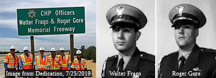 The portion of Route 99 from E Mission
Avenue (~ MER R11.596) to Campus Parkway (~ MER R11.687) in Merced is
officially named the "CHP Officer Walter Frago and Roger Gore Memorial
Freeway". On April 5, 1970, four California Highway Patrol Officers
were murdered in one of the worst uniformed police officer killing
incidents in American history when Officers George Aleyn, Walter Frago,
James Pence Jr., and Roger Gore were gunned down just off of Interstate 5.
Two of those officers, Walter Frago and Roger Gore were from Merced
County, Officer Frago having grown up in Merced, while Roger Gore resided
in Snelling. The officers were on the lookout for a suspect who had been
reportedly seen brandishing a weapon. Officers Frago and Gore were the
first on the scene, pulling over a vehicle with two men, when a gun fight
ensued leaving both of these fine officers dead at the age of 23 years.
Named by Assembly Concurrent Resolution 180, Chapter 147, September 18,
2000. The signage was installed and dedicated on July 25, 2019. Caltrans
was on-hand at the ceremony to support its partners such as the CHP.
Caltrans' representatives on-hand included Deputy District Director for
Maintenance Samuel Jordan, Valley Maintenance Manager Jon Bevan, Merced
Maintenance Superintendent Dave Taylor, and Maintenance Supervisors Brian
Cox, Dennis Clay, and Chad Grissom. Gore, Frago, and fellow Officers
George Alleyn and James Pence, all lost their lives during a shooting on
April 6, 1970.
The portion of Route 99 from E Mission
Avenue (~ MER R11.596) to Campus Parkway (~ MER R11.687) in Merced is
officially named the "CHP Officer Walter Frago and Roger Gore Memorial
Freeway". On April 5, 1970, four California Highway Patrol Officers
were murdered in one of the worst uniformed police officer killing
incidents in American history when Officers George Aleyn, Walter Frago,
James Pence Jr., and Roger Gore were gunned down just off of Interstate 5.
Two of those officers, Walter Frago and Roger Gore were from Merced
County, Officer Frago having grown up in Merced, while Roger Gore resided
in Snelling. The officers were on the lookout for a suspect who had been
reportedly seen brandishing a weapon. Officers Frago and Gore were the
first on the scene, pulling over a vehicle with two men, when a gun fight
ensued leaving both of these fine officers dead at the age of 23 years.
Named by Assembly Concurrent Resolution 180, Chapter 147, September 18,
2000. The signage was installed and dedicated on July 25, 2019. Caltrans
was on-hand at the ceremony to support its partners such as the CHP.
Caltrans' representatives on-hand included Deputy District Director for
Maintenance Samuel Jordan, Valley Maintenance Manager Jon Bevan, Merced
Maintenance Superintendent Dave Taylor, and Maintenance Supervisors Brian
Cox, Dennis Clay, and Chad Grissom. Gore, Frago, and fellow Officers
George Alleyn and James Pence, all lost their lives during a shooting on
April 6, 1970.
(Source: Dedication photo and information from Caltrans District 10 FB page; KHTS 1220)
 The portion of Route 99 between Childs Avenue (~MER 13.054) and 16th Street (~ MER
16.583) in the City of Merced is named the "Officer Stephan Gene Gray
Memorial Highway". This segment was named in memory of Officer
Stephan Gene Gray of the Merced Police Department, who was killed in the
line of duty on April 15, 2004, while working in an undercover detail with
the Special Operations Unit specializing in street level narcotics and
gang violence suppression. Officer Gray was born on August 21, 1969, in
Tulare; he attended local schools until his family relocated to Hanford,
where he graduated from Hanford High School in 1987. Officer Gray attended
Fresno City College for two years, and entered the Fresno Police Academy;
upon completion, he was hired as an officer by the Merced Police
Department. Highly decorated, Officer Gray was a gallant and dedicated
officer who exemplified the true character of the brave men and women who
devote their time and energy to the perilous duties of law enforcement.
Named by Senate Concurrent Resolution (SCR) 7, Resolution Chapter 56, on
05/25/2006.
The portion of Route 99 between Childs Avenue (~MER 13.054) and 16th Street (~ MER
16.583) in the City of Merced is named the "Officer Stephan Gene Gray
Memorial Highway". This segment was named in memory of Officer
Stephan Gene Gray of the Merced Police Department, who was killed in the
line of duty on April 15, 2004, while working in an undercover detail with
the Special Operations Unit specializing in street level narcotics and
gang violence suppression. Officer Gray was born on August 21, 1969, in
Tulare; he attended local schools until his family relocated to Hanford,
where he graduated from Hanford High School in 1987. Officer Gray attended
Fresno City College for two years, and entered the Fresno Police Academy;
upon completion, he was hired as an officer by the Merced Police
Department. Highly decorated, Officer Gray was a gallant and dedicated
officer who exemplified the true character of the brave men and women who
devote their time and energy to the perilous duties of law enforcement.
Named by Senate Concurrent Resolution (SCR) 7, Resolution Chapter 56, on
05/25/2006.
(Image source: Gribblenation; Merced PD)
 The northbound and southbound portion of Route 99 between Franklin Road (~ MER 18.384)
and the Winton Way and Applegate Road exit (~ MER 22.747) in Atwater is
officially named the "Correctional Officer Jose Rivera Memorial
Highway", This segment was named in memory of Federal Correctional
Officer Jose Rivera was violently murdered on June 20, 2008 by two inmates
while employed at the United States Penitentiary Atwater in Atwater.
Officer Rivera died needlessly at a very young age. The third of five
children, Officer Rivera grew up in Chowchilla and graduated from Le Grand
High School in 2003. Shortly thereafter, Officer Rivera enlisted in the
United States Navy. Officer Rivera served four years in the military,
which included two tours in Iraq. After serving his country overseas,
Officer Rivera returned to serve his country at home; and upon his return,
Officer Rivera began working for the Federal Bureau of Prisons in Atwater.
Officer Rivera's death is tragic and a reminder that the law enforcement
officers who serve the public risk their lives on a daily basis. Named by
Senate Concurrent Resolution (SCR) 118, Resolution Chapter 129, on
9/7/2010.
The northbound and southbound portion of Route 99 between Franklin Road (~ MER 18.384)
and the Winton Way and Applegate Road exit (~ MER 22.747) in Atwater is
officially named the "Correctional Officer Jose Rivera Memorial
Highway", This segment was named in memory of Federal Correctional
Officer Jose Rivera was violently murdered on June 20, 2008 by two inmates
while employed at the United States Penitentiary Atwater in Atwater.
Officer Rivera died needlessly at a very young age. The third of five
children, Officer Rivera grew up in Chowchilla and graduated from Le Grand
High School in 2003. Shortly thereafter, Officer Rivera enlisted in the
United States Navy. Officer Rivera served four years in the military,
which included two tours in Iraq. After serving his country overseas,
Officer Rivera returned to serve his country at home; and upon his return,
Officer Rivera began working for the Federal Bureau of Prisons in Atwater.
Officer Rivera's death is tragic and a reminder that the law enforcement
officers who serve the public risk their lives on a daily basis. Named by
Senate Concurrent Resolution (SCR) 118, Resolution Chapter 129, on
9/7/2010.
(Image source: Federal Bureau of Prisons)
 The portion of Route 99 constructed to freeway standards
near the City of Livingston (~ MER R28.8 to MER R31.068) is colloquially
called the "Livingston Freeway". Officially, it is the "Kenneth
L. Maddy Freeway" (signed as "Kenneth L. Maddy Memorial Highway").
Kenneth L. Maddy served as California Senate Republican leader (1987-1995)
and was the legislative proponent of the Livingston Bypass on Route 99.
Named by Senate Concurrent Resolution 25, Chapter 85, in 1997.
The portion of Route 99 constructed to freeway standards
near the City of Livingston (~ MER R28.8 to MER R31.068) is colloquially
called the "Livingston Freeway". Officially, it is the "Kenneth
L. Maddy Freeway" (signed as "Kenneth L. Maddy Memorial Highway").
Kenneth L. Maddy served as California Senate Republican leader (1987-1995)
and was the legislative proponent of the Livingston Bypass on Route 99.
Named by Senate Concurrent Resolution 25, Chapter 85, in 1997.
(Image source: Gribblenation; Join California)
 The portion of Route 99 between the
Stanislaus/Merced County line in the County of Stanislaus (near Turlock)
(STA R0.0) and Mitchell Road (near Ceres) (~ STA R10.18) is named the "Joash
E. Paul Memorial Highway". Named in honor of Joash E. Paul, a
lifelong resident of the City of Turlock where he was a rancher, an
entrepreneur, and a dedicated servant of the people of Stanislaus County.
Born on September 23, 1919, Joash Paul was elected to the Stanislaus
County Board of Supervisors in 1968 and served as a board member until
1980. He worked in real estate for 25 years, and until the mid-1970s
helped operate a family-owned lodging and dining establishment along Route 99 when it passed through the City of Turlock. After retiring from the
board of supervisors, he served as president of the fund-raising
foundation for the then county-owned Scenic General Hospital in the City
of Modesto. He was an active member of various community organizations in
the City of Turlock, including the Assyrian American Civic Club, the
Sacred Heart Catholic Church, and the Portuguese Union of the State of
California. Joash E. Paul died in 2000. Named by Assembly Concurrent
Resolution 19, Chaptered 7/2/2003, Chapter 81.
The portion of Route 99 between the
Stanislaus/Merced County line in the County of Stanislaus (near Turlock)
(STA R0.0) and Mitchell Road (near Ceres) (~ STA R10.18) is named the "Joash
E. Paul Memorial Highway". Named in honor of Joash E. Paul, a
lifelong resident of the City of Turlock where he was a rancher, an
entrepreneur, and a dedicated servant of the people of Stanislaus County.
Born on September 23, 1919, Joash Paul was elected to the Stanislaus
County Board of Supervisors in 1968 and served as a board member until
1980. He worked in real estate for 25 years, and until the mid-1970s
helped operate a family-owned lodging and dining establishment along Route 99 when it passed through the City of Turlock. After retiring from the
board of supervisors, he served as president of the fund-raising
foundation for the then county-owned Scenic General Hospital in the City
of Modesto. He was an active member of various community organizations in
the City of Turlock, including the Assyrian American Civic Club, the
Sacred Heart Catholic Church, and the Portuguese Union of the State of
California. Joash E. Paul died in 2000. Named by Assembly Concurrent
Resolution 19, Chaptered 7/2/2003, Chapter 81.
(Image source: Ceres Courier)
 The portion of Route 99
between the junction with Route 219 near Salida (~ STA 0.076) and the
Pelandale Avenue exit (on the northern end of Modesto) (~ STA R21.67) in
Stanislaus County is offiically named the "CHP Officer Earl Scott
Memorial Highway". This segment was named in memory of California
Highway Patrol Officer Earl Scott, who was tragically shot and killed on
February 17, 2006 while making a traffic stop on Route 99 in Stanislaus
County. Officer Scott was 36 years old and had served with the California
Highway Patrol (CHP) for five years. Officer Scott came from a long line
of family members who devoted themselves to public service under the
auspices of the CHP, including his father and two uncles who retired from
the CHP as sergeants, and a cousin who currently serves as a sergeant with
the CHP. Officer Scott is remembered as being the first to volunteer for
such causes as shaving his head for "Shave the Brave," a fundraiser for
cancer victims; and he also frequently took youth Law Enforcement
Explorers on ride-alongs. Named by Senate Concurrent Resolution (SCR) 120,
Resolution Chapter 130, on 9/7/2010.
The portion of Route 99
between the junction with Route 219 near Salida (~ STA 0.076) and the
Pelandale Avenue exit (on the northern end of Modesto) (~ STA R21.67) in
Stanislaus County is offiically named the "CHP Officer Earl Scott
Memorial Highway". This segment was named in memory of California
Highway Patrol Officer Earl Scott, who was tragically shot and killed on
February 17, 2006 while making a traffic stop on Route 99 in Stanislaus
County. Officer Scott was 36 years old and had served with the California
Highway Patrol (CHP) for five years. Officer Scott came from a long line
of family members who devoted themselves to public service under the
auspices of the CHP, including his father and two uncles who retired from
the CHP as sergeants, and a cousin who currently serves as a sergeant with
the CHP. Officer Scott is remembered as being the first to volunteer for
such causes as shaving his head for "Shave the Brave," a fundraiser for
cancer victims; and he also frequently took youth Law Enforcement
Explorers on ride-alongs. Named by Senate Concurrent Resolution (SCR) 120,
Resolution Chapter 130, on 9/7/2010.
(Image source: Modesto Bee, Officer Down Memorial Page)
 The interchange at Route 99 and Whitmore Avenue (~ STA R11.948) in the City of
Ceres is named the "Sergeant Howard K. Stevenson Memorial Interchange".
It was named in memory of Sergeant Howard K. "Howie" Stevenson, who was
born on February 18, 1965. On June 3, 1986, at 21 years of age, Stevenson
became a peace officer with the Ceres Police Department. On January 9,
2005, while responding to a call for assistance at a local liquor store,
Sergeant Stevenson and fellow officers were ambushed and met with a hail
of gunfire from an assault rifle. Sergeant Stevenson died almost
instantly. Sergeant Stevenson was the first police officer in the 86-year
history of the City of Ceres to be killed in the line of duty. Sergeant
Stevenson is remembered affectionately by his fellow officers as being a
role model and mentor to younger officers, and as being "a cops' cop".
Named by Assembly Concurrent Resolution (ACR) 20, Resolution Chapter 77,
on 7/17/2009.
The interchange at Route 99 and Whitmore Avenue (~ STA R11.948) in the City of
Ceres is named the "Sergeant Howard K. Stevenson Memorial Interchange".
It was named in memory of Sergeant Howard K. "Howie" Stevenson, who was
born on February 18, 1965. On June 3, 1986, at 21 years of age, Stevenson
became a peace officer with the Ceres Police Department. On January 9,
2005, while responding to a call for assistance at a local liquor store,
Sergeant Stevenson and fellow officers were ambushed and met with a hail
of gunfire from an assault rifle. Sergeant Stevenson died almost
instantly. Sergeant Stevenson was the first police officer in the 86-year
history of the City of Ceres to be killed in the line of duty. Sergeant
Stevenson is remembered affectionately by his fellow officers as being a
role model and mentor to younger officers, and as being "a cops' cop".
Named by Assembly Concurrent Resolution (ACR) 20, Resolution Chapter 77,
on 7/17/2009.
(Image source: American Legion/Facebook, Ceres Memorial Page)
 The portion of Route 99 from the Stanislaus
county line (seemingly the southern end S of Turlock, although it wasn't
explicit in the resolution) (~ STA 0.0) to Route 132 in Modesto (~ STA
14.762) is named the "John G. Veneman Freeway". It was named by
Assembly Concurrent Resolution No. 171, Chapter 131, in 1984. John Veneman
was born in 1925 in Corcoran, California. In 1944, he graduated from
Arizona State College. After serving with the United States Naval Reserve
(1944-1945), he attended the University of Texas. In 1959, he was elected
to the Board of Supervisors of Stanislaus County, where he served until
1962. In 1962, he was elected to the California State Assembly, serving
until 1969. He authored legislation to improve and complete the section of
Route 99 from Modesto to Turlock, which bears his name. In 1969, he was
appointed Under Secretary, Department of Health, Education and Welfare. In
1973, he left government for private industry. He died in 1982 in
Sacramento, California.
The portion of Route 99 from the Stanislaus
county line (seemingly the southern end S of Turlock, although it wasn't
explicit in the resolution) (~ STA 0.0) to Route 132 in Modesto (~ STA
14.762) is named the "John G. Veneman Freeway". It was named by
Assembly Concurrent Resolution No. 171, Chapter 131, in 1984. John Veneman
was born in 1925 in Corcoran, California. In 1944, he graduated from
Arizona State College. After serving with the United States Naval Reserve
(1944-1945), he attended the University of Texas. In 1959, he was elected
to the Board of Supervisors of Stanislaus County, where he served until
1962. In 1962, he was elected to the California State Assembly, serving
until 1969. He authored legislation to improve and complete the section of
Route 99 from Modesto to Turlock, which bears his name. In 1969, he was
appointed Under Secretary, Department of Health, Education and Welfare. In
1973, he left government for private industry. He died in 1982 in
Sacramento, California.
(Image source: AAroads)
 The portion of Route 99 between
Tuolumne Boulevard (~ STA R15.116) and Standiford Avenue/Beckwith Road
(~STA R20.269) in Modesto is named the "Jerry Medina Memorial Freeway".
This section of highway was named to remind all of us of the need to keep
safety a priority and a reminder to cherish every day and enjoy it to the
fullest. It was named after Jerry Medina, an 18 year old killed on March
29, 2001 when a truck crossed the highway median and landed on Jerry's car
near Maze Boulevard. Five other people were injured as a result of this
accident. Named by Assembly Concurrent Resolution 168, Chapter 140, on
September 3, 2002.
The portion of Route 99 between
Tuolumne Boulevard (~ STA R15.116) and Standiford Avenue/Beckwith Road
(~STA R20.269) in Modesto is named the "Jerry Medina Memorial Freeway".
This section of highway was named to remind all of us of the need to keep
safety a priority and a reminder to cherish every day and enjoy it to the
fullest. It was named after Jerry Medina, an 18 year old killed on March
29, 2001 when a truck crossed the highway median and landed on Jerry's car
near Maze Boulevard. Five other people were injured as a result of this
accident. Named by Assembly Concurrent Resolution 168, Chapter 140, on
September 3, 2002.
(Image source: Gribblenation)
 The portion of Route 99 between the Cities of Salida (~ STA
R20.246) and Manteca (~ SJ 5.703) is officially named "The 442nd
Regimental Combat Team Memorial Highway". The "100th
Infantry" and "442nd Regimental" names are in
honor of the Nisei Soldiers of World War II who served in units of the
United States Armed Forces comprising the 100/442/MIS triad. Named by
Assembly Concurrent Resolution No. 62, Chapter 115 in 1994. The other part
of the triad is on Route 23.
The portion of Route 99 between the Cities of Salida (~ STA
R20.246) and Manteca (~ SJ 5.703) is officially named "The 442nd
Regimental Combat Team Memorial Highway". The "100th
Infantry" and "442nd Regimental" names are in
honor of the Nisei Soldiers of World War II who served in units of the
United States Armed Forces comprising the 100/442/MIS triad. Named by
Assembly Concurrent Resolution No. 62, Chapter 115 in 1994. The other part
of the triad is on Route 23.
(Image source: Gribblenation; 100th Batallion; Hawaii Reporter)
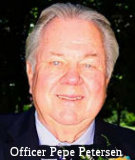 The portion of Route 99 between Mariposa Road (SJ 16.698) and Arch
Road (SJ 14.568) in the County of San Joaquin is named the Officer
Pepe Petersen Memorial Highway. It was named in memory of Officer
Laurits “Pepe” Petersen, whospent 30 years with the Stockton
Police Department. Officer Petersen graduated from Stockton High School
and completed law enforcement-related courses at San Joaquin Delta
College. Officer Petersen served his country from 1962 to 1964, inclusive,
in the United States Army, and joined the Stockton Police Department in
1968. Officer Petersen started work as a patrol officer and then worked as
a detective in the homicide division until his retirement in 1998. After
retiring, Officer Petersen worked for the San Joaquin County District
Attorney’s Office as an investigator and as a homicide detective.
Officer Petersen died February 23, 2016, after he was attacked in the 8300
block of Tam O’Shanter Drive near Cortez Park north of East Hammer
Lane, in the City of Stockton, and an autopsy revealed that Officer
Petersen was stabbed and shot. Named by Senate Concurrent Resolution 46,
Resolution Chapter 162, 9/20/2019.
The portion of Route 99 between Mariposa Road (SJ 16.698) and Arch
Road (SJ 14.568) in the County of San Joaquin is named the Officer
Pepe Petersen Memorial Highway. It was named in memory of Officer
Laurits “Pepe” Petersen, whospent 30 years with the Stockton
Police Department. Officer Petersen graduated from Stockton High School
and completed law enforcement-related courses at San Joaquin Delta
College. Officer Petersen served his country from 1962 to 1964, inclusive,
in the United States Army, and joined the Stockton Police Department in
1968. Officer Petersen started work as a patrol officer and then worked as
a detective in the homicide division until his retirement in 1998. After
retiring, Officer Petersen worked for the San Joaquin County District
Attorney’s Office as an investigator and as a homicide detective.
Officer Petersen died February 23, 2016, after he was attacked in the 8300
block of Tam O’Shanter Drive near Cortez Park north of East Hammer
Lane, in the City of Stockton, and an autopsy revealed that Officer
Petersen was stabbed and shot. Named by Senate Concurrent Resolution 46,
Resolution Chapter 162, 9/20/2019.
(Image source: Recordnet)
The portion between Route 4 in Stockton (~SJ 17.467) and Hammer Lane (~ SJ 22.905) is officially designated the "Women Veterans' Highway". Named in recognition of the sacrifices made by women in defense of our nation that began over 220 years ago with the American Revolution and continues today. Throughout our country's history, nearly two million women have attained the esteemed title of veteran because of their service to the United States. In 1999, women comprised 14 percent of all Americans in military uniform and accounted for 20 percent of all new recruits. Though women were not permitted to participate in the United States' armed forces in earlier years, historical records verify that over 60 women were either wounded or killed at various battles during the Civil War. In 1901, the United States' Army recognized women's enthusiasm to serve our country by establishing the first official entity for women named the Army Nurse Corps, without providing the benefit of military rank, equal pay, or benefits. Because of their courageous efforts and determined commitment to their country, women were finally granted attendance to the United States Military Academies in 1975 when Congress introduced and passed a law allowing for these highly regarded universities to become coeducational. Named by Senate Concurrent Resolution 43, Chapter 129, 9/12/2003.
 The portion of this route between Route 4 in Stockton (~SJ 17.467) and Route 50 (~ SAC R24.236) in Sacramento is named the "Purple Hearts Veterans
Highway" (although it is signed as the "Purple Hearts Veterans
Freeway"). It was named by Senate Concurrent Resolution 54, Chapter
19, in 1992.
The portion of this route between Route 4 in Stockton (~SJ 17.467) and Route 50 (~ SAC R24.236) in Sacramento is named the "Purple Hearts Veterans
Highway" (although it is signed as the "Purple Hearts Veterans
Freeway"). It was named by Senate Concurrent Resolution 54, Chapter
19, in 1992.
(Image Source: AARoads)
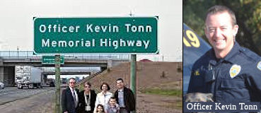 The portion of Route 99 in the City of Galt (~SJ 38.749 to SAC
0.005) is named the "Officer Kevin Tonn Memorial Highway". It was
named in memory of Kevin Tonn, who became interested in law enforcement
prior to entering high school, as his father attended the Sacramento
County Sheriff’s Academy and his uncle was a special agent with the
Department of Justice. Kevin Tonn, in high school, joined the Roseville
Police Explorers and started down the path of helping and serving others.
At 19 years of age, Kevin Tonn enlisted in the United States Army and
became a military policeman and, following his military service, he became
a firefighter in the State of New York for eight years, rising to the rank
of assistant chief. Kevin Tonn later returned to California and, after
working as a fire prevention officer for the City of Sacramento and later
owning and operating a letter and parcel shipping business, he attended
the Sacramento County Sheriff’s Academy and eventually became a
police officer in the City of Galt in September 2009. Officer Tonn was
later promoted to the K-9 unit of the Galt Police Department, serving
along with his dog, Yaro. On January 15, 2013, after three and one-half
years of service, Officer Tonn, while responding to an in-progress
residential burglary, was shot by an individual he had sought to question,
and later succumbed to his injuries at Kaiser Hospital. Named by Senate
Concurrent Resolution 74, Res. Chapter 74, on June 26, 2014.
The portion of Route 99 in the City of Galt (~SJ 38.749 to SAC
0.005) is named the "Officer Kevin Tonn Memorial Highway". It was
named in memory of Kevin Tonn, who became interested in law enforcement
prior to entering high school, as his father attended the Sacramento
County Sheriff’s Academy and his uncle was a special agent with the
Department of Justice. Kevin Tonn, in high school, joined the Roseville
Police Explorers and started down the path of helping and serving others.
At 19 years of age, Kevin Tonn enlisted in the United States Army and
became a military policeman and, following his military service, he became
a firefighter in the State of New York for eight years, rising to the rank
of assistant chief. Kevin Tonn later returned to California and, after
working as a fire prevention officer for the City of Sacramento and later
owning and operating a letter and parcel shipping business, he attended
the Sacramento County Sheriff’s Academy and eventually became a
police officer in the City of Galt in September 2009. Officer Tonn was
later promoted to the K-9 unit of the Galt Police Department, serving
along with his dog, Yaro. On January 15, 2013, after three and one-half
years of service, Officer Tonn, while responding to an in-progress
residential burglary, was shot by an individual he had sought to question,
and later succumbed to his injuries at Kaiser Hospital. Named by Senate
Concurrent Resolution 74, Res. Chapter 74, on June 26, 2014.
(Image source: NorCal COPS; Officer Down Memorial Page)
The portion between the Sacramento County line near Galt (~ SAC 0.0) and Route 50 (~ SAC R24.236) is named the "South Sacramento Freeway". This was named after the unincorporated area of South Sacramento, which consists of parts of the incorporated city of Sacramento as well as the unincorporated enclave of Parkway, a place with a distinctive street grid where every route is a "parkway" of some sort.
 Lenehan") The portion of Route 99 between Grant Line Road (SAC 10.070) and the Sheldon
Road Overcrossing Bridge № 24-0374 (SAC 14.869) is named the “Police
Officer Tyler “Ty” Lenehan Memorial Highway”. It
was named in memory of Tyler “Ty” Lenehan, who was born in
Provo, Utah, in July 1977. Lenehan graduated from Oak Ridge High School in
El Dorado Hills; and after graduation, Lenehan became an aircraft
structural maintenance journeyman in the United States Air Force. Lenehan
graduated from the police academy in 2012 though the Sacramento Regional
Public Safety Training Center, American River College; and became a
reserve police officer with the Citrus Heights Police Department in 2012.
Lenehan later worked at the Galt Police Department from 2014 to 2016 where
he became a motor officer; and then at the Elk Grove Police Department
beginning in 2016, where he started working patrol and ultimately became a
motor officer in 2020. Lenehan’s watch ended while on duty January
21, 2022, when he sustained fatal injuries as the result of being hit on
Route 99 near 12th Avenue in the City of Sacramento by a drunk driver who
was driving in the wrong direction. Named by Assembly Resolution ACR 194, Res. Chapter 169, 09/06/22.
The portion of Route 99 between Grant Line Road (SAC 10.070) and the Sheldon
Road Overcrossing Bridge № 24-0374 (SAC 14.869) is named the “Police
Officer Tyler “Ty” Lenehan Memorial Highway”. It
was named in memory of Tyler “Ty” Lenehan, who was born in
Provo, Utah, in July 1977. Lenehan graduated from Oak Ridge High School in
El Dorado Hills; and after graduation, Lenehan became an aircraft
structural maintenance journeyman in the United States Air Force. Lenehan
graduated from the police academy in 2012 though the Sacramento Regional
Public Safety Training Center, American River College; and became a
reserve police officer with the Citrus Heights Police Department in 2012.
Lenehan later worked at the Galt Police Department from 2014 to 2016 where
he became a motor officer; and then at the Elk Grove Police Department
beginning in 2016, where he started working patrol and ultimately became a
motor officer in 2020. Lenehan’s watch ended while on duty January
21, 2022, when he sustained fatal injuries as the result of being hit on
Route 99 near 12th Avenue in the City of Sacramento by a drunk driver who
was driving in the wrong direction. Named by Assembly Resolution ACR 194, Res. Chapter 169, 09/06/22.
(Image source: Elk Grove Tribune)
 Named Structures
 The Hosking Ave (~ KER 18.546) interchange over Route 99 in the City of
Bakersfield is named the "Bakersfield Police Officer David J. Nelson
Memorial Bridge". It was named in memory of Officer David J. Nelson
of the Bakersfield Police Department, who gave his life on June 26, 2015
while performing his sworn duty to protect the citizens of the City of
Bakersfield, Officer Nelson graduated from the Kern County Law Enforcement
Training Academy on June 21, 2013, and served with distinction during his
tenure as a City of Bakersfield police officer. Officer Nelson was chosen
as a defensive tactics instructor for the Bakersfield Police Department in
recognition of his advanced skill in officer safety techniques and,
because of his commitment to excellence, was also selected to mentor and
train police officer trainees. On June 26, 2015, Officer Nelson attempted
to detain a dangerous and armed suspect who likely was planning to harm a
citizen of Bakersfield. When the suspect failed to stop his vehicle as
directed, Officer Nelson bravely gave chase and, during the pursuit of the
suspect, Officer Nelson was killed in a fatal vehicle accident. Named by
Assembly Concurrent Resolution 107, Resolution Chapter 45, on May 23,
2016.
The Hosking Ave (~ KER 18.546) interchange over Route 99 in the City of
Bakersfield is named the "Bakersfield Police Officer David J. Nelson
Memorial Bridge". It was named in memory of Officer David J. Nelson
of the Bakersfield Police Department, who gave his life on June 26, 2015
while performing his sworn duty to protect the citizens of the City of
Bakersfield, Officer Nelson graduated from the Kern County Law Enforcement
Training Academy on June 21, 2013, and served with distinction during his
tenure as a City of Bakersfield police officer. Officer Nelson was chosen
as a defensive tactics instructor for the Bakersfield Police Department in
recognition of his advanced skill in officer safety techniques and,
because of his commitment to excellence, was also selected to mentor and
train police officer trainees. On June 26, 2015, Officer Nelson attempted
to detain a dangerous and armed suspect who likely was planning to harm a
citizen of Bakersfield. When the suspect failed to stop his vehicle as
directed, Officer Nelson bravely gave chase and, during the pursuit of the
suspect, Officer Nelson was killed in a fatal vehicle accident. Named by
Assembly Concurrent Resolution 107, Resolution Chapter 45, on May 23,
2016.
(Image Source: Bakersfield.Com)
Bridge № 39-196 over Shanks Road (~ MER R34.45) in Merced county is named the "Dallas C. Bache Interchange". Dallas C. Bache was a dedicated civic leader whose efforts helped to bring about the construction of the Delhi Freeway in the 1970's. It was built in 1979, and was named by Assembly Concurrent Resolution 104, Chapter 43, in 1978 (before construction was finished).
 The overcrossing, in both directions, on Route 99 at Exit 236, Main Street, in the City of
Ripon (approximately post mile SJ 99 0.888) in the County of San Joaquin
is named the Officer Robert W. Winget Memorial Overpass. It was
named in memory of Officer Bob Winget, a United States Marine who served
in Vietnam and who had a 37-year law enforcement career. This career begin
in the early 1970s, serving the Los Angeles Police Department for 20
years, after which he moved north and became a deputy sheriff for the
County of Stanislaus, where he served for 12 years and was a longtime Drug
Abuse Resistance Education officer. In 2005, Officer Bob Winget moved to
the Ripon Police Department, where his duties included working with
K–9 officers and the all-terrain vehicle patrol. His partner was
Topper, the department’s antinarcotics K–9. Officer Robert
“Bob” Winget left for patrol from the Ripon Police Department
on the morning of April 10, 2007, where he was assigned to a southern area
in the City of Ripon, near the banks of the Stanislaus River in the Ripon
River Crossing area in his all-terrain patrol vehicle. At 11:40 a.m.,
dispatchers received an “undecipherable” transmission from
Officer Bob Winget. The Ripon Police Department set up a mobile command
center and began assigning Ripon police, fire, public works personnel, and
citizens in search grids to attempt to locate Officer Bob Winget. At
approximately 1:14 p.m., a Ripon Consolidated Fire District search crew
located Officer Bob Winget unconscious following a crash of his
all-terrain patrol vehicle along the river area west of Route 99. Crews
immediately began cardiopulmonary resuscitation and brought in a
four-wheel drive rescue vehicle that removed him from the area into a
waiting Ripon Consolidated Fire District ambulance. Officer Bob Winget was
transported to Doctor’s Hospital in the City of Modesto, where he
was pronounced deceased at approximately 2:27 p.m. from traumatic injuries
associated with the crash. Officer Bob Winget was memorialized and laid to
rest on April 17, 2007. Nearly 1,000 uniformed peace officers from around
the state gathered with Officer Bob Winget’s family and friends for
the funeral service at First Baptist Church in the City of Modesto.
Hundreds of citizens lined the streets of the Cities of Ripon and Modesto
to watch the motor procession pass on its way to Burwood Cemetery in the
County of San Joaquin, where he was laid to rest Named by Assembly
Concurrent Resolution (ACR) 127, Res. Chapter 41, 09/14/20.
The overcrossing, in both directions, on Route 99 at Exit 236, Main Street, in the City of
Ripon (approximately post mile SJ 99 0.888) in the County of San Joaquin
is named the Officer Robert W. Winget Memorial Overpass. It was
named in memory of Officer Bob Winget, a United States Marine who served
in Vietnam and who had a 37-year law enforcement career. This career begin
in the early 1970s, serving the Los Angeles Police Department for 20
years, after which he moved north and became a deputy sheriff for the
County of Stanislaus, where he served for 12 years and was a longtime Drug
Abuse Resistance Education officer. In 2005, Officer Bob Winget moved to
the Ripon Police Department, where his duties included working with
K–9 officers and the all-terrain vehicle patrol. His partner was
Topper, the department’s antinarcotics K–9. Officer Robert
“Bob” Winget left for patrol from the Ripon Police Department
on the morning of April 10, 2007, where he was assigned to a southern area
in the City of Ripon, near the banks of the Stanislaus River in the Ripon
River Crossing area in his all-terrain patrol vehicle. At 11:40 a.m.,
dispatchers received an “undecipherable” transmission from
Officer Bob Winget. The Ripon Police Department set up a mobile command
center and began assigning Ripon police, fire, public works personnel, and
citizens in search grids to attempt to locate Officer Bob Winget. At
approximately 1:14 p.m., a Ripon Consolidated Fire District search crew
located Officer Bob Winget unconscious following a crash of his
all-terrain patrol vehicle along the river area west of Route 99. Crews
immediately began cardiopulmonary resuscitation and brought in a
four-wheel drive rescue vehicle that removed him from the area into a
waiting Ripon Consolidated Fire District ambulance. Officer Bob Winget was
transported to Doctor’s Hospital in the City of Modesto, where he
was pronounced deceased at approximately 2:27 p.m. from traumatic injuries
associated with the crash. Officer Bob Winget was memorialized and laid to
rest on April 17, 2007. Nearly 1,000 uniformed peace officers from around
the state gathered with Officer Bob Winget’s family and friends for
the funeral service at First Baptist Church in the City of Modesto.
Hundreds of citizens lined the streets of the Cities of Ripon and Modesto
to watch the motor procession pass on its way to Burwood Cemetery in the
County of San Joaquin, where he was laid to rest Named by Assembly
Concurrent Resolution (ACR) 127, Res. Chapter 41, 09/14/20.
(Image source: Recordnet.Com)
This route also has the following Safety Roadside Rest Areas:
 Philip S. Raine (Tipton), in Tulare County 2.5 mi N of Tipton (~ TUL 22.4). It was named in 1982 in honor of Philip S. Raine, Chief of the Division of Highways
in Sacramento until he was forced into an early retirement with
subsequent death by cancer in 1981. CALTRANS and The Great Valley
Center, with the support of the American Institute of Architects,
California Council, and private organizations, are partnering in an open
one-stage international competition to select a design, and thereby a
design team, to update this stop as a self-sustainable and "off the
grid" roadside GreenStop. In other words, the goal is to make this a
"green" rest area that can serve as a model for current and future rest
stops within the state system, with the ability to be customized so as
to be regionally relevant for each location. Details on the competition
may be found at http://www.greenstopdesign.com/.
Philip S. Raine (Tipton), in Tulare County 2.5 mi N of Tipton (~ TUL 22.4). It was named in 1982 in honor of Philip S. Raine, Chief of the Division of Highways
in Sacramento until he was forced into an early retirement with
subsequent death by cancer in 1981. CALTRANS and The Great Valley
Center, with the support of the American Institute of Architects,
California Council, and private organizations, are partnering in an open
one-stage international competition to select a design, and thereby a
design team, to update this stop as a self-sustainable and "off the
grid" roadside GreenStop. In other words, the goal is to make this a
"green" rest area that can serve as a model for current and future rest
stops within the state system, with the ability to be customized so as
to be regionally relevant for each location. Details on the competition
may be found at http://www.greenstopdesign.com/.  C. H. Warlow (Kingsburg) in Tulare County (~TUL 51.987) at Dodge Avenue near the Kings River. Chester Warlow was a member of the California Highway Commission
from Fresno. He was also a member of the Shaver Lake fishing club (there
is a picture of him in the gallery at www.shaverlake.org/gallery.html). Mt. Warlow near Muir Pass was also named for him.
C. H. Warlow (Kingsburg) in Tulare County (~TUL 51.987) at Dodge Avenue near the Kings River. Chester Warlow was a member of the California Highway Commission
from Fresno. He was also a member of the Shaver Lake fishing club (there
is a picture of him in the gallery at www.shaverlake.org/gallery.html). Mt. Warlow near Muir Pass was also named for him.  Enoch Christoffersen Memorial Rest Area,
S of Turlock in Stanislaus County (~STA R0.297). Enoch Christoffersen served as Mayor of the City of Turlock from 1952 to 1958,
and again from 1962 to 1978. Named by Assembly Concurrent Resolution No.
41, Chapter 60, in 1993.
Enoch Christoffersen Memorial Rest Area,
S of Turlock in Stanislaus County (~STA R0.297). Enoch Christoffersen served as Mayor of the City of Turlock from 1952 to 1958,
and again from 1962 to 1978. Named by Assembly Concurrent Resolution No.
41, Chapter 60, in 1993.  The Enoch Christoffersen rest area is home to the District 10
Fallen Highway Workers Memorial. The fallen workers from District 10 memorialized on the newly
installed sign include:
The Enoch Christoffersen rest area is home to the District 10
Fallen Highway Workers Memorial. The fallen workers from District 10 memorialized on the newly
installed sign include:
(Source: Caltrans, 8/15/2023; Photos courtesy of Caltrans, District 10 Public Information Office)
 Historical Route
 This segment is designated as part of "Historic US Highway 99" by Assembly Concurrent
Resolution 19, Chapter 73, in 1993. Historic Route 99 signage in the field
is as follows:
This segment is designated as part of "Historic US Highway 99" by Assembly Concurrent
Resolution 19, Chapter 73, in 1993. Historic Route 99 signage in the field
is as follows:
National Trails The portion of this route from Fresno to Stockton was part of the "Pacific Highway (Valley Route Portion)".

 This portion of this segment from Route 120 to US 50 (i.e., former US 50) was part of the coast-to-coast "Lincoln Highway"
and part of the "Victory Highway".
This portion of this segment from Route 120 to US 50 (i.e., former US 50) was part of the coast-to-coast "Lincoln Highway"
and part of the "Victory Highway".
Portions of this route were part of the "National Park to Park Highway".
US 99 appears to have been part of the "Jefferson Davis Highway". This was an attempt to commemorate the "Lost Cause" or "Southern Cause" narrative of the Civil War. Along US 99, a monument was located near Bakersfield. This is discussed in more detail on the Trails and Roads page.
 Classified Landcaped Freeway
The following segments are designated as Classified Landscaped Freeway:
| County | Route | Starting PM | Ending PM |
| Kern | 99 | 20.82 | 21.48 |
| Kern | 99 | 21.48 | 24.80 |
| Kern | 99 | 24.86 | 25.37 |
| Kern | 99 | 25.42 | 25.92 |
| Kern | 99 | 25.92 | 27.06 |
| Kern | 99 | 49.20 | 49.48 |
| Kern | 99 | 49.85 | 50.07 |
| Kern | 99 | 55.07 | 56.61 |
| Kern | 99 | 56.61 | 57.13 |
| Tulare | 99 | 5.98 | 6.29 |
| Tulare | 99 | 6.29 | 7.45 |
| Tulare | 99 | 12.16 | 12.93 |
| Tulare | 99 | 18.65 | 19.33 |
| Tulare | 99 | 28.33 | 30.06 |
| Tulare | 99 | 53.63 | 53.94 |
| Fresno | 99 | 0.00 | 1.26 |
| Fresno | 99 | 4.72 | 5.99 |
| Fresno | 99 | 6.17 | 6.81 |
| Fresno | 99 | 10.83 | 11.38 |
| Fresno | 99 | 12.61 | 12.93 |
| Fresno | 99 | 12.98 | 13.18 |
| Fresno | 99 | 14.71 | 16.54 |
| Fresno | 99 | 16.60 | 16.92 |
| Fresno | 99 | 16.92 | 17.10 |
| Fresno | 99 | 18.03 | 24.39 |
| Fresno | 99 | 24.39 | 24.48 |
| Fresno | 99 | 24.48 | 26.22 |
| Fresno | 99 | 26.22 | 26.64 |
| Fresno | 99 | 26.64 | 28.00 |
| Madera | 99 | 9.98 | 11.64 |
| Madera | 99 | 11.74 | 12.63 |
| Madera | 99 | 12.85 | 13.14 |
| Madera | 99 | 13.93 | 14.40 |
| Merced | 99 | 11.14 | 12.98 |
| Merced | 99 | 12.98 | 13.30 |
| Merced | 99 | 13.71 | 16.00 |
| Merced | 99 | 16.00 | 16.06 |
| Merced | 99 | 22.30 | 23.05 |
| Merced | 99 | 23.28 | 23.47 |
| Merced | 99 | 23.59 | 24.10 |
| Merced | 99 | 26.90 | 27.52 |
| Merced | 99 | 28.84 | 30.57 |
| Merced | 99 | 33.17 | 34.43 |
| Stanislaus | 99 | R2.83 | R3.87 |
| Stanislaus | 99 | R7.86 | 8.69 |
| Stanislaus | 99 | R11.24 | R11.90 |
| Stanislaus | 99 | R12.91 | R14.92 |
| Stanislaus | 99 | R15.06 | R16.47 |
| Stanislaus | 99 | R22.20 | R22.90 |
| Stanislaus | 99 | R22.94 | R23.06 |
| San Joaquin | 99 | 0.66 | 1.16 |
| San Joaquin | 99 | 2.07 | 2.55 |
| San Joaquin | 99 | 4.59 | 4.84 |
| San Joaquin | 99 | 4.84 | 5.00 |
| San Joaquin | 99 | 6.20 | 6.40 |
| San Joaquin | 99 | 6.54 | 6.80 |
| San Joaquin | 99 | 6.80 | 7.32 |
| San Joaquin | 99 | 7.42 | 7.96 |
| San Joaquin | 99 | 8.76 | 8.96 |
| San Joaquin | 99 | 14.36 | 14.74 |
| San Joaquin | 99 | 17.90 | 20.09 |
| San Joaquin | 99 | 22.76 | 23.07 |
| San Joaquin | 99 | 28.34 | 28.63 |
| San Joaquin | 99 | 28.82 | 31.64 |
| San Joaquin | 99 | 33.40 | 33.74 |
| San Joaquin | 99 | 36.55 | 36.84 |
 Freeway
[SHC 253.5] Entire portion. Added to the Freeway and Expressway system in 1959.
 Commuter Lanes
HOV lanes currently exist between Mack Road and Martin Luther King Blvd. in Sacramento. These lines are in operation between 6 AM and 10 AM, and 3 PM and 7 PM, on weekdays, and require a minumum of two people.
Caltrans plans to add lanes to the segments from 0.8mi S of Elk Grove Blvd to Mack Road (11.4 mi, planned opening October 1997), and from Martin Luther King Blvd to Route 51 (construction starts August 1999).
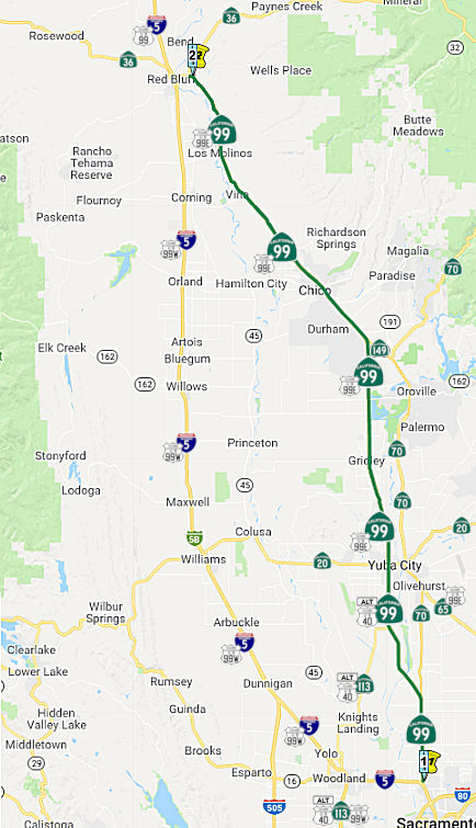 From Route 5 in Sacramento to Route 36 near Red Bluff, passing near Catlett and
Tudor.
From Route 5 in Sacramento to Route 36 near Red Bluff, passing near Catlett and
Tudor.
Post 1964 Signage HistoryIn 1963, this segment was covered by (b) and (c) of the original definition: “(b) Route 5 in Sacramento to Route 20, passing near Catlett and Tudor. (c) Route 20 to Route 5 near Red Bluff.”
The segment from Sacramento to the Route 70/Route 99 split was once cosigned as Route 70/Route 99, although it is legislatively Route 99. In 1969, this segment ran along Jibboom St., Garden Highway, El Centro Road.
The Chico bypass was completed by 1967. Before the Chico Bypass was constructed, the route through Durham and Richvale followed Richvale Highway west to Richvale, Richvale South Highway north to Nelson, Midway from Nelson to Chico via Durham, Main Street and Broadway through Chico, and Esplande north from Chico to current Route 99 near Wilson Landing Road.
In 1984, Chapter 409 combined (b) and (c), creating "(b) Route 5 in Sacramento to Route 5 near Red Bluff, passing near Catlett and Tudor."
In 1988, Chapter 106 changed the terminus of this segment to "Route 36 near Red Bluff"
Note that the original plans were for there to be an "East Valley"
corridor, consisting of Route 99 from I-5 north to Route 70, Route 70
north to Route 149, all of Route 149, and Route 99 north through Chico
probably reconnecting to I-5 (although plans north of Chico were shelved
in the 1990s). This was for a Midwest-style expressway with freeway
segments through the significant towns and interchanges at major
intersecting highways. This would have included a freeway bypass of
Marysville, the site of the last in-town surface street routing.
Unfortunately only the segments at the ends of the corridor -- I-5 to
Olivehurst and Oroville to just north of Chico -- were completed as
planned; everything else was cut back to conventional 4-lane commercial
standards (although a largely at-grade bypass of Marysville via the
Feather River berm and making use of the present Yuba River Route 70
bridge is under study as of 2018) due to lack of the funding needed to
acquire significant property between Marysville and Oroville for even an
expressway upgrade.
(Source: Scott Parker (Sparker) on AAroads, 3/28/2018)
 With respect to the freeway connection from N of Chico to
I-5. in March 1975, Caltrans advertised abandonment of an adopted routing
from 3.5 mi N of Chico to the Butte/Tehama County line. That section was
formally adopted as Freeway back in 1961. Subsequent discussion on that
notice provided information on the eventual connection that would have
been made with I-5: The freeway merge occurs where I-5 increases from two
to three lines, which is where the proposed yet unconstructed connection
for a future Route 99 freeway merge would have been. This merge point
would be somewhere near Manor Lane (south of the Riverside Avenue overpass
and north of the Flores Avenue interchange) based on the spot where
two-lane asphalt roadway changes to three-lane concrete roadway.
With respect to the freeway connection from N of Chico to
I-5. in March 1975, Caltrans advertised abandonment of an adopted routing
from 3.5 mi N of Chico to the Butte/Tehama County line. That section was
formally adopted as Freeway back in 1961. Subsequent discussion on that
notice provided information on the eventual connection that would have
been made with I-5: The freeway merge occurs where I-5 increases from two
to three lines, which is where the proposed yet unconstructed connection
for a future Route 99 freeway merge would have been. This merge point
would be somewhere near Manor Lane (south of the Riverside Avenue overpass
and north of the Flores Avenue interchange) based on the spot where
two-lane asphalt roadway changes to three-lane concrete roadway.
(Source: FB Discussion; Image Source: Sacramento Bee, 3/4/1975 via Joel Windmiller, 2/25/2023)
Pre 1964 Signage HistoryHistorically, Route 99 (then as US 99) split in Sacramento into two segments: US 99W and US 99E. The post-1964 routing of Route 99 corresponds primarily to the former US 99E; the US 99W routing was updated and adapted primarily for the eventual I-5 rounting. The two routings came back together near Red Bluff. See the "SUFFIXED" sections below for the history of the suffixed routing segments.
Doing the Splits: Present Day (I-5/Route 99) and Historic (US 99W/US 99E)
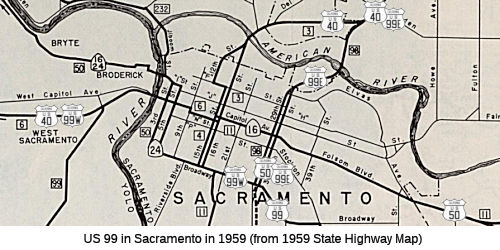 Post-1964 Route 99. The present routing
of Route 99 follows I-5 out of Sacramento along post-1960 Route 24, and
then N cosigned with Route 70 to Marysville. This corresponds to a segment
of LRN 232 between the curve in the Sacramento River near Bryte (where El
Centro Road splits off of Garden Highway and continues N) and E Nicolaus
(defined in 1951), LRN 245 from Catlett/E Nicolaus to the junction with
former US 40A near Tudor (defined in 1959), and LRN 87 (former US 40A,
former Route 24, current Route 70, defined in 1933), and LRN 3 (starting
in Yuba City, defined in 1909). At one point this was signed US 40
Alternate between Route 113 north of Knight's Landing and Route 20 in the
Yuba/Marysville area.
Post-1964 Route 99. The present routing
of Route 99 follows I-5 out of Sacramento along post-1960 Route 24, and
then N cosigned with Route 70 to Marysville. This corresponds to a segment
of LRN 232 between the curve in the Sacramento River near Bryte (where El
Centro Road splits off of Garden Highway and continues N) and E Nicolaus
(defined in 1951), LRN 245 from Catlett/E Nicolaus to the junction with
former US 40A near Tudor (defined in 1959), and LRN 87 (former US 40A,
former Route 24, current Route 70, defined in 1933), and LRN 3 (starting
in Yuba City, defined in 1909). At one point this was signed US 40
Alternate between Route 113 north of Knight's Landing and Route 20 in the
Yuba/Marysville area.
US 99W/US 99E Split. Prior to 1964, the US 99E/US 99W split occurred within Sacramento, where Broadway and the 29th/30th street couplet met.
US 99W. At that point US 99W continued along Broadway to meet Route 24 at Freeport, and then cosigned with Route 24 along Broadway, the 3rd/5th Street couplet to Capitol Avenue/"N" Street, where the route continued W cosigned with US 40 to Davis.
According to Chris Sampang, the routing of US 99W/US 40 between the Yolo Causeway and Route 113 was as follows:
At Route 113, US 99 (later US 99W) went north. Note
that US 99W later was given this route solo (from Olive Drive west) in the
early 1950s, after US 40 was placed on the bypass that is now I-80 and
right when US 40A was first commissioned (but before the north-south
connector from Russell to I-80 was constructed that would later become
Route 113). Also note that the Yolo Causeway originally was a twin-bridge
four lane structure up until the 1960s; the original Causeway (1910s-1920s
vintage) was located between the current railroad and freeway structures
and was dismantled to make way for the I-80 bridge. US 99 (and US 99W)
were routed this indirect way to Woodland via Davis, rather than the
direct route of former Route 16/Route 24 to Woodland, due to the issues of
flooding and closure.
(Based on information provided by Chris Sampang)
US 99E. US 99E continued NE along the 29th/30th Street couplet along LRN 98 cosigned with US 50. US 50 split off and headed E at Folsom Blvd along LRN 11. US 99E continue NE, joining up with US 40 N of the American River. It continued co-signed with US 40 (present-day I-80) as LRN 3 to Roseville, where LRN 3 split off N with US 40 continuing NE along LRN 17. US 99E continued N and NE along LRN 3 (present day Route 65) through Lincoln to Marysville, where it met US 40A (and what is now Route 99), jogged W briefly to Yuba City, and continued N along LRN 3 (Route 99).
The Split Section: US 99W/US 99E
The detailed history of segments along former US 99W and US 99E are covered in the "SUFFIXED" sections below.
Portions N of the former US 99W/US 99E merge near Red Bluff
See the next segment for details on this area.
 Suffixed Routings
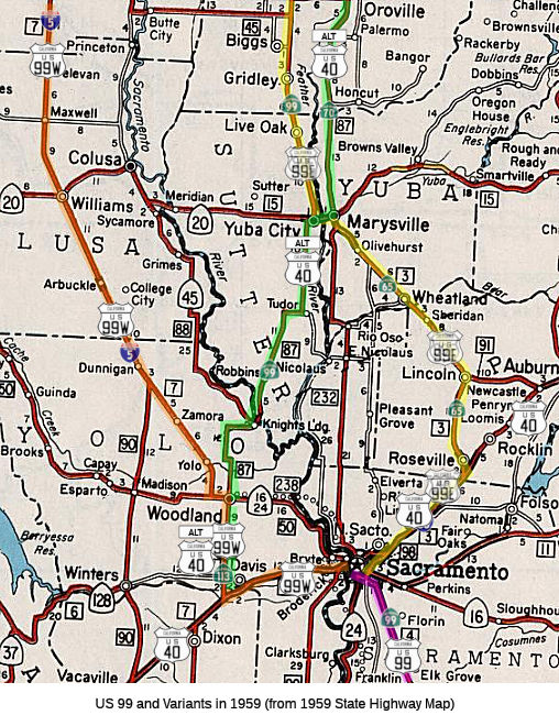 The old US 99 used to split into US 99E and US 99W in
Sacramento:
The old US 99 used to split into US 99E and US 99W in
Sacramento:
The current routing is what was much of US 99E. US 99E ran
concurrent with US 40 (now I-80) to Roseville along a portion of LRN 3,
defined in 1909. At Roseville, still as LRN 3, it ran N to Lincoln along
present day Route 65 (for a while, Route 65 and US 99E were cosigned).
From Lincoln, US 99E ran to Marysville still as LRN 3 (this segment is
present-day Route 65 to Olivehurst, and Route 70 from Olivehurst to
Marysville).
Part of the US 99E routing in Sacramento is now part of Route 51, the former Elvas Freeway. See Route 51 for specific historical information.
In October 2018, it was noted that the City of Sacramento Department of
Public Works is proposing to replace the Auburn Boulevard Bridge at Arcade
Creek due to its structurally deficient and functionally obsolete status,
as determined by the Federal Highway Administration criteria. The project
site is located in the north eastern corner of the City of Sacramento,
near the border with Sacramento County, where Auburn Boulevard crosses
Arcade Creek, east of Winding Way and west of Park Road and the I-80
ramps. The Auburn Boulevard Bridge over Arcade Creek is a reinforced
concrete T-beam structure that was originally constructed in 1927 (and
formerly used for US 40 and US 99E), and then widened in 1965. The bridge
has two spans with a total length of 70 feet. It carries two lanes of
traffic in both the eastbound and westbound direction, with a left turn
pocket for westbound to southbound users. The new bridge will be 100 feet
wide (see cross section below) and be raised slightly to remain
operational during a 20-year storm event. The new bridge will also be
designed to accommodate future improvements to the Auburn
Boulevard/Winding Way intersection that the County may implement.
(Source: City of Sacramento Auburn Bridge Replacement Project)
N of Sacramento, US 99E exited a shared routing with US 50 and continued through Roseville, Lincoln, Wheatland, and on to Marysville. In the 1964 "Great Renumbering", this became part of Route 65. See the Route 65 page for the discussion of this segment.
Route 20 between Marysville and Yuba City was co-signed with US 99E and Alternate US 40. (US 40A east was multiplexed with 20 east and US 99E south)
From Yuba City, US 99E turned north to Chico, and continued N along current Route 99 to near Oroville (~ BUT 11.105)
It then went W along current Richvale Highway to Midway. It continued N along Midway to Chico.
The 2018 STIP, approved at the CTC March 2018 meeting, appears to include PPNO 2430, on Midway (old SR 99) approximately 0.2 miles south of White Ave to approximately 0.7 miles south of White Ave, spanning Butte Creek and Butte Creek Overflow. Replace two bridge structures. The more detailed description notes: The Midway is a vital two-way, major collector, running north-south through a major agriculture zone in Butte County. It connects the City of Chico with Route 162 to the south and travels through the communities of Durham, Nelson and Richvale. This route was once Route 99 (presumably, US 99E). Both of the structures proposed to be replaced have low sufficiency ratings and have been determined to be "Structurally Deficient" by Caltrans Structures Maintenance and Investigations. They are both load limited and are of sub-standard width. The structure over Butte Creek also carries a speed limit of 10mph for vehicles over 10 tons. It has been determined that replacement of the bridges is the most feasible alternative.
In Chico, the route turned into Esplanade, and then rejoined current Route 99 N of Chico.
 In 1955, the Division of Highways unveiled proposals for the Chico freeway routing. Of
the three options presented, the Division of Highways preferred the A
option. All routes departed from the existing US 99E S of the city near
the Chico-Paradise Skyway, and rejoin US 99E at a point N of the Shasta
Union School.
In 1955, the Division of Highways unveiled proposals for the Chico freeway routing. Of
the three options presented, the Division of Highways preferred the A
option. All routes departed from the existing US 99E S of the city near
the Chico-Paradise Skyway, and rejoin US 99E at a point N of the Shasta
Union School.
(Source: Chico Enterprise-Record, 6/17/1955 via Joel Windmiller,
2/23/2023)
In continued along current Route 99 (LRN 3) to Red Bluff presumably rejoining US 99W along Route 36, all as LRN 3. Note: Looking at a map, there is a distinct possibility that US 99E turned into Tehama at Aramayo Way, and then continued to US 99W along San Benito Ave. This is unconfirmed. It could also have turned onto South Ave near Vina, rejoining 99W near Corning. The best way to tell would be by the date on the bridge on South Ave, County Sign Route A9.
The US 99W routing was the original routing for US 99 when it was
established in 1926. The US 99 W/US 99E split from Red Bluff to Sacramento
was approved by the AASHO on August 6th, 1928.
US 99W originally ran W out of Sacramento along LRN 50, defined in 1933, and then W along US 40 to the vicinity of Davis (along LRN 6, defined in 1909). It ran to near Exit 73 westbound (Olive Drive), then somehow connected with 5th Street on a now-removed alignment headed from US 40 west to the current Power Line Road/5th Street junction. (This removed alignment of 5th Street seems to have existed as late as 1967). US 99W continued west on 5th Street through downtown Davis, continuing in that direction as the street name changed to Russell Boulevard at B Street (where Davis's Central Park is located). US 99W then followed Russell to current Route 113 where it then merged with Alternate US 40 eastbound going north on Route 113 (cosigned as Route 113/US 99W). It then ran N cosigned with Alternate US 40 (present-day Route 113) to Woodland (along LRN 7, defined in 1909). It jogged W briefly along Route 16 (LRN 50), and then continued N signed as US 99W, along LRN 7, to Red Bluff. This was later replaced with I-5 (LRN 238, defined in 1959), whose routing is a closer approximation to Route 16 out of Sacramento to Woodland.
Note: The Gribblenation Blog (Tom Fearer), "Former US Route 99 West from West Sacramento to Red Bluff", has a detailed exploration of the history of US 99W between Sacramento and Red Bluff. That history is captured on this site in the sections on the successor highways: I-80, Route 113, Route 16, and I-5.
The routings in Davis changed to the Route 113 routing by 1953.
There was also a split at one time between Manteca to Stockton, between 1930 and 1933. At this time, US 99 ran down to Stockton, and US 99W split from US 99 in Stockton.
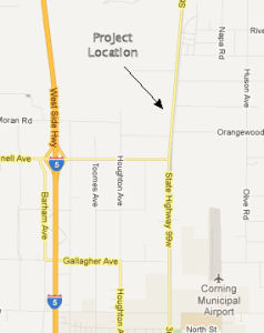 Note: Much of this is still signed (at least in terms of
name) as 99W. This is best seen starting around Williams, CA, where there
is a road roughly parallel to I-5 that appears to be called "Old Hwy 99W",
"County Road 99W", "Highway 99W" (as in Williams, CA), "99W Highway",
"State Highway 99W", and "Road 99W". The latter designation is co-signed
with Tehama County Sign Route A8 north of San Benito Avenue near Red Bluff, CA. Portions
of this routing may even still be in the state highway system, although
they are not signed as part of the formal Route 99. It is unclear if these
portions have postmiles.
Note: Much of this is still signed (at least in terms of
name) as 99W. This is best seen starting around Williams, CA, where there
is a road roughly parallel to I-5 that appears to be called "Old Hwy 99W",
"County Road 99W", "Highway 99W" (as in Williams, CA), "99W Highway",
"State Highway 99W", and "Road 99W". The latter designation is co-signed
with Tehama County Sign Route A8 north of San Benito Avenue near Red Bluff, CA. Portions
of this routing may even still be in the state highway system, although
they are not signed as part of the formal Route 99. It is unclear if these
portions have postmiles.
99W & Gyle Road Project (County Sign Route A11/Fmr. US 99W ∥ 02-TEH-05 R13.974/R24.919)
Additionally, in May 2017, the TCTC also proposes to amend the 99W & Gyle Road/County Sign Route A11 (roughly parallel to 099 TEH 11.819) to South Main Street & I-5 Overcrossing (~ 005 TEH R13.965) project (PPNO 2569) in Tehama County to delay Design (PS&E) and construction by one Fiscal Year (FY) and increase the project funding. This project is in Tehama from Gyle Road intersection of 99W (formerly old Route 99) and extends north to Red Bluff ending at I-5 overcrossing. The 99W & Gyle Road to South Main Street & I-5 Overcrossing project is programmed in the 2016 STIP with the Environmental (PA&ED) phase programmed in FY 17-18 and PS&E in FY 18-19. Also as part of the 2016 STIP, construction was reduced by $2,595,000 and delayed from FY 18-19 to FY 19-20. This road is the adopted I-5 alternate detour route which is used by oversized permitted vehicles and is critical for local manufacturing, lumber and agriculture industries. The project scope includes resurfacing and reconfiguring the roadway as well as work at the signalized intersection of South Main Street and I-5. In lieu of upgrading the signalized intersection, a roundabout is now being considered at that location which has added work to the environmental analysis and project cost.
Additionally, in June 2017, the CTC amended the SHOPP related to another project on 99W: The 99W & Gyle Road to South Main Street & I-5 Overcrossing project is programmed in the 2016 State Transportation Improvement Program (STIP) with the Environmental phase programmed in FY 2017-18 and PS&E in FY 2018-19. Also as part of the 2016 STIP, construction was reduced by $2,595,000 and delayed from FY 18-19 to FY 19-20. This road is the adopted I-5 alternate detour route that is used by oversized permitted vehicles and is critical for local manufacturing, lumber and agriculture industries. The project scope includes resurfacing and reconfiguring the roadway as well as work at the signalized intersection of South Main Street and I-5. In lieu of upgrading the signalized intersection, a roundabout is now being considered at that location which has added work to the environmental analysis and project cost. To accommodate the loss of STIP funding and the addition of the roundabout, TCTC proposes to delay PS&E and Construction and also increase the project cost.
In May 2021, the CTC received notice that Tehama County
proposes to delay construction (CON) for the 99W and Gyle Road to South
Main Street and I-5 Overcrossing project (PPNO 2569) in Tehama County. The
99W and Gyle Road to South Main Street and I-5 Overcrossing project (PPNO
2569) is currently programmed in STIP for Plans, Specifications and
Estimate (PS&E), and CON phases. The scope of work consists of
resurfacing and reconfiguring pavement delineation/reflective markers, and
various improvements on 99W (formerly old Route 99W) from Gyle Road/County Sign Route A11
to South Main Street and various intersection improvements at I-5
interchange. The STIP entry shows the scope as “In Tehama from Gyle
Road intersection of 99W (formerly old Route 99) and extends north to Red
Bluff ending at I-5 overcrossing.” Complications associated with the
COVID-19 pandemic have caused delays to project delivery. Tehama County
has been forced to focus its limited staff on COVID-19 mitigation efforts,
rather than focusing on projects that are still in early phases. At this
point, it has become apparent that it is not feasible for the project to
continue according to its current schedule. Delaying CON will align the
construction with the current PS&E schedule which was also impacted by
COVID-19 in early 2020. Those delays were also the reasons for previously
approved PS&E allocation extension. Therefore, Tehama County is
proposing to delay CON from 2021-22 to 2022-23. This STIP amendment was
approved in June 2021.
(Source: May 2021 CTC Agenda, Agenda Item
2.1b.(10); June 2021 CTC Agenda, Agenda Item 2.1a.(12))
In January 2022, the CTC approved for future
consideration of funding 02 – Tehama County. Highway 99 West
(former US 99) and South Main Street Reconstruction Project.
Construct pavement improvements on Highway 99 West. (MND) (PPNO 2569)
(CMAQ) (STIP). The Project will rehabilitate the pavement along a portion
of former US 99 (99W), including new guard rails, interchange and widening
modifications on Main Street, enhancements to bicyclist and pedestrian
facilities, and changes to traffic signals. The Project is located along
Highway 99 West from Gyle Road to the I-5 interchange on Main Street in
the City of Red Bluff, Tehama County. Tehama County (County) is the
California Environmental Quality Act lead agency for the Project. The
Project is estimated to cost $9,044,000 and is fully funded through
construction with State Transportation Improvement Program Funds
($5,688,000), Congestion Mitigation and Air Quality Improvement Funds
($1,800,000), Highway Infrastructure Program Funds ($122,000), and High
Priority Demonstration Project Funds ($1,434,000). Construction is
estimated to begin in Fiscal Year 2022-23.
(Source: January 2022 CTC Agenda, Agenda Item
2.2c.(4))
In January 2022, the CTC approved the following
financial allocation: $185,000. 02-Tehama near Route 99. 99W & Gyle
Road to South Main Street & I-5 Overcrossing. In Tehama from Gyle Road
intersection of 99W (formerly old Route 99) and extends north to Red Bluff
ending at I-5 overcrossing. Resurfacing & reconfigure pavement
delineation/reflective markers, and improvements and signalization at I-5
interchange. Allocation: PS&E $185,000.
(Source: January 2022 CTC Agenda, Agenda Item
2.5c.(3a) #6)
In May 2023, the CTC was noticed of a proposed
amendment to the 2022 STIP that would deprogram $8,350,000 in Construction
(CON) funds programmed in Fiscal Year 2024-25 for the 99W Gap Closure:
Glenn County Line to Corning City Limits project (PPNO 2567) to prioritize
the 99W and Gyle Road to South Main Street and I-5 Overcrossing project
(PPNO 2569), in Tehama County, per STIP Guidelines. The 99W Gap Closure:
Glenn County Line to Corning City Limits project (PPNO 2567) is currently
programmed in the 2022 STIP, for CON in 2024-25 and would rehabilitate
pavement, including Cold-in-Place Recycling and a Hot Mix overlay to
existing grade and update pavement delineation and reflective markers,
from the Tehama-Glenn County line, and extend north to Corning City
limits. The 99W and Gyle Road to South Main Street and I-5 Overcrossing
project (PPNO 2569), which is also programmed in the 2022 STIP, will
rehabilitate the deficiencies on this major collector, as a non-State
Highway System road in Tehama County. The Tehama County Transportation
Commission recognizes the importance of this project and the need to
address the project's insufficient funding as a result of project
escalation and an updated cost estimate, the deprogrammed funds from the
99W Gap Closure: Glenn County Line to Corning City Limits project (PPNO
2567) will be used to complete this project. In June 2023, the CTC
approved the STIP amendment.
(Source: May 2023 CTC Agenda, Agenda Item 2.1b.(3); June 2023 CTC
Agenda, Agenda Item 2.1a.(5))
Freeway Route Adoptions near Red Bluff") In April 1960, the Sacramento Bee published information on route adoptions in
the Red Bluff area. Note that on this map, North is to the LEFT. The
Sacramento Bee wrote regarding this:
In April 1960, the Sacramento Bee published information on route adoptions in
the Red Bluff area. Note that on this map, North is to the LEFT. The
Sacramento Bee wrote regarding this:
(Source: Joel Windmiller, California's Historic Highways on FB, 5/31/2020)
Aide Outlines US99E Freeway Tehama Routing. The state highway commission is considering adoption of a route for construction of 30 miles of freeway at an estimated cost of $12,765,000 on US 99E [future I-5] in Tehama County. State Highway Engineer'J C Womack yesterday recommended a route for the freeway from the Butte County line to 32 miles south of Red Bluff .
Taken Under Study. His recommendation was taken under advisement by the commission that opened a two day meeting in the Public Works Building. Womack said that of alternates studied his recommended route would save the state $1,228,000. He said it also would cause a minimum of interference with existing development and would involve the least acreage of cultivated land. His route would follow the existing highway to south of Deer Creek run, roughly parallel with and half mile east of the present highway to just north of Los Molinos, then turn northwesterly across the Sacramento River. It would cross the Southern Pacific Company tracks north of Proberta and join the adopted route of the US 99W Freeway (Route 99) south of Red Bluff The existing highway runs east of the Sacramento River to Red Bluff. The commission asked Womack to ascertain whether Tehama County Board of Supervisors wishes the commission to hold a public hearing on the routing before further action is taken.
StatusThe portion from Route 5 to 5 miles north of I-5 is cosigned with Route 70. Some old routings have been relinquished, for example, KP 20.5/29.1 in Sutter County. A proposed route adoption was also relinquished: From PM 36.0/42.2 in Sutter County and from PM 0.0/13.1 in Butte County.
In his 2006 Strategic Growth Plan, Governor Schwartzenegger proposed a comprehensive Route 70/Route 99 project. The project (stretching from the I-5/Route 99 junction to Route 149 in Butte County) converts two-lane conventional corridors to four-and-five-lane expressways, completes key segments to freeway by constructing interchanges, and provides additional capacity and throughput for current and projected future populations. It connects the Sacramento, Yuba-City and Chico urbanized area with an improved facility, saves lives by removing two lane segments, and supports improved freight movement.
In October 2009, the CTC approved for future consideration of funding a project that will construct an interchange at Route 99/Elverta Road (~ SAC 35.323) in northern Sacramento to replace the existing signalized “at grade” intersection. On July 14, 2009, the County Board of Supervisors certified the MND finding that the project will not have a significant effect on the environment. The project is estimated to cost $30,200,000. The project is programmed for funding with Route 99 Bond ($19,110,000) and Local ($ 11,090,000) funds. Construction is estimated to begin in fiscal year 2010/11. In November 2010, the CTC approved amending the project to (1) Revise the scope for the bridge structure to accommodate ten lanes versus eight lanes. (2) Revise scope to add 15 feet to the structure width to accommodate sidewalks and bike lanes on each side. (3) Revise the funding plan to reflect additional scope, funded from the Route 99 Corridor Bond program. In April 2012, it was reported that work on this project would begin in Summer 2012. Closeout is anticipated for July 2014.
Riego Road Improvements (~ SUT 0.918)
![[Riego]](maps/099-riego.jpg) There are plans to construct a new interchange to connect
Riego Road (~ SUT 0.918) to Route 99 at the Sacramento/Sutter County line.
The project is programmed in the Route 99 Corridor bond program and will
be combined with local funds. The estimated cost of the project is
$30,840,000 and is estimated to begin construction in Fiscal Year 2010-11.
The scope, as described for the preferred alternative, is consistent with
the project scope set forth in the approved project baseline agreement.
There are plans to construct a new interchange to connect
Riego Road (~ SUT 0.918) to Route 99 at the Sacramento/Sutter County line.
The project is programmed in the Route 99 Corridor bond program and will
be combined with local funds. The estimated cost of the project is
$30,840,000 and is estimated to begin construction in Fiscal Year 2010-11.
The scope, as described for the preferred alternative, is consistent with
the project scope set forth in the approved project baseline agreement.
In April 2012, it was reported that work should begin by Fall 2012 for improvements at Riego Road and Route 99, after the California Transportation Commission approved a $21.1 million allocation for the project in March 2012. The work should take about two years and when it is done will result in an interchange similar to that at Elkhorn Boulevard and Route 99 at Sacramento's northern edge. The completed project will have off- and on-ramps for traffic going either direction on Riego Road and 99 as well as an overcrossing for through traffic on Riego. Funding for the project comes from Proposition 1B, a $4.5 billion transportation bond approved by voters in 2006. The project did have some delays due to coordination with the United States Army Corps of Engineers in obtaining the required environmental permits. During this process, there were difficult and lengthy discussions and negotiations relating to the required project mitigation proposals that were initially deemed costly and unattainable by the Department. These negotiations continued until a workable resolution was reached. These delays not only led to delays in Design and Right of Way (R/W) acquisition, it also affected the construction milestone dates.
In August 2015, the CTC authorized relinquishment of right of way in the county of Sutter at Power Line Road (~ SUT 10.812) (S of Nicolaus), consisting of a relocated and reconstructed county road.
Feather River Bridge (~ SUT 12.015 to SUT 13.686)
![[Feather River Project]](maps/099-feather.jpg) In June 2008, the CTC approved reallocating some funding related to the Feather River Bridge
reconstruction, near Nicolaus. The Sutter 99 Segment 2, Feather River
Bridge Project PPNO (8361B) is part of the Route 99 Bond Program. The
project proposes to widen Route 99 in Sutter County from two to four lanes
with a continuous left turn lane from just south of Nicholaus Road to
Sacramento Avenue. The project mainly consists of a new 3,045 foot
two-lane bridge east of the existing Feather River Bridge (#18-26). The
project also realigns the ramps to Nicholaus Road. The existing two-lane
Feather River Bridge will remain in service. As the design work started,
and detailed design information became available, the design and
construction strategies considered during the environmental phase were
reevaluated. Foundation drilling revealed different foundation conditions
than what was originally considered. Preliminary consultations with the
regulatory agencies for permitting began with the updated information. It
was determined that environmental permit requirements had become more
stringent and the agencies were requiring a reduced impact on the river.
In addition, a more restrictive construction window for work being done in
the channel is required. These factors led to a change in design and
construction strategy. To address these new requirements and information,
the current design reduces the number of bridge spans and foundations in
the water, in order to minimize impacts to the main river channel. The
longer spans require longer and larger diameter piles and an increased
super structure and deck thickness, which in turn increases structure
costs. Other options available will not render any financial savings; in
fact, they could potentially be more costly in time and money. The
proposed construction method minimizes the work area in the channel and
reduces the noise levels from pile driving.
In June 2008, the CTC approved reallocating some funding related to the Feather River Bridge
reconstruction, near Nicolaus. The Sutter 99 Segment 2, Feather River
Bridge Project PPNO (8361B) is part of the Route 99 Bond Program. The
project proposes to widen Route 99 in Sutter County from two to four lanes
with a continuous left turn lane from just south of Nicholaus Road to
Sacramento Avenue. The project mainly consists of a new 3,045 foot
two-lane bridge east of the existing Feather River Bridge (#18-26). The
project also realigns the ramps to Nicholaus Road. The existing two-lane
Feather River Bridge will remain in service. As the design work started,
and detailed design information became available, the design and
construction strategies considered during the environmental phase were
reevaluated. Foundation drilling revealed different foundation conditions
than what was originally considered. Preliminary consultations with the
regulatory agencies for permitting began with the updated information. It
was determined that environmental permit requirements had become more
stringent and the agencies were requiring a reduced impact on the river.
In addition, a more restrictive construction window for work being done in
the channel is required. These factors led to a change in design and
construction strategy. To address these new requirements and information,
the current design reduces the number of bridge spans and foundations in
the water, in order to minimize impacts to the main river channel. The
longer spans require longer and larger diameter piles and an increased
super structure and deck thickness, which in turn increases structure
costs. Other options available will not render any financial savings; in
fact, they could potentially be more costly in time and money. The
proposed construction method minimizes the work area in the channel and
reduces the noise levels from pile driving.
In May 2012, KCRA reported that Caltrans will no longer use Nehemiah Construction, Inc., to widen Route 99 over the Feather River. The Gold River-based construction company was terminated from the Sutter County project because of nonperformance. Specifically, Caltrans indicated that Nehemiah Construction couldn't provide an adequate work force, and didn't have enough employees to complete the job. The change could extend the work into another construction season and delay the $60.8 million project's completion until 2016. It was originally slated for finish by 2015.
In May 2019, the CTC authorized relinquishment of right of way in the
county of Sutter (County) on Route 99 from 0.3 miles north of Central
Avenue to Route 113 (03-Sut-99-PM 17.1/R20.1), consisting of superseded
highway and collateral facilities. The County, by controlled access
highway agreement dated May 31, 2006, agreed to accept the relinquishment
and by letter dated March 6, 2019, agreed to waive the 90-day notice
requirement and accept title upon relinquishment by the State.
(Source: May 2019 CTC Minutes, Agenda Item 2.3c)
Tudor Bypass (~ SUT R17.522 to ~ SUT 16.449)
In early 2009, work began on a $54 million project to widen Route 99 to four lanes and realign connections at Wilson Road (~ SUT R17.522) and Route 113 (~ SUT 16.449), s of Yuba City. Completion is expected in 2010.
![[Tudor Bypass]](maps/099-tudor.jpg) There are plans to widen this route to four lanes near
Yuba City. There are also plans to bypass the city of Tudor. As of Mid-May
2009, it was reported that visible progress is being made on the Tudor
Bypass, a $54.8 million project to reroute Route 99 past the sweeping,
accident-prone S-curve at Route 113. The new four-lane roadway, a straight
shot through an expanse of orchards, is expected to open in September
2010. The section has the most need for improvements, as the junctions of
Route 99 and Garden Highway and Route 113 have an unusually high incidence
of accidents. Property owners were not happy with the loss of road
frontage. Traffic signals will be added at the intersections with Route 113 and Wilson Road. The previous road became Graden Highway and Tudor
Road.
There are plans to widen this route to four lanes near
Yuba City. There are also plans to bypass the city of Tudor. As of Mid-May
2009, it was reported that visible progress is being made on the Tudor
Bypass, a $54.8 million project to reroute Route 99 past the sweeping,
accident-prone S-curve at Route 113. The new four-lane roadway, a straight
shot through an expanse of orchards, is expected to open in September
2010. The section has the most need for improvements, as the junctions of
Route 99 and Garden Highway and Route 113 have an unusually high incidence
of accidents. Property owners were not happy with the loss of road
frontage. Traffic signals will be added at the intersections with Route 113 and Wilson Road. The previous road became Graden Highway and Tudor
Road.
Route 113 Interchange (~ SUT 16.449)
In May 2011, it was reported that there are plans to construct a new interchange near Route 113.
In April 2013, it was reported that Caltrans will be building an overpass as part of a new interchange between Route 99 and Route 113 in hopes of improving traffic flow and safety conditions. A groundbreaking ceremony was held on April 26, 2013 when the $19.4 million project gets underway. The interchange will replace stoplights installed when the Route 99 Tudor Bypass was completed south of Yuba City in 2010.
In August 2015, the CTC authorized relinquishment of right of way in the county of Sutter from Obanion Road (~ SUT 22.613) to Oswald Road (~ SUT 25.624), consisting of a relocated and reconstructed county roads and county road connections.
Oswald Intersection Improvements ( 03-Sut-99 PM 25.0/26.0)
In December 2021, the CTC amended the following project
into the SHOPP: 03-Sut-99 PM 25.0/26.0. PPNO 03-8383; ProjID 0319000070;
EA 4H870. Route 99 Near Yuba City, from 0.6 mile south to 0.4 mile north
of Oswald Road. Construct intersection improvements. Allocation ($1000s; ⊘ indicates phase not funded):
PA&ED $0; PS&E $2,150; R/W Sup $620; ⊘Con
Sup $1,770; ⊘R/W Cap $745; ⊘Const Cap $9,300; TOTAL $14,585.
Begin Const 6/16/2025. Additionally, in December 2021, it was reported
that the Sutter County Board of Supervisors also approved a $1.5 million
commitment toward improvements at Route 99 and Oswald Road. While the main
focus of public and supervisor discussion on the topic concerned whether a
roundabout or traffic light should be put in place, the main purpose of
the agenda item was the cooperative agreement with the California
Department of Transportation (Caltrans) that commits Sutter County to pay
$1.5 million toward the cost of construction improvements.
(Source: December 2021 CTC Agenda, Agenda Item
2.1a.(1a) #14; Appeal Democrat, 12/16/2021)
In March 2023, it was reported that the CTC approved
$1.1 billion in funding that includes the planning and development of a
“safety improvement project” at the intersection of Route 99
and Oswald Road in Yuba City. $2.8 million was allocated for the plan,
which has been developed in coordination with Sutter County. As previously
identified by county officials, the Route 99 and Oswald intersection has
been a continued cause of concern for area residents. The intersection is
of concern: A total of 72 traffic collisions have been recorded between S.
Walton Avenue, Franklin Road and Oswald Road between Jan. 1, 2017, and
Dec. 31, 2021. Of these crashes, 10 were a result of DUIs involving
alcohol or drugs. Out of the total collisions from this time frame, three
resulted in a fatality and 62 caused minor to visible injuries.
Improvements at the Route 99 and Oswald intersection have been a focus of
the Sutter County Board of Supervisors since October 2018 when the board
awarded a contract to a transportation consultant to study the
intersection and identify improvement alternatives. Alternatives studied
included (from least expensive to most expensive) a traffic signal, a
roundabout, and an overcrossing, An overcrossing would be tens of millions
of dollars; a roundabout was initially estimated at about $12 million, and
the traffic signal project is envisioned at $2.7 million. The community
was asked to weigh in on the alternatives. The roundabout option was very
controversial, despite several national and worldwide traffic studies that
have shown that roundabouts are typically the safest option. On 1/10/2023,
the Sutter County Board of Supervisors “adopted the Project Report
and the CEQA document … that identified a traffic signal as the
preferred alternative.” Work on the Oswald at Route 99 intersection
is scheduled to begin in 2025 or 2026.
(Source: Appeal Democrat, 3/27/2023)
In March 2023, the CTC approved the following
pre-construction project support phase SHOPP (2a) or SB1 (2b) allocation:
$2,770,000. 03-Sut-99 25.0/26.0. PPNO 03-8383; ProjID 0319000070; EA
4H870. Route 99 Near Yuba City, from 0.6 mile south to 0.4 mile north of
Oswald Road. Construct intersection improvements. PS&E $2,150,000; R/W
Sup $620,000.
(Source: March 2023 CTC Agenda, Agenda Item 2.5b.(2a) #6)
In December 2023, the CTC approved the following
amendment to a project in the 2022 SHOPP: 03-Sut-99 25.0/26.0
25.0/26.2. PPNO 03-8383; ProjID 0319000070; EA 4H870. Route 99
Near Yuba City, from 0.6 mile south to 0.4 0.6
mile north of Oswald Road. Construct intersection improvements. Note:
A conduit needs to be installed between the two adjacent traffic signals
for better coordination. Change postmiles to include the adjacent signal
within project limits. Update performance to match the current Department
methodology. No allocation changes.
(Source: December 2023 CTC Agenda, Agenda Item 2.1a.(1d) #11)
Yuba City to Chico (~ SUT 27.636 to ~ BUT R30.91)
Live Oak/Eager Road Interchange (SUT T35.8/36.4)
 In January 2021, the CTC amended the 2020 SHOPP to
include the following project: (1a) #11: 03-Sut-99 T35.8/36.4 PPNO 8385
ProjID 0320000040 EA 0J910. Route 99 near Live Oak, from 0.2 mile south of
Encinal Road/Live Oak Boulevard to 0.1 mile north of Kent Avenue; also
from 0.1 mile south to 0.1 mile north of Eager Road (PM R33.8/R34.0).
Eliminate direct access to Route 99 from Encinal Road/Live Oak Boulevard
and improve the intersection of Live Oak Boulevard and Eager Road to
enhance access to Route 99 at the Eager Road interchange. PA&ED
$1,160K; PS&E $1,380K; R/W Sup $430K; Con Sup $850K; R/W Cap $690K;
Const Cap $7,800K; TOTAL $12,310K. Begin Const 8/1/2024.
In January 2021, the CTC amended the 2020 SHOPP to
include the following project: (1a) #11: 03-Sut-99 T35.8/36.4 PPNO 8385
ProjID 0320000040 EA 0J910. Route 99 near Live Oak, from 0.2 mile south of
Encinal Road/Live Oak Boulevard to 0.1 mile north of Kent Avenue; also
from 0.1 mile south to 0.1 mile north of Eager Road (PM R33.8/R34.0).
Eliminate direct access to Route 99 from Encinal Road/Live Oak Boulevard
and improve the intersection of Live Oak Boulevard and Eager Road to
enhance access to Route 99 at the Eager Road interchange. PA&ED
$1,160K; PS&E $1,380K; R/W Sup $430K; Con Sup $850K; R/W Cap $690K;
Const Cap $7,800K; TOTAL $12,310K. Begin Const 8/1/2024.
(Source: January 2021 CTC Agenda, Agenda Item
2.1a.(1a) #11)
In January 2021, the CTC approved the following
pre-construction support phase allocation(s): (2a) #10. $1,160,000
(PA&ED). 03-Sut-99 T35.8/36.4. PPNO 03-8385; ProjID 0320000040; EA
0J910. Route 99 Near Live Oak, from 0.2 mile south of Encinal Road/Live
Oak Boulevard to 0.1 mile north of Kent Avenue; also from 0.1 mile south
to 0.1 mile north of Eager Road (PM R33.8/R34.0). Eliminate direct access
to Route 99 from Encinal Road/Live Oak Boulevard and improve the
intersection of Live Oak Boulevard and Eager Road to enhance access to
Route 99 at the Eager Road interchange. (Concurrent Amendment under SHOPP
Amendment 20H-005; January 2021.) Prog Year 23-24.
(Source: January 2021 CTC Agenda, Agenda Item
2.5b.(2a) #10)
In May 2021, it was reported that road work was
scheduled to begin for a safety project at the intersection of Route 99
and Live Oak Boulevard near the Lomo Railroad Crossing. The work will
start with crews replacing the left turn lanes in the center median with
flexible delineators, rumble strips and double-yellow striping. These
features will prohibit motorists from making a left turn from southbound
Route 99 to Live Oak Boulevard and from making a left turn from northbound
Route 99 to Encinal Road. Crews will also be placing painted splitter
islands at the intersection, which will allow only right-hand turns onto
Route 99 from local roads. Motorists also will be unable to cross the
highway between Live Oak Boulevard and Encinal Road. Live Oak Boulevard
and Encinal Road at Highway 99 will be closed temporarily during the
roadwork and detour routes will be in place.
(Source: Yahoo News, 5/21/2021)
In October 2022, the CTC approved for future
consideration of funding Lomo Crossing Safety Improvement Project
(03-Sut-99, PM R33.8/36.6). Improve access and features in proximity to
the Lomo railroad crossing, on Route 99, in Sutter County. (PPNO 8385).
The project is located on Route 99 between postmiles R34.8/36.6 and
R33.8/34.0, in Sutter County. The Department proposes to permanently
eliminate cross traffic access to Route 99 at Encinal Road and Live Oak
Boulevard at Lomo Crossing from south of Encinal Road/Live Oak Boulevard
to north of Kent Avenue; improve access at the Eager Road interchange: and
improve acceleration features in proximity to the railroad crossing at
Lomo Crossing for both the approach and departure directions of travel for
vehicles required by law to stop at the railroad crossing. This project is
currently programmed in the 2022 SHOPP for a project total of $12,310,000,
which includes Right of Way (capital and support) and Construction
(capital and support). Construction is estimated to begin in 2024. The
scope, as described for the preferred alternative, is consistent with the
project scope as programmed by the Commission in the 2022 SHOPP.
(Source: October 2022 CTC Agenda, Agenda Item
2.2c.(1))
In October 2022, the CTC approved the following
pre-construction phase allocation: $2,005,000. 03-Sut-99 T35.8/36.4. PPNO
03-8385; ProjID 0320000040; EA 0J910. Route 99 Near Live Oak, from 0.2
mile south of Encinal Road/Live Oak Boulevard to 0.1 mile north of Kent
Avenue; also from 0.1 mile south to 0.1 mile north of Eager Road (PM
R33.8/R34.0). Eliminate direct access to Route 99 from Encinal Road/Live
Oak Boulevard and improve the intersection of Live Oak Boulevard and Eager
Road to enhance access to Route 99 at the Eager Road interchange.
Programmed (Actual) Allocation: FY 23-24 PS&E $1,380,000 ($1,500,000);
R/W Sup $430,000 ($505,000).
(Source: October 2022 CTC Agenda, Agenda Item 2.5b.(2a) #3)
In December 2022, the CTC amended this project in the
SHOPP as follows: 03-Sut-99 T35.8/36.4 R33.8/36.6. PPNO
03-8385; ProjID 0320000040; EA 0J910. Near Live Oak, from 0.2 mile south
of Encinal Road/Live Oak Boulevard to 0.1 mile north of Kent Avenue
Eager Road to 0.6 mile south of Clark Road; also from 0.1
mile south to 0.1 mile north of Eager Road (PM R33.8/R34.0).
Eliminate direct cross traffic access to Route 99
from Encinal Road/Live Oak Boulevard, add acceleration lanes in
proximity to railroad crossing, and improve access to Eager Road
Interchange and improve the intersection of Live Oak
Boulevard and Eager Road to enhance access to Route 99 at the Eager Road
interchange. Allocation Changes ($ × 1,000): R/W Cap $690
⇨ $1,059; Const Cap $7,800 ⇨ $8,841; Total $12,310 ⇨
$13,720. Note: After detailed studies and public meetings, the preferred
alternative recommends providing acceleration lanes at the railroad
crossing, and allowing right-in/right-out access at Encinal Road/Live Oak
Boulevard. The postmiles, project description, scope, and cost are updated
to capture these changes.
(Source: December 2022 CTC Agenda, Agenda Item
2.1a.(1d) #6)
Marysville and Gridley Bypass (SUT T36.0/42.2, Route 149, BUT 0.0/13.1)
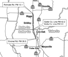 In June 2007, the CTC considered rescinding a portion of the freeway adoption for Route 99 in
the County of Sutter, Post Mile SUT T36.0/42.2 and the County of Butte,
Post Mile BUT 0.0/13.1. This was up for a vote again in December 2007. Due
to funding constraints, Caltarns is unable to construct a freeway on a new
alignment (bypassing the cities of Live Oak and Gridley) to replace the
existing Route 99 facility in Sutter and Butte Counties. The specific
portion to be rescinded is along Route 99 from Encinal Road at PM T36.0 to
PM 42.2 in Sutter County and from the Sutter/Butte county line PM 0.0 to
SR 162, at PM 13.1, in Butte County. Numerous studies were conducted on
the Route 99/Route 70 corridor, with the conclusion to upgrade Route 70 to
freeway standards, parallel to Route 99. Route 70 has been designated as a
focus route in the Interregional Transportation Strategic Plan and
maintains priority for Interregional Transportation Improvement Program
funding. Route 99 runs 36.8 miles through Sacramento County as a four-lane
expressway to an eight-lane freeway. Route 99 continues northward through
Sutter County for 42.3 miles as a two-lane conventional highway to a
four-lane freeway. It continues 45.9 miles through Butte County as a
two-lane conventional highway to a four-lane conventional highway. On May
22, 1963, the Commission adopted the current Route 99 corridor, which
bypasses the cities of Live Oak and Gridley. Numerous parcels, but not
all, were purchased to obtain the necessary right of way for the adopted
corridor. A decrease in freeway funding caused the project to be
suspended. In 1988, the Commission asked that a corridor study determine
the alignment for a divided expressway, for ultimate conversion to a
freeway, connecting Sacramento, Yuba City/Marysville, and Chico. The
result was a Routes 70 and 99 Corridor Study, which was adopted by the
Butte County Association of Governments and by the Sacramento Area Council
of Governments in 1990. Twenty-four alternatives were studied. The
recommended proposed alternative was “A four-lane freeway (initially
to be constructed as an expressway) on Route 70 from the Route 70/99
interchange to Route 149 via a Marysville Bypass; a four-lane freeway on
Route 149 from Route 70 to Route 99; and a four-lane freeway on Route 99
from Route 149 to the existing freeway section south of the City of
Chico.” The Study’s proposed alignment does not include a new
alignment for Route 99 bypassing the cities of Live Oak and Gridley,
though such a bypass was studied in 7 of the 24 alternatives. Butte
County’s direction on a bypass goes back to its 1984 General Plan
Circulation Element, which does not discuss or map a bypass of Live Oak or
Gridley along Route 99 as an alternative. Sutter County concurred with the
State Routes 70 and 99 Corridor Study in its 1995 General Plan Circulation
Element and did not discuss the Live Oak or Gridley bypass alternative nor
recognize it as an alternative on any maps in the Circulation Element.
Gridley City Council discussions indicate a strong desire to work with the
Department to reach a mutually beneficial solution.
In June 2007, the CTC considered rescinding a portion of the freeway adoption for Route 99 in
the County of Sutter, Post Mile SUT T36.0/42.2 and the County of Butte,
Post Mile BUT 0.0/13.1. This was up for a vote again in December 2007. Due
to funding constraints, Caltarns is unable to construct a freeway on a new
alignment (bypassing the cities of Live Oak and Gridley) to replace the
existing Route 99 facility in Sutter and Butte Counties. The specific
portion to be rescinded is along Route 99 from Encinal Road at PM T36.0 to
PM 42.2 in Sutter County and from the Sutter/Butte county line PM 0.0 to
SR 162, at PM 13.1, in Butte County. Numerous studies were conducted on
the Route 99/Route 70 corridor, with the conclusion to upgrade Route 70 to
freeway standards, parallel to Route 99. Route 70 has been designated as a
focus route in the Interregional Transportation Strategic Plan and
maintains priority for Interregional Transportation Improvement Program
funding. Route 99 runs 36.8 miles through Sacramento County as a four-lane
expressway to an eight-lane freeway. Route 99 continues northward through
Sutter County for 42.3 miles as a two-lane conventional highway to a
four-lane freeway. It continues 45.9 miles through Butte County as a
two-lane conventional highway to a four-lane conventional highway. On May
22, 1963, the Commission adopted the current Route 99 corridor, which
bypasses the cities of Live Oak and Gridley. Numerous parcels, but not
all, were purchased to obtain the necessary right of way for the adopted
corridor. A decrease in freeway funding caused the project to be
suspended. In 1988, the Commission asked that a corridor study determine
the alignment for a divided expressway, for ultimate conversion to a
freeway, connecting Sacramento, Yuba City/Marysville, and Chico. The
result was a Routes 70 and 99 Corridor Study, which was adopted by the
Butte County Association of Governments and by the Sacramento Area Council
of Governments in 1990. Twenty-four alternatives were studied. The
recommended proposed alternative was “A four-lane freeway (initially
to be constructed as an expressway) on Route 70 from the Route 70/99
interchange to Route 149 via a Marysville Bypass; a four-lane freeway on
Route 149 from Route 70 to Route 99; and a four-lane freeway on Route 99
from Route 149 to the existing freeway section south of the City of
Chico.” The Study’s proposed alignment does not include a new
alignment for Route 99 bypassing the cities of Live Oak and Gridley,
though such a bypass was studied in 7 of the 24 alternatives. Butte
County’s direction on a bypass goes back to its 1984 General Plan
Circulation Element, which does not discuss or map a bypass of Live Oak or
Gridley along Route 99 as an alternative. Sutter County concurred with the
State Routes 70 and 99 Corridor Study in its 1995 General Plan Circulation
Element and did not discuss the Live Oak or Gridley bypass alternative nor
recognize it as an alternative on any maps in the Circulation Element.
Gridley City Council discussions indicate a strong desire to work with the
Department to reach a mutually beneficial solution.
In December 2009, an effort by the state to sell 24 parcels east of Gridley (~ BUT 4.187), purchased by Caltrans in the 1960s for a future Route 99 bypass around the city ran into problems. The plan was dropped in the 1990s when it became clear either Route 99 or Route 70 could be improved to freeway or expressway status, but not both. After study and debate, Route 70 was chosen. The state started proceedings to sell the land in 2004, but delayed at the request of Gridley, which saw an eventual need for such a bypass. The bypass has been retained in both the city and Butte County general plans now being developed... and in Demember 2009, the Butte County Association of Governments added its endorsement to those seeking to have the state retain the property. Caltrans estimates the sale would raise $2.2 million. In the Gridley and county general plans, the bypass would be an "arterial" constructed to local standards, rather than a highway that would trigger state and federal oversight.
In October 2017, the CTC approved for future consideration of funding a project on Route 99 in Sutter County that will construct roadway improvements in the city of Live Oak -- specifically, it proposes to rehabilitate Live Oak Boulevard (~ SUT 40.278).
Widening Near Chico (~ BUT R9.554L)
![[99 aux lane near Chico]](maps/099-chico.jpg) In February 2009, the CTC approved for future
consideration of funding a project to construct an auxiliary lane near
Chico. The project is located in the City of Chico on Route 99 between the
Route 32 and East 1st Avenue interchanges and on East 1st Avenue in the
vicinity of the Route 99/East 1st Avenue interchange. The project would
improve the operational characteristics of Route 99 by providing an
auxiliary lane in each direction between Route 32 and East 1st Avenue. Two
build alternatives, the Inside Widening Alternative and the Outside
Widening Alternative, were considered during the environmental process.
The Inside Widening Alternative with signalized conventional ramp
intersections on East 1st Avenue was selected as the preferred
alternative. The preferred alternative results in certain environmental
impacts related to land use, transportation, air quality, noise, hydrology
and water quality, biological resources, cultural resources, earth
resources, visual resources, public services and facilities that require
mitigation to be reduced to a less than significant level. The project is
planned to be constructed in three phases. Phase I consists of northbound
ramp improvements at East 1st Avenue. The construction capital and support
costs for this phase were programmed at $8,286,000. Phase I construction
is nearly complete. Phase II consists of the construction of a northbound
auxiliary lane and widening of median and structures. This phase is
estimated to cost $39,520,000 and is programmed with Route 99 Bond
($23,520,000) and STIP ($16,000,000) funds. Construction is estimated to
begin May 2010. Phase III will construct a southbound auxiliary lane. This
phase is estimated to cost $12,500,000 and is not programmed.
In February 2009, the CTC approved for future
consideration of funding a project to construct an auxiliary lane near
Chico. The project is located in the City of Chico on Route 99 between the
Route 32 and East 1st Avenue interchanges and on East 1st Avenue in the
vicinity of the Route 99/East 1st Avenue interchange. The project would
improve the operational characteristics of Route 99 by providing an
auxiliary lane in each direction between Route 32 and East 1st Avenue. Two
build alternatives, the Inside Widening Alternative and the Outside
Widening Alternative, were considered during the environmental process.
The Inside Widening Alternative with signalized conventional ramp
intersections on East 1st Avenue was selected as the preferred
alternative. The preferred alternative results in certain environmental
impacts related to land use, transportation, air quality, noise, hydrology
and water quality, biological resources, cultural resources, earth
resources, visual resources, public services and facilities that require
mitigation to be reduced to a less than significant level. The project is
planned to be constructed in three phases. Phase I consists of northbound
ramp improvements at East 1st Avenue. The construction capital and support
costs for this phase were programmed at $8,286,000. Phase I construction
is nearly complete. Phase II consists of the construction of a northbound
auxiliary lane and widening of median and structures. This phase is
estimated to cost $39,520,000 and is programmed with Route 99 Bond
($23,520,000) and STIP ($16,000,000) funds. Construction is estimated to
begin May 2010. Phase III will construct a southbound auxiliary lane. This
phase is estimated to cost $12,500,000 and is not programmed.
In February 2010, the CTC approved amending the 2008 State Transportation Improvement Program (STIP) and the Route 99 Corridor baseline agreement for the Butte Route 99 Chico Auxiliary Lanes — Phase II project (PPNO 2410B) in Chico to add Phase 3 scope including southbound (SB) auxiliary lane improvements; change lead agency for Construction from BCAG to Caltrans; replace $1,653,000 Regional Improvement Program (RIP) Right of Way (R/W) funds with Congestion Mitigation and Air Quality (CMAQ) funds; and update project schedule. This project is part of the Route 99 Bond Program. The ultimate Route 99 auxiliary lane project was approved in 2005, which included northbound (NB) and SB auxiliary lanes between Route 32 and East 1st Avenue. The project also includes improvements to the NB off-ramp at East 1st Avenue, a viaduct structure widening over Bidwell Park, widening of undercrossing structures at Palmetto Avenue, interchange ramp improvements and soundwall construction. The completed improvements will relieve congestion, increase capacity, and enhance safety. There are three phases due to funding constraints: Phase 1 — Improve NB off-ramp at First Avenue (PPNO 2410) — Completed; Phase 2 — Construct NB auxiliary lane, widen the NB and SB viaduct structures over Bidwell Park, widen both undercrossing structures (NB and SB) at Palmetto Avenue, and construct soundwalls (PPNO 2410B) — Currently programmed with Route 99 bond and STIP funds; and Phase 3 — Construct the SB auxiliary lane with corresponding ramp improvements, and widen East 1st Avenue. The adjusted end of construction is October 2013.
In June 2010, it was noted that recent estimates now indicate lower construction costs for Phase 2 as well as additional savings if combined with Phase 3. BCAG proposed (and the CTC concured with) combining Phase 3 work with Phase 2. If the two phases could not be combined, the project runs the risk of increased costs for the delivery for each phase as well as an increase to the impact on traffic and to the public. There were also some funding shifts. The revised project completion shows:
| Begin Right of Way Phase | 05/01/08 |
| End Right of Way Phase (Right of Way Certification Milestone) | 05/10/10 |
| Begin Construction Phase (Contract Award Milestone) | 01/15/11 |
| End Construction Phase (Construction Contract Acceptance Milestone) | 10/15/13 |
| Begin Closeout Phase | 10/15/13 |
| End Closeout Phase (Closeout Report) | 10/15/15 |
Cottonwood Creek Bridge Replacement (03-But-99 14.9/15.7)
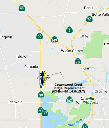 In May 2018, the CTC approved for future consideration of funding the following project for
which a Mitigated Negative Declaration (MND) has been completed: Route 99
in Butte County. Replace existing bridge on Route 99 near the town of
Richvale. (PPNO 2425) (03-But-99, PM 14.89/15.67) This project is located
on Route 99 near Richvale in Butte County. The project proposes to
construct a new bridge adjacent to the Cottonwood Creek Bridge. The
foundation of the existing bridge is determined to be scour critical. The
project proposes for the existing bridge to remain open during
construction of the new bridge and be demolished after completion. The
proposed project is estimated to cost $8.1 million in Capital Outlay
Right-of-Way and Construction. The project is fully funded and is
currently programmed in the 2018 SHOPP for an estimated total of $12.0
million, which includes Construction (capital and support) and
Right-of-Way (capital and support). Construction is estimated to begin in
2020. The scope, as described for the preferred alternative, is consistent
with the project scope programmed by the Commission in the 2018 SHOPP.
In May 2018, the CTC approved for future consideration of funding the following project for
which a Mitigated Negative Declaration (MND) has been completed: Route 99
in Butte County. Replace existing bridge on Route 99 near the town of
Richvale. (PPNO 2425) (03-But-99, PM 14.89/15.67) This project is located
on Route 99 near Richvale in Butte County. The project proposes to
construct a new bridge adjacent to the Cottonwood Creek Bridge. The
foundation of the existing bridge is determined to be scour critical. The
project proposes for the existing bridge to remain open during
construction of the new bridge and be demolished after completion. The
proposed project is estimated to cost $8.1 million in Capital Outlay
Right-of-Way and Construction. The project is fully funded and is
currently programmed in the 2018 SHOPP for an estimated total of $12.0
million, which includes Construction (capital and support) and
Right-of-Way (capital and support). Construction is estimated to begin in
2020. The scope, as described for the preferred alternative, is consistent
with the project scope programmed by the Commission in the 2018 SHOPP.
(Source: May 2018 CTC Minutes, Agenda Item 2.2c(1))
The following project was included in the final adopted 2018 SHOPP: PPNO 2425. 03-Butte-99 14.9/15.7. On Route 99. Near Richvale, at Cottonwood Creek Bridge № 12-0120, from 0.3 mile south to 0.5 mile north of Nelson Avenue. Replace and realign scour critical bridge. Begin Con: 5/15/2020. Total Project Cost: $11,964K.
In June 2019, the CTC approved the following SHOPP
scope amendment: 03-But-99 14.9/15.7 PPNO 2425 ProjID 0314000101. On Route 99 Near Richvale, at Cottonwood Creek Bridge № 12-0120, from 0.3
mile south to 0.5 mile north of Nelson Avenue. Replace and realign
scour-critical bridge. Additional R/W capital is due to increased
mitigation to purchase credits for Giant Garter Snake. During design,
stage construction plans were revised requiring that the new alignment be
built prior to removal of existing alignment. This resulted in increase of
roadway excavation and asphalt quantities, and mobilization costs. Need
for larger sized culverts and increase in unit price and quantities for
structural items also resulted in higher construction capital. Updated
total cost: $15,590K
(Source: June 2019 CTC Minutes, Agenda Item
2.1a.(1) Scope Item 23)
In June 2020, the CTC authorized the following
allocation for Construction Support and Construction Capital for this
project: $11,768,000. 03-But-99 14.9/15.7. PPNO 03-2425. ProjID
0314000101. EA 0F290. On Route 99 near Richvale, from 0.3 mile south to
0.5 mile north of Nelson Avenue at Cottonwood Creek Bridge №
12-0120. Outcome/Output: Replace and realign scour critical
bridge, rehabilitate drainage systems, and reconstruct Nelson Avenue
intersection.
(Source: June 2020 CTC Agenda, Agenda Item 2.5b.(1)
#3)
In March 2022, it was reported that Caltrans has
completed construction of the new Cottonwood Creek Bridge in Butte County.
The $15.3 million project includes $3.2 million in funding from Senate
Bill (SB) 1, the Road Repair and Accountability Act of 2017. The new
bridge, located on Route 99 north of the Thermalito Afterbay reservoir,
replaces an aging structure damaged by erosion. Over the years, swiftly
moving water from Cottonwood Creek removed sediment around the bridge
piers, compromising the integrity of the structure. In addition to
building a new bridge, construction crews realigned a segment of roadway
and widened the Nelson Avenue intersection at Route 99 by providing an
additional left-turn lane onto eastbound lanes. In the past two years,
Caltrans has also upgraded the Western Canal Bridge on Route 99 in Butte
County and replaced the Route 70 Simmerly Slough Bridge north of
Marysville, the Route 20 Wadsworth Canal Bridge in Sutter County, and the
Route 20 Dry Creek Bridge in Yuba County.
(Source: Lake County News, 3/22/2022)
In July 2010, the CTC authorized relinquishment of right of way along Route 99 from post mile BUT 22.8 to the Durham Dayton Highway (~ BUT 23.831).
In January 2011, the CTC approved for future consideration of funding a project in Butte County that will replace the northbound Butte Creek Bridge (~ BUT 28.745) near the city of Chico. The project is programmed in the 2010 State Highway Operation and Protection Program. Construction is estimated to begin in Fiscal Year 2012-13. Total estimated project cost is $15,517,000 for capital and support. The project will mitigate potential impacts to biological resources to a less than significant level. Potential impacts to elderberry shrubs in the project area will be mitigated by purchasing credits at a mitigation bank. Potential impacts to fish will be mitigated by replacing riparian vegetation at a 3:1 ratio.
Roadway Raising: Wilson Landing Road to Keefers Slough Bridge (03-But-99 38.9/39.7)
In June 2022, the CTC amended the following new capital
project into the SHOPP: 03-But-99 38.9/39.7. PPNO 03-2441; ProjID
0321000181; EA 2J070. Route 99 Near Chico, from north of Wilson Landing
Road to Keefers Slough Bridge. Raise the roadway grade, install cross-road
culverts, and re-grade roadside ditches to prevent roadway flooding.
Allocation ($ × 1,000): PA&ED $550; PS&E $600; R/W Sup $120;
Con Sup $950; R/W Cap $15; Const Cap $3,800; TOTAL $6,035. Begin Const:
1/15/2024.
(Source: June 2022 CTC Agenda, Agenda Item
2.1a.(1a) #1)
In June 2022, the CTC approved the following
pre-construction phase SHOPP allocation: $550,000. 03-But-99 38.9/39.7.
PPNO 03-2441; ProjID 0321000181; EA 2J070. Route 99 Near Chico, from north
of Wilson Landing Road to Keefers Slough Bridge. Raise the roadway grade,
install cross-road culverts, and re-grade roadside ditches to prevent
roadway flooding. Concurrent Amendment under SHOPP Amendment 22H-002; June
2022. Allocation FY 23-24: PA&ED $550,000.
(Source: June 2022 CTC Agenda, Agenda Item 2.5b.(2a) #12)
In December 2022, the CTC approved the following
pre-construction phase SHOPP allocation: $720,000. 03-But-99 38.9/39.7.
PPNO 03-2441; ProjID 0321000181; EA 2J070. Route 99 Near Chico, from north
of Wilson Landing Road to Keefers Slough Bridge. Raise the roadway grade,
install cross-road culverts, and re-grade roadside ditches to prevent
roadway flooding. Allocation: PS&E $600,000; R/W Sup $120,000.
(Source: December 2022 CTC Agenda, Agenda Item
2.5b.(2a) #3)
South Avenue Roundabout (02-Tehama-99 PM 4.2/4.8)
In March 2020, the CTC amended the following project
into the SHOPP: 02-Teh-99 PM 4.2/4.8 PPNO 3744 ProjID 0219000044 EA 0J010
Route 99 near Los Molinos, from 0.3 mile S to 0.3 mile N of South Ave.
Construct roundabout. Total cost: $14,407K. BC 3/19/2024. Construction and
R/W acquisition not yet programmed. The CTC also approved the following
financial allocation: 02-Teh-99 PM 4.2/4.8. PPNO 3744. ProjID 0219000044.
EA 0J010. Route 99 near Los Molinos, from 0.3 mile south to 0.3 mile north
of of South Avenue. Construct roundabout. (Concurrent Amendment under
SHOPP Amendment 18H-015; March 2020.) Financial allocation: PA&ED
$1,050,000.
(Source: March 2020 CTC Agenda, Agenda Item
2.1a.(1a) #19, 2.5b.(2a) #3)
The 2020 SHOPP, approved in May 2020, included the
following Collision Reduction item of interest (carried over from the 2018
SHOPP): 02-Tehama-99 PM 4.2/4.8 PPNO 3744 Proj ID 0219000044 EA 0J010.
Route 99 near Los Molinos, from 0.3 mile south to 0.3 mile north of South
Avenue. Construct roundabout. Programmed in FY23-24, with construction
scheduled to start in March 2024. Total project cost is $14,407K, with
$9,497K being capital (const and right of way) and $4,910K being support
(engineering, environmental, etc.).
(Source: 2020 Approved SHOPP a/o May 2020)
In March 2022, it was reported that Caltrans was
hosting virtual public meetings to gather comments and public input on the
South Avenue safety project. The South Avenue safety project is scheduled
for 2024 and would construct a roundabout at the intersection of Route 99E
and South Avenue south of Vina and east of Corning.
(Source:$Red Bluff Daily News, 3/7/2022)
In June 2022, the CTC approved for future consideration
of funding the following project for which a Mitigated Negative
Declaration (MND) has been completed: 02-Teh-99, PM 4.2/4.8. South
Avenue Safety Project. Installation of a roundabout on Route 99 in
Tehama County. (PPNO 3744) The project is located on Route 99 between
postmiles 4.2 and 4.8, in Tehama County. The Department proposes to
reconfigure the existing intersection at Route 99 and South Avenue by
replacing the existing minor leg stop-controlled intersection with a
roundabout. In addition, improvements will include an extension to the box
culvert that conveys Hoag Slough under Route 99, installation of
electrical and traffic management systems, and applications for erosion
and storm water treatment. The project will also require the acquisition
of new right of way. This project is fully funded and is currently
programmed in the 2022 State Highway Operation and Protection Program
(SHOPP) for a project total of $14,407,000, which includes Right of Way
(capital) and Construction (capital and support). Construction is
estimated to begin in 2024. The scope, as described for the preferred
alternative, is consistent with the project scope as programmed by the
Commission in the 2022 SHOPP.
(Source: June 2022 CTC Agenda, Agenda Item
2.2c.(1))
In June 2022, the CTC approved the following
pre-construction phase SHOPP allocation: $1,610,000. 02-Teh-99 4.2/4.8.
PPNO 02-3744; ProjID 0219000044; EA 0J010. Route 99 Near Los Molinos, from
0.3 mile south to 0.3 mile north of South Avenue. Construct roundabout.
Concurrent consideration of funding under Resolution E-22-39; June 2022.
Allocation: FY23-24. PS&E $1,430,000; R/W Sup $180,000.
(Source: June 2022 CTC Agenda, Agenda Item 2.5b.(2a) #10)
In July 2022, it was reported that this roundabout is
at the intersection of South Avenue and Route 99E. The roundabout would be
the same size as the one planned for the northbound I-5 interchange with
South Main Street in Red Bluff. Besides adding the roundabout, this
project will include roadway excavation to accommodate the new alignment
and structural section, concrete curbs and gutters, a center island, and
new signs and drainage improvements. The funding approval will allow the
project to move forward into the final design phase, which will produce
final plans, specifications and estimates, leading to the project being
advertised for bids for the construction phase. Construction is
anticipated to take place between April and November of 2024. It is
anticipated to be a season-long project, and traffic control will be in
place during construction. According to data analysis by Caltrans, between
Jan. 1, 2013, and Dec. 31, 2017, there were 17 collisions; 11 involved
injuries and 6 were property damage only. The collision rate is 4.7 times
the statewide average for similar facility types, and the fatal plus
injury rate is 7 times the statewide average. Caltrans said some benefits
to the roundabout are fewer conflict points, reduced speeds, a 68 percent
reduction in collisions, an 88 percent reduction in injury collisions and
100 percent reduction in fatal collisions, shorter queue length and
vehicle delays, less air pollution and provision of a U-turn movement in
all directions.
(Source:$Red Bluff Daily News, 7/28/2022)
In January 2023, it was reported that Caltrans
anticipates starting hard construction activities for this project in the
spring of 2024, and completed by the end of 2024. For impacts to the
traveling public, Caltrans expects 99 percent of the project to be done
under one-way traffic control, which means there will be some delays. One
lane will be open most of the time during the project, and there will be a
minimal amount of time; Caltrans may have to do some shutting down the
highway. Caltrans looked at a signal project where they would signalize
all three legs of the intersection. This alternative was ruled out because
the reduction in accidents was not sufficient, with at best a 20 percent
reduction in accidents. Another alternative Caltrans considered was a
flyover alternative where they separate the different grades and cause one
direction to not have to encounter the other direction of travel. That
would do tremendous good as far as reducing accidents, but it also comes
at a tremendous cost estimated somewhere in the neighborhood of 24
million.
(Source:$Red Bluff Daily News, 1/14/2023)
In January 2024, the CTC approved the following
construction phase allocation for a project with a cost increase greater
than 20%: $11,972,000. 02-Teh-99 4.2/4.8. PPNO 02-3744; ProjID 0219000044;
EA 0J010. Route 99 Near Los Molinos, from 0.3 mile south to 0.3 mile north
of South Avenue. Outcome/Output: Construct roundabout to improve
safety. This project will reduce the number and severity of collisions.
CEQA - MND, 4/27/2022; Re-validation 11/27/2023. NEPA - FONSI, 4/27/2022;
Re-validation 11/27/2023. Future consideration of funding approved under
Resolution E-22-39; June 2022..Pre-Construction Phase: Budgeted (Actual,
if different): PA&ED $1,050,000 ($898,836);
PS&E $1,430,000 ($1,240,575); R/W Sup $180,000 ($65,066).
Construction Phase - Programmed ($ × 1000) (Allocation, if
different): CON ENG $2,250,000; CONST $7,350,000 ($9,722,000).
In March 2020, this project was programmed in the SHOPP for $7,350,000 in
Construction Capital and $2,250,000 in Construction Support for allocation
in Fiscal Year 2023-24. In November 2023, the Engineer’s Estimate
(EE) reflected the need of $9,722,000 in Construction Capital (32.3
percent over the programmed amount) and $2,250,000 in Construction Support
(no increase over the programmed amount). The Department plans to
advertise the project in February 2024 and begin construction in May 2024.
Construction is planned for two construction seasons with a duration of
180 working days. The Construction Capital is greater than the programmed
amount due to adjustments made to the EE to reflect recent bids for
roundabout projects. Constraints due to adjacent vernal pools eliminated
the option for temporary detours and limited the options for the traffic
monitoring camera foundation.
The Department adjusted the project’s EE by reviewing the bid
results of similar recent roundabout projects and current bidding trends,
increasing the unit cost of major items including roadway excavation,
minor concrete, and hot mix asphalt beyond the anticipated 3.2 percent
escalation. As a result, the pavement structural section items increased
by $411,000. As the design was refined, the size of the traffic islands
and required drainage systems also increased. The increase in drainage
system items resulted in a cost increase of $428,000. In addition,
proposed work in close proximity to vernal pools is not allowed during the
wet season. This restriction will delay the start of construction and push
the schedule to two construction seasons. This will impact traffic
control, stormwater items, and add more overhead costs for the contractor.
Prior to completing design and achieving Ready to List, the Department
revisited the traffic and safety components of the project and added
Construction Zone Enhanced Enforcement Program to increase safety of the
workers and the public. During the design of the traffic monitoring camera
foundation, the preferred alternative of a pile footing could not be used
due to the impacts it would cause to the vernal pools. Therefore, a
conservative alternative was utilized by designing a spread footing to
minimize impacts to the vernal pools. As a result of these adjustments
that were made to the cost of the bid items; mobilization and contingency
costs increased by $758,000 based on a percentage of the bid item costs.
(Source: January 2024 CTC Agenda, Agenda Item 2.5d.(1))
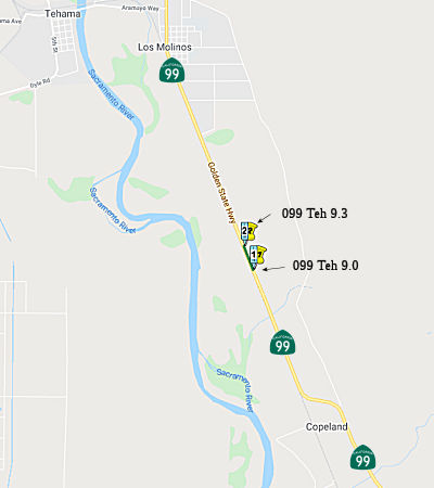 Champlin Slough Bridge № 08-0006 (02-Tehama-99 9.0/9.3)
The following project was included in the final adopted 2018 SHOPP in March 2018: PPNO 3642. 02-Tehama-99 9.0/9.3. On Route 99 Near Los Molinos, from 0.2 mile south to 0.2 mile north of Champlin Slough Bridge № 08-0006. Replace bridge to correct scour critical conditions. Begin Con: 4/19/2022. Total Project Cost: $7,560K.
In October 2019, it was reported that Caltrans District
2 was holding public open houses to discuss the upcoming replacement of
Champlin Slough Bridge on Route 99, approximately 3 miles south of Los
Molinos. Construction on the approximately $4.4 million project is slated
to begin in the summer of 2022. During that time, Route 99 will be closed
just north and south of the construction area, and a detour around the
construction zone will be in place and for two to three months. The
closure will likely impact residents living along Route 99 and drivers
traveling between Chico and Red Bluff. The new bridge will be constructed
using Accelerated Bridge Construction technologies to reduce the amount of
time needed to implement road closures. The Champlin Slough Bridge,
originally constructed in 1918, is one of the last remaining pre World War
I structures still in service along Route 99 in Tehama County. This
project will replace the 100+-year-old bridge with a new bridge meeting
current standards.
(Source: Action News Now, 10/1/2019)
The 2020 SHOPP, approved in May 2020, included the
following Bridge Preservation item of interest (carried over from the 2018
SHOPP): 02-Tehama-99 PM 9.0/9.3 PPNO 3642 Proj ID 0216000148 EA 1H510.
Route 99 near Los Molinos, from 0.2 mile south to 0.2 mile north of
Champlin Slough Bridge № 08-0006. Replace bridge to correct scour
critical conditions. Programmed in FY21-22, with construction scheduled to
start in April 2022. Total project cost is $7,560K, with $4,460K being
capital (const and right of way) and $3,100K being support (engineering,
environmental, etc.).
(Source: 2020 Approved SHOPP a/o May 2020)
In June 2020, the CTC approved for future consideration
of funding the Champlin Slough Bridge Replacement Project, which
will replace a bridge over Champlin Slough in Tehama County. (PPNO 3642)
Specifically, the project proposes to replace the Champlin Slough Bridge
near Los Molinos at post mile (PM) 9.1. The proposed replacement structure
is 85 feet long, has a single-span, and will meet current safety standards
when constructed. This project is fully funded and is currently programmed
in the 2018 SHOPP for a total of $7,560,000 which includes Construction
(capital and support) and Right of Way (capital and support). Construction
is estimated to begin in 2022. The scope, as described for the preferred
alternative, is consistent with the project scope programmed by the
Commission in the 2018 SHOPP.
(Source: June 2020 CTC Agenda, Agenda Item
2.2c.(1))
In June 2020, the CTC approved the following support
allocation for this project: 02-Teh-99 9.0/9.3 PPNO 3642 ProjID 0216000148
EA 1H510 Near Los Molinos, from 0.2 mile south to 0.2 mile north of
Champlin Slough Bridge № 08-0006. Replace bridge to correct scour
critical conditions. Allocation: PS&E $1,170,000; R/W Sup $90,000
(Source: June 2020 CTC Agenda, Agenda Item
2.5b.(2b) #7)
In August 2021, the CTC approved the following
construction phase allocation: $5,301,000. 02-Teh-99 9.0/9.3. PPNO
02-3642: ProjID 0216000148; EA 1H510. Route 99 Near Los Molinos, at
Champlin Slough Bridge № 08-0006. Outcome/Output: Replace bridge,
install rock slope protection, replace guardrail, and reconstruct roadway.
Allocation: CON ENG $990,000 CONST $4,370,000. (Future consideration of
funding approved under Resolution E-20-44; June 2020)
(Source: August 2021 CTC Agenda, Agenda Item
2.5b.(1) #9)
In May 2022, it was reported that Caltrans has
rescheduled the Champlin Slough Bridge Replacement project to begin May
31, with full closure of Route 99E for seven weeks beginning Wednesday,
June 1. The project will completely replace the existing bridge structure
just south of Los Molinos on Route 99E in Tehama County. It includes new
guard railing, and the addition of numerous safety features. One-way
traffic control will start May 31 and the full closure will start the
evening of June 1. Caltrans will detour traffic at South Avenue to
northbound Interstate 5 to Red Bluff. Southbound traffic will travel from
Red Bluff via I-5 to South Avenue. The $7.5 million project includes 90
working days, with 45 calendar days requiring the highway closure.
Motorists can expect to travel this portion of the highway by mid-July and
the entire project is expected to be completed by mid-August.
(Source: Red Bluff Daily News, 5/26/2022)
In November 2010, the CTC approved amending the 2010 State Transportation Improvement Program (STIP) and the Route 99 Corridor baseline agreement for the Los Molinos project (PPNO 3326) [In Los Molinos, from Orange Street to Tehama Vina Road, PM TEH 11.6 to TEH 12.6] in Tehama County to: · Update Phase 2 schedule and funding plan based on current estimates. · Increase Right of Way (R/W) funding to accommodate utility relocation work recently discovered. · Split out Transportation Enhancement (TE) project added as part of the 2010 STIP.
In January 2012, the CTC approved about $3 million in funding for a "traffic calming" project on Route 99 from Grant Street in Los Molinos north to Tehama Vina Road (~ TEH 12.095 to TEH 12.538). Curbs, gutters, lights, drainage, bike buffers, landscape islands and a thin-blanket overlay will be installed.
In May 2017, the CTC authorized deletion of the Los Molinos Phase III project (PPNO 2528) from the STIP (TEH 12.5 to TEH 13.5). The project is the last phase of a series of improvements in Los Molinos and was delayed until FY 20-21 due to funding constraints realized in the 2016 STIP cycle. The project was going to be delivered in conjunction with a project with a similar scope programmed in the 2016 State Highway Operations and Protection Program (SHOPP) which will update this location to current American’s with Disabilities Act (ADA) requirements. The SHOPP project scope includes curb ramps, sidewalk gap closures, drainage, paving and lighting. However, due to ADA mandates, the SHOPP project cannot be delayed but is able to incorporate the scope in the Los Molinos Phase III Project.
In August 2009, the CTC approved reinquishment of right of way in the county of Tehama along Route 99 near Los Molinos at Butler Street (~ TEH 13.451), consisting of a reconstructed county road.
In May 2012, the CTC authorized SHOPP funding on Route 99, in Tehama County, 02-Teh-99 14.1 Near Los Molinos, from the south fork of Mill Creek Bridge #08-160 to First Avenue. $3,800,000 to replace one scoured bridge to maintain structural integrity, reduce the risk to lives and properties, and to comply with the Bridge Inspection Report recommendation.
In September 2010, the CTC approved vacation of right of way in the county of Tehama along Route 99 between 66th Avenue and 68th Avenue (~ TEH 17.633 to TEH R17.955), consisting of highway right of way no longer needed for State highway purposes.
In November 2010, the CTC authorized relinquishment of right of way in the county of Tehama along Route 99 at 68th Avenue and Le Claire Avenue near Los Molinos (~ TEH R17.955 to TEH R18.195), consisting of reconstructed county roads.
Business Routes Naming The interchange between Route 99 and Riego Road in
Sutter County (~ SUT 0.918) is officially named the "Dean Patton
Memorial Interchange." It was named in memory of Dean Patton of
Grass Valley, who started his career with the Department of Transportation
as a highway maintenance worker in 2006, initially assigned to the
Marysville special crews yard as part of a stormwater and bridge crew, and
more recently assigned to the Nevada City maintenance yard. On May 2,
2013, Mr. Patton was struck by another vehicle and killed while riding his
motorcycle on his day off onRoute 99 at Riego Road in Sutter County on the
way to the State Capitol in Sacramento, as a participant in the third
annual Highway Workers Memorial Run, benefiting the children of fallen
Caltrans employees. In his private life, Mr. Patton sought to improve his
community through public service, active involvement in the Twin Cities
Church in Grass Valley, helping others better themselves through
Alcoholics Anonymous, and coaching a Little League team for children with
special needs. It was named on 09/20/13 by SCR 55, Res. Chapter 125,
Statutes of 2013.
The interchange between Route 99 and Riego Road in
Sutter County (~ SUT 0.918) is officially named the "Dean Patton
Memorial Interchange." It was named in memory of Dean Patton of
Grass Valley, who started his career with the Department of Transportation
as a highway maintenance worker in 2006, initially assigned to the
Marysville special crews yard as part of a stormwater and bridge crew, and
more recently assigned to the Nevada City maintenance yard. On May 2,
2013, Mr. Patton was struck by another vehicle and killed while riding his
motorcycle on his day off onRoute 99 at Riego Road in Sutter County on the
way to the State Capitol in Sacramento, as a participant in the third
annual Highway Workers Memorial Run, benefiting the children of fallen
Caltrans employees. In his private life, Mr. Patton sought to improve his
community through public service, active involvement in the Twin Cities
Church in Grass Valley, helping others better themselves through
Alcoholics Anonymous, and coaching a Little League team for children with
special needs. It was named on 09/20/13 by SCR 55, Res. Chapter 125,
Statutes of 2013.
(Image source: The Union)
 The 5-mile segment of Route 99 south of its
intersection with Route 70 in the County of Sutter (~ SUT 2.491 to SUT
7.491) is named the Bernie Richter Memorial Highway. It was
named in memory of Bernie Richter, born September 7, 1931, a member of the
Assembly of the State of California from 1992 to 1998. In January 1998
Bernie Richter witnessed a vehicle lose control, crash into a bridge
abutment just south of the intersection of Route 99 and Route 70 in the
County of Sutter, and burst into flames. At this point Assemblymember
Richter raced to the vehicle with his own fire extinguisher, and with the
assistance of another good Samaritan, rescued the driver by pulling him
out of the vehicle. Bernie Richter died at the age of 68 on October 25,
1999. Named by Assembly Concurrent Resolution 189, August 17, 2004,
Chapter 142.
The 5-mile segment of Route 99 south of its
intersection with Route 70 in the County of Sutter (~ SUT 2.491 to SUT
7.491) is named the Bernie Richter Memorial Highway. It was
named in memory of Bernie Richter, born September 7, 1931, a member of the
Assembly of the State of California from 1992 to 1998. In January 1998
Bernie Richter witnessed a vehicle lose control, crash into a bridge
abutment just south of the intersection of Route 99 and Route 70 in the
County of Sutter, and burst into flames. At this point Assemblymember
Richter raced to the vehicle with his own fire extinguisher, and with the
assistance of another good Samaritan, rescued the driver by pulling him
out of the vehicle. Bernie Richter died at the age of 68 on October 25,
1999. Named by Assembly Concurrent Resolution 189, August 17, 2004,
Chapter 142.
(Image source: Local Wiki - Chico)
 The Tudor Bypass segment of Rout 99, from the intersection of Route 99 and Central Avenue to the
intersection of Route 99 and Route 113 (~ SUT 16.881 to SUT R20.042), in
Sutter County is formally named the "Joan Bechtel Memorial Highway".
It was named in memory of Joan Bechtel, was elected to the Sutter County
Board of Supervisors in November 1992, and who subsequently represented
the citizens of the Fourth Supervisorial District from January 1993 to May
2002. She served as the Sutter County Clerk-Recorder from May 2002 to
December 2007. Ms. Bechtel also showed her commitment to the community by
serving as a member of the Fremont-Rideout Health Group's Board of
Directors for 25 years, and on the Yuba-Sutter Fair Board for eight years.
During her tenure as county supervisor, Ms. Bechtel led the effort to
widen Route 99 for the safety of all citizens of Sutter County and all
those that travel along Route 99. As a direct result of her efforts, there
has been a precipitous drop in accident rates and fatalities on Route 99.
Ms. Bechtel passed away on June 25, 2008, and the Legislature wishes to
honor her commitment and dedication to Sutter County. Named by Assembly
Concurrent Resolution (ACR) 150, Resolution Chapter 162, on 9/19/2008.
The Tudor Bypass segment of Rout 99, from the intersection of Route 99 and Central Avenue to the
intersection of Route 99 and Route 113 (~ SUT 16.881 to SUT R20.042), in
Sutter County is formally named the "Joan Bechtel Memorial Highway".
It was named in memory of Joan Bechtel, was elected to the Sutter County
Board of Supervisors in November 1992, and who subsequently represented
the citizens of the Fourth Supervisorial District from January 1993 to May
2002. She served as the Sutter County Clerk-Recorder from May 2002 to
December 2007. Ms. Bechtel also showed her commitment to the community by
serving as a member of the Fremont-Rideout Health Group's Board of
Directors for 25 years, and on the Yuba-Sutter Fair Board for eight years.
During her tenure as county supervisor, Ms. Bechtel led the effort to
widen Route 99 for the safety of all citizens of Sutter County and all
those that travel along Route 99. As a direct result of her efforts, there
has been a precipitous drop in accident rates and fatalities on Route 99.
Ms. Bechtel passed away on June 25, 2008, and the Legislature wishes to
honor her commitment and dedication to Sutter County. Named by Assembly
Concurrent Resolution (ACR) 150, Resolution Chapter 162, on 9/19/2008.
(Image source: Appeal-Democrat)
The segment of Route 99 between Hull Road and Stewart Road (~ SUT 22.829 to SUT 26.873) in Sutter County is named the "California Small Business Owners’ Highway". It was named in recognition of the tremendous contributions that small businesses make to the economic strength of our nation and state. The nation’s 28 million small businesses are the job creation engine of the American economy, responsible for one-half of all private sector jobs, and are the source of roughly 70% of all new jobs in the decade between 2004 and 2014. California is home to three and one-half million of these small businesses, accounting for 99% of the state’s employers and 52% of the state’s workforce, and producing more than one-half of California’s gross domestic product in 2014. California is home to the most innovative and competitive businesses in the world, placing the state consistently among the top 10 economies in the world, and California’s small businesses are critical to the economic health of the state because small businesses are innovative forces in the marketplace and are among the most likely to take risks to create new technologies and industries. The naming demonstrates a commitment to small businesses and support for small-scale private-sector job creators are among the most promising strategies to enhance California’s human capital, expand job opportunities, and increase the state’s competitive advantage in the global marketplace. Named by Assembly Concurrent Resolution (ACR) 118, Resolution Chapter 174, September 11, 2014.
The portion of this route from Route 65 to Red Bluff was historically called the "Capitol Highway" (now 070 YUB R8.316 to 036 TEH L41.141, along what is old 99W). In local usage, it is called the "East Side Highway".
 The portion of Route 99 from 9th Avenue (TEH 16.264) to 61st Avenue (TEH 16.691) in the
County of Tehama is named the "CHP Officer Archie E. Nichols Memorial
Highway". It was named in memory of Archie E. Nichols, who
was born in September 1919, in Long Beach, California. At 18 years of age
in 1937, Archie joined the United States Army Air Corps, where he served
for six years, including fighting in World War II, before being shot down
in 1943. First Lieutenant Nichols was piloting a Boeing B-17 Flying
Fortress bomber fighting in Germany when he was shot down on his way back
to England after a bombing run. Due to technology restrictions at the
time, pilots wore electrical suits to regulate pressure and his suit was
damaged in the crash, which caused it to short out and destroy one of his
kidneys. During this time, the Department of the California Highway Patrol
(CHP) was recruiting military personnel as the state population rose, and
First Lieutenant Nichols was contacted and he thought it was a great
opportunity to continue serving the public. Following his recovery, First
Lieutenant Nichols was relieved from military service and moved back to
California and joined the CHP. Initially, Officer Nichols served as an
officer in the County of San Bernardino for one year before moving his
family to the Red Bluff area and working patrol there until his death. The
Nichols family lived on a walnut ranch near the community of Los Molinos
in the County of Tehama and raised dairy cows to provide food for the
family. Officer Nichols would often get called at home in the middle of
the night to go handle an accident because he was one of the few CHP
officers living in the County of Tehama at the time. Officer
Nichols’ public service was not limited to the United States Army
Air Corps or the CHP. He was also a volunteer at the local fire department
in Los Molinos, and served in several other local civic organizations.
Officer Nichols was very involved in the community, always helping
neighbors and friends when needed. Officer Nichols and some other law
enforcement officers spent a significant amount of off-duty time on a
project painting trees near a dangerous area in the City of Red Bluff to
prevent accidents. He and his wife were very involved in the Sacred Heart
Catholic Church where a memorial to him still stands today. Officer
Nichols’ love of service was passed on to his children as well, with
five of his children serving in the United States Armed Forces, the Army,
the Navy, and the Air Force, and another child becoming a Catholic nun.
Officer Nichols’ grandchildren have continued his legacy of service,
with his grandson, Dustin, serving as a CHP Lieutenant, his grandson,
Steven, serving as a captain within the Department of Corrections and
Rehabilitation, where his son, Taylor, Archie’s great-grandson, also
is a corrections officer, and his son, Christopher, who served in the
United States Air Force and was wounded in Afghanistan. Around the last
year of his life, Officer Nichols was forced to go on a restrictive diet
for the purpose of trying to save the function of his remaining kidney,
but he eventually died of kidney failure in Los Molinos. CHP Officer
Archie E. Nichols passed away on November 13, 1959, after a life of
service to his state and nation. He is survived by 38 grandchildren, 37
great-grandchildren, and 3 great-great grandchildren. Named by Senate
Concurrent Resolution (SCR) 105, Res. Chapter 117, 7/6/2018.
The portion of Route 99 from 9th Avenue (TEH 16.264) to 61st Avenue (TEH 16.691) in the
County of Tehama is named the "CHP Officer Archie E. Nichols Memorial
Highway". It was named in memory of Archie E. Nichols, who
was born in September 1919, in Long Beach, California. At 18 years of age
in 1937, Archie joined the United States Army Air Corps, where he served
for six years, including fighting in World War II, before being shot down
in 1943. First Lieutenant Nichols was piloting a Boeing B-17 Flying
Fortress bomber fighting in Germany when he was shot down on his way back
to England after a bombing run. Due to technology restrictions at the
time, pilots wore electrical suits to regulate pressure and his suit was
damaged in the crash, which caused it to short out and destroy one of his
kidneys. During this time, the Department of the California Highway Patrol
(CHP) was recruiting military personnel as the state population rose, and
First Lieutenant Nichols was contacted and he thought it was a great
opportunity to continue serving the public. Following his recovery, First
Lieutenant Nichols was relieved from military service and moved back to
California and joined the CHP. Initially, Officer Nichols served as an
officer in the County of San Bernardino for one year before moving his
family to the Red Bluff area and working patrol there until his death. The
Nichols family lived on a walnut ranch near the community of Los Molinos
in the County of Tehama and raised dairy cows to provide food for the
family. Officer Nichols would often get called at home in the middle of
the night to go handle an accident because he was one of the few CHP
officers living in the County of Tehama at the time. Officer
Nichols’ public service was not limited to the United States Army
Air Corps or the CHP. He was also a volunteer at the local fire department
in Los Molinos, and served in several other local civic organizations.
Officer Nichols was very involved in the community, always helping
neighbors and friends when needed. Officer Nichols and some other law
enforcement officers spent a significant amount of off-duty time on a
project painting trees near a dangerous area in the City of Red Bluff to
prevent accidents. He and his wife were very involved in the Sacred Heart
Catholic Church where a memorial to him still stands today. Officer
Nichols’ love of service was passed on to his children as well, with
five of his children serving in the United States Armed Forces, the Army,
the Navy, and the Air Force, and another child becoming a Catholic nun.
Officer Nichols’ grandchildren have continued his legacy of service,
with his grandson, Dustin, serving as a CHP Lieutenant, his grandson,
Steven, serving as a captain within the Department of Corrections and
Rehabilitation, where his son, Taylor, Archie’s great-grandson, also
is a corrections officer, and his son, Christopher, who served in the
United States Air Force and was wounded in Afghanistan. Around the last
year of his life, Officer Nichols was forced to go on a restrictive diet
for the purpose of trying to save the function of his remaining kidney,
but he eventually died of kidney failure in Los Molinos. CHP Officer
Archie E. Nichols passed away on November 13, 1959, after a life of
service to his state and nation. He is survived by 38 grandchildren, 37
great-grandchildren, and 3 great-great grandchildren. Named by Senate
Concurrent Resolution (SCR) 105, Res. Chapter 117, 7/6/2018.
(Image source: Red Bluff Daily News)
 The portion of Route 99
from TEH 20.400 at Eldrid Avenue near the community of Dairyville to TEH
24.529 near Arch Street in the City of Red Bluff in the County of Tehama
is named the “Farm-to-Fork Corridor”. It was named in
recognition of the fact that farmers in the Counties of Butte, Sutter,
Tehama, and Yuba have provided fresh agricultural commodities and produce
to Californians for generations; and that they continue to provide quality
agricultural commodities and produce to the City of Sacramento and the
greater United States. The City of Sacramento is known as
“America’s Farm-to-Fork Capital” and high-quality
agricultural commodities and produce are frequently transported to the
City of Sacramento and the greater United States via Route 99. Named by
Assembly Resolution ACR 27, Res. Chapter 109, Statutes of 2021, on 09/07/21.
The portion of Route 99
from TEH 20.400 at Eldrid Avenue near the community of Dairyville to TEH
24.529 near Arch Street in the City of Red Bluff in the County of Tehama
is named the “Farm-to-Fork Corridor”. It was named in
recognition of the fact that farmers in the Counties of Butte, Sutter,
Tehama, and Yuba have provided fresh agricultural commodities and produce
to Californians for generations; and that they continue to provide quality
agricultural commodities and produce to the City of Sacramento and the
greater United States. The City of Sacramento is known as
“America’s Farm-to-Fork Capital” and high-quality
agricultural commodities and produce are frequently transported to the
City of Sacramento and the greater United States via Route 99. Named by
Assembly Resolution ACR 27, Res. Chapter 109, Statutes of 2021, on 09/07/21.
(Image source: YouTube)
 The portion of Rout 99 in Sutter County, from SUT 36 (N of Yuba City) to SUT 40, inclusive, is named the “Patricia Ann Weston Memorial Highway”.
This segment was named in memory of Patricia Ann Weston, who was born on
July 19, 1951, in Mount Pleasant, Michigan. Weston graduated from the
Central Michigan University in 1973 with a Bachelor of Science degree in
Earth Science, Geography; and moved to California in 1974. She attended
the University of California, Davis, from June 1976 to September 1977; and
started her career in transportation with the Sacramento Area Regional
Planning Commission. Weston began her career with the Department of
Transportation (Caltrans) on January 9, 1979, in planning in the
Marysville District 3 Office, transferred to the headquarters Division of
Mass Transportation, and finally transferred to the headquarters Division
of Transportation Planning as the Office Chief of Advance System Planning
and Economics on January 4, 1993. Weston was a champion and advocate for
rural agencies working to ensure that rural projects were included in the
State Transportation Improvement Program. Weston changed state
transportation planning by being instrumental in not only the development
of the Transportation Development Act, an act that provides funding to
counties and cities for transit projects, but also in assisting the State
of California in securing the initial Urban Mass Transportation
Administration (UMTA) grants that provided funding to private and
nonprofit groups for handicap services. Weston wrote the 1998
Interregional Strategic Plan, a plan that describes the framework by which
the state carries out its responsibilities for the Interregional
Transportation Improvement Program and identifies how the Department of
Transportation works with regional agencies in gaining consensus on the
prioritized improvements contained in the program. Weston was instrumental
in writing GoCalifornia and the Governor's Strategic Growth Plan, which
established the framework for the subsequent Proposition 1B Program.
Weston mentored generations of planners and engineers at both the
Department of Transportation and at transportation planning agencies and
private planning firms statewide, freely sharing her experiences,
expertise, wisdom, and extreme professionalism with all who endeavored to
become more than they were. Weston dedicated 30 years of service to the
State of California and all who travel on its transportation systems,
spending her life improving those systems, and making travel options more
accessible, faster, and safer for the traveling public. On September 8,
2009, Patricia Ann Weston peacefully and quietly passed away following a
short illness. Named by Senate Concurrent Resolution (SCR) 84, Resolution
Chapter 66, on 8/4/2010.
The portion of Rout 99 in Sutter County, from SUT 36 (N of Yuba City) to SUT 40, inclusive, is named the “Patricia Ann Weston Memorial Highway”.
This segment was named in memory of Patricia Ann Weston, who was born on
July 19, 1951, in Mount Pleasant, Michigan. Weston graduated from the
Central Michigan University in 1973 with a Bachelor of Science degree in
Earth Science, Geography; and moved to California in 1974. She attended
the University of California, Davis, from June 1976 to September 1977; and
started her career in transportation with the Sacramento Area Regional
Planning Commission. Weston began her career with the Department of
Transportation (Caltrans) on January 9, 1979, in planning in the
Marysville District 3 Office, transferred to the headquarters Division of
Mass Transportation, and finally transferred to the headquarters Division
of Transportation Planning as the Office Chief of Advance System Planning
and Economics on January 4, 1993. Weston was a champion and advocate for
rural agencies working to ensure that rural projects were included in the
State Transportation Improvement Program. Weston changed state
transportation planning by being instrumental in not only the development
of the Transportation Development Act, an act that provides funding to
counties and cities for transit projects, but also in assisting the State
of California in securing the initial Urban Mass Transportation
Administration (UMTA) grants that provided funding to private and
nonprofit groups for handicap services. Weston wrote the 1998
Interregional Strategic Plan, a plan that describes the framework by which
the state carries out its responsibilities for the Interregional
Transportation Improvement Program and identifies how the Department of
Transportation works with regional agencies in gaining consensus on the
prioritized improvements contained in the program. Weston was instrumental
in writing GoCalifornia and the Governor's Strategic Growth Plan, which
established the framework for the subsequent Proposition 1B Program.
Weston mentored generations of planners and engineers at both the
Department of Transportation and at transportation planning agencies and
private planning firms statewide, freely sharing her experiences,
expertise, wisdom, and extreme professionalism with all who endeavored to
become more than they were. Weston dedicated 30 years of service to the
State of California and all who travel on its transportation systems,
spending her life improving those systems, and making travel options more
accessible, faster, and safer for the traveling public. On September 8,
2009, Patricia Ann Weston peacefully and quietly passed away following a
short illness. Named by Senate Concurrent Resolution (SCR) 84, Resolution
Chapter 66, on 8/4/2010.
(Image source: Patricia: From Alaska to California; Legacy.Com)
 The portion of Route 99
between Oroville Dam Boulevard West (~ BUT 13.168) and Nelson Avenue (~
BUT 15.19) in Oroville is named the "Milton La Malfa Memorial Highway".
It was named in memory of Milton Joseph La Malfa, who died on October 5,
2008. Born in San Jose, California, to Tony and Marge La Malfa on February
22, 1937, Milton La Malfa was raised and lived nearly his entire life in
Richvale, California, on the farm that his Italian grandfather, Giusseppe
La Malfa, purchased in 1931. Earning a degree in agriculture/business from
Fresno State University in 1959, Milton La Malfa married Karon Myers of
Oroville, California, in 1958, and they had three children, Doug, Sherry,
and Lisa. Distinguishing himself as a prominent rice farmer in the area,
Milton La Malfa worked with his father to level the ground in the 1950's
and 1960's, taming new acreage and improving irrigation methods of rice.
Milton La Malfa was also involved with experimental projects through the
rice experiment station, where he worked on fertilizer and herbicide
studies to improve rice production and yields and grew foundation seed
rice, and in 1960, a small rice dryer was built on the ranch for seed rice
storage and isolation. In addition to utilizing his outstanding talent and
skills as an innovative thinker in his farming operation, Milton La Malfa
shared his wise counsel in numerous capacities on a broad range of public
and private organizations, including several rice industry organizations.
Milton La Malfa provided leadership and results-oriented vision as a
director of the Butte County Rice Growers Association from 1973 to 1975
and again from 1981 to 1986, as well as secretary-treasurer for four years
and chair for one year. Milton La Malfa also served with distinction as a
director of Associated Rice Marketing Cooperative from 1988 to 1993,
serving as chair for one year, and also gave his time as director of the
Richvale Seed Growers for many years. Milton La Malfa was instrumental in
organizing local farmers in 1985 to form the Western Canal Water Users
Association, which initiated the negotiations with Pacific Gas and
Electric to purchase the water rights and conveyance system for the
farmers in the area; he subsequently became director of the Western Canal
Water District (formed from the Western Canal Water Users Association) and
also served as its president. Milton La Malfa also contributed extensively
as a director of Drainage District 200 and was on the Board of the
Northern California Water Association, which is the advocacy arm of the
water districts in Sacramento. Milton La Malfa was recognized for his
leadership in rice propagation, development, and in securing water for
California rice's future, and was nationally awarded the prestigious 2008
Rice Farmer of the Year Award by the USA Rice Federation. Milton La Malfa
was dedicated to philanthropy in his personal life, and his many
contributions to the community will not be forgotten. Named by Assembly
Concurrent Resolution (ACR) 71, Resolution Chapter 107, on 9/23/2009.
The portion of Route 99
between Oroville Dam Boulevard West (~ BUT 13.168) and Nelson Avenue (~
BUT 15.19) in Oroville is named the "Milton La Malfa Memorial Highway".
It was named in memory of Milton Joseph La Malfa, who died on October 5,
2008. Born in San Jose, California, to Tony and Marge La Malfa on February
22, 1937, Milton La Malfa was raised and lived nearly his entire life in
Richvale, California, on the farm that his Italian grandfather, Giusseppe
La Malfa, purchased in 1931. Earning a degree in agriculture/business from
Fresno State University in 1959, Milton La Malfa married Karon Myers of
Oroville, California, in 1958, and they had three children, Doug, Sherry,
and Lisa. Distinguishing himself as a prominent rice farmer in the area,
Milton La Malfa worked with his father to level the ground in the 1950's
and 1960's, taming new acreage and improving irrigation methods of rice.
Milton La Malfa was also involved with experimental projects through the
rice experiment station, where he worked on fertilizer and herbicide
studies to improve rice production and yields and grew foundation seed
rice, and in 1960, a small rice dryer was built on the ranch for seed rice
storage and isolation. In addition to utilizing his outstanding talent and
skills as an innovative thinker in his farming operation, Milton La Malfa
shared his wise counsel in numerous capacities on a broad range of public
and private organizations, including several rice industry organizations.
Milton La Malfa provided leadership and results-oriented vision as a
director of the Butte County Rice Growers Association from 1973 to 1975
and again from 1981 to 1986, as well as secretary-treasurer for four years
and chair for one year. Milton La Malfa also served with distinction as a
director of Associated Rice Marketing Cooperative from 1988 to 1993,
serving as chair for one year, and also gave his time as director of the
Richvale Seed Growers for many years. Milton La Malfa was instrumental in
organizing local farmers in 1985 to form the Western Canal Water Users
Association, which initiated the negotiations with Pacific Gas and
Electric to purchase the water rights and conveyance system for the
farmers in the area; he subsequently became director of the Western Canal
Water District (formed from the Western Canal Water Users Association) and
also served as its president. Milton La Malfa also contributed extensively
as a director of Drainage District 200 and was on the Board of the
Northern California Water Association, which is the advocacy arm of the
water districts in Sacramento. Milton La Malfa was recognized for his
leadership in rice propagation, development, and in securing water for
California rice's future, and was nationally awarded the prestigious 2008
Rice Farmer of the Year Award by the USA Rice Federation. Milton La Malfa
was dedicated to philanthropy in his personal life, and his many
contributions to the community will not be forgotten. Named by Assembly
Concurrent Resolution (ACR) 71, Resolution Chapter 107, on 9/23/2009.
(Image source: Chico Enterprise-Record)
 The portion of Route 99 consisting of the four-lane
expressway between the Pentz Road overcrossing (BUT 24.2) and the Edgar
Slough (Bridge № 12-128, BUT 030.03) is officially designated the "Ray
E. Johnson Expressway". Ray E. Johnson was a member of the
California Legislature for 18 years, having been first elected in 1964 to
the Assembly, and to the Senate in 1976. He represented 15 counties as a
Member of the Legislature and, in that capacity, was instrumental in
securing the completion of the Route 65 Bypass of Interstate 80 and in the
three-lane widening of Interstate 80. Named by Assembly Concurrent
Resolution No. 74, Chapter 113, in 1993.
The portion of Route 99 consisting of the four-lane
expressway between the Pentz Road overcrossing (BUT 24.2) and the Edgar
Slough (Bridge № 12-128, BUT 030.03) is officially designated the "Ray
E. Johnson Expressway". Ray E. Johnson was a member of the
California Legislature for 18 years, having been first elected in 1964 to
the Assembly, and to the Senate in 1976. He represented 15 counties as a
Member of the Legislature and, in that capacity, was instrumental in
securing the completion of the Route 65 Bypass of Interstate 80 and in the
three-lane widening of Interstate 80. Named by Assembly Concurrent
Resolution No. 74, Chapter 113, in 1993.
(Image source: Oroville Unified School District)
 The portion of Route 99, from one mile north of its intersection with Wilson
Landing Road (~ BUT 38.816) to Broyles Road (~ BUT 44.33), north of the
City of Chico, is named the "Caltrans Leadworker Gary Wayne Smith
Memorial Highway". It was named in memory of Gary Wayne Smith, who
began working for Caltrans on May 16, 1978, and spent the majority of his
career at the Chico Maintenance Station. On November 14, 2010, Gary Wayne
Smith was struck and killed by a vehicle while performing traffic control
at the scene of a fatal accident on Route 99 north of the City of Chico.
Gary Wayne Smith was known as a kind-natured individual who was never
without a smile and who helped many coworkers on the job. Gary Wayne Smith
never hesitated to help or respond to callouts regardless of the time or
day. Gary Wayne Smith had great pride regarding his service to the State
of California. Named by Senate Concurrent Resolution 52, Resolution
Chapter 94, on September 15, 2011.
The portion of Route 99, from one mile north of its intersection with Wilson
Landing Road (~ BUT 38.816) to Broyles Road (~ BUT 44.33), north of the
City of Chico, is named the "Caltrans Leadworker Gary Wayne Smith
Memorial Highway". It was named in memory of Gary Wayne Smith, who
began working for Caltrans on May 16, 1978, and spent the majority of his
career at the Chico Maintenance Station. On November 14, 2010, Gary Wayne
Smith was struck and killed by a vehicle while performing traffic control
at the scene of a fatal accident on Route 99 north of the City of Chico.
Gary Wayne Smith was known as a kind-natured individual who was never
without a smile and who helped many coworkers on the job. Gary Wayne Smith
never hesitated to help or respond to callouts regardless of the time or
day. Gary Wayne Smith had great pride regarding his service to the State
of California. Named by Senate Concurrent Resolution 52, Resolution
Chapter 94, on September 15, 2011.
(Image source: Chico Enterprise-Record; Caltrans In-Remembrance)
National Trails This segment was part of the "Pacific Highway".
US 99 appears to have been part of the "Jefferson Davis Highway". This was an attempt to commemorate the "Lost Cause" or "Southern Cause" narrative of the Civil War. Along US 99, a monument was located near the Oregon Border. This is discussed in more detail on the Trails and Roads page.
Freeway[SHC 253.5] From Route 5 in Sacramento to Route 36 near Red Bluff. Added to the Freeway and Expressway system in 1959.
Classified Landcaped FreewayThe following segments are designated as Classified Landscaped Freeway:
| County | Route | Starting PM | Ending PM |
| Sacramento | 99 | 0.59 | 0.99 |
| Sacramento | 99 | 1.32 | 1.86 |
| Sacramento | 99 | 13.70 | 14.00 |
| Sacramento | 99 | 17.02 | 17.32 |
| Sacramento | 99 | 17.46 | 24.35 |
| Sacramento | 99 | R32.12 | R32.37 |
| Sutter | 99 | R30.67 | R32.14 |
| Sutter | 99 | R32.47 | R32.77 |
| Sutter | 99 | R33.79 | R34.12 |
| Butte | 99 | R31.15 | R31.72 |
| Butte | 99 | R32.21 | R35.31 |
 Interregional Route
No current routing. As of 1964, the routing N of Red Bluff was part of I-5
Pre 1964 Signage History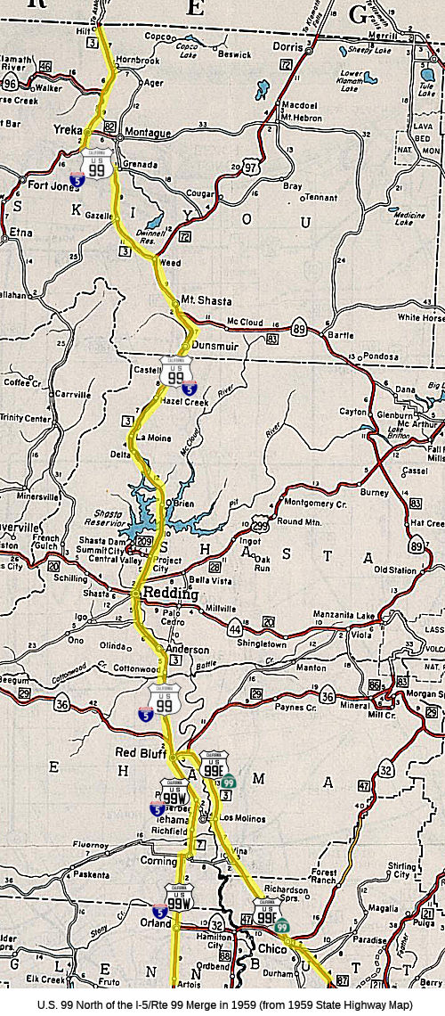 Before 1964, the current routing of I-5 was signed as US 99 to the Oregon border. This was LRN 3. Parts of this have been bypassed
by the I-5 freeway. The older true Route 99 segments include present-day
Route 273, Route 265, and Route 263.
Before 1964, the current routing of I-5 was signed as US 99 to the Oregon border. This was LRN 3. Parts of this have been bypassed
by the I-5 freeway. The older true Route 99 segments include present-day
Route 273, Route 265, and Route 263.
For information on the freeway routing proposals, see the I-5 page.
Parts of the original US 99 12 foot wide original concrete slab (OCS)
still exist in Siskyou County, and can be driven on:
(Based on a posting by donutbandit on M.T.R)
Red Bluff
Note: A full history of the routing in Red Bluff can be found in the Gribblenation Blogs: "Former US Route 99 in Red Bluff (the US Route 99 West and US Route 99 East split)" and "Former US Route 99 West from West Sacramento to Red Bluff". This also goes into great detail into the split between US 99E and US 99W.
Note: Information on the route adoption for the future freeway portion between Red Bluff and Redding is covered on the I-5 page.
Cottonwood
Former US 99 in Cottonwood of southern Shasta County,
California was located on Main Street in the community. The Main Street
routing started as early as 1917. In 1927, a new bridge over Cottonwood
Creek was financed; it was completed by 1930. In 1949, a reconstructed
segment of US 99/LRN 3 from Cottonwood north to Anderson was completed.
This resulted in a bypass of much of an older 15 foot wide concrete
segment (now Rhonda Road) of US 99/LRN 3 between Cottonwood and Anderson.
By 1961, construction of a freeway realignment of US 99/LRN 3/I-5 onto a
bypass of Cottonwood was underway (the routing having been adopted in
1957).
(Source: Gribblenation Blog (Tom Fearer), "Former US Route 99 in Cottonwood", September 2021)
Redding
For the history of Route 99 in Redding, see Route 273.
In October 2017, it was reported that Darion Fairburn,
23, and 73-year-old Dave Selby, succeeded in getting Historic US 99 signs
for the portions of former US 99 in Mountain Gate, about 12 miles north of
Redding. The first sign was unveiled in October 2017 at Fawndale Road and
Wonderland Boulevard at the spot where motorists drive on the former
highway. The ceremony took place not far from where a Texaco station used
to attract drivers who wanted a full-service fill-up and stroll over to
see a pen with of about eight buffalo. Fairburn said he got the idea for
his US 99 sign project about two years ago when he was a California
Conservation Corps worker working on habitat restoration along Route 99
near Sacramento. "That got me wondering about its history. So I looked and
discovered it was the I-5 of the 20th century and it also ran through
Mountain Gate until 1965," Fairburn said. Caltrans gave him old maps that
he could study. He found out the Mountain Gate sections — Holiday
Road and Wonderland Boulevard — were built by the state highway
department in April 1917 as the Pacific Highway then in 1932 as US 99.
Fairburn noted, I-5 north of Redding got its Cascade Wonderland Highway
moniker from those two frontage roads. By 1964, the construction of I-5
had wiped out the old alignment of US 99, but some recognizable stretches
still remain on Wonderland Boulevard and Holiday Road such as narrow
concrete pavement, culverts and bridges, according to the Shasta County
Public Works Department. The 2008 drought made even more segments visible
when the level of Lake Shasta dropped to a 16-year low and exposed part of
the old Pacific Highway and other short stretches and bridges of US 99
(similarly, in the South, when the drought dropped the level of Pyramid
Lake, portions of the former Ridge Route section of US 99 were exposed).
In Shasta County, US 99 went from Red Bluff to roads we know today as old
Main Street in Cottonwood, Rhonda Road in Anderson and Route 273 between
Anderson and Redding, where there's already a Historic Route 99 sign
northbound just south of Buenaventura Boulevard. The old state highway
went through Redding's Market Street, headed north onto the Miracle Mile
to reach what is now Twin View Boulevard where it meandered past such
landmarks as Joe's Giant Orange Restaurant on Cascade Boulevard in Shasta
Lake. The route took drivers up Union School Road and Old Oregon Trail
before hooking up with Wonderland Boulevard and Holiday Road and
eventually using the Pit River Bridge and the Sacramento River canyon. The
highway went past another landmark, the Mesquite Steakhouse, that's been
abandoned for years and burned down earlier in October 2017 off Wonderland
Boulevard. The former portions of US 99 in Mountain Gate are (1) Holiday
Road from 2,600 feet south of Old Oregon Trail to 1,000 feet south of Old
Oregon Trail; (2) Holiday Road from 1,000 feet north of Old Oregon Trail
to 3,300 feet north of Old Oregon Trail; and (3) Wonderland Boulevard from
Bass Drive to northerly limits.
(Source: Redding Record Searchlight, 10/21/2017)
Lake Shasta
In the Lake Shasta area, I-5 replaced the former Route 99 routing, which was submerged when the lake was filled. Relics of this routing reappears when the lake water level drops, as noted in this story: "A bridge from Highway 99, the precursor to Interstate 5, was being used last week as a makeshift low-water boat ramp at Antlers Resort & Marina near Lakeshore Drive in Lakehead."
In November 2017, it was noted that before Shasta Lake
was built, the Pacific Highway headed west from Redding and then north to
Keswick, following the Sacramento River and the RR tracks alongside it.
Coram today (north of Keswick) is just below Shasta Dam; Kennett, north of
Coram, is now underwater. There were actually two Pacific Highways: No 1
and No 2. No 1 became US 99 and No 2 went into Kennett. These were two
separate -- and separately signed -- alignments.
(Source: Discussion of a photo of Pacific Highway in Redding on Facebook, 11/3/2017)
Sacramento River Canyon
The Gribblenation Blog "Interstate 5 in the Sacramento River Canyon" provides extensive details of the routing of US 99 in the Shasta Dam area, as well as the eventual
construction of the freeway routing. The following are some excerpts from
that blog:
(Source: Gribblenation Blog "Interstate 5 in the Sacramento River Canyon")
In 1931, State Engineer Edward Hyatt drafted the State Water Plan. The State Water Plan was essentially the genesis of the Central Valley Project ("CVP") and California State Water Project ("CSWP"). The State of California intended to finance the CVP and CSWP sale of revenue bonds. The State authorized bonds for the CVP (which included Shasta Dam as a key piece) in 1933 but fell short of the funding required due to the Great Depression. The CVP was subsequently authorized in 1935 as one of the many New Deal public works projects. This included plans for Kennett Dam and Reservoir, later renamed Shasta Dam. By 1935, the Division of Highways was planning for relocation of LRN 3/US 99 and the Southern Pacific Railroad around Kennett (Shasta) Lake. A ground breaking ceremony for Shasta Dam took place in the town of Kennett on September 12th, 1937. Shasta Dam was intended to be 800 feet high and would be constructed by Pacific Constructors Incorporated. Pacific Constructors Incorporated set up several company camps that would house workers at the site of Shasta Dam. These company towns were known as: Central Valley, Toyon, Project City, Pine Grove, and Summit City. Project City was located at what was LRN 3/US 99 on Cascade Boulevard and Shasta Lake Boulevard (future Route 151). In November 1938, construction of a diversion tunnel at Shasta Dam began so that the foundations could be built. This included realignment of US 99/LRN 3 and the design of the new Pit River Bridge. By 1943, the new Pit River Bridge was completed, and the new alignment of US 99/LRN 3 around Shasta Dam (including the then new Antlers Bridge) was opened to traffic.
The Federal Aid Highway Act was enacted on June 29th, 1956 which put US 99/LRN between Weed-Shasta Lake City on the planned route of I-5. The first contract to rebuild US 99/LRN 3 in the Shasta River Canyon came in 1952, with a contract for 4 miles of divided highway north of Dunsmuir. This was followed by a new contract in 1953 to construct a new bridge over the Sacramento River in Dunsmuir. 12 miles of US 99/LRN 3 north from Redding to Shasta Lake City were cited to have been completed in 1955. Additional contracted projects in the Sacramento River Canyon at the time included a new bridge over Dog Creek and 6.5 miles of additional highway. The new Dog Creek Bridge along with 6 miles of divided highway is stated to have opened as a realignment of US 99/LRN 3 in December 1956. Freeway construction started in 1958, with a segment near Dunsmuir. In 1964, US 99 in this area was renumbered as I-5.
Dunsmuir
The bypass route used the modern Dunsmuir Avenue bridge over the Sacramento River in Dunsmuir, then followed current Dunsmuir Avenue/Mott Road to the northern terminus which is a dead end at the old Diamond Lumber building. It likely followed the existing freeway route from there up to S. Mt. Shasta Blvd.
Note: The following is summarized from Gribblenation Blog (Tom Fearer), “Former US Route 99 in Dunsmuir”, September 2021. See the blog post for more details, history, links to maps, and other artifacts and correspondence. Excerpted with permission.
Former US 99 in Dunsmuir of southern Siskiyou County,
California was located on Dunsmuir Avenue. This was along LRN 3. The
construction of LRN 3 in Siskiyou County connected with Back Street in
Dunsmuir with the first automobiles arriving in 1912 according to dunsmuir.com. Back Street eventually came to be known as "Florence Avenue" following the
construction of LRN 3 and would later become "Dunsmuir Avenue." A very
early LRN 3 through Dunsmuir on Florence Avenue was shown on the 1917
California State Automobile Association Map. The routing along Dunsmuir
Ave continued as US 99 was created in 1926 and the state routes were
signed in 1934. In 1948, it was announced that US 99/LRN 3 in Dunsmuir was
slated to be converted to a freeway. The September/October 1951 California
Highways & Public Works described an upcoming 4.92 mile realignment of
US 99/LRN 3 off Florence Avenue at Spring Street north of downtown
Dunsmuir to Big Canyon onto a new freeway grade. In 1953, a proposed
extension south through downtown Dunsmuir to Castella in Shasta County was
announced. The first contract to rebuild US 99/LRN 3 in the Shasta River
Canyon came in 1952 for 4 miles of divided highway north of Dunsmuir. This
was followed by a contract in 1953 to construct a new bridge over the
Sacramento River in Dunsmuir. 12 miles of US 99/LRN 3 north from Redding
to Shasta Lake City were completed in 1955. Continuing projects included a
new bridge over Dog Creek and 6.5 miles of additional highway. Dog Creek
Bridge opened in 1957. The freeway bypass of Dunsmuir was budgeted
starting in FY1960. It was built above downtown and existing US 99/LRN 3
corridor on Dunsmuir Avenue via a large excavated cut in the terrain. It
opened in late 1960. By 1963, the four lane conversion of US 99/LRN 3 six
miles south of Castella in the Sacramento River was completed. The
Castella stub was the last segment of four lane freeway-expressway to be
completed from Shasta Lake north to Dunsmuir.
(Source: Gribblenation Blog (Tom Fearer), “Former US Route 99 in Dunsmuir”, September 2021)
Mt. Shasta City
Note: The following is summarized from Gribblenation Blog (Tom Fearer), “Former US Route 99 in Mount Shasta City”, September 2021. See the blog post for more details, history, links to maps, and other artifacts and correspondence. Excerpted with permission.
The original path of travel between what is now Oregon
and California by way of the Sacramento River Canyon was along what came
to be known as the "Siskiyou Trail". The present site of Mount Shasta City
later became part of a major 1837 cattle drive to Oregon along the
Sacramento River Canyon via the Siskiyou Trail. The formation of the
California-Oregon Trail saw much of the Siskiyou Trail in the Sacramento
River Canyon bypassed to the west via Scott Valley, Scott Mountain and the
town of Shasta. Nonetheless the Sacramento River Canyon and Siskiyou Trail
remained an established path of travel. In 1855 a tolled bridge over the
Sacramento River was built at Upper Soda Springs immediately north of
modern Dunsmuir by settlers Ross and Mary McLeod. The Siskiyou Trail would
be improved by 1860 to a road capable of handing Stage Travel from Upper
Soda Springs to Yreka and southward through the Sacramento River Canyon by
1870. The town of Sisson was established by 1888, incorporated in 1905,
and was renamed Mt. Shasta by 1924. In 1909, LRN 3 was defined, and by
1915, a contract was award for construction of a 18 foot wide road on LRN 3 from the Siskiyou County Line 20.7 miles north to Weed. As a result, LRN 3 and the Pacific Highway were shifted onto a new alignment between
Dunsmuir and Weed replacing the Siskiyou Trail (now Old Stage Road) with
what now known as Mount Shasta Boulevard. Former US Route 99 in Mount
Shasta City of southern Siskiyou County, California was located on Mount
Shasta Boulevard. In 1929, US 99/LRN 3 was moved to a new alignment near
Spring Hill to avoid a sharp curve at a steep incline. The Spring Hill
realignment of US 99/LRN 3 involved relocating the Southern Pacific
Railroad tracks. Things remained muchly the same, modulo repavings and
other improvements, until 1951. The September/October 1951 California
Highways & Public Works described an upcoming 4.92 mile realignment of
US 99/LRN 3 off Florence Avenue at Spring Street north of downtown
Dunsmuir to Big Canyon Creek near Mount Shasta City onto a new freeway
grade. In 1951, a new 8 mile alignment of US 99/LRN 3 from Spring Hill on
the outskirts of Mount Shasta City to Weed opened, replacing the 1923
alignment, this include a new railroad overhead at Black Butte and was
0.37 miles shorter and had 36 less curves than its 1923 iteration. In
1964, the 6.8 mile Mount Shasta City freeway bypass opened as I-5,
relegating former US 99 (now Business Route 5) to the Mt. Shasta Blvd. Interstate 5
was rebuilt to freeway standards near Spring Hill to the outskirts of Weed
during the early 1970s.
(Source: Gribblenation Blog (Tom Fearer), “Former US Route 99 in Mount Shasta City”, September 2021)
Weed
As noted by Tom Fearer in the Gribblenation Blog "Former US Route 99 in Weed (US Route 97 and California State Route 265 on Weed Boulevard)":
(Source: Gribblenation Blog "Former US Route 99 in Weed (US Route 97 and California State Route 265 on Weed Boulevard)", November 2020)
Weed Boulevard previously was the through segment of US 99 in downtown Weed of Siskiyou County, California. Presently segments of former US 99 on Weed Boulevard are retained in the State Highway System as US 97 and Route 265. Approximately 0.430 miles of US 97 is aligned on Weed Boulevard along with 0.435 miles of Route 265. The remaining 0.088 miles of Route 265 are aligned as access to I-5 via Chaparral Drive. Notably, US 97 and Route 265 on Weed Boulevard are also co-signed as Historic US 99 in addition to Business Route 5. US 99 started life as LRN 3. By 1913, the Pacific Highway was created as a major Auto Trail between San Diego and Vancouver, British Columbia. The Pacific Highway followed LRN 3 from the Oregon State Line south into downtown Red Bluff. By 1917, a very early routing of LRN 3 from the Weed south to Redding entered Weed via what is now Old Edgewood Road and Weed Boulevard. By 1928, US 99/LRN 3 shifted to what is now Edgewood Road north of Weed . It is likely US 99 was never signed on Old Edgewood Road, given when actual signage in the field started.
In 1931, LRN 72 was added. In its original definition, LRN 72 originated from US 99/LRN 3 at Weed Boulevard in downtown Weed and terminated at the Oregon State Line. On June 23rd, 1934 the AASHO approved the shifting of US 97 from a terminus at US 99 near Ashland, Oregon to US 99/LRN 3 in Weed via LRN 72.
In 1951, a new alignment of US 99/LRN 3 opened from the City of Weed 8 miles south to the vicinity of Mount Shasta City (specifically Spring Hill). This new alignment of US 99/LRN 3 was much straighter than the original highway (built in 1923) and eliminated numerous curves between Weed-Mount Shasta City. The Federal Aid Highway Act, enacted on June 29th, 1956, put US 99/LRN 3 through Weed on the planned route of I-5. By late 1959, Caltrans was planning a freeway alignment of US 99/LRN 3 north of Weed 3.2 miles to the Shasta River, as the existing US 99/LRN 3 on Edgewood Road was curvy and difficult to plow in the winter. By 1963, the freeway alignment for I-5 started to replace the old US 99 alignment (Weed was finally bypassed by 1967). On June 29th, 1965, US 99 was approved to be truncated out of California by the AASHO Executive Committee; two weeks after that on July 15, 1965, Legislative Chapter 1402 extended US 97 south through downtown Weed via Weed Boulevard to the I-5 Highway Avenue Interchange, and created Route 265 that was routed north from US 97 via Weed Boulevard to the North Weed Interchange of I-5.
N of Yreka to Oregon
Note: The following is summarized from Gribblenation Blog (Tom Fearer), “Former US Route 99 from the Klamath River to the Oregon State Line via Hornbrook”, September 2021. See the blog post for more details, history, links to maps, and other artifacts and correspondence. Excerpted with permission.
The discussion above on Mt. Shasta City provided the
early history of the Siskiyou Trail, also known as the California-Oregon
Trail. Part of this trail was known as the Siskiyou Mountain Wagon Road,
which connected Ashland, Oregon to Henley, California, South of Henley,
the C-O Trail crossed the Klamath River and followed the Anderson Grade on
a bypass of the Shasta River Canyon towards Yreka via Hawkinsville.
Originating from Henley the alignment of Anderson Grade Road skirted the
eastern rim of the Shasta River Canyon requiring only single crossings of
the Shasta River and Klamath River. In the case of the Klamath River the
California-Oregon Trail on Anderson Grade Road utilized a ferry crossing.
By 1887, the Southern Pacific Railroad completed its line over Siskiyou
Pass, following much of the grade of the Siskiyou Mountain Wagon Road.
Siding facilities such as Steinman, Siskiyou, Colestin, and Gregory were
established along the way. By 1909, the primary highway north of Yreka
followed today's Yreka-Ager Road and much of Siskiyou County Sign Route A28 towards
Hornbrook. The secondary road followed current Anderson Grade Road from
Yreka towards Hornbrook. Both routes from Yreka converged in Hornbrook
passing northward through the sidings of Zuleka and Coles approaching the
Oregon State Line. Also in 1909, LRN 3 was first defined and work begun to
find a roadway to adopt into the state system. By 1914, a contract to
construct Pacific Highway/LRN 3 north from Hornbrook to the Oregon State
Line had been awarded for what is now Old Shasta River Road as part of a
survey for construction/relocation of LRN 3 north of Yreka to the Oregon
State Line. By 1917, the incomplete Pacific Highway entered Siskiyou
County, California near the siding of Coles (near modern day Hilt) and
following LRN 3 via Hornbrook Highway southward towards the Klamath River,
and south of the Klamath River to Yreka it followed Anderson Grade Road.
By 1920, the Pacific Highway was completed over Siskiyou Pass and was a
vast improvement over the Siskiyou Mountain Wagon Road. It crossed into
California and Siskiyou County onto LRN 3 via what is now Jefferson Road
towards Hornbrook. By 1931, a new alignment of US 99/LRN 3 in the Shasta
River Canyon was completed, consisting of a 4.5 mile segment of
straightened highway including five new bridges. It ended at the the
confluence of the Shasta River and Klamath River. The new alignment was
7.46 miles compared to 9.36 miles on Old Shasta River Road, with a maximum
grade of 4.14% compared to 7% on Old Shasta River Road. In Oregon, US 99
over Siskiyou Pass became quickly inadequate to meet the needs of modern
highway traffic. This led to a new alignment for US 99 between Ashland to
Sikiyou Pass, breaking ground during October 1933. This new alignment of
US 99 may have been part of the reasoning of why US 97 was shifted to a
new terminus in Weed, California during 1934, with US 97 in Oregon being
replaced with OR 66. The new alignment opened in 1940, and former US 99
from Emigrant Lake to Ashland became an extension of OR 66. Former US 99
from Emigrant Lake to Siskiyou siding by way of the Steinman Overcrossing
was retained as an unnumbered Oregon State Highway.
(Source: Gribblenation Blog (Tom Fearer), “Former US Route 99 from the Klamath River to the Oregon State Line via Hornbrook”, September 2021)
In 1950, US 99/LRN 3 in California north from Hornbrook
to the Oregon State Line was moved to a new 1.84 mile realignment to meet
the improved highway over Siskiyou Pass in Oregon. The new 1.84 mile
approach to the Oregon State Line moved US 99 off of Jefferson Road
westward closer to Hilt. This shift of US 99/LRN 3 moved the highway off
of Hornbrook Highway onto the grade occupied by modern I-5 on November
21st, 1949. The new alignment of US 99/LRN 3 bypassed Hornbrook to the
west via Henley. By 1966, funding had been earmarked for construction of
I-5 north from Yreka to Hornbrook. The construction included a new bridge
structure over the Klamath River. Portions of former US 99 became Route 263 by 1967.
(Source: Gribblenation Blog (Tom Fearer), “Former US Route 99 from the Klamath River to the Oregon State Line via Hornbrook”, September 2021)
StatusIn November 2020, it was reported that the Trump Administration released
the Shasta Lake Water Resources Investigation Final Supplemental
Environmental Impact Statement to increase water storage capacity in the
Shasta Lake reservoir by 634,000 acre-feet, or more than 200 billion
gallons. This will have the side effect of submerging the 1927 Doney and
Charlie Creek bridges for old US 99 when the lake is full after the dam
project is completed.
(Source: US Bureau of Reclamation, 11/19/2020)
 Exit Information
 Other WWW Links National Trails
 The portion of former US 99 that was cosigned with US 6 was
part of the Midland Trail.
 Interstate Submissions
Route 99 was not recommended for inclusion in the Interstate system. However, Assembly Joint Resolution 63 requested the President and Congress of the United States to enact legislation to include Route 99 in the interstate highway system. (August 19, 2004, Chapter 153).
The question is often raised of why this has not been designated as an interstate -- with the number being the subject of intense discussion. Scott Parker (Sparker) addressed this in an AAroads post on 7/10/2016, which is as good an explanation as any (minor editing was done to fit the conventions of this website). Route 99 may eventually become an interstate, which although it would give it a new shield, could very well disconnect it from the history of US 99 (and note that while the bastardizations of the x99 numbers are available (I-99 isn't, unless AASHTO decides to repeat the Pennsylvania designation in California, just like Pennsylvania has California University), the reasonable ones (199, 299) are taken in the state:
As with the Route 99 corridor, any push for Interstate status for Route 58 will have to come from political forces in the affected regions; there is little possibility that Caltrans itself would initiate such an action. Local political action was responsible for the last three [non-chargable] Interstate conversions (I-110 in '81, I-710 in '84, and I-880 in '86); in each case, a congressman from the area (the late Glenn Anderson, D-Gardena, in the case of the first two) was on point for the necessary AASHTO/FHWA vetting. Part of the problem is that the actual construction involved in Interstate upgrades is considered within Caltrans to be just another drain on their resources -- and that the budgeting process that is involved in apportioning funds to each district would be substantially disrupted by "piling on" such an outlay in addition to the requirements of the STIP under which they are operating. Unless an improvement to Interstate standards on one of the corridors in question is actually contained within the currently effective STIP, even considering 5 to 15-year windows for upgrades to any is thought of as an "off-book" project. It's not like it was with the pre-'73 Division of Highways; Caltrans is an omnibus tranportation/transit agency with as much $$ volume going to localized (mostly urban/suburban) programmed projects -- just examine any of the last three or four STIP's on a line-item level! [Ed: And if you note, the first interstate submissions for this route were prior to 1973] Long-distance corridor work, unless severely substandard facilities are involved (like Route 99 between Route 198 and the Fresno area), is undertaken if and only if there is sufficient funding available -- which, given the more recent bias toward street/transit issues in denser locales, is not always a given.
In short, Interstate conversion isn't cheap -- and Caltrans' priorities are presently focused on localized issues; they won't run point on such long-distance upgrades. If either Route 58 or Route 99 is to gain Interstate status -- despite being warranted by commercial traffic stats -- it will come from outside. Since the Route 99 corridor is already listed (via an addendum to the High Priority Corridor 54 description) as a future Interstate, the only legislative action required for signage would be for a member of Congress to pick a number and tack it onto the existing legislative description; the existence of the state plan to expand Route 99 would likely serve as a de facto "25-year-window" for facility compliance. Arranging for the same treatment for Route 58 would require an entirely new corridor designation (Barstow to Buttonwillow); the process would be similar if not identical to the language added to the yearly federal funding bill that eventually resulted in I–42 in NC. Again, that would have to come from a congressional source with sufficient clout to steer it through the committee process. In the case of either corridor, it's likely that Caltrans would approach either "mandate from above" with their usual shrug of the shoulders; they'd likely spread any upgrade projects over as many STIP terms as they could, and carry on as before, with work progressing at a marginally faster rate than before.
There was more discussion in December 2016 about Route 99 eventually becoming I–9, and AARoads has a whole page on the proposal. Is it likely to happen? Considering the cost and impact for resigning the route, it is more likely the 99 designation would be retained and the route would be upgraded (backgraded) to US 99 again, because renumbering would impact not only the southern Route 99 corridor, but the northern corridor as well (would it stay 99?), as well as forcing renumbering of Route 9 elsewhere in the state. Much less impact to keep the Interstate designation hidden and go back to a US highway shield.
 Blue Star Memorial Highway
The portion of this route that is former US 99 was designated as a "North-South Blue Star Memorial Highway" by Senate Concurrent Resolution 33, Ch. 82 in 1947.
 Statistics
Overall statistics for Route 99:
 Pre-1964 Legislative Route
In 1933, Chapter 767 added the route from "[LRN 53] at Rio Vista via Ryer Island to [LRN 6] near Broderick" to the highway system. In 1935, this was defined in the code to be LRN 99 with the same definition.
In 1961, Chapter 1146 relaxed the origin to be "[LRN 53] near Rio Vista".
This route ran from Route 12 near Rio Vista via Ryer Island to US 40), now I-80, near Broderick. It is part of the present-day unsigned Route 84 in this area.
© 1996-2020 Daniel P. Faigin.
Maintained by: Daniel P. Faigin
<webmaster@cahighways.org>.
 Route 98
 Route 100