
 California Highways:
Click here for a key to the symbols used. An explanation of acronyms may be found at the bottom of the page.
 Routing
 Post 1964 Signage History
In 1965, Chapter 1371 defined this route as “Route 15 to Route 30 in San Bernardino” Prior to 1965, it was part of Route 18.
In 1976, Chapter 1354 changed "Route 15" to "Route 194".
In 1982, Chapter 681 changed "Route 194" to "Route 215".
This segment was changed to end at Route 210 in 1999, reflecting the 1998 change of Route 30 to Route 210 (AB 1650, Ch 724, 10/10/99).
 Pre 1964 Signage History
 This was part of LRN 43, defined in 1933. This was part of pre-1964 Route 18. The
freeway alignment was adopted in 1963.
This was part of LRN 43, defined in 1933. This was part of pre-1964 Route 18. The
freeway alignment was adopted in 1963.
 Status
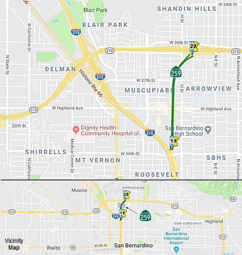
This routing was signed, at one point, as access to Route 30 East and I-215 South. However, the callboxes and some maps identify it as Route 259, and the new exit numbers will make this even clearer. It serves as a ramp to Route 210 E (former Route 30 E) when traveling NB on I-215, and as a ramp to I-215 S when travelling WB on Route 210 (former Route 30). It also serves Highland Avenue and E Street (which is accessed from I-215 NB only). According to some observers, by Febraury 2008, the Route 30 references had been changed to reference Route 210. Some portions were signed as Business Route 30.
Median Barrier (08-SBd-259 PM 1.1/1.2)
In August 2020, the CTC approved the following
financial allocation: $495,000 for PS&E; $17,000 for R/W Support.
08-SBd-259 PM 1.1/1.2. PPNO 3016C ProjID 0819000102 EA 1K780. Route 259 In
the city of San Bernardino, from H Street to Route 210. Construct median
barrier.
(Source: August 2020 CTC Agenda, Agenda Item
2.5b.(2a) #26)
In June 2021, the CTC was informed of the following
SHOPP Safety Resolution G-03-10 Delegated Allocation: $918,000. 08-SBd-259
1.1/1.2. PPNO 08-3016C; ProjID 0819000102; EA 1K780. Route 259 In the city
of San Bernardino, from H Street to Route 210. Outcome/Output: Construct
median barrier. This project will reduce the number and severity of
collisions. Allocation Date: 05/12/2021. Allocation: CON ENG $347,000
CONST $491,000.
(Source: June 2021 CTC Agenda, Agenda Item 2.5f.(3)
#3)
 Classified Landcaped Freeway
The following segments are designated as Classified Landscaped Freeway:
| County | Route | Starting PM | Ending PM |
| San Bernardino | 259 | 0.00 | 1.51 |
 Exit Information
 Other WWW Links
 Freeway
[SHC 253.1] Entire route. Added to the Freeway and Expressway system in 1959.
 Statistics
Overall statistics for Route 259:
 Pre-1964 Legislative Route
In 1959, Chapter 1062 defined LRN 259 as “[LRN 105] to [LRN 5] near Castro Valley.” This is a proposed segment of Route 92 between Route 238 and I-580.
© 1996-2020 Daniel P. Faigin.
Maintained by: Daniel P. Faigin
<webmaster@cahighways.org>.
 From Route
  Route 258
 Route 260