
State Route 153
Click here for a key to the symbols used. An explanation of acronyms may be found at the bottom of the page.
 Routing
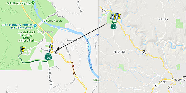
 From Route 49 near Coloma to Marshall's Monument.
 Post 1964 Signage History
This route is unchanged from its 1963 definition.
 Pre 1964 Signage History
This route was LRN 92, defined in 1933. It was not signed. This route
exists in the State Historic Park.
Signed Route 153 was not defined as part of the initial state signage of
routes in 1934. It is unclear what (if any) route was signed as Route 153
between 1934 and 1964.
 Status
Note: This is one of five routes in California with
"backward postmiles" -- that is, PM ED 0.000 is at the Eastern
end of the route, and increase as the route goes West. The
historical reason for this is unclear, unlike with other "backward
postmile" highways that often transitioned from S/N to W/E (such as
I-580).
This route has only one sign, at its start. Below the sign is another
sign noting this is California's Shortest State Highway (although it
really isn't; another highway, Route 283, has that honor).
 Other WWW Links
 Statistics
Overall statistics for Route 153:
- Total Length (1995): 0.5 miles
- Average Daily Traffic (1992): 100 to 2,250
- Mileage Classification: Rural: 0.5; Sm. Urban: 0; Urbanized: 0.
- Previous Federal Aid Mileage: None.
- Functional Classification: Collector: 0.1 mi; Rural Minor
Collector/Local Road: 0.4 mi.
- Counties Traversed: El Dorado.
 Pre-1964 Legislative Route
In 1933, Chapter 767 defined the route from "Hueneme to Montalvo-San
Fernando Road near Somis via Oxnard and Camarillo" to be a state highway.
In 1935, this route was added to the highway code as LRN 153, with the
following definition:
"Hueneme to [LRN 9] near Somis via Oxnard and Camarillo"
In 1959, Chapter 1062 changed the definition to delete the specific
routing: "…near Somis via Oxnard and Camarillo".
This route is present-day Route 34. According to a 1943 USGS map, this
ran along Wood Road to Oxnard Road (5th Street), and then along 5th,
Pleasant Valley, and Lewis (Somis Road) to Somis and Sign Route 118. This
appears to have been signed as a spur of Sign Route 118 in the 1940s,
perhaps until 1964.
Acronyms and Explanations:
- "LRN" refers to the Pre-1964 Legislative Route Number.
"US" refers to a US Shield signed route.
"I" refers to an Eisenhower Interstate signed route.
"Route" usually indicates a state shield signed route, but said route may be signed as US or I.
- Previous Federal Aid (pre-1992) categories:
Federal Aid Interstate (FAI); Federal Aid Primary (FAP);
Federal Aid Urban (FAU); and Federal Aid Secondary (FAS).
Current Functional Classifications (used for aid purposes):
Principal Arterial (PA); Minor Arterial (MA);
Collector (Col); Rural Minor Collector/Local Road (RMC/LR). Note that ISTEA repealed the previous Federal-Aid System, effective in 1992, and established the functional classification system for all public roads.
- Other frequently used terms: California Transportation Commission (Commission or CTC), California Department of Transportation (Department or Caltrans), Regional Improvement Program (RIP), Interregional Improvement Program (IIP), State Transportation Improvement Program (STIP), State Highway Operation and Protection Program (SHOPP), Traffic Congestion Relief Program (TCRP), Clean Air and Transportation Improvement Act of 1990 (Proposition 116), High Speed Passenger Train Bond Program (Proposition 1A), Highway Safety, Traffic Reduction, Air Quality, and Port Security Bond Act of 2006 (Proposition 1B), Corridor Mobility Improvement Account (CMIA), State Route 99 Bond Program (RTE or SR 99), Local Bridge Seismic Retrofit Account (LBSRA), Trade Corridors Improvement Fund (TCIF), Highway-Railroad Crossing Safety Account (HRCSA), State-Local Partnership Program (SLPP), Environmental Phase (PA&ED), Design Phase (PS&E), Right of Way (R/W), Fiscal Year (FY), Active Transportation Program (ATP), Trade Corridor Enhancement Program (TCEP), Local Partnership Program (LPP), Local Streets and Roads Program (LSRP), Solutions for Congested Corridors Program (SCCP).
 Route 152
 Route 154
© 1996-2020 Daniel P. Faigin.
Maintained by: Daniel P. Faigin
<webmaster@cahighways.org>.

 California Highways: