
 California Highways:
Click here for a key to the symbols used. An explanation of acronyms may be found at the bottom of the page.
 Routing
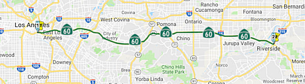 From Route 10 near the Los Angeles River in Los Angeles to
Route 215 in Riverside via Pomona.
From Route 10 near the Los Angeles River in Los Angeles to
Route 215 in Riverside via Pomona.
 Post 1964 Signage History
As defined in 1963, this segment ran from "Route 10 near Soto Street in Los Angeles to Route 395 via Pomona and Riverside." Note that, although this routing was defined in 1963 as Route 60 (signed with the state green signage), it was not signed until the Pomona Freeway actually opened. In particular, a 1966 Thomas Brothers map shows much of the Pomona Freeway ready to open in Fall 1966, but no route number assigned (US 60 is still along I-10 as of 1966). It certainly appears that the Pomona Freeway between I-10 and Route 71 was never signed as US 60; although the portion E of the Route 71 expressway was. Based on the state highway maps, the transition from US 60 to Route 60 occurred in 1967.
The intent was to have this signed as a planned realignment of US 60, but
the swift truncation of US 60 from downtown Los Angeles to US 95 in Blythe
on October 2, 1965 rapidly changed the plans to make this California Route 60.
(Source: Gribblenation Blog (Tom Fearer), "Legislative Route Number 172 (Future California State Route 60 and the Pomona Freeway)", 10/17/2023)
In 1968, Chapter 282 changed the western end to reflect various reroutings and redesignations that occurred in downtown Los Angeles, making the origin "Route 10 near the Los Angeles River in Los Angeles"
In 1969, Chapter 294 changed the reference to "Route 395" to "Route 15".
In 1976, Chapter 1354 changed the reference to "Route 15" to "Route 194"
In 1982, Chapter 681 changed the reference to "Route 194" to "Route 215".
In 1986, Chapter 928 changed the definition of the terminus of this segment to "Route 215 in Riverside via Pomona"
Note that US 60 remained in California until 1982, although using its
historical routing, not necessarily the post-1964 Route 60 routing (except
where they were approximately the same, such as a freeway overlain on the
older surface street routing). AASHTO deferred a Caltrans request to
truncate US 60 between US 95 in Blythe and the Arizona state line on June
29, 1982, deferring it pending a like application from Arizona. Caltrans
noted in their request that US 60 was not signed along US 95/Interstate 10
east of Blythe to the Arizona state line. US 60 was officially deleted in
California during the November 1982 AASHTO meeting, when it was truncated
from US 95 in Blythe to I-10 near Brenda, Arizona.
(Source: Gribblenation Blog (Tom Fearer), "The final stand of US Route 60 in California during 1982", 10/19/2023)
 Pre 1964 Signage History
In the 1934 definition of state highways, Sign Route 60 was not defined. In the 1926 definition of US highways, US 60 was defined (see below) and precluded any use of Sign Route 60 until the great renumbering. In the 1964 Great Renumbering, much of the US 60 corridor (the portion generally E of Riverside) became Route 60; the segment from Los Angeles to Riverside was on a different LRN alignment than the original US 60.
The first segment of Post-1964 Route 60, between Los Angeles and Riverside, is an interesting route. The Post-1964 routing was never signed as US 60. As noted above, the intent was to have the post-1964 Route 60 as a planned realignment of US 60, but the swift truncation of US 60 from downtown Los Angeles to US 95 in Blythe on October 2, 1965 rapidly changed those plans, and this became California Route 60. Note that this segment of Route 60 was not signed as US 60 between 1964-1965, as construction had not been completed.
Post-1964 Route 60: LRN 172 and the LRN 19 Replacement
Note that the proposed freeway routing that became the Pomona Freeway was LRN 172 between downtown Los Angeles and the US 60/Route 57 S junction was LRN 172 was defined in 1933. The remainder was a replacement for LRN 19, although LRN 19 used a different US 60 routing between Walnut (where Route 57 meets Route 60 today) and Riverside. The current Route 60 routing from Walnut E is a new freeway routing, defined after 1964 (and thus, it was the Route 60 routing). Note that there never was a Sign Route 60.
LRN 172 Segment
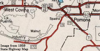 LRN 172 was
added to the State Highway System during 1933. LRN 172 was initially
intended to connect from Boyle Avenue in downtown Los Angeles east to LRN 19 near Walnut Station. As originally conceived, the planned routing of
LRN 172 would never be constructed from San Gabriel Boulevard east to
Anaheim Puente Road. During the early 1950s through to the early 1960s,
the corridor was consolidated into the initial planned 30.6 miles of the
Pomona Freeway. 1934 state highway maps show LRN 172 originating at Boyle
Avenue (US 101/LRN 2) in downtown Los Angeles. LRN 172 departs east on 4th
Street, 3rd Street and Pomona Boulevard towards an
unconstructed segment through Montebello. A planned alignment through
Puente connected to the eastern half of LRN 172 along 5th
Avenue. The eastern half of LRN 172 terminates at LRN 19 near Walnut
Station and Pomona. There was a gap in the planned route. The western half
ends at San Gabriel Boulevard (then Sign Route 19/LRN 168) via 3rd
Street, Pomona Boulevard, Mesa Drive (now Potrero Grande Drive) and Hill
Drive. The eastern half of LRN 172 resumes east of Anaheim Puente Road
(now Azusa Avenue) along 5th Avenue (now Colima Road). LRN 172
follows what is now Golden Springs Drive and Brea Canyon Road to LRN 19
near Walnut Station. The western half of LRN 172 was truncated to the
intersection of Hill Drive and San Gabriel Boulevard by 1940; at the same
time, Anaheim Puente Road was taken under state highway maintenance as
part of the eastern segment of LRN 172. That was withdrawn by 1942. 1947
Legislative Chapter 1233 changed the western origin of LRN 172 to LRN 2.
This measure effectively extended LRN 172 west of Boyle Avenue via 4th
Street to the planned Santa Ana Freeway.
LRN 172 was
added to the State Highway System during 1933. LRN 172 was initially
intended to connect from Boyle Avenue in downtown Los Angeles east to LRN 19 near Walnut Station. As originally conceived, the planned routing of
LRN 172 would never be constructed from San Gabriel Boulevard east to
Anaheim Puente Road. During the early 1950s through to the early 1960s,
the corridor was consolidated into the initial planned 30.6 miles of the
Pomona Freeway. 1934 state highway maps show LRN 172 originating at Boyle
Avenue (US 101/LRN 2) in downtown Los Angeles. LRN 172 departs east on 4th
Street, 3rd Street and Pomona Boulevard towards an
unconstructed segment through Montebello. A planned alignment through
Puente connected to the eastern half of LRN 172 along 5th
Avenue. The eastern half of LRN 172 terminates at LRN 19 near Walnut
Station and Pomona. There was a gap in the planned route. The western half
ends at San Gabriel Boulevard (then Sign Route 19/LRN 168) via 3rd
Street, Pomona Boulevard, Mesa Drive (now Potrero Grande Drive) and Hill
Drive. The eastern half of LRN 172 resumes east of Anaheim Puente Road
(now Azusa Avenue) along 5th Avenue (now Colima Road). LRN 172
follows what is now Golden Springs Drive and Brea Canyon Road to LRN 19
near Walnut Station. The western half of LRN 172 was truncated to the
intersection of Hill Drive and San Gabriel Boulevard by 1940; at the same
time, Anaheim Puente Road was taken under state highway maintenance as
part of the eastern segment of LRN 172. That was withdrawn by 1942. 1947
Legislative Chapter 1233 changed the western origin of LRN 172 to LRN 2.
This measure effectively extended LRN 172 west of Boyle Avenue via 4th
Street to the planned Santa Ana Freeway.
(Source: Gribblenation Blog (Tom Fearer), "Legislative Route Number 172 (Future California State Route 60 and the Pomona Freeway)", 10/17/2023)
By 1956, LRN 172 had been designated as part of the
larger Pomona Freeway corridor. An adoption of 18 miles of the Pomona
Freeway between Potrero Grande Drive and LRN 19 was made by the California
Highway Commission on April 2, 1954. In 1959, it was noted that the
California Highway Commission defined the Pomona Freeway as running from
the Santa Ana Freeway (US 101 and I-5) in Los Angeles east to the Corona
Freeway (Route 71) near Pomona on November 16, 1955. The California
Highway Commision adopted the routing of the Pomona Freeway from the Santa
Ana Freeway east to Woods Avenue on November 20, 1958. Additional Pomona
Freeway alignment adoptions were made by the California Highway Commission
on April 20, 1955, and June 21, 1955. The Pomona Freeway between Woods
Avenue east to Potrero Grande Drive was adopted by the California Highway
Commission on October 28, 1959. The segment of the Pomona Freeway between
LRN 19 at Brea Canyon east to the Corona Freeway was adopted on June 23,
1960.
(Source: Gribblenation Blog (Tom Fearer), "Legislative Route Number 172 (Future California State Route 60 and the Pomona Freeway)", 10/17/2023)
LRN 19 Segment: Walnut Junction to Pomona
LRN 19 between Pomona and Fullerton was completed and
opened to traffic on July 15, 1933. It was not assigned a Sign
Route. By 1935, LRN 19 branched away from US 101/LRN 2 in Fullerton via
Pomona Avenue (now Brea Boulevard) and Spadra Road (now Brea Canyon
Road). Upon entering Los Angeles County, LRN 19 emerged from the
Orange County line along Brea Canyon Road, following Brea Canyon Road and
5th Street into downtown Pomona where it intersected US 60 at
Garey Avenue.
(Source: Gribblenation Blog (Tom Fearer), "California State Route 57", 8/12/2023)
By 1955, discussions regarding a Brea Canyon Freeway
had begun. In 1956, the California Highway Commission selected an
alignment for the US 101-LRN 19 Freeway (alternatively the Brea Canyon
Freeway). By 1960, an agreement was in place to construct the Brea Canyon
Freeway. The Brea Canyon Freeway was planned to pass through the cities of
Orange, Santa Ana, Placentia, Anaheim, Fullerton and Brea. In 1962,
California Highways & Public Works announced the contract to construct
the Route 22/Garden Grove Freeway, I-5/US 101/Santa Ana Freeway and the
Orange Freeway Interchange (formerly the Brea Canyon Freeway).
(Source: Gribblenation Blog (Tom Fearer), "California State Route 57", 8/12/2023)
In 1959, other portions of Route 57 were defined. The portion between Route 60 and I-10 was part of LRN 272 with an indeterminate routing. The portion between I-10 and I-210 was originally part of Route 71, and was LRN 240. This portion later became part of I-210, and was renumbered as part of Route 57 in 1998.
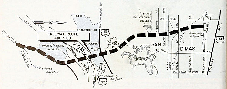 In 1963, California Highways & Public Works announced
8.7 miles of I-210/LRN 240 and LRN 272 in the cities of Pomona, San Dimas
and Glendora had been selected for adoption during the last four
California Highway Commission meetings of 1962. Also in 1963, it was
announced that the entire Orange Freeway would be signed as Route 57. The Santa Ana Freeway-San Bernardino Freeway portion of the
Orange Freeway had 19.8 miles adopted by the California Highway
Commission. The segment of the Orange Freeway on LRN 273 to
Huntington Beach had not yet been adopted.
In 1963, California Highways & Public Works announced
8.7 miles of I-210/LRN 240 and LRN 272 in the cities of Pomona, San Dimas
and Glendora had been selected for adoption during the last four
California Highway Commission meetings of 1962. Also in 1963, it was
announced that the entire Orange Freeway would be signed as Route 57. The Santa Ana Freeway-San Bernardino Freeway portion of the
Orange Freeway had 19.8 miles adopted by the California Highway
Commission. The segment of the Orange Freeway on LRN 273 to
Huntington Beach had not yet been adopted.
(Source: Gribblenation Blog (Tom Fearer), "California State Route 57", 8/12/2023)
LRN 19 Segment: Pomona to Riverside
The original alignment was US 60 between Pomona and Riverside. A new freeway for Route 60 was constructed between these points on a new alignment.
Pre-1964 US 60 Between Los Angeles and Riverside
 Sign Route 60 was not used in the 1934 Sign Route system. There
was, however, US 60.
Sign Route 60 was not used in the 1934 Sign Route system. There
was, however, US 60.
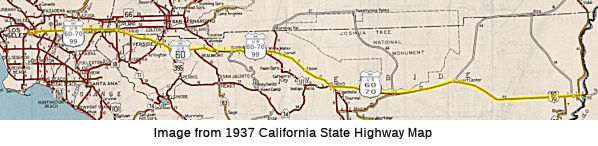 US 60 signage dates back to
1926. Between Los Angele and Pomona, US 60 shared signage with US 99 and
US 70.US 99 dates back primarily to 1926 but some was after 1934; and US 70 was added in 1935. US 60/US 70 began in downtown Los Angeles, followed
Ramona, Garvey-Holt Blvd, and Holt Street into Pomona. In Pomona, the
routing for US 60 turned on Garey and ran to S to Mission, where US 60
continued E to Riverside and Beaumont.
US 60 signage dates back to
1926. Between Los Angele and Pomona, US 60 shared signage with US 99 and
US 70.US 99 dates back primarily to 1926 but some was after 1934; and US 70 was added in 1935. US 60/US 70 began in downtown Los Angeles, followed
Ramona, Garvey-Holt Blvd, and Holt Street into Pomona. In Pomona, the
routing for US 60 turned on Garey and ran to S to Mission, where US 60
continued E to Riverside and Beaumont.
(Image source: "A High Plains Traveler Highway History Essay: The Changing West End of U.S. 70", 1/10/2023)
 Between US 101 (later I-5) and Riverside, US 60 was made up of
three LRNs: LRN 26, LRN 19, and a short portion of LRN 77: LRN 26 was
extended between the eastern border of Los Angeles and Colton (utilizing
Ramona, Garvey, Holt Ave, and Colton Avenue (since renamed Valley Blvd))
in 1931. In 1933, LRN 26 was formally extended into Los Angeles to meet US 101; this extension was along Ramona Blvd. This portion was originally
signed as US 60; US 99 was added in 1934, and US 70 in 1935. US 60
diverged to the S in Pomona following LRN 19 and short portion of LRN 77,
heading into Riverside. Eventually, US 60 would rejoin LRN 26 (US 99,
later US 70) in Beaumont. In 1935, a routing was added that ran along
Valley Blvd between the eastern city limits of Los Angeles and El Monte;
this was later added to LRN 77. More on this below. This segment starts at
the San Bernardino Split, which was where US 60 and US 70 started at the
junction with US 99 and US 101. The grade separated interchange was
originally completed in 1943; it was later modified by the addition of the
flyover in 1954. In 1996, the flyover was removed due to earthquake
safety. Note: By 1953, it was noted that the Ramona Freeway name was used
in Los Angeles County; in San Bernardino County, it was the "US 70-99
Freeway".
Between US 101 (later I-5) and Riverside, US 60 was made up of
three LRNs: LRN 26, LRN 19, and a short portion of LRN 77: LRN 26 was
extended between the eastern border of Los Angeles and Colton (utilizing
Ramona, Garvey, Holt Ave, and Colton Avenue (since renamed Valley Blvd))
in 1931. In 1933, LRN 26 was formally extended into Los Angeles to meet US 101; this extension was along Ramona Blvd. This portion was originally
signed as US 60; US 99 was added in 1934, and US 70 in 1935. US 60
diverged to the S in Pomona following LRN 19 and short portion of LRN 77,
heading into Riverside. Eventually, US 60 would rejoin LRN 26 (US 99,
later US 70) in Beaumont. In 1935, a routing was added that ran along
Valley Blvd between the eastern city limits of Los Angeles and El Monte;
this was later added to LRN 77. More on this below. This segment starts at
the San Bernardino Split, which was where US 60 and US 70 started at the
junction with US 99 and US 101. The grade separated interchange was
originally completed in 1943; it was later modified by the addition of the
flyover in 1954. In 1996, the flyover was removed due to earthquake
safety. Note: By 1953, it was noted that the Ramona Freeway name was used
in Los Angeles County; in San Bernardino County, it was the "US 70-99
Freeway".
US Highway and Interstate Numberings
As originally envisioned in the early drafts of US Route System. what became US 66 in California was intended to be US 60.
The designation of the Chicago-Los Angeles corridor was intended to carry
a X0 route number given it was to denote a major east/west US Route.
Ultimately the State of Kentucky petitioned to have a X0 US Route, and the
Chicago-Los Angeles corridor became US 66 in the finalized US Route System
created by the American Association of State Highway Officials (AASHO)
during November 1926. The X0 route in Kentucky, US 60, would rapidly be
extended after the US Route System was created and would come into play in
California during the early 1930s. A letter from the AASHO Executive
Secretary to the California State Highway Engineer dated Marth 30, 1931,
noted US 60 had been tentatively approved to be extended to California
during the AASHO Executive Committee on May 26, 1930. The approval of US 60 being extended to California carried the stipulation that the Colorado
River Bridge in Blythe be purchased by the California Division of Highways
and Arizona State Road Department. The letter noted California and Arizona
had taken steps through their respective legislatures to purchase the
Colorado River Bridge and the terminus of US 60 would be at an undisclosed
location in Los Angeles.
(Source: Gribblenation Blog (Tom Fearer), "Interstate 10 in the Sonoran Desert between the Colorado River and Coachella Valley", 10/14/2023)
The California State Highway Engineer submitted a
recommended routing of US 60 to the AASHO Executive Secretary on September
8, 1931. The route description of US 60 show as ending in Los Angeles by
way of Pomona at an undisclosed terminus. The routing of US 60 defined it
as entering Coachella Valley via LRN 64 through Box Canyon to Mecca
towards Coachella. From Coachella US 60 joined US 99/LRN 26 passing
through Coachella Valley towards San Gorgonio Pass. A September 1934
exchange of letters between the California State Highway Engineer and
AASHO acknowledged US 70 had been extended into California with an
endpoint following US 60 into downtown Los Angeles. The routing definition
of US 70 indicated it would multiplex US 99/US 60 east from downtown Los
Angeles to Pomona and onwards multiplexed with US 60 east to Beaumont and
US 99/US 60 through San Gorgonio Pass and Coachella Valley to LRN 64 near
Coachella. From Coachella US 70 followed US 60 via LRN 64 to the Arizona
State Line.
(Source: Gribblenation Blog (Tom Fearer), "Interstate 10 in the Sonoran Desert between the Colorado River and Coachella Valley", 10/14/2023)
The truncation of US 99 from Calexico to the junction
of the Golden State Freeway and San Bernardino Freeway in Los Angeles was
approved by the AASHO Executive Committee on June 19, 1963. US 70 was
truncated from Los Angeles to US 95 in Blythe by AASHO on August 26, 1963.
LRN 64 was dropped as part of the 1964 State Highway Renumbering. The
AASHO Executive Committee approved US 60 to be truncated from downtown Los
Angeles to US 95 in Blythe on October 2, 1965. On June 24, 1969, AASHO
approved an Arizona Highway Department request to truncate US 70 from the
California State Line to Globe, Arizona. US Route 60 was officially
deleted in California by AASHTO during their November 1982 meeting, with a
new ending at I-10 near Brenda, Arizona.
(Source: Gribblenation Blog (Tom Fearer), "Interstate 10 in the Sonoran Desert between the Colorado River and Coachella Valley", 10/14/2023)
Los Angeles and East Los Angeles to Pomona
In 1926, when the US highway system was commissioned,
the only US highway that transited downtown Los Angeles was US 101. Both
US 66 and US 99 went through Pasadena, although there was an effort to
bring US 66 into downtown Los Angeles (as described on the US 66 page).
Note that as originally envisioned in the early drafts of US Route System,
what became US 66 in California was intended to be US 60. The
designation of the Chicago-Los Angeles corridor was intended to carry a x0
route number given it was to denote a major east/west US Route.
Ultimately the State of Kentucky petitioned to have a x0 US Route and the Chicago-Los Angeles corridor became US 66 in the finalized
US Route System created by AASHO during November 1926. In the late 1920s,
however, the main E/W lateral from Los Angeles was LRN 9, running along
Colorado and Foothill E from Pasadena to San Bernardino.
(DPF map research; US 66 Information Source:
Gribblenation Blog (Tom Fearer), "Former US Route 60-70 on Jack Rabbit Trail", March 2022)
In 1931, LRN 26 was extended into downtown Los Angeles with the addition of a segment that ran from [LRN 26] near Colton via Pomona to Los Angeles. Specifically, segment (i) of Chapter 82 defined it as "[LRN 26] near Colton via Pomona to Los Angeles". The April 1931 CHPW also discussed the proposal for the route, which referred to it as "a highway from Los Angeles to a connection with [LRN 26] E of Colton". Note that the extension did not start in Los Angeles; rather, it started near the eastern border of Los Angeles (roughly where the current Route 710 freeway ends at Valley Blvd), near Atlantic (LRN 167) and Garvey. This is because, prior to 1933, the Division of Highways could not maintain highways within cities.
Work to extend US 60 into California started in 1931.
In March 1931 tentative approval to extend US 60 was received, with the
stipulation that the Colorado River Bridge in Blythe be purchased by the
California Division of Highways and Arizona State Road Department.
The approval indicated that California and Arizona had taken steps through
their respective legislatures to purchase the Colorado River Bridge and
the terminus of US 60 was to be at an undisclosed location in Los Angeles.
The purchase happened in April 1931, and the state submitted a recommended
routing for US 60 to AASHO in September 1931. The route description
showed US 60 as ending in Los Angeles by way of Pomona. According to Scott
Parker on AARoads, "ACSC originally signed US 60 over Main St., originally
from 7th Street downtown, but later from Sunset Blvd. north of
the Civic Center. US 66 was at that time (pre-1935) on Broadway, a couple
of blocks west, so US 66 and US 60 paralleled each other—one (US 66)
on a state-maintained route (LRN 165) and the other with ACSC-erected US 60 signage on a non-state route, which curved east with Main St. and
segued (with US 99 past Daly St.) onto Valley Blvd., which was
state-maintained east of the L.A. city line at Eastern Ave. (LRN 77)."
Scott's recollections are a bit imprecise, as prior to 1934, US 99 shared
a routing with US 66 along LRN 9. In any case, by 1932, US 60 had been
extended to Los Angeles.
(Reference: Scott Parker (Sparker) on AARoad, "Re: US 66 1935 alignment via Eagle Rock pre-1936 via Royal Oaks Ave in Monrovia?", 5/20/2019)
Scott Parker on AARoads additionally noted the
following regarding the original routing of US 60:
(Scott Parker (Sparker) on AARoad, "Re: US 66 1935 alignment via Eagle Rock pre-1936 via Royal Oaks Ave in Monrovia?", 5/20/2019)
[The original routing in Downtown Los Angeles] was a decidedly temporary route; the Ramona Parkway/Garvey Ave. continuum (LRN 26) was under development at that time; when it opened, both US 99 (initially east of Soto St.) and US 60 were rerouted onto the parkway, which ended at Mission St. a block south of Macy (the US 60 terminus was then the corner of Mission & Macy (US 101/LRN 2). It was deemed very vital to get the US 60 traffic off Main Street, since it crossed 4 major RR lines at grade: the SP at the Rondout curve near their Spring Street yard, the Santa Fe on the west bank of the L.A. River, the U.P. on the east bank, and the S.P. again out on Valley Blvd. at Eastern. Invariably there would be lengthy traffic stoppages due to the proximity of the yards (trains would sit across the crossing for several minutes until track clearances were given). US 66 didn't have that problem; it used North Broadway, which perched on the hillside above the yard; its L.A. River crossing cleared both the river and the adjacent tracks. After 1935, when the Figueroa Tunnels were opened (about the same time as the Ramona Parkway), the state highway routings "gelled" into the configuration that would take them through WW II—with the addition of the Arroyo Seco Parkway (1940) northeast of the tunnels and carrying the rerouted US 66. The ACSC "interim" pre-'35 routings did what they were supposed to do during that Depression-era period with scarce funding available; provide a series of signed routes that provided egress to the downtown area from the adjoining areas. Eventually the Division of Highways selected a few of them and incorporated those into the state system, including the original US 99 path along Marengo St., Daly St., and Ave. 26—which continued to host an unsigned LRN 4 well after US 99 had been rerouted through the tunnels to the Civic Center, being relinquished only when replaced a quarter-century later by the I-5/Golden State Freeway.
Note: It does appear that Valley Blvd was the major thoroughfare between Los Angeles and points E prior to 1934, potentially competing with US 66, and with the smaller possibility that it was signed, for a time, as US 60. Valley Blvd did not end at Garey and Eastern; it continued to the S, going around the San Jose Hills into Pomona, where it split into Holt and 5th Street. Holt, as noted below, was part of LRN 26; 5th Street in Pomona (later Mission Blvd) was LRN 19. LRN 19 was later extended W along Valley Blvd to Brea Canyon (and continued S down Brea Canyon). The route of Valley Blvd approximated the eventual route of LRN 172 (Pomona Freeway, Route 60), although Valley Blvd S of Garey was never in the state highway system. The state highway maps, prior to the mid-1930s, did not identify the US highways clearly.
In 1933, when the Division of Highways gained the ability to maintain highways within cities, the LRN 26 was extended again, now running from "Los Angeles (Aliso Street) to [LRN 26] near Monterey Park via Ramona Blvd", which completed LRN 26 into downtown Los Angeles. This specification was for the eventual Ramona Parkway that became the San Bernardino Freeway (I-10).
Prior to 1935, US 60 followed an interim alignment from
downtown Los Angeles eastward following Macy Street, Mission Road,
Alhambra Avenue and Valley Boulevard towards Pomona. In fact, it appears
that US 60 continued along Valley until it intersected Garvey, even though
the "official" LRN 26 routing was along Garvey from Eastern. This was
likely to avoid a jog from Valley down Eastern. LRN 26, as the planned
Ramona Parkway, was under construction W of Atlantic Blvd (LRN 167). Maps
of the time show LRN 26 starting at Garvey and continuing E. The planned
Ramona Parkway was shown on maps as a dotted line connecting Macy Street
directly to Garvey Avenue. The Los Angeles-Pomona Arterial,
which was to follow what would become Ramona Boulevard, ran from Aliso
Street and Mission Street in downtown Los Angeles to the city limits of
Pomona. Construction was started in 1932. Ramona Boulevard along with
improvements to Garvey Avenue was dedicated on May 25, 1935.
(Source: Gribblenation Blog (Tom Fearer), "Interstate 10S and the original Interstate 110 in California", March 2024; Gibblenation Blog (Tom Fearer), "Former US Route 60 and US Route 70 in the Los Angeles-Pomona corridor", March 2022)
The Ramona Expressway portion of I-10 started its
development shortly after the US Highway system was adopted in 1926. At
this time, California began development of US 99. However, in 1926, US 99
was still designated to run along LRN 9 (US 66) through Pasadena. The
desire was to eventually have the US 99 run directly into downtown Los
Angeles. In Monterey Park, Garvey Avenue was designated as part of future
US 99. However, west of Atlantic Boulevard, the roadway ended. The
six-mile gap would be filled by a new roadway that would connect Garvey
Avenue near Atlantic Boulevard with Aliso Street at Mission Road to be
named Ramona Boulevard. Ramona Boulevard was along terrain that was
suitable for grade separations, with the Pacific Electric Railroad tracks
to the north and a hillside to the south. In order to accommodate the new
highway, six bridges that already spanned the tracks were extended or
reconstructed and two new grade separations were constructed near Monterey
Pass Road. Near the west end of the project, the Macy Street (now Cesar E.
Chavez Avenue) bridge, which had been built in 1910, provided another
grade separation over the tracks and could accommodate a roadway without
reconstruction. Thus, there were nine bridges in all with no at-grade
crossings and virtually no local property access. Once completed, LRN 26
was officially extended to Los Angeles, and arrangements were made to
resign it was US 99. Ramona Boulevard was opened to traffic on April 20,
1935 and was called an “airline” route by the State because
motorists could “fly” without intersectional conflict at 50
miles per hour. In 1944, Aliso Street, the westerly extension of Ramona
Boulevard was widened and reconstructed. This project, which was
undertaken by the City, included a grade separation at Mission Road. In
coordination with this project, the State widened Ramona Boulevard
easterly to the East City Limit and constructed a four-foot wide median.
Upon the completion of these projects, Ramona Boulevard was renamed Ramona
Parkway. In 1954, shortly after Ramona Parkway was extended easterly of
the City, it was renamed the San Bernardino Freeway. In 1970, most of the
1935 and 1944 improvements were demolished to make way for the San
Bernardino Freeway and Express Busway.
(The historical information above on the Ramona
Expressway was derived from "Transportation Topics and Tales: Milestones
in Transportation History in Southern California" by John E. Fisher,
P.E. PTOE, available at http://ladot.lacity.org/pdf/PDF100.pdf)
Leaving downtown LA in City Terrace, LRN 26 was called
Ramona Boulevard before it merged with Garvey Avenue. East of Monterey
Park, the route was a straight line — sometimes called an “air
line” — to the San Jose Hills and Pomona’s Holt Avenue.
A good share of it today lies under I-10. The main remnant of the route is
on Garvey between I-710 and where it merges into I-10 on the east end of
El Monte. A few links of frontage road along I-10 in Covina and West
Covina are still called Garvey Avenue, and there are still some small
segments of Ramona Blvd. A small portion of Holt Avenue exists in Covina,
although it has no connection with Pomona’s Holt and was not part of
LRN 26. The route itself was adopted by the state in 1931. The first
stretch of the new highway construction for the project was from Barranca
Street in West Covina, over the San Jose Hills through W.J.
Kellogg’s ranch along Arroyo (the future Cal Poly Pomona) to Pomona.
News accounts said the entire paved route would finally be ready for
travel on April 4, 1935, though some portions of it had opened earlier.
However, the Pomona Progress-Bulletin said on April 8 that heavy rains
delayed completing the work, and the full route didn’t open for
another few days. The article also said that the state had approved a
$12,000 contract to plant 25,000 ground-cover plants as well as two dozen
types of trees and shrubs along the highway. The new Pomona-LA road helped
spawn additional construction in the Inland Empire. Improvement programs
were begun on segments of Holt in Pomona and A Street in Ontario and
farther east when the route became Valley Boulevard in Fontana.
(Source: Daily Bulletin, 10/7/2019)
With the completion of the Ramona Parkway, LRN 26 was complete, and US 99 / US 60 was relocated to the Ramona Parkway / Garvey Routing. What about the previous signed US 60 routing along Valley Blvd (also called Pomona Blvd) to Garvey? In 1935, Chapter 626 added the following as Section 603 with no LRN: “603. There is hereby added to the state highway system a new route or portion of route from the east city limits of Los Angeles on Valley Boulevard to [LRN 26] near El Monte via Valley Boulevard and Pomona Boulevard”. In 1937, Chapter 841 repealed Section 603, and added the segment to [LRN 77] as segment (a), making the original Pomona to San Diego segment of LRN 77 (which we'll run into again with the Pomona diagonal) as (b). Note that, post 1935, segment (a) of LRN 77 does not appear to have had a number, although some claim to have seen maps showing it as US 70, with US 60 / US 99 along the LRN 26 segment. State highway maps and USGS maps, however, show LRN 26 with the US 60 / US 70 / US 99 triplex.
Additionally, in September 1934, California received word that US 70 had been extended into California from New Mexico. The original routing (in California) was cosigned with US 60. When this happened, signage for US 70 was added to the US 60 / US 99 signage in this area. Note that, for a short time E of Pomona, US 70 followed the US 60 route through Riverside to Beaumont.
Construction of the "Eastern Gateway" in Los Angeles
started in 1941. This would serve as a freeway structure originating at
Aliso Street in Los Angeles, and would tie directly in with existing US 99/US 60/US 70/LRN 26 via Ramona Boulevard along with the planned Santa
Ana Parkway of US 101/LRN 2. The Eastern Gateway included construction of
the new Aliso Street Bridge. The Aliso Street Bridge opened to traffic in
1944, along with a temporary connection to Mission Street and US 99/US 60/US 70/LRN 26 on the existing Ramona Parkway. Part of the upcoming
project consisted of upgrading Ramona Boulevard to full freeway standards
to the eastern Los Angeles city limit. The Ramona Freeway became the San
Bernardino Freeway in 1955.
(Source: Gribblenation Blog (Tom Fearer), "Interstate 10S and the original Interstate 110 in California", March 2024)
According to a Thomas Brothers map, which predates the
Pomona Grade Separation and the new routing through the San Jose hills: US 60 / US 70 / US 99 entered from the west in El Monte along Garvey. At the
intersection with Pacific (which was a diagonal from Ramona/San Bernadino
Road, and was called Holt in Baldwin Park (later renamed Pacific)), Garvey
turned into Arroyo Avenue, turning back into Holt Ave briefly at the
eastern end of West Covina, before becoming Arroyo Ave again. Note that
the Holt name is confusing: It also applied to a portion of Rowland
Avenue, which turned into Pomona and Covina Road, which turned into Holt,
which intersected (you guessed it) Arroyo Ave in the San Jose hills (this
is now Covina Hills Road, which continues right to the edge of the current
freeway).
(Source: Thomas Bros. map of Pasadena, Alhambra, Pomona, South Pasadena, Ontario, San Gabriel, Arcadia, Azusa, Monrovia, Upland, San Marino, Altadena, Sierra Madre, El Monte, La Verne, Covina, Glendora, Claremont, Rosemead, San Dimas, Baldwin Park, Duarte, Temple City, Wilmar, West Covina, and vicinity, Circa 1940s (document is undated))
The history of the East LA Interchange, where US 101, I-10, I-5, and Route 60 come together, is discussed with US 101.
In terms of freeway construction: Conversion of US 99/US 60/US 70/LRN 26 to full freeway standards east from Los Angeles city
limit 1.8 miles to Helen Drive was completed by April 1951.
Conversion to Hellman Avenue in Alhambra was completed in late 1952.
Construction of an underpass of the Pacific Electric Railway along with an
interchange at Eastern Avenue was also completed in 1952. The segment of
the Ramona Freeway from Hellman Avenue to 8th Street (Alhambra)
was completed by 1953. By Fall 1953, the Ramona Freeway was upgraded to
full freeway standards between the Aliso Street Bridge and Sign Route 19/Rosemead Boulevard interchange. The route was extended to San
Gabriel Blvd by 1954.
(Source: Gribblenation Blog, "Former US Route 60 and US Route 70 in the Los Angeles-Pomona corridor", March 2022)
Pomona to Riverside
The Pomona to Riverside segment of US 60 dates back to 1931.
In 1931, LRN 26 was extended from San Bernardino to the eastern edge of Los Angeles, and LRN 19 was extended from its 1909 definition to run into Beaumont. LRN 19 was defined in 1909 to run from LRN 9 W of Claremont (US 66 / US 99) to Riverside, and the 1931 extension changed that to run to LRN 26 in Beaumont. 1931 also saw another segment added to LRN 19, running from Pomona to LRN 2 (US 101) near Santa Ana; this segment would eventually become Route 57 and part of Route 60. Lastly, 1931 saw the extension of US 60 into California. This extension ran along LRN 26 (Holt Avenue), turning onto LRN 19 at Garey, and continuing along LRN 19 down Garey to 5th Street; Garey continued S as LRN 77, which would eventually become Sign Route 71. LRN 19 then turned E and originally continued 5th Street and California Street, and then SE along Riverside Blvd (all of which, by the mid 1950s had become Mission Blvd, with some slight reroutings S of California Street and near the airport) to Mira Loma. Shortly after passing LRN 193 (Hamner Avenue (then Adams, now Milliken), it turned pure east at Eitiwanda, continuing along Riverside Drive (subsequently renamed Mission Blvd and then overlain with the Route 60 freeway). At that point, Riverside Blvd (Mission Blvd) continued into Riverside as Van Buren; remember, US 60 had turned onto Riverside Drive (Mission Blvd) continuing E. At what is now Country Village Road, US 60 turned off Riverside Drive (Mission Blvd) onto 7th Street into Riverside. Unsurprisingly, this is now all Mission Blvd into Riverside. In Riverside, LRN 19 transitioned onto Eighth Street (now University), meeting LRN 43 at Market Street; LRN 43 continued N into San Bernardino as Sign Route 18 (and later, US 91 and US 395). US 60 continued E along Eighth/University (adding a co-sign with US 395), continuing to Box Springs Road to Allesandro Avenue (now Sunnymead Blvd, some of which is buried under the US 395/Route 60 junction). US 395 then continued S along LRN 78, with LRN 19 continuing E along Allesandro/Sunnymead through the Moreno Valley Badlands, meeting LRN 26 in Beaumont.
The routing described above was US 60. Prior to 1938, it was also cosigned with US 99 and US 70. Prior to 1934, US 99 used a routing along LRN 9 into Los Angeles. This is confirmed by the inset on the 1930 state highway map, which shows US 99 in Pasadena together with US 66. That map, however, doesn't show US 99 E of Los Angeles on the larger maps. The 1934 state highway map, however, shows US 60 and US 99 using the LRN 19 alignment W of Beaumont, and still shows US 99 entering Pasadena along Foothill, co-signed with US 66. Presumably, US 99 was co-signed with Sign Route 18 up LRN 43 into San Bernardino to pick up LRN 9, although there is a smaller possibility that it used LRN 19 (which, if one recalls, started at LRN 9, at the intersection of Garey and Foothill). However, by the 1936 state highway map, US 99 is shown on LRN 19 W of Beaumont, but entering Los Angeles along Garvey, LRN 26, with US 60 and US 70. However, the 1935 Division of Highways map of US and State Numbered highways shows US 99 using the LRN 26 routing from Beaumont into Los Angeles, and US 60 / US 70 sharing the LRN 19 routing between Beaumont and Pomona. By the 1938 map, however, things are clear again: US 70 and US 99 are along the LRN 26 routing, and US 60 is using LRN 19 between Beaumont and Pomona.
In 1939, details were announced regarding the Pomona
Grade Separation that would serve as an extension of LRN 77 and the new
split of US 60 from US 99/US 70/LRN 26. US 60 originally had split
from US 99/US 70/LRN 26 via Garey Avenue south to 5th Street in
downtown Pomona. The Pomona Grade separation allowed US 60 follow
LRN 77 to 5th Street via two railroad overpass structures. The
Pomona Grade Separation opened on March 19, 1940, and only ran to Fifth.
At the edge of Pomona, Fifth turned into Brea Canyon Road.
(Source: Gribblenation Blog, "Former US Route 60 and US Route 70 in the Los Angeles-Pomona corridor", March 2022)
By 1940, a short connecting segment—an extension of Arroyo Ave—had been constructed between LRN 19 on 5th/Mission and LRN 26 on Holt. It appears to have been an extension of LRN 77, and included the eventual Temescal Freeway (now Route 71). This spur is currently Route 71 between I-10 and Route 60. By 1940, it appears to have been signed as part of US 60 / US 70 / US 99. LRN 26, at this time, ran along Garvey Ave and Arroyo Ave to meet Holt Avenue in Pomona (note: it appears that Holt originally met Arroyo at the base of the San Jose Hills: one turned R onto Holt, and then made a left where Holt met Valley (at the point Valley turned into Holt)—this road is now Ridgeway Street), and then along Holt, Colton Avenue, and Ocean Highway into Colton. Much of this has been subsumed under I-10, although portions of Garvey exists as frontage roads as far as Barranca in West Covina. Garvey turned into Arroyo at Barranca, and the Arroyo Avenue portion was mostly subsumed into I-10. Near the Pomona Grade Separation, US 60 / US 70 / US 99 veered S to Holt. The specific road is subsumed under Route 71. Note that a road called Ganesha came off of Arroyo just E of where LRN 26 veered off; that road today is Murchison Avenue and Fairplex Road, and it explains the naming of Ganesha High School. Additionally, the intersection of Murchison Avnue and Ridgeway is approximately what used to be Arroyo and Holt, although it was likely modified by freeway construction. East of the point where Pomona Blvd splits off of Valley Blvd, Holt has been renamed as an extension of Valley Blvd. Note that the split of Valley Blvd into Holt and 5th has been transformed by time: Valley now continues onto what was Holt, and the transition from Mission Blvd (nee 5th) to Valley Blvd has been lost with the construction of the Route 57 freeway (although maps do show that prior to the freeway, LRN 19 went along Pomona Blvd to the Pomona Grade Separation, down to Mission, and then to points E).
 Status
In June 2015, it was reported that, in its latest analysis of California
Highway Patrol data from 2012, the Southern California Associations of
Governments (SCAG) included sections of this route in its list of freeway
sections in L.A. County and the Inland Empire with the highest
concentrations of truck crashes per mile annually. These sections were
I-710 at Route 60 in the East L.A. Interchange (~ LA R3.163), with 7.2
accidents; I-710 between I-105 and the Route 91, with 5.8 accidents; the
convergence of Route 60 and Route 57, with six crashes; and I-5 between
I-710 and I-10, also in the East L.A. Interchange, with 6.6 crashes. The
analysis also identified that the second-highest number of truck crashes
can be found on three parts of Route 60 between I-605 and I-710, between
the I-15 and Route 71 — the Chino Valley Highway, formerly known as
the Corona Expressway — and immediately east of I-215. That category
also includes I-10 between Route 71 and I-215, I-605 between Route 60 and
I-10, and Route 710 between Route 91 and the Port of Long Beach as well as
between I-5 and I-105. With the nation's largest combined harbor, the Los
Angeles area also is one of the busiest in the country, if not the world,
for trucking. I-710 often handles more than 43,000 daily truck trips,
Route 60 up to 27,000 and I-5 about 21,500, according to Caltrans.
(Source: LA Times, 6/2/2015)
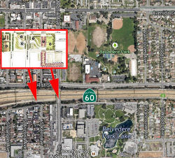 In November 2014, it was
reported that the LA County Department of Regional Planning has started to
dream about putting a cap park on top of Route 60 in East LA, once again
joining the two halves of Belvedere Park (~ LA R3.882 to LA R4.01), which
have been separated since the freeway cut through more than 50 years ago.
The 31-acre park is the largest in East LA proper and already has an
Olympic-sized pool, an amphitheater, and a skate park. If the freeway were
to be capped, the new addition would cover a three-block section at Mednik
Avenue that could hold more space for sports fields and courts, public
art, and/or a playground; it would also vastly improve access for bikes
and pedestrians looking to travel from one side of the park to the other.
Unfortunately, there's no budget or money for the project yet; it's just a
beautiful dream.
In November 2014, it was
reported that the LA County Department of Regional Planning has started to
dream about putting a cap park on top of Route 60 in East LA, once again
joining the two halves of Belvedere Park (~ LA R3.882 to LA R4.01), which
have been separated since the freeway cut through more than 50 years ago.
The 31-acre park is the largest in East LA proper and already has an
Olympic-sized pool, an amphitheater, and a skate park. If the freeway were
to be capped, the new addition would cover a three-block section at Mednik
Avenue that could hold more space for sports fields and courts, public
art, and/or a playground; it would also vastly improve access for bikes
and pedestrians looking to travel from one side of the park to the other.
Unfortunately, there's no budget or money for the project yet; it's just a
beautiful dream.
(Source: Curbed LA, 11/10/2014)
In April 2011, signs were dedicated on Route 60 directing motorists to the Armenian Genocide Martyrs Monument (~ LA R5.589). The signs, authorized by the state Legislature, point the way to a memorial tower above Garfield Avenue that commemorates the attempt a century ago to eliminate Armenians from the Ottoman Empire. Leaders of modern-day Turkey dispute the "genocide" label. The United States, worried about U.S.-Turkish relations, has not taken a formal position on the subject. Some believe that official acknowledgement such as these directional signs will send "shockwaves" through those who fail to recognize the impact that the killings and deportations still have on Armenians around the world.
In December 2011, a tanker truck exploded at the Paramount undercrossing (LA R007.80), significantly damaging the bridge. In fact, the damage was so significant that the bridge had to be torn down and reconstructed, and the freeway itself was closed for a few days to repave the main-line. The US Department of Transportation released $2M in emergency funds for the repairs.
A small section of this route was up for relinquishment on the February 2003 CTC agenda: the section near PM LA 11.0 in the City of South El Monte. This is probably a section of the original routing.
In March 2016, the Los Angeles MTA presented its full proposal for what
transit lines could be built -- and when -- if Los Angeles County voters
approve a half-cent sales tax increase in November 2016. This proposal
included funding for Route 60/I-605 Interchange HOV Direct Connectors (~
LA 11.66). This project is from the North and Southbound on I-605 from
Rose Hills to I-10 and on East and Westbound Route 60 from Santa Anita to
Turnbull Canyon. The Interchange improvements include adding auxiliary
lanes, widening lanes and bridges, interchange connectors, ramp
improvements and realignments.
(Source: Los Angeles Times 3/18/2016; Metro Board Report 3/24/2016)
In August 2011, the CTC approved $100,718,000 in SHOPP funding for repairs in the cities of Industry to Diamond Bar from Route 605 to Route 57 (~ LA 11.66 to LA R25.657), that will rehabilitate 48 lane miles of pavement to improve safety and ride quality. Project will replace damaged roadway slabs, grind roadway for smooth profile, replace approach and departure slabs and joint seals at 11 structures, and replace striping, markings and markers.
In November 2011, it was reported that the Southern California Association of Governments (SCAG) had included, as part of the East-West Freight Corridor plans, the construction of a 50' high, double-decker truck lane in a creekbed along Route 60 (~ LA 12.163 to LA R22.324). SCAG envisions a dedicated truckway for electric trucks running from I-710 to I-15. The massive regional plan calls for raising gasoline taxes to pay for bridge retrofits, freeway improvements, rail lines, bicycle lanes and sidewalks. The EGPress has reported that the City of Commerce has joined other cities in opposing the plan to build truck-only lanes on Route 60. City Officials said there was not enough outreach or consideration of the impacts prior to a decision to settle on those lanes. City of Commerce planning officials say SCAG met once with city staff in April and provided no follow-up information on potential property impacts. Meanwhile SCAG "refused" to consider truck-only freight lanes on Route 91, I-10, and I-210 corridors. The Route 60 alignment was chosen, according to the City of Commerce, due to an assumption that it would result in the least impact on homes and private property, but city officials said they were never consulted to confirm that this would be true. Once the work is finished, the $22.5 million project will swap the Brea Canyon Road entrance and exit (~ LA R22.988) with a new Lemon Avenue entrance and exit a few miles to the west (~ LA R22.394).
7th Avenue Interchange (~ LA 14.191)
One of the projects in the $5+ billion 605 Corridor
Improvement Project (605CIP) (See I-605) is a revamp of the Route 60
on-/off-ramps at 7th Avenue in Hacienda Heights (unincorporated L.A.
County). In 2015, Metro and Caltrans completed early studies to
determining how to widen I-605 and Route 60 through much of the San
Gabriel Valley. The PSR includes four alternative configurations for
I-605, but all the alternatives show essentially the same configuration
for Route 60 through Hacienda Heights. After completing the larger study,
Metro looked to identify small early projects to prepare for widening
I-605. These projects could proceed ahead of the larger project if they
provided an independent benefit (generally meaning that they would
increase car capacity) and the costs (fiscally, and in terms of
demolishing adjacent homes/businesses/etc.) were not too onerous. For the
7th Avenue project, Metro is retooling the north side (westbound) ramps
essentially to push them a little further north, in order to make space
for later adding one more westbound lane to Route 60. In 2018, the Metro
board approved a two-year $2 million contract with Advantec Consulting
Engineers to design/engineer the project. In August 2020, Caltrans
approved the 7th Avenue project’s environmental documentation,
stating that it was “categorically exempt” from the National
Environmental Protection Act (NEPA) despite increasing car capacity
somewhat by “increasing storage on WB Route 60 on-ramp by
lengthening and widening the ramp.” Widening a short stretch of
roadway – apparently less than around a mile – will induce
more driving, but falls below the agreed-upon threshold for impacting the
environment. Through Hacienda Heights, Route 60 runs in close proximity to
homes, apartments, schools, a church, and a few commercial developments.
Its sound walls run along hundreds of backyards. Metro, however, has
engineered the lane addition to not remove any homes in Hacienda Heights,
although the future widening will include seven to nine home demolitions
on El Monte’s Linnard Street, and a number of commercial/industrial
parcels outside of Hacienda Heights are slated for partial or full
demolition.
(Source: Streetsblog LA, 7/15/2022)
In April 2022, Metro staff reported that design and
construction for the 7th Avenue project was on hold. At that time Metro
had only spent $1.07 million (page 27), about half of the contract costs
approved by the board in 2018. The hold occurred in 2020, early on during
the pandemic, when Metro’s fiscal outlook was uncertain. The project
remains on hold, even as the agency returned to better than anticipated
revenues and increased highway program budgets. Metro explains: “As
a result of declining tax revenues due to the COVID-19 pandemic, measures
were taken to evaluate and prioritize Metro’s Capital Program
schedule in the near-term. After assessing Metro’s overall funding
capacity, priority was given to projects under construction. Consequently,
Metro decided to stop or slow down work on several projects in
pre-construction stages, including the SR60/7th Avenue Interchange
Improvements Project, to meet current funding constraints.” The hold
was not because of any project scope/design changes nor other unforeseen
costs driving design costs above the $2 million that the board had already
approved. The estimated total cost is $24.1 million, based on a Caltrans
Project Report approved June 2022.
(Source: Streetsblog LA, 7/15/2022)
Lemon Avenue Interchange (~ LA R22.988)
The SAFETEA-LU act, enacted in August 2005 as the reauthorization of TEA-21, provided the following expenditures on or near this route:
In May 2018, it was reported that two of the three legs
of the new Lemon Avenue interchange of Route 60 in Diamond Bar will open
on Tuesday, May 1, 2018 in time for the busy morning commute, according to
the Alameda Corridor-East Construction Authority. An eastbound freeway
on-ramp — also at Lemon Avenue — scheduled to open sometime in
June, will complete the three-legged interchange that has been in the
works for 14 years in the eastern section of Los Angeles County, at the
corner of Los Angeles, San Bernardino and Orange counties. Along with ACE,
the lead agency, Caltrans, Los Angeles County and the cities of Diamond
Bar and City of Industry have been working on adding the new exit/entrance
to the busy freeway since 2004. A contract was signed in 2011.
Construction has been ongoing for the past 1 1/2 years, including multiple
weekend lane closures, detours and delays. At the same time, motorists
will no longer be able to exit the freeway at Brea Canyon Road. The
eastbound off-ramp at Brea Canyon Road in Diamond Bar will be permanently
closed. However, just until June, the eastbound on-ramp to the freeway at
Brea Canyon will remain open until construction is complete on the Lemon
Avenue on-ramp. Closing the Brea Canyon Road ramps and diverting cars and
trucks to Lemon Avenue is a precursor to a full-fledged reconfiguration of
the larger Route 57/Route 60 freeways where they join together for a
two-mile stretch in Diamond Bar, known as the 57/60 Freeway Confluence.
(Source: San Gabriel Valley Tribune, 4/30/2018)
57/60 Confluence Project (~ LA R23.464 to LA R25.607)
In November 2010, it was reported that there is a project to improve the Route 57/Route 60 interchange. The "57/60 Confluence Project" has the goal of solving the problem of 16 lanes of traffic being squeezed into 12. The improvements include creating a bypass lane to reduce the need for motorists to cross several traffic lanes as they exit or enter the freeway at Grand Avenue. The project also calls for construction of an eastbound bypass ramp, which would run under Route 57 and take traffic exiting Route 60 directly to Grand. A new eastbound loop on-ramp would connect Grand to Route 60 and eliminate the need for left turn lanes. The existing westbound off-ramp at Grand would be widened and relocated about 100 feet north. Plans also include construction of a new 2,500-foot auxiliary lane on southbound Route 57 as it merges with Route 60. The third lane would eliminate the bottleneck that is currently created when the southbound Route 57 drops from three lanes to two. The Grand overpass would be raised and widened to accommodate four lanes in each direction. It also would feature a new westbound on-ramp. The project would create 5,148 jobs, with targeted completion in less than 10 years. The interchange has been designated as the No. 1 highway congestion segment in Caltrans' District 7, and the No. 3 congestion segment in the state, according to the Caltrans Highway Congestion Monitoring Program. It is also in the Metropolitan Transportation Authority's Long Range Transportation Plan, but the funds will not be available until 2029. The current goal is to complete the project by 2016. More than half of the project's $258 million price tag is eligible for federal funding, while the remainder would be funded with local sales tax and state gas tax revenues. Currently, the city of Industry has committed $35 million in local redevelopment funding to the project. MTA's contribution would be an additional $8.75 million for the construction of the westbound off-ramp at Grand. Together with MTA and Diamond Bar, the city of Industry also is seeking project funding and potential listing on the next federal reauthorization of the Transportation Act.
In May 2013, the CTC received notice of the preparation of an EIR concerning the Route 57/Route 60 interchange. The project is proposed to be funded with federal and local dollars. Depending on the alternative selected, the total estimated project cost is between $220,000,000 and $239,000,000. Construction is estimated to begin in Fiscal Year 2015-16. The alternatives under consideration are: (1) No Build Alternative; (2) maintains the existing compact-diamond configuration with added capacity at on and off-ramps, adding a new bypass single ramp lane would connect from northbound Route 57 to the Grand Avenue off-ramp, and a bypass lane on-ramp would be constructed to connect Grand Avenue to eastbound Route 60. In the westbound direction of Route 60, the existing dropped lane would be extended all the way to Grand Avenue. The Grand Avenue overcrossing would be widened to four lanes in each direction. (3) This builds on the previous alternative, except an additional eastbound loop on-ramp from Grand Avenue is proposed as a component of the project.
In March 2014, the CTC approved for future consideration of funding a project in Los Angeles County that will reconfigure the conflux of Route 60 and Route 57 at Grand Avenue, including widening the Grand Avenue overcrossing, adding auxiliary lanes, and reconfiguring the on- and off-ramps. The project is not fully funded. The project is fully funded for environmental only with federal and local dollars. The total estimated cost is $231,000,000 for capital and support. Depending on the availability of funding, construction is estimated to begin in Fiscal Year 2014-15.
In September 2014, it was reported that Federal officials approved a $10-million grant for a series of fixes to the congested interchange between Route 60 and Route 57 in eastern Los Angeles County. The $10-million grant from the U.S. Department of Transportation will partially fund on- and off-ramps to eastbound Route 60. The first stage of construction is expected to cost about $53 million and will probably start in summer 2015. For two perilous miles in Diamond Bar, Route 60 and Route 57 combine, reducing 17 lanes to 14, while more traffic merges on and off from a local intersection. Cars and trucks frequently veer across up to five lanes to reach the correct exit. Intersecting freeways are typically built at 90-degree angles. But in the early 1970s, engineers built Route 57 alongside Rolute 60 because the curve of the hillside was too steep to accomodate another configuration. The goal of the construction is to separate the movements.
In November 2015, it was noted that the 2014 TIGER
grant is going toward the $260 million total cost of the Route 57/Route 60
interchange project, expected in three phases. November 2015 marked the
kickoff of construction of phases one and two. The complete project
includes ramp and interchange reconfigurations and the addition of
mainline and bypass lanes to reduce weaving. The $10 million TIGER grant
will be used specifically for construction of a westbound freeway off-ramp
at Grand Avenue in the project’s second phase. But, while phases one
and two are moving forward, funding for the third and largest phase of the
57/60 Confluence Project has yet to be identified. Considered the bulk of
the project —with the mainline improvements and bypass roads on
Route 57 and Route 60 to eliminate the weaving— it currently has
secured zero funding and is an unfortunate reminder of the great need for
funding throughout the country where projects are not moving forward.
(Source: Transportation.Gov, 11/23/2015)
In March 2016, the Los Angeles MTA presented its full
proposal for what transit lines could be built -- and when -- if Los
Angeles County voters approve a half-cent sales tax increase in November
2016. This proposal included funding for Route 57/Route 60 Interchange
Improvements that include adding a new westbound on-ramp to Route 60 at
Grand Ave., street widening improvements in the vicinity of Grand Ave. and
Golden Springs Dr., a new westbound off-ramp to Route 60 and auxiliary
lane to Grand Ave., freeway mainline improvements and by-pass connectors,
for a total of 2 miles.
(Source: Los Angeles Times 3/18/2016; Metro Board Report 3/24/2016)
In April 2018, it was reported that Metro was applying
for TCRP (Trade Corridor Relief Program) funds in addition to SB1 funds
for the Route 57/Route 60 interchange project.
(Source: Metro The Source, 4/19/2018)
In May 2019, the CTC approved an allocation of
$5,000,000 for 07-LA-57 R4.3/R4.8,, 07-LA-60 R23.3/R26.5: Route 57/60
Confluence: Chokepoint Relief Program. In Los Angeles County, in Diamond
Bar and the City of Industry on Route 60 from EB Route 60 to Route 57
connector overcrossing to near Golden Springs Drive Undercrossing and
Route 57 from NB Route 57 to WB Route 60 connector overcrossing to South
Route 57/Route 60 separation. Interchange modifications, including
auxiliary lanes and three new bridges. R/W allocation.
(Source: May 2019 CTC Minutes, Agenda Item
2.5s.(5))
In December 2020, it was reported that the CTC approved
$217.9 million in Trade Corridor Enhancement Program funds for the Route 57/Route 60 Confluence Chokepoint Relief Program to make the notorious
interchange safer by reducing weaving and smoothing out traffic flow
through the interchange. The funds will construct highway improvements and
bypass connectors to reduce accidents and alleviate a truck bottleneck at
a location that is critical to goods movement operations across the
region, state and nation.
(Source: Metro "The Source" 12/2/2020)]
In June 2022, the CTC approved an allocation for the
following SB1 Trade Corridor Enhancement Program (TCEP) projects, on the
State Highway System: #1. $217,900,000. 07-LA-57 R4.3/R4.8 | 07-LA-60
R23.3/R26.5. PPNO 07-5394; ProjID 0715000076; EA 27912. Route 57/60
Confluence: Chokepoint Relief Project. In Los Angeles County, in
Diamond Bar and the City of Industry on Route 60 from EB Route 60 to SB
Route 57 connector overcrossing to near Golden Springs Drive Undercrossing
and Route 57 from NB Route 57 to WB Route 60 connector overcrossing to
South Route 57/Route 60 separation. Interchange modifications, including
auxiliary lanes and three new bridges. Future consideration of funding
approved under Resolution E-14-10; March 2014. Right of Way Certification:
06/03/2022 Contribution from other sources: $121,700,000. LACMTA is
requesting non-proportional spending of TCEP unds during construction as
documented in the baseline agreement. At completion, project expenditure
will be reconciled to ensure that TCEP funds have been expended
proportionally.As part of this allocation request, LACMTA is requesting to
extend the period of project completion an additional 52 months beyond the
36 month deadline as the project is inclusive of expansive multiple
complex ramps, bridges, retaining and supportive structures. Allocation:
TCEP-R/21-22 CONST $130,700,000; TCEP-S/21-22 CONST $87,200,000.
(Source: June 2022 CTC Agenda, Agenda Item 2.5s.(7)
#1)
In July 2023, it was reported that the third phase of
the Route 57/Route 60 Confluence Chokepoint Relief Project has been
launched. With a total cost of $444.12 million, the changes from this
project aim to relieve traffic congestion at “one of the most
complex and problematic freeway junctions in the nation. Once complete, it
will purportedly enhance traffic flow, alleviate congestion, improve
commuter safety and air quality and increase the efficiency of the
movement of goods. The Route 57/Route 60 Confluence is a crucial
intersection that links Route 57 and Route 60, serving as a critical nexus
for connecting Los Angeles, Orange and San Bernardino counties. The
two-mile-long artery passes through the cities of Diamond Bar and Industry
and carries a daily traffic volume of approximately 350,000 vehicles,
according to The San Gabriel Valley Council of Governments. Due to lane
drops and hazardous weaving between trucks and commuters, the interchange
is among the highest truck-accident locations in Southern California and,
according to American Transportation Research Institute, it is the
seventh-worst truck bottleneck in the nation. The project will involve a
series of modifications, including reconfiguring ramps and interchanges
and adding mainline and bypass lanes, thereby reducing hazardous
lane-weaving movements. Funding was secured through federal, state, and
local sources. Contributions include $239.9 million from the state’s
SB 1 Trade Corridor Enhancement Program funds, $175.6 million from Los
Angeles County Measure M local sales tax funds, $27 million from the
federal Infrastructure for Rebuilding America program, and an additional
$1.6 million from the City of Industry. Construction of the Route 57/Route 60 Confluence Project is scheduled for completion in July 2028.
(Source:$Daily News, 7/3/2023)
In August 2025, it was reported that the current
eastbound Route 60 Grand Ave off-ramp would close permanently on Aug. 22,
and a new off-ramp would open Aug. 26 at 6 AM. This was part of the Route 57/Route 60 Confluence Chokepoint Relief Project. The Route 57/Route 60
Confluence Chokepoint Relief Project Phase 3 started in July 2023 and is
ongoing. Project completion is scheduled for July 2028. The total cost for
the project is $444.12 million. The 57/60 Confluence has been funded with
a combination of Local, State, and Federal sources. Major construction of
the SR 57/60 Confluence Chokepoint Relief Project began in July 2023 and
is ongoing. The project is scheduled for completion in July 2028. The
construction includes: (1) New eastbound Route 60 Grand Avenue bypass
bridge exclusively for eastbound Route 60 commuters exiting Grand Avenue;
(2) New Grand Avenue bridge with reconfigured on- and off-ramps; (3) New
eastbound Route 60 bypass bridge over Diamond Bar Boulevard to be used as
a bypass for eastbound Route 60 commuters; (4) New eastbound Route 60
bypass bridge over Prospectors Road to be used as a new lane on eastbound
Route 60.
(Source: SGVCOG Information Page, 10/3/2025; City of Diamond Bar on FB, 8/22/2025)
In February 2026, Metro released the 2025 Short Range
Transportation Plan (SRTP). This plan included $272 million in funding for
Route 57/Route 60 Interchange Improvements, with an estimated completion
in 2028.
(Source: Metro 2025 Short Range Transportation Plan (SRTP), 2/2026)
60 Swarm Project - Pipeline Ave (SBD R 0.86) to Route 91/I-215 (RIV 12.124)
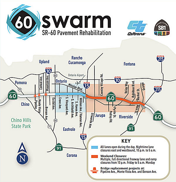 In July 2019, it was reported that Route 60 would be undergoing repairs for
15 weekends starting in July 2019 and continuing through November 2019.
Excluding Labor Day weekend, eastbound lanes between I-15 and the Route 60/Route 91/I-215 junction in Riverside would be closed for eight weekends
starting July 26, followed by westbound closures for the following seven
weekends. Lanes will be closed from 10p Friday to 5a Monday and on weekday
nights from 10p to 5a. The closures are part of a $134-million project to
replace deteriorating pavement and stripe lanes from Ontario to Riverside.
The work also includes replacement of bridges in Chino (that work will
continue through Summer 2021) as part of the so-called 60 Swarm projects:
Pipeline Avenue (SBD R000.86, Bridge 54-0744), Monte Vista Avenue (SBD
R001.87, Bridge 54-0746), and Benson Ave (SBD R002.87, Bridge 54-0748). It
includes $16.9 million in funding from Senate Bill 1 and the Road Repair
and Accountability Act of 2017.
In July 2019, it was reported that Route 60 would be undergoing repairs for
15 weekends starting in July 2019 and continuing through November 2019.
Excluding Labor Day weekend, eastbound lanes between I-15 and the Route 60/Route 91/I-215 junction in Riverside would be closed for eight weekends
starting July 26, followed by westbound closures for the following seven
weekends. Lanes will be closed from 10p Friday to 5a Monday and on weekday
nights from 10p to 5a. The closures are part of a $134-million project to
replace deteriorating pavement and stripe lanes from Ontario to Riverside.
The work also includes replacement of bridges in Chino (that work will
continue through Summer 2021) as part of the so-called 60 Swarm projects:
Pipeline Avenue (SBD R000.86, Bridge 54-0744), Monte Vista Avenue (SBD
R001.87, Bridge 54-0746), and Benson Ave (SBD R002.87, Bridge 54-0748). It
includes $16.9 million in funding from Senate Bill 1 and the Road Repair
and Accountability Act of 2017.
(Source: LA Times, 7/19/2019)
The pavement rehabilitation portion of the project will
include 18-mile of concrete and asphalt rehabilitation on Route 60 lanes,
shoulders and on/off ramps, as well as upgrading pedestrian sidewalk ADA
ramps at the on/off ramp intersections. The bridge replacements are
raising the vertical clearances on these bridges, which were constructed
in 1970,to current standards to mitigate over-height loads from hitting
the structures. The current bridges are continuous concrete box or girder
bridges. Current clearances range from 14.9' to 15.1'; for comparison, the
nearby Central Avenue bridge has a clearance of 17.1'.
(Source: 60 Swarm Webpage)
In November 2019, it was reported that mid-November
marked the final "60 Swarm" closure, when construction workers planned to
tear down half of the Benson Avenue bridge in Chino, triggering
alternating closures on Route 60 there. The westbound lanes would be
closed Friday night, and the eastbound lanes on Saturday night. While this
marks the end of full freeway closures, pavement repairs will continue to
prompt periodic nighttime lane closures during the week through fall 2021
between Euclid Avenue and the Route 60/Route 91/I-215 interchange.
Additionally, the replacement of bridges at Pipeline Avenue, Monte Vista
Avenue and Benson Avenue will trigger closures.
(Source: $$ Press Enterprise, 11/14/2019)
In August 2021, the CTC approved the following construction phase
allocation: $11,840,000. 08-SBd-60 R1.37. PPNO 08-3009R; ProjID
0817000240; EA 1J210. Route 60 In Chino, at Ramona Avenue Overcrossing No.
54-0745. Outcome/Output: Improve freight corridor movement by removing
vertical clearance constraint by lowering the profile of Route 60.
Allocation: CON ENG $2,420,000 CONST $8,970,000.
(Source: August 2021 CTC Agenda, Agenda Item
2.5b.(1) #57)
Route 60/Central Avenue Interchange (08-SBd-60 R2.1/R2.6)
In June 2020, the CTC approved amending the Trade
Corridors Improvement Funding (TCIF) Program to include the Route 60
Central Avenue Interchange Project and to program $8,638,000 for the
project. Funding for this amendment is made available by cost savings on
completed Trade Corridors Improvement Funding Program projects. This
amendment is consistent with the Trade Corridors Improvement Funding
Program Guidelines and the May 2019 Program Close-Out Policy. The Route 60
Central Avenue Interchange is a primary freeway access point for major
industrial, commercial, and residential uses for the City of Chino, and
Central Avenue is a designated truck route. The project addresses a key
bottleneck in the system and will promote cleaner, more efficient goods
movement that will generate at least 318,000 new trade-related jobs by
2030. Travel time savings are a significant benefit to this project not
only for passenger vehicles, but for freight as well. It is anticipated
there will be $32.8 million in passenger time savings and an additional
$13.1 million in freight benefits. The project will widen the Central
Avenue Bridge over Route 60, provide two back-to-back left turn lanes and
receiving lanes for both freeway on-ramp intersections on Central Avenue,
and add a High Occupancy Vehicle preferential lane. Additionally, both
ramp intersections will receive improvements to bring sidewalks and curb
ramps up to Americans with Disability Act standards. Lastly, the project
will add an auxiliary lane on the Route 60 mainline, seismically retrofit
the Central Avenue Bridge, and accommodate future planned widening of
Central Avenue.
(Source: June 2020 CTC Agenda, Agenda Item 4.17)
In June 2020, the CTC approved an allocation of
$8,638,000 for the locally-administered Proposition 1B (Prop 1B) Trade
Corridor Improvement Fund (TCIF) State Route 60/Central Avenue Interchange
(PPNO 3017C) project: 08-SBd-60 R2.1/R2.6 PPNO 08-3017C ProjID 0800000064
EA 0C870 Route 60/Central Avenue Interchange. In the city of
Chino. Widen existing bridge, widen on-ramps in both directions and
construct a transition/acceleration lane on Route 60 (TCIF 135). (The
programmed TCIF funds are to be split: $0 for construction engineering and
$8,638,000 for construction capital.) (Contribution from other sources:
$20,337,000.) (Concurrent TCIF Program Amendment under Resolution
TCIF-P-1920-09; June 2020) (Concurrent TCIF Baseline Agreement approval
under Resolution TCIF-P-1920-08B; June 2020) ALLOCATION IS CONTINGENT UPON
THE APPROVAL OF A BUDGET REVISION BY THE DEPARTMENT OF FINANCE AND ON THE
PASSAGE OF THE 2020 BUDGET ACT
(Source: June 2020 CTC Agenda, Agenda Item
2.5g.(5b))
Haven Avenue to Milliken Avenue Auxiliary Lane (08-SBD-60 R7.3/R10.0)
In October 2017, a SHOPP amendment to correct a project number highlighted the following project: 08-SBD-60 R7.3/R10.0: On Route 60 in San Bernardino County: In Ontario, from Haven Avenue to Milliken Avenue/Hamner Avenue. Construct auxiliary lane and widen connector and ramps. The project was also included in the final adopted 2018 SHOPP in March 2018.
In June 2019, the CTC approved the following SHOPP
scope amendment: 08-SBd-60 R7.3/R10.0 PPNO 3003N ProjID 0817000075. Route 60 In Ontario, from Haven Avenue to Milliken Avenue/Hamner Avenue.
Construct auxiliary lane and widen connector and ramps. During the
preparation of the Project Report, constuction capital costs increased,
primarily due to increases in costs for pavements, sound walls, state
furnished materials, and Time Related Overhead (TRO). Construction support
dropped after a reevaluation of construction inspection needs. Sound wall
locations have moved, and there is no need for construction easements, so
R/W capital cost has gone down. Updated cost: $42,528K.
(Source: June 2019 CTC Minutes, Agenda Item
2.1a.(1) Scope Item 98)
In June 2019, the CTC approved the following SHOPP
support allocation: $3,870,000 08-SBD-60 R7.3/R10.0 PPNO 3003N ProjID
0817000075. Route 60 In Ontario, from Haven Avenue to Milliken
Avenue/Hamner Avenue. Construct auxiliary lane and widen connector and
ramps. PS&E $3,850,000 R/W Support $20,000 (Concurrent SB 1 Baseline
Agreement approval under Resolution SHOPP-P-1819-13B.) (Concurrent
amendment under SHOPP Amendment 18H-010.)
(Source June 2019 CTC Minutes, Agenda Item
2.5b.(2a) Item 34)
In December 2020, the CTC approved the following SHOPP
Construction Phase allocation: $38,947,000 for San Bernardino 08-SBd-60
R7.3/R9.958. PPNO 08-3003N ProjID 0817000075 EA 0E33U. Route 60 In
Ontario, from 0.4 mile east of Vineyard Avenue to Milliken Avenue/Hamner
Avenue. Outcome/Output: Construct auxiliary lane and widen connector and
ramps to improve operational efficiency and reduce congestion. Con Eng:
$6,100,000; Const $29,518,000. (CEQA - CE, 12/3/2018; Re-validation
5/20/2020) (NEPA - CE, 12/3/2018; Re-validation 5/20/2020) (SB 1 Baseline
Agreement approved under Resolution SHOPP-P-1819-13B; June 2019.)
(Source: December 2020 CTC Agenda, Agenda Item
2.5b.(1) #13)
Route 60 Archibald Avenue Interchange Improvement Project (08-SBD-60 R7.8/R7.9)
In December 2018, the CTC approved adding the following
project to the Trade Corridor Improvement Fund (TCIF) funding list:
Project 130 – Route 60 Archibald Avenue Interchange Improvement
Project. (~ SBD R7.9). With the support of the Southern California
Consensus Group, the San Bernardino County Transportation Authority
proposes to amend the Trade Corridor Improvement Fund Program by including
the Route 60 Archibald Avenue Interchange Improvement Project as Project
130. The proposed project will improve the existing interchange by adding
left-turn lanes and right-turn pockets, extending the left-turn lane
storage lengths, widening all ramps, and constructing retaining walls.
These improvements will improve the flow of commerce into and out of the
truck terminals and logistics centers along Route 60 and the surrounding
area. The Route 60 Archibald Avenue Interchange Improvement Project is
estimated to cost $17.216 million and construction is expected to begin in
October 2019.
(Source: December 2018 CTC Minutes, Agenda Item
4.22)
In May 2019, the CTC approved the Project Baseline
Agreement for the Trade Corridors Improvement Fund Project 130, State
Route 60 Archibald Interchange Improvement Project, in San Bernardino
County.
(Source: May 2019 CTC Minutes, Agenda Item 4.26)
In June 2019, the CTC approved an allocation of
$1,310,000 for the locally-administered Proposition 1B Trade Corridors
Improvement Fund (TCIF) Route 60 Archibald Avenue Interchange Improvement
project (PPNO 1250, ProjID 0814000194) (08-SBD-60 R7.8/R7.9). Route 60 in
the city of Ontario. Construct left-turn lanes in each direction on
Archibald Avenue, construct right-turn pockets approaching the eastbound
and westbound on-ramps on Archibald, extend left-turn lane storage length
by approximately 190 feet south of the interchange for northbound traffic
accessing the westbound on-ramp and widen all ramps to provide an
additional lane and standard shoulder widths. Also construct a 250 feet
retaining wall along the westbound on-ramp 225 feet long retaining wall
along with CHP reinforcement areas on both sides.(TCIF 130)
(Source: June 2019 CTC Minutes, Agenda Item
2.5g.(5a))
In April 2007, the CTC considered a request for a new connection at Valley Way (~ RIV 7.537). This would be an interchange to Route 60 in the county of Riverside, at Post Mile 7.5. The existing connection has difficulties due to increasing traffic volumes on Route 60 and congestion at the Valley Way interchange. This project will revise the connection to Route 60 at Valley Way. The Commission adopted the portion of Route 60 in the vicinity of Valley Way as a freeway on November 28, 1941. The existing route is a sixlane facility west of the Valley Way interchange and an eight-lane facility east of the Valley Way interchange. Future widening to ten lanes is planned west of the Valley Way interchange to accommodate high occupancy vehicle lanes. In August 1992, a Project Study Report (PSR) was approved to modify the existing Valley Way interchange. The Project Report was approved on July 12, 2005. Route 60, including the Valley Way interchange, was constructed to freeway standards in 1962. The continuing urbanization of Riverside County has placed more demand on the Valley Way ramps to and from Route 60. This project will remove the existing eastbound diamond exit ramp at Valley Way and construct a new eastbound exit hook ramp one-half mile west of Valley Way connecting to the Mission Boulevard/Byrne Road intersection. A new eastbound entrance hook ramp will be constructed adjacent to the new eastbound exit hook ramp. The existing eastbound diamond entrance ramp at Valley Way will remain in operation. The revised interchange at Valley Way will be an elongated interchange. The proposed improvements will increase the capacity of the existing interchange and considerably improve interchange operations.
91/215/60 Interchange Improvements (~ RIV 12.109)
There is a significant project to reconstruct the Route 91/I-215/Route 60 interchange. The project includes rebuilding the Spruce Street bridge; relocating the existing eastbound on-ramp to Route 60 from Orange Street to Main Street; and widening the existing highway undercrossing bridges at University Avenue, Mission Inn Avenue and Third Street. There are also plans to replace the existing southbound (to I-215) loop ramp with a direct freeway-to-freeway connector, as well as replacing the northbound to westbound (to Route 91) loop ramp with a direct freeway-to-freeway connector. There are also plans to remove the existing I-215 southbound off-ramp and northbound on-ramp at Spruce Street. These ramps will be relocated to Route 91 as an eastbound off-ramp and a westbound on-ramp at the new Spruce Street overcrossing bridge. The project will also realign East La Cadena Drive between 1st and Spruce Street, and provide a grade separation at the railroad crossing, as well as realigning West La Cadena Drive to accommodate the new interchange connectors. The Route 91 main line will be widened, and auxiliary lanes added between University and the 60/91/215 interchange. Additionally, I-215 (Route 60) will be widened from the 60/91/215 interchange to the 60/215 junction, including extending the existing carpool lanes from University Avenue to the 60/215 junction, and providing auxiliary lanes leading to and departing from the new freeway connectors. The existing I-215 (Route 60) Blaine Street, Iowa Avenue and Linden Street overcrossing bridges will be reconstructed to span the new freeway widening, and the existing I-215 (Route 60) Blaine Street, University Avenue and Central Avenue/Watkins Drive interchanges will be improved, including ramp widening. Sycamore Canyon Boulevard will be realigned at Central Avenue. The project will construct a new interchange at Martin Luther King Boulevard, and remove the existing El Cerrito Drive interchange. The existing railroad overhead bridges at Down Street and Chicago Avenue will be widened. At the 60/215 junction, a truck by-pass connector will be constructed from southbound I-215 to eastbound Route 60 and southbound I-215. On Route 60, the existing Day Street interchange will be modified. On I-215, the Box Springs Road interchange will be rebuilt with an overcrossing bridge. Lastly, there will be a a concrete barrier on northbound I-215 at the junction to westbound Route 60. This project has taken three years, cost over $317-million, and should conclude in Spring 2008. Caltrans officials plan to open two new connector ramps by the end of 2007, including one that soars 72 feet high and measures just over a mile long.
In May 2014, it was reported that the Chino city council voted to spend $12.5 million to cover the city’s share of the cost of interchange improvements at Central Avenue and Route 60. The project calls for widening of the Central Avenue bridge over the freeway and widening of the eastbound and westbound ramps. Landscaping will be replaced. Construction is tentatively scheduled for June 2019 through December 2020. SANBAG will maintain the landscaping for five years after completion.
 Commuter Lanes
In San Bernardino County, HOV lanes exist between the Los Angeles County line and the Riverside County line. These opened in February 1997, require two or more occupants, and are always in operation.
HOV lanes are planned, under construction or opened as follows:
According to Don Hagstrom in May 2003, Caltrans has announced the beginning of a long-awaited project to connect the two carpool (HOV) lanes between the northbound Route 57 (Orange) Freeway and the eastbound Route 60 (Pomona) Freeway. It is unclear if this is a two-way connector.
According to the Los Angeles Times in September 2006, Caltrans was set to begin creating the HOV lanes between the Route 57 and I-605 freeways in January 2007. The $100-million project includes sound walls. Caltrans will use the existing freeway median for the new lanes. Construction began in early 2006 to add 7½ miles of carpool lanes between Route 91 and the Valley Way exit in Riverside County. The new lanes will cost an estimated $55 million and are slated to open in late 2007. This may be one of the phases of TCRP #63. By 2010, there should be 48 miles of continuous HOV lanes through Los Angeles, San Bernardino and Riverside counties. As of April 2007, the completion date had been changed to 2011. The lanes opened for traffic in October 2010.
 Business Routes
Riverside: Mission Blvd and University Avenue appears to be the old Route 60 Business Loop. There may be some signs remaining.
 Naming
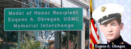 The I-5/I-10/Route 60/U 101 interchange (~ LA 0.163), commonly referred to as the East Los Angeles
Interchange, is named the “Medal of Honor Recipient , Eugene A.
Obregon, USMC, Memorial Interchange” (it was originally named
the “Marine Private First Class Eugene A. Obregon Interchange”).
This interchange was named in memory of Medal of Honor Recipient Eugene A.
Obregon, USMC. While serving as an ammunition carrier with Golf Company,
Third Battalion, Fifth Marine Regiment, First Marine Division
(Reinforced), during the Korean War, PFC Obregon was killed in action on
September 26, 1950. The machine-gun squad of Private Obregon was
temporarily pinned down by hostile fire; and during this time, he observed
a fellow marine fall wounded in the line of fire. Armed only with a
pistol, Private Obregon unhesitantly dashed from his cover position to the
side of the fallen marine. Firing his pistol with one hand as he ran,
Private Obregon grasped his comrade by the arm, and despite the great
peril to himself, dragged the marine to the side of the road. Still under
enemy fire, Private Obregon was bandaging the marine's wounds when hostile
troops began approaching their position. Quickly seizing the woxxunded
marine's rifle, Private Obregon placed his own body as a shield in front
of the wounded marine and lay there firing accurately and effectively into
the approaching enemy troops until he, himself, was fatally wounded by
enemy machine-gun fire. By his courageous fighting spirit, and loyal
devotion to duty, Private Obregon enabled his fellow marines to rescue the
wounded marine. By fate and courage, Private Obregon is one of the valiant
Mexican Americans to receive the Congressional Medal of Honor, the
nation's highest military honor for bravery. Named by Senate Concurrent
Resolution (SCR) 109, Resolution Chapter 66, on 6/26/2008.
The I-5/I-10/Route 60/U 101 interchange (~ LA 0.163), commonly referred to as the East Los Angeles
Interchange, is named the “Medal of Honor Recipient , Eugene A.
Obregon, USMC, Memorial Interchange” (it was originally named
the “Marine Private First Class Eugene A. Obregon Interchange”).
This interchange was named in memory of Medal of Honor Recipient Eugene A.
Obregon, USMC. While serving as an ammunition carrier with Golf Company,
Third Battalion, Fifth Marine Regiment, First Marine Division
(Reinforced), during the Korean War, PFC Obregon was killed in action on
September 26, 1950. The machine-gun squad of Private Obregon was
temporarily pinned down by hostile fire; and during this time, he observed
a fellow marine fall wounded in the line of fire. Armed only with a
pistol, Private Obregon unhesitantly dashed from his cover position to the
side of the fallen marine. Firing his pistol with one hand as he ran,
Private Obregon grasped his comrade by the arm, and despite the great
peril to himself, dragged the marine to the side of the road. Still under
enemy fire, Private Obregon was bandaging the marine's wounds when hostile
troops began approaching their position. Quickly seizing the woxxunded
marine's rifle, Private Obregon placed his own body as a shield in front
of the wounded marine and lay there firing accurately and effectively into
the approaching enemy troops until he, himself, was fatally wounded by
enemy machine-gun fire. By his courageous fighting spirit, and loyal
devotion to duty, Private Obregon enabled his fellow marines to rescue the
wounded marine. By fate and courage, Private Obregon is one of the valiant
Mexican Americans to receive the Congressional Medal of Honor, the
nation's highest military honor for bravery. Named by Senate Concurrent
Resolution (SCR) 109, Resolution Chapter 66, on 6/26/2008.
(Image source: Flikr; Alchetron)
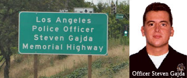 The segment of Route 60 between its interchange with I-10 at PM LA 0.118 and
the Indiana Street overpass at PM LA 1.94 in the City of Los Angeles is
named the "Los Angeles Police Officer Steven Gajda Memorial Highway"
This segment was named in memory of LAPD Officer Steven Gajda, born in
October 1968, in Parkridge, Illinois. Steven Gajda served as a helicopter
crew member in the United States Army, and Steven Gajda entered the Los
Angeles Police Academy on May 21, 1990, where he earned a reputation as a
conscientious cadet. After his appointment as an officer with the Los
Angeles Police Department, Steven Gajda was assigned to the department's
anti-gang unit, called the Community Resources Against Street Hoodlums
(CRASH) unit, which operates in the most violent neighborhoods in Los
Angeles. While serving in the CRASH unit, Gajda was shot on December 31,
1997, when identified gang members wanted on murder charges were fleeing
the scene of a New Year's Eve disturbance. Steven Gajda died from these
injuries the following day, January 1, 1998, his wife's birthday. Steven
Gajda was known as an officer who was willing to accept responsibility and
for his humor and artistic talents, drawing caricatures that showed life
with the CRASH unit, and his spirit always brought support to his fellow
officers. Named by Senate Concurrent Resolution (SCR) 38, Resolution
Chapter 90, on 7/10/2007.
The segment of Route 60 between its interchange with I-10 at PM LA 0.118 and
the Indiana Street overpass at PM LA 1.94 in the City of Los Angeles is
named the "Los Angeles Police Officer Steven Gajda Memorial Highway"
This segment was named in memory of LAPD Officer Steven Gajda, born in
October 1968, in Parkridge, Illinois. Steven Gajda served as a helicopter
crew member in the United States Army, and Steven Gajda entered the Los
Angeles Police Academy on May 21, 1990, where he earned a reputation as a
conscientious cadet. After his appointment as an officer with the Los
Angeles Police Department, Steven Gajda was assigned to the department's
anti-gang unit, called the Community Resources Against Street Hoodlums
(CRASH) unit, which operates in the most violent neighborhoods in Los
Angeles. While serving in the CRASH unit, Gajda was shot on December 31,
1997, when identified gang members wanted on murder charges were fleeing
the scene of a New Year's Eve disturbance. Steven Gajda died from these
injuries the following day, January 1, 1998, his wife's birthday. Steven
Gajda was known as an officer who was willing to accept responsibility and
for his humor and artistic talents, drawing caricatures that showed life
with the CRASH unit, and his spirit always brought support to his fellow
officers. Named by Senate Concurrent Resolution (SCR) 38, Resolution
Chapter 90, on 7/10/2007.
(Image sources: Flikr, LAPD Online)
 The segment of Route 60 from I-5 to Route 83 in Chino is named the
"Pomona Freeway" (~ LA R0.92 to SBD R4.537). It was named by the
State Highway Commission on November 15, 1955. The first segment opened in
1965. It was named because it traverses the city of Pomona, CA, which was
named in 1875 after the Roman goddess of orchards.
The segment of Route 60 from I-5 to Route 83 in Chino is named the
"Pomona Freeway" (~ LA R0.92 to SBD R4.537). It was named by the
State Highway Commission on November 15, 1955. The first segment opened in
1965. It was named because it traverses the city of Pomona, CA, which was
named in 1875 after the Roman goddess of orchards.
(Image source: Youtube)
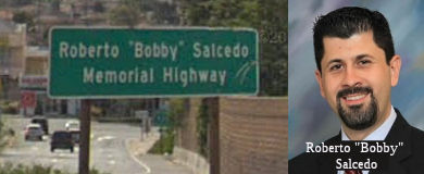 The portion of Route 60 between Atlantic Boulevard in the City of Monterey Park and the
city limit of the City of Rosemead in the County of Los Angeles (~LA
R4.461 to LA R8.211) is officially named the "Roberto "Bobby" Salcedo
Memorial Highway" This segment was named in honor of Roberto "Bobby"
Salcedo, who was a victim in a senseless killing spree on December 31,
2009, in Gomez Palacio, Durango, Mexico, where he and his wife Betzy were
visiting her family for the Christmas holidays. Mr. Salcedo graduated in
1994 from Mountain View High School in El Monte, and continued his
education at California State University, Long Beach, where he earned a
bachelor of arts degree in history, with a specialization in the history
of the United States and Latin America. While earning his degree, Mr.
Salcedo worked as a program assistant in the California Student
Opportunity and Access (Cal-SOAP) program at Mountain View High School,
promoting the value of higher education and assisting students with
college applications and financial aid documents. In 1998, Mr. Salcedo
began his teaching career in the Social Sciences Department at South El
Monte High School, where he was highly regarded as an excellent role model
and an enthusiastic teacher. In 2004, Mr. Salcedo earned a master of arts
degree in educational administration at California State University, San
Bernardino, and was promoted to Assistant Principal of Activities at South
El Monte High School. Mr. Salcedo was later appointed as Assistant
Principal for Instruction at Mountain View High School. Most recently, Mr.
Salcedo served the El Monte High School District as Assistant Principal
for Instruction at El Monte High School, following his appointment in
September, 2009, and also had been reelected to a third term on the Board
of Trustees of the El Monte City School District. At the time of his
death, Mr. Salcedo was working on his doctorate degree at the University
of California, Los Angeles. Named by Assembly Concurrant Resolution (ACR)
174, 9/9/2010, Resolution Chapter 144.
The portion of Route 60 between Atlantic Boulevard in the City of Monterey Park and the
city limit of the City of Rosemead in the County of Los Angeles (~LA
R4.461 to LA R8.211) is officially named the "Roberto "Bobby" Salcedo
Memorial Highway" This segment was named in honor of Roberto "Bobby"
Salcedo, who was a victim in a senseless killing spree on December 31,
2009, in Gomez Palacio, Durango, Mexico, where he and his wife Betzy were
visiting her family for the Christmas holidays. Mr. Salcedo graduated in
1994 from Mountain View High School in El Monte, and continued his
education at California State University, Long Beach, where he earned a
bachelor of arts degree in history, with a specialization in the history
of the United States and Latin America. While earning his degree, Mr.
Salcedo worked as a program assistant in the California Student
Opportunity and Access (Cal-SOAP) program at Mountain View High School,
promoting the value of higher education and assisting students with
college applications and financial aid documents. In 1998, Mr. Salcedo
began his teaching career in the Social Sciences Department at South El
Monte High School, where he was highly regarded as an excellent role model
and an enthusiastic teacher. In 2004, Mr. Salcedo earned a master of arts
degree in educational administration at California State University, San
Bernardino, and was promoted to Assistant Principal of Activities at South
El Monte High School. Mr. Salcedo was later appointed as Assistant
Principal for Instruction at Mountain View High School. Most recently, Mr.
Salcedo served the El Monte High School District as Assistant Principal
for Instruction at El Monte High School, following his appointment in
September, 2009, and also had been reelected to a third term on the Board
of Trustees of the El Monte City School District. At the time of his
death, Mr. Salcedo was working on his doctorate degree at the University
of California, Los Angeles. Named by Assembly Concurrant Resolution (ACR)
174, 9/9/2010, Resolution Chapter 144.
(Image sources: Google Streetview, Alhambra Source)
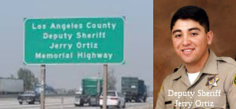 The segment of Route 60 between Rosemead Boulevard and I-605, in
Los Angeles County (~ LA 9.504 to LA 11.831) is named the "Los Angeles
County Deputy Sheriff Jerry Ortiz Memorial Highway". This segment
was named in memory of Deputy Jerry Ortiz of the Los Angeles County
Sheriff's Department who was killed in the line of duty on June 24, 2005,
in Hawaiian Gardens while conducting an investigation. Deputy Ortiz
faithfully served the residents of Los Angeles County as a Gang
Enforcement Deputy. He was a resident of Diamond Bar and served in the
United States Army from 1988 to 1996. He was also a boxing fan and a
member of the Los Angeles County Sheriff's Department Boxing Team. The
designation recognizes the hazardous work, serious responsibility, and
strong commitment that Deputy Ortiz willingly accepted during his 15 years
as a law enforcement officer. Named by Assembly Concurrent Resolution
(ACR) 27, Resolution Chapter 68, on 7/32007.
The segment of Route 60 between Rosemead Boulevard and I-605, in
Los Angeles County (~ LA 9.504 to LA 11.831) is named the "Los Angeles
County Deputy Sheriff Jerry Ortiz Memorial Highway". This segment
was named in memory of Deputy Jerry Ortiz of the Los Angeles County
Sheriff's Department who was killed in the line of duty on June 24, 2005,
in Hawaiian Gardens while conducting an investigation. Deputy Ortiz
faithfully served the residents of Los Angeles County as a Gang
Enforcement Deputy. He was a resident of Diamond Bar and served in the
United States Army from 1988 to 1996. He was also a boxing fan and a
member of the Los Angeles County Sheriff's Department Boxing Team. The
designation recognizes the hazardous work, serious responsibility, and
strong commitment that Deputy Ortiz willingly accepted during his 15 years
as a law enforcement officer. Named by Assembly Concurrent Resolution
(ACR) 27, Resolution Chapter 68, on 7/32007.
(Image source: Flikr via Google Images, Michael Parker on Twitter)
 The interchange on Route 60 at the 7th Avenue Undercrossing (~ LA
14.279) in the City of Hacienda Heights in the County of Los Angeles is
named the “Los Angeles County Sheriff’s Deputy Michael
Richard Arruda Memorial Interchange”. It was named in memory
of Deputy Michael Richard Arruda of the Los Angeles County Sheriff’s
Department, who was tragically shot on June 9, 2004, in the City of
Hacienda Heights and ultimately succumbed to his injuries on June 15,
2004. Arruda had served 13 years as a law enforcement officer. Chaptered
by Secretary of State. Res. Chapter 128, Statutes of 2024, SCR 115,
06/26/2024.
The interchange on Route 60 at the 7th Avenue Undercrossing (~ LA
14.279) in the City of Hacienda Heights in the County of Los Angeles is
named the “Los Angeles County Sheriff’s Deputy Michael
Richard Arruda Memorial Interchange”. It was named in memory
of Deputy Michael Richard Arruda of the Los Angeles County Sheriff’s
Department, who was tragically shot on June 9, 2004, in the City of
Hacienda Heights and ultimately succumbed to his injuries on June 15,
2004. Arruda had served 13 years as a law enforcement officer. Chaptered
by Secretary of State. Res. Chapter 128, Statutes of 2024, SCR 115,
06/26/2024.
(Image source: Find a Grave)
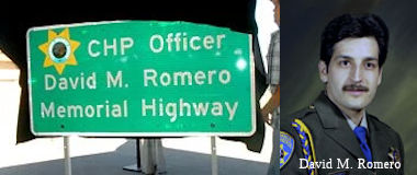 The portion of Route 60 eastbound from Route 605 (LA 11.71) to Hacienda Boulevard (LA
15.93) and westbound from Hacienda Boulevard (LA 15.96) to Route 605 (LA
11.59) in the County of Los Angeles is named the "CHP Officer David M.
Romero Memorial Highway" This segment was named in memory of
California Highway Patrol (CHP) Officer David M. Romero, born on April 2,
1958, in West Covina, California. Officer Romero attended Los Altos High
School in Hacienda Heights, California, and graduated in June 1976, after
which he attended Rio Hondo College in Whittier, California. Prior to
working for the CHP, Officer Romero worked in the service department for a
Chevrolet dealer in the City of La Puente. Officer Romero was selected for
the cadet position and entered the CHP Academy on January 11, 1982. Upon
graduation from the CHP Academy on May 27, 1982, Officer Romero, badge
number 10116, was assigned to the Santa Fe Springs area office as a
motorcycle officer. Officer Romero also served in the Riverside area
office before transferring back to the Santa Fe Springs Area, serving the
State of California as a CHP Officer for 23 years and 4 months. Officer
Romero was killed in the line of duty on September 23, 2005. While,
stopped at a red light on his departmental motorcycle in the City of
Industry, he was rear-ended by a vehicle traveling at a high rate of
speed, driven by an intoxicated driver. Officer Romero was a dedicated
officer who loved his job and enjoyed the people with whom he worked.
Named by Senate Concurrent Resolution (SCR) 57, Resolution Chapter 123, on
9/25/2009.
The portion of Route 60 eastbound from Route 605 (LA 11.71) to Hacienda Boulevard (LA
15.93) and westbound from Hacienda Boulevard (LA 15.96) to Route 605 (LA
11.59) in the County of Los Angeles is named the "CHP Officer David M.
Romero Memorial Highway" This segment was named in memory of
California Highway Patrol (CHP) Officer David M. Romero, born on April 2,
1958, in West Covina, California. Officer Romero attended Los Altos High
School in Hacienda Heights, California, and graduated in June 1976, after
which he attended Rio Hondo College in Whittier, California. Prior to
working for the CHP, Officer Romero worked in the service department for a
Chevrolet dealer in the City of La Puente. Officer Romero was selected for
the cadet position and entered the CHP Academy on January 11, 1982. Upon
graduation from the CHP Academy on May 27, 1982, Officer Romero, badge
number 10116, was assigned to the Santa Fe Springs area office as a
motorcycle officer. Officer Romero also served in the Riverside area
office before transferring back to the Santa Fe Springs Area, serving the
State of California as a CHP Officer for 23 years and 4 months. Officer
Romero was killed in the line of duty on September 23, 2005. While,
stopped at a red light on his departmental motorcycle in the City of
Industry, he was rear-ended by a vehicle traveling at a high rate of
speed, driven by an intoxicated driver. Officer Romero was a dedicated
officer who loved his job and enjoyed the people with whom he worked.
Named by Senate Concurrent Resolution (SCR) 57, Resolution Chapter 123, on
9/25/2009.
(Image sources: Daily Breeze, CHP)
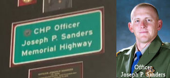 The portion of Route 60 eastbound (LA 15.96) from Hacienda Boulevard to (LA 20.44)
Nogales Street and westbound from (LA 20.44) Nogales Street to (LA 15.96)
Hacienda Boulevard, as well as the portion of northbound Hacienda
Boulevard to eastbound and westbound Route 60, as well as the Hacienda
Boulevard off ramp from westbound Route 60, as well as the eastbound and
westbound on ramps and off ramps for Azusa Avenue and Fullerton Road, as
well as the eastbound off ramp to Nogales Street and southbound Nogales
Street to eastbound and westbound Route 60 is named the "CHP Officer
Joseph P. Sanders Memorial Highway." It was named in memory of
California Highway Patrol (CHP) Officer Joseph P. Sanders, born March 7,
1979, to Wayne and Beverly Sanders in Sacramento, California. Officer
Sanders attended Galt High School in Galt, California, and graduated in
June 1997. Upon graduation from high school, Officer Sanders joined the
United States Marine Corps where he attained the rank of sergeant. Officer
Sanders was selected for the position of cadet and entered the CHP Academy
on June 18, 2007. Upon graduation from the CHP Academy on December 21,
2007, Officer Sanders, badge number 18781, was assigned to the Santa Fe
Springs area office where he served the State of California as a highway
patrol officer for nearly a year. Officer Sanders was married to Tondria
Bryn Myrick on October 8, 2004, and had five wonderful children, Trentten,
John, Silas, Savannah, and Elizabeth. Officer Sanders was killed in the
line of duty on December 15, 2008, when he was directing traffic at the
site of a traffic collision on eastbound Route 60, west of Azusa Avenue in
the city of Hacienda Heights. A subsequent collision between two vehicles
caused one of the vehicles to veer out of control, striking Officer
Sanders and causing major injuries. Officer Sanders was airlifted to USC
Medical Center in Los Angeles where he succumbed to his injuries. Officer
Sanders was admired for his faithfulness and loyalty to family, friends,
and work, his honesty and determination in all aspects of his life, his
dedication to community and willingness to serve his community, and his
kindness and quiet good nature. Named by Assembly Concurrent Resolution
(ACR) 94, Resolution Chapter 116, on 9/23/2009.
The portion of Route 60 eastbound (LA 15.96) from Hacienda Boulevard to (LA 20.44)
Nogales Street and westbound from (LA 20.44) Nogales Street to (LA 15.96)
Hacienda Boulevard, as well as the portion of northbound Hacienda
Boulevard to eastbound and westbound Route 60, as well as the Hacienda
Boulevard off ramp from westbound Route 60, as well as the eastbound and
westbound on ramps and off ramps for Azusa Avenue and Fullerton Road, as
well as the eastbound off ramp to Nogales Street and southbound Nogales
Street to eastbound and westbound Route 60 is named the "CHP Officer
Joseph P. Sanders Memorial Highway." It was named in memory of
California Highway Patrol (CHP) Officer Joseph P. Sanders, born March 7,
1979, to Wayne and Beverly Sanders in Sacramento, California. Officer
Sanders attended Galt High School in Galt, California, and graduated in
June 1997. Upon graduation from high school, Officer Sanders joined the
United States Marine Corps where he attained the rank of sergeant. Officer
Sanders was selected for the position of cadet and entered the CHP Academy
on June 18, 2007. Upon graduation from the CHP Academy on December 21,
2007, Officer Sanders, badge number 18781, was assigned to the Santa Fe
Springs area office where he served the State of California as a highway
patrol officer for nearly a year. Officer Sanders was married to Tondria
Bryn Myrick on October 8, 2004, and had five wonderful children, Trentten,
John, Silas, Savannah, and Elizabeth. Officer Sanders was killed in the
line of duty on December 15, 2008, when he was directing traffic at the
site of a traffic collision on eastbound Route 60, west of Azusa Avenue in
the city of Hacienda Heights. A subsequent collision between two vehicles
caused one of the vehicles to veer out of control, striking Officer
Sanders and causing major injuries. Officer Sanders was airlifted to USC
Medical Center in Los Angeles where he succumbed to his injuries. Officer
Sanders was admired for his faithfulness and loyalty to family, friends,
and work, his honesty and determination in all aspects of his life, his
dedication to community and willingness to serve his community, and his
kindness and quiet good nature. Named by Assembly Concurrent Resolution
(ACR) 94, Resolution Chapter 116, on 9/23/2009.
(Image sources: Tiktok, California Assn of Highway Patrolmen)
 The portion of Route 60 from Lemon Avenue (LA 22.377) on the west to Golden
Springs Drive (LA 26.526) on the east, in the City of Diamond Bar in the
County of Los Angeles, is designated the Jack Tanaka Memorial Highway.
It was named in memory of Former Diamond Bar Mayor Jack Tanaka, who was a
man of many accomplishments, receiving a number of international awards
and inspiring students through his involvement at Diamond Bar High School.
Tanaka died on August 3, 2017, after a long battle against lung cancer.
;Tanaka was a retired United States Army Sergeant, worked as a former
peace officer with the California Youth Authority in the California
Department of Corrections and Rehabilitation, was elected to the City of
Diamond Bar City Council, and later served as Mayor of Diamond Bar. Jack
Tanaka and his wife, Wanda, were well known on the Diamond Bar High School
campus for their work as dedicated Leo Club advisers, and the couple
received the Lions Clubs International’s Lion of the Year Award in
2012. In addition to volunteering, Jack Tanaka was well known by many
Diamond Bar residents for being an active member of city government,
serving two terms as mayor after he was first elected as mayor in 2005,
and continuing on to serve on the City of Diamond Bar Planning Commission
as vice chairman for over three years. In November 2016, when Jack Tanaka
announced his retirement after 10 years of community service to the city,
he was praised by the Diamond Bar City Council with a standing ovation,
and served his last day in office on December 1, 2016. Named by Senate
Concurrent Resolution 11 (SCR 11), Resolution Chapter 118, 7/19/2019.
The portion of Route 60 from Lemon Avenue (LA 22.377) on the west to Golden
Springs Drive (LA 26.526) on the east, in the City of Diamond Bar in the
County of Los Angeles, is designated the Jack Tanaka Memorial Highway.
It was named in memory of Former Diamond Bar Mayor Jack Tanaka, who was a
man of many accomplishments, receiving a number of international awards
and inspiring students through his involvement at Diamond Bar High School.
Tanaka died on August 3, 2017, after a long battle against lung cancer.
;Tanaka was a retired United States Army Sergeant, worked as a former
peace officer with the California Youth Authority in the California
Department of Corrections and Rehabilitation, was elected to the City of
Diamond Bar City Council, and later served as Mayor of Diamond Bar. Jack
Tanaka and his wife, Wanda, were well known on the Diamond Bar High School
campus for their work as dedicated Leo Club advisers, and the couple
received the Lions Clubs International’s Lion of the Year Award in
2012. In addition to volunteering, Jack Tanaka was well known by many
Diamond Bar residents for being an active member of city government,
serving two terms as mayor after he was first elected as mayor in 2005,
and continuing on to serve on the City of Diamond Bar Planning Commission
as vice chairman for over three years. In November 2016, when Jack Tanaka
announced his retirement after 10 years of community service to the city,
he was praised by the Diamond Bar City Council with a standing ovation,
and served his last day in office on December 1, 2016. Named by Senate
Concurrent Resolution 11 (SCR 11), Resolution Chapter 118, 7/19/2019.
(Image source: Snarfed from Rafu Shimpo, the Los Angeles Japanese Daily News, 10/28/2019)
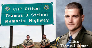 The segment of Route 60 in the City of Pomona, beginning with Phillips Ranch Road and
ending at Reservoir Street (~ LA R28.042 to LA R30.351) is named the "CHP
Officer Thomas J. Steiner Memorial Highway". This segment was memory
of CHP Officer Thomas J. Steiner, who was killed in the line of duty in
the afternoon of April 21, 2004. Officer Thomas J. Steiner was slain by an
armed assailant while leaving Los Angeles Superior Court in Pomona, and
succumbed to his injuries as a result of the assault. Thomas J. Steiner
was born on February 14, 1969, in Richmond, Virginia. His family lived in
Long Beach, California, where he attended and graduated from Millikan High
School. Prior to beginning his career with the CHP, Thomas J. Steiner
attended Cal Poly Pomona where he received a Bachelor's Degree in
business. He joined the CHP on October 19, 1998. After successfully
completing his academy training, he reported to the Santa Fe Springs Area,
where he made significant contributions to traffic safety and to the
motoring public while assigned to the Santa Fe Springs Area office. He
served five years as a sworn peace officer for the California Highway
Patrol and was known by his fellow officers for his dedication to the
department and to the protection of the citizens of our state. Named by
Senate Concurrent Resolution (SCR) 20, Resolution Chapter 2, on 1/31/2006.
The actual naming ceremony was held in April 2008.
The segment of Route 60 in the City of Pomona, beginning with Phillips Ranch Road and
ending at Reservoir Street (~ LA R28.042 to LA R30.351) is named the "CHP
Officer Thomas J. Steiner Memorial Highway". This segment was memory
of CHP Officer Thomas J. Steiner, who was killed in the line of duty in
the afternoon of April 21, 2004. Officer Thomas J. Steiner was slain by an
armed assailant while leaving Los Angeles Superior Court in Pomona, and
succumbed to his injuries as a result of the assault. Thomas J. Steiner
was born on February 14, 1969, in Richmond, Virginia. His family lived in
Long Beach, California, where he attended and graduated from Millikan High
School. Prior to beginning his career with the CHP, Thomas J. Steiner
attended Cal Poly Pomona where he received a Bachelor's Degree in
business. He joined the CHP on October 19, 1998. After successfully
completing his academy training, he reported to the Santa Fe Springs Area,
where he made significant contributions to traffic safety and to the
motoring public while assigned to the Santa Fe Springs Area office. He
served five years as a sworn peace officer for the California Highway
Patrol and was known by his fellow officers for his dedication to the
department and to the protection of the citizens of our state. Named by
Senate Concurrent Resolution (SCR) 20, Resolution Chapter 2, on 1/31/2006.
The actual naming ceremony was held in April 2008.
(Image sources: Twitter, Calif. Assn of Highway Patrolmen)
 The section of Route 60 between Ramona Avenue and Mountain Avenue in Chino (~
SBD R1.375 to SBD R3.626) is officially named the “Officer
Russell M. Miller, Sr. Memorial Highway”. This segment was
named in memory of Officer Russell M. Miller, Sr., a 12-year veteran of
the Chino Police Department, who died in the line of duty on February 1,
2000. While on a routine traffic stop, and, while approaching the stopped
vehicle, he was struck from behind by a second vehicle, whose driver was
under the influence of alcohol. Miller was critically injured, and was
transported to a nearby trauma center where he died while undergoing
surgery. Officer Miller was born on December 27, 1948; and upon graduating
from Magnolia High School in Anaheim, California, in 1967, joined the
United States Navy, where he served six years at the height of the Vietnam
War. After leaving the Navy, Miller held a series of jobs working as a
welder, truck driver, and construction worker, and later applied to become
a police officer. After completing training, Miller graduated from the San
Bernardino County Sheriff's Academy on February 5, 1988, and joined the
Chino Police Department, later acting in the capacity as a field training
officer and part of the department's mounted enforcement team. Miller was
known as an officer who was well-liked and respected, and a stabilizing
force in his patrol unit. Officer Miller's memory lives on through an
annual memorial 5K "Run for Russ" race, established in 2001 in Chino,
California, an event that brings the community together to celebrate
Officer Miller's life and that forges stronger neighborhood bonds. Named
by Senate Concurrent Resolution (SCR) 83, Resolution Chapter 122, on
9/7/2010.
The section of Route 60 between Ramona Avenue and Mountain Avenue in Chino (~
SBD R1.375 to SBD R3.626) is officially named the “Officer
Russell M. Miller, Sr. Memorial Highway”. This segment was
named in memory of Officer Russell M. Miller, Sr., a 12-year veteran of
the Chino Police Department, who died in the line of duty on February 1,
2000. While on a routine traffic stop, and, while approaching the stopped
vehicle, he was struck from behind by a second vehicle, whose driver was
under the influence of alcohol. Miller was critically injured, and was
transported to a nearby trauma center where he died while undergoing
surgery. Officer Miller was born on December 27, 1948; and upon graduating
from Magnolia High School in Anaheim, California, in 1967, joined the
United States Navy, where he served six years at the height of the Vietnam
War. After leaving the Navy, Miller held a series of jobs working as a
welder, truck driver, and construction worker, and later applied to become
a police officer. After completing training, Miller graduated from the San
Bernardino County Sheriff's Academy on February 5, 1988, and joined the
Chino Police Department, later acting in the capacity as a field training
officer and part of the department's mounted enforcement team. Miller was
known as an officer who was well-liked and respected, and a stabilizing
force in his patrol unit. Officer Miller's memory lives on through an
annual memorial 5K "Run for Russ" race, established in 2001 in Chino,
California, an event that brings the community together to celebrate
Officer Miller's life and that forges stronger neighborhood bonds. Named
by Senate Concurrent Resolution (SCR) 83, Resolution Chapter 122, on
9/7/2010.
(Image source: Chino Police Officer Foundation)
 The segment of Route 60 from Euclid Avenue to Milliken Avenue (~ SBD R4.553 to SBD
R9.941) is named the "CYA Counselor Ineasie M. Baker Memorial Freeway".
This segment was named in memory of Ineasie M. Baker. Ineasie M. Baker, a
graduate of California State University, Fullerton (1975) with a degree in
Physical Education, eventually became a correctional officer and was later
promoted to a counselor for the California Youth Authority (CYA) She
worked for CYA for 13 years, and was highly respected and often worked
long hours to fulfill the needs of others. She was known as a "dedicated
and inspirational counselor whose main concern was the inmates." On August
9, 1996, Ineasie M. Baker was slain at the Herman G. Stark Youth
Correctional Facility, an institution for young adult criminals, where she
worked. Named by Assembly Concurrent Resolution (ACR) 63, Resolution
Chapter 115, on 9/12/2005.
The segment of Route 60 from Euclid Avenue to Milliken Avenue (~ SBD R4.553 to SBD
R9.941) is named the "CYA Counselor Ineasie M. Baker Memorial Freeway".
This segment was named in memory of Ineasie M. Baker. Ineasie M. Baker, a
graduate of California State University, Fullerton (1975) with a degree in
Physical Education, eventually became a correctional officer and was later
promoted to a counselor for the California Youth Authority (CYA) She
worked for CYA for 13 years, and was highly respected and often worked
long hours to fulfill the needs of others. She was known as a "dedicated
and inspirational counselor whose main concern was the inmates." On August
9, 1996, Ineasie M. Baker was slain at the Herman G. Stark Youth
Correctional Facility, an institution for young adult criminals, where she
worked. Named by Assembly Concurrent Resolution (ACR) 63, Resolution
Chapter 115, on 9/12/2005.
(Image source: Officer Down Memorial Page)
The segment from Route 83 to Route 215 is not officially named (~ SBD R4.553 to RIV 12.156).
 The Route 60, Route 215/Route 91/Route 215 Separation (Bridge № 56-0402) where
Route 60 and Route 91 meet I-215 (~ 08-Riv-60 12.21, 08-Rev-91 21.744,
08-Rev-215 R43.055) in the County of Riverside is named the “Joseph
Tavaglione Memorial Interchange”. It was named in memory of
Joseph Tavaglione, who was born in July 1923. Joseph Tavaglione was three
years of age when his family moved to the City of Riverside in 1927.
Joseph Tavaglione began his construction career working for a major lumber
firm; and then had a spectacular career as a local residential developer
overseeing the construction of thousands of military base housing units on
the west coast. He started his family business, Tavaglione Construction
and Development Inc., in 1960 in the City of Riverside with his younger
brother, Louie Tavaglione. Throughout his career of more than 60 years in
the construction field, Joseph Tavaglione’s firm has built
throughout the United States, primarily specializing in freestanding
retail sit-down restaurants, fast food restaurants, and over 1,000 7-11
convenience stores and gas stations. Tavaglione was the longest serving
member in the history of the California Transportation Commission (CTC);
he was appointed to CTC in October of 2002 by Governor Gray Davis;
reappointed to CTC by Governor Arnold Schwarzenegger in 2005 and 2009,
Governor Jerry Brown in 2013 and 2017, and Governor Gavin Newsom in 2021.
He served as chair of CTC. He resigned from his seat on CTC on July 1,
2024, after over 21 years of distinguished service. Tavaglione was a past
chair of the California Contractors’ State License Board, where he
served two terms; and previously served as the President of the National
Association of State Contractors Licensing Agencies, two four-year terms
on the City of Riverside’s Board of Public Utilities, as a member of
the City of Riverside’s Planning Commission, as the President of The
Valley Group of the Inland Empire, and was a member the Board of Directors
of the Riverside Humane Society Pet Adoption Center, the Riverside County
University Health System Medical Center Foundation, the Children’s
Spine Foundationthe Foundation Board of Trustees for both the University
of California, Riverside, and La Sierra University. Tavaglione passed away
peacefully at 101 years of age on August 1, 2024. Joseph
Tavaglione’s immeasurable impact on countless transportation
projects throughout the state included regionally significant projects,
including the Route 91/Route 60/I-215 Interchange Project, the Route 91
High Occupancy Vehicle Project, the Route 91 Corridor Improvement Project,
the I-15 Express Lanes Project, widenings of I-215 across the Counties of
San Bernardino and Riverside, the Metrolink 91/Perris Valley Line Project,
and numerous railroad crossing grade separations; and Named by SCR 13,
Res. Chapter 205, Statutes of 2024, 09/10/24.
The Route 60, Route 215/Route 91/Route 215 Separation (Bridge № 56-0402) where
Route 60 and Route 91 meet I-215 (~ 08-Riv-60 12.21, 08-Rev-91 21.744,
08-Rev-215 R43.055) in the County of Riverside is named the “Joseph
Tavaglione Memorial Interchange”. It was named in memory of
Joseph Tavaglione, who was born in July 1923. Joseph Tavaglione was three
years of age when his family moved to the City of Riverside in 1927.
Joseph Tavaglione began his construction career working for a major lumber
firm; and then had a spectacular career as a local residential developer
overseeing the construction of thousands of military base housing units on
the west coast. He started his family business, Tavaglione Construction
and Development Inc., in 1960 in the City of Riverside with his younger
brother, Louie Tavaglione. Throughout his career of more than 60 years in
the construction field, Joseph Tavaglione’s firm has built
throughout the United States, primarily specializing in freestanding
retail sit-down restaurants, fast food restaurants, and over 1,000 7-11
convenience stores and gas stations. Tavaglione was the longest serving
member in the history of the California Transportation Commission (CTC);
he was appointed to CTC in October of 2002 by Governor Gray Davis;
reappointed to CTC by Governor Arnold Schwarzenegger in 2005 and 2009,
Governor Jerry Brown in 2013 and 2017, and Governor Gavin Newsom in 2021.
He served as chair of CTC. He resigned from his seat on CTC on July 1,
2024, after over 21 years of distinguished service. Tavaglione was a past
chair of the California Contractors’ State License Board, where he
served two terms; and previously served as the President of the National
Association of State Contractors Licensing Agencies, two four-year terms
on the City of Riverside’s Board of Public Utilities, as a member of
the City of Riverside’s Planning Commission, as the President of The
Valley Group of the Inland Empire, and was a member the Board of Directors
of the Riverside Humane Society Pet Adoption Center, the Riverside County
University Health System Medical Center Foundation, the Children’s
Spine Foundationthe Foundation Board of Trustees for both the University
of California, Riverside, and La Sierra University. Tavaglione passed away
peacefully at 101 years of age on August 1, 2024. Joseph
Tavaglione’s immeasurable impact on countless transportation
projects throughout the state included regionally significant projects,
including the Route 91/Route 60/I-215 Interchange Project, the Route 91
High Occupancy Vehicle Project, the Route 91 Corridor Improvement Project,
the I-15 Express Lanes Project, widenings of I-215 across the Counties of
San Bernardino and Riverside, the Metrolink 91/Perris Valley Line Project,
and numerous railroad crossing grade separations; and Named by SCR 13,
Res. Chapter 205, Statutes of 2024, 09/10/24.
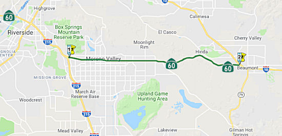 From Route 215 near Moreno Valley to Route 10 near
Beaumont.
From Route 215 near Moreno Valley to Route 10 near
Beaumont.
Post 1964 Signage HistoryIn 1963, this segment was defined as "Route 395 to Beaumont."
In 1969, Chapter 294 changed the reference to "Route 395" to "Route 15".
In 1976, Chapter 1354 changed the reference to "Route 15" to "Route 194", and changed the terminus to "Route 10 near Beaumont."
In 1982, Chapter 681 changed the reference to "Route 194" to "Route 215".
In 1986, Chapter 928 changed the definition of the origin of this segment to "Route 215 east of Riverside"
In 1994, Chapter 1220 changed the origin again, this time to "Route 215 near Moreno Valley"
Riverside International Raceway (which existed from 1959 to 1988 and held NASCAR, IMSA and Indycar/CART events) was located at the Day Street exit off of Route 60, where Moreno Valley Mall now stands. This site can also be accessed via the Eucalyptus Avenue exit off of I-215. A housing development just east of the mall, off of Atlantic Circle, contains several street names after famous racers: (Mario) Andretti Street; (Sir Jack) Brabham Street; (Cale) Yarborough Court; (Roger) Penske Street; (Dan) Gurney Place; (John) Surtees Court; and (Mark) Donohue Court.
Pre 1964 Signage History The Route 60 routing between Riverside and Beaumont is a new
alignment that replaced the previous US 60 alignment along LRN 19. The US 60 segment was LRN 19, defined in 1931. In Beaumont, Post-1964 Route 60
ends. However, US 60 originally continued to the E to the Arizona Border
along LRN 26 and LRN 64.
Route 60/US 60 Between Riverside and Beaumont
This extension was a former county highway commonly referred to as the Jackrabbit Trail. It was used as a bypass of LRN 26. It was also anticipated to be significant for truck traffic, and the deflection of truck traffic was felt to be significant.
The route of US 60 (and US 70 prior to 1938) east from Riverside to
Beaumont was as follows:
(Source: Gribblenation Blog: "California State Route 60/Former US Route 60/70 through the Moreno Valley Badlands west to Riverside")
By 1938 US 70 was moved off the shared alignment of US 60/LRN 19 through
the Moreno Valley Badlands onto a multiplex of US 99 west of Beaumont. The
Four-Lane alignment through the badlands opened in 1956.
(Source: Gribblenation Blog: "California State Route 60/Former US Route 60/70 through the Moreno Valley Badlands west to Riverside")
When the Jackrabbit Trail opened, it was not the official name of the
road – the Riverside County Board of Supervisors tried desperately
to have people use names such as the Beaumont-Moreno Road, but the Jack
Rabbit epithet stuck. For many years, traversing the Badlands between what
is today Moreno Valley and the Pass area meant using the trail, which was
very winding. In the early 1930s, there was a plan afoot to grade a road
through the Badlands that would ease many of the problems with the Jack
Rabbit Trail. In 1935, the State of California did just that, completing
the first incarnation of LRN 19 (which became US 60) through the Badlands.
This was a highway at the time, and was joined in 1936 to a new segment
running from Box Springs to the Badlands (present-day Sunnymead Boulevard
in Moreno Valley), and in 1937 to the final segment joining the Badlands
route to Beaumont. This was a major improvement in east-west travel
through Riverside County, and knocked fully 4 miles off of the trip from
Moreno to Beaumont. With the massive growth of the county’s
population after World War II and the resulting increase in freeway
construction, it was natural that US 60 / LRN 19 through the Badlands
would be improved. In the mid-1950s, much of the 1935 highway was replaced
by the new freeway, and on Feb. 16, 1956, many state and local officials
gathered for a ribbon-cutting ceremony at the freeway’s intersection
with the original routing of Route 79 along Gilman Springs Road. Here,
they opened the new segment of freeway which, with later improvements, is
much the same route used today through the region.
(Source: Press Enterprise, 10/10/2019)
Between Beaumont and Arizona, there were three distinct segments of US 60:
Beaumont and San Gorgonio to Indio
Between Beaumont and Indio, this was also part of LRN 26. This portion of LRN 26 was defined in 1916. It was signed as US 99, US 60 (after 1931), and US 70 after 1938 from Beaumont to Indio.
The portion of the route from San Gorgonio Station (now
Beaumont) to Indio dates back to the Bradshaw Trail. The Bradshaw Trail
was a wagon road through the Sonoran Desert east to the Colorado River.
During the California Gold Rush the Bradshaw Trail was plotted through the
Sonoran Desert by William D. Bradshaw. The Bradshaw Trail despite its elongated path essentially was the forerunner of what would become modern I-10
from Palm Springs to the City of Blythe. During the 1916 Second State
Highway Bond Act LRN 26 was added to the State Highway System as a route
from San Bernardino southeast to El Centro. LRN 26 was essentially a
forerunner of what would become the earliest alignments of US 99.
(Source: Gribblenation Blog "Califoooornia! (Interstate 10 west from CA 86 through Coachella Valley and San Gorgonio Pass to CA 60 in the Moreno Valley Badlands)")
Through Beaumont, LRN 26 ran along 6th Street and Ramsey Street, and it continued as Ramsey Street into Banning. In Cabezon, LRN 26 used Main Street. Near Whitewater, it was what is now the Whitewater Cutoff, and in North Palm Springs, Garnet Road.
In 1933, a series of improvements to US 99/US 60/US 70/LRN 26 in Coachella Valley were completed. These improvements included
widening 14.5 miles of highway between Whitewater-Indio and the
elimination of 31 dips via bridging structures.
(Source: Gribblenation Blog (Tom Fearer), "Former US Route 99-60-70 in Indio and Coachella Valley", May 2022)
The 1923 Whitewater Bridge was constructed as part of
the construction of LRN 26, later US 60/US 99/US 70 and currently I-10
(although the 1923 bridge never saw the route as I-10). The 1923
Whitewater Bridge was host to several Auto Trails. The 1924 Rand McNally
Highway Map of California shows the Southern National Highway and the
Atlantic & Pacific Highway crossing the 1923 Whitewater Bridge. By
late 1926 the US Route System was approved which led to US 99 being
aligned over LRN 26 and the 1923 Whitewater Bridge. In 1932 US 60 was
extended into California which multiplexed US 99/LRN 26 from Mecca over
the 1923 Whitewater Bridge. US 99 and US 60 were joined by US 70 in 1934
when it was extended into California. As the 1930s and 1940s progressed
traffic increased on US 99/60/70. In the 1950s much of LRN 26 and US 99/60/70 in Coachella Valley was upgraded to an expressway more in line
with the present alignment of I-10. The July/August 1954 Department of
Public Works Guide discusses the progress of building US 99/60/70 in
Coachella Valley to an expressway. The replacement bridge was built in
1952, and currently along I-10 as RIV 27.69 (Bridges 56-0004L and
56-0004R). The original alignment of US 60 in this area is Whitewater
Cutoff Road, and the bridge is currently closed to automobile and
pedestrians.
(Source: Gribblenation Blog: Former US Routes 99/60/70 on the 1923 Whitewater Bridge)
Tom Fearer describes the 1935 routing as follows: From
the junction with Route 111/LRN 187 US 99/US 60/US 70/LRN 26 passed
through Garnet siding via what is now Garnet Avenue. From Garnet, US 99/US 60/US 70/LRN 26 followed what is now Varner Road to Edom. From
Edom, US 99/US 60/US 70/LRN 26 largely followed Varner Road to a railroad
crossing near what is now Madison Street to Indio Boulevard towards
downtown Indio. US 99/US 60/US 70/LRN 26 originally passed through
the downtown Indio business district via Jackson Street (now Fargo
Street), where it jogged back to Indio Boulevard. From downtown
Indio, US 99/US 60/US 70/LRN 26 ran concurrent to Coachella. US 99
split via what is now Cesar Chavez Street on LRN 26 towards El Centro,
whereas US 60/US 70/Sign Route 111 followed Grapefruit Boulevard on LRN 64
towards Mecca and Box Canyon. At 66th Street, LRN 64 split off
to the E, continuing to Box Canyon Road and across Box Canyon. LRN 187
resumed its route as Sign Route 111 to El Centro.
(Source: Gribblenation Blog (Tom Fearer), "Former US Route 99-60-70 in Indio and Coachella Valley", May 2022)
In 1935, the Indio-Cutoff opened and US 60/US 70 was
realigned onto the new spur of LRN 64. This opening was five months ahead
of schedule. The Indio-Cutoff was 9 miles shorter than the original
alignment of US 60/US 70 through Box Canyon. Despite Box Canyon no
longer being part of US 60/US 70, it remained under State maintenance and
become part of the post-1964 Route 195. Additionally, in 1937, a
realignment/widening of US 99/US 60/US 70/LRN 26 in downtown Indio
occurred. The realignment of US 99/US 60/US 70/LRN 26 in Indio began
at Oasis Street (4 blocks W of Jackson Street (now Fargo)) and extended to
the southern city limit. Lastly, in 1941, the new junction of US 99/US 60/US 70/LRN 26 with Sign Route 111/LRN 187 opened. The new "Palm
Springs Junction" featured channelized traffic that was carried via
two-lanes in each direction of travel on US 99/US 60/US 70/LRN 26.
Previously US 99/US 60/US 70/LRN 26 intersected Route 111/LRN 187 at what
is now Tipton Road.
(Source: Gribblenation Blog (Tom Fearer), "Former US Route 99-60-70 in Indio and Coachella Valley", May 2022)
The opening of the Indio-Cutoff, the 1937 realignment, and the Palm Springs Junction changed things. By 1943, Closer to Indio, Varner Road was still LRN 26 through Thousand Palms and Palm Desert. LRN 26 entered Indio through Jefferson Street and Indio Blvd; the diversion along Jackson/Fargo Street was gone, and Sign Route 111 joined LRN 26 at Indio Blvd. Sign Route 111 joined LRN 26 at the intersection with 46th Avenue (later Ave 46, and now "CA 111"); this is also the point where Sign Route 74 and the second segment of LRN 64 terminated . At Dillon Road, LRN 64 split off and carried US 60/US 70 to Arizona, with LRN 26 continuing down to the Salton Sea, Westmorland, and Brawley. Note that although Tamarack Road parallels I-10 near the Palm Springs Cutoff, it was never LRN 26.
Originally, LRN 26 split from LRN 187 at the Cesar Chavez (Harrison Street) / Grapefruit Blvd split, with US 99 continuing down LRN 26, and Sign Route 111 continuing along Grapefruit. This changed with the 1964 renumbering, when the portion of former US 99 between Route 111 to Palm Desert and the former US 99/Route 111 split became Route 111, and US 99 to El Centro became Route 86. At that time, the Salton Sea segment of Route 111 started at the split with Route 86 and ran to Route 78 near Brawley; and Route 86 ran I-8 (former US 80) near El Centro to I-10. Route 111 was shortened to start at Route 86 near Mecca in 1972. This reflected a rerouting of Route 86 off of the old US 99 Cesar Chavez/Harrison St alignment through Oasis onto a new expressway that ran S from 66th Avenue. Things changed more after the Route 86 Expressway was constructed between I-10 and Mecca. At that time, the Route 86 Expressway, former Route 86S, became Route 86. The previous routing of Route 86 along Indio Blvd and Grapefruit was relinquished to Indio (although it still had some Route 111 signage for continuity). Ave 66 (66th Ave) and the Box Canyon, Route 195, were legislatively deleted, although a portion was transferred in Mecca was transferred in 2014 to provide a connection between Route 86 and Route 111 along Ave 66 and Lincoln Street (due to the construction of the Ave 66 bypass).
By March 1941, LRN 26 between Beaumont and Banning had
been upgraded to a four-lane divided highway. Freeway conversion
started in the 1950s, with freeway route adoption or studies taking place
in 1952 in Beaumont and Cabazon. The Beaumont Bypass opened in 1962; the
freeway through Cabazon was completed in 1964. Summer 1966 saw the freeway
completed to Route 111.
(Source: Gribblenation Blog (Tom Fearer), "Former US Routes 99-60-70 in San Gorgonio Pass (Beaumont, Banning and Cabazon)", April 2022)
In 1954, work was progressing on expanding US 99/US 60/US 70/LRN 26 to expressway standards in the Coachella Valley. The
1923 Whitewater River Bridge was bypassed by a new four-lane alignment of
US 99/US 60/US 70/LRN 26 that year, and the ongoing expressway project
spanned 14.4 miles from west of Garnet to Thousand Palms (previously
Edom). By 1958, studies were starting for the full freeway conversion. By
1967, most of the freeway conversion had been completed to Indio. At that
time, there was a determined freeway routing that would bypass Indio and
connect with a planned freeway to Thermal. I-10 followed an interim
alignment through Indio from the Indio Rail Overhead along Indio Boulevard
and Dillon Road to the Indio-Cutoff. I-10 was ultimately completed in the
early 1970s; it was shown as completed by the 1975 state highway map.
(Source: Gribblenation Blog (Tom Fearer), "Former US Route 99-60-70 in Indio and Coachella Valley", May 2022)
Indio to the Arizona Border
By 1924, the stretch beween Mecca and the Arizona
Border was part of the Atlantic and Pacific Highway. This would become LRN 64. The general routing of LRN 64 was different from the Bradshaw Trail as
it followed Box Canyon, Chiriaco Summit and Chuckwalla Valley. 1924 saw
the start of work to modernize/grade LRN 64 (the Mecca-Blythe Highway).
Improvements were in the segment from Shavers Well in Box Canyon and
extending east to Blythe.
(Source: Gribblenation Blog "Califoooornia! (Interstate 10 west from CA 86 through Coachella Valley and San Gorgonio Pass to CA 60 in the Moreno Valley Badlands)"; Gribblenation Blog (Tom Fearer), "Interstate 10 in the Sonoran Desert between the Colorado River and Coachella Valley", 10/14/2023)
Before 1935, the alignment of US 60/US 70/LRN 64 east
from Mecca to the Arizona state line split from US 99 in Coachella. US 99
split via what is Cesar Chavez Street on LRN 26 towards El Centro, whereas
US 60/US 70 followed Grapefruit Boulevard on LRN 64 towards Mecca. At 66th
(now Ave 66), it turned E and into Box Canyon along Box Canyon Road. From
Box Canyon, US 60/US 70/LRN 64 continued east over Chiriaco Summit towards
Chuckwalla Valley. US 60/US 70/LRN 64 eastbound passed through Chuckwalla
Valley along what is now Chuckwalla Valley Road towards Blythe. Within
Blythe, US 60/US 70/LRN 64 followed Hobsonway to the Colorado River Bridge
at the Arizona state line.
(Source: Gribblenation Blog (Tom Fearer), "Interstate 10 in the Sonoran Desert between the Colorado River and Coachella Valley", 10/14/2023)
The 1934 State Highway Map shows a fully graded LRN 64
carrying US 60. The 1935 California Division of Highways Map of Riverside
County shows the entire routing of LRN 64 in far more detail. LRN 64/US 60/US 70 originally diverged significantly from I-10 using alignments on
Chuckwalla Valley Road and Box Canyon Road. A September 1934 Department of
Public Works Guide describes the construction of what was known as the
"Indio Cut-Off" route of US 60 bypassing Box Canyon Road. Chiraco Summit
at the time was referred to has "Shaver's Summit" and the Guide states
that Box Canyon Road was oiled in 1933. The Indio Cut-Off is described as
having a 6.3% grade and an anticipated opening of July 1935. By late 1935
the modern grade used by I-10 descending westward from Chiriaco Summit
into Coachella Valley in proximity to Coachella was completed. US 60/US 70
were moved to the new grade by 1936. By 1940 US 95 was routed into
California via what was Route 195. After US 95 was extended to California,
a second Route 195 was created along LRN 64 on Box Canyon Road. LRN 64 was
actually a split route carrying US 60/US 70 on the north segment and Route 195 on Box Canyon Road, according to the 1940 State Highway Map. By the
1966 State Highway Map edition the planned bypass of Chuckwalla Valley
Road appears. By the 1967 State Highway Map I-10 appears co-signed with US 60 from Coachella to Chiriaco Summit. By 1969, I-10 bypassed Chuckwalla
Valley and was nearly completed through the Sonoran Desert. West of
Chuckwalla Valley Road the former routing of US 60/US 70 in Desert Center
was on Ragsdale Road just north of I-10.
(Source: Gribblenation Blog Old US Route 60/70 through Hell (Chuckwall Valley Road and Ragsdale Road), Califoooornia! (Interstate 10 west from CA 86 through Coachella Valley and San Gorgonio Pass to CA 60 in the Moreno Valley Badlands))
Modern Dillon Road between Grapefruit Boulevard and
I-10 was once part of the Indio-Cutoff alignment of US 60 and US 70. In
1934, construction began on the Indio-Cutoff Spur of LRN 64. The
Indio-Cutoff was to serve as a new alignment of US 60/US 70 that would
enter Coachella Valley via Dillon Road and would provide a bypass to the
hazards of Box Canyon. The cutoff opened in 1935, and US 60/US 70 was
realigned onto the new spur of LRN 64. This was five months ahead of
schedule; and the new cutoff was 9 miles shorter than the original
alignment of US 60/US 70 through Box Canyon. Despite Box Canyon no longer
being part of US 60/US 70, it would remain under State maintenance and
become part of the second Route 195. The eastern end of the Indio-Cutoff
near Indio incorporated Dillon Road into its alignment.
(Source: Gribblenation Blog (Tom Fearer), "Dillon Road", 9/15/2023)
For those looking for old US 60/US 70 off of I-10, look for several small exits on I-10 between Indio and Blythe. There is a portion of US 60 between Corn Springs Rd. and Ford Dry Lake Rd.
The highway from Blythe to Needles was originally Sign
Route 195/LRN 146. The AASHO Executive Secretary advised the Highway
Engineers of California, Nevada, Oregon and Idaho in a letter dated July
7, 1939, that the AASHO Executive Committee approved the extension of US 95 to Blythe, California. US 95 absorbed the existing routing of Sign
Route 195/LRN 146 from the Nevada State Line south to US 60/US 70/LRN 64
at Hobsonway in Blythe. Upon the extension of US 95 into California the
original Sign Route 195 was deleted. The Sign Route 195 number was
reassigned to the former routing of US 60/US 70 via the spur of LRN 64 in
Box Canyon.
(Source: Gribblenation Blog (Tom Fearer), "Interstate 10 in the Sonoran Desert between the Colorado River and Coachella Valley", 10/14/2023)
In 1958, US 60/US 70/LRN 64 from Indio-Cactus City was
under study to expand to freeway standards. US 60/US 70/LRN 64 from Cactus
City east to the Arizona State Line had a freeway alignment adopted by the
California Highway Commission. US 70 was truncated from Los Angeles to US 95 in Blythe by the American Association of State Highway Officials on
August 26, 1963. The truncation of US 70 left only US 60 and temporary
I-10 as the only signed routes using the Indio stub of Dillon Road along
the Indio-Cutoff. LRN 26 would be dropped along with all the Legislative
Route Numbers as part of the 1964 State Highway Renumbering.
(Source: Gribblenation Blog (Tom Fearer), "Dillon Road", 9/15/2023)
The February/March 1928 California Highways &
Public Works featured the opening of the Colorado River Bridge
(Blythe-Ehrenburg Bridge) at the Arizona state line east of Blythe. The
Colorado River Bridge opened as a Riverside County owned tolled crossing
which replaced the existing ferry to Ehrenburg, Arizona.
(Source: Gribblenation Blog (Tom Fearer), "Interstate 10 in the Sonoran Desert between the Colorado River and Coachella Valley", 10/14/2023)
In Blythe, the first bridge to cross the Colorado replaced an existing cable ferry, established in 1870 between Ehrenberg AZ and Blythe CA. The new bridge, opened in 1928, was a toll bridge constructed by Riverside County, and was not part of the state highway system (although it was an extension of LRN 64). It had five steel truss spans each 190' long, for a total length of 950'. The roadbed was 20' wide, and it was 30' above the water. In 1931, the state purchased the toll bridge.
In 1961, the new Colorado River Bridge carrying US 60/US 70/US 95/I-10 into Arizona east of Blythe was completed.
Construction costs for the new Colorado River Bridge were shared by the
states of California and Arizona. The new span replaced the earlier 1928
structure.
(Source: Gribblenation Blog (Tom Fearer), "Interstate 10 in the Sonoran Desert between the Colorado River and Coachella Valley", 10/14/2023)
StatusIn August 2011, it was reported that the HOV lanes on Route 60 in Moreno Valley (~RIV R12.377 to RIV 22.092) have been converted from standard full-time car-pool lanes to part-time lanes. They have been restriped from the double yellow lines with specific entry and exit points to being delineated with broken white lines. As a result, solo drivers may use the car-pool lanes once rush hour is over. Use is restricted to HOV-2 from 6 am to 10 am, and from 3 pm to 7pm, Monday through Friday. Further, at any hour of the day, drivers may enter or exit the lanes at any point.
In July 2019, it was reported that the RCTC is considering an ambitious
plan for additional HOT lanes in the county:
(Source: $$ Press Enterprise, 7/6/2019)
Nason Street Interchange (~ RIV 18.352)
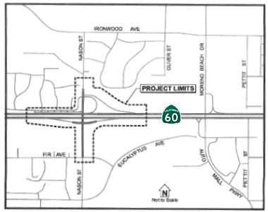 In April 2012, the CTC approved
for future consideration of funding a project in Riverside County that
will replace the existing two-lane bridge overcrossing at Nason
Street/Route 60 with a new five-lane overcrossing; including median,
shoulders that accommodate bicycles, and 6.5 foot-wide sidewalk. The
project will also widen Nason Street to four through lanes, including
landscaping and soundwall. The project is programmed in the State-Local
Partnership Program (SLPP). The total estimated project cost is
$17,130,000 for capital and support. Construction is estimated to begin in
Fiscal Year 2012-13. The scope, as described for the preferred
alternative, is consistent with the project scope programmed by the
Commission in the SLPP.
In April 2012, the CTC approved
for future consideration of funding a project in Riverside County that
will replace the existing two-lane bridge overcrossing at Nason
Street/Route 60 with a new five-lane overcrossing; including median,
shoulders that accommodate bicycles, and 6.5 foot-wide sidewalk. The
project will also widen Nason Street to four through lanes, including
landscaping and soundwall. The project is programmed in the State-Local
Partnership Program (SLPP). The total estimated project cost is
$17,130,000 for capital and support. Construction is estimated to begin in
Fiscal Year 2012-13. The scope, as described for the preferred
alternative, is consistent with the project scope programmed by the
Commission in the SLPP.
In May 2012, the CTC authorized $1 million to rebuild the Route 60 intersection with Nason Street in Moreno Valley.
In December 2018, the CTC relinquished right of way in
the city of Moreno Valley (City) on and along Nason Street, consisting of
collateral facilities (08-Riv-60-PM 18.33/18.36). The City, by Resolution
No. 2017-52 adopted October 2, 2017, agreed to waive the 90-day notice
requirement and accept title upon relinquishment by the State.
(Source: December 2018 CTC Minutes, Agenda Item 2.3c)
In December 2020, the CTC approved an allocation of $16,800,000 for the
locally-administered Senate Bill 1 (SB 1) Trade Corridor Enhancement
Program (TCEP) Route 60 Truck Safety and Efficiency Project (08-Riv-60 PM
18.8/19.6) – Phase 1A (PPNO 08-3010T ProjID 0812000059 EA 32303).
This project is located on Route 60 and Moreno Beach Drive in the City of
Moreno Valley, County of Riverside. This specific project component is the
second phase of an interchange project that will replace a 50-year old
2-lane bridge with a new 6-lane bridge, reconfigure the north side of
Route 60/Moreno Beach Drive Interchange, and build an associated freeway
auxiliary lane. Because the bridge is so narrow, trucks are restricted on
the eastbound offramp to right- hand (southerly) turns only. The
allocation provides $16,800,000 in Const. funding.
(Source: December 2020 CTC Agenda, Agenda Item
2.5s.(4))
In May 2019, it was reported that the name of a planned Moreno Valley
warehouse complex will appear on Route 60 Freeway exit signs after action
by the Moreno Valley City Council, replacing the name of a city pioneer
will soon disappear from the freeway corridor. Caltrans spokeswoman
Jocelyn Whitfield said the new freeway signs likely will be put up in
early 2020. In February 2018, the council changed the name of part of
Theodore Street (RIV 21.378) — earlier named for Theodore Clark, a
city founder — to World Logistics Center Parkway south of Route 60.
The World Logistics Center is Highland Fairview’s planned
40.6-million-square-foot development on the city’s east side. At the
time, the council left the Theodore name intact to the north. However, in
order for Caltrans to post only one name on freeway signs and not charge
Moreno Valley a significant amount of money for them, city officials were
told the street name had to be the same on both sides of the freeway. So
city staff members sought, and received, narrow council approval Tuesday
for changing the name from Theodore Street to World Logistics Center
Parkway in the section between the freeway and Hemlock Avenue, too. Some
freeway signs will have a shortened version, “WLC Parkway,”
while others will say, “World Logistics Center Parkway.” City
street signs will read, “World Logistics Center Parkway.”
(Source: Press Enterprise (Paywall), 5/24/2019)
World Logistics Parkway (nee Theodore St.) Interchange Replacement - RIV 20.0/22.0
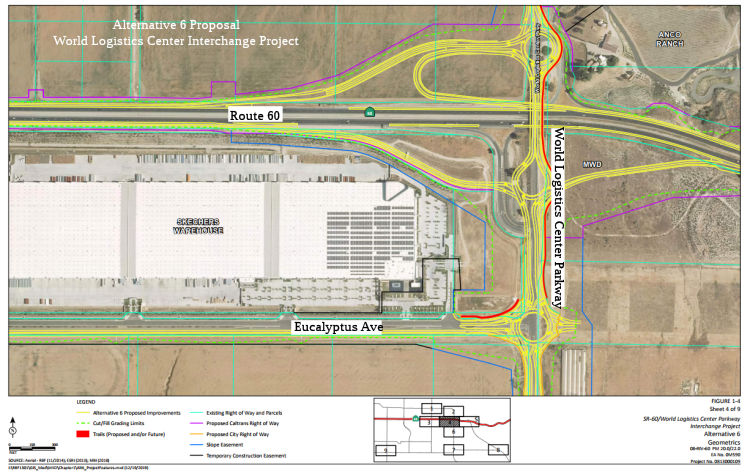 In April 2020, it was announced that a draft EIR was available for public
review regarding the Route 60/World Logistics Center Parkway (WLC Pkwy)
Interchange Project. According to the draft EIR, the City of Moreno Valley
(City), in cooperation with Caltrans District 8, proposes to reconstruct
and improve the Route 60/WLC Pkwy interchange in order to:
In April 2020, it was announced that a draft EIR was available for public
review regarding the Route 60/World Logistics Center Parkway (WLC Pkwy)
Interchange Project. According to the draft EIR, the City of Moreno Valley
(City), in cooperation with Caltrans District 8, proposes to reconstruct
and improve the Route 60/WLC Pkwy interchange in order to:
(Source: Rte 60/World Logistics Center Parkway
Interchange Project Draft EIR/EA, April 2020, provided via email)
According to the draft EIR, the proposed project would construct modifications to the existing Route 60/WLC Pkwy interchange from Post Mile (PM) 20.0 to PM 22.0 on Route 60, approximately 2 miles (mi). Major improvements to the interchange will include:
The project alternatives developed for consideration in the Draft EIR/EA were:
Some of the other alternatives considered in earlier design passes, but later discarded, included:
Two design variations (Design Variations 2a and 6a)
were also under consideration. After comparing and weighing the benefits
and impacts of all feasible alternatives, the project proponent (the City
of Moreno Valley) has identified Build Alternative 6 as the Locally
Preferred Alternative (LPA). According to the Draft EIR, partial grading
for the eastbound off-ramp was completed in 2010 as part of a separate
project and approved by Caltrans under Encroachment Permit No.
08-09-6-DD-0825. No right-of-way for the eastbound off-ramp or other
improvements have been acquired for the proposed project.
(Source: Rte 60/World Logistics Center Parkway
Interchange Project Draft EIR/EA, April 2020, provided via email)
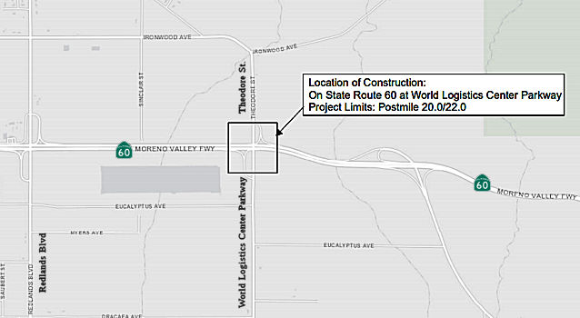 In March 2021, the CTC approved for future consideration of funding the
following project: 08-Riv-60, PM 20.0/22.0. State Route 60 / World
Logistics Center Parkway Interchange Project. Reconstruct and
improve the Route 60/World Logistics Center Parkway interchange in
Riverside County. (FEIR) (EA 0M590) (Local Funds). This project is located
on Route 60 in Riverside County. The project would construct modifications
to the existing SR 60/World Logistics Center (WLC) Parkway interchange
from postmile 20.0 to postmile 22.0 on Route 60. Major improvements to the
interchange would include the following: reconstruction of the westbound
and eastbound Route 60 on-and off- ramps; replacement of the existing WLC
Parkway Overcrossing to provide a minimum 16.5 feet vertical clearance and
additional through and turn lanes; addition of auxiliary lanes in each
direction from Route 60/WLC Parkway to the Redlands Boulevard (west) and
Gilman Springs Road (east) interchange on- and off-ramps. The total
estimated project cost for this project is $71,000,000 for construction
and $28,000,000 for right of way from Local funds. Construction is
estimated to begin 2024-25. A Final Environmental Impact Report (FEIR) has
been completed. Resources that may be impacted by the project include
paleontological resources, Climate Change/Greenhouse Gas (GHG) emissions,
and noise. Potential impacts associated with the project can all be
mitigated to below significance with the exception of Climate Change /
Greenhouse Gas (GHG) emissions and noise, for which a Statement of
Overriding Considerations was prepared.
In March 2021, the CTC approved for future consideration of funding the
following project: 08-Riv-60, PM 20.0/22.0. State Route 60 / World
Logistics Center Parkway Interchange Project. Reconstruct and
improve the Route 60/World Logistics Center Parkway interchange in
Riverside County. (FEIR) (EA 0M590) (Local Funds). This project is located
on Route 60 in Riverside County. The project would construct modifications
to the existing SR 60/World Logistics Center (WLC) Parkway interchange
from postmile 20.0 to postmile 22.0 on Route 60. Major improvements to the
interchange would include the following: reconstruction of the westbound
and eastbound Route 60 on-and off- ramps; replacement of the existing WLC
Parkway Overcrossing to provide a minimum 16.5 feet vertical clearance and
additional through and turn lanes; addition of auxiliary lanes in each
direction from Route 60/WLC Parkway to the Redlands Boulevard (west) and
Gilman Springs Road (east) interchange on- and off-ramps. The total
estimated project cost for this project is $71,000,000 for construction
and $28,000,000 for right of way from Local funds. Construction is
estimated to begin 2024-25. A Final Environmental Impact Report (FEIR) has
been completed. Resources that may be impacted by the project include
paleontological resources, Climate Change/Greenhouse Gas (GHG) emissions,
and noise. Potential impacts associated with the project can all be
mitigated to below significance with the exception of Climate Change /
Greenhouse Gas (GHG) emissions and noise, for which a Statement of
Overriding Considerations was prepared.
(Source: March 2021 CTC Agenda, Agenda Item
2.2c.(6))
In December 2025, the CTC approved an amendment to the
2024 Trade Corridor Enhancement Program that made the following technical
change: The Route 60 / World Logistics Center Parkway Interchange Project,
which was programmed with $25,300,000 for a single component and is being
implemented by the City of Moreno Valley. The project’s 2024 Trade
Corridor Enhancement Program funding includes $23,600,000 for the
right-of-way phase and $1,700,000 for the right-of- way support phase.
Under this amendment, $1,700,000 will be moved from the right-of- way
support phase to the right-of-way phase, resulting in $25,300,000 for the
right-of- way phase and $0 for the right-of-way support phase. This
project will replace a nonstandard overpass to eliminate bridge strikes
from freight vehicles, construct new and upgraded on- and off-ramps to
provide sufficient length for merging, replace signalized intersections
with roundabouts to improve traffic flow, and add multiuse paths,
sidewalks, and bike lanes to improve community safety and connectivity.
(Source: December 2025 CTC Agenda, Agenda Item 4.16)
Badlands Truck Lanes (RIV 22.1/26.5)
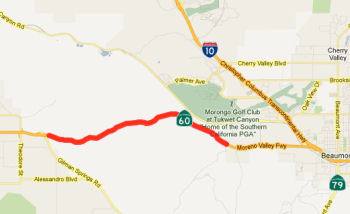 In June 2012, it was reported that accident
statistics prompted Riverside County transportation officials to make
construction of truck lanes along Route 60 in the Badlands (i.e., between
Moreno Valley and Beaumont) a high priority, and that they have forged an
agreement with Caltrans to fund the work. Construction is expected to
begin in 2016. Specifically, in June 2012, the RCTC approved partnering
with Caltrans to spend $84 million to build the truck climbing lanes in
both directions along Route 60 from Gilman Springs Road east of Moreno
Valley to Jack Rabbit Trail near Beaumont. Trucks account for about
one-sixth of the 53,000 vehicles that use Route 60 in both directions at
Gilman Springs each day, according to 2010 traffic counts conducted by
Caltrans. Construction will rely on $27 million from Caltrans and up to
$57 million from the transportation commission. Much of the money will
come from federal funds awarded to the transportation commission for
congestion relief intended to achieve air quality improvements. Since
2009, transportation crews have raised the height of the median dividing
east- and westbound traffic, installed rumble strips along the shoulders
to warn drivers when they stray from the driving lanes and erected
electronic signs that alert drivers of their speed. The truck climbing
lanes were included when they asked voters in 2002 to extend the
county’s half-cent sales tax for transportation improvements. The
lanes are among $4.6 billion in road, rail and transit projects planned
through 2039. It was also noted that the project received an infusion of
funds in late 2012 for planning and engineering; these funds coming from
earmarks that were not ready for construction. One of these projects was
the new interchange at Potero Blvd and Route 60 in Beaumont (see below).
In June 2012, it was reported that accident
statistics prompted Riverside County transportation officials to make
construction of truck lanes along Route 60 in the Badlands (i.e., between
Moreno Valley and Beaumont) a high priority, and that they have forged an
agreement with Caltrans to fund the work. Construction is expected to
begin in 2016. Specifically, in June 2012, the RCTC approved partnering
with Caltrans to spend $84 million to build the truck climbing lanes in
both directions along Route 60 from Gilman Springs Road east of Moreno
Valley to Jack Rabbit Trail near Beaumont. Trucks account for about
one-sixth of the 53,000 vehicles that use Route 60 in both directions at
Gilman Springs each day, according to 2010 traffic counts conducted by
Caltrans. Construction will rely on $27 million from Caltrans and up to
$57 million from the transportation commission. Much of the money will
come from federal funds awarded to the transportation commission for
congestion relief intended to achieve air quality improvements. Since
2009, transportation crews have raised the height of the median dividing
east- and westbound traffic, installed rumble strips along the shoulders
to warn drivers when they stray from the driving lanes and erected
electronic signs that alert drivers of their speed. The truck climbing
lanes were included when they asked voters in 2002 to extend the
county’s half-cent sales tax for transportation improvements. The
lanes are among $4.6 billion in road, rail and transit projects planned
through 2039. It was also noted that the project received an infusion of
funds in late 2012 for planning and engineering; these funds coming from
earmarks that were not ready for construction. One of these projects was
the new interchange at Potero Blvd and Route 60 in Beaumont (see below).
In November 2015, it was reported that the reserved
truck lanes on Route 60 between Gilman Springs Road and Jack Rabbit Trail
are closer. In cooperation with the California Department of
Transportation, the Riverside County Transportation Commission has
proposed an eastbound truck-climbing lane and westbound truck-descending
lane on a 4.5-mile stretch of Route 60. Inside and outside standard
shoulders in both directions are also part of the $138 million project,
according to official Caltrans documents. The suggested truck lanes were
brought to the table as a safety project. Mountainous terrain, inside
narrow shoulders, and a concrete median barrier have caused problems for
passenger vehicles passing slower moving trucks. With trucks already
regulated to drive slower than other motorists, an uphill climb reduces
truck speed even more, up to a 14 mph difference. On downgrade slopes,
truck speed is also reduced for safety purposes. Caltrans crash data for
the targeted westbound section of Route 60 reveal a rate more than twice
that of total statewide crash rates. Eastbound Route 60 also reported a
higher rate of crashes. Most crashes were either a rear-end collision or a
hit object. Eastbound lanes experienced more sideswipes, consistent with
more vehicles trying to pass trucks on a steep incline. Less than 20% of
crashes in either direction of Route 60 involved a tractor-trailer.
However, more than 20% of reported crashes involved a pickup/panel truck.
Primary factors in the majority of crashes were either speeding or an
improper turn. A 0.5-cent sales tax will fund a portion of the costs, with
state and federal funds also contributing. Caltrans hopes to begin the
project in mid-2017 and complete the lanes by early 2020.
(Source: Landline Magazine, 11/18/2015)
In October 2016, the CTC approved for future consideration of funding a project in Riverside County will construct an eastbound truck-climbing lane, a westbound truck-descending lane, and shoulders in both directions on Route 60 near the city of Moreno Valley. The project is programmed in the 2016 State Highway Operation and Protection Program. The total programmed amount is $15,000,000 for capital and support. Construction is estimated to begin in Fiscal Year 2017-18. The scope, as described for the preferred alternative, is consistent with the project scope programmed by the Commission in the 2016 State Highway Operation and Protection Program.
In May 2017, the CTC requested delay in the implementation of this project due to current litigation surrounding the approved Environmental Document. Specifically, they requested to delay construction from FY 2017-18 to FY 2018-19. The project received Environmental approval in May 2016. Subsequently, a lawsuit was filed claiming that a higher-level environmental document should have been processed for compliance with the California Environmental Quality Act (CEQA). Currently, RCTC and the Department are proceeding with the Design phase and Right of Way acquisition. However, the project advertisement schedule will be on hold until the lawsuit is settled or a judgement becomes available. The Department is optimistic that a construction allocation delay to FY 2018-19 will allow sufficient time for the resolution of legal proceedings. This delay was approved in June 2017.
The 2018 STIP, approved at the CTC March 2018 meeting, appears to make a technical adjustment in the allocation of the construction funding, which appears to be in FY18-19. This is PPNO 0046J, Near Beaumont. Construct new eastbound and westbuond truck lanes from Gilman Springs Road to 1.47 miles west of Jack Rabbit Trail and upgrade existing inside and outside shoulders to standard width.
In August 2018, it was reported that the Badlands
project received a boost when the California Transportation Commission
allocated $71.5 million in state money for the truck lanes. As is typical
with transportation projects, this one is being financed by cash cobbled
together from various sources: $80 million in state grants, $47 million in
federal dollars and $11 million from Measure A, Riverside County’s
half-cent transportation sales tax. The decision follows last
month’s announcement that environmental groups were dropping a legal
challenge. The groups included the Center for Biological Diversity, Sierra
Club, Residents for a Livable Moreno Valley, San Bernardino Valley Audubon
Society and Friends of the Northern San Jacinto Valley. They sued in 2016,
arguing the project would lure more truck traffic to the area. Proponents
maintained the special lanes were about improving safety, not increasing
the road’s capacity. This provides the remaining funding piece for
the $138 million project, allowing construction to commence. Some of the
funding was made possible by SB1, state legislation that provided funding
for transportation projects throughout California. Construction is set to
begin in summer of 2019, with an estimated completion date of 2022. The
agency intends to build a truck lane in each direction in a 4.5-mile
stretch between Gilman Springs Road near Moreno Valley and the base of a
hill 1.4 miles west of Jack Rabbit Trail, close to Beaumont. While
they’re at it, construction workers will widen the narrow shoulders
to standard 10-feet and 12-feet widths, while reducing steepness and
moderating the sharpest curves. The finished product would be similar,
though not as long or straight, as the system of truck lanes Las
Vegas-bound travelers encounter on I-15 in the Mojave Desert near the town
of Baker. While it's a project designed first and foremost to improve
safety in the area, it should also reduce commute times.
(Source: KABC, 8/21/2018; PressEnterprise,
8/17/2018)
In August 2018, the CTC approved an allocation of
$31,555,000 for the locally-administered State Transportation Improvement
Program (STIP) Route 60 Truck Climbing/Descending Lanes project (PPNO
0046J), in Riverside County. Contribution from other sources: $87,085,000
that includes SHOPP funding of $40,000,000.
(Source: August 2018 CTC Agenda Item 2.5c(2))
In June 2019, it was reported that construction has
begun on two truck lanes that will widen four-and-a-half miles of Route 60, between Gilman Springs Road and Jack Rabbit Trail. The project will
include construction of an eastbound truck climbing lane and a westbound
truck descending lane that will be 11 feet on the interior shoulder and 12
feet on the outside shoulder. It also will increase the median barrier
height by 6 to 10 inches and flatten roadway curves. There also will be
two wildlife crossings. Lastly, the project also will add 18 feet on
either side. Westbound lane closures will commence at the end of July and
continue through the end of December. There will be one lane open during
the construction. The project will go through five phases and should be
completed by the end of 2021. Funding for the $135 million project is
derived from federal, state funds and the Measure A voter-approved
half-cent sales tax for transportation improvements in Riverside County.
(Source: Record Gazette, 6/2/2019)
In October 2019, it was reported that Caltrans was
continuing to make headway with construction of the Route 60 Truck Lanes
Project, with a focus in September on excavation, drainage, wildlife
crossings, and dust control. On the north side of Route 60, crews are
building large slopes to excavate and deposit excess dirt from the
hillsides. The team is moving an average of 15,000 cubic yards of dirt per
day to adjacent fill locations. This will prevent dirt from needing to be
hauled off-site, saving 14,000 truck trips to and from the project area.
During this intensive earthwork period, known as Stage 2A, crews are
moving a total of 2.1 million cubic yards of dirt. The stage began August
22 with the closure of one westbound lane on Route 60 for about six
months. This single lane closure will be in place 24/7 for the safety of
construction crews and motorists. Stage 2A also requires crews to extend
drainage systems on the north side of Route 60 so that the roadway can be
widened. Our crews are constructing a total of 123 drainage systems. In
addition, crews are building two 20-foot by 20-foot wildlife crossings
during Stage 2A. Deer, mountain lions, bobcats, coyotes, raccoons, skunks,
and other animals will be using these crossings beneath the roadway. The
large crossings will allow daylight to enter, making it more likely for
animals to use the underground crossings for safe passage.
(Source: October 2019 Shifting Gears Newsletter)
In February 2020, it was reported that crews were ready
to reopen the right westbound lane in the Route 60 badlands, removing the
limitation of travelers to one lane while heading to Moreno Valley and
Riverside. A paving phase is expected to begin in summer 2020 in the
westbound lanes and that will be followed by work in the eastbound lanes.
The project covers a 4.5-mile stretch and construction is scheduled to
last through most of 2021. Once completed, the road will have the truck
lanes, widened shoulders, higher center medians, improved visibility and
wildlife crossings under the road. Construction crews were using the right
westbound lane to set up shop and work on that direction's truck lane from
Gilman Springs Road and 1.4 miles west of Jack Rabbit Trail. According to
the traffic commission, crews excavated 1.3 million cubic yards of dirt
and that represents 60% of the amount that needs to be removed to make
space for the new lanes and widened shoulders. The lane reduction forced
motorists into a single, narrow lane and a line of vehicles often
stretched east beyond the construction zone during the busiest hours of a
day.
(Source: Desert Sun, 2/21/2020)
In March 2020, the CTC approved the 2020 STIP, which
continued the programmed funding for PPNO 0046J "Rt 60Truck Climb/Descend
Ln w/shoulders (SHOPP)(16S-14)"
(Source: March 2020 CTC Agenda, Item 4.7, 2020 STIP
Adopted 3/25/2020)
In June 2021, it was reported that as part of the Route 60 Truck Lanes Project in the "Badlands" there will be two 20-by-20
concrete underpasses that are 200 feet in length, connecting the north
side of the freeway to the south side, that will serve as wildlife
crossings. In addition to the underpasses will be other passageways that
include seven new concrete culverts or large pipes ranging from 36 inches
to 60 inches in diameter. In total, the wildlife underpasses cost about
$7.5 million. These underground passageways as wildlife walkways, allowing
mountain lions, coyotes, bobcats, deer, as well as bats and endangered
bird species, to safely travel back and forth between their native
chaparral habitat, looking for nourishment or a mate. Some smaller
drainage pipes built in 1935 have been used by larger mammals to get to
the other side safely. But some animals don’t know of their
existence and end up being hit by vehicles while trying to cross the
freeway. One of the two was completed in April. The other will be finished
by the end of June. To prevent animals from darting across the lanes,
fencing will direct the animals to the sub-surface culverts and
concrete-box underpasses.
(Source: Press Enterprise, 6/8/2021)
In May 2022, it was reported that the truck lanes
through the Badlands had been opened. Vehicles began using the lanes on
Route 60 between Moreno Valley and Beaumont on 5/20/2022. The lanes go for
nearly 5 miles in the steep and hilly area. The opening marked the
culmination of a $138 million project that started in June 2019 with
design work. The freeway through that spot had two lanes on each side,
with narrow shoulders and sharp curves. As trucks slowed while climbing
the hills east of Moreno Valley, cars would stack up behind them. The
route through the hills now includes an eastbound truck-climbing lane and
a westbound truck-descending lane for 4.5 miles between Gilman Springs
Road and 1.4 miles west of Jack Rabbit Trail. The truck lanes, built next
to the freeway shoulders, will separate slower-moving big rigs from
regular vehicles that can use the two left lanes in both directions.
Shoulders also have been widened to offer more room for drivers to pull
over if needed and for emergency responders, the release states. Curves in
the road were straightened to make it easier for drivers to see. Two
wildlife crossings under the road will let coyotes, bobcats, mountain
lions, deer, and other animals pass below the traffic to lessen the chance
of vehicles striking them.
(Source: Press Enterprise, 5/20/2022)
State Route 60/Potrero Boulevard New Interchange Project (08-Riv-60, PM 28.03/30.42)
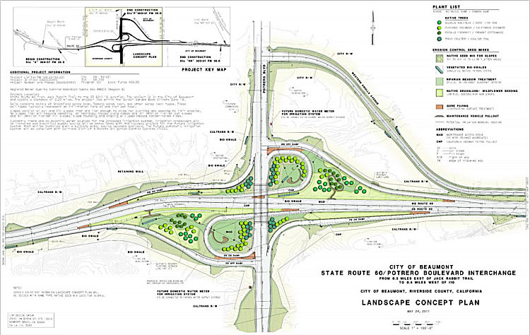 The SAFETEA-LU act, enacted in August 2005 as the
reauthorization of TEA-21, provided the following expenditures on or near
this route:
The SAFETEA-LU act, enacted in August 2005 as the
reauthorization of TEA-21, provided the following expenditures on or near
this route:
In May 2013, the CTC approved for future consideration of funding a project on Route 60 that will construct new interchange at Potrero Boulevard in the city of Beaumont. It will do this in two phases. Phase 1 will construct an overcrossing on Route 60 at Potrero Boulevard and use an existing connection at Western Knolls Avenue for temporary access to Route 60. Phase 2 will widen Potrero Boulevard to six lanes, construct exit and entry ramps, realign Western Knolls Avenue, and remove the connection at Western Knolls Avenue to Route 60. The project is entirely funded with federal and local dollars. The project will need an approval for a new public road connection from the Commission. The total estimated cost for construction and support for both phases is $78,330,000. Construction for Phase 1 is estimated to begin in Fiscal Year 2013-14.
According to a Beaumont planning document, Phase 1 was
later divided into Phases 1 and 1A. Phase 1 consists of:
(Source: Potrero Interchange, not dated)
Phase 1A consisted of:
These phases were to be constructed under Caltrans Permit Process, a streamlined process to complete minor improvements on Caltrans right of way, with a cost of approximately $2.23 million. The City obtained a permit for Phase 1A, but the work was never completed and the permit expired in 2015.
Phase 2 consisted of:
In 2016, the City restarted the process, with a planned
completion of Phases 1 and 1A in May 2018. At that time Portrero Boulevard
functioned mainly as a frontage road along Route 60, though it has
standard entrance and exit points on the freeway where it meets Western
Knolls Avenue. In February 2018, it was reported that more than a dozen
years after federal funding kicked off the Potrero Boulevard Interchange
Project, Pass Area leaders broke ground. The first phase of the Potrero
Boulevard Interchange Project is expected to be completed in February 2019
and will involve constructing a six-lane bridge over Route 60, between
Jack Rabbit Trail and the I-10/Route 60 junction in Beaumont. The new
overcrossing will feature a partial cloverleaf design and enable motorists
to smoothly and directly transition on and off Route 60 using Portrero,
which ends at the freeway and stretches north to Oak Valley Parkway, where
there are multiple subdivisions. In October 2018, it was reported that
Potrero Blvd and Western Knolls would be re-opening on Wednesday, October
17th following a realignment with the interchange. According to
city officials, additional phases of the project are planned that include
construction of an extension of Western Knolls from the westbound side of
Route 60 to Portrero, further reducing traffic congestion near the
I-10/Route 60 junction. Phase 2 also includes westbound and eastbound
diagonal and loop entry ramps (2 lanes plus HOV lane); extended ramp
acceleration/deceleration lanes; realignment of Western Knolls Avenue; and
removal of Western Knolls Avenue connections to Route 60. More funding
must come available before the additional phases can be initiated.
(Source: Potrero Interchange Project Website a/o 4/3/2019; Banning/BeaumontPatch,
2/2/2018)
In June 2023, the adoption of the 2022 Trade Corridor
Enhancement Program included the following description of a program: Route 60 Potrero Boulevard Interchange. This interchange will relieve congestion
on the national freight system by providing a new connection on Route 60
for trucks accessing freight clusters along Potrero Boulevard and 4th
Street. A reduction in congestion supports the high volume of goods
movement in the area and provides a unique opportunity to reduce vehicle
miles traveled by offering a more direct connection for freight vehicles.
Improved safety is another feature the Project offers with the closure of
two existing interchanges where collisions between fast-moving passenger
vehicles come into conflict with slow-moving freight vehicles.
(Source: June 2023 CTC Agenda, Agenda Item 4.5)
 In June 2025, the CTC approved for future consideration
of funding 08-Riv-60, PM 28.03/30.42; PPNO 08-1321. State Route 60/Potrero Boulevard New Interchange Project. Construct new
interchange on Route 60 at Potrero Boulevard in Riverside County. The
project features construction of a new full access interchange and bridge
overcrossing on Route 60 for Potrero Boulevard. The project limits begin
east of Jack Rabbit Trail and end west of Route 60 and the I-10 junction.
Phase 1 includes construction of a new 6-lane bridge overcrossing at Route 60 with a temporary connection to Western Knolls Avenue. Phase 2 includes
constructing the westbound and eastbound diagonal and loop entry ramps,
extended ramp acceleration and deceleration lanes, realignment of Western
Knolls Avenue, and removal of Western Knolls Avenue connections to Route 60. The project is currently programmed in the 2024 STIP. The total
programmed amount, which includes Construction (Capital and Support) is
$70,113,000 in SB 1 TCEP. Construction will begin in 2024-25. The scope,
as described for the preferred alternative, is consistent with the project
scope as programmed by the Commission in the 2024 STIP. The Commission
approved the project for future consideration of funding on May 7, 2013,
under Resolution E-13-42. Since the approval of the MND, there have been
changes to the project and an Addendum was prepared pursuant to CEQA.
Specifically, the Addendum addresses scope revisions and design
refinements, including removing an auxiliary lane, relocating a gas line,
adding a new roadway taper at the north end of the project limits, and
reducing grading impacts at the south end of the project limits. Project
impacts would remain less than significant with mitigation. The project
changes do not meet the criteria outlined under CEQA Guidelines Section
15162 to prepare a Subsequent MND. As a result, the Department completed
an Addendum to the MND pursuant to CEQA.
In June 2025, the CTC approved for future consideration
of funding 08-Riv-60, PM 28.03/30.42; PPNO 08-1321. State Route 60/Potrero Boulevard New Interchange Project. Construct new
interchange on Route 60 at Potrero Boulevard in Riverside County. The
project features construction of a new full access interchange and bridge
overcrossing on Route 60 for Potrero Boulevard. The project limits begin
east of Jack Rabbit Trail and end west of Route 60 and the I-10 junction.
Phase 1 includes construction of a new 6-lane bridge overcrossing at Route 60 with a temporary connection to Western Knolls Avenue. Phase 2 includes
constructing the westbound and eastbound diagonal and loop entry ramps,
extended ramp acceleration and deceleration lanes, realignment of Western
Knolls Avenue, and removal of Western Knolls Avenue connections to Route 60. The project is currently programmed in the 2024 STIP. The total
programmed amount, which includes Construction (Capital and Support) is
$70,113,000 in SB 1 TCEP. Construction will begin in 2024-25. The scope,
as described for the preferred alternative, is consistent with the project
scope as programmed by the Commission in the 2024 STIP. The Commission
approved the project for future consideration of funding on May 7, 2013,
under Resolution E-13-42. Since the approval of the MND, there have been
changes to the project and an Addendum was prepared pursuant to CEQA.
Specifically, the Addendum addresses scope revisions and design
refinements, including removing an auxiliary lane, relocating a gas line,
adding a new roadway taper at the north end of the project limits, and
reducing grading impacts at the south end of the project limits. Project
impacts would remain less than significant with mitigation. The project
changes do not meet the criteria outlined under CEQA Guidelines Section
15162 to prepare a Subsequent MND. As a result, the Department completed
an Addendum to the MND pursuant to CEQA.
(Source: June 2025 CTC Agenda, Agenda Item 2.2c.(4) #4)
In June 2025, the CTC approved the
following TCEP allocation: $33,500,000. 08-Riv-60 28.03/30.42. PPNO
08-1321; ProjID 0800020445; EA 34142. SR-60/Potrero Boulevard
Interchange Phase II. On Route 60 between Jack Rabbit Trail &
Route 60/I-10 Junction phase 2: new interchange on/off ramps. construct
Westbound/Eastbound Exit Ramps (2 lanes) and Westbound/Eastbound Loop
Entry Ramps (2 lanes) (entry ramps including HOV lane), realign Western
Knolls Avenue, and remove Western Knolls Avenue Connection to Route 60.
CEQA - MND, 03/01/2013; Re-validation 05/27/2025. NEPA - FONSI,
05/12/2012; Re-validation 05/27/2025. Future consideration of funding
approved under Resolution E-13-42; May 2023. Concurrent addendum for the
previously approved future consideration of funding under Resolution
E-25-44A; June 2025. Right of Way Certification: 05/16/2025. Contribution
from other sources: $24,500,000. Allocation: TCEP-S/24-25⇒ CONST
$33,500,000.
(Source: June 2025 CTC Agenda, Agenda Item 2.5s.(17))
In December 2025, it was reported that the Riverside
County Transportation Commission approved more than $156 million in
construction contracts for two regionally significant projects during its
December 10, 2025 meeting: Mid County Parkway Ramona Expressway and Route 60/Potrero Boulevard Interchange – Phase II. In the San Gorgonio
Pass, the City of Beaumont has partnered with RCTC and Caltrans to deliver
Phase II of the Route 60/Potrero Boulevard Interchange. The project will
build a new interchange at Route 60, realign Western Knolls Avenue, and
widen Potrero Boulevard to six lanes. These enhancements will make it
easier to access Route 60 and support ongoing residential and economic
growth in Beaumont and across Riverside County. Construction for both
projects will begin in early 2026.
(Source: RCTC, 12/22/2025)
Commuter LanesHOV lanes are planned from the E Route 215 junction to Redlands Blvd.
NamingThis segment of Route 60 is named the "Moreno Valley Freeway". It was named by Senate Concurrent Resolution 45, Chapter 103, in 1989.
 The portion of Route 60, from Pyrite Street (~ RIV R5.576) in the City of Jurupa Valley
to Valley Way in the City of Jurupa Valley (~ RIV 7.544), in the County of
Riverside is named the “Deputy Isaiah A. Cordero Memorial
Highway”. It was named in memory of Isaiah A. Cordero, who
was born in May 1990. Isaiah graduated from Cajon High School in the City
of San Bernardino, with the goal to become a Deputy Sheriff and to
eventually become a Motorcycle Enforcement Deputy. On May 5, 2014, Isaiah
fulfilled his first goal and began his career with the Riverside County
Sheriff’s Department as a Correctional Deputy. Isaiah worked in two
different correctional facilities before reclassifying to a Deputy Sheriff
in 2017. Isaiah graduated from the 204th Basic Academy in
February of 2018 and returned to working in a correctional facility as a
Deputy Sheriff. In 2020, Isaiah was transferred to the Jurupa Valley
Sheriff’s Station to begin field training. After successfully
completing the field training program, he was assigned to patrol the
cities and unincorporated communities served by the Jurupa Valley
Sheriff’s Station, including the incorporated cities of Jurupa
Valley, Eastvale, and Norco. In 2022, Isaiah was selected to undergo
motorcycle training to become a Motorcycle Enforcement Deputy. After
successfully completing a rigorous POST-certified motorcycle training
course, he accomplished his second goal and began patrolling the streets
as a Motorcycle Enforcement Deputy. Isaiah was specifically assigned to
conduct traffic enforcement on his motorcycle in the City of Jurupa
Valley. On December 29, 2022, at 32 years of age, Isaiah was shot in the
City of Jurupa Valley, when he pulled over an individual for a traffic
violation; and he was immediately transported to Riverside Community
Hospital, but he succumbed to his injuries and passed away later that
night. Named by Senate Concurrent Resolution (SCR) 16, Res. Chapter 134,
Statutes of 2023, 08/23/23.
The portion of Route 60, from Pyrite Street (~ RIV R5.576) in the City of Jurupa Valley
to Valley Way in the City of Jurupa Valley (~ RIV 7.544), in the County of
Riverside is named the “Deputy Isaiah A. Cordero Memorial
Highway”. It was named in memory of Isaiah A. Cordero, who
was born in May 1990. Isaiah graduated from Cajon High School in the City
of San Bernardino, with the goal to become a Deputy Sheriff and to
eventually become a Motorcycle Enforcement Deputy. On May 5, 2014, Isaiah
fulfilled his first goal and began his career with the Riverside County
Sheriff’s Department as a Correctional Deputy. Isaiah worked in two
different correctional facilities before reclassifying to a Deputy Sheriff
in 2017. Isaiah graduated from the 204th Basic Academy in
February of 2018 and returned to working in a correctional facility as a
Deputy Sheriff. In 2020, Isaiah was transferred to the Jurupa Valley
Sheriff’s Station to begin field training. After successfully
completing the field training program, he was assigned to patrol the
cities and unincorporated communities served by the Jurupa Valley
Sheriff’s Station, including the incorporated cities of Jurupa
Valley, Eastvale, and Norco. In 2022, Isaiah was selected to undergo
motorcycle training to become a Motorcycle Enforcement Deputy. After
successfully completing a rigorous POST-certified motorcycle training
course, he accomplished his second goal and began patrolling the streets
as a Motorcycle Enforcement Deputy. Isaiah was specifically assigned to
conduct traffic enforcement on his motorcycle in the City of Jurupa
Valley. On December 29, 2022, at 32 years of age, Isaiah was shot in the
City of Jurupa Valley, when he pulled over an individual for a traffic
violation; and he was immediately transported to Riverside Community
Hospital, but he succumbed to his injuries and passed away later that
night. Named by Senate Concurrent Resolution (SCR) 16, Res. Chapter 134,
Statutes of 2023, 08/23/23.
(Image source: Riverside Sheriff's Association)
 Named Structures
 The Nason Street Interchange in Moreno Valley (~ RIV 18.352) is named the "Sonny Bono Memorial Interchange". As
if you didn't know the story, Sonny Bono left his boyhood home in Detroit,
Michigan for Hollywood, California at a young age to become a star in show
business. His quest led him to a laborer's job as a meat truck driver and
deliveryman and then in promotions for a record company. Sonny Bono
parlayed those jobs into an opportunity to showcase his ability as a
showman and entertainer. Those talents eventually led to a career of fame
as a recording and television star as part of the duo Sonny and Cher.
Later, Sonny Bono pursued another dream as a restaurant owner in Palm
Springs. His concern on behalf of his community as a businessman led him
to public service eventually leading to his election as Mayor of Palm
Springs in 1988. Sonny Bono's public service career eventually led him to
the halls of the Congress of the United States in 1994 as the
Representative from the Coachella Valley and Western Riverside County
areas of southern California. Sonny Bono's achievements as a Congressman
brought needed national attention to the environmental needs of the Salton
Sea; he also worked on behalf of bringing the needed federal funding for
transportation and infrastructure projects for the Coachella Valley,
leading to funding for significant highway improvements throughout the
Coachella Valley and Riverside County. Named by Senate Concurrent
Resolution 99, Chapter 160, on September 20, 2000.
The Nason Street Interchange in Moreno Valley (~ RIV 18.352) is named the "Sonny Bono Memorial Interchange". As
if you didn't know the story, Sonny Bono left his boyhood home in Detroit,
Michigan for Hollywood, California at a young age to become a star in show
business. His quest led him to a laborer's job as a meat truck driver and
deliveryman and then in promotions for a record company. Sonny Bono
parlayed those jobs into an opportunity to showcase his ability as a
showman and entertainer. Those talents eventually led to a career of fame
as a recording and television star as part of the duo Sonny and Cher.
Later, Sonny Bono pursued another dream as a restaurant owner in Palm
Springs. His concern on behalf of his community as a businessman led him
to public service eventually leading to his election as Mayor of Palm
Springs in 1988. Sonny Bono's public service career eventually led him to
the halls of the Congress of the United States in 1994 as the
Representative from the Coachella Valley and Western Riverside County
areas of southern California. Sonny Bono's achievements as a Congressman
brought needed national attention to the environmental needs of the Salton
Sea; he also worked on behalf of bringing the needed federal funding for
transportation and infrastructure projects for the Coachella Valley,
leading to funding for significant highway improvements throughout the
Coachella Valley and Riverside County. Named by Senate Concurrent
Resolution 99, Chapter 160, on September 20, 2000.
(Image source: Wikipedia)
 Classified Landcaped Freeway
The following segments are designated as Classified Landscaped Freeway:
| County | Route | Starting PM | Ending PM |
| Los Angeles | 60 | 0.39 | 6.31 |
| Los Angeles | 60 | R7.54 | 8.89 |
| Los Angeles | 60 | 9.37 | 9.65 |
| Los Angeles | 60 | 10.03 | 11.26 |
| Los Angeles | 60 | 11.47 | 17.45 |
| Los Angeles | 60 | 17.45 | 17.52 |
| Los Angeles | 60 | 17.52 | 17.90 |
| Los Angeles | 60 | 19.74 | 19.80 |
| Los Angeles | 60 | 19.80 | 20.00 |
| Los Angeles | 60 | 20.43 | 20.90 |
| Los Angeles | 60 | 21.81 | 22.38 |
| Los Angeles | 60 | 22.47 | 22.95 |
| Los Angeles | 60 | R25.14 | R26.53 |
| Los Angeles | 60 | 29.37 | 30.39 |
| San Bernardino | 60 | R0.54 | R7.52 |
| San Bernardino | 60 | R7.57 | R8.65 |
| San Bernardino | 60 | R8.73 | R9.08 |
| Riverside | 60 | R1.58 | R1.79 |
| Riverside | 60 | R2.03 | R2.23 |
| Riverside | 60 | R2.67 | R4.73 |
| Riverside | 60 | R4.87 | R5.16 |
| Riverside | 60 | R5.24 | R5.78 |
| Riverside | 60 | R6.12 | R6.65 |
| Riverside | 60 | 6.81 | 9.79 |
| Riverside | 60 | 10.06 | 10.50 |
| Riverside | 60 | 10.70 | 12.20 |
| Riverside | 60 | 12.83 | 17.52 |
| Riverside | 60 | 19.04 | 19.74 |
 Exit Information
 Other WWW Links
 Freeway
[SHC 253.1] Entire route. All of part (1) and the portion of part (2) from Route 215 to Beaumont is constructed to freeway standards. Added to the Freeway and Expressway system in 1959.
 Statistics
Overall statistics for Route 60:
According to the Los Angeles Times in September 2006: An average of 341,000 vehicles a day drove past the Route 57 interchange in Diamond Bar in 2005, up from 287,000 in 1995. In Moreno Valley, 69,000 vehicles passed the Perris Boulevard exit in 2005, an increase of 24,000 vehicles a day since 1995. More than 1,200 drivers a day on average used the carpool lanes on the Route 60 in Los Angeles County during the morning rush hour in 2005, according to a Caltrans report.
 National Trails
 This route is part of the De Anza National Historic Trail.
 This route was part of the Southern National Highway.
 This route was part of the Atlantic-Pacific Highway.
The portion of this route from Moreno/Beaumont to Blythe (and likely beyond into Arizona) was part of the "Jack Rabbit Trail".
 Pre-1964 Legislative Route
The route that would become LRN 60 was first defined in the 1919 Third Bond Act as running from San Juan Capistranto (originally, the town of Serra) to Oxnard (originally, the town of El Rio). In 1925, Chapter 309 extended the route via an act that directed the department “...to acquire necessary rights of way and to construct and maintain a highway, which shall constitute and be a state highway, and to take over any existing public highway along the route hereinafter designated as a part of said state highway, from the town of Oxnard to a point to be selected by the state highway commission at or near the town of El Rio, Ventura county, upon the state highway extending from Los Angeles to Ventura.”
In 1935, the route was codified into the highway code as:
[LRN 2] near El Rio via Oxnard to [LRN 2] south of San Juan Capestrano
In 1957, Chapter 1911 softened the definition to delete the "via Oxnard".
This route ran from LRN 2 (US 101) near El Rio to LRN 2 (US 101) S of San Juan Capistrano. It was originally signed (1935) as Route 3. In 1935, when signage for alternate US highways was introduced it was resigned as US 101A (the numbering as US 101A was approved in 1938). In 1964, it became part of Route 1.
© 1996-2024 Daniel P. Faigin.
Maintained by: Daniel P. Faigin
<webmaster@cahighways.org>.
 Route 59
 Route 61