
 California Highways:
Click here for a key to the symbols used. An explanation of acronyms may be found at the bottom of the page.
 Routing
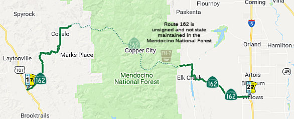 From Route 101 near Longvale to Route 5 near Willows via the vicinity of Covelo
and Mendocino Pass.
From Route 101 near Longvale to Route 5 near Willows via the vicinity of Covelo
and Mendocino Pass.
 Post 1964 Signage History
This segment was transferred from Route 261 in 1972 by Chapter 1216: "(a) Route 101 near Longvale to Route 5 near Willows via the vicinity of Covelo and Mendocino Pass."
 Pre 1964 Signage History
This segment was not a state route before 1965. The route runs (signed as Route 162) along Covelo Road into Covelo. From that point, state maintenance end, but the traversable route then runs E along Mendocino Pass Road (unsigned, but marked FH-7) through the Mendocino National Forest. Mendocino Pass Road becomes Alder Springs Road in Glenn County. Signage of the road resumes near Elk Creek when Route 162 exits the National Forest. The route enters Willows along Wood Street.
 Status
 Unconstructed from Covelo (Mendocino County PM34.05) to near Elk Creek (Glenn County PM37.65). The traversable local routing is
Mendocino Pass Road and Alder Springs Road (both part of Forest Highway
(FH) 7) and the unnamed portions of FH 7. As of October 1997, FWHA,
Caltrans, and the USFS had decided not to reconstruct and pave 47 miles of
FH 7. Mendocino Pass Road is primitive and unsuitable for use in a state
highway. Alder Springs Road was improved in 1972 and repaired in 1978.
Federal funds of $4M were allocated towards the improvement of Route 162 E
of Alder Springs, but the road is still not to state standards.
Unconstructed from Covelo (Mendocino County PM34.05) to near Elk Creek (Glenn County PM37.65). The traversable local routing is
Mendocino Pass Road and Alder Springs Road (both part of Forest Highway
(FH) 7) and the unnamed portions of FH 7. As of October 1997, FWHA,
Caltrans, and the USFS had decided not to reconstruct and pave 47 miles of
FH 7. Mendocino Pass Road is primitive and unsuitable for use in a state
highway. Alder Springs Road was improved in 1972 and repaired in 1978.
Federal funds of $4M were allocated towards the improvement of Route 162 E
of Alder Springs, but the road is still not to state standards.
The 2013 Traversable Highways report notes:
In January 2009, the CTC authorized relinquishment of right of way in the county of Mendocino along Route 162 from Route 101 to 0.1 mile easterly, consisting of superseded highway right of way.
South Eel River Bridge Project - MEN 8.2
 In April 2020, Caltrans posted a Notice of Intent regarding a seismic project to provide
Route 162 at MEN 8.2 with an earthquake-resistant bridge structure capable
of resisting a maximum credible earthquake. Three alternatives are in
consideration for the South Eel River Bridge Project.
In April 2020, Caltrans posted a Notice of Intent regarding a seismic project to provide
Route 162 at MEN 8.2 with an earthquake-resistant bridge structure capable
of resisting a maximum credible earthquake. Three alternatives are in
consideration for the South Eel River Bridge Project.
(Source: Notice from Caltrans District 1 on FB, 4/10/2020)
In January 2021, the CTC approved for future
consideration of funding the following project: 01-Men-162, PM 8.2. South
Eel River Seismic Project. Seismically upgrade South Eel River
Bridge on Route 162 in Mendocino County. (PPNO 4692) This project is
located on Route 162 near Longvale in Mendocino County. The project
proposes to upgrade the South Eel River Bridge to an earthquake-resistant
bridge structure capable of resisting a maximum credible earthquake. This
project is currently programmed in the 2020 State Highway Operation
Protection Program (SHOPP) for a total of $13,339,000 which includes
Construction (capital and support) and Right of Way (capital and support).
Construction is estimated to begin in Fiscal Year 2021-2022. The scope, as
described for the preferred alternative, is consistent with the project
scope programmed by the Commission in the 2020 SHOPP. A Mitigated Negative
Declaration (MND) has been completed. The project will result in less than
significant impacts to the environment after mitigation. The
following resource areas may be impacted by the project: biological
resources. Avoidance and minimization measures will reduce any
potential effects on the environment. These measures include, but are not
limited to, designing the bridge to provide habitat for bat Species of
Special Concern like the habitat that exists presently.
(Source: January 2021 CTC Agenda, Agenda Item
2.2c.(1))
In March 2021, the CTC approved the following
pre-construction SHOPP SB1 support phase allocation(s): (2b) #1.
$1,528,000 (PS&E, $1,295,000 programmed); $149,000 (R/W Sup, $127,000
programmed). 01-Men-162 8.2. PPNO 01-4692; ProjID 0117000223; EA 0A131.
Route 162 Near Longvale, from 8.2 miles to 8.3 miles east of Route 101 at
Eel River Bridge № 10-0236. Bridge seismic retrofit. (Future
consideration of funding approved under Resolution E-21-01; January
2021.) Prog. year 21-22.
(Source: March 2021 CTC Agenda, Agenda Item
2.5b.(2b) #1)
In June 2021, the CTC approved the following amendment
to the 2020 SHOPP: 01-Men-162 8.2 PPNO 4692 ProjID 0117000223 EA 01-0A131.
Route 162 Near Longvale, from 8.2 miles to 8.3 miles east of Route 101 at
Eel River Bridge № 10-0236. Bridge seismic retrofit. Note:
During design, it was determined that replacing the bridge along a new
alignment will reduce impacts to the environment and traveling public.
This change reduced the need for offsite mitigation, thus reducing R/W
capital. The change to a new alignment resulted in additional earthwork,
paving, landscaping, bridge deck area, and guardrail that consequently
increased the construction capital amount. R/W Cap $618K $251K;
Const Cap $6,383K $8,150K; Total $13,339K
$14,739K.
(Source: June 2021 CTC Agenda, Agenda Item
2.1a.(1d) #15)
In August 2022, the CTC approved a request for an
additional $757,000 in PS&E and $140,000 in RW CAP for the SHOPP
Bridge Seismic Restoration project on Route 162, in Mendocino County, to
complete the PS&E and RW phases. The project (01-MEN-162 8/8.4; PPNO
01-4692; ProjID 0117000223; EA 0A131) is on Route 162 near Longvale, from
8.0 miles to 8.4 miles east of Route 101 at Eel River Bridge №
10-0236. Outcome/Output: Bridge seismic retrofit. Route 162 is the
only route to travel in and out of the Round Valley Tribe in the Covelo
area. The project will replace the bridge. This project’s PS&E
and RW phases were programmed for $1,295,000 and $127,000 in the SHOPP for
completion in Fiscal Year 2021-22. In March 2021, the project
received a PS&E allocation for $1,528,000 and RW allocation for
$149,000. In October 2021, the project received G-12 funds in the amount
of $215,000 for RW. In March 2022, the project received G-12 funds in the
amount of $353,000 for PS&E. In June 2022, the project received
a 20-month allocation time extension for the construction phase. The
PS&E phase is currently 80 percent complete and the RW phase is 75
percent complete. The remaining budget is $10,000 for the PS&E
phase and $66,000 for the RW phase, which is insufficient to complete the
phases. The project is scheduled to be Ready to List by October 2022
and is anticipated to complete the remaining PS&E activities by March
2023. The project realized cost increases due to the complex design and
construction scenarios at this location with minimal right of way, a delay
in geotechnical studies, challenging negotiations with an adjacent
property owner, maintaining public access to the river, and additional
coordination with the permitting agencies. The bridge is located in a
remote, rural setting with mountainous terrain at the confluence of two
high flow rivers, and is the only route to service the Round Valley
Tribe. There was an unanticipated delay in drilling, due to the
property owner not allowing a permit to enter, that affected the ability
to finalize design requirements. These delays resulted in
constructability issues that were identified during the review of the
revised design. There has also been a concern from the community
regarding maintaining public access to the river. Currently, the
public encroaches on the property owner’s driveway to access the
river. Additional resources are needed to coordinate with the
community to minimize the encroachment to this property owner and still
maintain some access to the river. Environmental requirements were
later identified to provide provisions for bats, which was not anticipated
and requires further coordination for permits and modifications to the
design. Negotiations with a property owner, for a permanent acquisition,
have also been more challenging than anticipated. Continued efforts
are needed to respond to the property owner. Due to the complex nature of
the acquisition, additional resources have been required for research and
documentation of the project while moving forward toward
condemnation. The ongoing negotiations and condemnation process were
not anticipated and have delayed the project. All efforts and resources
are being used to avoid full condemnation and come to an agreement with
the property owner. However, the property owner is currently
contesting the resolution of necessity and is continually requesting
design changes to minimize the right of way impacts on the property. Staff
time has been required from various functional units to analyze the
property owner’s requests and implement design changes.
Several iterations of analysis and changes have occurred to work with the
property owner to avoid condemnation. The continuous coordination with the
property owner is requiring additional right of way support to resolve the
acquisition issue. The Department has made significant strides
toward reaching an agreement with this property owner. This request
for additional support funding is based on reaching an agreement and does
not include support for a full condemnation process.
(Source: August 2022 CTC Agenda, Agenda Item
2.5e.(1))
In December 2022, the CTC approved, for future
consideration of funding, the following project for which a Mitigated
Negative Declaration (MND) and an Addendum have been completed: Route 162
in Mendocino County (01-Men-162, PM 8.2). Replace the existing bridge with
a new bridge to the south, on Route 162, in Mendocino County. (PPNO
01-4692). This project is located on Route 162, at post mile 8.2, in
Mendocino County. The Department proposes to upgrade the South Eel River
Bridge to an earthquake-resistant bridge structure capable of resisting a
maximum credible earthquake. This project is currently programmed in the
2020 State Highway Operation Protection Program (SHOPP) for a total of
$14,361,000 which includes Construction (capital and support) and Right of
Way (capital and support). Construction began in Fiscal Year 2021-2022.
The scope, as described for the preferred alternative, is consistent with
the project scope programmed by the Commission in the 2020 SHOPP. A MND
was prepared because of potential biological resource impacts. A copy of
the MND has been provided to Commission staff. The Commission approved the
project for future consideration of funding on January 28, 2021, under
Resolution E-21-01. Additional temporary construction easement space for
construction of the structure is needed. Additional space is needed for
construction and temporary traffic delays will now occur under the chosen
Alternative C (construction on new alignment). The Department subsequently
completed an Addendum to the MND pursuant to the California Environmental
Quality Act.The Department has approved this project for construction.
This approval and the Addendum satisfy the environmental requirements for
this stage of the planning process.
(Source: December 2022 CTC Agenda, Agenda Item
2.2c.(8))
In December 2022, the CTC approved a request for
$16,920,000 (112.2% increase) allocation in Construction Capital and
$4,158,000 (4.5% increase) for the SHOPP Bridge Seismic Restoration
project on Route 162, in Mendocino County. (01-Men-162, PM 8.2, PPNO
01-4692, ProjID 0117000223, EA 0A131). On Route 162 Near Longvale, from
8.0 miles to 8.4 miles east of Route 101 at Eel River Bridge №
10-0236. Outcome/Output: Replace bridge to address seismic
deficiencies. CEQA - MND, 12/11/2020; Re-validation 6/23/2022. NEPA - CE,
12/11/2020; Re-validation 6/23/2022. Future consideration of funding
approved under Resolution E-21-01; January 2021. Twenty month time
extension for CONST and CON ENG approved under Waiver 22-73; June 2022. As
part of this allocation request, the Department is requesting to extend
the completion of CONST and CON ENG an additional 34 months beyond the 36
month deadline. In March 2018, this project was programmed in the SHOPP
for $6,383,000 in Construction Capital and $4,179,000 in Construction
Support for allocation in Fiscal Year 2021-22. In June 2021, the
project was amended to modify the scope and revise the programmed amount
to $8,150,000 in Construction Capital. In June 2022, the project was again
amended to split the environmental mitigation from this project and revise
the programmed amount to $7,972,000 in Construction Capital and $3,979,000
in Construction Support and the project received a 20-month construction
allocation time extension. In September 2022, the Engineer’s
Estimate (EE) reflected the need of $16,920,000 in Construction Capital
(112.2 percent over the programmed amount) and $4,158,000 in Construction
Support (4.5 percent over the programmed amount). The Department
plans to advertise the project in January 2023, and begin construction in
June 2023. Construction is planned for three construction seasons with a
duration of 585 working days. The Construction Capital and Support
estimates are higher than the original programmed amounts due to the
changes in the design of the roadway alignment and bridge
foundation, and significant increases as a result of the current
volatile prices of the bid items and an increase in the number of working
days for the project. The bridge is located in a remote, rural setting
with mountainous terrain at the confluence of two high flow rivers, and is
the only route to service the Round Valley Tribe. The Department has
seen an escalation in bid item prices due to the fluctuations in the
economy caused by inflation, supply chain shortages, and fuel costs.
As a result of the volatile bid item prices fluctuating greatly, it has
created a risk for contractors bidding on projects and has resulted in an
exponential increase in bids received.
(Source: December 2022 CTC Agenda, Agenda Item
2.5d.(1))
 Naming
Historically, this route is close to the original "El Camino Real" (The Kings Road). A portion of this route has officially been designated as part of "El Camino Real by Assembly Bill 1707, Chapter 739, on October 11, 2001. [Note: That's what the bill says. Likely, there was an error and what was meant was Route 262. Still, we go by what is in the state highway code, so this is named part of El Camino Real, no matter what the reality is. -- DPF]
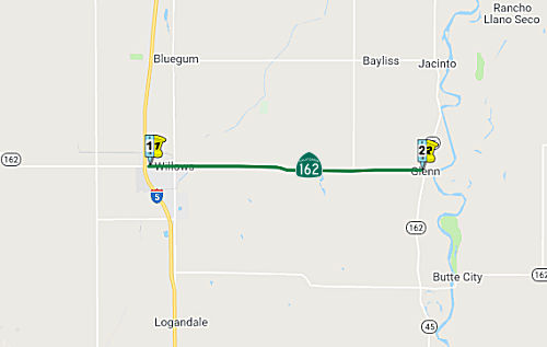 From Route 5 near Willows to Route 45.
Post 1964 Signage HistoryThis segment was defined in 1963 as the original (a).
Pre 1964 Signage HistoryThis segment was part of LRN 45, defined in 1919. It was not a signed route before 1964.
Naming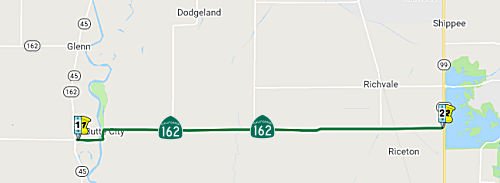 From Route 45 to Route 99 near Biggs.
Post 1964 Signage HistoryThis segment was defined in 1963 as the original (b).
Pre 1964 Signage HistoryThis segment was part of LRN 45, defined in 1919. This does not appear to have been signed before 1964.
StatusSacramento River Bridge (03-Gle-162, PM 76.3/78.6)
In March 2016, it was reported that Caltrans was
reconsidering a number of alternatives to demolishing and replacing the
Sacramento River Bridge on Route 162 near Butte City. The original plans
was that Caltrans would demolish the current steel truss bridge —
built in 1947 and no longer earthquake-safe — and build a new one
along the current road alignment. That approach would close Route 162 at
the crossing for 18 months, spanning from June 2020 to November 2021.
Caltrans proposed redirecting traffic — an average of 2,400 vehicles
per day, 20% of which are trucks — on a 34-mile detour to use the
bridge at Ordbend. Many members of the public were curious as to why a new
bridge could not be built beside the old one, so that Route 162 could
remain open during construction. The primary challenge to that approach is
connecting a new bridge to the causeway leading up to the old one. Other
options include putting a temporary bridge in place, but additional costs
would be added with that approach, also. After hearing comments from the
public, Caltrans is re-evaluating.
(Source: Andy3175 @ AAroads, 3/3/2016; Appeal-Democrat, 2/23/2016)
In June 2019, the CTC approved for future consideration
of funding project is located on Route 162 near Butte City in Glenn County
(03-Gle-162, PM 76.3/78.6). The project proposes to replace the Sacramento
River Bridge (No. 11-0017). The project proposes to seismic retrofit the
existing bridge by replacing both segments of the current bridge and
reconstruct the east side roadway to conform with the new structure. The
proposed project addresses issues of the current bridge built in 1948 and
deemed seismically vulnerable to section losses in pilings as well as
viaduct concrete girders exhibiting signs of distress due to insufficient
shear capacity. This project proposes to preserve and extend the useful
life of the existing roadway and meet current design standards. The
project is currently programmed in the 2018 State Highway Operation
Protection Program (SHOPP) for an estimated total of $54.0 million which
includes Construction (capital and support) and Right-of-Way (capital and
support). Construction is estimated to begin in fiscal year 2021-22. The
scope, as described for the preferred alternative, is consistent with the
project scope programmed by the Commission in the 2018 SHOPP.
(Source: June 2019 CTC Minutes, Agenda Item
2.2c.(1))
In June 2019, the CTC approved the following SHOPP SB1
support phase allocation: $6,900,000 03-GLE-162 76.3/78.6 PPNO 2633 ProjID
0312000052. Route 162 At Butte City, from Route 45 to 0.1 mile east of
McDougall Street. Replace Sacramento River Bridge and Viaduct No. 11-0017
and reconstruct east side roadway to conform with new structure. PS&E
$5,500,000 R/W Support $1,400,000. (Concurrent consideration of funding
under Resolution E-19-49; June 2019.) (As part of this allocation request,
the Department is requesting to extend the completion of the R/W Sup phase
an additional 17 months beyond the 36 month deadline.) (Concurrent SB 1
Baseline Agreement approval under Resolution SHOPP-P-1819-13B.)
(Concurrent amendment under SHOPP Amendment 18H-010.)
(Source June 2019 CTC Minutes, Agenda Item
2.5b.(2b) Item 4)
The 2020 SHOPP, approved in May 2020, included the
following Bridge Preservation item of interest (carried over from the 2018
SHOPP): 03-Glenn-162 PM 76.3/78.6 PPNO 2633 Proj ID 0312000052 EA 3F060.
Route 162 at Butte City, from Route 45 to 0.1 mile east of McDougall
Street. Replace Sacramento River Bridge № 11-0017 and viaduct
approach, and reconstruct east side roadway to conform with new structure.
Programmed in FY20-21, with construction scheduled to start in July 2021.
Total project cost is $110,400K, with $88,000K being capital (const and
right of way) and $22,400K being support (engineering, environmental,
etc.),
(Source: 2020 Approved SHOPP a/o May 2020)
In August 2021, the CTC approved the following
construction phase allocation: $98,488,000. 03-Gle-162 76.3/78.6. PPNO
03-2633; ProjID 0312000052; EA 3F060. Route 162 Near Butte City, from
Route 45 to 0.4 mile east of McDougall Street.
Outcome/Output: Replace Sacramento River Bridge № 11-0017 and
viaduct approach to current standards, and reconstruct east side roadway
to conform with new structure. Allocation: CON ENG $10,000,000 CONST
$85,000,000. (Future consideration of funding approved under Resolution
E-19-49; June 2019.) (Twelve month time extension for CONST and CON ENG
approved under Waiver 21-59; June 2021.) (As part of this allocation
request, the Department is requesting to extend the completion of the
CONST and CON ENG an additional 12 months beyond the 36 month deadline.)
(Source: August 2021 CTC Agenda, Agenda Item
2.5b.(1) #12)
In May 2022, it was reported that Caltrans has broken
ground on a major Sacramento River bridge and viaduct replacement project
on Route 162 in the Butte City area of Glenn County. The $106 million
project includes $13.8 million in funding from Senate Bill (SB) 1, the
Road Repair and Accountability Act of 2017. For more than seven decades,
residents, travelers, farmers and school buses have relied on the Butte
City Bridge (Sacramento River Bridge) to cross the Sacramento River. On
average, more than 2,700 vehicles, including more than 270 trucks, travel
daily on the bridge, which connects the county seats of Willows in Glenn
County and Oroville in Butte County. The aging structure serves as a vital
transportation link connecting Glenn, Colusa and Butte counties. Without
the bridge, motorists would have to travel more than 30 miles to connect
back to Route 162 and Route 45. Crews will construct a new bridge and
viaduct featuring 12-foot traffic lanes and 8-foot shoulders in each
direction just north of the current alignment. The structure will feature
a 4,686-foot cast-in-place prestressed box girder. A 14-foot eastbound
shoulder will be constructed on Route 162/Main Street from east of
McDougall Street to south of Eureka Street in Butte City.
(Source: Lake County News, 5/7/2022)
NamingThis segment is part of the "Biggs-Willows Road", named by Resolution Chapter 542 in 1919.
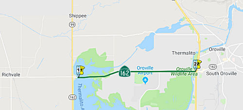 From Route 99 near Richvale to Route 70 near Oroville.
Post 1964 Signage HistoryThis segment was defined in 1963 as the original (c)
Pre 1964 Signage HistoryThis segment was part of LRN 21, defined in 1909. It was not a signed route before 1964.
StatusIn July 2020, it was reported that Caltrans has repaved a stretch
of Route 162 between Christian Avenue in Oroville (BUT 12.678) and the
Feather River (BUT 15.588) using recycled asphalt pavement and liquid
plastic made with single-use, plastic bottles – the first time the
department has paved a road using 100 percent recycled materials. The
pilot project features work on three lanes of a 1,000-foot highway
segment. The department is testing the material for later use throughout
the state. A one-mile segment of pavement using this treatment will
recycle 150,000 plastic bottles. Using this new technology developed by
TechniSoil Industrial of Redding, a recycling train of equipment grinds up
the top 3 inches of pavement and then mixes the grindings with a liquid
plastic polymer binder, which comes from a high amount of recycled,
single-use bottles. The new asphalt material is then placed on the top
surface of the roadway, eliminating the need for trucks to bring in
outside material for a paving operation. By eliminating the need to haul
asphalt from the outside, this process can significantly cut greenhouse
gas emissions. The "plastic" roadway has been found in previous tests to
be more durable and last two to three times longer than traditional
hot-mixed asphalt pavement. This pilot will be the first test on a state
highway. Contrast this with the traditional process, where Caltrans uses a
cold in-place asphalt recycling program that uses large machines to remove
3 to 6 inches of roadway surface and grind up the asphalt while mixing it
with a foamed binding agent made of bitumen, a leftover sludge from oil
refining. However, the recycled material used in this process is only
durable enough to serve as the roadway base. Trucks need to deliver
hot-mix asphalt from a production plant miles away and place a final layer
over the base.
(Source: Caltrans Press Release, 7/30/2020)
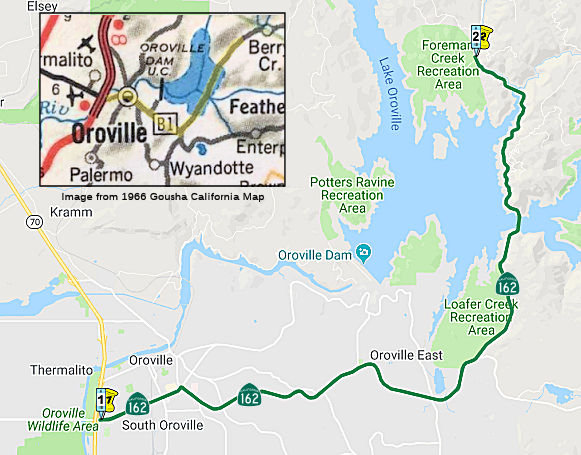 From Route 70 near Oroville to Foreman Creek Road via the Bidwell Bar Bridge.
Post 1964 Signage HistoryThis segment was added in 1970 by Chapter 1473: "(d) Route 70 near Oroville to Foreman Creek Road via the Bidwell Bar Bridge." This segment appears to have been previously signed Butte County Sign Route B1.
Pre 1964 Signage HistoryThis segment was not a state legislative route in 1963. It may have, at one time, been part of LRN 30.
In the late 1930s, there was a temporary routing of Alternate US 40 that took a more southern alignment than the current Route 70 routing, running through Berry Creek and Bucks Lake to Quincy along Orville-Quincy Highway, Spanish Ranch, and Bucks Lake Road. Much of that route is no longer part of the state highway system, although the portion from Oroville to Brush Creek is part of Route 162.
The routing that was to be LRN 30 was defined in the 1909 First Bond Issue as running from Oroville to Quincy. This was likely the Oroville-Quincy Highway. In the 1919 Third Bond Issue, the route was abandoned as a state highway and LRN 21 extended to cover the mileage to Quincy.
The route of LRN 30 east of Oroville appears to have used the following
route:
(Source: Gribblenation Blog "California State Route 162 to the Bidwell Bar Bridge (both the 1965 and 1856 variants)")
StatusThe SAFETEA-LU act, enacted in August 2005 as the reauthorization of TEA-21, provided the following expenditures on or near this route:
In March 2019, the CTC approved for future consideration of funding a
project on Route 162 in the city of Oroville in Butte County. The project
proposes to widen shoulders. The proposed project will provide a two way
left turn lane, standard shoulders, and a clear recovery zone. The project
also proposes to construct drainage ditches, culverts, sound and retaining
walls, and sidewalks. The proposed project addresses the issues of
multiple existing driveways along this portion of Route 162 and the need
to provide a safe means of travel, and alleviate traffic congestion due to
vehicle use of these driveways. This project is fully funded and currently
programmed in the 2018 SHOPP for approximately $22.4 million, construction
is estimated to begin in Fiscal Year 2020-21. The scope, as described for
the preferred alternative, is consistent with the project scope programmed
by the Commission in the 2018 SHOPP.
(Source: March 2019 CTC Minutes, Agenda Item 2.2c.(1))
 Named Structures
 Bridge 12-0193, crossing Feather River, W of the Routes 162 and 70 Juncture (BUT 015.57), is named the "Randy
Jennings Memorial Bridge". It was named by Assembly Concurrent
Resolution 84, Chapter 100 in1998. Butte County Deputy Sheriff Randy
Jennings was killed in the line of duty while investigating a domestic
dispute on May 21, 1977. The plaques mounted on the bridge note that on
May 21, 1997 Deputy Randy Jennings became the first Butte County
Sheriff’s Deputy to be murdered in the line of duty, at the age of
38. Randy was a member of the Special Incident Response Team, served as
the Department Range Master and was named Officer of the Year for 1996.
For his action in this final call Deputy Jennings was posthumously awarded
The Medal of Valor. A second plaque notes that Jennings graduated Oroville
High School, 1977, Butte College, AA, 1981, and Simpson College, BA, 1984,
and had a passion for motorcycles.
Bridge 12-0193, crossing Feather River, W of the Routes 162 and 70 Juncture (BUT 015.57), is named the "Randy
Jennings Memorial Bridge". It was named by Assembly Concurrent
Resolution 84, Chapter 100 in1998. Butte County Deputy Sheriff Randy
Jennings was killed in the line of duty while investigating a domestic
dispute on May 21, 1977. The plaques mounted on the bridge note that on
May 21, 1997 Deputy Randy Jennings became the first Butte County
Sheriff’s Deputy to be murdered in the line of duty, at the age of
38. Randy was a member of the Special Incident Response Team, served as
the Department Range Master and was named Officer of the Year for 1996.
For his action in this final call Deputy Jennings was posthumously awarded
The Medal of Valor. A second plaque notes that Jennings graduated Oroville
High School, 1977, Butte College, AA, 1981, and Simpson College, BA, 1984,
and had a passion for motorcycles.
(Image source: Bridgehunter; Historical Marker Data Base; Officer Down Memorial Page)
Bridge 12-0188 over Lake Oroville in Butte County (BUT 026.87) is unofficially named the "Bidwell Bar Bridge". It was constructed in 1965.
Pre 1964 Signage HistorySigned Route 162 was not defined as part of the initial state signage of routes in 1934.
 Other WWW Links
 Statistics
Overall statistics for Route 162:
 Pre-1964 Legislative Route
In 1933, the route from "[LRN 60] at Santa Monica to Colorado Boulevard near Eagle Rock" was added to the highway system. In 1935, this route was added to the highway code as LRN 162 with that definition.
In 1957, Chapter 1911 removed the portion east of LRN 61, making the definition "[LRN 60] near Santa Monica to [LRN 61] near Avenue 36". This change was likely an update reflecting the fact that US 66 was along Figueroa (LRN 165) and Sunset Blvd (LRN 2) to Santa Monica, and Sign Route 2 was along Verdugo, meaning there was no longer any need for the state to maintain Eagle Rock Blvd.
LRN 162 originally ran along Lincoln Blvd from US 101A (Sign Route 3, LRN 60) at Pennsylvania (later Olympic) to Santa Monica Blvd, along Santa Monica Blvd from Lincoln in Santa Monica to Myra Avenue (near Sunset), then North along Myra Avenue to Fountain, across Fountain to Hyperion Ave, up to Rowena. It then ran across Rowena (now Glendale Blvd) to the intersection of Glendale and Fletcher, and then up Fletcher (crossing San Fernando) to meet LRN 61 at Verdugo Road (note that some of this has been subsequently rerouted due to the Glendale Freeway). Note that the point where Fletcher meets Eagle Rock is roughly where Avenue 36 is. At this point, LRN 162 continued along Eagle Rock Blvd to end at LRN 161 at Colorado. The signage of this is convoluted:
Sign Route 2 clearly continued along LRN 61, which ran N from San Fernando Road along Verdugo, then along Cañada Blvd, then N along Verdugo Road to Foothill Blvd (Sign Route 118).
Note: It is unclear whether any of the connecting streets that served to connect LRN 162 with LRN 2 (US 101) at Sunset Blvd were part of LRN 162, as Myra Avenue was an underpass under Sunset.
The segment between Sunset Blvd and Santa Monica was the westernmost segment of both Sign Route 2 and US 66.
A 1954 issue of CHPW confirms that the widening of US 101 near Vermont was in anticipation for the future Route 2 freeway (LRN 162, called, at that time, the "Santa Monica Freeway" as it ran along Santa Monica Blvd, vice LRN 173, the Olympic Freeway (Route 26), which eventually became I-10): "The design finally adopted for the Hollywood Freeway at the crossing. with Vermont Avenue was influenced by the contemplated future construction of the Santa Monica Freeway and also the possibility of rail rapid transit facilities being installed on the future Santa Monica Freeway. This required the lengthening of the Vermont Avenue Bridge and other bridges in the vicinity. The added cost providing for future rail rapid transit facilities was financed by the City of Los Angeles from city funds. Similarly financed from city funds were the bus transfer facilities at Alvarado Street and Vermont Avenue and Western Avenue."
© 1996-2020 Daniel P. Faigin.
Maintained by: Daniel P. Faigin
<webmaster@cahighways.org>.
 Route 161
 Route 163