
 California Highways:
[Click here for a key to the symbols used. Some county routes were constructed with federal funds. These routes are indicated as FAP (Federal Aid Primary), FAU (Federal Aid Urban), or FAS (Federal Aid Secondary). If no funding source is shown, no federal funds were used. Note that while some segments seem to have the same attributes, they may differ in the county-local road number assigned to the segment, or in the Caltrans Map Sheet number.]
 Routing
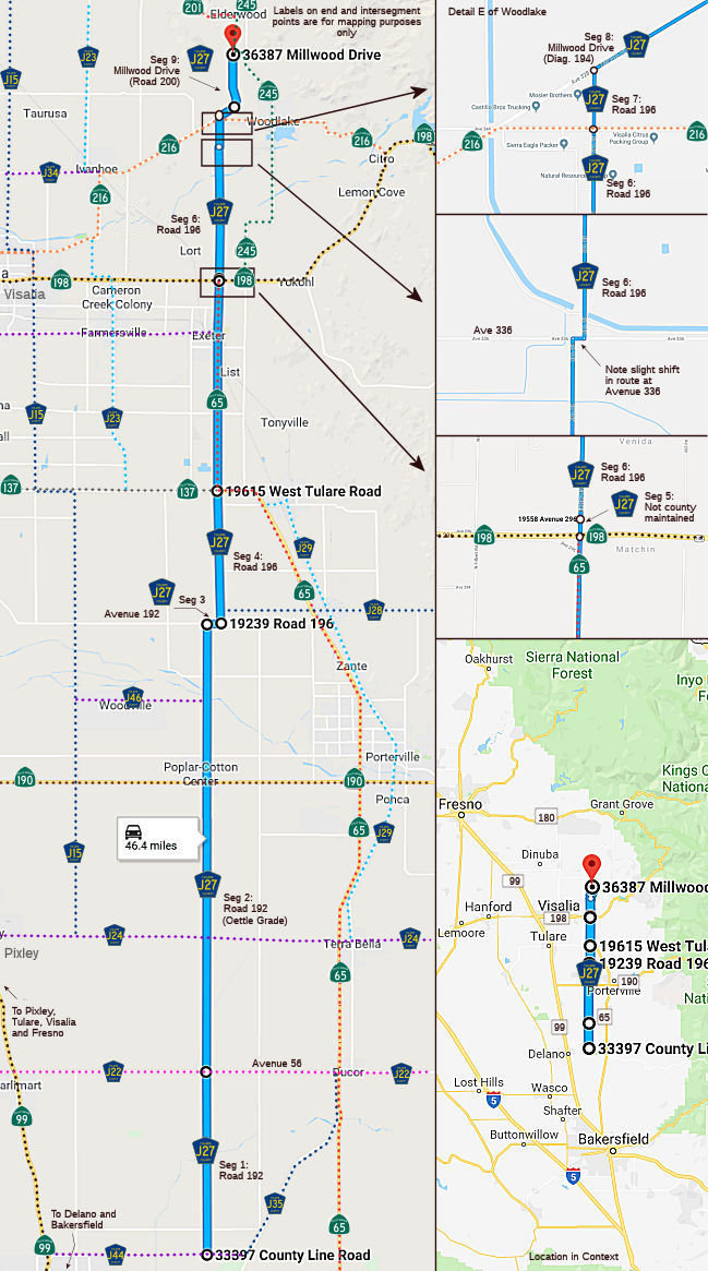 Road 192 from Ave 0 (County Line Road) to Avenue 56.
Note: This was not in the original definition, but is shown on Google Maps and in the Thomas Bros. Guide.
Oettle Grade (Road 192) from Avenue 56 (County Sign Route J22) to Avenue 192 (FAS, 17.15 mi)
Avenue 192 from Road 192 to Road 196 (FAS, 0.50 mi)
Road 196 from Avenue 192 to Route 137 (FAS, 5.01 mi)
Non-county maintained road from Route 198 to Road 196 (FAS, 0.14 mi)
Road 196 from the non-county maintained road to Route 216 (FAS, 5.85 mi)
Road 196 from Route 216 to Millwood Drive (Diagonal 194) (0.23 mi)
Millwood Drive (Diagonal 194) from Road 196 to Road 200 (1.50 mi)
Millwood Drive (Road 200) from Diagonal 194 to Route 245 (1.25 mi)
 History and Signage Information
This route was defined in 1975.
 Status
Total mileage: 31.63 mi.
© 1996-2020 Daniel P. Faigin.
Maintained by: Daniel P. Faigin
<webmaster@cahighways.org>.
 CR J26
 CR J28