
 California Highways:
[Click here for a key to the symbols used. Some county routes were constructed with federal funds. These routes are indicated as FAP (Federal Aid Primary), FAU (Federal Aid Urban), or FAS (Federal Aid Secondary). If no funding source is shown, no federal funds were used. Note that while some segments seem to have the same attributes, they may differ in the county-local road number assigned to the segment, or in the Caltrans Map Sheet number.]
 Routing
 History and Signage Information
The corridor of Monterey County Sign Route G18 and Jolon Road is tied to that of the
Spanish iteration of El Camino Real and Mission San Antonio de
Pauda. The Santa Lucia Mountains and general course of the San
Antonio River were explored by the Spanish during 1769 Portola Expedition
of Las Californias. Mission San Antonio de Pauda was founded during
1771 near the San Antonio River. The San Antonio River proved to be
a reliable source of water for irrigation purposes between Mission San
Miguel Arcangel and Mission Nuestra Senora de la Soledad. Thusly
general path of the Spanish iteration of El Camino Real followed the
general corridor of modern Jolon Road from Mission San Miguel Arcangel
through the Santa Lucia Mountains towards Mission Nuestra Senora de la
Soledad. During the 1870s and 1880s, the Southern Pacific Railroad
constructed a line through Salinas Valley towards San Miguel. The
Southern Pacific Railroad would develop frontage roads which would replace
the corridor of Jolon Road as the primary through highway between San
Miguel and Mission Soledad. These frontages during the 20th Century
would form the basis of LRN 2/US 101.
(Source: Gribblenation Blog (Tom Fearer), "Monterey County Route G18", 10/1/2023)
By 1935, Jolon Road was a major local highway. Jolon Road originated at
US 101 near Bradly and looped back to it near King City. Jolon Road
east of Lockwood followed what is now Bradley-Lockwood Road Jolon
Road became prominent during World War II due to the formation of Fort
Hunter Liggett during 1940 near Jolon. Forty miles of improvements
of Jolon Road began as a Work Projects Administration (WPA) project during
early 1941 and would conclude during late year 1942. The segment of
Jolon Road between Bradly to Lockwood was straightened as part of the
corridor improvements.
(Source: Gribblenation Blog (Tom Fearer), "Monterey County Route G18", 10/1/2023)
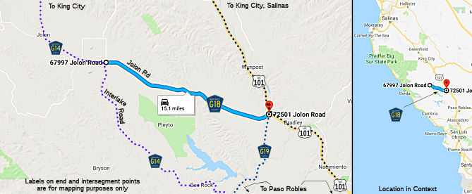
During 1971 Jolon Road was assigned as Monterey County Sign Route G14 and Monterey County Sign Route G18. Monterey County Sign Route G18 was assigned to the 16.40 miles of Jolon Road
east of Lockwood. Monterey County Sign Route G14 was assigned to the 23.82 miles
northwest of Lockwood. At some point between the mid-1970s and early
1980s, the Jolon Grade on Monterey County Sign Route G14 north of Jolon was straightened.
(Source: Gribblenation Blog (Tom Fearer), "Monterey County Route G18", 10/1/2023)
This route was defined in 1971.
 Other WWW Links
© 1996-2020 Daniel P. Faigin.
Maintained by: Daniel P. Faigin
<webmaster@cahighways.org>.
 Jolon Road from Interlake Road (County Sign Route
  CR G17
 CR G19