
 California Highways:
[Click here for a key to the symbols used. Some county routes were constructed with federal funds. These routes are indicated as FAP (Federal Aid Primary), FAU (Federal Aid Urban), or FAS (Federal Aid Secondary). If no funding source is shown, no federal funds were used. Note that while some segments seem to have the same attributes, they may differ in the county-local road number assigned to the segment, or in the Caltrans Map Sheet number.]
 Routing
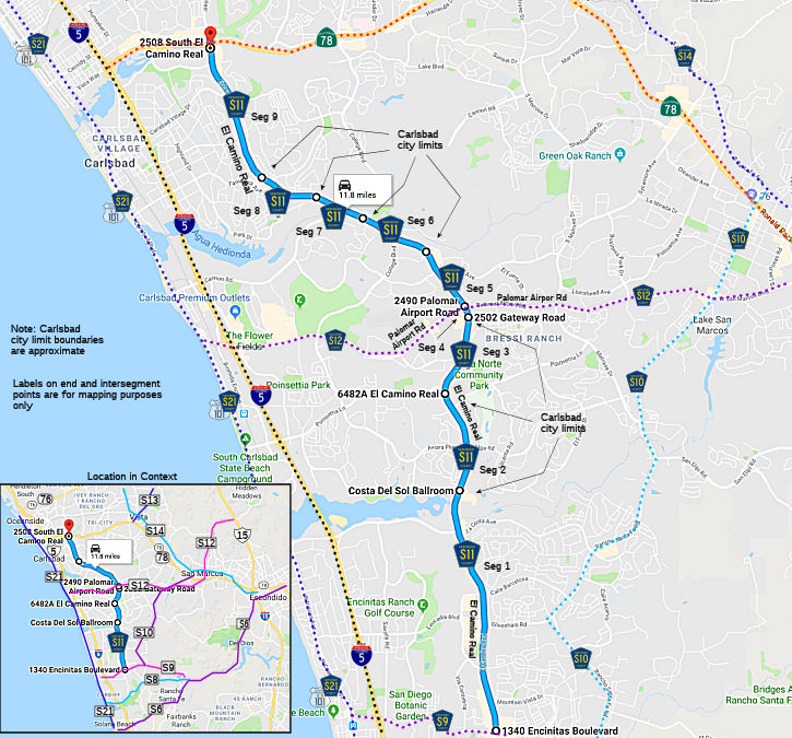 El Camino Real from Encinitas Blvd (County Sign Route S9) to the Carlsbad city limits (FAU, 3.33
mi)
El Camino Real from Encinitas Blvd (County Sign Route S9) to the Carlsbad city limits (FAU, 3.33
mi)
El Camino Real in Carlsbad from the Carlsbad city limits to the Carlsbad city limits (FAU, 1.37 mi)
El Camino Real from the Carlsbad city limits to the Carlsbad city limits (FAU, 0.50 mi)
El Camino Real in Carlsbad from the Carlsbad city limits to the Carlsbad city limits (FAU, 0.83 mi)
El Camino Real from the Carlsbad city limits to Palomar Airport Road (FAU, 0.15 mi)
El Camino Real in Carlsbad from Palomar Airport Road to the Carlsbad city limits (FAU, 0.91 mi)
El Camino Real from the Carlsbad city limits to the Carlsbad city limits (FAU, 0.96 mi)
El Camino Real in Carlsbad from the Carlsbad city limits to the Carlsbad city limits (FAU, 0.68 mi)
El Camino Real from the Carlsbad city limits to the Carlsbad city limits (FAU, 0.78 mi)
El Camino Real in Carlsbad from the Carlsbad city limits to Route 78 (FAU, 2.07 mi)
 History and Signage Information
This route was defined in 1959.
 Status
Total mileage: 11.58 mi.
© 1996-2020 Daniel P. Faigin.
Maintained by: Daniel P. Faigin
<webmaster@cahighways.org>.
 CR S10
 CR S12