
 California Highways:
[Click here for a key to the symbols used. Some county routes were constructed with federal funds. These routes are indicated as FAP (Federal Aid Primary), FAU (Federal Aid Urban), or FAS (Federal Aid Secondary). If no funding source is shown, no federal funds were used. Note that while some segments seem to have the same attributes, they may differ in the county-local road number assigned to the segment, or in the Caltrans Map Sheet number.]
 Routing
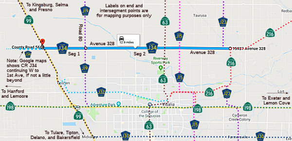 Avenue 328 from Route 99 to Road 80. Note: This was not part of the original
definition, but appears as part of the route on both Google Maps and the 1991
Thomas Brothers Atlas and Drivers Guide.
Avenue 328 from Route 99 to Road 80. Note: This was not part of the original
definition, but appears as part of the route on both Google Maps and the 1991
Thomas Brothers Atlas and Drivers Guide.
Note: Google maps also shows the route continuing W to at least 1st Ave, if not a bit further.
Avenue 328 from Road 80 (County Sign Route J19) to Route 216 near Ivanhoe (FAS, 9.95 mi)
 History and Signage Information
This route was defined in 1971.
© 1996-2020 Daniel P. Faigin.
Maintained by: Daniel P. Faigin
<webmaster@cahighways.org>.
 CR J33
 CR J35