

 As we pass from May into June, I’d welcome you to the June Gloom, but it came early. As I write this, I’ve been busily working to get the March and April (and now May) updates to the Highway Pages done. They are closer — I just finished going through the March and May CTC minutes. This weekend I’ll process these headlines, and the updates should be good to go
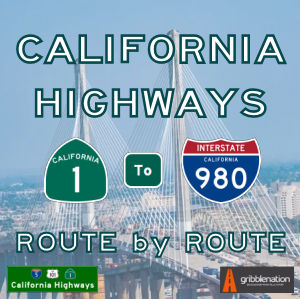
The first season of the podcast is winding down. We have one episode left to record, and then I’ll take a couple of months off to start writing Season 2, when we will actually start going route by route through the state highways. Season 2 will have 10 episodes on Route 1, and two on Route 2. Hopefully, the sound quality is getting a bit better. I’m learning as I go on, and I think on some I overprocessed and overcompensated for breaths, creaks, and other bumps (uh) in the night. Our sample episode has crossed 105 listens, but many are still falling short. Visit our Spotify for Podcast episodes page, our main podcast site, or use your favorite podcasting app to catch up on our back episodes. We have a 6-part series on the history of the state highway system, and a 4-part series on highway numbering.
What else? We’re back to attending theatre regularly, although I haven’t started writing reviews again. Although we’re not going to be able to make it this year, if you’re near Hollywood in June, I encourage you to go down to old US 66 and attend the Hollywood Fringe Festival. There should be at least one show of interest out of the hundreds of shows being presented.
OK. You should be caught up now. Here are the headlines that I found about California’s highways for May:
Key
[Ħ Historical information | $ Paywalls, $$ really obnoxious paywalls, and ∅ other annoying restrictions. I’m no longer going to list the paper names, as I’m including them in the headlines now. Note: For $ paywalls, sometimes the only way is incognito mode, grabbing the text before the paywall shows, and pasting into an editor.]
California Highways: Route by Route Podcast
 CARxR 1.11: Highway Naming. In our penultimate episode of the season, we explore highways and their names. Tom and Daniel discuss how highways got their names in the past, as well as how highways are named today through the legislature. You’ll see a discussion of historical names, destination-based names, and memorial names. We’ll also explore auto trail names, as well as some of the more notorious names that highways have been given. Lastly, listen until after the end credits for a discussion about an aspect of naming that people often forget. (38:01)
Back episodes are available at the Podcast’s forever home, as well as on its Spotify for Podcasters home. The Spotify (nee Anchor.FM) link also has links to the podcast’s page on most major podcasting services.
Highway Headlines
- City meeting with Caltrans director inspired optimism about truck climbing lanes project (Tehachapi News). The most optimistic news reported at Monday night’s City Council meeting came from Councilman Phil Smith. During the council comments portion at the end of the meeting, Smith shared news of a recent meeting he and city staff had with the new director of Caltrans about the proposed truck climbing lane for Highway 58. Caltrans recently released environmental reports related to the project, and another Highway 58 project west of Tehachapi — the Keene Pavement Project — is even further along in the planning process. But funding the projects once the planning and design are complete remains an obstacle.
- $Last piece of remade Bay Bridge expands access to Yerba Buena, Treasure Island (Napa Valley Register). The last piece of the massive Bay Bridge reconstruction will open Sunday, almost 10 years after the main span bearing Interstate 80 began carrying traffic. The new eastbound off-ramp to Yerba Buena Island will increase access to Treasure Island, where San Francisco officials hope to develop thousands of new homes, retail and commercial space, and hotel rooms. City plans have touted Treasure Island as San Francisco’s newest emerging neighborhood. “It’s a much better connection to the island,” said Bart Ney, a spokesman for Caltrans. “There’s all kinds of development.”
- $American Canyon says annexation might ease Highway 29 traffic (Napa Valley Register). American Canyon officials want to annex 83 acres and develop a portion with industry and businesses and — if all goes as described — a road extension that takes some traffic off busy Highway 29. The city is working on an environmental impact report for its proposed Paoli/Watson Lane annexation. This land is east of Highway 29 near Paoli Loop Road. What might seem to be an American Canyon-centric issue could have ramifications for anyone driving in the south county. The proposed annexation would allow a Newell Drive extension to connect with the highway. “The city intends to extend Newell Drive as a parallel roadway to (Highway) 29 to relieve traffic congestion,” the draft environmental impact report said. How much relief is unclear, though an extended Newell Drive would handle more than existing traffic in this fast-growing area. Nearby Watson Ranch is planned to someday host more than 1,000 homes.
- $Caltrans work will partially or fully close Vincent Thomas Bridge in San Pedro (Daily News). Most, if not all, of the Vincent Thomas Bridge could close for one to two years beginning around 2025 so the nearly 60-year-old San Pedro span can get a new roadbed for the first time since it was built. Details on the California Department of Transportation project, estimated to cost $628.5 million, are just now rolling out — with the news coming as a surprise to many of those who will be heavily impacted. Caltrans will host a virtual meeting, as part of an extensive state and federal scoping process for the project, from 5:30 to 7:30 p.m. Thursday, May 4. Work is anticipated to take place from 2025 to 2027. Replacing the roadway, Caltrans officials say, is necessary to maintain the bridge, which turns 60 in November, into the future. The road in both directions has been damaged over time by saltwater, moisture and heavy use.
- Plan to add toll to Highway 37 for safety funding faces opposition (CBS San Francisco). Between flooding during King Tides and everyday commute congestion, Highway 37 in the North Bay has long been a major concern of the State. Transportation officials have come up with a plan to fix the vital connecting road, but the method to pay for it is drawing criticism – and raising concerns about how future projects may be funded. The roadway sits only a few feet above the water and has already experienced shutdowns due to flooding. So, the State’s long-term plan is to turn the road into a four-lane “causeway,” essentially, a low-level bridge that will span most of the 21 miles from Vallejo to Novato. It would include a bike and pedestrian lane and a rail line for the SMART commuter train. That will take billions of dollars and more than 20 years to complete. But there is also a short-term plan involving one section of the highway.
- State to consider Highway 37 toll (Marin I-J). Highway 37, the major North Bay commuter route linking Marin and Vallejo, could become a toll road for the second time since it was built nearly a century ago under a proposal before the state this month. The California Transportation Commission is set to decide whether to approve the toll at its May 17-18 meeting in San Francisco. The toll would take effect in 2027 and be similar to tolls on state-owned bridges in the area, which would be at least $8 in 2027. Bay Area transportation agencies and Caltrans are seeking to add the toll to the 12-mile corridor to pay for significant changes to the highway in response to grueling traffic conditions and sea-level rise projections. The near-term project plans to widen a 10-mile, traffic-prone section of road between Sears Point and Mare Island, where the highway bottlenecks to one lane in each direction. The estimated $430 million widening project, planned for completion in 2027, would add a carpool lane in each direction for vehicles with at least two occupants. The carpool lane would not be tolled.
