

 As we pass from May into June, I’d welcome you to the June Gloom, but it came early. As I write this, I’ve been busily working to get the March and April (and now May) updates to the Highway Pages done. They are closer — I just finished going through the March and May CTC minutes. This weekend I’ll process these headlines, and the updates should be good to go
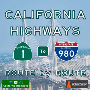
The first season of the podcast is winding down. We have one episode left to record, and then I’ll take a couple of months off to start writing Season 2, when we will actually start going route by route through the state highways. Season 2 will have 10 episodes on Route 1, and two on Route 2. Hopefully, the sound quality is getting a bit better. I’m learning as I go on, and I think on some I overprocessed and overcompensated for breaths, creaks, and other bumps (uh) in the night. Our sample episode has crossed 105 listens, but many are still falling short. Visit our Spotify for Podcast episodes page, our main podcast site, or use your favorite podcasting app to catch up on our back episodes. We have a 6-part series on the history of the state highway system, and a 4-part series on highway numbering.
What else? We’re back to attending theatre regularly, although I haven’t started writing reviews again. Although we’re not going to be able to make it this year, if you’re near Hollywood in June, I encourage you to go down to old US 66 and attend the Hollywood Fringe Festival. There should be at least one show of interest out of the hundreds of shows being presented.
OK. You should be caught up now. Here are the headlines that I found about California’s highways for May:
Key
[Ħ Historical information | $ Paywalls, $$ really obnoxious paywalls, and ∅ other annoying restrictions. I’m no longer going to list the paper names, as I’m including them in the headlines now. Note: For $ paywalls, sometimes the only way is incognito mode, grabbing the text before the paywall shows, and pasting into an editor.]
California Highways: Route by Route Podcast
 CARxR 1.11: Highway Naming. In our penultimate episode of the season, we explore highways and their names. Tom and Daniel discuss how highways got their names in the past, as well as how highways are named today through the legislature. You’ll see a discussion of historical names, destination-based names, and memorial names. We’ll also explore auto trail names, as well as some of the more notorious names that highways have been given. Lastly, listen until after the end credits for a discussion about an aspect of naming that people often forget. (38:01)
Back episodes are available at the Podcast’s forever home, as well as on its Spotify for Podcasters home. The Spotify (nee Anchor.FM) link also has links to the podcast’s page on most major podcasting services.
Highway Headlines
- City meeting with Caltrans director inspired optimism about truck climbing lanes project (Tehachapi News). The most optimistic news reported at Monday night’s City Council meeting came from Councilman Phil Smith. During the council comments portion at the end of the meeting, Smith shared news of a recent meeting he and city staff had with the new director of Caltrans about the proposed truck climbing lane for Highway 58. Caltrans recently released environmental reports related to the project, and another Highway 58 project west of Tehachapi — the Keene Pavement Project — is even further along in the planning process. But funding the projects once the planning and design are complete remains an obstacle.
- $Last piece of remade Bay Bridge expands access to Yerba Buena, Treasure Island (Napa Valley Register). The last piece of the massive Bay Bridge reconstruction will open Sunday, almost 10 years after the main span bearing Interstate 80 began carrying traffic. The new eastbound off-ramp to Yerba Buena Island will increase access to Treasure Island, where San Francisco officials hope to develop thousands of new homes, retail and commercial space, and hotel rooms. City plans have touted Treasure Island as San Francisco’s newest emerging neighborhood. “It’s a much better connection to the island,” said Bart Ney, a spokesman for Caltrans. “There’s all kinds of development.”
- $American Canyon says annexation might ease Highway 29 traffic (Napa Valley Register). American Canyon officials want to annex 83 acres and develop a portion with industry and businesses and — if all goes as described — a road extension that takes some traffic off busy Highway 29. The city is working on an environmental impact report for its proposed Paoli/Watson Lane annexation. This land is east of Highway 29 near Paoli Loop Road. What might seem to be an American Canyon-centric issue could have ramifications for anyone driving in the south county. The proposed annexation would allow a Newell Drive extension to connect with the highway. “The city intends to extend Newell Drive as a parallel roadway to (Highway) 29 to relieve traffic congestion,” the draft environmental impact report said. How much relief is unclear, though an extended Newell Drive would handle more than existing traffic in this fast-growing area. Nearby Watson Ranch is planned to someday host more than 1,000 homes.
- $Caltrans work will partially or fully close Vincent Thomas Bridge in San Pedro (Daily News). Most, if not all, of the Vincent Thomas Bridge could close for one to two years beginning around 2025 so the nearly 60-year-old San Pedro span can get a new roadbed for the first time since it was built. Details on the California Department of Transportation project, estimated to cost $628.5 million, are just now rolling out — with the news coming as a surprise to many of those who will be heavily impacted. Caltrans will host a virtual meeting, as part of an extensive state and federal scoping process for the project, from 5:30 to 7:30 p.m. Thursday, May 4. Work is anticipated to take place from 2025 to 2027. Replacing the roadway, Caltrans officials say, is necessary to maintain the bridge, which turns 60 in November, into the future. The road in both directions has been damaged over time by saltwater, moisture and heavy use.
- Plan to add toll to Highway 37 for safety funding faces opposition (CBS San Francisco). Between flooding during King Tides and everyday commute congestion, Highway 37 in the North Bay has long been a major concern of the State. Transportation officials have come up with a plan to fix the vital connecting road, but the method to pay for it is drawing criticism – and raising concerns about how future projects may be funded. The roadway sits only a few feet above the water and has already experienced shutdowns due to flooding. So, the State’s long-term plan is to turn the road into a four-lane “causeway,” essentially, a low-level bridge that will span most of the 21 miles from Vallejo to Novato. It would include a bike and pedestrian lane and a rail line for the SMART commuter train. That will take billions of dollars and more than 20 years to complete. But there is also a short-term plan involving one section of the highway.
- State to consider Highway 37 toll (Marin I-J). Highway 37, the major North Bay commuter route linking Marin and Vallejo, could become a toll road for the second time since it was built nearly a century ago under a proposal before the state this month. The California Transportation Commission is set to decide whether to approve the toll at its May 17-18 meeting in San Francisco. The toll would take effect in 2027 and be similar to tolls on state-owned bridges in the area, which would be at least $8 in 2027. Bay Area transportation agencies and Caltrans are seeking to add the toll to the 12-mile corridor to pay for significant changes to the highway in response to grueling traffic conditions and sea-level rise projections. The near-term project plans to widen a 10-mile, traffic-prone section of road between Sears Point and Mare Island, where the highway bottlenecks to one lane in each direction. The estimated $430 million widening project, planned for completion in 2027, would add a carpool lane in each direction for vehicles with at least two occupants. The carpool lane would not be tolled.
- Update on Dam Painting at Route 71 and Route 91 (FB/One Way Painting). One Way Painting’s owner Jeff McCabe along with his brother Jim came out and cracked the Liberty Bell today to finish off the project. “Our county’s not perfect, just like the Liberty Bell. We may have a long way to go but there is a goal and a symbol that we all want to work toward, and we’re all in this together. “
- Portion of Highway 180 to be closed due to collapsed roads (ABC30 Fresno). If you’re planning a trip to Kings Canyon National Park or one of the many camping spots and hiking trails along Highway 180, you may have to re-think your plans. Caltrans is closing a portion of the corridor from just east of Hume Lake Road to near Kanawyers. That includes access to Cedar Grove and Boyden Cavern. Due to the heavy rain we experienced in March, several sections of the road have collapsed or are unsafe for drivers.
- Vincent Thomas Bridge needs months, maybe years, of construction; Caltrans weighs closure options (Long Beach Post News). Construction isn’t expected to start until 2025, but Caltrans officials are asking for community input now as they prepare for a project that will close or reduce lanes on the Vincent Thomas Bridge for nine months or longer. The historic 6,000-foot span is the only way to access Terminal Island and the Port of Long Beach from the west, and the 60-year-old suspension bridge needs a full deck replacement. The potential detour routes would have the biggest impact on Wilmington, but some traffic caused by the construction would likely spill into Long Beach.
- Construction on Alamo Pintado Creek pedestrian bridge in Los Olivos begins May 22 (Santa Maria Times). A project to replace the Alamo Pintado Creek pedestrian bridge on the south side of State Route 154 near Los Olivos is expected to begin construction the week of Monday, May 22, according to Caltrans District 5. The project to remove a retaining wall adjacent to the bridge and install rock slope protection is estimated for completion by summer 2025, Caltrans officials noted. During construction officials said the bridge will be closed to all pedestrians, equestrians and bicyclists will need to use State Route 154 or a local street to cross the creek.
- $What could L.A. look and feel like without freeways? (Los Angeles Times). Word has been out for some time now: A freeway is anything but free. If you don’t believe the literature or the FasTrak tolls, believe your eyes. Visually, whether in the movies (think “La La Land”) or on your morning commute, the freeway is a creation that tells on itself. It can only carry you so high. A marvel of 20th century design, it is a form of conveyance limited as much by engineering and politics as by its own promise: efficiency. “If only we had more lanes, bro.” The memes always contain at least a grain of truth beneath the hilarity. If the freeway can’t deliver what it says, give it more of your efforts and more resources until it works as it was designed.
- $Motorists in San Pedro, Long Beach face headaches during repairs to Vincent Thomas Bridge (Los Angeles Times). The 60-year-old Vincent Thomas Bridge in San Pedro is showing its age and needs major repair work, but a restoration project that is sure to create traffic headaches for locals could last nine months to three years, depending on the construction schedule. The 6,000-foot span bridge connects San Pedro to the west end of Terminal Island, which is home to the Port of Long Beach and Port of Los Angeles. The bridge carries roughly 58,000 vehicles daily, with more than 5,100 heavy trucks, according 2021 data from the California Department of Transportation. But the years of acting as one of the main arteries to the ports have caused the bridge’s concrete to deteriorate, Caltrans said in its project overview plan to replace the bridge’s deck or upper layer of concrete. The project is meant to preserve the bridge’s structural integrity and overall safety, with a total cost of approximately $706 million for construction, design and other aspects of the project.
- Caltrans Says SR 134 Bridge Over Arroyo Will Experience Frequent Closures for Months-Long Barrier Upgrade Project (Pasadena Now). On Wednesday the California Department of Transportation (Caltrans) announced an updated closure schedule for the bridge barrier upgrade project on the State Route 134 freeway over Arroyo Seco Natural Park in Pasadena. According to the statement, the announcement said Caltrans planned to begin the bridge barrier demolition and reconstruction along both directions of the bridge “as soon as” this week. These operations are expected to take place through at least September and will require intermittent closures of freeway facilities so that crews may safely conduct the work.
- Highway 37 to become a toll road (Marin I-J). Highway 37, the 21-mile commuter route linking Marin County to Vallejo, is now set to become the Bay Area’s newest toll road. The California Transportation Commission voted unanimously on Wednesday to authorize the Metropolitan Transportation Commission to begin tolling the North Bay corridor to pay for a proposed widening project on a traffic-prone section of the highway. The authorization also opens the door to continue tolling the road to help pay for a long-term project to rebuild the highway on an elevated causeway to adapt to sea-level rise threats. The Metropolitan Transportation Commission, which is the Bay Area’s main transportation planning agency, is proposing to widen 10 miles of the corridor between Sears Point and Mare Island where the road bottlenecks to one lane in each direction. The pinch point causes traffic delays of up to an hour during the westbound morning commute and up to 100 minutes during the eastbound evening commute.
- New Podcast: Freeway Exit (KPBS San Diego). Freeways are not free. We pay for them in all kinds of ways — with our tax dollars, our time, our environment and our health. While freeways have enabled huge amounts of economic growth, they’ve also caused displacement and division. Learn the forgotten history of our urban freeway network, and how decades after that network was finished, some communities are still working to heal the wounds that freeways left behind. As climate change threatens to wreak havoc on our cities, freeways are not just a part of the problem. They can also be part of the solution.
- $Sinkhole is finally fixed on the 118 in Porter Ranch, after a year of repairs (Daily News). The off-ramp from westbound 118 Freeway onto Reseda Boulevard in Porter Ranch has reopened after being closed for more than a year, Caltrans announced on Thursday, May 18. The ramp was shut down in April of 2022 due to a sinkhole caused by a broken drainage pipe. It was supposed to reopen by the end of 2022. But atmospheric rivers that hammered Southern California caused numerous sinkholes in the region and forced a delay in the project. All that water “over-saturated the soil within the project boundaries and caused damage to the construction site,” according to Caltrans.
- City Council approves steep slope path for the Rincon Multi-Use Trail Project (Coastal View). The Carpinteria City Council ruled 3-1 to pursue alternative three – an altered version of the proposed Rincon Multi-Use Trail project that sparked controversy for impacts to paragliding and safety concerns – during a special meeting on Monday. The Rincon Multi-Use Trail Project was originally conceived as a solution to the current gap between the Pacific Coast Bikeway and the Carpinteria bluffs in the California Coastal Trail. The project gained controversy, however, following the Planning Commission’s Jan. 18, 2022 approval of the project’s environmental impact report and Conditional Use Permit and Coastal Development Permit. The completion of this project is mandatory for the city of Carpinteria to be in accordance with its Coastal Land Use Plan and the conditions of approval for the Caltrans Casitas Pass and Linden Avenue project.
- Highway 1 closures to continue for ‘several months’ (SF Gate). Two sections of Highway 1 along the Big Sur coast will take months to reopen after fierce winter storms forced partial closures. Travelers coming from the Bay Area can drive to Monterey through to Big Vista Point, but not to Los Angeles and Southern California using Highway 1. Highway 1’s southern closure is scheduled to move 21 miles north of Ragged Point, about half a mile south of Paul’s Slide on Friday, May 26, at 4 p.m., Caltrans District 5 said in a statement. Drivers will not be able to park in the turnaround area, and Limekiln State Park will remain closed, the agency said.
- Mysterious company buys entire Calif. ghost town for $22.5M (Eagle Mountain is former Riverside R3) (SF Gate). A road diverges in the yellow flats along the outer rim of Joshua Tree National Park. The two lanes in the middle of the desert peel off Interstate 10, about an hour and a half from Palm Springs. They break at the entrance to Eagle Mountain, a ghost town in the California desert that has attracted continuous attention since its untimely end in 1983. Unlike other California ghost towns, Eagle Mountain never truly died. Now, an unknown buyer has purchased the town to add a new chapter to its storied history.
- $Is Caltrans poised to destroy an Indigenous burial site? (Los Angeles Times). It didn’t take long for a team of highway archaeologists to mark their first find while searching for buried human remains on an aging stretch of U.S. Highway 395 that cuts along the eastern flank of the Sierra Nevada range. That alone was enough to concern local tribal leaders, but they went on to hit more bones missed by earlier archaeological surveys required to start construction of a $69.7-million Caltrans project to convert 12.6 miles of 395 from a two-lane road to a safer four-lane expressway.
- California Transportation Commission (CTC) Invests $1.6 Billion to Continue Rebuilding – Including Bridge & Roadway Projects in Fresno, Kings, and Kern Counties (Gold Rush Cam). The California Transportation Commission (CTC) this week allocated more than $1.6 billion in state and federal caltrans logofunding that will continue transforming and improving transportation infrastructure throughout the state. The allocation includes nearly $500 million in funding from the federal Infrastructure Investment and Jobs Act of 2021 (IIJA) and more than $89 million in funding from Senate Bill (SB) 1, the Road Repair and Accountability Act of 2017. “The infrastructure projects funded with these state and federal dollars will benefit all Californians by reducing climate impacts, improving equity and access, and increasing traveler safety,” said Caltrans Director Tony Tavares. “These transformative investments are giving Caltrans the tools it needs to rebuild California.” Projects the CTC approved include:
- Public input sought for Felton traffic study – Press Banner | Scotts Valley, CA (Press Banner). The draft of a key traffic study that seeks to fix problems with dangerous portions of Highway 9 has been released. The Santa Cruz County Regional Transportation Commission is now seeking public feedback on the San Lorenzo Valley Schools Circulation and Access Study. Santa Cruz METRO teamed up with the County, San Lorenzo Valley Unified School District, Caltrans and the RTC to make the popular route for students and their parents safer, but it’s been a long process. The Highway 9/San Lorenzo Valley Complete Streets Corridor Plan was completed in 2019, after years of public meetings, focus groups and surveys. It’s supposed to be a guiding document to coordinate future transportation projects in the area.
- Southern Big Sur coast is about to reopen. Here’s where you’ll be able to reach on Hwy. 1 (Yahoo!Sports). Access to popular spots on the southern Big Sur coast will be restored next week when Caltrans reopens a key stretch of Highway 1 — just in time for Memorial Day holiday weekend travel. The scenic highway is currently closed from Ragged Point in San Luis Obispo County to 18.7 miles south of Big Sur at Big Creek Vista Point in Monterey County due to a series of landslides. Caltrans will move the southern end of the closure north by about 21 miles at 4 p.m. Friday, May 26, the state roads agency said in a news release. That will allow travelers to once again reach Salmon Creek, Willow Creek, Jade Cove, Plaskett Creek, Pacific Valley, Sand Dollar Beach and Kirk Creek, as well as Treebones Resort.
- $New bridge opens on Highway 70 (Appeal Democrat). The California Department of Transportation (Caltrans) said Wednesday that traffic has shifted onto the newly constructed Honcut Creek Bridge on State Highway 70 at Laurellen Road and the Yuba County and Butte County line. “Motorists should be alert to construction crews rehabilitating the pavement and existing bridge deck east of the new structure between Lower Honcut Road in Butte County and Old State Highway in Yuba County,” officials said. Caltrans said the roadway is the final construction phase of a $63.3-million Butte County project to construct the new bridge and passing lanes between East Gridley Road and the Yuba County and Butte County line. Officials expect it to be completed sometime this summer.
- Watch as 9+ blocks of housing in San Diego become a freeway (KPBS Public Media). State Route 15 in City Heights was one of the last freeways built in San Diego. Prior to its construction in the 1990s, the 15 existed to the north and south of the neighborhood. But to get from one side to the other, drivers had to take a detour on other freeways or cut through neighborhood streets. City Heights residents fought for decades to stop the freeway, but Caltrans saw it as a critical missing link in the regional transportation network. The state agency ultimately agreed to cap one block of the freeway and put a park on top. KPBS explores the history of this freeway fight in Episode 4 of its newest podcast, “Freeway Exit.” Start listening from Episode 1 to learn more about the past, present and future of San Diego freeways.
- State Commission approves Highway 37 toll proposal (The Bay Link Blog). The California Transportation Commission(link is external) (CTC) today approved the application submitted earlier this spring by MTC’s Bay Area Infrastructure Financing Authority(link is external) (BAIFA) affiliate for authorization to operate a toll facility on the critical and frequently congested stretch of Highway 37 between Mare Island in Vallejo and the junction with State Route 121 at Sears Point in Sonoma County. The CTC’s unanimous approval of the tolling proposal marks a crucial milestone in the effort by MTC, Caltrans, North Bay county transportation agencies and other partners to implement both near-term and long-term improvements to Highway 37 corridor. The 21-mile route currently has just one lane in each direction along the 10-mile segment between Mare Island and Sears Point. Congestion routinely adds 30 minutes each day to the westbound morning commute between Solano and Marin counties, and as much as 80 minutes to the eastbound commutes in the afternoon and evening.
- $Newsom unveils plan to speed up infrastructure in California (Los Angeles Times). Surrounded by hard hat-wearing construction workers at a solar energy project in the Central Valley, Gov. Gavin Newsom unveiled a sweeping package of legislation and signed an executive order Friday to make it easier to build transportation, clean energy and water infrastructure across California. The governor said the proposal intends to cut through bureaucratic hurdles that have stymied grand public works projects and will help California capitalize on an infusion of money from the Biden administration to boost climate-friendly construction. Newsom’s proposal aims to shorten the contracting process for bridge and water projects, limit timelines for environmental litigation and simplify permitting for complicated developments in the Sacramento-San Joaquin River Delta and elsewhere.
- California Transportation Commission OK’s Highway 37 tolls (Northern California Public Media). Tolls are coming to Highway 37. Despite hand wringing over the necessity, consternation over the financial hit to commuters, and questioning of whether tolls advance or undermine equity – the California Transportation Commission – CTC – moved unanimously to approve a plan to add a toll lane in both directions on Highway 37 between Sears Point and Mare Island. Andrew Fremier is the Bay Area’s Metropolitan Transportation Commission chief and he said reducing congestion is a major motivator for the project. “Right now from about the Sears Point Raceway to Mare Island, you have one lane in each direction, and that really is the pinch point, both in the westbound direction in the morning where there’s about an hour delay, and in the eastbound direction in the evenings, that is up to a hundred minutes,” Fremier said to CTC commissioners.
- $Highway 37 toll proposal approved (Press Democrat). The California Transportation Commission approved the Metropolitan Transportation Commission’s request to apply a toll on State Route 37. The unanimous vote, made during Wednesday’s meeting, does not specify the toll amount. The approval came with two amendments: that the Transportation Commission is required to consider toll discounts based on regional, rather than federal income levels. The second amendment requires the commission to update its guidelines for toll hearings. Still to be determined, the $7 toll as it stands now, is the rate for crossing the San Francisco Bay Area bridges. That rate is due to go up to $8 by the year 2025, according to MTC spokesman John Goodwin.
- $Riverside County ghost town sells for $22.6 million (Los Angeles Times). One of California’s biggest ghost towns has been sold to a mysterious buyer whose plans are unclear. Eagle Mountain, located in Riverside County near the southeast corner of Joshua Tree National Park, was once a bustling iron mine. The 10,000-acre site has sold for nearly $22.6 million, according to Securities and Exchange Commission records. For decades, the mine and company town around it have been abandoned, occasionally used in films like Christopher Nolan’s “Tenet.”
- $CTC approves projects in Marysville, Yuba City | News | appeal-democrat.com (Appeal Democrat). As part of $1.6 billion in state and federal funding that was allocated this week by the California Transportation Commission (CTC) to help transform and improve transportation infrastructure throughout the state, three projects in the Yuba-Sutter region were included in that approval. State officials said the $1.6 billion available includes nearly $500 million in funding from the federal Infrastructure Investment and Jobs Act of 2021 (IIJA) and more than $89 million in funding from Senate Bill 1, the Road Repair and Accountability Act of 2017. In Marysville, $14.6 million, including $12.9 million in IIJA funds, for a California Department of Transportation (Caltrans) project was approved for a new pump plant at the State Route 70 Marysville railroad undercrossing and to reconstruct an existing pump plant at the Binney Junction railroad undercrossing, according to Caltrans.
- Why California Stopped Building Freeways (ACCESS Magazine (h/t Gordon Ross)). Planning and construction of metropolitan freeway systems in the 1950s and 1906s are frequently cited examples gone awry. Critics point to insulated and indifferent highway builders, who concern themselves more with traffic flow than communities and carve up cities with little regard for the negative social, psychological, and aesthetic effects of freeways. Many freeway projects in cities around the country provoked “freeway revolts” – intense community opposition to specific freeways projects which lead officials to delete controversial routes from state freeway plans. The freeway revolts dovetailed with broader environmental activism in the 1970s to cause many states to shift their focus from freeways and automobiles to other modes of transportation. The new attention given to public transit, carpooling, bicycling, and walking is often credited (or blamed) for dramatically curtailing freeway development in cities around the country. Such is the case in California, where in 1975 the state formally renounced its 1959 California Freeway System plan and adopted a new “multimodal” stance.
- Castroville Highway 156 project delayed, $18 million over budget (KSBW). The Transportation Agency for Monterey County announced that the State Route 156/Castroville Boulevard project is not expected to be ready to list by the June 30 funding deadline. Ready to list means a project has met certain criteria by the time funding is allocated. The project, which was approved under Monterey Counties Measure X in 2016, is being held up by PG&E utility relocation work that will not be completed until December. Now, to make sure the project avoids losing funding, the California Transportation Commission is calling for at-risk funding allocation.
- 21 miles of Highway 1 reopen following repairs (KSBY). Twenty-one miles of Highway 1 in the Big Sur area reopened Friday following the completion of repairs at a point north of Gorda, Caltrans District 5 said in a press release. The reopening was made possible after crews repaired a major washout of the highway called Gilbert’s Slide north of Gorda at post mile 10.6. Residents and travelers going north from Morro Bay will now have over 65 miles of coastal highway to explore before meeting the next closure and turnaround just south of Limekiln State Park in Monterey County. Limekiln State Park remains closed.
- $Highways Have Sliced Through City After City. Can the U.S. Undo the Damage? (The New York Times). Anthony Roberts set out to walk to a convenience store on the opposite side of a busy highway in Kansas City, Mo., one afternoon. It wasn’t an easy trip. First, he had to detour out of his way to reach an intersection. Then he had to wait for the light to change. When the walk signal finally came on, he had little time to cross several lanes of traffic and reach the highway’s wide median. Finally, he had to make it across the other set of lanes to complete his trek. “For a person who doesn’t have a car, it’s very hard, especially in the wintertime,” Mr. Roberts said. “No one wants to take a risk with their lives trying to cross the highway.”
- Berkeley wants to make changes to I-80 (Berkeleyside). The roaring, congested, 10-lane Eastshore Freeway has been Berkeley’s de facto western border for generations. Now some city officials and residents say it’s time to rethink Interstate 80, and the barrier it forms between Berkeley and its waterfront. Their visions range from the merely ambitious to the down-right audacious: One proposal calls for transforming the aging and utilitarian University Avenue overpass into a freeway-topping park, while another group wants to dig miles of tunnels along the waterfront to move the entire interstate underground. Fueling these ideas is a recognition of the often-destructive role freeways have played in many American cities, as well as a new $1 billion federal grant program — created as part of the infrastructure law championed by the Biden administration — that doles out funding for projects to address their inequitable impacts.
- $Study looks at potential cost for L.A. drivers on the 405, 10, 101 freeways (Los Angeles Times). Merging onto the Santa Monica Freeway at rush hour or along the infamously choked Sepulveda Pass could carry a price for Angelenos — and a promise. The Los Angeles County Metropolitan Transportation Authority is expected by the summer to release a long-awaited study that will offer a blueprint for a congestion pricing scheme similar to ones in cities such as London, Stockholm and Singapore, where commuters pay to drive in city centers. The transit agency has zeroed in on three locations for a possible test program: a nearly 16-mile stretch of the 10 Freeway between downtown and Santa Monica, arterial streets and freeways around downtown and the canyon streets and freeways that connect the San Fernando Valley to the L.A. Basin.
- Portion of Hwy 178 closed due to crack in the road (KGET). Damage to the roadway along Highway 178 forced a closure of part of the highway Saturday, according to the California Highway Patrol and Caltrans. Officials said the road was closed Saturday afternoon between the mouth of the canyon in Bakersfield to Lake Isabella. There is no estimate for reopening, CHP said. The portion of the damaged road sits just feet from the Kern River. Outflow from the river was measured at around 7,300 cubic feet per second at around 6 p.m. Saturday.
- Highway 101 Bridge Project Complete in Los Alamos (Edhat Santa Barbara). A project to reconstruct the bridges on US Highway 101 at the Interchange with State Route 135 in Los Alamos has been completed. This bridge project included the demolition and reconstruction of two bridges on US 101 near State Route 135. The contractor for this $15 million project was Cal Portland Construction of Santa Maria, CA. Caltrans wishes to thank the community of Los Alamos for their patience during this project.
- Vincent Thomas Bridge Will Get A Makeover And Caltrans Wants Public Input (LAist). The historic Vincent Thomas Bridge, which serves as the main gateway to the Port of Los Angeles, needs a makeover. About the bridge: Built in 1963 and spanning more than 6,000 feet, the bridge carries an average of 44,500 vehicles a day, and 11% of those are heavy trucks. That constant, heavy load has worn down the bridge’s deck to the point that it needs replacing. What’s proposed: But first, Caltrans officials are seeking input from surrounding communities on proposed construction in 2025, because it will impact travel along State Route 47 and on nearby roadways.
- Placer County commissions plan for North Lake Tahoe highway transit improvements (Sierra Sun). Placer County is continuing efforts to address traffic concerns and enhance transit along state routes 89 and 267 in North Lake Tahoe with short-term and long-term improvements. The Placer County Board of Supervisors last week approved a $511,838 contract with Wood Rodgers Inc. to create a strategic implementation and phasing plan to advance implementation along the two corridors, both of which connect Interstate 80 to North Lake Tahoe. The plan will include collaboration with stakeholder groups such as Caltrans, the Town of Truckee, emergency responders, local businesses and residents in the region. The plan will expand on the transportation recommendations provided in the county’s Resort Triangle Transportation Plan that the board approved in October 2020. The RTTP outlined initiatives to reduce traffic, get people out of their cars, encourage alternative commuting options and address congestion.
- McCullough Construction Replacing Swift Creek Bridge (Construction Equipment Guide). Crews from McCullough Construction Inc. are eager to complete the California Department of Transportation’s (Caltrans) $14 million replacement of the Swift Creek Bridge on State Route 3 in Trinity County, a project that is 90 percent complete. The work is anticipated to be complete in late spring or summer. The initiative is replacing the existing bridge, a 168-ft. long, two-span, reinforced concrete T-girder bridge with seat type abutments and a pier wall supported on spread footings with one-lane in each direction. The work is taking place approximately 1 mi. south of Trinity Center, to a half-mile north of Trinity Center along SR 3.
- Toro Creek Bridge construction near Morro Bay now complete (KSBY). People heading out of Cayucos into Morro Bay will now cross over the new Toro Creek Bridge. Construction on the new bridge, which Caltrans says complies with current earthquake, geometric, hydraulic and structural standards, began in May 2022. The new configuration along Highway 1 includes two northbound lanes and one southbound lane over the bridge. A second southbound lane is expected to reopen in the coming weeks.
Gribblenation Blog (Tom Fearer)
- Vasco Road (planned California State Route 84). Vasco Road is a 17.7-mile roadway spanning the northern Diablo Range beginning at California State Route 4 in Brentwood of Contra Costa County south to Tesla Road/Alameda County Route J2 in Livermore. The corridor of Vasco Road was added as a planned extension of Legislative Route Number 108 during 1959 which became planned California State Route 84 during the 1964 State Highway Renumbering. Despite never being constructed to State Highway standards much of Vasco Road is an expressway design. 12.8-miles of Vasco Road was realigned during 1996 to make way for the Los Vaqueros Reservoir. Vasco Road was extended north to where it now terminates at California State Route 4 during 2009. Several curves and steeps grades along Vasco Road north of Livermore were eliminated during 2010.
- Friant Road (former California State Route 41). Friant Road is an approximately eleven-mile Fresno County expressway which spans from California State Route 41/Blackstone Avenue in Fresno to the community Friant via a gorge running along the San Joaquin River. Portions of the original alignments of Friant Road also served as part of early California State Route 41. Friant Road was modernized during the 2000s into the expressway seen today. The Lewis S. Eaton Trail was largely built over the initial grade of Friant Road which was part of early California State Route 41.
- Former US Route 101 through Sargent. Sargent is a ghost town and siding of the Southern Pacific Railroad located in southern Santa Clara County. The original alignment of US Route 101 was aligned through Sargent via what is now known as Old Monterey Road. Sargent was bypassed gradually due to shifts of the alignment of US Route 101 which occurred during 1941 and 1950. Pictured as the blog cover is a view on Old Monterey Road which is now no longer accessible to the general public. Below is a scan of the 1935 Division of Highways Map of Santa Clara County which depicts the original alignment US Route 101 through Sargent.
- Tulare Lake returns. During the winter of 2023 California experienced one of the wettest seasons in recent decades. Enough snow and water were deposited into the Sierra Nevada Mountains that the runoff was enough to partially reform Tulare Lake within San Joaquin Valley. Tulare Lake was once the largest lake west of the Mississippi River by surface area. Tulare Lake has been largely dried for the past century due to irrigation divisions and upstream impoundments. This blog will examine the history of Tulare Lake and its recent return. Pictured as the blog cover is Tulare Lake from 19th Avenue in Kings County during early May 2023. Tulare Lake can be seen near its maximum extent below on the 1876 P.Y. Baker Map of Tulare County.
- California State Route 247. California State Route 247 is an approximately 78-mile State Highway located in the Mojave Desert of San Bernardino County. The first segment of California State Route 247 begins at California State Route 62 in Yucca Valley and terminates at California State Route 18 in Lucerne Valley via Old Woman Springs Road. The second segment of California State Route 247 begins at California State Route 18 in Lucerne Valley and follows Barstow Road to Interstate 15 in Barstow. The definition of the two segments of California State Route 247 creates an odd situation where California State Route 247 crosses over itself in Lucerne Valley at the intersection of Old Woman Springs Road and Barstow Road. California State Route 247 was constructed to State Highway standards during the early 1970s.
- Pincushion Peak and Sky Harbour Road. Sky Harbour Road is an approximate six-mile highway in the Sierra Nevada Mountains foothills of northern Fresno County. Sky Harbour Road begins at Millerton Road at Table Mountain Rancheria. From Millerton Road, Sky Harbour Road follows the eastern shore of Millerton Lake to the South Finegold Picnic Area. The San Joaquin River Trail and Pincushion Peak Trail are both accessible from the South Finegold Picnic Area.
- US Route 95 in California. US Route 95 within California exists within San Bernardino County and Riverside County. US Route 95 within California is approximately 130 miles factoring multiplexes along Interstate 10 and Interstate 40. US Route 95 in California begins at the Arizona state line along the Colorado River near Blythe in Riverside County. US Route 95 follows the general course of the Colorado River north through the Sonoran Desert to the Mojave Desert towards Needles of San Bernadino County. US Route 95 enters Nevada north of Interstate 40 and the historic alignment of US Route 66. US Route 95 was extended to Blythe, California during July 1939. Upon US Route 95 entering California during 1939 it overlapped and deleted much of the original California State Route 195. US Route 95 was extended from Blythe into Arizona during June 1960.
- California State Route 62. California State Route 62 is a 151-mile State Highway located in Riverside County and San Bernardino County. California State Route 62 begins at Interstate 10 near San Gorgonio Pass and the western flank of the Sonoran Desert near Whiteriver. California State Route 62 ascends Morongo Canyon and crosses through the Mojave Desert to an eastern terminus at the Colorado River Bridge at the Arizona state line in Parker. California State Route 62 was initially defined during 1964 with a terminus in Twentynine Palms. California State Route 62 was extended to the Arizona state line during 1970.
