🎰 Ain’t There No More, Vegas Style

We have a timeshare in Kaanapali Hawaii. I mention that because we rarely go there; normally we swap the time to stay someplace in driving distance of Los Angeles. I did that recently, spending a week at the Jockey Club in Las Vegas. The facility has an interesting history. Built in 1974 before the big building boom, it was built as a condominium (one of the first on the strip), and originally had a restaurant, high end shops, tennis courts, and plans for a casino. In 1977, they started selling timeshares. In 2004, they sold the undeveloped land and surface parking lot to a group that, after some ownership change, built the Cosmopolitan. But the Jockey Club remains, surrounded on three sides, because it will be impossible to get 14,000 owners (condos and timeshare) to ever agree on selling the buildings. It will ever be this outpost of 1980s Vegas surrounded by a town that has grown and changed around it.

I found the history of the Jockey Club interesting because one of my many hobbies is the history of Las Vegas. When we think of Las Vegas, what comes to mind is the Vegas of the late 1950s to perhaps 1980: the Vegas of neon signs on the strip. The Vegas of headliners and lounges. The Vegas with showgirls. The Vegas with name hotels like the Frontier, Sands, Flamingo, Sahara, Thunderbird, Dunes, Desert Inn. The Vegas of the Rat Pack. That Swingin’ town. The Vegas where the people had class, and dressed up. Oh, and the mob and Howard Hughes.

That Vegas is dead. That Vegas was built on hotels that had personality, that were built with an acceptable scale. They were different, each with their own character. They had unique signs, and unique people and stories behind them. But today that’s not the case. They are all massive boxes with no architectural character, and as you move from one to the next you often can’t tell you are in a different hotel. It doesn’t make that much of a difference, because they are owned by the same corporation. Rooms are the same. The pools and restaurants all feel the same. The signs are all large TV screens. “Residencies” are in massive arenas, and shows are pulsing rock music — often in rooms leased to the promoters and not programmed by the hotel. The Vegas is 2020 is nothing like the Vegas of 1960.

But as a student of history on vacation, I asked: What is left of the old Vegas. I knew the structures that were left. The answer was “not much”. There are some two story garden wings left at the Tropicana. There’s the casino at Circus Circus (circus building). There are the bones of the towers at the Sahara or Westgate (International). In terms of structure, that’s it. Although the names of the Flamingo and Caesars and Sahara live on, none of the original buildings, in their original form, are there. As for the signs? The oldest signs left (excluding Fremont Street) are the Flamingo sign (dating to 1970) and the Circus Circus clown (late 1960s). That’s it. Not much of the old town. Want the neon. Go to the museum.  The only part of old Vegas that remains is the racism under the surface.

ETA: Here are two good resources that sent me down a fun rabbit hole: (1) Mountain West Digital Library: Historical Maps of Las Vegas;  (2) Historical Maps at NDOT. UNLV also has some great digital collections.

Being a highway guy, I decided to see if I could drive and find the old Vegas. I went out W Bonanza looking for evidence of the famed Moulin Rogue. There’s nothing. An empty lot across from the LVRJ space. I could only figure it out from the mural. I went S and W out old 95: Fremont St, Charleston, Boulder Highway. The Showboat is gone, to be replaced by apartments. The big casinos near Henderson are new. You could only tell the old highway by the remaining motor courts and used car lots, many of which are derelict. The few of those that remained on old 91, by the way, are being killed by the highway work being done on LV Blvd by the City of Las Vegas. There are remnants of the neon, but not much.

I tried to imagine what my parents or grandparents saw driving into the town. I have only vague memories of that time, coming out for a Shriners Convention at the Aladdin in the mid 1970s. Vast expanses of desert. Billboards for Foxy’s Deli. SIgns with the headliners. All gone. Even the Stuckey’s by the side of the road are gone.

Do I enjoy Vegas today? To some extent, but more to explore the history and the art. The casinos are just a room; the gambling of no interest other than the math and people watching. The shows tend to be “meh”: certainly not the nice dinner shows of old.

What is it to gain a resort, and lose its soul?

Share

🎰 Vegas and Race

Recently, I was in Las Vegas. While there, I visited my favorite hangout, the Pinball Hall of Fame.  While there, I couldn’t help but notice the back glass on my favorite games from the 1950s, 1960s, and 1970s. All featured scantily clad teen-aged and college women, designed to titillate  the young men playing pinball in the arcades at the time (I’m looking at you, Music Odyssey in West LA). All of whom… were white. This wasn’t a surprise: despite the societal upheavals, there was still a lot of segregation and these games had to sell in the south.

Las Vegas was similarly segregated in the 1950s and 1960s. Black performers of the time couldn’t stay in the strip hotels. They either had to stay in separate trailers, or stay downtown, on the west side, in the industrial part of downtown, not even in glitter gulch. The one resort that welcomed them closed after 6 months, due to pressure from the big casinos.

Ah, but you would say times have changed. Look at the strip today. It is bustling with people of all colors, shapes, and sizes. Black, white, and brown are welcomed into casinos — all that matters is that their (virtual) money is green and their credit is good. But look deeper. What is seen cannot be unseen. Look at the people on the slot machines. White. Asian, but only from the Crazy Rich Asian franchise. Black? The closest you come is the genie from Aladdin. Look at the ads on all the big screen hotels marquees. It is all well-dressed white people enjoying themselves. The people dining in the fancy restaurants on those screens and in the ads. All white. The people shopping in all the fabulous stores? All white. The dancers in all the dance revues? All white? Based on the screens, Vegas is appealing to the rich white fantasy, not the people on the street. Even the cards for the strippers that they hand out? You see them littering the streets. All white.

It made me think that the Vegas of today isn’t all that different from the Vegas of yore. Hotels are advertising for the cliental they want. They may love the money they are making, but what does this say about the big corporations behind the operations. They aren’t seeing most minorities as the “whales” with the money they want to take.

This made me not want to patronize the big casinos (and I wasn’t staying in one — I was in a timeshare surrounded by one that was independent). I don’t gamble, and generally gave my dining dollar to local owed joints when I could. But I just kept seeing it, and it kept bothering me.

Share

🍏🍯🍎🍯 L’Shanah Tovah – Happy New Year – 5782

Apple in Honeyuserpic=tallitRosh Hashanah, the Jewish New Year, starts at sundown tomorrow (Tuesday) night, September 7th. Thus, it’s time for my annual New Years message for my family, my real-life, Blog,  Dreamwidth, Google+, Tumblr, Twitter, and Facebook friends (including all the new ones I have made this year), and all other readers of my journal:

L’Shana Tovah. Happy New Year 5782. May you be written and inscribed for a very happy, sweet, and healthy new year.

For those curious about Jewish customs at this time: There are a number of things you will see. The first is an abundance of sweet foods. Apples dipped in honey. Honey cakes. The sweet foods remind us of the sweet year to come. Apples in honey, specifically, express our hopes for a sweet and fruitful year. Apples were selected because in ancient times they became a symbol of the Jewish people in relationship to God. In Song of Songs, we read, “As the apple is rare and unique among the trees of the forest, so is my beloved [Israel] amongst the maidens [nations] of the world.” In medieval times, writes Patti Shosteck in A Lexicon of Jewish Cooking, apples were considered so special that individuals would use a sharp utensil or their nails to hand-carve their personal hopes and prayers into the apple skins before they were eaten. And the Zohar, a 13th-century Jewish mystical text, states that beauty – represented by God – “diffuses itself in the world as an apple.” With respect to the honey: honey – whether from dates, figs, or apiaries – was the most prevalent sweetener in the Jewish world and was the most available “sweet” for dipping purposes. And as for the biblical description of Israel as a land flowing with “milk and honey,” the Torah is alluding to a paste made from overripe dates, not honey from beehives. Still, enjoying honey at Rosh HaShanah reminds us of our historic connection with the Holy Land. Although the tradition is not in the Torah or Talmud, even as early as the 7th century, it was customary to wish someone, “Shana Tova Umetukah” (A Good and Sweet Year).
(Source: Reform Judaism Website)

Rosh Hashanah Images
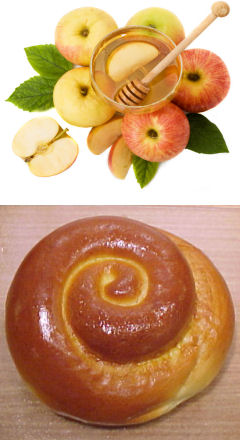
Another traditional food is a round challah. Some say they it represents a crown that reflects our coronating God as the Ruler of the world. Others suggest that the circular shape points to the cyclical nature of the year. The Hebrew word for year is “shana,” which comes from the Hebrew word “repeat.” Perhaps the circle illustrates how the years just go round and round. But Rosh Hashana challahs are not really circles; they are spirals… The word “shana” has a double meaning as well. In addition to “repeat,” it also means “change”. As the year goes go round and round, repeating the same seasons and holidays as the year before, we are presented with a choice: Do we want this shana (year) to be a repetition, or do we want to make a change (shinui)? Hopefully, each year we make choices for change that are positive, and each year we will climb higher and higher, creating a spiritual spiral. The shape of the Rosh Hashana challah reminds us that this is the time of year to make those decisions. This is the time to engage in the creative spiritual process that lifts us out of the repetitive cycle, and directs our energies toward a higher end.
(Source: Aish Ha’Torah)

There are also apologies, for during the ten days starting Tuesday evening, Jews examine their lives and see how they can do better. On Yom Kippur (starting the evening of September 15th), Jews apologize to G-d for their misdeeds during the past year. However, for an action against another person, one must apologize to that person.

So, in that spirit:

If I have offended any of you, in any way, shape, manner, or form, real or imagined, then I apologize and beg forgiveness. If I have done anything to hurt, demean, or otherwise injure you, I apologize and beg forgiveness. If I have done or said over the past year that has upset, or otherwise bothered you, I sincerely apologize, and will do my best to ensure it won’t happen again.

If you have done something in the above categories, don’t worry. I know it wasn’t intentional, and I would accept any apology you would make.

May all my blog readers and all my friends have a very happy, healthy, and meaningful new year. May you find in this year what you need to find in life.

Share

🛣 Changes to the California Highway Website covering June-August 2021

Blah blah blah introduction. Perhaps I should go with that.

Seriously, though. We’re at the end of Summer 2021, and the best thing I can say is that we’re not having to deal with a Presidential campaign again. COVID is still here, however, impacting travel. I did get some travel in over my summer, with drives to Los Osos, Scottsdale, and Las Vegas, and exploration of the Route 166 corridor and the Route 58 corridor between I-15 and Route 14. I got to see the construction they are doing S of Mojave on Route 14, and got to kill off a load of podcasts. Hopefully you’ve had a safe summer. As always: Please make sure you are vaccinated, and please continue to wear masks. Neither complete eliminates risk, but they are both key factors in reducing risk to an acceptable level. As someone who has been working in Cybersecurity for over 35 years, I understand how being risk adverse can blind you to the importance of doing the simple things to reduce risk. Just as with our highways, our goals should be to reduce the risks whereever we can.

On to the updates.

Updates were made to the following highways, based on my reading of the papers from the last week of May 2021 through xxxx 2021 (which are posted to the roadgeeking category at the “Observations Along The Road” and to the CaliforniaHighways Facebook group) as well as any backed up email changes. I also reviewed the the AAroads forum (Ꜳ). This resulted in changes on the following routes, with credit as indicated [my research(ℱ), contributions of information or leads (via direct mail or ꜲRoads) from Anthony R. Brooks(1), Tom Fearer(2), Brian Nordon(3),  Tony Ortega(4), Scott Parker(5), Joe Rouse(6), Chris Sampang(7), Carol Stephens(8): Route 1(ℱ,2), Route 4(ℱ), Marine Route 5 (M-5)(ℱ), I-5(ℱ,2), Route 11(ℱ), Route 16(2), Route 17(ℱ), Route 18(ℱ),  Route 25(ℱ), Route 29(ℱ), Route 33(2), Route 35(ℱ), Route 36(ℱ), Route 37(ℱ), Route 41(ℱ,2), Route 46(ℱ,2), US 50(ℱ,2), Route 58(6,5), Route 71(ℱ), Route 74(ℱ),  Route 77(ℱ,1), I-80(ℱ,2), Route 88(ℱ), Route 91(ℱ,1,4), Route 99(ℱ,2), US 101(ℱ,2), Route 110(ℱ), Route 113(2), Route 121(ℱ), Route 132(ℱ), Route 135(ℱ), Route 136(3),  Route 140(ℱ), LRN 148(ℱ), Route 152(ℱ), Route 156(ℱ), Route 166(ℱ), Route 174(ℱ), Route 176(ℱ), Route 187(ℱ), Route 207(ℱ), Route 247(ℱ), Route 249(8), Route 273(ℱ), Route 275(2), Former US 399(2),  US 395(ℱ), I-405(ℱ), I-580(ℱ),  Marine Route 580(ℱ), I-680(ℱ), I-710(ℱ), County Sign Route A13(ℱ), County Sign Route 66(7).
(Source: private email, Highway headline posts through August 2021 as indicated, AARoads through 09/05/2021)

Updated the links to the Cal-NexUS pages and the highway exits, because Caltrans went and moved things again(ℱ). Updated the El Camino Real Bells page to reflect the removal of the El Camino Real bell from downtown Santa Cruz, and the rationale therefore(ℱ). Updated the Statistics page to better reflect the shortness of Route 77(1).

Marine Highway SystemAdded information on the National Marine Highway System(ℱ):
(Source: CleanTechnica, 6/22/2021US DOT Maritime Administration: National Marine Highways, 6/2021)

In California waters, there are two routes: Route 5 (M-5) and Route 580 (M-580). The US Department of Transportation has a special webpage all about this system of marine highways, complete with a map of the system. The system’s highways are numbered the same as nearby Interstate Highways from which they could relieve congestion. The DOT Maritime Administration (MARAD)’s Marine Highway Program has one major goal: expand the use of America’s navigable waters. They closely with public and private organizations to:

  • Develop and expand marine highway service options and facilitate their further integration into the current U.S. surface transportation system, especially where water-based transport is the most efficient, effective and sustainable option
  • Highlight the benefits, increase public awareness and promote waterways as a viable (in some cases a superior) alternative to “landside” shipping and transportation options

The Marine Highway system currently includes 26 “Marine Highway Routes” that serve as extensions of the surface transportation system. Each all-water route is designated by the Secretary and offers relief to landside corridors suffering from traffic congestion, excessive air emissions or other environmental challenges. For the highways in California, a section was added to the appropriate route page providing information on the Marine highway route.

Reviewed the Pending Legislation page, based on the California Legislature site. As usual, I recommend to every Californian that they visit the legislative website regularly and see what their legis-critters are doing. As many people are unfamiliar with how the legislature operates (and why there are so many “non-substantive changes” and “gut and amend” bills), I’ve added the legislative calendar to the end of the Pending Legislation page. Noted the passage of the following:

Read More …

Share

🛣 Headlines About California Highways – August 2021

The end of August. Summer is coming to an end, although the hot days are still here (and the Santa Ana winds are still to come, which is scary given the fires we’ve had so far). I hope everyone is staying safe with all the dangers out there — COVID, brush fires, flash floods, monsoons. Please do what you can to stay safe. Get vaccinated. Vote “no” on the recall. Watch out for flash floods. Stay out of evacuation zones. Watch out for the draft. Stay away from Texas.

This post was delayed a bit because I was on vacation in Las Vegas. I plan to do some posts about that: one looking at the subtle racism that is still present in the town that once you see, you can’t unsee. The other looking at how the town — and the roads — have changed. We all wax rhapsodic about “Classic” Vegas, but classic vegas is no more. There are no headliners like the headliners of old, there are no lounges or showrooms like the ones of old, there are no hotels like the hotels of old, there are no signs like the signs of old. There are glimmers, fleeting, of the past. But was the past better? Is today’s Vegas better? You’ll have to read my upcoming posts to know.

One thing the trip to Vegas makes clear is that change is here to stay (unless you are exchanging it for a gambling voucher or playing Pinball at the Pinball Hall of Fame). The days of driving US 91 to Vegas, seeing the signs for the hotels and for Foxy’s Deli are gone. Stuckey’s is only a memory. The roads are crowded, and filled with people trying to get there an extra five minutes earlier. The headlines this month capture the change.

One other thing the end of summer will bring us is another round of highway page updates. They are almost done, and these headlines will be included in that update. So watch this space. After the headlines are posted, all that will remain is reviewing the AARoads Pacific Southwest forum for updates. As always, if you see a naming sign in the wild (i.e., a sign with the name of a highway) and I don’t have a picture of that sign in the NAMING section for the route, please send me the photo. Your name will be immortalized as a contributor.

And lastly, all together now: “Ready, set, discuss”.

Key

[Ħ Historical information |  Paywalls, $$ really obnoxious paywalls, and  other annoying restrictions. I’m no longer going to list the paper names, as I’m including them in the headlines now. Note: For paywalls, sometimes the only way is incognito mode, grabbing the text before the paywall shows, and pasting into an editor. ]

Highway Headlines

  • Full closure of northbound State Route 113 to Interstate 5 begins Monday (California News Times). According to the California Department of Transportation, the full closure of State Highway 113 to Interstate 5 will begin on Monday, according to Caltrans. Drivers are advised to plan ahead. The road will be officially closed at 9 pm on Monday and will reopen at 5 am on August 23. Caltrans recommends the following detours: NBSR-113 to NBI-5. Remove Main Street from the ramp (Exit 37) and turn right onto East Main Street. Use I-5 South On Lamp (Sacramento) from East Main. From SB I-5, take County Road 102 (Exit 536) and turn left. Proceed to the right and take the NB I-5 (Reading) from CR-102 back to I-5 bound for the north. Everyone living in this area expects loud construction noise, and drivers in this area need to anticipate lane restrictions and be aware of commercial vehicles.
  • Why improving the drive to Southern California is so complicated (Las Vegas Sun News). Jim Nares is all too familiar with the Sunday morning routine of waking up early in his Las Vegas hotel room to get a head start on the drive back to Southern California via Interstate 15. Sleeping in poses a seemingly unavoidable hurdle: Long hours stuck in traffic getting home to Winchester, Calif. Nares has been traveling by car with his wife to Las Vegas for 20 years for outdoor recreation, restaurants and light gambling. To keep the return drive at the minimum of four hours, Nares opts for either an early-morning departure or late-night arrival back home. Leaving in the afternoon when thousands of others hit the road is out of the question, he says. “I don’t like traveling back on Sunday,” he said. “Sometimes it just happens. … If we do, we definitely try to be past state line by 9 a.m., otherwise we just stick around (Las Vegas) until, like, 6, 7 p.m.” The parade of bumper-to-bumper traffic is a Sunday afternoon ritual heading back to California. Residents of California accounted for 21% of visitors to Las Vegas in 2019, according to the most recent Visitor Profile Study by the Las Vegas Convention and Visitors Authority. During the pandemic when air travel was limited because of safety concerns, drive-in visitors from California helped keep the local economy moving. Having those visitors stalled in traffic is concerning, Clark County Commissioner Tick Segerblom said. After all, the last impression of someone’s visit shouldn’t be delays on the road.
  • How does the Caltrans project on Highway 41 compare to other similar endeavors? (KMPH). After decades of accidents along a two-lane stretch of Highway 41 in Fresno County, Caltrans is installing a center barrier that will keep people from crossing into oncoming traffic to pass slower drivers ahead of them. That came after a push by a group called Widen Highway 41 that a woman named Lorna Roush founded after her cousin’s husband Ken Atkins was killed in a head-on crash. “This is a temporary fix. It’s a Band Aid,” Roush said of the K-Rail. “We’re going to save lives from head-ons while we work on the logistics of getting that widened to four lanes.”
  • American Canyon plots the future look of Highway 29 (Napa Valley Register). American Canyon is trying to keep its Highway 29 of the future from becoming an irrevocably entrenched Anywhere, USA blur of strip malls, parking lots and clashing architecture. “That is the front door to our city,” city Community Development Director Brent Cooper said. It’s also a front door/first impression for Napa County. A sign in American Canyon along Highway 29 depicts vineyards and pristine hillsides and proclaims, “Where your Napa Valley experience begins.”
  • Newsom Signs S.B. 51, Durazo’s Legislation that Changes Law on Caltrans Tenant Property Sales (Streetsblog California). Last week, Governor Gavin Newsom signed S.B. 51, state legislation that changes a four-decades-old law that governs how Caltrans-owned residential properties along the 710 corridor will be sold. Critics contend that the changes will make it harder for tenants, some of whom have lived in the properties for forty years, to purchase the properties. The legislation’s author, Senator Maria Elena Durazo, contends the legislation will make it easier to preserve the existing stock as affordable housing for current and future generations.

Read More …

Share