
 California Highways:
 ![[Old State Shield]](images/oldstate.gif) Before 1964, California routes had two distinct numbers: the number with which
the route was signed, and the number with which the legislature identified
the routes (LRN). A single LRN could be used over different sign routes,
and vice-versa.
Before 1964, California routes had two distinct numbers: the number with which
the route was signed, and the number with which the legislature identified
the routes (LRN). A single LRN could be used over different sign routes,
and vice-versa.
 Routes were officially defined via legislative acts ("legislative routes"), and were
initially established with legislation in 1909, when the first 25 routes
were defined. At this time, the legislation only defined routes. Around
1916, numbers were assigned to the legislative routes; this list was
maintained by the Division of Highways and was not part of the legislative
code, except for occasional references. In 1935, the legislative route
numbers became part of the State Highway Code through 1935 Chapter 29
Article 3. The legislative routes have been extended by legislative acts
over the years. The original legislative numbers were never posted along
highways, but were used on state highway maps and construction signage.
While the state had one of the best highway marking programs in the
country, originally the roads were marked primarily with the old trail signs – such as “Lincoln Highway”, “Old Spanish Trail" and “National Old Trails – rather
than numbers.
Routes were officially defined via legislative acts ("legislative routes"), and were
initially established with legislation in 1909, when the first 25 routes
were defined. At this time, the legislation only defined routes. Around
1916, numbers were assigned to the legislative routes; this list was
maintained by the Division of Highways and was not part of the legislative
code, except for occasional references. In 1935, the legislative route
numbers became part of the State Highway Code through 1935 Chapter 29
Article 3. The legislative routes have been extended by legislative acts
over the years. The original legislative numbers were never posted along
highways, but were used on state highway maps and construction signage.
While the state had one of the best highway marking programs in the
country, originally the roads were marked primarily with the old trail signs – such as “Lincoln Highway”, “Old Spanish Trail" and “National Old Trails – rather
than numbers.
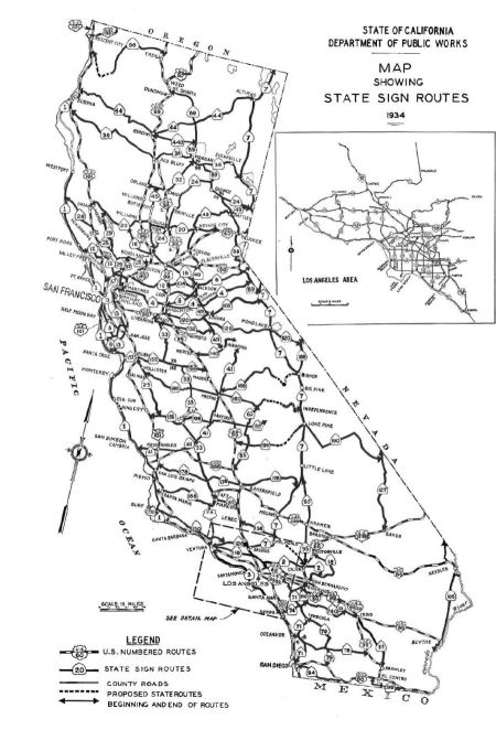
Before 1934, the only routes that were signed in California were the US Highway routes (signage of these started in 1928). Once US Highways began to be signed, the state Division of Highways met with representatives of the auto clubs to adopt a route marker for state highways. There were a number of proposals (see figure below). In late 1934 the new program for signing state highways was announced. The group selected a "bear shield" design developed by the Division of Architecture, which resembled a miner's spade and displayed a grizzly bear taken from the California Bear Flag. They featured black figures on a white background, and were originally porcelain enamel on 18-gauge steel. The original intent was to have 3 signs per mile. After the state assigned sign route numbers to routes, they provided funds to the auto clubs to actually sign the routes.Auto Club signage of routes continued until 1956 in the southern portion of the state, and 1969 in the northern portion of the state, although the state had the primary responsibility of signing freeways.
The initial route numbering for state-signed routes was as follows:
There are some additional patterns that show up, but it is unclear if
there were formal rules as no documentation has yet been found (again,
note that these route numbers refer to the 1934 original route numbers,
and skip the pre-1934 US routes):
(Source: Gribblenation Blog (Tom Fearer), “Patterns in the original 1934 California Sign State Route grid”, April 2022; as well as observations by this webmaster)
 The image to the right shows some sign proposals from the Auto Club of
Southern California.
The image to the right shows some sign proposals from the Auto Club of
Southern California.
(Image source: Yates Morgan, Archivist, Auto Club
of Southern California)
It was noted on AARoads that many of the laterals in the central and
southern part of the state were three-digit, ascending from L.A. northward
until about Visalia, then descending again to about Stockton. Many of the
routes had nearby routes with a difference of 12. So north of Route 126,
you'll find Route 138, then Route 150 (today's Route 246/Route 154/Route 192). You'll see Route 166, Route 178, and Route 190; Route 152 and Route 140; Route 132, Route 120, and Route 108. But not everything fits this
pattern, so this could just be the mind finding something.
(Source: AARoads Discussion - CA–118 and CA–126, April/May 2019)
As routes got added, an attempt was made to follow this, although it soon fell by the wayside, except for the even/odd usage.
As the state highway network grew, and existing roads became longer, each new segment was given its own number (but was an extension of the original signed route). This resulted in some state highways having up to 13 different legislative route numbers along their length. For example, Santa Monica Boulevard from the junction with US 101 was listed as Legislative Route Number 162 [LRN 162], State Signed Route 2 [Route 2], and US 66.
In 1959-60, all the old "miner's spade" "Grizzly Bear" highway markers were replaced by plain white "miner's spade" shields, without the Bear. This was the exact design of today's shields, except white in color instead of green. There are a few of these shields still around; in particular, around Route 126 in Ventura and the older portions of Route 134 in Glendale.
Tom Fearer has a detailed exploration of the change in signing standards in California in the blog "The last 1956-63 era California Sign State Route Spade?". This includes the original sign proposals from CSAA and ACSC, the evolution of the white shield, and the differing state signage standards.
![[Green State Shield]](images/state.gif) In 1964, all state routes were renumbered to bring their legislative route
number in sync with their signed route number (see the Mar/Apr 1964 issue of CHPW). There was also a renumbering to retire some US highway numbers, and to sign with Interstate route numbers [There
is a good article on this renumbering at http://www.gbcnet.com/ushighways/history/1964_hwy_renumbering_contents.html].This
removed any remaining semblance of order in the numbering of state
highways. The routes were signed with a green shield, still in the shape
of a miner's space, but lacking the grizzly bear. The new color was chosen
for its visibility in hazy or foggy driving conditions, as well as the
fact that new signage requirements required that shields on guide signs
needed to match the shields on the road, and green shields allowed the use
of outlines instead of actual shields (which were required with the white
signage).
In 1964, all state routes were renumbered to bring their legislative route
number in sync with their signed route number (see the Mar/Apr 1964 issue of CHPW). There was also a renumbering to retire some US highway numbers, and to sign with Interstate route numbers [There
is a good article on this renumbering at http://www.gbcnet.com/ushighways/history/1964_hwy_renumbering_contents.html].This
removed any remaining semblance of order in the numbering of state
highways. The routes were signed with a green shield, still in the shape
of a miner's space, but lacking the grizzly bear. The new color was chosen
for its visibility in hazy or foggy driving conditions, as well as the
fact that new signage requirements required that shields on guide signs
needed to match the shields on the road, and green shields allowed the use
of outlines instead of actual shields (which were required with the white
signage).
There were a number of reasons for the renumbering. First and foremost, the goal was to move to a "one route, one number" system. This meant getting rid of duplication and conflicting route numbers (such as having both US 40 and I-40), having routes signed with multiple numbers, having signed routes being legislatively multiple different numbers. The new system was intended to have a minimal concurrencies (although some US highways remained signed until their replacement Interstates were completed).
 Numbering of Federal Highway System (US) Routes
  Exit Numbers
© 1996-2020 Daniel P.
Faigin.
Maintained by: Daniel P. Faigin <webmaster@cahighways.org>.