
United States of America
(A-G)
|

California
-
|
![[Bridging the Bay]](logos/ucb-bridging.gif) |
Bridging
the Bay: Bridging the Campus (University of
California, Berkeley Library).
The exhibit includes books, documents, architectural
drawings and renderings, blueprints, artifacts, maps, and
photographs. The bridges documented include the Golden Gate
Bridge, the San Francisco-Oakland Bay Bridge, the Carquinez
Bridge, the Richmond-San Rafael Bridge, the Antioch Bridge,
and the Dumbarton Bridge. The exhibit also contains
documents detailing Bay Area bridge projects that were
seriously considered, but were never built. |
|
![[AARoads]](logos/ca-aaroads.gif) |
![[A Member of the cahighways.org Family of Web Pages]](smllogo.gif) California
Highways @ AAroads (Andy Field and Crew).Formerly
limited to just San Diego, Andy Field and the crew at
AARoads have expanded to cover all of California. California
Highways @ AAroads (Andy Field and Crew).Formerly
limited to just San Diego, Andy Field and the crew at
AARoads have expanded to cover all of California.
Note: You can keep up to date with changes at AARoads via
their blog.
|
|
 |
California
Highways @ Corco Highways (David
J. Corcoran) Photos of highway signs from around
the state |
|
![[Road Signs and Sights]](logos/road-signs-sights.jpg) |
California
Road Signs and Sights (Mark Roberts). Photos of
California road signs, signals, and various highway sites. |
|
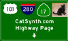 |
Catsynth.Com's
Highway Pages (Amar Chaudhary). A collection of
various articles regarding highways in California. Includes
a discussion forum. |
|
 |
Floodgap
Roadgap (Cameron Kaiser). A personal collection
of roadgeekery, with a special emphasis on dead or dying
routes in an effort to preserve them photographically in a
state as close to their last living alignment as possible.
Roadgap is generally concerned with Southern California.
Routes included are Old US 395, CA 47, CA 103, The Arroyo
Seco Freeway: CA 110 (Old CA 11, Old US 66), The Mass Grave:
CA 7, CA 14U, CA 31 (and TEMP I-15), US 60, US 91, The Road
to Cabrillo: Old CA 209, The Crosstown Freeway: Old CA 30,
Balboa Avenue: Old CA 274, Not Quite South Bay Freeway: CA
54 and BR 54 , and El Toyon Freeway: Dead CA 252 . |
|

|
Gribblenation
Blog (Tom Fearer). The broader Gribblenation
Blog covers many states and tells many road stories.
Tom Fearer is a major contributor there, and has loads of
pages related to California State Highways. Of particular
interest is the
Golden State Highways page, a directory of all his
blogs about California (previoius version: the Golden
State Highways and California Travel Directory). |
|
 |
Highway
101 Project (Don Wilson)
A site devoted to the preservation of the memory of the
original route of US 101 in the area from San Jose to Santa
Barbara, California. The purpose of this project is to
locate the original routing of 101 in relation to the
current road system, and to photograph and document,
wherever possible, the original cement sections of the old
route, and existing structures that were originally
businesses that were primarily intended to serve motorists
on the 101. The project will be divided into a number of
sections that span the 101 route from Santa Barbara north to
San Jose, Ca. Each section page will include a southbound
and northbound detailed road guide for following the
original 101 route by automobile. |
|
![[Santa Clarita Resources]](logos/scvresources.gif) |
Historical
Highways of Central and Southern California (Michael
Ballard).
These pages includes information on US 6 and US 99, as well
as information on unbuilt freeways, maps, East Los Angeles
interchanges, and much, much more. |
|
![[DLK Highways]](logos/dlk.gif) |
Kriske.Com's
Highway Page (David Kriske). This page provides
information on California's Highway Signs, the Embarcadero
(Golden Gate) Freeway [I-480], the Hayward Bypass (Route
238), the Grapevine, San Francisco's Urban Freeways, and
much more. |
|
 |
Mojave
Roads (Larry Turoski). A chronicle of travels in
the California, Nevada, and Arizona deserts, as well as a
guide for those new to desert travel or those looking for
new places to explore. |
|
![[Ridge Route]](logos/ridgeroute.jpg) |
Ridge
Route: The website dedicated to that curvy
little road that united California. This site provides
history of the ridge route, tour information, a map,
connections to related sites, and information on regular
maintenance of the route. |
|
![[Roadtrip to California]](logos/roadtrip.jpg) |
Roadtrip to
California and Los Angeles (Scott Kozel). A trip
to California, with lots and lots of pictures. |
|
![[San Diego Exits]](logos/sdexits.gif) |
San
Diego Freeway Junctions (Phillip Edrelsky).
A list of freeway exits in San Diego and Imperial Counties
and some parts of Orange and Riverside Counties. |
|
 |
Tux
Travels (Torrin). Pictures of routes in
California, primarily in San Diego County. |
|
![[ushighways.cahighways.org]](logos/ushighways.jpg) |
US Highways in
California Page (Casey Cooper).
The historic US highways of California have the same magic
that Route 66 has, although much of theirs is still waiting
to be rediscovered. This site is a repository of information
about the 18 US highways that once traversed California.
|
|
|
Official Pages
|
![[Caltrans]](logos/caltrans.gif) |
California
Department of Transportation.
The folks that make this all possible, by building the roads
in the first place. And the second place. And the third
place. One of the more interesting pages here is the Caltrans
Photolog Video. |
|
 |
Bakersfield
Freeways.
The website of the City of Bakersfield, Freeway Engineering
Division. In the summer of 2002, the City created this
division to deal with the many major transportation projects
that it is undertaking. These projects primarily involve
freeway type projects and their interchanges with the street
system, but this Division also oversees the development of
the projects that are part of Alternative No. 15 of the
Bakersfield Systems Study. |
|
![[Toll Roads]](logos/tollroadslogo.gif) |
Transportation
Corridor Agencies.
The folks that maintain the toll roads in Orange County
(Route 73, Route 241, and Route 261) |
|
|
|
![[Multistate]](logos/spinglobe.gif)
Multiple States or Areas |
Hobbyist Pages:
 |
AAroads.
This site, which really consists of multiple sites, provides
an entryway into sites covering almost every state. AARoads
offers a wide range of highway coverage spread throughout
six domains. Due to the large number of areas profiled, the
AARoads family includes a number of additional domains:
Interstate-Guide.com, and SouthEastRoads.com. AARoads.com
continues to carry the Delaware Highways Page, and the High
Priority Corridors. SouthEastRoads covers the southeastern
U.S. and Interstate-Guide.com provides a listing of every
Interstate highway and Interstate Business Loop or Spur. |
|
Alps'
Roads. Covers all of the United States, specializing
in California, Connecticut, Georgia, Massachusetts,
Maryland, Maine, New Hampshire, New Jersey, New York,
Pennsylvania, Québec, Rhode Island, South Carolina,
Vermont, and assorted other states. Mostly photos.
(Steve Alpert) |
|
American
Roads. The American Roads web site features
information and resources related to finding and traveling
America's scenic and historic old highways. Travel down the
Lincoln Highway, the National Old Trails Road, or the Old
Spanish Trail. Find old, forgotten alignments of US 60 or
80. Get off the freeways and see the real America! |
|
Corcohighways.
Welcome to Corcohighways.org, a one-man show dedicated to
driving and photographing as many of the nation’s
highways as possible. Back in 2007, as a college freshman
with a love of highways and a car that needed driving, I
embarked to drive every mile of state highway in Washington.
At that point, a monster was born. In 2009 I moved to
Wyoming and clinched that system. In 2011 I moved to Arizona
and clinched that system. In 2013, I moved to Montana and
finally clinched the Idaho system in 2014. In 2015, I went
to Delaware just to clinch that highway system. In 2016, I
finished Montana and moved to Idaho, allowing me to get
started on Oregon. In 2018, I finished Oregon while also
working on California and Nevada. While doing all that, I
managed to drive and photograph at least a little bit in
most of these United States. As of October 2018, I’ve
finally finished Oregon. I started on California and Nevada
in earnest in October 2017 and am well underway and on track
to finish those states and probably Rhode Island by 2020. |
|
Froggie's
Highway Photography.These pages document the many
photographs and roadtrips that Froggie has taken over many
roadtrips, specializing in the mid-western and eastern US.
(AJ Froggie) |
|
Roads of the
Mid-South and West. Over 18 years ago we started
traveling, documenting, and photo taking along the Roads of
the Mid-South & Mid-West, and now have grown to the
Northeast and Mid-Atlantic regions of the United States of
America. View roads from the small county blacktops to the
eight lane inter-urban freeways, and all in between, from 34
states, and the nations capital! Content is ever growing,
check back often!
(Bill Burmaster) |
|
|
 Alabama
 |
Hobbyist Pages:
Official Pages:
|
|

Alaska
|
Hobbyist Pages:
Official Pages:
|
|

Arizona
|
Hobbyist Pages:
Official Pages:
|
|

Arkansas
|
Hobbyist Pages:
Official Pages:
|
|

Colorado
|
Hobbyist Pages:
Official Pages:
|
|

Connecticut
|
Hobbyist Pages:
Official Pages:
|
|

Delaware
|
Hobbyist Pages:
Official Pages:
|
|

District of Columbia
|
Hobbyist Pages:
|
|

Florida |
Hobbyist Pages:
Official Pages:
|
|

Georgia |
Hobbyist Sites:
Official Sites:
|
|

Guam |
Official Pages:
|
|

 California Highways:
  History Related Links
  US Regional Links: H-O